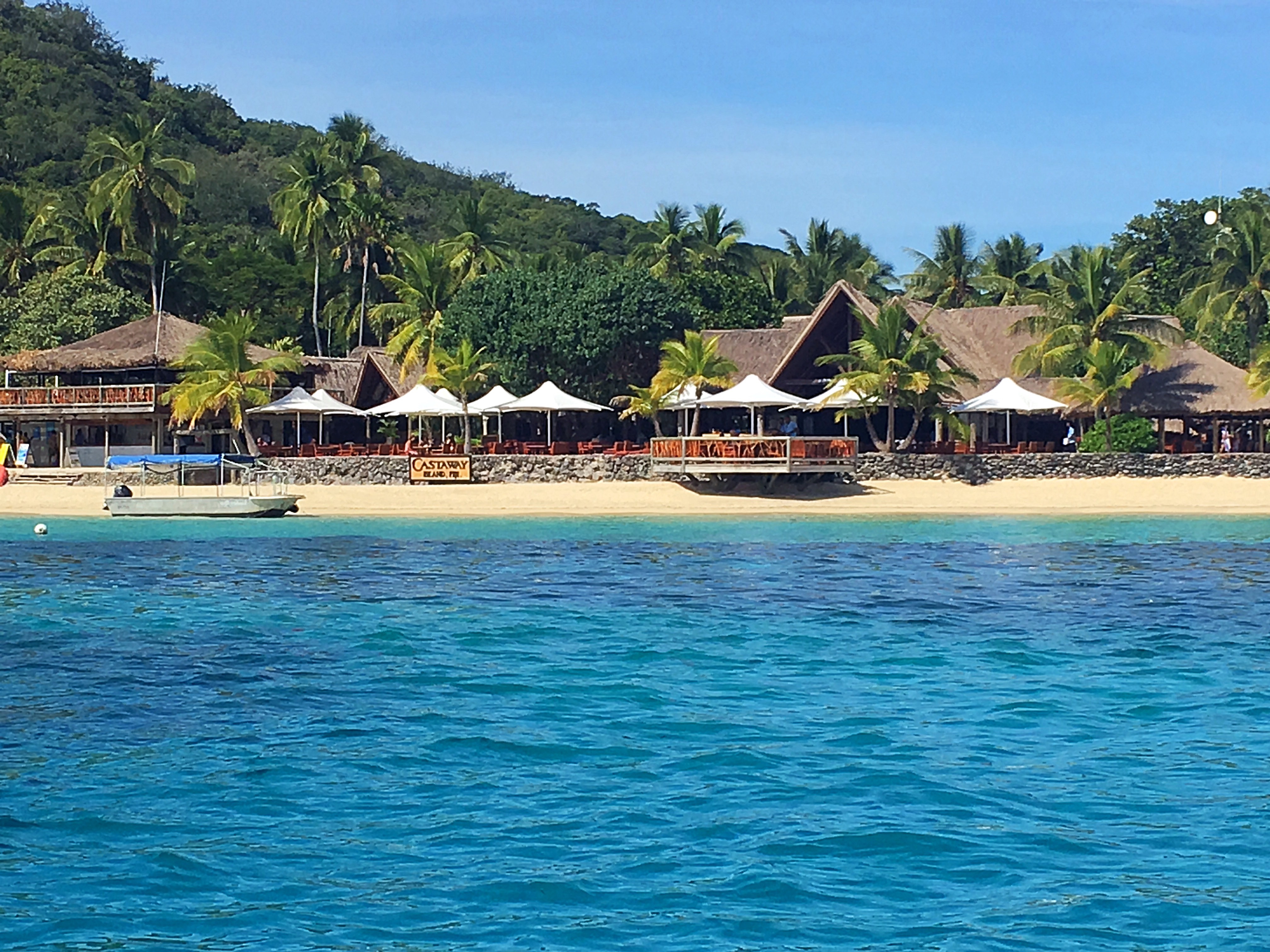
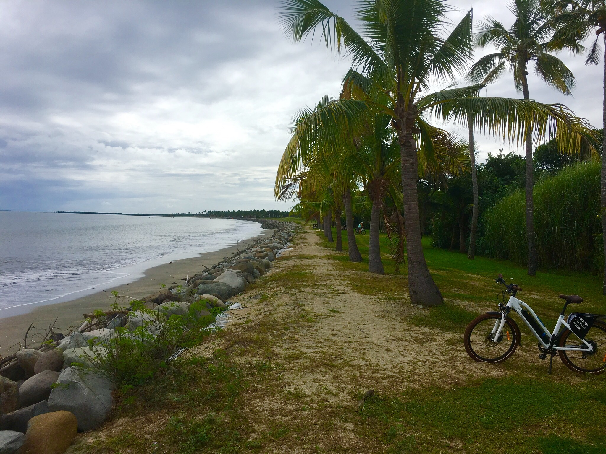
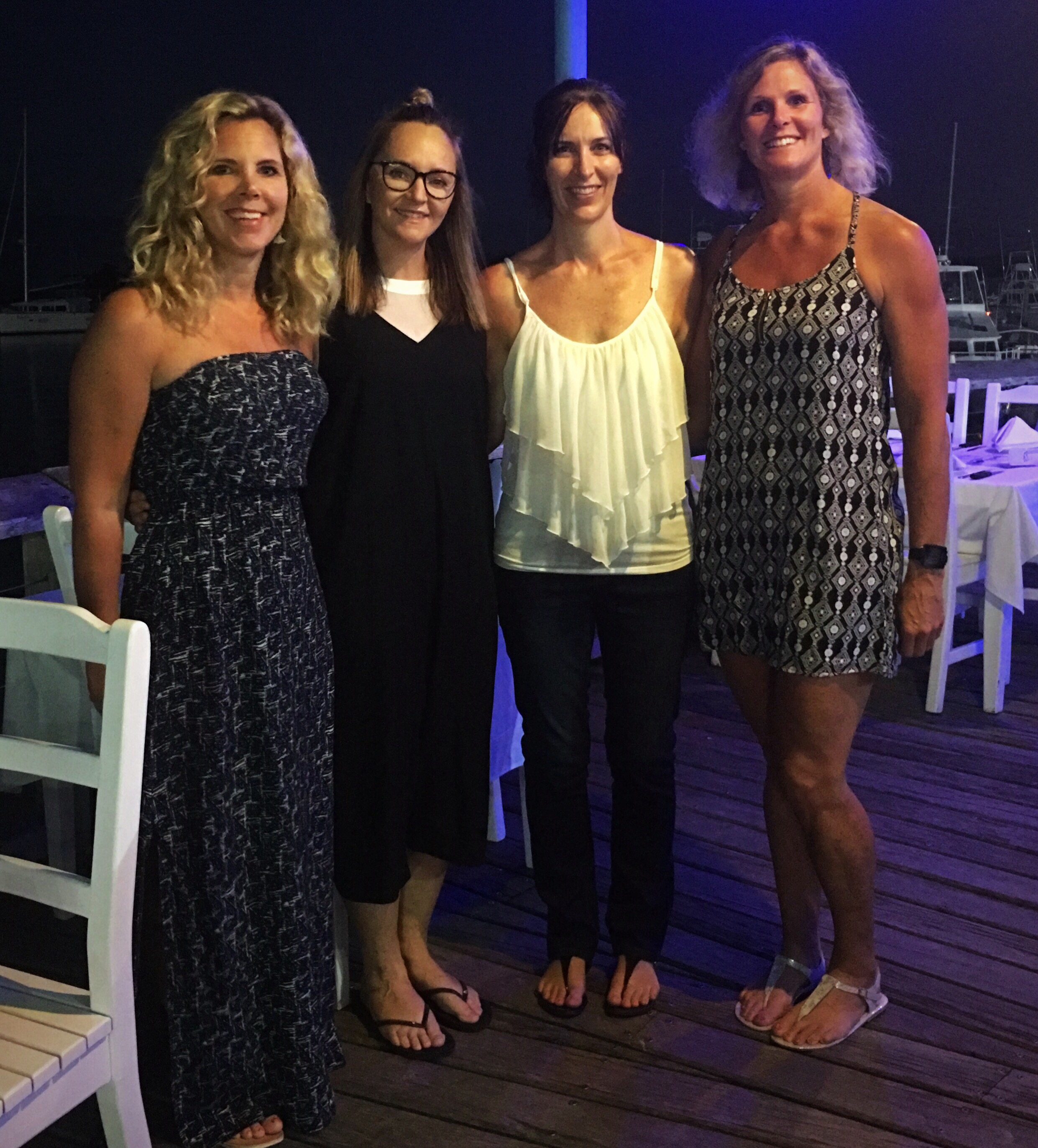
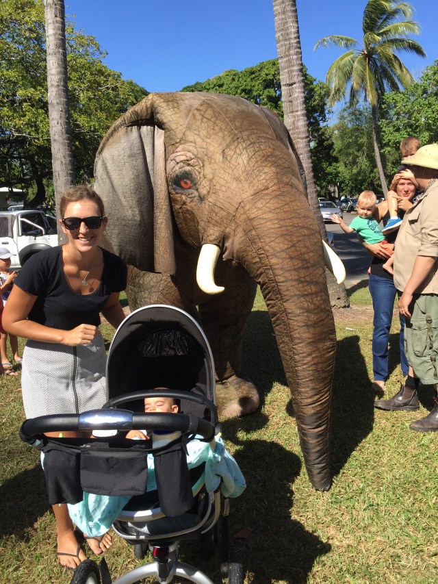
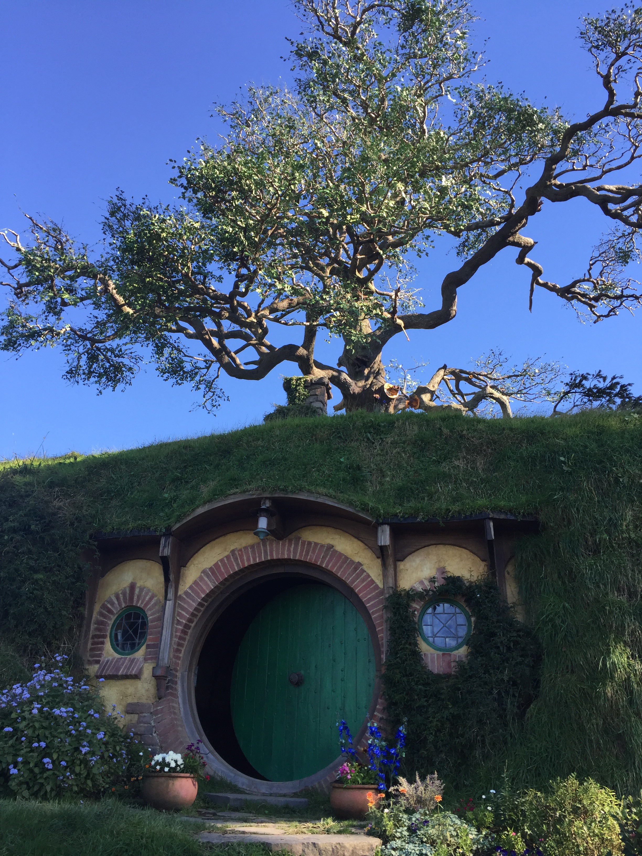
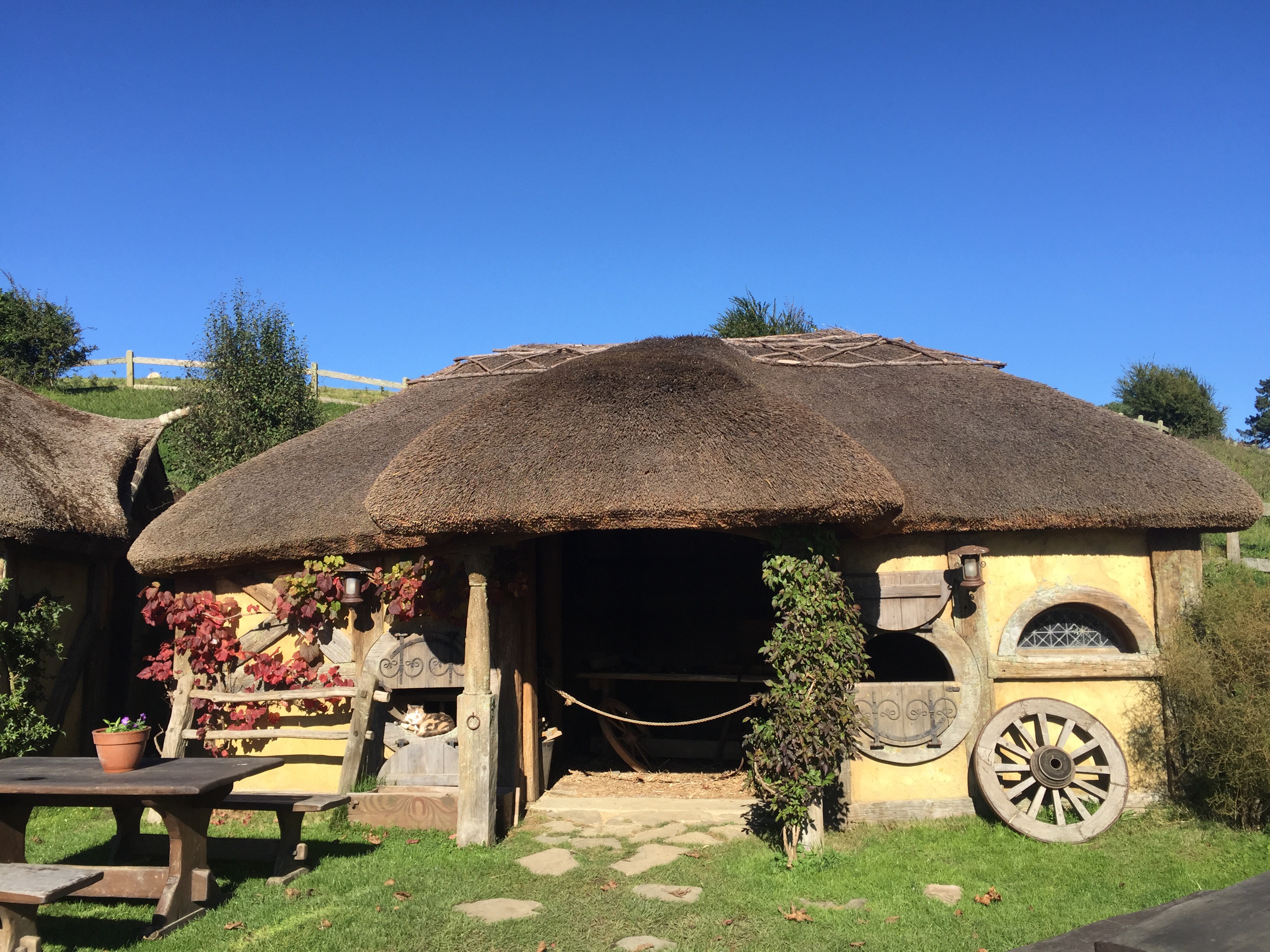
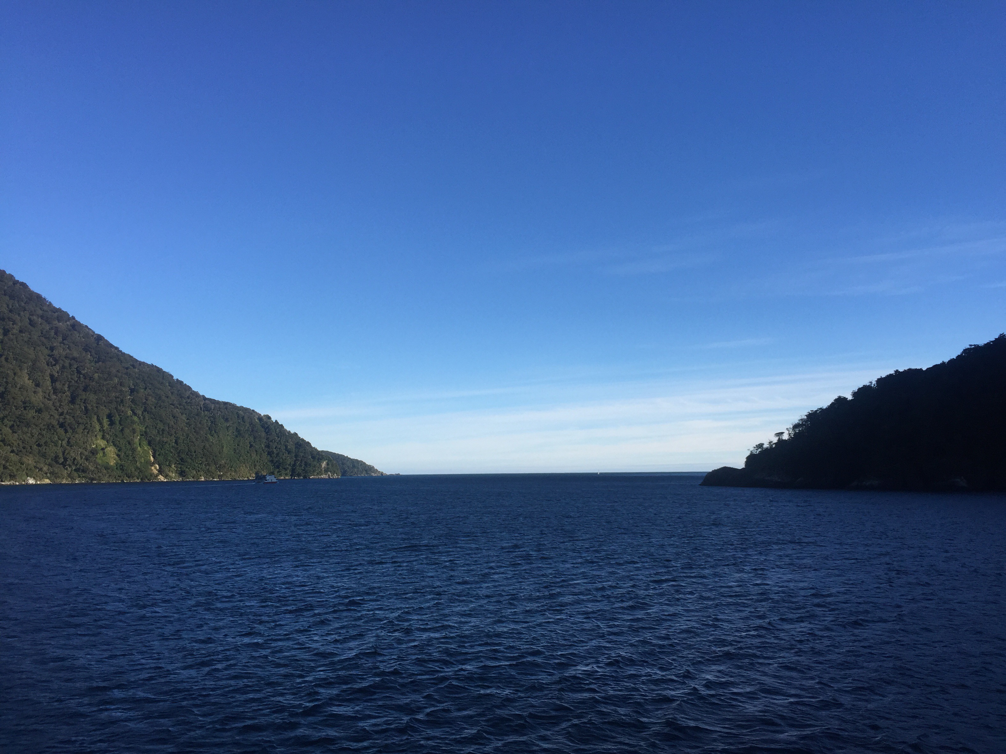
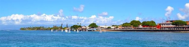
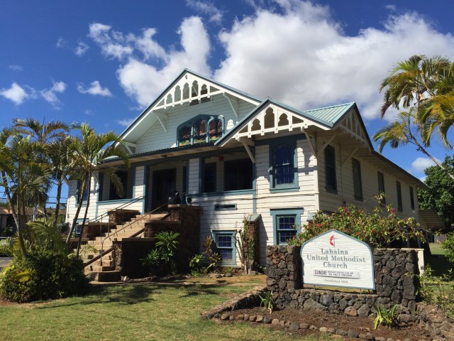
Pukalani Country Club, Maui – Hawaii, USA

For our first round of golf on Maui we headed to the Pukalani Country Club which was located on the hillside of “Up-Country” Maui.  The course is situated at an elevation of 1,100 feet on the slopes of Mt. Haleakala, the dormant volcano that makes up the island’s eastern half.  Mt Haleakala whose name in Hawaiian means “House of the Rising Sun” and is reflected in the club’s logo.


The course was designed by Bob Baldock and built in 1980.

Pukalani in Hawaiian means “Entrance to Heaven” which is quite apt given it’s elevation and the stunning views it offered on some of the holes.

It was a good course to get warmed up on and we all enjoyed our round there.


Posted in Hawaii, USA, United States of America | Tagged , | Leave a comment

Exploring Maui – Hawaii, USA

Lahaina

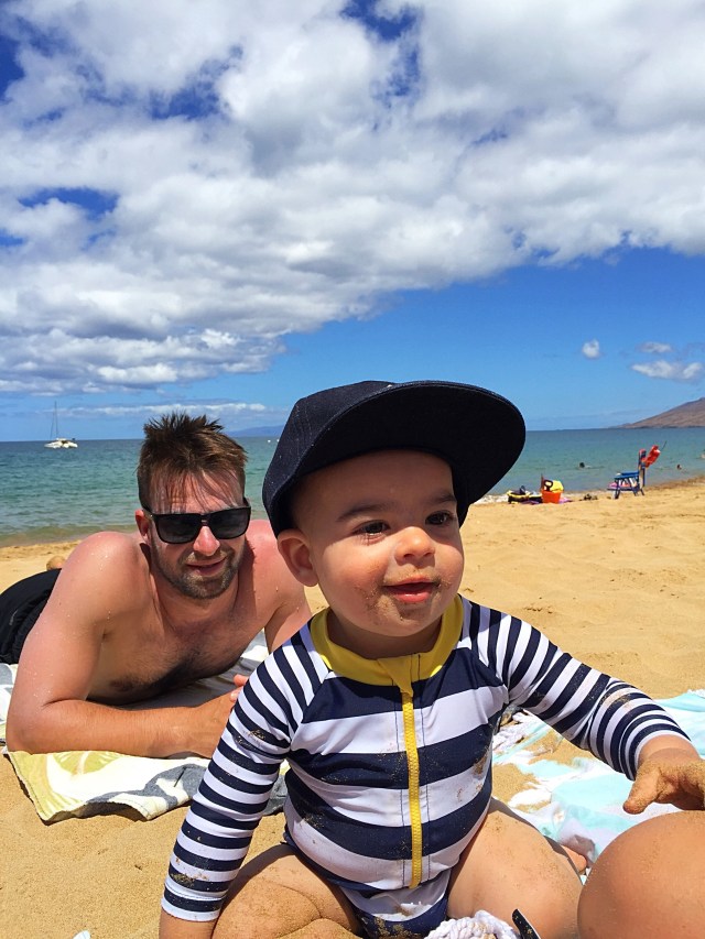
After a leisurely start to our first full day on Maui we took a drive to Lahaina which was about 45 minutes north of where we were staying.  Lahaina was the capital of the Kingdom of Hawaii from 1820 to 1845, when the capital was moved back to Honolulu.  In the 19th century, Lahaina was the center of the global whaling industry, with many sailing ships anchoring at its waterfront, today pleasure craft make their home there.  Lahaina’s popularity as a tropical getaway has made its real estate some of the most expensive in Hawaii; many luxury homes and condos are sold for more than USD2 million there.

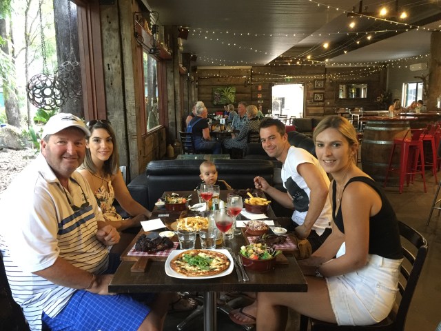
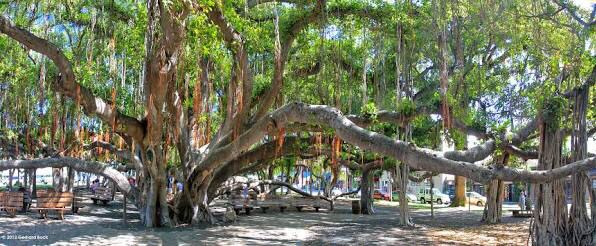
There was a monthly art exhibition on under the largest Banyan Tree in the USA so we had a wander through there.  We then explored the famous Front Street which is ranked as one of the “Top Ten Greatest Streets” by the American Planning Association. There are many historic buildings housing restaurants, art galleries and shops which back onto the water.  We stopped at one of the local seafood restaurants and had lunch overlooking the water.  We then discovered the outlet malls at the end of Front Street so did a bit of retail therapy : )
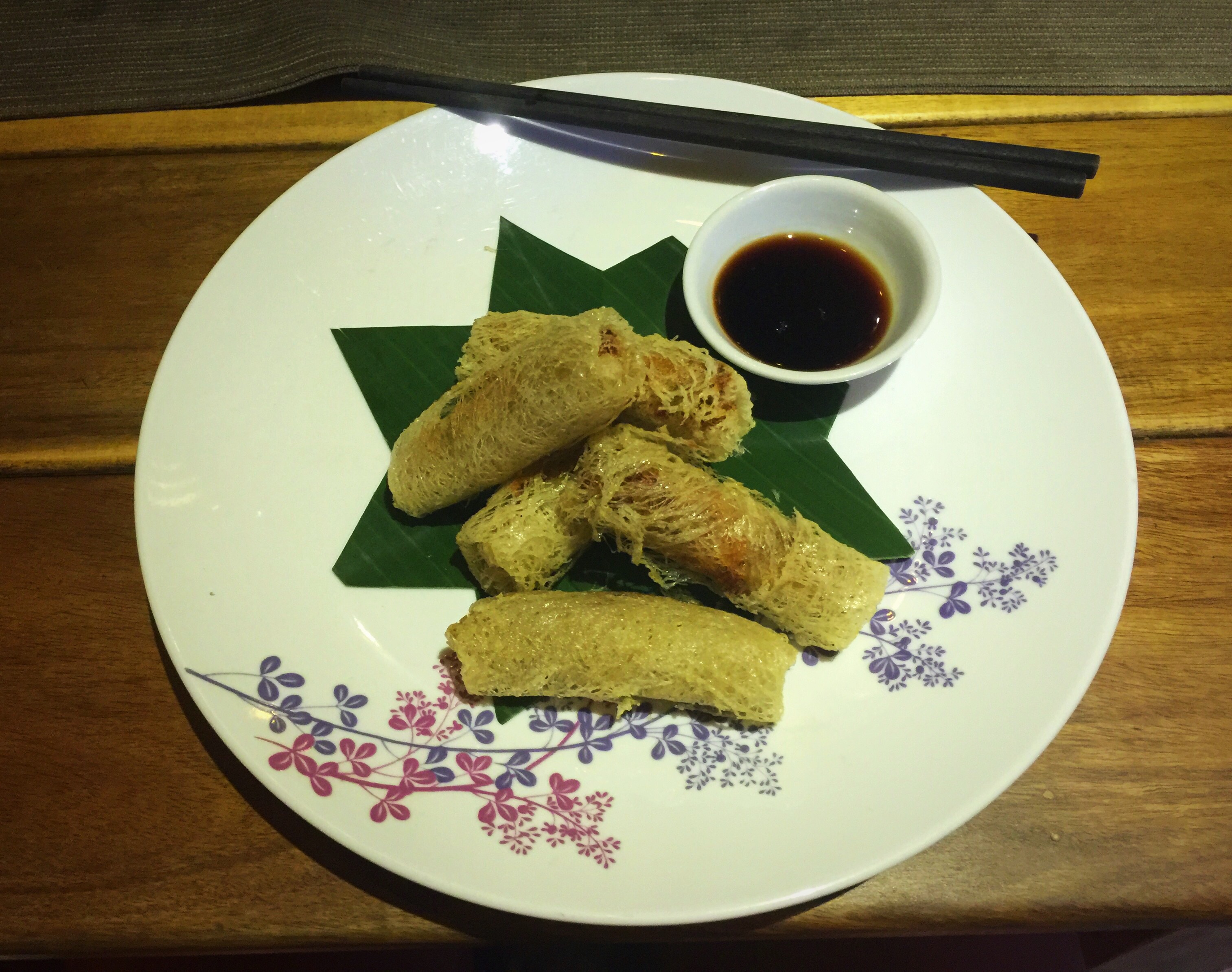
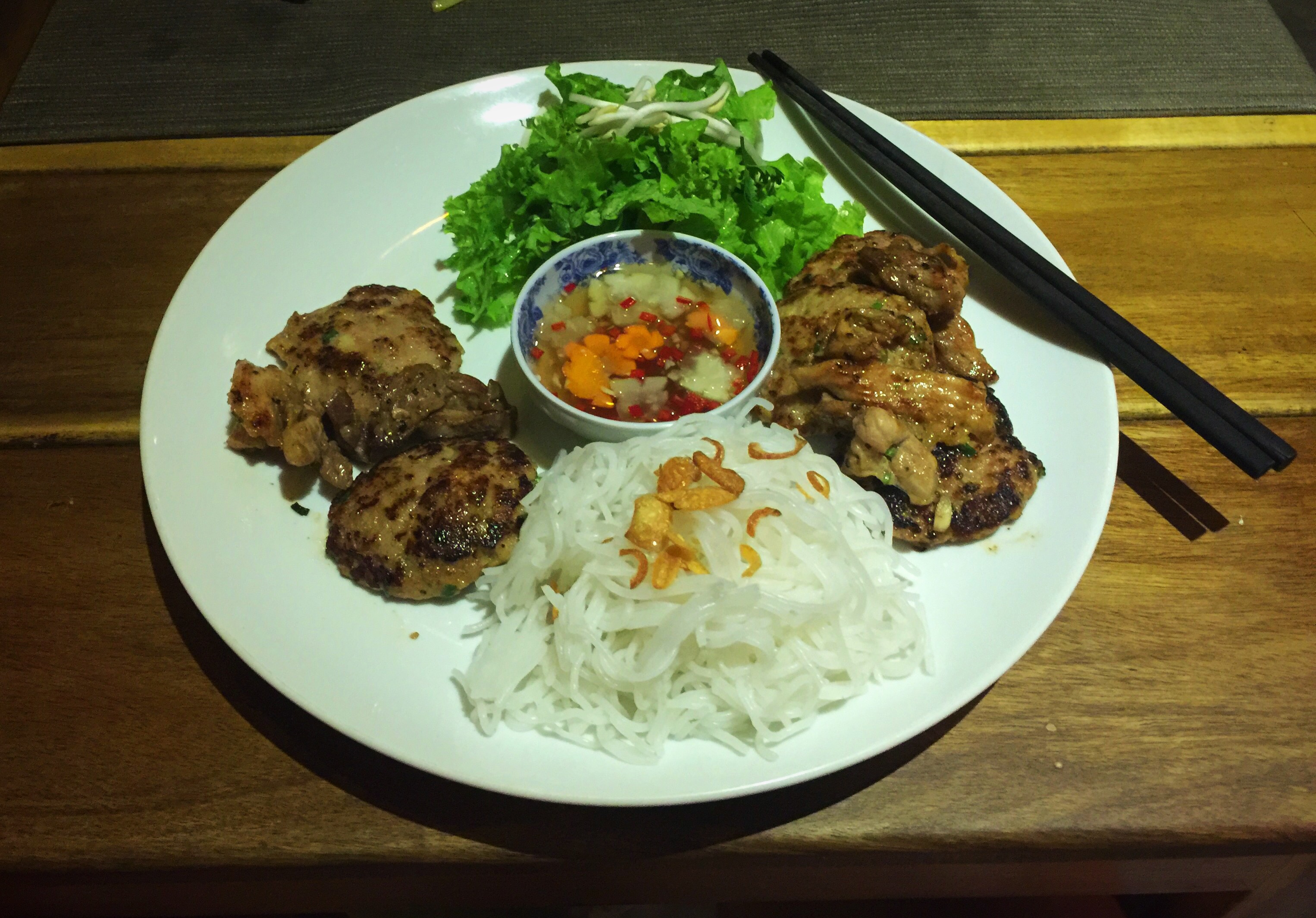
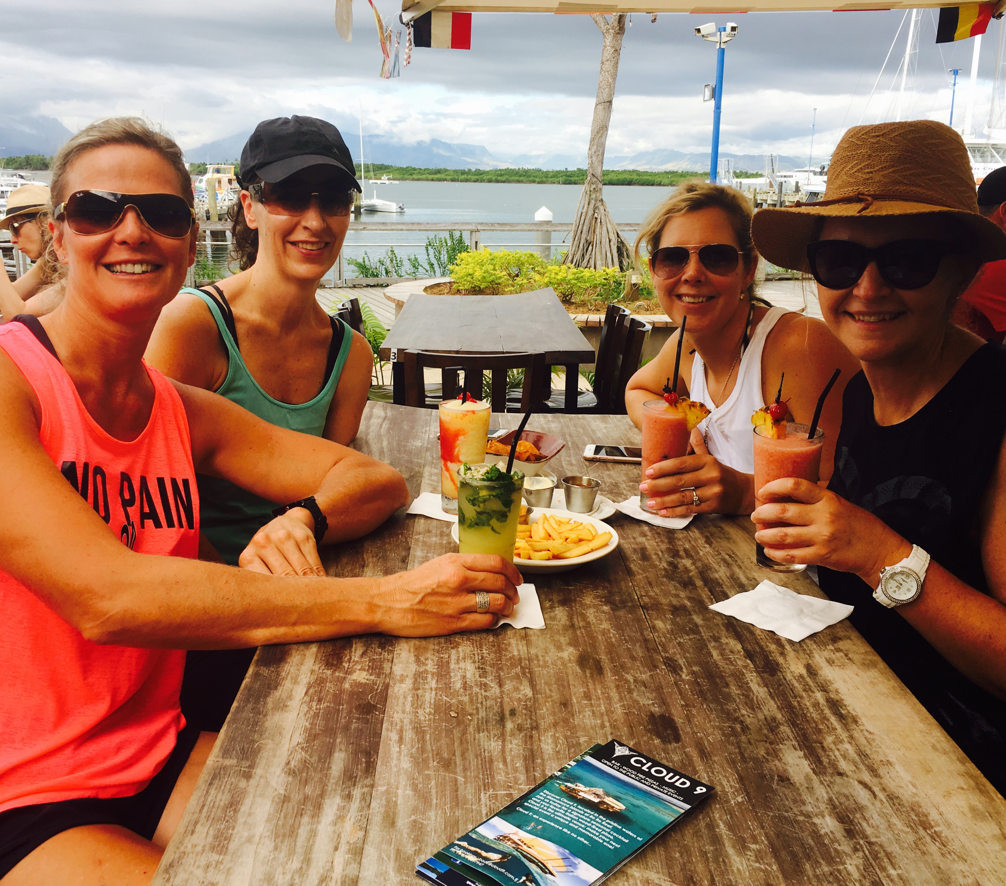
Lunchtime view

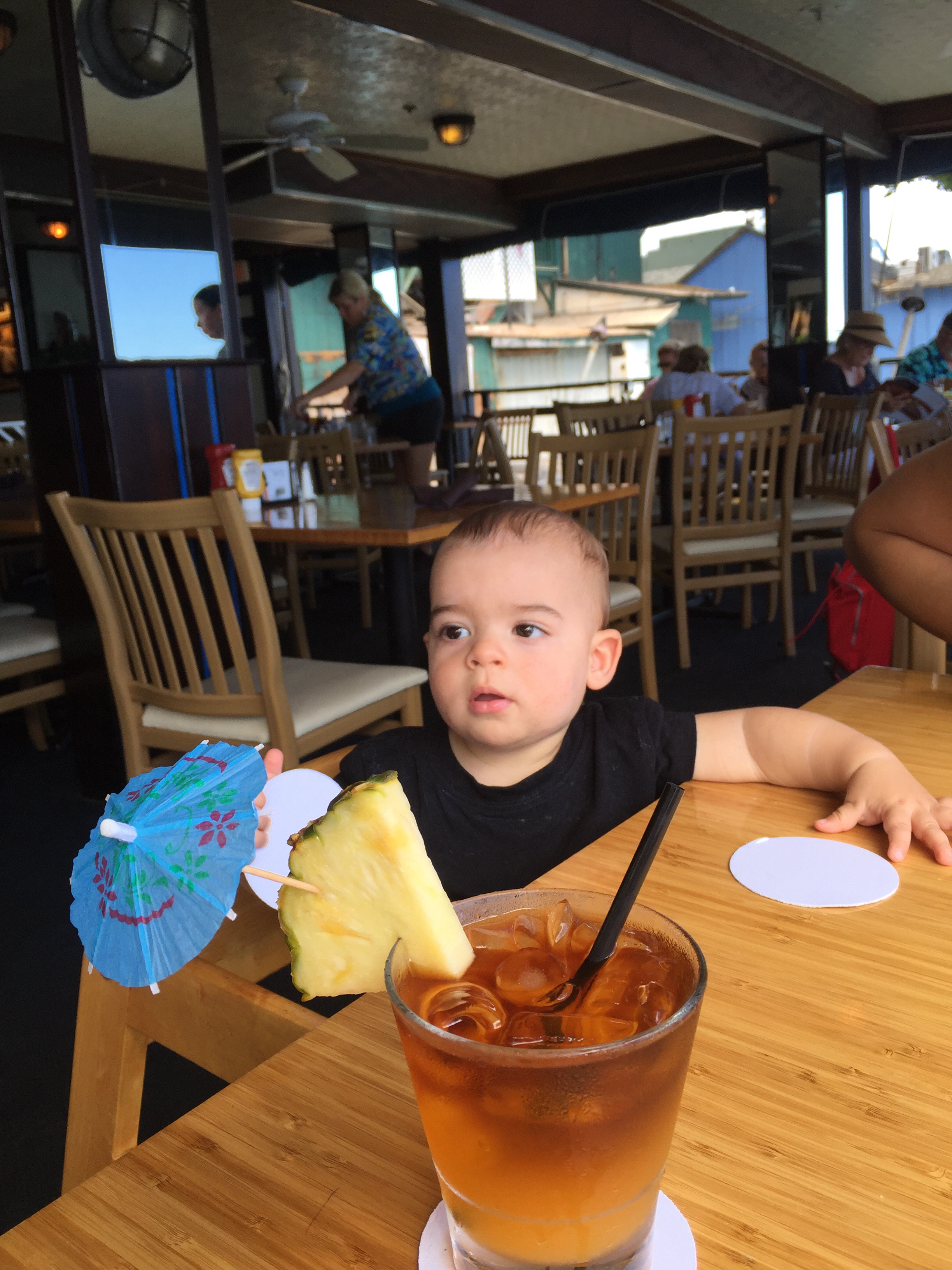
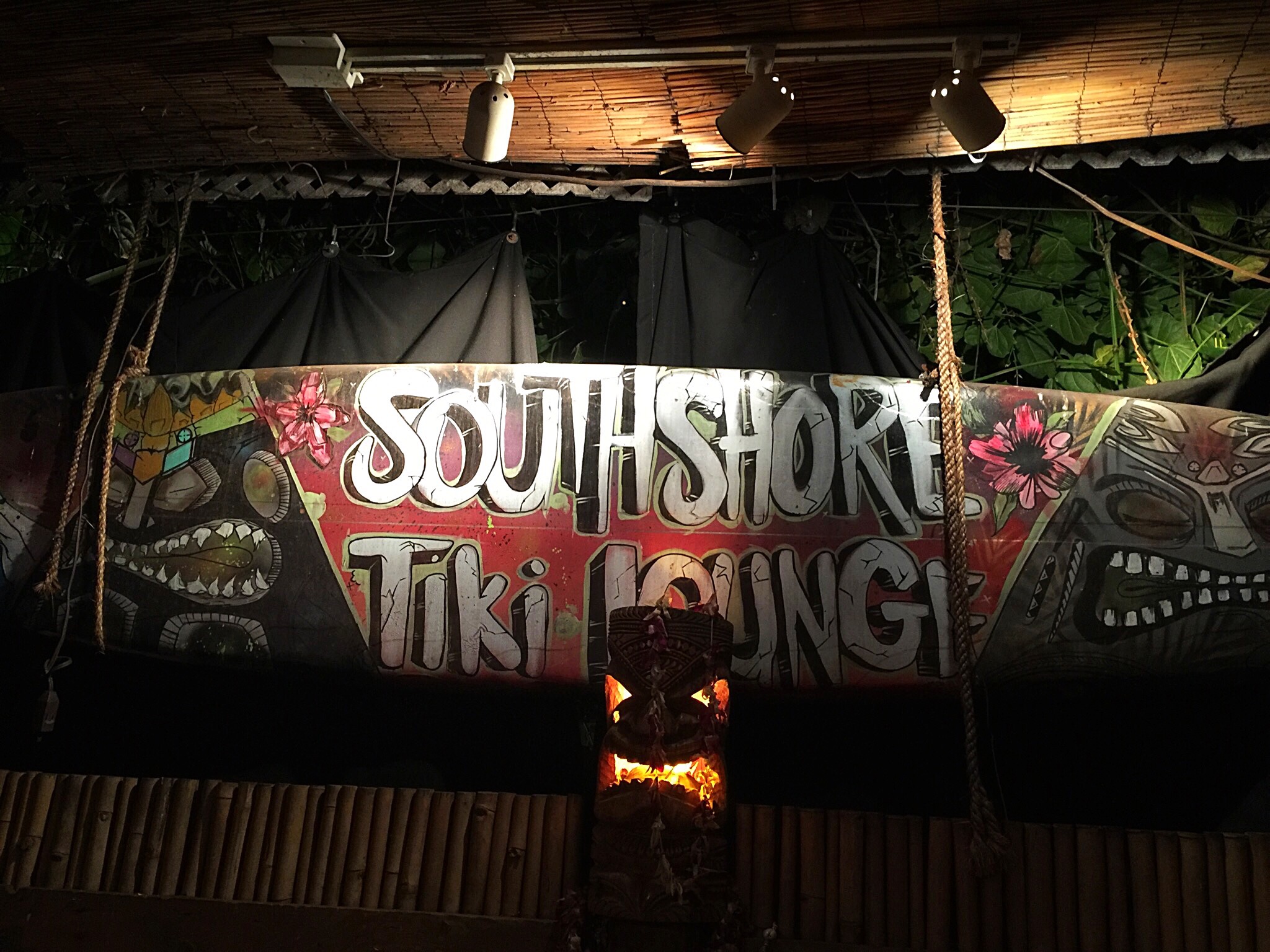
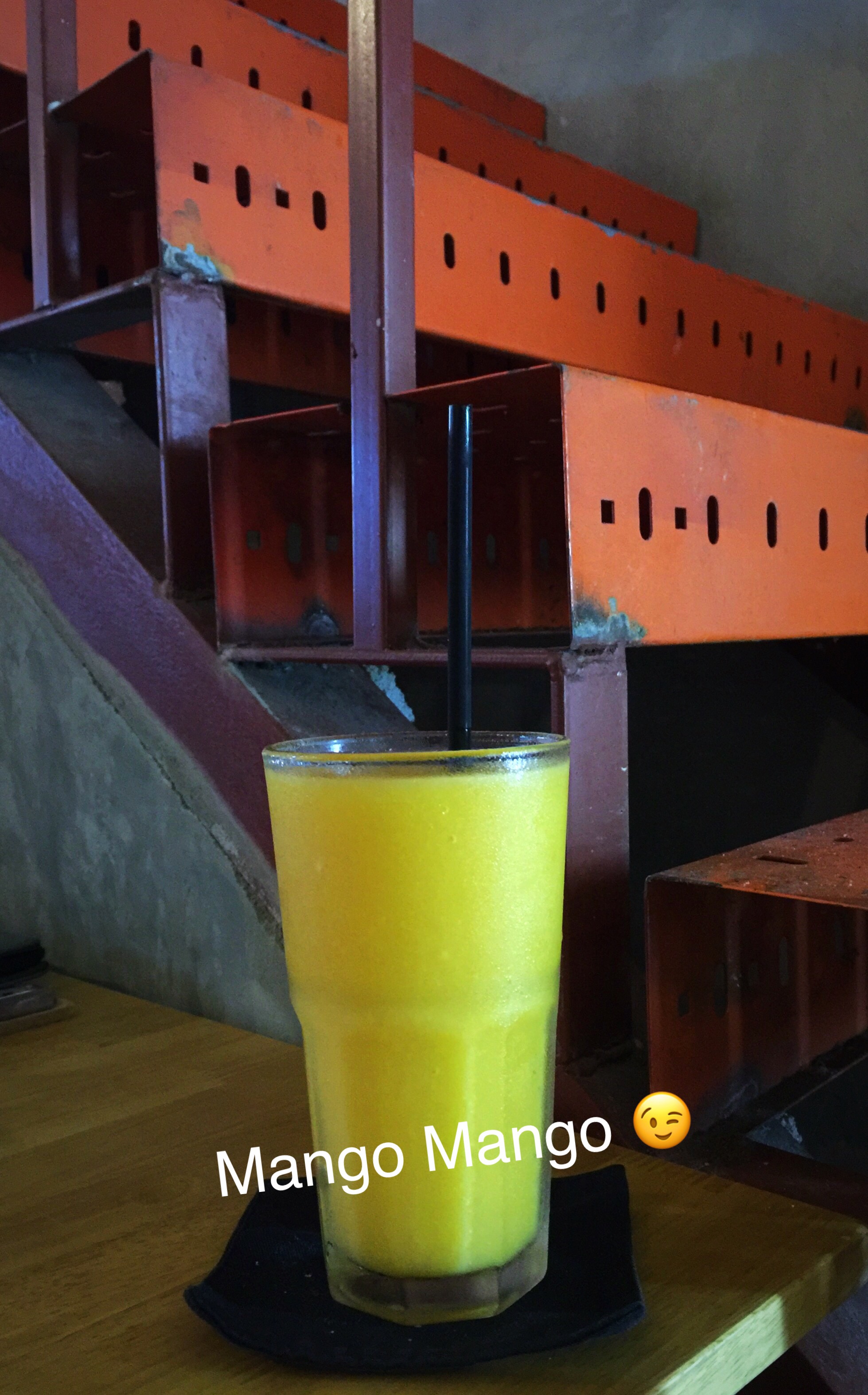
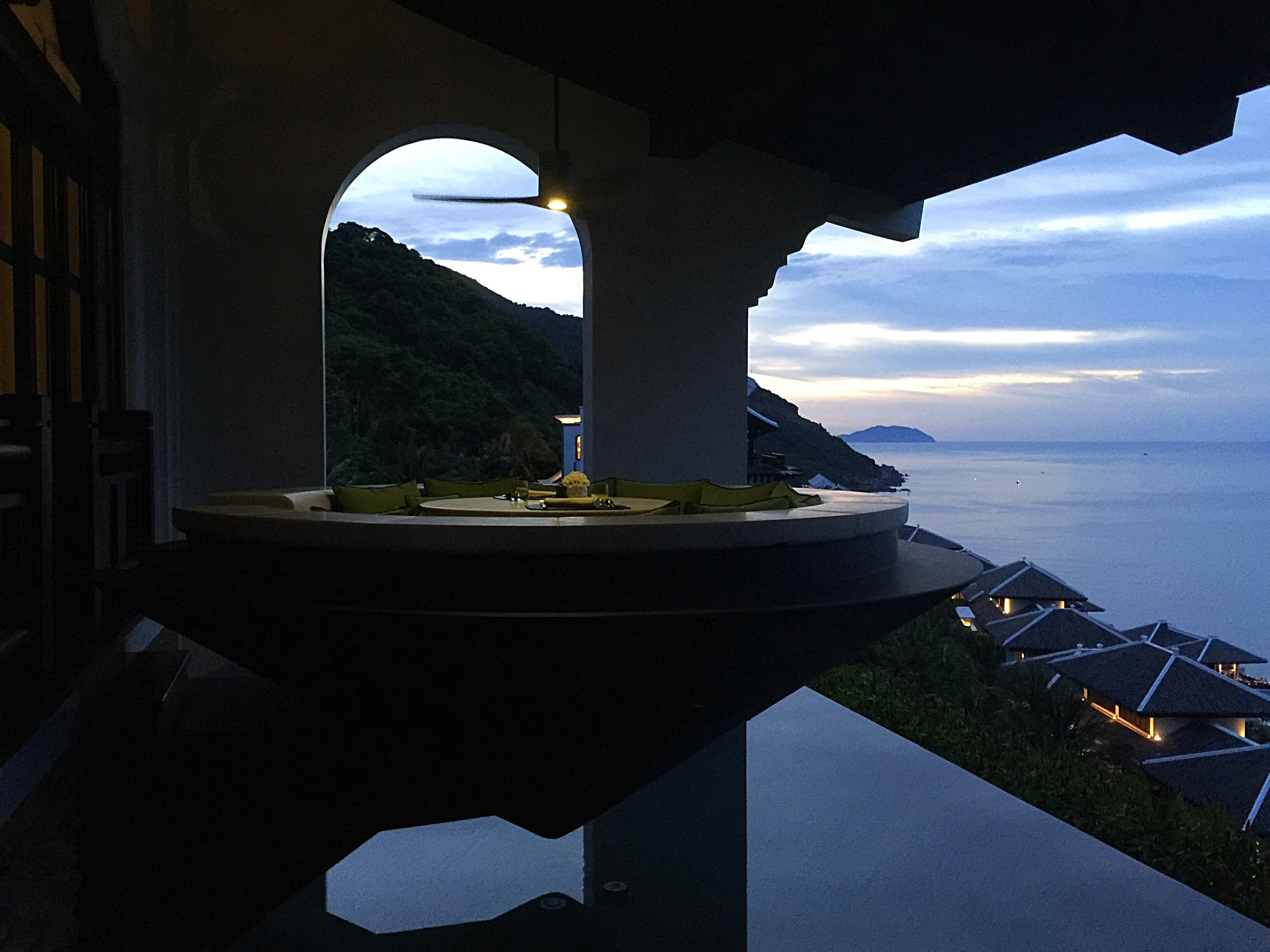
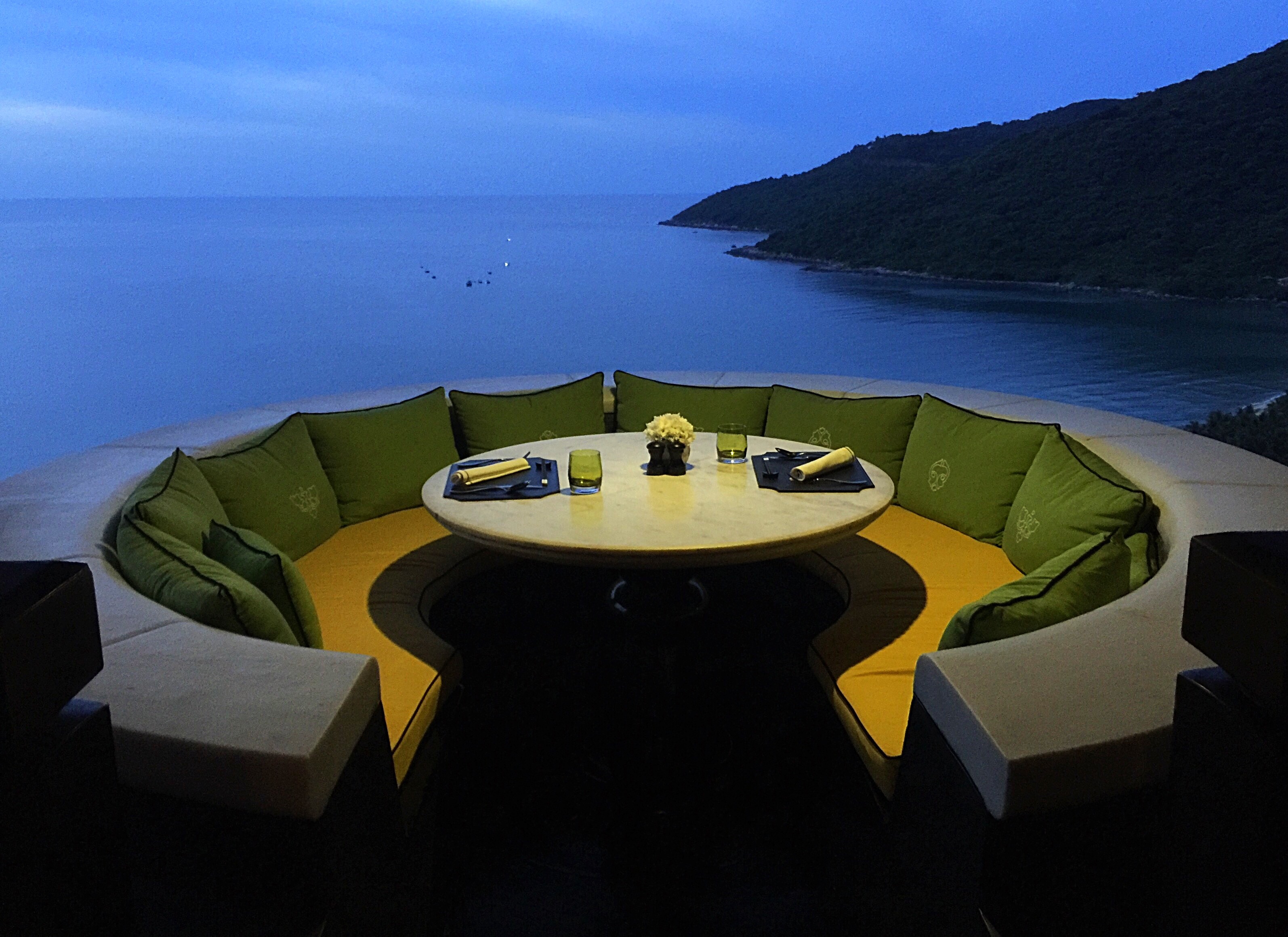
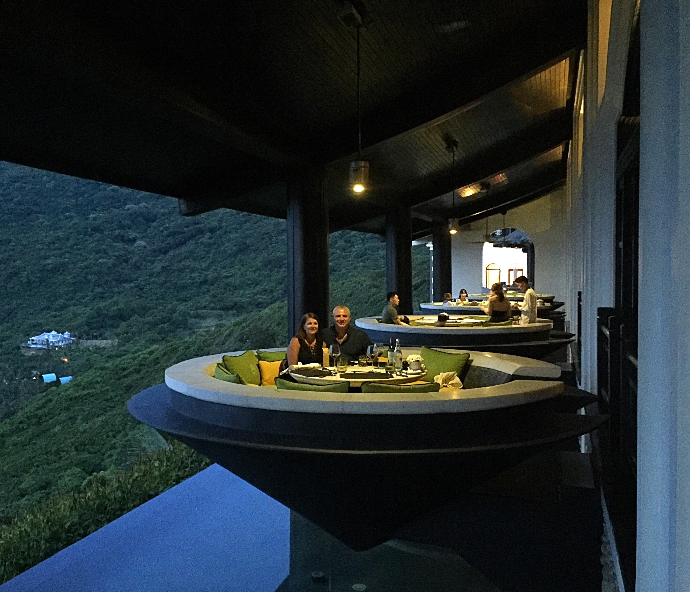
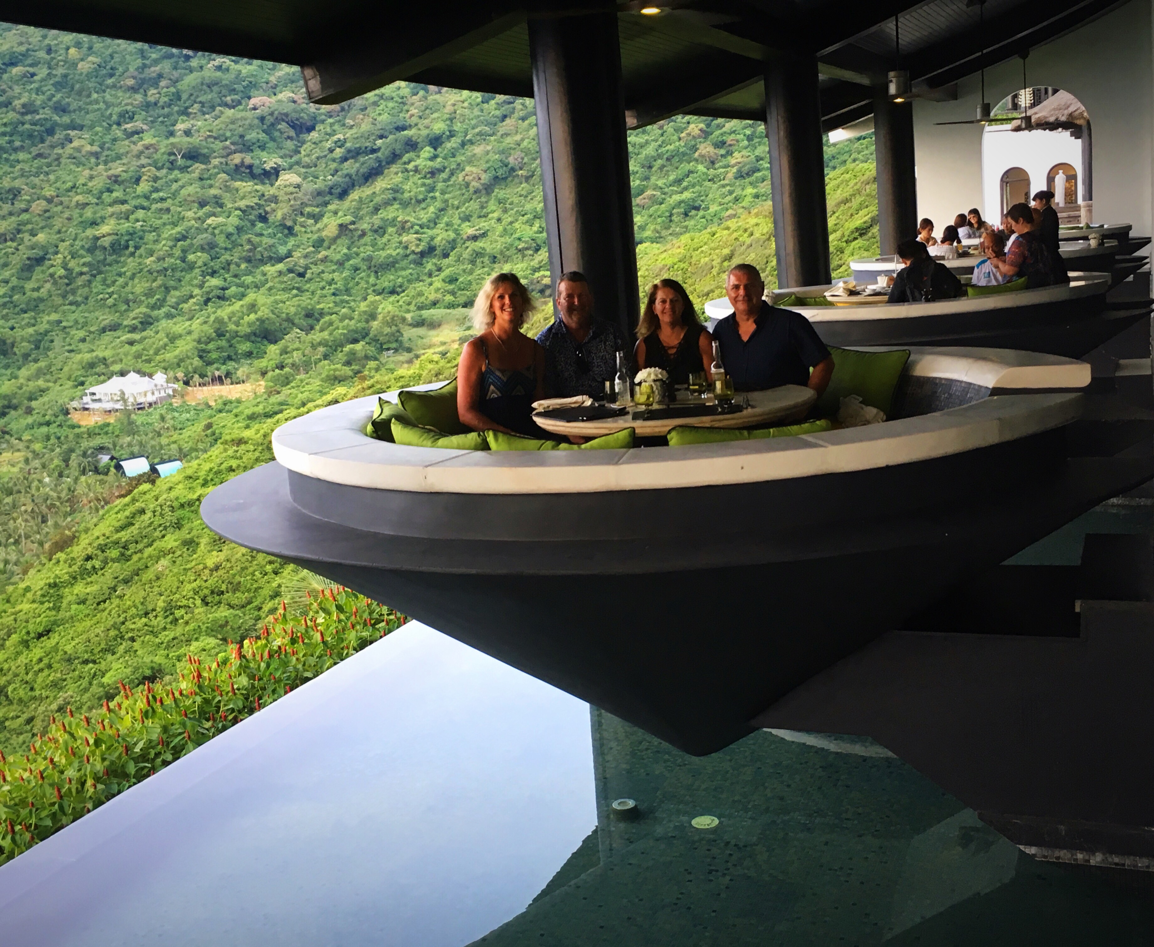
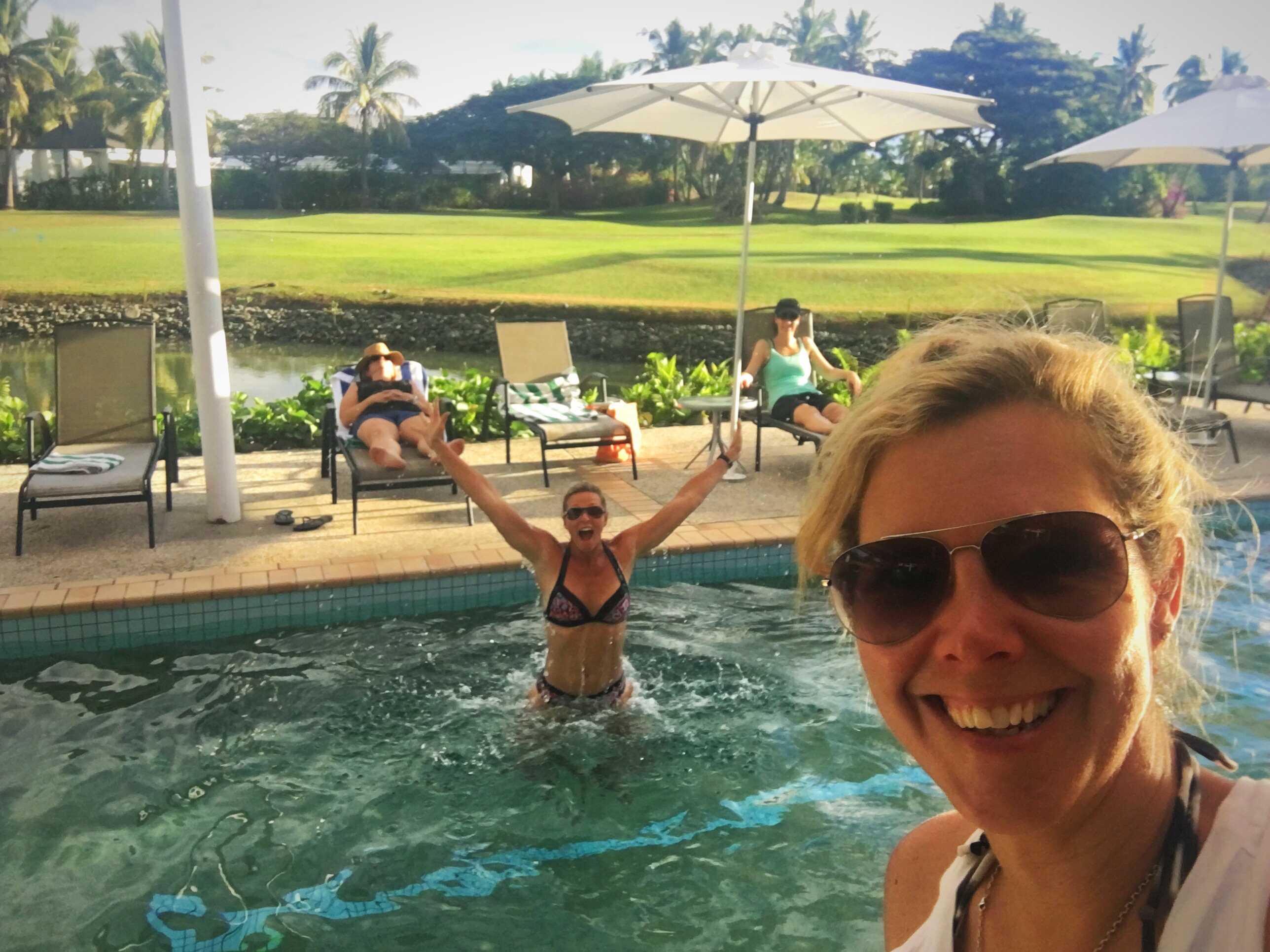
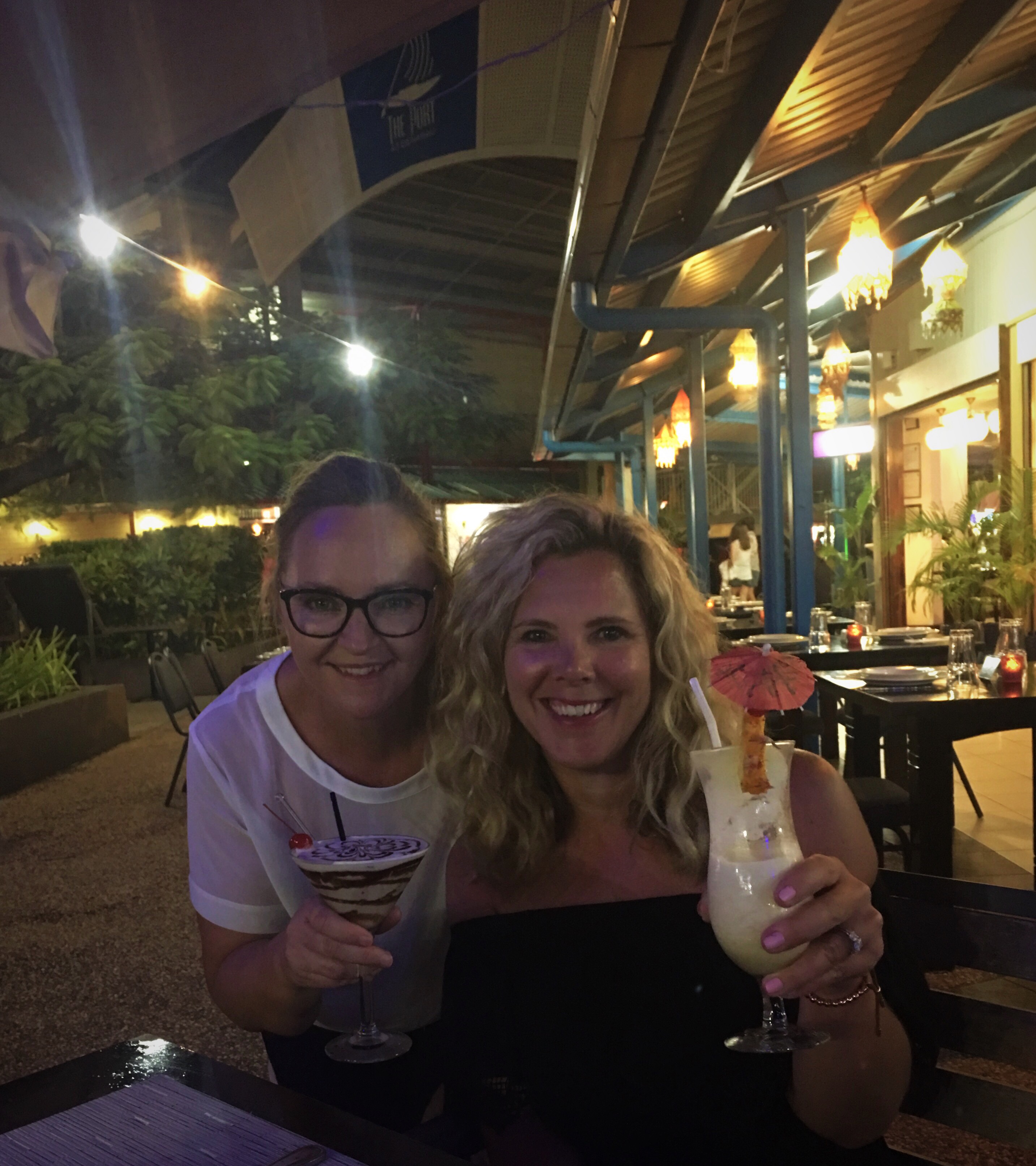
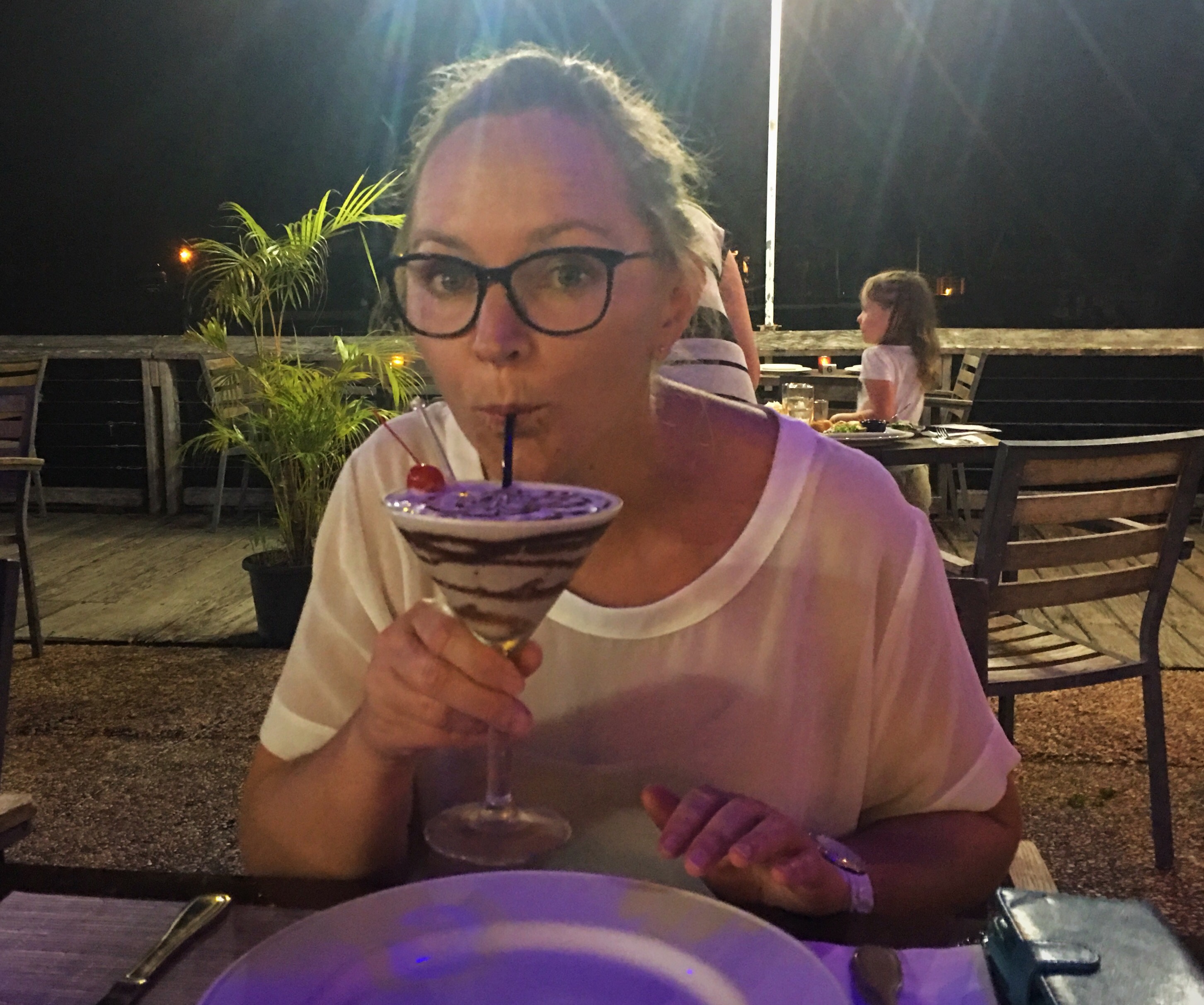
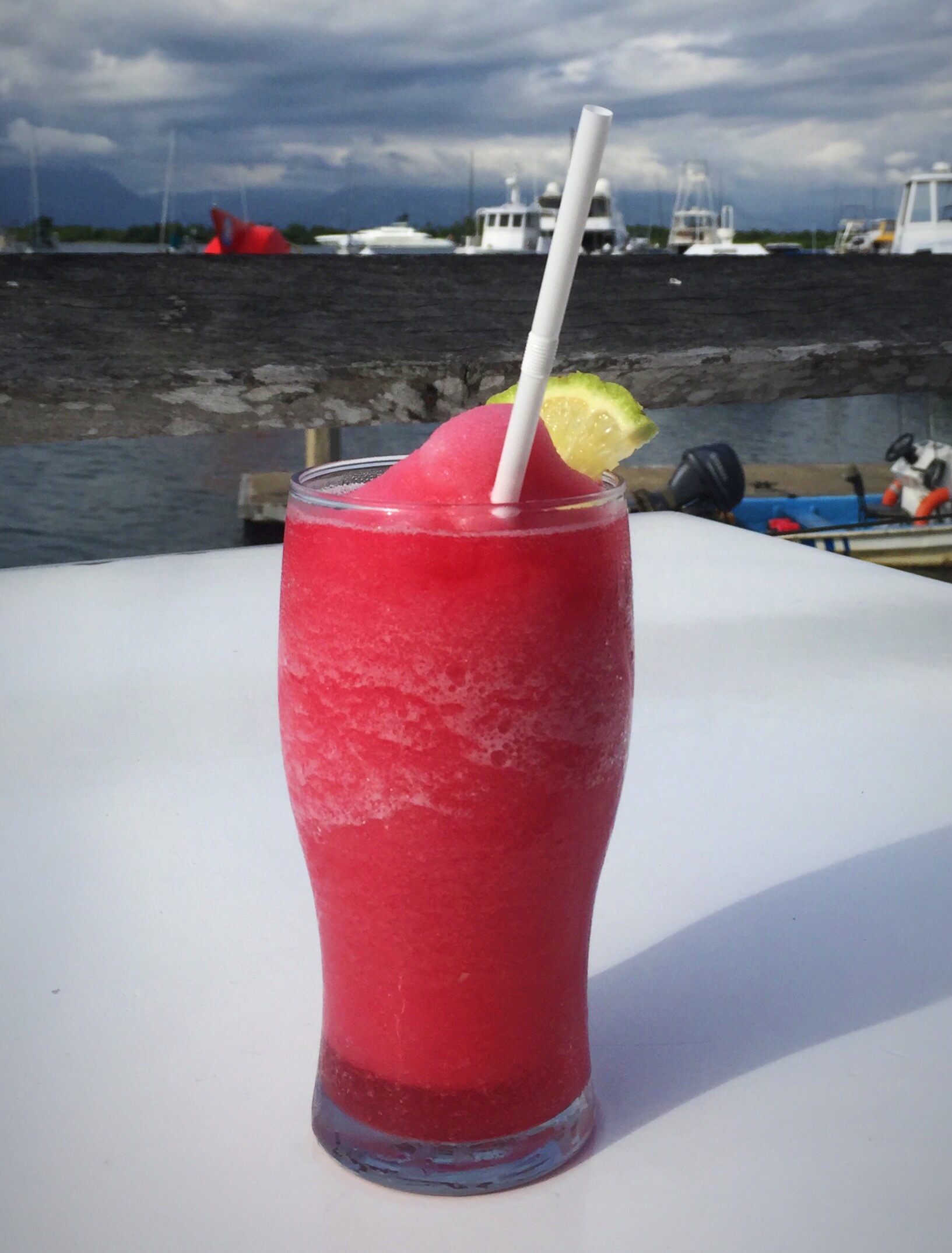
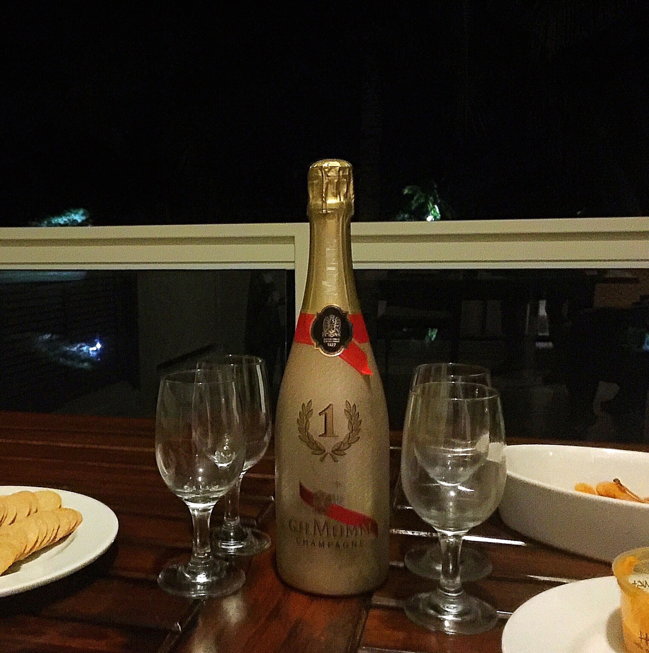
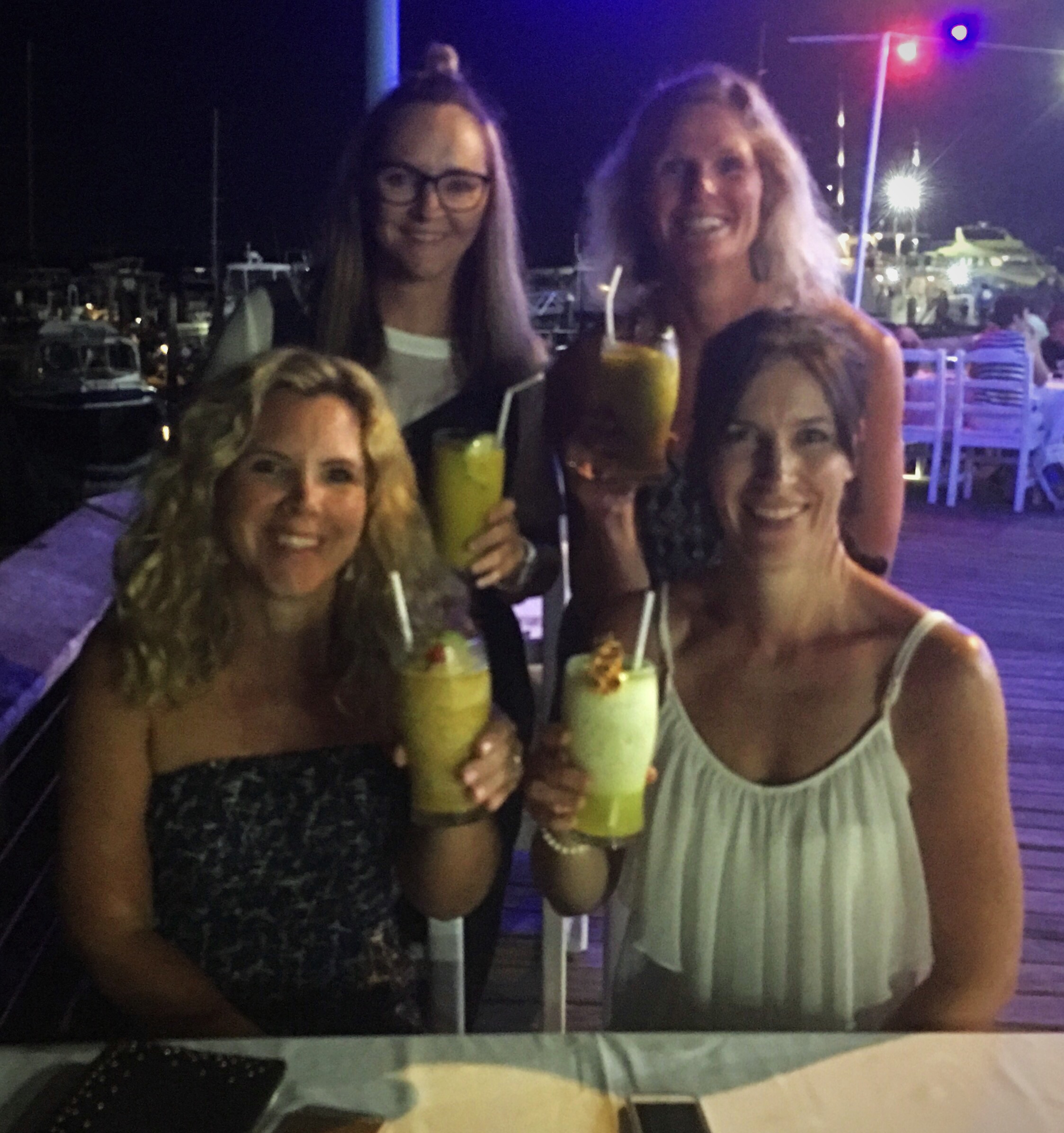
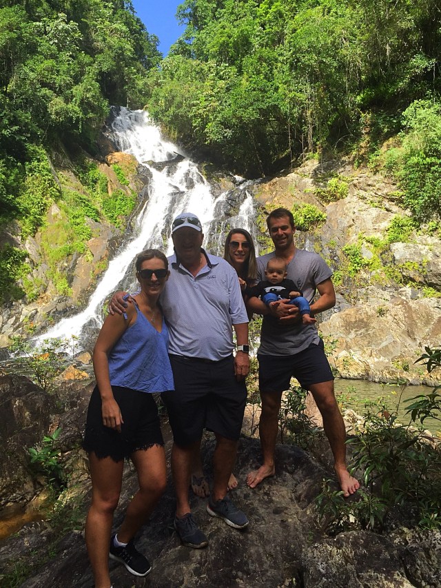
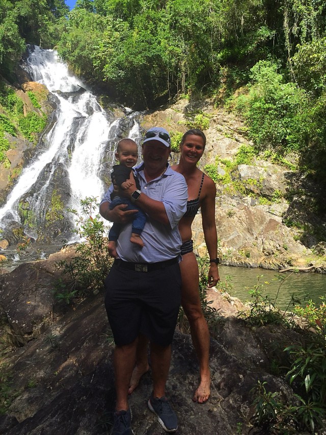
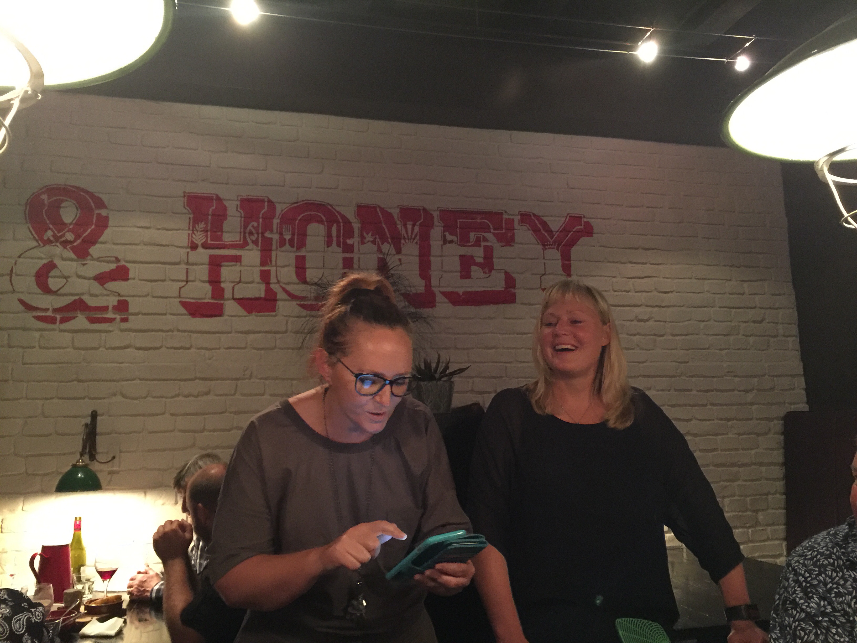
First cocktail on the island

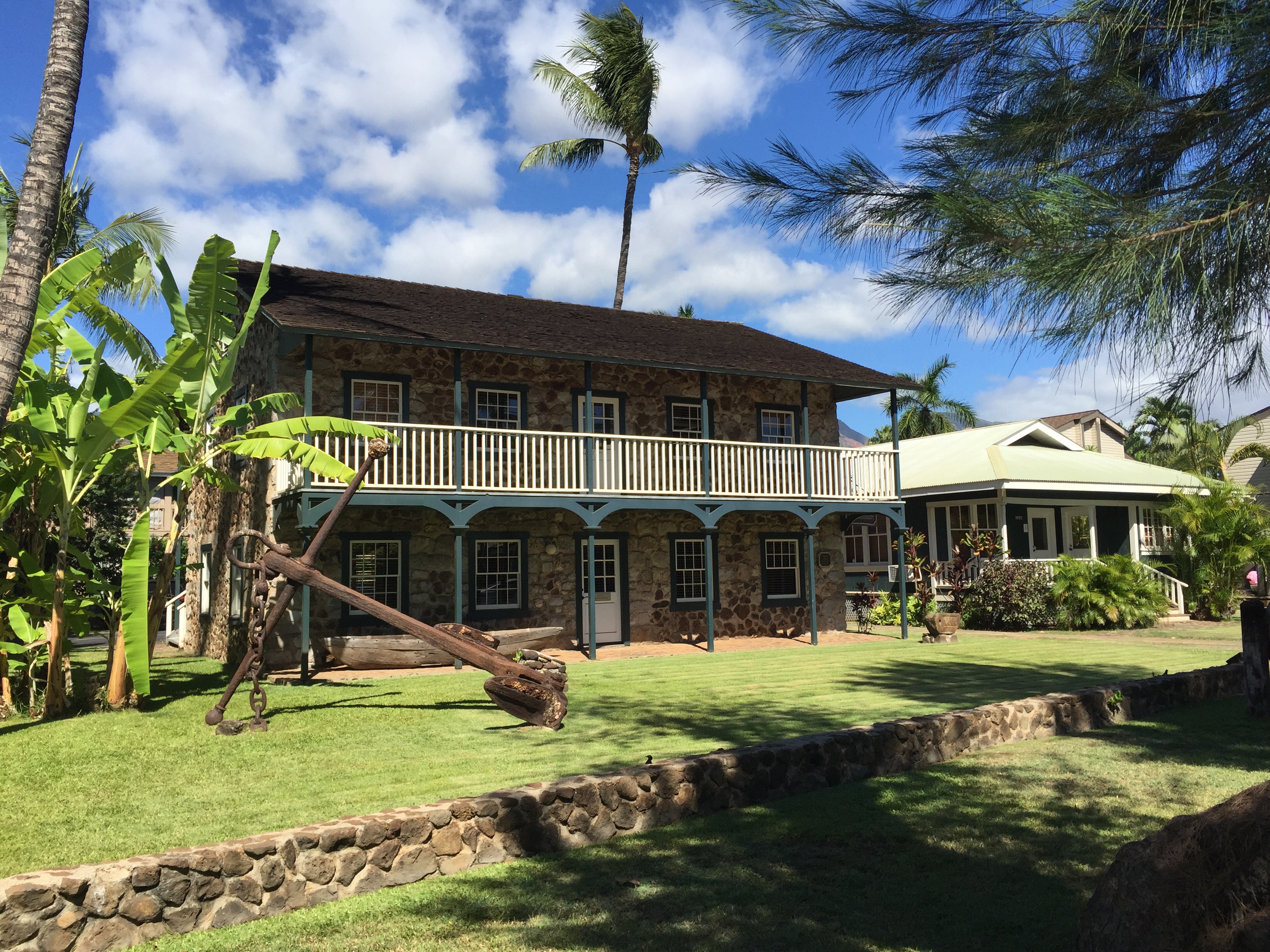
Seamen’s House & Hospital – completely restored in 1982 to its original appearance, the Seamen’s House was first built in 1833 on the commission of King Kamehameha III.  At the time, Lahaina did not extend much further north than Dickerson Street, which was then a stream flowing alongside a missionary compound.  This building was deliberately situated about a mile from the homes of the missionaries and devout Christian Governor Hoapili.  The King approached a Honolulu merchant to build a house on his property which would cater to visiting sailors as an inn and a store.  The King also had another purpose in mind: he needed a place to indulge in activities not condoned by the influential missionaries and to be away from their prying eyes.  They frowned on the partaking of “ardent spirits” and maintaining the old tradition of a sacred marriage between closely related high chiefs.  So it was here the King could meet his beloved sister, Princess Nahi’ena’ena.  By 1841, Joaquin Armas, a Mexican cowboy who was hired as the “King’s bullock catcher”, became landlord of this estate.  In 1844, the structure was leased to the US State Department to serve as a hospital for seamen, particularly whalers who flocked to these shores in 1860.  During archaeological excavation, a “permanent guard” was found under a corner of the foundation: the skeleton of a human sacrifice which lay halfway outside the building.  After being blessed by a Hawaiian minister, the skull maintains its permanent vigil over the building to this day.
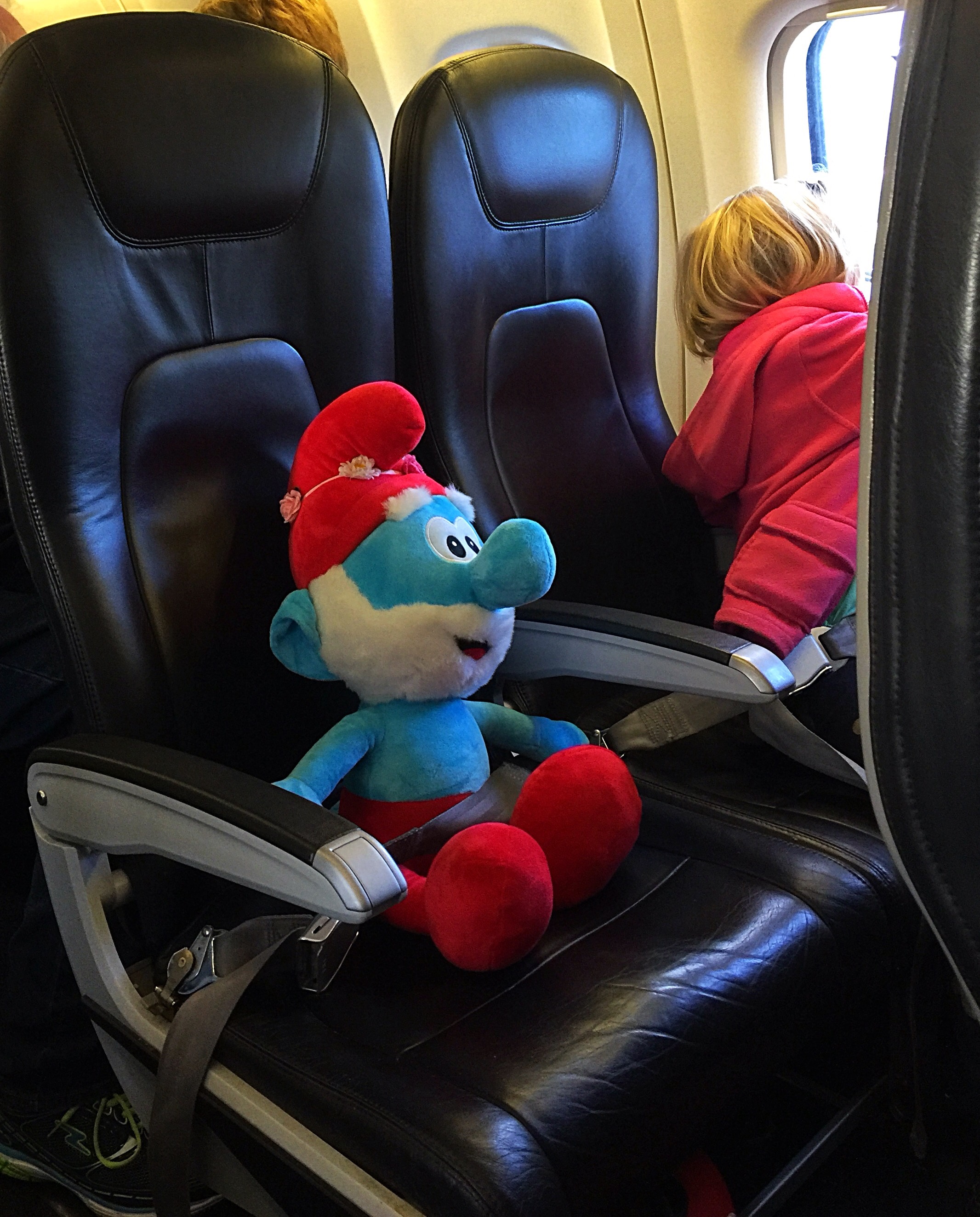
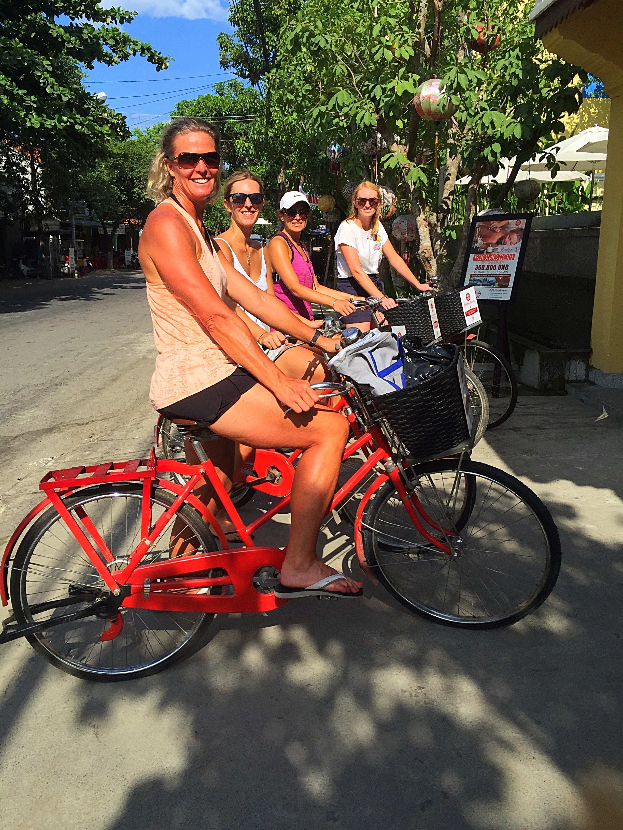
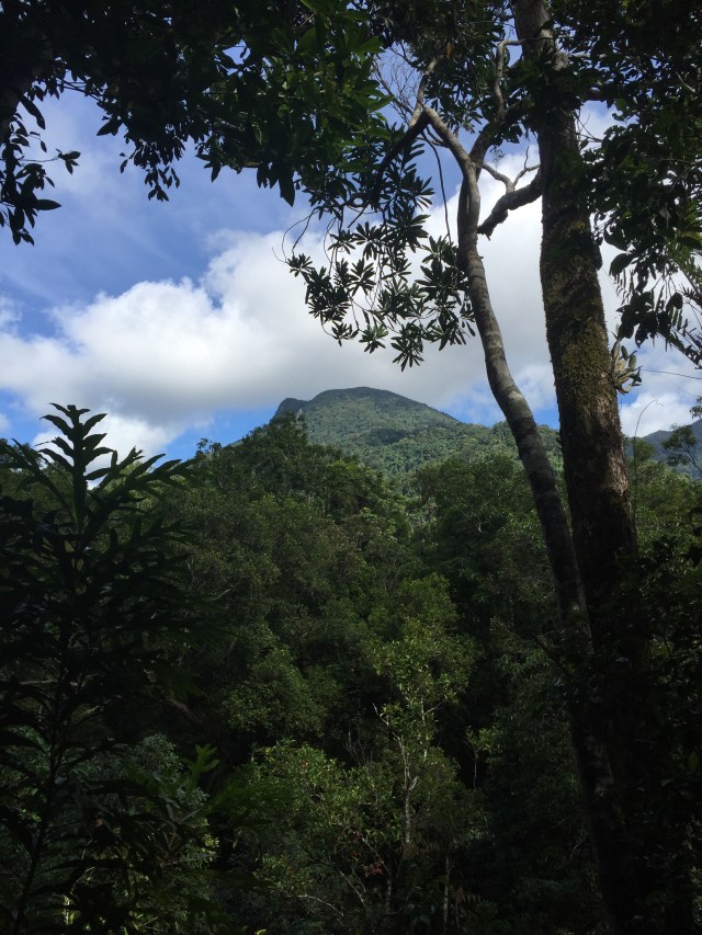
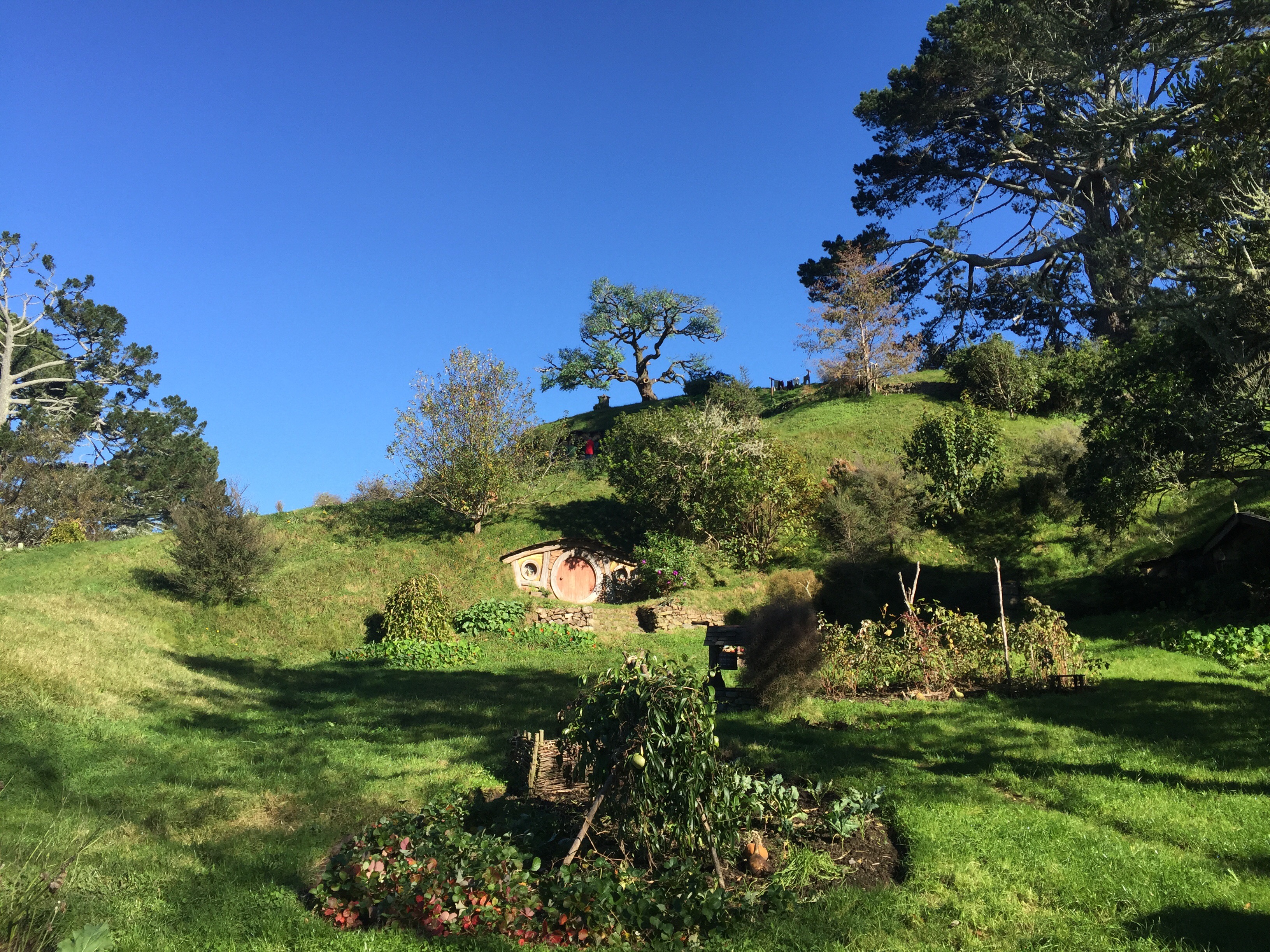
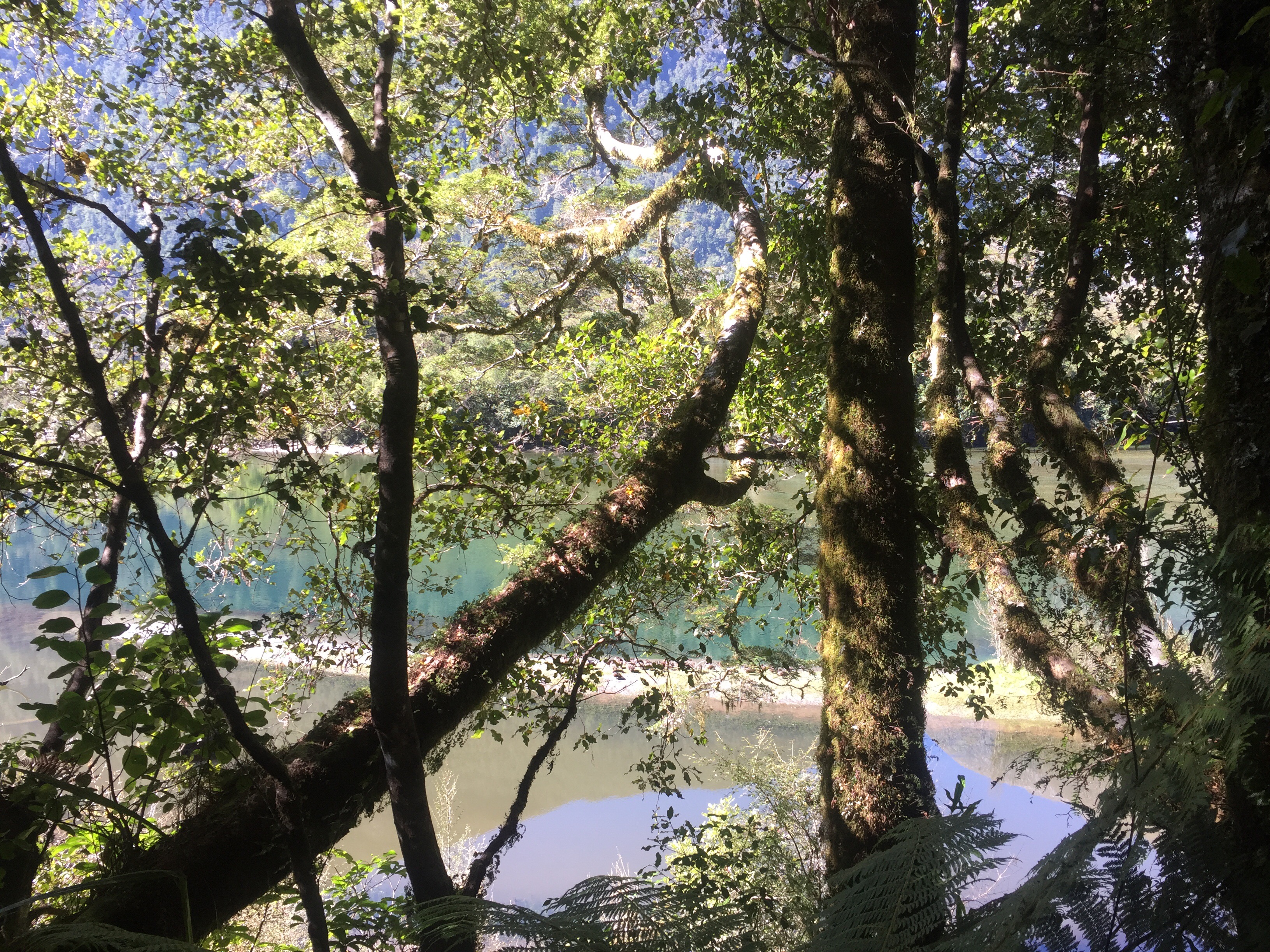
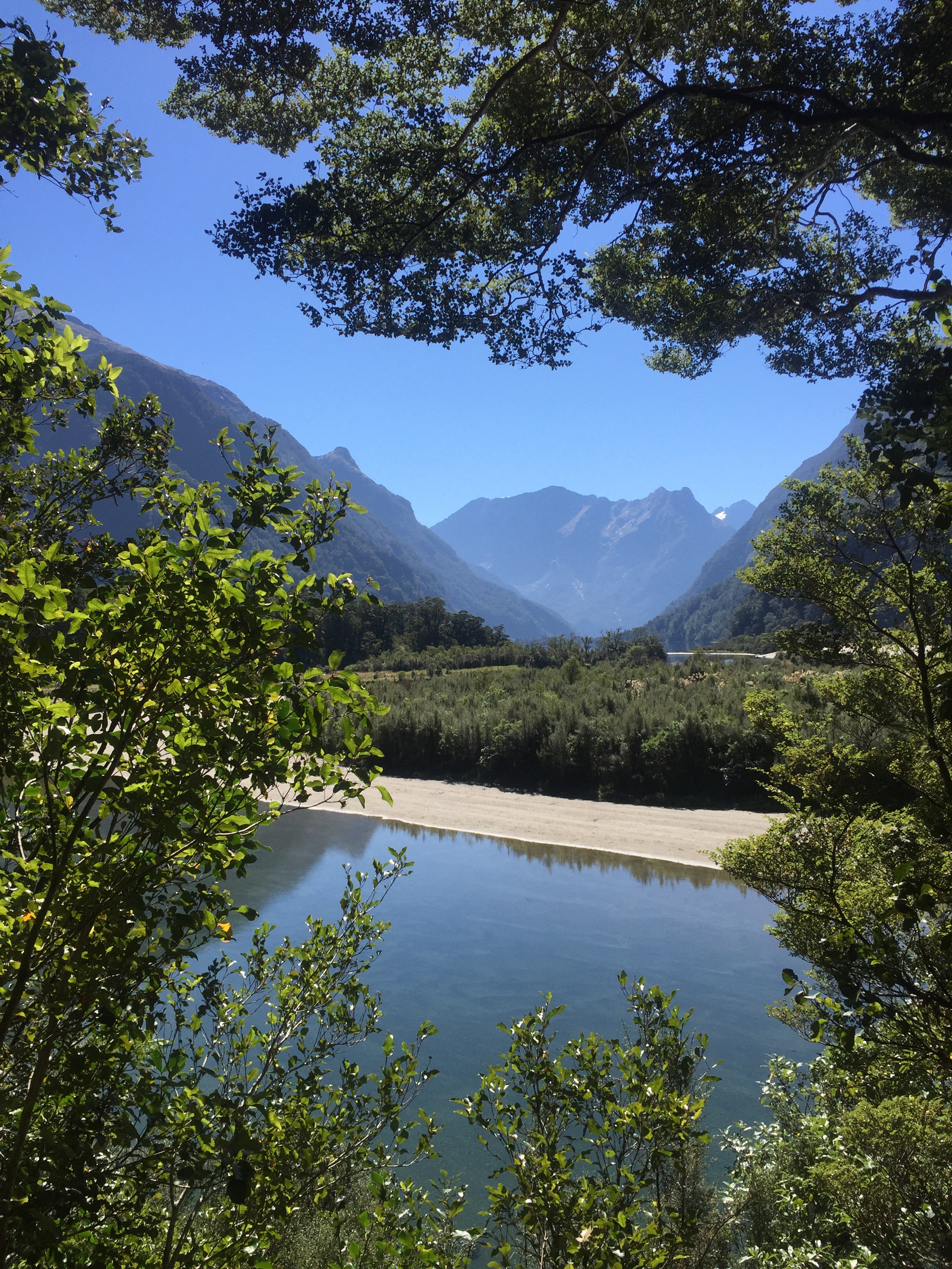
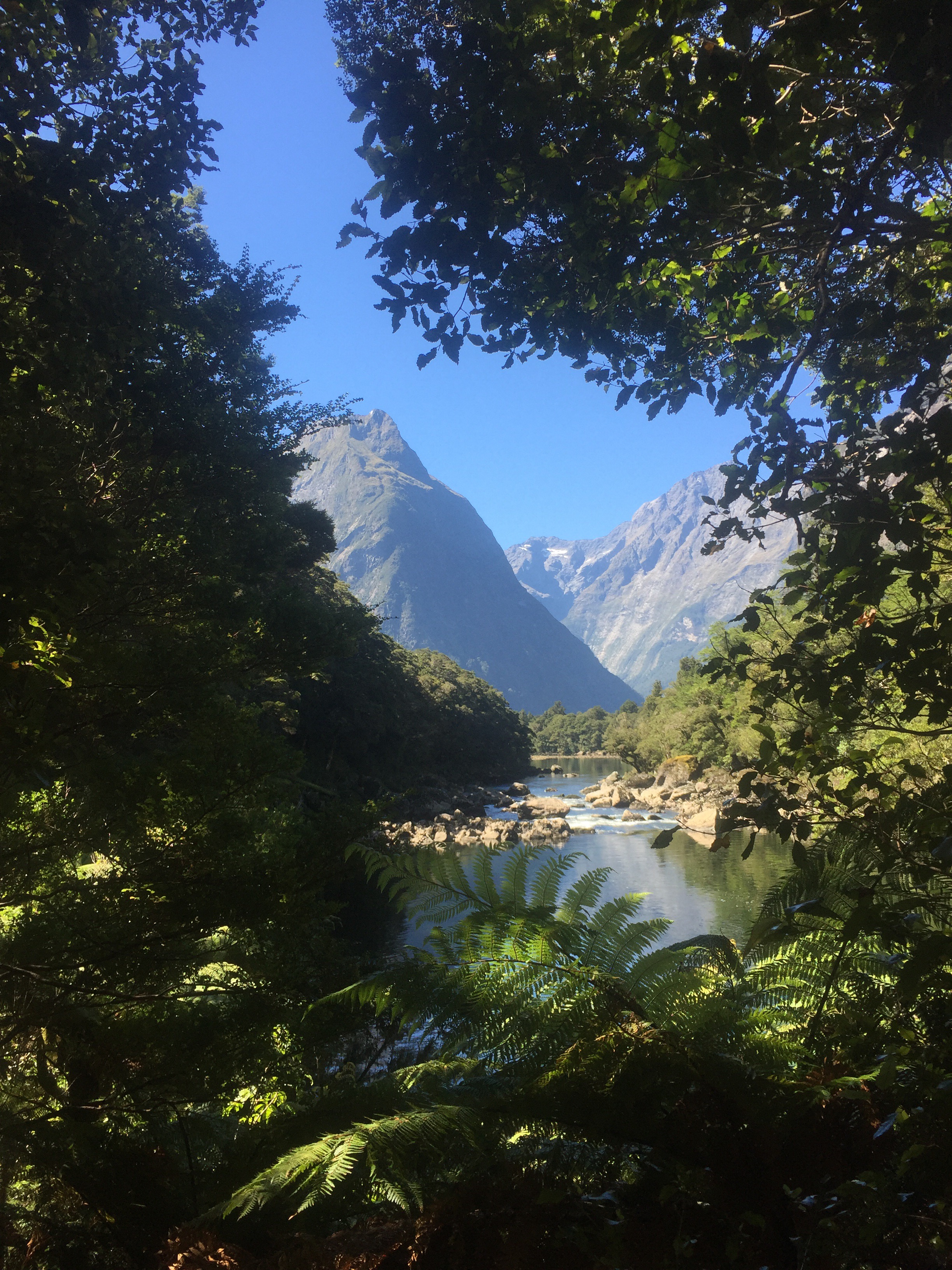
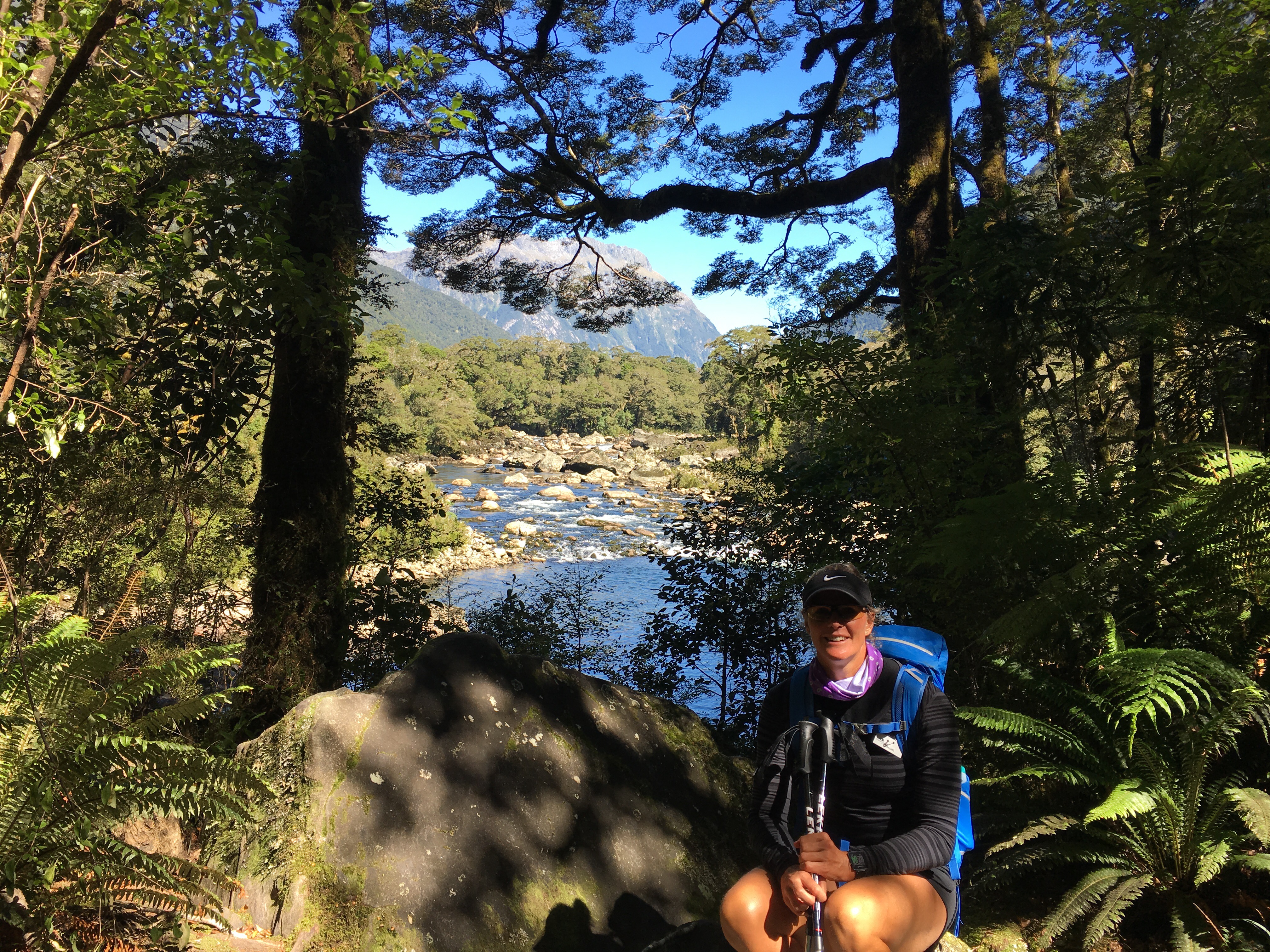
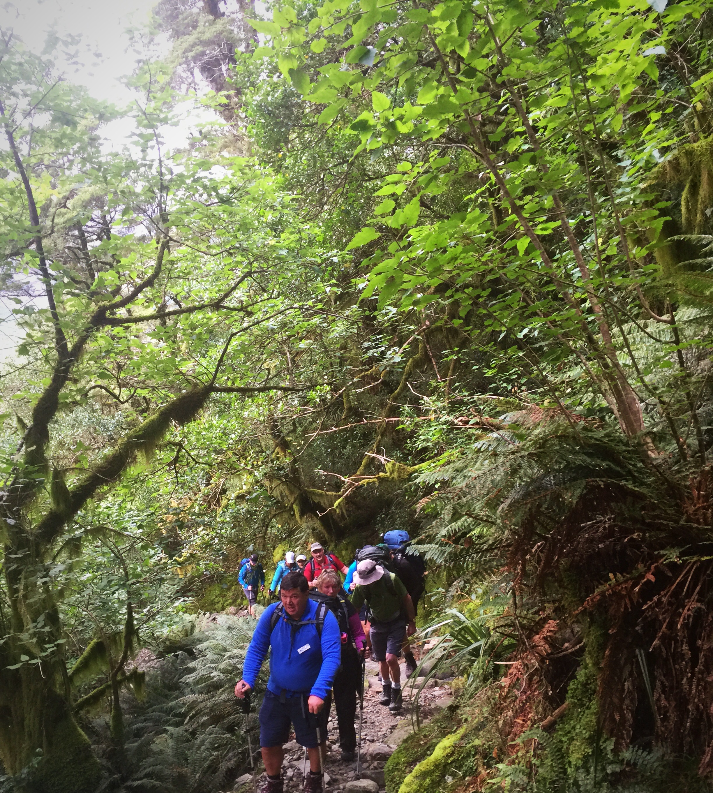
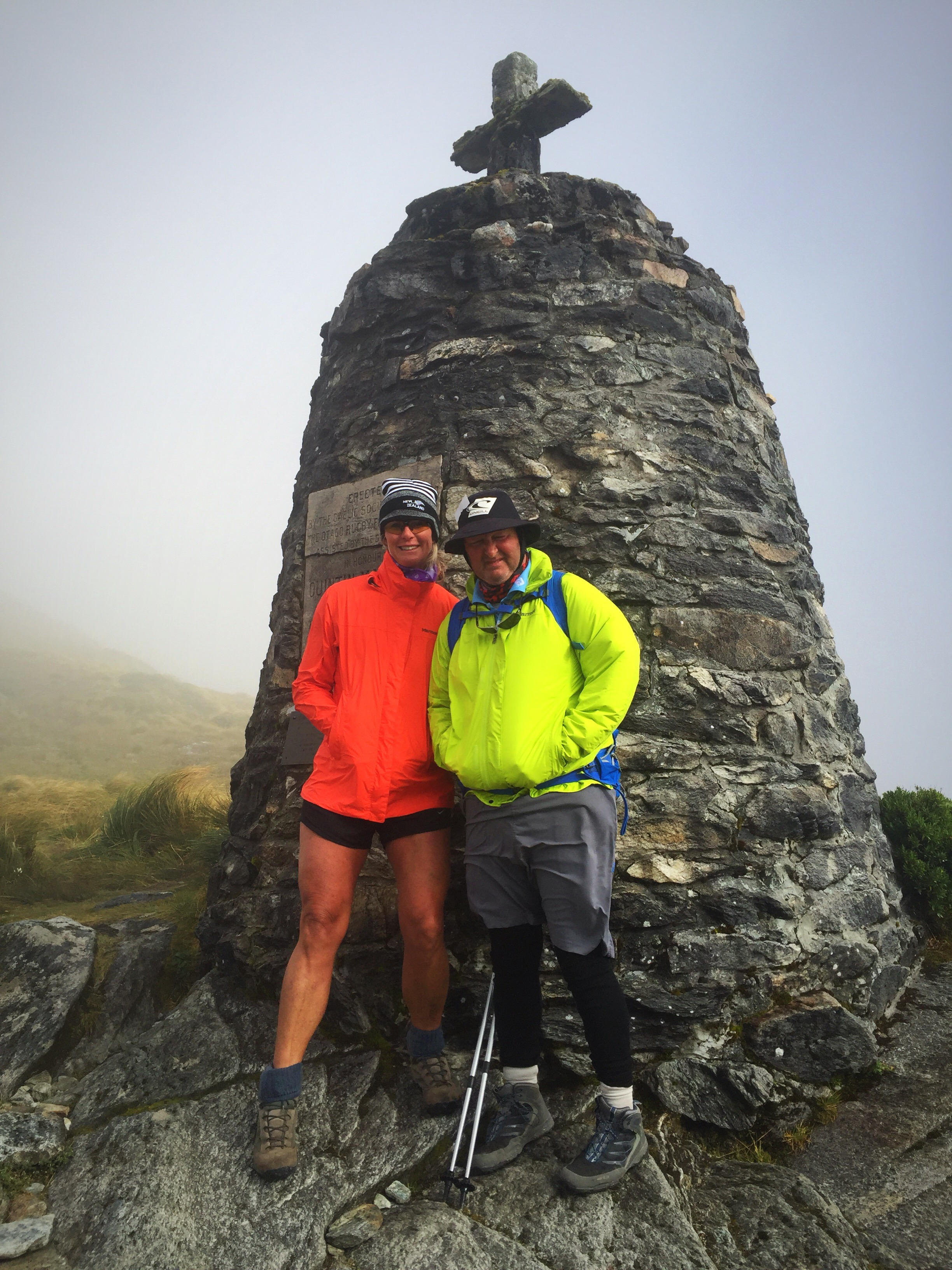
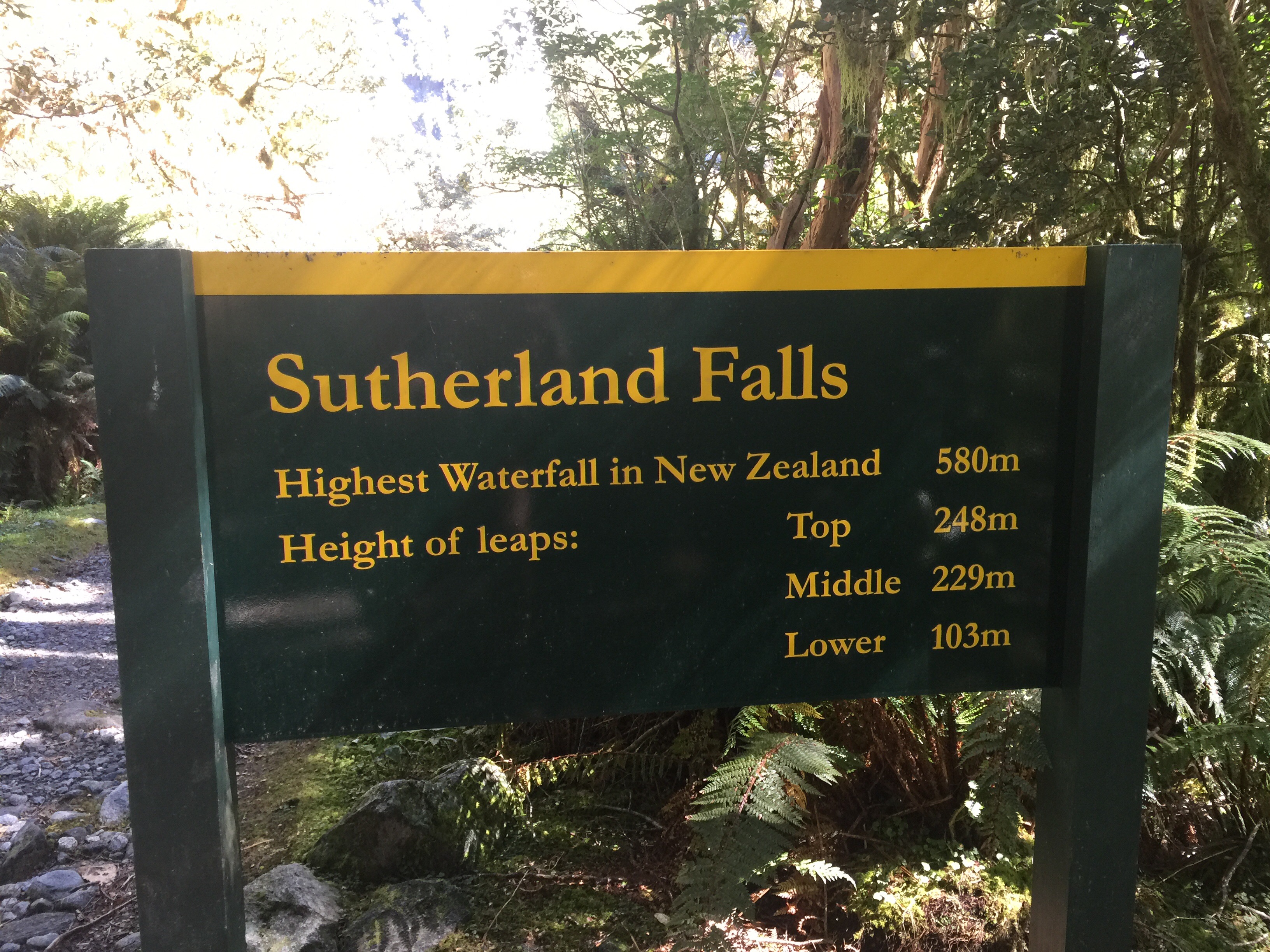
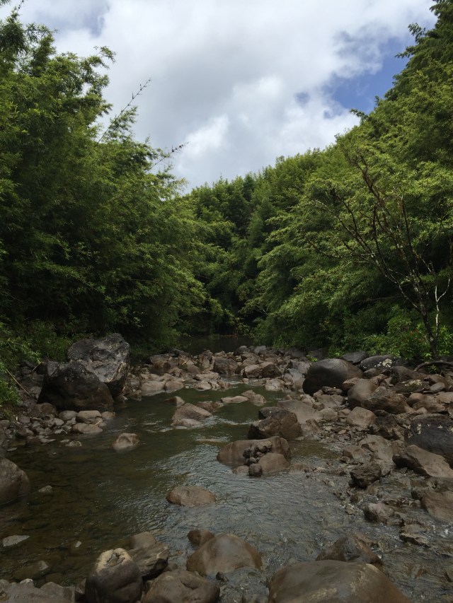
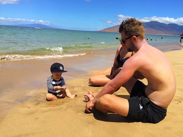

Bamboo Forest Hike

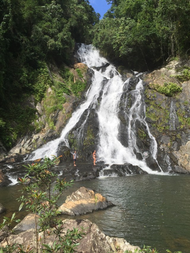
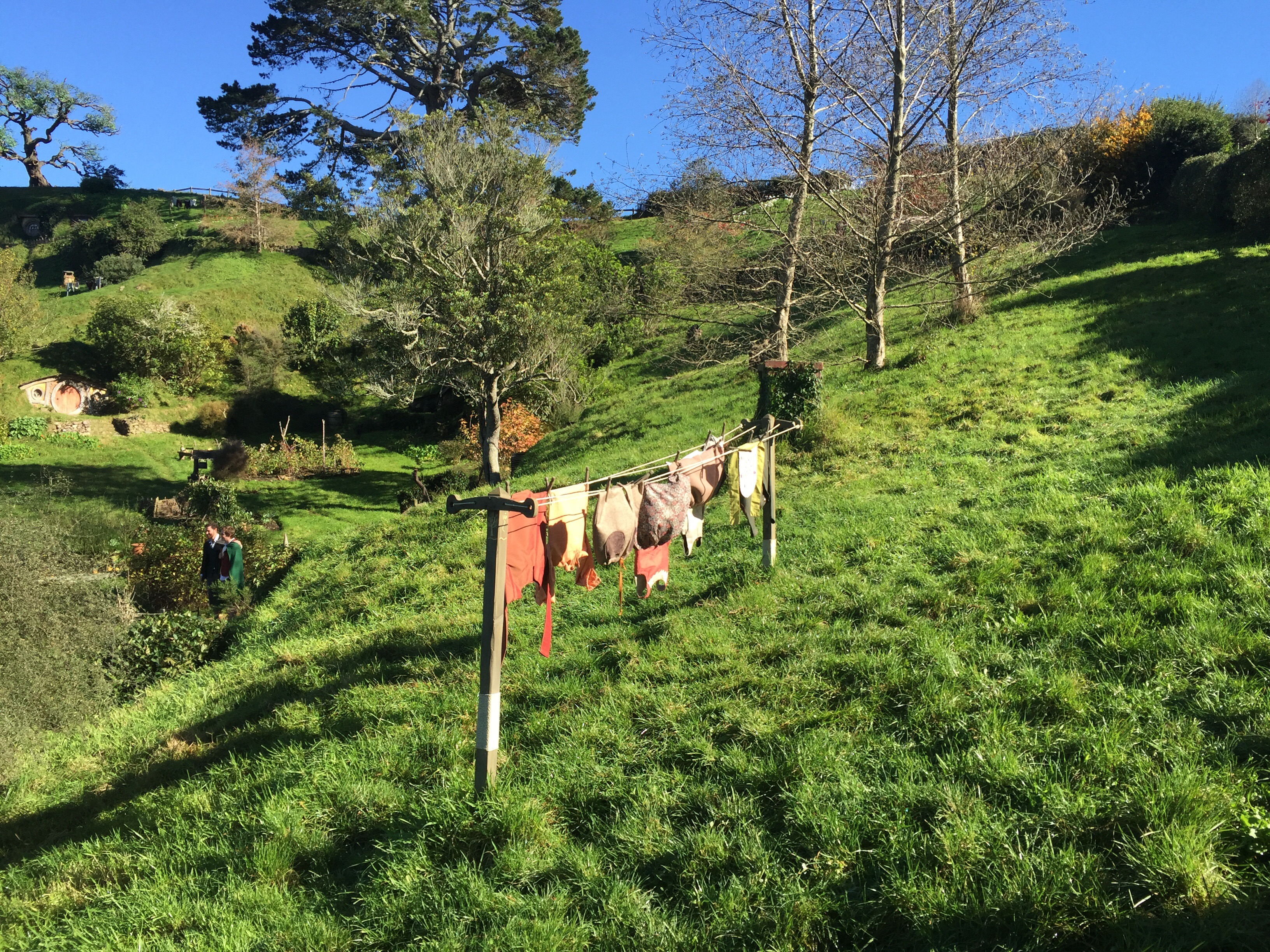
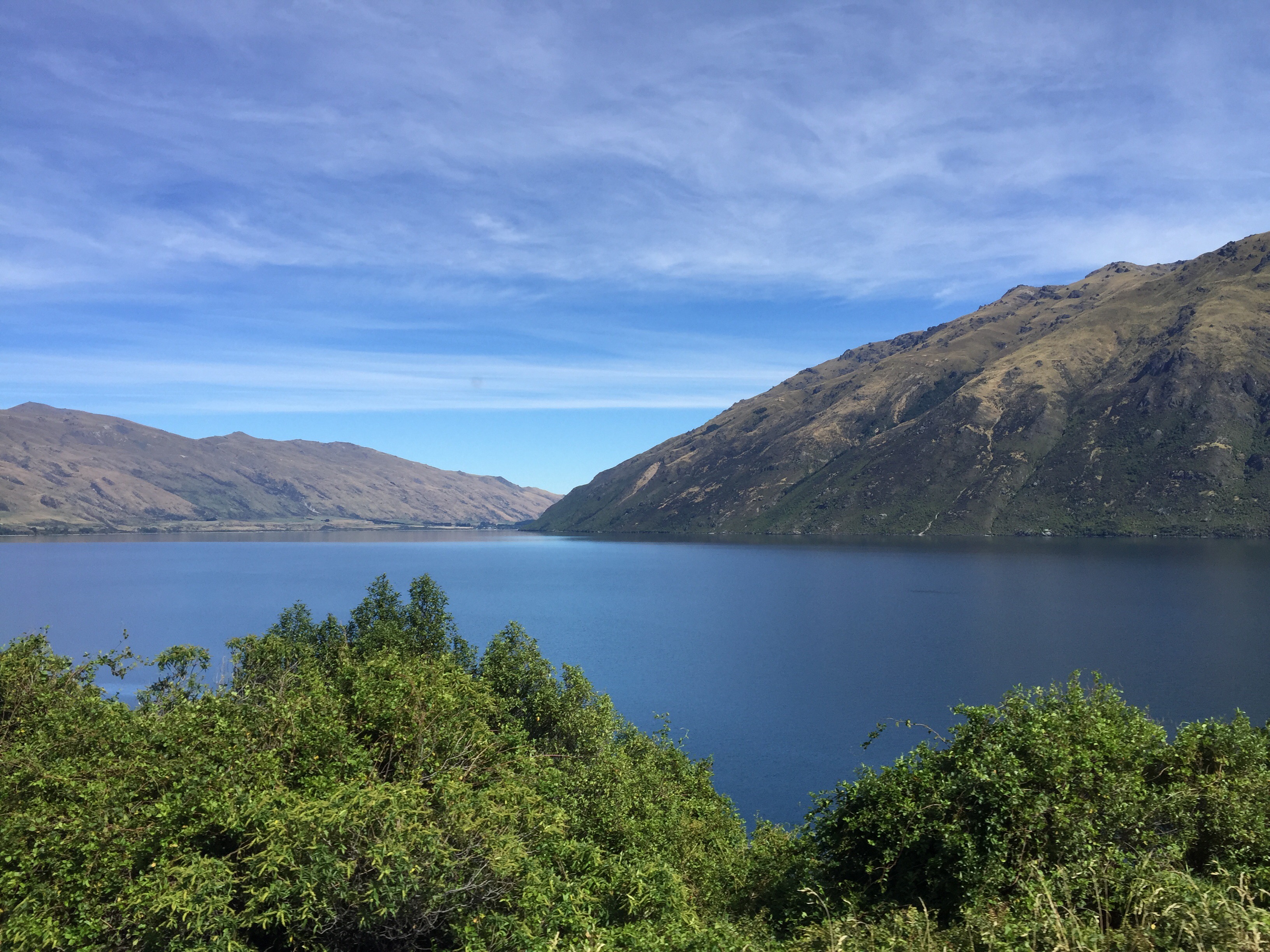
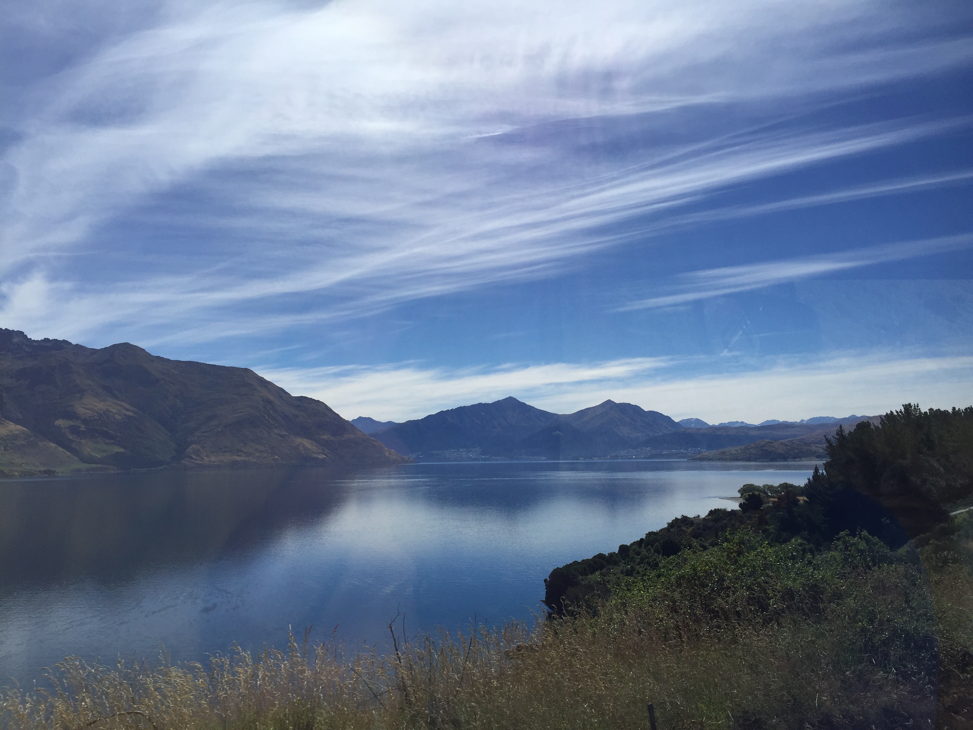
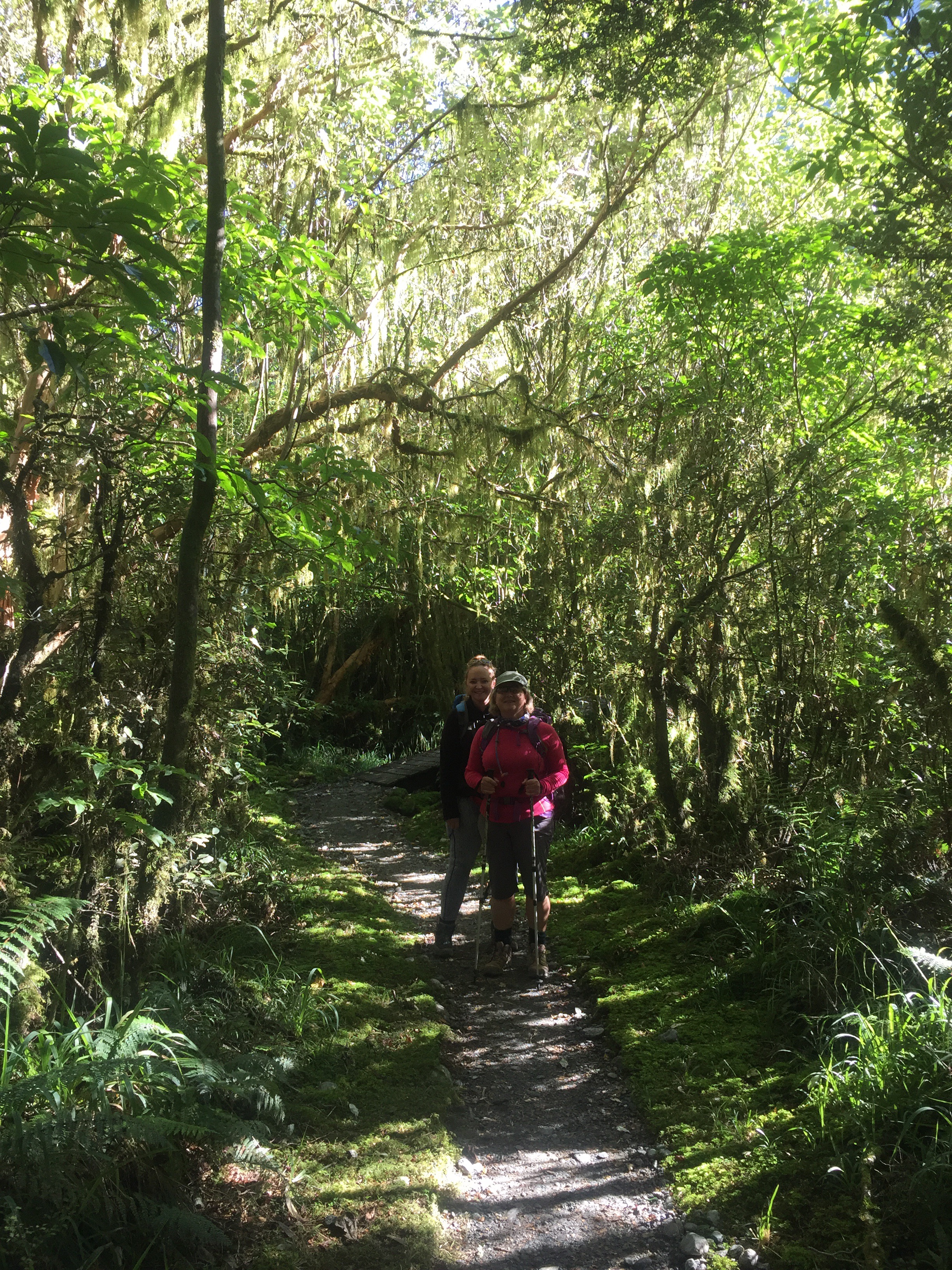
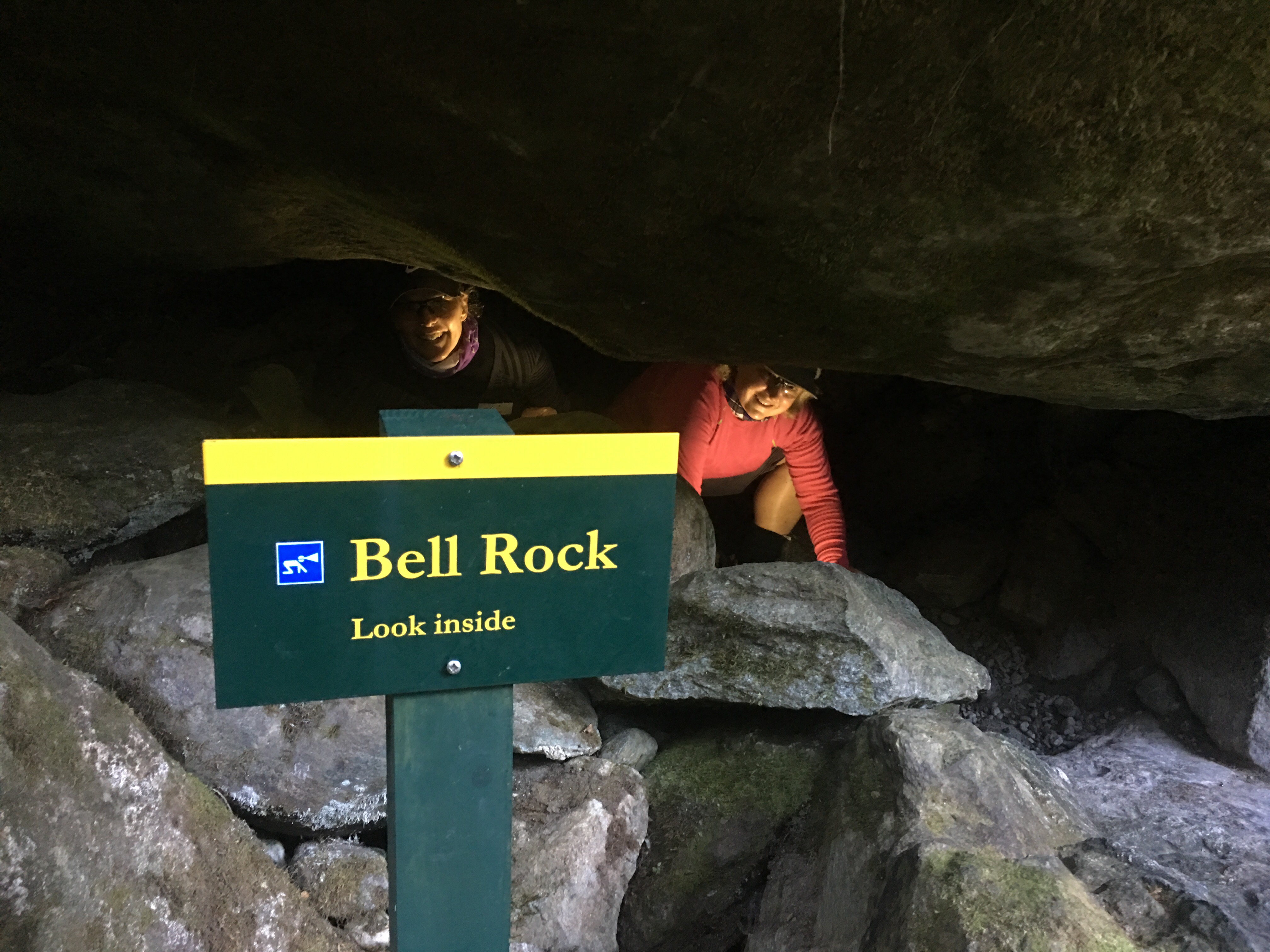
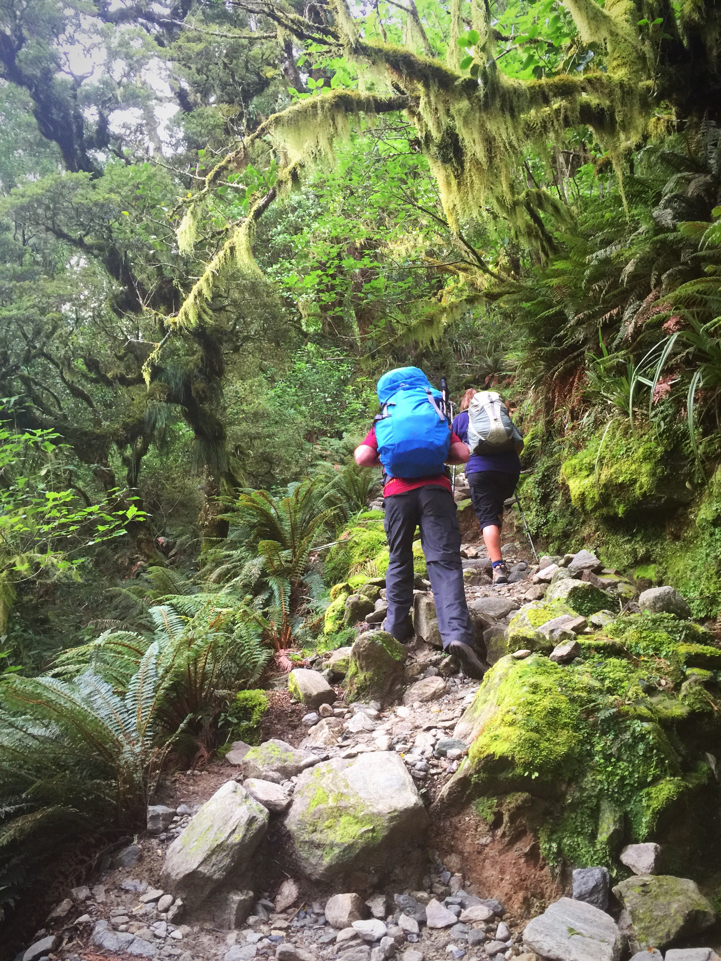
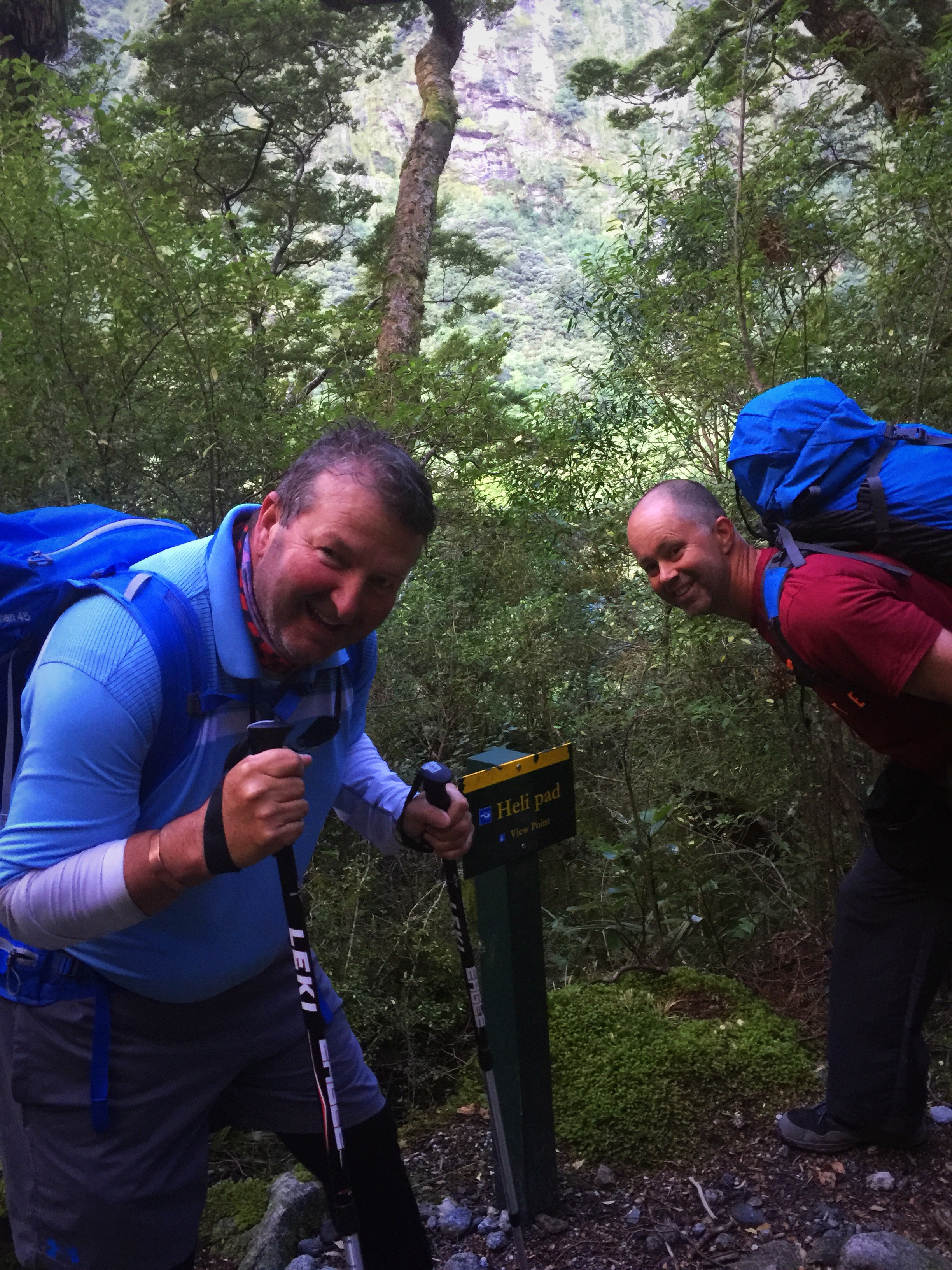
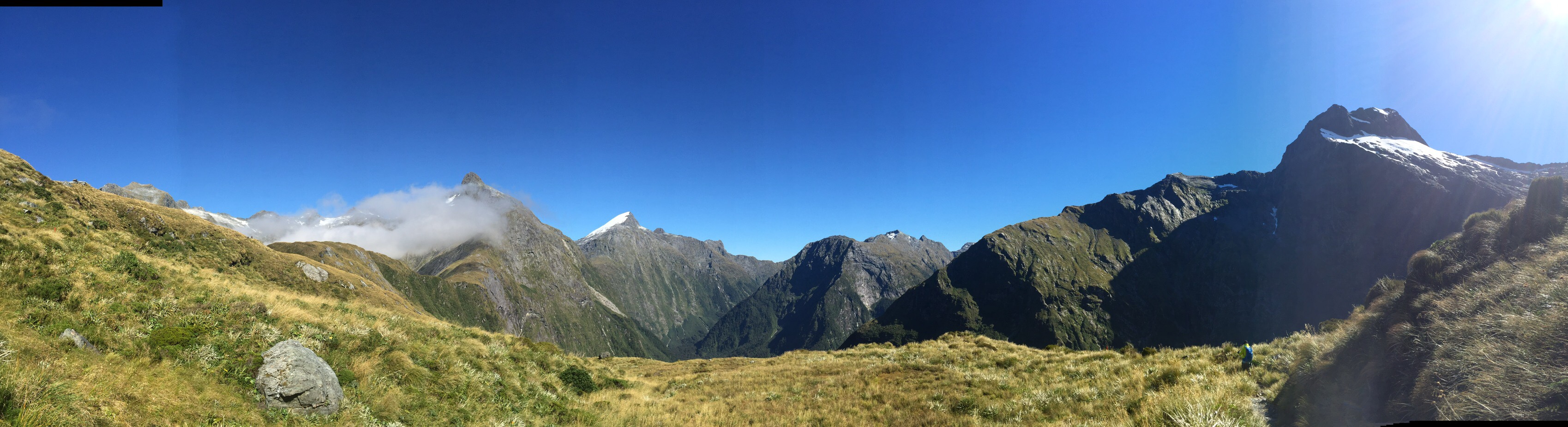
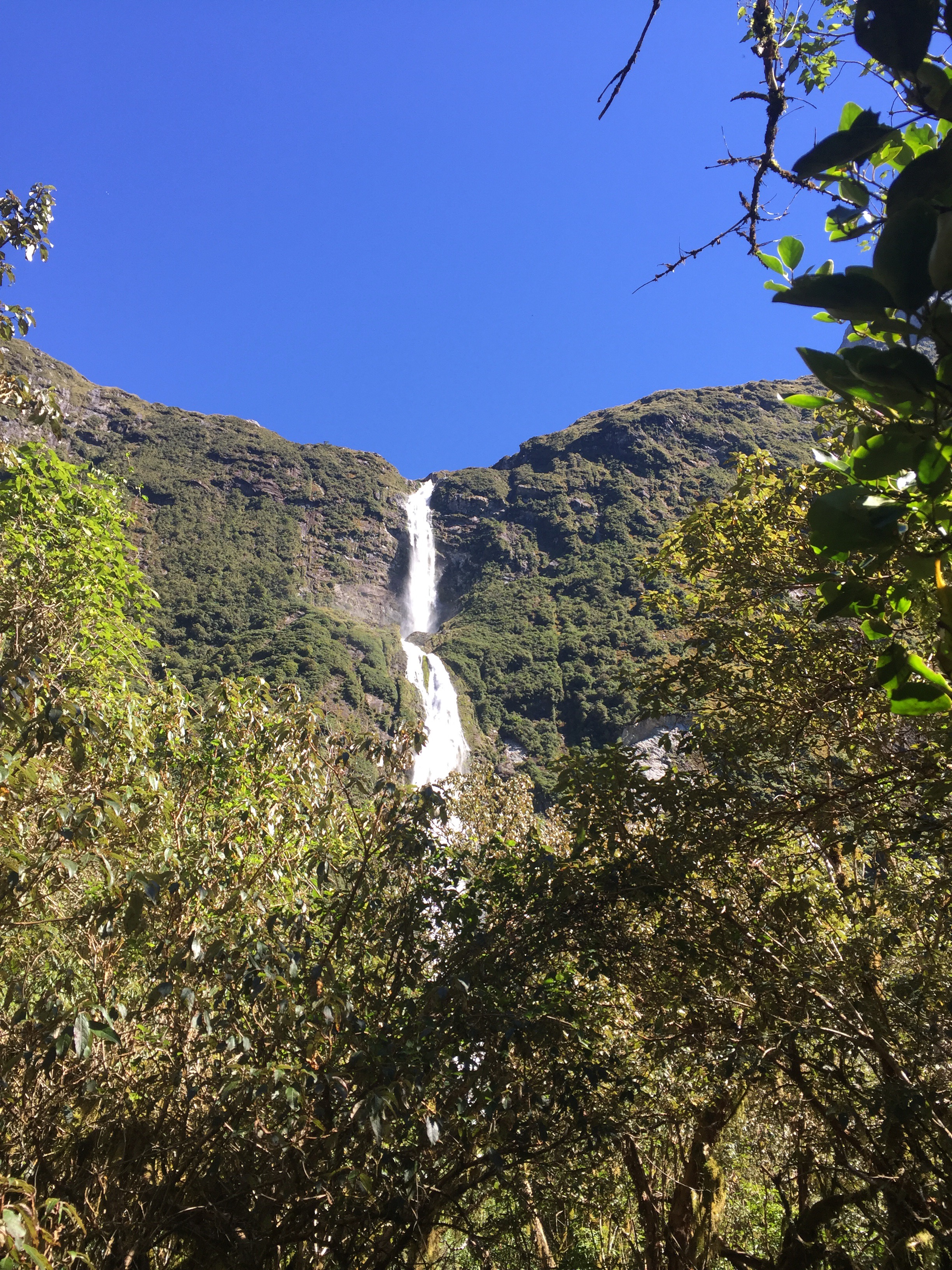
The next day we decided to explore the other side of the island and take the road towards Hana.  The waiter at the Outback Steak House had recomended this hike in a bamboo forest.  I had done some googling to find the exact spot as there is another bamboo forest hike at the bottom of the island.  We went past all these cars parked on the side of the road but they were doing the Twin Waterfalls walk – apparently this is very touristy and busy so we carried on to the lesser known bamboo forest hike which was also marked by a number of cars parked on the side of the road although no where near as many.  We entered the hike through this narrow opening in the bush and followed the track down what became quite a slippery slope – Steve took one look at this and turned back.  The rest of us including George of the Jungle, aka Taj carried on.

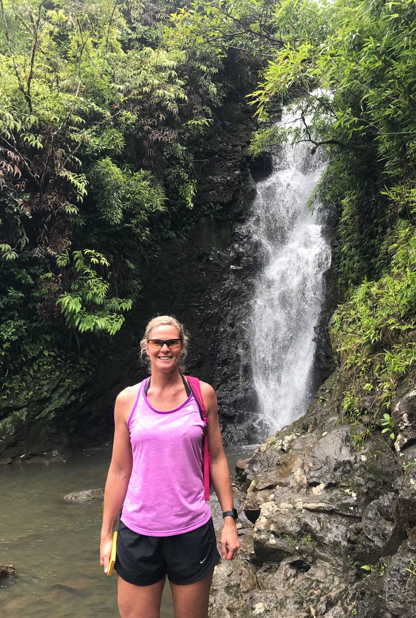
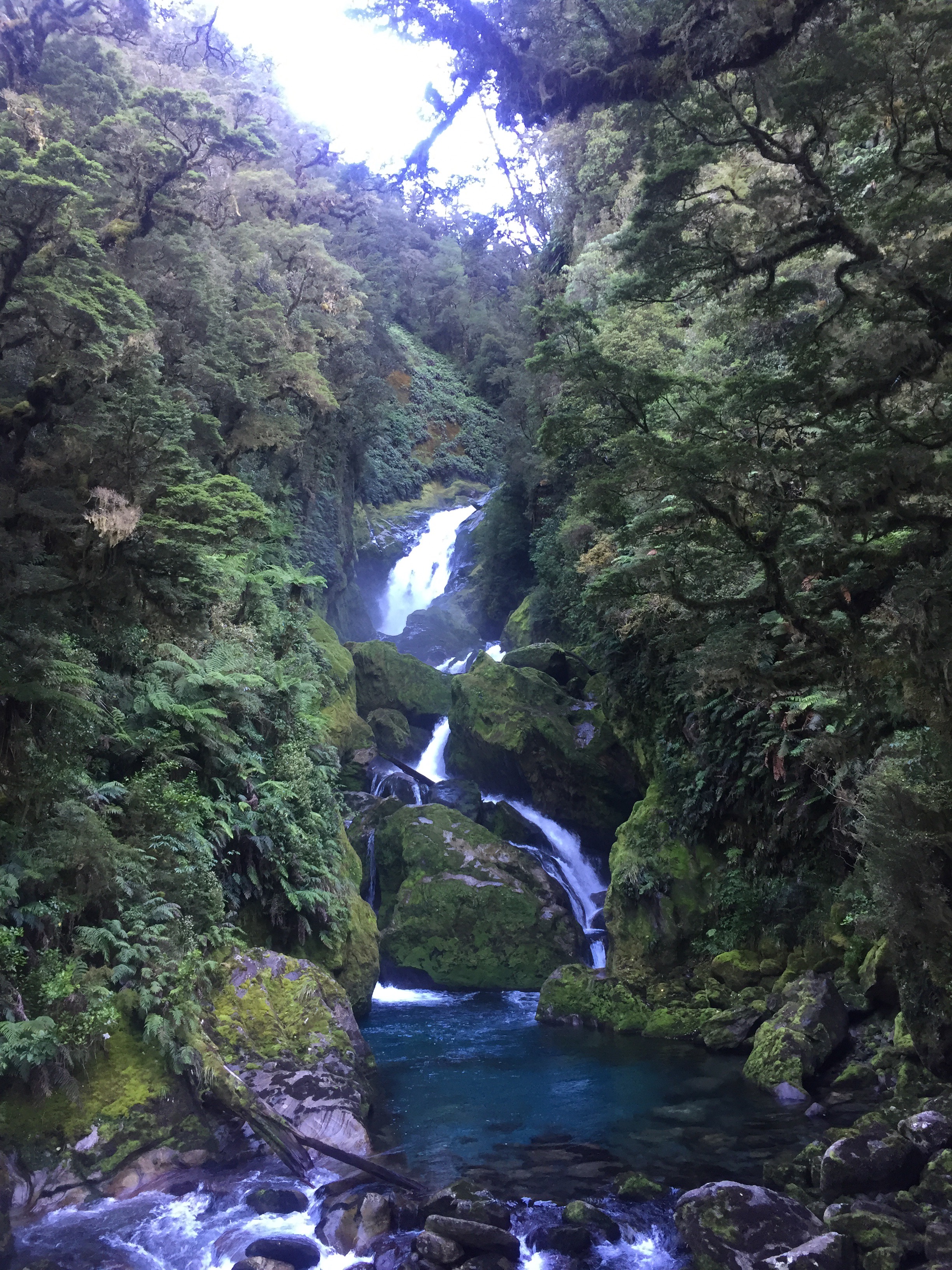
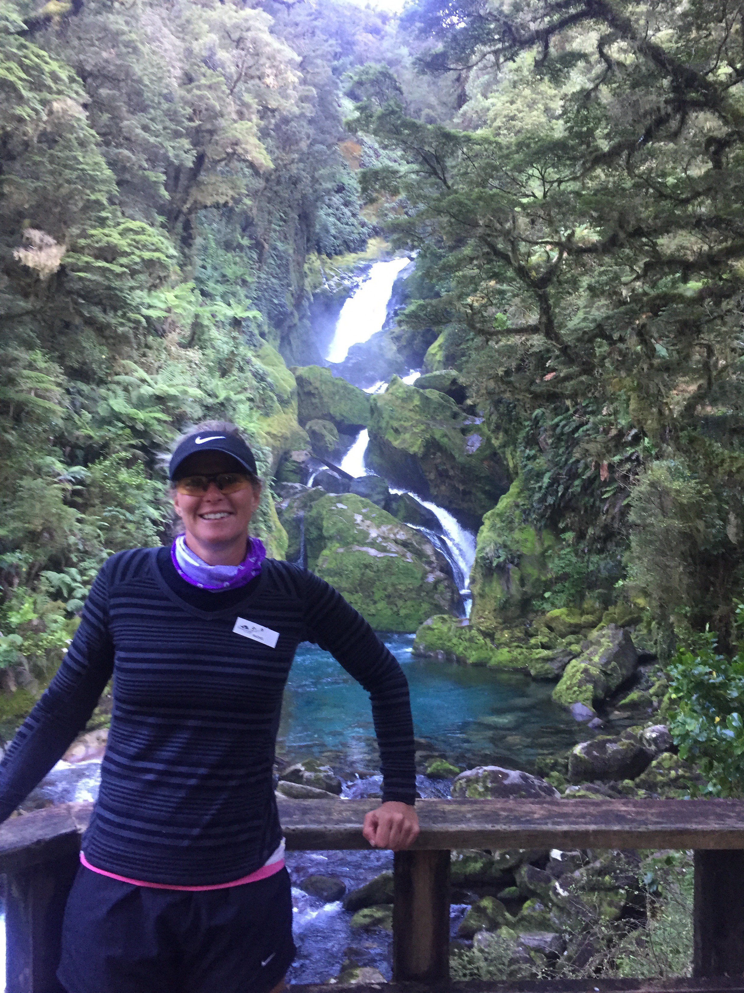
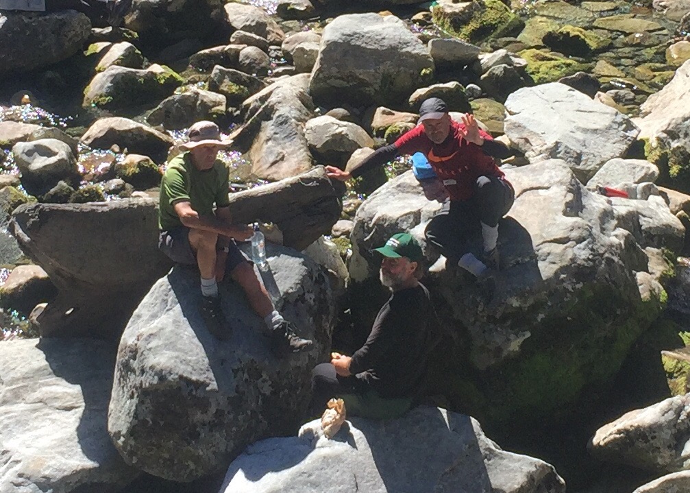
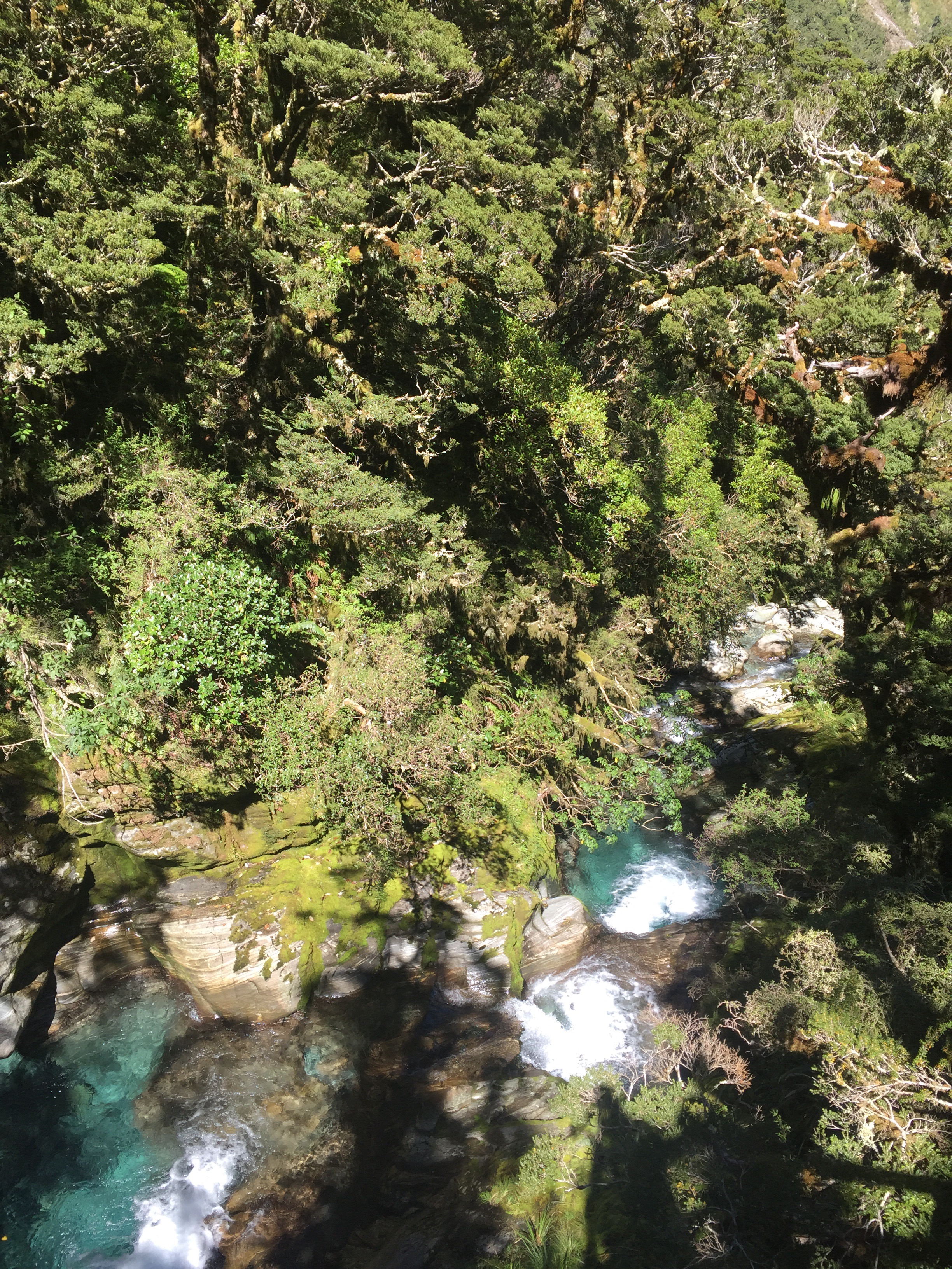
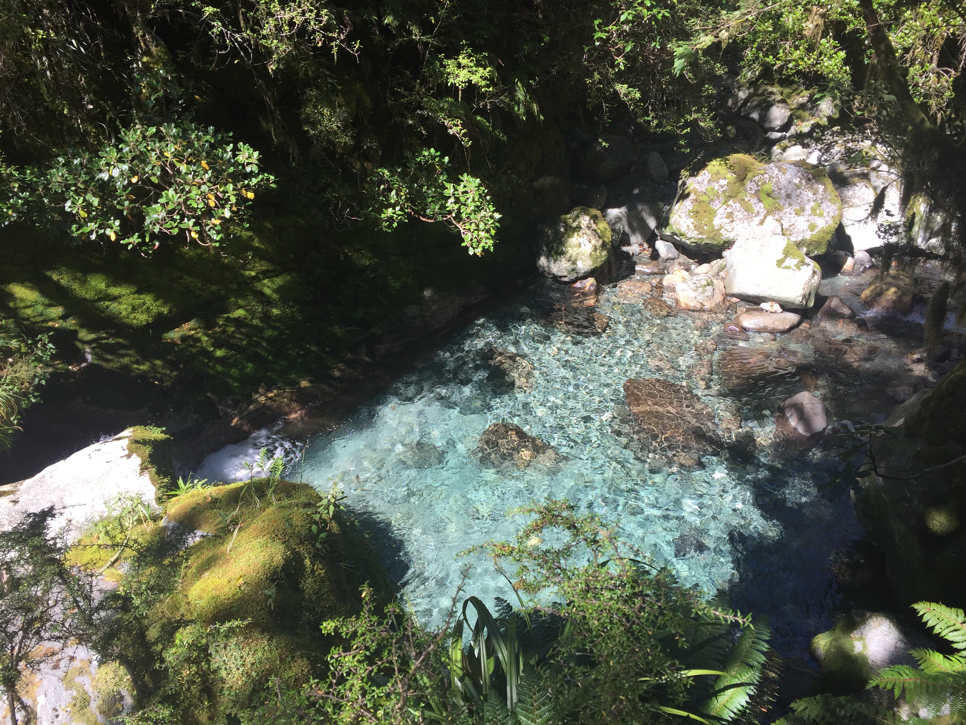
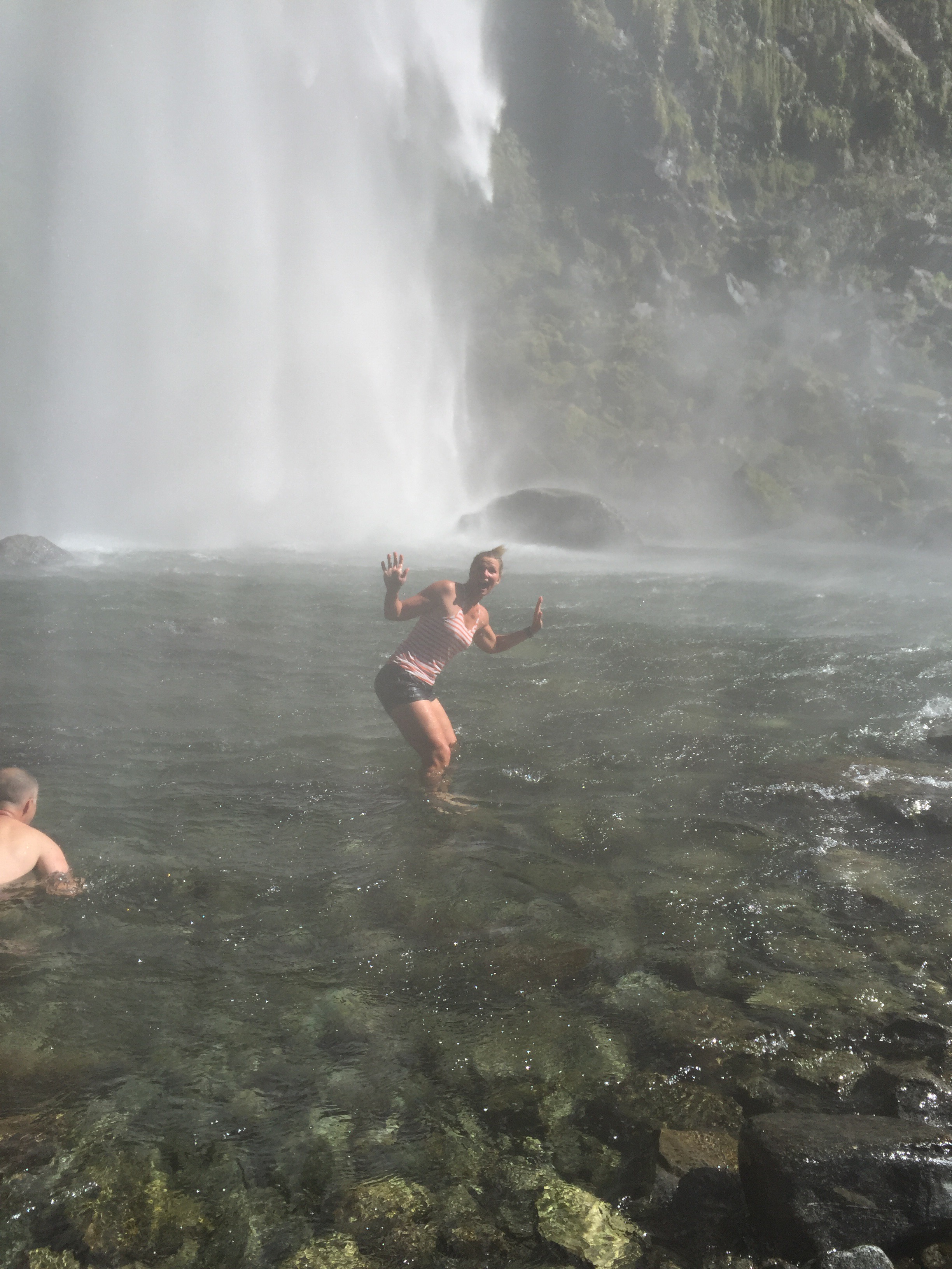
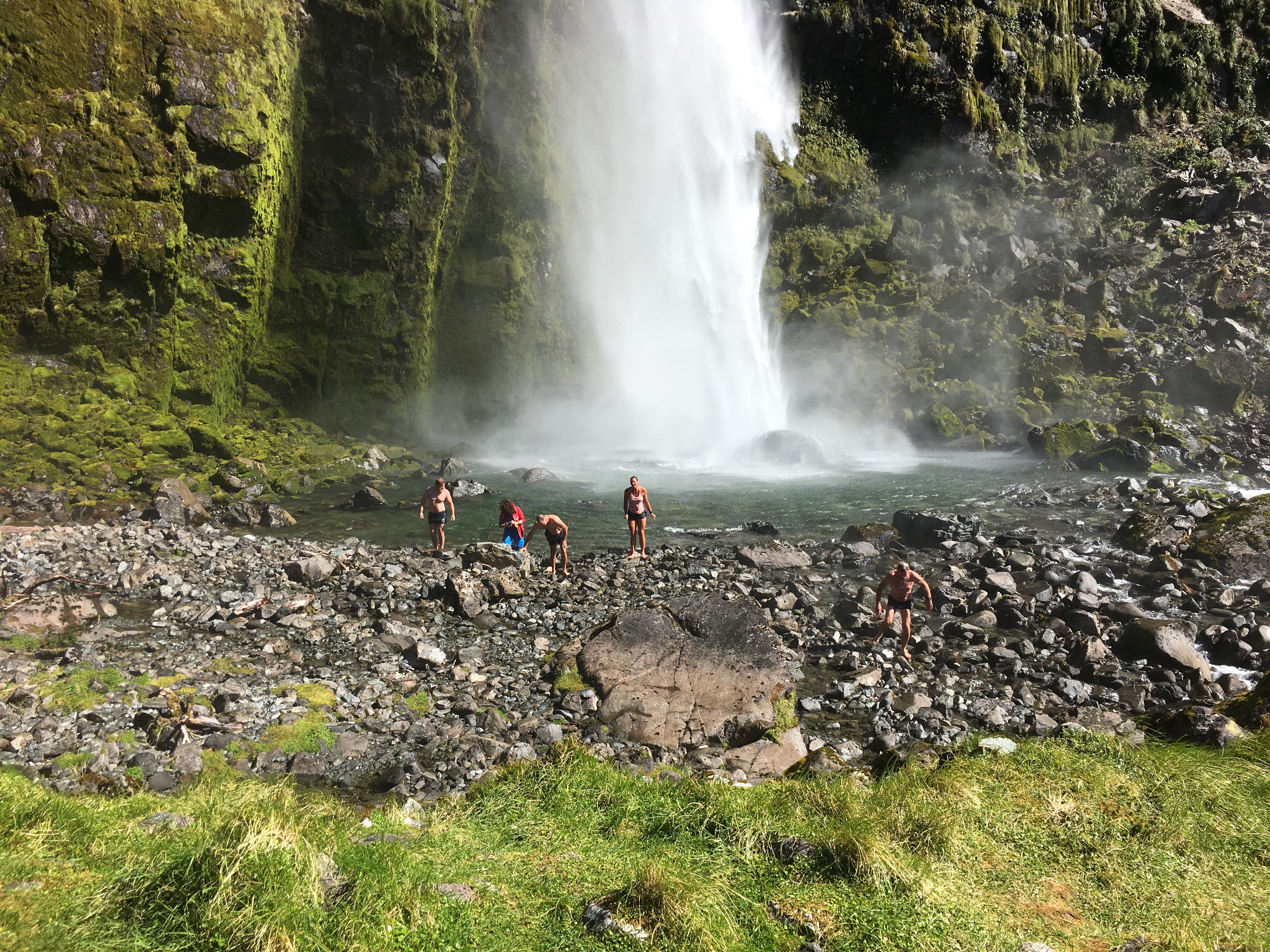
We negotiated our way down the slope via bamboo and then had to rock jump across a river.  The track lead us to a waterfall and swimming hole.  Paul got chatting to a lady who turned out to be originally from Wellington – her and her family were currently living on Maui.  She told us that the track carries on up to more waterfalls and swimming holes, each one higher than the other.  She told us that normally it was fairly dry in there but that had had a lot of rain causing it to be very muddy.  There was a rope to get up to the next level which we initially thought might be a bit tricky carrying Taj so Paul and I went up to explore.  It didn’t take long to get to the next waterfall and swimming hole which was quite cool.  Paul decided to go back and get Ashleigh and Taj.  Meanwhile I got my bikini on and took a refreshing dip.  It had got really hot and humid.

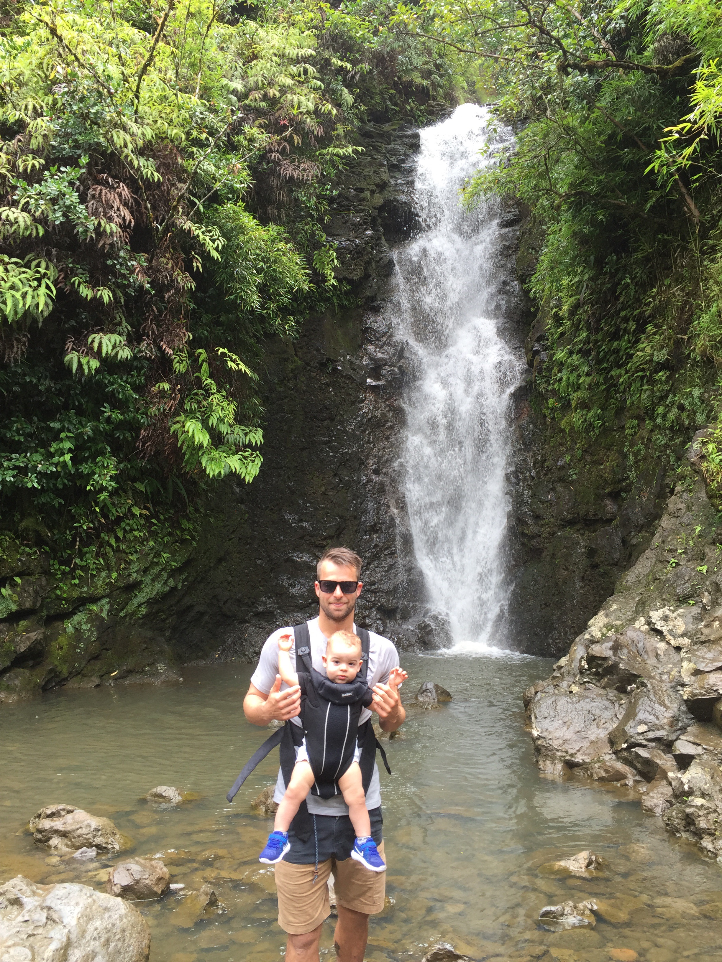
Ashleigh and Taj made it safely up the next level albeit with a bit more mud on them.  Ashleigh and Taj hopped in the water and Taj loved splashing about in there.  I had to go and do the rope swing : )


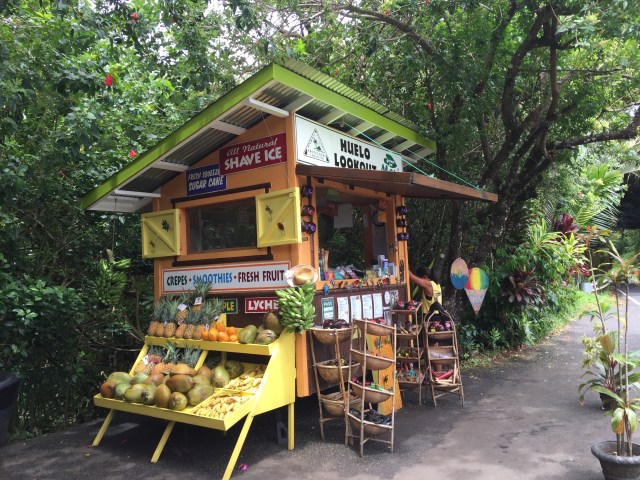
​We noted to get to the next level you had to climb quite a precarious looking ladder so thought we had gone far enough.  After cooling off we made our way back to the car gathering a bit more mud as we went.  We really weren’t that prepared for getting dirty so had to make the best of what we had, that is, wearing wet and muddy shoes for the next wee while.  We got back to the car and Steve was still there – bonus!  We stopped off at a fruit stall on the way back to Paia for a freshly blended juice.

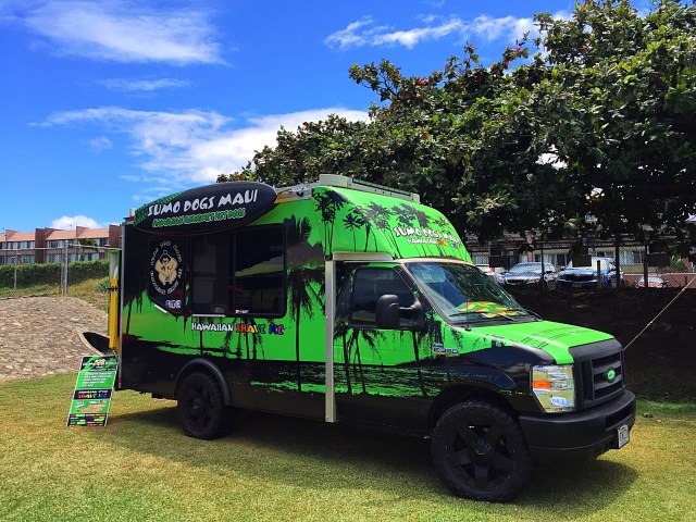
We had been recommended the Flatbread Company in Paia for a bite so that was our lunch spot.  Paia pronounced Pah-ee-ah reflects its heritage as a unique Hawaiian plantation village that originated in the latter half of the nineteenth century.  The first mill was constructed in the 1870’s as the sugar industry took hold on Maui.  Paia Town was established later in 1896 with the founding of a company store for workers.  The Paia Sugar Mill up until 2000 was Maui’s oldest operating plantation.

In April 1946, Paia experienced the largest tsunami in Hawaii’s recorded history, which was the result of an earthquake originating in the Aleutians Islands.  Although 159 people lost their lives throughout the Hawaiian Islands, Paia only had one death.  The town did suffer extensive property damage and thus launched another rebuilding period.

In recent decades, Paia has become a laid back town with local businesses and a coexistence between longtime residents and those attracted by the area’s world class windsurfing.  In 1978 a group of young guys discovered the perfect windsurf conditions at Ho’okipa Beach Park in Paia.  From that day forth, Paia began to develop its reputation for being the “Windsurf Capital of the World”.  As word quickly spread, in the 80’s and 90’s Paia saw an influx of windsurf enthusiasts from the world searching for the windsurf mecca they had heard countless stories about.  Many of the moved to the Paia area.

The Flatbread Company is very popular so we had to sit on a bench seat outside the store and wait for a table which didn’t take too long.  Due to the muddy conditions of Paul’s shoes he had decided to go barefoot – I thought that would be quite acceptable in the hippy town but no he was sent packing to put some shoes on : ). The food was definitely worth the wait though.  They source local organic ingredients and the flatbread dough is made from 100% organic wheat that is milled into white flour and the wheat germ restored.  We choose Mopsy’s Kayla Pork which is their best seller along with a Pele Pesto.  DELISH!


Diving and Snorkelling

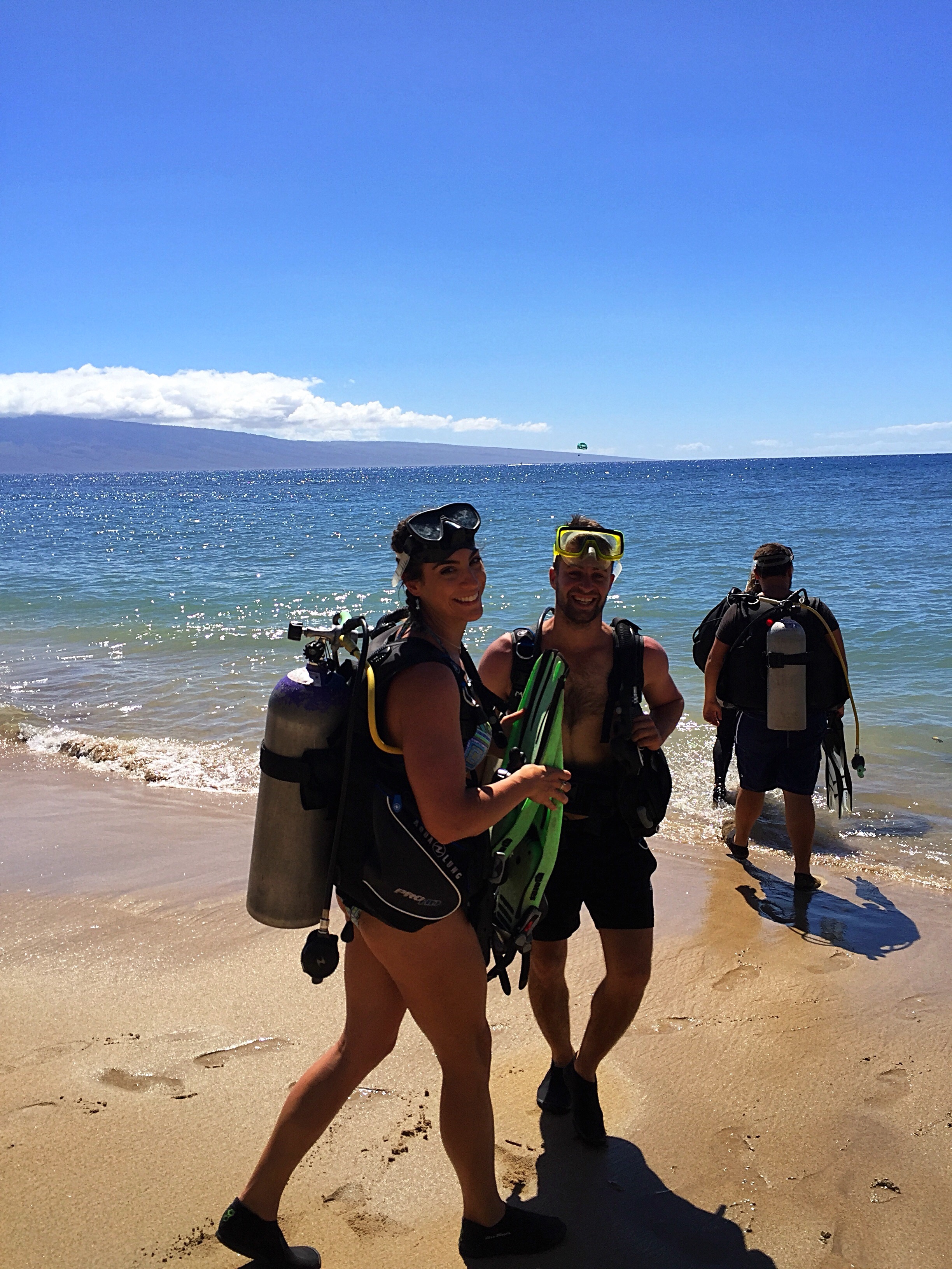
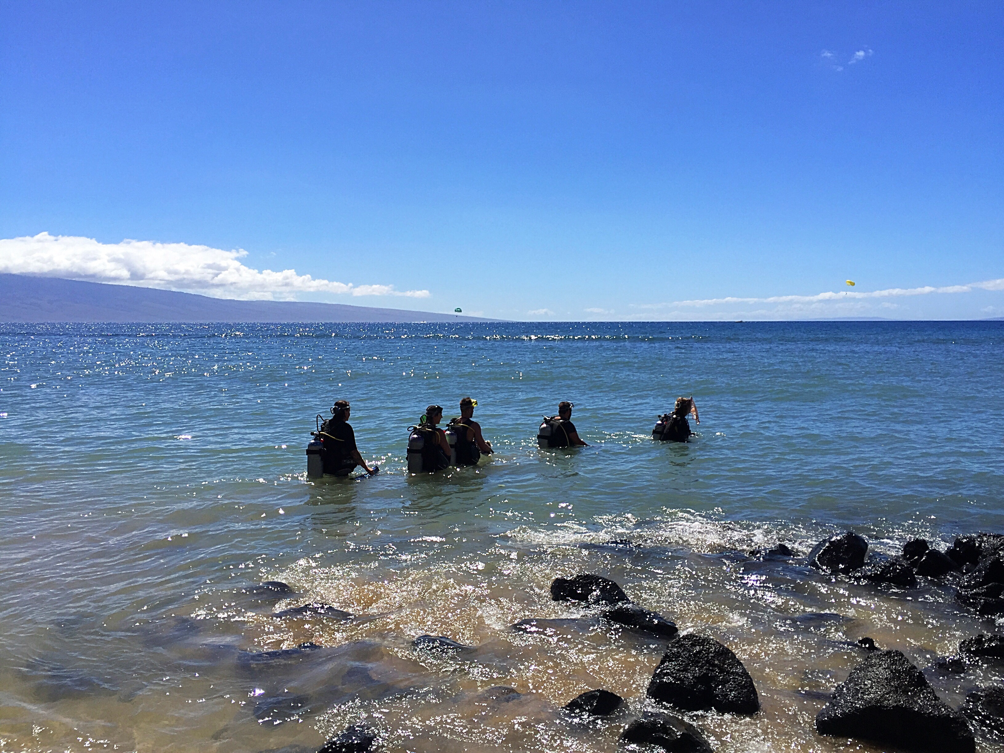
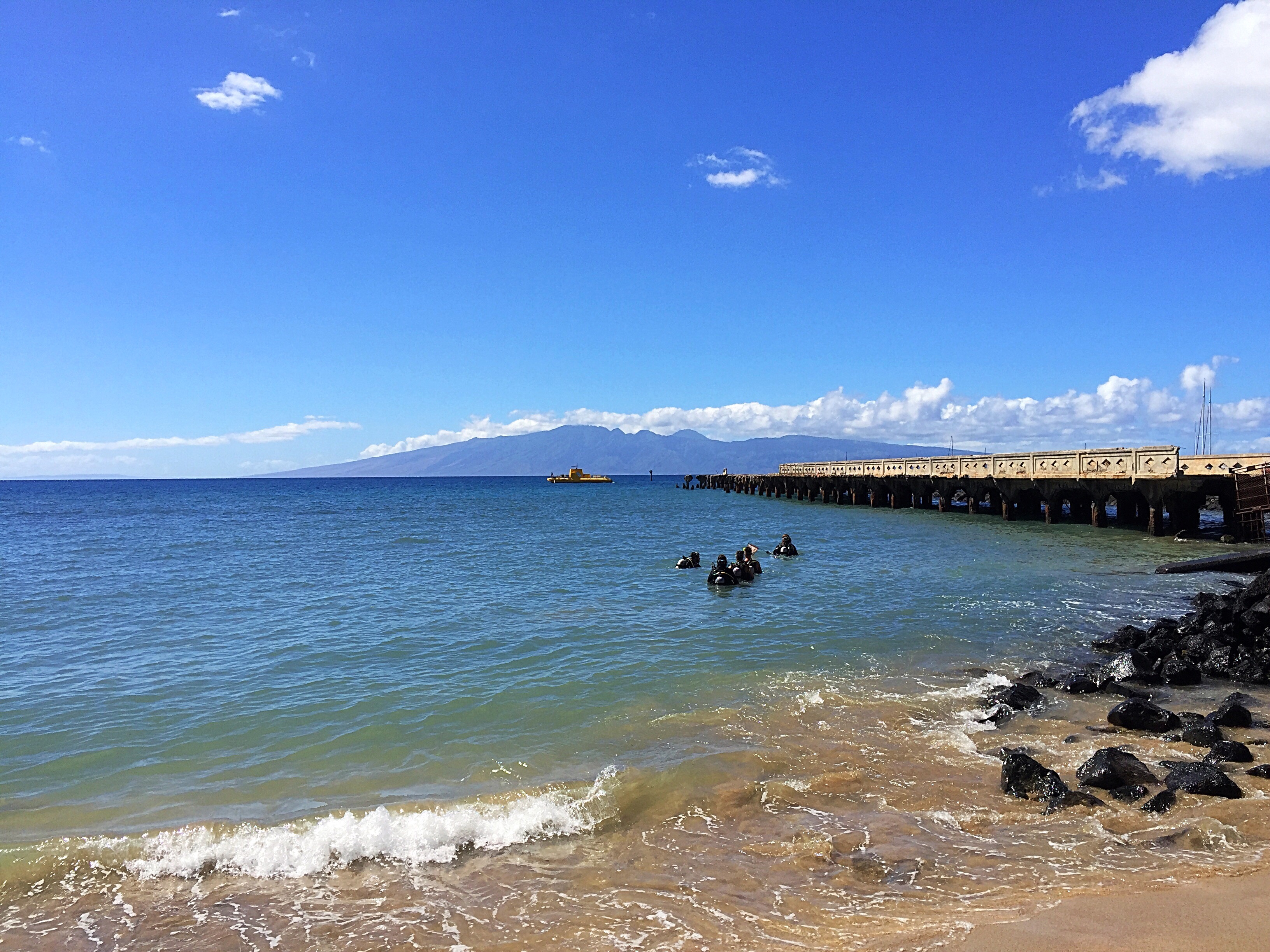
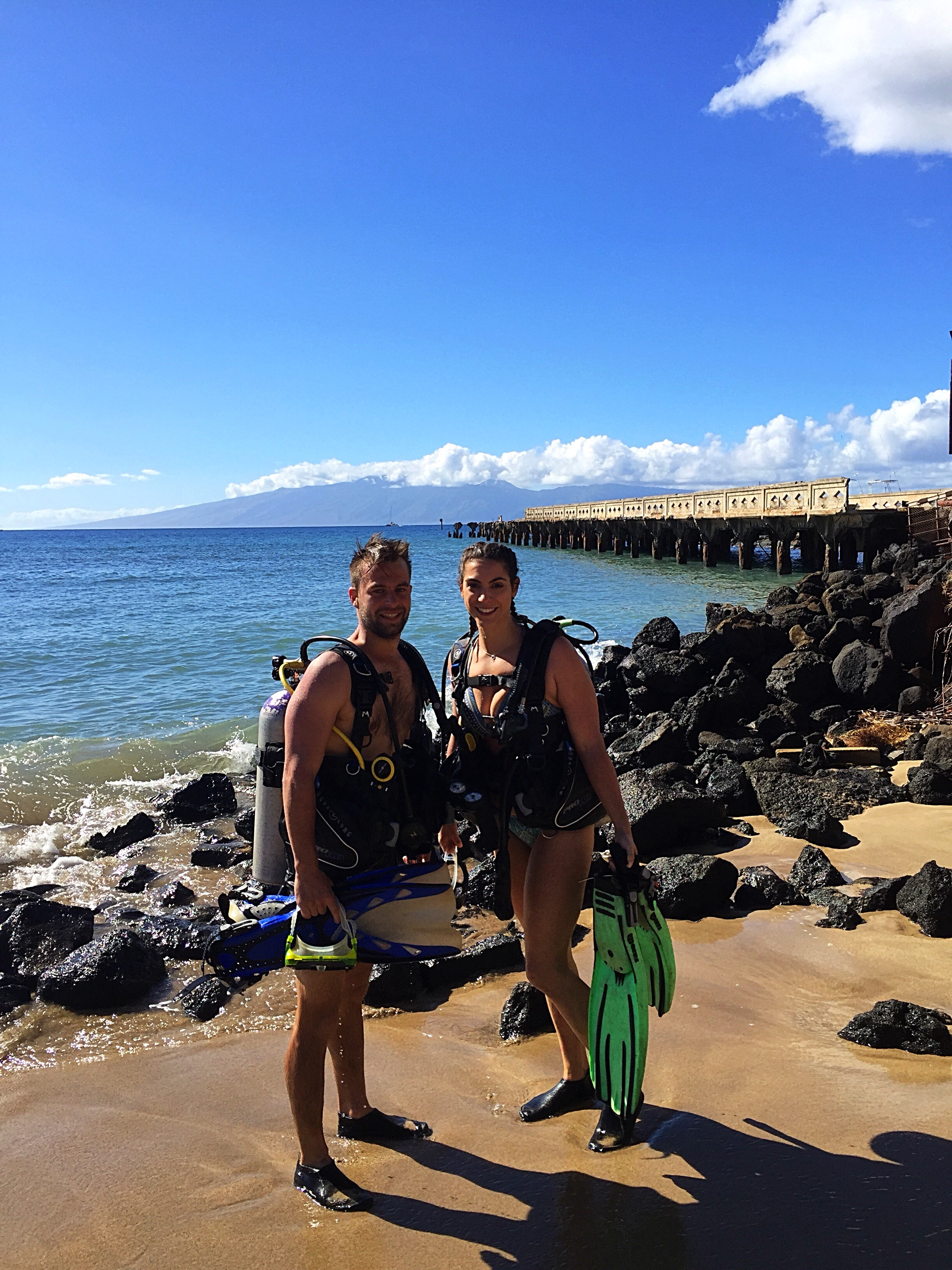
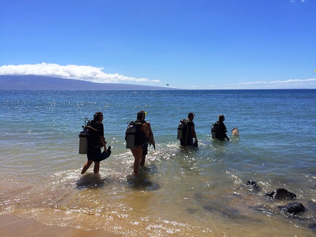
There are so many snorkelling and diving spots on the island just off the beach.  Paul did a dive off the beach at Kahekili Beach Park with Ty from In2Scuba ( https://www.in2scubadivingmaui.com ).  He loved it and got to see sharks and turtles.  Ashleigh joined him a couple of days later at Mala wharf where they again saw sharks, turtles and a moray eel.  Ty was an awesome instructor and really took the time to explain where they were going and then what they saw when they got back.

Mala wharf was once a fully-functioning pier which served as a shipping facility for the island’s pineapple and agriculture. In 1992, however, 30 feet surf came marching into Lahaina as a result of Hurricane Iniki, and the end of the dock was completely destroyed. Today, the pilings from the old dock lie scattered along the ocean floor, and what was once a shipping facility above water is now a healthy artificial reef which is home to a vast array of marine life.

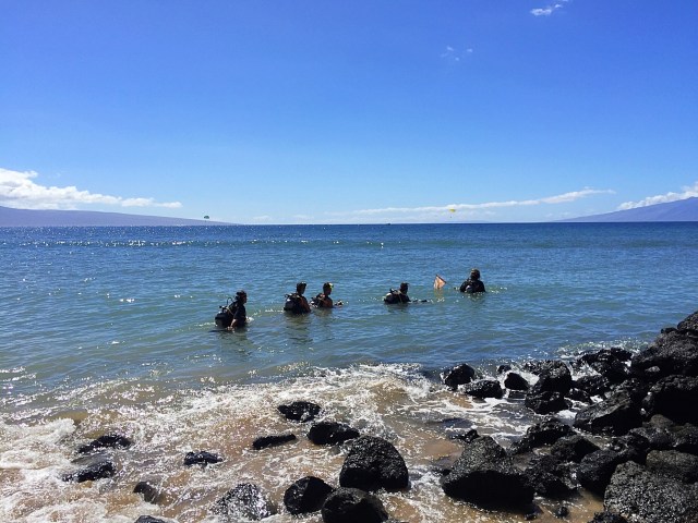
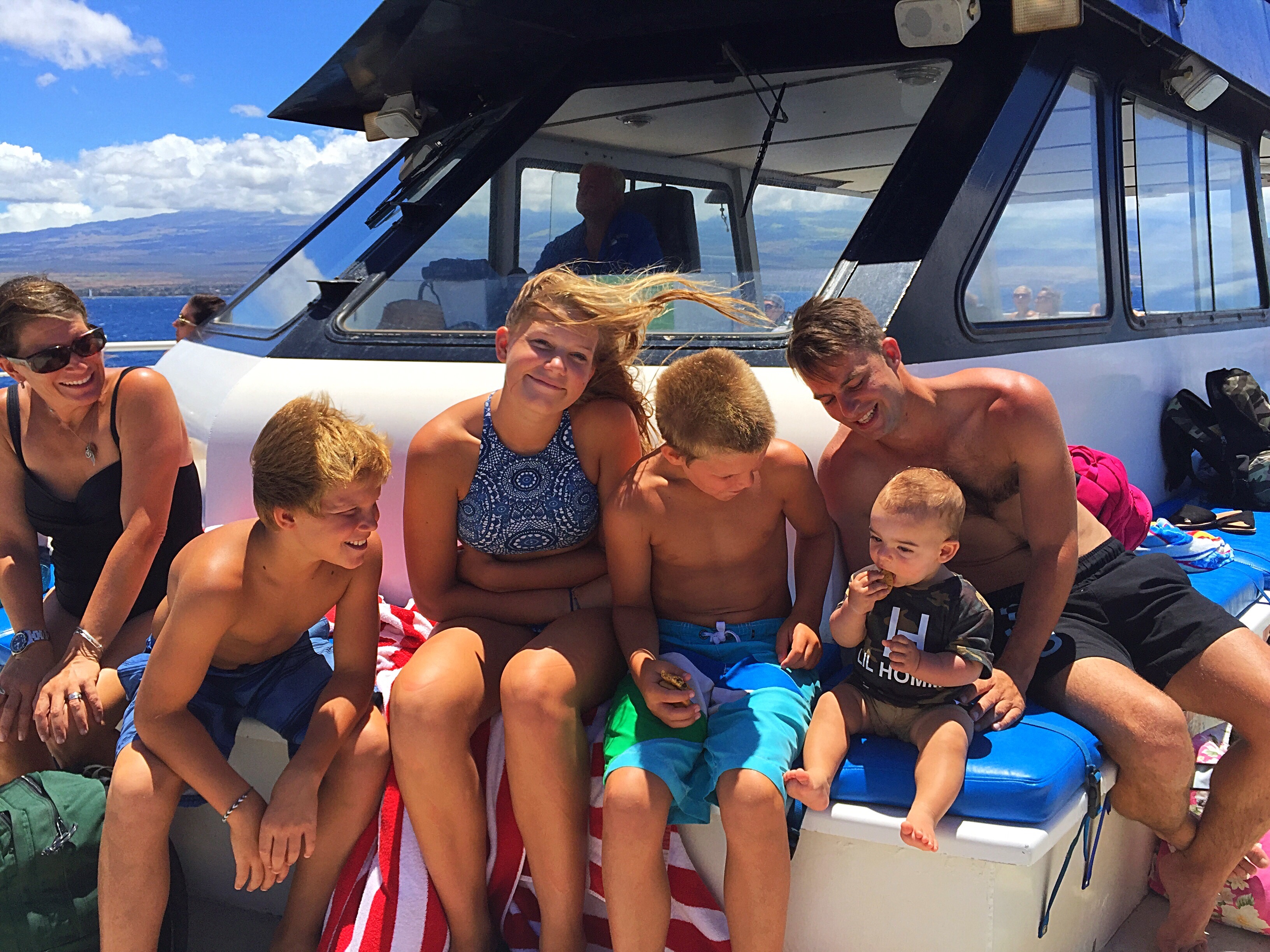
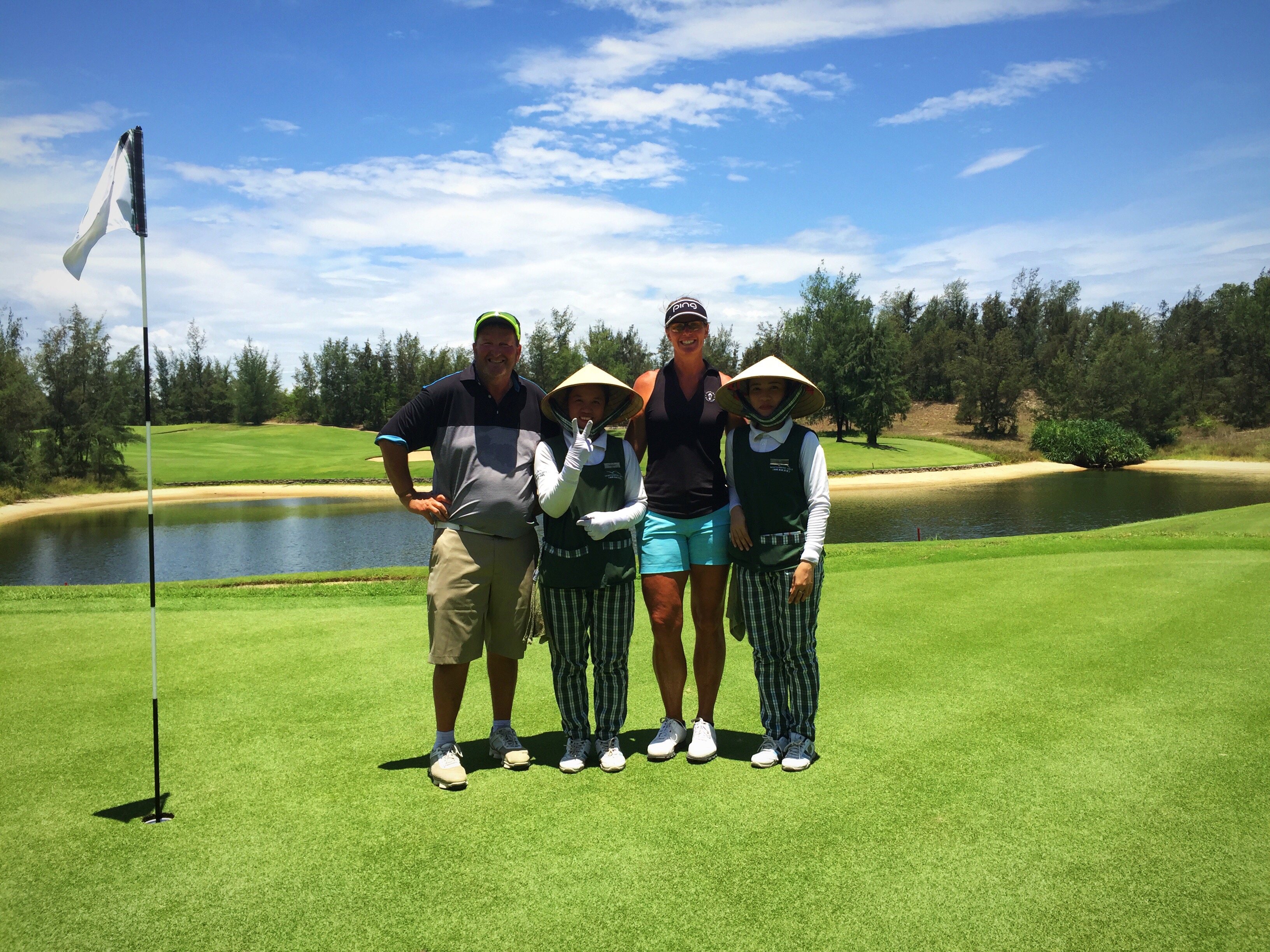
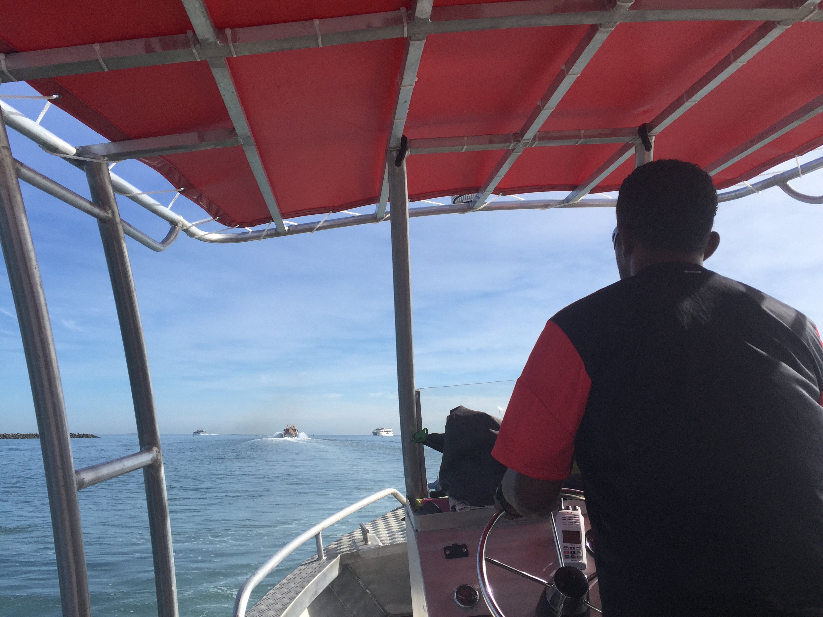
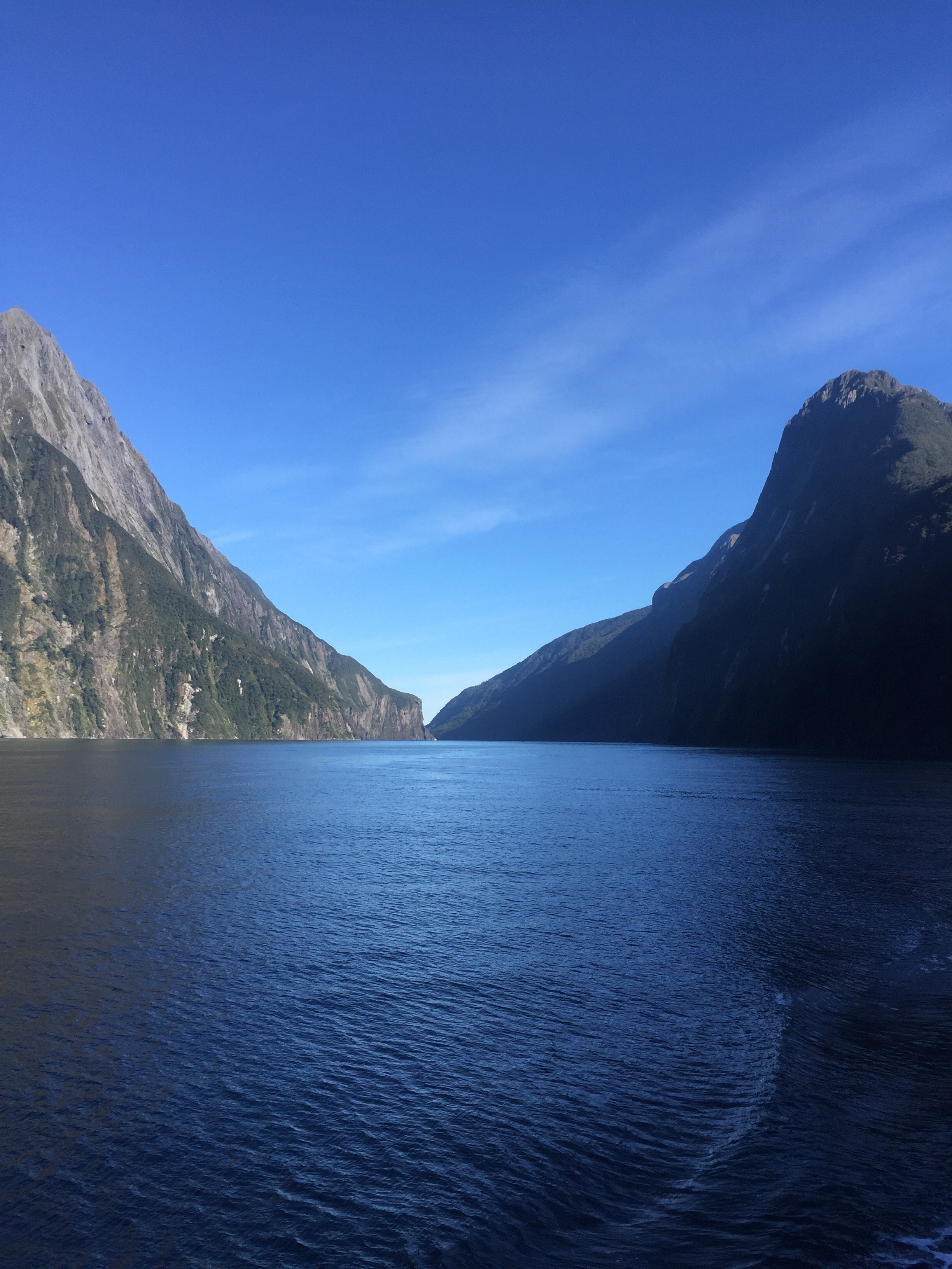
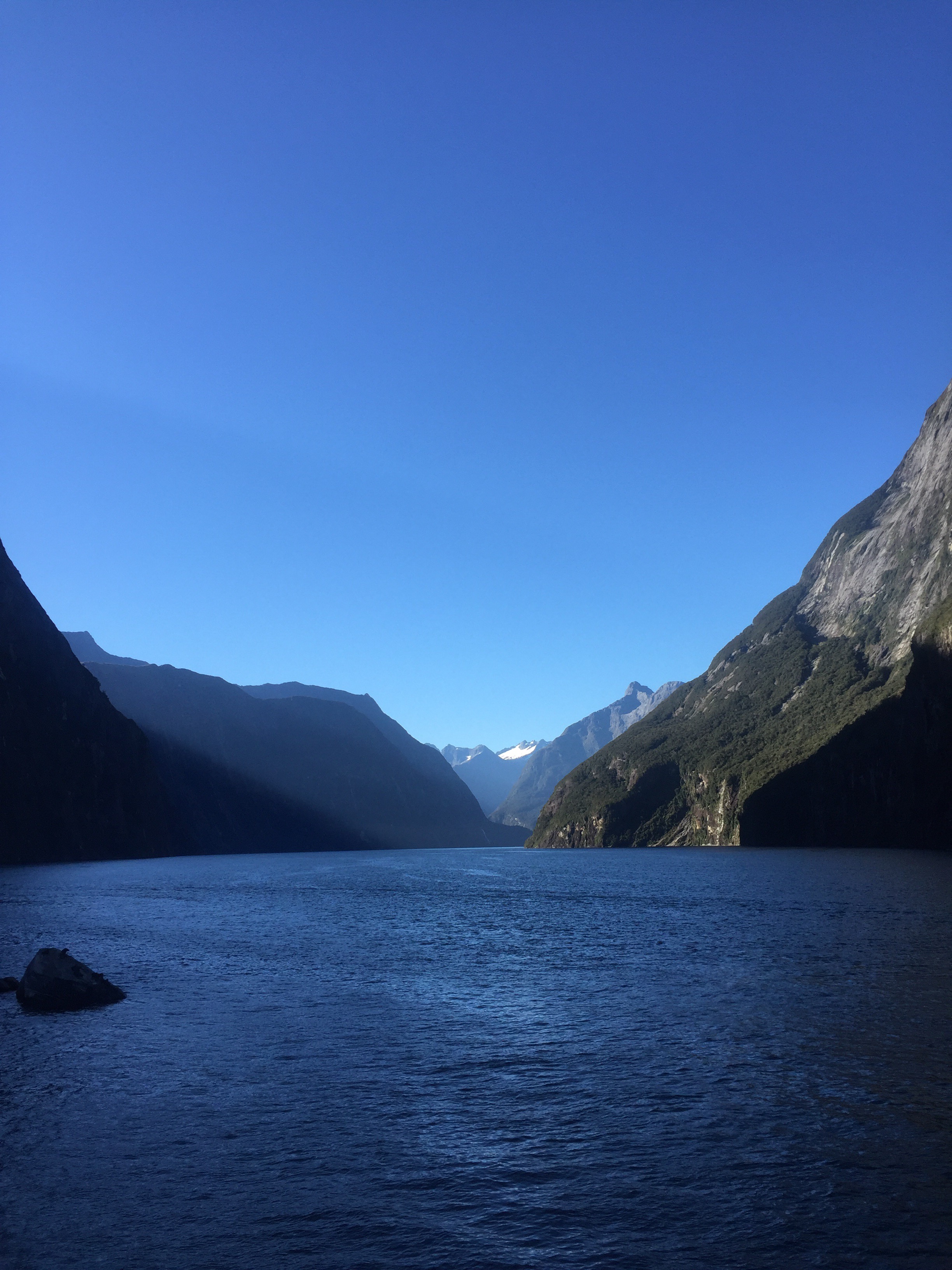
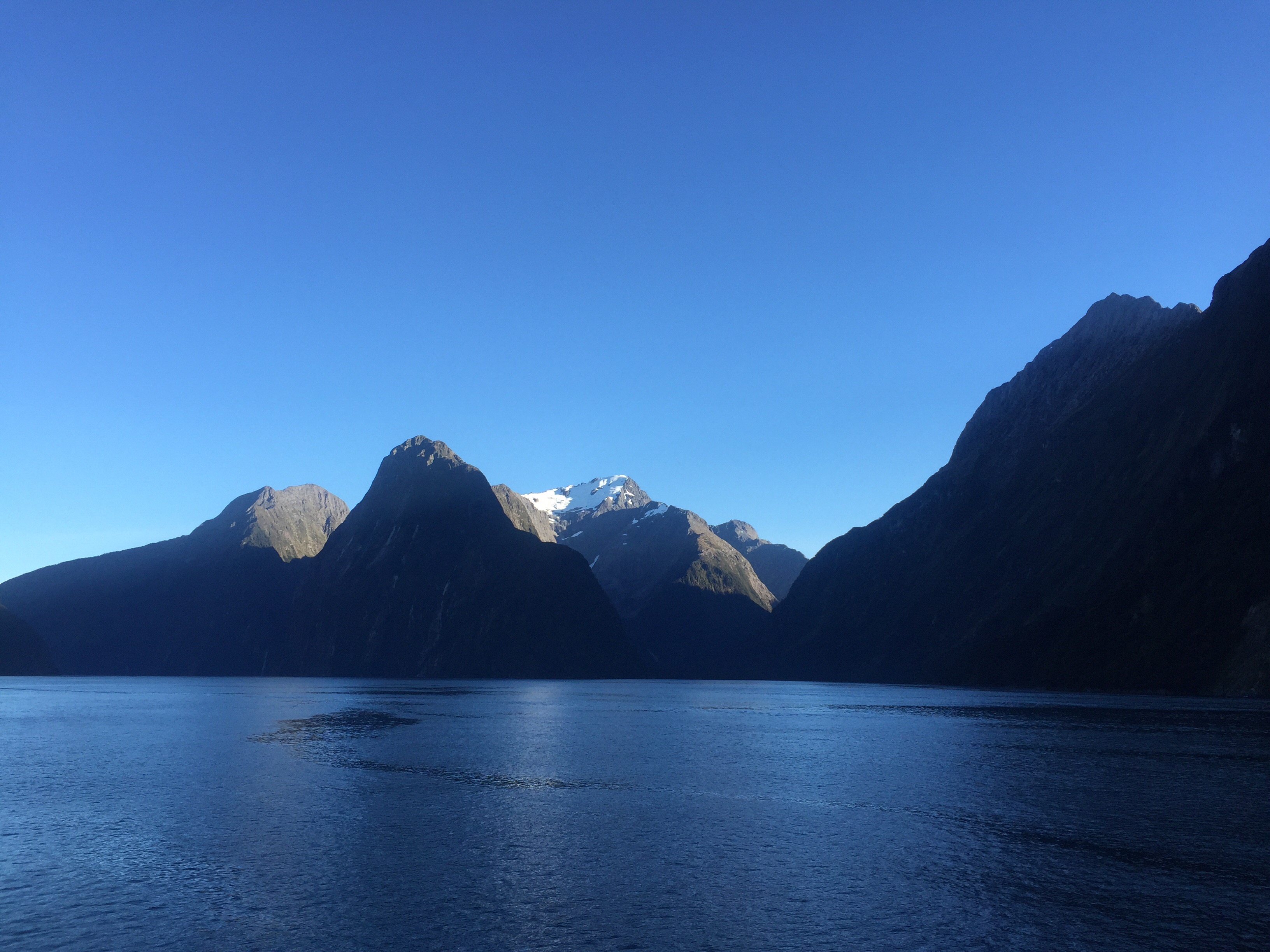
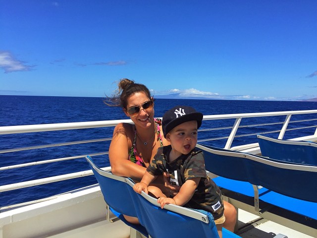
We decided to take a snorkelling trip offshore too.  We were recommended the Pacific Whale Foundation trip that goes out to Molokini Crater and to Turtle Town.

The Pacific Whale Foundation is a not for profit organisation and their mission is to protect our oceans through science and advocacy.  They accomplish this through ongoing marine research, education and conservation programs.  Through their ocean ecotours, they have educated nearly 3.5 million people about the marine environment, while raising needed funds to support vital whale and dolphin research studies, educational programs for children and adults, as well as important conservation programs, including the fight to stop commercial whaling.

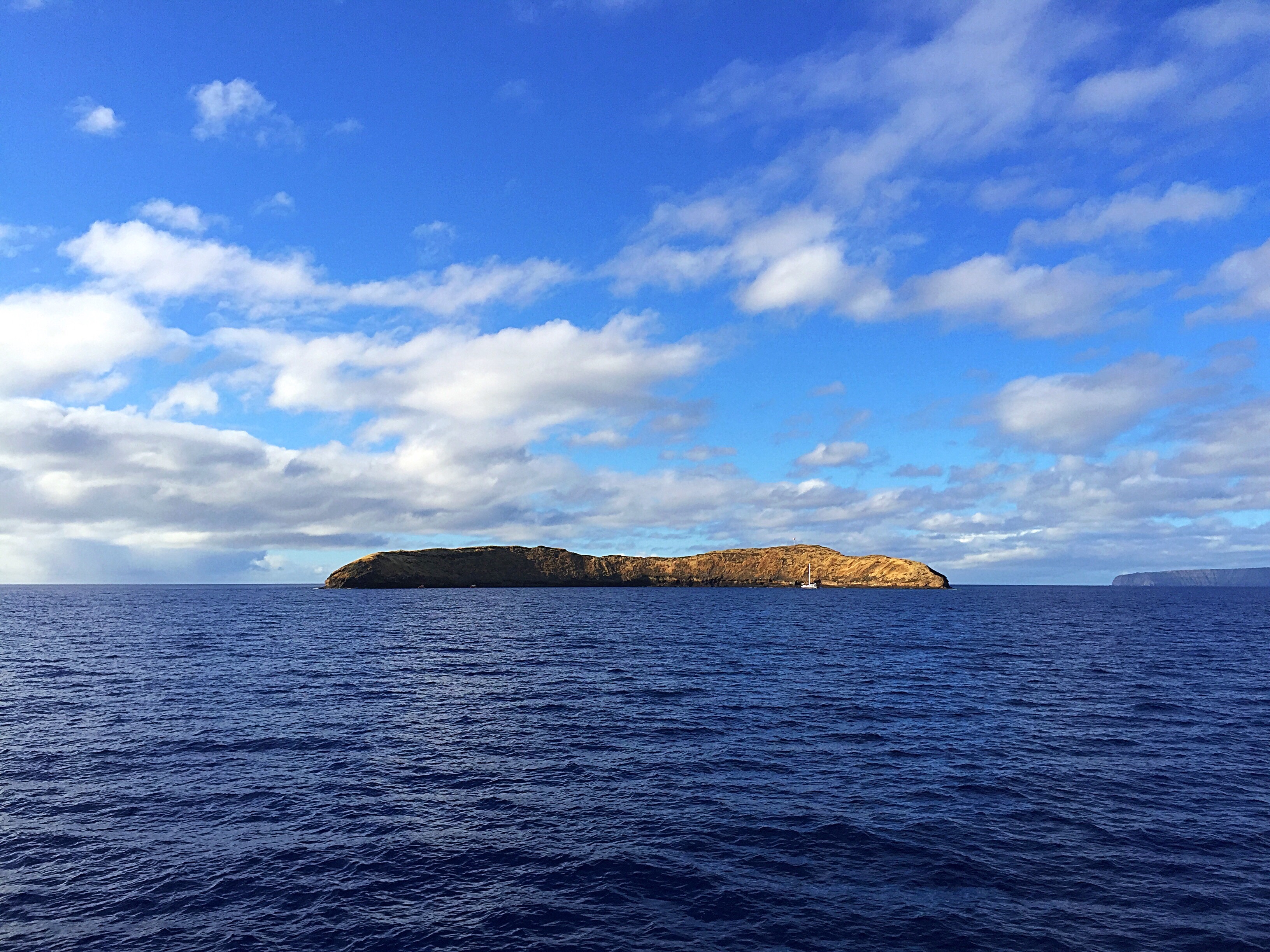
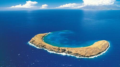
The crew were very friendly and included a couple of marine naturalists.  We went out to the Molokini crater first which is a crescent-shaped, partially submerged volcanic crater that forms a small, uninhabited islet located in ʻAlalākeiki Channel between the islands of Maui and Kahoʻolawe, within Maui County in Hawaiʻi.  It is the remains of one of the seven Pleistocene epoch volcanoes that formed the prehistoric Maui Nui island, during the Quaternary Period of the Cenozoic Era.  The islet itself is a bird sanctuary and you are not allowed to go ashore.

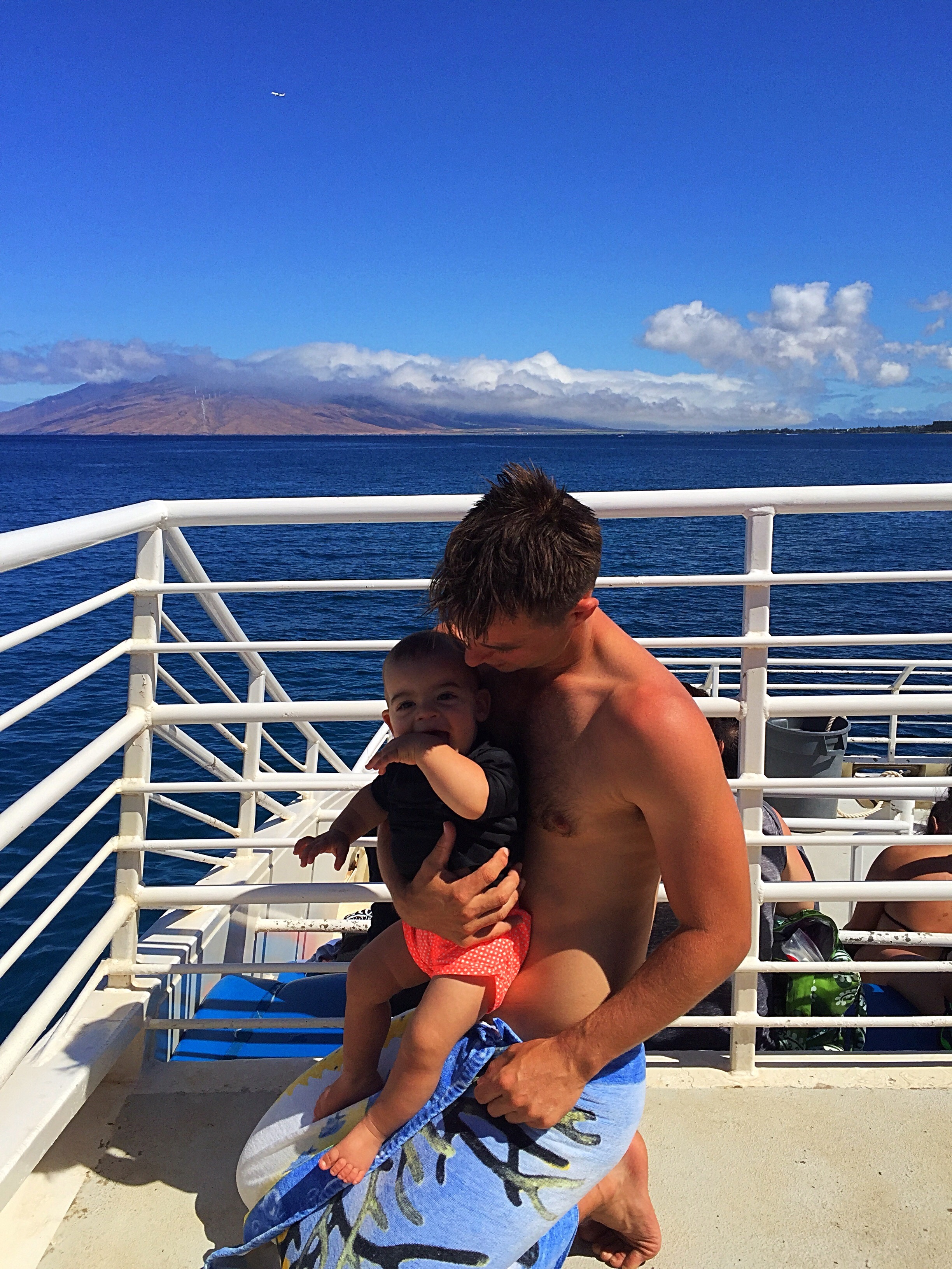
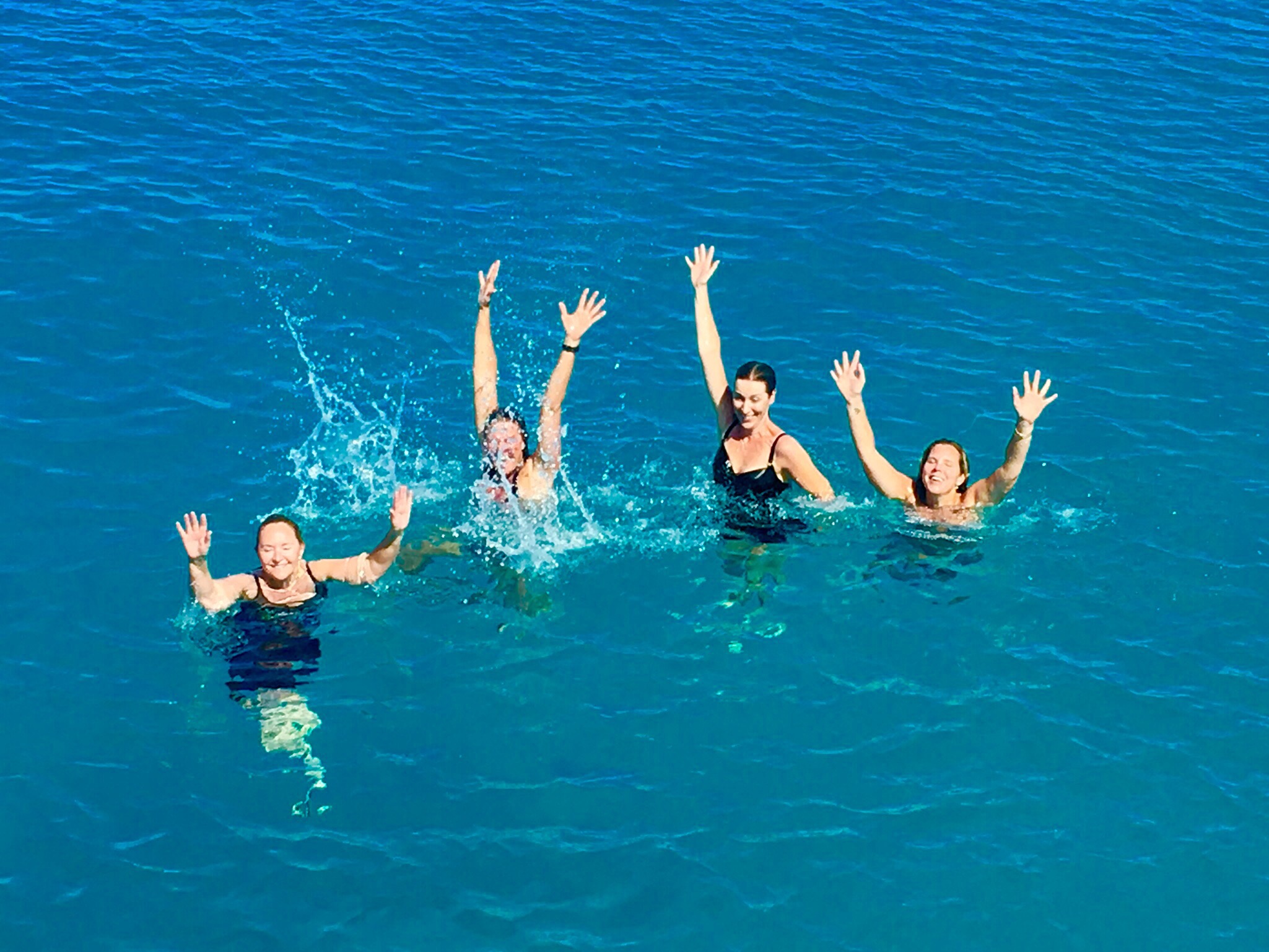
They backed the boat in and we kitted up and jumped in – the water wasn’t as warm as we had been expecting but it was really clear.  There were so many fish, it was so cool.  Paul & I had gone in first as Ashleigh was trying to get Taj to have a sleep so he could be left with Grandad.  We hadn’t been in the water long when Paul tugged my arm and pointed below us – a reef shark was casually swimming along the ocean floor.  It was so cool – a definite highlight of our trip to Maui for me.  We spent about an hour in the water before up anchoring to move on to our next spot.

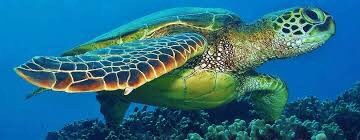
The next spot is known as the Turtle arches due to its lava arch formations and the frequent sightings of green sea turtles.

The green sea turtle (Chelonia mydas), also known as the green turtle, black (sea) turtle, or Pacific green turtle, is a large sea turtle of the family Cheloniidae. It is the only species in the genus Chelonia. Its range extends throughout tropical and subtropical seas around the world, with two distinct populations in the Atlantic and Pacific Oceans, but it is also found in the Indian Ocean. The common name comes from the usually green fat found beneath its carapace; these turtles’ shells are olive to black.

Like other sea turtles, green sea turtles migrate long distances between feeding grounds and hatching beaches. Many islands worldwide are known as Turtle Island due to green sea turtles nesting on their beaches. Females crawl out on beaches, dig nests and lay eggs during the night. Later, hatchlings emerge and scramble into the water. Those that reach maturity may live to 80 years in the wild.

I was very excited to see one of these turtles.  I joined the snorkelling safari taken by one of the naturists which was so cool as she dove down and pointed various fish out and then came up and told us all about them.  One of the other snorkellers yelled out Turtle so we all swam over to have a look – it was very cool swimming gracefully through the sea.  It actually turned quite choppy so I decided to hop out – I had seen a turtle so I was pretty happy.

We then had a BBQ lunch on the boat while one of the crew gave us a talk about sharks.  She was very passionate about sharks and said that they were to be revered not feared.

Basic Facts about Sharks

There are more than 465 known species of sharks living in our oceans today. Sharks are an apex predator at or near the top of their marine food chains, and they regulate the populations of species below them. Research has shown that massive depletion of sharks has cascading effects throughout the ocean’s ecosystems.

Sharks belong to a family of fish that have skeletons made of cartilage, a tissue more flexible and lighter than bone. They breathe through a series of five to seven gill slits located on either side of their bodies. All sharks have multiple rows of teeth, and while they lose teeth on a regular basis, new teeth continue to grow in and replace those they lose.

Shark ‘skin’ is made up of a series of scales that act as an outer skeleton for easy movement and for saving energy in the water. The upper side of a shark is generally dark to blend in with the water from above and their undersides are white or lighter colored to blend in with the lighter surface of the sea from below. This helps to camouflage them from predators and prey.

Diet

Most species of shark eat things like fish, crustaceans, mollusks, plankton, krill, marine mammals and other sharks. Sharks also have a very acute sense of smell that allows them to detect blood in the water from miles away.

Population

It is difficult to estimate population numbers since there are many different species spanning a large geographic area. However, overall shark numbers are on the decline due to the many threats they face in the wild.

Habitat & Range

Sharks have adapted to living in a wide range of aquatic habitats at various temperatures. While some species inhabit shallow, coastal regions, others live in deep waters, on the ocean floor and in the open ocean. Some species, like the bull shark, are even known to swim in salt, fresh and brackish waters.

Behavior

Most sharks are especially active in the evening and night when they hunt. Some sharks migrate over great distances to feed and breed. This can take them over entire ocean basins. While some shark species are solitary, others display social behavior at various levels. Hammerhead sharks, for instance, school during mating season around seamounts and islands.

Some shark species, like the great white shark, attack and surprise their prey, usually seals and sea lions, from below. Species that dwell on the ocean floor have developed the ability to bottom-feed. Others attack schooling fish in a feeding frenzy, while large sharks like the whale and basking sharks filter feed by swimming through the ocean with their mouths open wide, filtering large quantities of plankton and krill.

Reproduction

Sharks mature slowly, and reach reproductive age anywhere from 12 to 15 years. This, combined with the fact that many species only give birth to one or two pups at a time, means that sharks have great difficulty recovering after their populations have declined.

Soon after birth, sharks pups swim away to fend for themselves. They are born with fully-fledged sets of teeth and are able to feed and live on their own.

Sharks predate the dinosaurs by 200 million years. The largest known species of shark, C. megalodon, might have reached a maximum length of 67 feet.

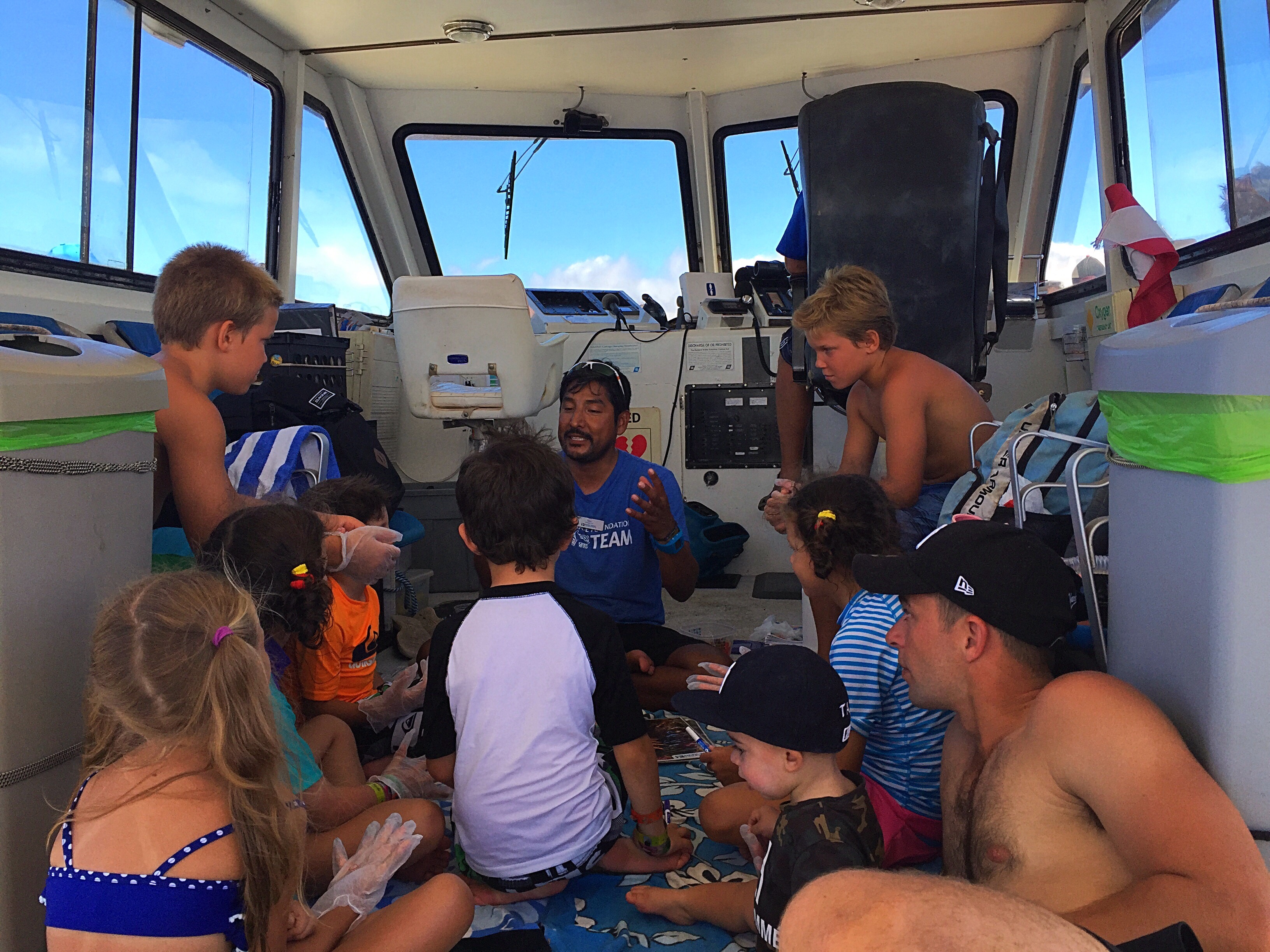
One of the naturists on board then ran an educational session for the kieki’s (kids) on board about coral – Taj attended his first ever class.  He was very well behaved and sat their quietly taking it all in.  Paul sat with him and we think this may have been one of the few times that Paul has ever listened in class too 😂😂. Taj did get distracted when a cute little blonde girl sat next to him – he tried to get her attention but she was eyes front!

Taj made friends with a family from Cape Cod in the USA.  The Mum was travelling with her 14 year old daughter and 12 year old twin boys.  The boys were very taken with Taj and he of course enjoyed the attention.  They were great boys, very sociable and loved all sports known to man.  They were also very into their snorkelling and one of them had seen the spotted moray eel before everyone else and was pointing it out.   One of the boys said that their Dad had stayed home because he needed some space : ). After lunch we had warm chocolate chip cookies which the boys ate a lot of – they seemed to think that Taj could eat as many as them so kept giving him biscuits.  He of course was willingly accepting them until Ashleigh put a stop to it.

We were up near the Great Barrier Reef in Australia earlier in the year and there is a lot of talk about coral bleaching and the death of the coral reefs.  They didn’t talk so much about the bleaching in Hawaii but there was a lot of talk about protecting them and the importance they play in the ecosystem.  One thing I hadn’t thought of before was the damage that certain sunscreens can do to them – the crew talked a lot about this – the common chemical is benzophenone-2 or BP-2 and this is highly toxic to corals.  See below for more information as to why coral reefs are so important and need to be treated with the utmost respect.

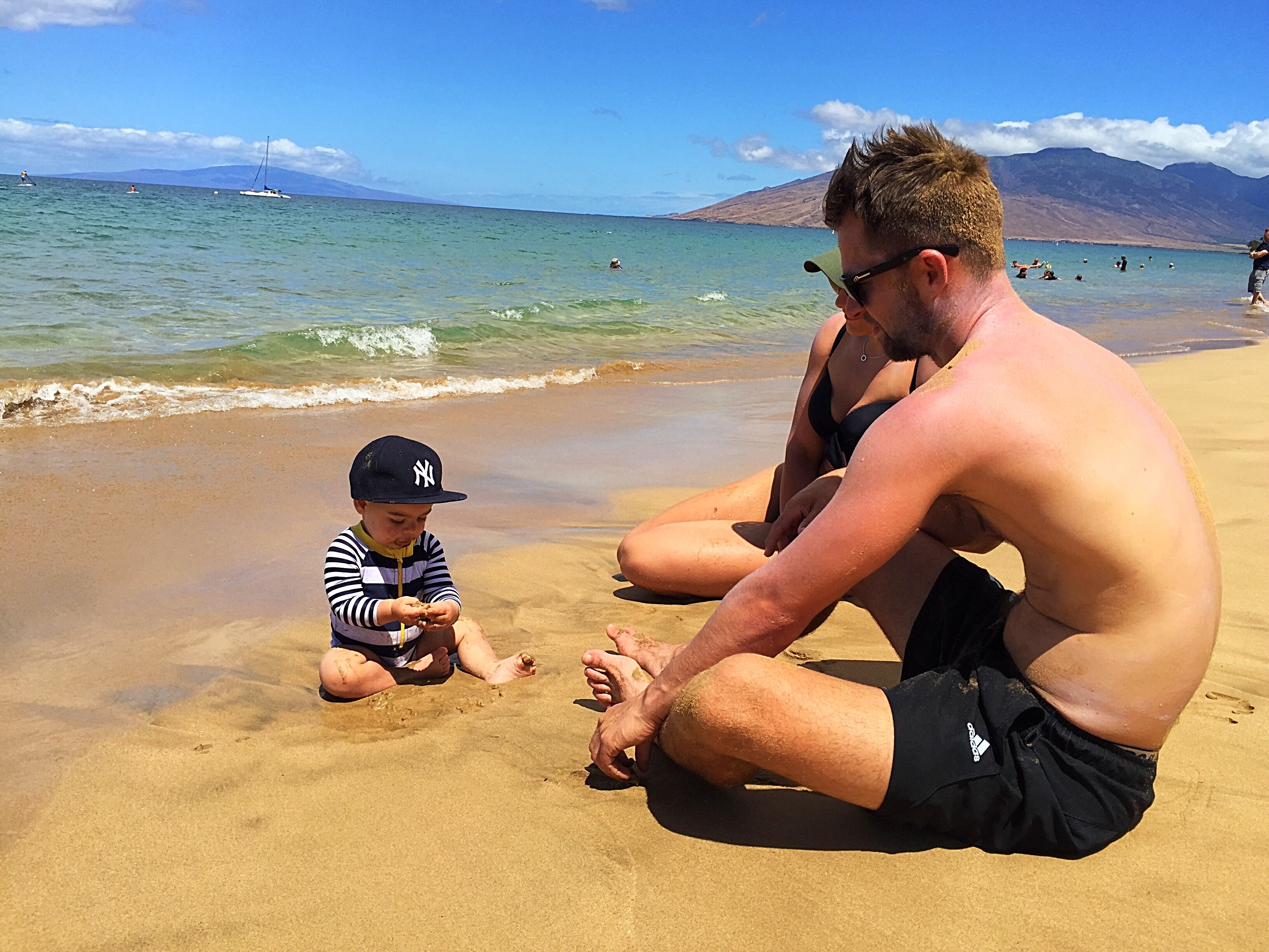
We also did some snorkelling off the beach at Honolulu Bay which was a very popular spot.

One morning Ashleigh and I drove back to Turtle Cove which it turned out wasn’t far from where we were staying and did a snorkel off the beach.  I really wanted to see some more turtles.  We explored the reefs round from the beach and Ashleigh spotted another moray eel.   We then came across a turtle swimming in between the reefs and then another, and another.  In total I think we saw about ten turtles either swimming, resting on the sand or eating the coral.  It was so cool and you could get fairly close without disturbing them.  We spent an hour in the water and saw a lot of fish.  What a great way to start the day.

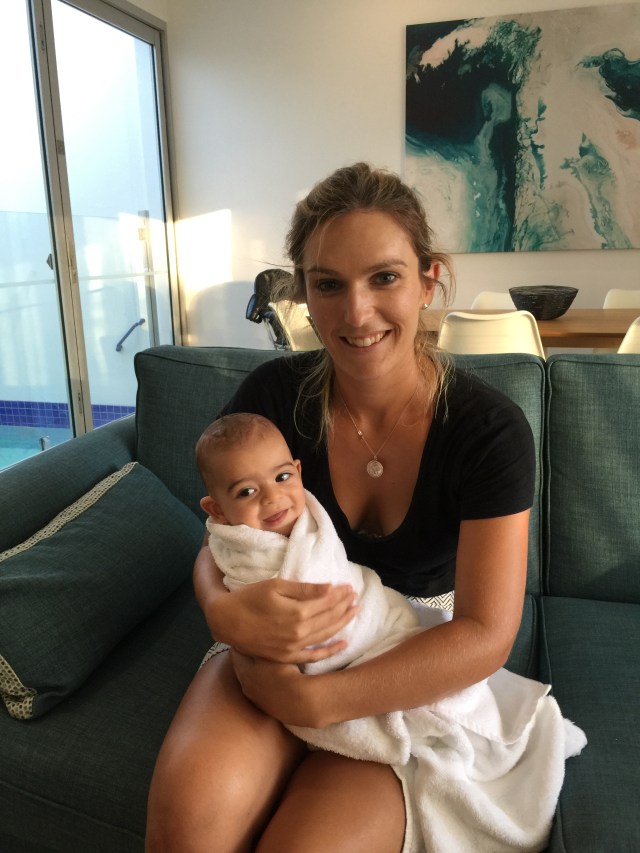
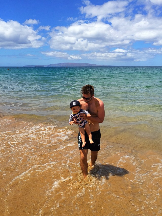
Kamaole Beach Park was just across from where we were staying and was a lovely spot for a refreshing dip and Taj enjoyed himself playing in and eating the sand!
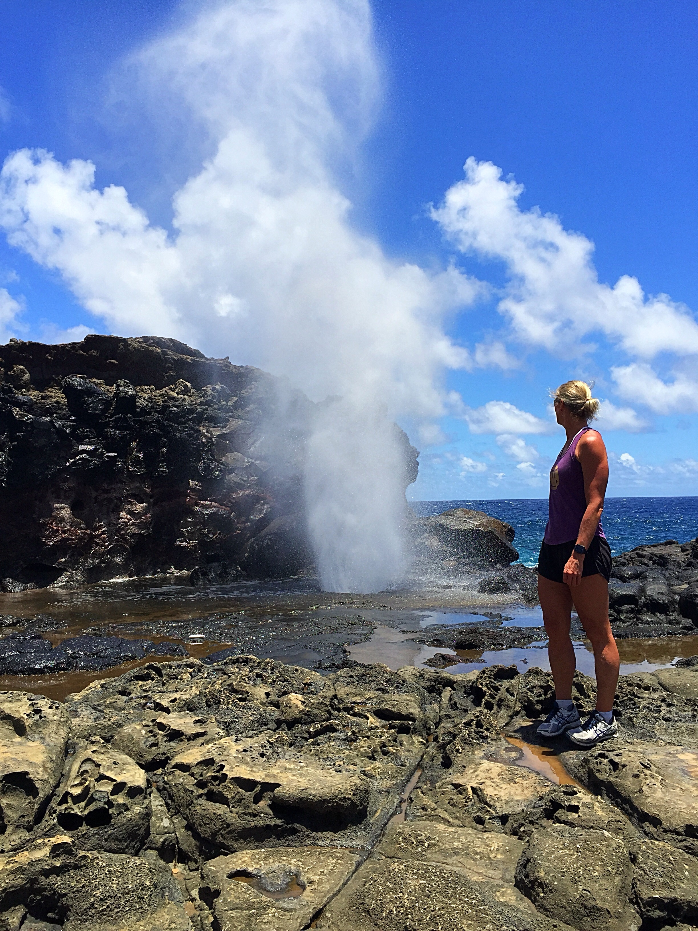
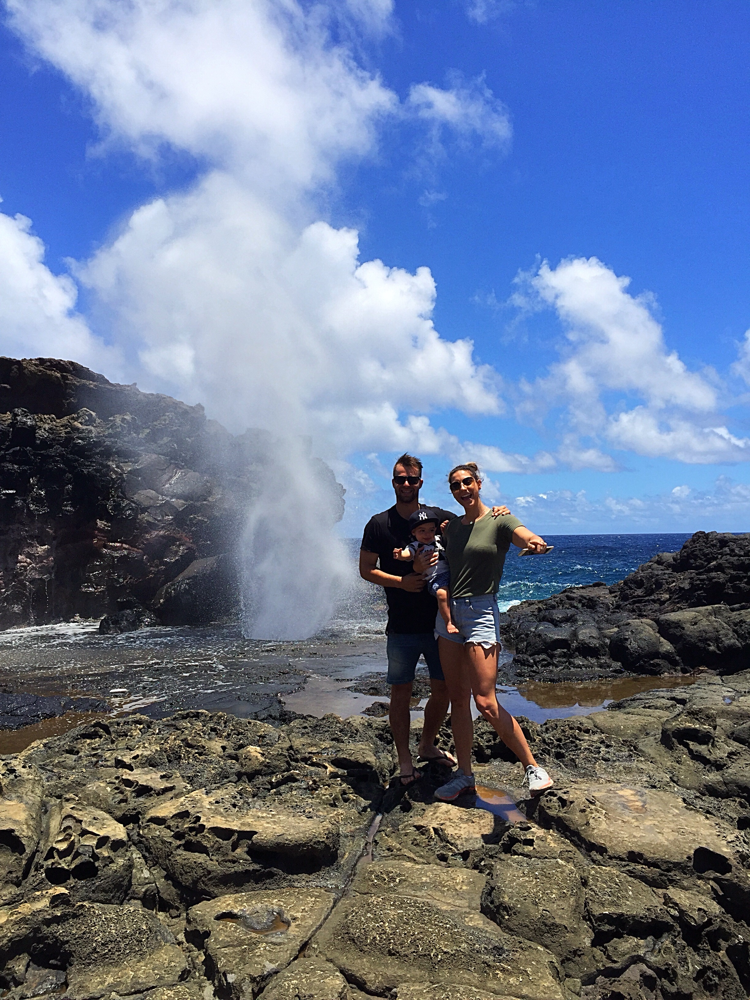
Nakalele Blowhole

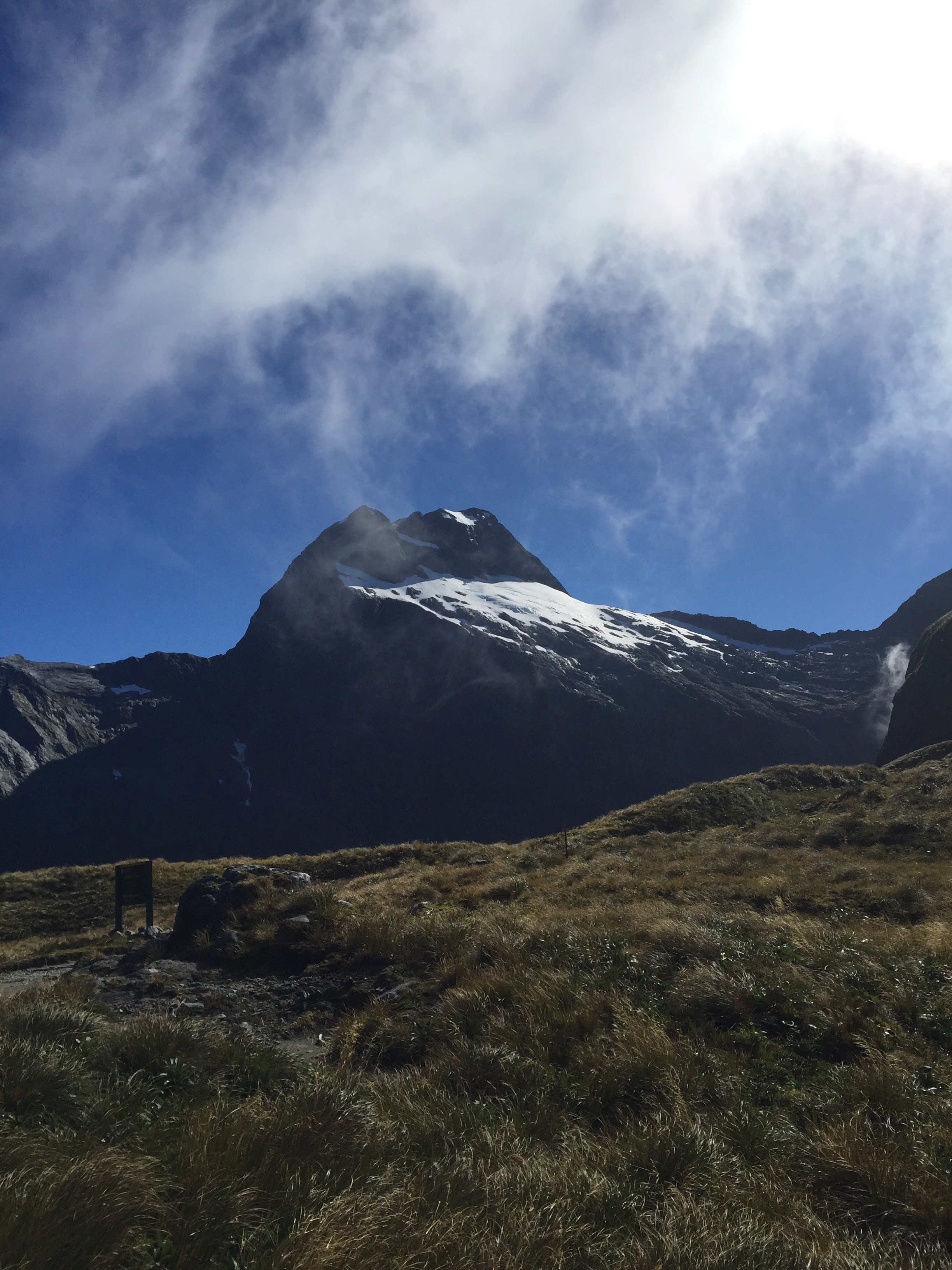
Even though Maui has a dormant volcano that will likely erupt again, Maui’s most active eruption has nothing to do with lava.  Rather it’s a forceful explosion of seawater that erupts on a regular basis – often as frequently as every few minutes when the surf and wind are both up.  We took a drive to see the Nakalele Blowhole on Maui’s northwestern coast – it is a natural geyser where seawater trapped in an underwater lava tube is searching for a way to escape.  Since it can’t go back the way it came in – there’s too much pressure from the waves – the only outlet is a tire sized hole in the jagged, jet black lava rock, where a column of water is powerfully jettisoned up to 100 feet in the air.

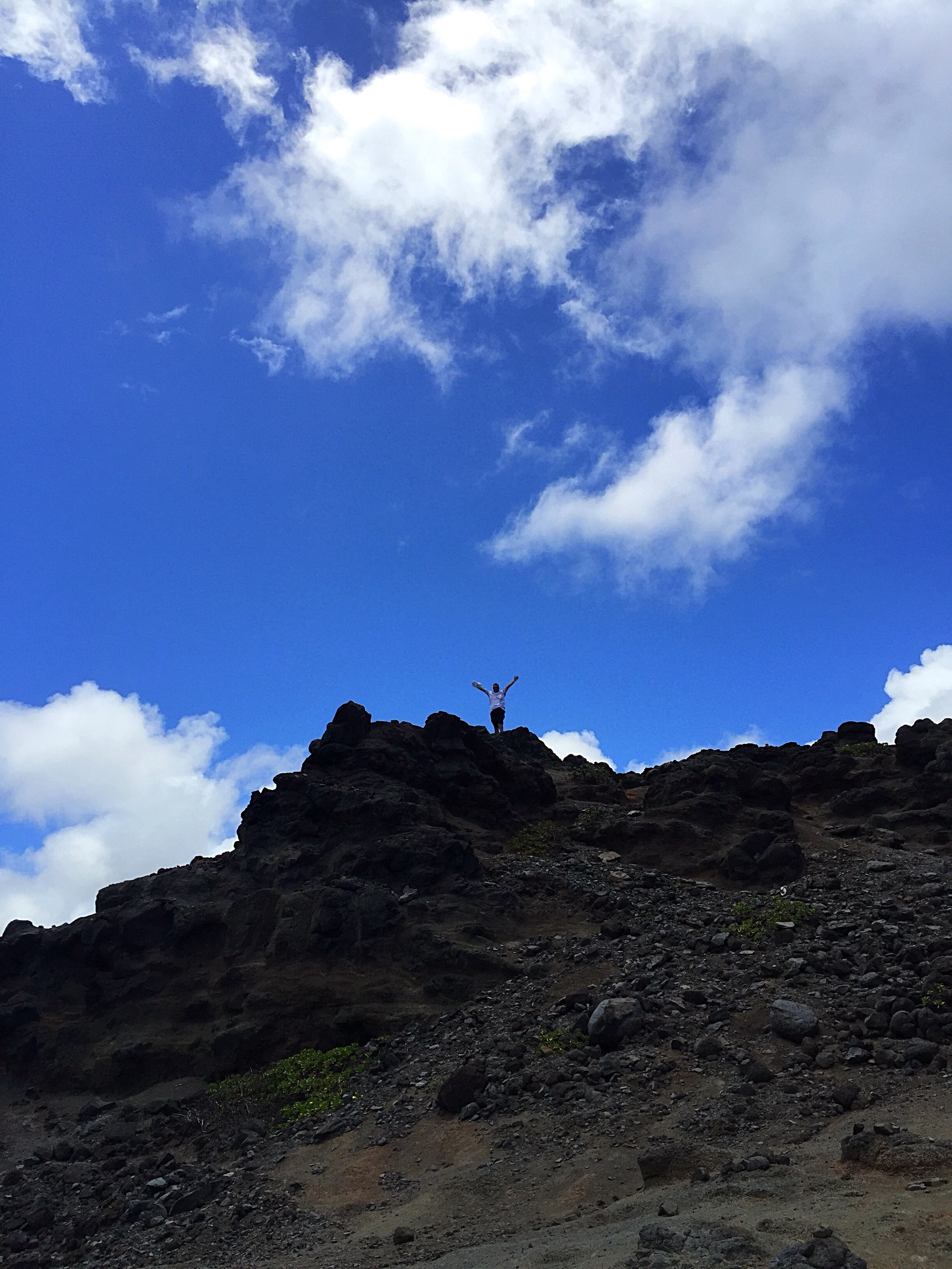
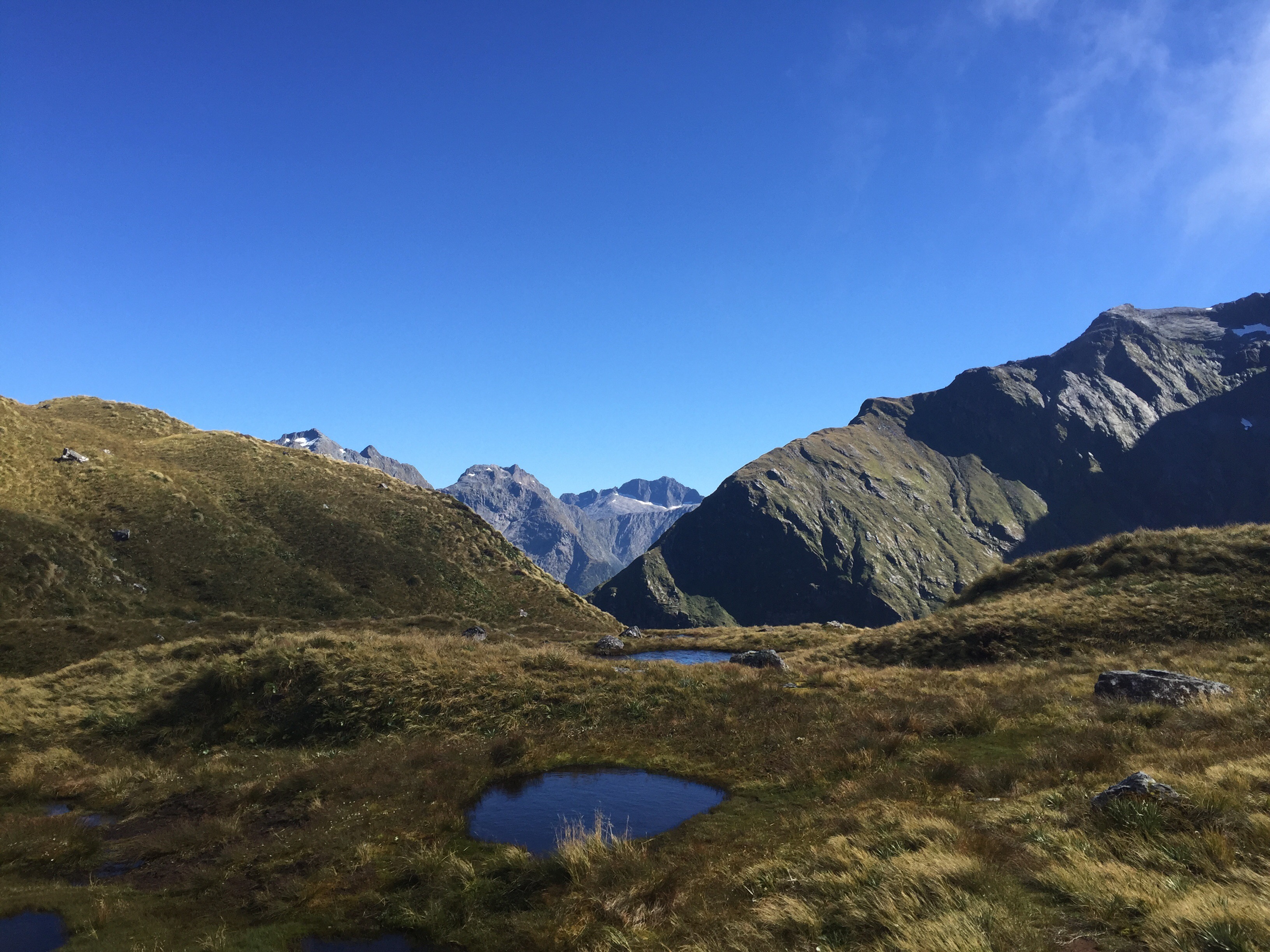
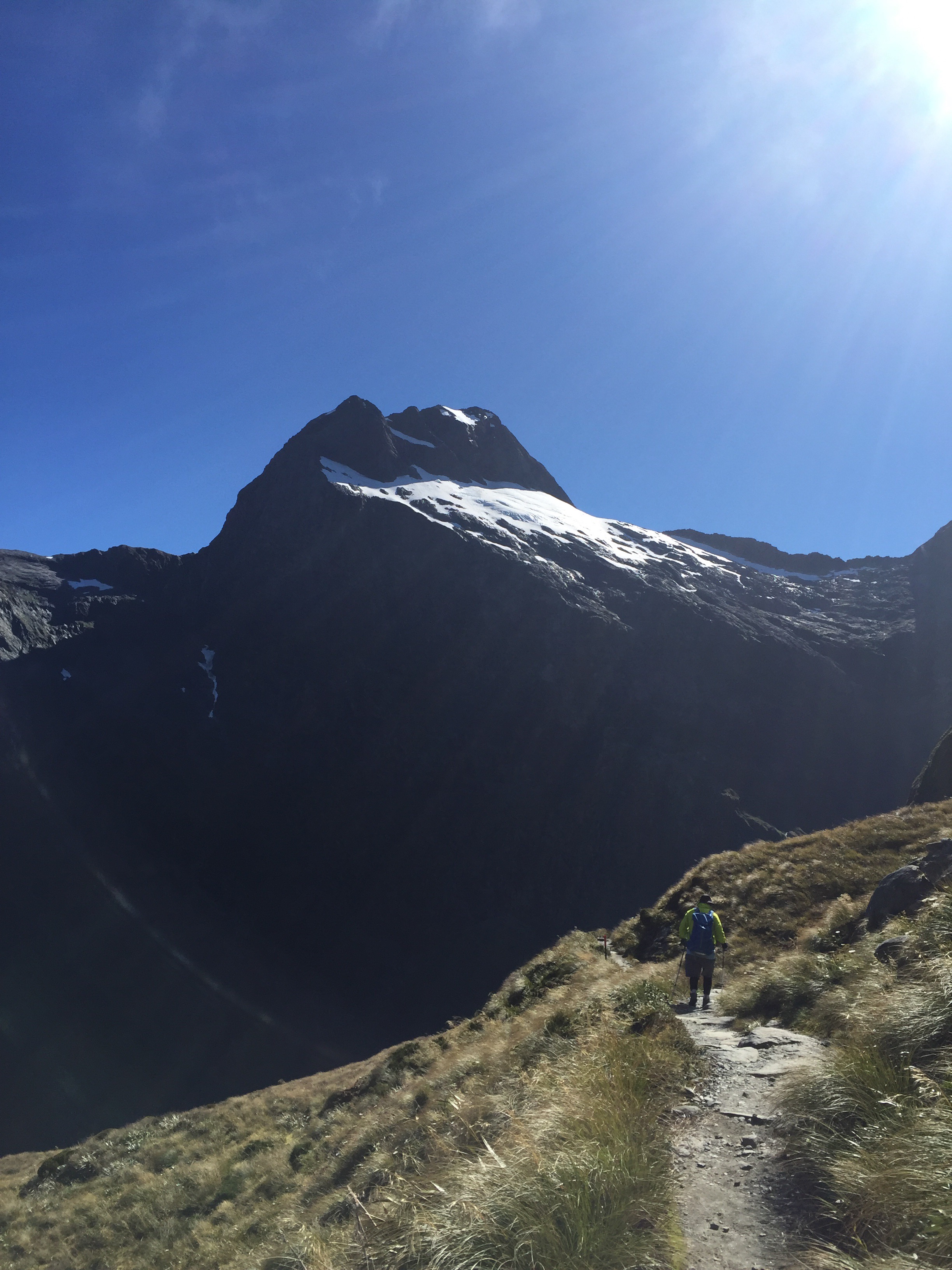
When we pulled up into the carpark to walk down to the blowhole we noticed all these police cars had closed the road further round the island and a helicopter was flying overhead with a monsoon bucket dangling from it.  There was a scrub fire just up on the hill –  we couldn’t see the fire only a bit of smoke.  As we walked down to the blowhole the helicopter made numerous trips down to the ocean to fill up the monsoon bucket.  Seeing a helicopter against the cliffs gives you quite a good perspective on how high some of the cliffs actually are.

I had read on the internet about the dangers of the blowhole and that you need to keep your distance.  There have been terrifying instances in the past where the blowhole has sucked people into the hole who were literally standing right over it and some have drowned.  Despite the warning signs on the way down there were a couple of young guys standing over the hole and putting a GoPro down the hole.  To be fair the blowhole didn’t look in full swing but accidents happen so quickly.  We kept our distance and only hung around to get some cool photos – Steve really kept his distance choosing to climb along the cliffs at the top rather than climb down to the blowhole – we don’t call him Precious for nothing : )

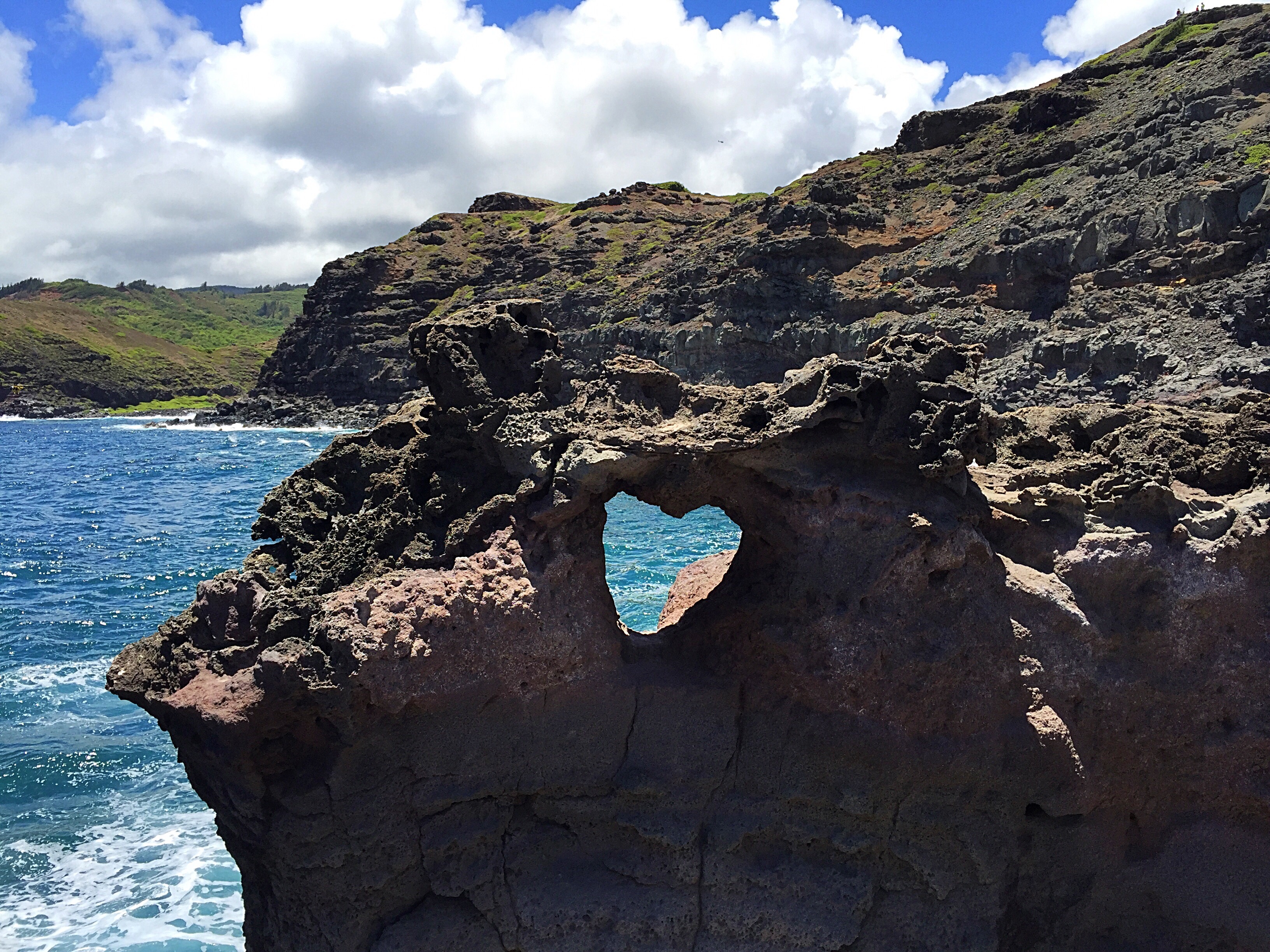
There is also this heart shaped hole in the rock which is quite cool.  Apparently pictures of the rock are even more popular on Instagram than the blowhole these days.

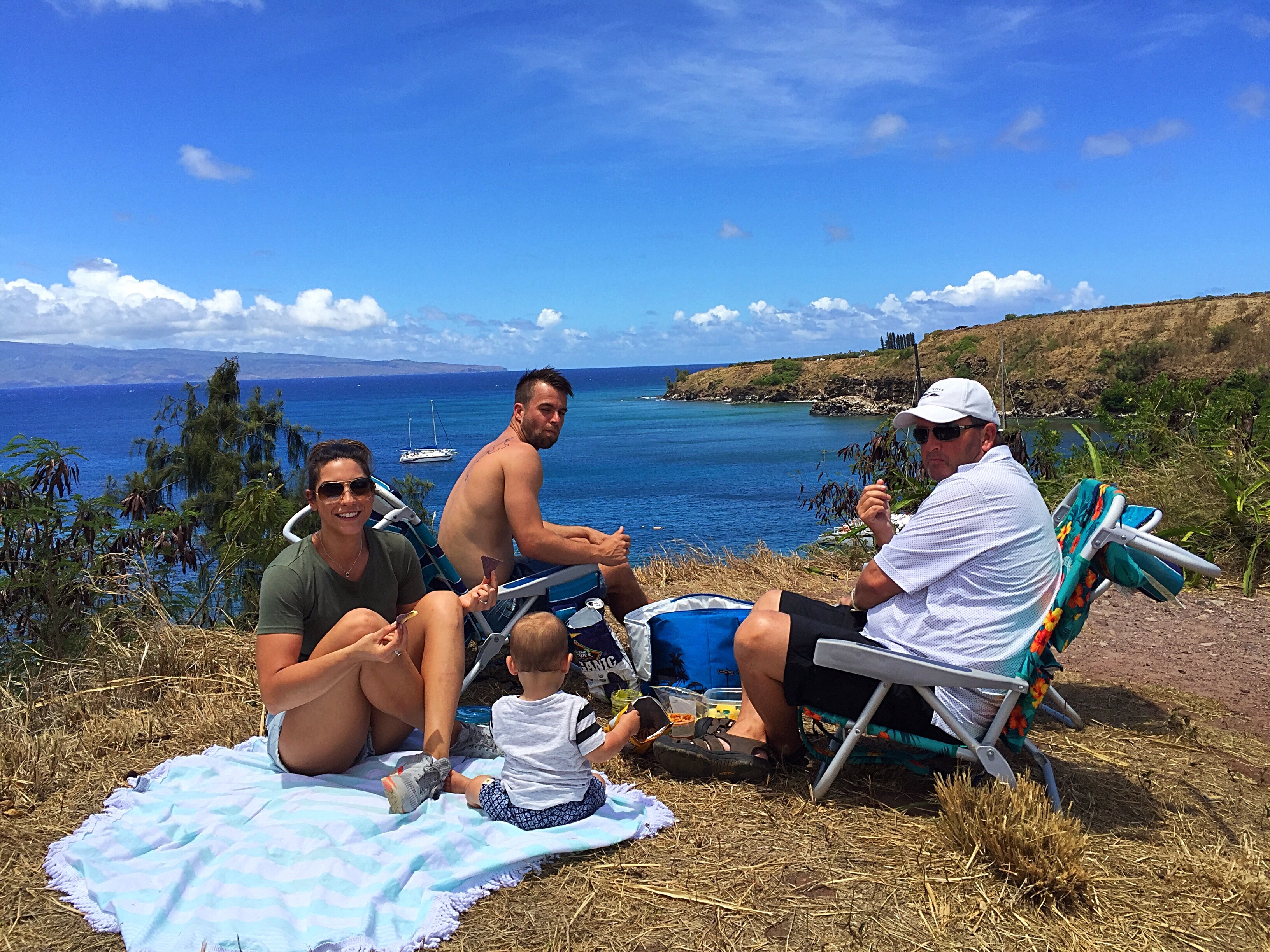
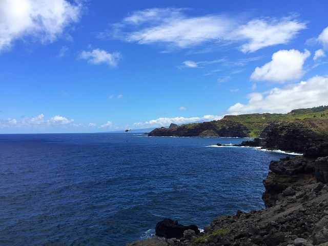
Exploration done and pictures taken we headed back up the cliffs to the car.  We headed back towards Lahaina where we stopped off on a hill overlooking Honolua Bay to have a picnic lunch.

Maui Swap Meet

The Maui Swap Meet has been an institution loved by both local residents and tourists since 1981. It is held every Saturday morning from 7 AM to 1 PM, in the parking lot of University of Hawaii Maui College.

This is the place to find the only real bargains on Maui. It’s like a large flea market. T-shirts, jewelry, flowers, fresh fruits and vegetables, hand-painted shirts and dresses, and an amazing variety of other STUFF, is all for sale by Maui residents. 200 vendors and thousands of customers (60% locals and 40% tourists) show up here every Saturday morning, knowing this is the place for a good deal.

There’s also plenty to eat at the Maui Swap Meet. Food trucks and other vendors sell snacks, nuts, candies, drinks, shave ice, and complete lunch entrees. This is an opportunity to taste some authentic Maui foods for less money than you would pay in Maui’s restaurants.

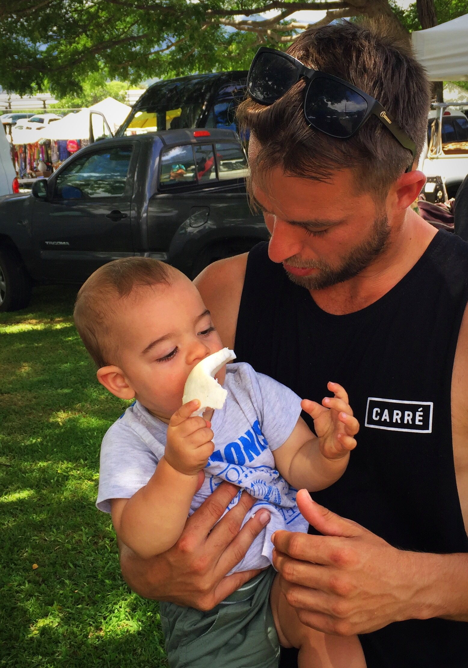
We spent a couple of hours here and it was cool to look around all the arts and crafts. we all tasted some local delights and I did a bit of shopping. Taj enjoyed eating the flesh of a coconut after we had drunk the water out of it.

In fact Taj enjoyed many of the local fruits as did we…

Mango seed
Blueberry Smoothie

Basic Facts about Coral Reefs

Definitions:

a) Coral: Coral is a hard substance of various colors, made up of skeletons of a kind of tiny animal (Chambers Universal Learners’ Dictionary, 1980).

b) Reefs: Reef is a submerged ridge of rock or coral near the surface of the water

(Princeton University, 2003)

Hence, to avoid any confusion on the definition, coral reefs can be said as reefs in general.

What is a reef?

Reefs are limestone formations produced by living organisms, found in shallow, tropical marine waters. Among the predominant organisms in most reefs are stony corals, colonial cnidarians that produce an exoskeleton of limestone. Many reefs result from biotic processes which is the deposition of sand, wave erosion planning down rock outcrops and other natural processes. A healthy reef has 25 percent of all the marine species living among the corals which include sponges, fish, crabs and many more organisms often living symbiotically (Ministry of agriculture and agro-based industry, 2004). However, the best-known reefs are those of tropical waters developed through biotic processes dominated by corals and calcareous algae.

There are three types of reefs which include the Fringing reefs, Barrier reefs and Atoll (Ministry of agriculture and agro-based industry, 2004). Fringing reefs are coral platforms which grow around island and mainland shores that are more or less continuous with the shore and expose at low tide. The second type of reefs which are the Barrier reefs occurs further offshore. This happens when land masses sink and Fringing reefs become separated from shorelines by wide channels. As an example the Great Barrier Reef of North East Australia is the largest known complex of coral reefs. The last type of reefs which are called Atoll is a reef surrounding a lagoon that has no central island with passages through the reef to the sea.

Why are reefs important?

(a) Medical treatment

According to Andrew Bruckner a coral reef ecologist in the National Marine Fisheries Service’s Office of Protected Resources, Silver Spring, Maryland The prospect of finding a new drug in the sea, especially among coral reef species, may be 300 to 400 times more likely than isolating one from a terrestrial ecosystem.

The antiviral drugs Ara-A and AZT and the anticancer agent Ara-C, developed from extracts of sponges found on a Caribbean reef, were among the earliest modern medicines obtained from coral reefs. Other products, such as Dolostatin 10, isolated from a sea hare found in the Indian Ocean, are under clinical trials for use in the treatment of breast and liver cancers, tumors, and leukemia. (Issues in Science and Technology, 2002)

Aside from this, natural compounds in corals have proven to be of immense value especially in terms of medicinal properties. For example, the bark of the Pacific yew tree yielded a compound that has helped battle some forms of cancer. Such finds have led to a new industry–bioprospecting–and such prospectors have fanned out across the globe in search of nature’s remedies. Now a compound isolated from coral collected off the coast of Okinawa has shown the ability to slow down and possibly prevent virus replication and it may hold promise as a cancer treatment. (The Coral Reef Alliance, 2006)

(b) Tourism

The conservation of coral reefs is vital also because in some countries it is a huge source of revenue, which can enhance the countries economic growth, and this is derived from the tourism industry.

For example, the coral reefs in the Malacca Straits alone have a total assessed economic value of US$563 million for tourism, shoreline protection, fisheries, and research potential, whereas the sustainable value of Southeast Asia’s coral reef fisheries on the whole is estimated at US$2.4 billion per year. (Wild Asia, 2005)

Within Malaysia the islands off the east coast of the Peninsular are a major tourist attraction, for example, according to the Tioman Development Authority “An average of 190,000 tourists arrive annually in Pulau Tioman, based on tourist arrivals from 1995 – 2003.”

(c) Ecosystem balance and biodiversity

The marine ecosystem relies largely upon the survival of coral reefs as it provides a shelter for thousands of species of marine life, and since corals are at the base of the food chain, it provides food for the rest of the reef community. It ensures the energy flow through the marine community, creating ecological interactions.

The coral reef which is the base of the food chain is also known as a producer, which produces energy through photosynthesis. Among them are three main types of producers. The first is cyanobactera or blue-green algae, which fix nitrogen and enhance nutrient availability. The second type is seaweeds, which consist of both micro algae and turf algae which are grazed by herbivores. The third type is reef building, or hematypic corals, which have a special relationship with tiny plant-like organisms called zooxanthellae. The zooxanthellae live inside the tissues of the coral and share mutual benefits. (Hawaii Coral Reef Network, 2005)

These producers in turn are essential for the existence of its consumers, which are organisms that consume energy by eating other organisms. Consumers can be divided into two categories. The first is herbivores, animals that eat plants, such as sea urchins, surgeon fishes, and parrotfish. Herbivores contribute mainly to the coral reef by controlling the overgrowth of seaweed and turf algae. The second is corallivores, animals that eat corals such as butterfly fish. The presences of corallivores are a good indicator of the health status of a reef. Coral reef organisms construct huge and intricate physical structures that are home to nearly one quarter of all known marine species. (Hawaii Coral Reef Network 2005)

It is also an essential to maintain a biodiversity of marine life. “In Malaysia, there are approximately 450 coral reef fish species, which include such important species as Pomacentridae (Damselfish). The total of 101 species of damselfish found in Malaysia is 82% of the total from Indonesia and 86% of the total from the Philippines.” (Wild Asia 2005) From this it is clear that coral reefs contribute to a huge biodiversity of fish and is of enourmous global value.

(e) Protects the shorelines from natural disasters

Coral reefs ultimately provide protection from natural disasters and shoreline damage. Coral reefs assist in the prevention of beach erosion, which according to new report by the United Nations Environment Programme (UNEP). The report, titled “In the Front Line: Shoreline Protection and other Ecosystem Services from Mangroves and Coral Reefs”, estimates that a typical coral reef can absorb up to 90 percent of the energy of wind-generated waves thus protecting coastal areas from damage. The report cites a study from Sri Lanka which shows that one square kilometer of coral reef prevents 2,000 cubic meters of coastal erosion annually.

Coral reefs also provide protection to coastal areas, by reducing the impact of tidal waves or tsunamis. According to Simon Cripps, director of the Global Marine Program at the environment group WWF International, “Coral reefs act as a natural breakwater and mangroves are a natural shock absorber, and this applies to floods and cyclones as well as tsunamis.” A comparison was made after the Asian tsunami disaster and indicated that places with “healthy coral reefs and intact mangroves were far less badly hit than places where the reefs had been damaged and the mangroves ripped out and replaced by beachfront hotels and prawn farms.”

(f) Maintain fisheries resources.

Coral reefs ensure an abundant source of fish as it functions as a breeding, feeding and nursery grounds for fish. According to WWF Malaysia report, As much as 30% of fish caught depend on coral reefs in Malaysia. Therefore in order to protect the fishing industry and ensure a continual source of food and a livelihood for fishermen, it is of utmost importance to protect coral reefs.

In many countries such as the Philippines namely the small islands, many of the households rely on fishing as a primary source of income. For example on tiny Malalison Island approximately three-quarters of the households (55 hectares) in the central Philippines make at least part of their income from fishing, and 75 per cent live below the poverty level (Agbayani et al, 2000). By the late 1980s, live coral cover was down to 35 per cent and the community catch had shrunk to a small fraction of what it once had been (Baticados and Agbayani, 2000). This of course clearly demonstrates the crucial role that reefs play.

Posted in Hawaii, USA, United States of America | Tagged | Leave a comment

Maui – Local Delights – Hawaii, USA

Winter lived on in NZ and the tropical climate of Hawaii was calling.  We flew to Hawaii on the 12th August and met Paul, Ashleigh and Taj in Honolulu before continuing onto the island of Maui.  I had been looking at the temperatures up there and it was saying mid to late twenties but it was actually in the early thirties most days we were there – no complaints!  

I think we both had different travel experiences getting to Honolulu and ours was probably a lot more relaxing : 0

A special guest on our flight from Napier to Auckland

Koru delights

Meanwhile in Sydney….


We got to Maui about 1pm and our accomodation wasn’t ready so we had some lunch at the Outbeak Steak House where the Waiter was full of suggestions for our stay on Maui.  I got quite excited while Steve’s eyes glazed over at the thought of so much outdoor exploration that didn’t involve a golf course!  We then did some grocery shopping before all crashing out for a couple of hours.

Grandad was very happy to be reunited with his little buddy.

Not sure about the tongue poking though : 0

We were staying in South Kihei which is on Maui’s south shore.  The accomodation was in a good location and we were within walking distance to the beach, shops, restaurants and bars.  I had done a bit of research prior to the trip regarding where to eat and drink and of course that included the best happy hours on the island : )

Some of the local highlights during our stay……

Life’s a Beach

This became the local – they had happy hour between 4pm and 6pm and served these monstrous beers for USD3.50 and a monstrous MaiTai for USD8 – I must say I was a bit shocked when they bought out my MaiTai but it ended up being the best MaiTai on the island and I had no trouble drinking it all : ). Needless to say we had a few visits here and the locals were very friendly.  This was helped by Taj being the little charmer that he is – he never fails to smile and engage with the people around him and if they’re not looking at him then he makes cute little sounds until they are looking at him!  Who does that remind you of, minus the cuteness : 0

Life’s a Beach

Horhito’s Shrimp Tacos Food Truck

The world over, food trucks are becoming more popular and Maui was no exception.  We saw a few food trucks during our visit and I had read about this one that did USD3 tacos.  It turned out Horhito’s Shrimp Tacos was parked just down the road from where we were staying.  The tacos were pretty good for the price so we had dinner there one night.

Hawaiian Moons Natural Foods

I always love a good natural foods shop so when I discovered Hawaiian Moons was 500 metres from where we were staying I was pretty happy.  They had a good range of fresh produce and meat as well as a salad bar and you could buy locally made artisan bread.

Hawaiian Moons

Lava Java

Another passion of mine is a good coffee and when it is locally grown and roasted I love it even more.  There were a few local growers and roasteries on the island but this one was just down the road so it became a morning ritual for me while everyone was still sleeping – grab a coffee and head to the beach to watch the people out in the sea learning to surf and paddle board.

The couple that own Lava Java, work with several upcountry growers to get their Kula Coffee and look to well known Maui grower Kimo Faulkner for the other Maui coffees.  The Kula Coffee’s “untold story” began over a decade ago, when about 250 Kona coffee starter plants found a new home on the slopes of Haleakala, and officially became Kula Coffee.

Lava Java Maui

Three’s Bar & Grill

Three friends who surfed and chefed together formed Three’s Bar & Grill in 2009 as a catering company but it didn’t take them long to establish a permanent restaurant in South Kihei.  We enjoyed happy hour drinks and food there one night and it was great – they have incorporated the three chef’s three cuisines – Hawaiian, Southwestern and Pacific Rim.

Again Taj made friends with all the wait staff.

Three’s Bar & Grill

South Shore Tiki Lounge

We had spotted this place on our walks so put it on the list to visit one night.  They professed to have some of the best pizza on the island so we tested it out when we visited and they didn’t disappoint.  They pride themselves on buying local and use only the finest and freshest ingredients.  The blurb above their menu was pretty impressive:

“We strive to buy local and use only the finest and freshest ingredients. Our bread products are made with wheat and malted barley flour. They contain no dairy products and are cholesterol free. Our meat products come from Maui Cattle Company free-range cows. They contain no hormones or antibiotics. Our fresh fish is caught off the shores of Maui. Our oil “Whole Harvest Smart Fry” is 100% cold expeller pressed soybean oil used only for cooking our French fries. It contains no harsh chemicals, no solvents, no trans fatty acids, no hydrogenation and no cholesterol. Our veggie dogs and burgers are made from soybean and wheat protein. They are low carb, low calorie and low fat. Our vegan chili is made with 3 types of beans, 3 types of chili, 3 types of onions, tomatoes, and herbs. Our hand tossed New York style pizzas are crafted from scratch using wheat flour, extra virgin olive oil, filtered water and a few secret spices. The sauce is made from fresh crushed Roma tomatoes and fresh (not dried) chopped herbs and spices. We hope you enjoy!”

I am very into knowing where my food comes from and what it contains so I was pretty impressed they had gone to the lengths they had to ensure the food they serve really does come from the finest and freshest ingredients.

Tiki Lounge

Paia Fish Market Restaurant

Every time we walked past this restaurant it was busy so we thought we better check it out.  We worked out that it was quieter earlier in the week so on the last Monday night we were there we wandered down here for dinner.  The website said that the portions were generous and the prices reasonable – my sort of place : )

Again there focus was on locally caught fresh fish and locally grown produce.  You order at the counter and find a table wherever you can, even if that means sharing with other people – they encourage rubbing elbows and making friends.  

The meals were large, tasty and satisfying.  There are actually three Paia Fish Market Restaurants on the island – the one we were at in South Kihei, one in Lahaina and the original one in Paia which opened in 1989.

Paia Fish Market

The Hawaii Fudge Company

As we were wandering back to our apartment after dinner one night we decided to go and check out the Hawaii Fudge Company – the smells drew us in.  We got accosted by a couple of staff who were promoting a fudge making class where you get to make a pound of fudge and become a fudgeologist!  They offered us a good deal so Ashleigh and I signed up for the next night.

We arrived at Fudge University at 5.30pm and the other two people booked in for the class didn’t turn up so we ended up having our own private class.  Paul gave us a bit of history on the Company and then on Hawaii itself which was really interesting.  The mythology is very similar to that of our indigenous people in NZ.  They have produced these four different fudge boxes which depict four different Hawaiian Legends – see below.

The Company employs about 12 people in their factory who make small batches of fudge just like you would at home.  They have many flavours including some seasonal ones.  There are two locations on Maui – Kihei and Lahaina and one on Oahu.

Pre fudge making we had to come up with a name for ourselves using an adjective starting with the same letter as our first name.  We then had to introduce ourselves and explain why we had chosen our adjective.  I was Racey Rachie due to racing everywhere no matter what I’m doing : ). Ashleigh was Awesome Ashleigh for obvious reasons, least of which was having to look after both Taj and Paul – just like having two children really : )

It was now time to make our own fudge creation – we had the choice of a white chocolate fudge or a chocolate fudge – Ashleigh went white and I went chocolate.  You then chose the flavouring, the bits and pieces to go in the fudge and a topping if you wanted one.  I love mint chocolate so I choose mint flavouring, mint chips and some pistachios to jazz it up.  Ashleigh went down the macadamia, caramel route.  We didn’t have to do too much hard work as the base mixture was already mixed.  It was then microwaved for 60 seconds for white and 90 seconds for chocolate – we then had 10 seconds in which to get all our flavourings and bits and pieces mixed in before pouring into our fudge boxes.  We all did the countdown while the fudgeologist of the moment did their mixing.  10 seconds goes fast which may explain why all my pistachios ended up in one corner of my fudge – I didn’t quite get them mixed in properly.

We had to come up with a name for our creations and from memory I called mine Peppy Peppermint with a hint of Pistachios.  We then graduated as Fudgeologists and took our pound of fudge home along with another lot of ingredients to make a second batch.  We were a bit dissapointed that we had to wait a few hours for it to set – we wanted to get into it – I had licked the bowl and it was going to be good!  Half of my fudge made it back to NZ after the holiday but it is long gone now.

Fudge History

Before 1886, the origin and history of fudge is unclear, but Fudge is thought to be an American invention. Most believe the first batch was a result of a accidental “fudged” batch of caramels, hence the name “fudge”.

In 1886, fudge was sold at a local Baltimore grocery store for 40 cents a pound. This is the first known sale of fudge. A letter, found in the archives of Vassar College, written by Emelyn Battersby Hartridge reveals that Emelyn wrote that her schoolmate’s cousin made fudge in 1886 in Baltimore and sold it for 40 cents a pound.

In 1888, Miss Hartridge asked for the fudge recipe, and made 30 pounds of fudge for the Vassar Senior Auction. The recipe was very popular at the school from that point forward. Fudge became a new confection after word spread to other women’s colleges of the tasty delight. Later, Smith and Wellesley schools each developed their own recipe for fudge.

Vassar College was the first degree-granting institution of higher education for women in the United States. It didn’t become coeducational until 1969.  Vassar was the second of the Seven Sisters colleges, higher education schools that were formerly strictly for women, and historically sister institutions to the Ivy League – Yale, Harvard, Princeton…

The story Paul told us was that one of the women was making a batch of caramel and it went wrong – it still tasted good so she sold it as Fudged Caramel – fudged being botched, cocked up.  The woman of the college continued to make fudge and used it to sweeten the local politicians whilst lobbying them on various political matters.

Definition of Fudge

Fudge is a crystalline candy and controlling the sugar solution crystallization is the key to delicious, smooth fudge. One of the most important aspects of any candy is the final texture. Temperature separates hard caramels from fudge and tiny microcrystals of sugar in fudge gives fudge its firm but smooth texture. The secret to successful fudge is getting these crystals to form at just the right time.

Hawaii Fudge Company – Love, Peace, Fudge

Our Fudge Lecturers – Paul & Heaven

The History of Hawaii

“The Aloha State” became the 50th state in 1959, but the history of Hawaii goes back centuries earlier. Roughly 1,500 years ago, Polynesians from the Marquesas Islands first set foot on Hawaii Island. With only the stars to guide them, they miraculously sailed over 3,200 kilometres in canoes to migrate to the Islands.

500 years later, settlers from Tahiti arrived, bringing their beliefs in gods and demi-gods and instituting a strict social hierarchy based on a kapu (taboo) system. Hawaiian culture flourished over the centuries, giving rise to the art of the hula and the sport of surfing, but land division conflicts between ruling chieftains were common.

In 1778, Captain James Cook, landed on Kauai at Waimea Bay. Naming the archipelago the “Sandwich Islands” in honour of the Earl of Sandwich, Cook opened the doors to the west. Cook was killed only a year later in Kealakekua Bay on Hawaii Island.

In 1791, North Kohala born Kamehameha united the warring factions of Hawaii Island and went on to unify all of the Hawaiian Islands into one royal kingdom in 1810. In 1819, less than a year after King Kamehameha’s death, his son, Liholiho, abolished the ancient kapu system.

In 1820, the first Protestant missionaries arrived on Hawaii Island filling the void left after the end of the kapu system. Hawaii became a port for seamen, traders and whalers. The whaling industry boom flourished in Lahaina Harbor in Maui. Throughout these years of growth, western disease took a heavy toll on the Native Hawaiian population.

Western influence continued to grow and in 1893, American Colonists who controlled much of Hawaii’s economy overthrew the Hawaiian Kingdom in a peaceful, yet still controversial coup. In 1898, Hawaii became a territory of the United States.

In the 20th century, sugar and pineapple plantations fuelled Hawaii’s economy bringing an influx of Japanese, Chinese, Filipino and Portuguese immigrants. Lanai, under the leadership of James Dole, became known as the “Pineapple Island”, after becoming the world’s leading exporter of pineapple. This mix of immigrant ethnicities is what makes Hawaii’s population so diverse today.
On December 7, 1941, the Japanese launched a surprise attack on Pearl Harbor on Oahu. Four years later, on September 2, 1945, Japan signed its unconditional surrender on the USS Battleship Missouri, which still rests in Pearl Harbor today. In 1959, Hawaii became the 50th State of the United States. Today, Hawaii is a global gathering place for visitors to share in the spirit of aloha. Beyond the sun and surf of the islands, we urge you to discover the rich cultural history of Hawaii to add even more depth to your visit.

Hawaiian Religion

Ancient Hawaiian Religion

The Hawaiians believed in multiple gods who controlled the aspects of their lives. They believe that, in the beginning, there was nothing but the god Keawe. Keawe was said to be the first being and ancestor to the chief gods. Keawe manifested himself in the form of his son, Kane, the god of creation and light, and in his daughter, Nawahine, the moon goddess and the mother of heaven. 

From Kane and Nawahine came their sons: Lono, the god of agriculture, Ku, the god of war, and Kanaloa, patron of the ocean. Kane, with his sons, were the four main gods in the Hawaiian religion, the akua. The Akua ruled over the world and they watched over it. The Hawaiians respected the land they lived in because they believed that the gods would take forms of nature, like plants or animals, so they lived in the mentality of loving the land. After the akua, each household had their own specific god that they paid homeage to, the ‘aumakua. The ‘aumakua were said to be guardian spirits that took multiple forms, such as sharks, birds, fish, or other creatures. The ‘aumakua symbolized strength, guidance, warnings, assistance, and inspiration. The Hawaiians worshipped their gods with the Kapu system, the rules that they followed to keep their gods’ territories and images holy. The Kapu system was both their laws and their religion, and it controlled the actions of the Hawaiian people until King Kamehameha II abolished it in November 1819. This left the Hawaiian people without direction for a year, until the missionaries arrived in 1820.

Post contact Hawaiian Religion

When the missionaries arrived in Hawaii in 1820, they saw it as divine providence that the Hawaiians had overthrown their previous religion, leaving their minds open to the truth of Christianity. The missionaries sought to save and civilize the Hawaiians so they could be brought into the modern world. The Hawaiians were taught the doctrine of the Puritans. Hawaiians converted to Christianity in large numbers, yet some stayed in the practice of the old gods.

Modern Religion in Hawaii

Religion in Hawaii today has been greatly influenced by the cultures that make it up. Hawaii has had a large Asiatic influence since it became a port for world trade, so a large part of Hawaii’s religious background is made up of religions of Asian descent, such as Buddhism. With our world being connected with easy travel, there are elements of many religions in Hawaii. 

Hawaiian Legends

Forging Fire God: Pele

Lighting up ancient Hawaiian legends, Pele (pronounced peh-leh) the goddess of fire, lightning, wind, dance and volcanoes is a well-known character. Otherwise known as ka wahine ai honua, the woman who devours the land, Pele’s home is believed to be Halemaumau crater at the summit of Kilauea, one of the world’s most active volcanoes. However, all of Hawaii lays the setting for her stories, so that to this day, any volcanic eruption in Hawaii is attributed to Pele’s longing to be with her true love.

Frozen Mantle God: Poli’Ahu

Poliʻahu met the Aliʻi Aiwohikupua on the Eastern slope of Mauna Kea. The two fell in love and Aiwohikupua took Poliʻahu home to his native Kauai. There Poliʻahu discovered that the aliʻi was already betrothed to a princess of Maui. Poliʻahu left in dismay, but managed to first curse the betrothed. She first chilled the princess of Maui to the bone, then turned the cold into heat. Finally, the princess gave up and left him. Later Poliʻahu similarly cursed Aiwohikupua, freezing him to death. The four goddesses are defined by their otherworldly beauty. Poliʻahu is noted as Hawaii’s most beautiful goddess.


Origin Gods: Papa & Wakea

Together, Papahānaumoku and Wākea created Hawaii, Maui, Kaua’i, and Ho’ohokukalani. After having incest with his own daughter, Ho’ohokukalani, she gave birth to Haloa-naka, meaning elder child. It was a stillborn baby, which they later planted and became the first kalo or taro, a staple of the Hawaiian diet. After Haloa-naka, Ho’ohokukalani gave birth to another child named Haloa, meaning younger sibling, and he became the first kanaka or Hawaiian person. The relationship between Haloa-naka and Haloa describes the balance of relationships between the land and the people that live in it. Haloa-naka, the land or kalo, takes care of the kanakas or Haloa by providing them with food and nutrients. In return, Haloa or the people would treat and take care of the land like their own family. Later on, Wākea reunites with Papahānaumoku and they create Ni’ihau, Lehua, and Kaʻula. In one tradition, the first person on Earth was the woman Laʻila. She and her husband Kealiʻi are the parents of Kahiko, the father of Wākea. Wākea made the land and sea from the calabash or gourd (‘ipu) of Papahānaumoku. He threw it up high, and it became the heavens. He made the rain from its juice and from the seeds he made the sun, moon, and stars.

Hidden Beauty God: La’ieikawai

In Hawaiian mythology, Laʻieikawai (Lāʻi.e.-i-ka-wai) and her twin sister Laʻielohelohe were princesses, and were born in Laie, Hawaii, Oahu.

They were separated and hidden away from their chiefly father who had all his daughters killed at birth, because he wanted a first born son. Laʻieikawai was hidden in a cave which was only accessed by diving in a pool of water named Waiapuka. Soon it was well known that someone of royalty resided nearby because of the tell-tale rainbow that graced the sky above her cave dwelling. Her grandmother Waka secretly tried to smuggle her to Paliuli, Puna, Hawaii (island). On the way there others heard of her beauty and the rumors travelled all throughout the islands. Aiwohikupua, a chief from the island of Kauai decided he would pursue her. At her home in Paliuli, Laieikawai was attended by supernatural birds such as the ‘i’iwi polena. It is said she could float on the wings of the birds. While other royalty in Hawai’i had mere feather capes and cloaks, Laʻieikawai had a house made of the sacred feathers. After a series of misfortunes, she becomes known as Kawahineliula (“woman of the twilight”). In 1863, S. N. Haleʻole published the story of the figure in The Hawaiian Romance of Laieikawai, the first fictional work of literature produced by a Native Hawaiian.

Posted in Hawaii, USA | Tagged , , , , , , , | Leave a comment

Revisiting HoiAn – Vietnam

Steve was adamant that he didn’t want to spend his birthday in June at home in the depths of winter.  I am always wanting to go to new places but all the places in Asia that we looked at didn’t work for some reason or other.  One of my favorite places to re visit is HoiAn in central Vietnam – we spent two months there back in 2015 and it was certainly no chore going back there.  The food is the number one drawcard for me – it is so fresh and flavourful.  I couldn’t wait to get amongst it again.

When we visited in 2015 we stayed out at Montgomerie Links, a golf club about 25 minutes out of HoiAn.  This time we decided we wanted to be closer to the action so we could explore the old town on a whim.  We chose to stay at the Little HoiAn Central Boutique Hotel and Spa and it turned out to be a great choice.  The hotel wasn’t too big, the rooms were spacious, the pool area was nice and the staff were great.  It was about a 10 minute walk to town which was perfect.

Steve’s birthday was extra special as he was lavished with gifts by the hotel staff, some of whom gathered to sing happy birthday to him.  We insisted on sharing the cake with them even though they wanted us to eat it all – we told them it was a NZ tradition to share the cake.  Crikey I was having enough trouble with food consumption without having to eat half a cake!  Special thanks to Suzy who is one of the front office superstars at the hotel – she looked after us so well : ). She organised our transport to the golf club each day and although it ran smoothly most of the time we had a couple of hitches with the driver going to the wrong golf course.  Steve had also booked for Laura to come and stay later on in our stay and the hotel mixed the dates up.  Steve went to sort it out and Suzy told him that he must have made a mistake as he is an “old man” – he of course took great delight in showing her that they had made the mistake not the “old man”.  It became a standing joke after that.

As you know we very rarely travel without our golf clubs and this time was no exception – it was the Golfnut’s birthday after all.  We played seven rounds of golf while we were up there – four at Montgomerie Links and three at Danang Golf Club which is the Greg Norman designed course.  It was lovely to see all our friends at Montgomerie Links – we had lunch with Miss Hang and Miss Van one day – Miss Van works at the Bana Hills Golf Club now but made a special effort to come for lunch.  I had contacted our favourite caddies prior to the trip but unfortunately my one, Hoa had just left but Steve’s one Tinh was still around so she caddied for him every round at Montgomerie.

We also played with some nice guys who were all golfing alone on the various days we played – Brad and Ray from Australia and Gerry, originally from Ireland but now residing in Hong Kong with his Korean wife who spoke fluent Russian and whom he is convinced is a Russian spy : ). She joined us for lunch one day – if she’s a Russian spy then she has a very good sense of humour – she was good chat : )

Check out my blogs from 2015 for more information on the golf courses – 

Danang Golf Club

Montgomerie Links

Tinh

Steve jumping on the Caddy wagon – Montgomerie Links

Danang Golf Club

I revisited all my favorite spots around town and was surprised as to how busy it was and how many more coffee places there were.  HoiAn Roastery had one cafe when I was there in 2015 and there must be at least four now and the same with CocoBox, the farm shop.  The tourists are obviously recognising the quality of the food and drinks at these places which has led to the expansion.  I also went back to Highlands Coffee and the same guy who used to give me love hearts on my coffee was still there and he remembered me – apparently he has worked there for five years.  

We were recommended a new sports bar down by the river – 3 Dragons Sports Bar which was great to watch the rugby at.  It’s not open like the HoiAn Sports Bar so is cooler and the air conditioner units work a treat.  We enjoyed watching the All Black’s beat the Lions in the first test there and the food is pretty good.

The guy that owns the 3 Dragons recommended a new restaurant to us called the Red Dragon – it is a little bit out of town but taxis are so cheap it is not a problem.  It was sensational – family owned and run and you can see them preparing the food.  The menu is not large but what they do offer is top quality and so delicious.  The tofu and mango fresh spring rolls were to die for as was there take on bruschetta.  

One place I meant to visit last time we were there was Dingo Deli – this is owned by the guy that owns the HoiAn Sports Bar and is a delicatessen as well as a cafe.  Again the food was delicious but more European than Vietnamese.

Check out – 

3 Dragons Sports Bar

Dingo Deli

The Red Dragon doesn’t have a website but is located at 332 Cửa Đại, Cẩm Châu, Tp. Hội An.

We also re visited our favourites –

The Little Menu Restaurant

Hai Cafe

Morning Glory

Good Morning Vietnam

Ashleigh’s parents Con & Louise were travelling in Vietnam at the same time so we met up with them for a few days in HoiAn.  They hadn’t been there before so we showed them around a little.  We watched the second Lion’s test with them – you know the one where we lost!  That was a bit of a downer but we had hot weather, great food and sights to see so we couldn’t dwell for too long : 0

On the Sunday night before they returned home we went out to the Intercontinental Hotel on the other side of Danang for dinner.  We had visited there two years previously and it is pretty cool.  Citron Restaurant which sits on the top level has these upside down Vietnamese hats floating above the water that you dine in.  Unfortunately you can’t book them now so it is first in first served.  We decided to get there for 5pm which is when the restaurant opened for dinner.  What we didn’t know ist that they also do a high tea so all the “hats” were occupied and we went on the waiting list.  We got a drink and kept a close eye on proceedings.  It didn’t actually take too long before we were moved into a “hat”.  It was a lovely evening and we enjoyed a nice dinner before having a look around the resort.

Check out my previous blog for more info on the Intercontinental – 

Intercontinental Danang

Laura and her friends Rachel & Georgina arrived on the Sunday night while we were dining at the Intercontinental.  They had been travelling around Asia and timed there visit to HoiAn while we were there.  We enjoyed spending time with them and enjoying more delicious food.  Laura had spent a few weeks in HoiAn earlier in the year so had some more good eating suggestions.  One afternoon we used the hotel bikes to bike down to the markets where we enjoyed avocado and mango smoothies – delish!  I had always been a bit nervous about biking around in HoiAn but it was so cool – wish I had discovered it earlier.  It was so hot that biking was a better option due to the breeze generated.

It was then time to say goodbye and head back to winter – just a short visit this time but enough to get my Vietnamese food fix.  Suzy came in on her morning off to wave us goodbye – probably came to make sure the “old man” left : )

Suzy is the one on the left : )

Posted in HoiAn, Vietnam | Tagged | Leave a comment

Fiji with the Fab Four – Fiji

In June the Fab Four headed to Fiji – our only other overseas jaunt had been pre kids (them not me, apart from Steve of course). On that trip we only just made our flight to Noumea due to some over zealous shopping in duty free. We had our names called over the PA system so we sauntered to the departure gate to find it empty : 0. In those days you had to catch the bus out to the plane so they had to send a bus back to get us. Needless to say we were not very popular when we boarded the plane – to be fair we were too busy laughing to be too worried!

This time we were determined to do better : ). I got to the airport in good time as I had stayed in Auckland the night before – Jen and Camilla were travelling up from Hamilton and meeting Sheree in Papakura. They thought they had left in plenty of time but the traffic was diabolical. Meanwhile I am standing in the self checkin area looking like Nigel No Mates calling them every five minutes to see where they are. I then thought I could check us all in online but no I needed their passports. Next move was to check myself in only to find that I was 3 kilograms overweight when I went to the bag drop and it was going to cost me $100! I flagged that idea and decided to wait for the others.

Check in closed at 8am and they got there with five minutes to spare. It was all go though as Camilla was also overweight – she thought the limit was 25kg – unpacking and repacking commenced! It was all the food and drink supplies putting us over the limit, not the clothes! Due to all my tootooing with trying to check them in the kiosks were now rejecting us! We got in the line which was actually quite long – panic was setting in. I then spotted an unattended staff member and made a bee line for her – thankfully she calmly checked us in reversing all the mess ups I had made!

Phew, we were on our way. We cleared customs and did our duty free shopping in the time allocated and made the departure gate to find our fellow travellers still there – bonus!

We arrived to 30 degree temperatures in Fiji – bliss after the cold winter we had been enduring in NZ. I had a card from a taxi driver we used last time we were in Fiji and I had arranged for him to pick us up and he didn’t let me down.

We were staying in the Terrace Apartments in Denerau and they upgraded us to a three bedroom apartment. They were a bit tired but very functional with a large kitchen, dining and lounge area and a great big deck overlooking the pool and golf course. What more could four fabulous girls want?

We hit the pool straight away. It was so nice being back in the warmth with minimal clothing on : )

It wasn’t long before the cocktails were calling us at the Port so off we went to Hard Rock Cafe.

Our daily routine started with a 6km jaunt along the beach and through all the resorts on Denarau. Sheree then had us doing interval sprints, well when I say ‘us’ I really mean me – Camilla couldn’t be arsed and Jen participated half heartedly for a few before sauntering off with Camilla. This only lasted a couple of days until Sheree tweaked her calf muscle.

We had decided to do a trip out to Cloud 9 which is a floating party pontoon out in the ocean. I had been to a 40th there before so I knew how cool it was. I went over to the Port to book it and ended up booking us our own private charter! It actually worked out cheaper and we were able to add in some sightseeing and snorkelling too.

We went over to the Port just before 9am on the Friday to meet our skipper Toby. He was wearing a Chiefs jersey so we knew we were in good hands – we all hail from the Waikato after all.

Toby took us out to the surf reef first up – people were surfing in the middle of the ocean – very cool.

Next stop, Cloud 9. We got there just after 10am and found some chairs. We were only going to be there for a couple of hours so we thought we better get into the beers, cider and pizza. We all jumped off the top of the pontoon and had a swim in the sea – the colour of the water is amazing. It was so much fun and we probably could have stayed there all day.

Toby turned up again at 12.30pm – he had been off fishing and sleeping – two things the Fijians excel at : )

All on board and we were off on a tour of the island resorts.  I have been to Fiji many times and have heard of the various resorts but it was actually cool to see them all and their relativity to each other.  There were a few I hadn’t heard of too as well as some under construction.

Toby chose a snorkelling spot just out from Castaway Island – there was a good reef there and we saw lots of fish.  Camilla and I spent a bit of time out there while the other two had a brief look and then proceeded to lie on the floating pontoon and catch a few rays.  Speaking of rays, just as I was about to head back to the boat I spotted two stingrays  cruising beneath me – very cool.

We then headed back to the Port – the wind had got up and the sea was quite choppy so it was a bumpy ride back in.  Such a great day and I would highly recommend checking out a private charter if you have a group of people – it works out cheaper and you can be flexible with what you want to do.

More cocktails down at the Port were in order that evening – we had discovered FJ10 frozen margaritas at Cardos and thought it was between certain hours in the afternoon but alas no, it was all day long – result : )

The Port was also the scene of the selfie queens (Camilla and Sheree) perfecting their pouts.  It was fair to say that Jen and I were rather inept at this form of art : )  Add a cocktail or two to the selfie queens and boom 💥 they really come out to play.

I had taken Jessica my Jersey cow for a tropical sojourn because a. She was freezing in NZ and b. Sheree hates her!  There is a bit of history behind this hate relationship and I love the reaction I get when I present her on these Fab Four get togethers : )

On our last full day in Denerau we hired some electric bikes and did a bit of a ticky tour around – to be honest you can’t go too far but it was fun.  The cost to hire the electric bikes was FJ9 or NZD7 per hour – that is so cheap.  OK they weren’t the flashiest bikes but they went alright.  We had a blast cruising around and ducking into gated communities with a smile and a wave to the security guards – just act like you belong there and they don’t seem to mind.  Fake it till you make it as the saying goes.  We did a bit of off road and ended up at the back of the golf course next to the sea.

That afternoon Sheree and I had a pamper session booked – we went offsite to the Beauty Spot on the edge of Denerau.  It was interesting!  Sheree’s therapist had a cold or something and was actually quite unwell so Sheree asked her to stop for fear of catching what she had.  They replaced her with another therapist so all’s well that end’s well.  She even went back the next morning and got a new hairdo. 

After five nights it was time to head back to NZ and the reality that winter was still alive and kicking as were the husbands and kids and there constant demands.  The real mum’s amongst us had a blissful time being able to do what they wanted, when they wanted without a constant demand on their time.  We shared many laughs and re lived old memories while creating new ones.  Where to next Fabs?

Posted in Fiji | Leave a comment

Port Douglas – Queensland, Australia

In late May we headed to Port Douglas in Northern Queensland to catch up with some friends who have moved up there and to have a family holiday with Laura, Paul, Ashleigh and wee Taj : )

Our friends Kim and Graham who are originally from the UK but who have spent some time living in NZ decided to make Newell's Beach their home in July 2016.  Newell's Beach is located about 20 minutes north of Port Douglas.

It has been years since I have been up that way so it was nice to re acquaint myself with the area.  Kim is a fountain of knowledge when it comes to all things travel so she had some good tips and also showed us a few of her favorite spots.  The first one was a walk in the Mossman Gorge.

Mossman Gorge forms the southern sector of the renowned Daintree Rainforest. The Daintree Rainforest was World Heritage listed in 1988 and is the last remnant of the oldest surviving rainforest in the world. Here visitors are afforded a rare chance to revel in its beauty and take in every aspect of the Daintree region.  The Daintree Region is an area of ancient tropical rainforest containing one of the most complex ecosystems on earth. Spanning 120,000 hectares, the Daintree Rainforest is the largest portion of tropical rainforest in Australia.

The region contains over 135 million years worth of heritage making it a worthy inclusion on the World Heritage list. The listing has also aided in the fight to preserve the area for many generations to come.

The Kuku Yalanji people are the Indigenous inhabitants of the land and have a history dating back 50,000 years to the earliest human occupation of Australia. They are true rainforest people, living in complete harmony with their environment. It is part of them and they are part of it. Their traditional country extends from south of Mossman to Cooktown in the north, and Palmer River in the west.

The Mossman Gorge is steeped in history and legends that have been passed down through the generations of the Kuku Yalanji.

One of their greatest legends is a tale about the striking backdrop to the Gorge – Manjal Dimbi. Manjal Dimbi is the most prominent of all nearby mountains. Roughly translated, Manjal Dimbi means "mountain holding back". According to Aboriginal dreamtime stories, the large humanoid rock represents Kubirri, who came to the aid of the Kuku Yalanji when they were persecuted by the evil spirit, Wurrumbu. Kubirri holds back the evil spirit, who is now confined to The Bluff above Mossman River, Manjal Dimbi has been anglicised to "Mt Demi" and Kubirri is known as the "Good Shepherd.”

After our walk in the Mossman Gorge we took a drive to Silky Oaks which is a luxury eco lodge that sits high above the crystal-clear waters of the Mossman River and is enveloped by the lush Daintree Rainforest cloaking the steep mountain sides from the riverbanks.  A cocktail and high tea were in order – what a lovely spot.

We awoke on our second day to tropical rain – it was fair pouring down.  After a leisurely breakfast we took a drive to Tranquility Falls – a waterfall nestled in the rainforest which has a great swimming hole.  We were hoping that the rain would abate but it didn't – we wandered to the falls but none of us found swimming particularly appealing!  We drove back into the Daintree Village to have a coffee while the boys played a quick game of pool.  The rain had stopped by now.

That afternoon Kim and I drove into have a look around Port Douglas while Steve, Graham and Mark (Graham's nephew from the UK) played pool in Mossman.

We had a couple of great dinners with Kim, Graham and Mark.  It was good to see them and to see where they are living – frogs, cane toads, snakes, crocs and all : 0

We left Kim and Graham's early on day three and headed to Cairns Airport to pick Laura, Paul, Ashleigh and Taj up.  We hadn't seen Taj since December so we very much looking forward to seeing him.

On our way back to Port Douglas we called in to Chill Cafe in Palm Cove for breakfast – it was delicious and just what everyone needed.

We then carried onto our accomodation at the Pool Villas in Port Douglas which were very nice.  A refreshing swim in the hotel pool before we ventured back to the Mossman Gorge to do the walk.  You catch a bus from the Vistor's Centre to the start of the walk and the last bus back leaves at 5.30pm.  We had just over an hour to do the walk which is about 3km so plenty of time.  The swimming spot is towards the end of the walk so I decided to take a dip – it was about 5.25pm.  We fast walked the last 200 metres to see that last bus pulling out – we ran after it waving but it didn't stop.  We waited about ten minutes thinking maybe there was one last bus but no so we walked the 4km's back to the car – luckily it is pretty much all down hill and we didn't have Steve with us who would have moaned the whole way : )

The next day we decided to do a food and wine tour – there is an organised one you can do but unfortunatley they don't accomodate babies so we did our own one after some valuable input from Kim.

First stop was Kuranda which is a village in the rainforest where you find lots of art, tropical handicrafts and jewellery by local artisans. I had a wander down to the railway station where both the train and the Skyrail from Cairns come in.

Kuranda was first settled in 1885 and surveyed by Thomas Behan in 1888 in anticipation of development that would accompany the arrival of the railway. Kuranda Station is one of the earliest stations to be built in Australia. The current railway station was completed in 1915 using standard concrete units, and is one of the oldest remaining examples of its type in Queensland. Tourism started in Kuranda in 1930 when the first tourists arrived by train.

The Skyrail Rainforest Cableway opened in 1995 and is a world first in environmental tourism which takes you over Australia’s World Heritage listed Tropical Rainforest canopy and deep into the forest. The cableway is 7.5 kilometres long.

Next stop was de Brueys Boutique Winery where they specialise in tropical fruit wines, liqueurs and ports. We did a full tasting of all the wines, liqueurs and ports and they were very nice. The winery itself grew mangoes but acquired the other tropical fruits from local growers. There was also a whole rafter of turkey's who gobbled every time someone spoke to them. They provided good entertainment for Taj while we were tasting : )

We then went to the Mt Uncle Distillery who produce premium spirits and liqueurs. However, we were there for lunch rather than tasting this time. The Bridges Cafe and Restaurant came highly recommended and it didn't disappoint. They also have a few animals that you can visit like alpacas and donkeys.

The perfect after lunch treat is coffee and chocolate so the next stop was Coffee Works who are the original boutique roasters and chocolatiers of Tropical Australia. You pay an AU18 entry fee which allows you to try as many coffees, teas and chocolate flavours as you like – heaven! Luckily they were closing within the half hour or we could have been quite ill! They also have a coffee museum which was interesting – coffee has been a vice for many centuries : )

The Coffee Works museum is the result of Ian Bersten's lifelong passion with coffee.

Ian Bersten, a commerce graduate of the University of New South Wales, began roasting coffee in a small shop in Sydney in 1968 and was the founding director of the large coffee roasting company Belaroma, in Sydney. He sold his remaining share in the business in 2008.

Ian Bersten is an entrepreneur, writer and inventor. He has invented a coffee roaster, coffee brewer, coffee hoppers and a coffee grinder. In more recent times, he invented the Chaicoffski gourmet coffee and tea brewer. Ian has written four books, the most famous of which is in every serious coffee roasters library, Coffee Floats Tea Sinks. Ian also initiated a chocolate shop in Willoughby in Sydney in 2005 called Chocolate Genie.

Bersten's passion and his ability to speak 5 languages led him to dedicate 37 years of extensive research, including countless trips across the globe visiting vaults and historical archives to trace the origin, history and evolution of every style of coffee maker.

His attention to detail and insistent demand for facts, led him through the Patent Offices in Spain, Italy, France, Germany and the USA. He then went on to source and collect over 2000 significant coffee and tea making treasures dating back to the early 1700s. Coffee World is the culmination of Ian's life's work, and is the largest and most significant collection of its kind in the world.

Rob and Annie Webber, the owners of Coffee Works, have been in the coffee roasting business since 1988. Rob and Annie were casual collectors of antique coffee machines themselves. Ian's book Coffee Floats Tea Sinks was used as a reference book for purchasing around 400 antique coffee items. Rob and Annie purchased Ian's collection in 2005 and Coffee World was created in 2007. Prior to this, the larger parts of the Bersten collection were stored in cardboard boxes in a warehouse in Sydney and even Ian himself had not viewed the entire collection on display in one place.

Coffees of the World

All coffee growing countries of the world have a grading system for their green coffee beans. Obviously, the higher the grade, the better the quality, the greater the demand, the higher the price. There are 2 species of coffee plant grown commercially worldwide: Robusta and Arabica.

Robusta is a more robust plant in every way. It is tougher, higher yielding, has double the caffeine content and can grow right down to sea level. Quality and flavour of Robusta coffee is very inferior to Arabica coffee. Robusta sells for less than half the price of quality Arabicas on the world market. Robusta is used to make instant coffee. It is also used extensively by large commercial coffee roasters who blend Robusta with low grade Arabica coffees to produce coffees to compete on price rather than quality.

Arabica is higher grown and better quality coffee. Within the Arabica species there are approximately 20 different varieties of coffee, all with different characteristics.

Only 10% of all the Arabica coffee grown worldwide is of a quality to be classified as 'A grade' or speciality coffee. High grown Arabica coffee of this quality commands premium prices and is only sought after and used by speciality coffee roasters such as Coffee Works.

Key indicators used by all countries to determine the grading of their green beans ready for international sale are – the colour, size and density of the green bean and the presence or lack of impurities and imperfections found within a sample batch of green bean. Cupping quality is established by cupping roasted coffee samples to determine the presence of unpleasant and undesirable flavours or taints.

Coffee Facts

What does the coffee tree look like and where did it originate? Coffee is a subtropical plant with evergreen leaves. It originated as an under story plant in the highland tropical rainforests of Ethiopia. Coffee bushes can grow to 30 feet in height, but they are kept pruned to 12 feet for mechanical harvesting.

Where does coffee grow around the world? In a subtropical belt bordered by the Tropic of Cancer and the Tropic of Capricorn.

Which species of coffee is grown in Australia? Arabica only.

How long does it take for a coffee bush to bear it's crop? 5 years from planting.

What is the life span of a coffee bush? 50 years plus.

When and how do the fruit form? Trees flower and fruit once per year.

How often do trees flower and fruit? Flowering occurs about 6 weeks after harvest in October / November. Coffee flowers resemble that of Jasmine. They are a beautiful white and slightly perfumed and last about 1 week.

When is flowering and what do the flowers look like? Coffee sets its fruits after flowering. The fruit begin as small green buds and take 8 to 9 months to ripen to a cherry red colour. The coffee bean roasted at Coffee Works is the seed from the centre of the coffee cherry. Each coffee berry contains 2 seeds.

How are coffee tree planted? From seedlings which can be grown directly from seed. It takes 18 months from seed to seedling ready for planting. Seedlings are planted in rows with 3 metres between rows and 1 metre between trees within the row. From planting it takes 5 years for a coffee plant to bear its first crop.

How is ripening of the cherry controlled in Northern Queensland? Growers purposely stress their trees immediately after harvesting by withholding irrigation and stressing the trees for 6 weeks. They then irrigate the trees heavily to make them flower uniformly.

At what time of the year is the Australian coffee harvest? Harvesting of ripe red coffee cherries occurs between June and August depending on the season.

What is the preferred method of processing Arabica coffee and why? Wet processing which gets better quality and hence better prices.

How much coffee does each tree bear? From every mature tree you can expect to get 1 to 2 kilograms of roasted coffee.

How much coffee is harvested per hectare? This varies from year to year but on average 1.2 tonne.

How much coffee is grown in Australia? 200 tonnes per year.

What percentage of the Australian crop in grown in Northern Queensland? 90%. There are twelve farms in the area. The only other place where coffee is grown in Australia is Northern New South Wales (NSW) where the land holdings are much smaller. It is hand picked there and therefore extremely labour intensive. There are about 70 farmers in Northern NSW and they produce about 10 tonne per year.

The major diseases affecting coffee are Coffee Rust and Coffee Berry Disease. These diseases are spread in the form of spores carried by the wind. Australia and Hawaii are the only two countries free of these diseases.

Temperatures below 7 degrees and above 33 degrees slow growth and reduce coffee production. Coffee bushes are highly susceptible to frost.

A viable size plantation is about 40 hectares and it costs about $1.4 million to establish a commercial coffee plantation. With hand picking one person can harvest about 12 kilograms of green coffee beans per day. Machine harvesting enables one person to harvest 8 tonne of green coffee beans per day.

After sampling lots of coffee and tea and an excessive amount of chocolate it was time to head back to Port Douglas.

The next day Paul, Ashleigh, Taj and myself went for a drive to the Daintree Discovery Centre which is north of the Daintree River which we had to cross via car ferry.

First up though we needed some sustenance so we visited the Floravilla Biodynamic Icecream factory where they make over 26 flavours capturing the essence of the local ingredients to make their unique range. It seems strange to have an icecream factory in the middle of a tropical rainforest but it works. They use biodynamic and organic ingredients – the milk is sourced from Mungalli Creek Dairy who use biodynamic farming techniques. The icecream was delicious – I had the signature icecream simply called Daintree Rainforest – it contained lemon myrtle, coconut, ginger, Daintree organic vanilla, kale and spirulina. OMG it was perfect.

The Daintree Discovery Centre is a window into the workings of the rainforest from the plant life to the bird, animal and insect life. They have different areas focusing on the different aspects. They also have an aerial walkway and 23 metre canopy tower allowing you to get into the canopy of the rainforest. Unfortunately we didn't get to see much wildlife – the ranger we met said that it can be a bit hit and miss depending on the time of the day. The centre itself is extremely informative with lots to see.

The Daintree is one of the few places where the rainforest meets the reef, but it is its antiquity that sets it apart. It is the oldest intact lowland tropical rainforest in the world. Thought to be around 180 million years old, it is truly one of Earth's most precious, living treasures. The Amazon rainforest is only though to be 7 million years old.

Around 120,000 years ago, consecutive ice ages occurred. The rainforest contracted and expanded and animals either adapted to the conditions or disappeared. The Daintree region, which sits in within the Wet Tropics, became a refuge for ancient and unique plants and animals.

Within this refuge many species were able to live without reason to change and their descendants today retain many of their primitive characteristics, some dating back 110 million years.

The plant diversity and structural complexity here is unrivalled anywhere else on Earth. It includes 12 of the 19 primitive flowering plant families and represents the origins of many of Australias most familiar flora. The Wet Tropics represent a major stage of the Earth's evolutionary history – almost a complete record of the evolution of plant life.

The wet tropical rainforests of North-East Queensland contain the richest fauna diversity in Australia. The region, which represents less than 0.1% of the Australian continent by area, contains:

20% of Australia's bird species

35% of Australia's frogs, marsupials and reptiles

65% of Australia's bat and butterfly species

Even more important is that over 70 animals and 700 plant species found in the Daintree Rainforest are endemic to North East Queensland.

One bird that we were all very keen to see was the Cassowary. I had never even heard of this bird before my visit to the Daintree Discovery Centre. They are a keystone species, which means they are vital for seed dispersal in the rainforest. Described as living dinosaurs, these ancient birds began to evolve around 60 million years ago, during the Cretaceous period, when non-avian dinosaurs were the dominant animal life on Earth. More than 150 rainforest plants rely on them to spread their seeds, especially the large fruit species.

Fully grown female Cassowaries stand at 1.8 metres tall and weigh over 60 kilograms. Mature males are much smaller at 1.5 metres and about 35 kilograms. Cassowaries tend to be solitary. They are quite territorial and will defend their local patch if threatened. In fact, mature birds only tolerate each other during mating. However, they avoid confrontation wherever possible and generally announce their presence by making a deep rumbling sound. Fruit makes up 99% of the Cassowary's diet, with the other 1% being mostly insects, snails and fungi.

Cassowaries usually breed from June to October. The female generally lays about four eggs in a sheltered spot directly on the forest floor. The male then incubates the eggs for about 50 days. Once the chicks have hatched, he then takes sole responsibility for rearing them for up to 16 months.

The latest study lists the number of Cassowaries in Australia's Wet Tropics to be around 4000.

The next day Paul and Ashleigh travelled down to Cairns to go diving on the Great Barrier Reef. That meant we were in charge of Taj for the day. Laura was on hand for the main duties, one of which was nappy changing 😂😂

We walked into Port Douglas as there was a big craft market on as well as a concert for kids being performed by the LaLa's. We thought that sounded like a bit of Taj but when we got there he proceeded to sleep! Laura and I didn't think we would get much out of the LaLa's so we went for coffee instead. Along the way we saw a mechanical life size elephant and again Taj slept through all the excitement.

However, he did wake up for a trip on the Bally Hooley Steam Railway line.   The coal fired train takes you from Port Douglas to Choo Choo Cafe just around the corner from where we were staying. There are a couple of trains that make the journey and these were the last trains used by the Mossman Sugar Mill to haul sugarcane to the Mill before switching over to diesel.  The historic track has been in existence for over a century. 

We spent the afternoon relaxing and then waited for Paul & Ashleigh's return. Unfortunately there was a serious accident between Cairns and Port Douglas closing the road which meant they had to take the inland road which doubled the travel time. Taj was great all day but was super excited to see his Mum and Dad when they finally got home about 7.30pm.

On our last day in Port Douglas we were lucky enough to go out crocodile spotting with our friend Graham. He skippers a boat called Solar Whisper that does wildlife spotting tours on the Daintree River. The boat is powered by solar and electric engines when there is not enough sun. The tide was quite high but we were fortunate enough to see 7 crocodiles. We even got to see the big daddy of his part of the river called Scarface. He is huge and got his name due to the number of scars he has on his face as a result of lots of fights with other crocodiles.

There are two species of crocodiles in Australia, the Saltwater and Freshwater species, and only the "salties" inhabit the Daintree River. It's scientific name is Crocodylus Porosus and its habitat ranges throughout the Indo Pacific regions.

Although history suggest the animals to be very big, the largest crocodiles seen in Australia these days would be between 5 and 6 metres. The Daintree River has a population of about 70 adult crocodiles, the largest being the males at about 5 metres. The females reach about 3.5 metres, and there are many juveniles and hatchlings.

The population is described by the experts as being low density, and that is because of prolonged hunting over many years. By 1974 the numbers were dangerously low and legislation was introduced to protect them. The numbers have come back slightly to the present sustainable level and they are still breeding successfully.

They breed during the summer by laying many eggs in a large composting mound which they construct. The eggs are incubated for three months until they hatch during the Wet season. There is about a 30% hatching rate. The hatchlings are 20cm long and stay with the female for several weeks or months before dispersing. If one or two survive, nature has been successful.

Some of the predators include goannas which will dig into the nest to take the eggs, while fish, sharks and birds attack the hatchlings. For safety while fishing, hatchlings move along the edges in the shallows catching prawns, crabs and small fish. The larger crocs have a staple diet of fish and crabs although they are opportunistic and great scavengers.

After the boat cruise we said goodbye to Graham and headed back to Tranquility Falls. It was a lovely day today so no excuse not to go swimming. Only Paul and I enjoyed a swim – the others thought it was too cold. Compared to NZ fresh water swimming holes it was tropical : )

That night we enjoyed a lovely meal at the Beach Shack which is a neighbourhood restaurant not in the heart of Port Douglas. It was set outdoors with a sand floor. The food was lovely so would highly recommend a visit if you are in the area.

We had an early start the next morning to get back to the airport in Cairns and to go our separate ways back to our respective homes. It had been a great few days and I really enjoyed exploring what the area had to offer which is a lot. There are a lot more boutique food producers in the Tablelands that we didn't get to visit so we'll put that on the list for next time.


Posted in Australia | Tagged | Leave a comment

Hobbiton – Matamata, NZ

Back in May we were fortunate enough to be given free tickets to visit Hobbiton.  Hobbiton is located just outside Matamata in the Waikato region of New Zealand and has been nicknamed Hobbiton.  It was originally used to film parts of the Lord of the Rings trilogy where temporary hobbit holes were built creating The Shire.

Filming of both the Lord of the Rings trilogy and the Hobbit trilogy happened in a number of locations around New Zealand, namely:

Nelson and Marlborough, South Island

Aoraki Mt Cook and the Mackenzie region, South Island

Otago, South Island

Ruapehu, North Island

Fiordland National Park, South Island

I personally haven’t watched any of the movies but I had heard such great things about Hobbiton that it was too good an opportunity to pass up.  It was a crisp winter’s day – minus 1 with a frost covering the ground.  By the time our tour started the sun had melted the frost – it was the perfect winter’s day with not a cloud in the sky : )

Our tour guide was Scottish and she had moved to New Zealand specifically to work as a tour guide at Hobbiton such was her obsession with the Lord of the Rings and Hobbit trilogies.  She had applied for the job online, had an interview on Skype and was winging her way to NZ within a couple of weeks.  She said it is her dream job and she is absolutely loving it and you could tell – she was so passionate.

She told us that over the summer months it is so busy she can do up to six tours a day.  The guides are also responsible for keeping the Hobbit holes clean so every morning they clean the inside and outside of the windows and dust the props you can see in the windows.  Although the hobbit holes are now all permanent structures there is only one that you can actually go into.  The others are too small.

Hobbiton has four permanent gardeners who take care of the gardens in the Shire’s rest and grow various vegetables.  Apparently they are quite competitive so they are always having competitions as to who can grow the biggest of something.

The Hobbiton Movie Set is the only set that remains intact from the trilogies, and that allows visitors to fully immerse themselves in the wonders of The Shire.

The Hobbit is a film series consisting of three high fantasy adventure films directed by New Zealander Peter Jackson. They are based on the 1937 novel The Hobbit by J. R. R. Tolkien, with large portions of the trilogy inspired by the appendices to The Return of the King, which expand on the story told in The Hobbit, as well as new material and characters written especially for the films. Together they act as a prequel to Jackson’s The Lord of the Rings film trilogy. The films are subtitled An Unexpected Journey (2012), The Desolation of Smaug (2013), and The Battle of the Five Armies (2014).

The screenplay was written by Fran Walsh (Peter Jackson’s wife), Philippa Boyens, Jackson, and Guillermo del Toro, who was originally chosen to direct before his departure from the project. The films take place in the fictional world of Middle-earth sixty years before the beginning of The Lord of the Rings, and follow hobbit Bilbo Baggins (Martin Freeman), who is convinced by the wizard Gandalf the Grey (Ian McKellen) to accompany thirteen dwarves, led by Thorin Oakenshield (Richard Armitage), on a quest to reclaim the Lonely Mountain from the dragon Smaug (voiced by Benedict Cumberbatch). The films also expand upon certain elements from the novel and other source material, such as Gandalf’s investigation at Dol Guldur, and the pursuit of Azog and Bolg, who seek vengeance against Thorin and his ancestors.

The films feature an ensemble cast that also includes James Nesbitt, Ken Stott, Evangeline Lilly, Lee Pace and Luke Evans, with several actors reprising their roles from The Lord of the Rings, including Cate Blanchett, Orlando Bloom, Ian Holm, Christopher Lee, Hugo Weaving, Elijah Wood and Andy Serkis. The films also feature Manu Bennett, Sylvester McCoy, Stephen Fry, Mikael Persbrandt, Barry Humphries, and Lawrence Makoare. Also returning for production, among others, were illustrators John Howe and Alan Lee, art director Dan Hennah, cinematographer Andrew Lesnie, and composer Howard Shore, while props were again crafted by Weta Workshop, with visual effects managed by Weta Digital.

The first film in the series premiered at the Embassy Theatre in Wellington, New Zealand on 28 November 2012. One hundred thousand people lined the red carpet on Courtenay Place, and the entire event was broadcast live on television in New Zealand and streamed over the Internet. The second film of the series premiered at the Dolby Theatre in Los Angeles, California on 2 December 2013. The third and final film premiered at Leicester Square in London on 1 December 2014.

The series was a major financial success, with the films classified as one of the highest-grossing film series of all time, going on to outgross The Lord of the Rings film trilogy. Although critically considered to be inferior to The Lord of the Rings, it was nominated for various awards and won several, though not as many as its predecessor.

How Hobbiton came to be…….

In 1998, Sir Peter Jackson’s team of location scouts were searching for the iconic rolling hills and lush green pastures of Hobbiton™. An aerial search led them to the Alexander farm, a stunning 1,250 acre sheep farm in the heart of the Waikato. They noted the area’s striking similarity to The Shire™, as described by JRR Tolkien, and quickly realised that the Hobbits™ had found a home.

In one particular part of the farm, a magnificent pine tree towered over a nearby lake, adjacent to a rising hill. Bag End now sits atop that hill, overlooking the Party Tree, as that pine would later be known. The surrounding areas were untouched; no power lines, no buildings and no roads in sight. This meant that Sir Peter Jackson could leave the 20th century behind, and fully submerge himself in the fantasy world of Middle-earth™.

In March 1999 the crew began the nine month quest to bring the ideas for Hobbiton to fruition; help was provided by the New Zealand Army, and soon 39 temporary Hobbit Holes™ were scattered across the 12 acre plot used for the set. Secrecy was key, and strict security measures were put in place by the production company throughout construction and filming. Filming commenced in December 1999, and it took around three months to get a wrap on The Shire.

After an initial attempt at demolition, 17 bare plywood facades remained. These shells would serve as the catalyst that propelled Hobbiton forward into the public eye, with guided tours commencing in 2002.

In 2009, Sir Peter Jackson returned to film The Hobbit trilogy, and he left behind the beautiful movie set you see today; 44 permanently reconstructed Hobbit Holes, in the same fantastic detail seen in the movies. In 2012 The Green Dragon™ Inn was opened as the finale to the journey. Guests now finish their Hobbiton Movie Set experience with a refreshing beverage from the Hobbit™ Southfarthing™ Range. There’s an abundance of movie magic nestled inside the fully operational farm.

Posted in New Zealand, Waikato | Tagged | 2 Comments

The finest walk in the world – Milford Track Day 5

There was no walking involved on day five of our trip, just a boat cruise on the Milford Sound.  The glorious weather we had for the last day of the walk continued.  Everywhere you looked there were picture postcard opportunities – the Sound is stunning.  The downside to this awesome weather is that there are not so many waterfalls to see but we saw a couple.  We also saw some fur seals lying on the rocks.

We stood on the upper deck to start with taking in the breathtaking vistas.  Once we reached the Tasman Sea and turned around we were on the sheltered side of the Sound where the sun hadn’t managed to get to yet making it rather chilly.  We ended up going inside the boat but I went back up onto the deck a few times to take more photos – I couldn’t get enough of the scenery.

After our cruise we hopped onto the bus for our trip back to Queenstown – it was going to take four to five hours.  We dropped one of the guides, Mark, off in Te Anau Downs – he was off to meet the next group that were starting the track.  We then stopped in Te Anau for lunch before carrying onto Queenstown.  We got a got a good run and were back in town by about 3.30pm.

That night all sixteen of us enjoyed a meal together at The Public Kitchen in Queenstown.  It was a lovely evening in Queenstown and it was hard to beleive that Auckland was being tormented by the Tasman tempest.  Sheree had some funny prizes to give out to reward some of the shenanigans over the past few days.

It had been the most amazing trip.  It was so well organised and run by Ultimate Hikes.  The guides were all fantastic and shared their knowledge and passion for the outdoors with us enthusiastically.  The group of people we did the walk with were all friendly and as enamoured with the beauty of the place we call home, as much as we were.  I learnt a lot about a part of the country I had heard so much about but had never visited.  If the Milford Track is on your bucket list then I highly recommend putting it on the top – it was simply awesome.

Tourism on the Edge

Looking Back

Adventuresome and rich overseas tourists, crossing the Tasman from Australia with the Union Steamship Company, were visiting Milford as early as 1874. Word of the splendid isolation and grandeur of the place spread rapidly thereafter following European explorations of the late 1700s. Visitors arrived by sea, as land routes were first unknown. But despite being named on early maps as Milford Haven, no one was tempted to permanently settle at the head of the isolated sound until the 1880s.

“Ah, my Milford haven may never be the same…..” Donald Sutherland diary 1888, commenting on the international publicity Sutherland Falls was receiving.

One man who visited Milford and stayed to appreciate the area’s wild beauty was Donald Sutherland. He made Milford his home in 1877. In 1880, while searching for an inland route to Queenstown with Mackay, paid in part with government funds, he came across the falls that now carry his name.

Living here all year round, without the modern highway and facilities today’s visitors and temporary residents rely on, required exceptional skills which for many years, few had. Donald Sutherland utilised the natural resources around him and obtained supplies from the Government lighthouse steamer, which called occasionally.

Despite the isolation and hardships of living at Milford in the early days, the pull of the visually stunning and spiritually inspiring terrain was powerful. People kept arriving, especially after the opening of the Milford Track. Even the government recognised the importance of tourism to New Zealand’s economy and as early as the 1900s was subsidising private enterprise into tourism ventures. Immense physical hurdles were overcome with the formation of the Milford Road and Homer Tunnel, first started with pick and shovel as a Depression work scheme in the 1930’s and finally completed in 1991.

Now the isolated edge has been broken through and thousands of visitors a day are able to visit Milford all year round; future visitor numbers are expected to increase.

Looking Forward

As the flow of time continues to change this place from one of isolation to one of high visitation, the challenge is to retain the spectacular landscape spirit of Milford / Piopiotahi so the future generation can experience it as we have today.

Tangata whenua – people of the land

It was the koko-takiwai (pounamu) and kakapo which primarily attracted Ngati Tahu to Fiordland.  The koko-takiwai is favoured as a softer type of pounamu, more easily shaped into a finer quality of end product.  It was therefore particularly sought after for the making of ornaments, such as hei-tiki.  The area also offered many other mahinga kai to sustain parties on their arduous expeditions, including a range of Manu (birds), fish and kaimoana resources.

There are two principal trails linking the Fiordland coast with the rest of Te Wai Pounamu (the South Island).  A sea route around the fiords links Piopiotahi to Murihiku, and was the main route by which the koko-takiwai gathered from the end of the fiords was transported.  The inland route for transporting koko-takiwai by backpack lay over what is now known as the Milford Track.  In addition, a trail from Martins Bay, up the Hollyford Valley and over into the Routeburn Valley to the pounamu source at the head of Lake Whakatipu-wai-maori, was commonly used by Tai Poutini iwi, who regularly traveled south via this route to obtain koko-takiwai.

Tauranga waka (landing places) occur up and down the coast, and wherever a Tauranga waka is located there is also likely to have been a nohoanga (fishing ground or kaimoana resource) with the sea trail linked to a land trail or mahinga kai reserve.  Similarly, the lakes and the Waiau River were very important mahinga kai areas.  The tupuna had considerable knowledge of whakapapa (genealogical decent), traditional trails and Tauranga waka, places for gathering kai and other taonga, ways in which to use the resources of the lakes, rivers and coast and tikianga (protocols) for the proper and sustainable utilisation of resources.  All of these values remain important to Ngai Tahu today.

Particular stretches of the coastline have their own traditions.  For example, the visit of Tamaahua to Piopiotahi (Milford Sound) in search of Poutini, who had absconded with his wife Waitaiki, is linked to the creation of pounamu further north on Te Tai Poutini (the West Coast).  The koko-takiwai which is found in Piopiotahi has its basis in a visit to Piopiotahi by the waka Tairea.  A woman, koko-takiwai, and her children, known as Matakirikiri, were left behind by the Tairea and were turned into Pounamu.

Maori legends about Milford Sound

Milford Sound was known to the Maori, who named it Piopiotahi – for the single piopio, a now extinct bird.  The name derives from a legend about the last endeavour of Maui-tikitiki-a-Taranga, the great Polynesian demi-god.  Maui set off from Hawaiki accompanied by a piopio, in an attempt to gain immortality for mankind.  To acheive this goal, he had to enter the womb of Hinenui-te-Po (the goddess of death), travel through her body and emerge from her mouth.  After Maui’s failure and death, the piopio who had witnessed the tragedy, fled south to Milford Sound to mourn for the death of its mate.

Landscapes

New Zealand is not known as ‘the shaky isles’ for nothing.  Every year thousands of earthquakes, most not felt, occur as the massive Pacific plate and the Indo-Australian plate jostle against each other.  Stressed to breaking point, rocks within the plates eventually give way with a jolt, relieving the stress but making the earth shake, with occasionally catastrophic effects.

New Zealand earthquakes are caused in a more complex fashion than in many other parts of the world.  There are two processes at work: one of the plates sinking under the other (subduction); and the plates sliding sideways past each other.  The Alpine Fault results from the latter process.  In New Zealand’s main seismic region, the Indo-Australian plate rides over the Pacific plate, but from Fiordland south the reverse happens.

A shock of magnitude 6 or above occurs on average once a year in New Zealand, magnitude 7 once in a decade, and magnitude 8 only once a century.

On average Fiordland experiences one earthquake a day, sometimes more, and most we cannot feel.

Earthquakes are caused when the movement of the plates builds up tension, which on release causes a shock wave or jolt.

The Alpine Fault

The Alpine Fault, which runs for 600km down the spine of the South Island, entering the Tasman sea at the mouth of Milford Sound, is one of the world’s major geological features.  It’s the “on-land” boundary of the Pacific and Australian Plates.

This fault has ruptured four times in the past 1000 years, each time producing an earthquake of about magnitude 8.  Approximate rupture dates are 1717 AD, 1620 AD, 1450 AD and 1100 AD.  Horizontal movement of the Alpine Fault is about 30 metres per 1000 years – very fast by global standards.  Each time it has ruptured, it has also moved vertically, lifting the Southern Alps in the process.  In the last 12 million years the Southern Alps have been uplifted by an amazing 20 kilometres, and it is only the fast pace of erosion that has kept their highest point below 4000 metres.  The glaciers and rivers have removed the rest of the material and spread it out across the lowland plains or onto the sea floor.

Ecology

The high rainfall experienced in Fiordland helps to create a unique marine environment.  In this high rainfall zone, a large volume of freshwater flows in to meet up with the saltwater in Milford Sound.

Being less dense, fresh water forms a 5 centimetre to 10 metre layer of fresh water on the surface of the saltwater.  Tannins, washed out of the vegetation on land, stain the water the colour of weekly brewed tea.  This creates a dark layer on the surface that cuts down the amount of light entering the sea water, restricting most of the marine life to the top 40 metres (light levels at 10 metres in the fiords are equivalent to those at about 70 metres in the open sea).  This band (below the freshwater layer) is calm, clear and relatively warm and is home to sponges, corals and fish of sub-tropical, cool water and deep water varieties.

Certain animals found on the continental shelf at depths of 100 to 200 metres turn up commonly in the fiords in the water less than 30 metres.  They include red and white hydrocorals, shrimps, sponges, sea pens starfish and orange line perch.

The fiords support one of the world’s largest populations of black coral trees (about 7 million colonies), with some of them up to 200 years old.

The fiords are also home to Branchiopoda; clam-like animals that have remained relatively unchanged for over 300 million years.

Although the fiords extend to depths of over 400 metres, life peters out quickly in the gloomy depths.

Bottlenose dolphins (aihe), New Zealand fur seals (kekeno), Fiordland crested penguins (tawaki) and little blue penguins (korora) are resident in the fiords.

Dolphins

You may see different species of Dolphin in Milford Sound.  Bottlenose Dolphin (Tursiops truncatus) are the most common dolphin seen.  The smaller Dusky Dolphin (Lagenorhychus obscurus) are sometimes seen as well.

Seals

Once hunted to near extinction, the New Zealand Fur Seal (Arctocephalus forsteri) can now be found along most rocky coastlines in southern New Zealand and can usually be seen in Milford Sound.  It is thought that many of the seals at Milford are young males.

Penguins

The Fiordland Crested Penguin (Eudptyes pachyrhynchus) or Tawaki is only found along the Fiordland coastline, it is one of the rarest penguins in the world.  They are recognised by a sulphur yellow eyebrow which extends over the eye to the back of the head where it develops into a plume.  At times of the year they are seen for short periods in Milford Sound.

Black Coral

Black Coral (Antipathes fiordensis) is endemic to Fiordland and grows at depths as shallow as 5 metres, but grows especially well at depths of about 15 metres where it crowds the near vertical walls.  It forms colonies that in places resemble small to medium sized trees.  Black coral grows less than 20 millimetres a year so trees over five metres tall are estimated to be over 300 years old.  Black corals are actually misnamed being neither black nor true coral.  Living trees may be yellow, orange, green or white. Only dead skeletons are black.

Milford Road

The Milford Road eventuated as one of the unemployment schemes set up by the government during the depression years of the 1920s.  Beginning in 1929, 200 men with picks, shovels and wheelbarrows formed a new road to Te Anau Downs Station from the small town of Te Anau.

Workers carried their gear and straw mattresses up to the road workers camps.  “The only tools the road gangs had were picks, shovels and crowbars.  While four of the gang did the picking and shovelling into wheelbarrows, the other two wheeled the spoil away to build up the foundations of the road.  Extra barrows were provided so that there was no standing around waiting for your barrow to be filled.”  The workers were paid 14 shillings a day for six days of the week, but if it was wet there was no pay at all!

The roadmen continued the road through to reach the Divide at the head of the Eglinton Valley in 1934.  In October 1933 engineer John Christie, an experienced climber, was chosen to lead a party of ten men to carry out a reconnaissance survey of the Hollyford and Cleddau Valleys and survey the proposed Homer Tunnel.  The reconnaissance survey had been completed in the remarkable time of only seven months (from October 1933 to April 1934).  Christie remarked later that “it was really a two year job.  But you know how it is, the politicians think about it for a long time and then want it done yesterday.  So we did it.”

In November 1934 engineer Harold Smith (Smithy) was sent with a party of 25 men to begin work at the Milford end of the road. Because there was no accomodation at Milford, Smithy and ten men walked the Milford Track beforehand to put up tents prior to the arrival of the others by sea.  There was still no wharf at Milford so the party set about building one, also a wharf shed, a water reservoir and an access road to the hotel.  They then carried out a systematic survey of the road right up to the future tunnel, pegging out the road and the bridge crossings all the way.  This job took until January 1935 to complete and during this time rats got into their precious flour supply.

Road construction continued and the Milford crew met up with the Homer crew in 1940 when the tunnel had been pierced by the tunnellers working from the Homer End.

The Homer camp for the construction of the tunnel was in the “safe area”, out of reach of avalanches, about 500 metres short of the tunnel.  Winters were particularly harsh with snow, ice and avalanches and the men living in only tent style huts.  The standard hut had a wooden floor and wooden boarding halfway up the wall.  The remainder including the roof was just canvas, or if you were lucky it was topped with corrugated iron.

Homer Tunnel

A tunnel beneath the Homer Saddle was proposed as early as 1889 by William Henry Homer, the discoverer of the saddle.  In January, Homer and his mate George Barber explored the upper Hollyford Valley and camped beside the Hollyford River, where Homer prophesied that some day a road, or possibly even a railway, would come via the Eglinton and Hollyford Valleys.

It took nearly half a century before the decision was finally made to proceed with “Homer’s Tunnel”.

On 4th July 1935 Martin (“Digger”) Scully and a party of seven men trundled their heavy wooden wheelbarrows up the valley.  Then, armed with only picks and shovels they began cutting their way through 100 metres of loose scree to approach the solid rock wall, shoring up the scree sides with timber on the way.  It was slow, tedious work under wet, cold conditions with the ever present threat of an avalanche from above.  But by early 1936 they reached the cliff face and went underground.

Initially the tunnel was excavated “24 feet wide by 17 feet high” with an arched roof and a steep 1 in 10 gradient towards Milford.  Then they struck an unexpected problem.  Water was pouring through the roof and this had to be pumped out as fast as it came in, otherwise the downward trending tunnel would fill up.  So the dimensions were reduced considerably to “14 feet by 9 feet”, with the idea of punching a smaller tunnel through more quickly and getting the water to drain out the far end.  The enlarging could come later.

Drills, operated by compressed air, were used to bore the holes in the rock for the gelignite.  Then after the drill holes were loaded with explosive the charges were fired electrically from a remote control panel.

A light railway was built into the tunnel and after dynamiting, the shattered rock was scraped up into buckets and loaded into dump trucks that were pulled uphill to the entrance by an electric winch.  A diesel locomotive then took the trucks to be tipped for the foundations of the approach to the tunnel.

By 1940 the tunnel had been pierced by the tunnellers working from the Homer end.  The problem now was how to remove the rock debris from the Milford end.  A huge bulldozer was brought by boat to Milford.

Work on the tunnel ceased in 1942 due to World War II.  The unfinished tunnel was opened up to Milford Track walkers in 1947 to enable a round trip back to Te Anau.  Work on the tunnel was not recommenced until 1951.  The tunnel was finished in 1953 and opened officially to traffic in 1954.

During the construction of the tunnel there were three fatalities due to avalanches.

On 6th July 1936 Leigh Overton was in the crib house at the entrance to the tunnel when without warning at all the wind blast of an avalanche hit the hut.  It took over an hour before the men found Overton’s badly mutilated body pinned under the remains of the crib house.

On 4th May 1937 Donald Hulse, the engineer in charge and Thomas Smith, the tunnel overseer were killed by an avalanche that swept away the building they were in.

After the double tragedies a concrete shelter extension was built straight out from the tunnel.  Although the new tunnel portal was made of heavily reinforced concrete, it was crushed completely flat by an avalanche in 1945.
 

Posted in Uncategorized | Leave a comment

The finest walk in the world – Milford Track Day 4

The sun was shining right from the get go on day four so we knew we were in for a stunner.  We began descending a rocky hill known as Gentle Annie before passing an old slip where the track flattens and we entered lush rainforest. We could see Sutherland Falls in the distance.  The track condition was excellent which made for easy walking.

We stopped at Boatshed for morning tea.  Boastshed was built in 1928 and housed the boats that used to move supplies from Lake Ada.  Nowadays there is a swing bridge that crosses the Arthur River.  It was such a gorgeous morning and the vistas were amazing.

Today I walked with Sheree and Karen and we pretty much chatted the whole way – no surprises there!  It certainly made the day go fast.  

Our next stop was Mackay Falls named after John Mackay one of the pioneers of the track along with Donald Sutherland.  Apparently they are among the most photographed waterfalls in the world.  

Next to Mackay Falls was Bell Rock.  The story of Bell Rock is that over millions of years the water eroded the inside of this rock and then in an earthquake many years ago the rock was moved to it’s current position.  You can actually stand up inside it and Mark told us that on a guide training walk they managed to fit 28 guides in there.  Karen & I hopped in there and both commented that we’re not sure we would be too happy to be in there with 26 other people!

We carried on to our lunch stop which was at another waterfall called Giants Gate Falls.  We all climbed down and sat on the rocks to eat our lunch – it was like eating lunch in paradise.  The water was unbelievably clear but wow it was cold.  I put my hand in and it felt a lot colder than the water at Sutherland Falls had felt.  A couple of the guys took their boots off and put their feet in the water – they went numb pretty quickly.

After lunch we only had about 4 kilometres to go to get to Sandfly Point.  The flat and wide track skirts Lake Ada and was built by 45 convicts in 1890.

As promised the sandflies greeted us with enthusiasm when we arrived at Sandfly Hut.  I had actually taken all my layers off so lathered myself in insect repellant.  They hovered but didn’t land.  Steve had got to Sandfly Point before me and had put every item of clothing on – there was no way those sandflies were going to get him!  We had to put our name down on the boat list and fortunately we made it into the first group of 18.

Today’s 21km would have to be the best half marathon distance I have ever walked – good company, fabulous vistas, a great track and sunshine to boot.  How lucky are we!

We had the obligatory photos at the 33.5 mile marker, Steve’s photo being taken under duress again : 0. 

We then had about a ten minute boat trip around to Milford Sound where we got our first glimpse of Mitre Peak.  Everything looked so impressive basking in the sunshine.

We got bussed to Mitre Peak Lodge where we got settled into our rooms – talk about a room with a view.

Across the road there is a foreshore walk so I decided to do that while I still had my boots on – the tide was out so I walked right out to the foreshore.

The second boat took quite a bit longer to come in so by that time we were all enjoying the bar offerings.

After dinner we were all presented with a Certificate of Achievement to say we had successfully completed the Milford Track.  It had been thoroughly enjoyable and we got incredibly lucky with the weather.  We also made some new friends along the way – the group had been great providing lots of laughs and encouragement.

Mitre Peak Lodge History

Donald Sutherland initiated the modern history of Milford when he became the first European to take up residence at Milford Sound.  In 1878 he built a simple slab hut with a thatched roof that sat just above the shore line.  To this modest home he gave the grand title of “Esperance Chalet”.

By 1880 he had two neighbours: a prospector from Big Bay named John McKay and James Malcolm.  Sutherland named this collection of three huts “The City of Milford”.

In 1890 Sutherland married Mrs Elizabeth Samuel of Dunedin and the couple started development at Milford Sound by building and operating an accomodation house.  This remained in business for several decades, as long as the Sutherland’s were alive.

When Donald died in 1919, Elizabeth continued to run “The Chalet”.  In 1922 it was purchased by the government Tourist Department and demolished shortly after Elizabeth Sutherland’s death in 1924.

After this, the only accomodation of track walkers was at Sandfly Point.

When the Sandfly Lodge burned down in 1926, tent accomodation was offered to walkers until 1928, when the new Milford Hotel opened.

In 1950, the Tourist Hotel Corporation was established and took over operation of the Te Anau and Milford hotels from the Tourist Department.  In February of that year the east wing of the Milford Hotel caught fire and was destroyed.  Because the hotel was such a vital link to the track in the days before Milford Road opened, the track was closed for two years while the hotel was being rebuilt.

Fire struck again in October 1959, gutting the kitchen and administration block at Milford Hotel.  It was rebuilt in time for the following season and caused less disruption to the track operation that the 1950 fire because the Milford Road was now open.

Te Paepae Tirohanga o Piopiotahi – Milford Foreshore Walk

The foreshore walk allows you to step out on a short journey around the edge of the Cleddau River delta, the only easily accessible coastal river delta in Fiordland.  Maori call the river Te Awa Piopiotahi.

Places on the edge, where rivers meet sea, undergo constant physical changes that we can observe from clues that are around us.  This is evident from the regular rhythm of the salty, twice daily tides; the irregular pounding of storm strewn driftwood; the continuous flow of fresh mountain water and the gushing rage of silt laden floods.  Within this intermittently changing place, plant and animal edge dwellers adapt and survive.

The delta and nearby flat land adjoining Fresh Water Basin has attracted people over the centuries, those with resourcefulness and fortitude to adapt and survive.  

The maori of Milford Sound or Piopiotahi represents the essence that binds the physical and spiritual elements of all things together, generating and upholding life.  All elements of the natural environment possess a life force, and all forms of life are related.  Maori is a critical element of the spiritual relationship of Ngati Tahu Whanui with this area.

Piopiotahi was first visited by Maori more than 1000 years ago.  They were drawn to the area in search of resources including its magnificent stone – pounamu – which they carried out over the ‘inland route’.  The stone was worked ‘back home’ during the winter months, fashioned into various forms of treasured adornment and sometimes minor tools.

Maori travelled the ‘inland route’ from Lake Te Anau-au, along Te Wai-Tawai (Clinton River), over Omani (MacKinnon Pass), along Te Awa-O-Hire (Arthur River) to Piopiotahi – the same route that is now the Milford Track.  Then via the ocean pathway of the fiord they accessed a special form of translucent ponamu (or bowenite) known as takiwai, found at Hopokeka (Anita Bay).

Nohoanga (seasonal camps) here on the Cleddau River delta were welcomed for mahingakai (food gathering) and resting places between mountain and sea, and were rich in natural resources which generation after generation of Ngati Tahu whanui knew how to utilise for survival.

Kaimoana, food from the sea, was the Maori staple, supplemented with foods from the forest.  Hunting, gathering and preserving were vital tasks.  Upon leaving the nohoanga here on the delta, the people walked back over Omani and beyond Te Anau-au to their kainga (settlement) on the lower Waiau and along the southern coast.  On their backs they carried young children, preserved birds, seal skins, unworked takiwai and enough flax to repair and replace sandals as they negotiated the mountain terrain.

Posted in Uncategorized | Leave a comment

The finest walk in the world – Milford Track Day 3

Day three was the day we were most anxious about – at the previous evening’s briefing we were told that we would climb 700 metres over 6 miles and descend 900 metres over 3.5 miles.  There are 11 switchbacks going up and one of the switchbacks has 7 mini switchbacks on it!

Start time was 7.30am and Steve and I got on the track early. The tracks were in good condition and we made good progress. Steve stopped to take a few layers off and I kept moving hooking up with Matthew. We started the switchbacks but I didn’t count them so didn’t really know where we were at when one of the guides, Hannah, went by and said you’re on switchback number 9, not far to go now. The sign at Mintaro Hut said it would take us two and a half hours to the Memorial Cairn and we did it in one hour and twenty minutes!

The boys looking hopefully at the Heli pad sign

The temperature had dropped and the wind was blowing about 55 kilometres per hour when we reached the Memorial Cairn.  It was freezing.  Hannah had hot drinks available which I took advantage of.  Matthew decided to keep going up to Pass Hut which was our lunch stop.  I waited for Steve.  I found a little spot behind the Memorial to shelter in.  The clouds were passing overhead pretty quickly and every now and then you would get a glimpse of the mountains but they didn’t clear altogether.

Steve wasn’t too far behind but he was frozen so I managed to get a quick photo of the two of us at the Memorial Cairn. As you can see from his face it really was the last thing he wanted to be doing.  He certainly wasn’t interested in a re take!

We carried on past the highest point on the pass and then up to Pass Hut – I gave Steve one of my gloves but then decided to stop and get out a pair of socks.  We ended up with one glove and one sock on each.

We got into Pass Hut and Kelly told us to take any wet layers off and get dry and warm again.  Kelly also told us this was a pretty calm day with 55 kilometre per hour winds.  I braved the toilet which was out on the cliff edge but didn’t hang around too long to take any pictures – it really was a room with a view though.  Standing in the hut eating my lunch I could feel the cold draft seeping up my legs.  I decided to put my leggings on and then we started our descent.

The timing for the descent was three hours but we thought given we had blitzed the climb we would blitz that.  Within ten minutes of leaving the Hut all the clouds had cleared and the sun had come out – we felt instantly warm – it was such a nice feeling.  The vistas were amazing.  There were a few helicopters buzzing around overhead as Wednesday is supply restocking day for all the huts.

We made good progress zig zagging down the hill and a few of the others caught us at Cascades Shelter.  The waterfall and rock pools were stunning and the colour of the water was beautiful.  From memory we thought we only had about a mile to go after the shelter.  That mile turned out to be one of the longest miles – the track had got quite rocky and we just kept descending.  I thought I saw the Hut at one stage but was obviously seeing things.  Matthew then thought he saw something but again he was seeing things.  We were very quickly getting over this descent.  We then passed the twenty mile marker but still continued on for quite a way eventually crossing the Roaring Burn swingbridge to find Quintin Hut.  It was a welcome sight.

It had taken us three hours so they were not wrong on the timing of the descent.  Looking at the walk notes afterwards it does say that the descent is some of the hardest walking and it was.

After a little bit of sustenance we (minus Steve) then decided to do the highly recomended walk to Sutherland Falls – New Zealand’s highest waterfall at 580 metres high.  The walk was noted as being one and a half hours return but we did it in just over an hours return.  It was definitley worth it – the Falls are impressive and the volume of water coming down and the force of it is quite incredible.  A few of the freedom walkers were having a swim and Matthew and I had decided we would have one too.

The spray from the waterfall was intense and you got quite wet just getting to it.  Walking over the rocks just to get to the waters edge was also a challenge and I eventually fell over hurting both a toe and my little pinky which remained sore for some days afterwards!  I didn’t find the water that cold although I wouldn’t have wanted to wallow in it for too long.  I lay back and put my head under – you can’t beat fresh alpine water on your skin and hair.

I was amazed how warm I felt when I got out – the further away you got from the spray the warmer you got.  I then enjoyed the walk back to the hut in my wet clothes : ). Luckily the sun was shining and it had turned into quite a warm day.

We were served up another delicious meal and retired to bed reasonably early in preparation for the 21 kilometres that lay ahead the next day.

Pass Hut History

The walk from the memorial cairn to the Pass Hut is the most exposed and dangerous stretch of the Milford Track.

On a calm day it’s difficult to beleive that up here winds can reach frightening speeds, often requiring walkers to hang onto the snow grass to stop themselves being blown off the edge!  These regular gusts have spelt doom for many of the previous Pass Huts.

Built in 1928 the first Pass Hut was prefabricated in Invercargill and packed up to the pass by horses.  Along the way they packers had much difficulty with the heavy curved roofing iron and ended up axing it in half before reaching the site!  Although small, it became a haven and a welcome addition to the tracks comforts.

It was blown down three times during its 40 year service on the pass.  When it was flattened for the second time in 1947, many years passed before its reconstruction.  Thankfully Bill Anderson, hut keeper at Quintin during the 1950s and 60s gave up on waiting for a replacement and laboriously carted box wood lining, and bits of iron up to the pass week after week from Quintin.  He recycled the old foundations, the original door and roof, and parts of the walls found near the site.

At the beginning of the 1958 / 59 season a new “A” frame hut replaced the 1928 version.  This time all the building material was air-dropped in making much lighter work of it.  While this hut made the first one seem like a match box, the numbers of walkers requiring shelter at the Pass continued to increase and a larger addition was soon added.

In late 1967 the first National Parks Board hut was built on the pass to provide shelter for the new ‘freedom’ or ‘independent’ walkers.  This was to relieve the obvious pressure on the guided walks THC hut which was by now catering for up to 60 walkers.  IT had not long been in place when a huge gale lifted it from its foundations and disposed of it in 1968.  At the same time, the original 1928 hut rebuilt by Bill Anderson was finally blown off the pass and the second THC hut was also crumpled!

The force of the winds brought the THC and Parks Board together to build a new hut – another “A” frame hut that was in use through the 1970s.  In the early 1980s it was replaced again before being replaced once more in 2010 by the one that exists today (the sixth version).  So far it has managed to stand strong against the fierce winds crossing the pass at phenomenal rates – but for how long?  

Today, constructions workers encounter the same testing conditions but also face a different set of challenges with modern building requirements!

Using existing concrete foundations laid in 1982, the current hut’s construction began in February 2010.  With winter conditions approaching, workers had a small window of opportunity to complete construction.  The installation of temporary waorkers quarters airlifted in by helicopter (and secured with sacks filled with rocks!) enabled construction all day through most types of weather.  Even minor setbacks from one specific storm could not hold construction despite pushing the workers quarters a few feet off their foundations!  The hut was completed in May 2010. 

Cutting a track up the Clinton

On September 7th 1888, Quinton MacKinnon and mate Ernest Mitchell, left for the head of Lake Te Anau and set up base camp on the bank of the Clinton River.  As they blazed their track up the Clinton Valley they shifted their camp forward each day.

“It was fearful work,” wrote Mitchell afterwards, “through ‘lawyers’ (a prickly plant) and over rocks, the ground getting worse as we got higher”.  It rained continually for several days and everything in the tent got soaking wet.  Then the sun came out and their blankets became “a moving mass of blowflies”.  Mitchell’s dog raided two blue duck nests sucking all 14 eggs dry and doing the explorers out of a feed of pancakes.  But they were both arriving guns and they shot five kakapo for tucker instread.  They also tried kiwi, but found the “flesh far too rank for eating”.

As they approached the pass at the head of the valley they came to a pretty little lake which they named “Lake Beautiful” (later named Lake Mintaro).  “It was the loveliest lake I have ever seen” wrote Mitchell, “with bush on one side and tussocky slopes on the other.  Surrounded by a great amphitheatre of mountains it lay at the foot of the saddle, with lots of paradise ducks on it.”

On October 16th 1888 they hauled themselves up through the scrub and snow grass onto the top of the pass.  Unfortunately it was raining and the visibility was poor, but they groped their way along the pass toward Mt Balloon and descended about halfway down the far side where they camped for the night, fireless and supper less.  The next morning they scrambled down to the bushline and followed the left bank of the Roaring Burn down to a shingle beach where they killed and grilled a blue duck.  Continuing along the bank of the Roaring Burn they then intercepted Sutherland’s track close to his slab Beech but and left a message set on a stick.  The next day they continued out to Milford Sound.

MacKinnon wrote in Sutherland’s visitors book: “October 21st 1888.  Found good available track from Te Anau to connect with Sutherland’s Track at Beech Hut.  Found government maps very much out and the Hermit’s (Donald Sutherland) explorations very much in.”

Memorial Cairn

Today, a rough hewn cairn stands strong in the memory of their achievement.  The memorial is one of the most historical features remaining on the Milford Track.  After Mackinnon’s drowning in Lake Te Anau in 1892, the idea of building a memorial in his honour was raised by the Gaelic Society.  They raised funds over the next twenty years and with government assistance and also funds from the Otago Rugby Football Union, they were ready to have a memorial built.  The Gaelic Society called upon well known Dunedin stone mason, James Robertson, to undertake the task.  James, a Scotsman aged 67, was in two minds about accepting the challenging but prestigious task on top of the exposed MacKinnon Pass.  However he finally gave in and proceeded to Pompolona Hut in December 1914, accompanied by a labourer.  Here they based themselves, walking up the pass every day.  They collected blocks of stone from near the site, then dressed and fitted them using a limestone mortar.  The circular corn was created with a space left for the final Celtic cross and sandstone inscription plaque, which were added later.  The stone work was completed on April 25th 1915.  The rigours of the climate at an altitude of 1100 metres took its toll on James’ health and in July of that year he passed away.

Donald Sutherland

In 1888, Donald Sutherland cut a track to the Sutherland Falls and built a simple slab hut.  He had been commissioned to do so by Cheif Surveyor of Otago C. W. Adams, who was bringing a team of surveyors to map the Arthur Valley, measure the height of Sutherland Falls and hopefully find a route through to Lake Te Anau.  Sutherland’s slab hut was built to accomodate the surveyors, who moved it closer to the river.  It became known as Beech Hut.

In 1897, two corrugated iron huts were built on the present site and collectively they became known as Quintin Huts, named after Quintin MacKinnon, the first guide and discoverer of the MacKinnon Pass.

The lodge has been developed on the same site ever since and remains the only main lodge on the Milford Track not to have been destroyed by fire or avalanche.

Sutherland Falls

On 10th November 1880, Donald Sutherland and John Mackay obtained their first view of a high waterfall cascading down a sheer face of rock in three great leaps.  Naming it the Sutherland Falls, Sutherland estimated that it was between 3,000 to 4,000 feet high.  A generous figure which he later increased to 5,700 feet, but which surveyor C.W. Adams eventually cut back to 1,904 feet (580 metres).On this same trip they had discovered the Mackay Falls, naming it after John Mackay.

William (Bill) Anderson

Bill and his wife May were employed by the Tourist Hotel Corporation (THC) as hut managers at Quintin Hut in 1950.  This was the start for Bill of a 30 year relationship with the Milford Track.  In 1973, Bill built a replica of Sutherland’s original Beech Hut on the same site as the original.  He used hand-pit-sawn timber and traditional methods in its construction.  His most famous exploits were in the exploration and creation of the Anderson Track, a loop track on the true left bank of the Staircase creek, from which a person could obtain a full length 35mm photograph of the Sutherland Falls.

Airstrip

Machinery for construction of an airstrip at Quintin Lodge was airlifted to the site by helicopter in May 1968.  Be February 1969, the airstrip had been completed.  This brought an end to the delivery of supplies by tractor, boat and packhorse.
These were now brought in. by light aircraft.  By the late 1990s, helicopter resupply had completely taken over from that of fixed-wing aircraft and the airstrip was left to be reclaimed by the native forest.

Ecology

Kiwi

There are resident Kiwi still found along the Milford Track and they can be heard calling at night.

There is debate about whether Kiwi evolved from a flightless ancestor, or lost its ability to fly.  But it does have a very small vestigial wing, with a tiny cat-like claw on the end.  This stumpy wing gave rise to the species’ name – Apteryx – meaning ‘wingless’.

Kiwi have evolved quite differently to other birds.

  • They burrow like some mammals, and their body temperature is lower than most birds, between 37 and 38 degrees Celsius, just like a mammal.
  • The kiwi’s powerful legs are heavy and marrow filled, like a mammal.  They make up a third of the bird’s weight.  The skeletons of most birds are light and filled with air sacs to enable flight.
  • While most birds depend on sight, the kiwi relies on a highly developed sense of smell and touch.  The kiwi’s sense of hearing is also well developed.  It’s ear openings are large and visible, and it will cock its head to direct its ear toward soft or distant noises.
  • A female has two ovaries – like a mammal, unlike most birds, which have one.  The chick emerges from it’s enormous egg, fully feathered and able to feed itself – which is very unusual for a bird.
  • Kiwi plumage is hair-like, and it has cat like whiskers on its face and around the base of its beak.  These whiskers are likely to have evolved to help the bird feel its way through the dark.

Kakapo

While no longer found on mainland New Zealand, Fiordland was the last stronghold for the Kakapo.  The species has declined drastically since the introduction of mammalian predators.  The surviving individuals were all taken to predator free offshore islands in an attempt to bring them back from the brink of extinction.  Early Maori and European explorers in the Milford area relied on this unique bird as a source of food.

Like the Kiwi, the Kakapo has evolved in a very unique way.

  • The Kakapo is the heaviest parrot in the world.
  • It is possibly the longest-lived bird species in the world; the low adult mortality rate suggests a mean life expectancy of 90 years.
  • It is flightless.
  • It is the only parrot that has a ‘lek’ breeding system.  Kākāpō don’t breed every year – that depends on whether there’s enough rimu fruit around for them to eat.  But when they do breed, they do it different to most!  In the breeding season, the male kākāpō can inflate like a balloon and emit a low ‘sonic’ boom which, in mountainous terrain, can be heard up to five kilometres away.  Breeding activity usually starts in about December, when male kākāpō take to prominent ridges, rocks or hilltops with low-growing vegetation and begin a courtship competition for female attention. This is known as ‘lek’ breeding, and is not known from any other parrot species in the world – or from any other New Zealand bird.  From its prominent bowl site, each bird inflates a thoracic air sac and emits a deep resonant non-directional ‘boom’ from its swollen body, announcing to any females in the area that he is ready to mate. After 20-30 booms they then make a high-pitched metallic call, or ‘ching’.  This pinpoints the male’s position, to direct the females to him. The booming and chinging serenade can last for eight hours without break, every night for 2-3 months in the breeding seasons when nesting occurs.  The males compete against each other, and can release thousands of ‘booms’ a night.

The kakapo is the heavyweight of the parrot world, with smaller females weighing 1.4kg and the males 2.2kg.  Fat reserves of a kilogram or more can be added prior to a breeding season.

It is thought that, many hundreds of thousands of years ago, the kakapo was probably a typical, lightweight parrot that flew through the air to travel and gather its food.  But the process of evolution without the presence and effect of mammals in New Zealand saw the bird give away its flying skills, put on weight, and become a good hiker and climber instead, with powerful claws.

Kakapo also have very strong legs, allowing them to walk several kilometres at a time.  Their wings are still large, but now have little more use than to slow it down when it leaps from the top of low trees and help kakapo maintain their balance while running or climbing.

Another peculiar habit of the kakapo is to freeze when disturbed, keeping absolutely still and hoping to blend into the background.  Most animals have evolved more useful forms of defence, such as taking flight; but the kakapo obviously did not need this behaviour in the days when New Zealand’s predators were birds.

New Zealand has more species of flightless birds – both living and extinct – than any other country.  They include kiwi, kakapo, takahe, weka, Moa, three flightless wrens and two adzebills.

One reason New Zealand has so many flightless birds is that, before humans arrived about 1000 years ago, there were no land mammals that preyed on birds.  Predators were other birds, such as laughing owl, eagle, goshawk and falcon.  With no predators sniffing them out, flightless birds could safely forage from the forest floor, living and nesting on the ground.

Flying takes a lot of energy.  With the ground being so safe, birds could save energy by walking.

Since people arrived in New Zealand, the forest floor has become a place of threat and peril for all New Zealand’s flightless birds.

Posted in Uncategorized | Leave a comment