
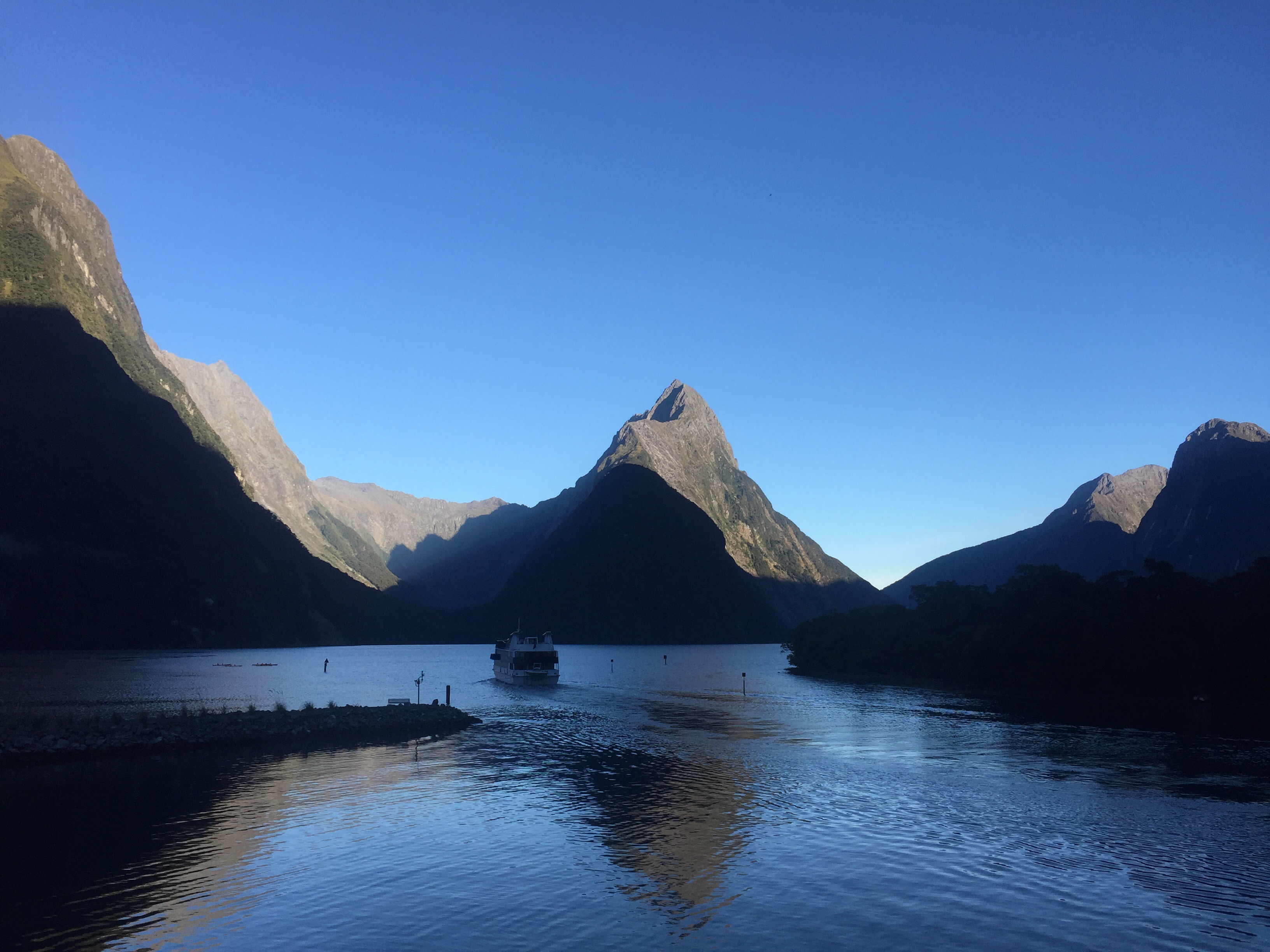
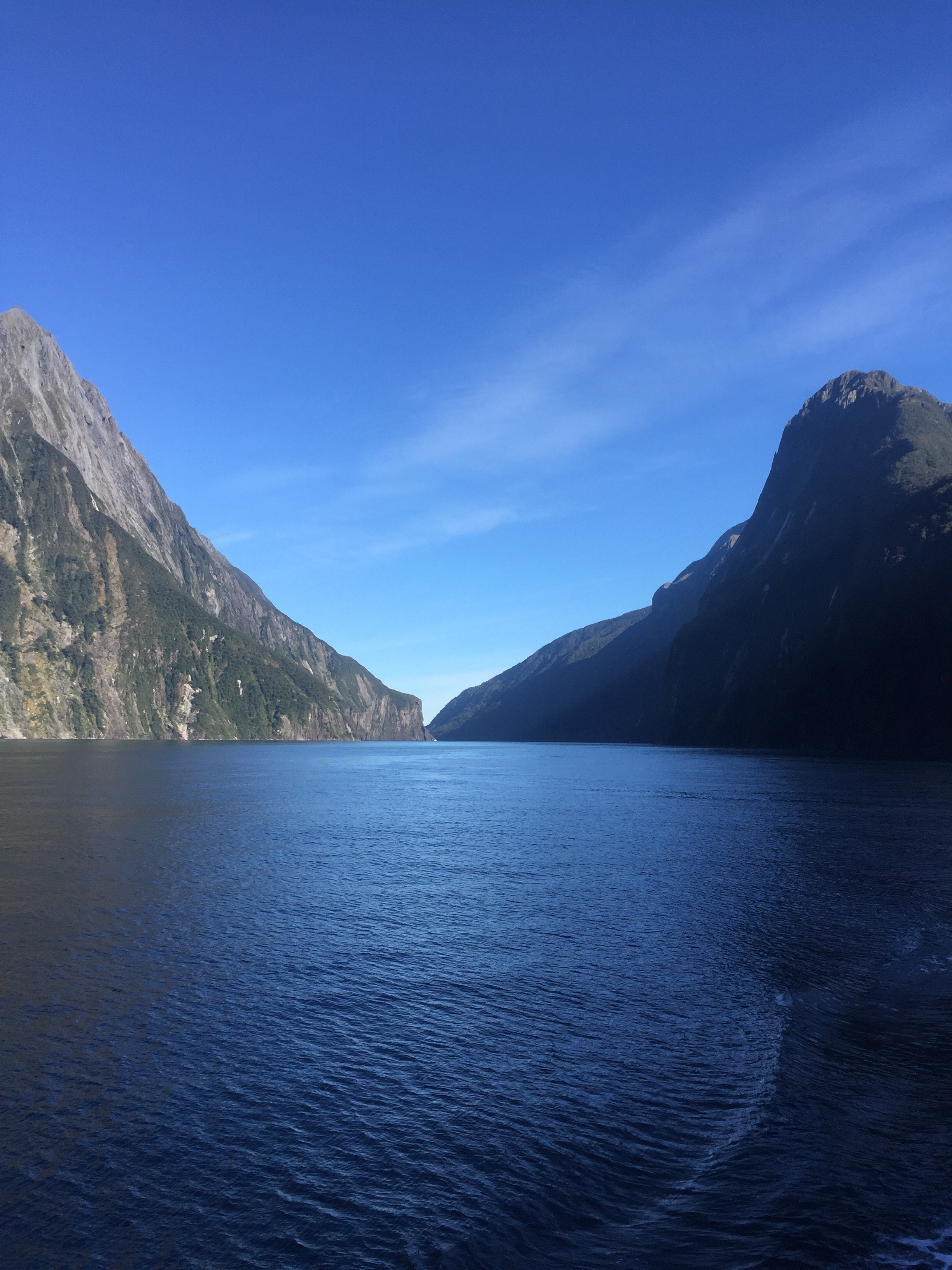
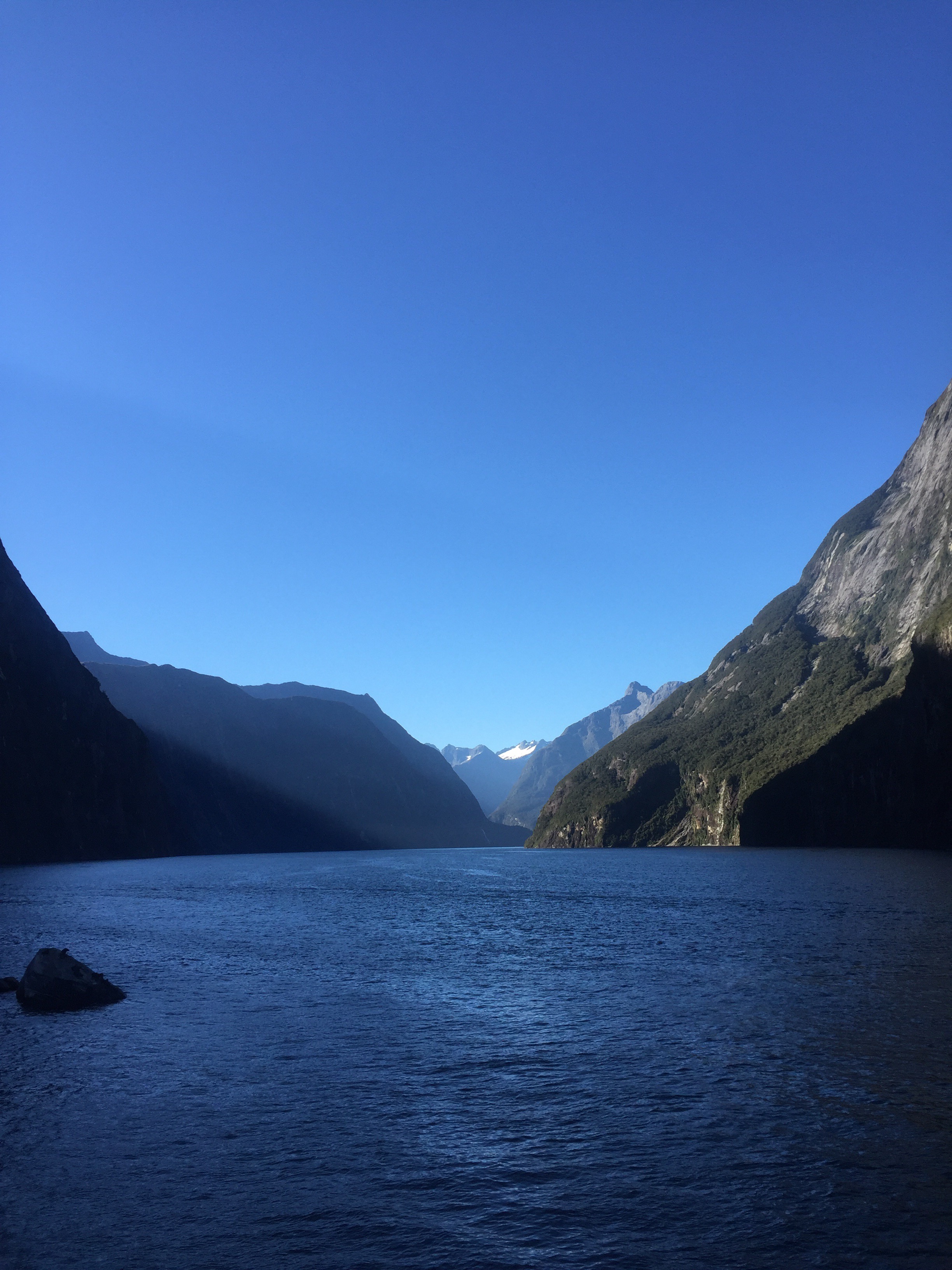
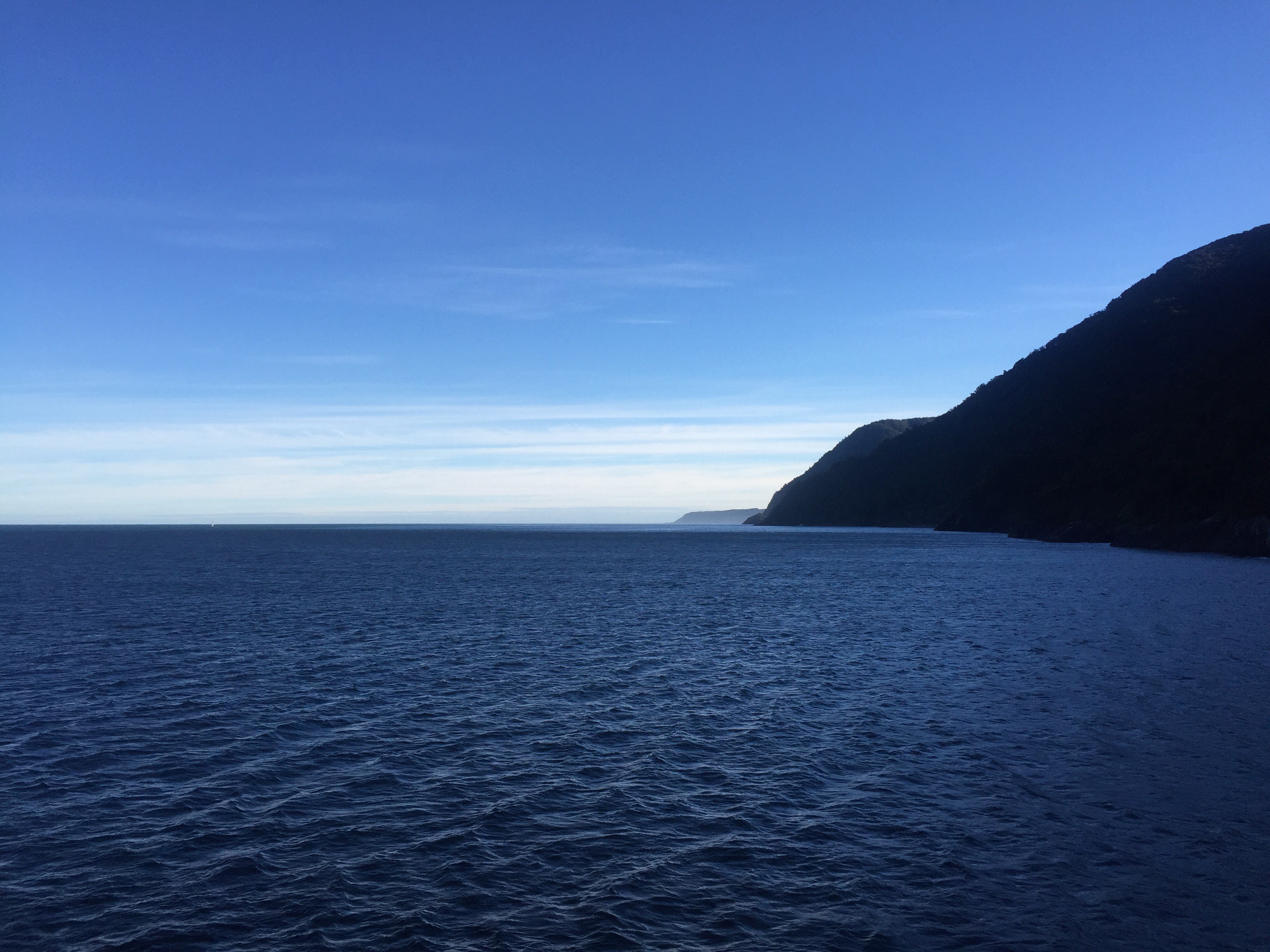
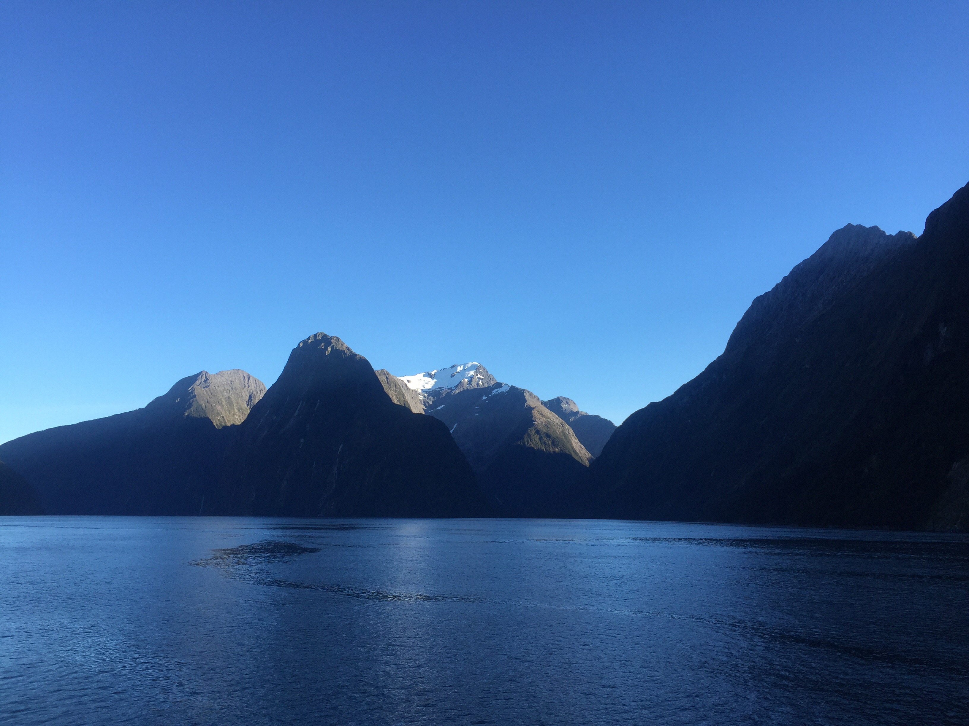
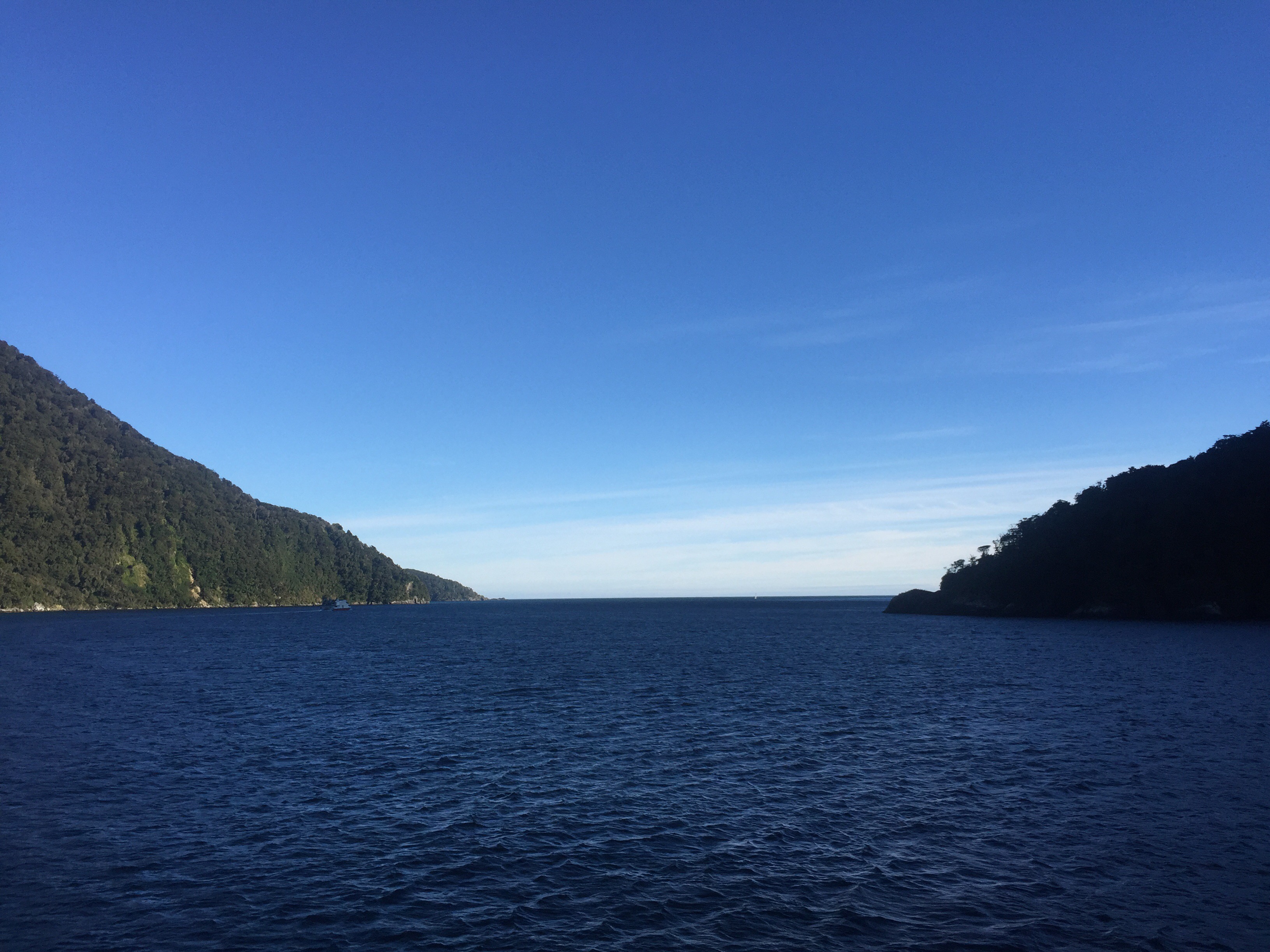
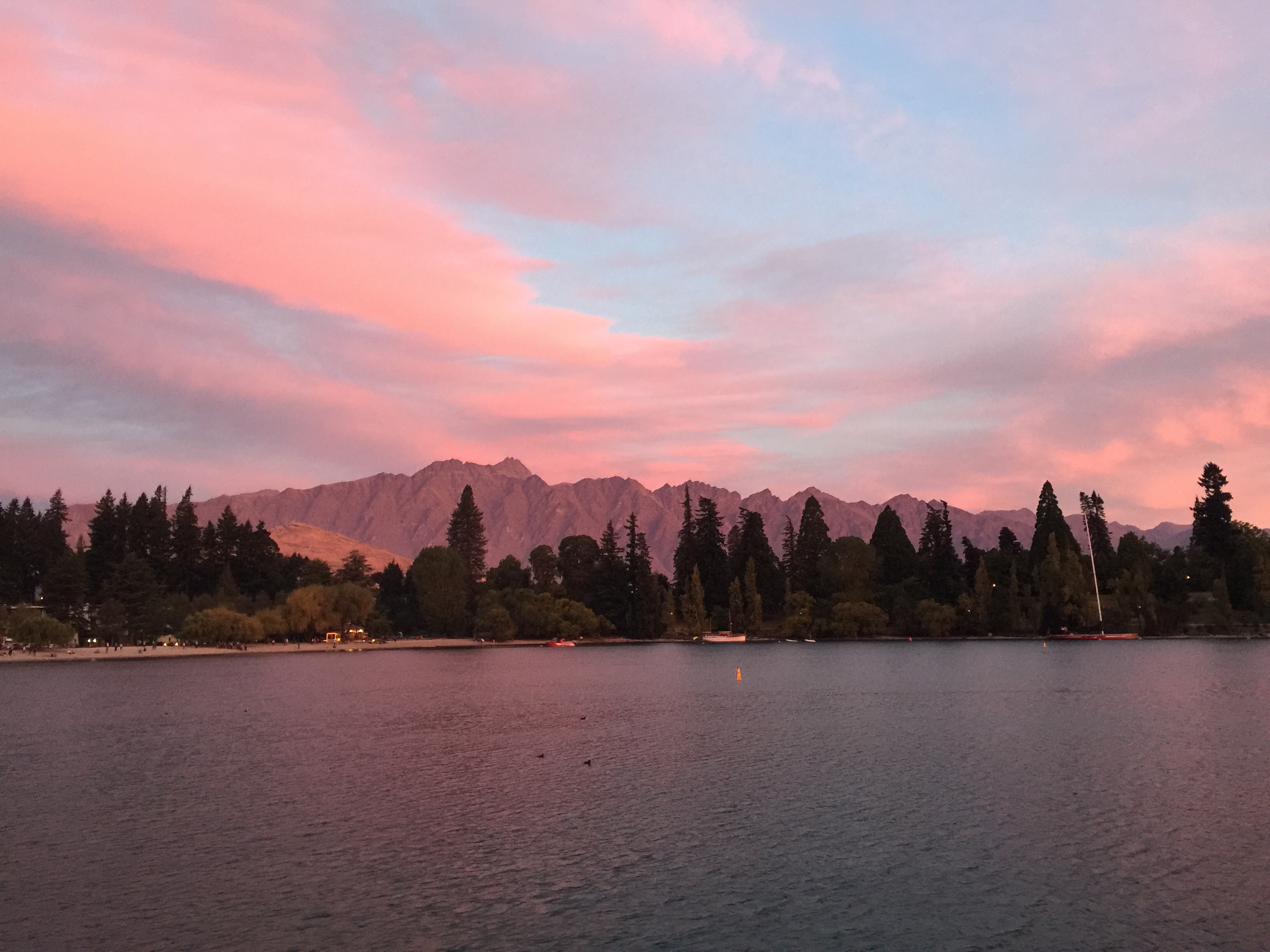
There was no walking involved on day five of our trip, just a boat cruise on the Milford Sound. The glorious weather we had for the last day of the walk continued. Everywhere you looked there were picture postcard opportunities – the Sound is stunning. The downside to this awesome weather is that there are not so many waterfalls to see but we saw a couple. We also saw some fur seals lying on the rocks.
We stood on the upper deck to start with taking in the breathtaking vistas. Once we reached the Tasman Sea and turned around we were on the sheltered side of the Sound where the sun hadn’t managed to get to yet making it rather chilly. We ended up going inside the boat but I went back up onto the deck a few times to take more photos – I couldn’t get enough of the scenery.


After our cruise we hopped onto the bus for our trip back to Queenstown – it was going to take four to five hours. We dropped one of the guides, Mark, off in Te Anau Downs – he was off to meet the next group that were starting the track. We then stopped in Te Anau for lunch before carrying onto Queenstown. We got a got a good run and were back in town by about 3.30pm.
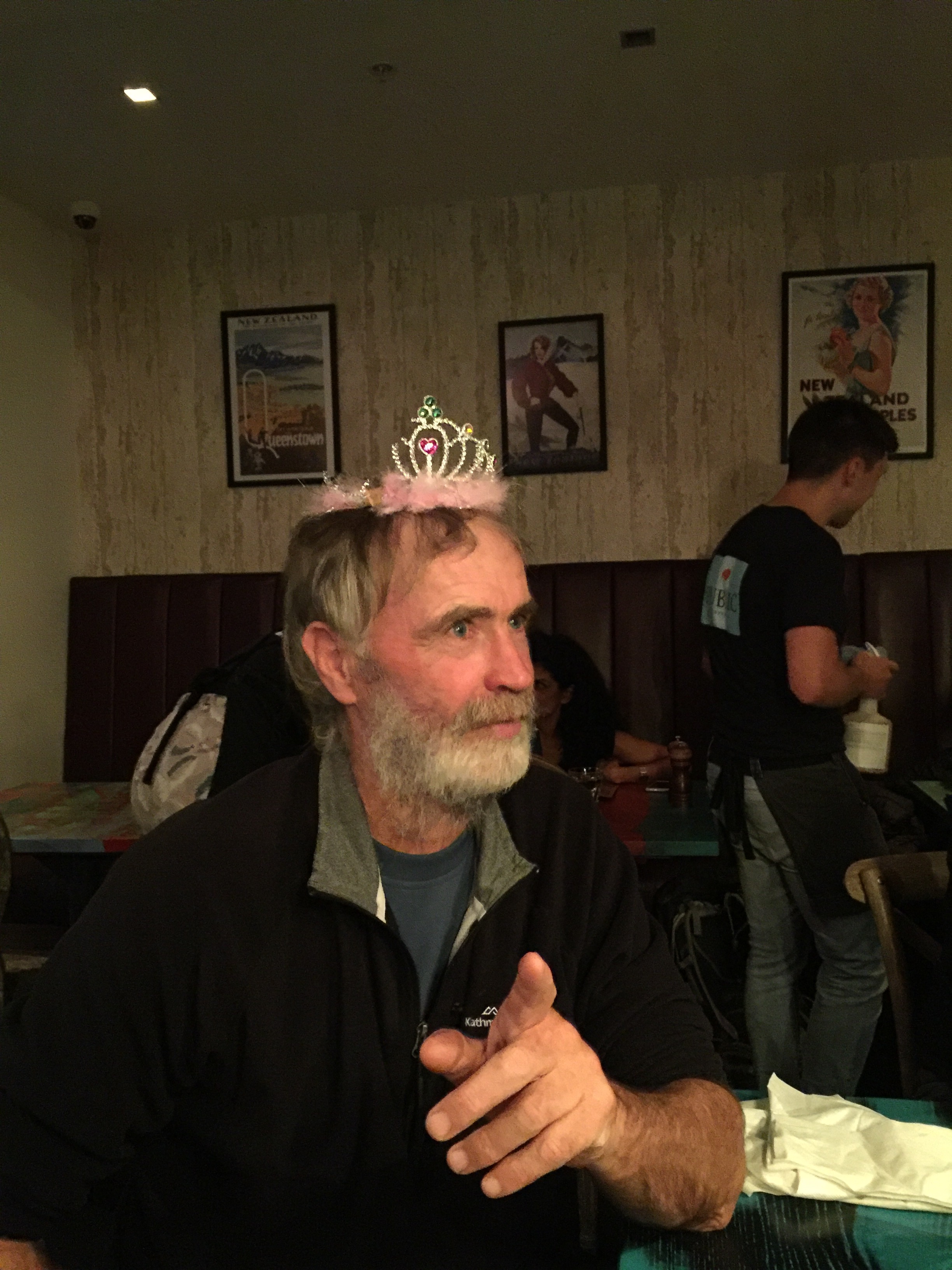
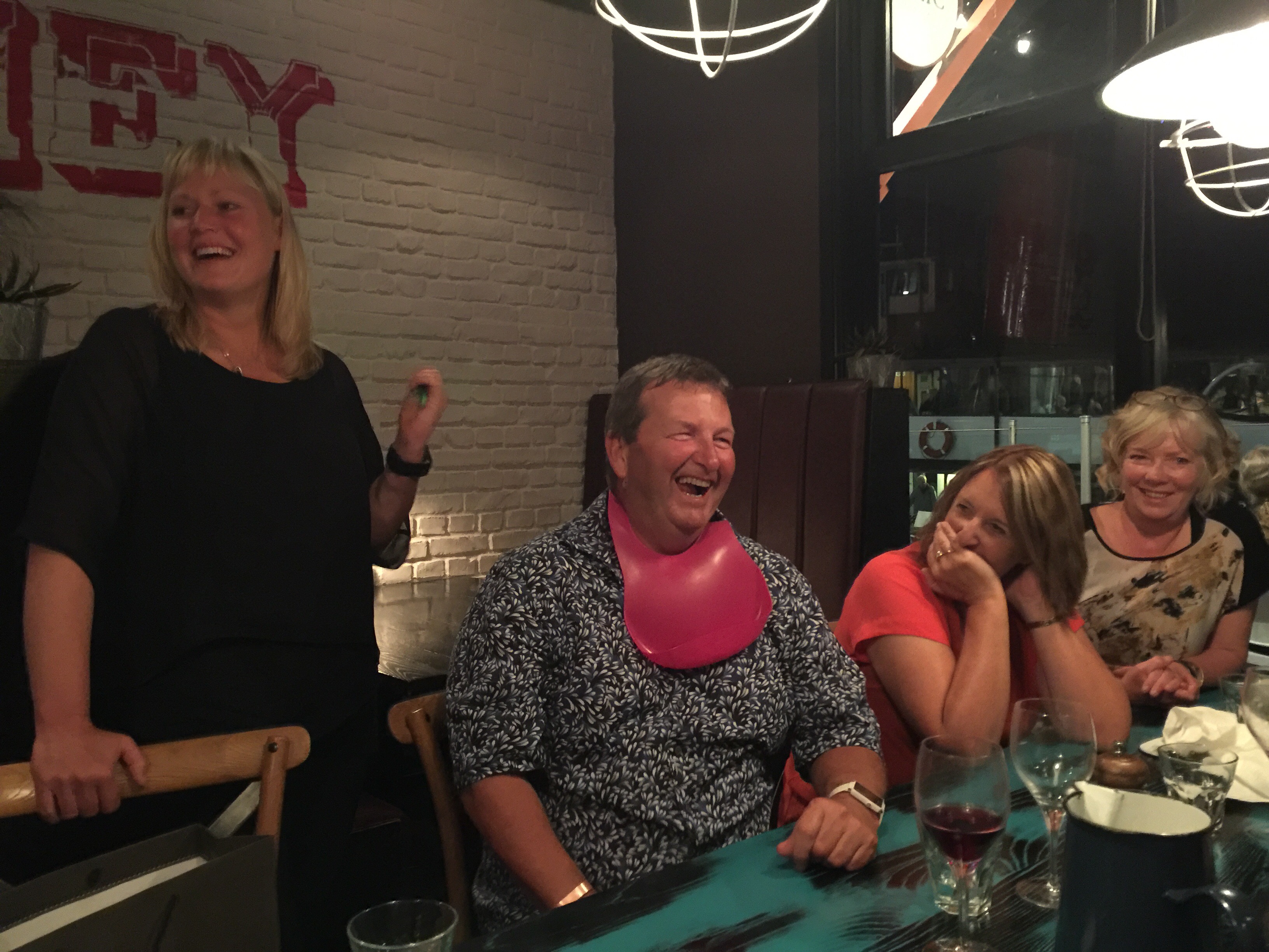
That night all sixteen of us enjoyed a meal together at The Public Kitchen in Queenstown. It was a lovely evening in Queenstown and it was hard to beleive that Auckland was being tormented by the Tasman tempest. Sheree had some funny prizes to give out to reward some of the shenanigans over the past few days.


It had been the most amazing trip. It was so well organised and run by Ultimate Hikes. The guides were all fantastic and shared their knowledge and passion for the outdoors with us enthusiastically. The group of people we did the walk with were all friendly and as enamoured with the beauty of the place we call home, as much as we were. I learnt a lot about a part of the country I had heard so much about but had never visited. If the Milford Track is on your bucket list then I highly recommend putting it on the top – it was simply awesome.
Tourism on the Edge
Looking Back
Adventuresome and rich overseas tourists, crossing the Tasman from Australia with the Union Steamship Company, were visiting Milford as early as 1874. Word of the splendid isolation and grandeur of the place spread rapidly thereafter following European explorations of the late 1700s. Visitors arrived by sea, as land routes were first unknown. But despite being named on early maps as Milford Haven, no one was tempted to permanently settle at the head of the isolated sound until the 1880s.
“Ah, my Milford haven may never be the same…..” Donald Sutherland diary 1888, commenting on the international publicity Sutherland Falls was receiving.
One man who visited Milford and stayed to appreciate the area’s wild beauty was Donald Sutherland. He made Milford his home in 1877. In 1880, while searching for an inland route to Queenstown with Mackay, paid in part with government funds, he came across the falls that now carry his name.
Living here all year round, without the modern highway and facilities today’s visitors and temporary residents rely on, required exceptional skills which for many years, few had. Donald Sutherland utilised the natural resources around him and obtained supplies from the Government lighthouse steamer, which called occasionally.
Despite the isolation and hardships of living at Milford in the early days, the pull of the visually stunning and spiritually inspiring terrain was powerful. People kept arriving, especially after the opening of the Milford Track. Even the government recognised the importance of tourism to New Zealand’s economy and as early as the 1900s was subsidising private enterprise into tourism ventures. Immense physical hurdles were overcome with the formation of the Milford Road and Homer Tunnel, first started with pick and shovel as a Depression work scheme in the 1930’s and finally completed in 1991.
Now the isolated edge has been broken through and thousands of visitors a day are able to visit Milford all year round; future visitor numbers are expected to increase.
Looking Forward
As the flow of time continues to change this place from one of isolation to one of high visitation, the challenge is to retain the spectacular landscape spirit of Milford / Piopiotahi so the future generation can experience it as we have today.
Tangata whenua – people of the land
It was the koko-takiwai (pounamu) and kakapo which primarily attracted Ngati Tahu to Fiordland. The koko-takiwai is favoured as a softer type of pounamu, more easily shaped into a finer quality of end product. It was therefore particularly sought after for the making of ornaments, such as hei-tiki. The area also offered many other mahinga kai to sustain parties on their arduous expeditions, including a range of Manu (birds), fish and kaimoana resources.
There are two principal trails linking the Fiordland coast with the rest of Te Wai Pounamu (the South Island). A sea route around the fiords links Piopiotahi to Murihiku, and was the main route by which the koko-takiwai gathered from the end of the fiords was transported. The inland route for transporting koko-takiwai by backpack lay over what is now known as the Milford Track. In addition, a trail from Martins Bay, up the Hollyford Valley and over into the Routeburn Valley to the pounamu source at the head of Lake Whakatipu-wai-maori, was commonly used by Tai Poutini iwi, who regularly traveled south via this route to obtain koko-takiwai.
Tauranga waka (landing places) occur up and down the coast, and wherever a Tauranga waka is located there is also likely to have been a nohoanga (fishing ground or kaimoana resource) with the sea trail linked to a land trail or mahinga kai reserve. Similarly, the lakes and the Waiau River were very important mahinga kai areas. The tupuna had considerable knowledge of whakapapa (genealogical decent), traditional trails and Tauranga waka, places for gathering kai and other taonga, ways in which to use the resources of the lakes, rivers and coast and tikianga (protocols) for the proper and sustainable utilisation of resources. All of these values remain important to Ngai Tahu today.
Particular stretches of the coastline have their own traditions. For example, the visit of Tamaahua to Piopiotahi (Milford Sound) in search of Poutini, who had absconded with his wife Waitaiki, is linked to the creation of pounamu further north on Te Tai Poutini (the West Coast). The koko-takiwai which is found in Piopiotahi has its basis in a visit to Piopiotahi by the waka Tairea. A woman, koko-takiwai, and her children, known as Matakirikiri, were left behind by the Tairea and were turned into Pounamu.
Maori legends about Milford Sound
Milford Sound was known to the Maori, who named it Piopiotahi – for the single piopio, a now extinct bird. The name derives from a legend about the last endeavour of Maui-tikitiki-a-Taranga, the great Polynesian demi-god. Maui set off from Hawaiki accompanied by a piopio, in an attempt to gain immortality for mankind. To acheive this goal, he had to enter the womb of Hinenui-te-Po (the goddess of death), travel through her body and emerge from her mouth. After Maui’s failure and death, the piopio who had witnessed the tragedy, fled south to Milford Sound to mourn for the death of its mate.
Landscapes
New Zealand is not known as ‘the shaky isles’ for nothing. Every year thousands of earthquakes, most not felt, occur as the massive Pacific plate and the Indo-Australian plate jostle against each other. Stressed to breaking point, rocks within the plates eventually give way with a jolt, relieving the stress but making the earth shake, with occasionally catastrophic effects.
New Zealand earthquakes are caused in a more complex fashion than in many other parts of the world. There are two processes at work: one of the plates sinking under the other (subduction); and the plates sliding sideways past each other. The Alpine Fault results from the latter process. In New Zealand’s main seismic region, the Indo-Australian plate rides over the Pacific plate, but from Fiordland south the reverse happens.
A shock of magnitude 6 or above occurs on average once a year in New Zealand, magnitude 7 once in a decade, and magnitude 8 only once a century.
On average Fiordland experiences one earthquake a day, sometimes more, and most we cannot feel.
Earthquakes are caused when the movement of the plates builds up tension, which on release causes a shock wave or jolt.
The Alpine Fault
The Alpine Fault, which runs for 600km down the spine of the South Island, entering the Tasman sea at the mouth of Milford Sound, is one of the world’s major geological features. It’s the “on-land” boundary of the Pacific and Australian Plates.
This fault has ruptured four times in the past 1000 years, each time producing an earthquake of about magnitude 8. Approximate rupture dates are 1717 AD, 1620 AD, 1450 AD and 1100 AD. Horizontal movement of the Alpine Fault is about 30 metres per 1000 years – very fast by global standards. Each time it has ruptured, it has also moved vertically, lifting the Southern Alps in the process. In the last 12 million years the Southern Alps have been uplifted by an amazing 20 kilometres, and it is only the fast pace of erosion that has kept their highest point below 4000 metres. The glaciers and rivers have removed the rest of the material and spread it out across the lowland plains or onto the sea floor.

Ecology
The high rainfall experienced in Fiordland helps to create a unique marine environment. In this high rainfall zone, a large volume of freshwater flows in to meet up with the saltwater in Milford Sound.
Being less dense, fresh water forms a 5 centimetre to 10 metre layer of fresh water on the surface of the saltwater. Tannins, washed out of the vegetation on land, stain the water the colour of weekly brewed tea. This creates a dark layer on the surface that cuts down the amount of light entering the sea water, restricting most of the marine life to the top 40 metres (light levels at 10 metres in the fiords are equivalent to those at about 70 metres in the open sea). This band (below the freshwater layer) is calm, clear and relatively warm and is home to sponges, corals and fish of sub-tropical, cool water and deep water varieties.
Certain animals found on the continental shelf at depths of 100 to 200 metres turn up commonly in the fiords in the water less than 30 metres. They include red and white hydrocorals, shrimps, sponges, sea pens starfish and orange line perch.
The fiords support one of the world’s largest populations of black coral trees (about 7 million colonies), with some of them up to 200 years old.
The fiords are also home to Branchiopoda; clam-like animals that have remained relatively unchanged for over 300 million years.
Although the fiords extend to depths of over 400 metres, life peters out quickly in the gloomy depths.
Bottlenose dolphins (aihe), New Zealand fur seals (kekeno), Fiordland crested penguins (tawaki) and little blue penguins (korora) are resident in the fiords.
Dolphins
You may see different species of Dolphin in Milford Sound. Bottlenose Dolphin (Tursiops truncatus) are the most common dolphin seen. The smaller Dusky Dolphin (Lagenorhychus obscurus) are sometimes seen as well.
Seals
Once hunted to near extinction, the New Zealand Fur Seal (Arctocephalus forsteri) can now be found along most rocky coastlines in southern New Zealand and can usually be seen in Milford Sound. It is thought that many of the seals at Milford are young males.
Penguins
The Fiordland Crested Penguin (Eudptyes pachyrhynchus) or Tawaki is only found along the Fiordland coastline, it is one of the rarest penguins in the world. They are recognised by a sulphur yellow eyebrow which extends over the eye to the back of the head where it develops into a plume. At times of the year they are seen for short periods in Milford Sound.
Black Coral
Black Coral (Antipathes fiordensis) is endemic to Fiordland and grows at depths as shallow as 5 metres, but grows especially well at depths of about 15 metres where it crowds the near vertical walls. It forms colonies that in places resemble small to medium sized trees. Black coral grows less than 20 millimetres a year so trees over five metres tall are estimated to be over 300 years old. Black corals are actually misnamed being neither black nor true coral. Living trees may be yellow, orange, green or white. Only dead skeletons are black.
Milford Road
The Milford Road eventuated as one of the unemployment schemes set up by the government during the depression years of the 1920s. Beginning in 1929, 200 men with picks, shovels and wheelbarrows formed a new road to Te Anau Downs Station from the small town of Te Anau.
Workers carried their gear and straw mattresses up to the road workers camps. “The only tools the road gangs had were picks, shovels and crowbars. While four of the gang did the picking and shovelling into wheelbarrows, the other two wheeled the spoil away to build up the foundations of the road. Extra barrows were provided so that there was no standing around waiting for your barrow to be filled.” The workers were paid 14 shillings a day for six days of the week, but if it was wet there was no pay at all!
The roadmen continued the road through to reach the Divide at the head of the Eglinton Valley in 1934. In October 1933 engineer John Christie, an experienced climber, was chosen to lead a party of ten men to carry out a reconnaissance survey of the Hollyford and Cleddau Valleys and survey the proposed Homer Tunnel. The reconnaissance survey had been completed in the remarkable time of only seven months (from October 1933 to April 1934). Christie remarked later that “it was really a two year job. But you know how it is, the politicians think about it for a long time and then want it done yesterday. So we did it.”
In November 1934 engineer Harold Smith (Smithy) was sent with a party of 25 men to begin work at the Milford end of the road. Because there was no accomodation at Milford, Smithy and ten men walked the Milford Track beforehand to put up tents prior to the arrival of the others by sea. There was still no wharf at Milford so the party set about building one, also a wharf shed, a water reservoir and an access road to the hotel. They then carried out a systematic survey of the road right up to the future tunnel, pegging out the road and the bridge crossings all the way. This job took until January 1935 to complete and during this time rats got into their precious flour supply.
Road construction continued and the Milford crew met up with the Homer crew in 1940 when the tunnel had been pierced by the tunnellers working from the Homer End.
The Homer camp for the construction of the tunnel was in the “safe area”, out of reach of avalanches, about 500 metres short of the tunnel. Winters were particularly harsh with snow, ice and avalanches and the men living in only tent style huts. The standard hut had a wooden floor and wooden boarding halfway up the wall. The remainder including the roof was just canvas, or if you were lucky it was topped with corrugated iron.
Homer Tunnel
A tunnel beneath the Homer Saddle was proposed as early as 1889 by William Henry Homer, the discoverer of the saddle. In January, Homer and his mate George Barber explored the upper Hollyford Valley and camped beside the Hollyford River, where Homer prophesied that some day a road, or possibly even a railway, would come via the Eglinton and Hollyford Valleys.
It took nearly half a century before the decision was finally made to proceed with “Homer’s Tunnel”.
On 4th July 1935 Martin (“Digger”) Scully and a party of seven men trundled their heavy wooden wheelbarrows up the valley. Then, armed with only picks and shovels they began cutting their way through 100 metres of loose scree to approach the solid rock wall, shoring up the scree sides with timber on the way. It was slow, tedious work under wet, cold conditions with the ever present threat of an avalanche from above. But by early 1936 they reached the cliff face and went underground.
Initially the tunnel was excavated “24 feet wide by 17 feet high” with an arched roof and a steep 1 in 10 gradient towards Milford. Then they struck an unexpected problem. Water was pouring through the roof and this had to be pumped out as fast as it came in, otherwise the downward trending tunnel would fill up. So the dimensions were reduced considerably to “14 feet by 9 feet”, with the idea of punching a smaller tunnel through more quickly and getting the water to drain out the far end. The enlarging could come later.
Drills, operated by compressed air, were used to bore the holes in the rock for the gelignite. Then after the drill holes were loaded with explosive the charges were fired electrically from a remote control panel.
A light railway was built into the tunnel and after dynamiting, the shattered rock was scraped up into buckets and loaded into dump trucks that were pulled uphill to the entrance by an electric winch. A diesel locomotive then took the trucks to be tipped for the foundations of the approach to the tunnel.
By 1940 the tunnel had been pierced by the tunnellers working from the Homer end. The problem now was how to remove the rock debris from the Milford end. A huge bulldozer was brought by boat to Milford.
Work on the tunnel ceased in 1942 due to World War II. The unfinished tunnel was opened up to Milford Track walkers in 1947 to enable a round trip back to Te Anau. Work on the tunnel was not recommenced until 1951. The tunnel was finished in 1953 and opened officially to traffic in 1954.
During the construction of the tunnel there were three fatalities due to avalanches.
On 6th July 1936 Leigh Overton was in the crib house at the entrance to the tunnel when without warning at all the wind blast of an avalanche hit the hut. It took over an hour before the men found Overton’s badly mutilated body pinned under the remains of the crib house.
On 4th May 1937 Donald Hulse, the engineer in charge and Thomas Smith, the tunnel overseer were killed by an avalanche that swept away the building they were in.
After the double tragedies a concrete shelter extension was built straight out from the tunnel. Although the new tunnel portal was made of heavily reinforced concrete, it was crushed completely flat by an avalanche in 1945.
