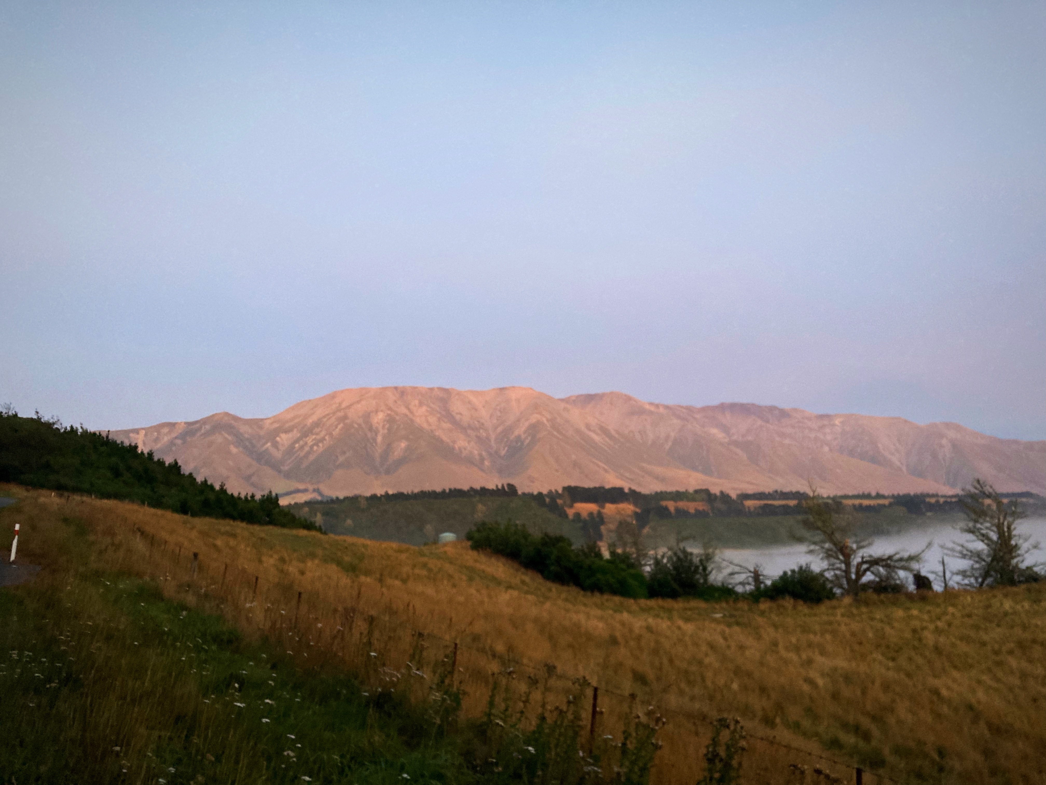
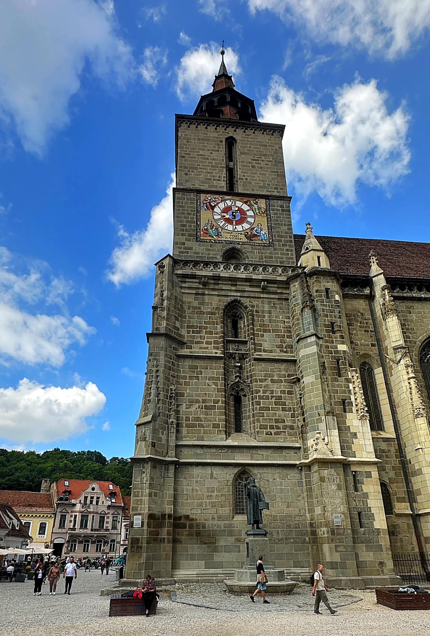
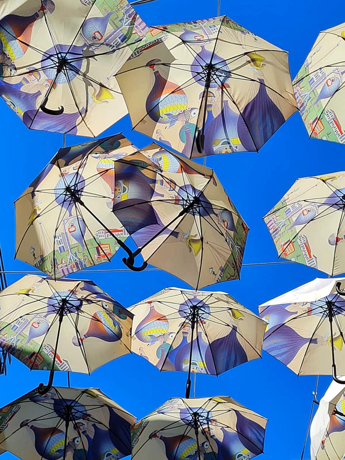
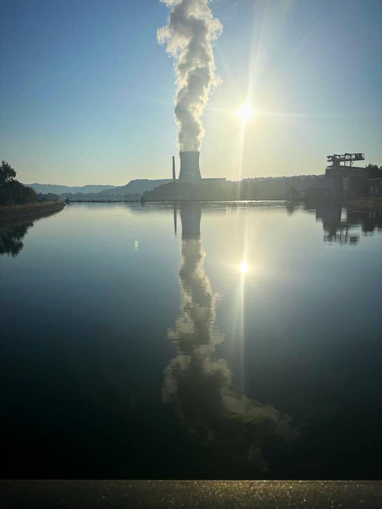
We left Christchurch Saturday morning and headed over Arthur’s Pass to the West Coast. Very lucky with a bluebird day
Arthur’s Pass, a mountain road and railway which traverses across from the east to the west of the South Island (and vice versa). The Southern Alps is the glorious mountainous seam which splits New Zealand’s South Island, and Arthur’s Pass crosses them to connect Canterbury with Westland.
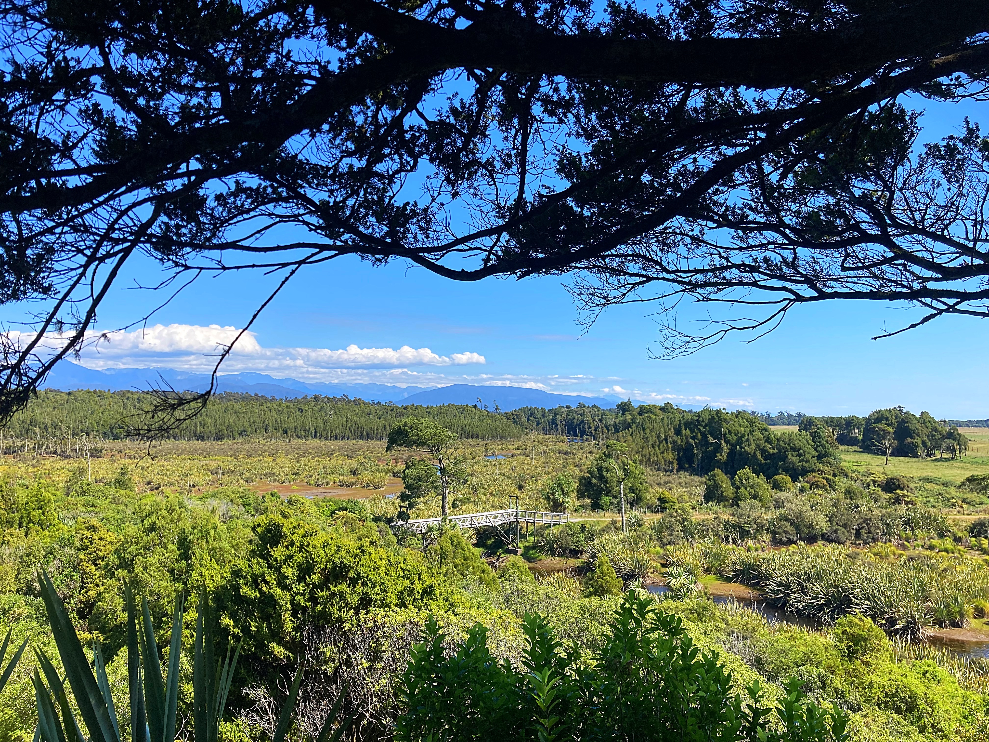
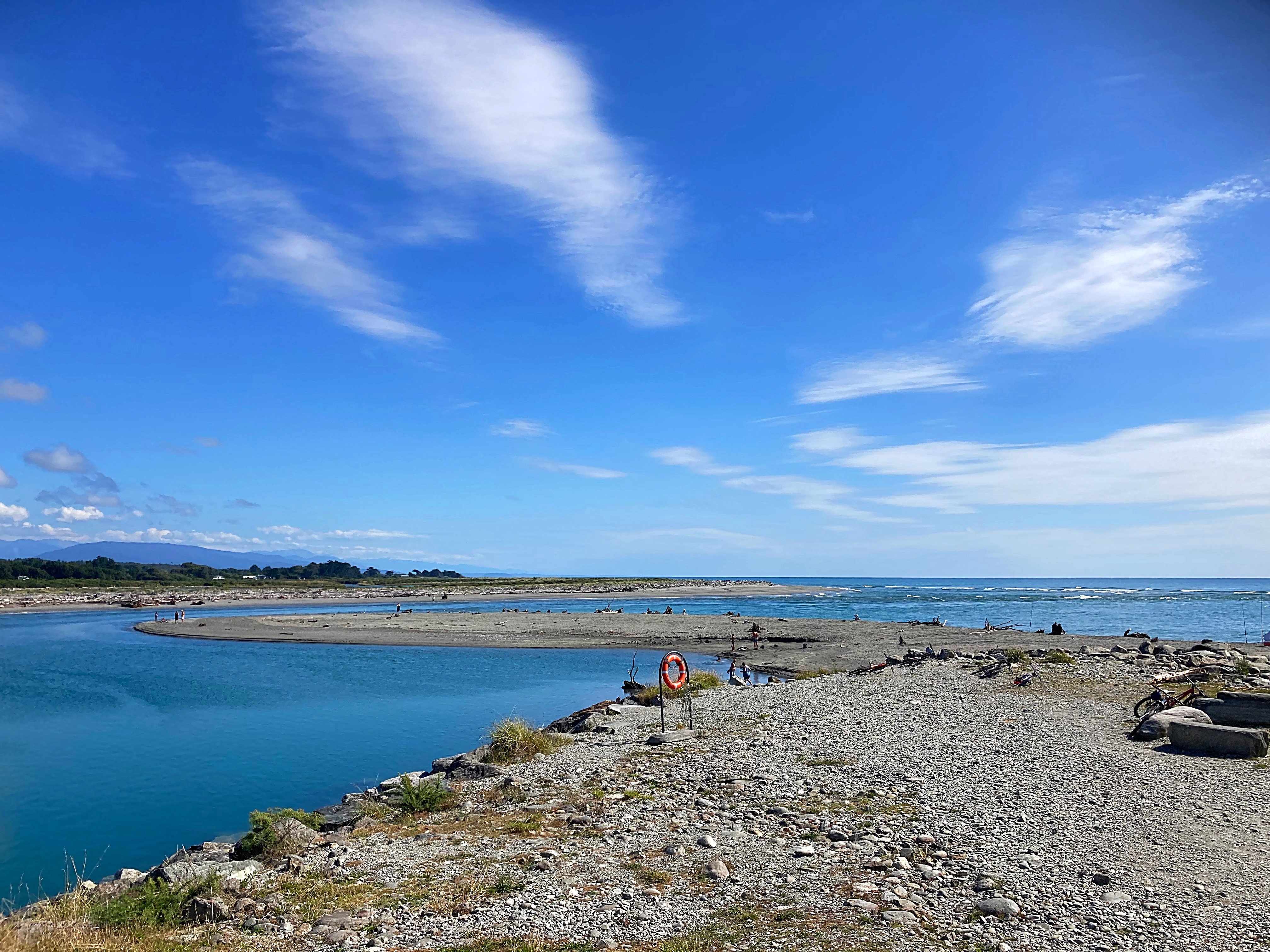
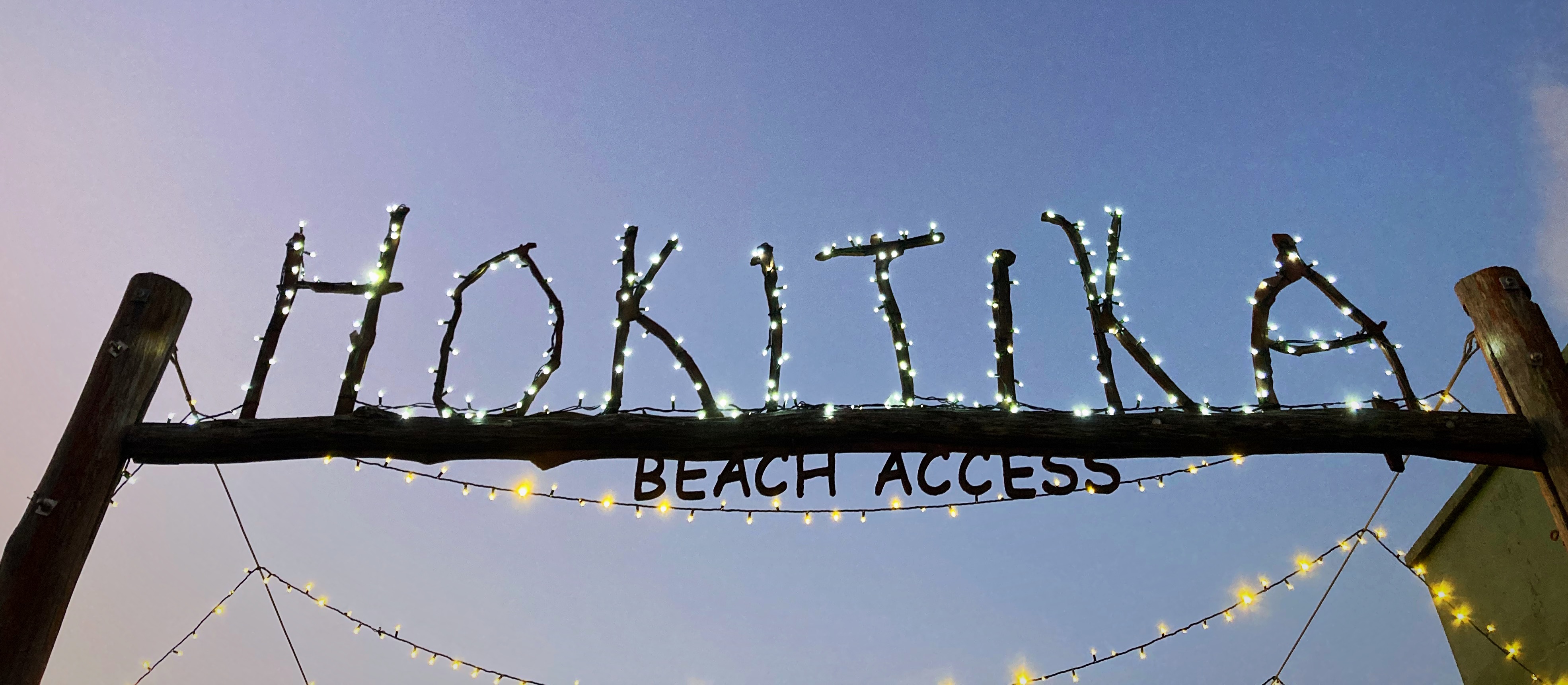
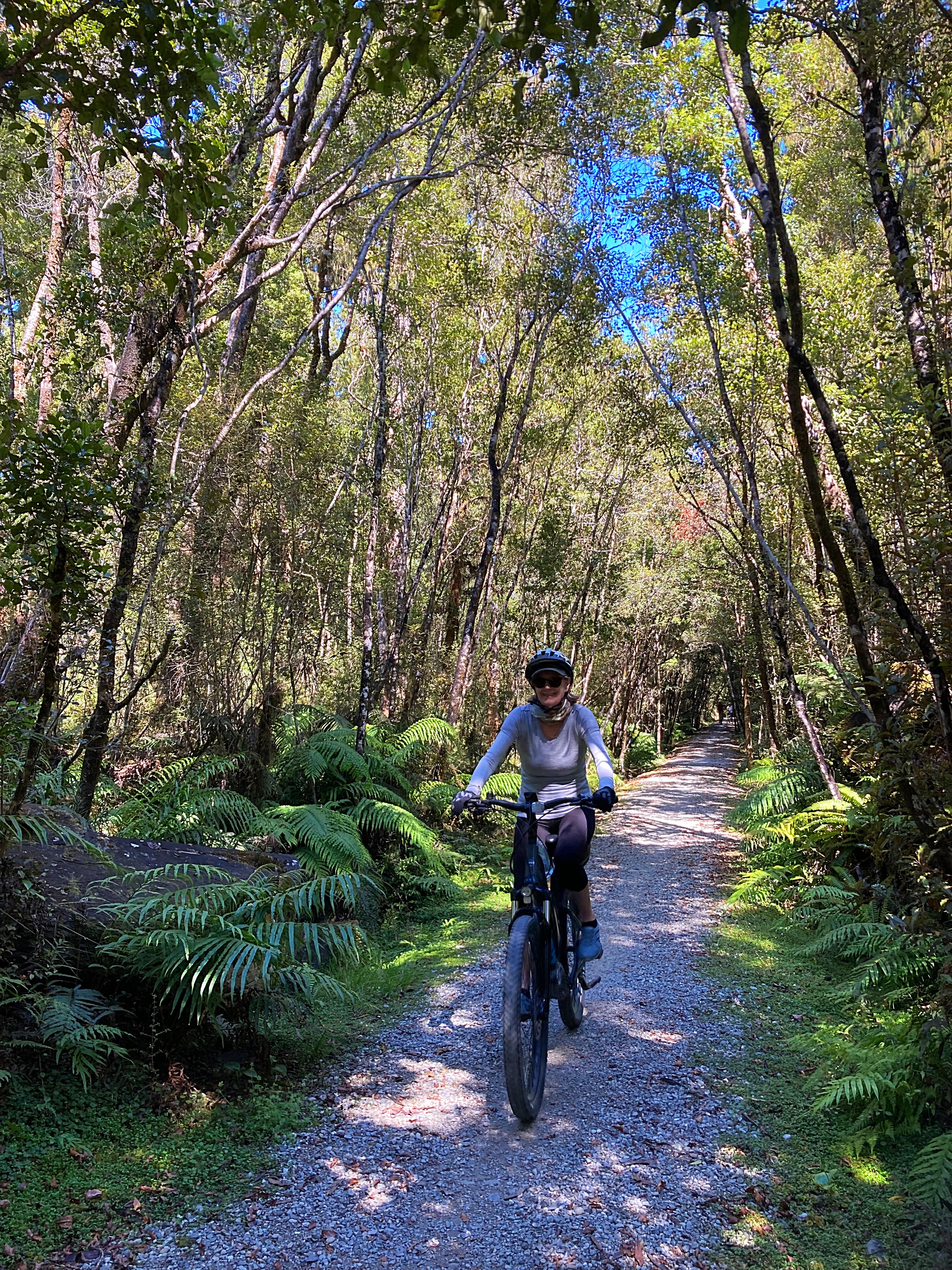
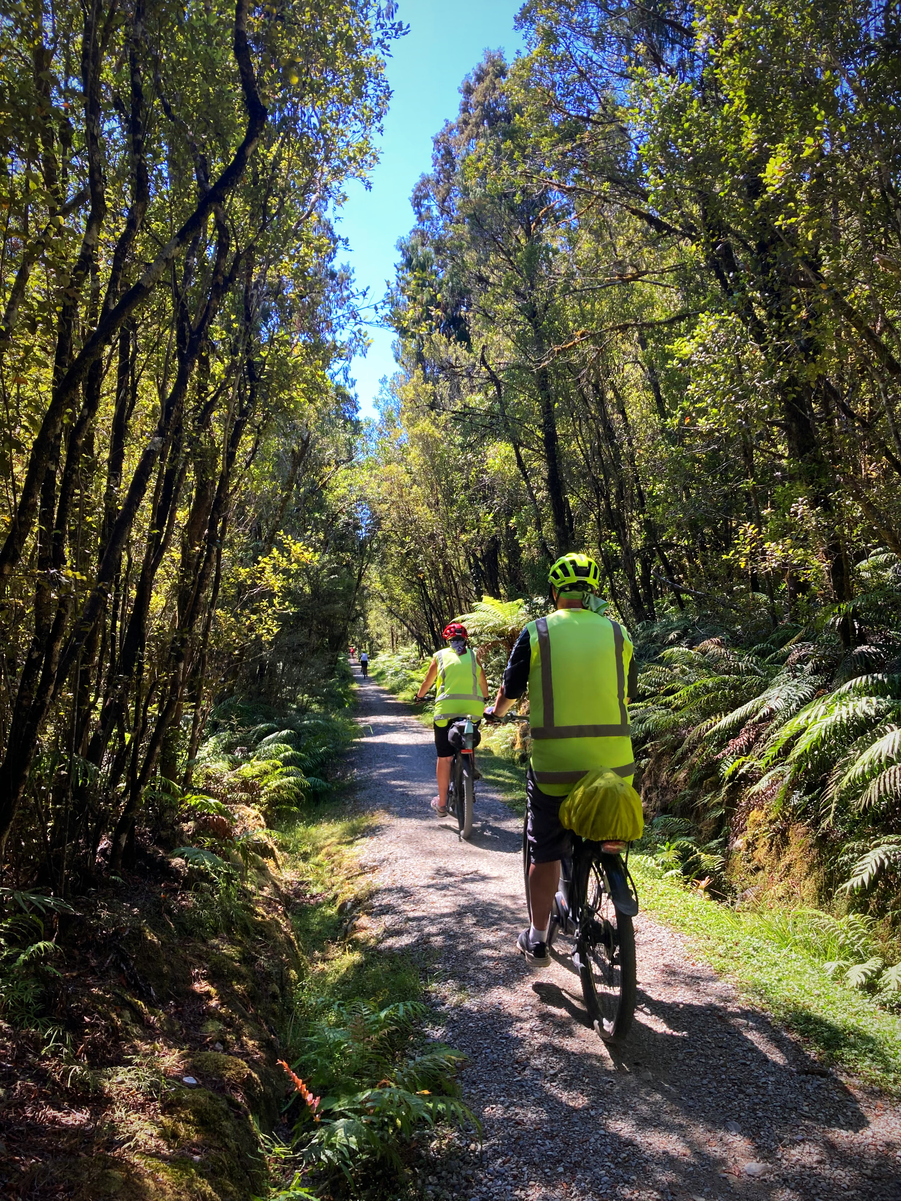
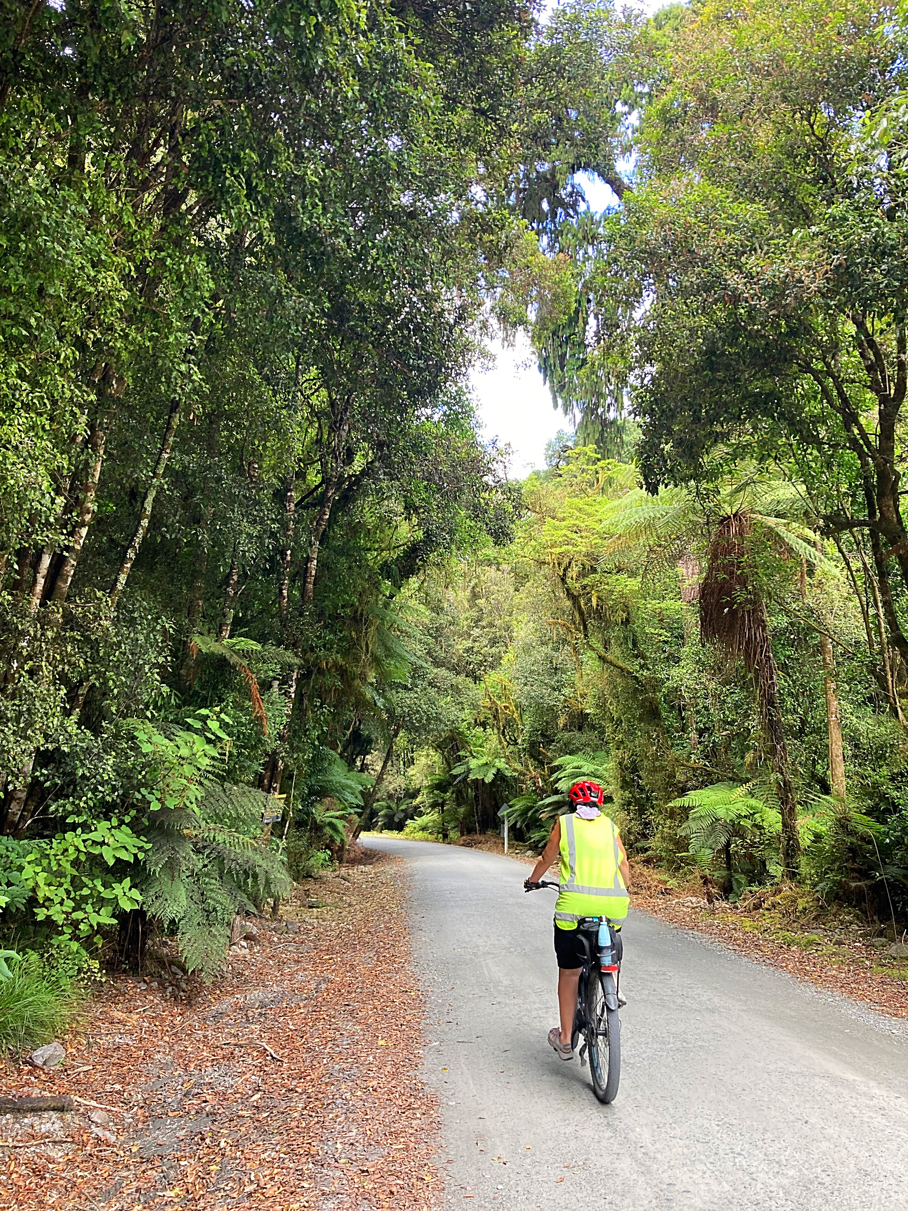
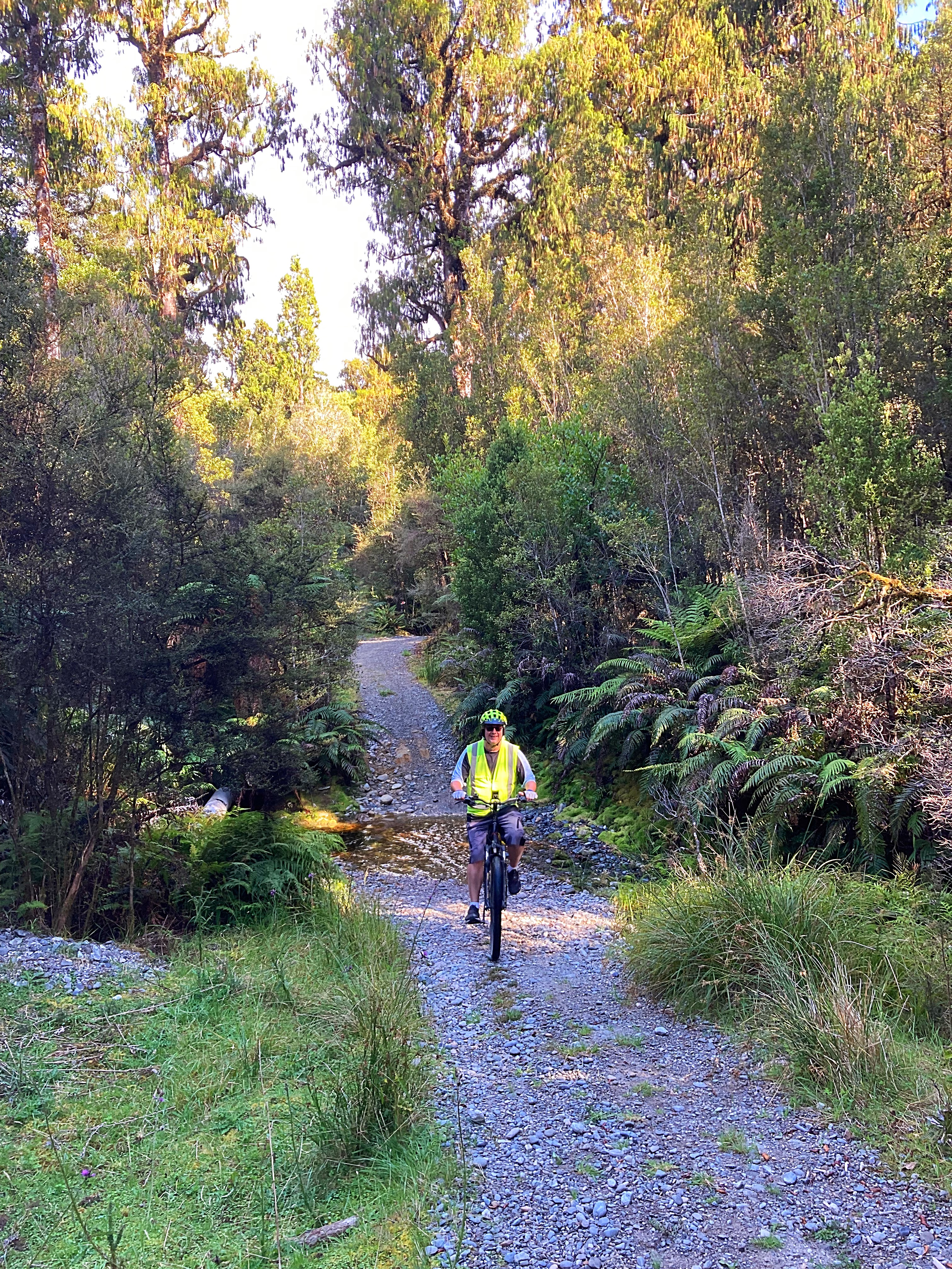
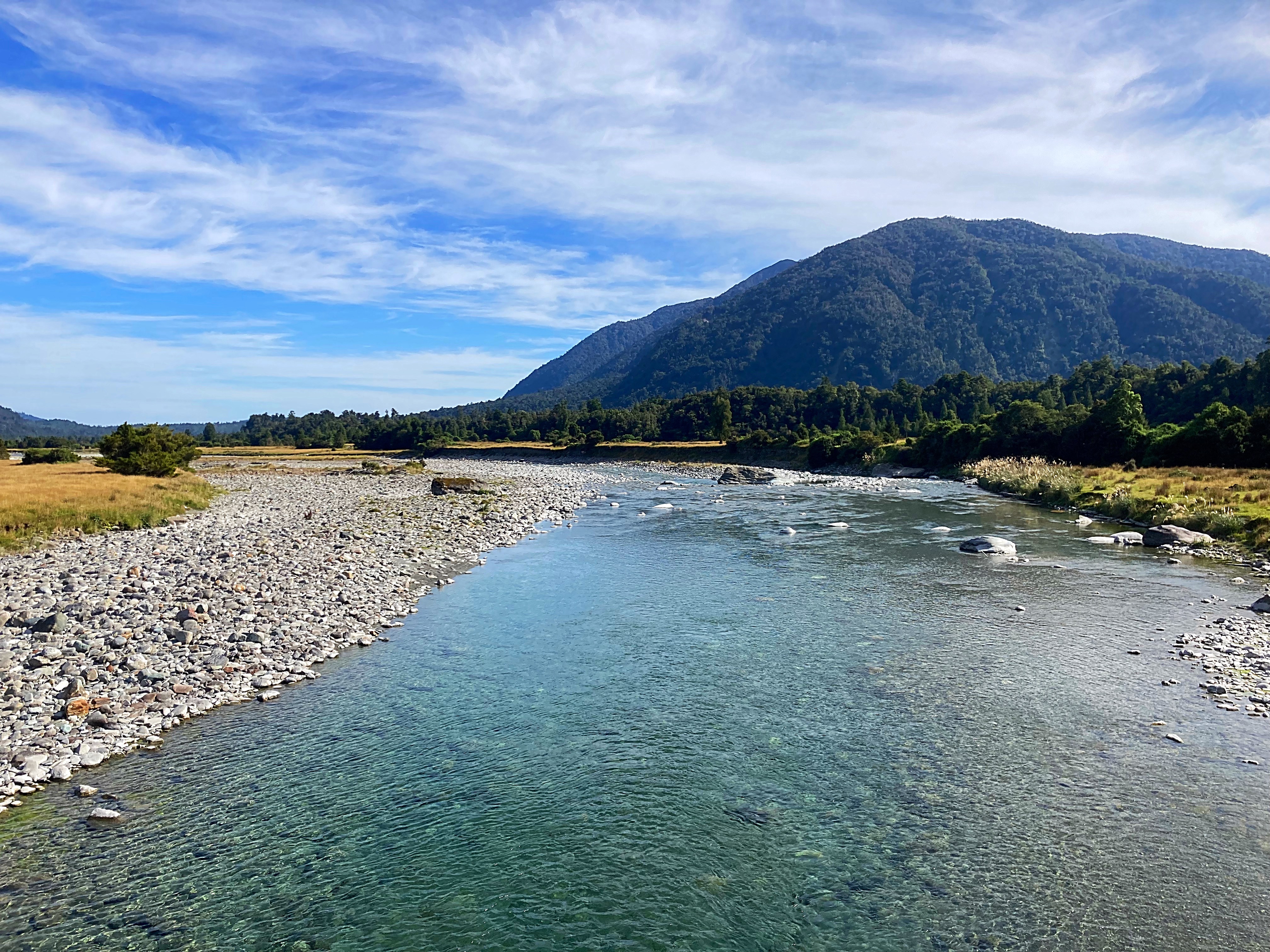
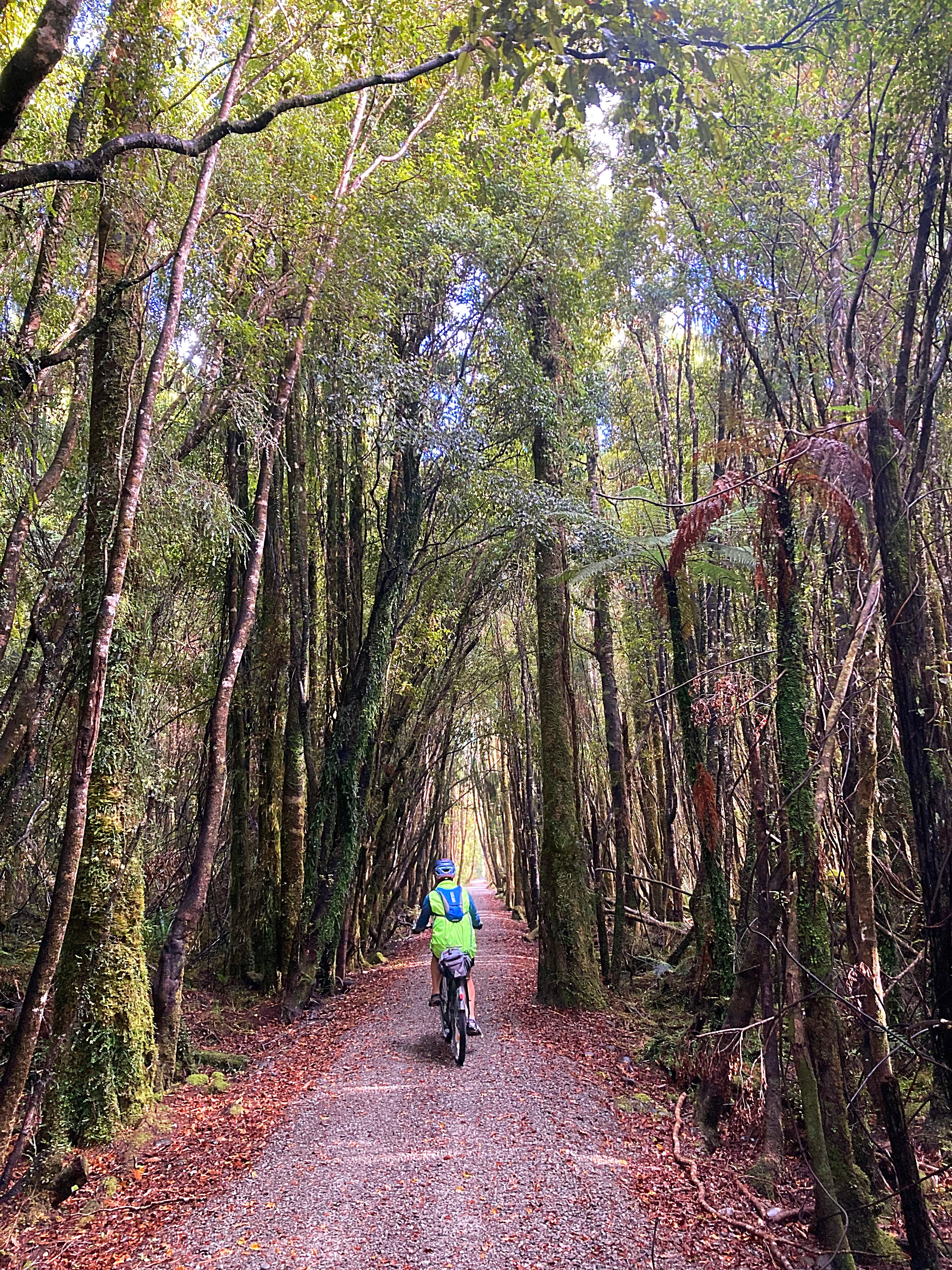
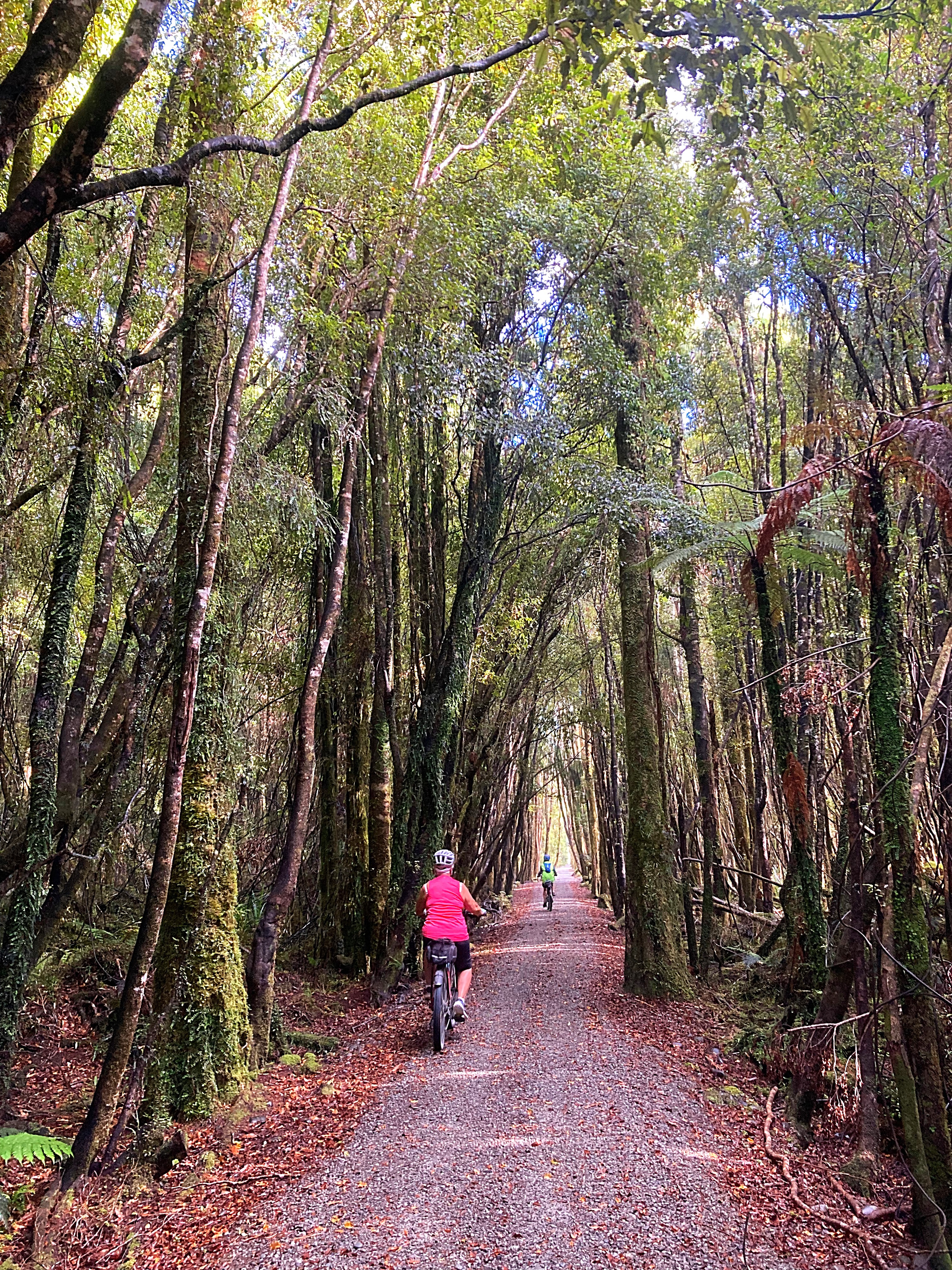
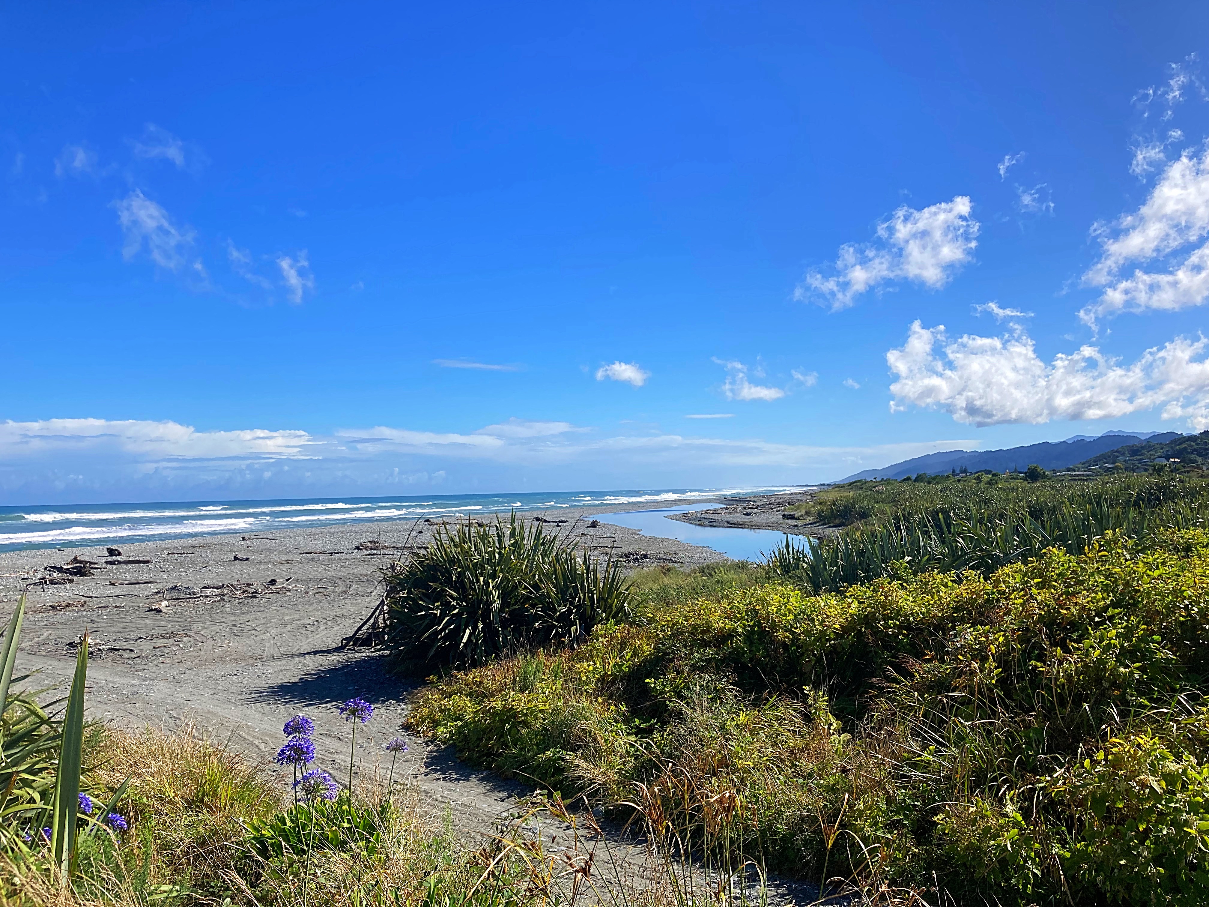
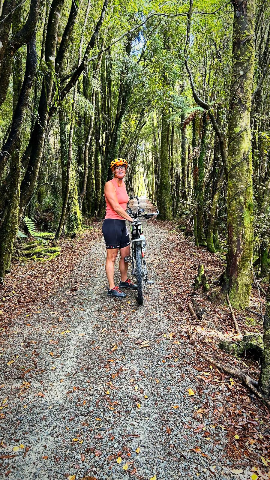
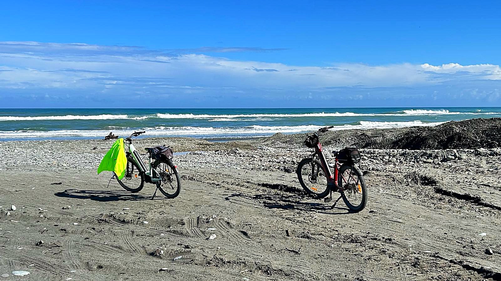
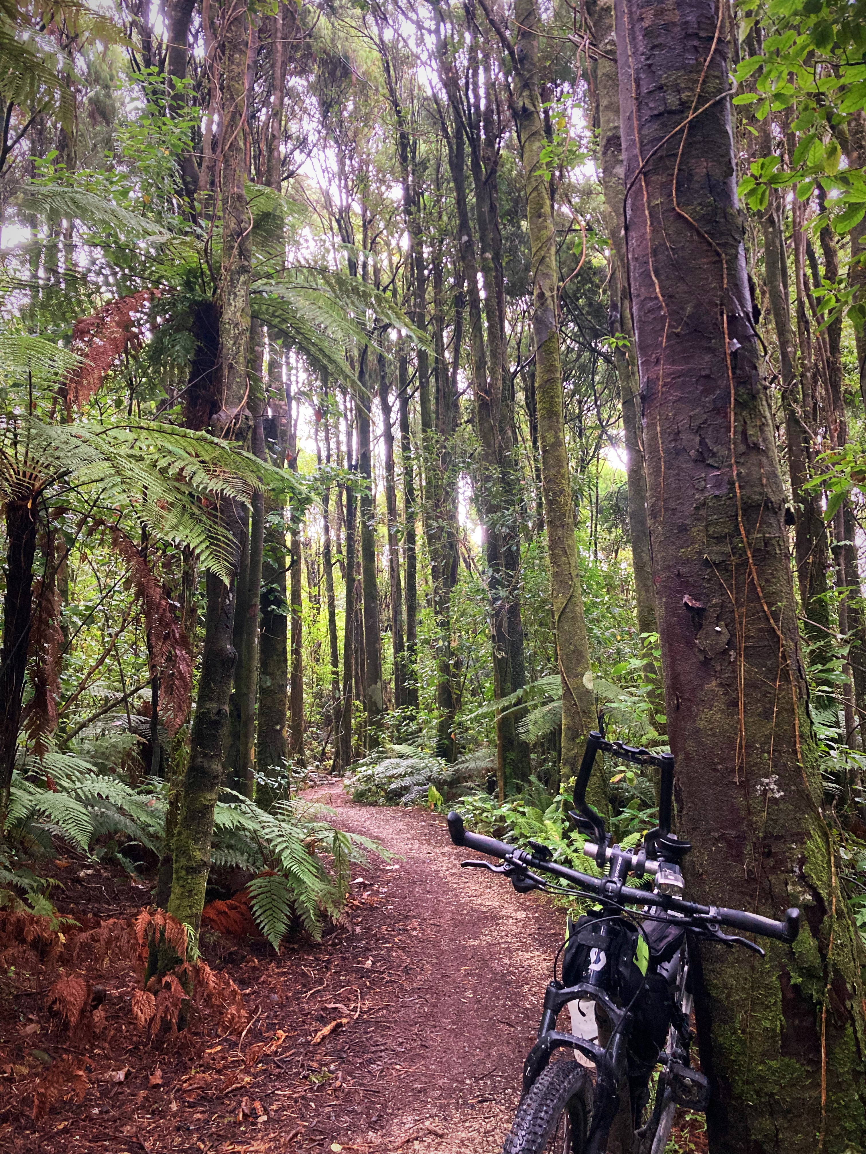
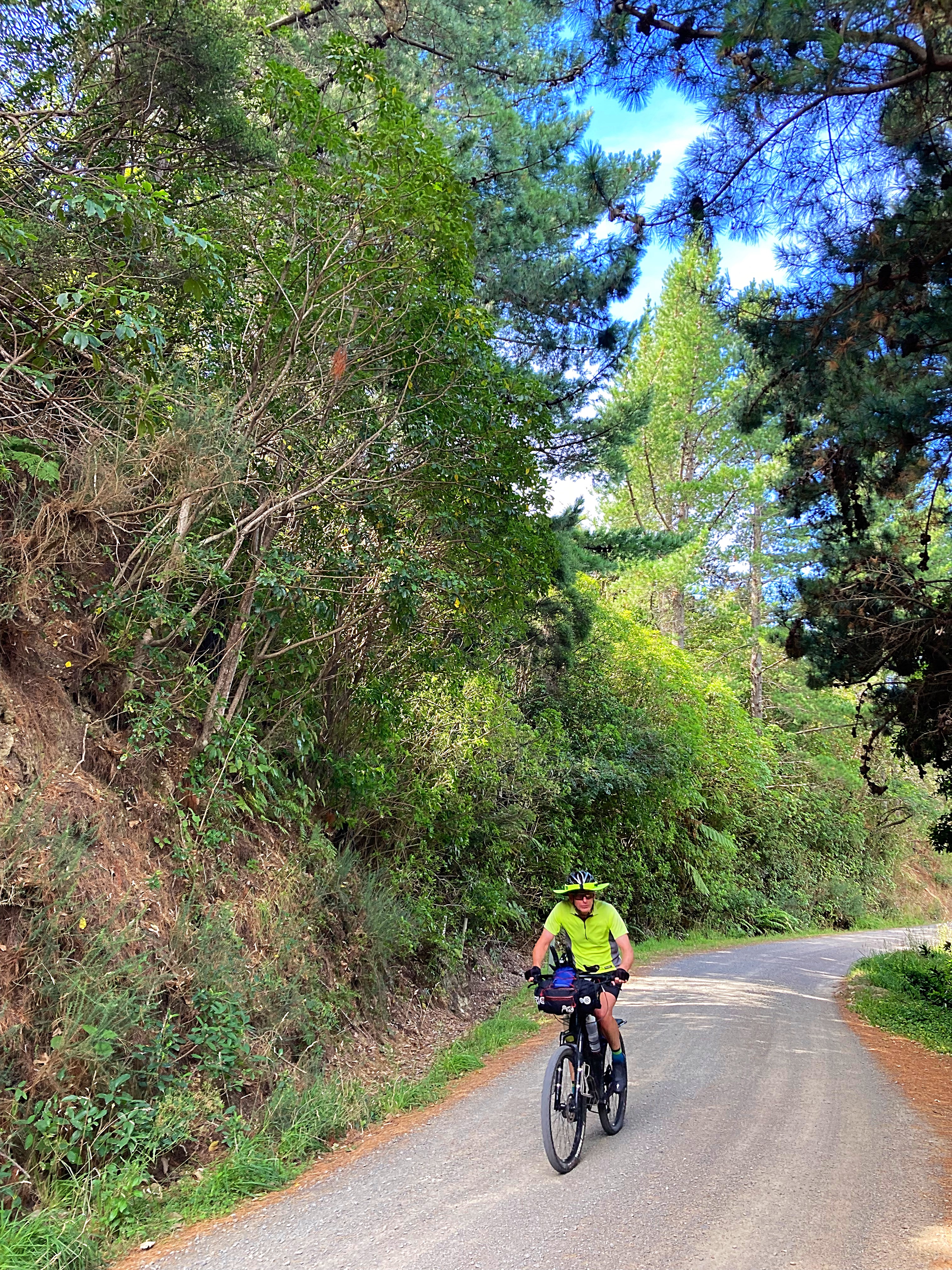
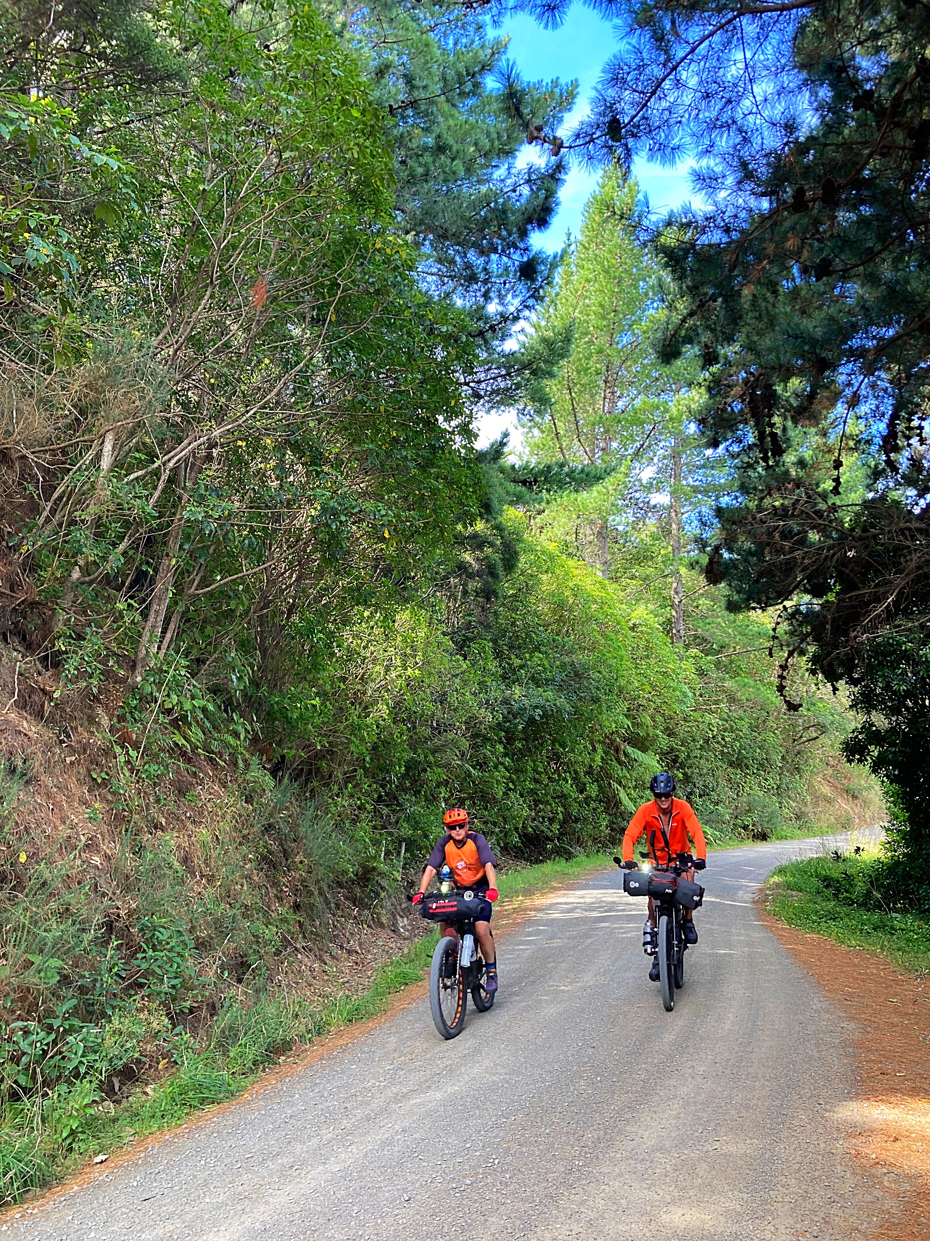
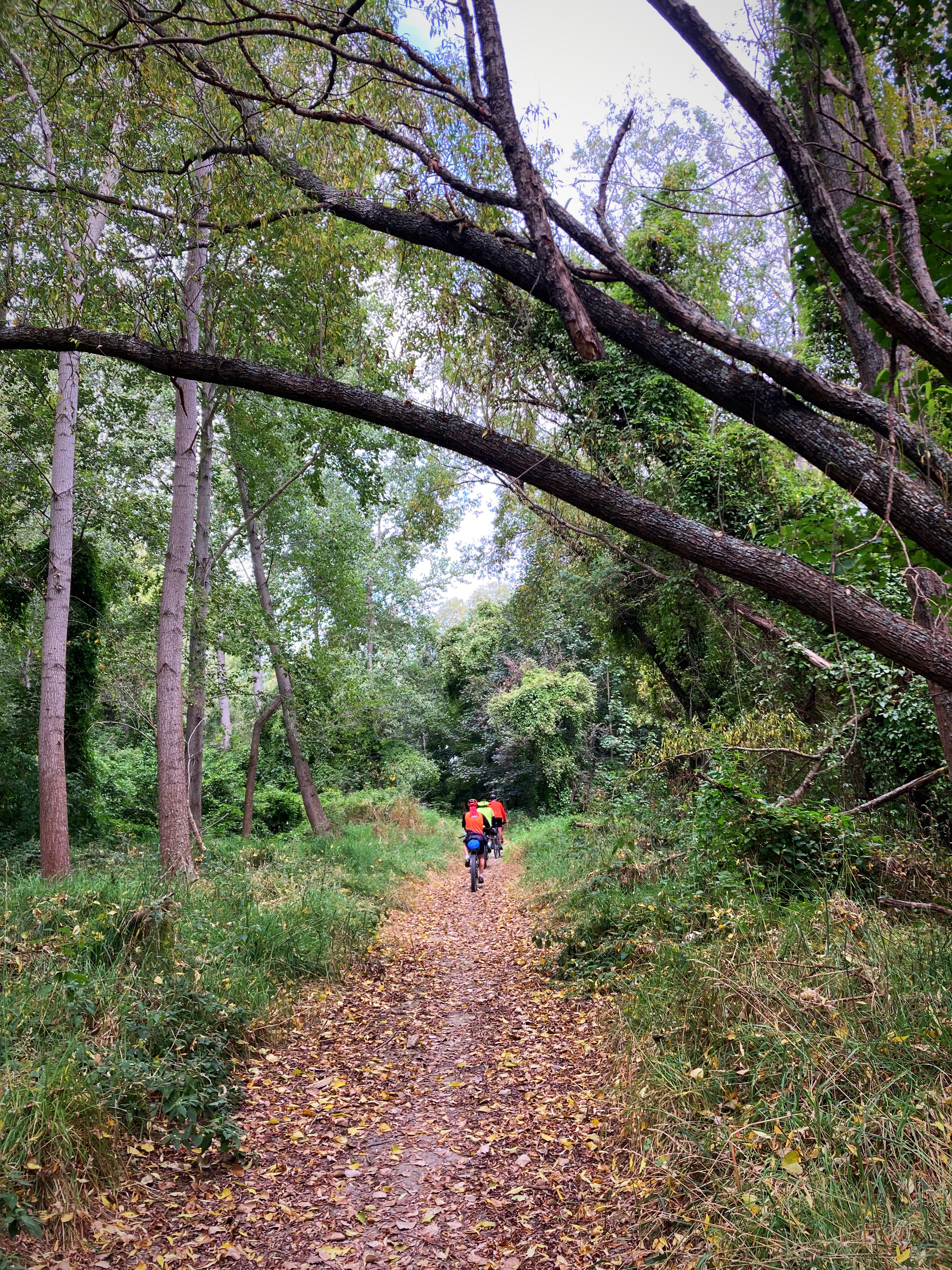
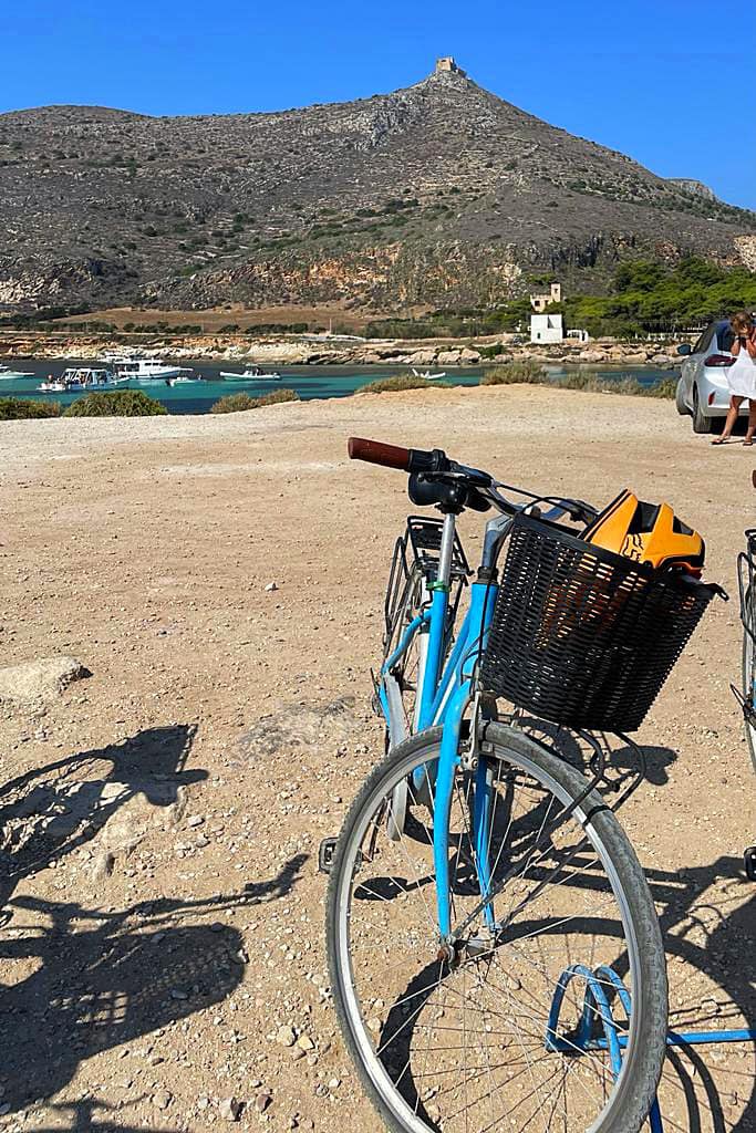
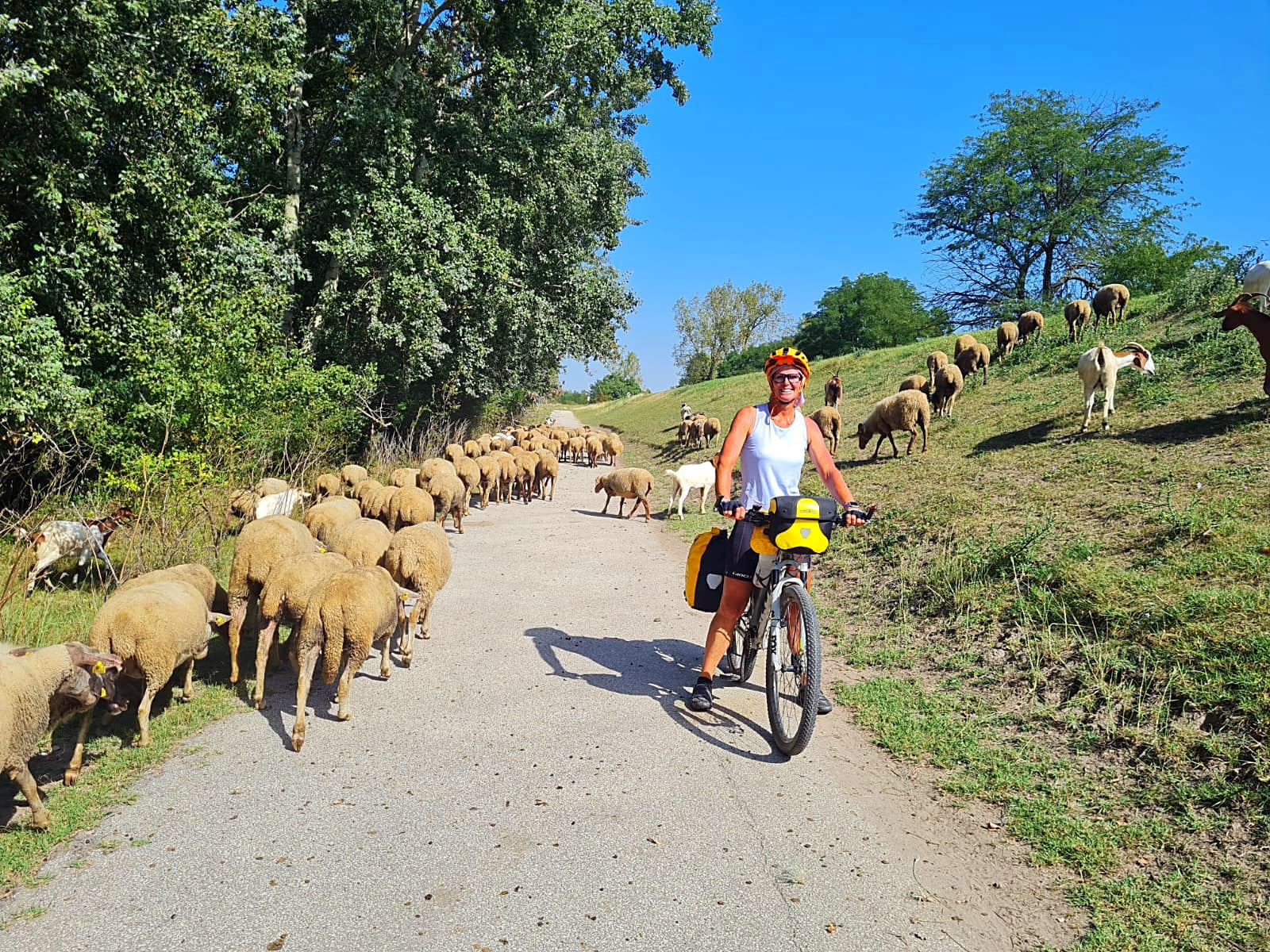
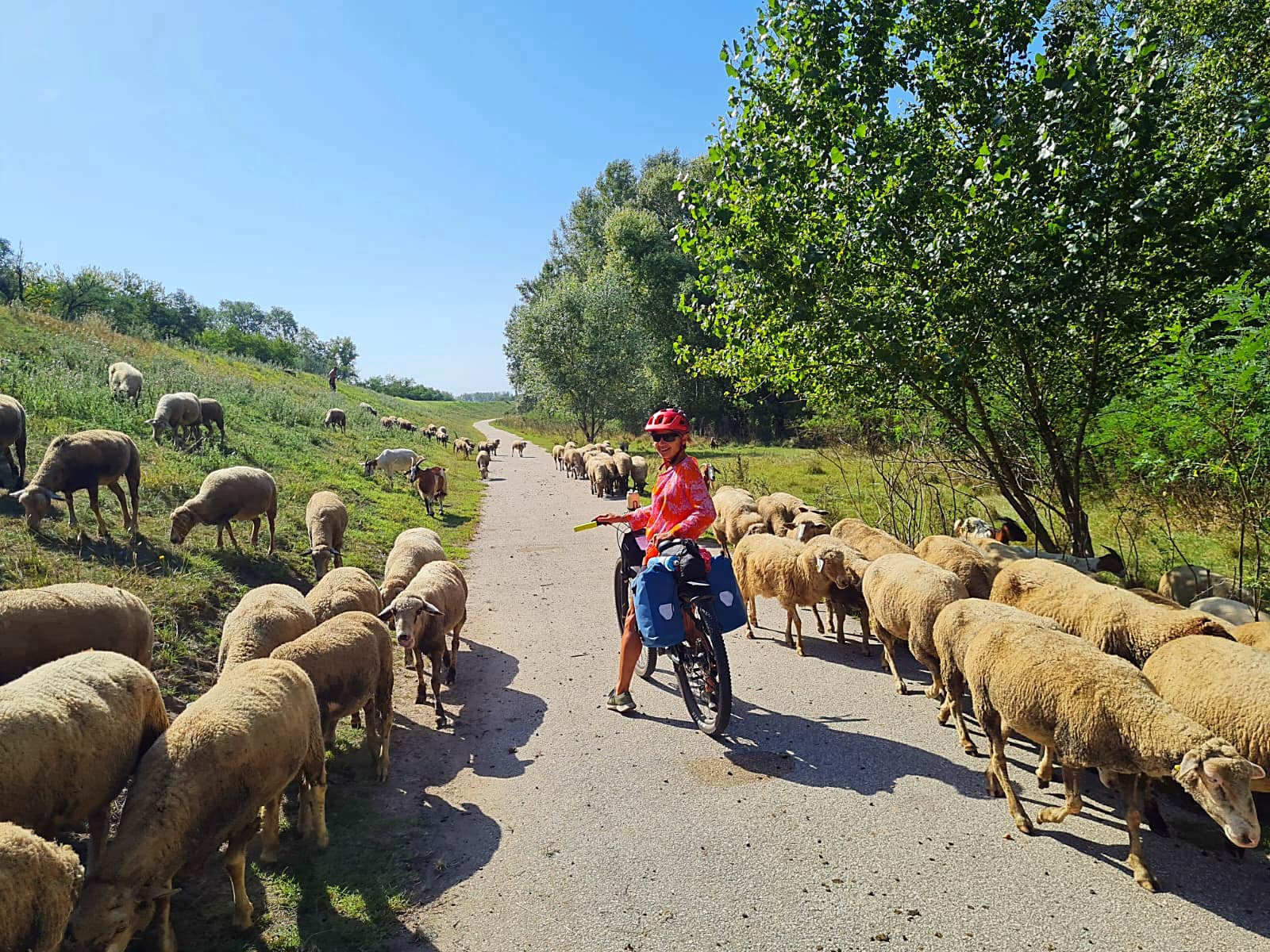
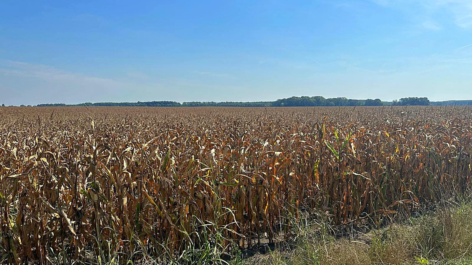
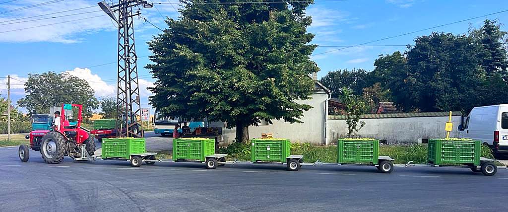
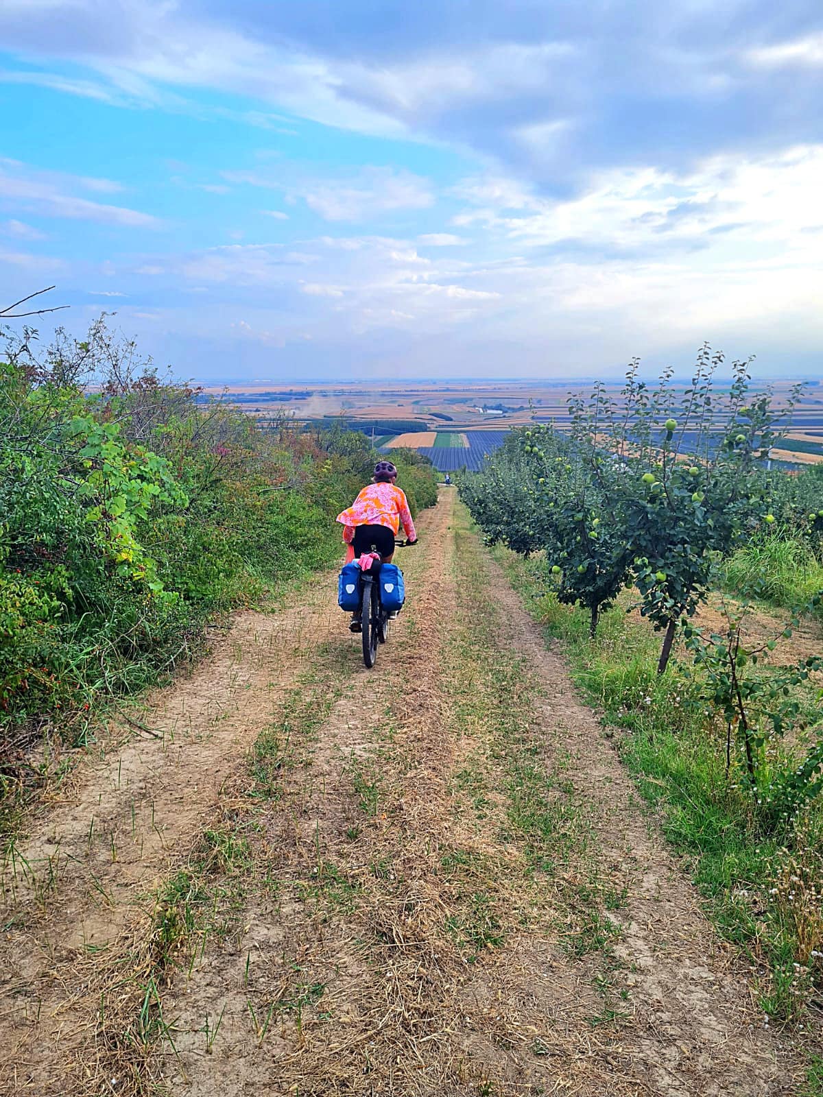
We cycled from just north of Ross to Hokitika through some beautiful native bush and out onto the coast in Hokitika where we enjoyed a swim in the ocean which was a lovely.
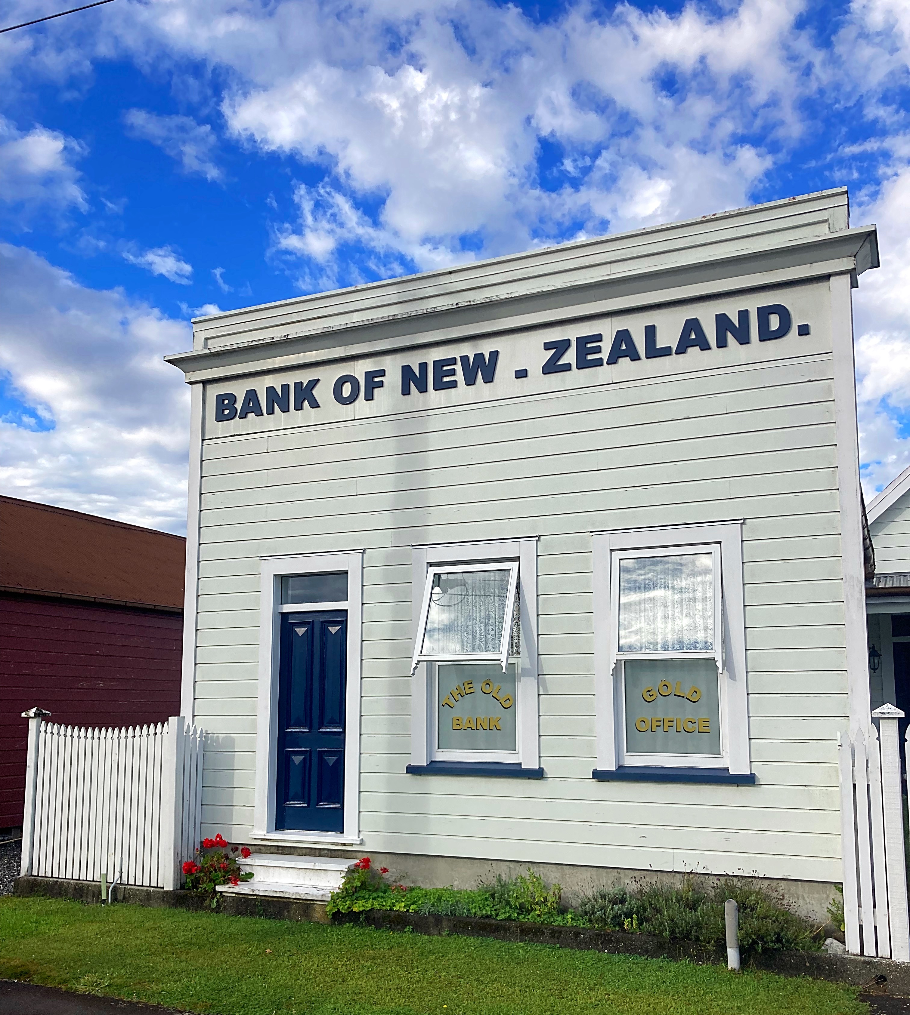
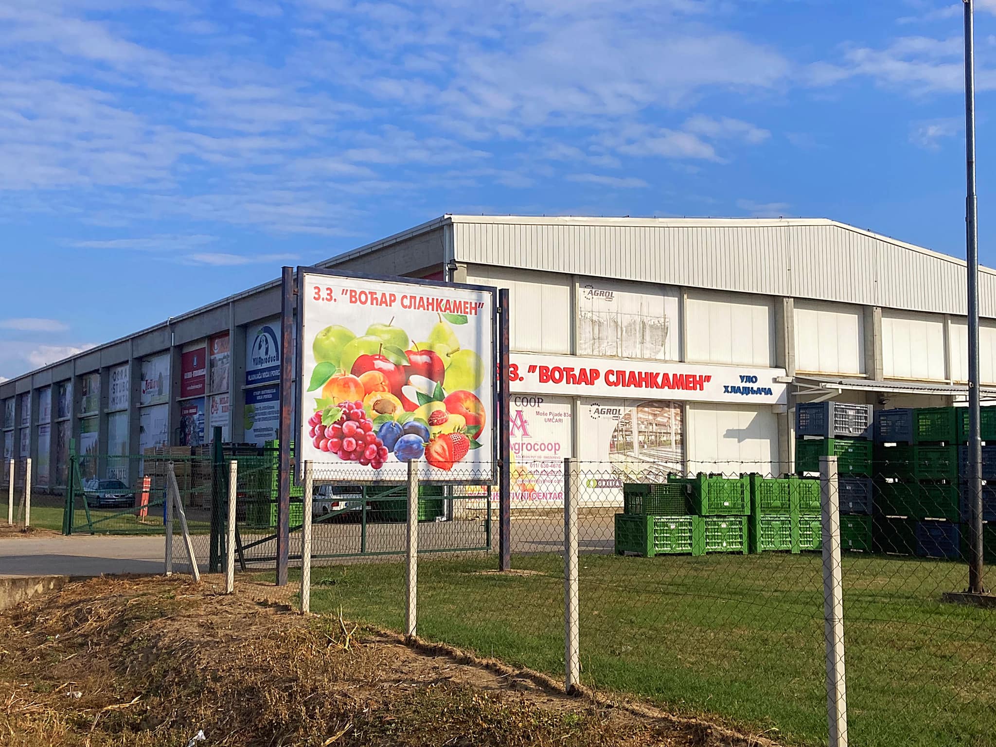
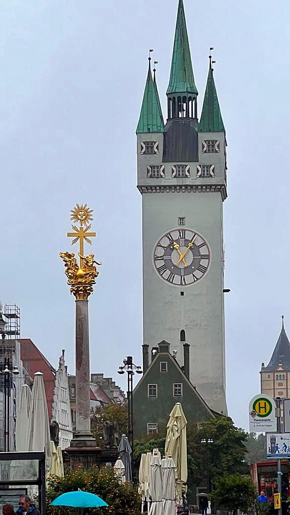
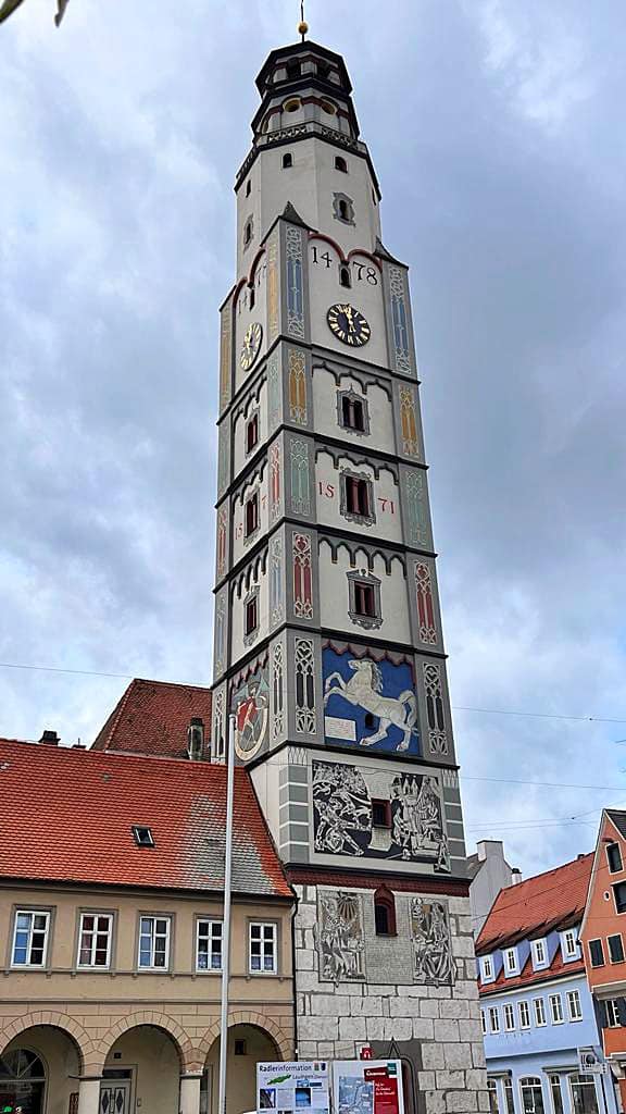
Hokitika was founded on gold mining in 1864, it was a centre of the West Coast gold rush and grew very quickly.
In 1867, the port of Hokitika ranked first in New Zealand in both the number of vessels entered inwards and in the total value of exports; principally gold.
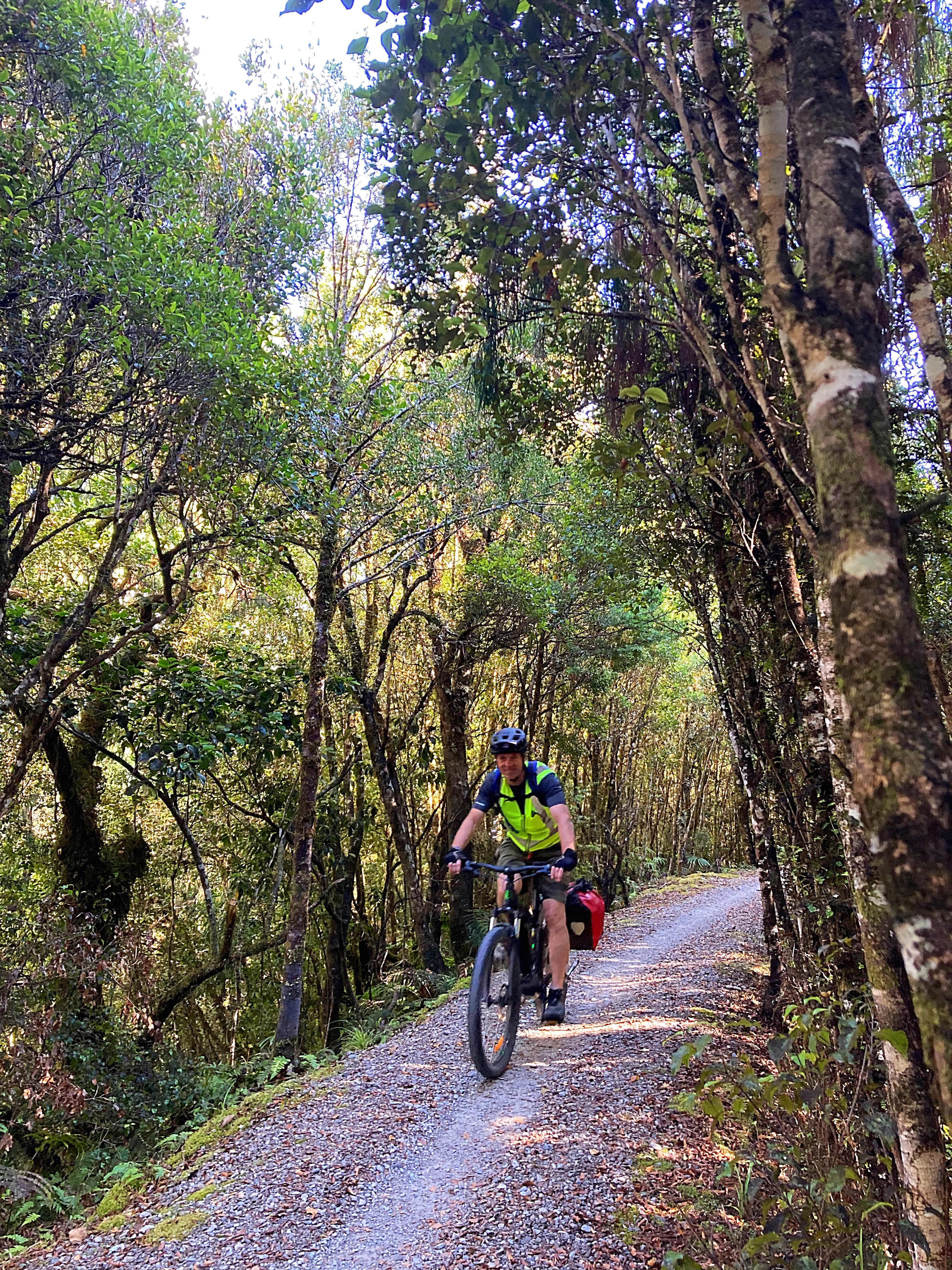
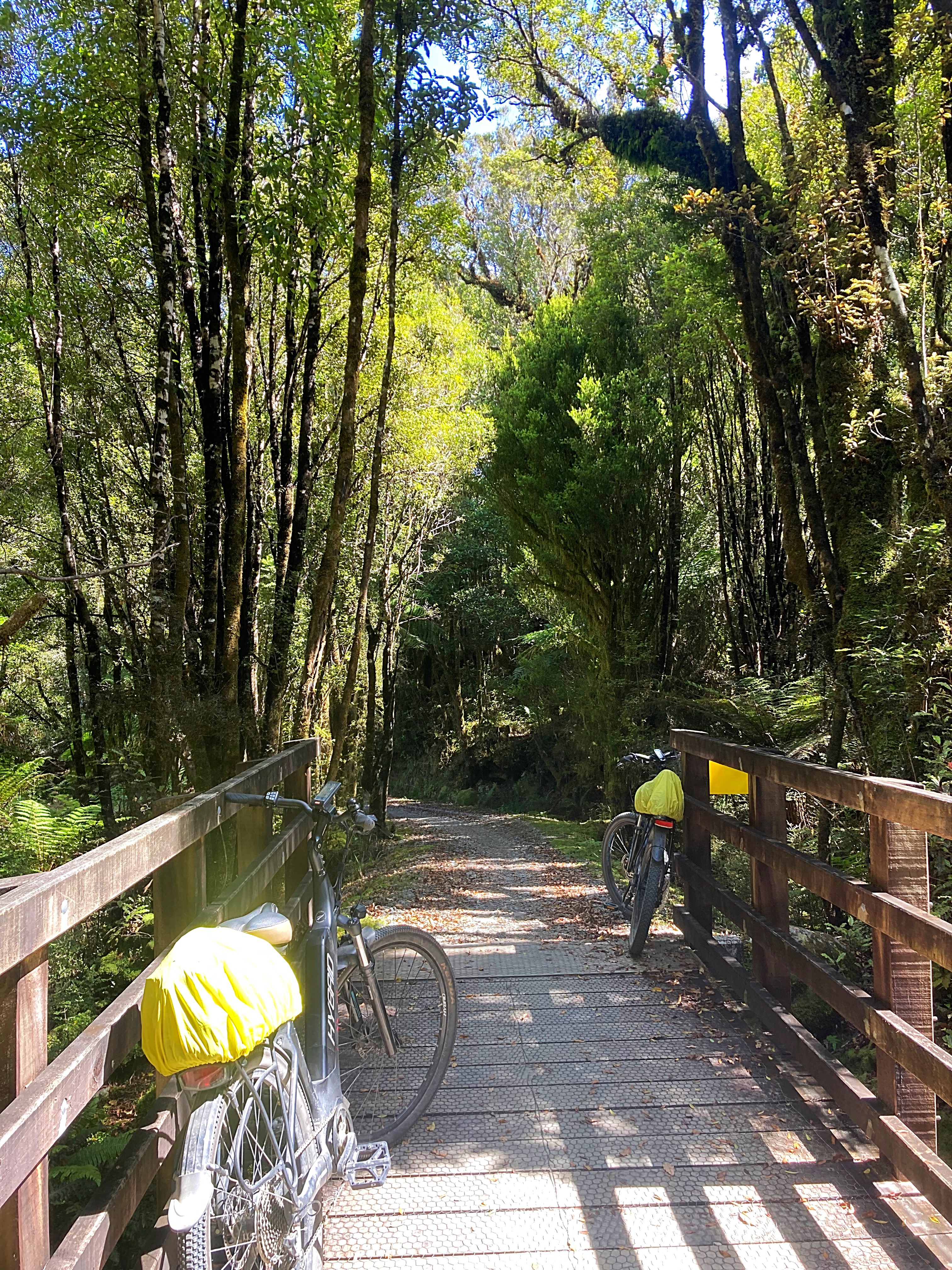
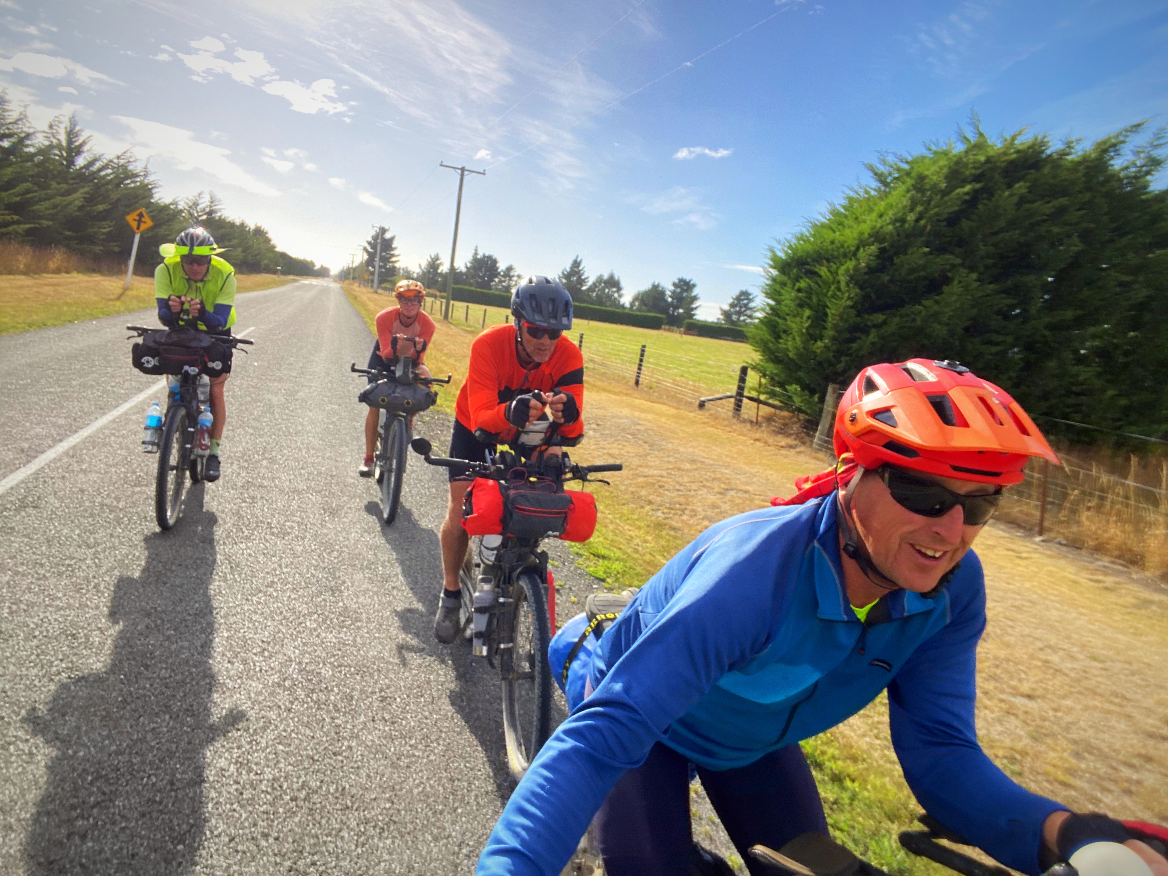
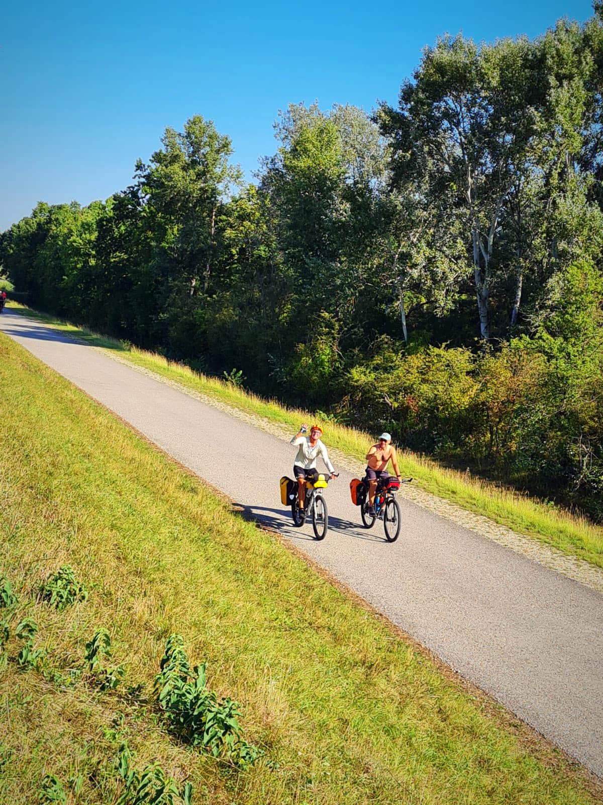
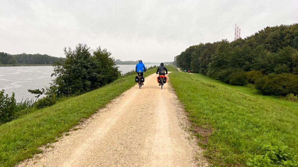
West Coast Wilderness – Day 2 – 47km
A bit more cloud greeted us today but it was still a nice day and perfect for riding.
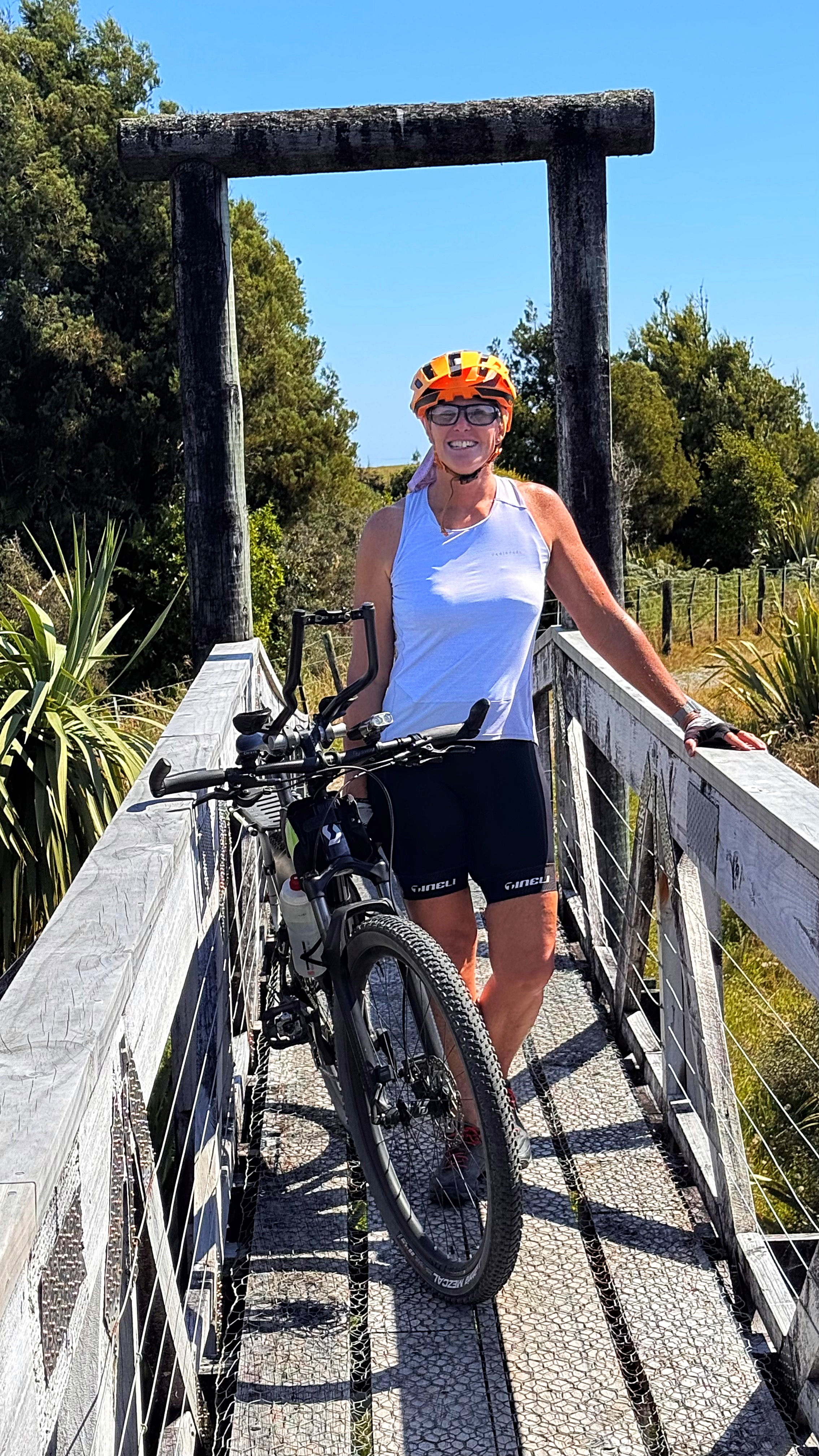
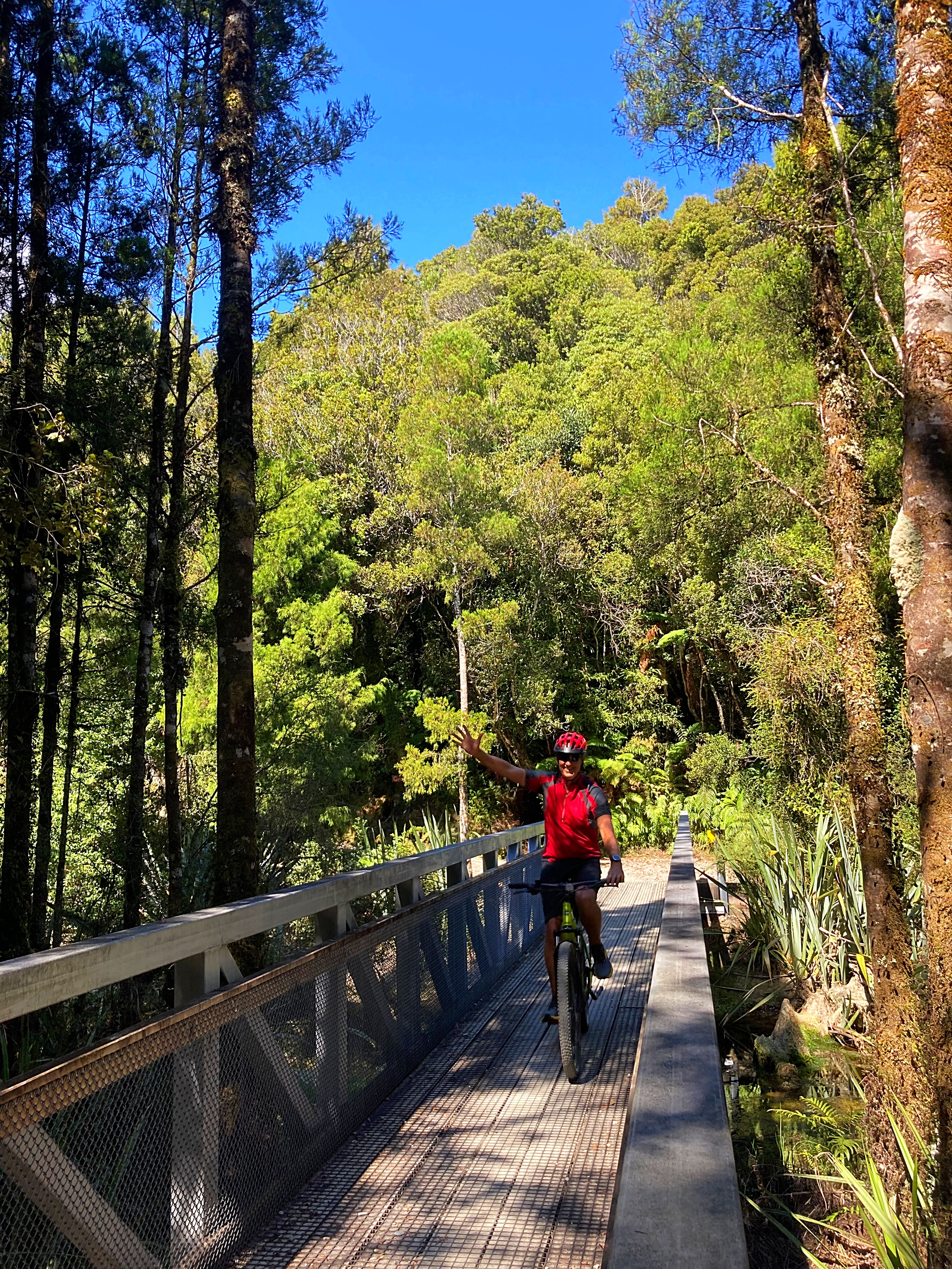
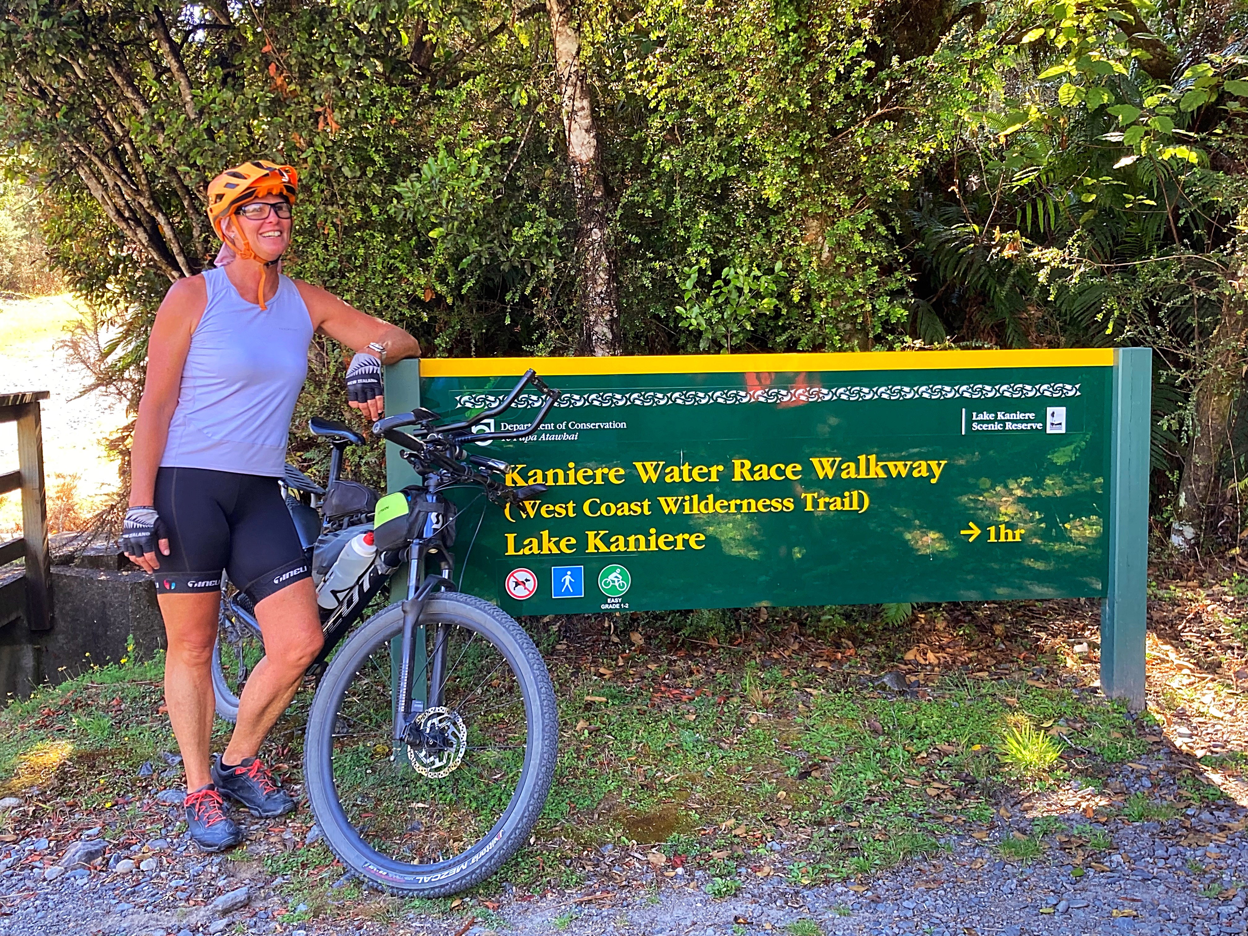
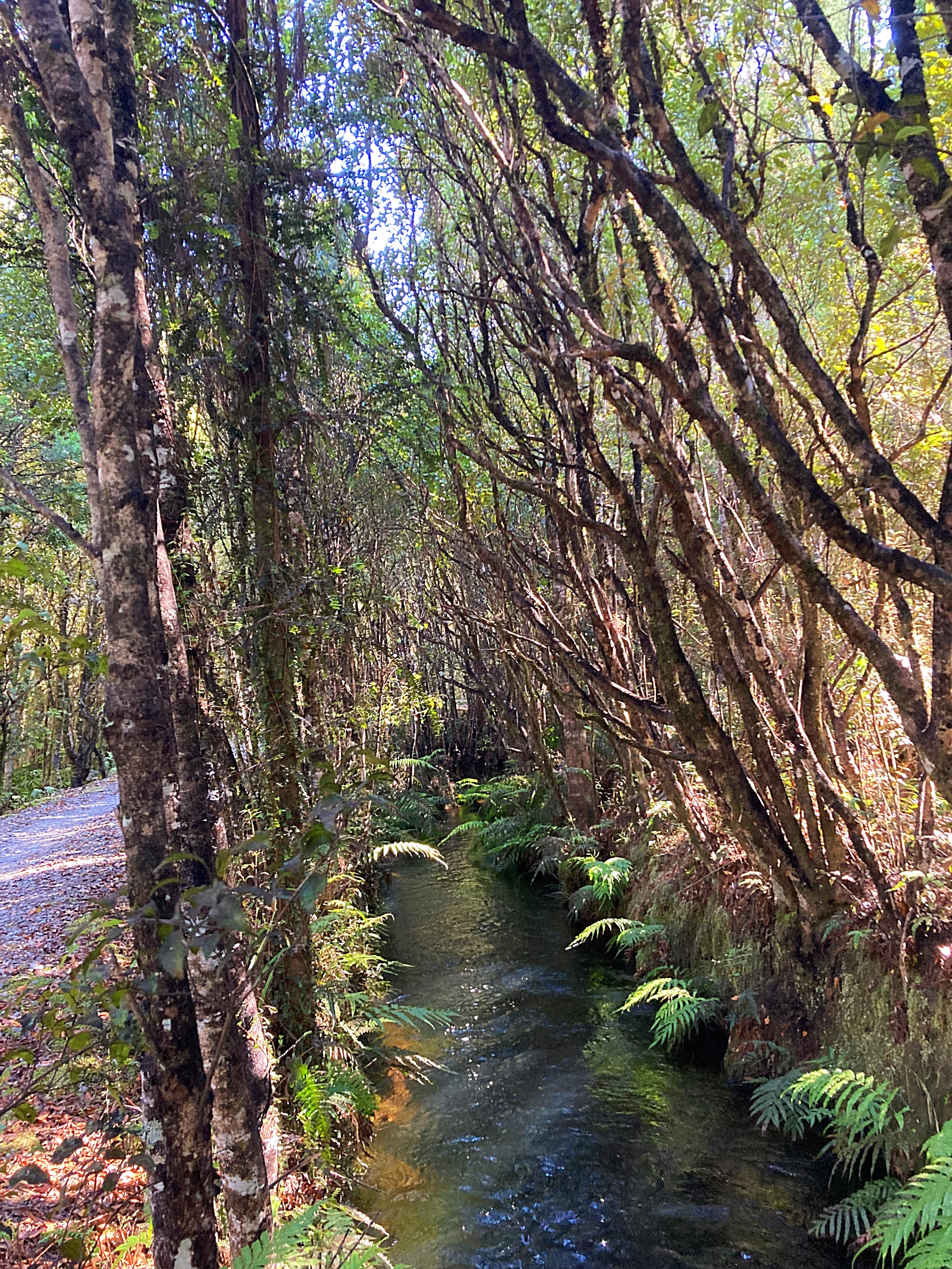
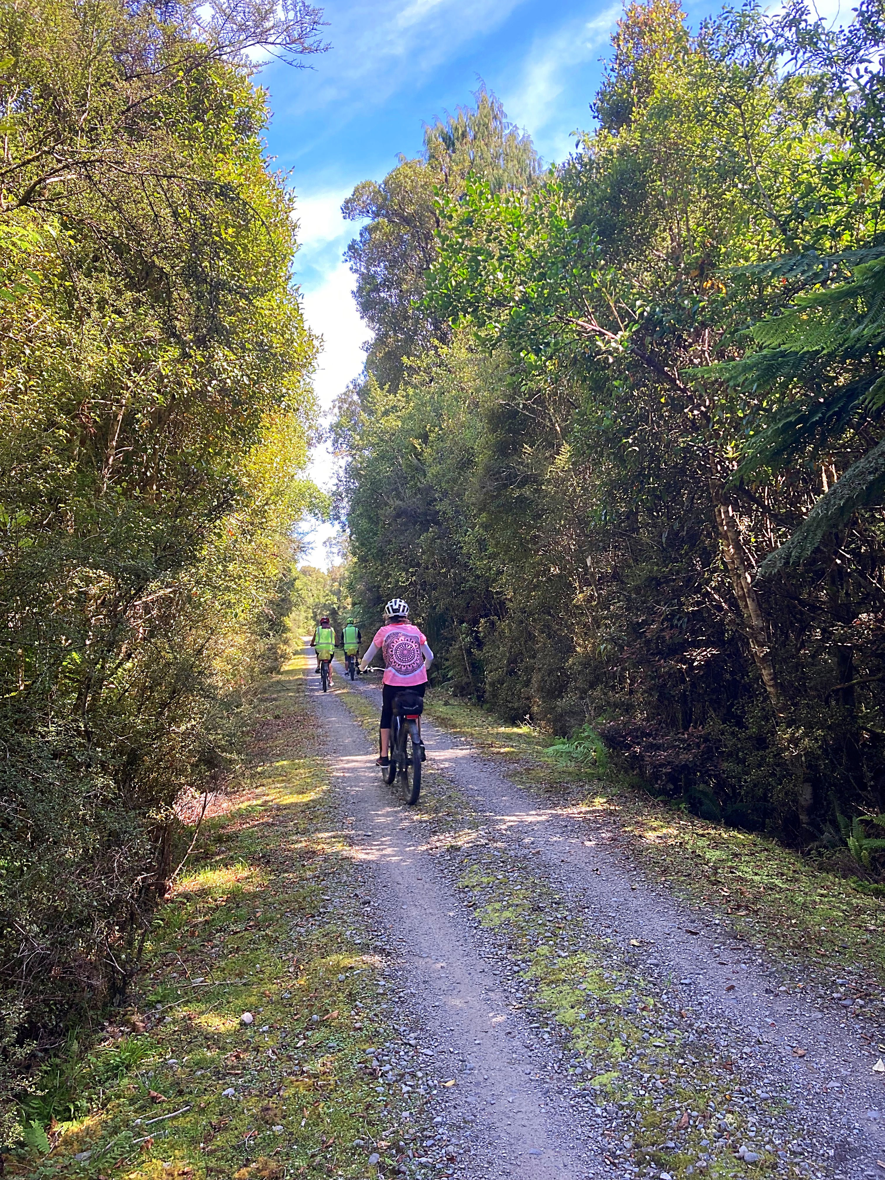
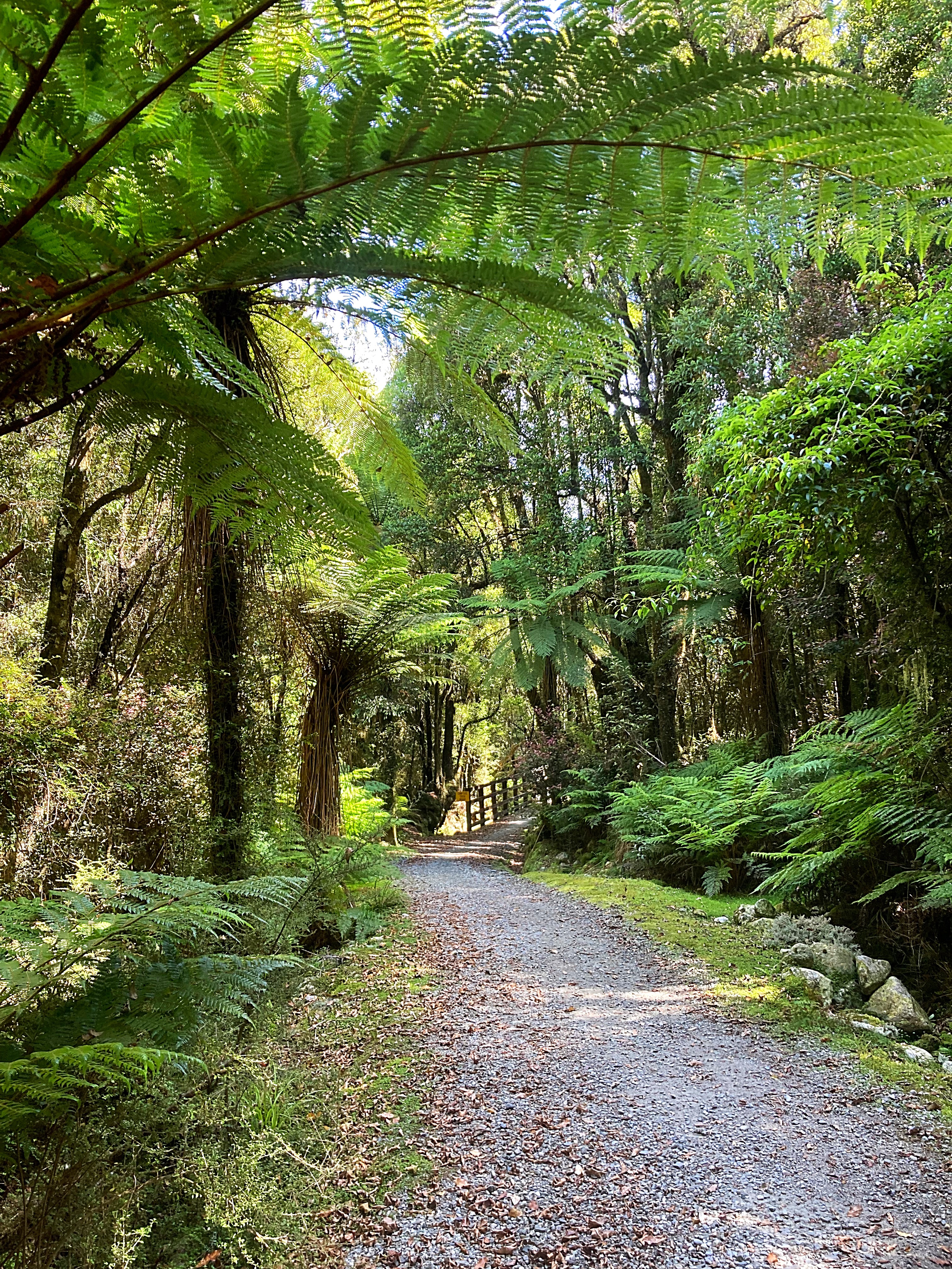
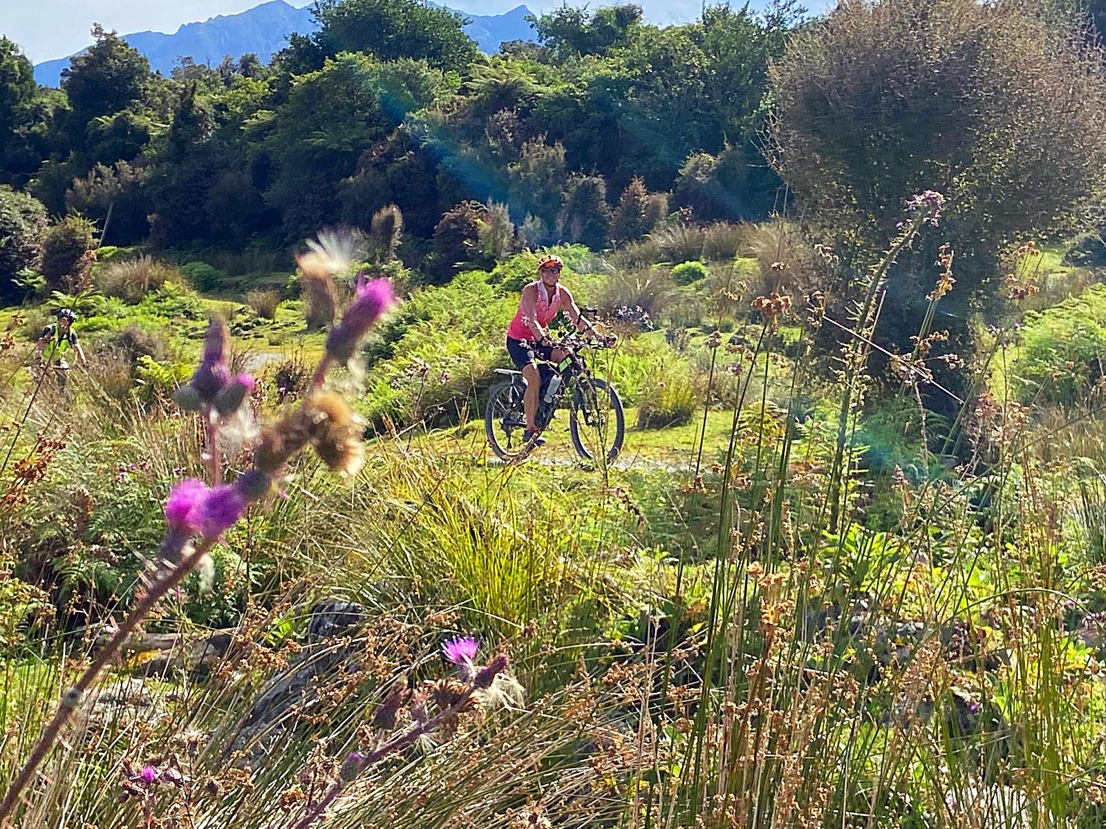
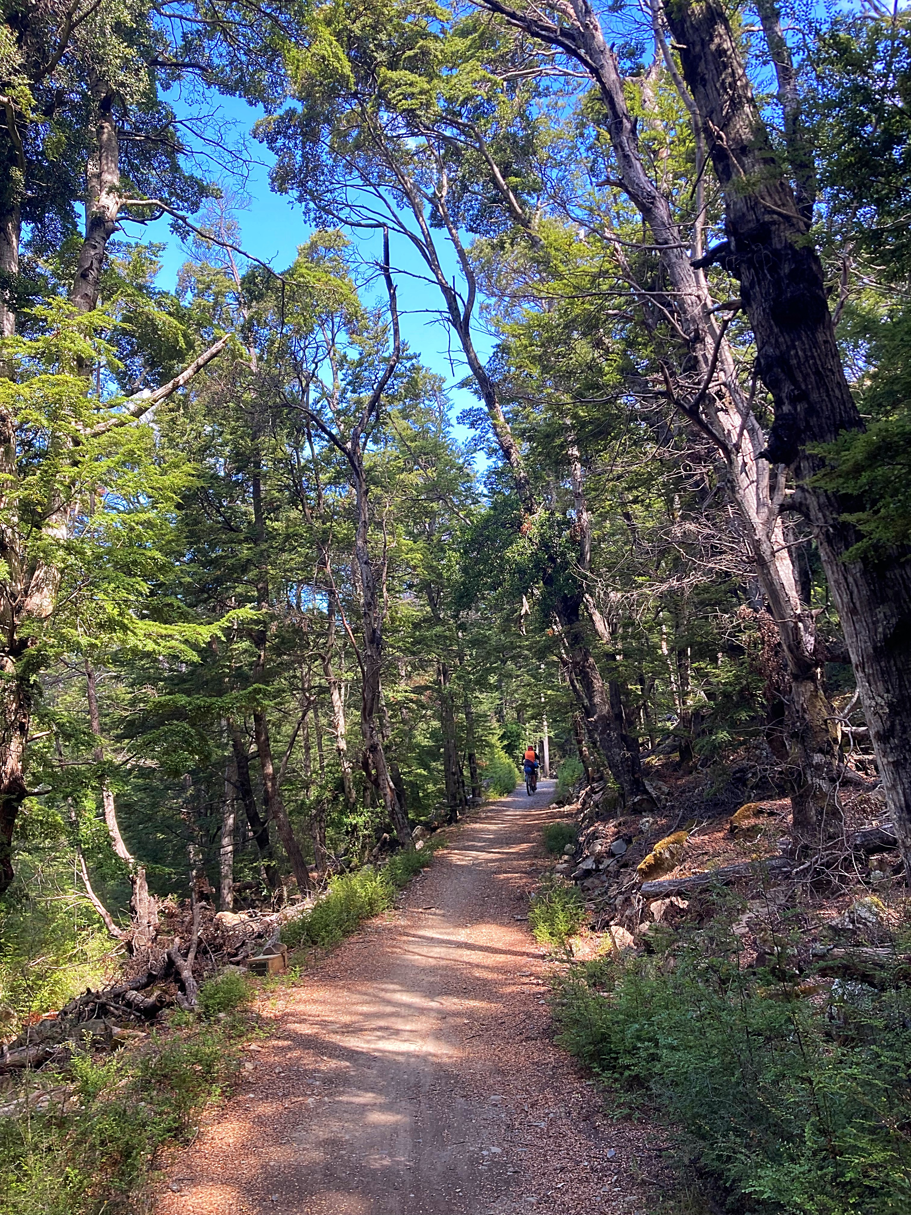
First up we cycled from Hokitika to Lake Kaniere. The section where you cycle along the old gold mining water races is one of the best rides ever.
Lake Kaniere provided our first swimming opportunity of the day which a few of us took up.
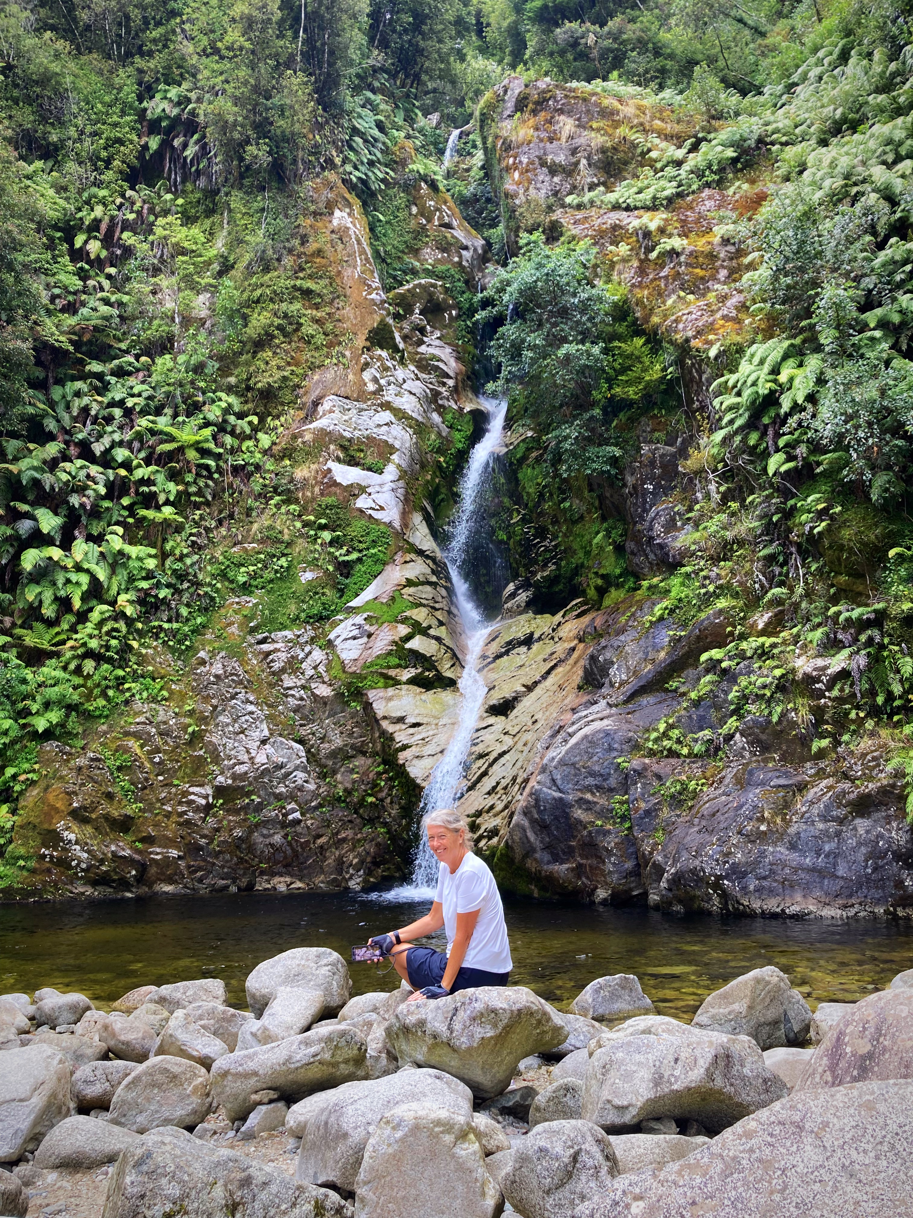
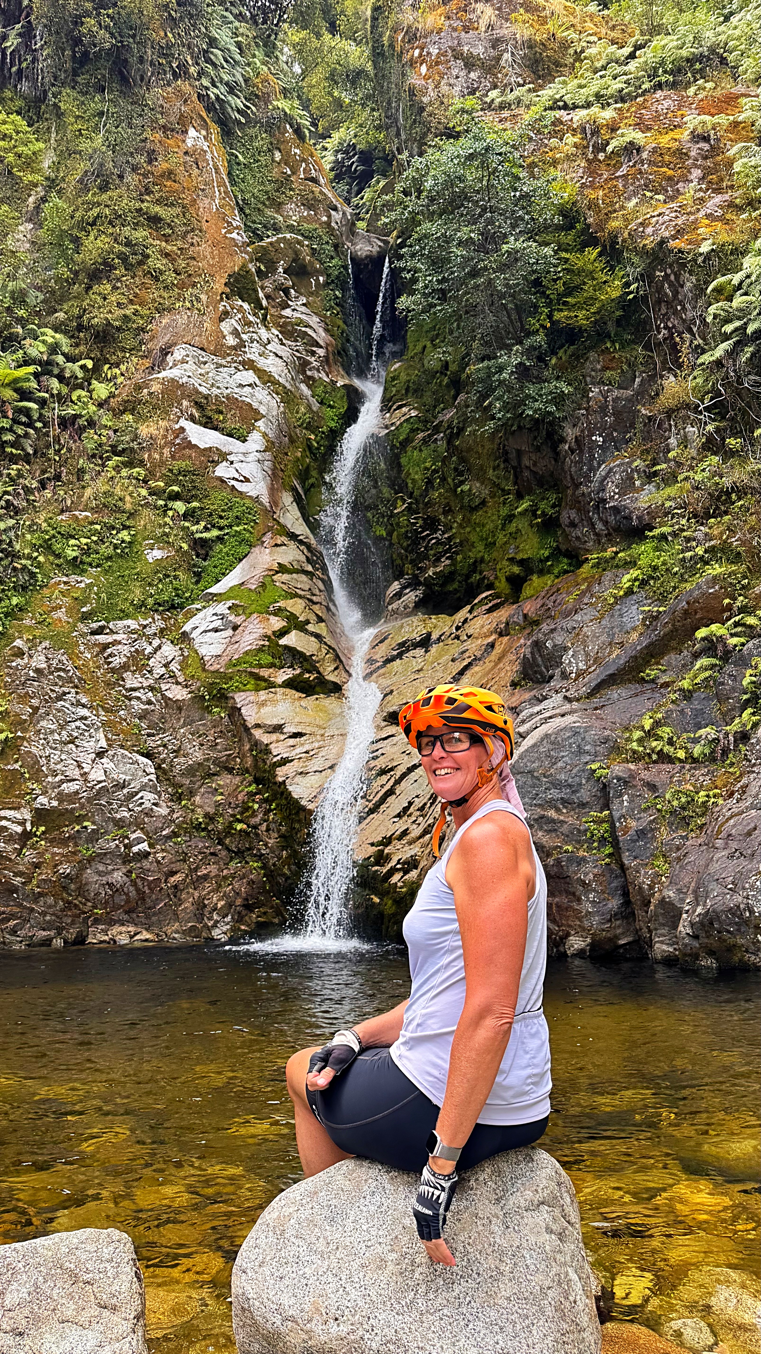
We then followed the lake up and stopped at Dorothy Falls before carrying on down to Kokatahi where we had lunch. The publican happened to be outside and opened specially for us (normal opening time 4pm). In exchange for buying a beverage or two we could enjoy our picnic lunch on his deck.
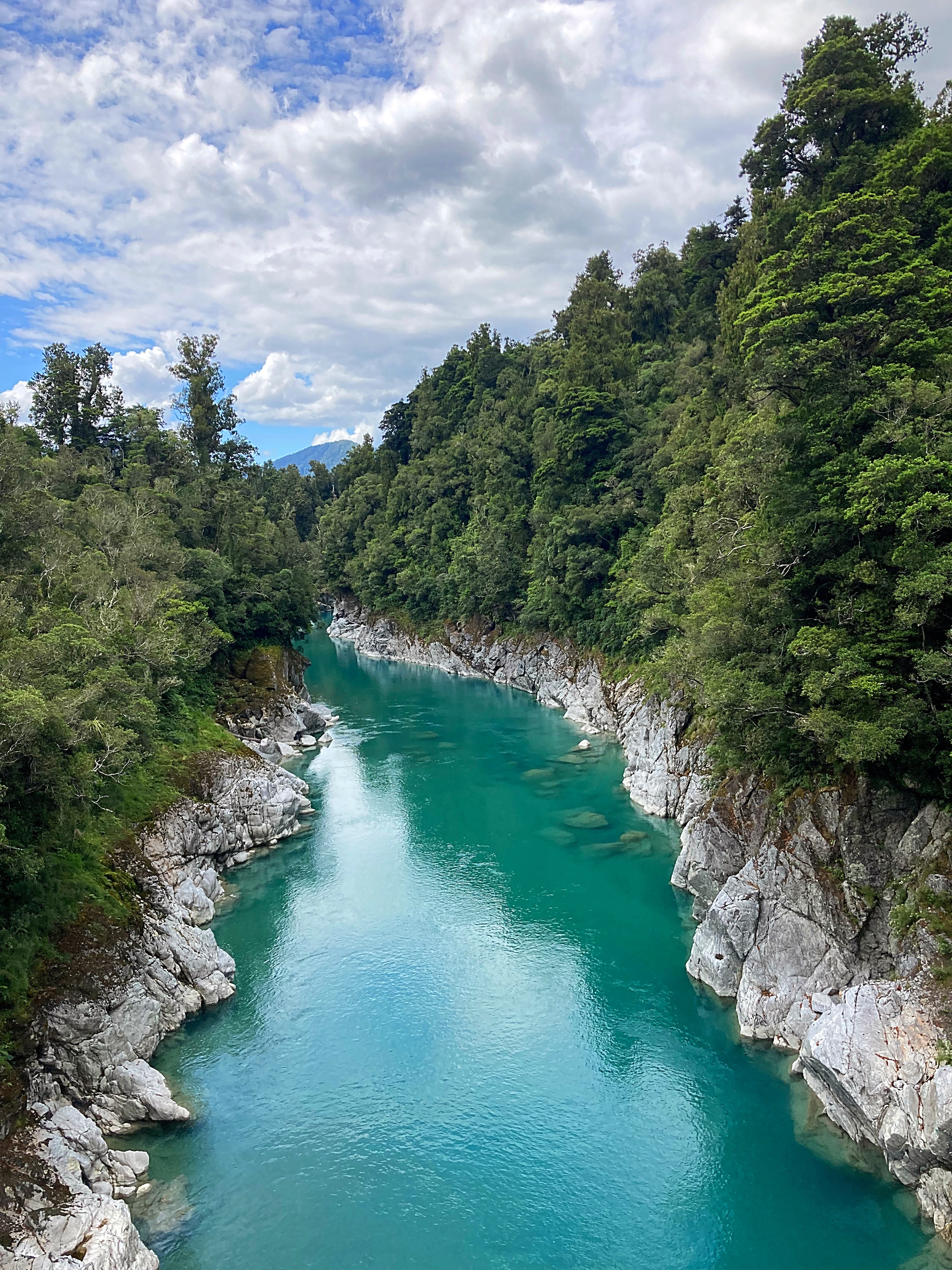
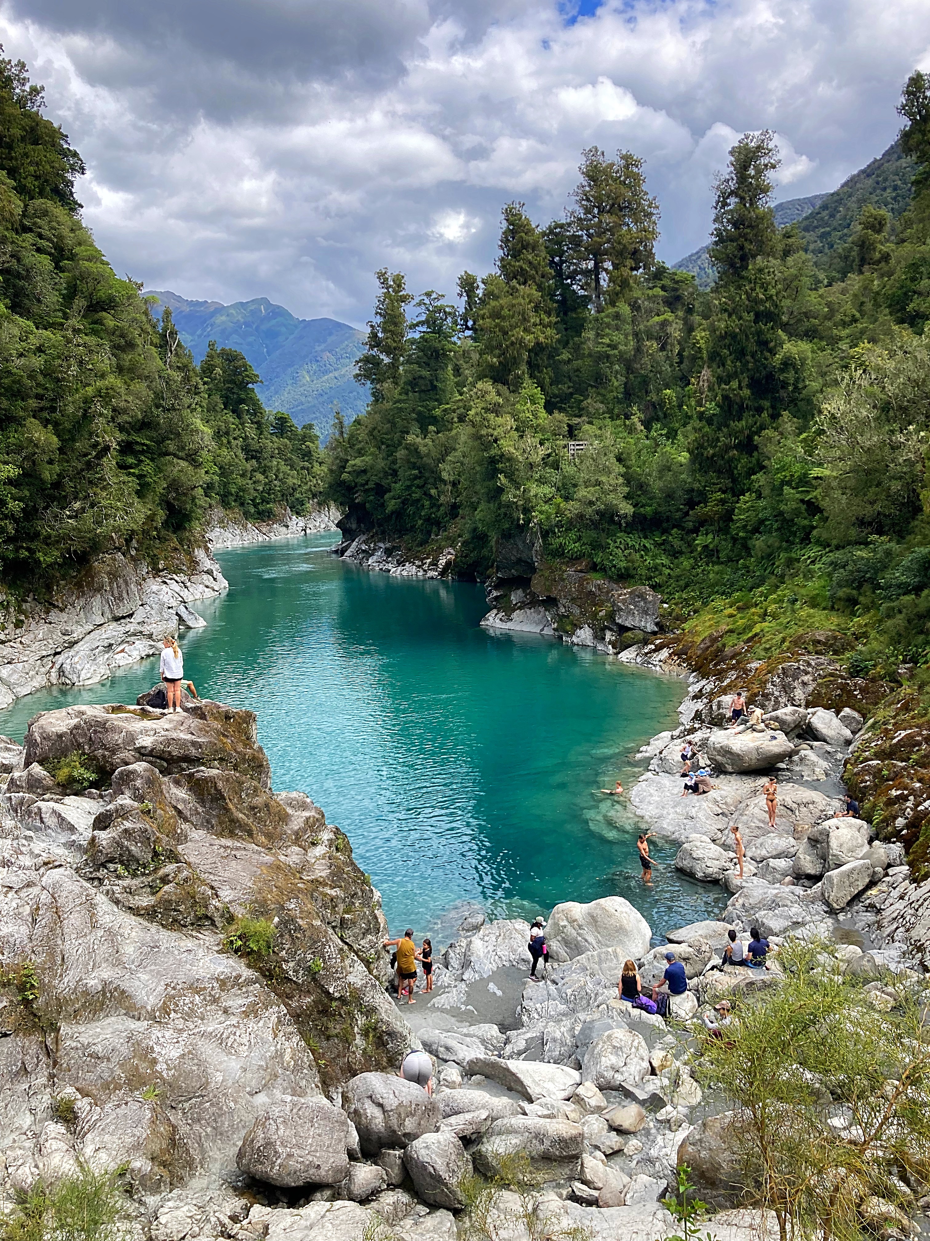
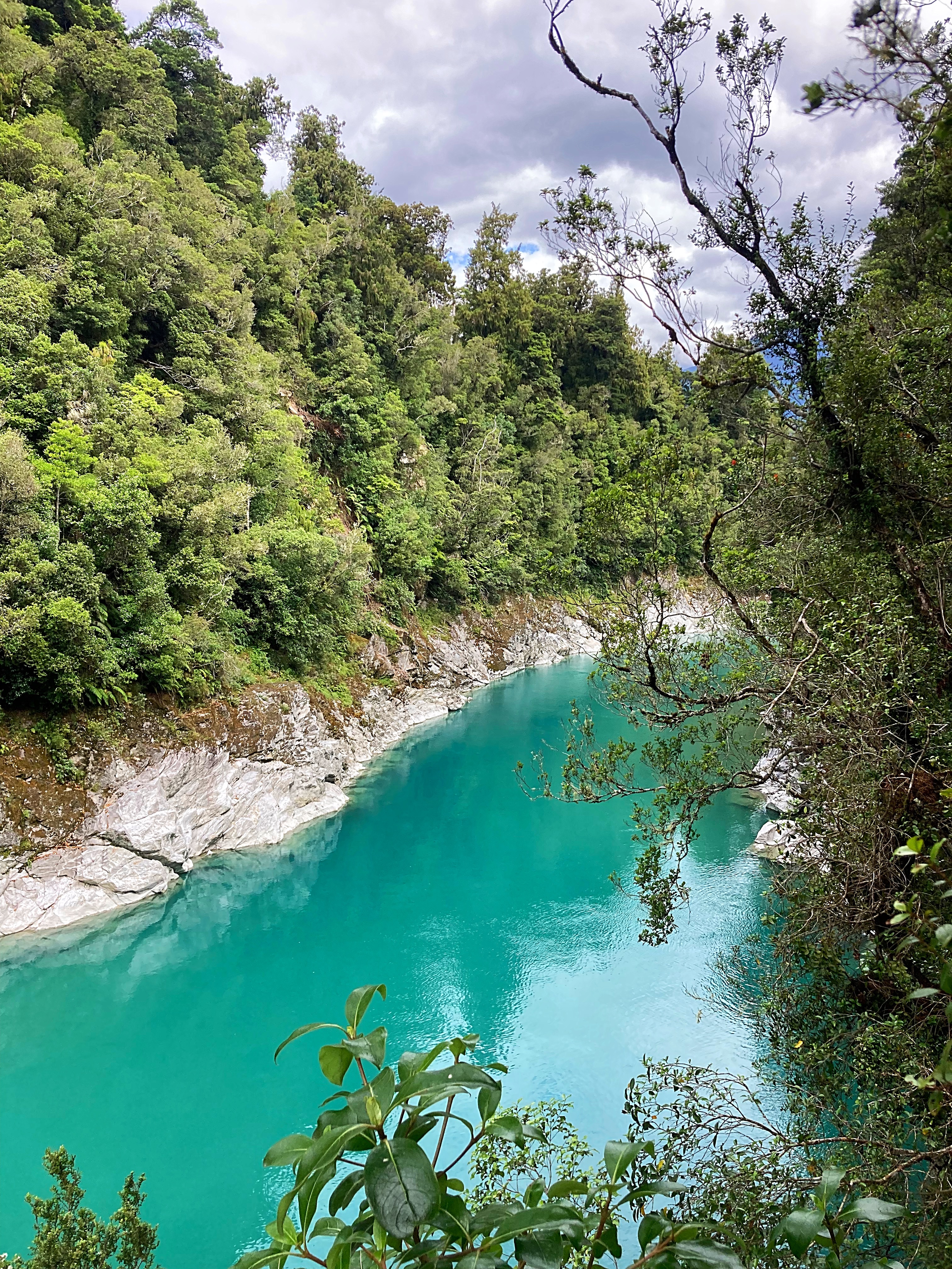
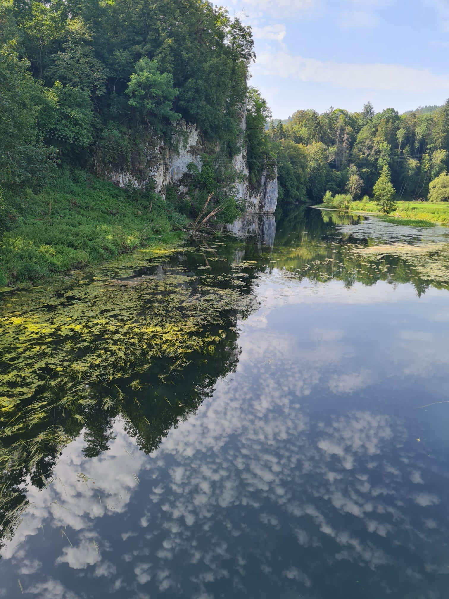
The bikes were then loaded up and we drove up the Hokitika Gorge where we did a walk to see the brilliant turquoise water fringed with stark white limestone cliffs and lush green rainforest.
Ice, water, rock and age-old natural forces helped create the visual beauty of the Hokitika Gorge. Glaciers ground the fine rock sediment that adds the essential element for highlighting the super blue-green water and helped work its way through the white granite bedrock.
These same glacial waters also carry precious pounamu (New Zealand jade/greenstone) from the mountains down to the sea. It’s one of several river sources around Hokitika making this cool little town the pounamu capital of the world.
I couldn’t resist another swim so took a dip in the Hokitika Gorge – refreshingly cool.
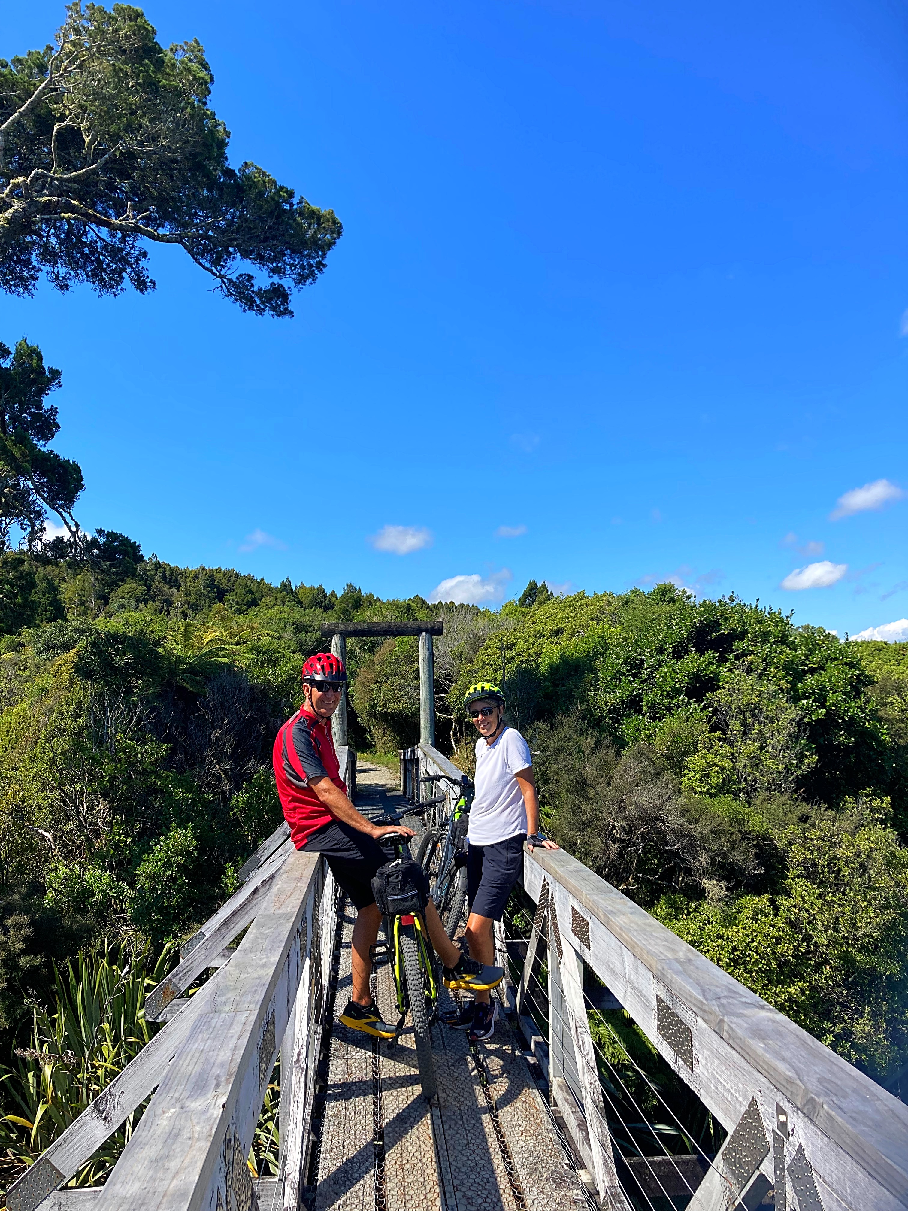
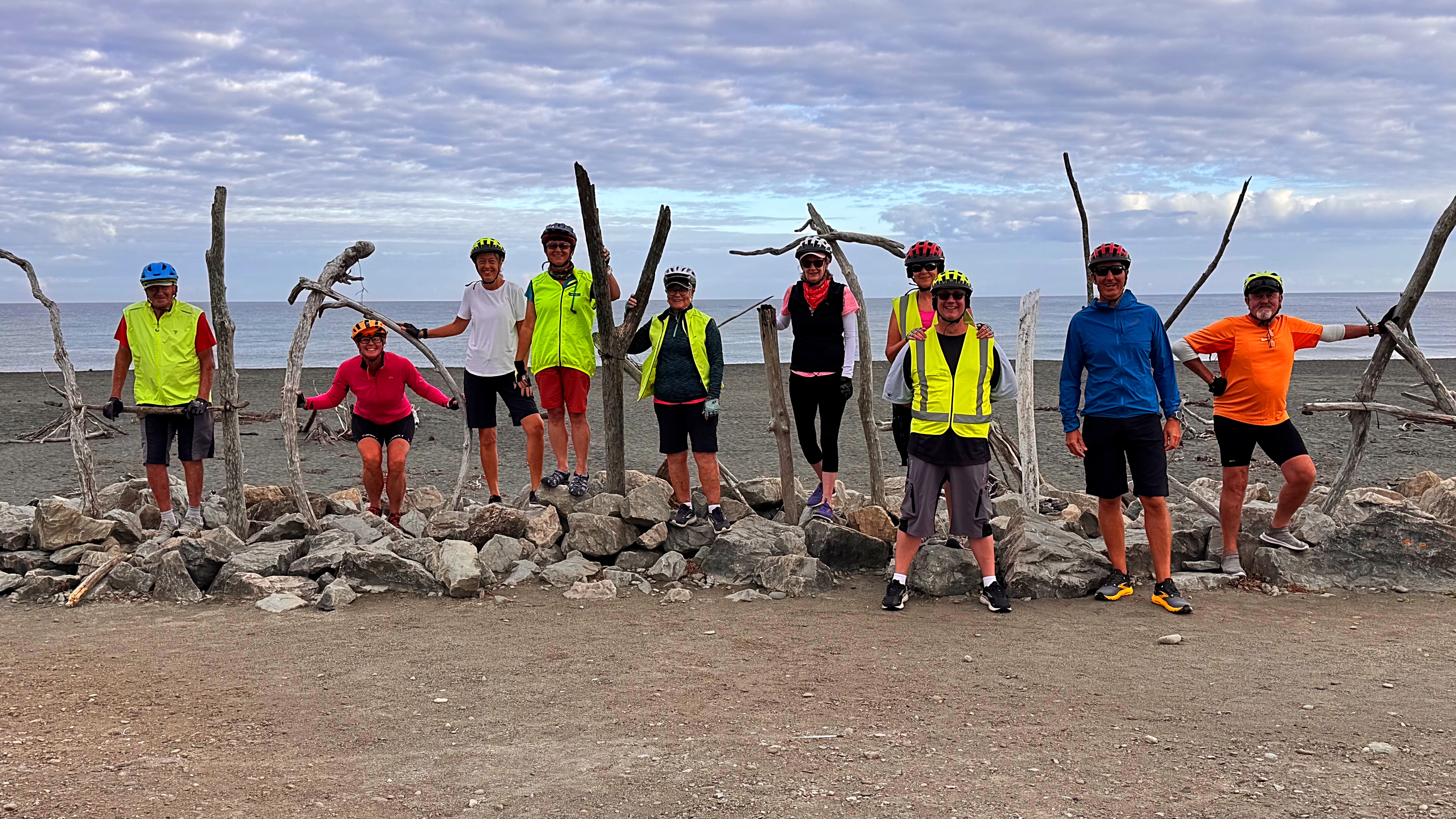
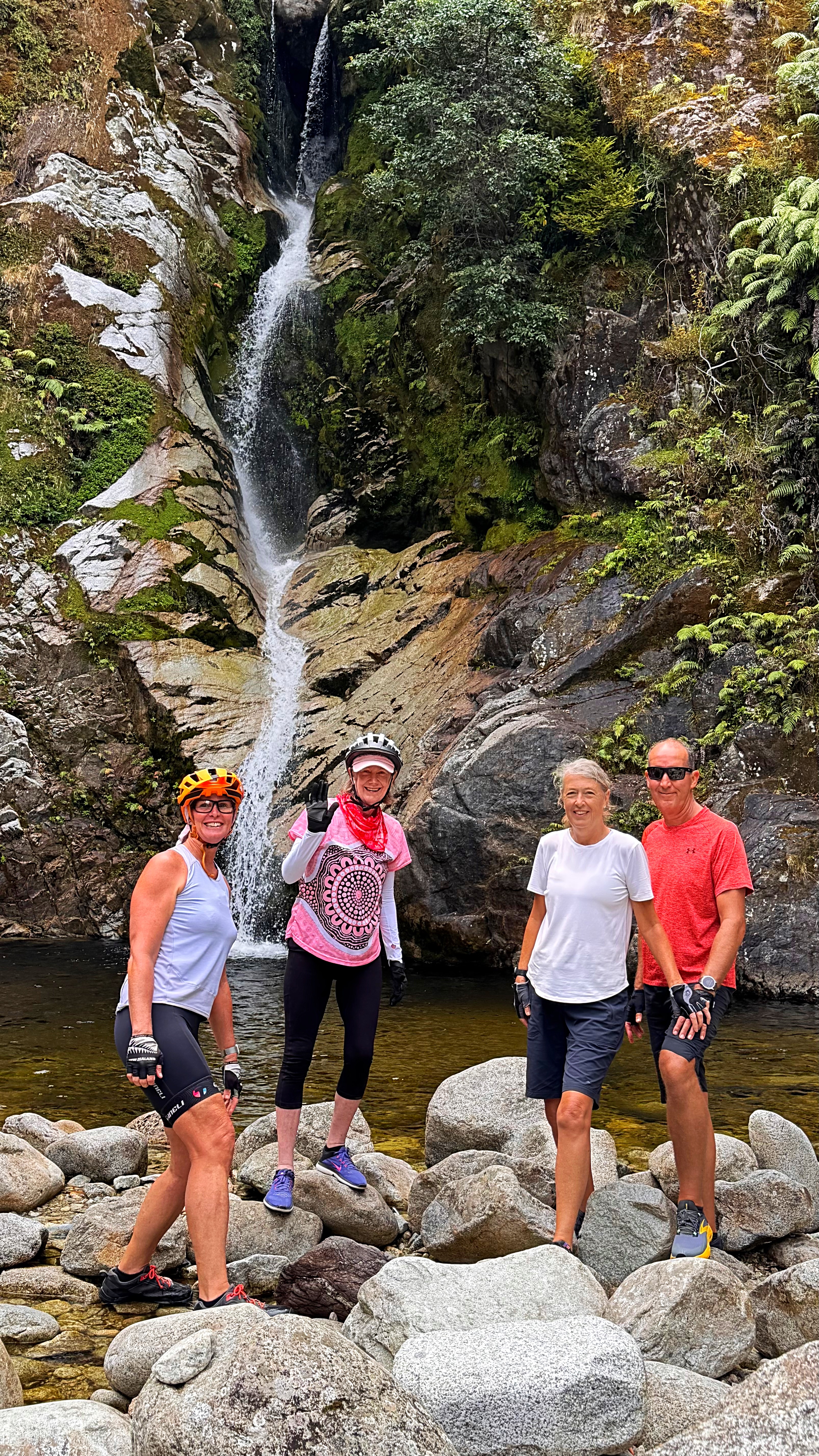
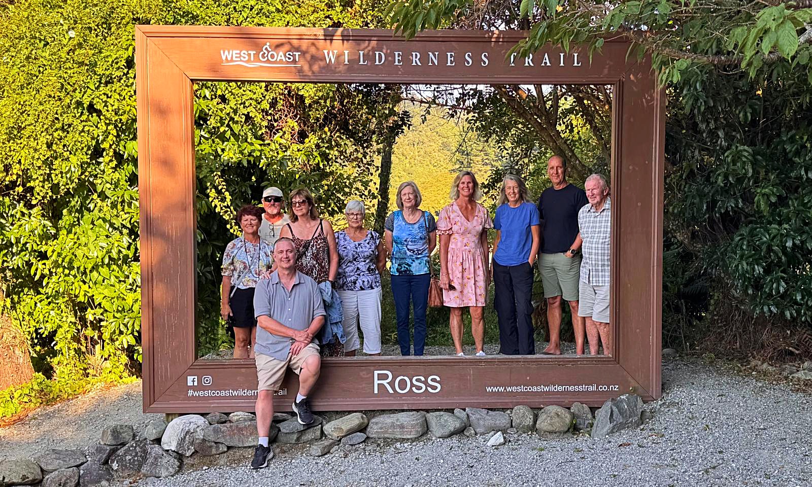
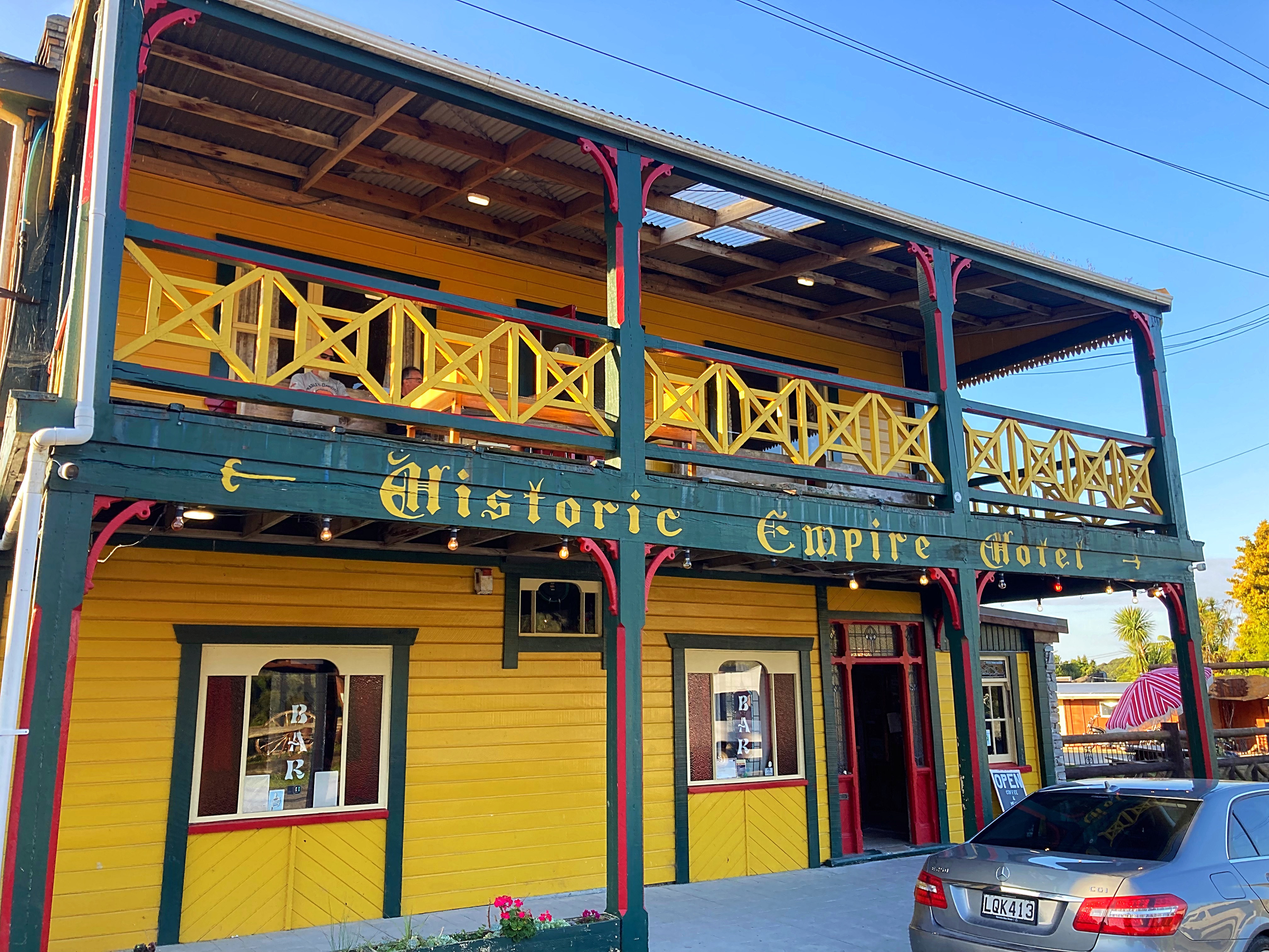
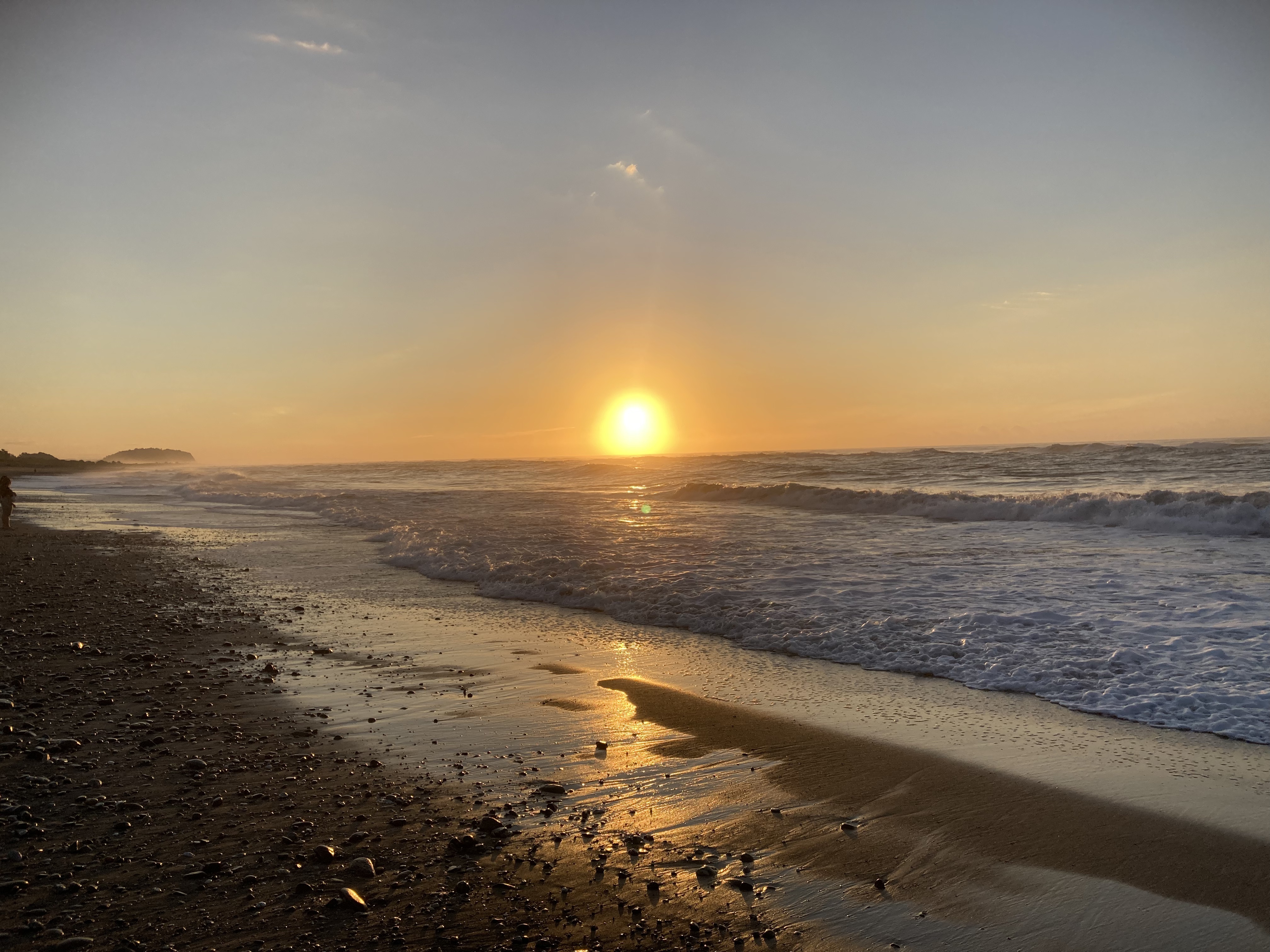
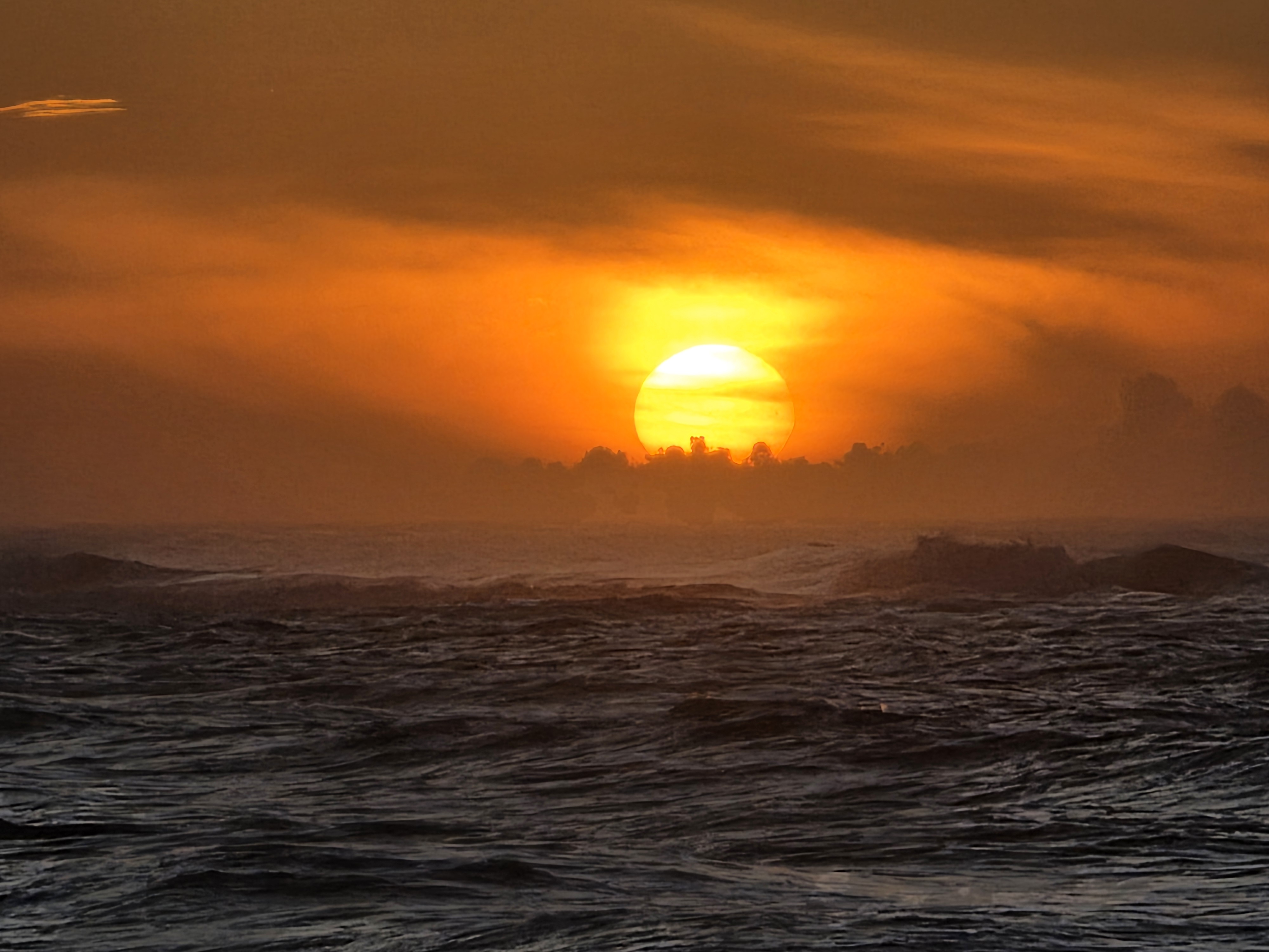
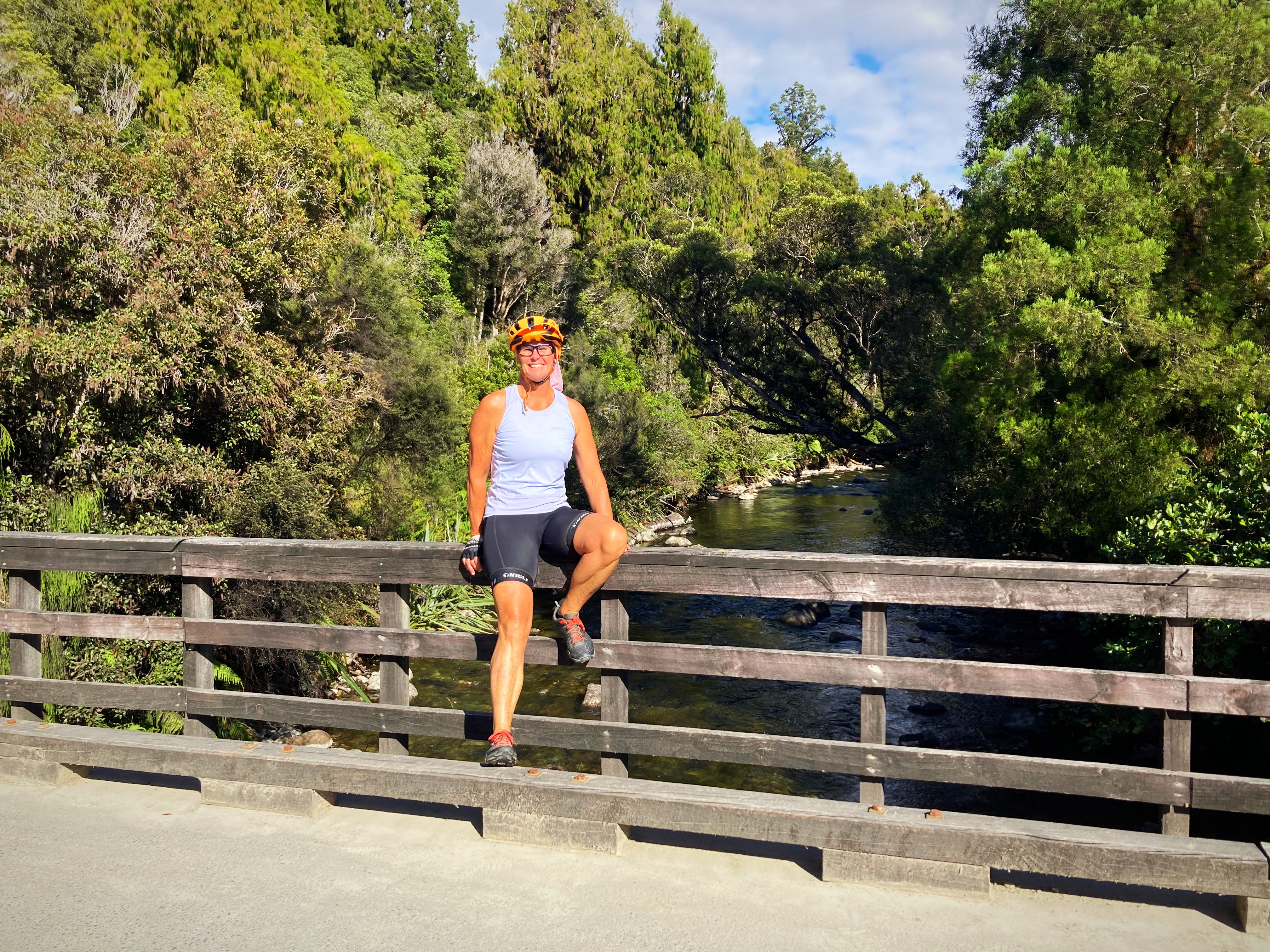
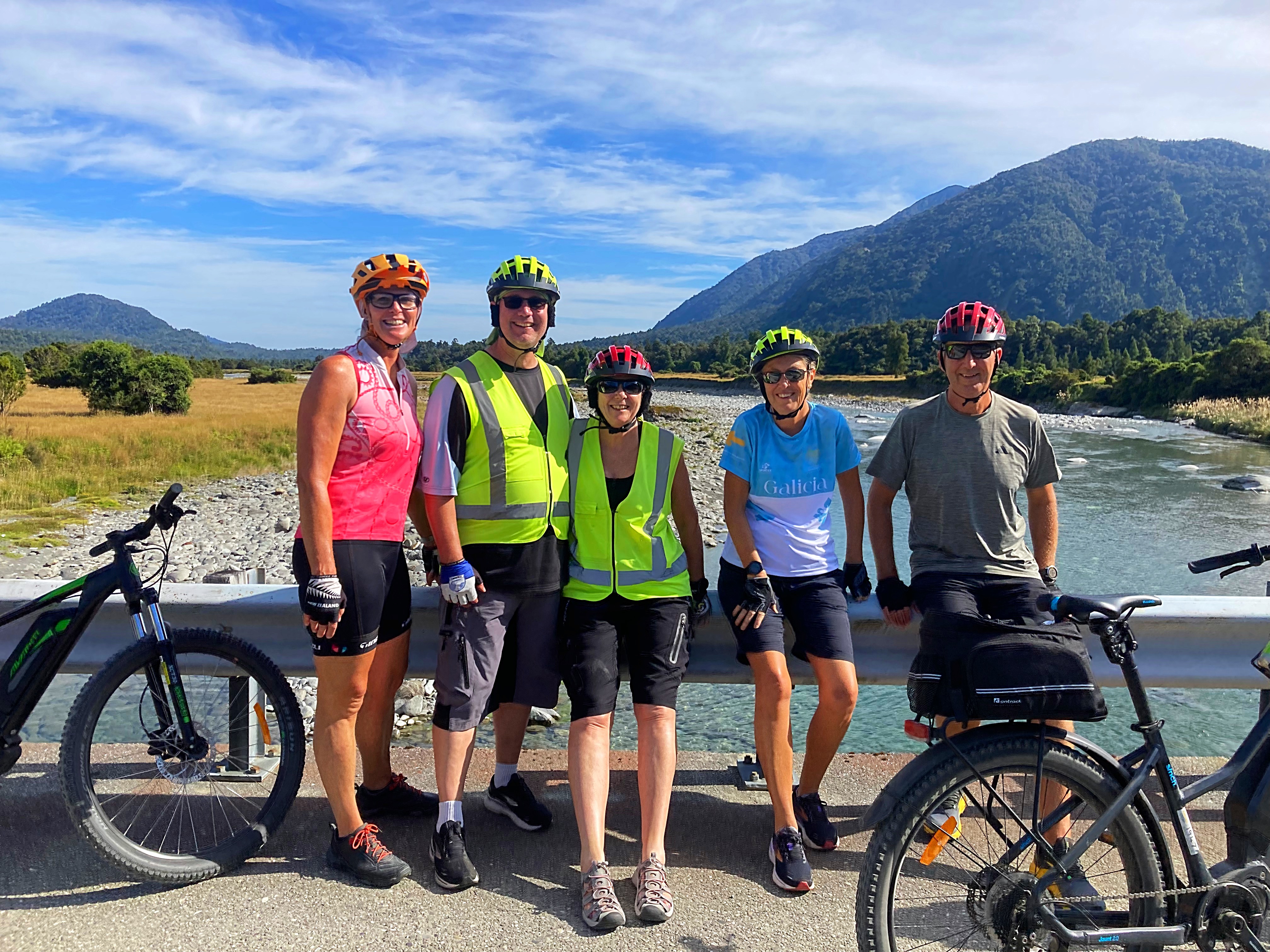
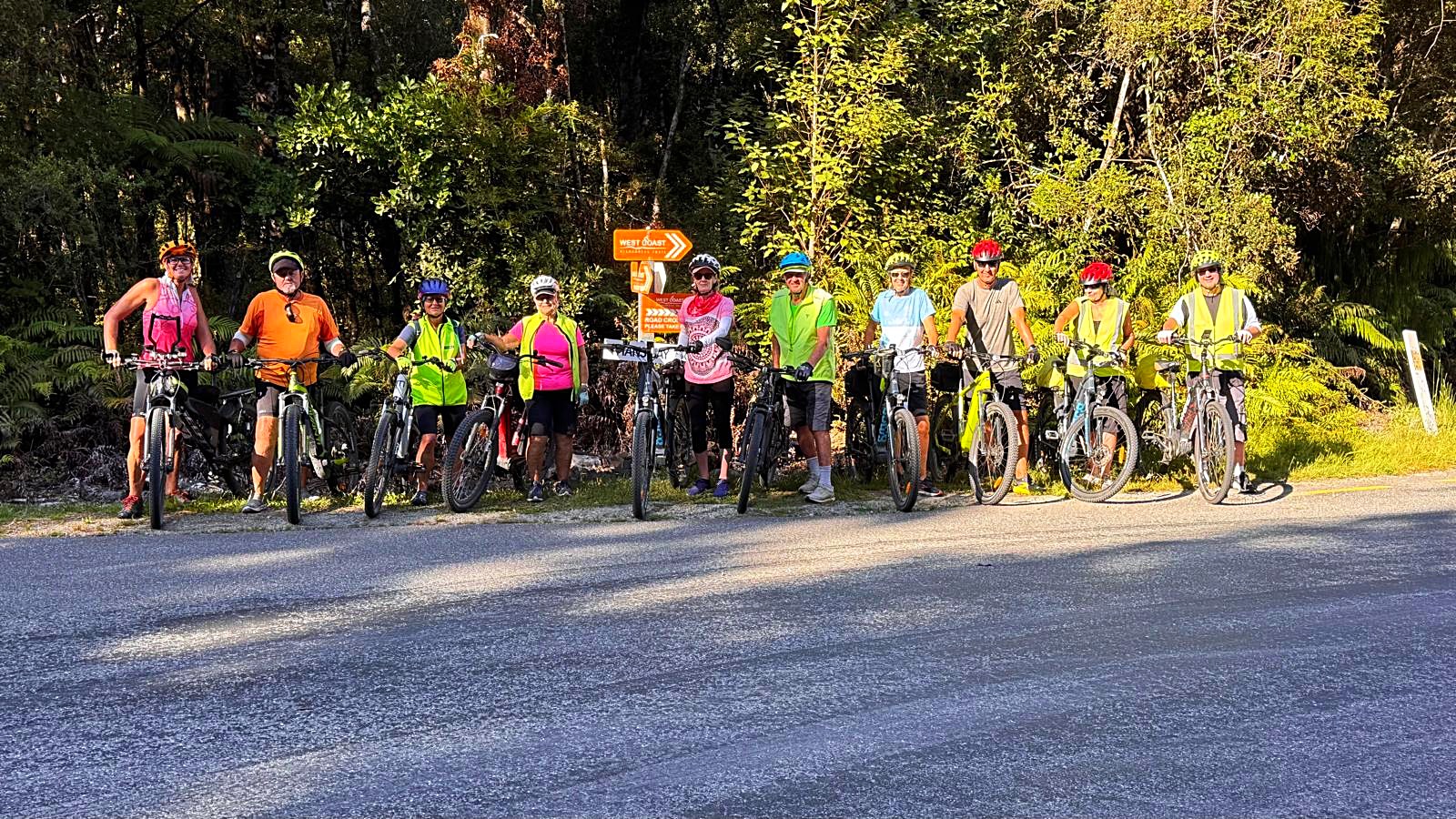
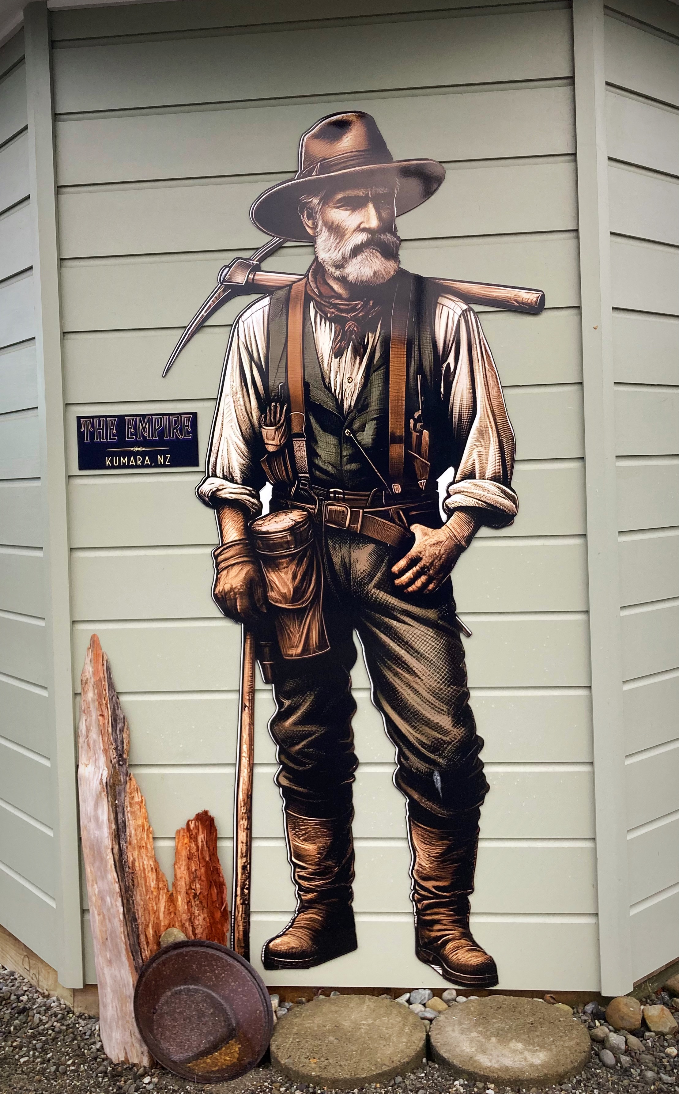
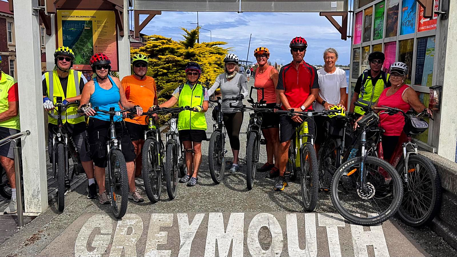
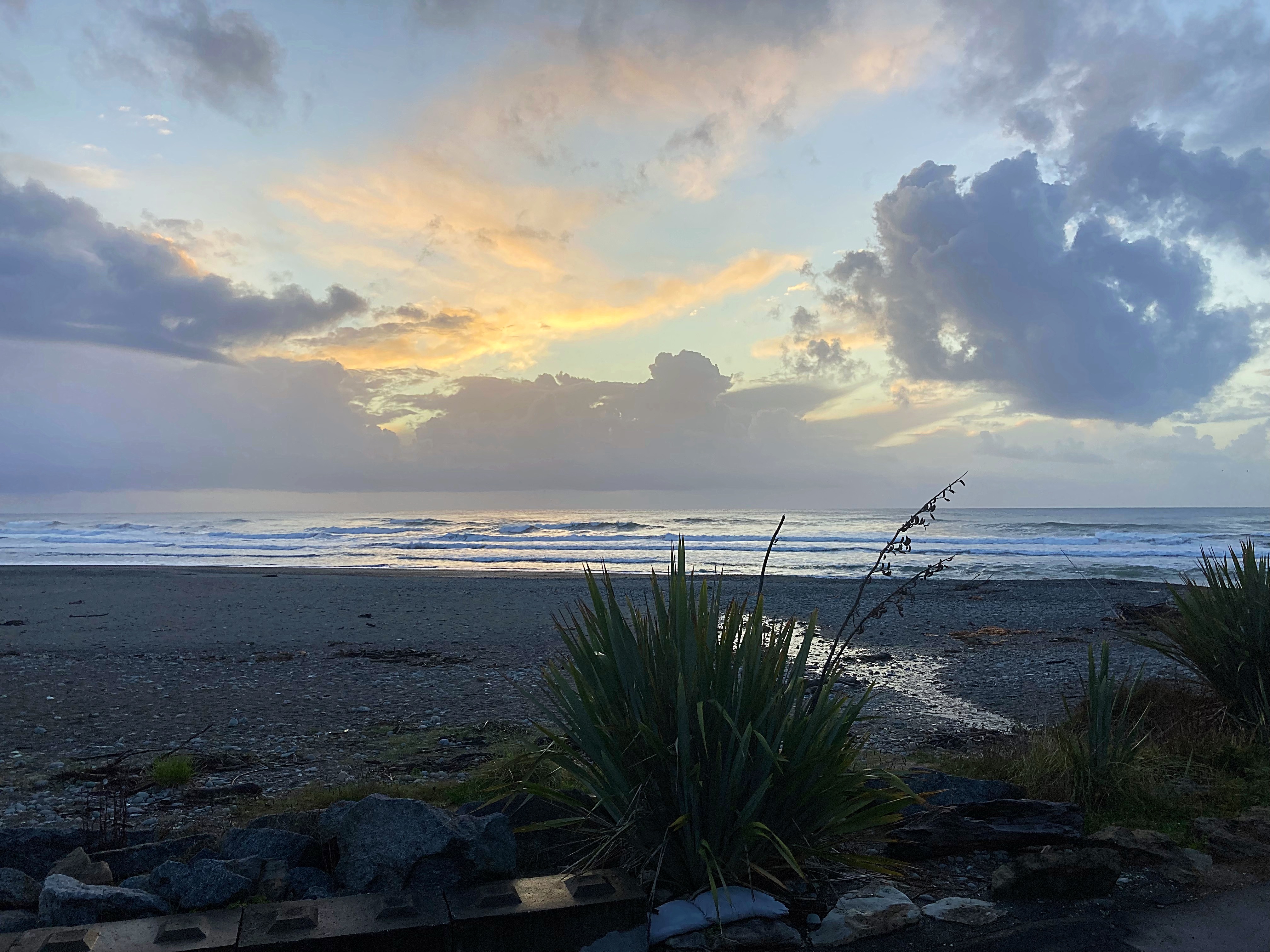
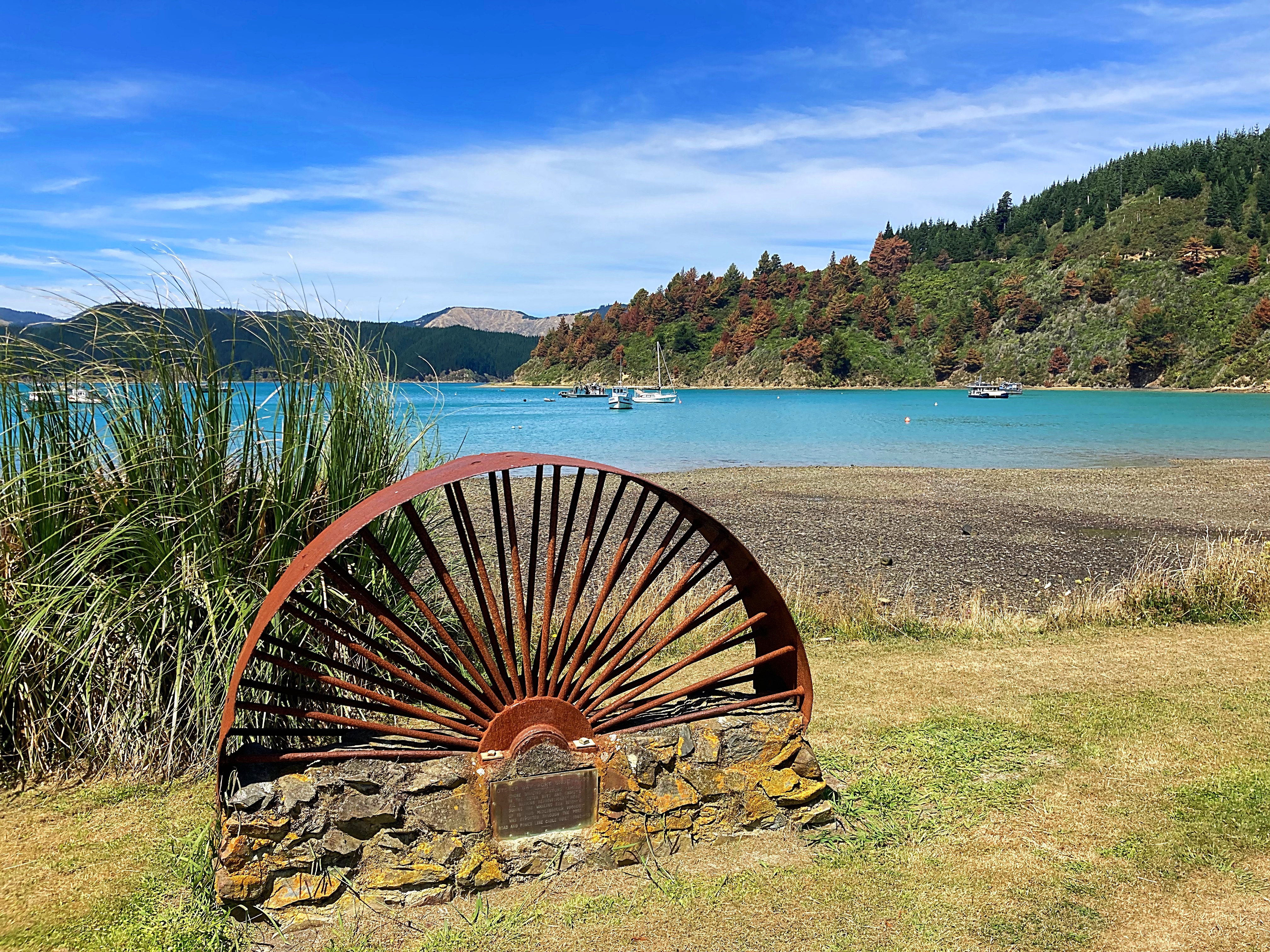
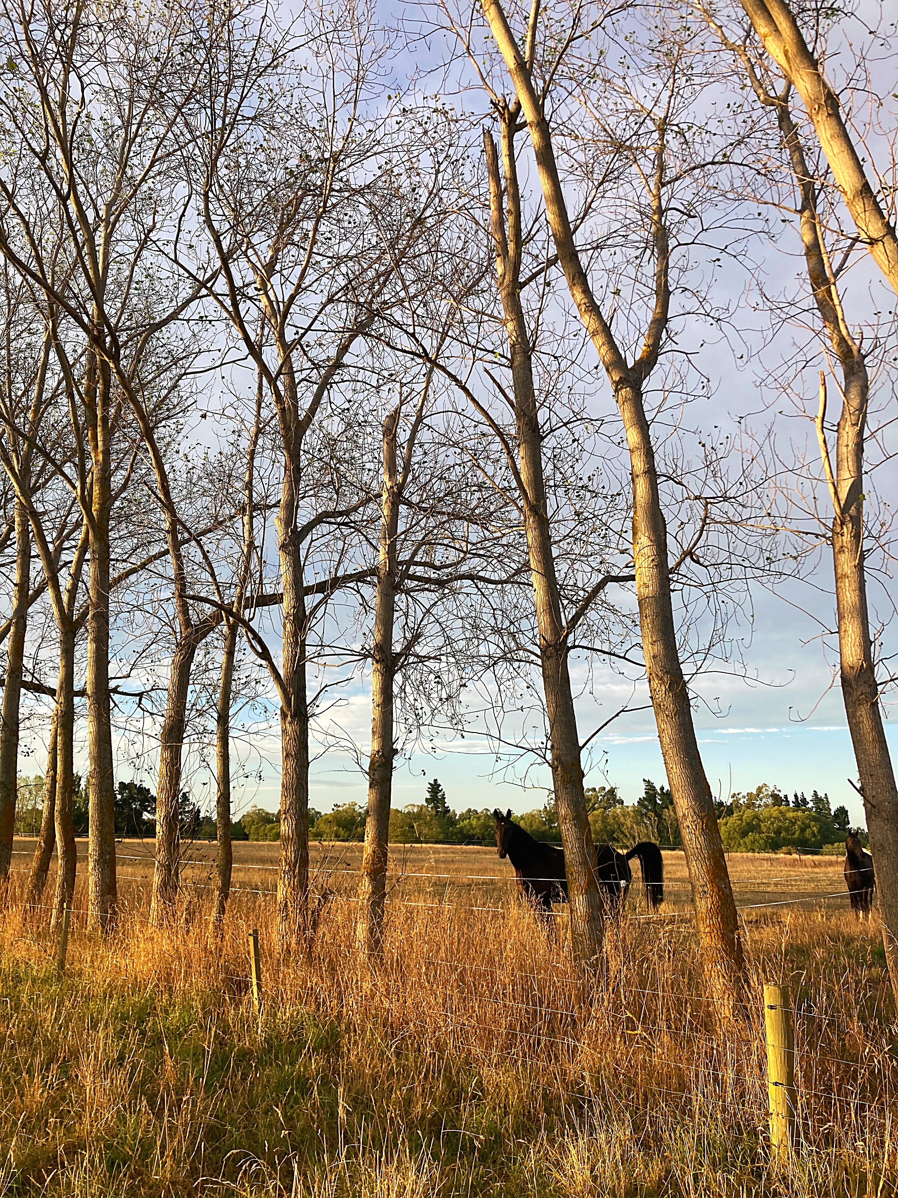
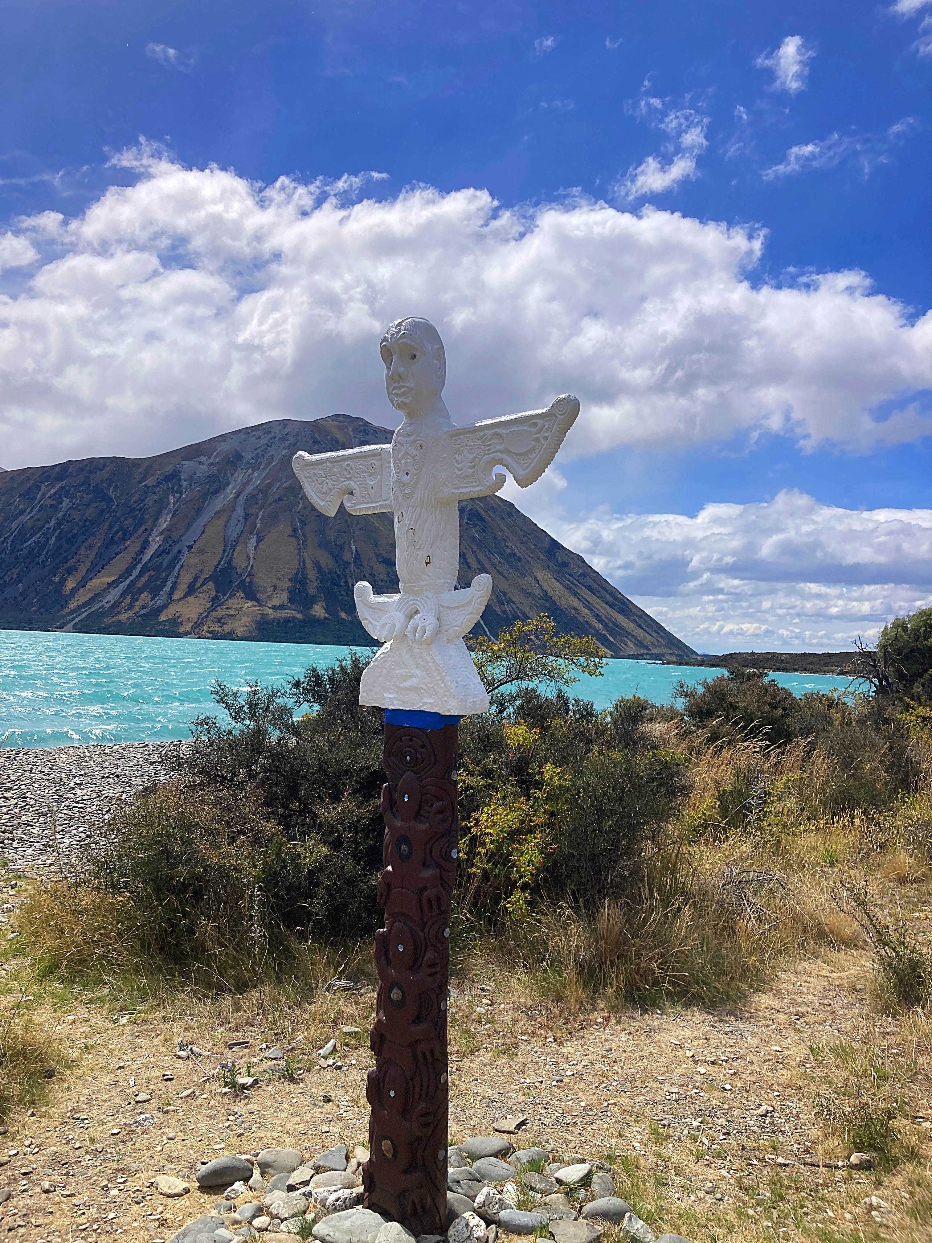
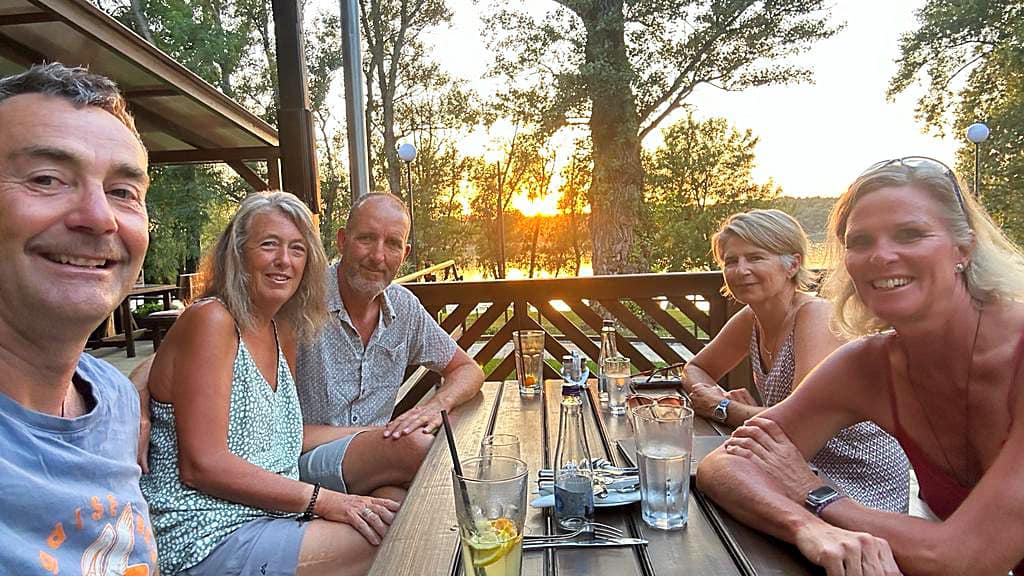
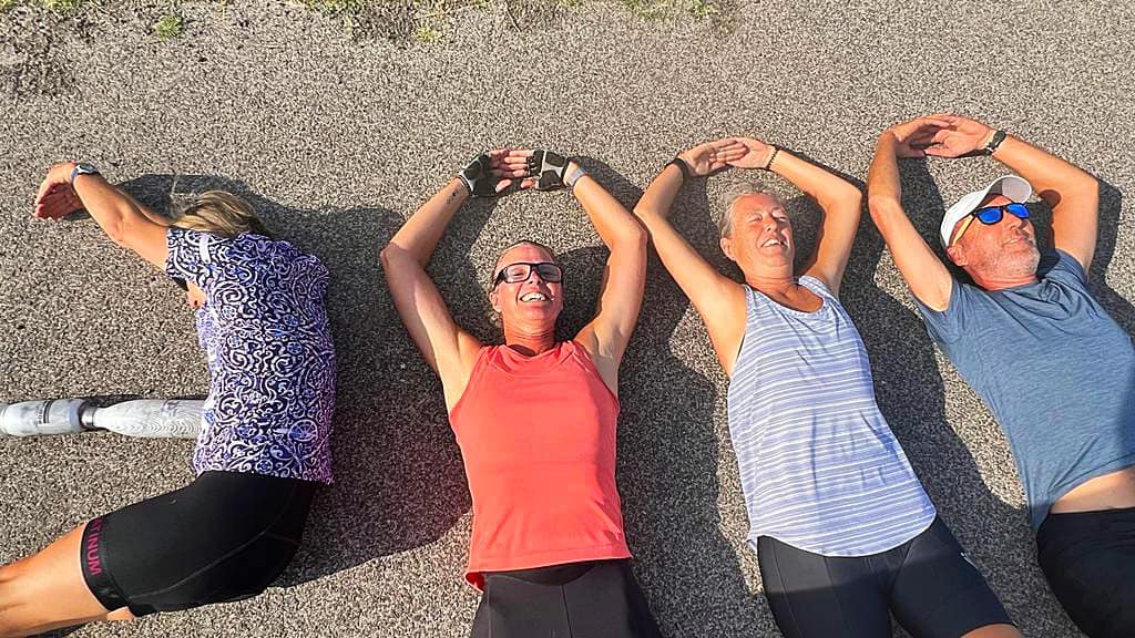
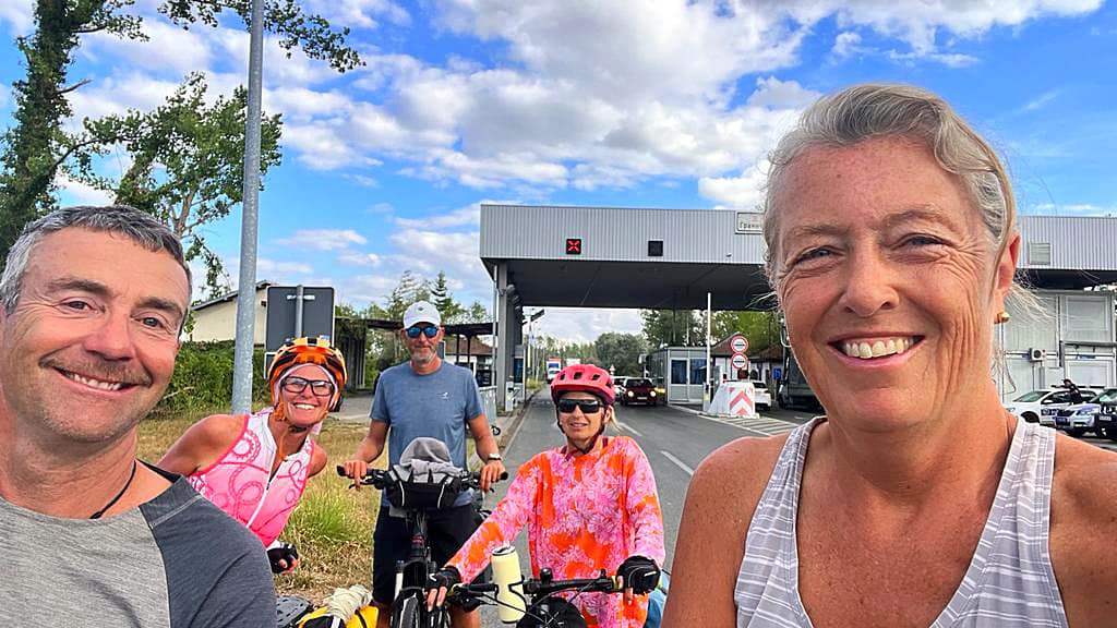
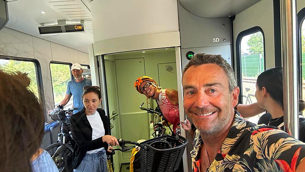
We finished the day with a lovely Sunday roast at The Empire Hotel in Ross before heading down to Ross Beach to watch the sun set. We also took a group photo at the official start of the West Coast Wilderness Trail.
How lucky are we
West Coast Wilderness – Day 3 – 51km
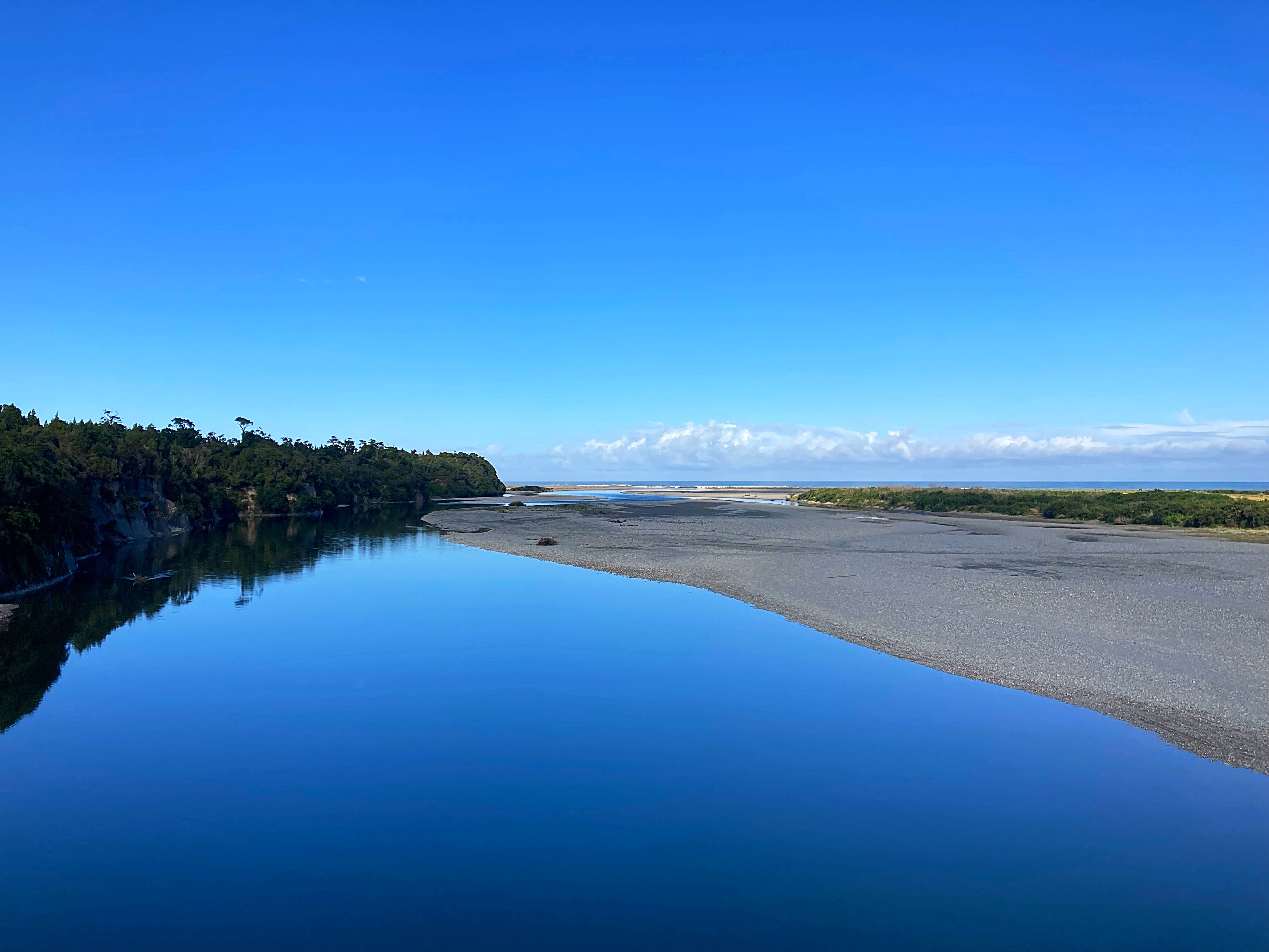
We left Hokitika by van and returned to a spot near Lake Kaniere to start our ride to the Arahura River.
The Arahura River is known as the Ponamu River as it is a major source of pounamu (jade or greenstone), a taonga (treasure) for Mãori. There is a Maori myth about how this came to be and the South Island of New Zealand is known as Te Wai Pounamu, the waters of Pounamu.
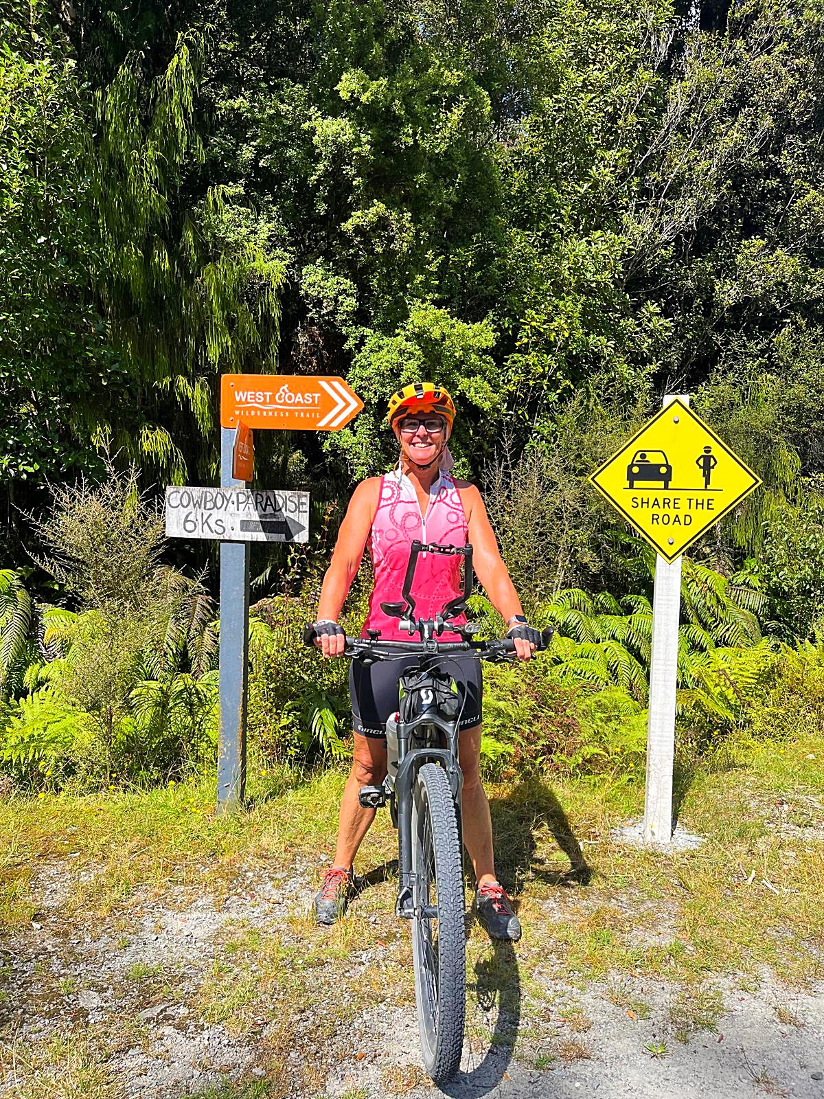
From here we climbed up to Cowboys Paradise which is a replica of a Wild West town. It is currently closed due to its owner’s participation in a number of illegal operations
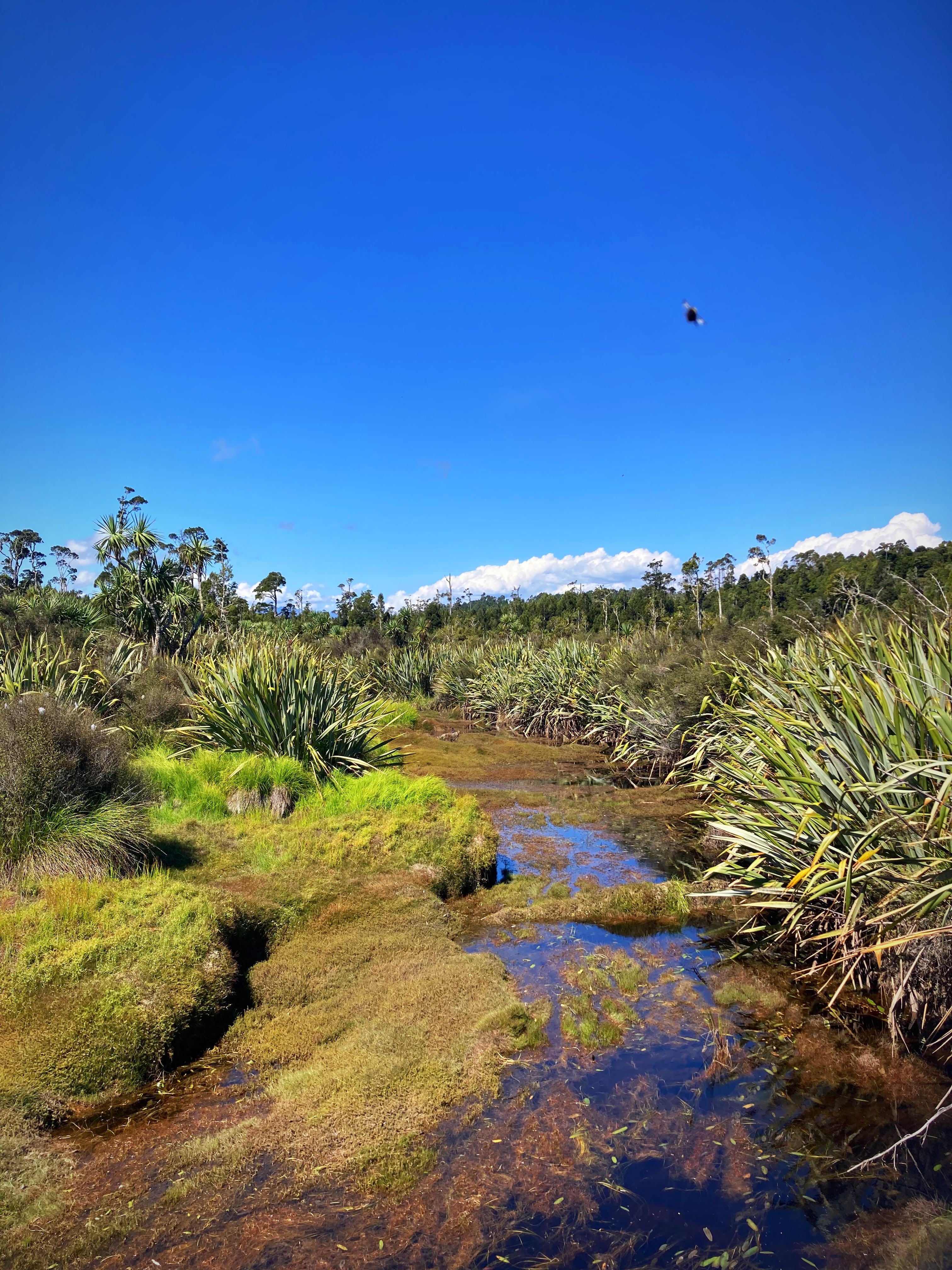
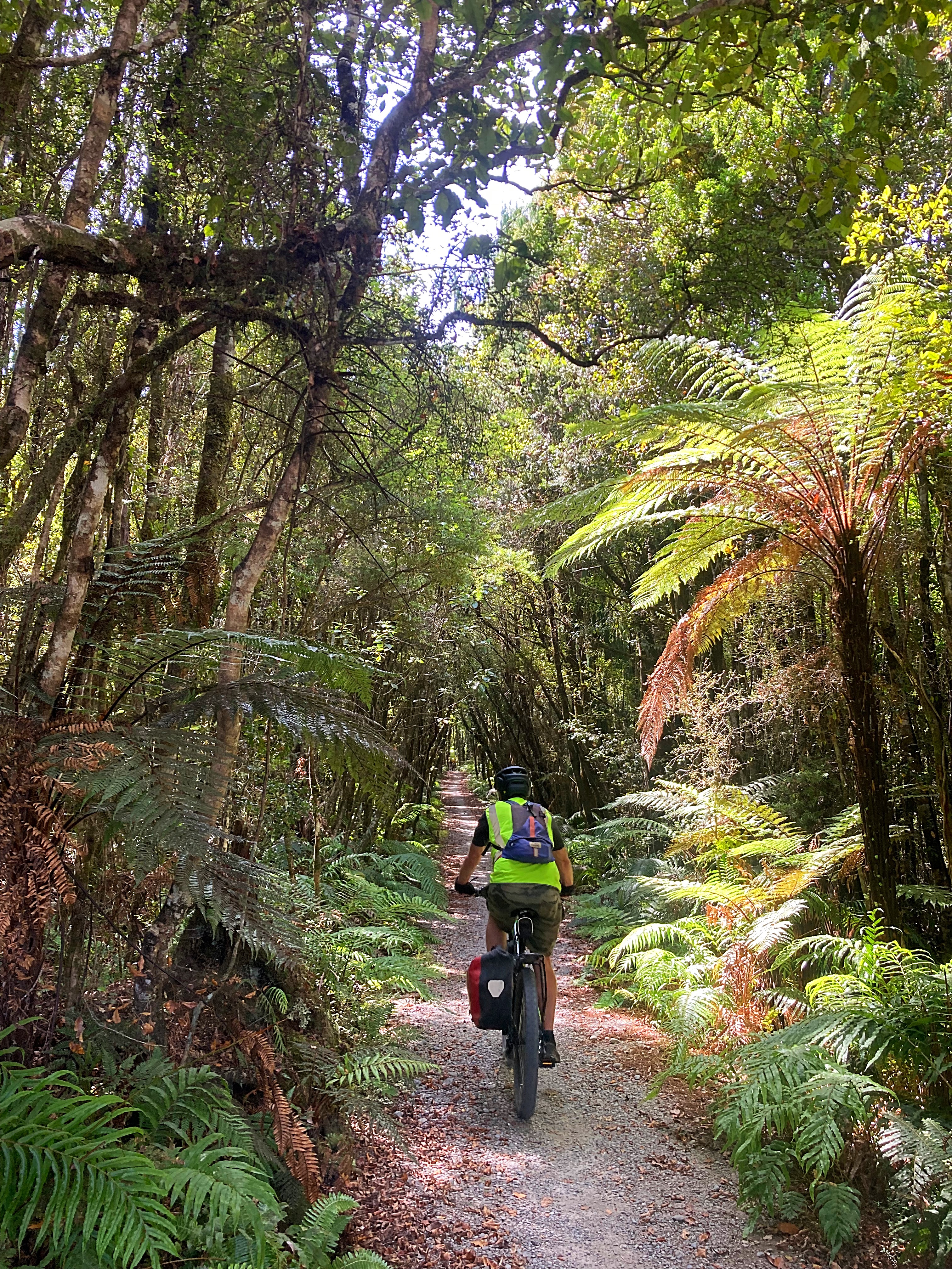
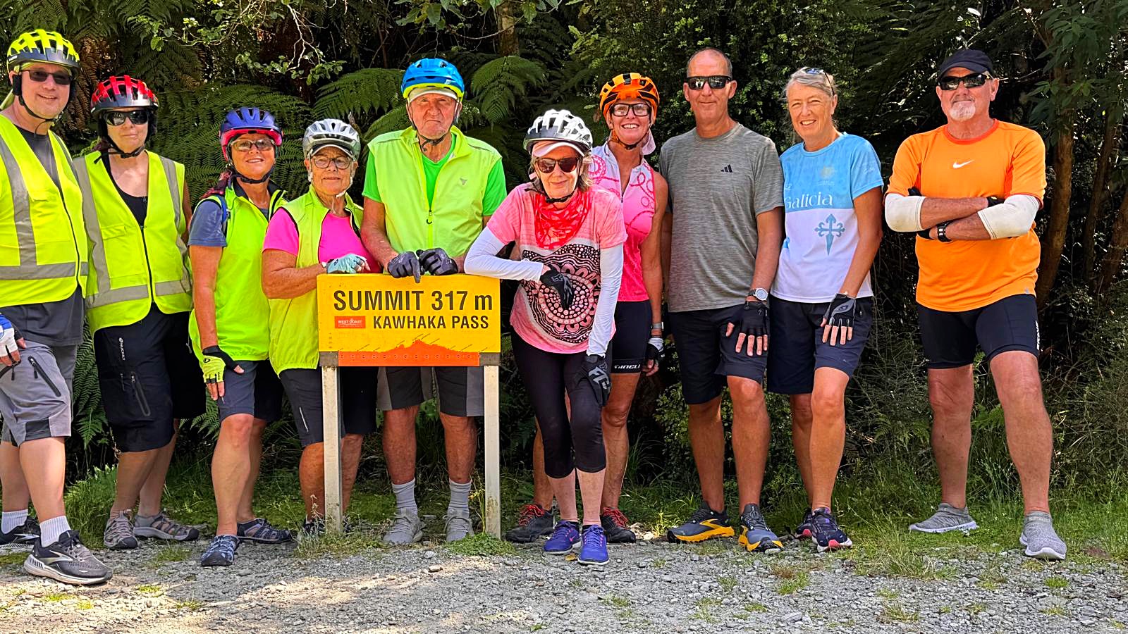
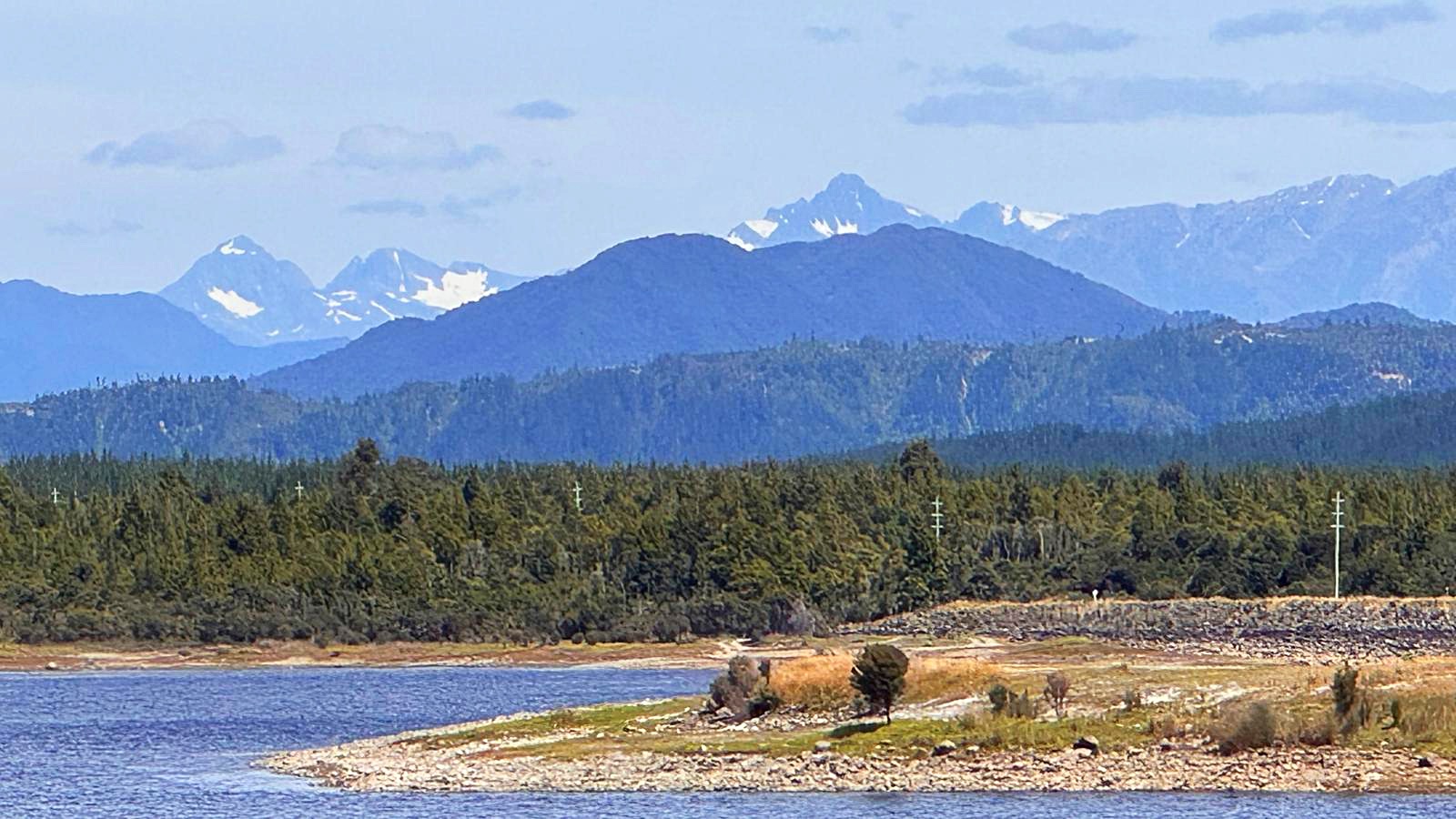
The trails flow through some beautiful native bush reaching a high point of 317m above sea level at Kawhaka Pass. There are some great views of the Southern Alps along the way and even Mt Cook in the distance.
Again there is a lot of gold mining history in here and remnants of water races and dams.
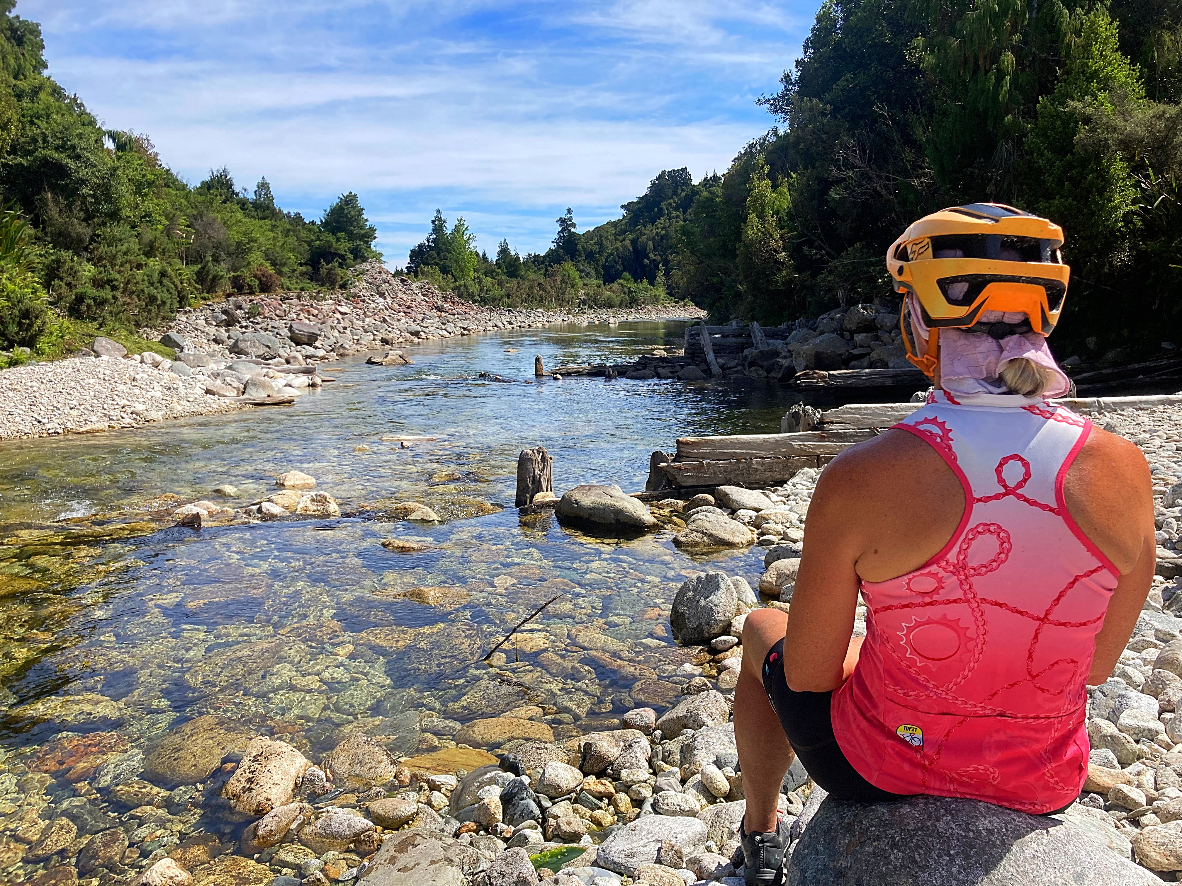
It was a super hot day and the water in the rivers looked so inviting but unfortunately there was no swimming today.
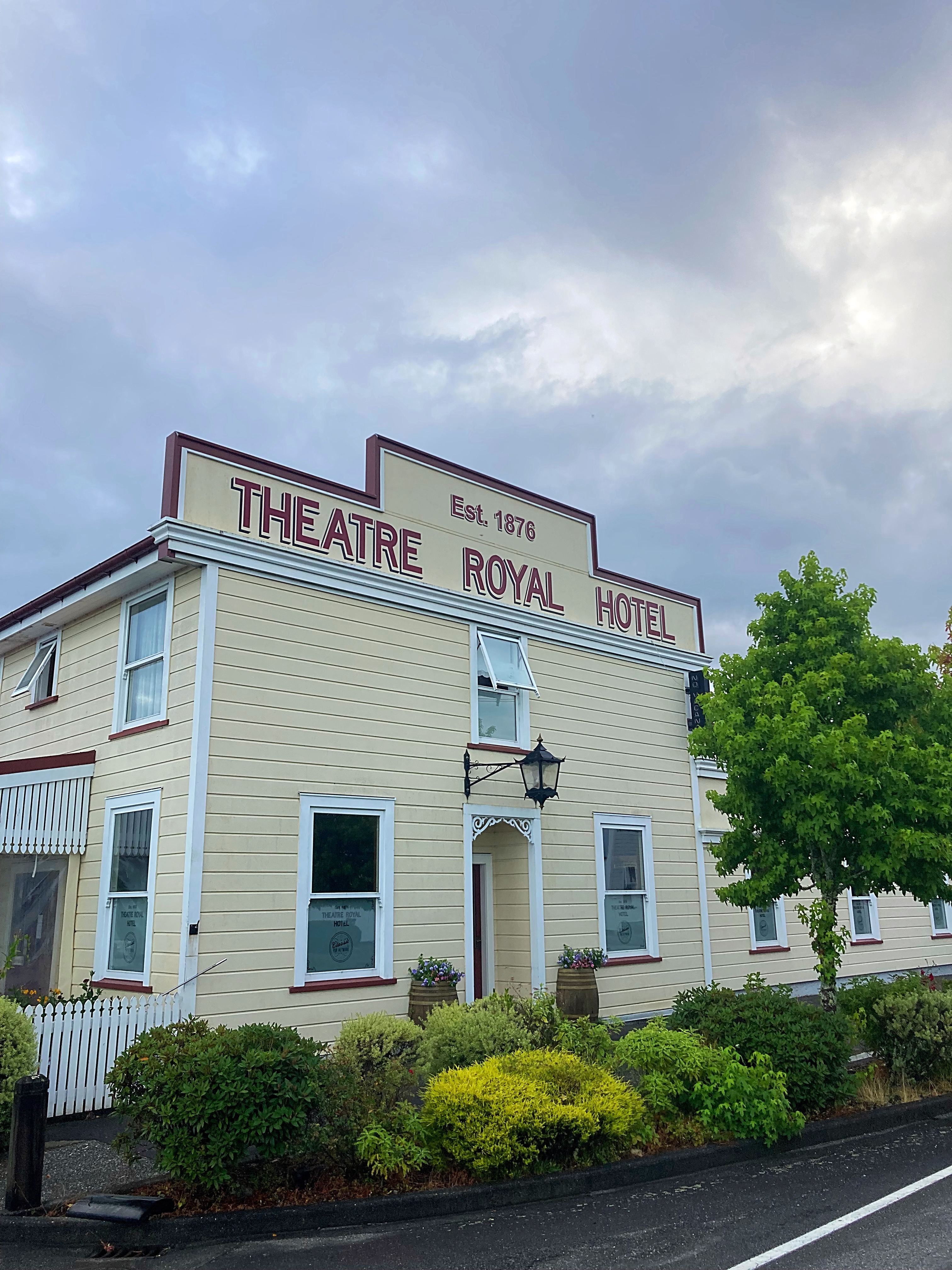
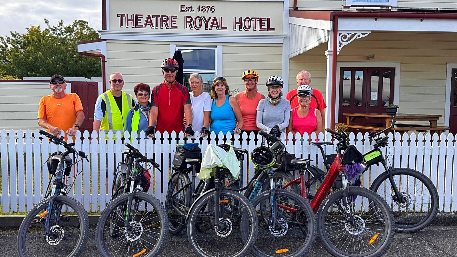
Tonight we are staying at the Theatre Royal Hotel which is the West Coast’s only fully restored gold miners’ hotel, and once world-renowned theatre in Kumara.
Kumara featured the Last Great Gold Rush and was the home of New Zealand’s longest serving Premier, Richard John Seddon.
West Coast Wilderness – Day 4 – 30km
A walk around Kumara before breakfast took about 5 minutes so it was hard to imagine the town as a bustling place with 41 hotels at the time of the gold rush.
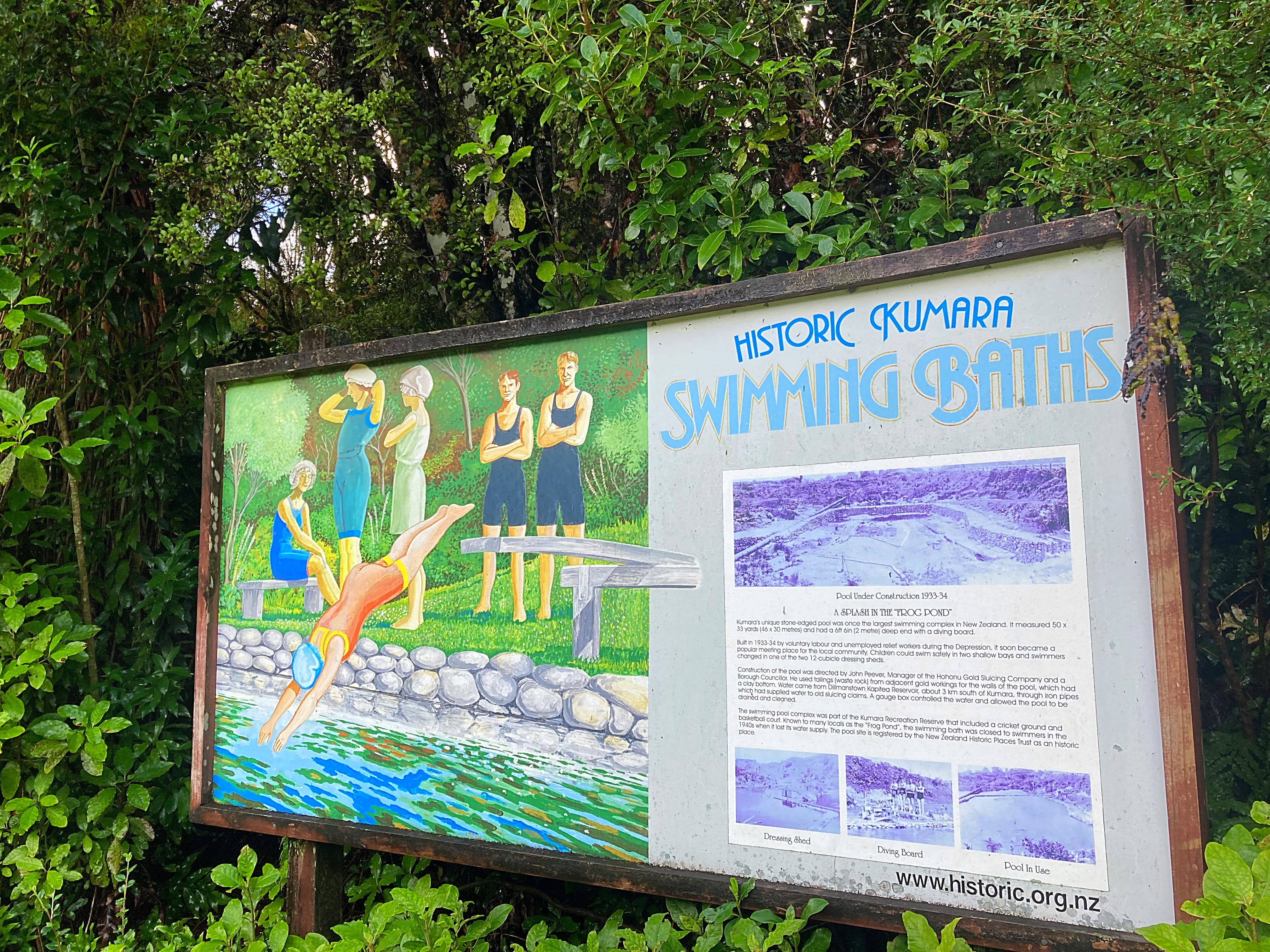
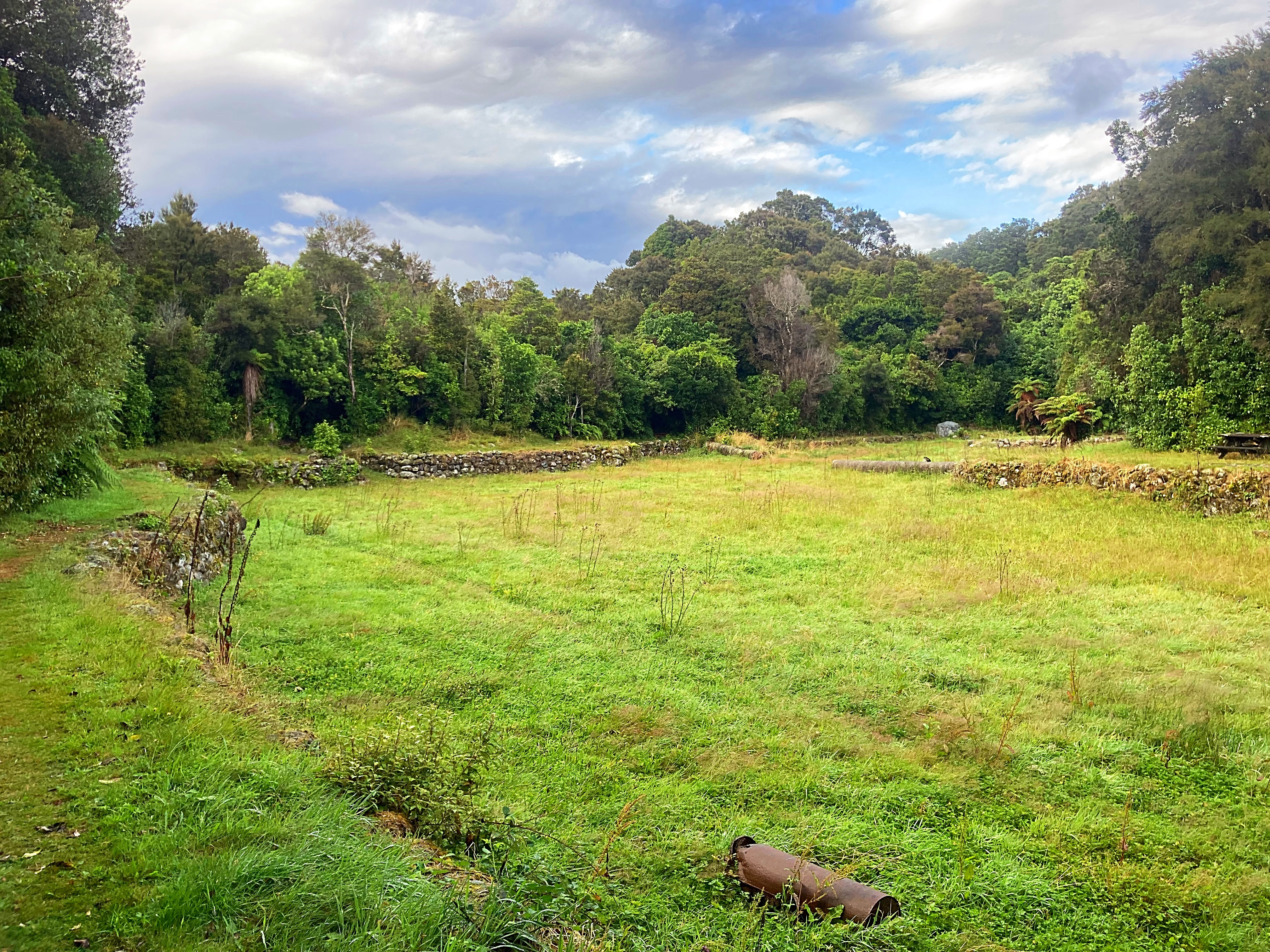
Before getting on the bikes we took a drive to see what was once NZ’s largest swimming pool measuring 46 X 30 metres. The deep end, complete with diving boards was 2 meters deep.
The pool, a Category 2 Historic Place, was built as a community project during the depression in the 1930’s. The left-over tailings from old gold workings were used to build the perimeter walls. The floor of the pool was clay and the water for the pool came from a reservoir formerly used for sluicing gold. It had several pools including two shallow bays for children and was furnished with two 12-person changing sheds. Locals called it “The Frog Pond”.
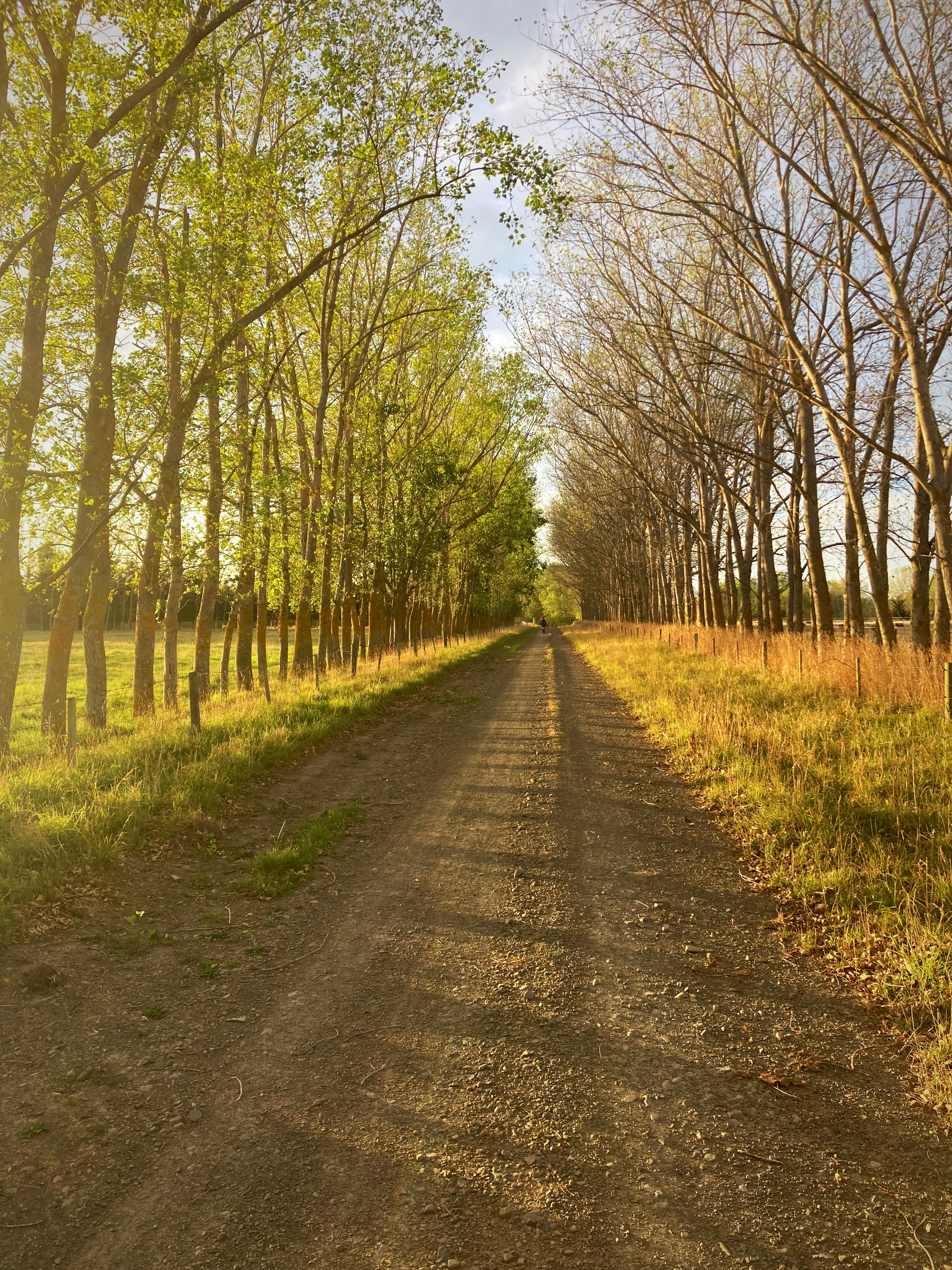
It was then time to saddle up for the 30km ride to Greymouth through bush trails and then a trail along the coast.
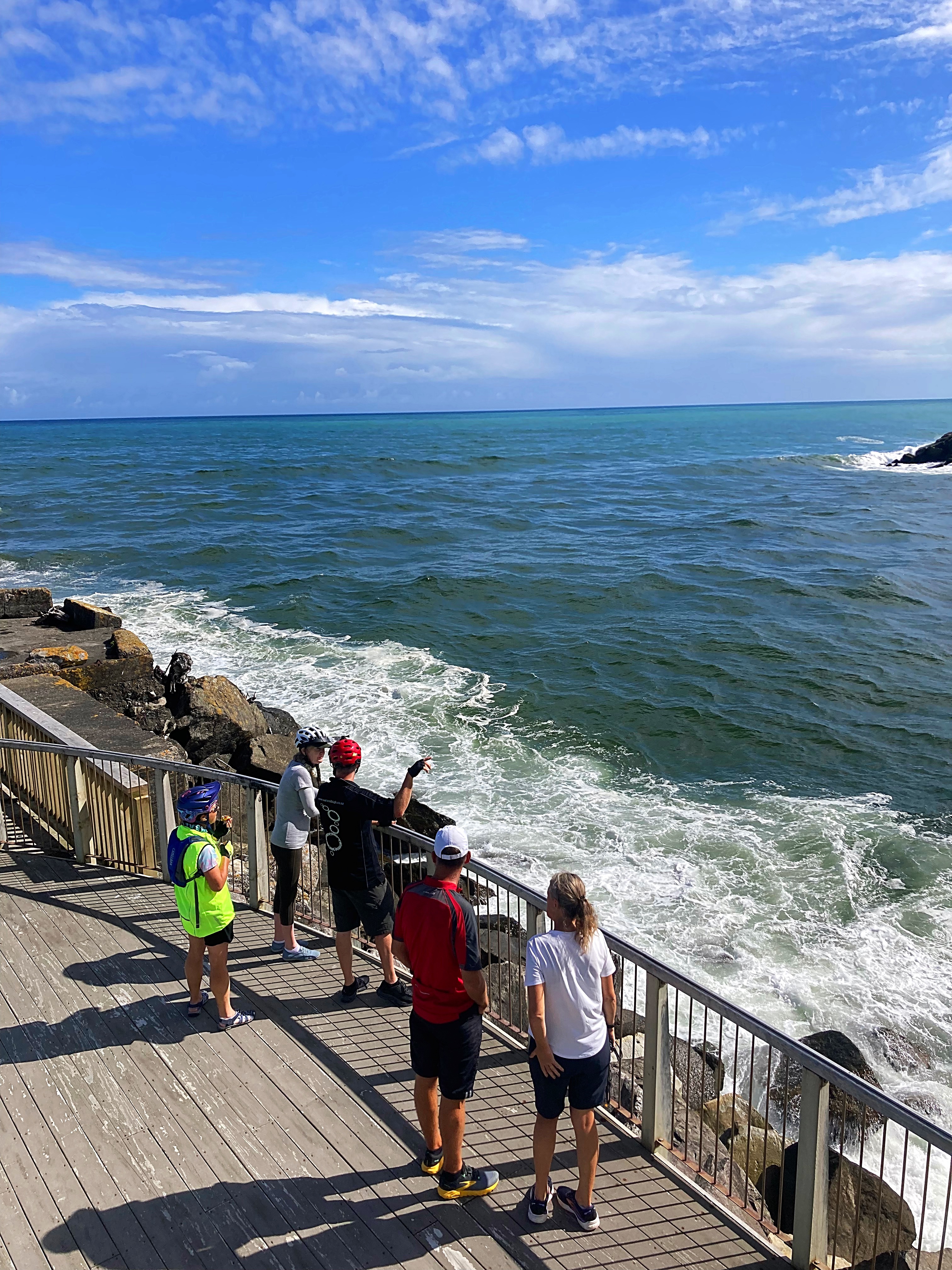
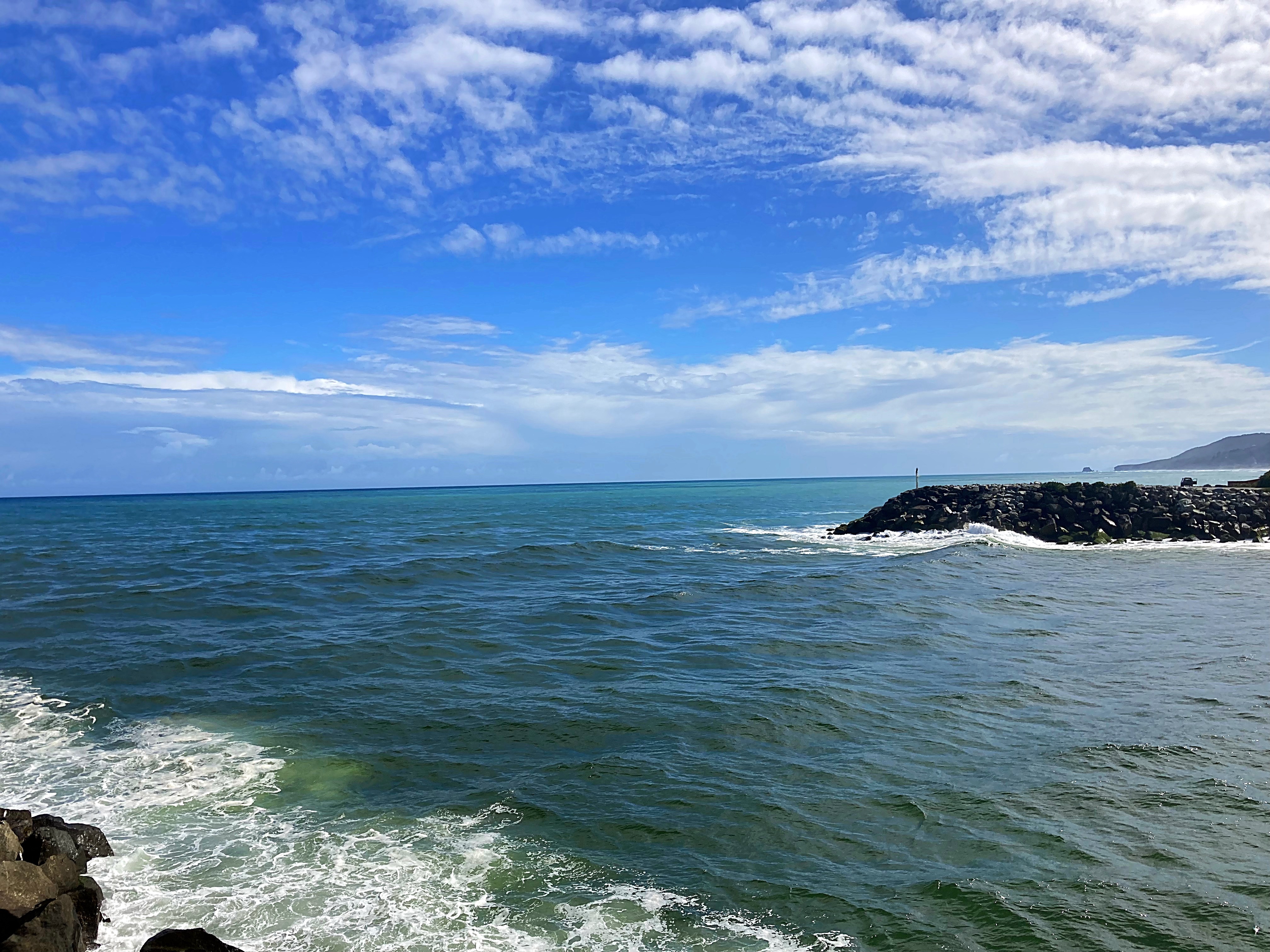
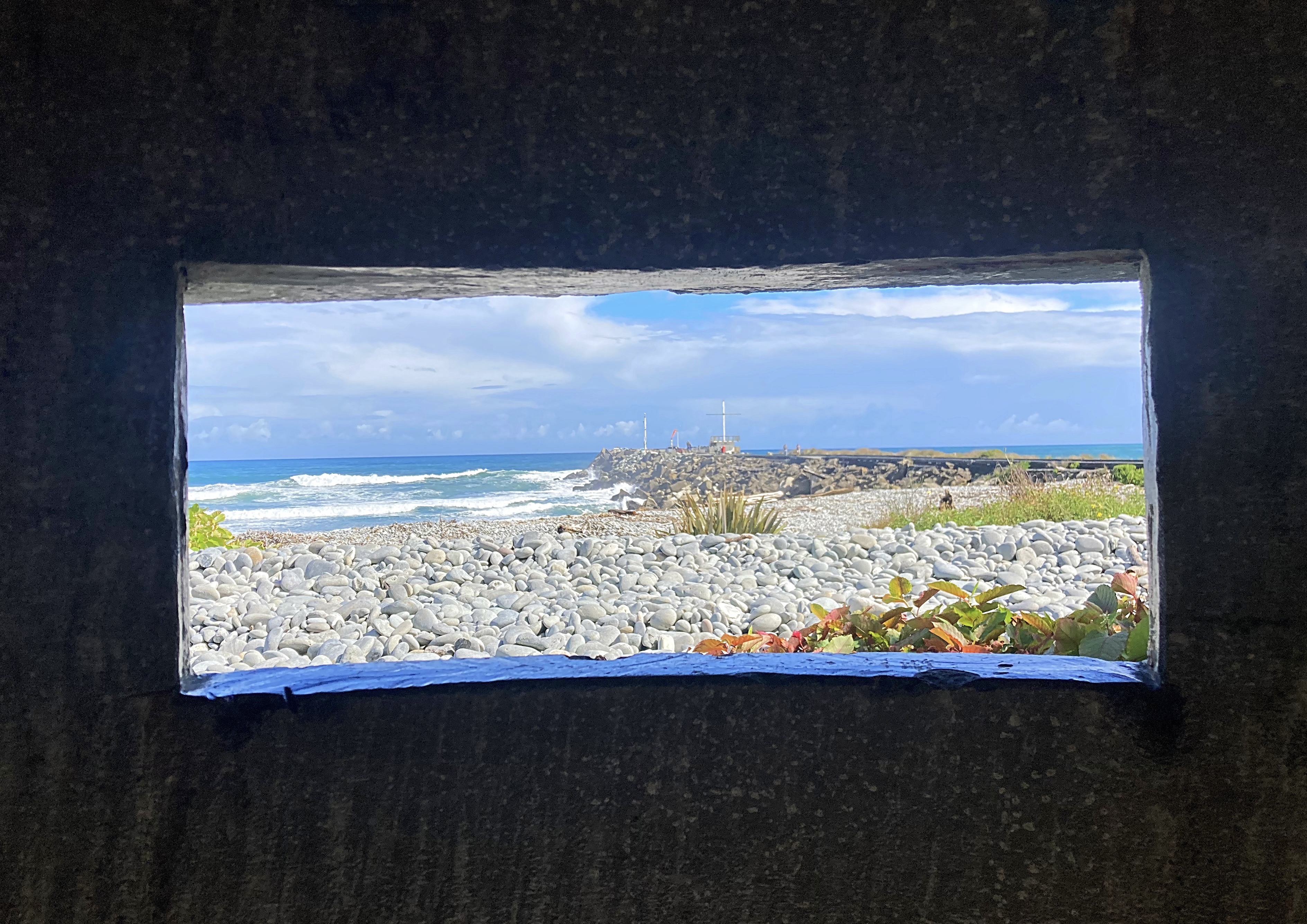
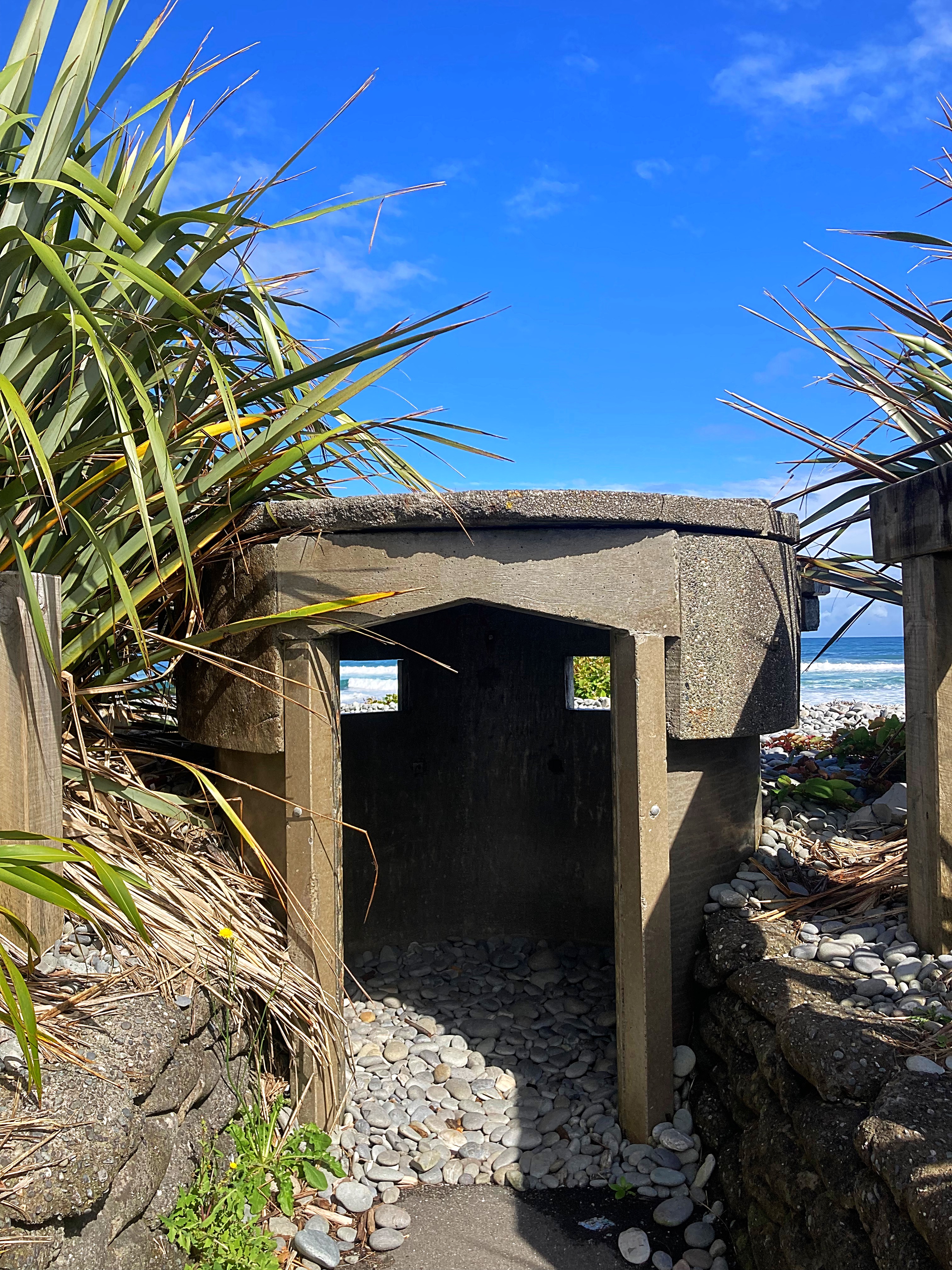
We stopped at the infamous Greymouth bar which is notorious and has claimed many a ship and sailor.
The Port of Greymouth was a busy town in 1870, with 55 hotels, grog shanties, stables, brothels and dance halls. The road to Canterbury opened in 1865, literally a horse track, and not until 1923 was there a rail ink. With the decline of of alluvial goldmining and the provision of better harbour facilities, an important coal export trade gradually grew and become the main basis for the subsequent prosperity of Greymouth.
Gold gave birth to the West Coast but it was “Old King Coal” that kept it living.
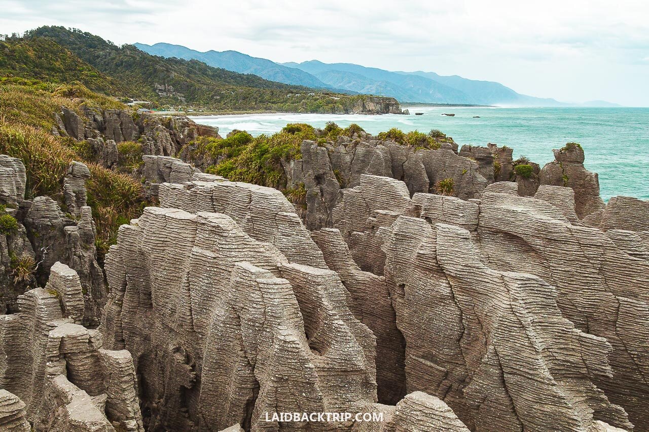
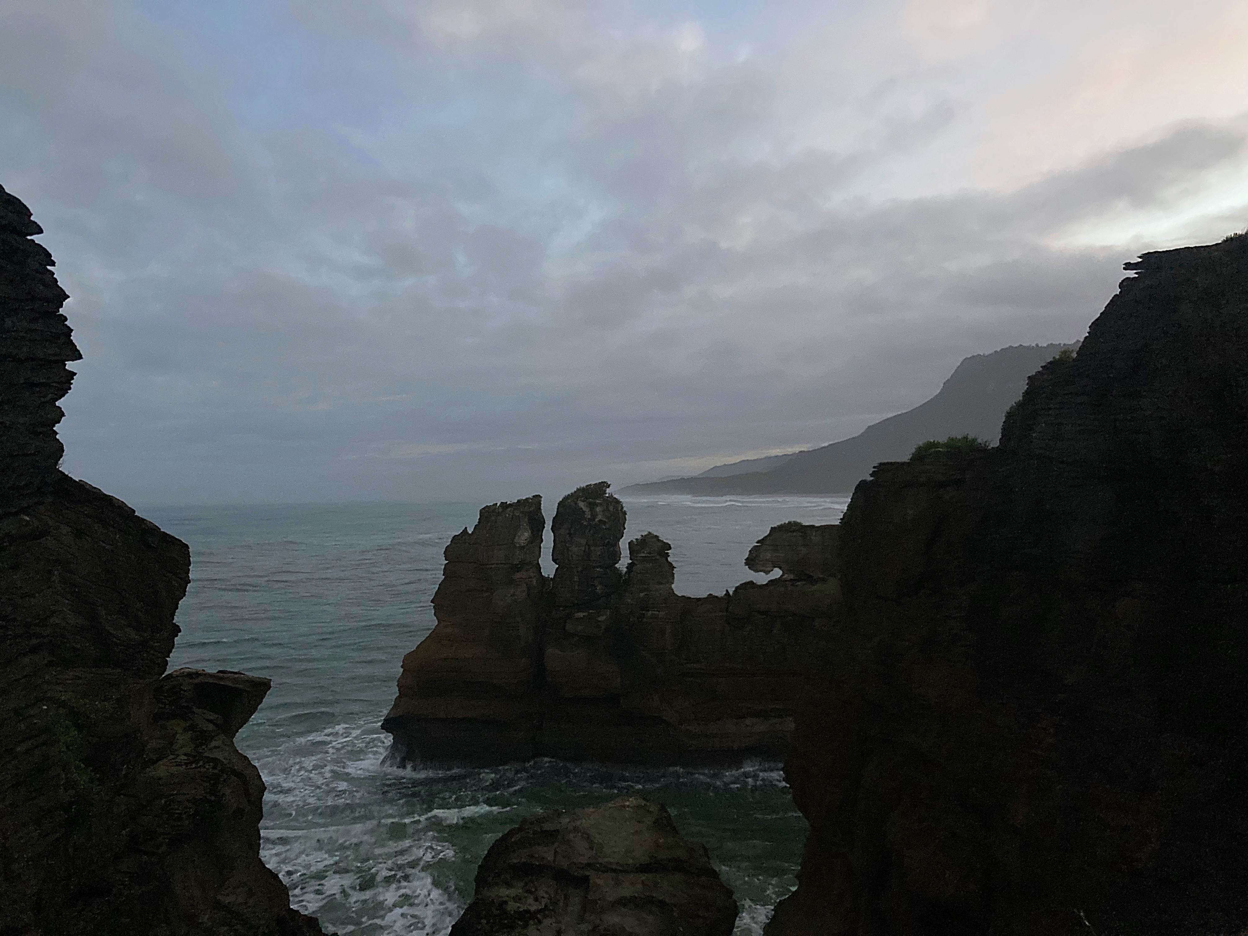
After lunch in Greymouth we drove up the coast to Punakaiki, home of the famous pancake rocks. Unfortunately, the weather took a turn for the worse so our walk out to see the rocks ended in sideways rain and not a lot of enthusiasm to hang around. I’ve included a photo from the internet to remind me of what I missed.
South Island Maori tell of the Polynesian hero Maui setting out from Hawaiki with members of his family in the waka Mahunui to explore the southern oceans.
Land was sighted on the West Coast of the South Island. Opinions were divided; some of the crew believed they were looking at the tops of a high range of mountains, Maui contended it was “he tiritiri o moana ” (a mirage of the ocean). It was no mirage.
As the waka drew near to Mahitahi (Bruce Bay), 150 km south of Greymouth, the snow capped tops of the Southern Alps could be clearly discerned, including Ao-raki and his brothers. The mountain range retained the name He Tiritiri o Moana, and these Southern Alps form the encircling eastern and southern vista from the Greymouth Harbour.
Abel Tasman first saw New Zealand from off the West Coast in 1642. James Cook followed in 1769. Neither landed on the West Coast, but they are commemorated by having their names applied to the mountains Aoraki (Mt. Cook) and Rarakiroa (Tasman Sea).
Tasman was blown east from Tasmania and discovered New Zealand by mistake, thinking it was part of Argentina, and naming it Staten Landt. Captain Cook arrived from Tahiti and mapped the complete coastline of New Zealand.
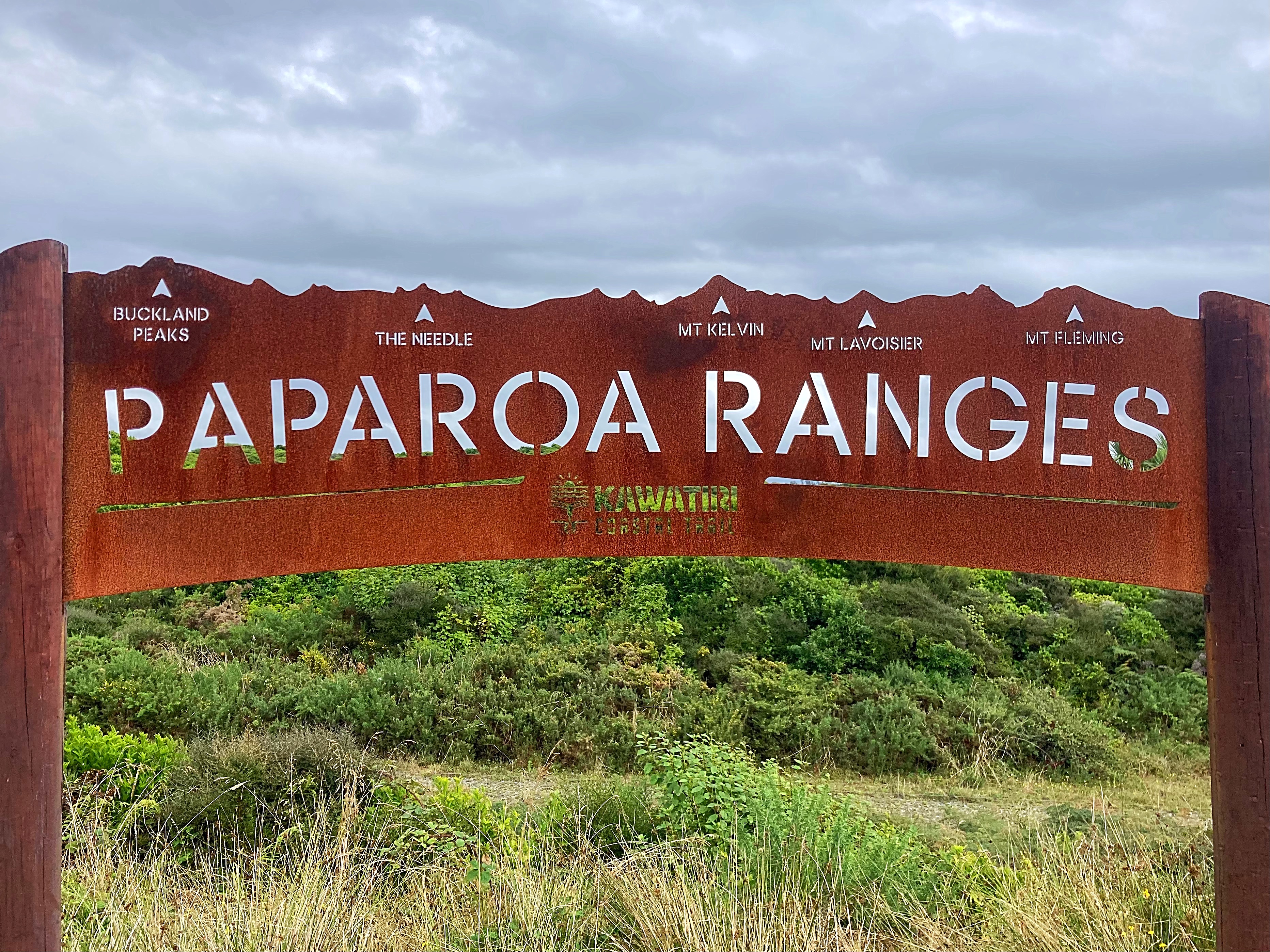
Kawatiri Coastal Trail – Day 5 – 21km
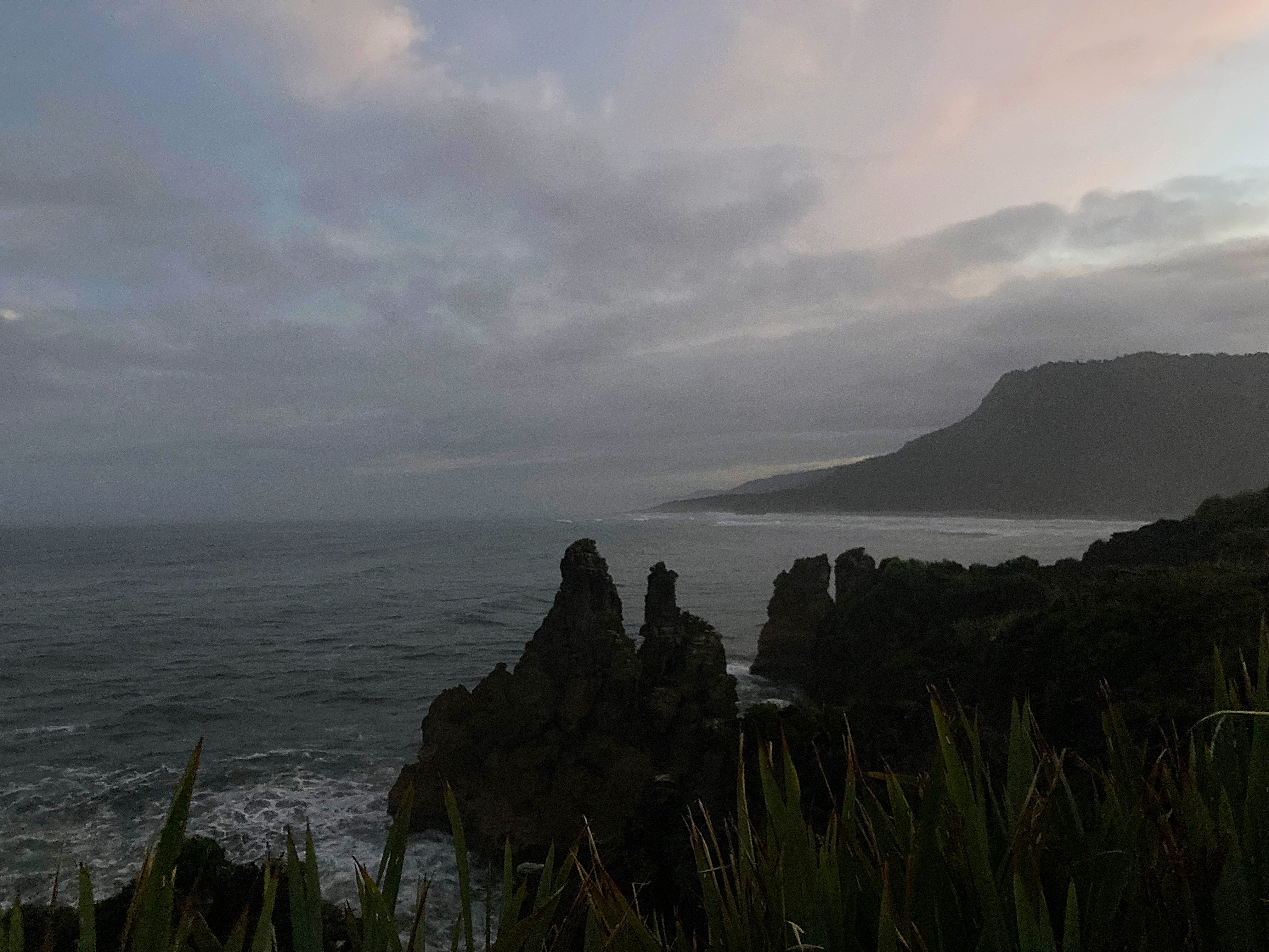
After a lot of rain overnight we woke to a dry morning so I decided to revisit the pancake rocks at Punakaiki before breakfast. It was great as I really hadn’t seen anything the day before.
Rising from the sea at Dolomite Point, the Pancake Rocks are part of a heavily eroded limestone area where the sea bursts through underwater channels and escapes via vertical blowholes.
These rocks, dating back some 30 million years, formed as layers on the sea bed which eventually rose under seismic action. Since then water, wind and salt spray have been constantly eroding the softer layers leaving a ‘pancake’ stack of harder limestone.
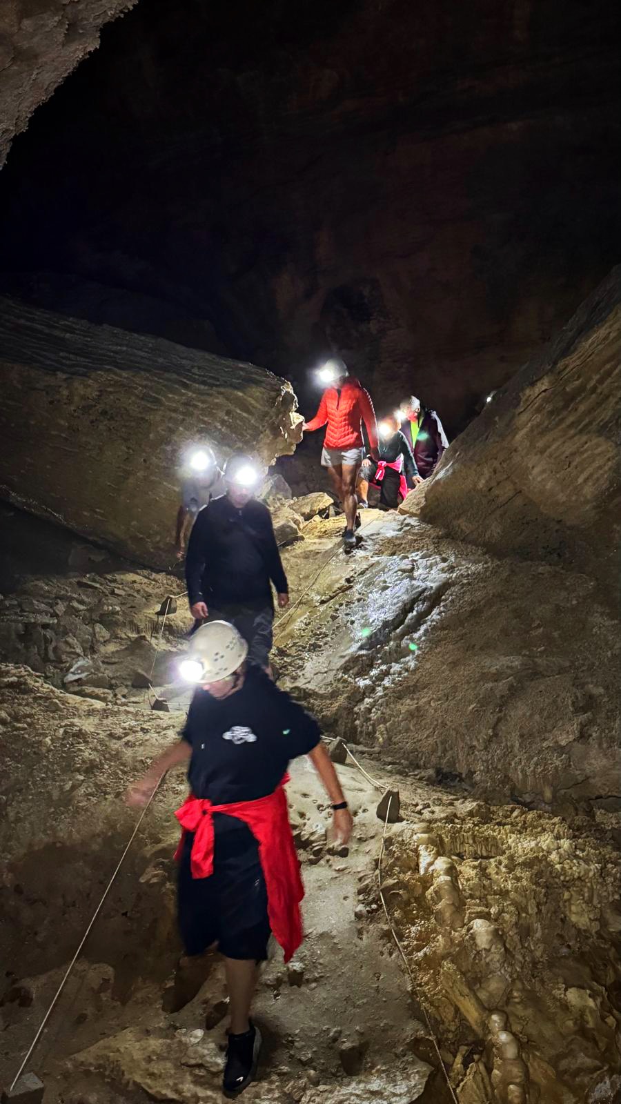
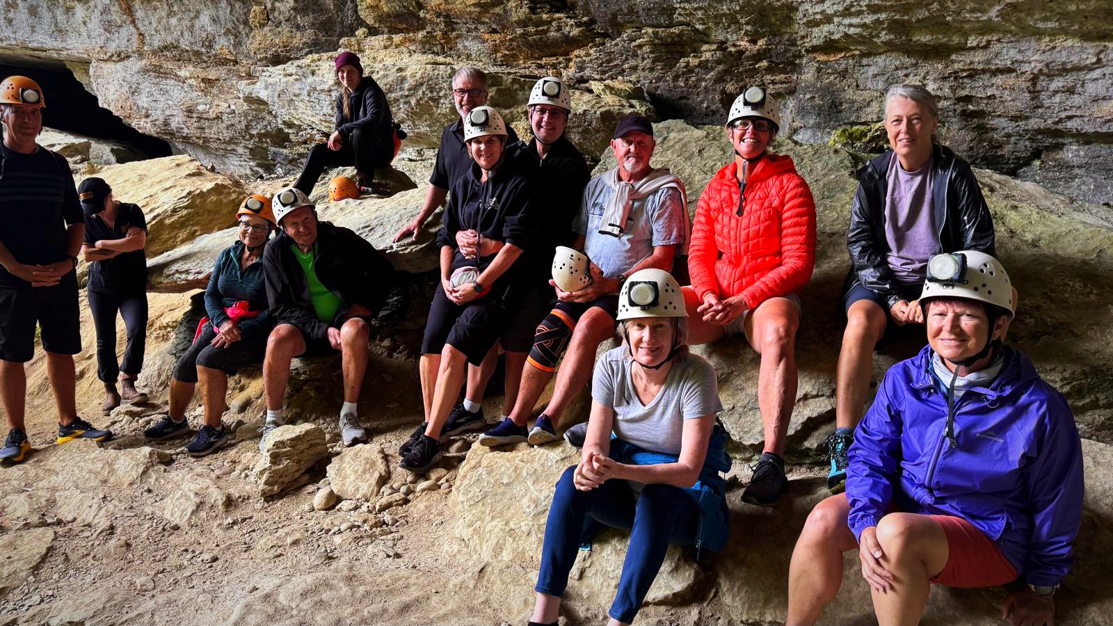
After breakfast we drove north to Charleston where we did a tour of the Te Ananui Caves. To get to the track leading into the cave we took the Nile Rainforest Train. They have two engines – Dorothy (a diesel powered engine) and Cecil (a petrol powered Morris 1100 engine). Dorothy took us through the rainforest before we descended the equivalent of 7 stories to the cave entrance.
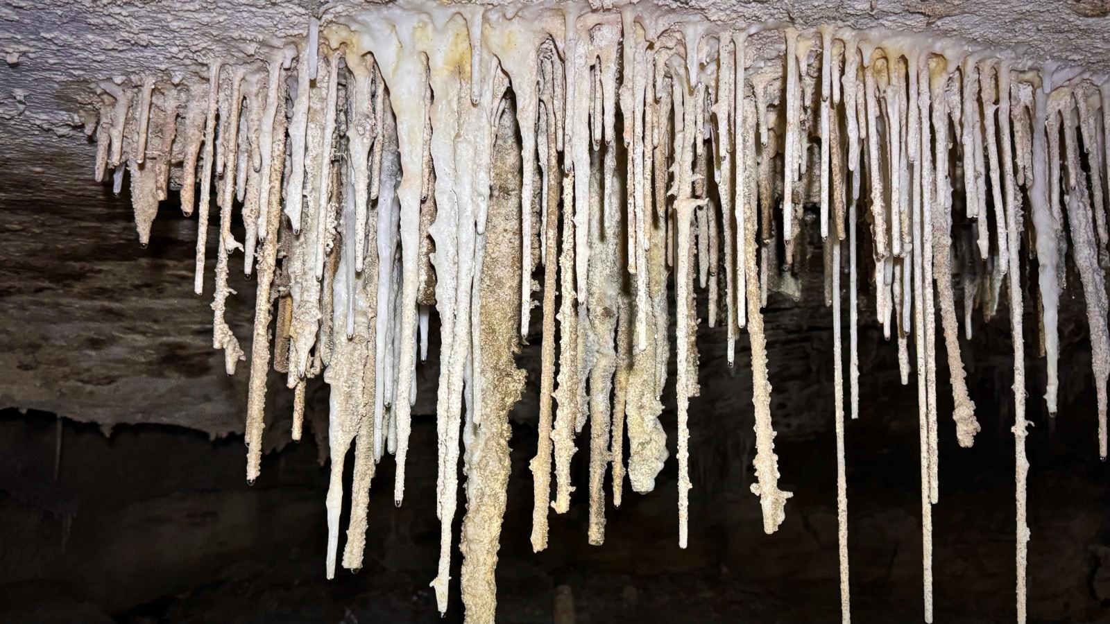
We went down three levels, ducking and diving through some impressive stalagmites and stalactites. Headlights off, we then experienced a very impressive display of glow worms.
There are 68 caves in this area with the Te Ananui cave being the only one accessible to the public via a commercial operation run by Underworld Adventures on Department of Conservation land. Information about the other caves is not available to the public to protect them.
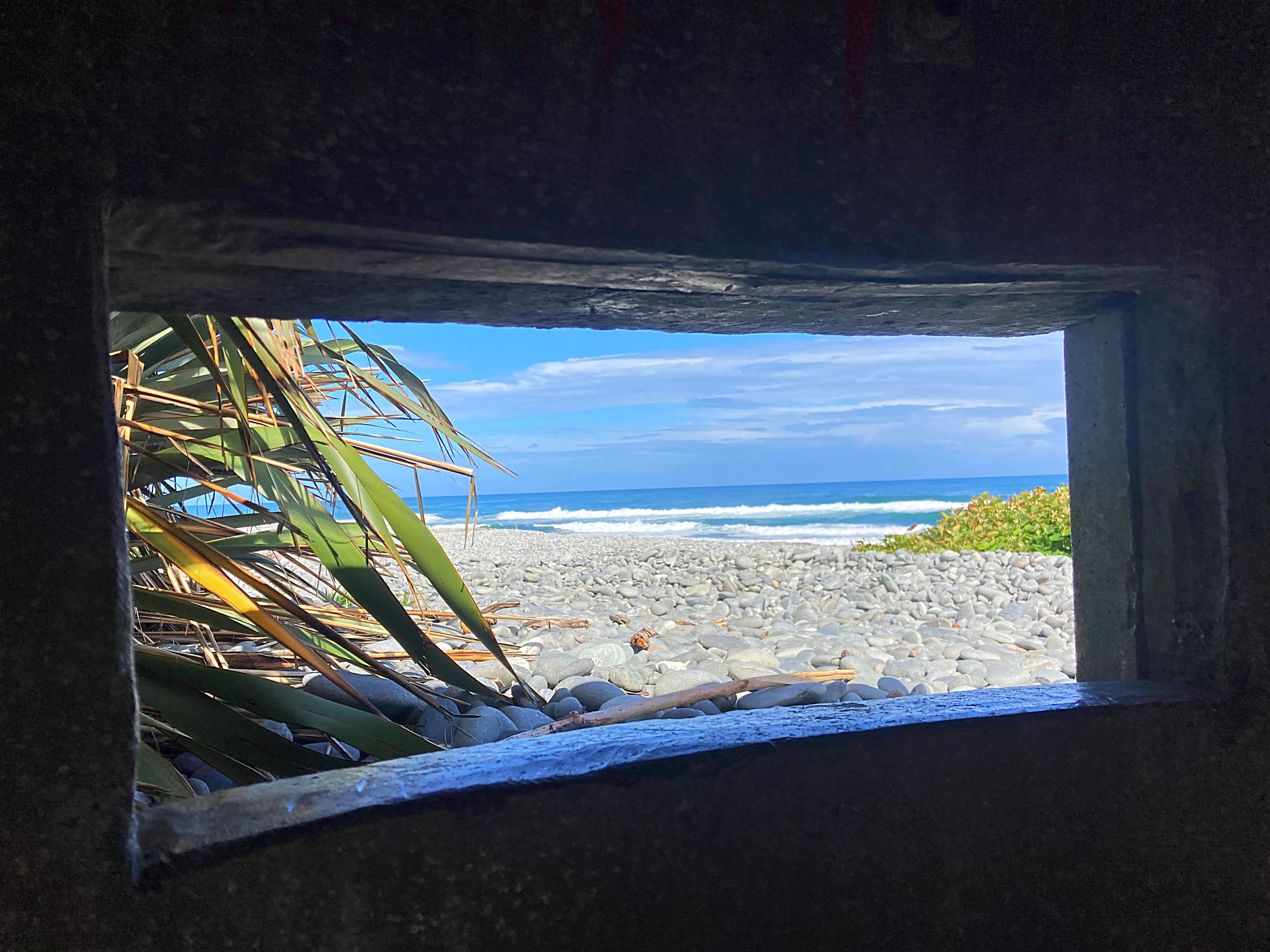
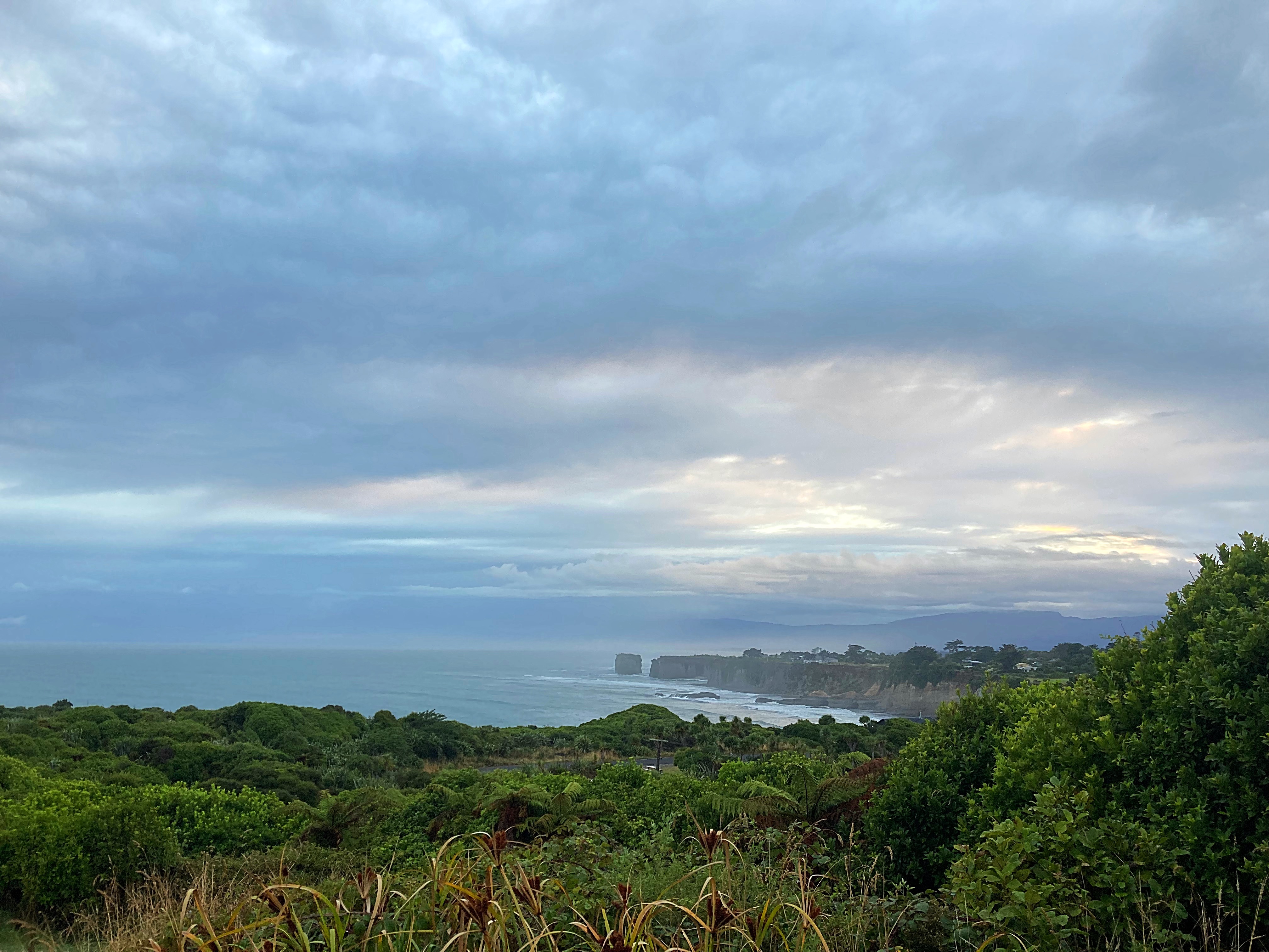
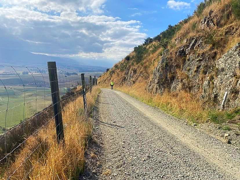
Our bike adventure for the day involved 6km in the pouring rain to get to section 6 of the new Kawatiri Coastal Trail that runs from Westport to Charleston. There are 8 sections but section 7 is still a couple of weeks from being finished. We were riding from South to North (sections 6 to 1). Check out https://kawatiricoastaltrail.co.nz/ for more information. Fortunately, the rain stopped as we joined the trail proper.
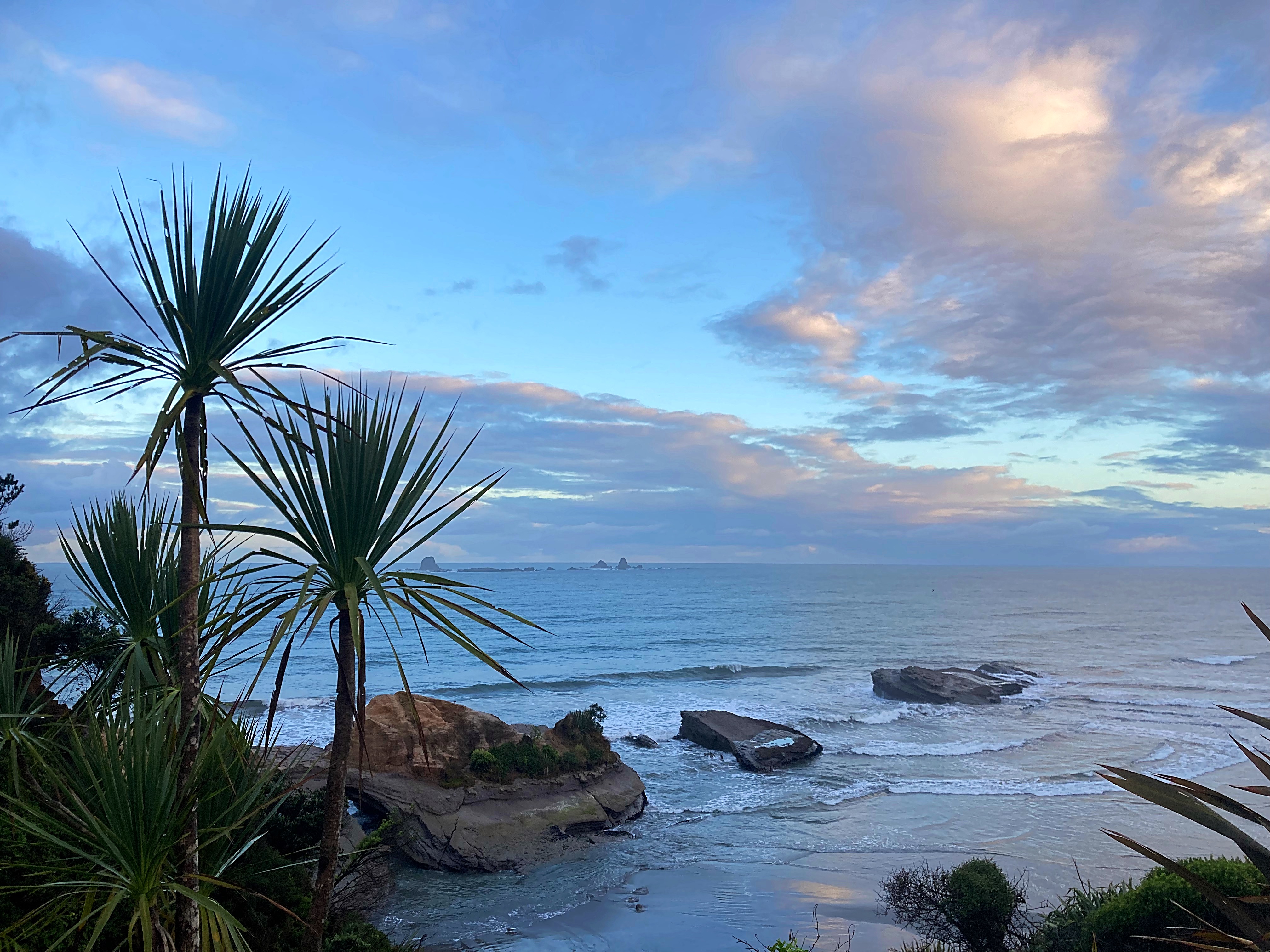
What an amazing new trail – beautiful tracks through the forest, farmland and then along the coastline. We finished up at Cape Foulwind – new territory for me but I was impressed by what I saw.
Sailing up the coast on his British barque Endeavour, Lieutenant James Cook was so battered by persistent rain and gales on 20 March 1770 that he recorded the headland here as ‘a cape of foul winds’. The name stuck as persistently as the storms.
Wild weather does not appear to deter New Zealand Fur Seals that breed and haul out around the cape. They find protective shelter amongst the rocks and thrive on the food-rich ocean at their doorstep. They are known to be quite smelly too, giving the name Cape Foulwind a double meaning.
Kawatiri Coastal Trail – Day 6 – 14km
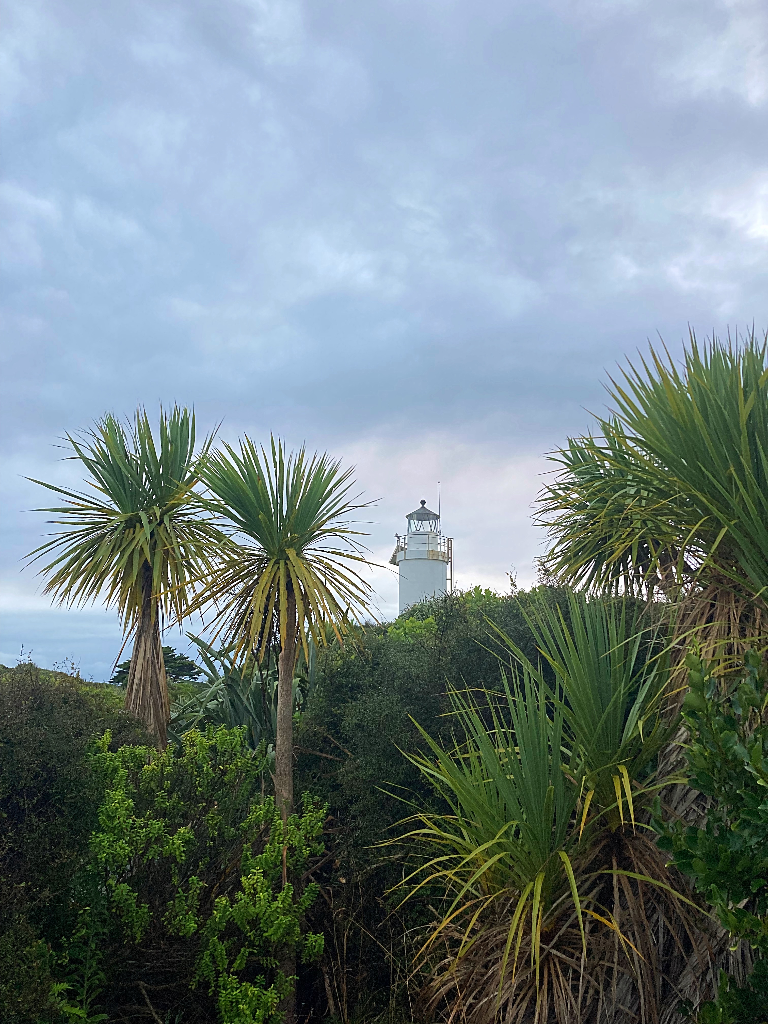
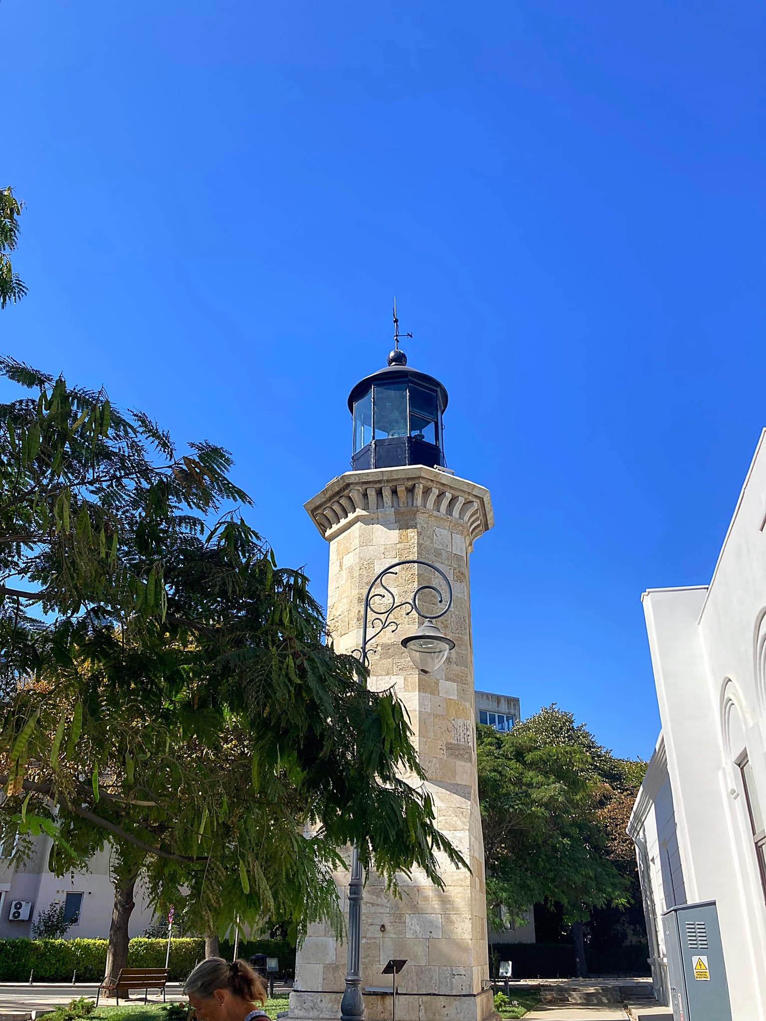
Another pre breakfast walk to check out the Lighthouse at Cape Foulwind. The original lighthouse was built in 1876 as part of a Government initiative to improve shipping safety around New Zealand’s coasts. The Cape’s lighthouse is the only one between Jackson Bay and Farewell Spit. The kerosene-fuelled lighthouse, requiring keepers, was replaced in the 1920s with the present day concrete tower and automatic lamp.
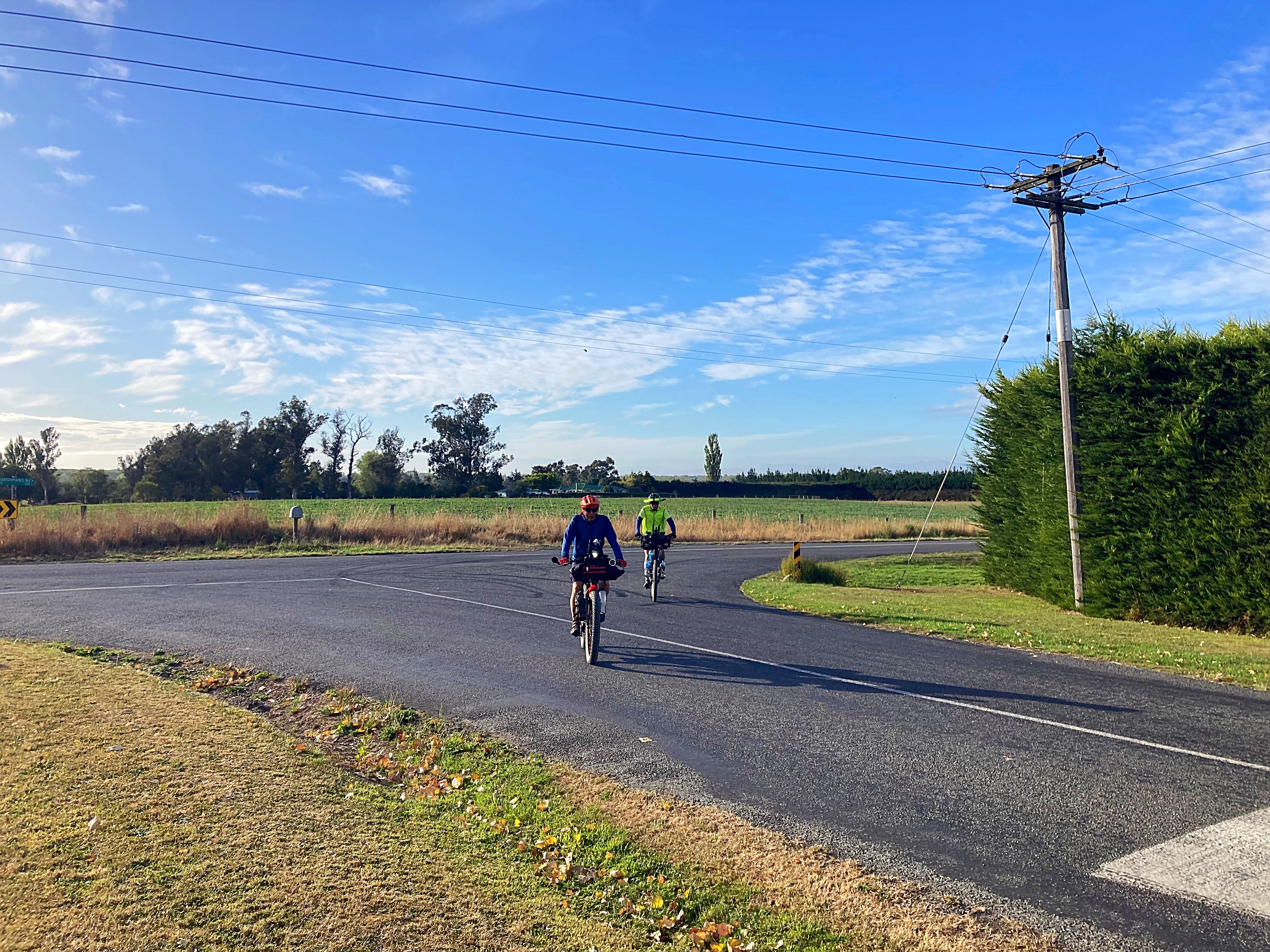
After breakfast we rode the remaining two sections of the Kawatiri Coastal Trail into Westport. The trail is fantastic and I highly recommend checking it out if you’re in this part of the world.
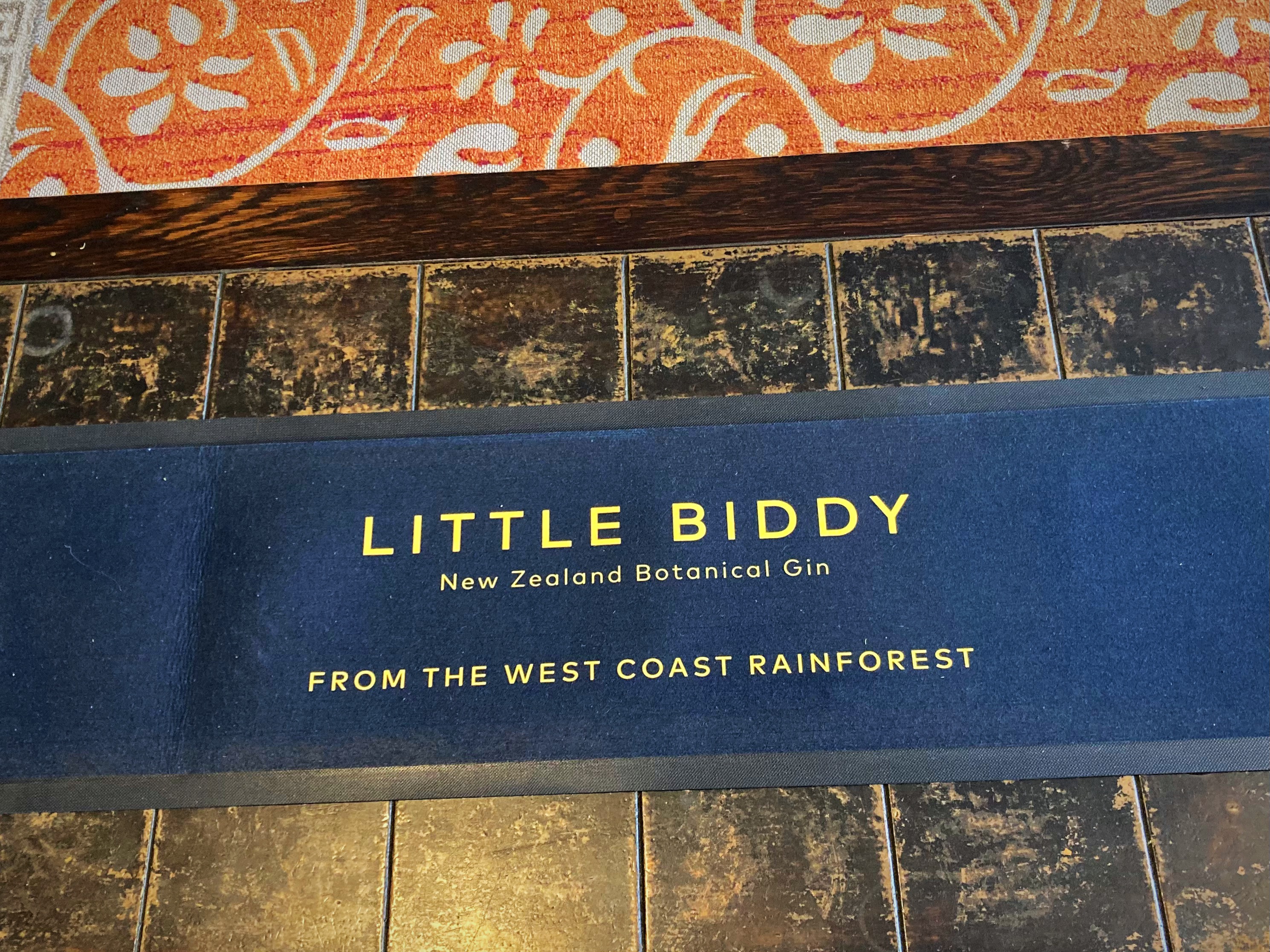
Time for a quick coffee before setting off to do a gin tasting in Reefton.
Reefton’s alluvial gold rush in the 1860’s helped to establish a rich heritage. Reefton is famous for being the first place in the Southern Hemisphere to generate and reticulate its own electricity for public use in 1888, even before the fashionable suburbs of London and New York.
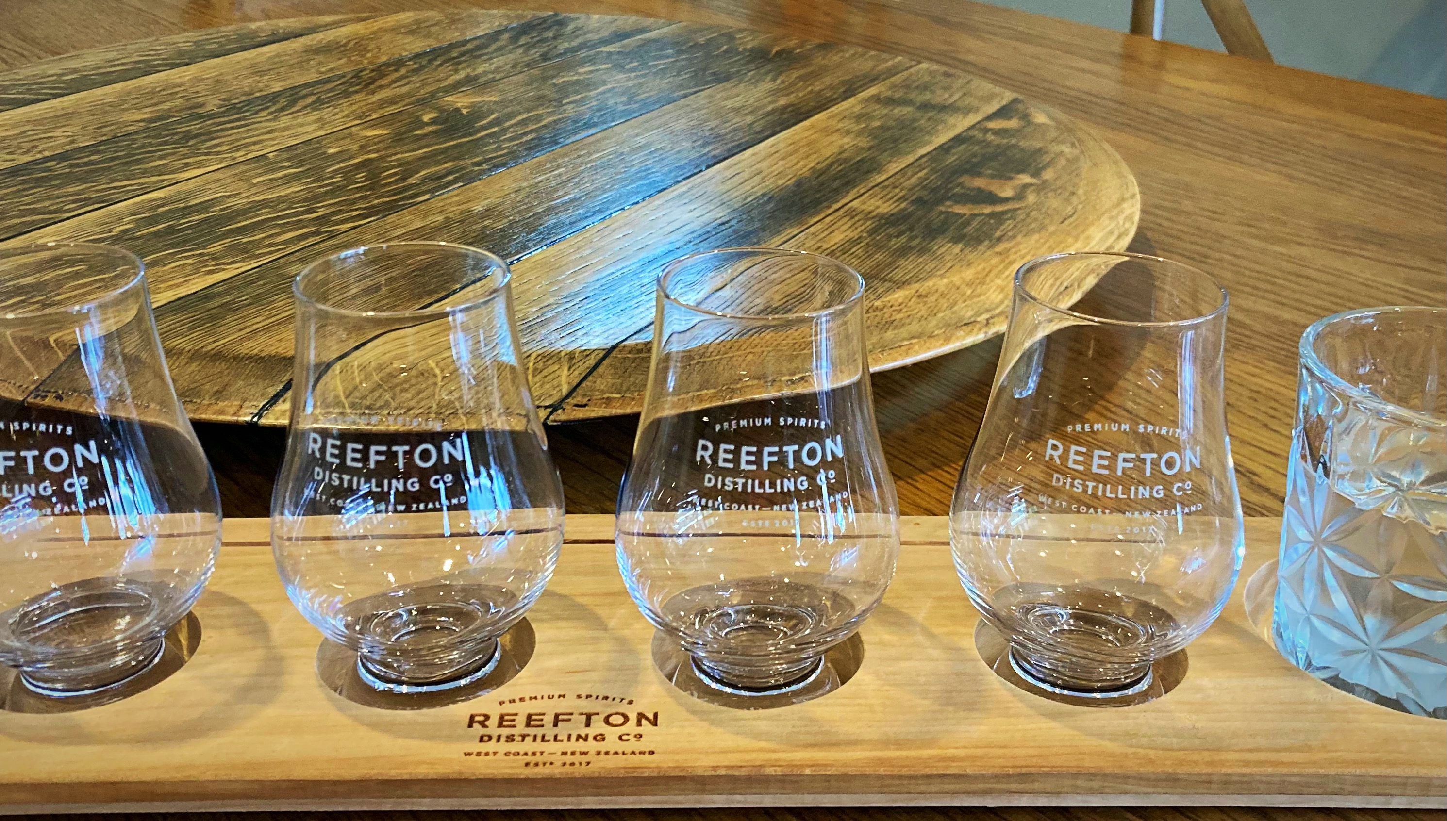
Reefton is now also famous for having the second largest gin distillery in New Zealand – Reefton Distilling Co. who produce a range of small batch products – Little Biddy Gin, Wild Rain Vodka and soon Moonlight Whiskey.
We enjoyed a very informative talk by the cellar door manager, Trudy, who told us about the vision and passion of the distillery’s founder, Patsy Bass. Patsy was born in Reefton and wanted to create something that would generate jobs for Reefton, develop a tourist attraction to encourage people to visit the town and give them a reason to stay. They currently employ 12 people. Reefton has a population of about 1000 people.
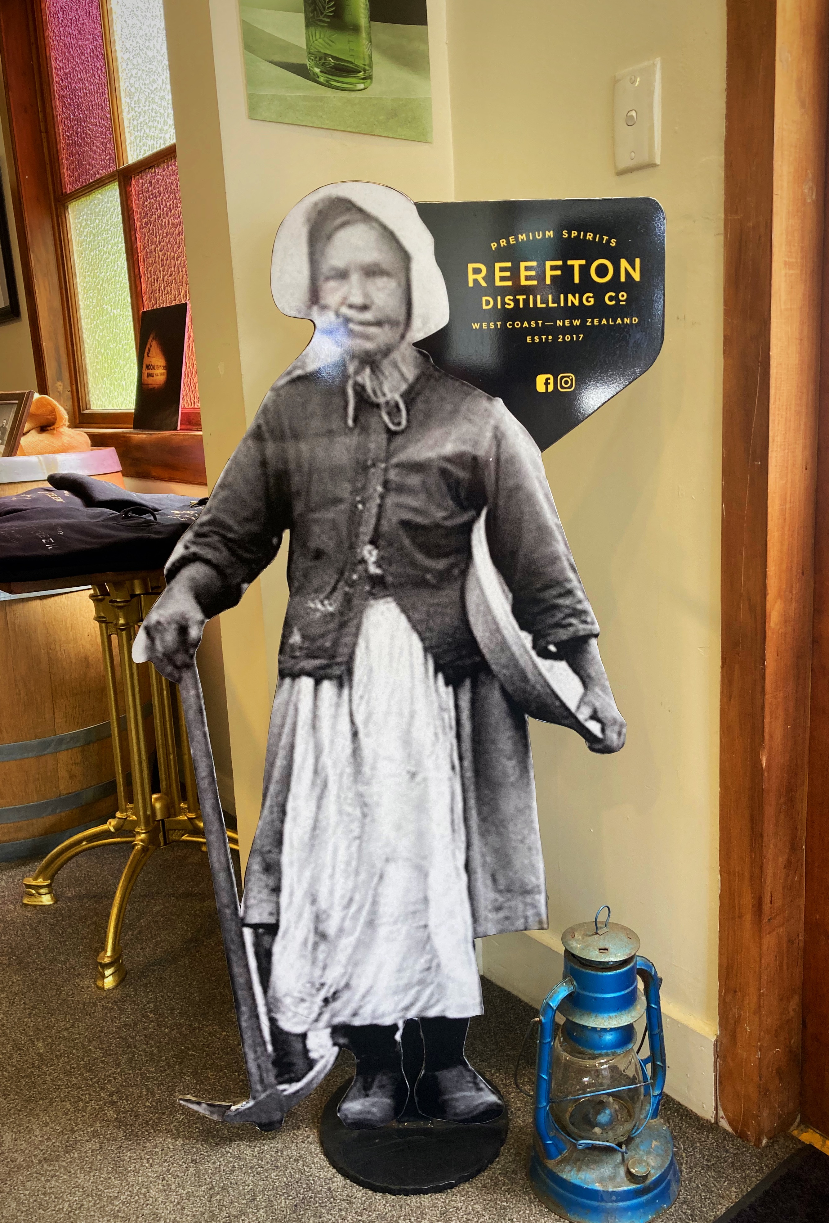
The name “Little Biddy” comes from a female gold miner who came to NZ for the gold rush in about 1880. She was born in Ireland, was only four foot tall but very capable of hard, physical work. She was quite a character by all accounts, and became well known on the West Coast as Little Biddy. Check out https://en.m.wikipedia.org/wiki/Bridget_Goodwin to appreciate what a character Little Biddy was.
It was then back in the van for a very scenic drive over the Lewis Pass back to Christchurch, where we all went our separate ways after a fantastic week exploring the West Coast. Big ups to Steve and Paul our organisers, tour guides and all round great humans from Natural High https://www.naturalhigh.co.nz/
Sounds to Sounds – nearlyThe Pyscholists take two…..
Lambers, Crammers, Hicksy and the Young One are clearly very slow learners as today we take on another epic adventure on our bikes.
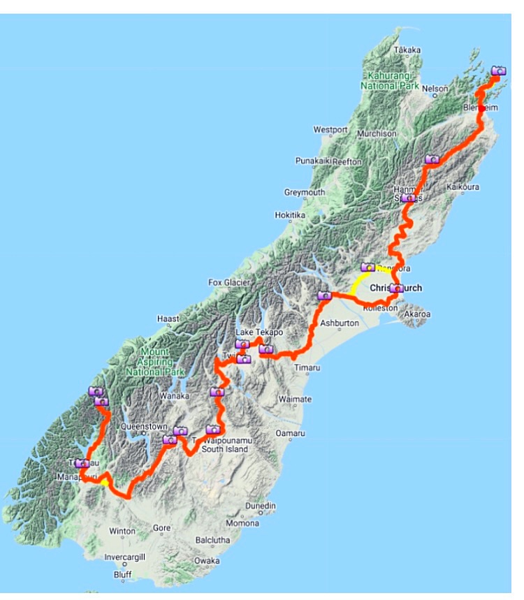
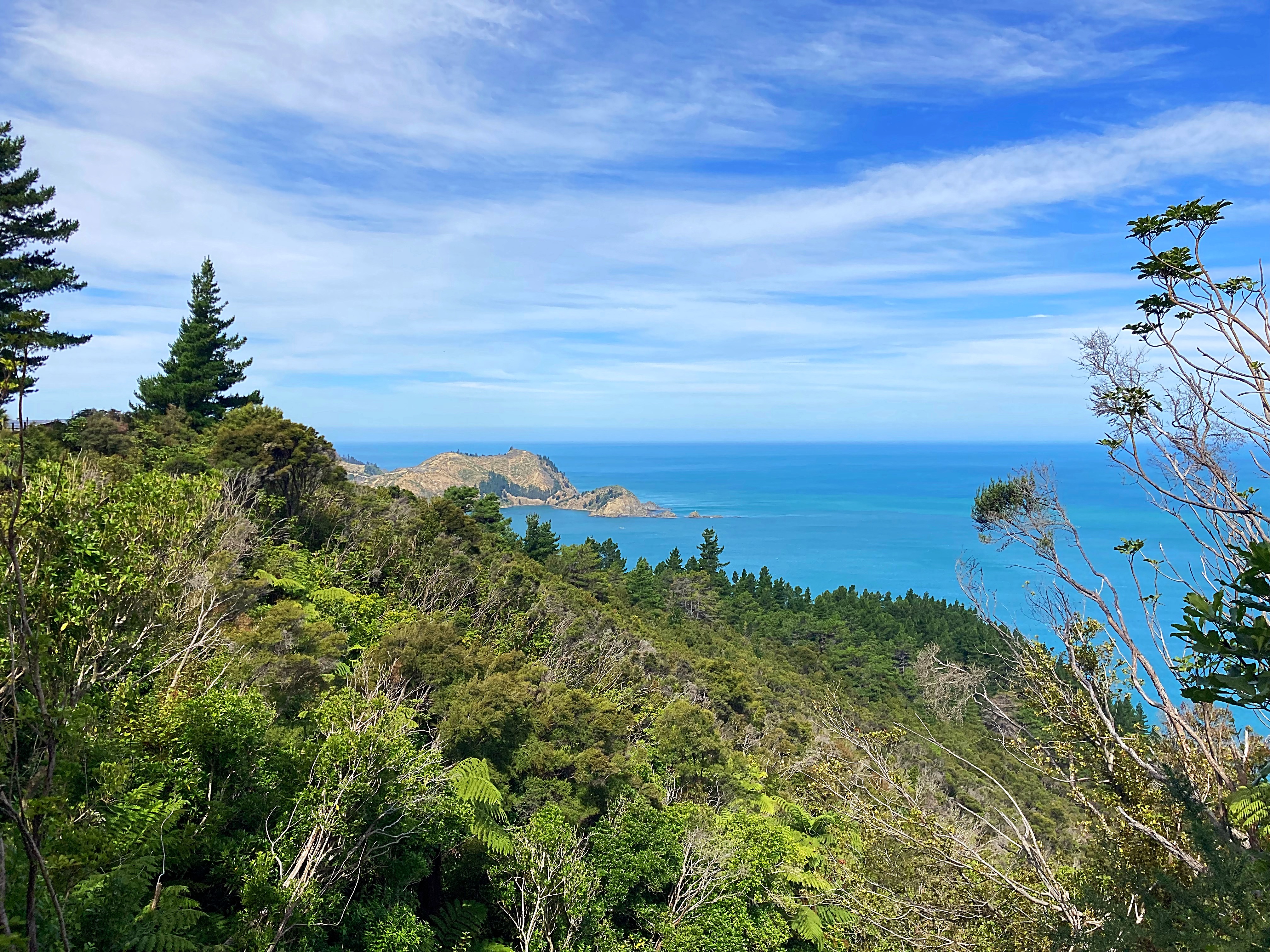
This time we will be rolling down the South Island from Picton to Milford Sound, a slightly varied version on the Kennett Brothers Sounds to Sounds which goes from Queen Charlotte Sound to Milford Sound.
Crammers walked the Queen Charlotte a couple of years back and said “not on a bike” For him to say that was quite something so we’re starting from Picton instead.
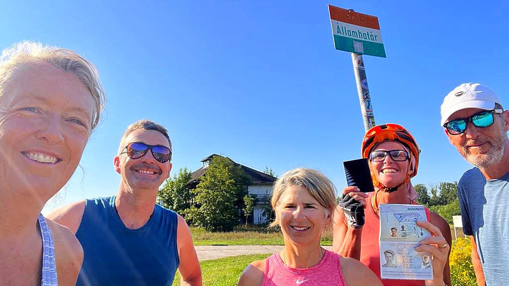
12 February 2024
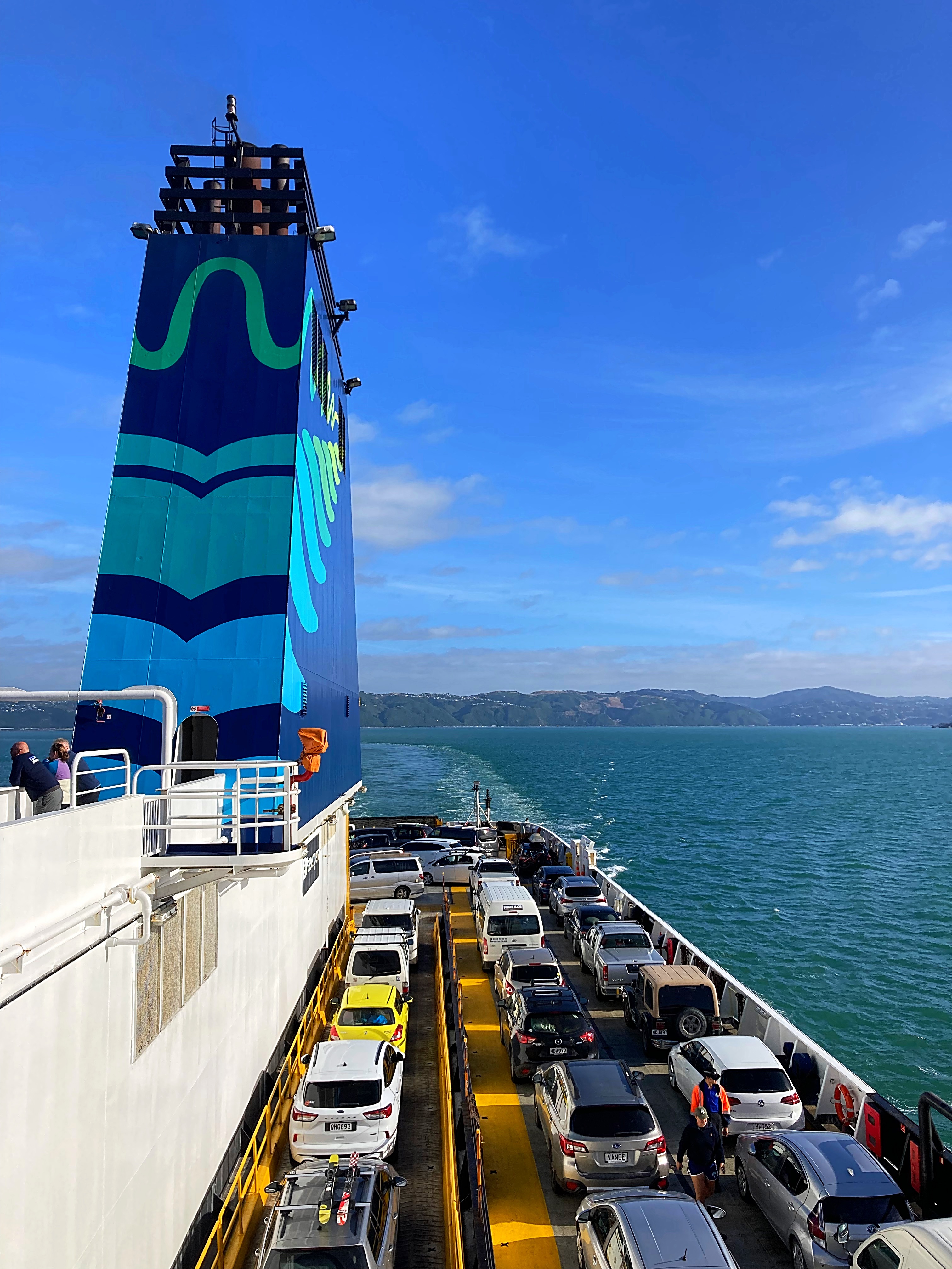
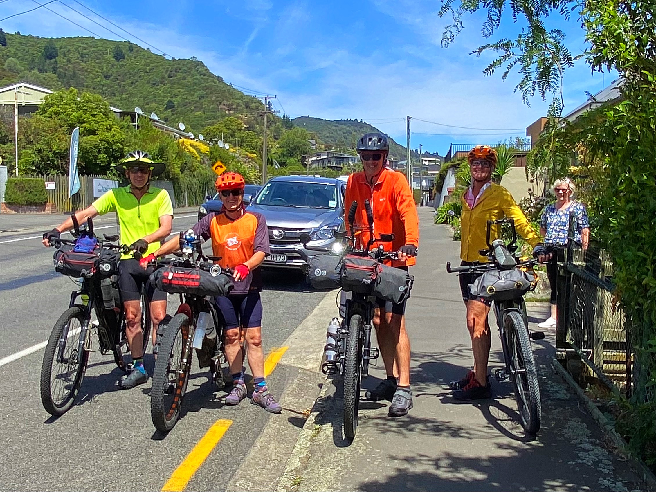
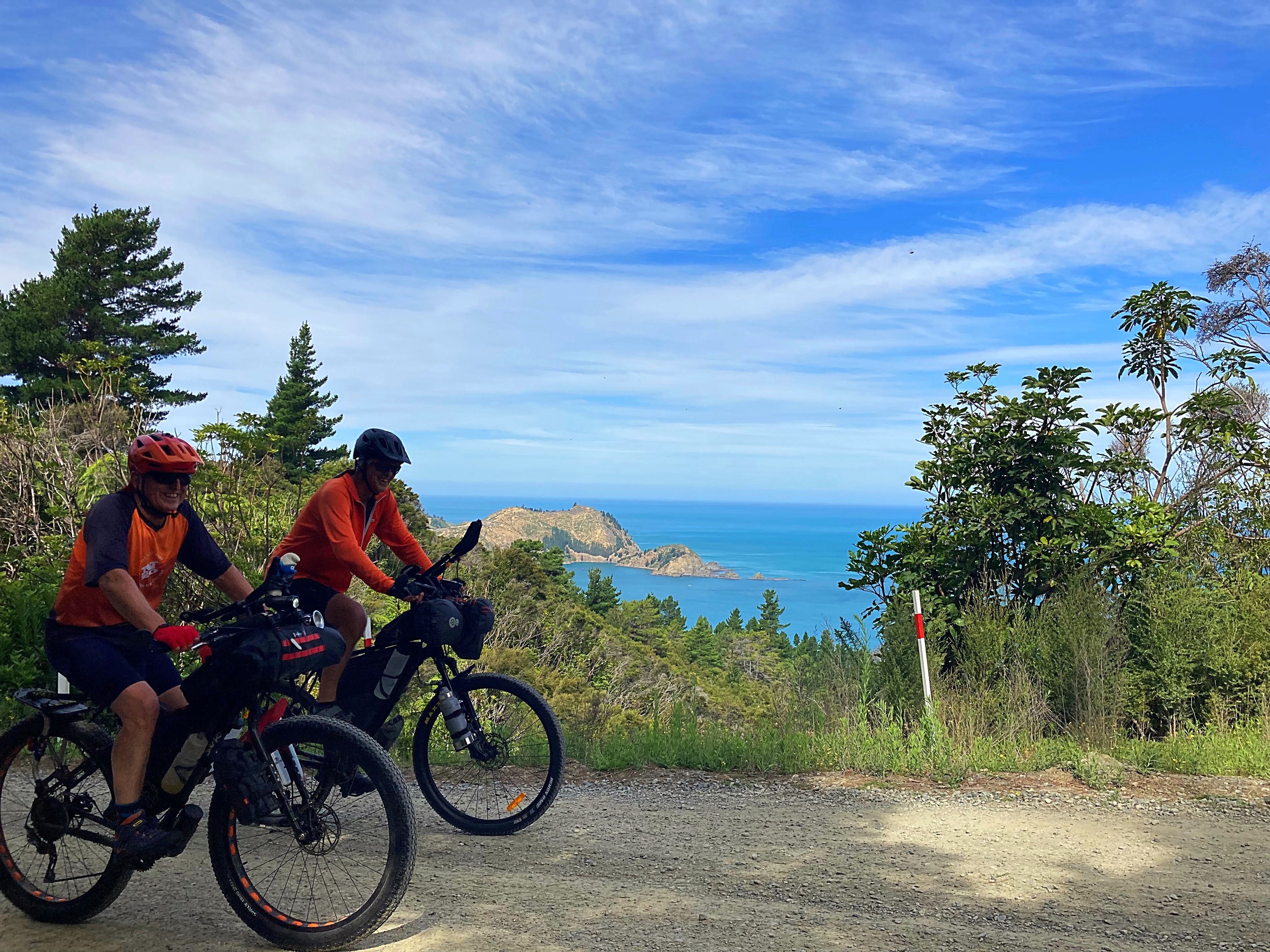
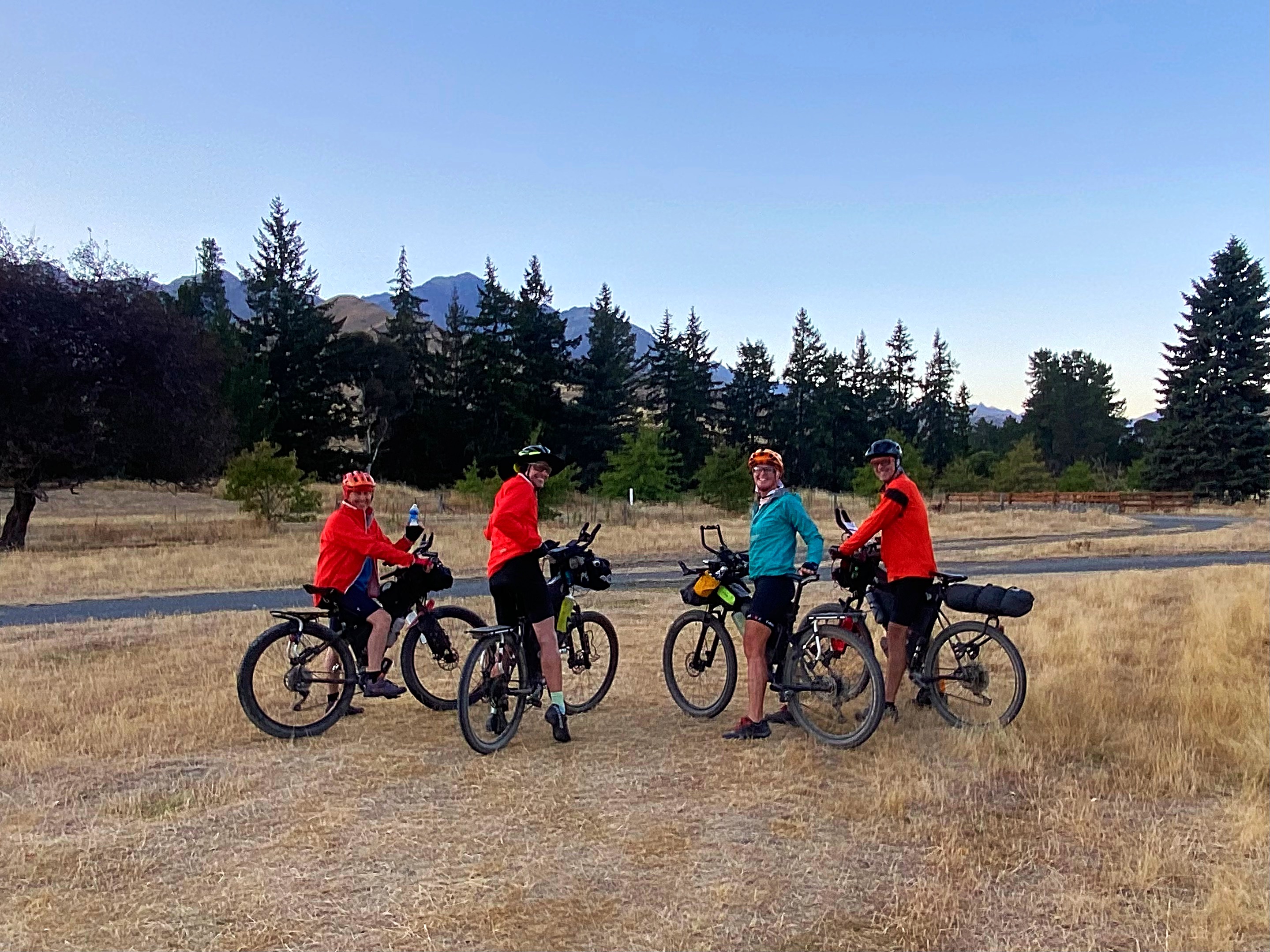
Day 1 – Wellington to Picton on the and then Picton to Blenheim (the long way) on the 64km 1438 metres climbed
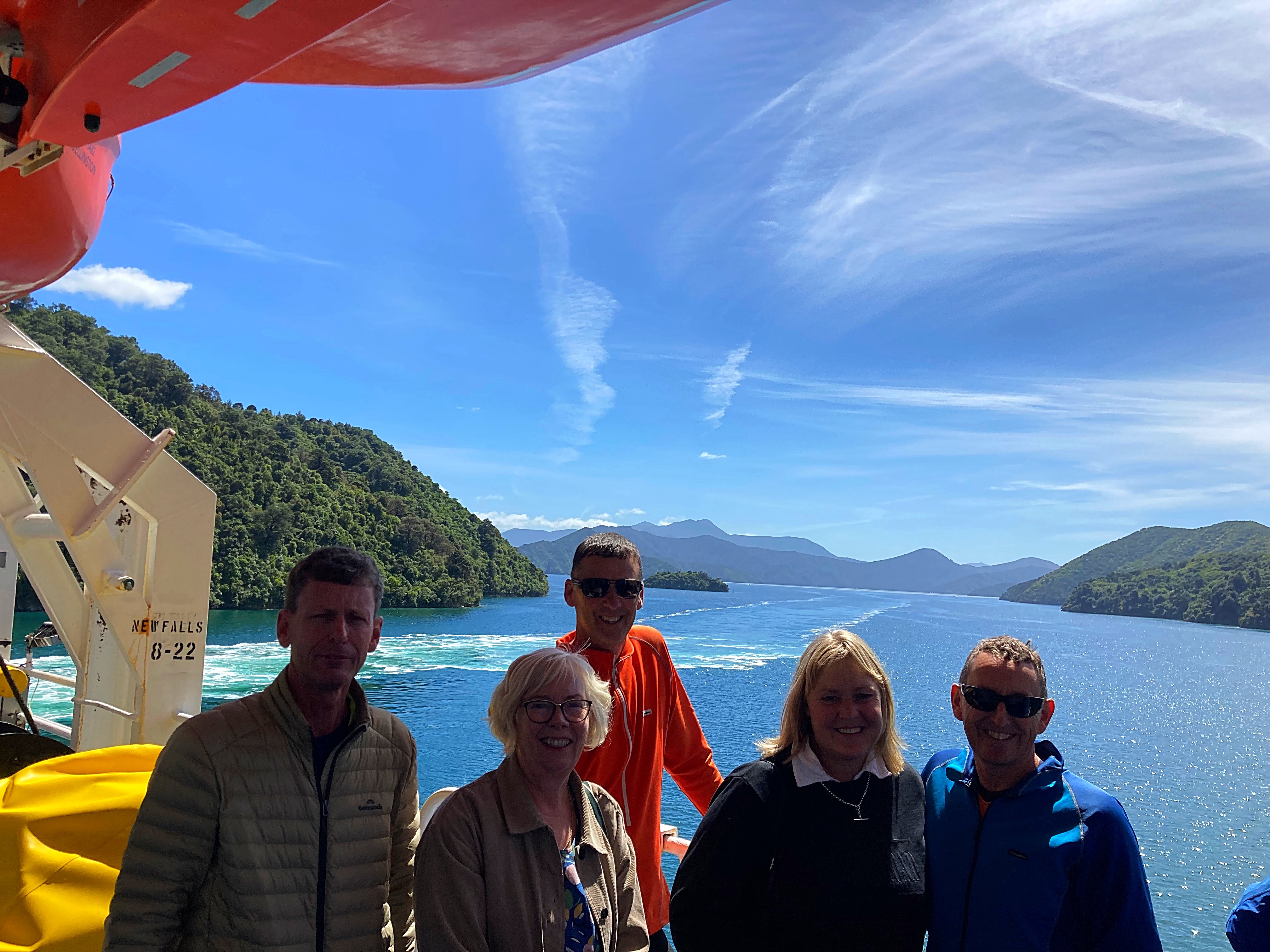
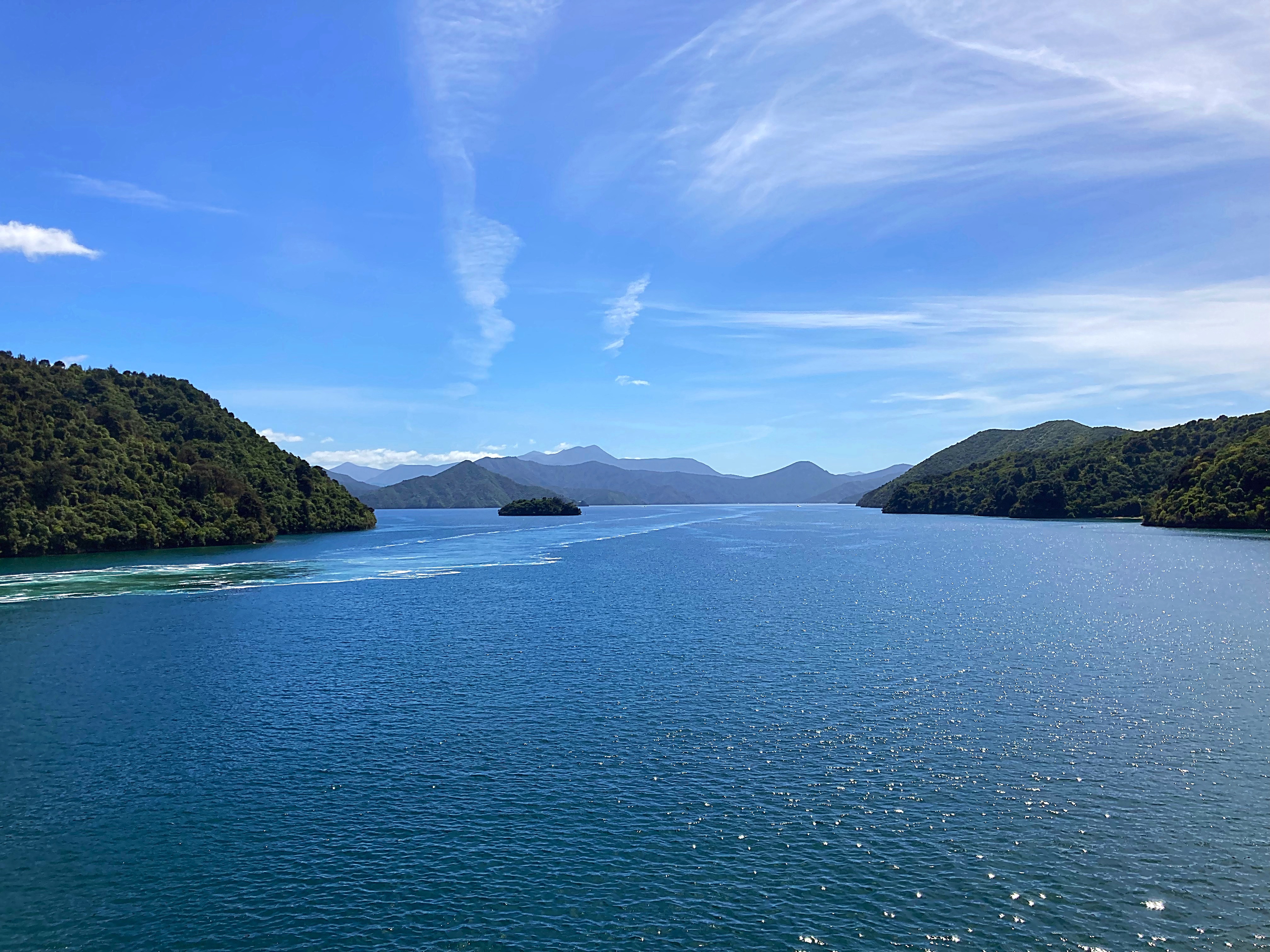
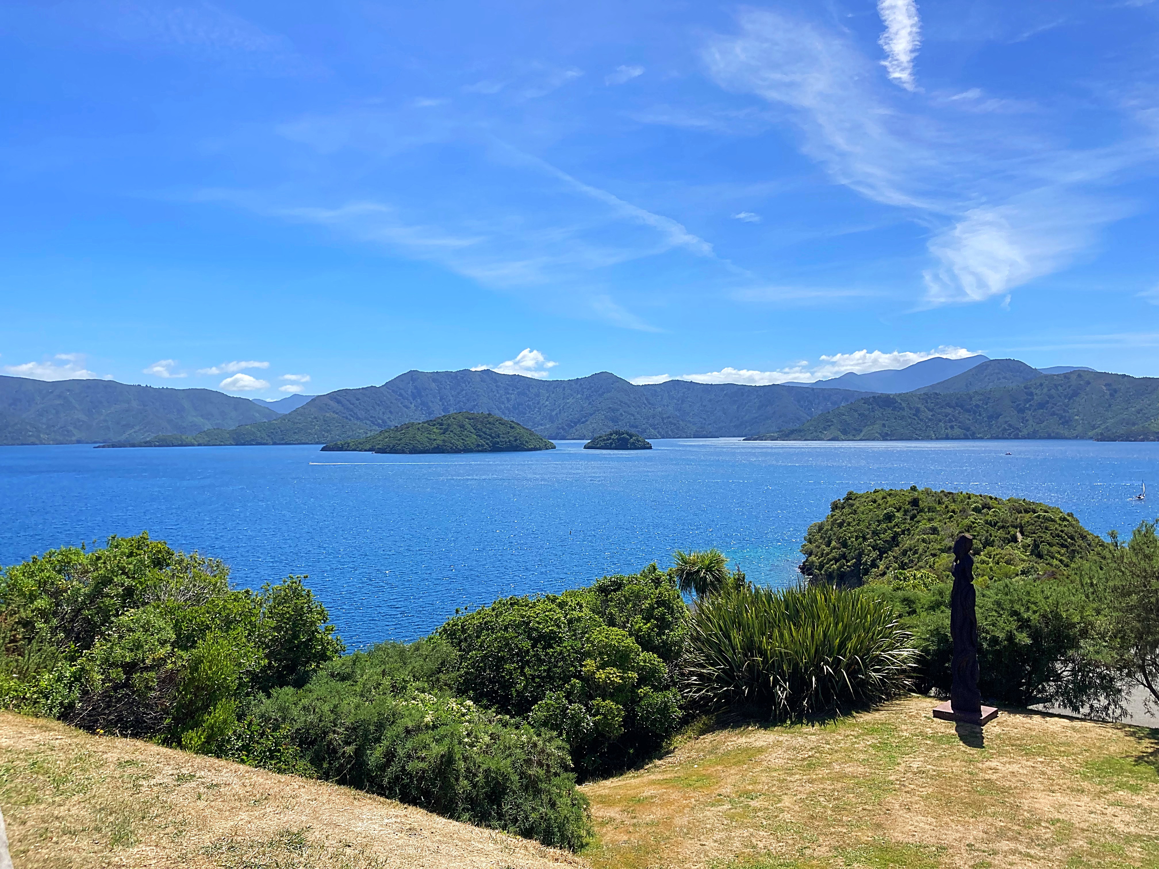
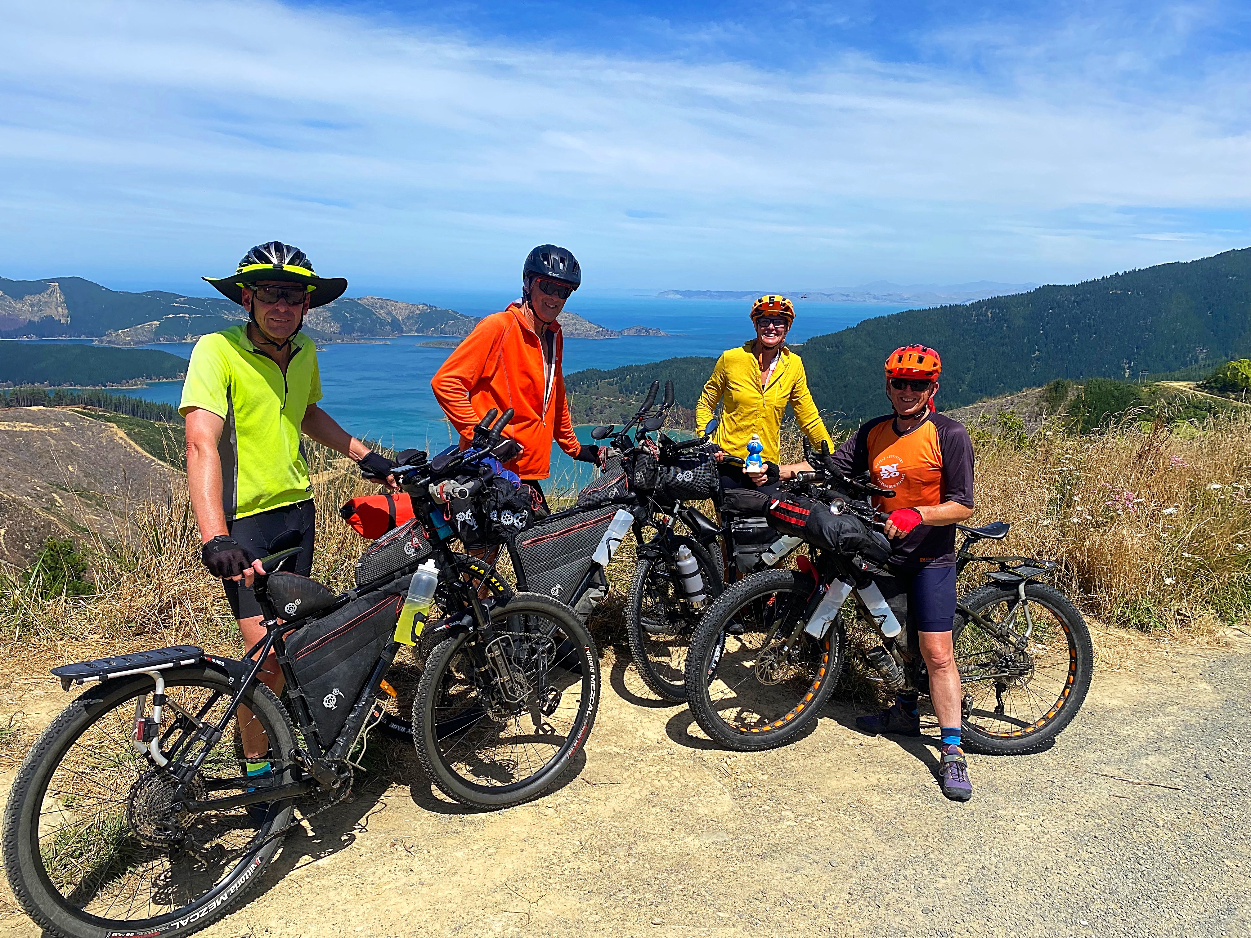
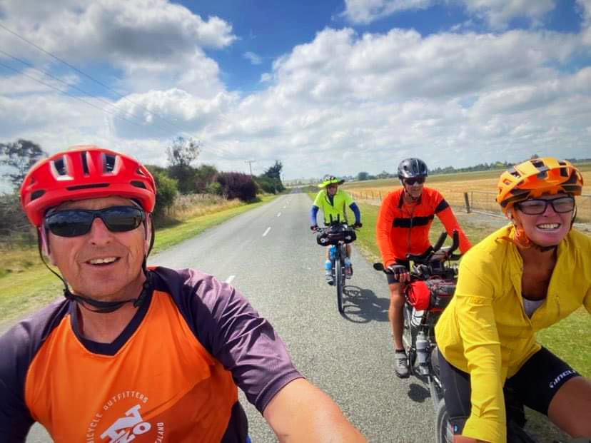
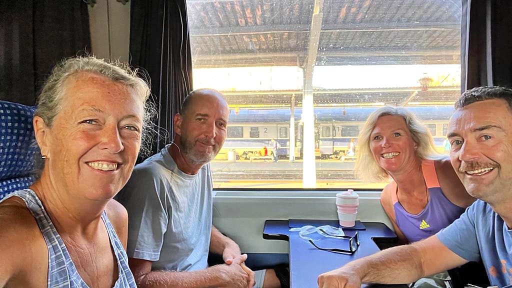
After an early start (some way earlier than others – Phil & Rosie & Chris & Mary left Taranaki at 2.30am) we met on the Interislander Ferry for a relaxing 3 hour crossing. It was a calm, blue sky day so a good start to our adventure.
We had decided to take the long way to Blenheim rather than going 25km down State Highway 1. How hard could a 60km ride around the coast be
Quite damn hard it would turn out. It all started off very pleasant around the beautiful bays until we hit a hill that just kept on giving. Fortunately, it was tarsealed which always makes it easier. The view at the top over Oyster Bay was certainly worth it.
The downhill to Oyster Bay was also fun and on the recommendation of a local we had a picnic lunch there.
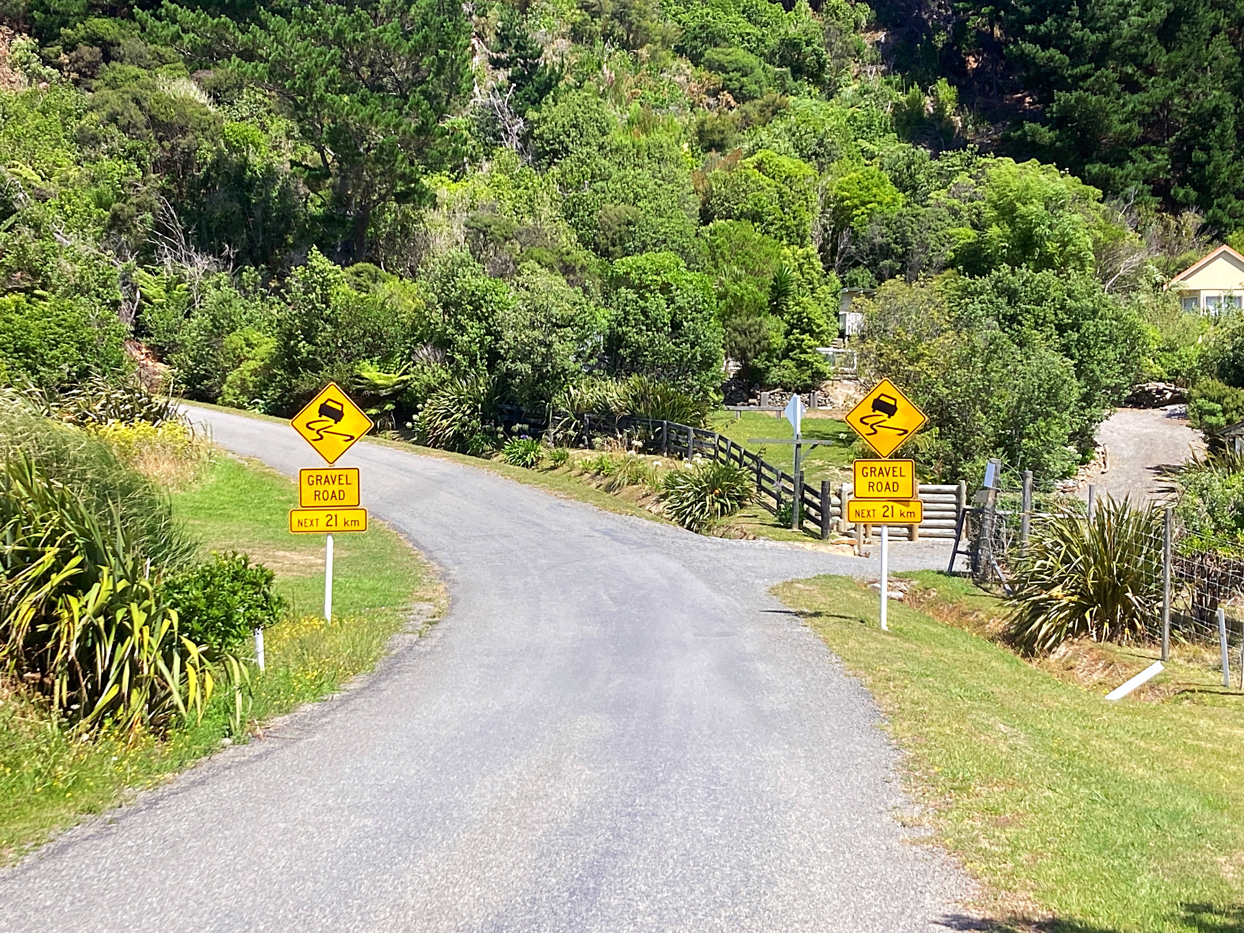
We then saw a sign that said “Gravel Road next 21km” joy upon joy. We went up and back down to sea level a number of times and it was pretty tough – the gravel was knarly and corrugated in places bringing ‘hike a bike’ into play a couple of times
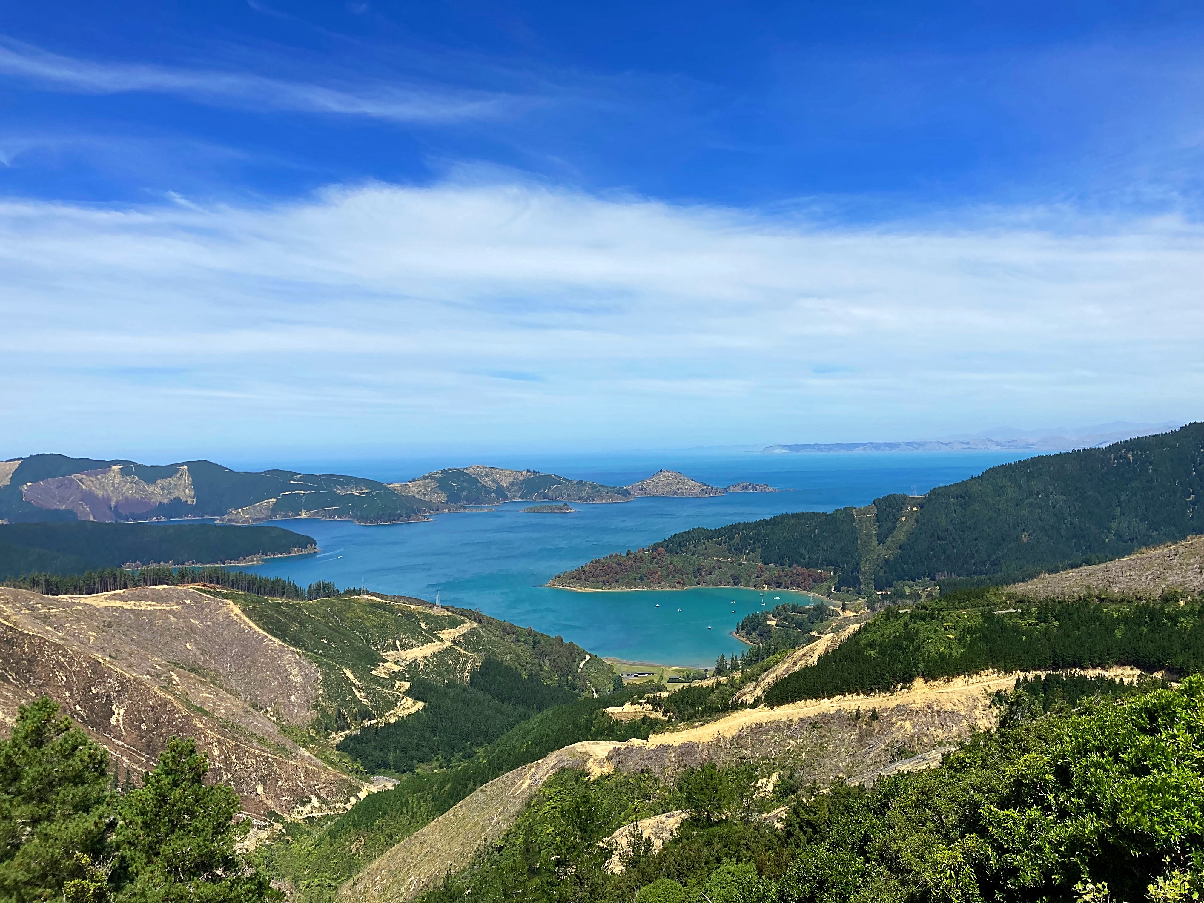
This coast line has a history steeped in whaling. John Guard, an Australian convict, was a whaler at Port Underwood and one of the original European settlers with the distinction of being the father of the first documented European child born in the South Island in the 1830’s. His house also witnessed the signing of Tiritiri o Waitangi on 17 June 1840.
We also passed Robin Hood Cottage, one of the oldest buildings in Marlborough.
In Whites Bay there is a historic Cable Station site. The former cable station was the Southern link in the initial Cook Strait communications cable which was active from 1866 to 1945. It was a simple copper telegraph cable laid across the seabed from Lyall Bay, Wellington to Whites Bay.
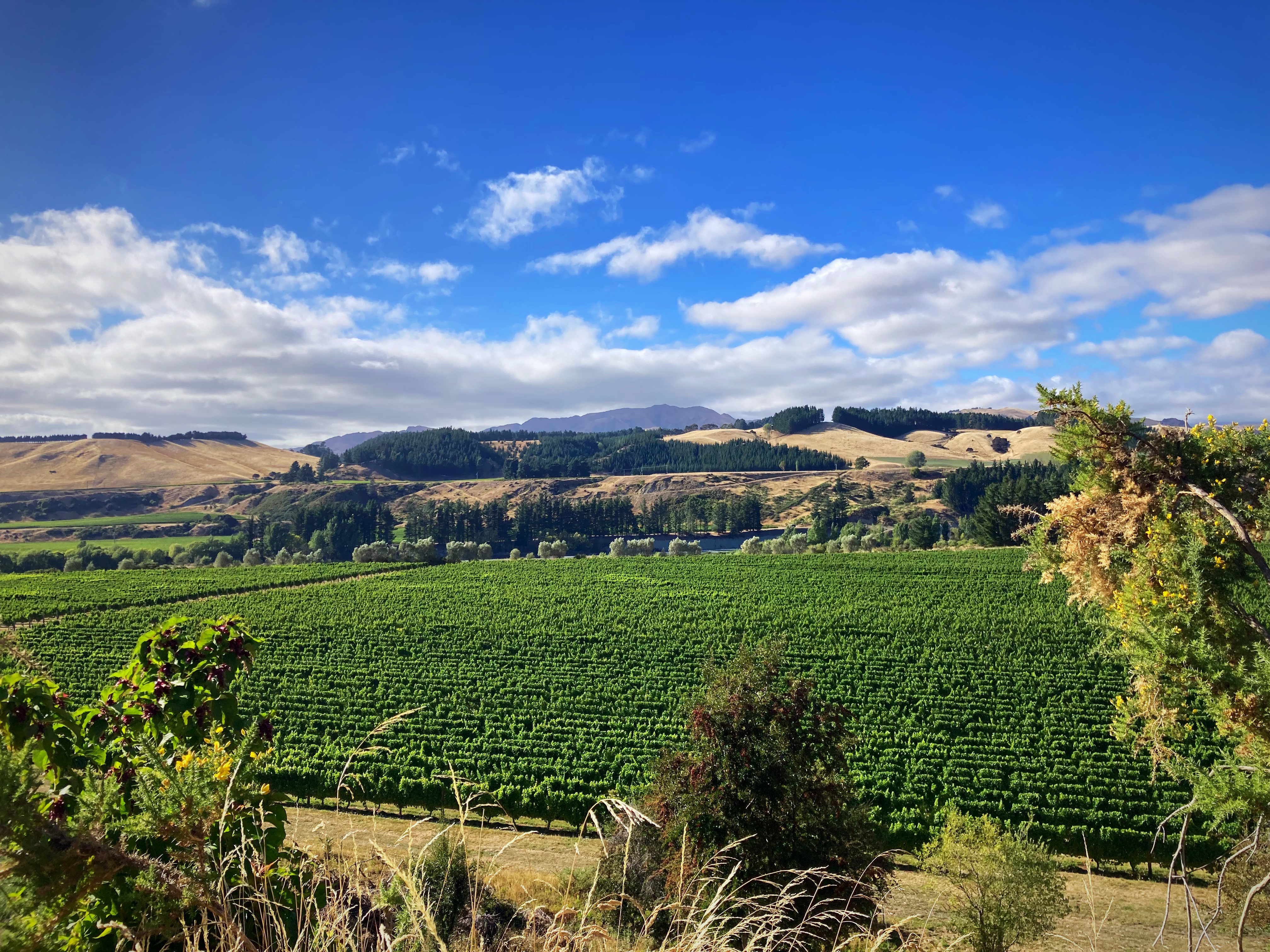
We finally made it back to the tarseal and had a beautiful 16 odd kilometre ride into Blenheim passing vineyard after vineyard.
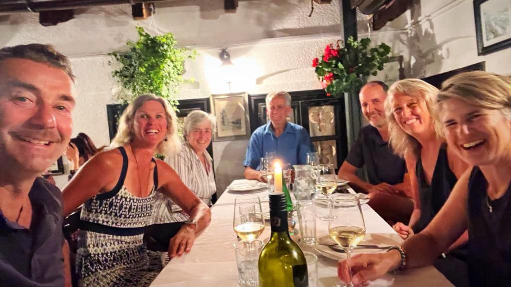
Rosie and Mary, our trail angels for the first few days of our ride, had organised dinner and dessert along with breakfast for tomorrow. Very grateful after a longer than expected day. It was also Mary’s birthday so big ups to her for doing that for us on what should have been her special day .
We’re all going to sleep well tonight
13 February 2024
Day 2 – Blenheim to Upcot Station (Molesworth Rd) 79km 1350 metres climbed
After upsetting the neighbour at the motel for making too much noise at 6am we managed to get away at 6.45am.
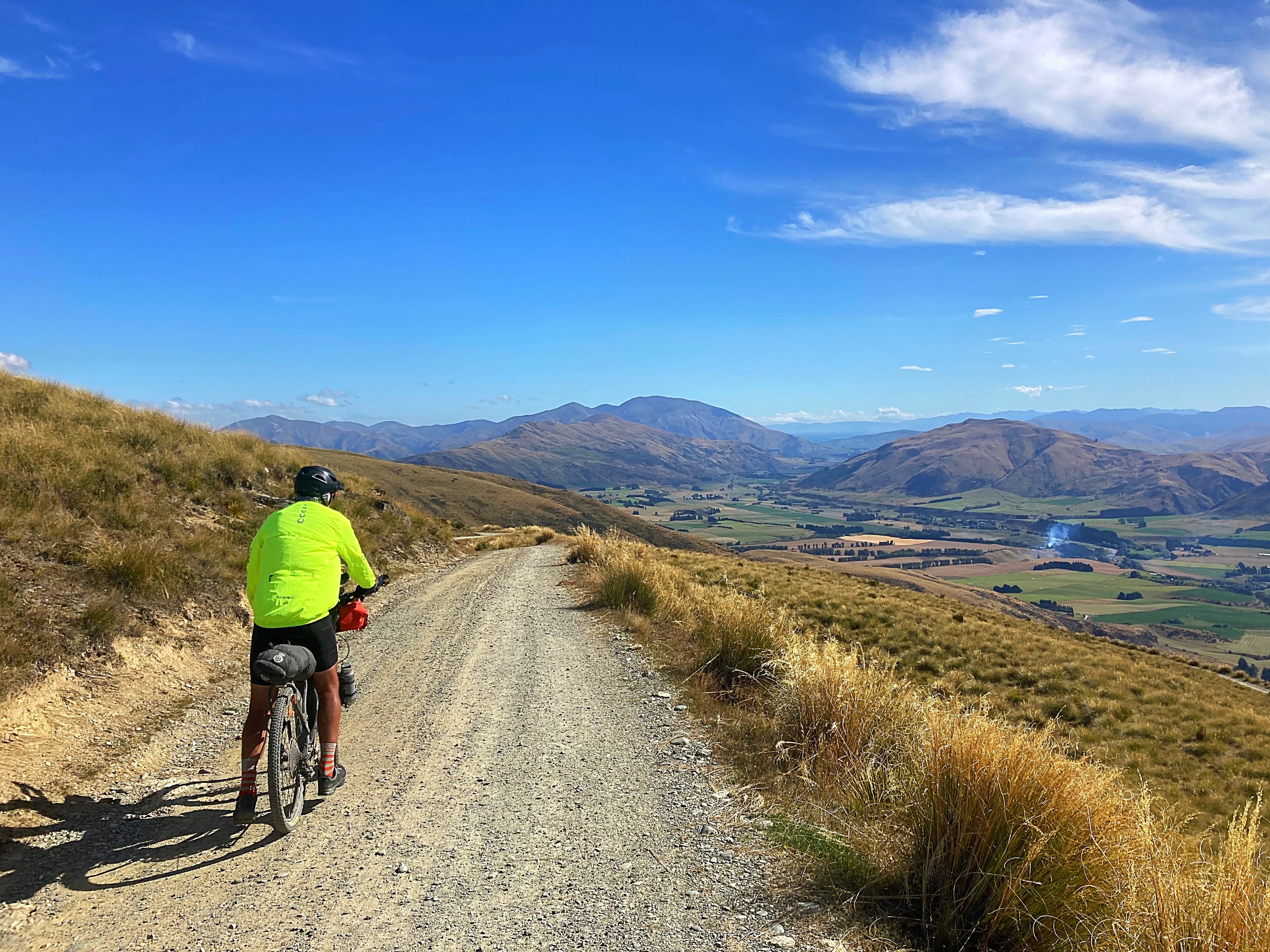
We followed a lovely cycle path out of Blenheim for about 9km before getting onto Taylor’s Pass Rd. Very pleasant riding in the cool morning conditions.
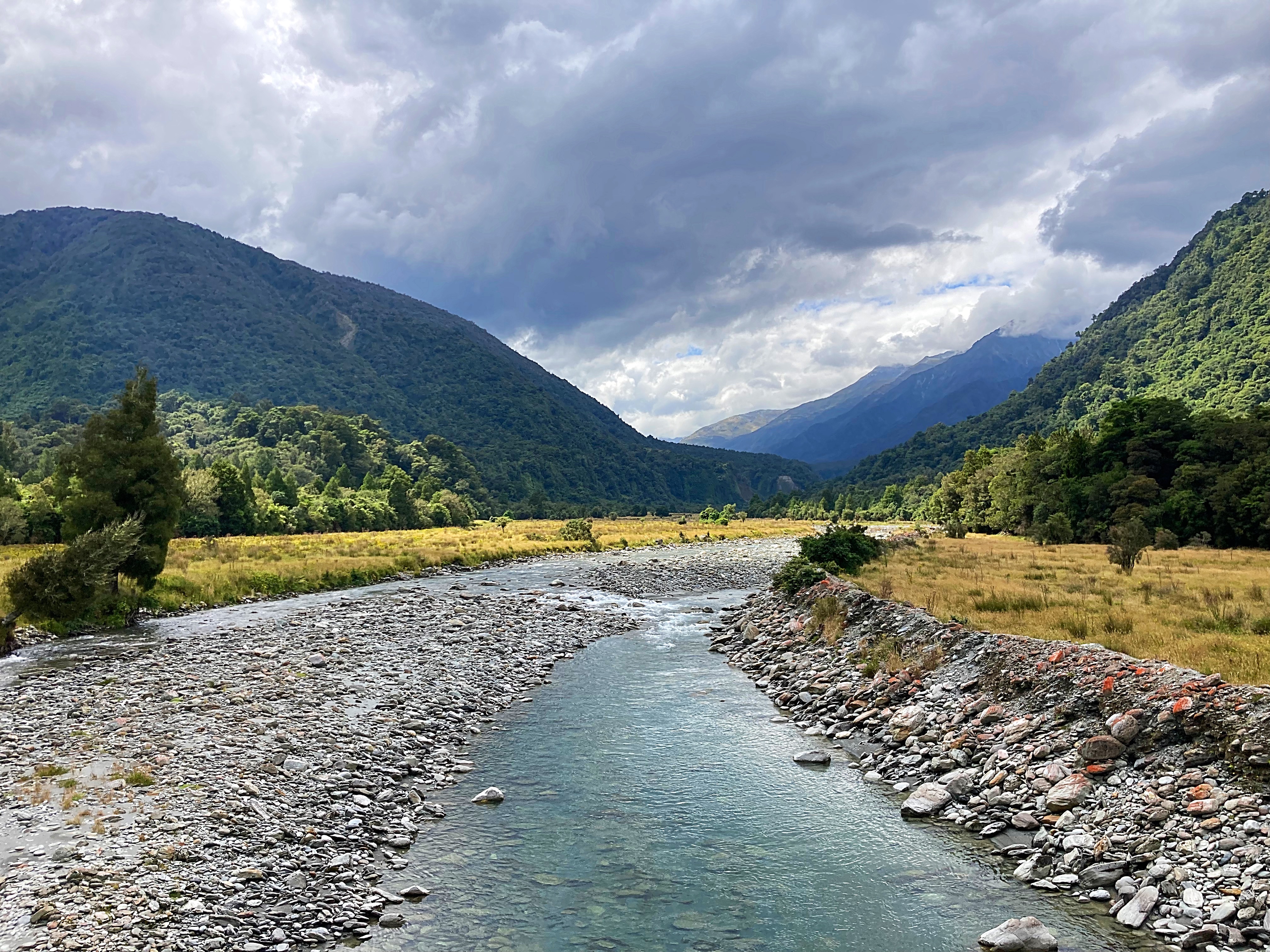
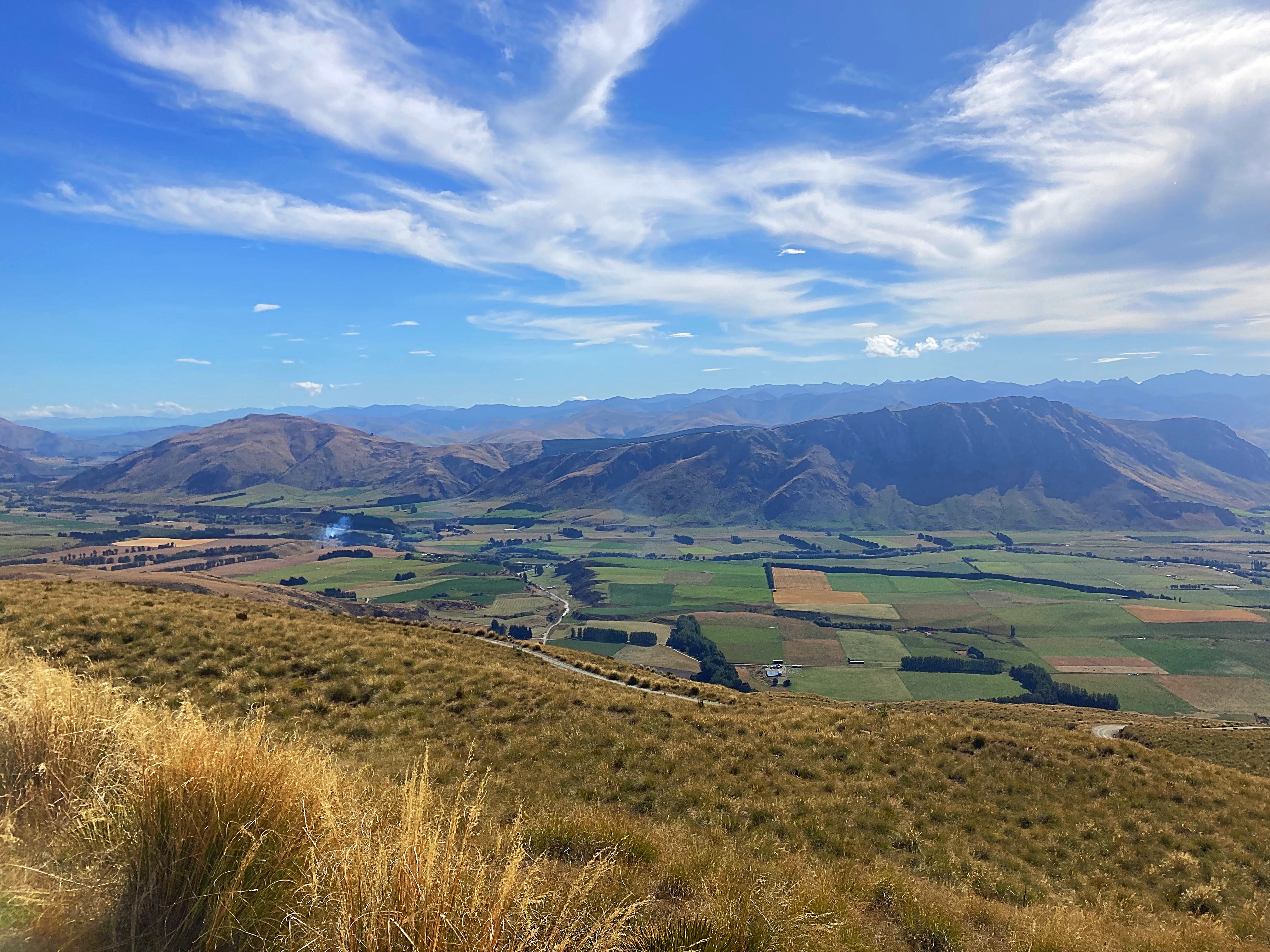
We then joined the Awatere Valley Rd which we would follow for the next 50km. Our vistas started with row upon row of vineyards before becoming large expanses of brown terrain.
The sun had made an appearance by this stage and the sky was so blue against the brown hills. I just love these big country views. I was in my happy place even though we were climbing and descending regularly.
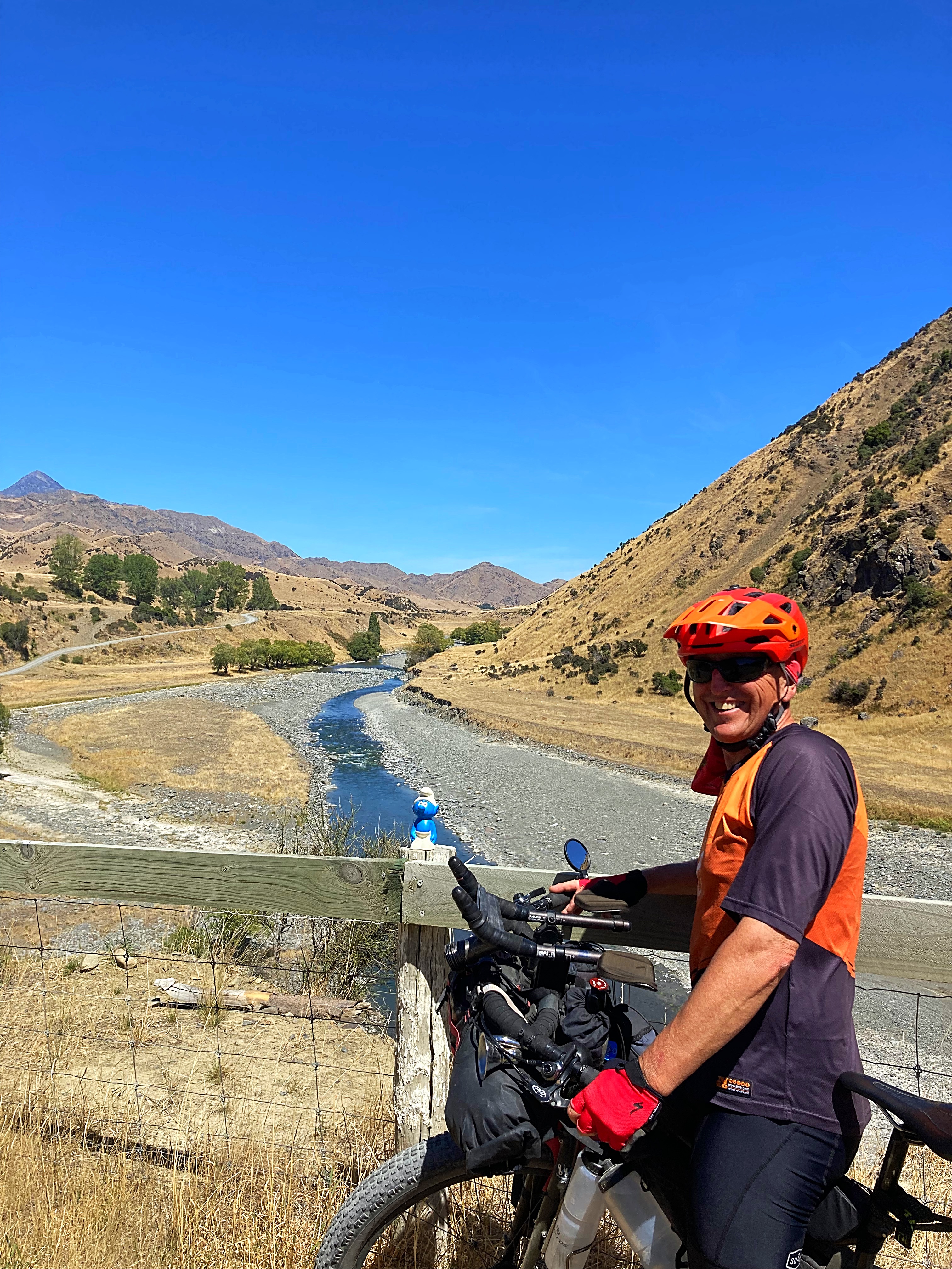
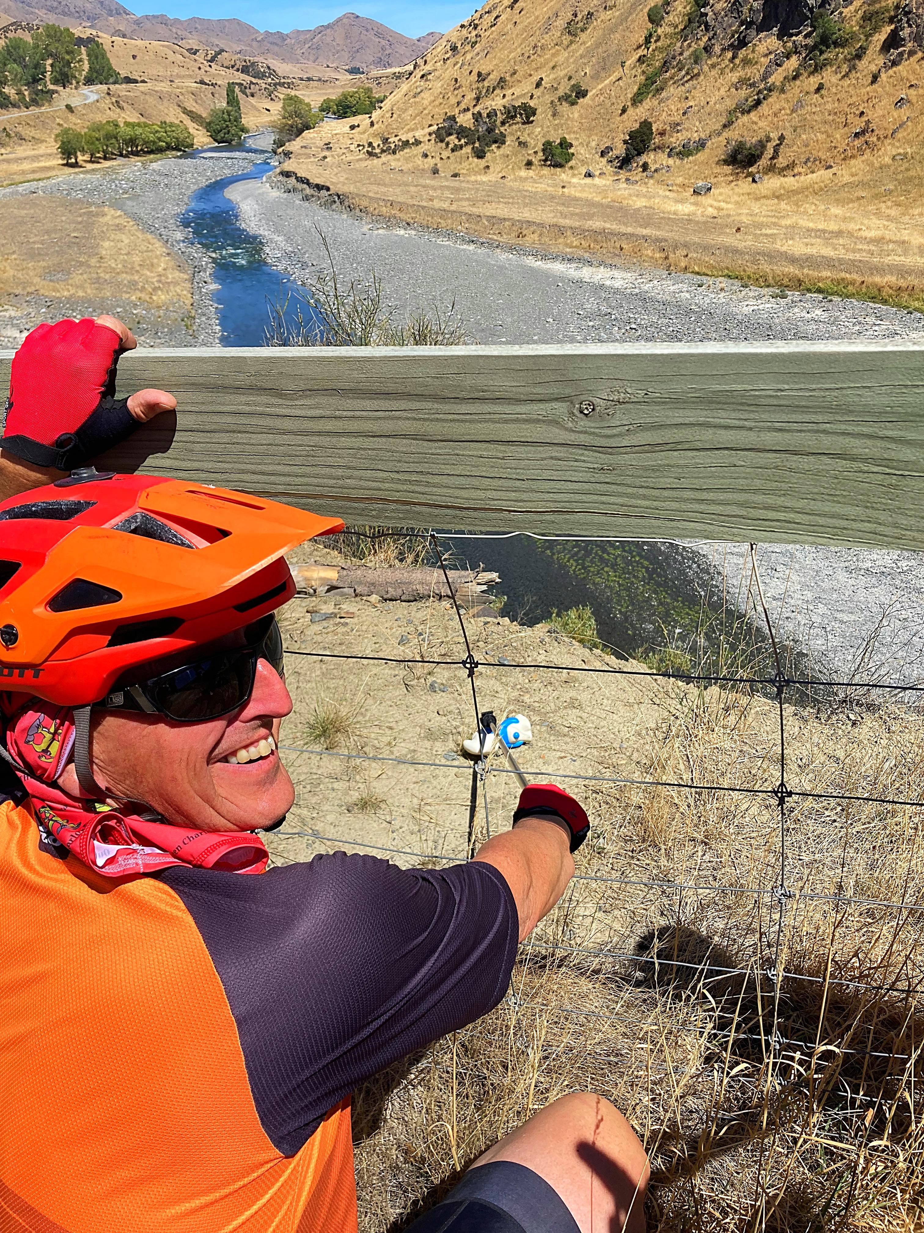
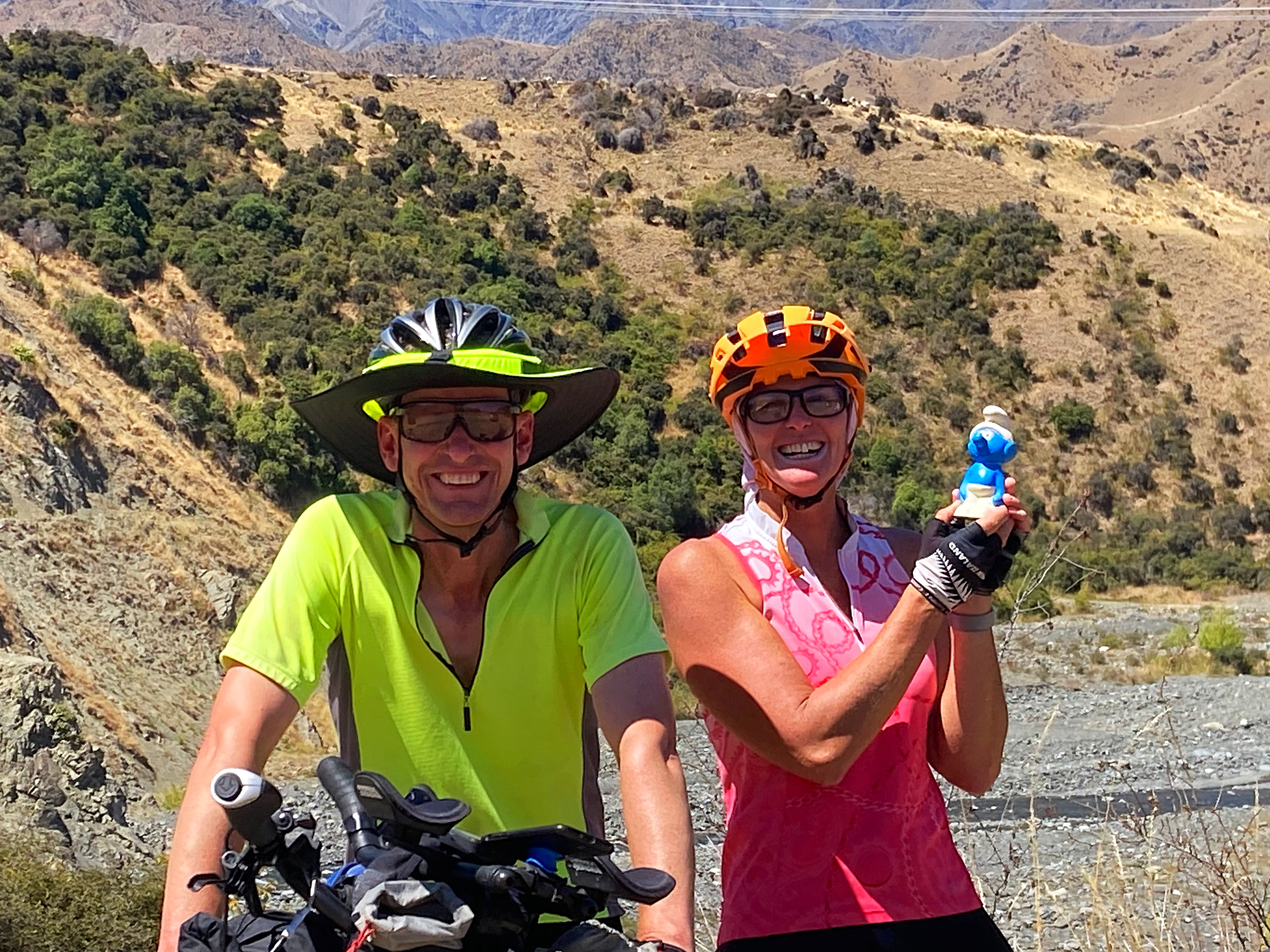
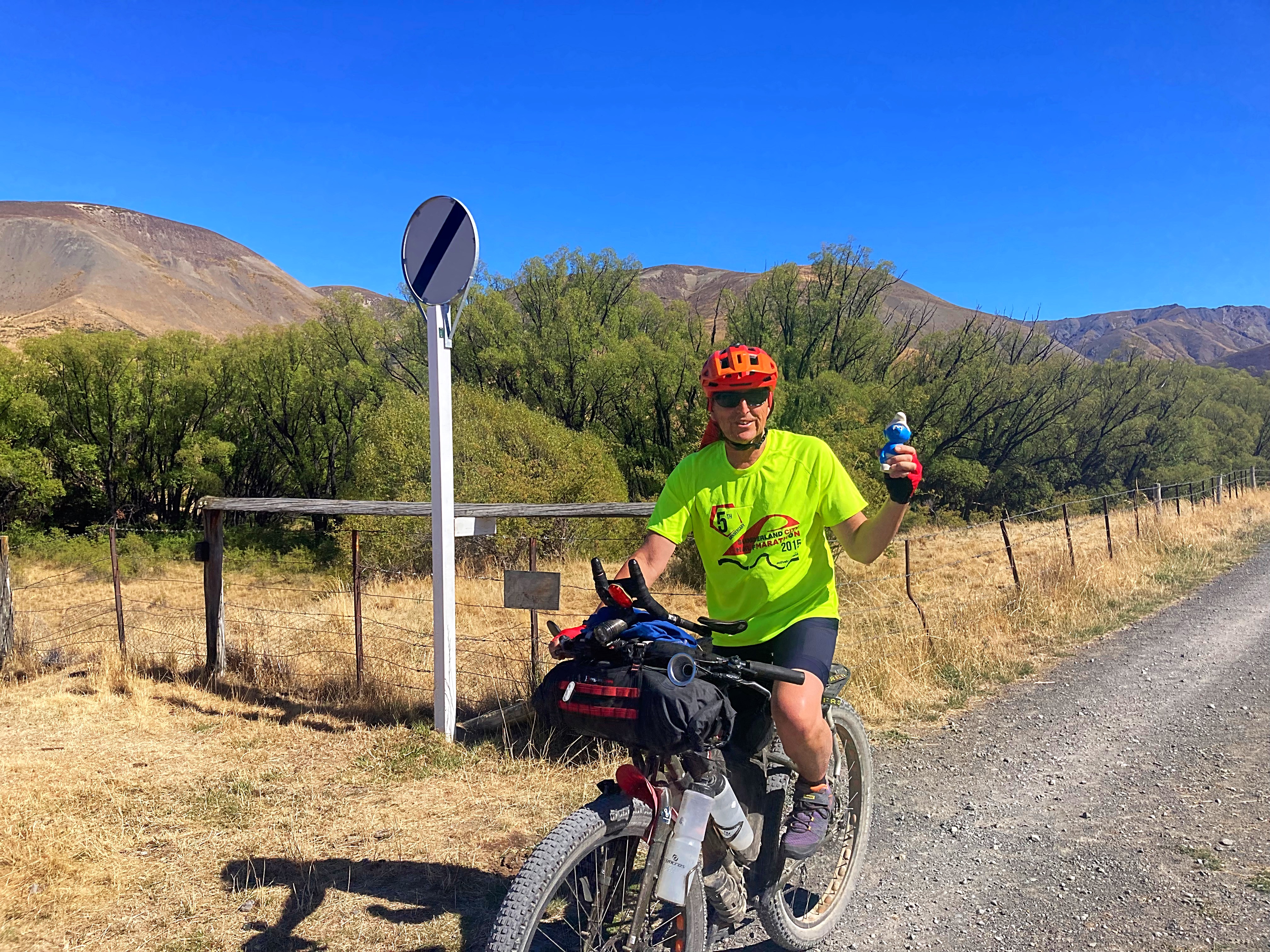
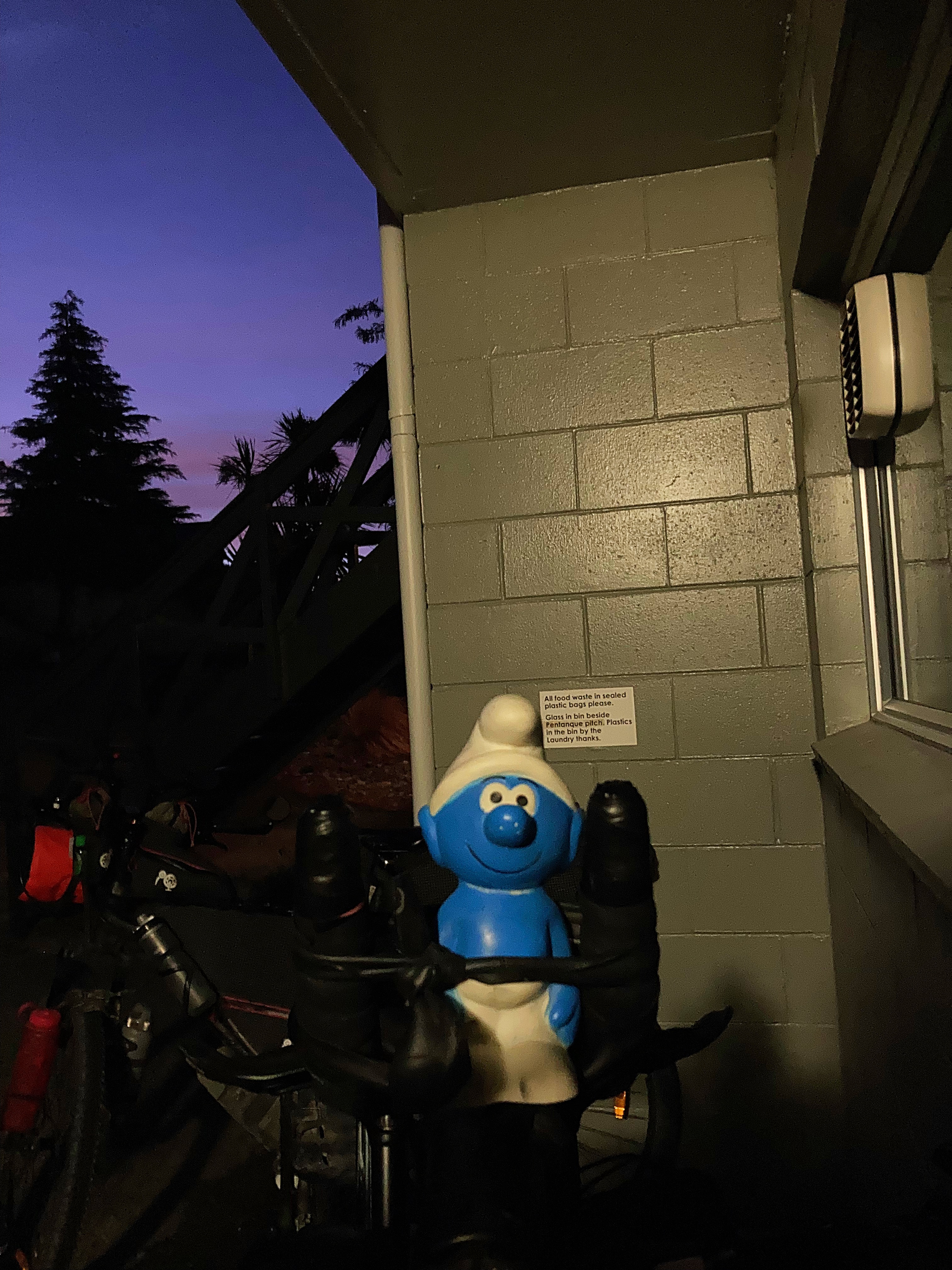
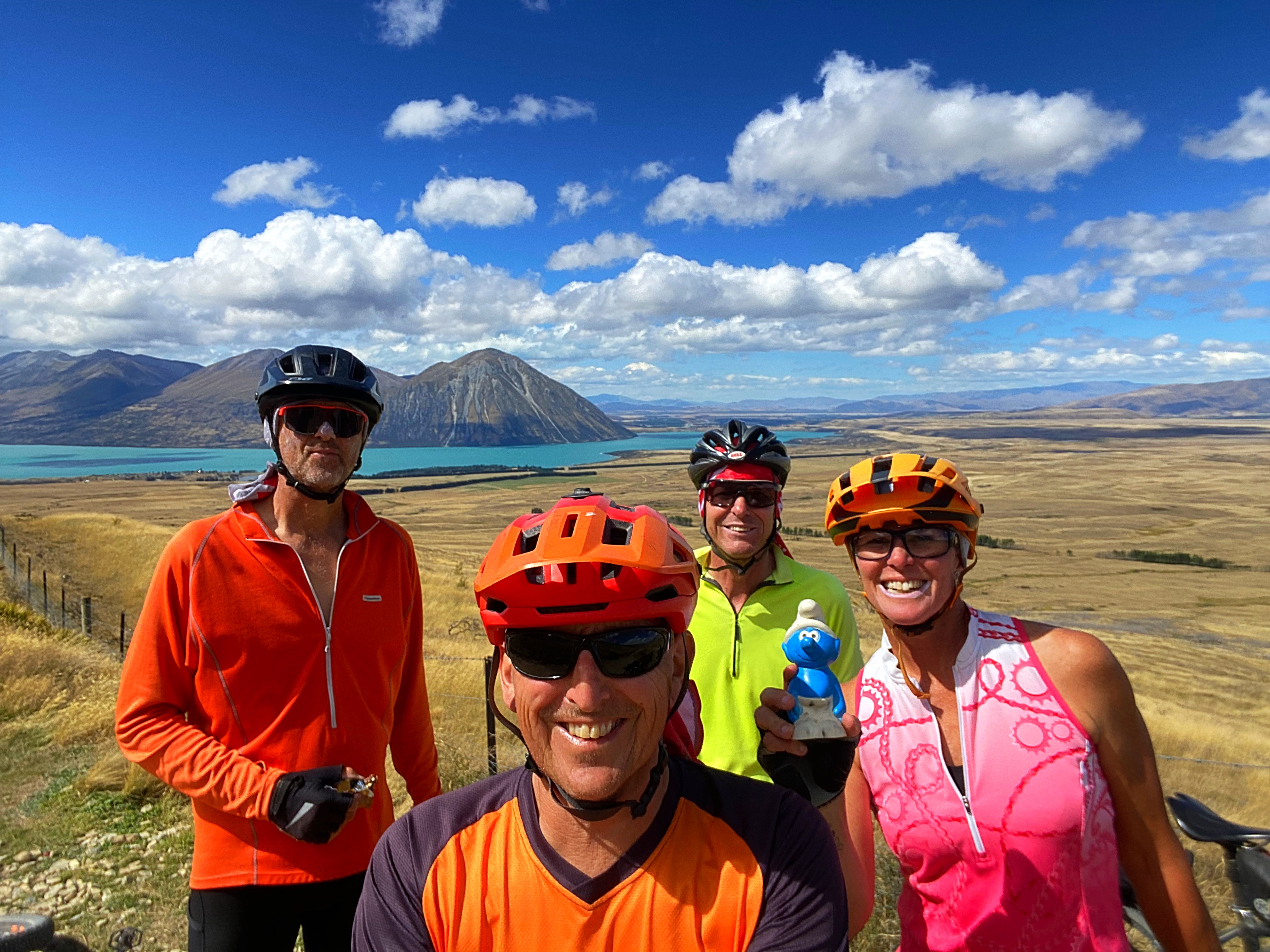
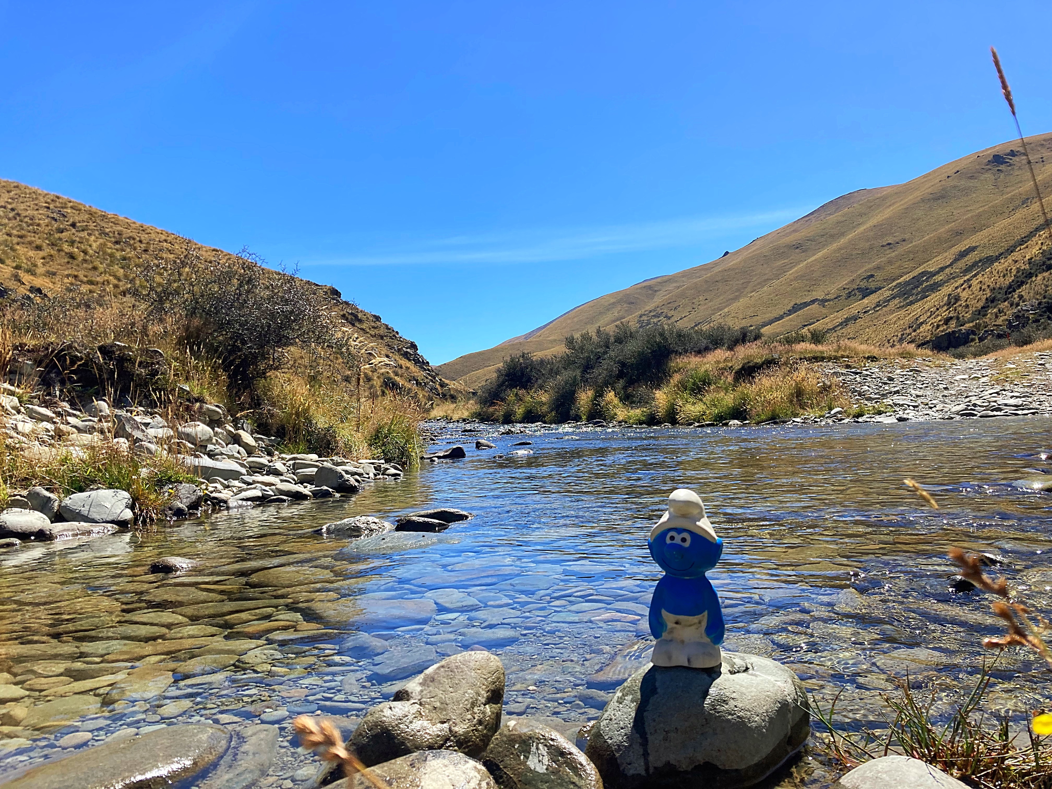
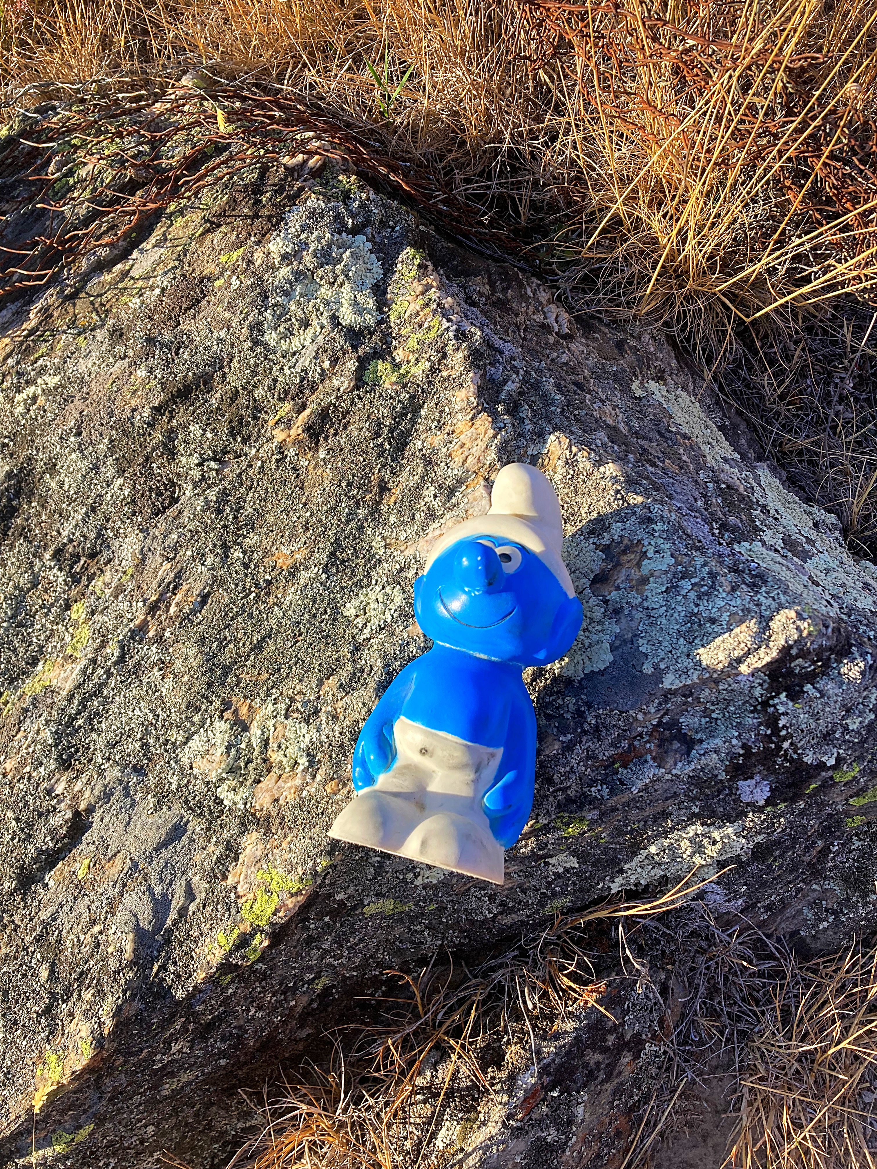
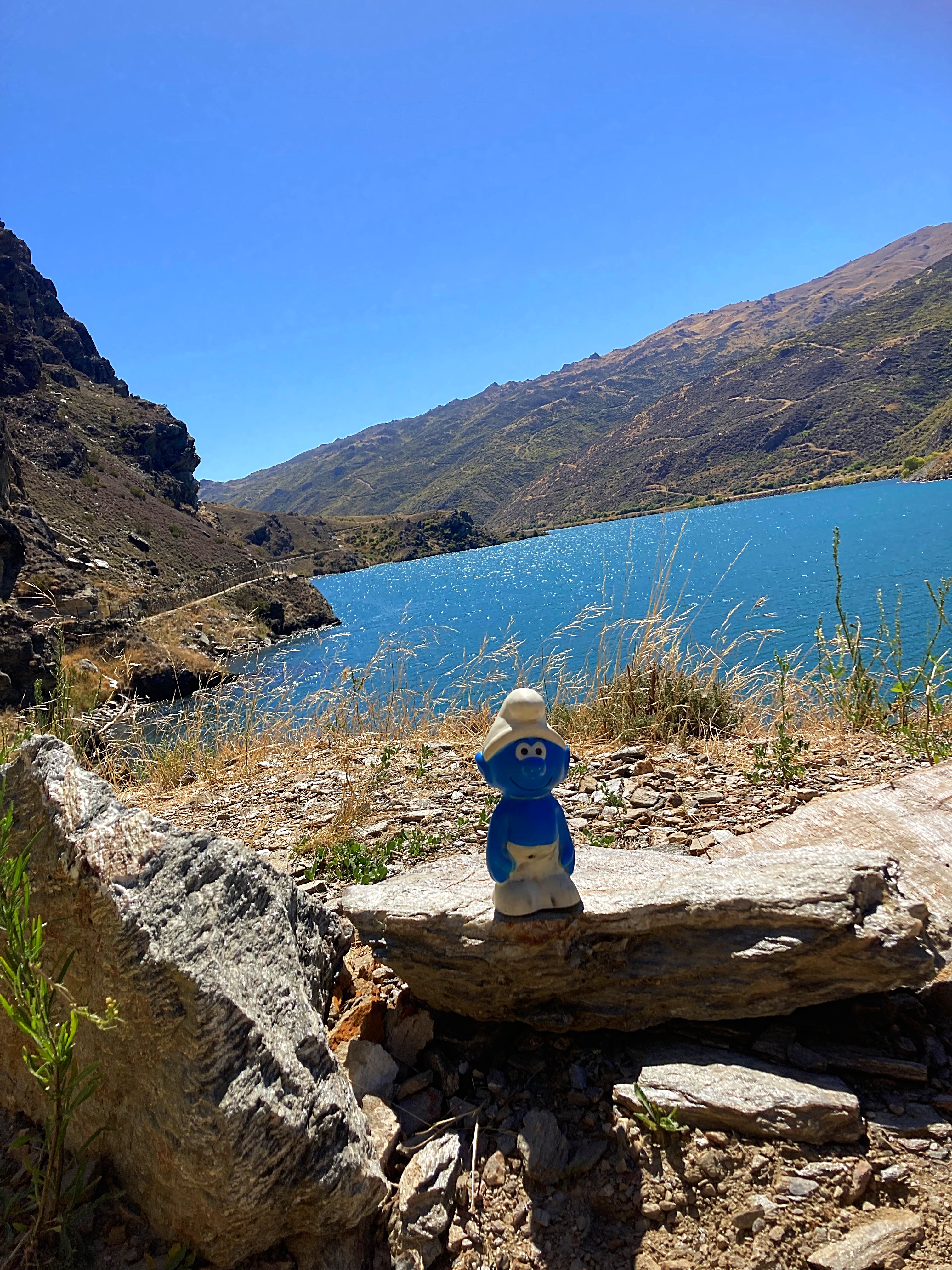
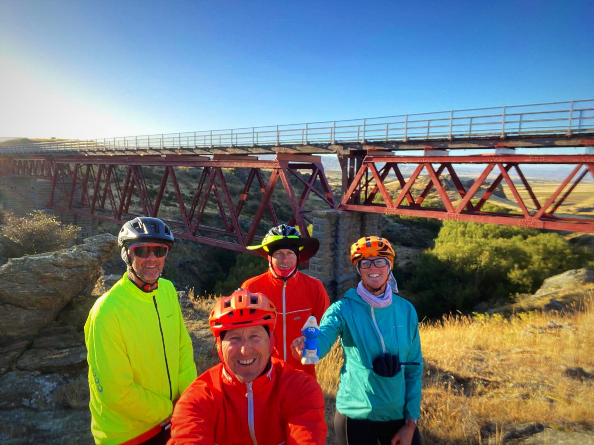
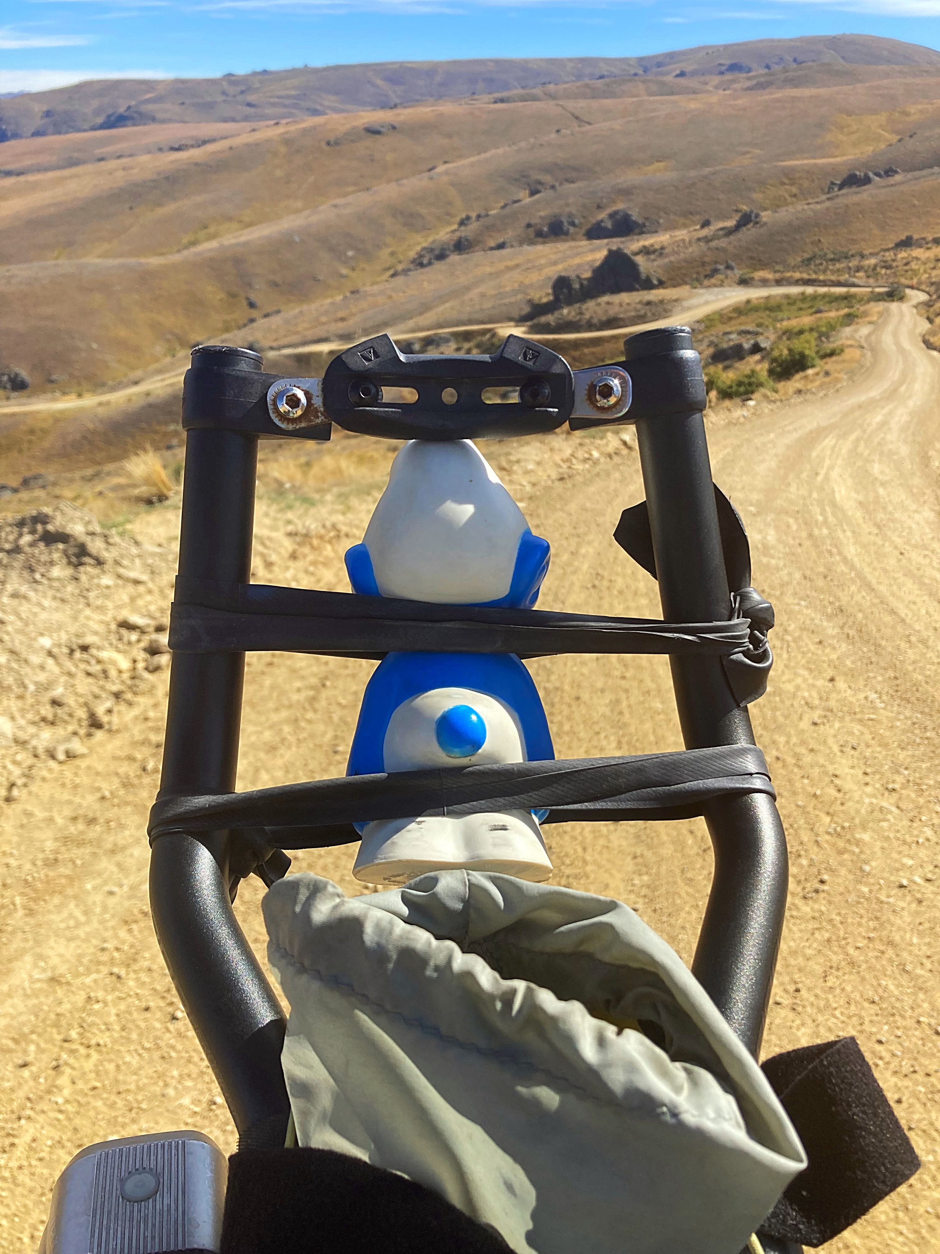
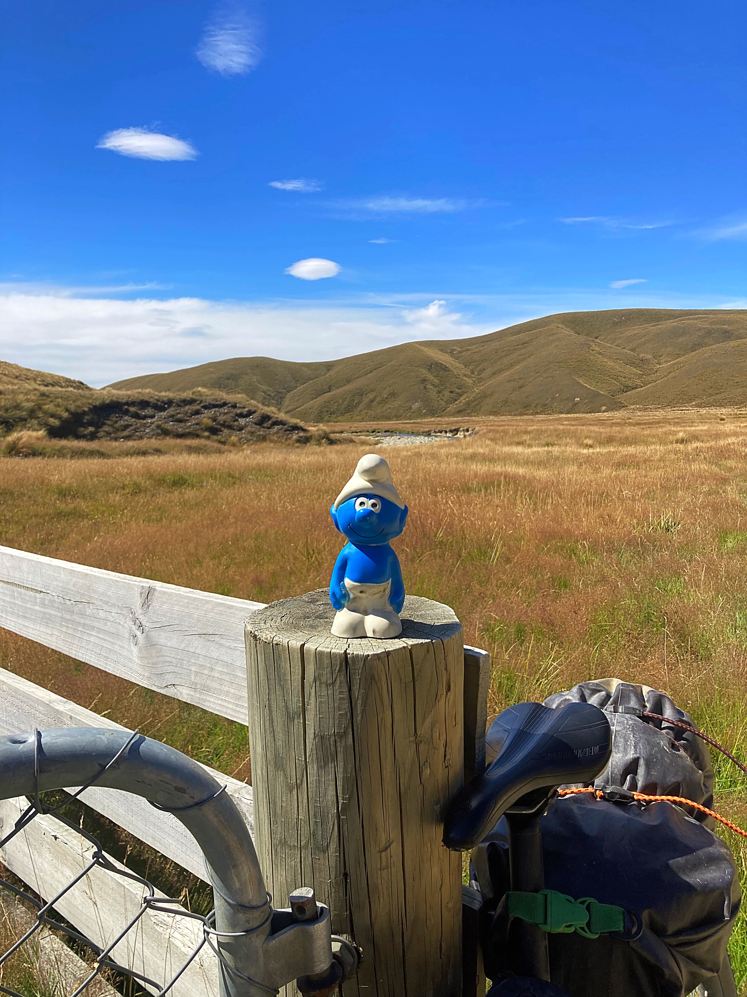
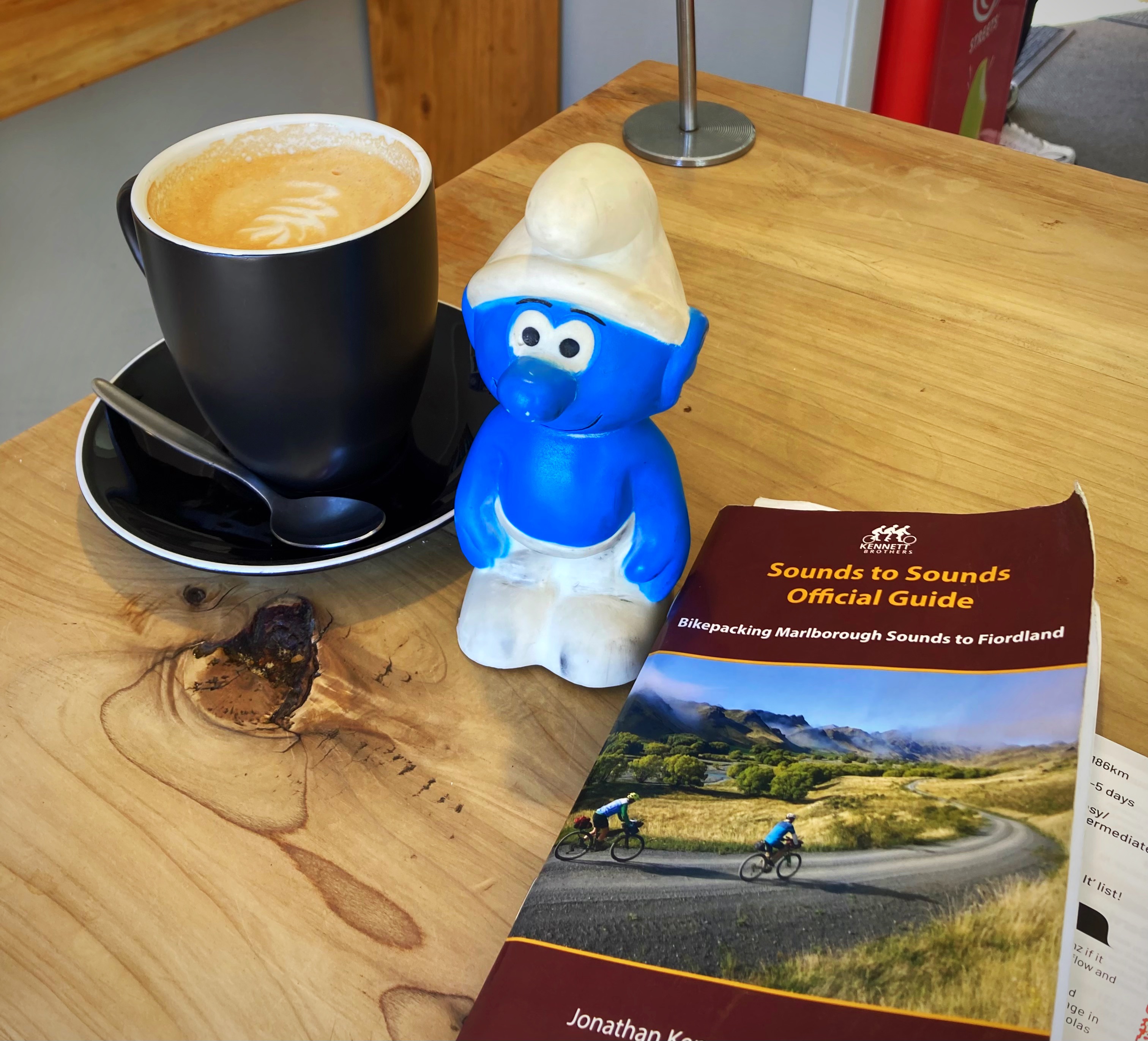
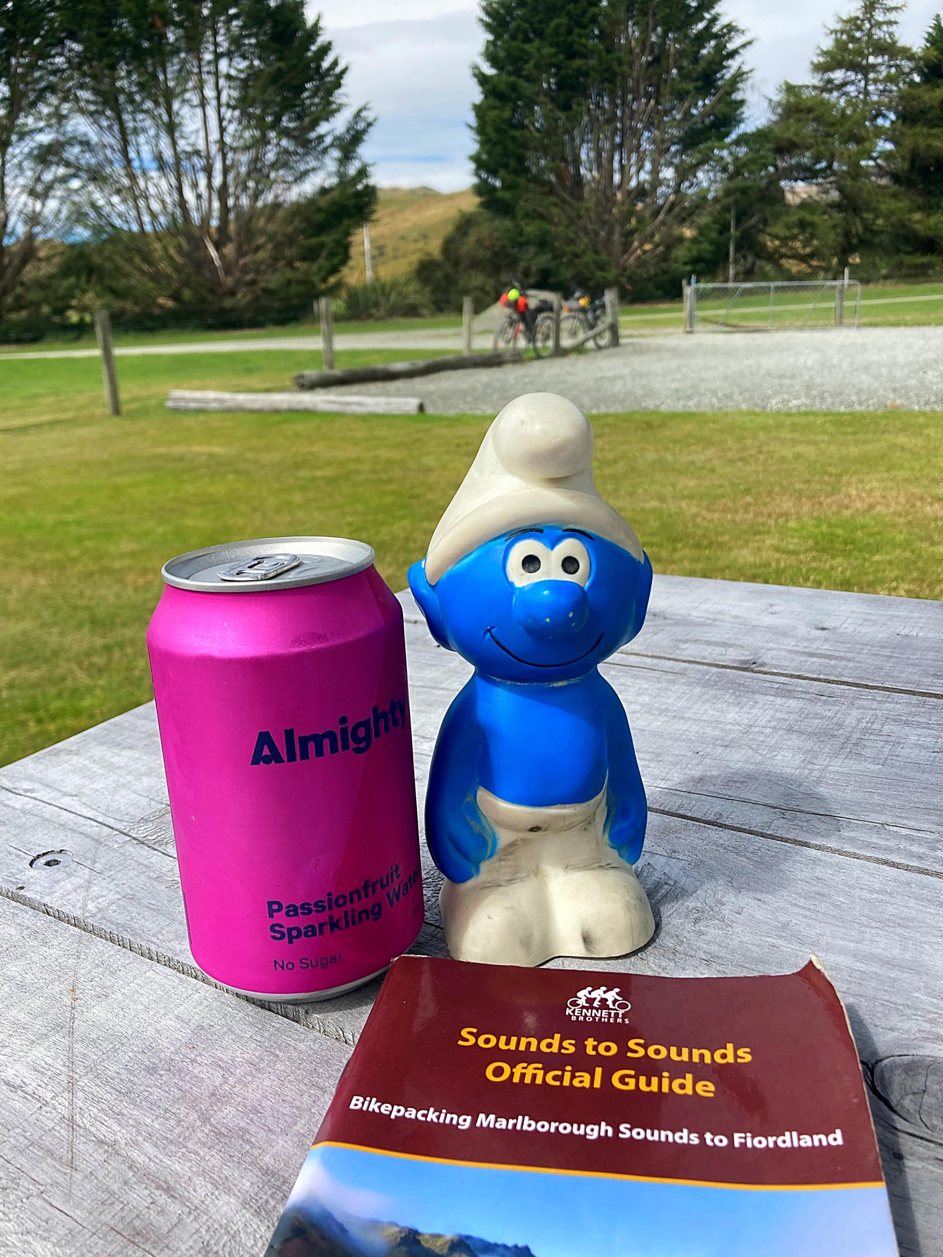
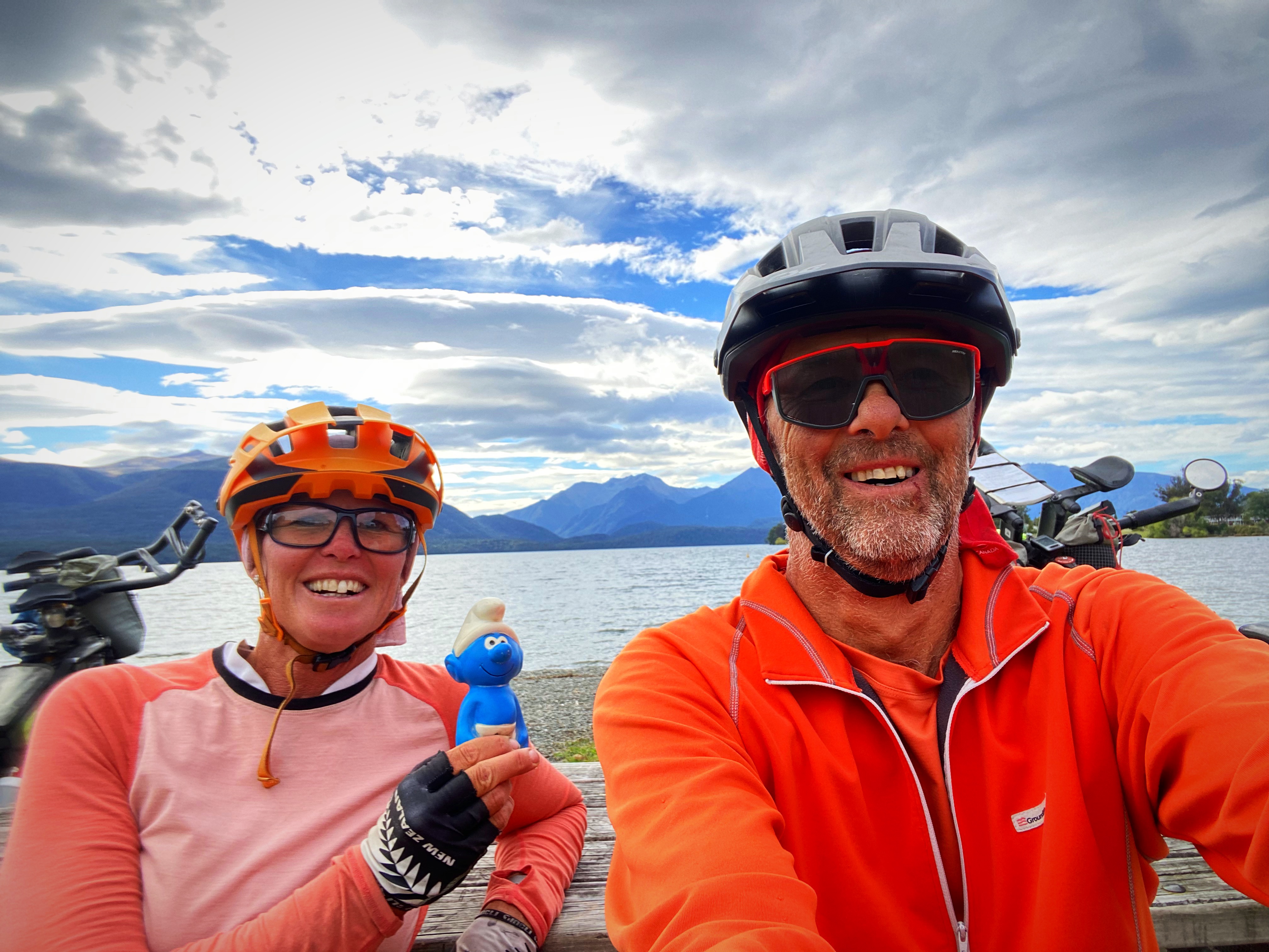
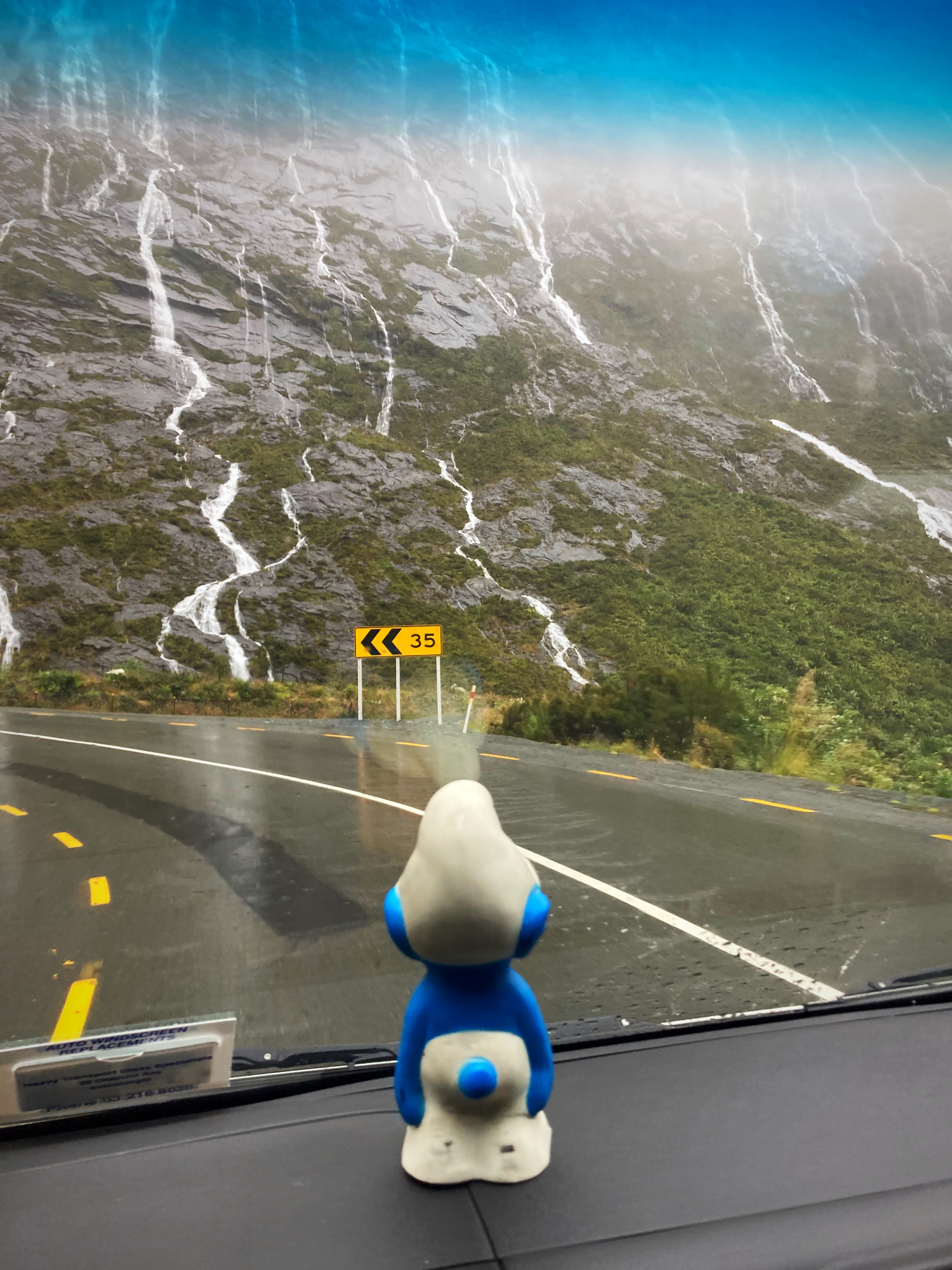
We found a shady spot for lunch. After lunch I asked Crammers if I could get a picture of our mascot Smurfy (a childhood toy of Crammers that he has just reunited with – long story ). He put him on the fence post and said “don’t fall of ya bugger” So what happened, he fell off and nearly went over the edge of the cliff. Fortunately Crammers used his selfie stick to retrieve Smurfy
The temperature reached 31 degrees so we were getting pretty hot. We arrived at Upcot Station at 2pm – a record for Lambers & Crammers who earnt themselves the names of Dilly and Dally on past biking excursions
Our hosts at Upcot Station, Nicky, Bill and their daughters Mel & Lou are delightful good old fashioned Kiwi hospitality. An absolute plus was they have a pool so that was first up on the agenda.
After cooling off and showering we had a delicious dinner – everything on the plate bar the mushrooms was home grown. This was followed by peach and nectarine crumble – also homegrown.
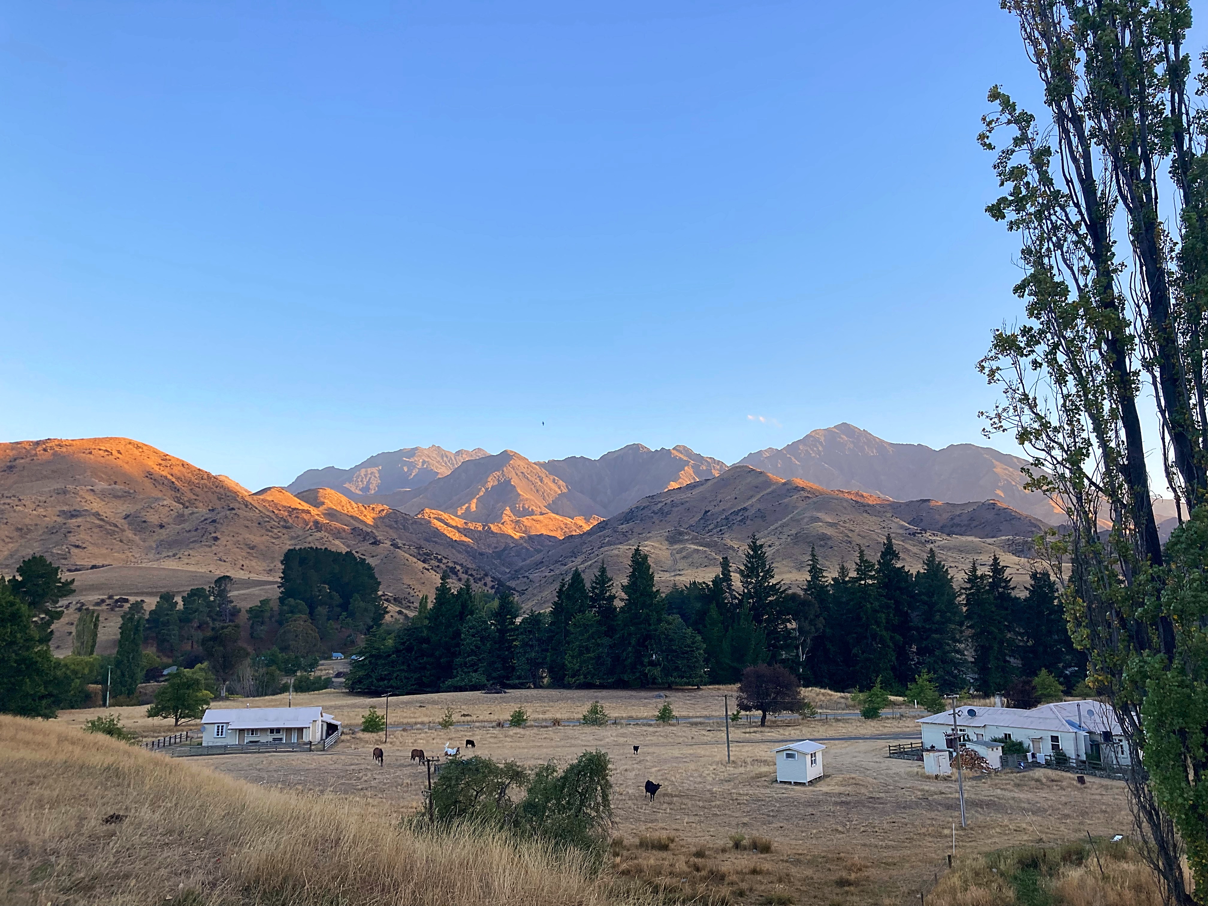
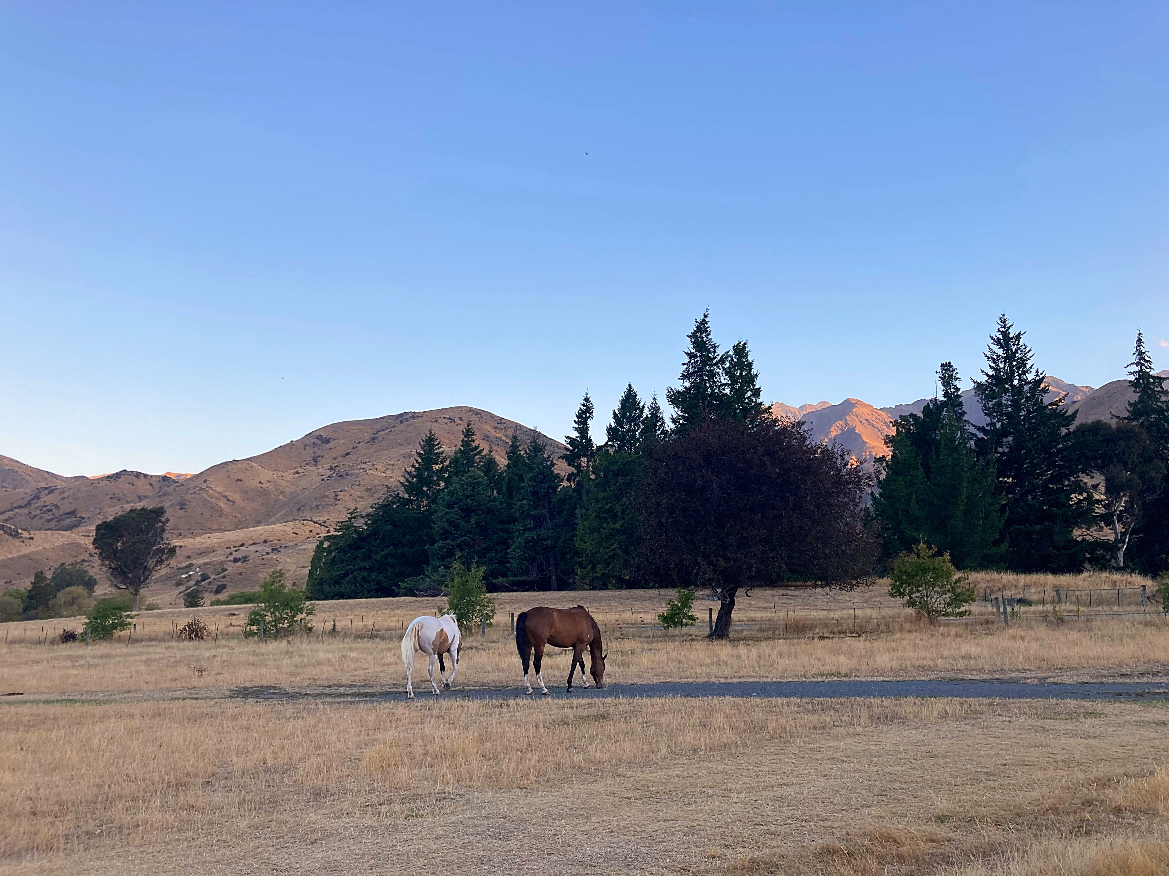
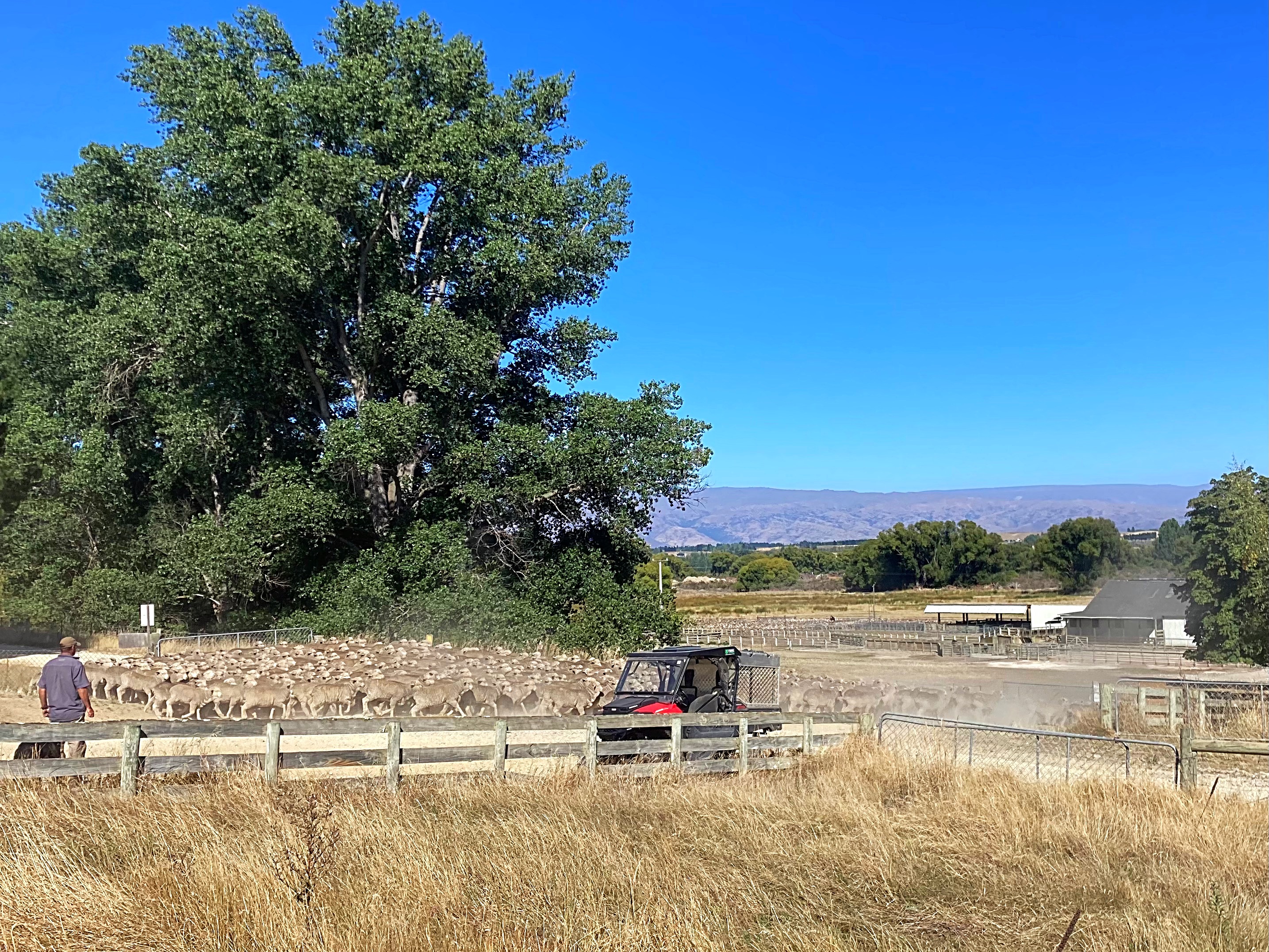
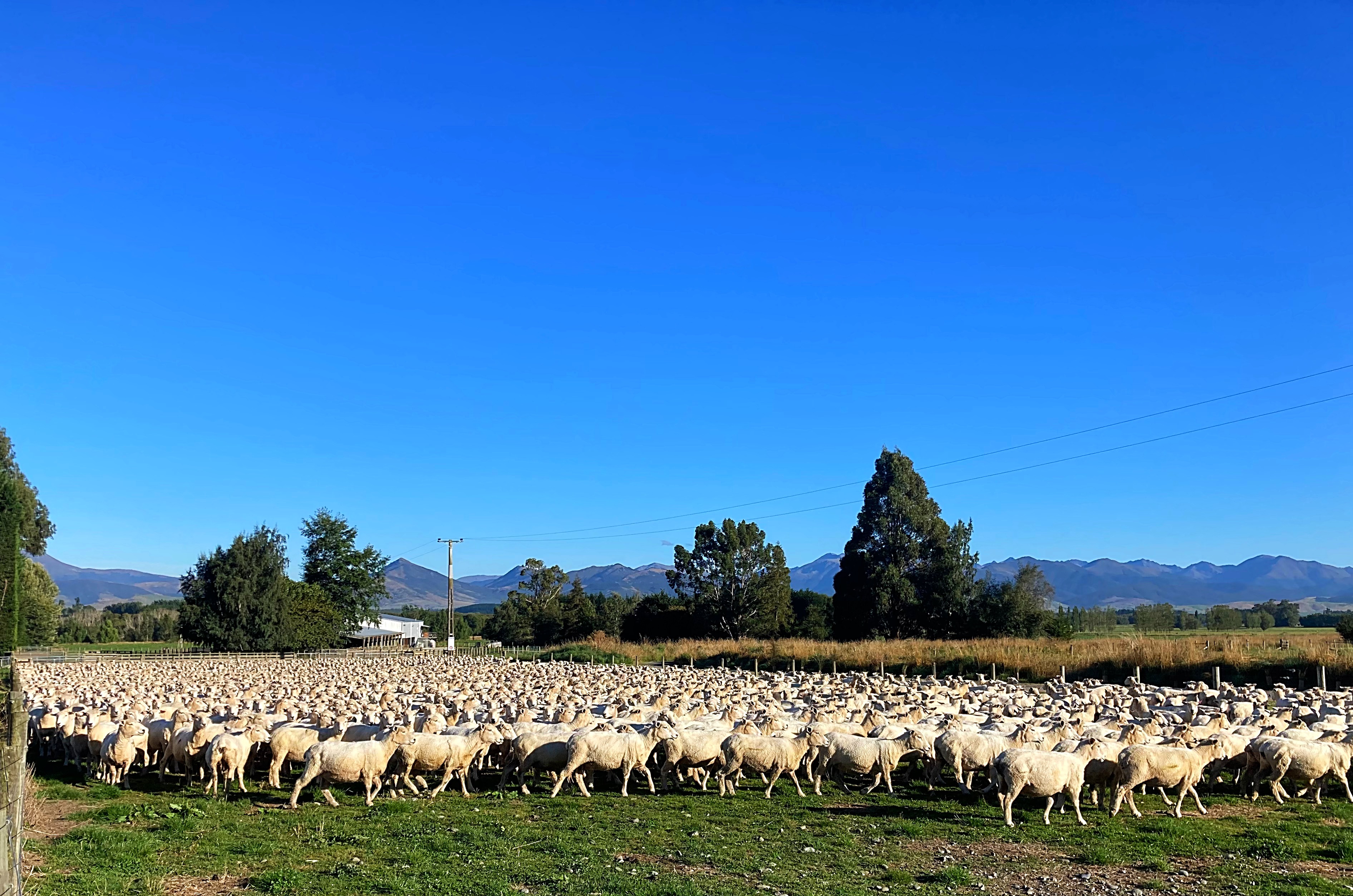
Bill is third generation on the property and they have 13,500 hectares. They run about 6000 sheep, have about 16 horses they use to work the property, a number of working dogs and beef cattle. It was so interesting talking to them about the property.
Enjoying the journey and meeting the people elevate these adventures to the next level
14 February 2024
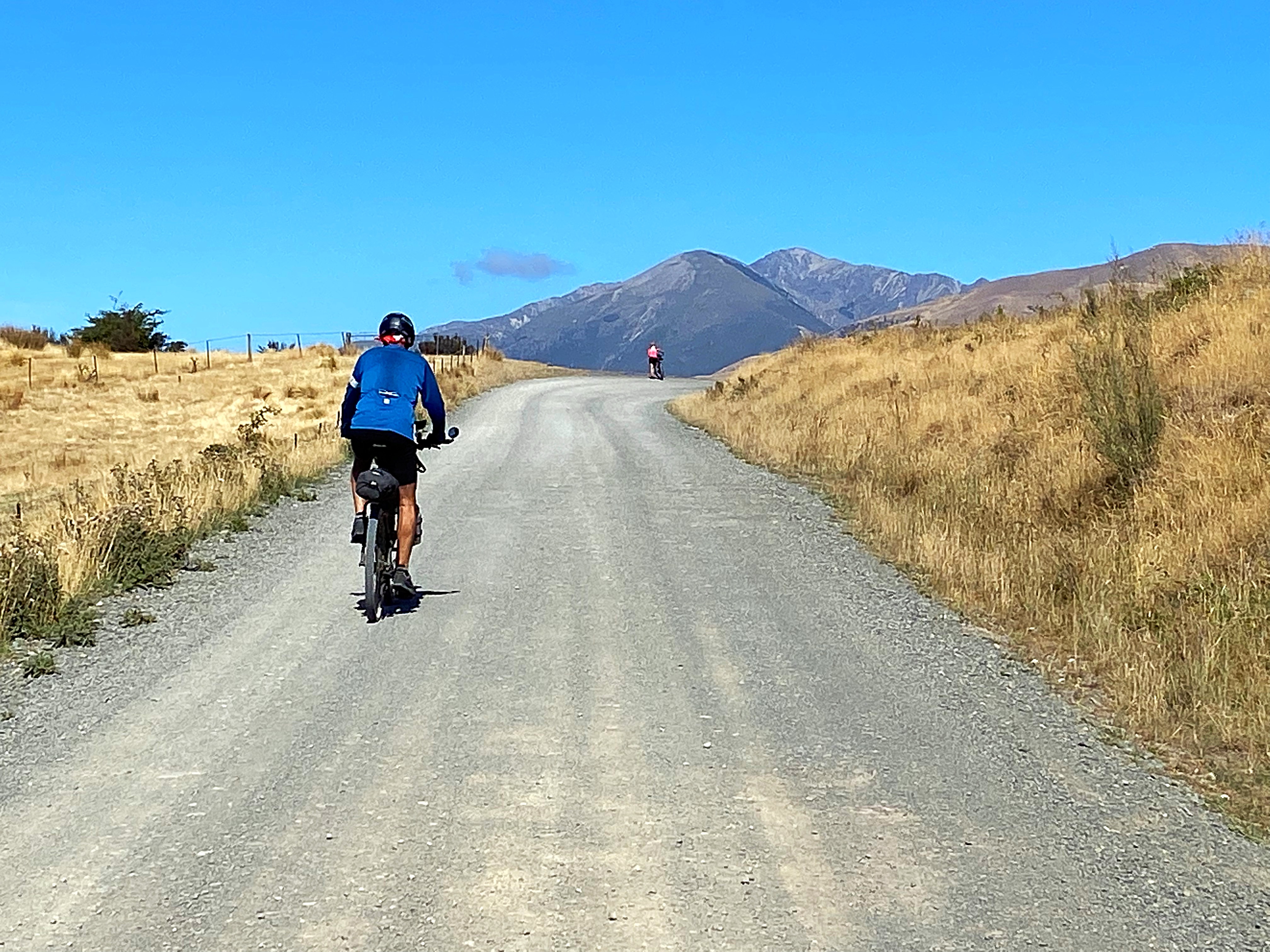
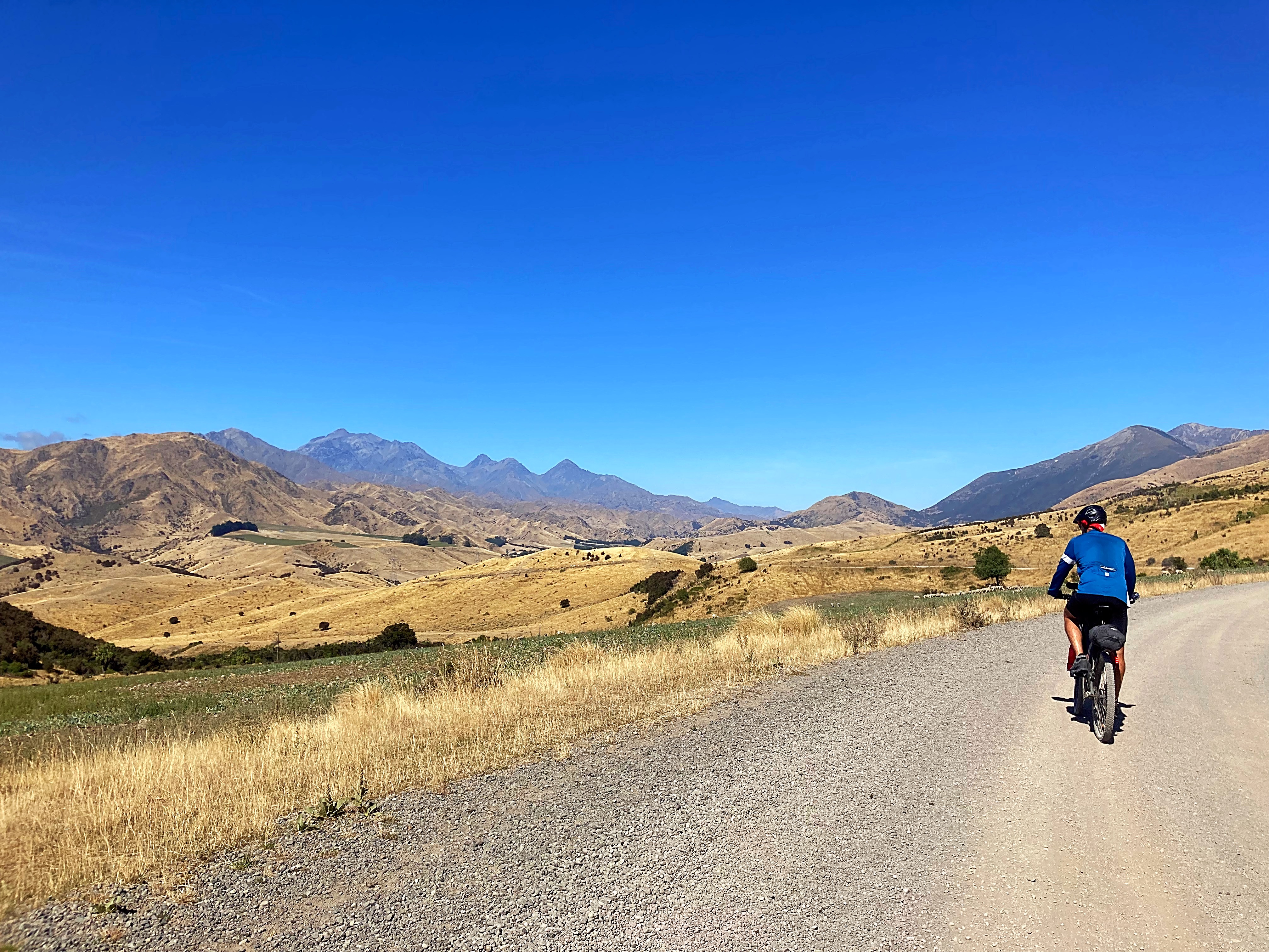
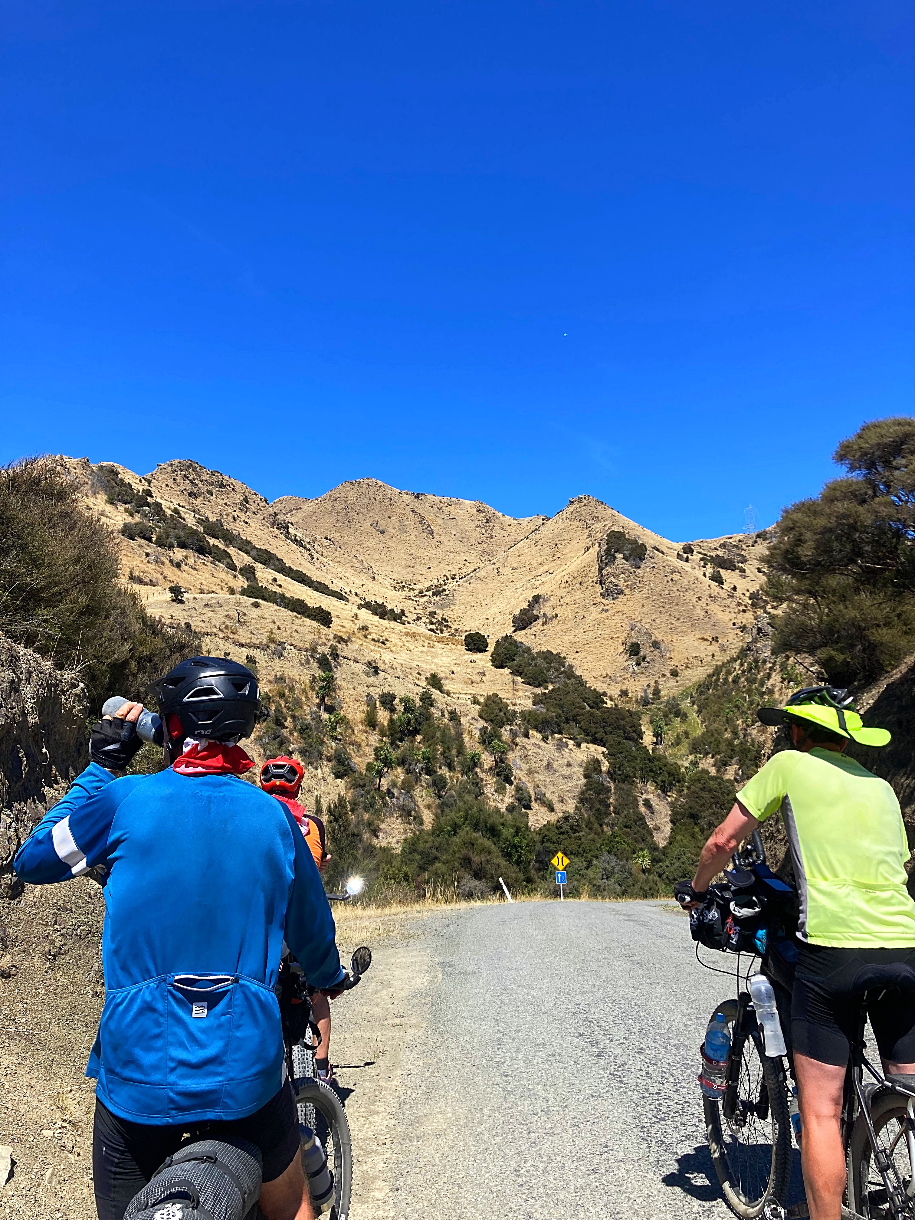
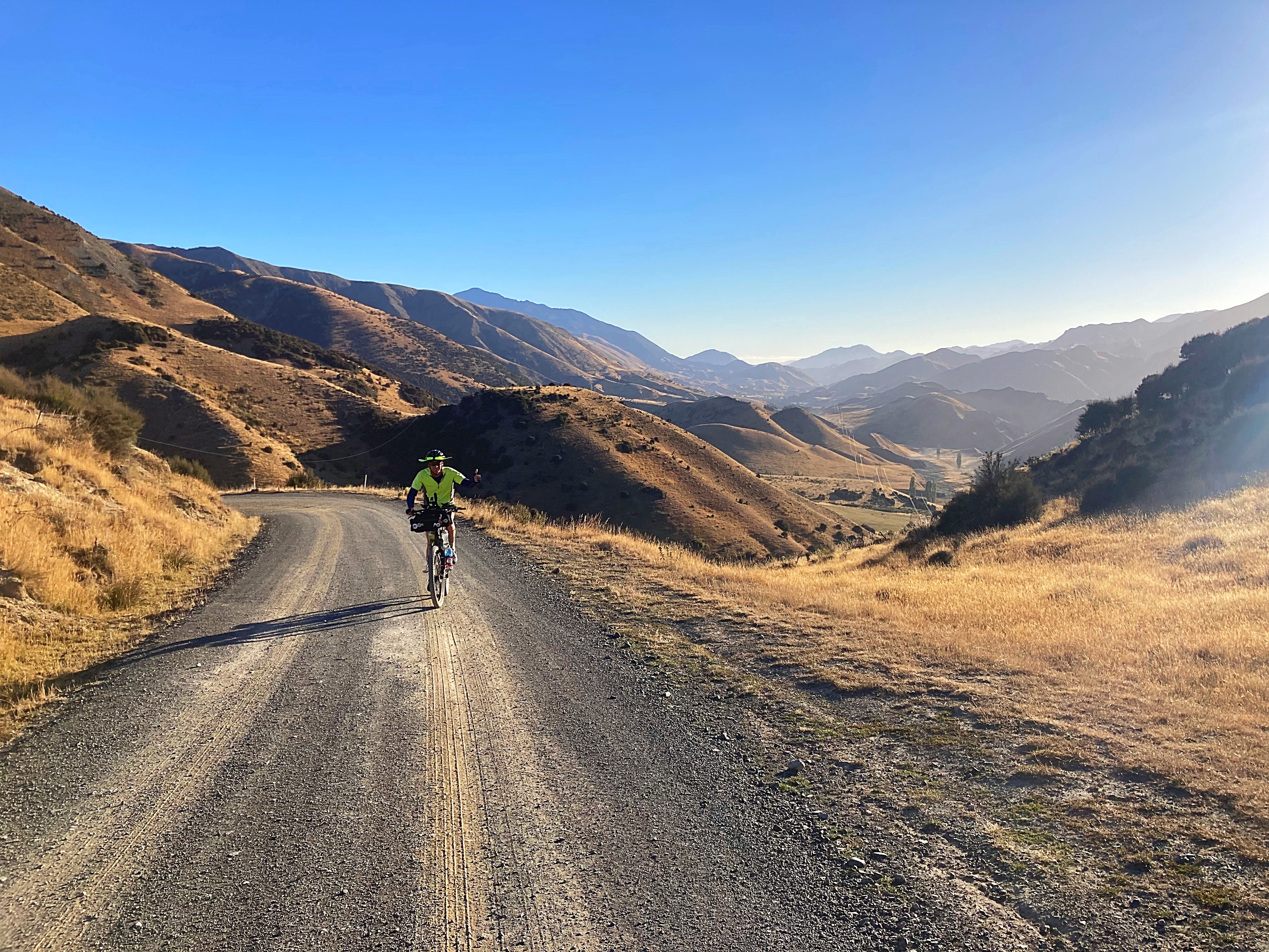
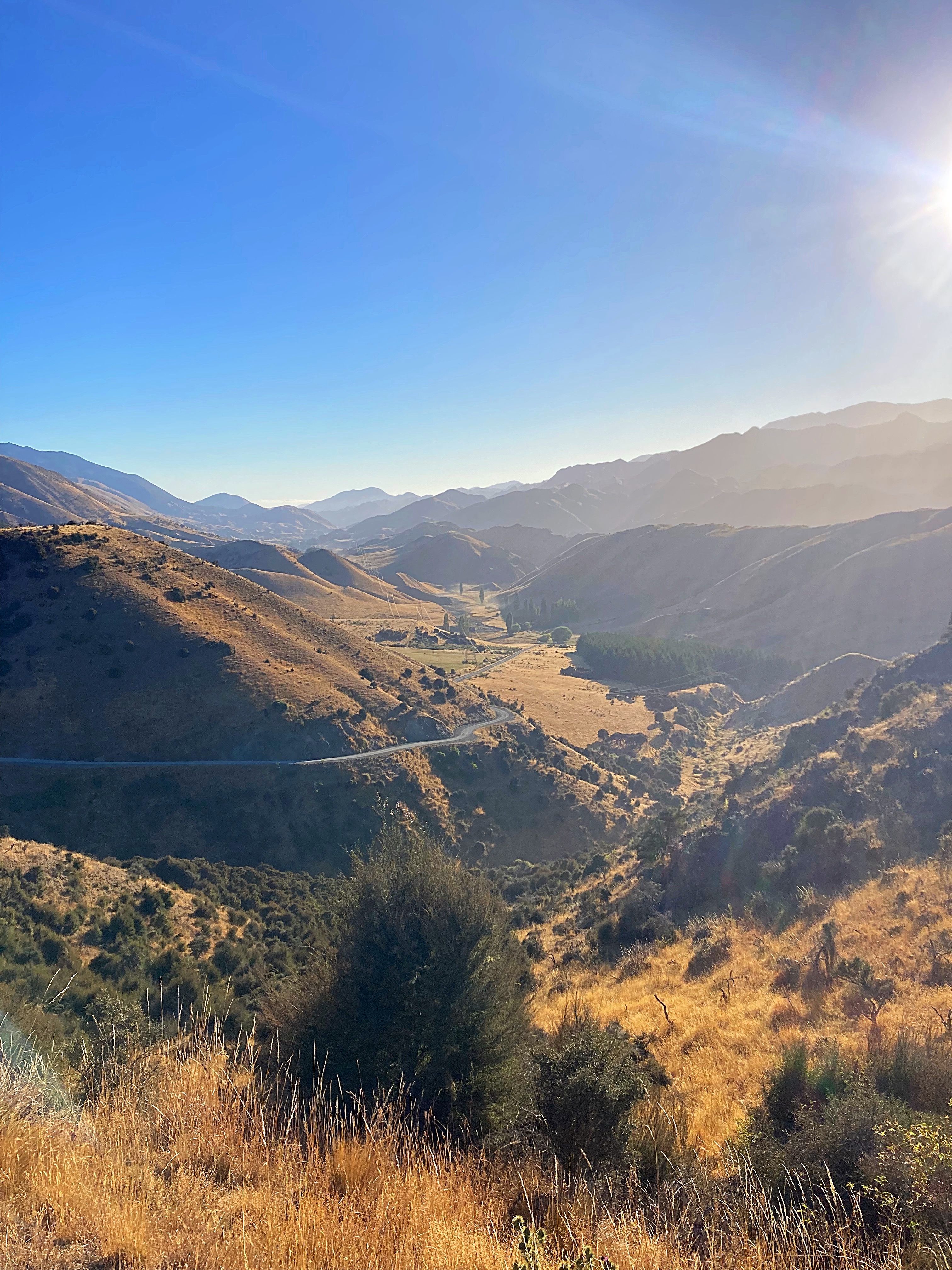
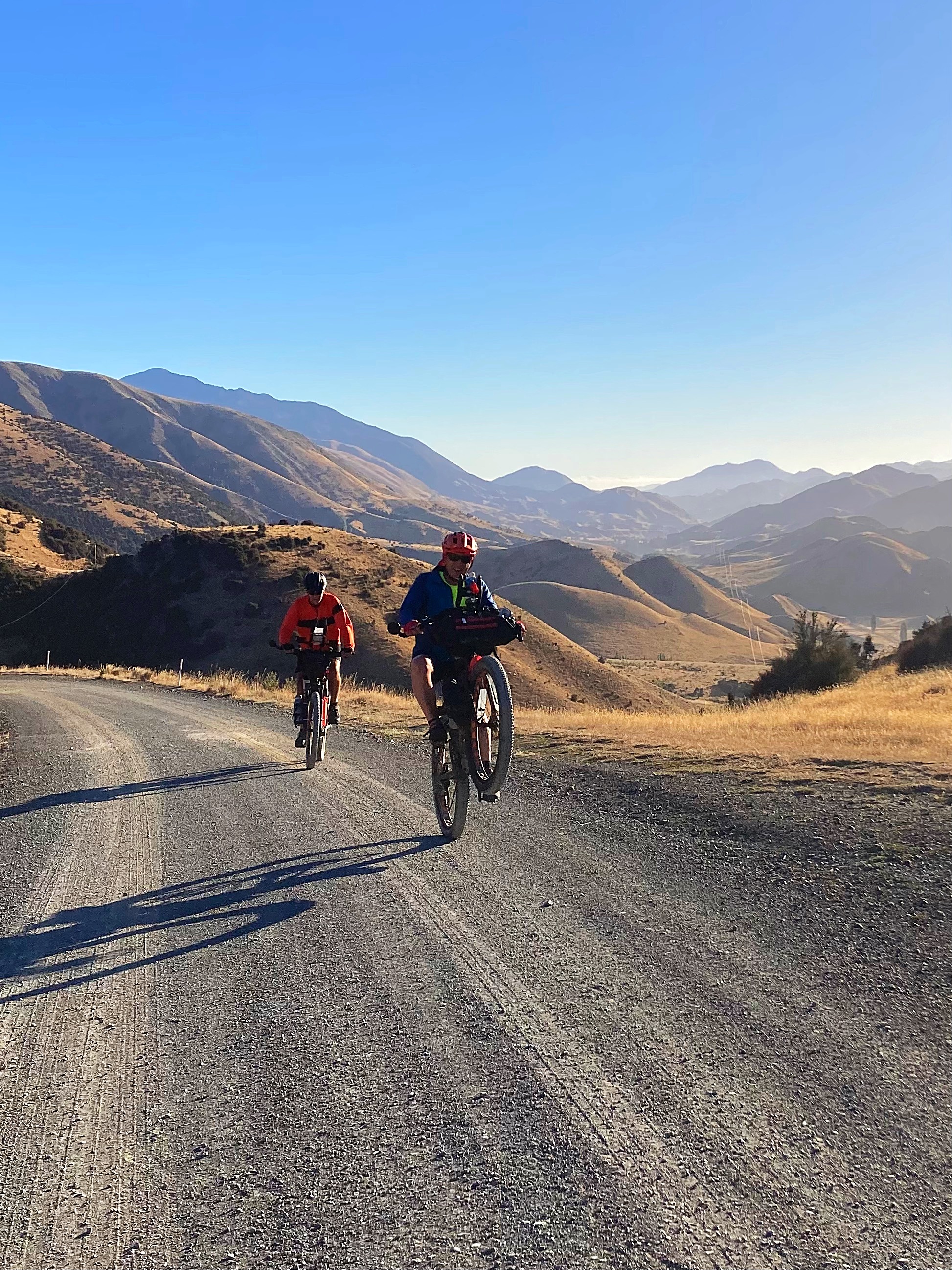
Day 3 – Upcot Station (Molesworth Rd) to Hanmer Springs 120km 2000 metres climbed
Another early morning as we were in for a big day on the pedals filled with saddles and passes. Mel whipped us up a delicious breakfast of eggs, bacon, sausages, fried potatoes and stewed tomatoes at 6am.
We left Upcot Station at 7am and five kilometres into the ride we hit the Upcot Saddle. It was another blue sky day so the vistas were magical. Check Crammers wheelie out that he pulled at the top – too much energy that boy.
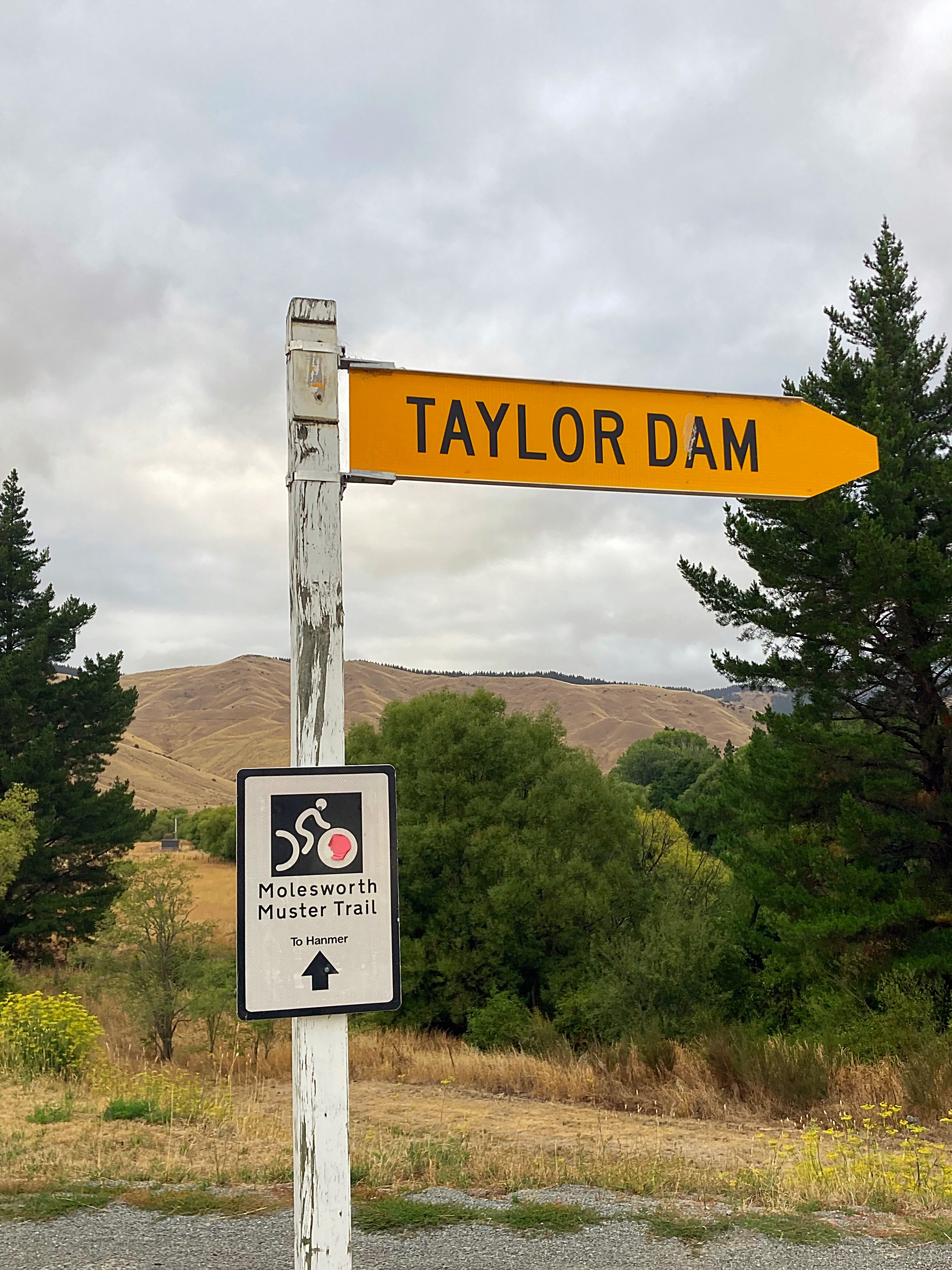
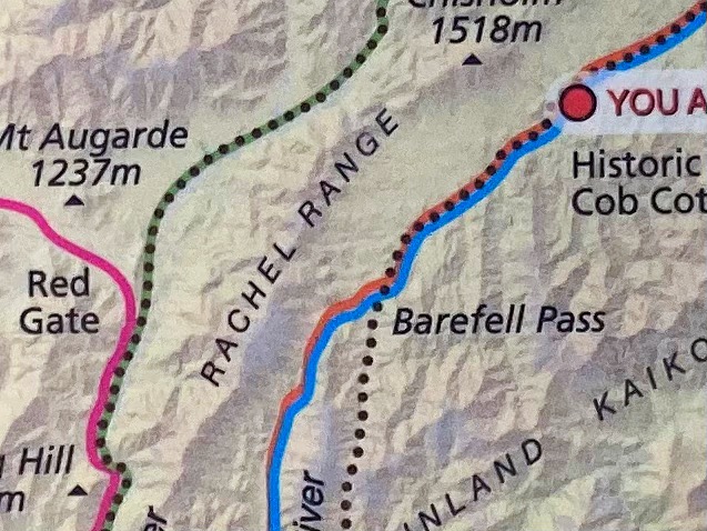
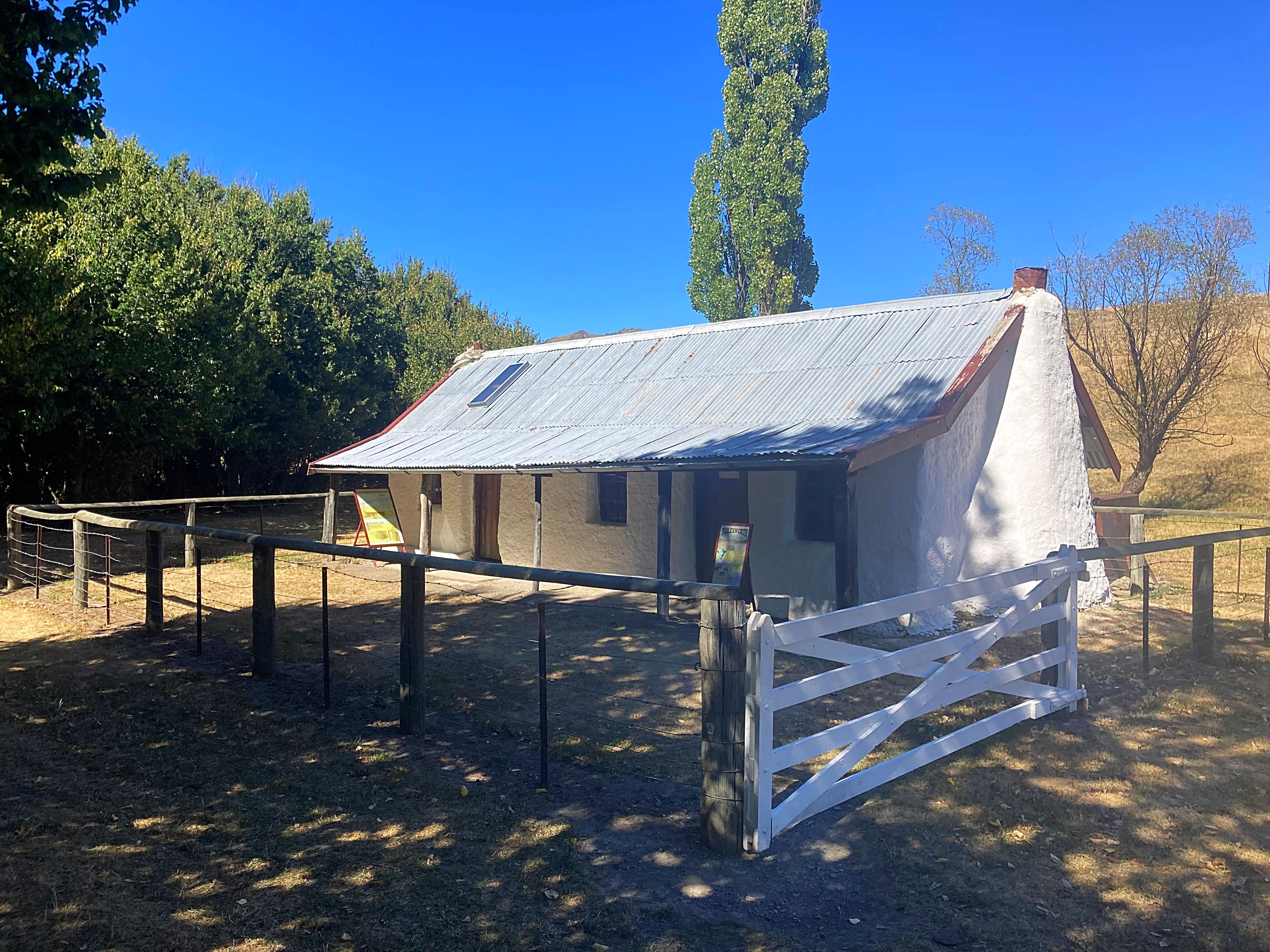
We then undulated up and down for another 25 kilometres before reaching the historic Molesworth Cob Cottage which is close to the current Molesworth homestead and associated buildings.
The cob cottage was built in 1865. Like many homes erected in New Zealand in the 18th century, the cob homestead was built of readily available materials. Forests in the area had been destroyed by the fires of moa-hunting Maoris and European farmers so the obvious choice of building material was cob. Cob is a primitive type of concrete, a wet clay mix reinforced with dung, chopped straw and salt which sets hard when dry.
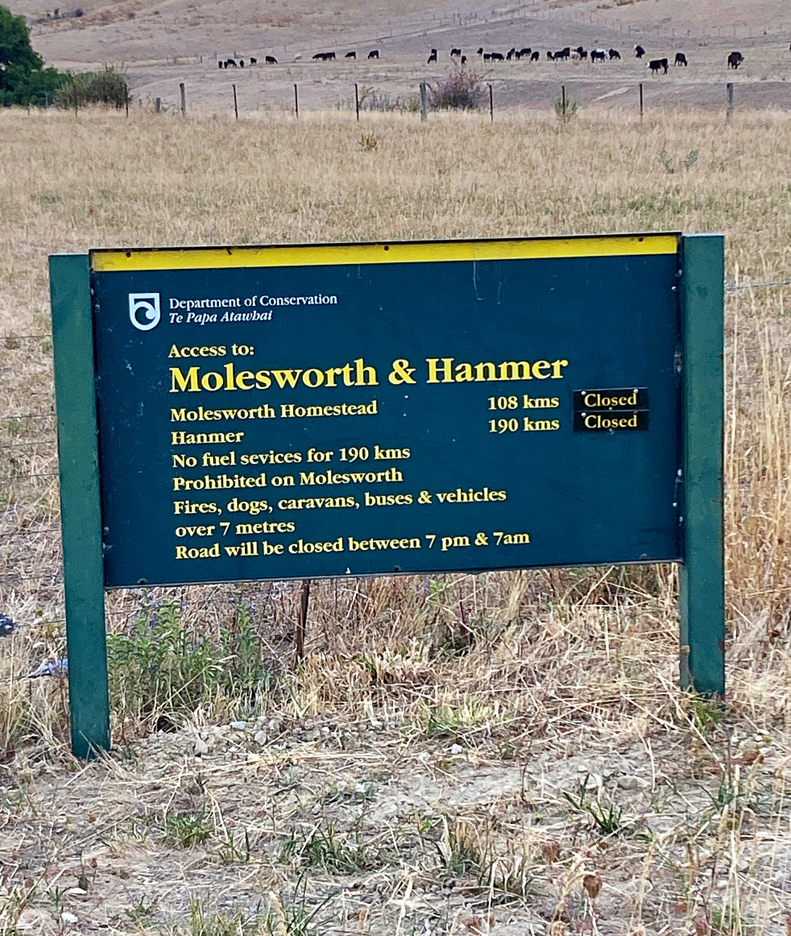
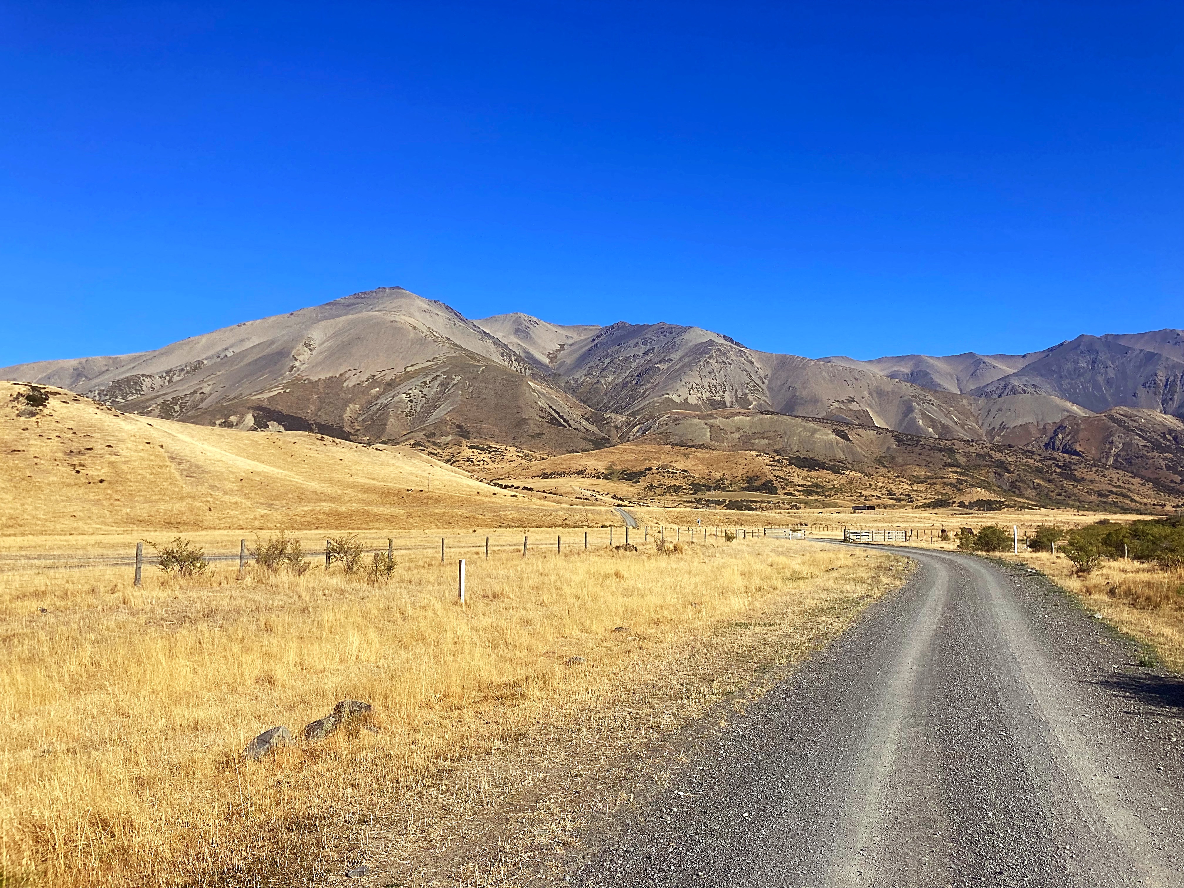
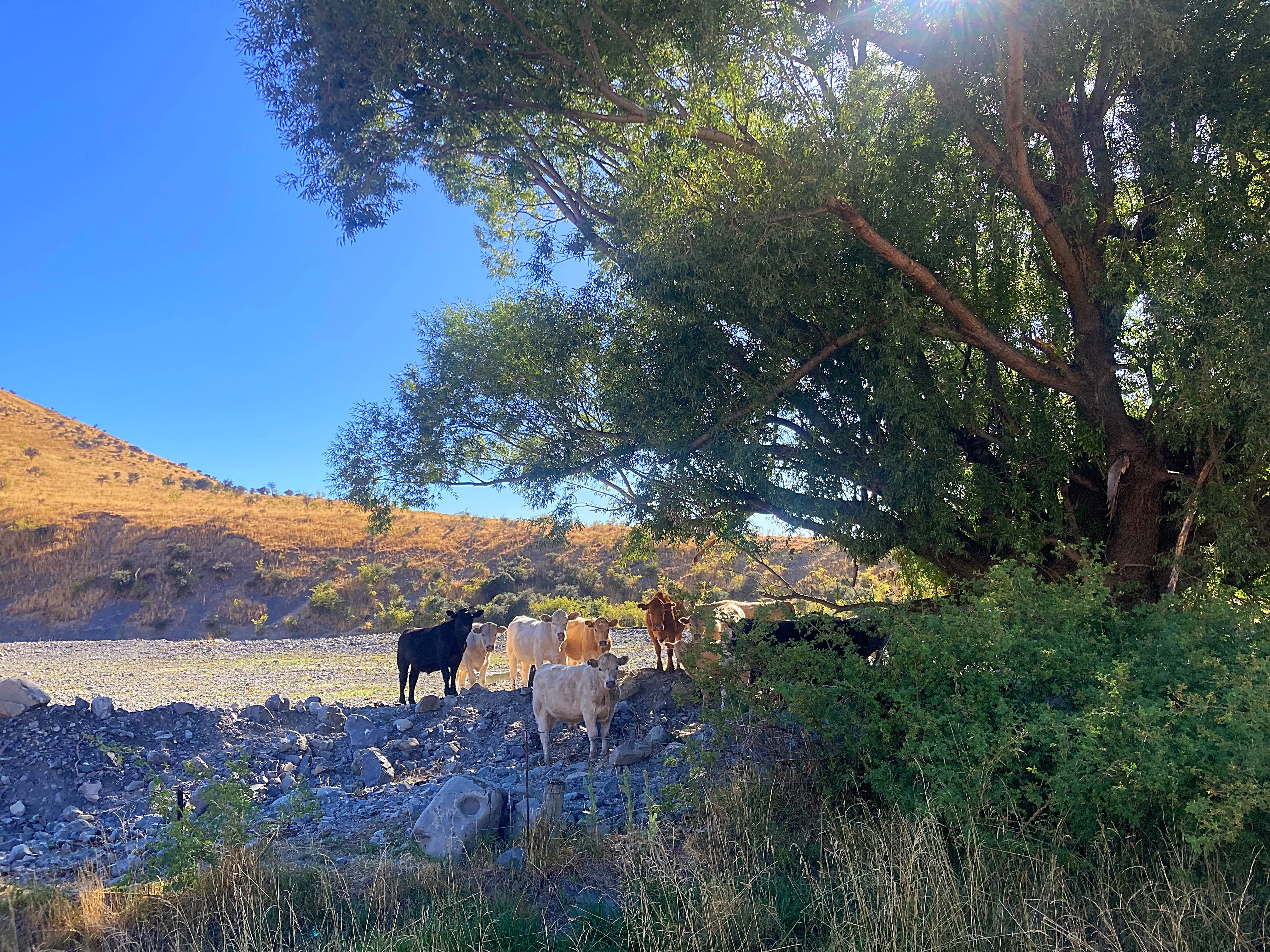
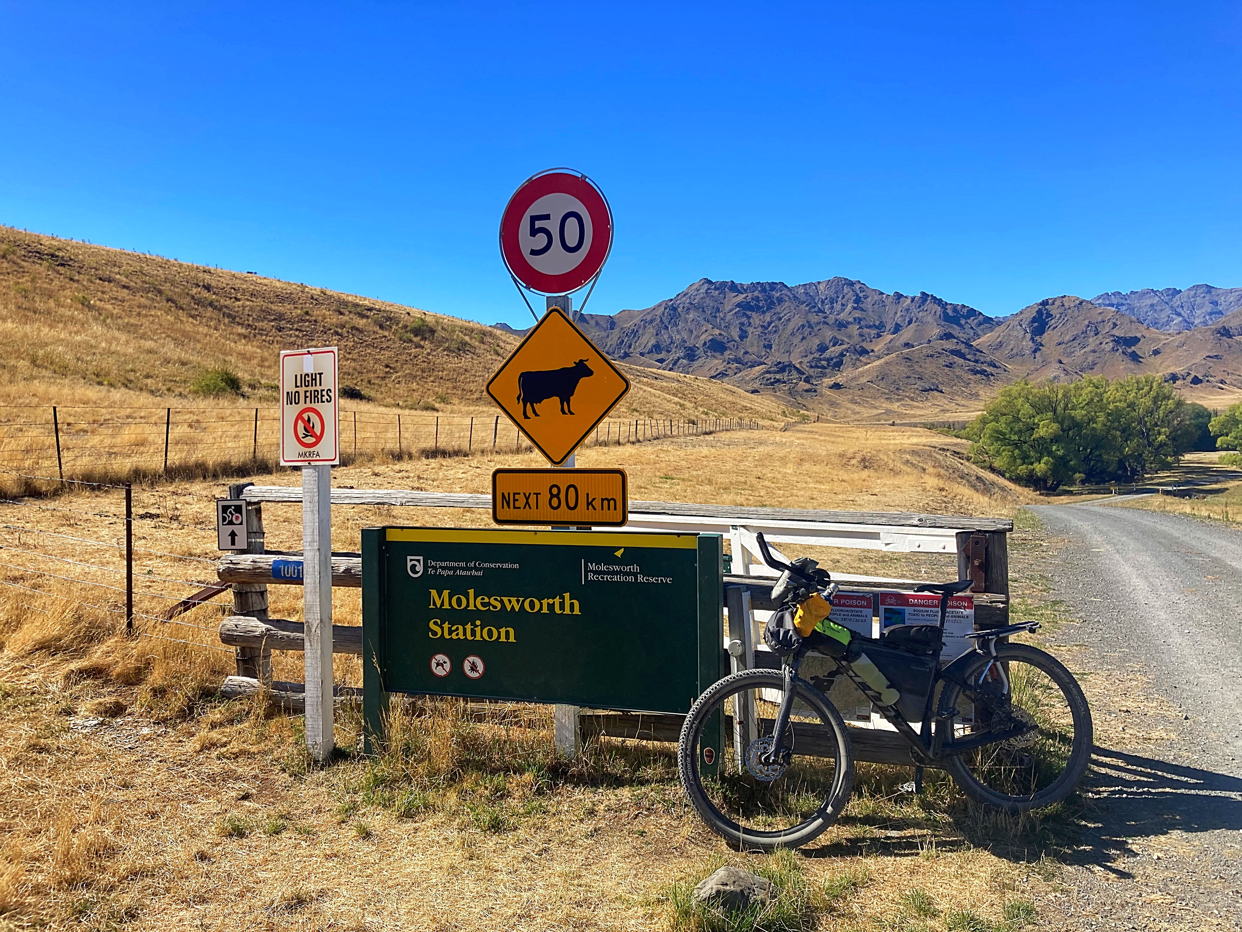
Molesworth Station is the largest farm in NZ at 182,000 hectares. It is owned by the Government and farmed in conjunction with the Department of Conservation. They run 9,000 to 10,000 head of cattle – mainly Hereford and Aberdeen Angus.
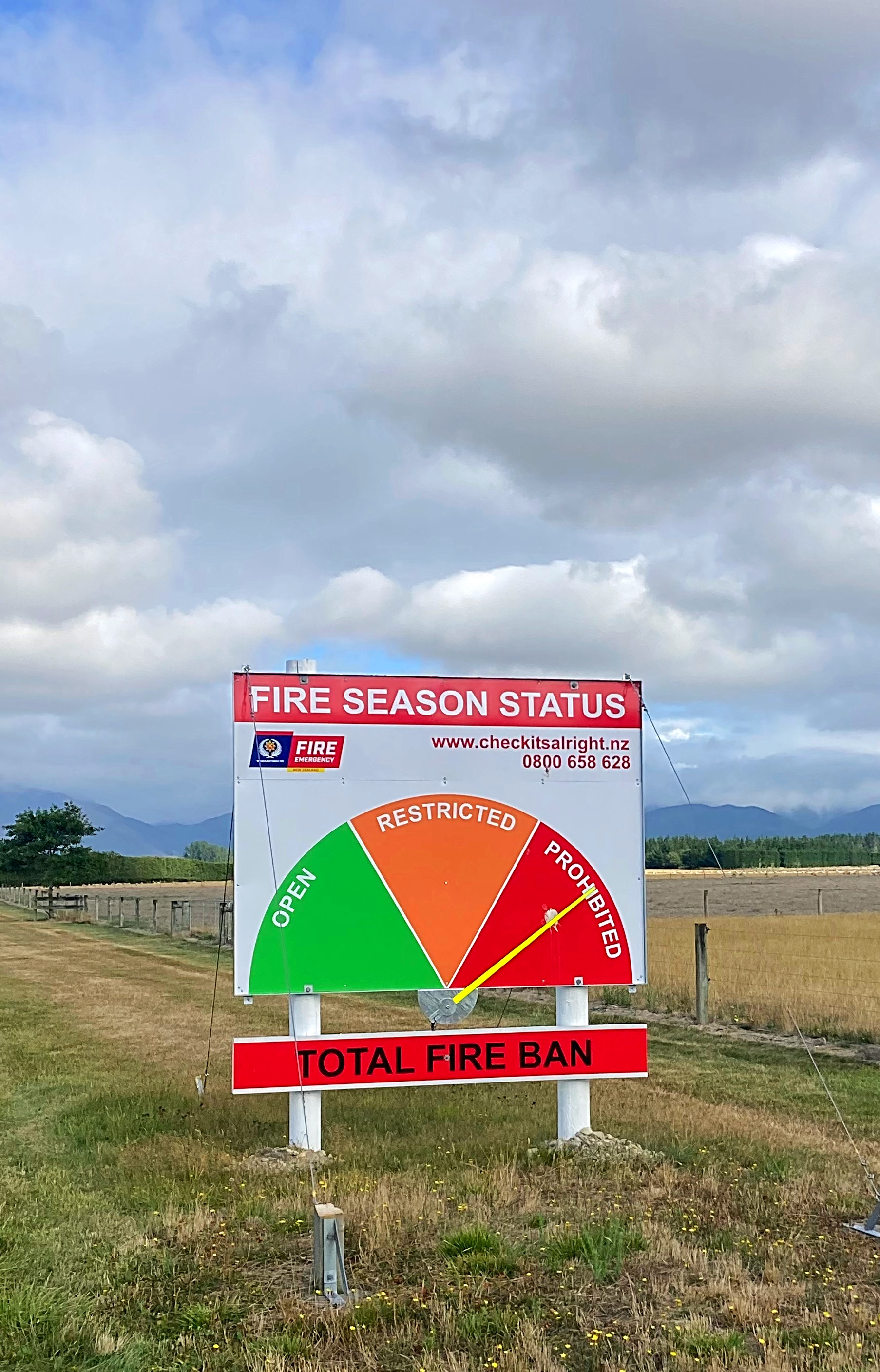
This road we were riding on passes through the driest areas of Molesworth, where rainfall is as little as 760mm per year. Since this also means less snow, cattle are brought into this area in winter to feed. The grass is precious – visitors are reminded of the fire risks.
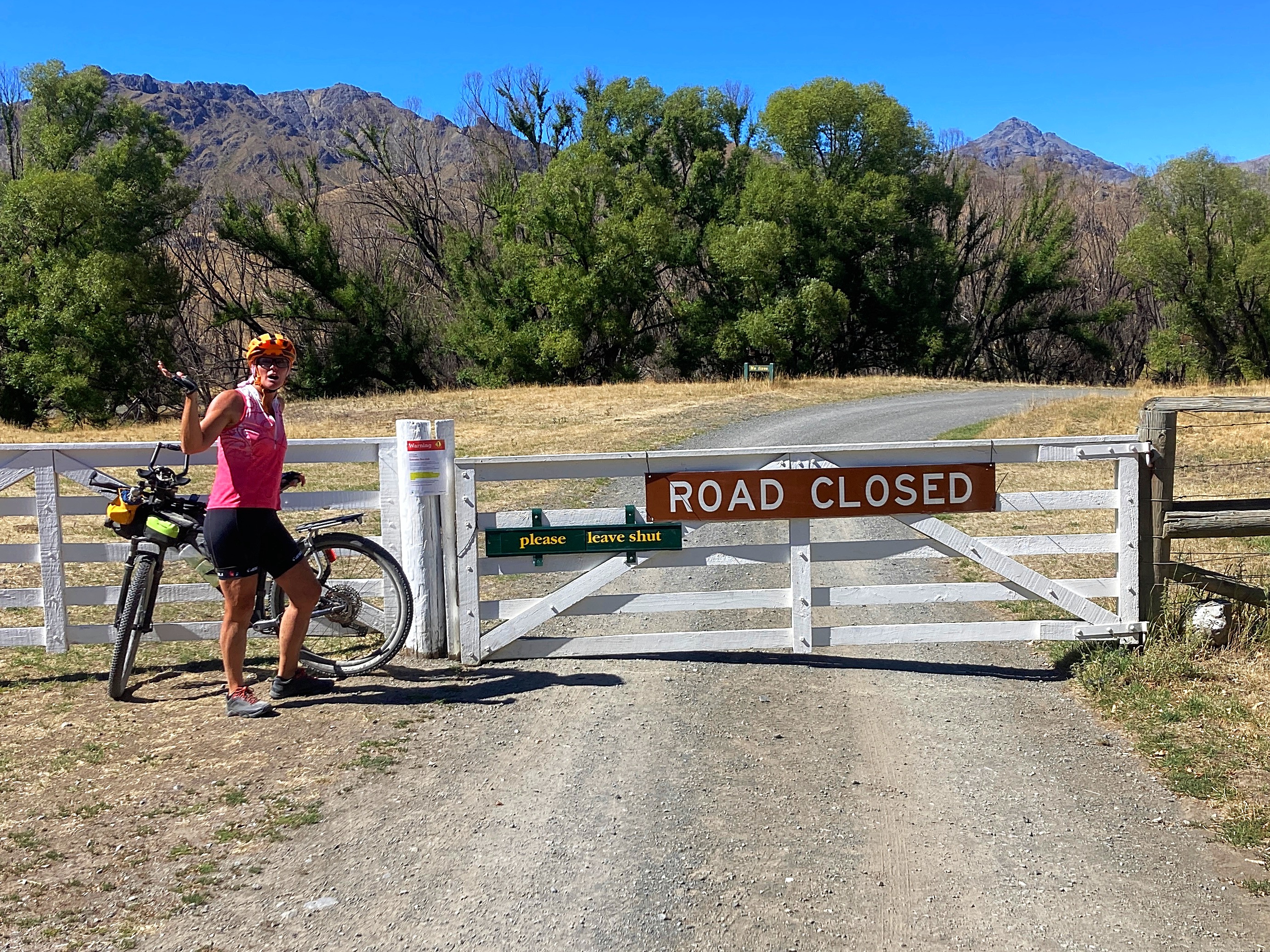
There is a high fire risk this summer so the road is actually closed to through vehicular traffic. Bikes, however are permitted.
I discovered on the map on one of the information boards that there is a Rachel Range on the Molesworth – spelt correctly and all
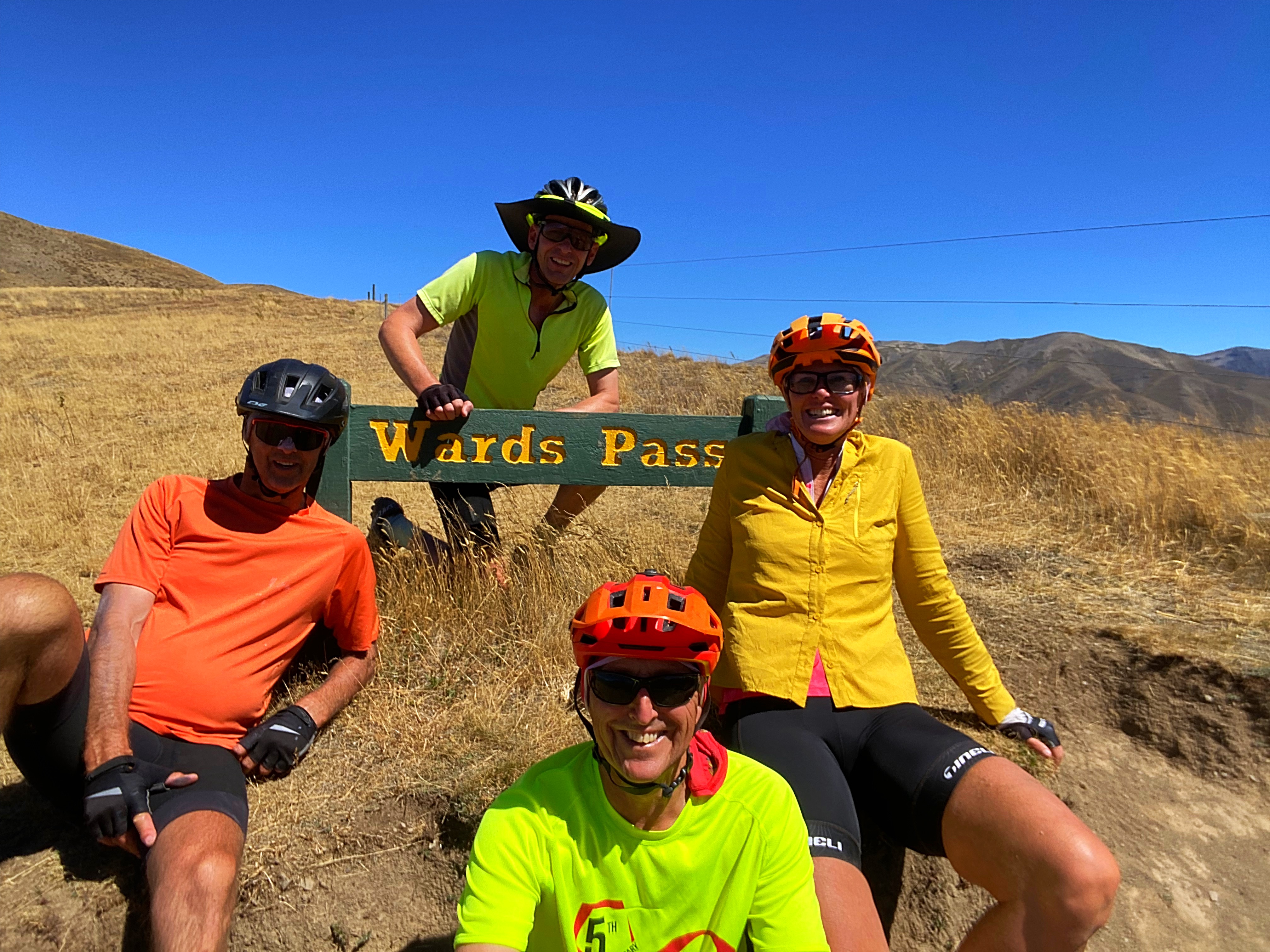
We had our first lunch here before hitting our next climb for the day – Wards Pass. This is the highest point on the road at 1145 metres above sea level. Another grunty climb with a headwind to boot at times .
After Wards Pass we had more descents than ascents although there were still a few little blips as we call them. These blips were made all the more arduous when the temperature hit 39 degrees – we were exposed to the sun for most of the day.
We made it out of the Molesworth Station where the fire ban is not in place so fired up the jet boil for a coffee. We were really over drinking warm water and in the latter part of the day, river water that we had acquired at our second lunch stop.
Coffee and Mel’s chocolate cake were a match made in heaven.
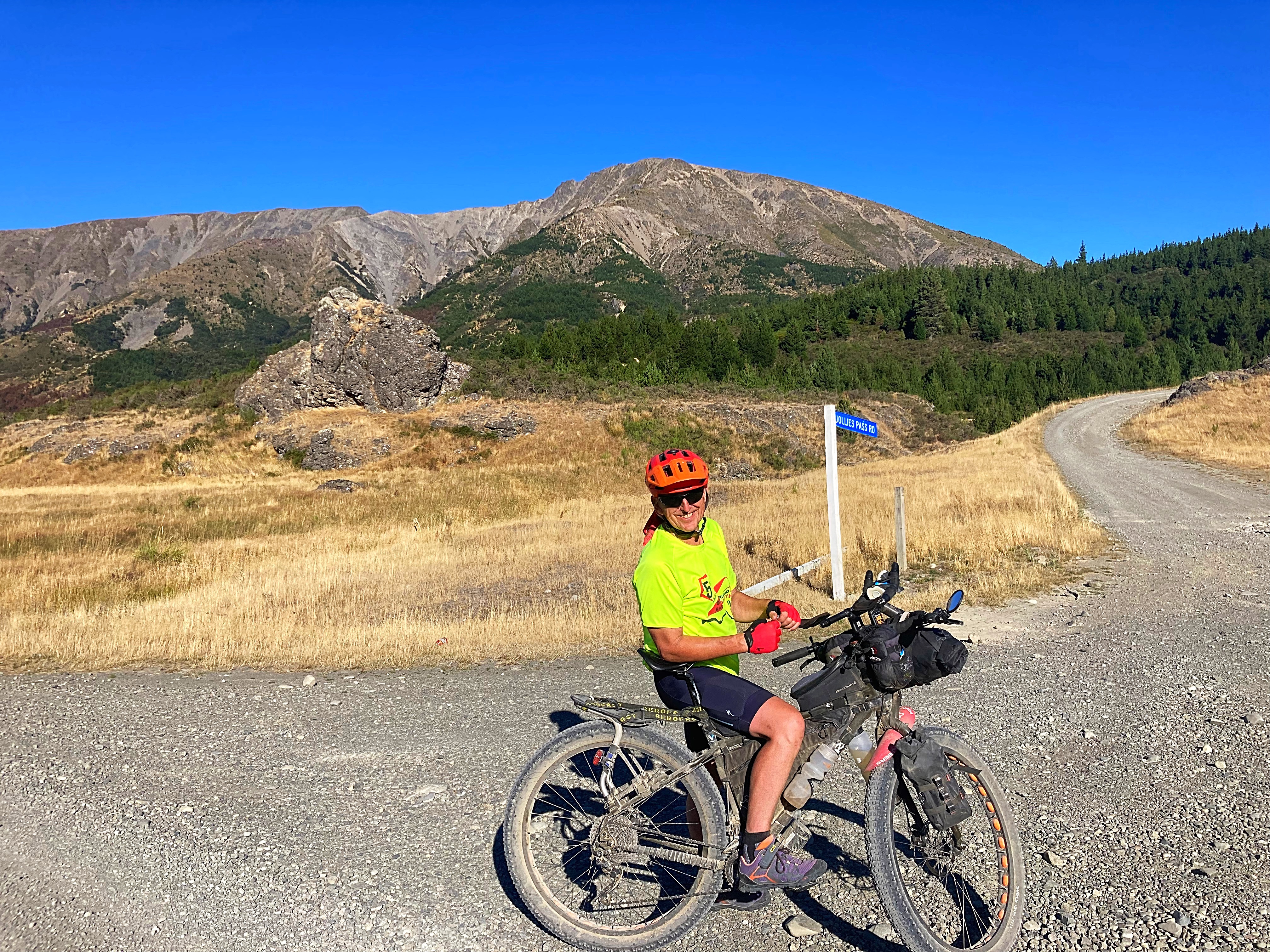
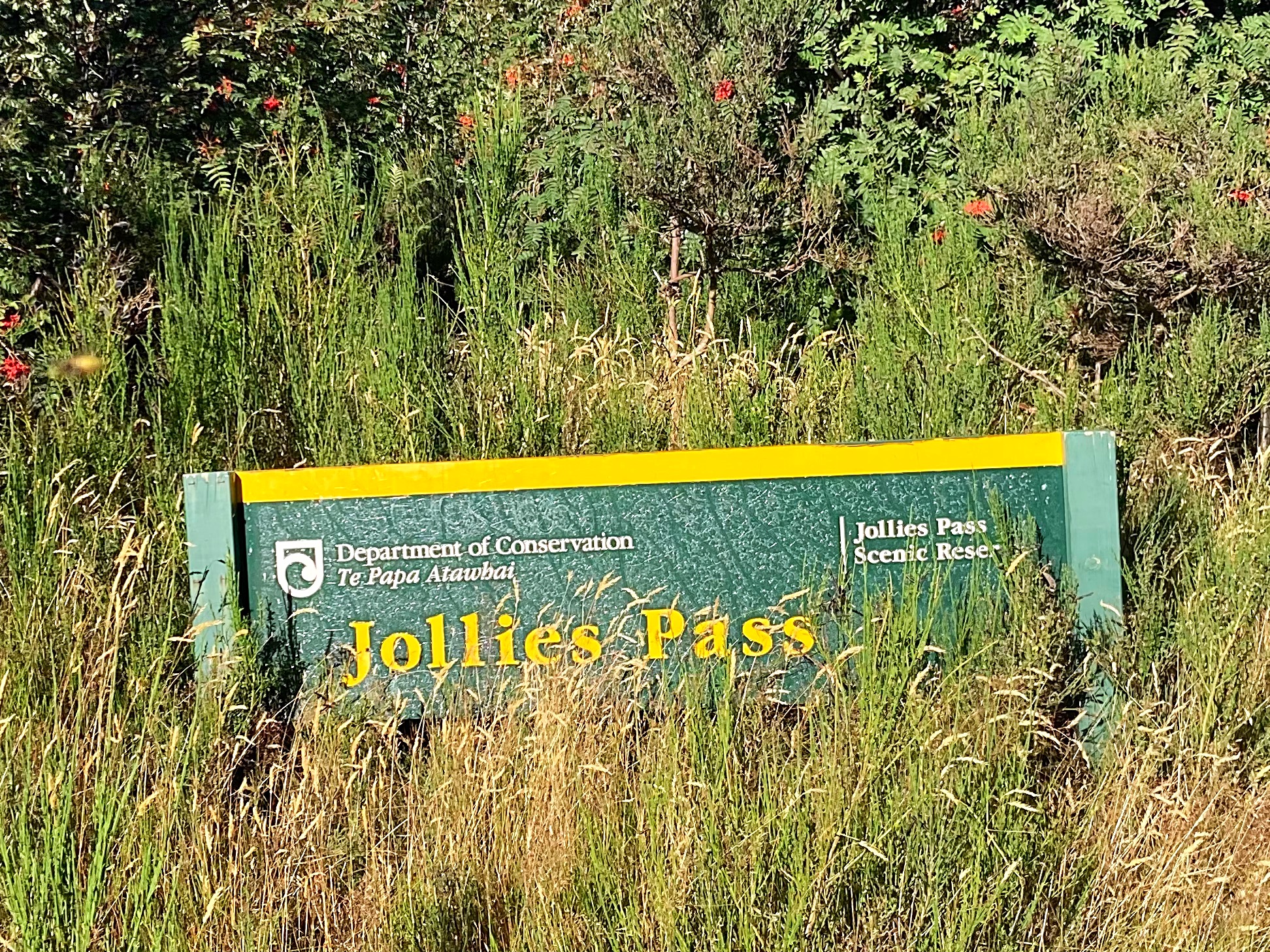
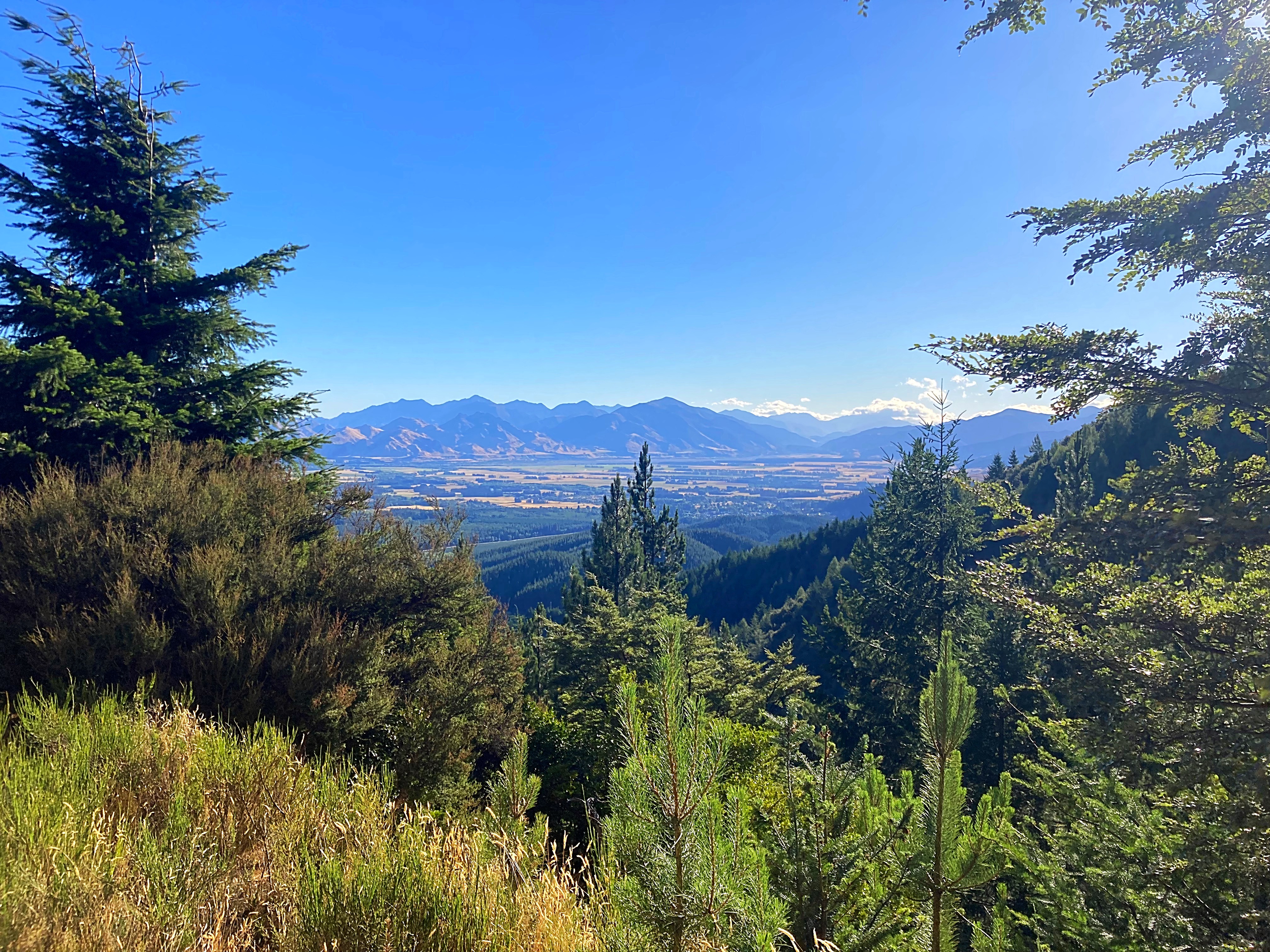
We had one more pass to go over before we hit Hanmer – Jollies Pass. Chris had done a reccy earlier on in the summer and his description of it had me a little on edge. A 4 kilometre climb to the top with a fairly steep descent on a four wheel drive track. It actually turned out to be rather Jolly the ascent was gradual and in the shade. The descent was pretty good with only two hike a bikes coming into play.
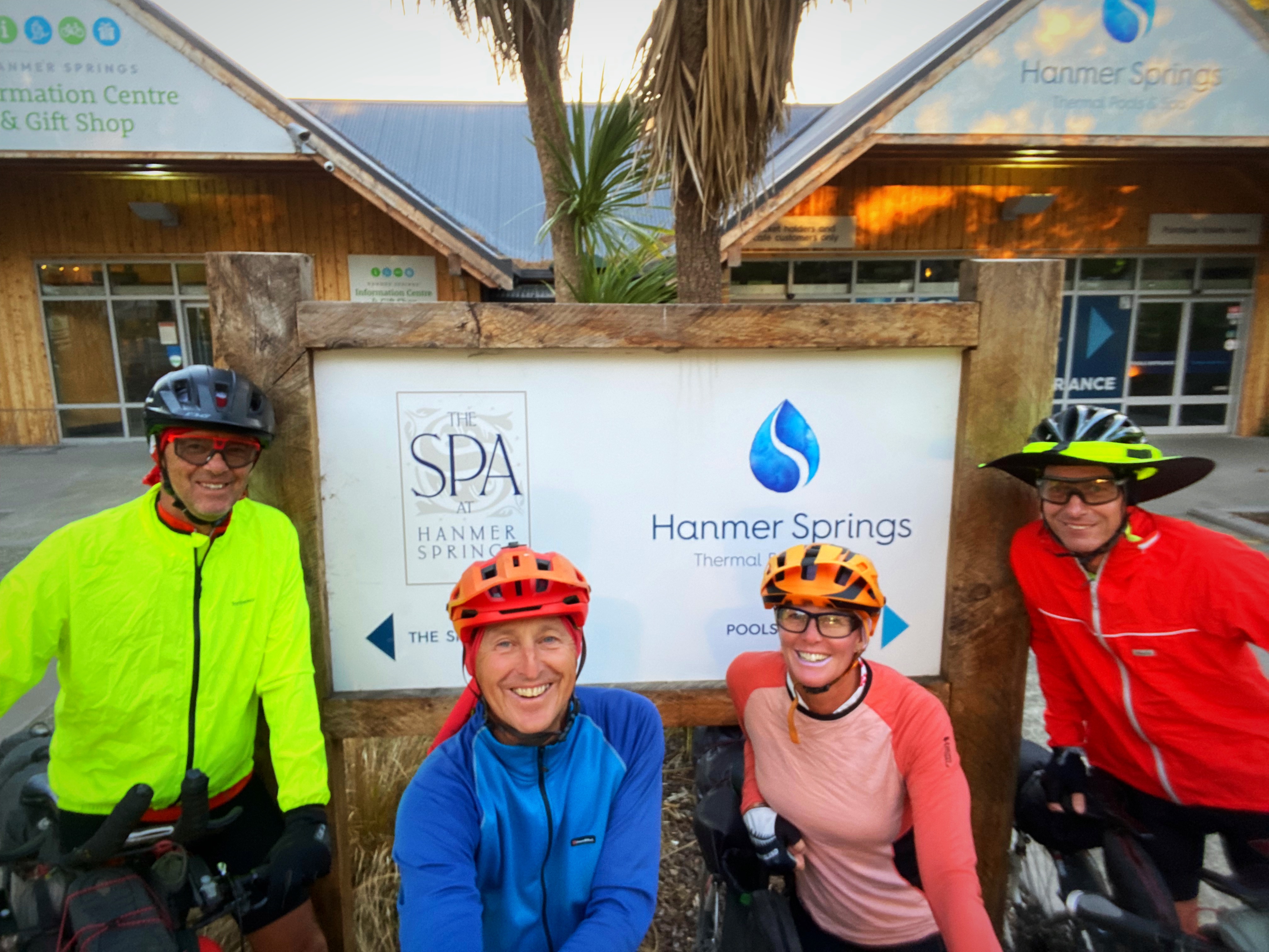
We got into Hanmer at 7pm – 12 hours after we left Upcot Station and just over 9 hours of actual riding time. We had a welcoming committee of Chris and Mary’s three grandkids who were very happy to see their Poppa. We then enjoyed a delicious home cooked meal before enjoying some much needed time off the pedals.
A challenging day but worth every pedal to enjoy such beautiful scenery
15 February 2024
Day 4 – Hanmer Springs to Amberley 131km 927 metres climbed
Well we got a bit cocky about today’s ride after yesterday’s mammoth effort. 112 kilometres on tarseal and 18 kilometres on gravel and in Crammers words “ how hard can it be”
We rode on State Highway One from Hanmer to Culverden and had our second breakfast with Chris’s daughter and grandkids. After three days of no cafe stops, we went all out and had two coffees each.
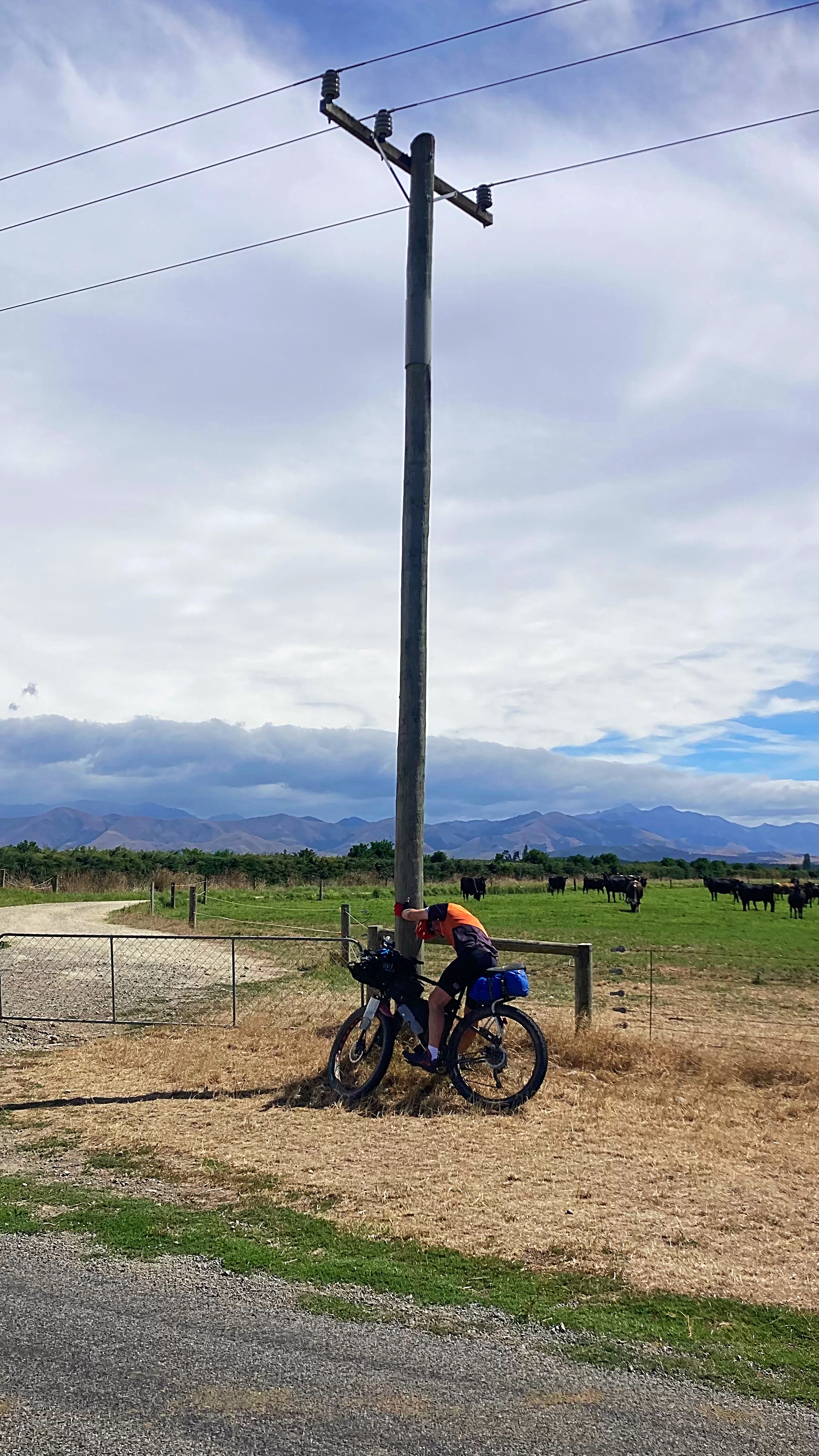
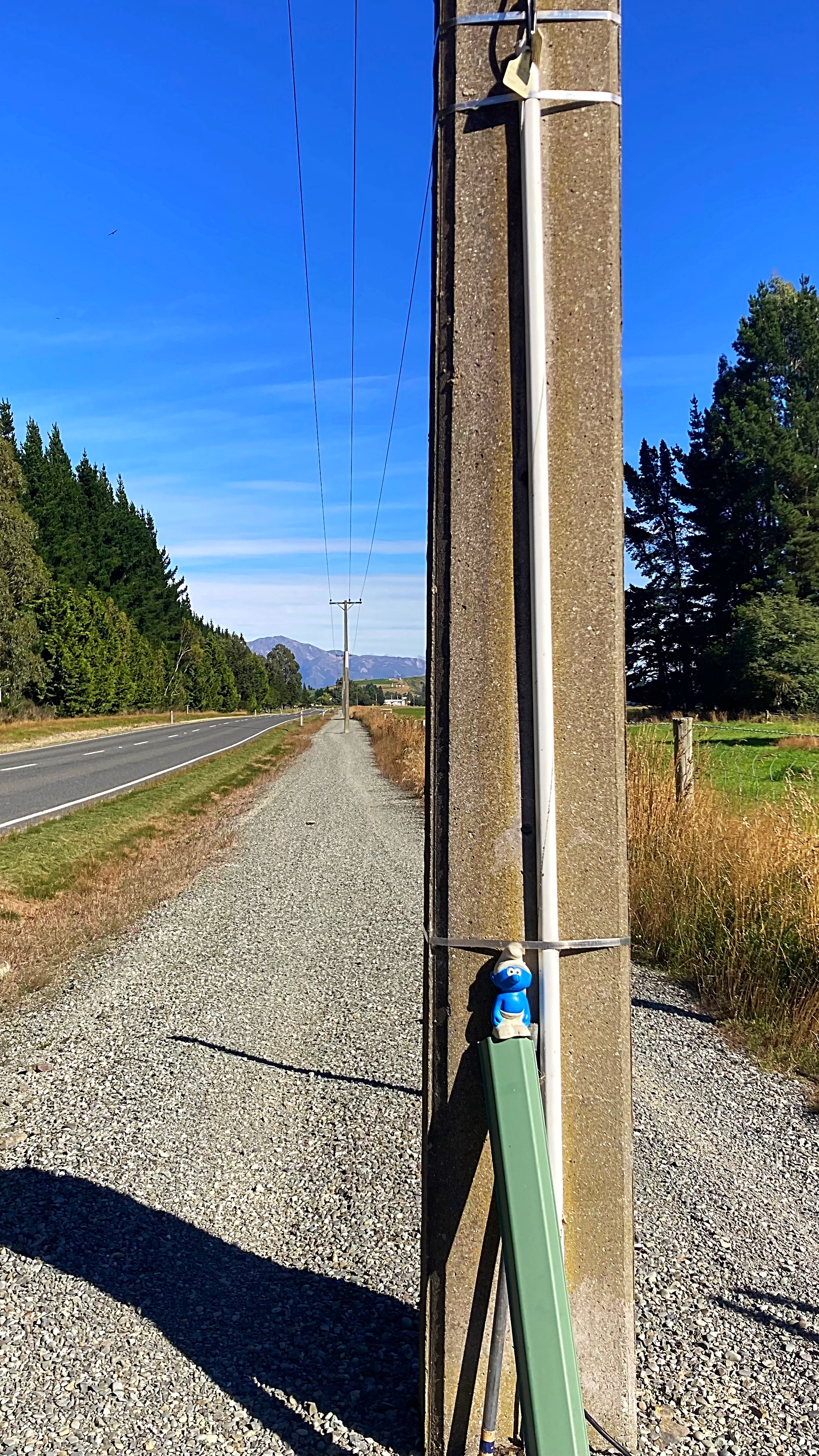
To be fair, the first 64 kilometres to Hurunui were awesome. It then went a little pear shaped as we hit a very strong headwind. It took us 50 minutes to do 8 kilometres it was horrendous and none of us had ridden in these winds before. Check out Crammers hanging onto the power pole for dear life . Fortunately we then turned and had a side tail wind which made things a little more pleasant into our lunch stop at Harwarden.
The first half of the day was spent riding through hectares of dairy farms with massive irrigation units pumping away. For the first time ever they have had water restrictions imposed on them. It is very easy to see where they irrigate as it’s super green versus being very brown up in the hills.
Dairying in Canterbury grew tenfold from the early eighties to 2009 / 2010. In the early eighties 20,000 hectares was used for dairy cows, now more than 200,000 hectares is used for dairy cows.
After Harwarden we headed for the hills and the gravel. We had winds coming at us from every direction in the last 50 kilometres.
At about the 114 kilometre mark though we hit the tarseal again and had a tail wind. Just after we hit the tarseal the guide book noted the “Big Dipper” which was a steep descent with a quick ascent – I managed to hit 63 kilometres an hour going down – yee haa . We cruised the rest of the way into Amberley at about 30 kilometres an hour .
Weatherwise today it was a lot cloudier but we still got to 29 degrees at one stage.
We enjoyed a yummy dinner at the Brew Moon Brewing Company – highly recommend.
16 February 2024
Day 5 – Amberley to Mt Hutt Lodge (Rakaia Gorge) 133km 989 metres climbed
The weather was a lot kinder to us today – the temperature was between 18 and 22 degrees with minimal wind – perfect biking conditions.
The Sounds to Sounds has two options in this area – go via Christchurch or around it. We chose to detour around it to places that I hadn’t been before.
At the junction where we took the detour option we stopped for a quick snack. I looked down and saw that my speedo was saying I was doing 63 kilometres an hour while I was stationary my protein bars are good but not that good. It then turned itself off but fired back up again later in the day – technology
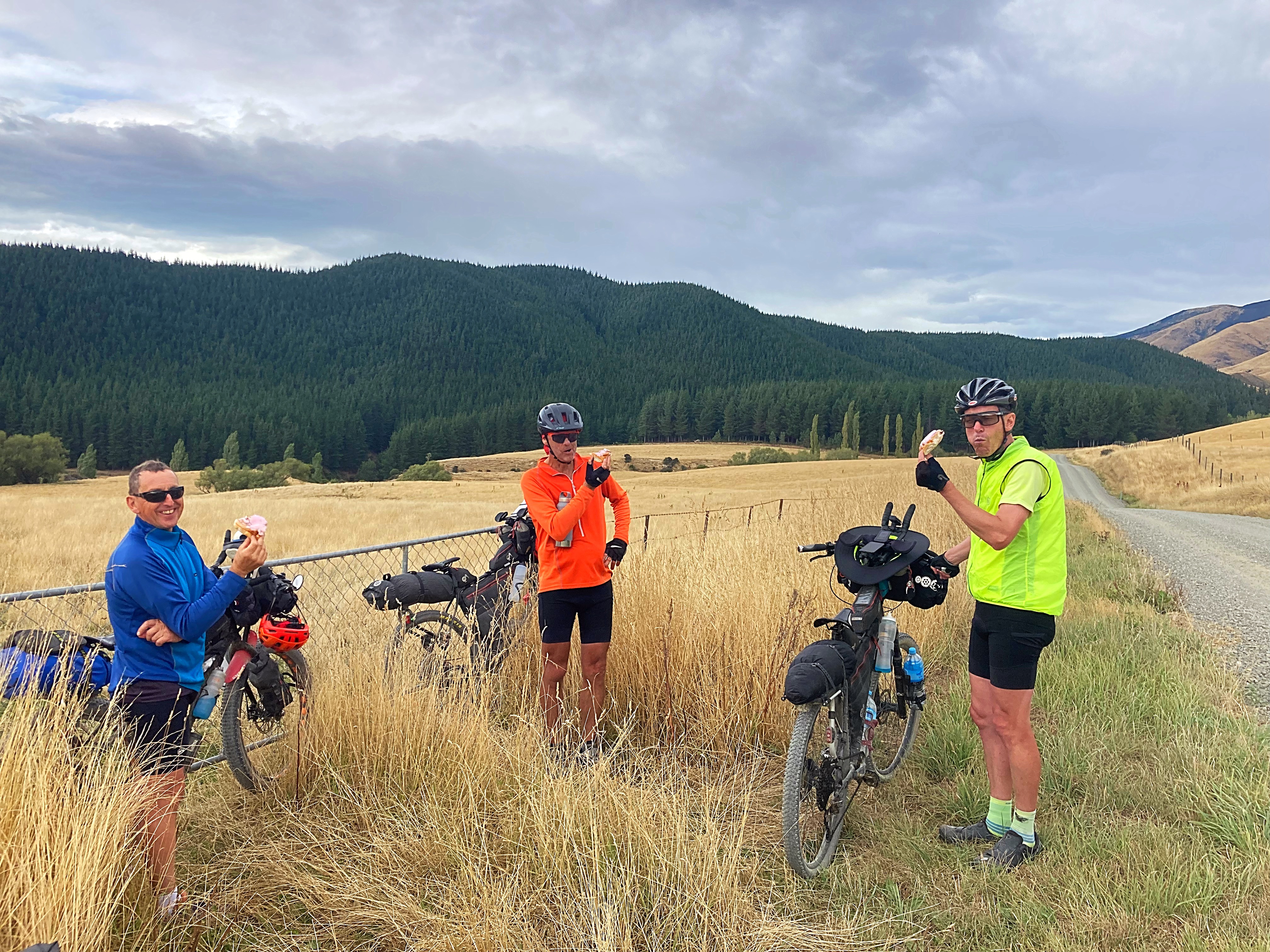
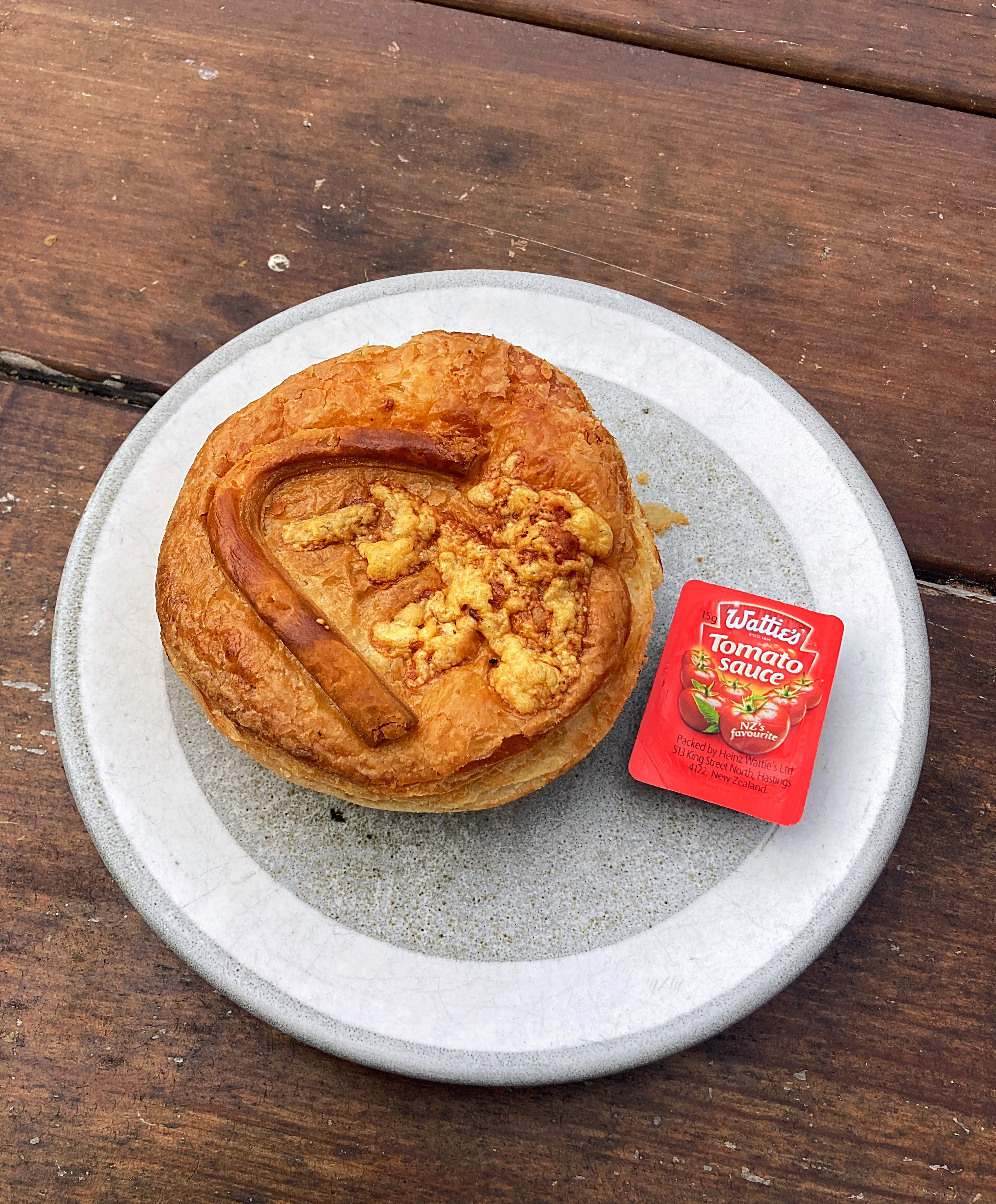
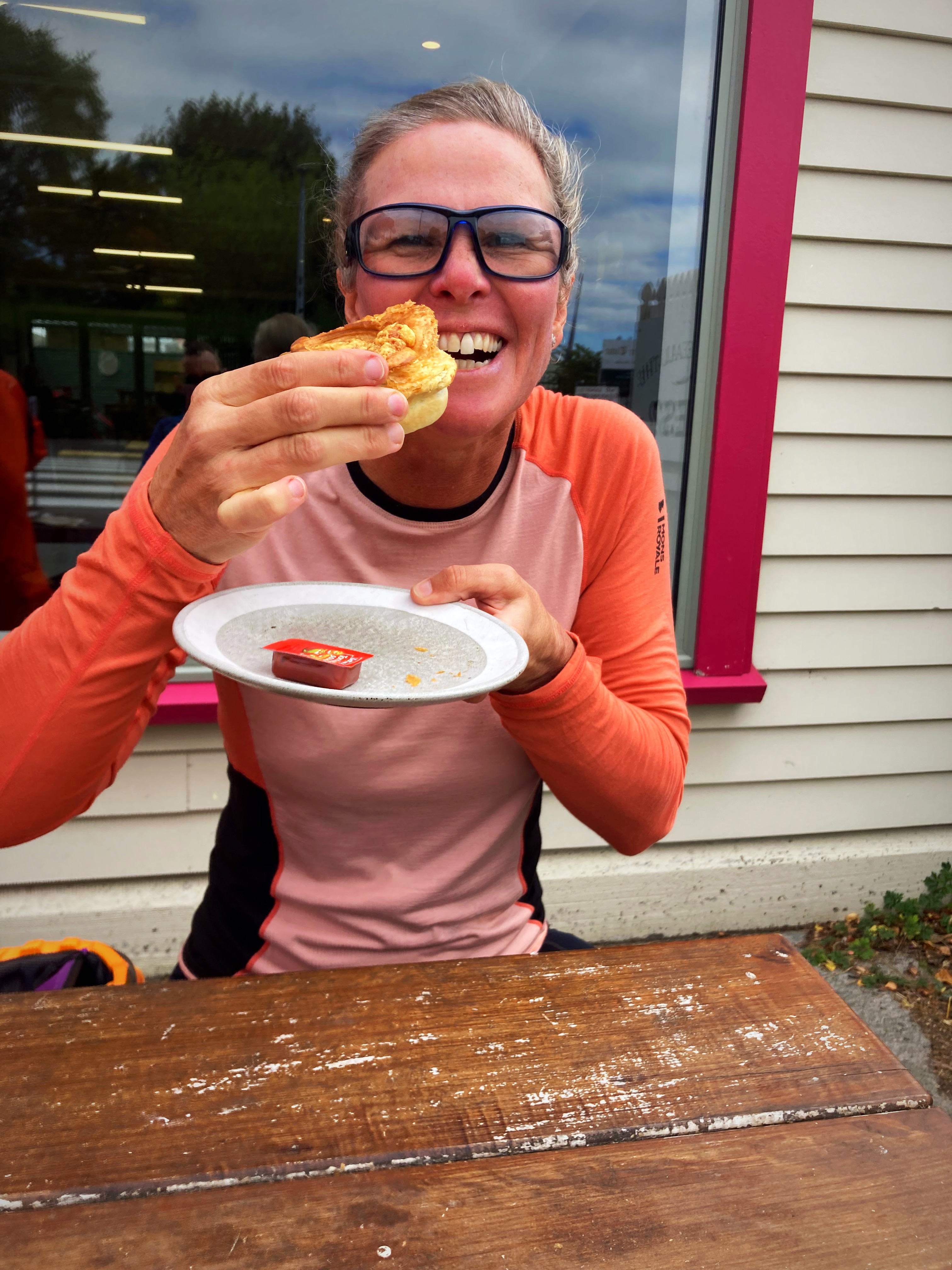
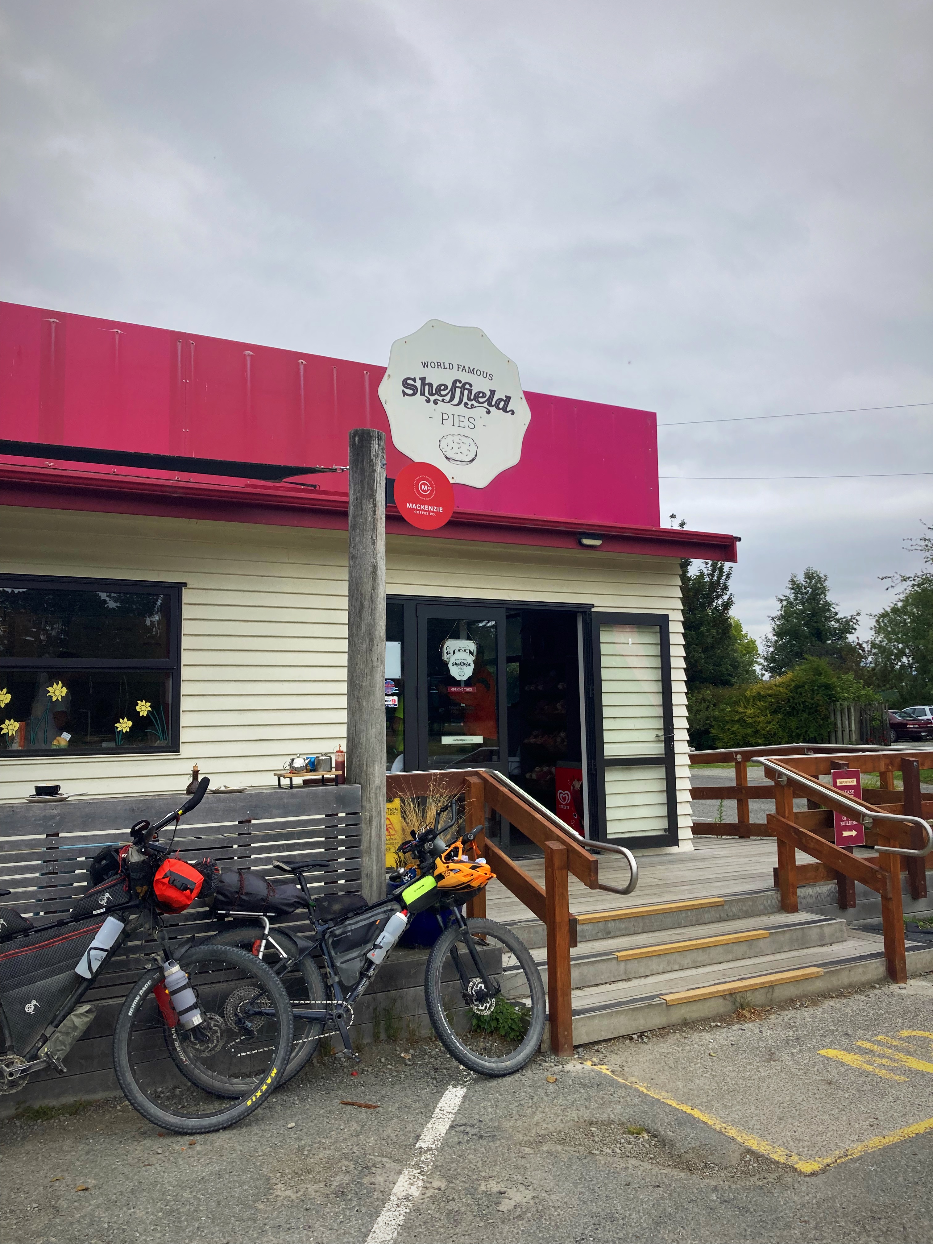
Today’s photo control point was a world famous Sheffield pie. We went through both Oxford and Sheffield where they have a Sheffield pie shop – was this going to be a two pie day
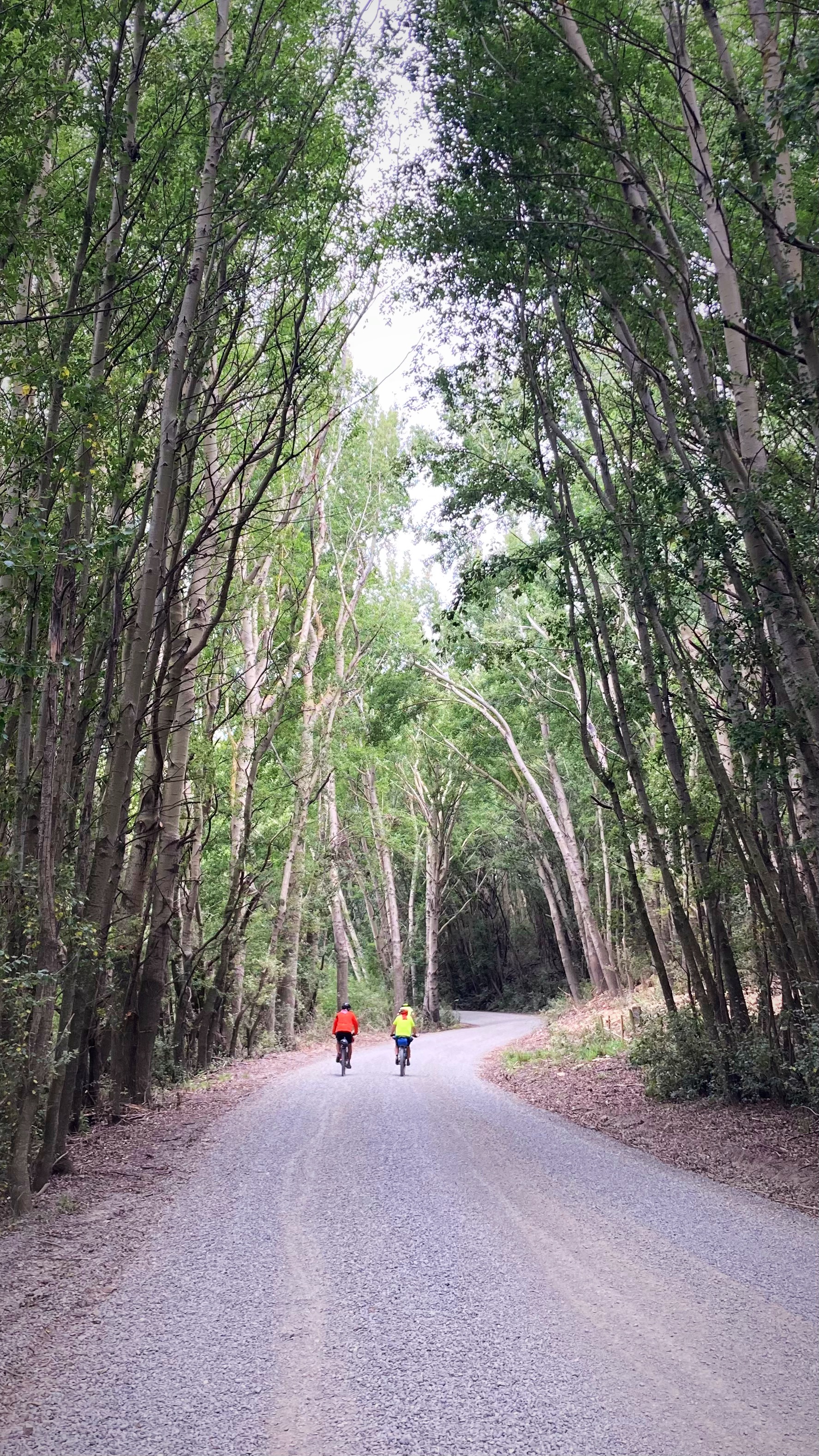
We got to Oxford after about 63 kilometres of riding and the mince and cheese pie hit the spot along with a coffee. Eighteen kilometres later we got to Sheffield and we decided a sweet treat and coffee were in order.
We had a bit of gravel riding after that but the gradient was gentle. We also had a couple of river crossings today – one with water and one without. I still managed to hike a bike in both – one I blame sun strike, the other I saw an option where I wouldn’t get wet feet. Of course Crammers and Chris managed to ride through both (they did get wet feet though ).
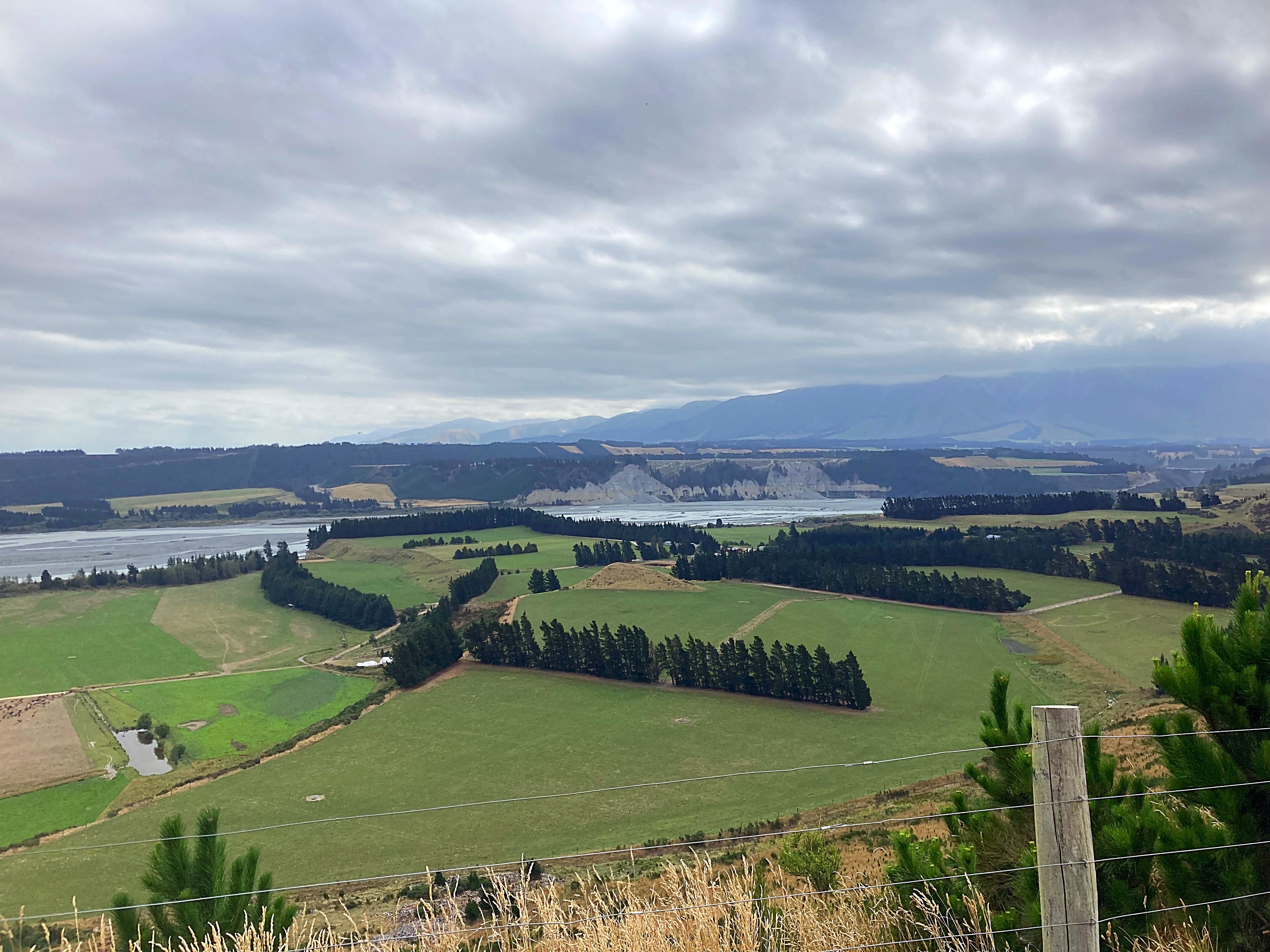
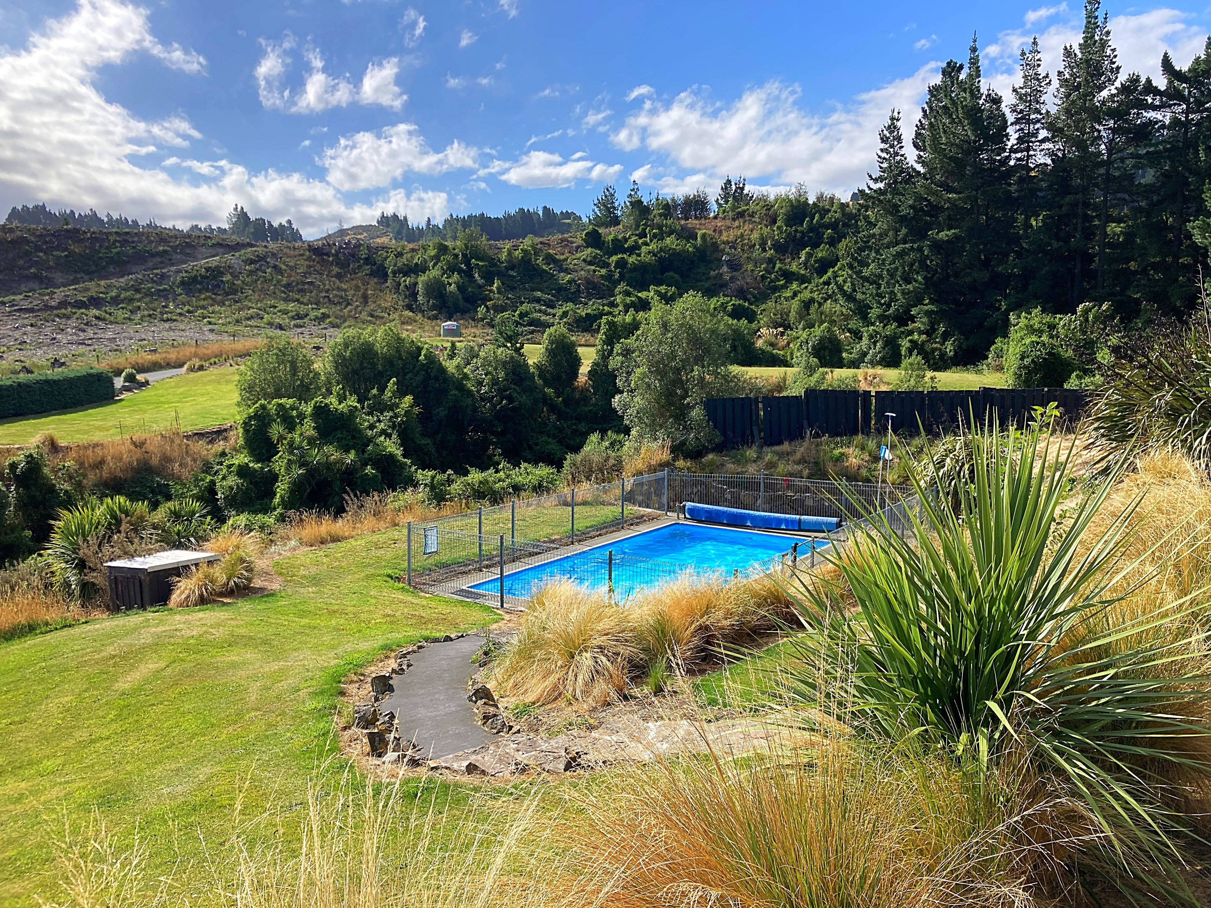
We had a nice view over the Rakaia Gorge before we started our descent. We were very happy to see the sign for Mt Hutt Lodge, and even happier to see they had a pool. I enjoyed my chocolate milk (a bikepacking staple) while taking in the vista. Unfortunately Mt Hutt was covered in cloud.
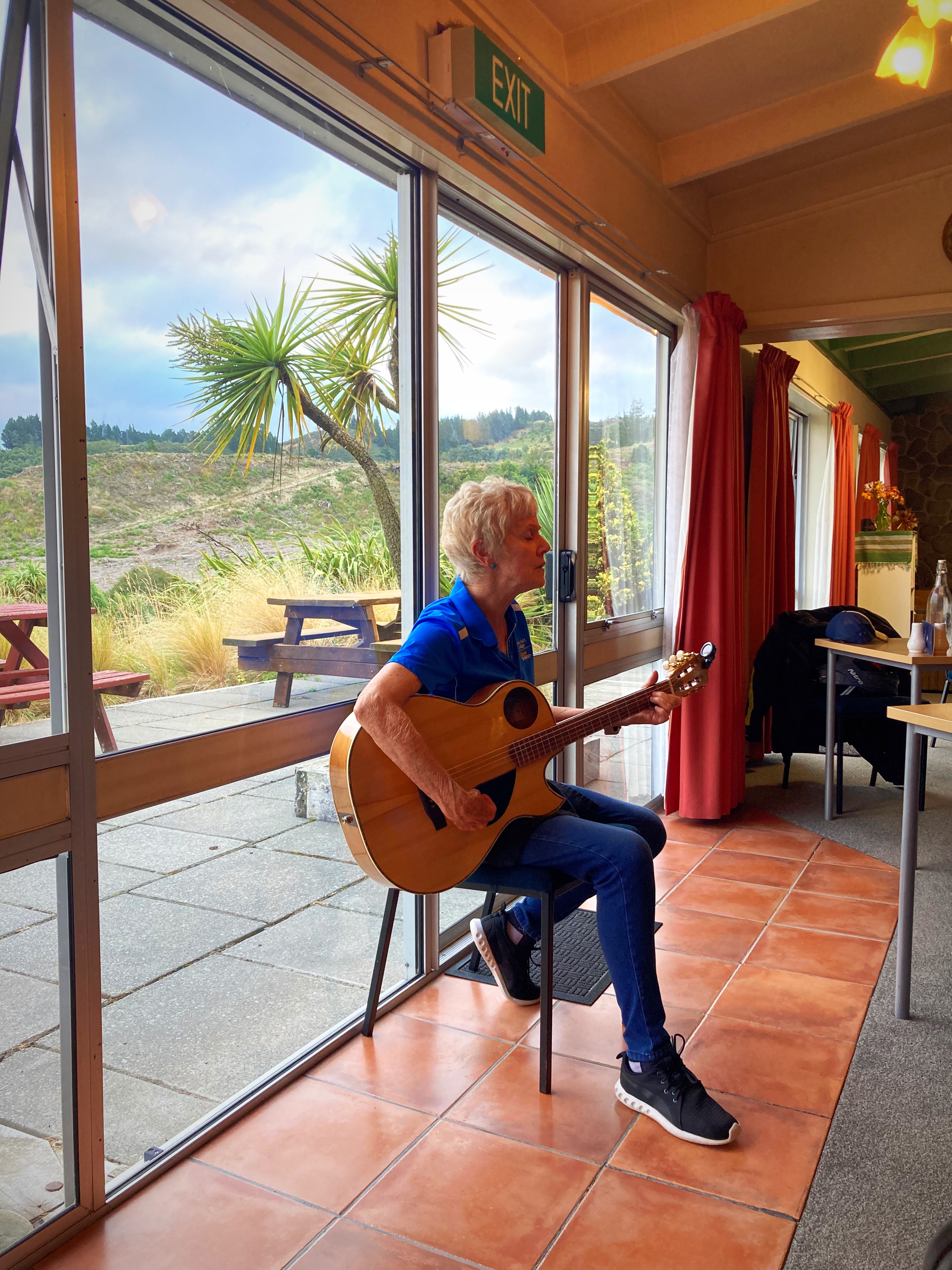
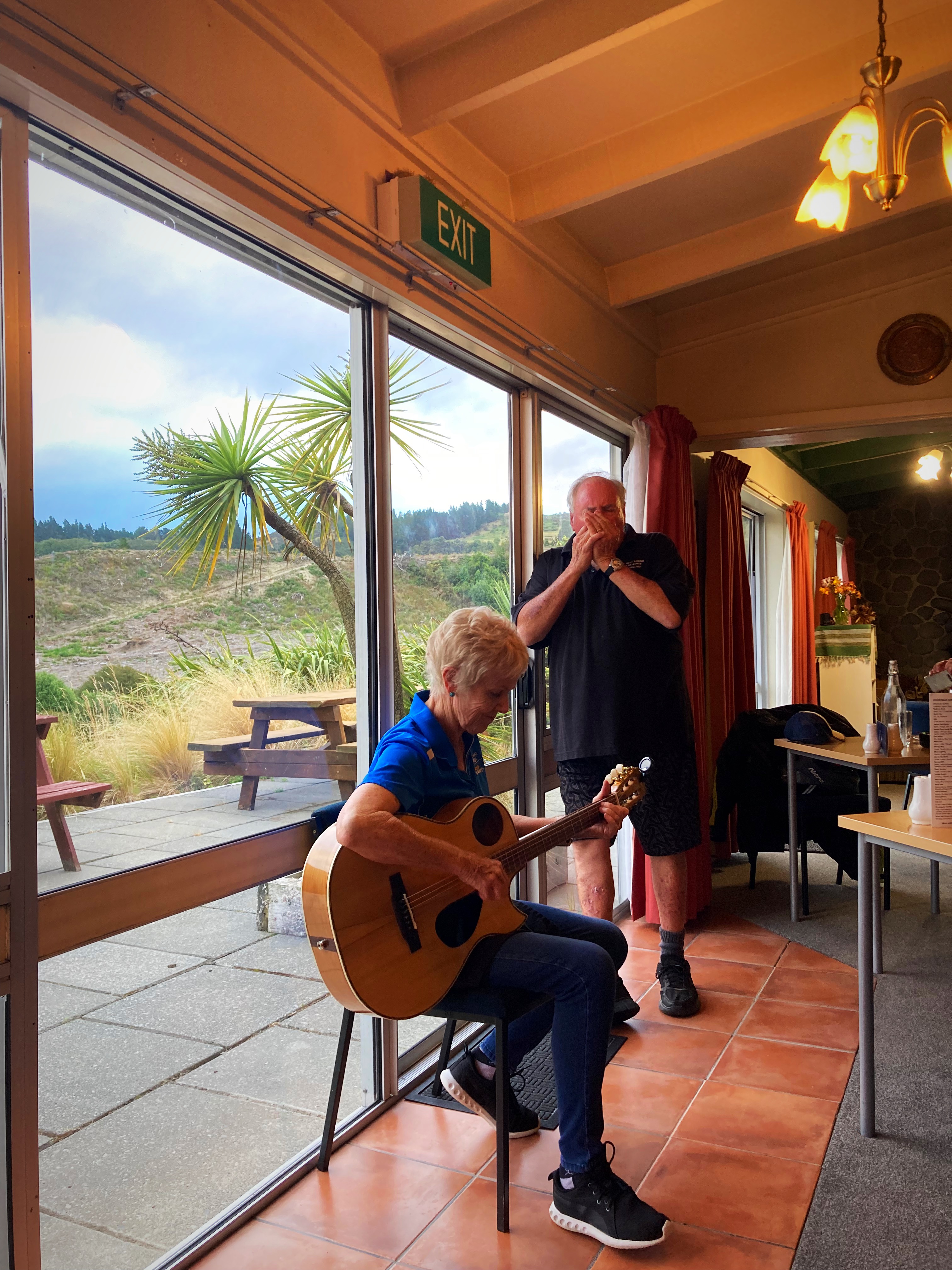
Our hosts here, Butch and Jo are so hospitable and we enjoyed a lovely meal in the restaurant – Butch is the chef. Jo then played guitar and sang us a couple of songs before Butch joined her with the harmonica. What a special touch to end another good day exploring our beautiful country.
Jo is also a highly acclaimed ski instructor who has taught all over the world and had a lot to do with establishing ski schools at the ski fields down here. She always travelled with a guitar so she could add that musical touch wherever she went. Butch was a professional surfer. They have owned and run Mt Hutt Lodge for the past twenty years.
17 February 2024
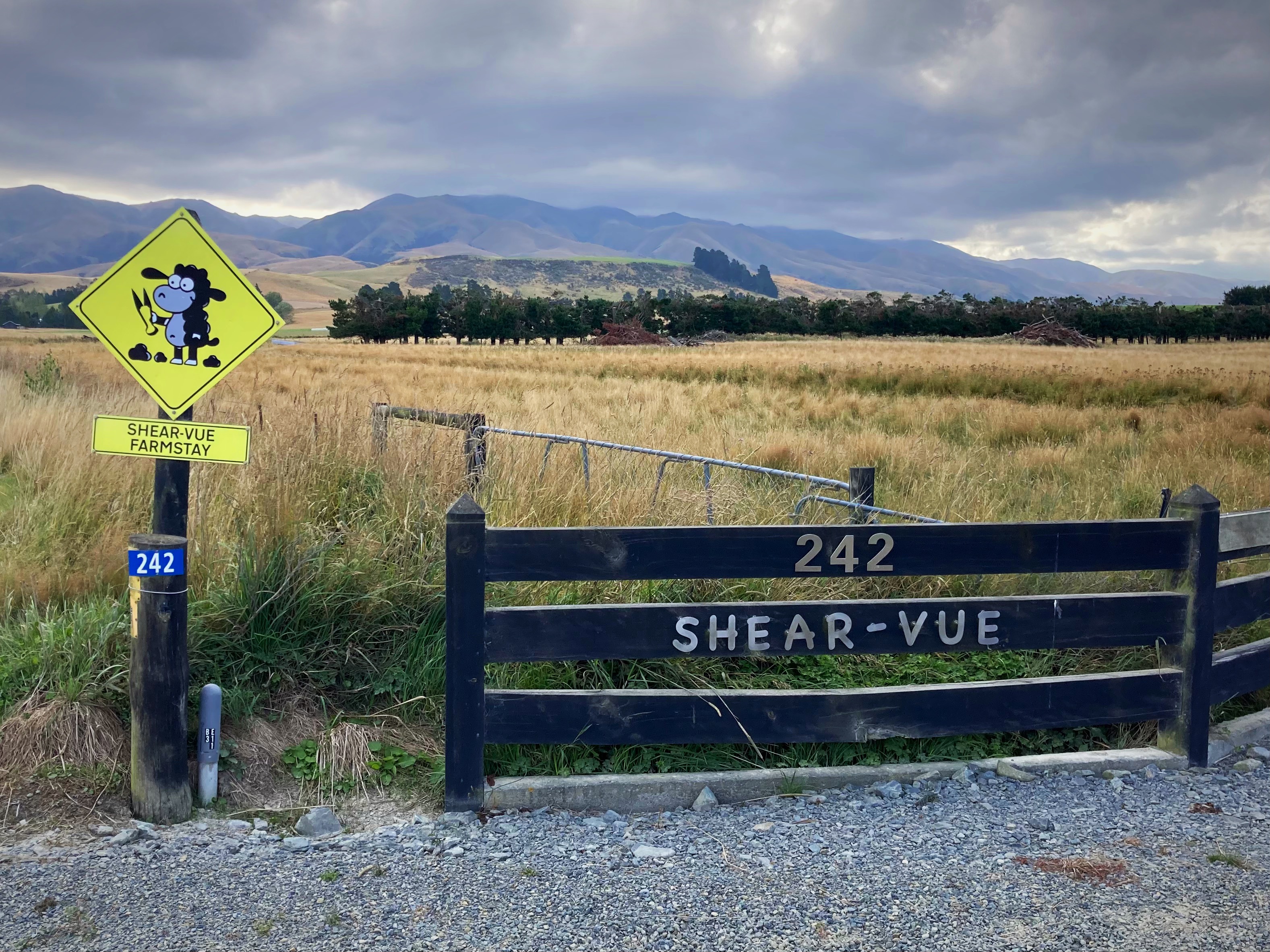
Day 6 – Mt Hutt Lodge (Rakaia Gorge) to Shear-Vue Farmstay (nearest town is Fairlie)152km 1234 metres climbed
We had a big day ahead of us so decided to get an earlier start. We left Mt Hutt Lodge in the dark at 6.15am. It was pretty chilly too at about 7 degrees so the full fingered gloves came out.
The cloud around Mt Hutt had cleared from the night before so it was nice to be able to see it. Mt Hutt is a popular ski resort.
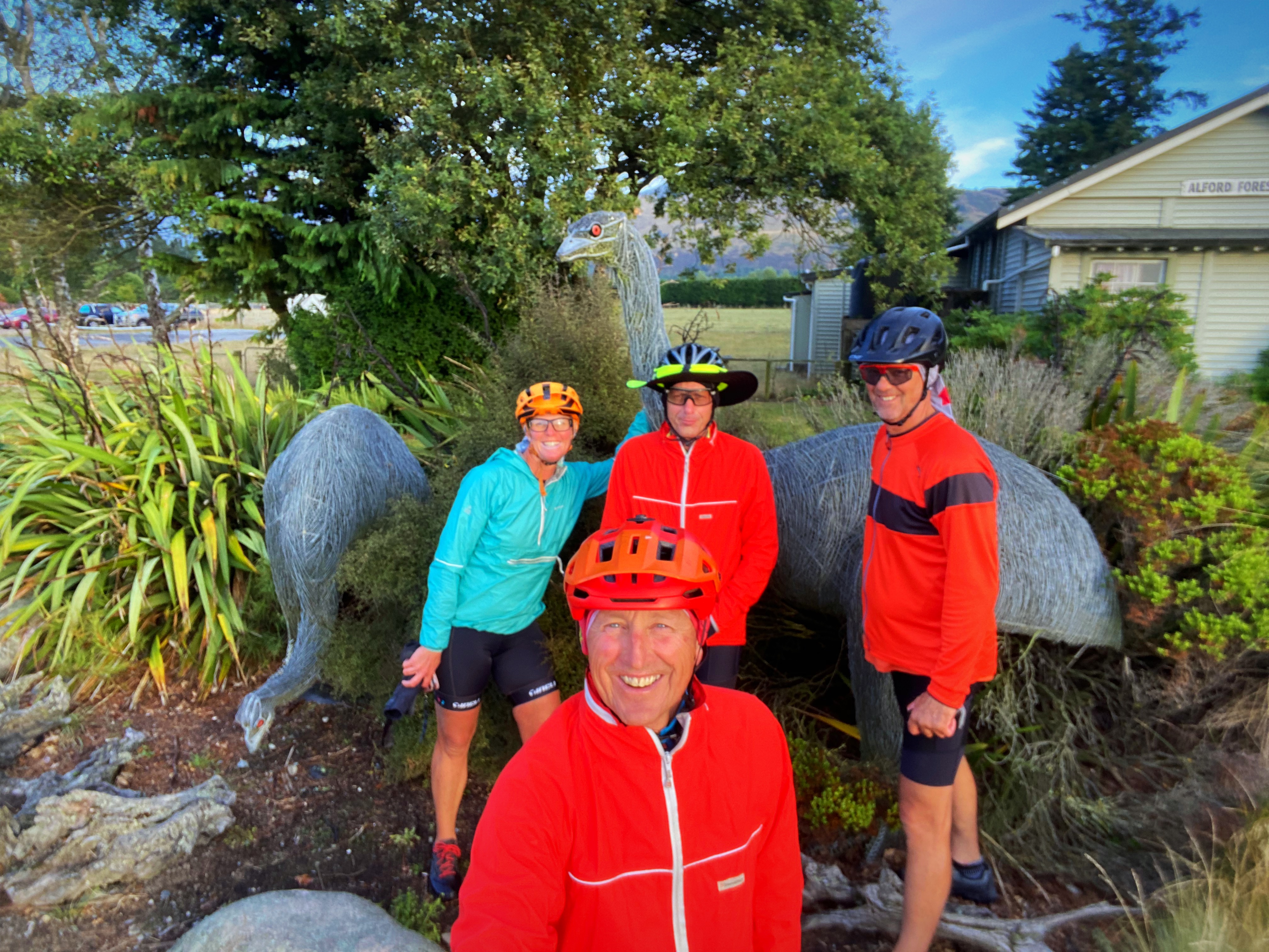
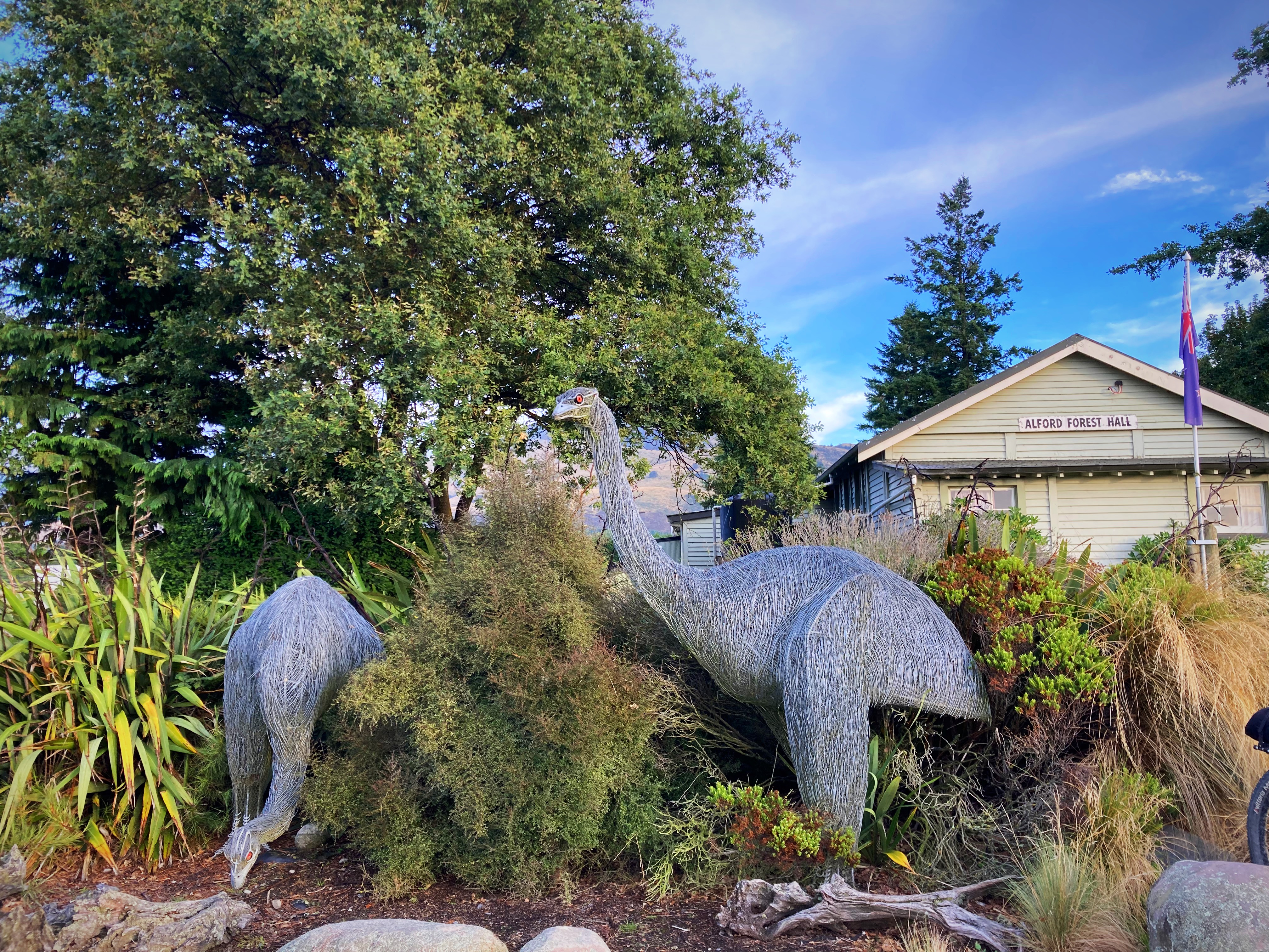
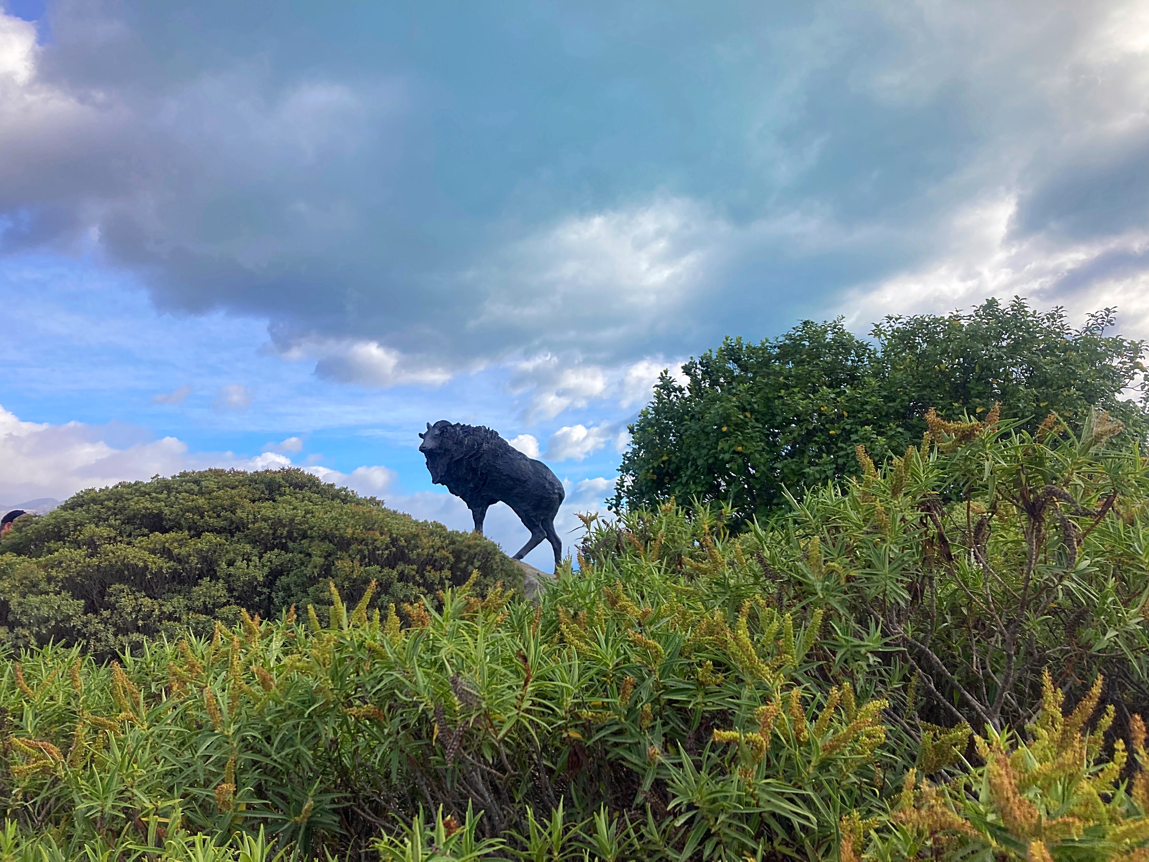
We had a photo control point at the Alford Forest Moa sculpture.
These extinct large birds weighed up to 235 Kilograms and stood more than three metres high. Grey or Reddish brown in colour: lifespan about 80 to 100 years. They were killed out about 400 years ago. Eleven different kinds of Moa were known to inhabit New Zealand. Around the Foothills Area they were known to be quite common, as many gizzard stones have been found. Their diet was mainly woody plants and grasses.
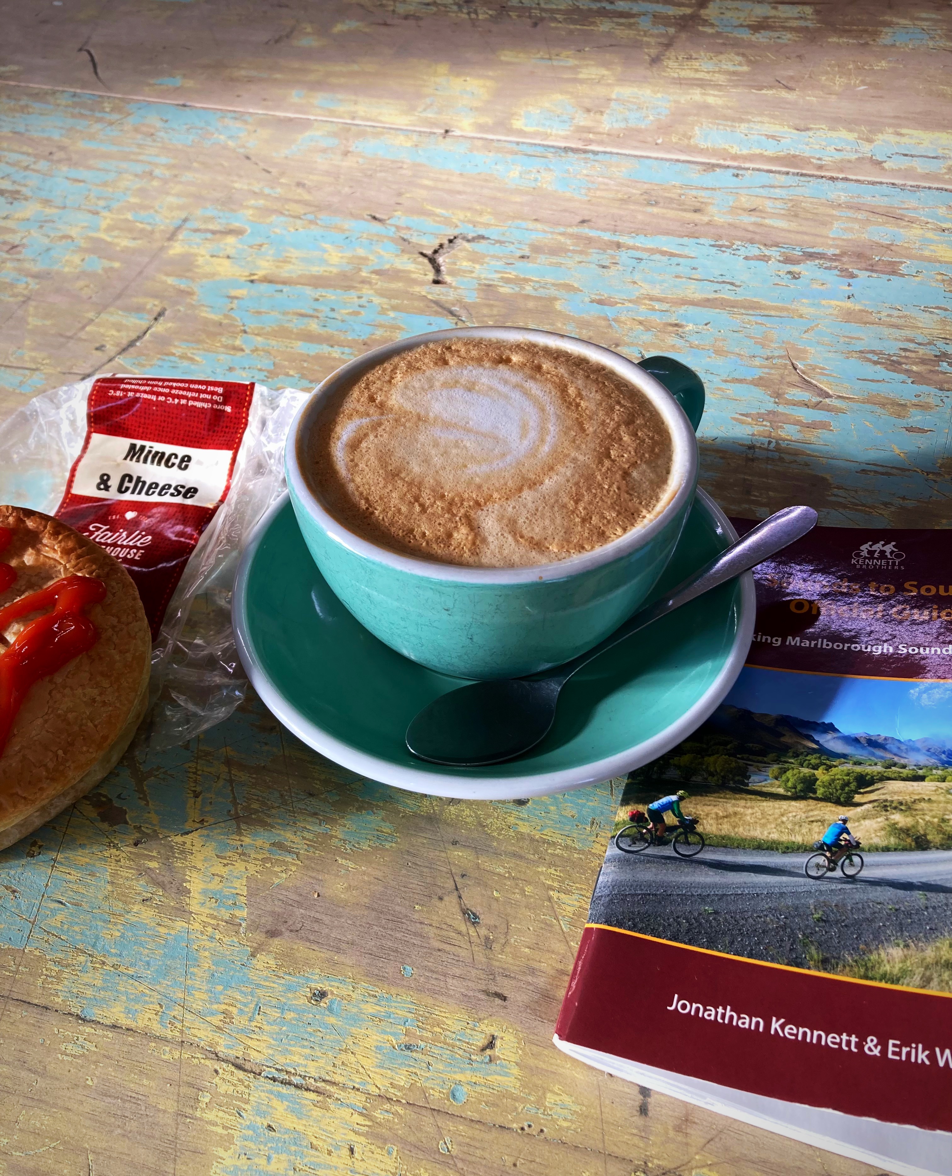
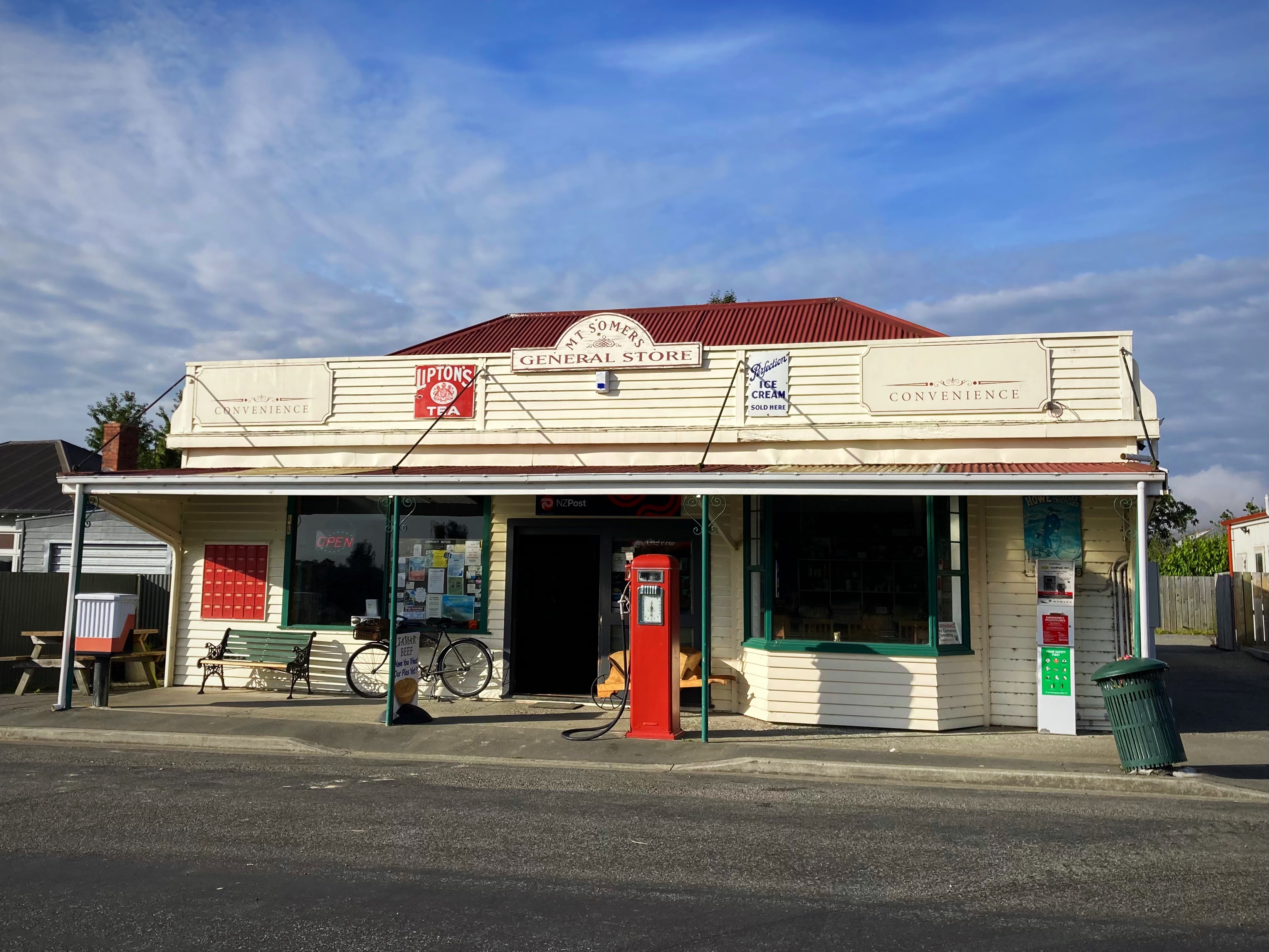
At 33 kilometres in we reached Mt Sommers where the General Store was serving coffee and hot pies – needs must. I had a Fairlie Bakehouse mince and cheese pie and I would have to say it was way better than the world famous Sheffield one from yesterday.
We then had 57 kilometres to our next sustenance spot – Geraldine. Of course the route had us out on the back country gravel roads. The woman in the General Store couldn’t fathom why we didn’t just take the main road, telling us that the gravel on the route we were taking was horrendous.
When we cross crossed the main Inland Scenic Route a number of times we were also questioning ourselves. To be fair the gravel wasn’t too bad. We did a cool little forest track just out of Geraldine which was a nice change.
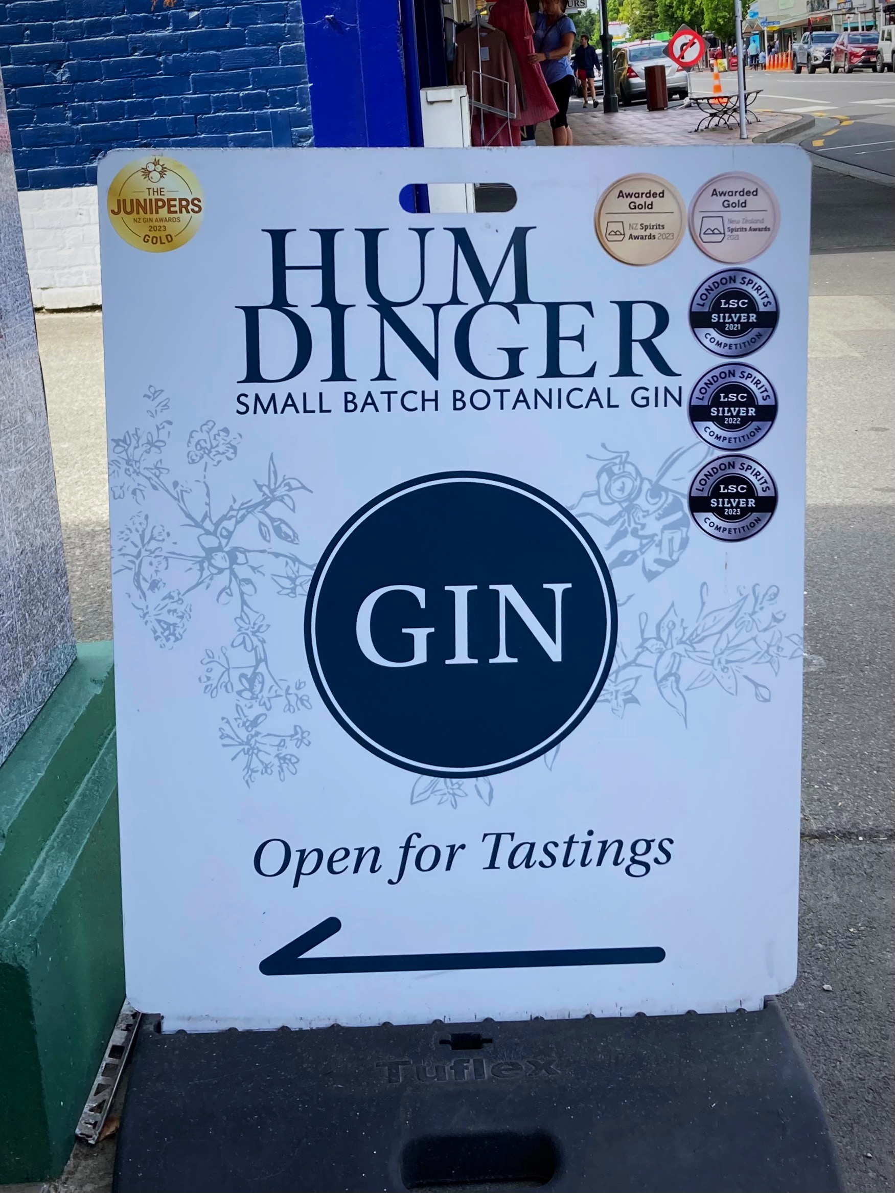
On entering the Main Street I saw a sign to my favorite gin shop – Humdinger, and they had a tasting going on. Man that hurt having to walk on past – in hindsight it was a very wise decision.
Second coffee of the day and a toasted sandwhich for lunch in Geraldine set us up for the afternoon, sort of.
We had a bit of a “oh bugger” moment when we had overshot a road we were meant to turn right into due to the signpost being missing. Back we went about 1.5 kilometres – doesn’t sound like much but on a 150 kilometre day
It was not long after this that it all went a bit pear shaped. At about 138 kilometres we started climbing, and climbing and climbing. Hicksy conceded first, closely followed by Crammers and I – hike a bike mode started. The Young One, meanwhile powered on and rode the whole of it – legend.
The descent to the main road was a welcome one and we only had a couple of kilometres left to get to Shear-Vue Farmstay for the night.
Our hosts, Julie and Tony, cooked us a delicious meal which we demolished all of. We were joined by another couple of female bikers who had ridden in from Geraldine.
After twelve hours out on the bike, my bed for the night has never felt so good
18 February 2024
Day 7 – Shear-Vue Farmstay (nearest town is Fairlie) to Lake Tekapo 63km 928 metres climbed
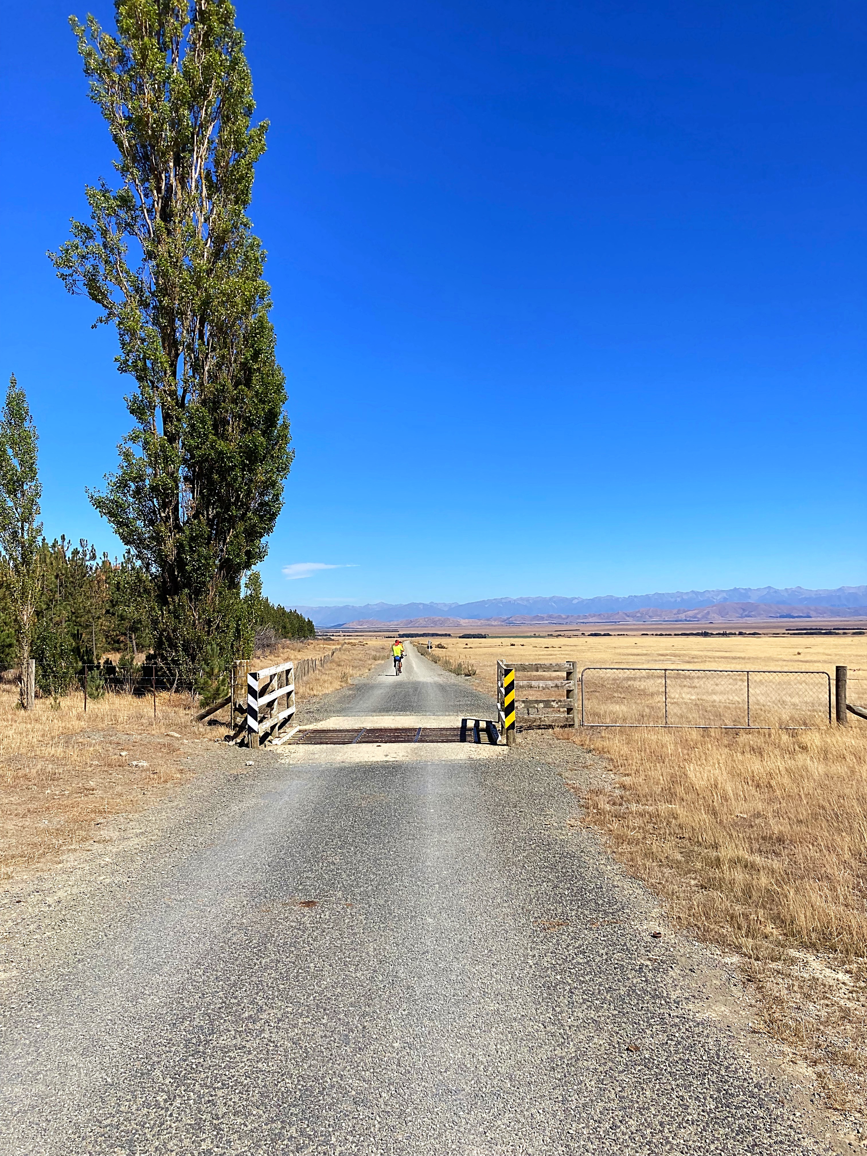
We basically had a day off today with only a 62 kilometre ride. It is also Sunday so we enjoyed a leisurely breakfast with Julie and Tony and left Shear-Vue at about 8.30am.
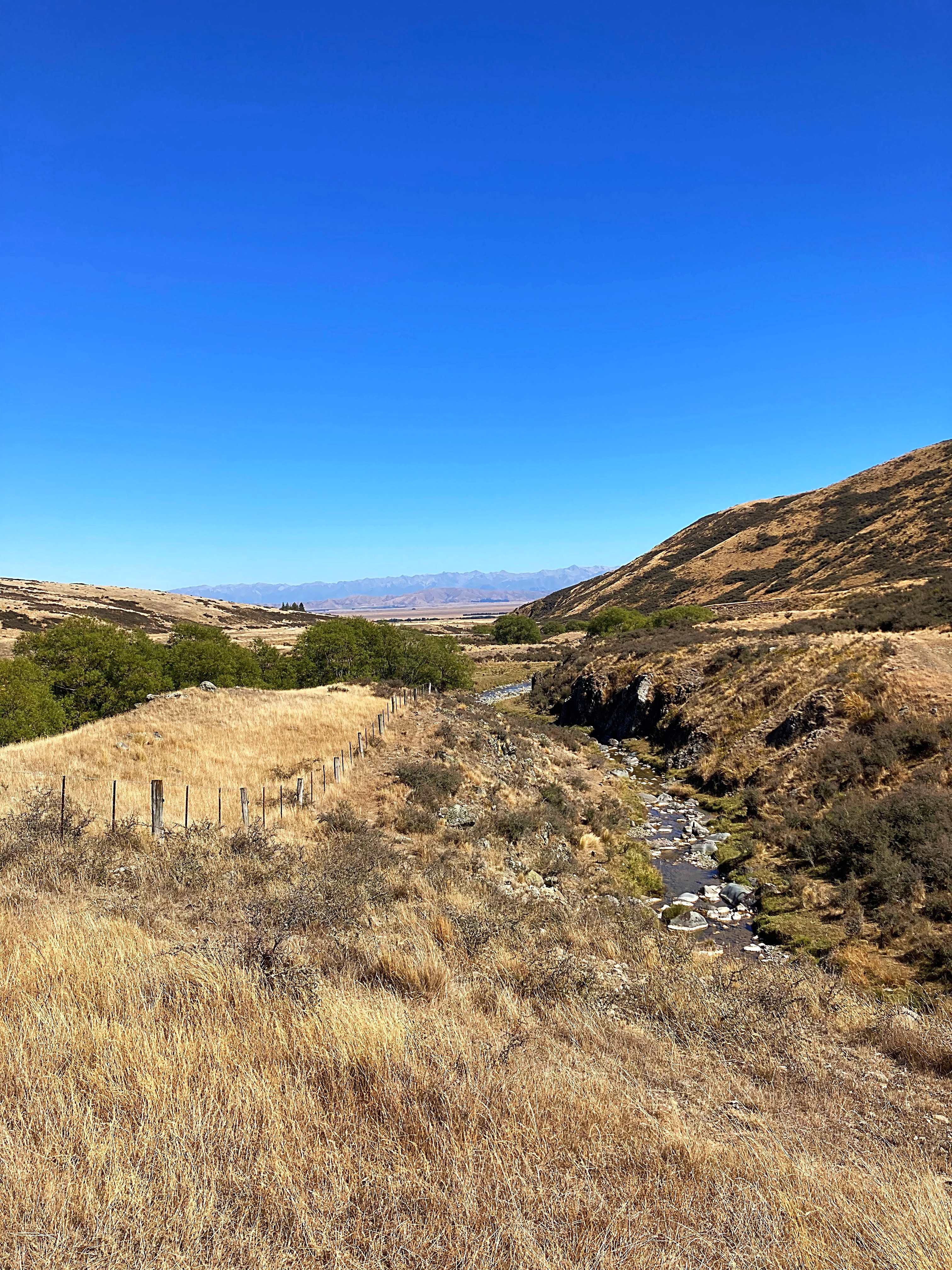
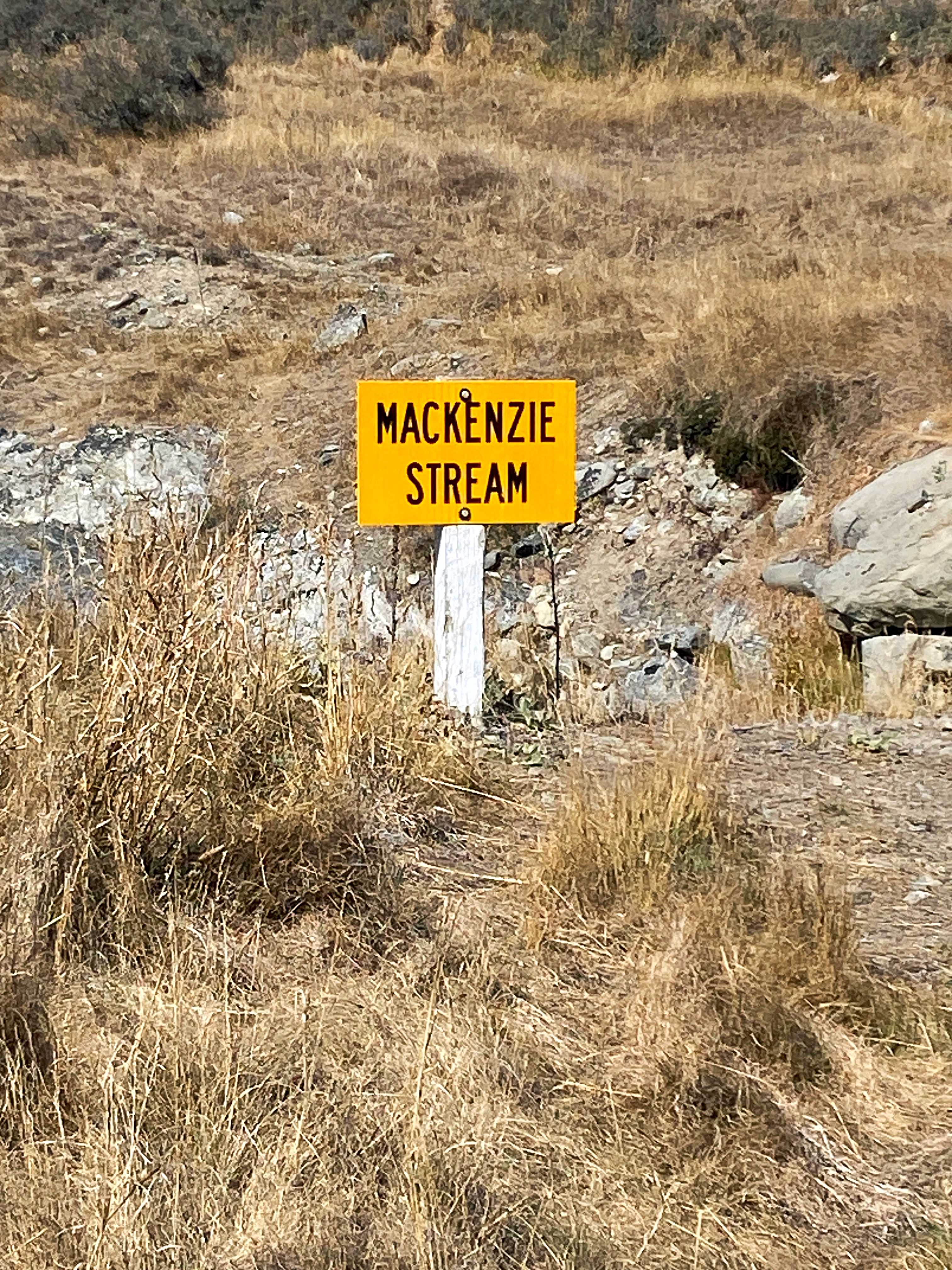
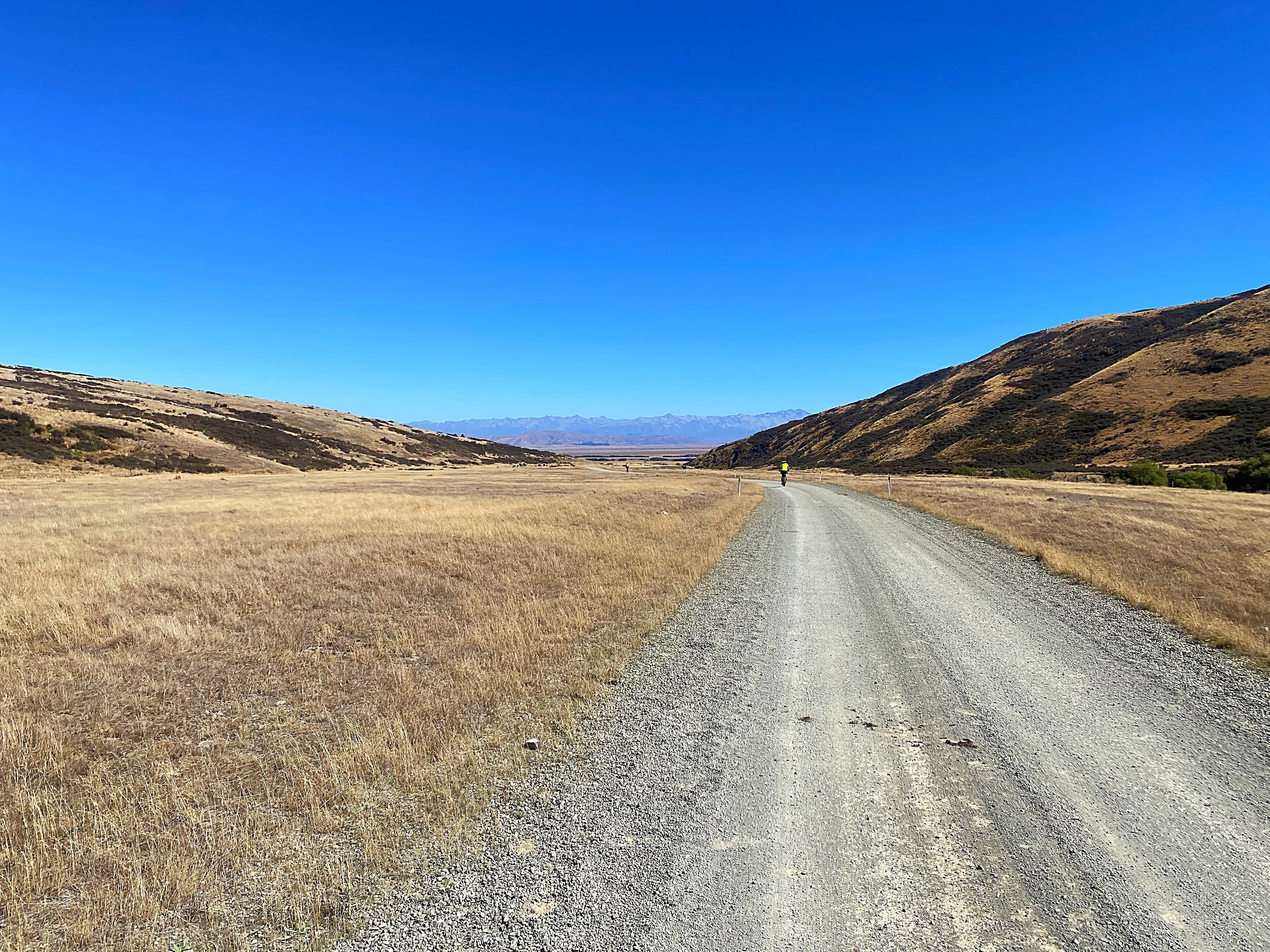
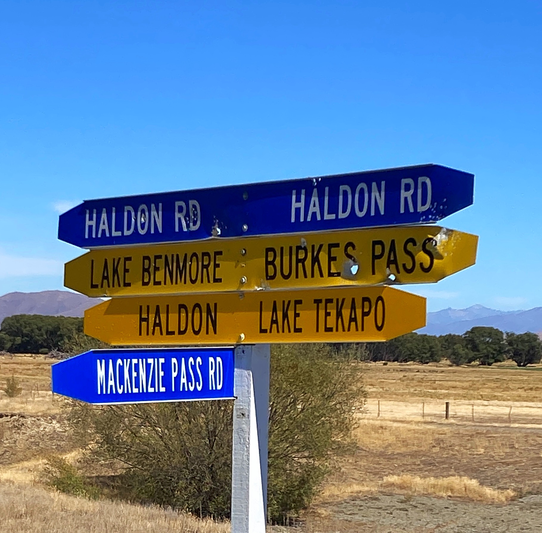
We were rolling through beef and sheep farms up through the valley trying to work out which was the ominous Mackenzie Pass – it’s like being on a mystery tour. It revealed itself about 4 kilometres from the summit with the last bit being a pinch climb – no hike a bike for me today though
Just after we reached the summit, a couple of Americans on gravel bikes came up the hill. They are riding around the country with a group of others with a tour company.
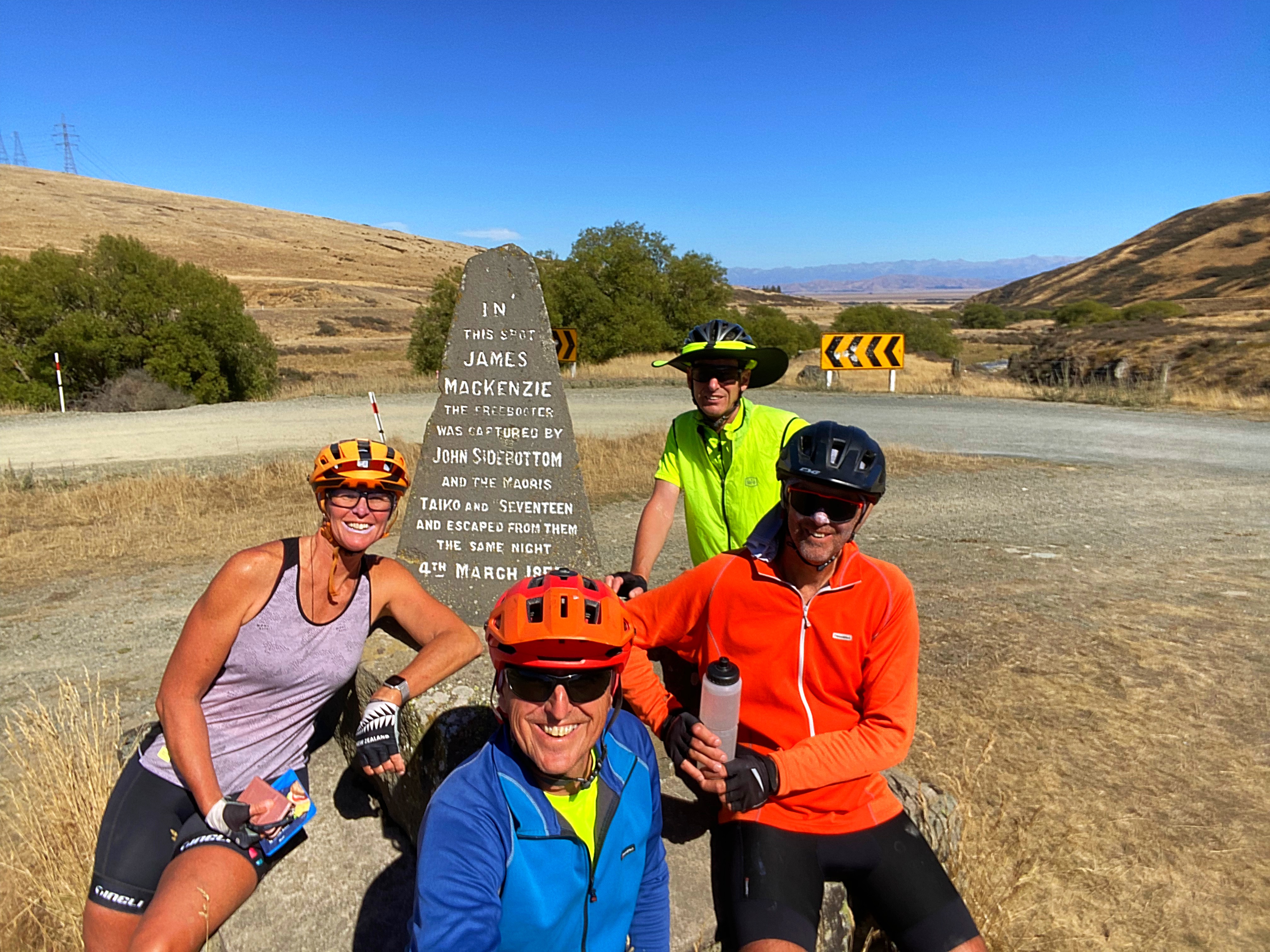
The pass is named after James Mackenzie. In March 1855, shepherds searching for 1000 missing sheep in the upper reaches of the Waitaki Valley apprehended suspected rustler James Mackenzie, one of New Zealand’s first and most enduring folk heroes.
On the west side of the pass stands a tri-lingual (English, Gaelic and Maori) stone cairn which reads ” In this spot James Mackenzie (sic) freebooter, was captured by John Sidebottom and Maoris, Taiko and Seventeen and escaped the same night, 4th March 1855.”
The exploits of Mackenzie and his loyal dog Friday left an indelible mark on the South Island high country. Canny pastoralists quickly realised the significance of the pass where he was found with the stolen sheep, and the open country beyond. This region was subsequently dubbed the Mackenzie Country.
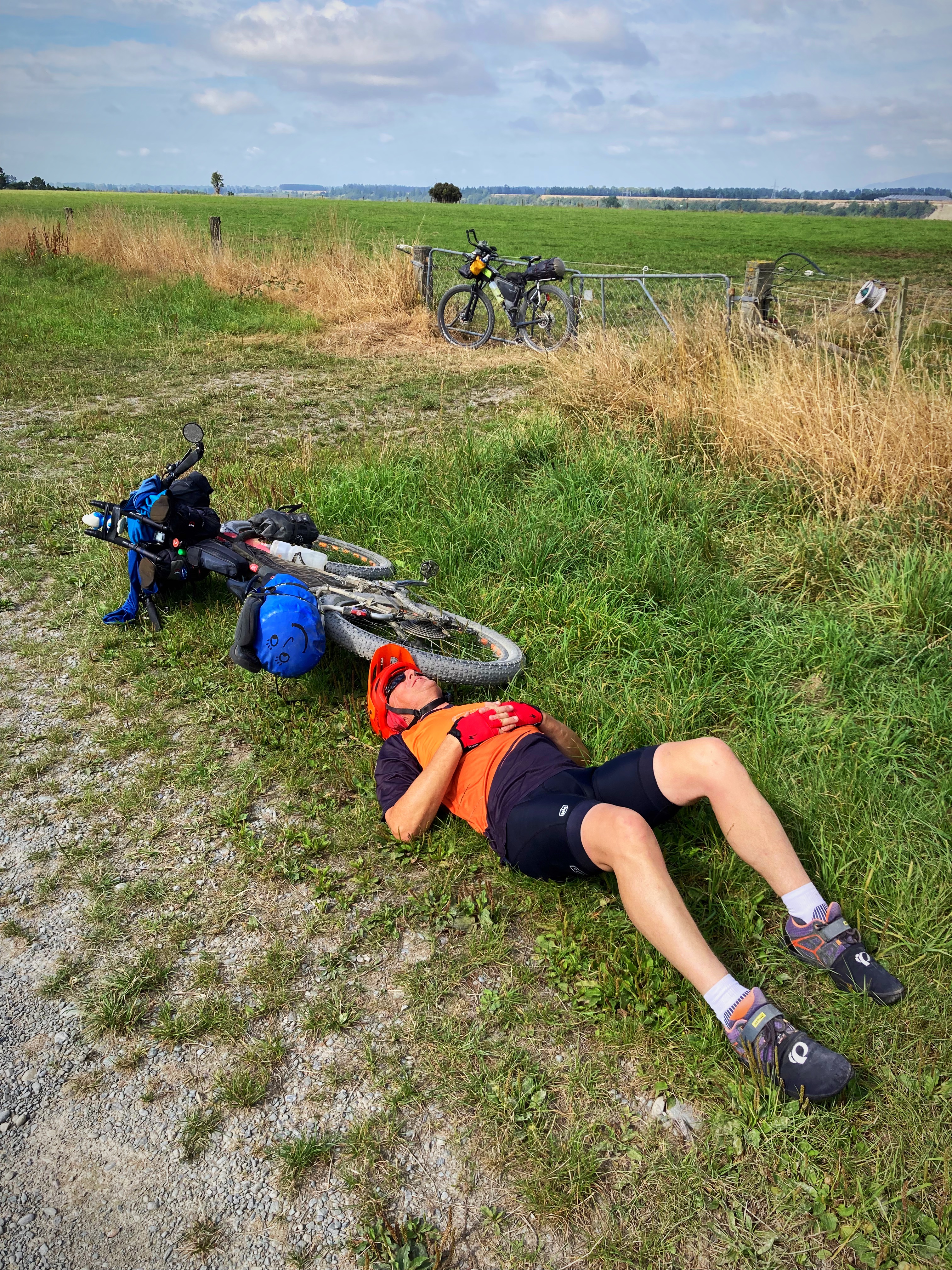
We had our first lunch near the memorial with one of us also having a lie down
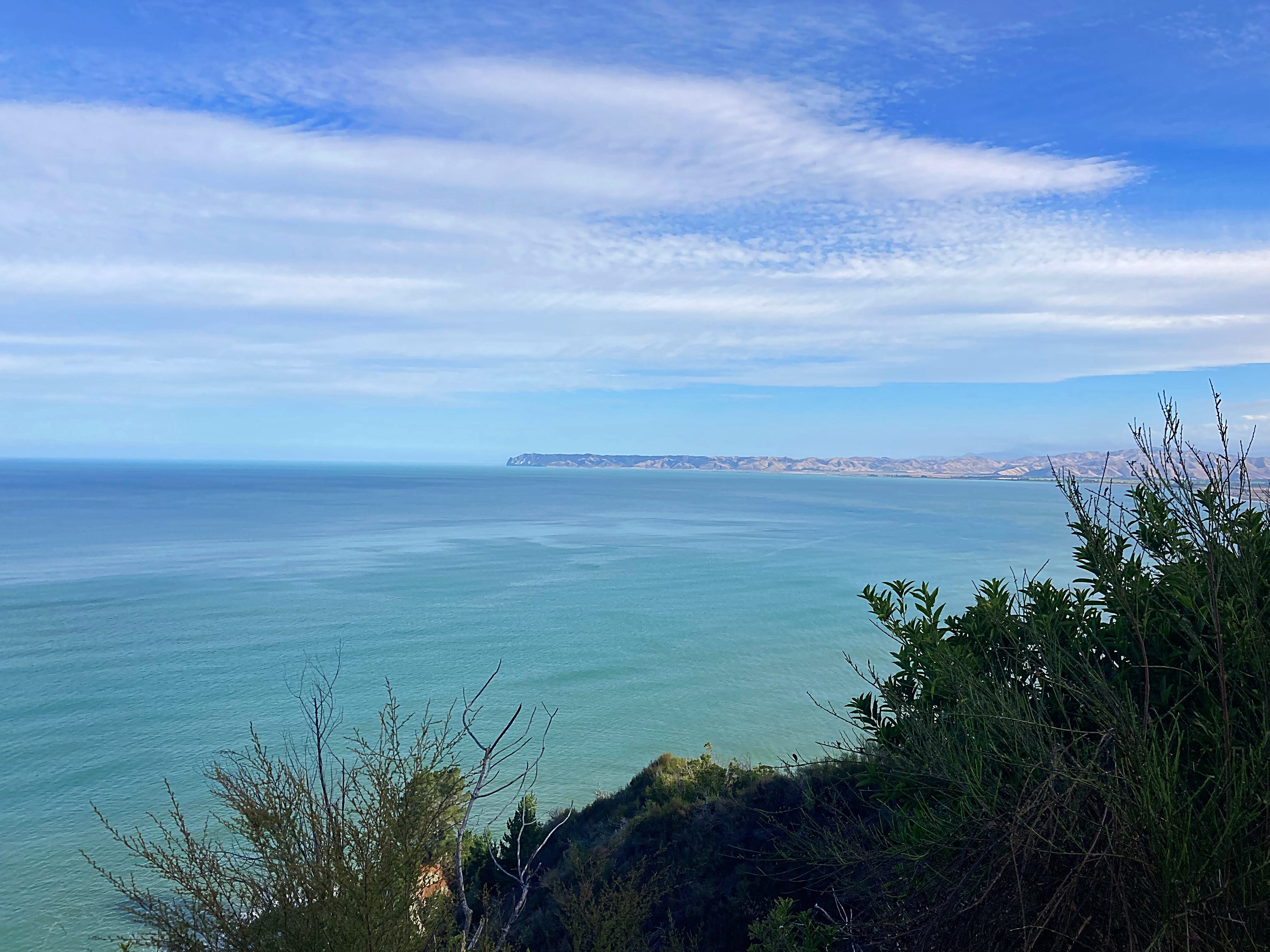
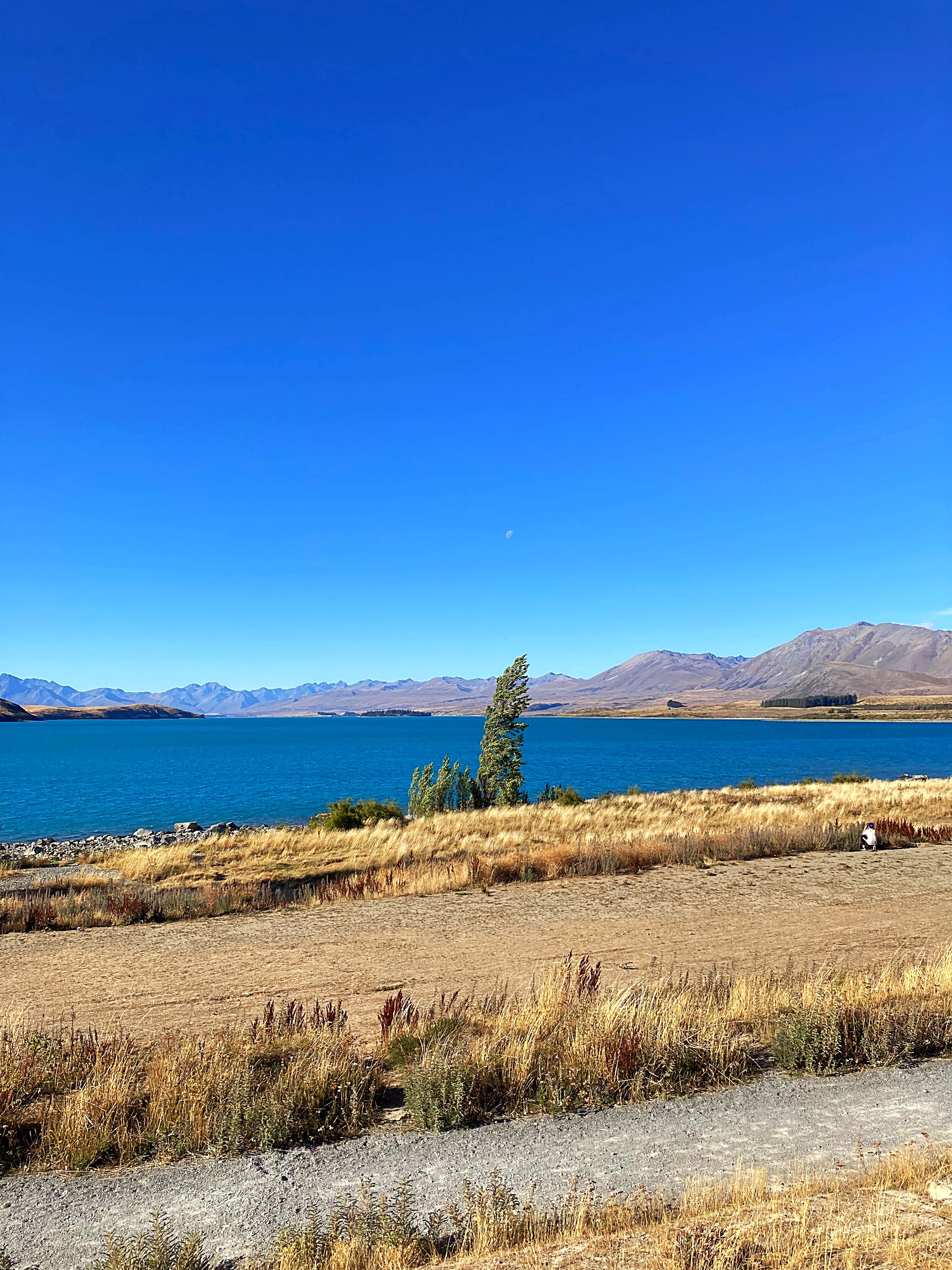
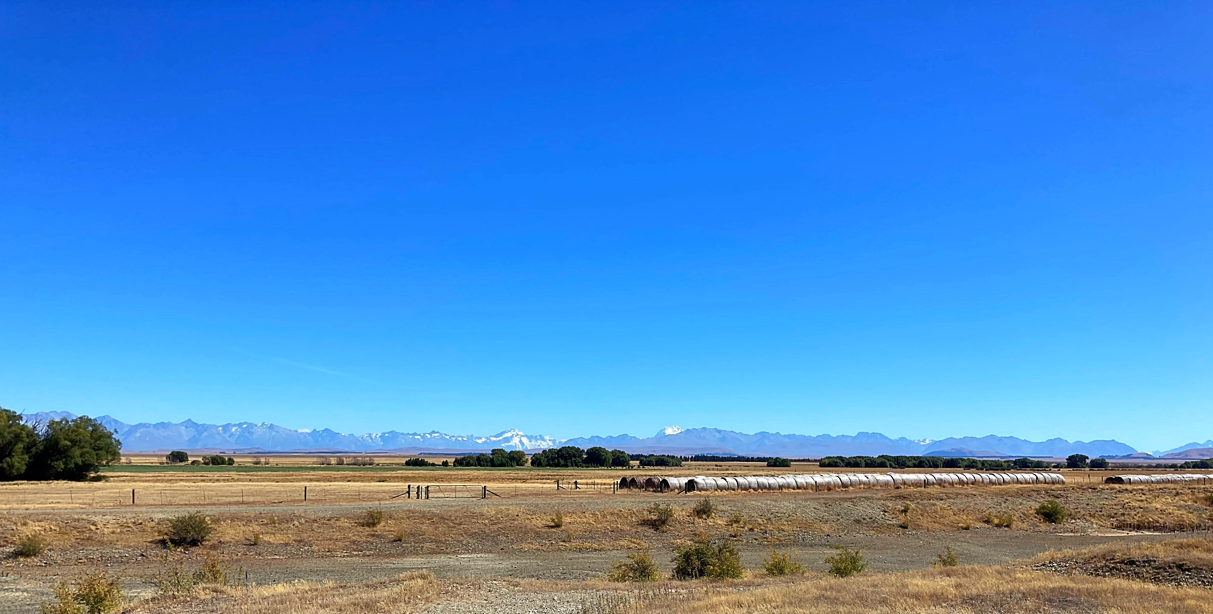
We then headed down the valley with the Southern Alps and the top of Aoraki Mt Cook in front of us. It is a barren but beautiful landscape, especially with a perfect blue sky day.
They have built a cycle path alongside State Highway 8 that heads into Tekapo and it is just as well, as it is not a particularly friendly road for cyclists.
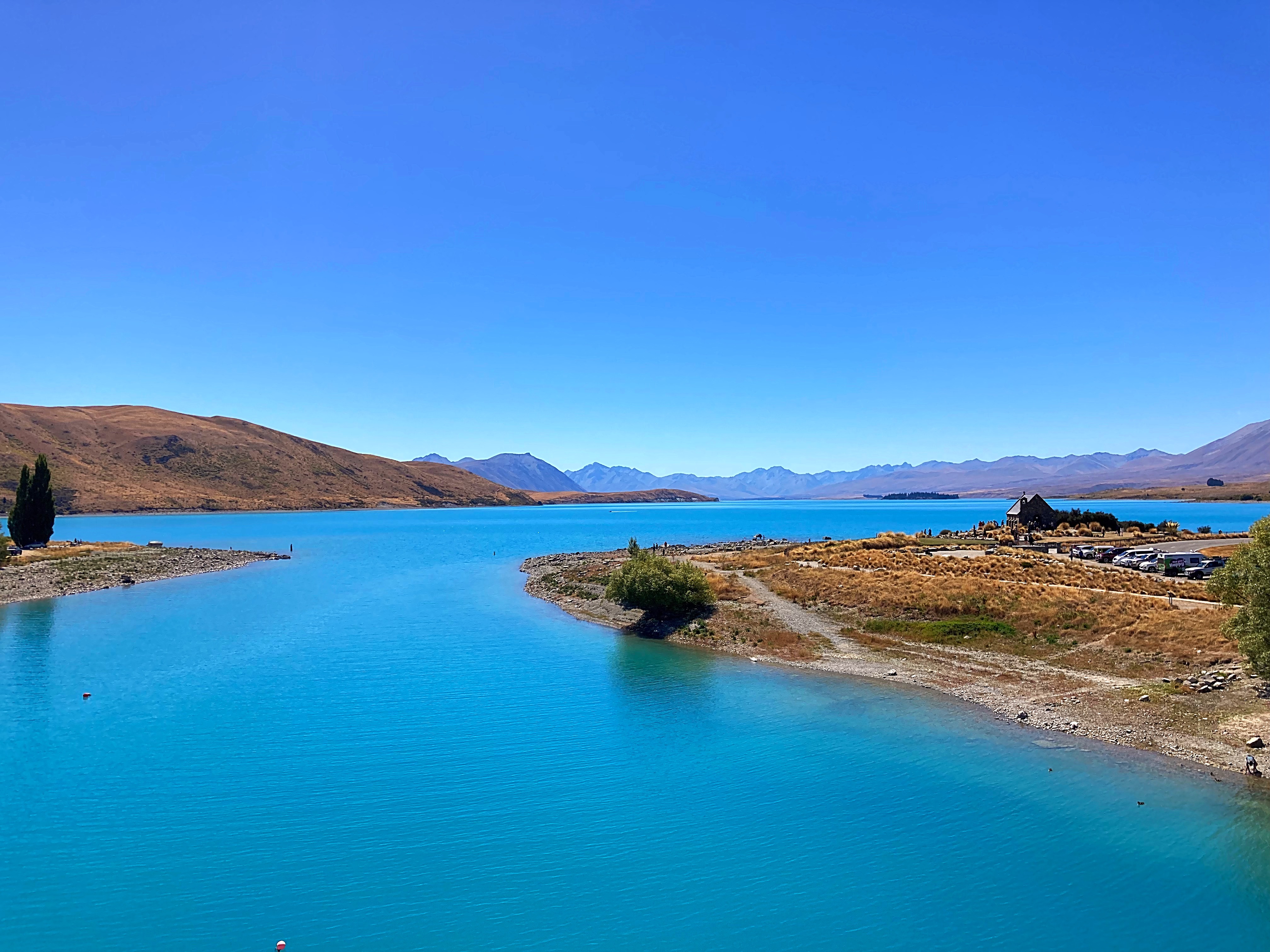
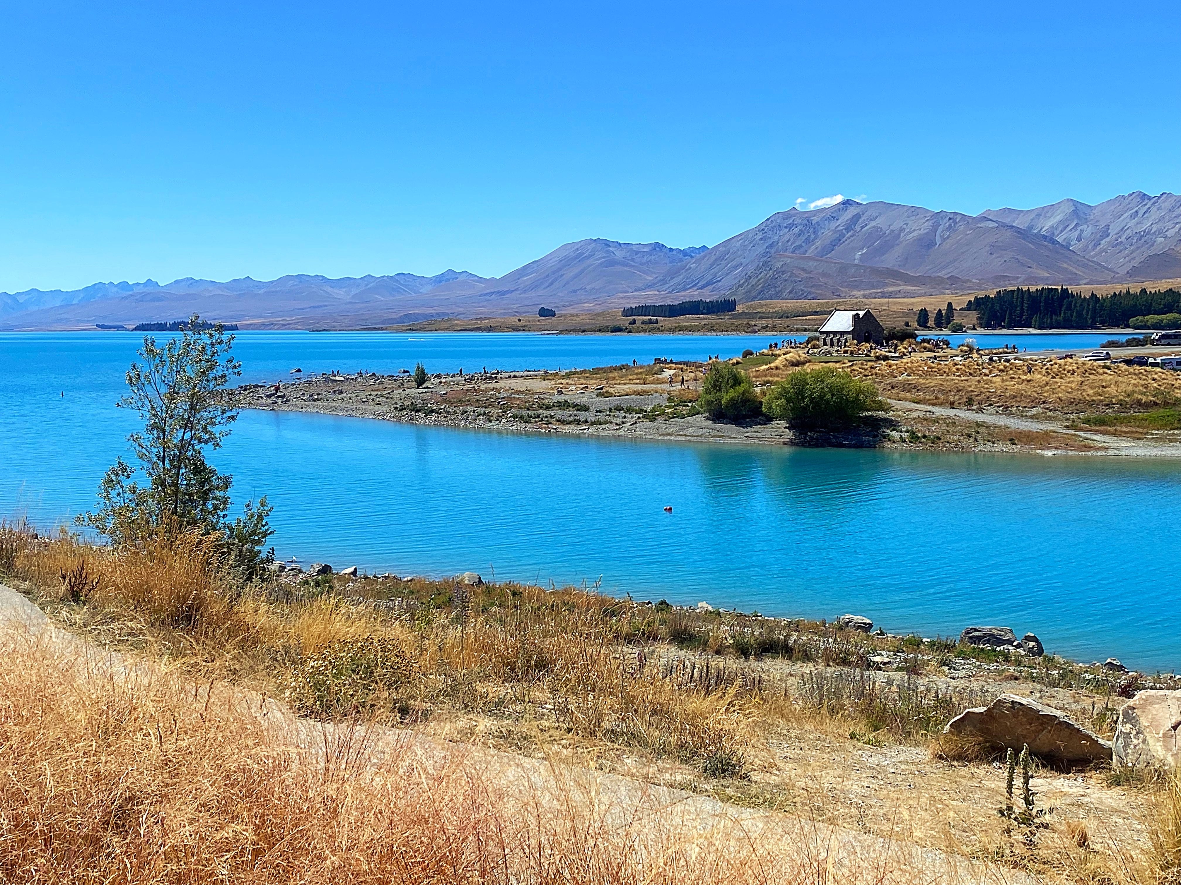
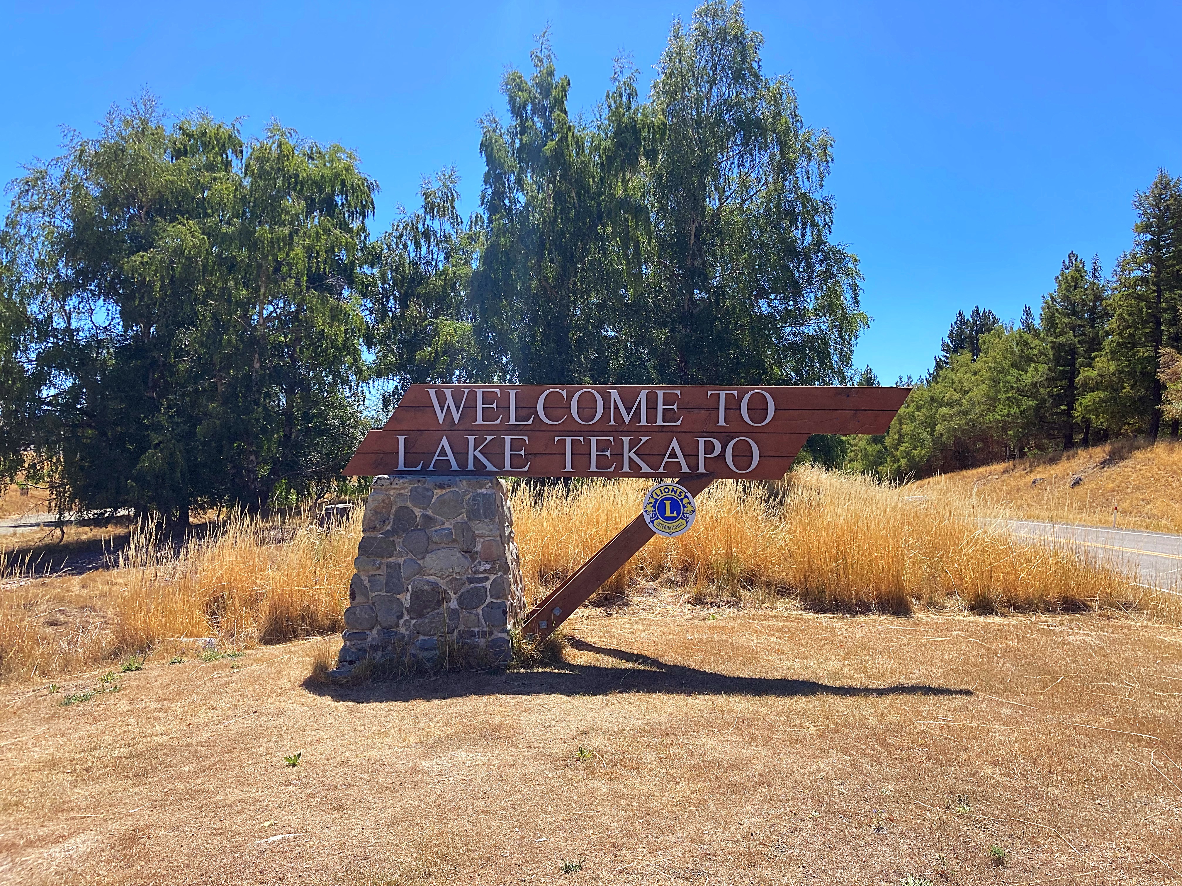
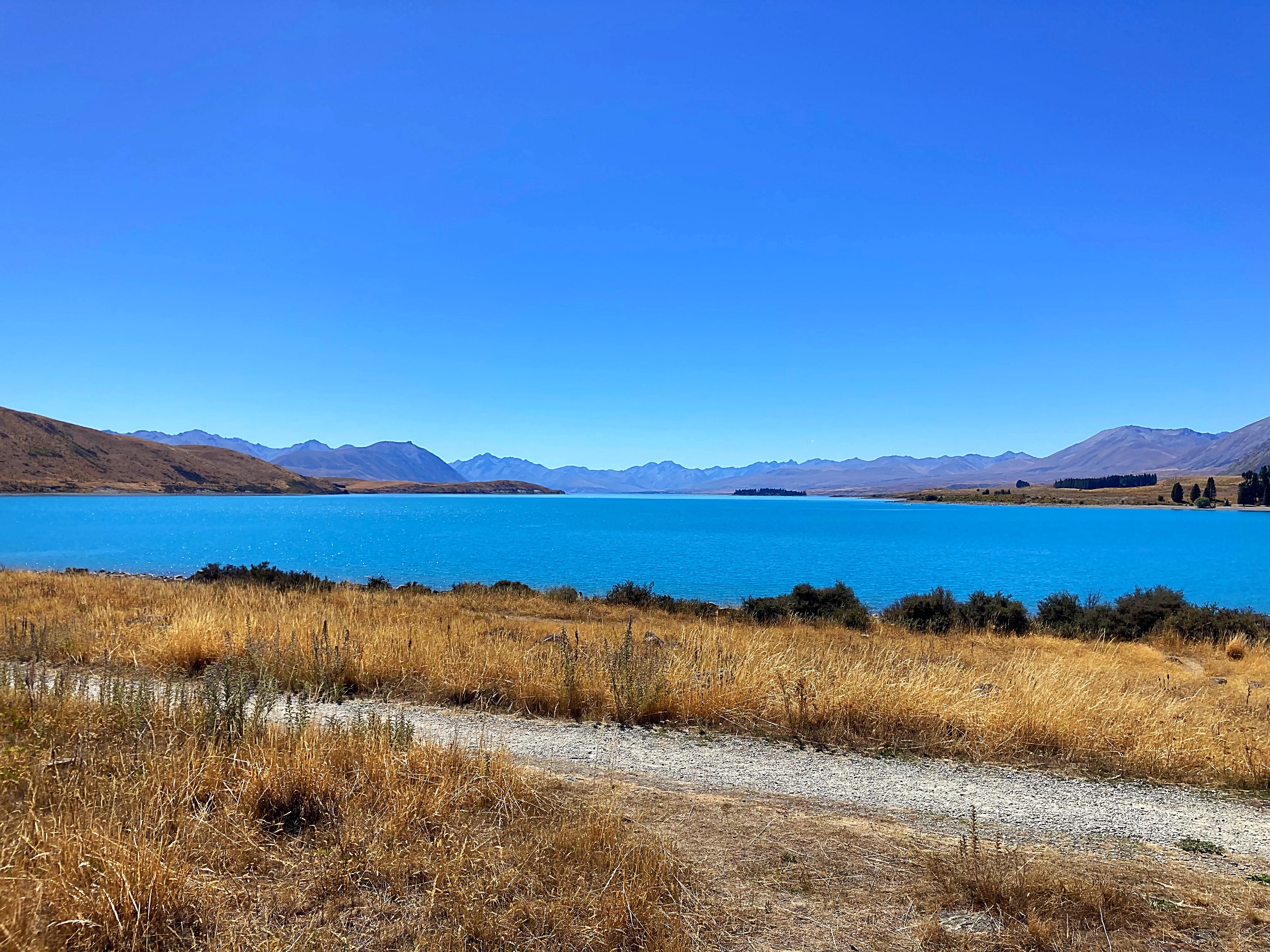
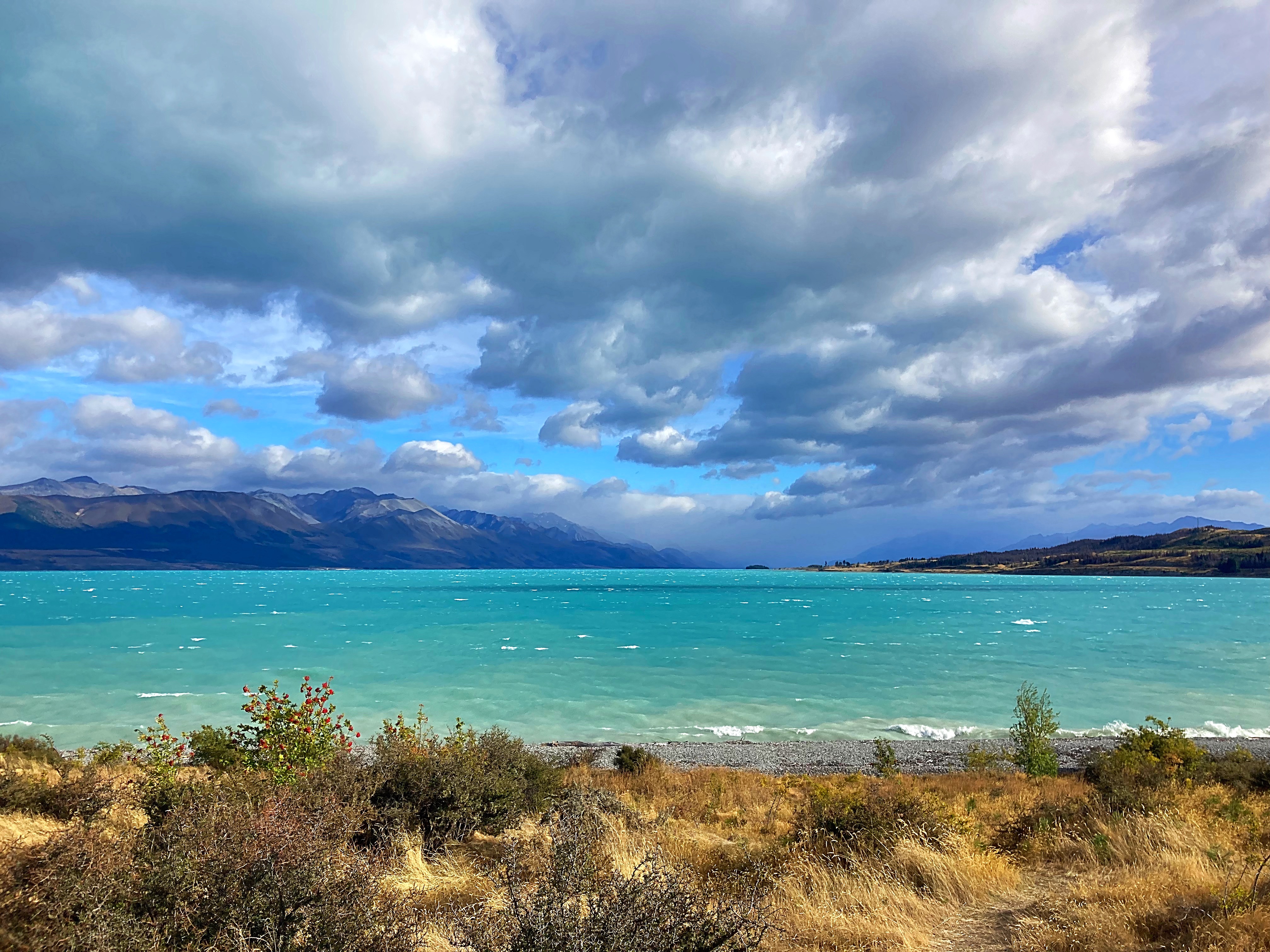
Lake Tekapo never ceases to take your breath away as you get a peak of it coming into town. The two rivers that feed the lake have their sources in the Southern Alps to the north. The meltwater from the Southern Alps is tinged with a light turquoise colour from the glacial silt. This gives Lake Tekapo its distinctive colour.
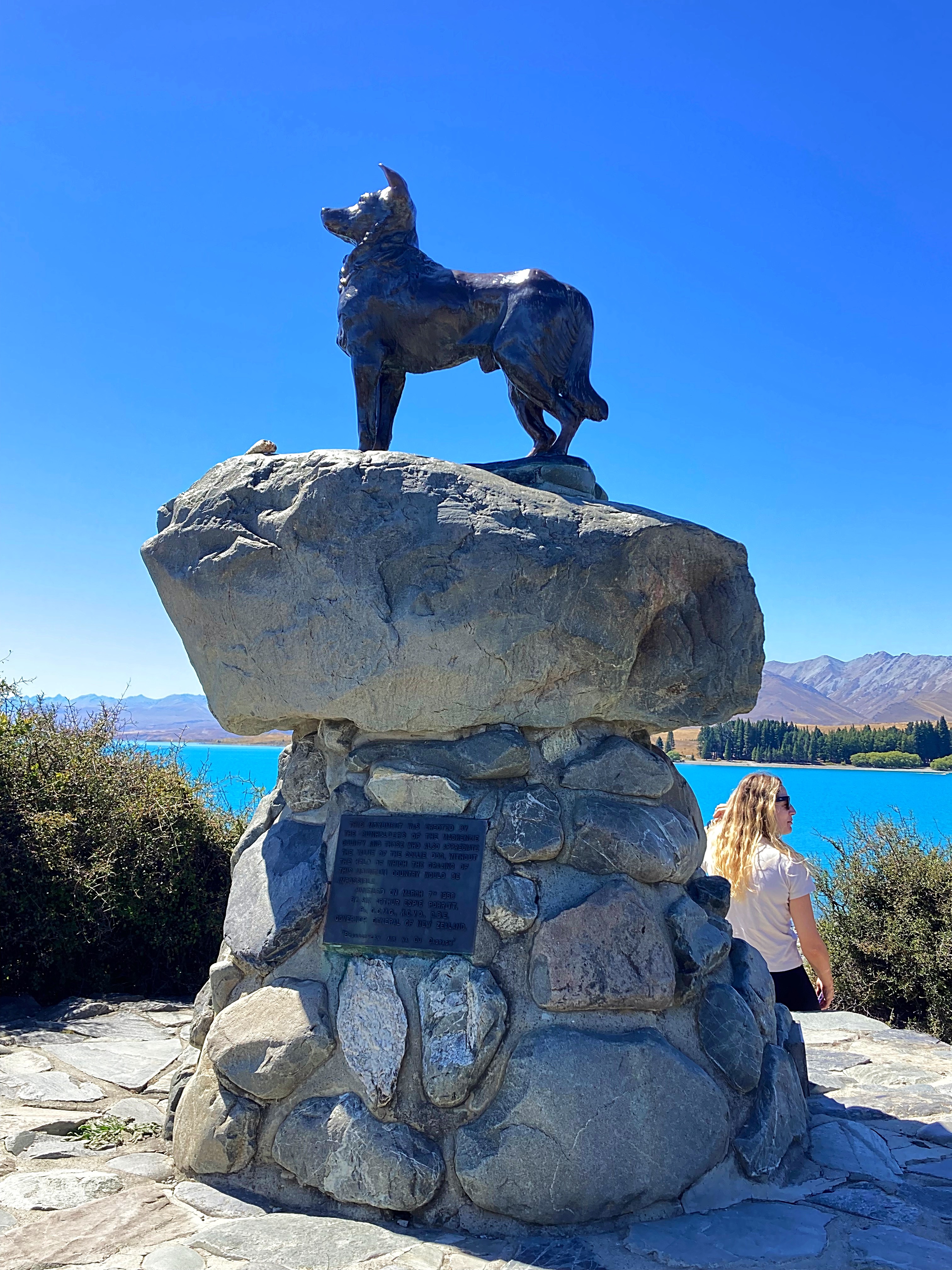
We cycled past the sheep dog memorial. In the 19th century, Scottish shepherds came to work on the pastoral runs of the eastern South Island. The high country could not have been farmed successfully without the border collies they brought with them. To honour these ‘canine Scots’, a statue of a collie has been raised at Lake Tekapo.
We also have a border collie in our group – can’t go past a lamp post without having a pee (no naming or shaming though).
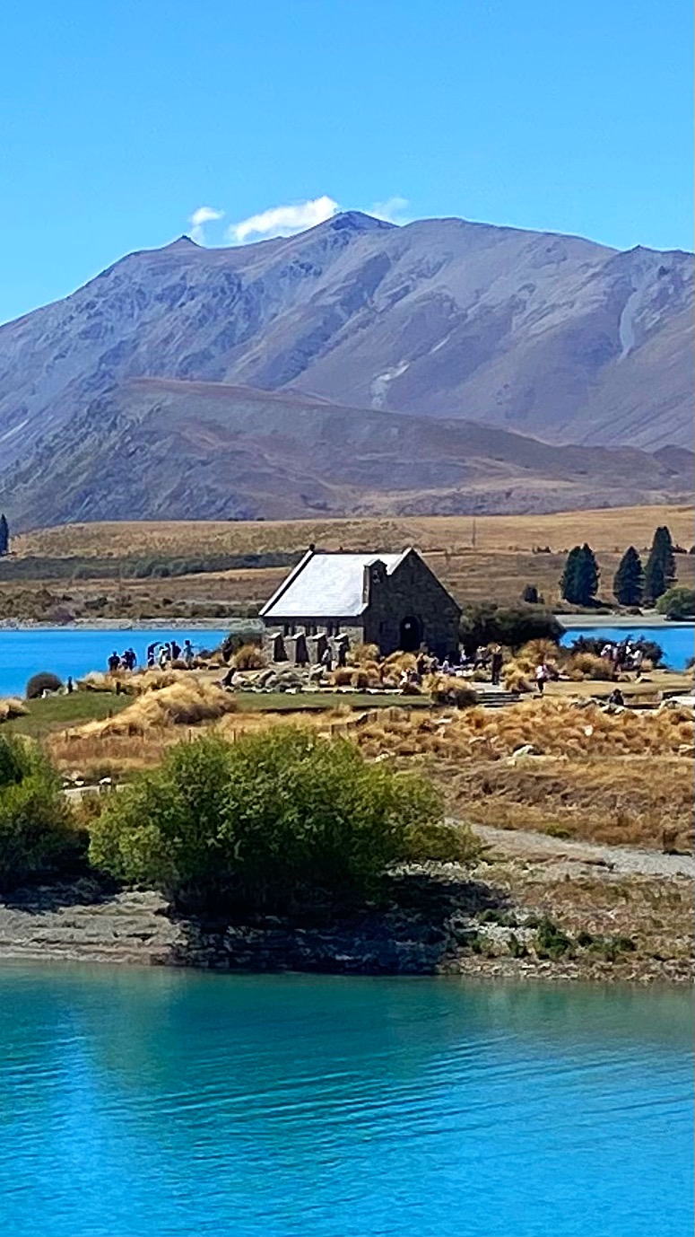
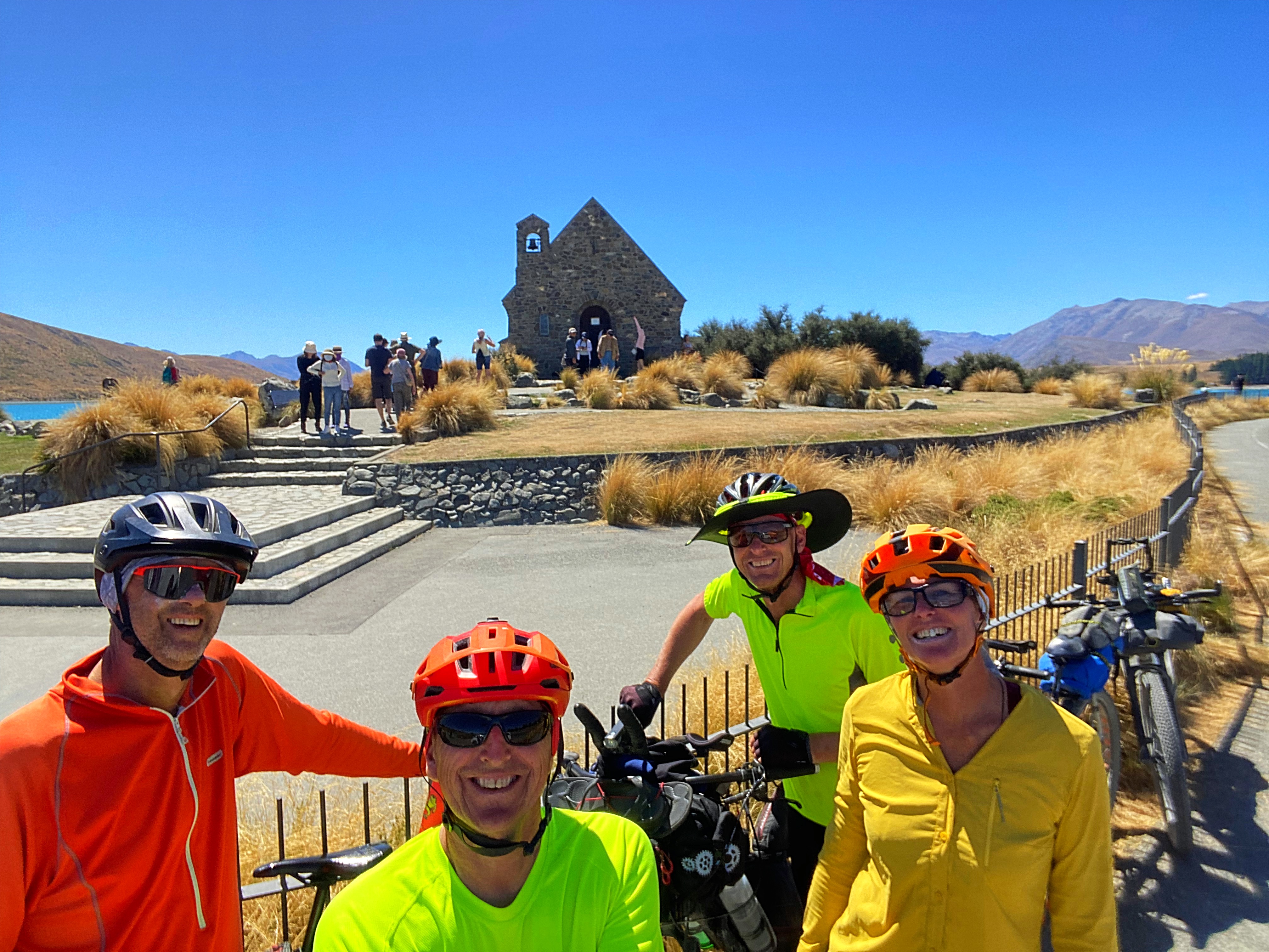
We also stopped at the Church of the Good Shepherd which was built to the glory of God and as a memorial to the pioneers of the Mackenzie Country.
Tekapo is a very popular spot with tourists and there were people everywhere today enjoying the vistas.
We’re staying in a very comfortable Air BNB and everyone was very happy with a shorter day and some downtime this afternoon. We all started the day feeling like we’d been hit by a bus
19 February 2024
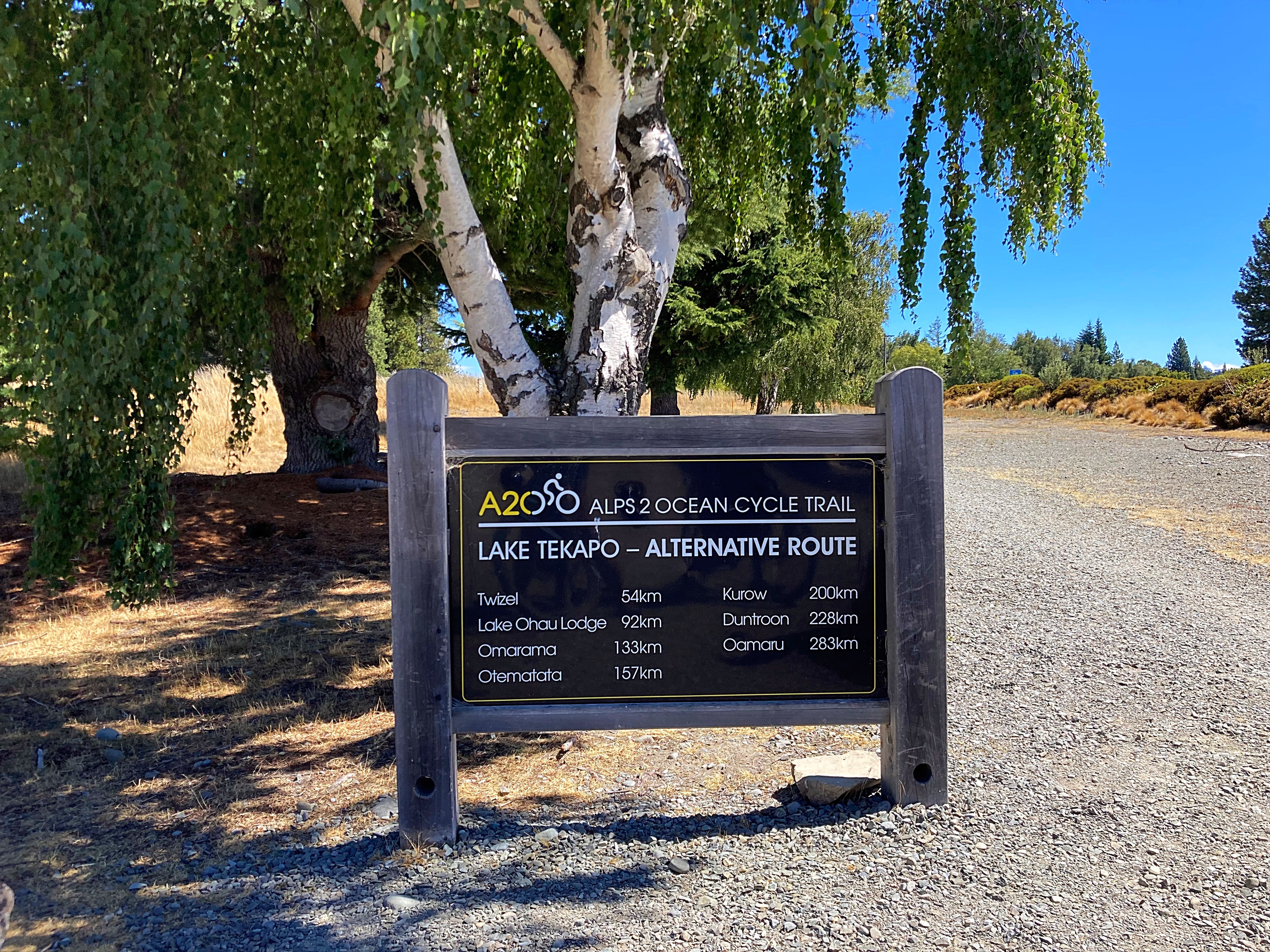
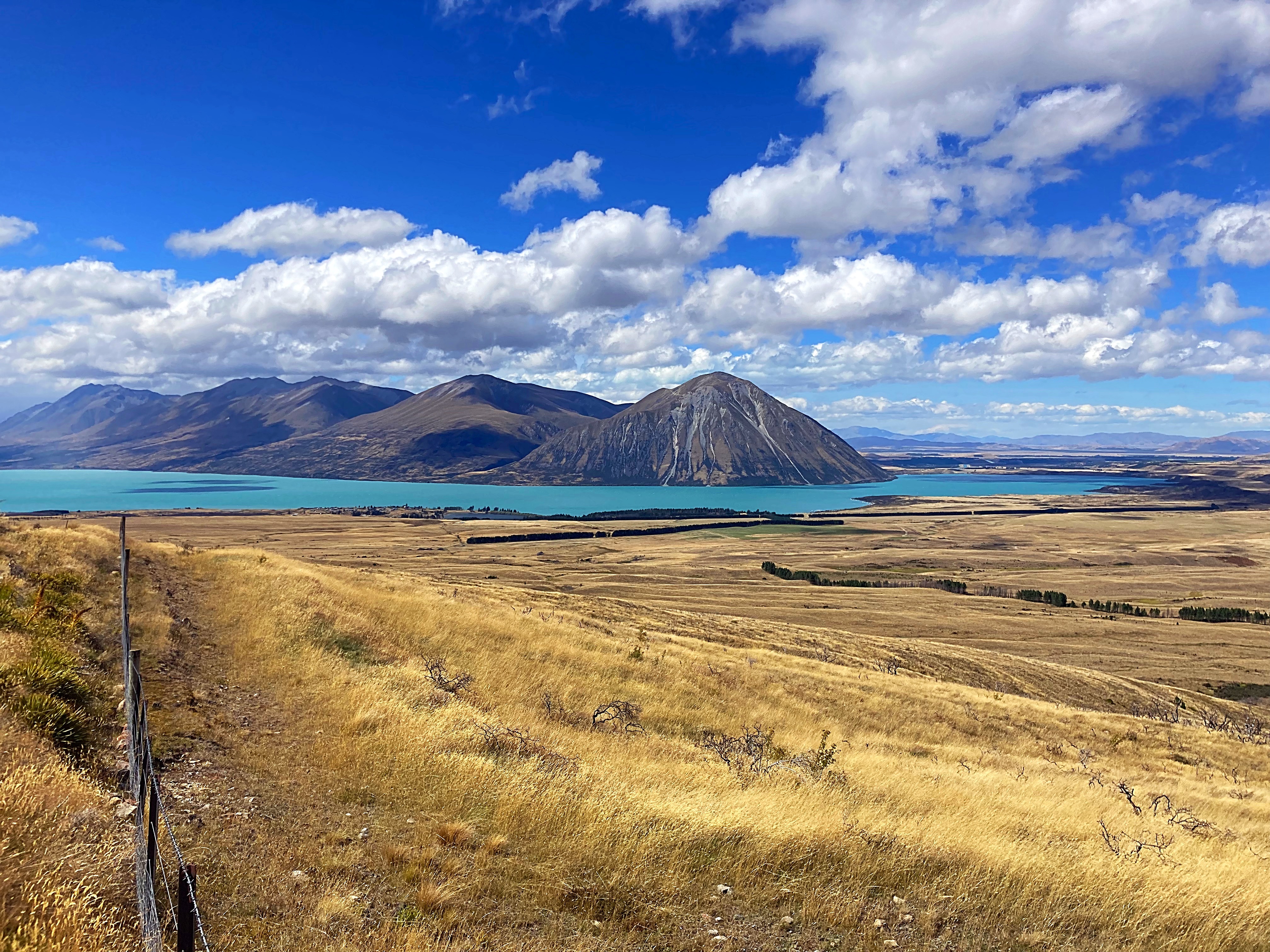
Day 8 – Lake Tekapo to Omarama 138km 818 metres climbed
Normal transmission has resumed with 138 kilometres under the pedals today.
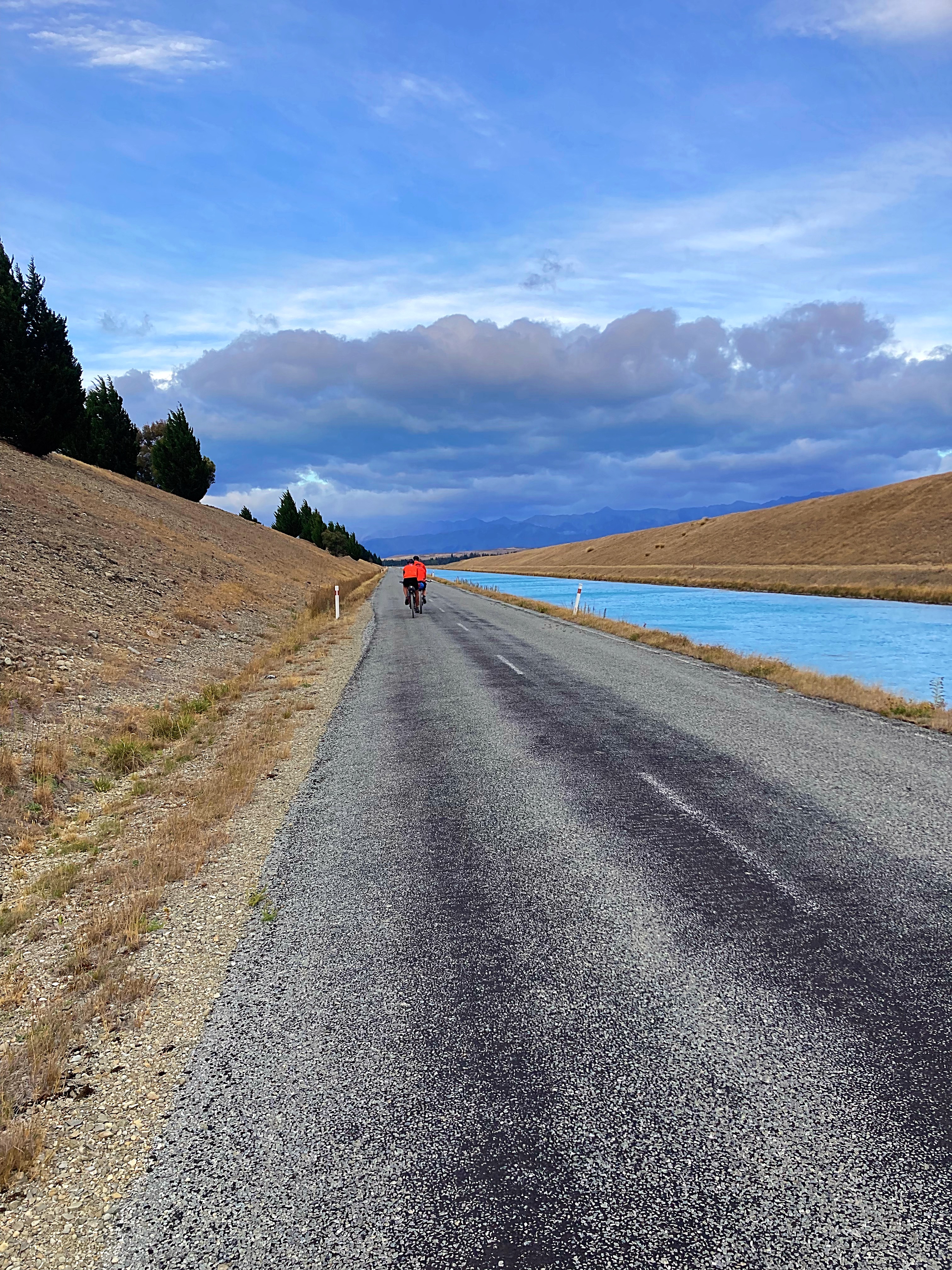
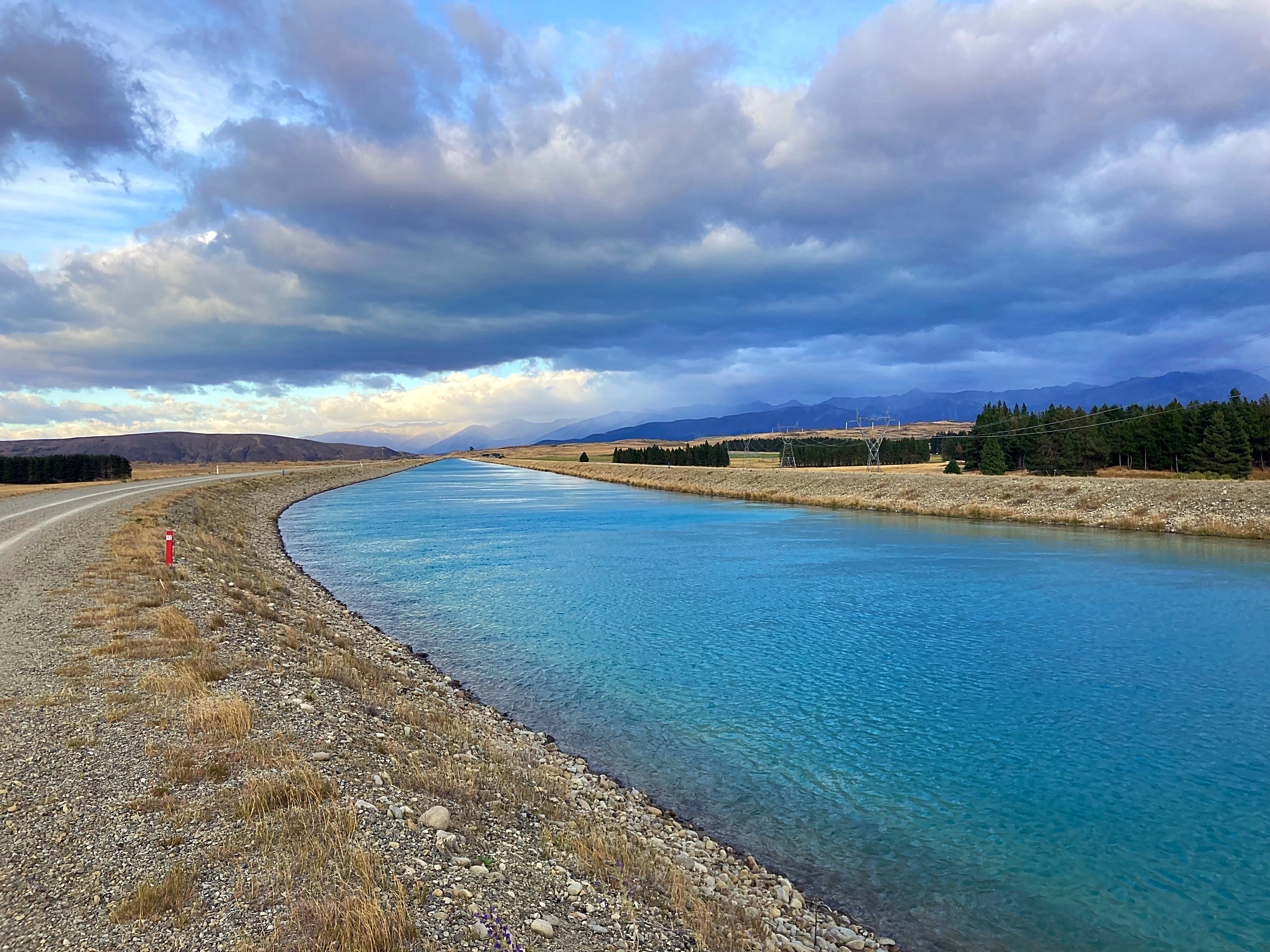
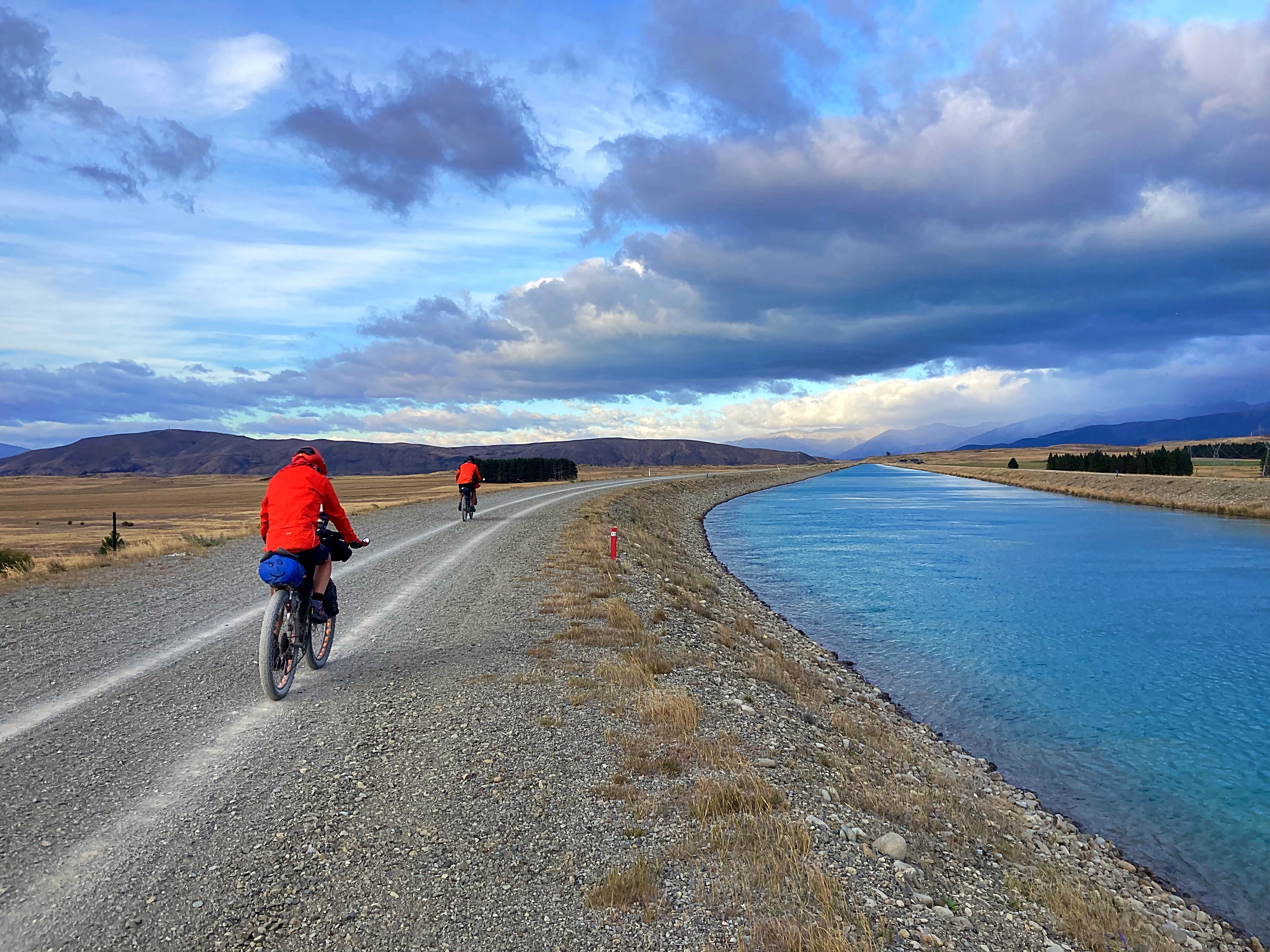
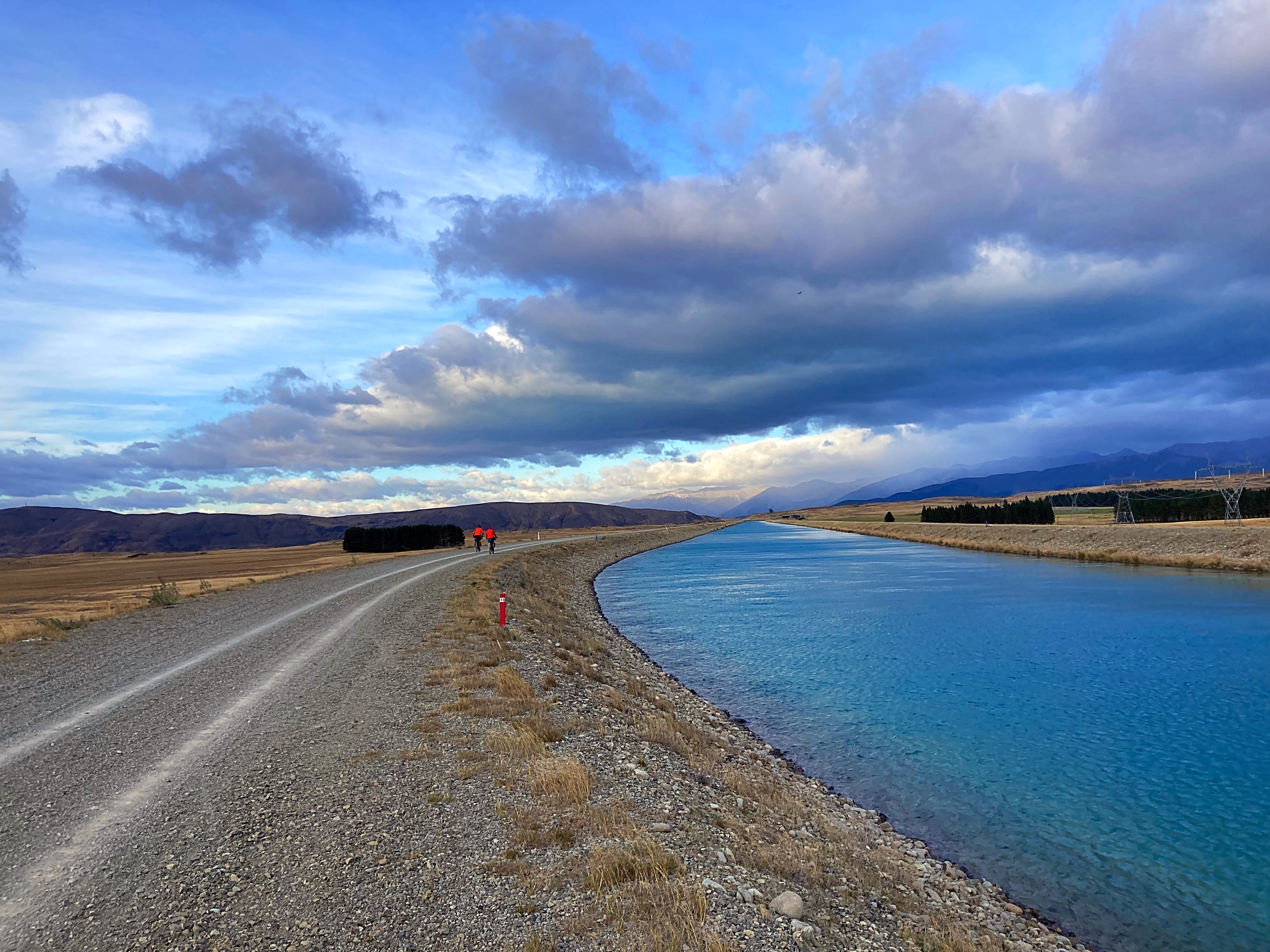
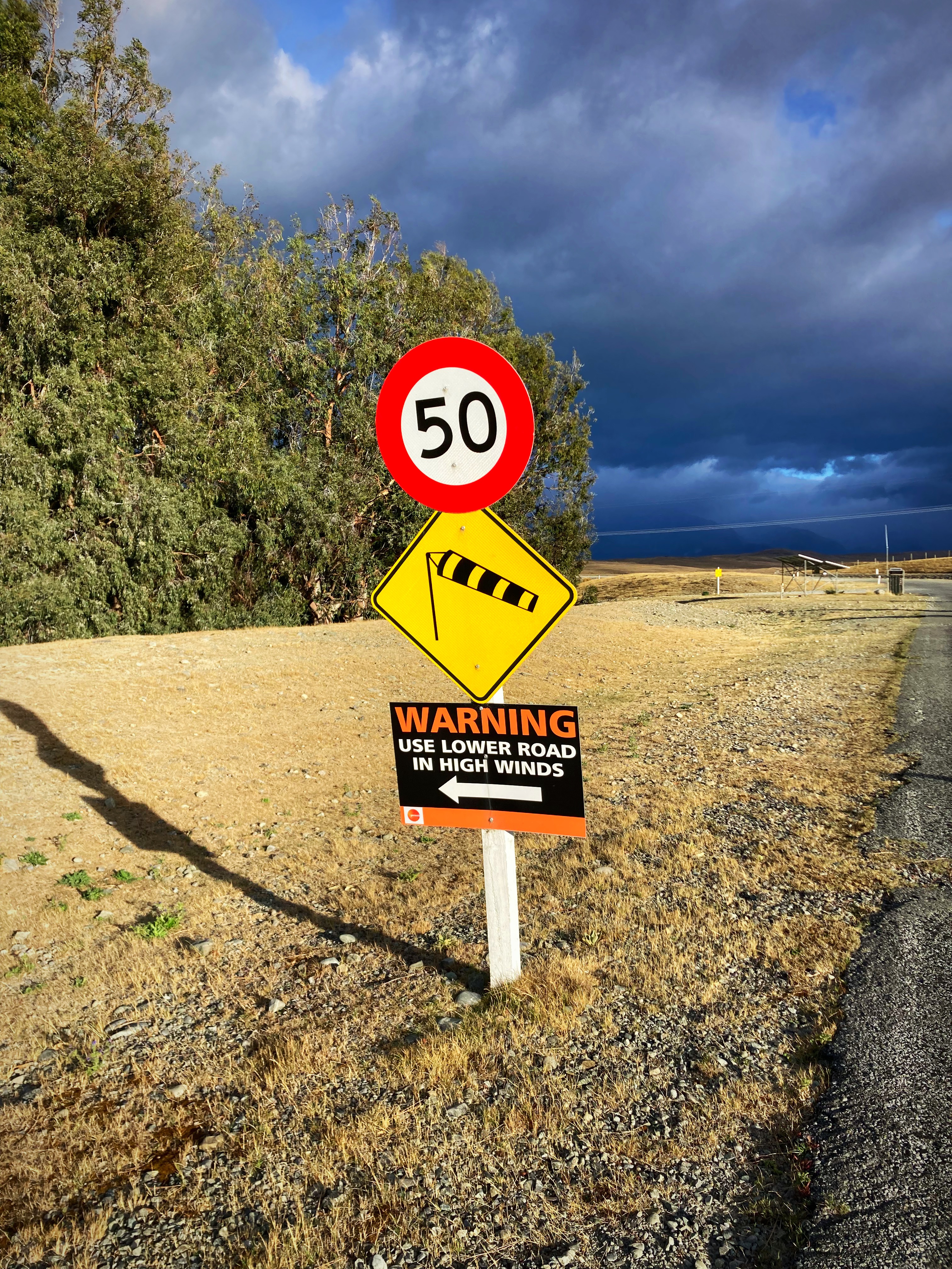
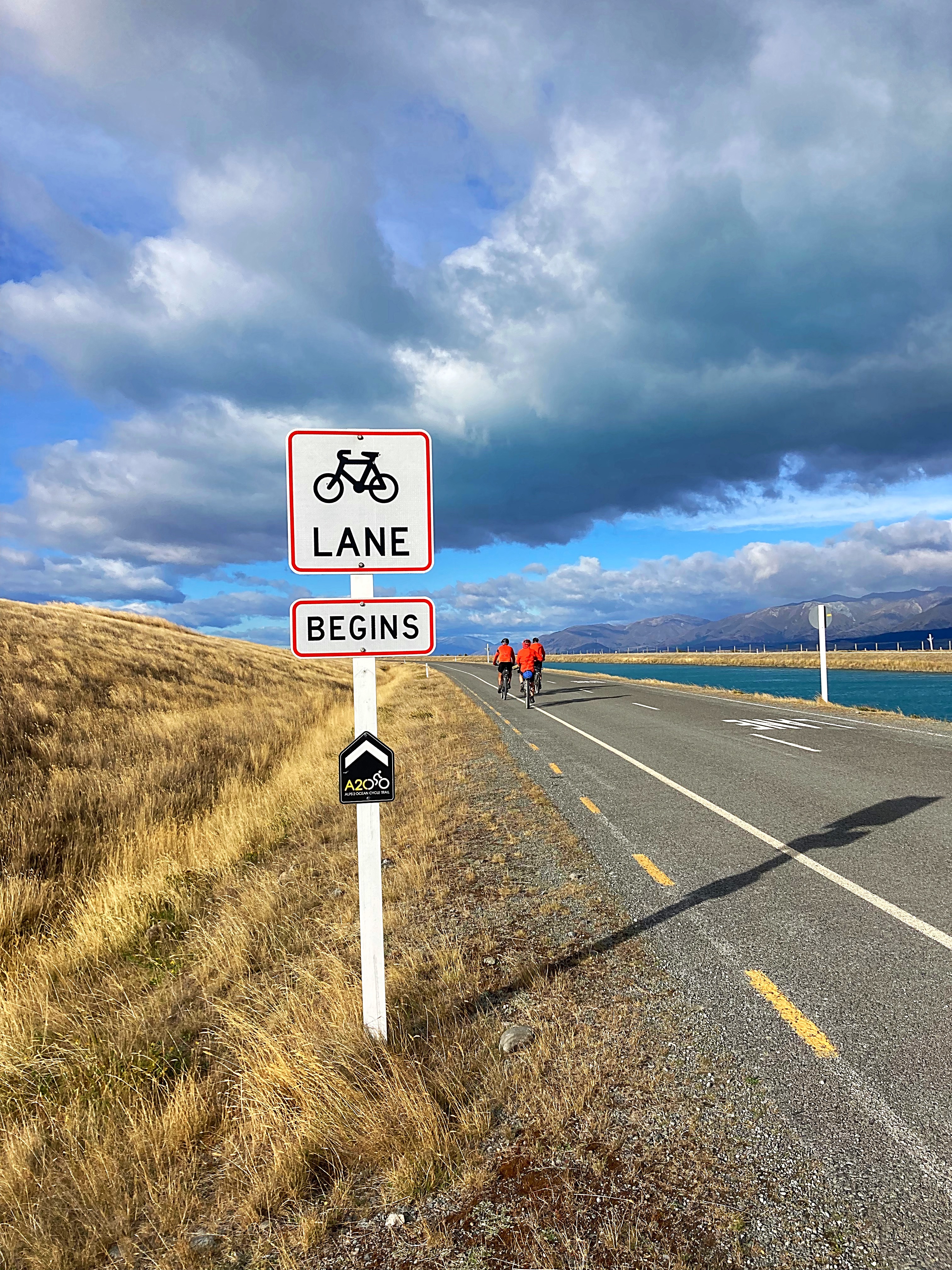
We followed the Alps to Ocean trail today starting out along the Tekapo Canals. Unfortunately we had some very strong winds this morning – some head winds and lots of buffeting side winds. I felt my bike was on a 45 degree angle half the time.
We got to one section of the canal where it had a low road in case of high winds – I’m not sure if it helped much.
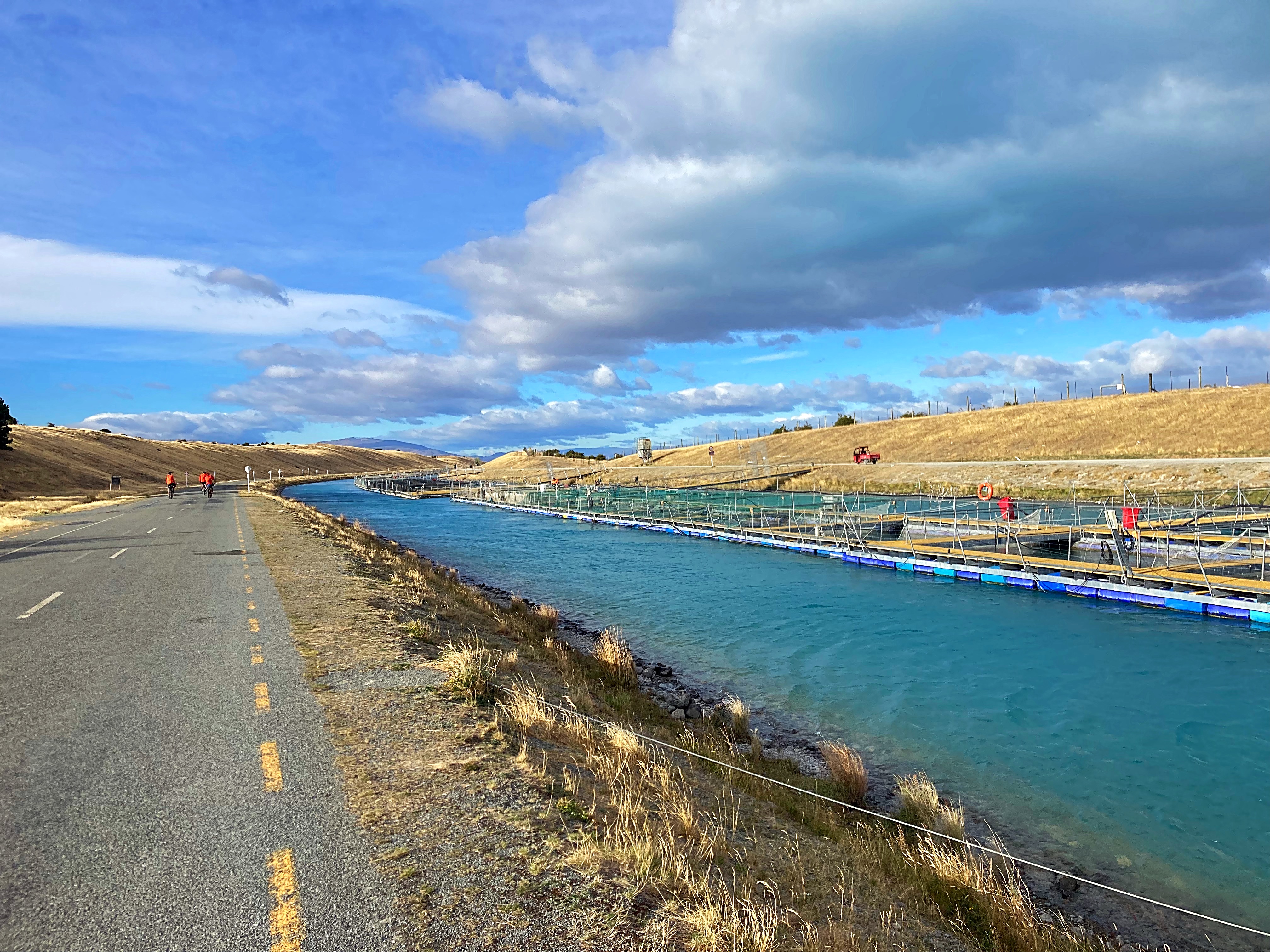
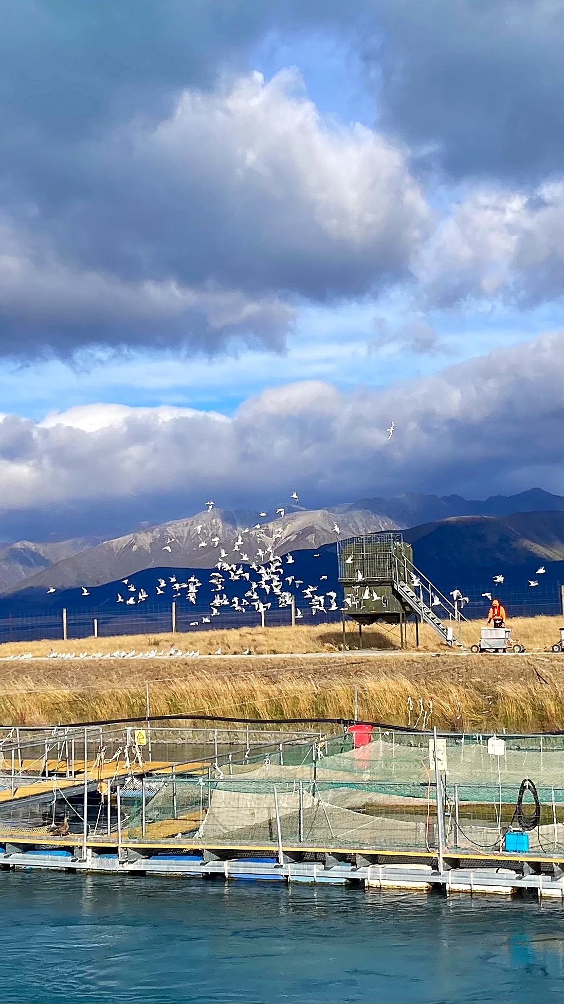
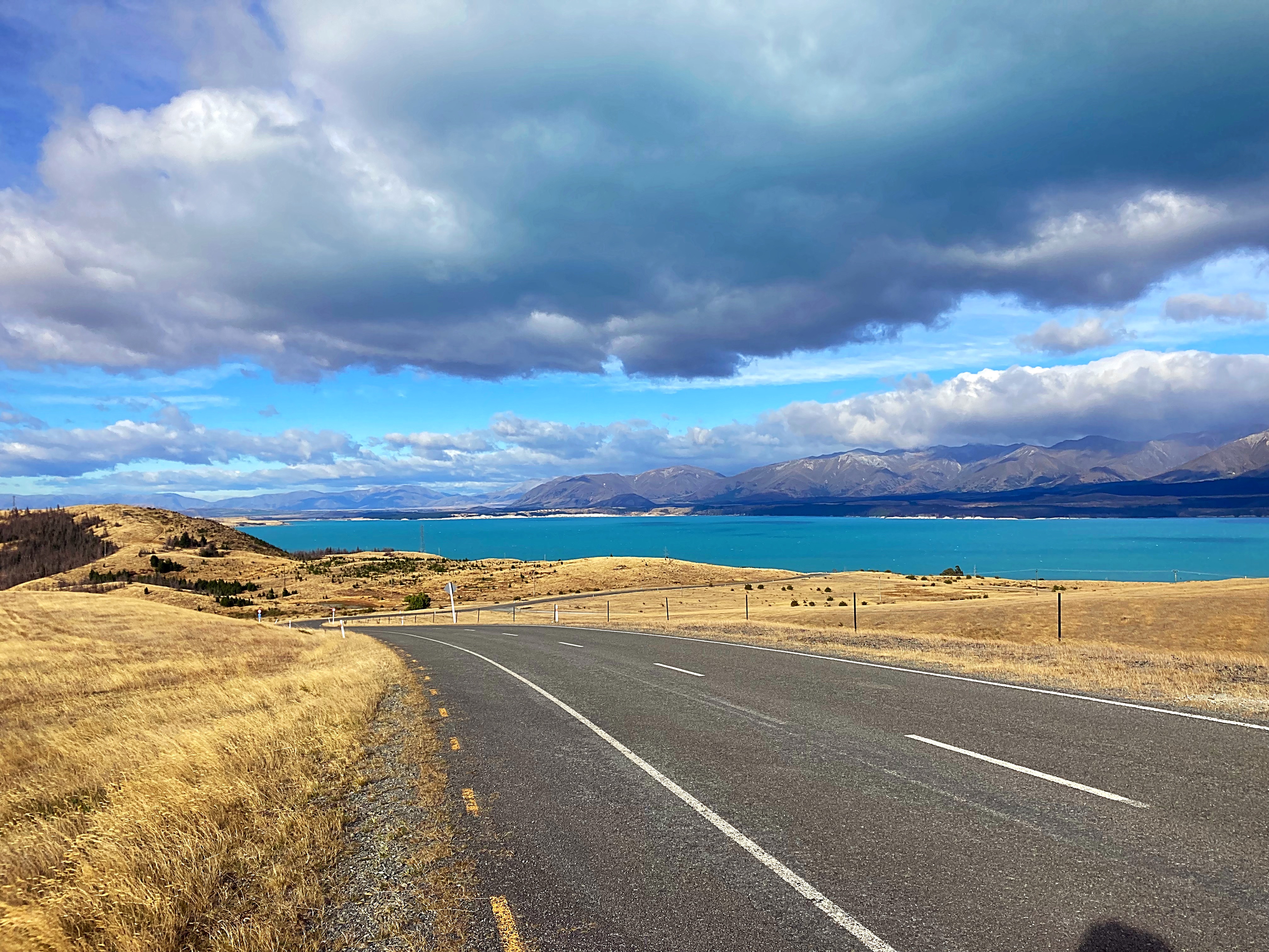
We passed some salmon farms on the canal before reaching Lake Pukaki. Unfortunately today, Aoraki Mt Cook was shrouded in cloud.
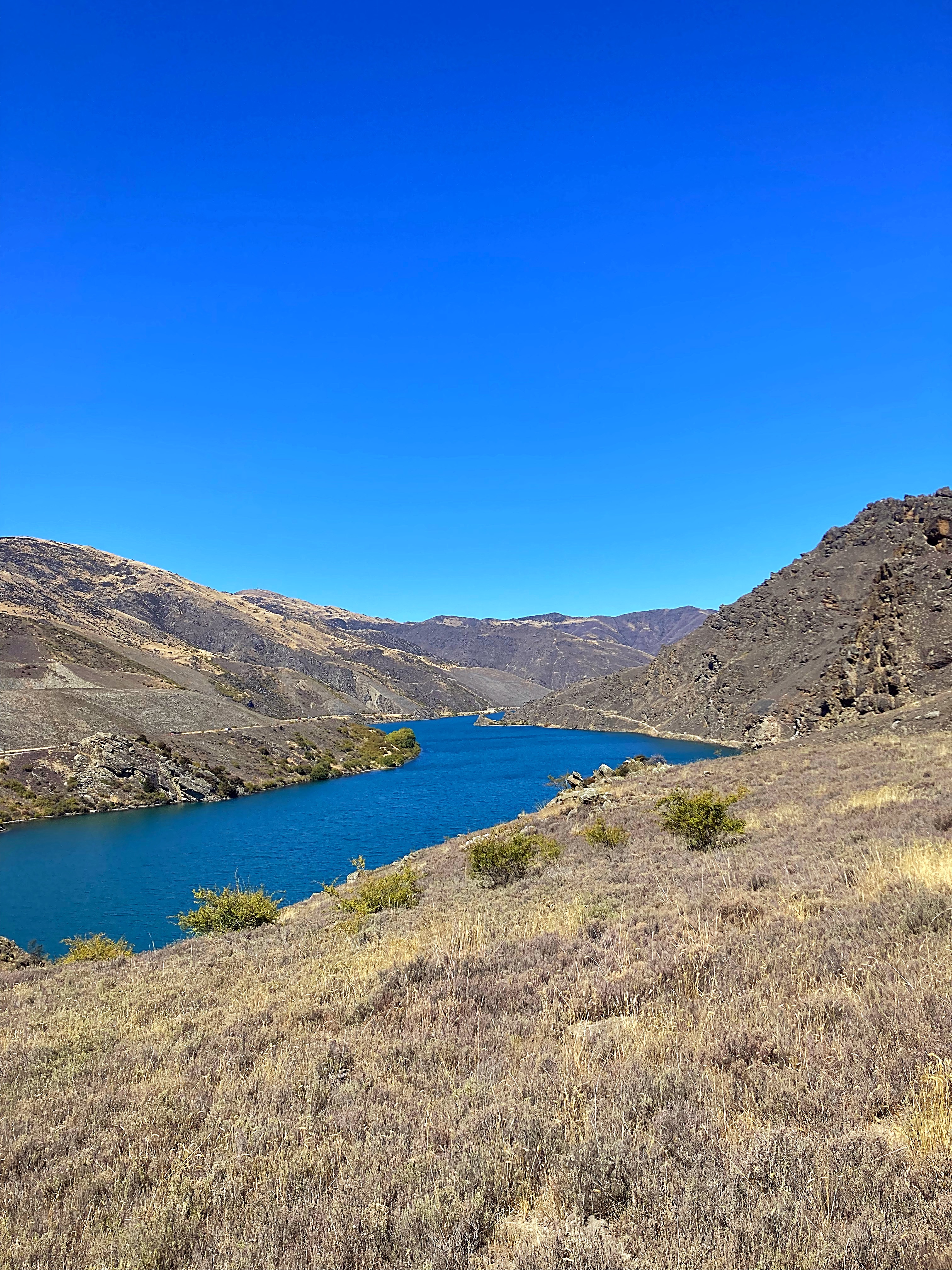
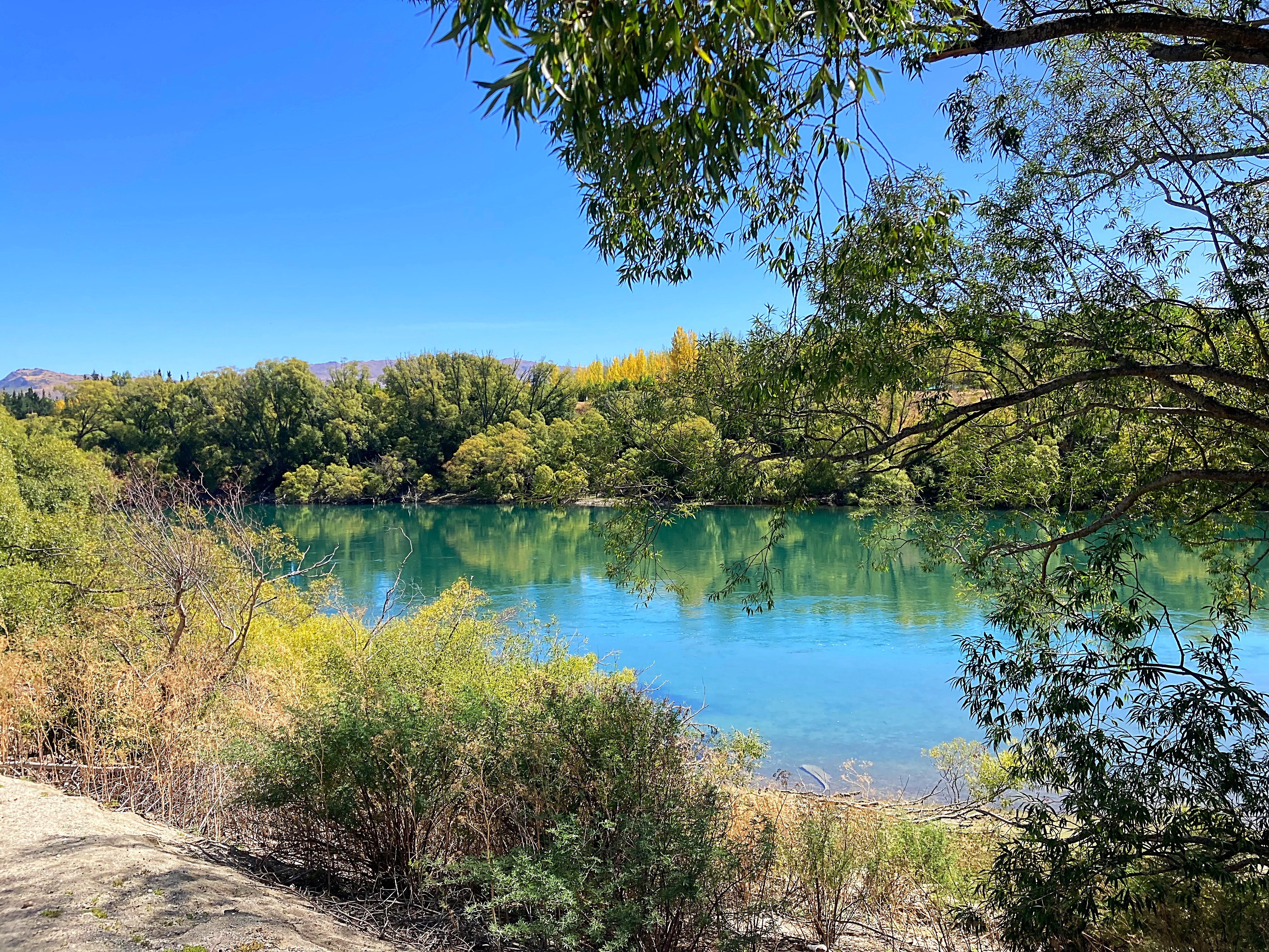
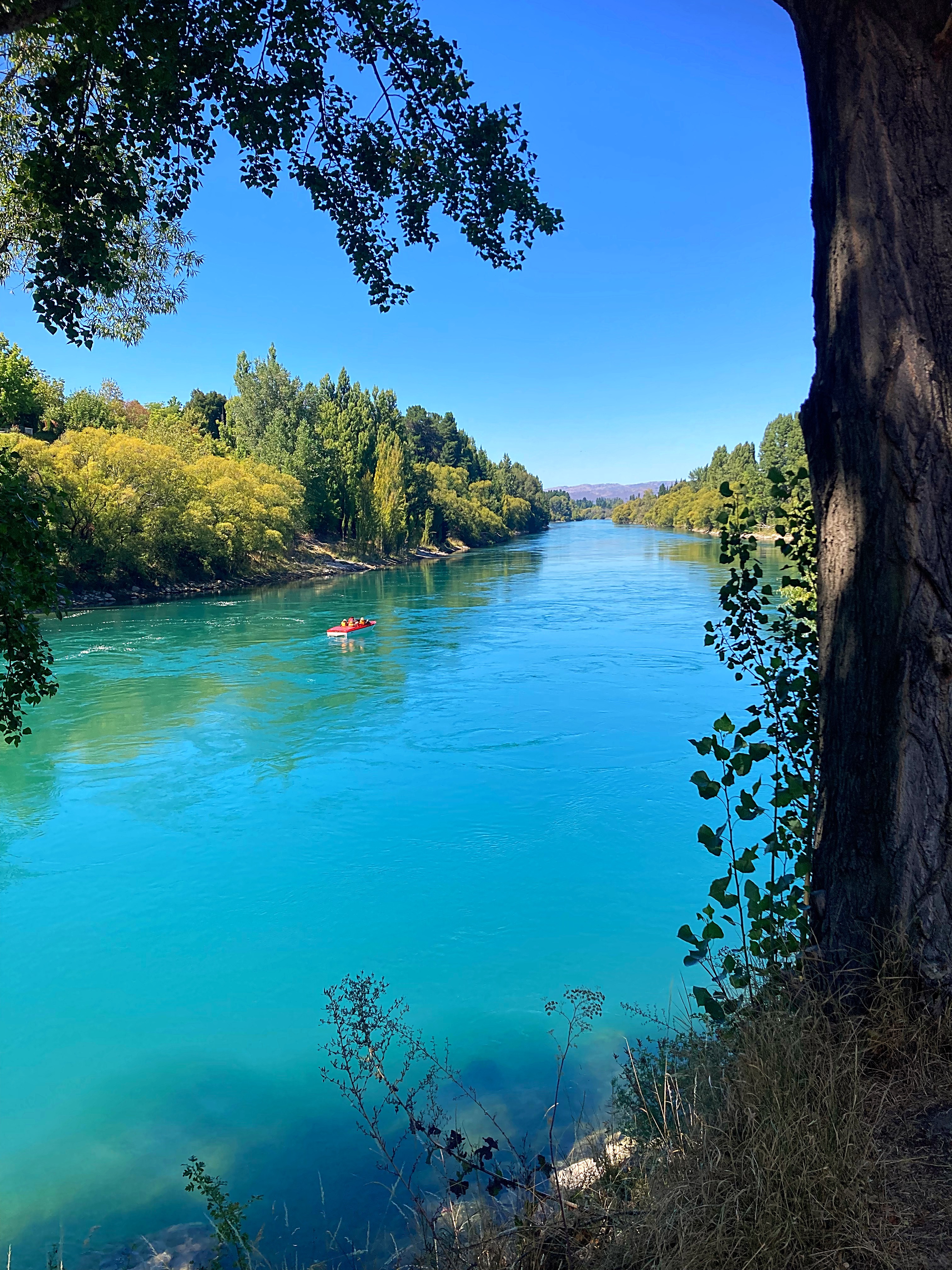
Lake Pukaki is the largest of three roughly parallel alpine lakes running north–south along the northern edge of the Mackenzie Basin on New Zealand’s South Island. The others are Lakes Tekapo and Ōhau. The glacial feed to the lakes gives them a distinctive blue colour, created by glacial flour, the extremely finely ground rock particles from the glaciers.
The lake is now part of the Waitaki hydroelectric scheme. The lake’s original outflow was at its southern end, into the Pukaki River. The outflow has been dammed, and canals carry water from Lake Pukaki and Lake Ōhau through the Ōhau A power station to Lake Ruataniwha.
Pukaki is also fed by the waters of Lake Tekapo, which are diverted through a canal to a power station on Pukaki’s eastern shore (Tekapo B station).
The border collie went up market today with a blue loo
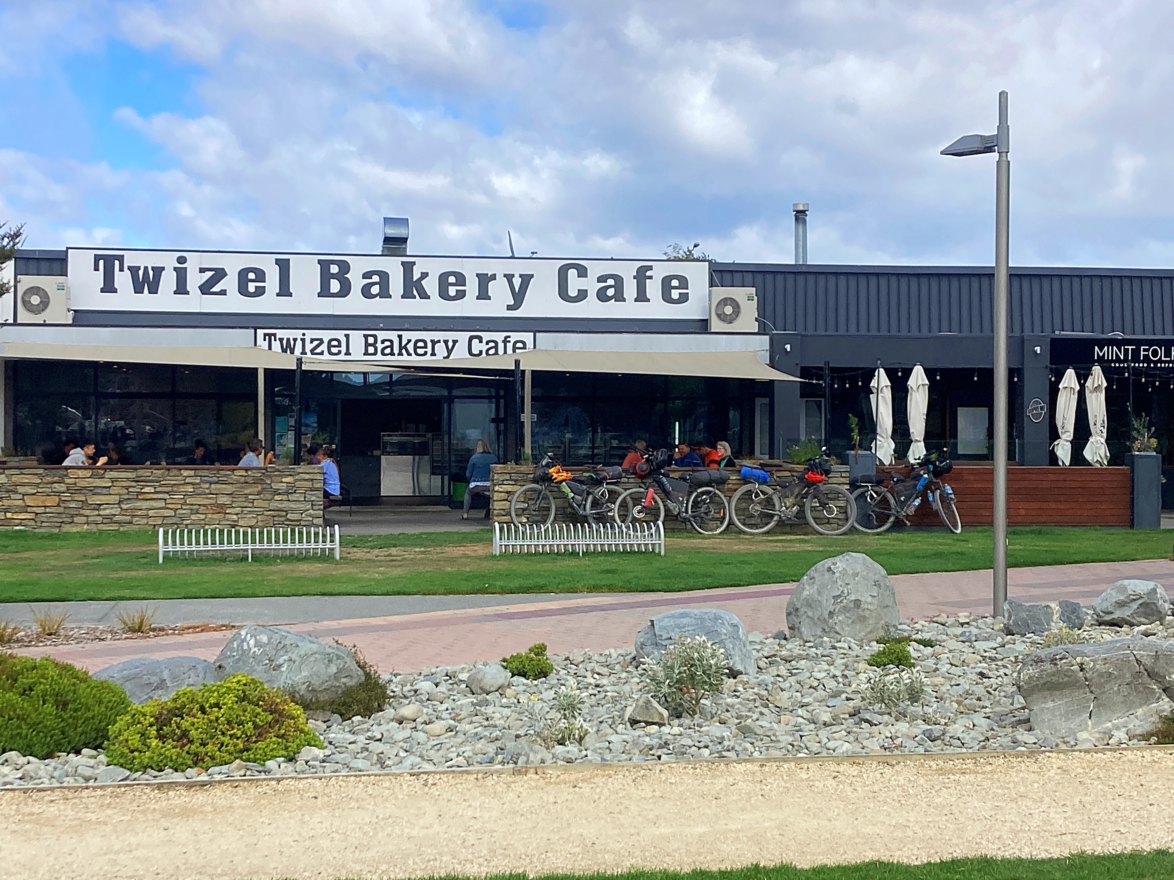
After Lake Pukaki we went cross country to Twizel and enjoyed some tail winds and good fast riding. We had our second breakfast in Twizel – toasted sandwiches all round and of course coffee and hot chocolate.
We followed the Ohau River to Lake Ohau and dropped down to the trail around the lake where it was slightly more sheltered from the wind.
Both Lake Pukaki and Lake Ohau looked like you could surf on them with the waves crashing onto the shoreline.
Third time unlucky with the final 10 kilometres into Lake Ohau Lodge – I’ve had a head wind every time I’ve ridden that road.
We then started the ascent up the Tarnbrae Track – high point 900 metres. We did actually have a bit of a tailwind up there but didn’t enjoy the rough track so much near the top. In fact, Crammers was so over it, poor smurfy was thrown off the bike
We met up with some friends / trail angels of the boys at the bottom of the track – Andrew & Barbara. Barbara had made us blackberry and white chocolate muffins – yummy ( we have extras for tomorrow too – very spoilt). They rode back to Omarama with us and joined us for dinner at the pub.
We will all sleep well again tonight.
20 February 2024
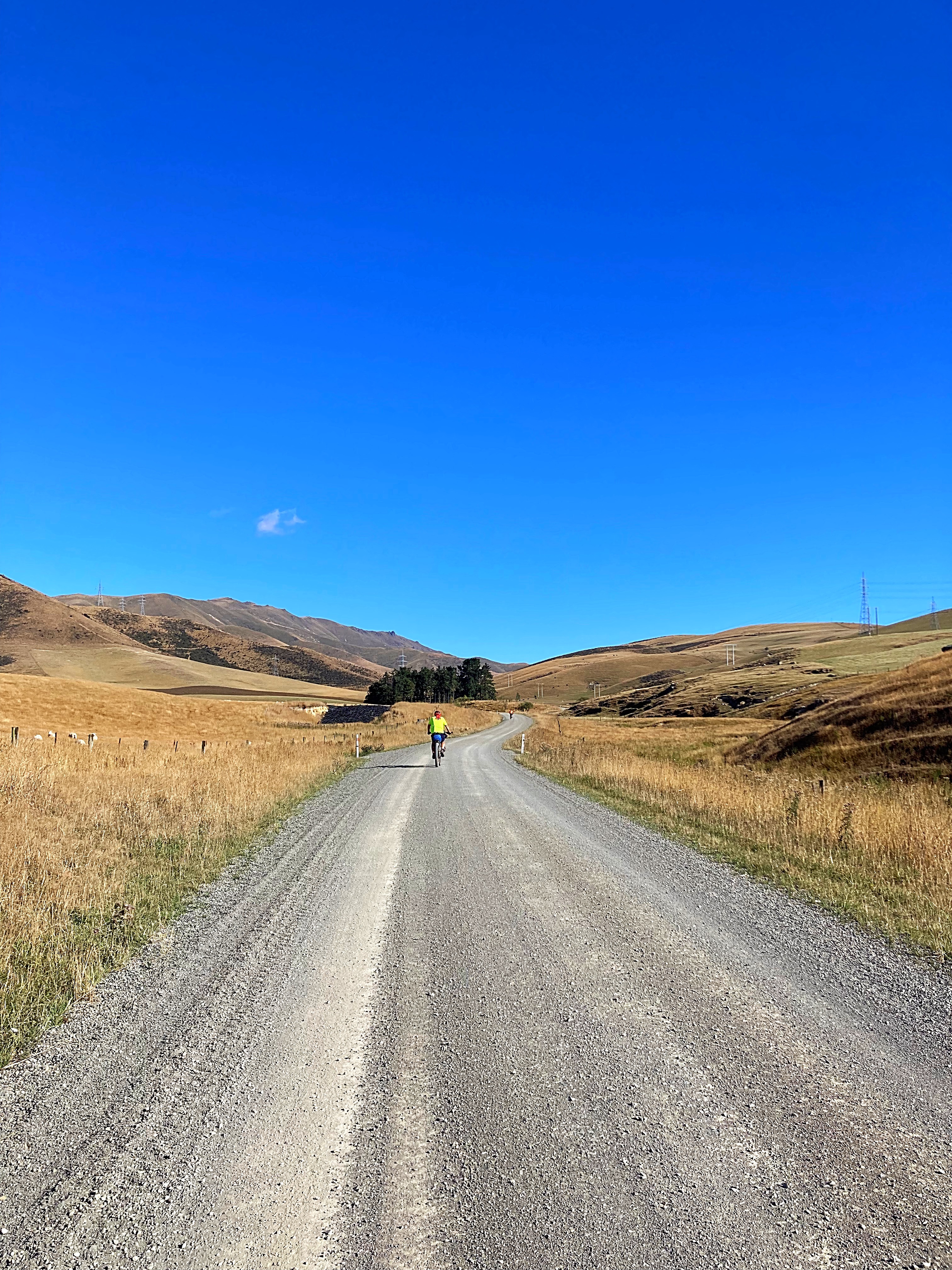
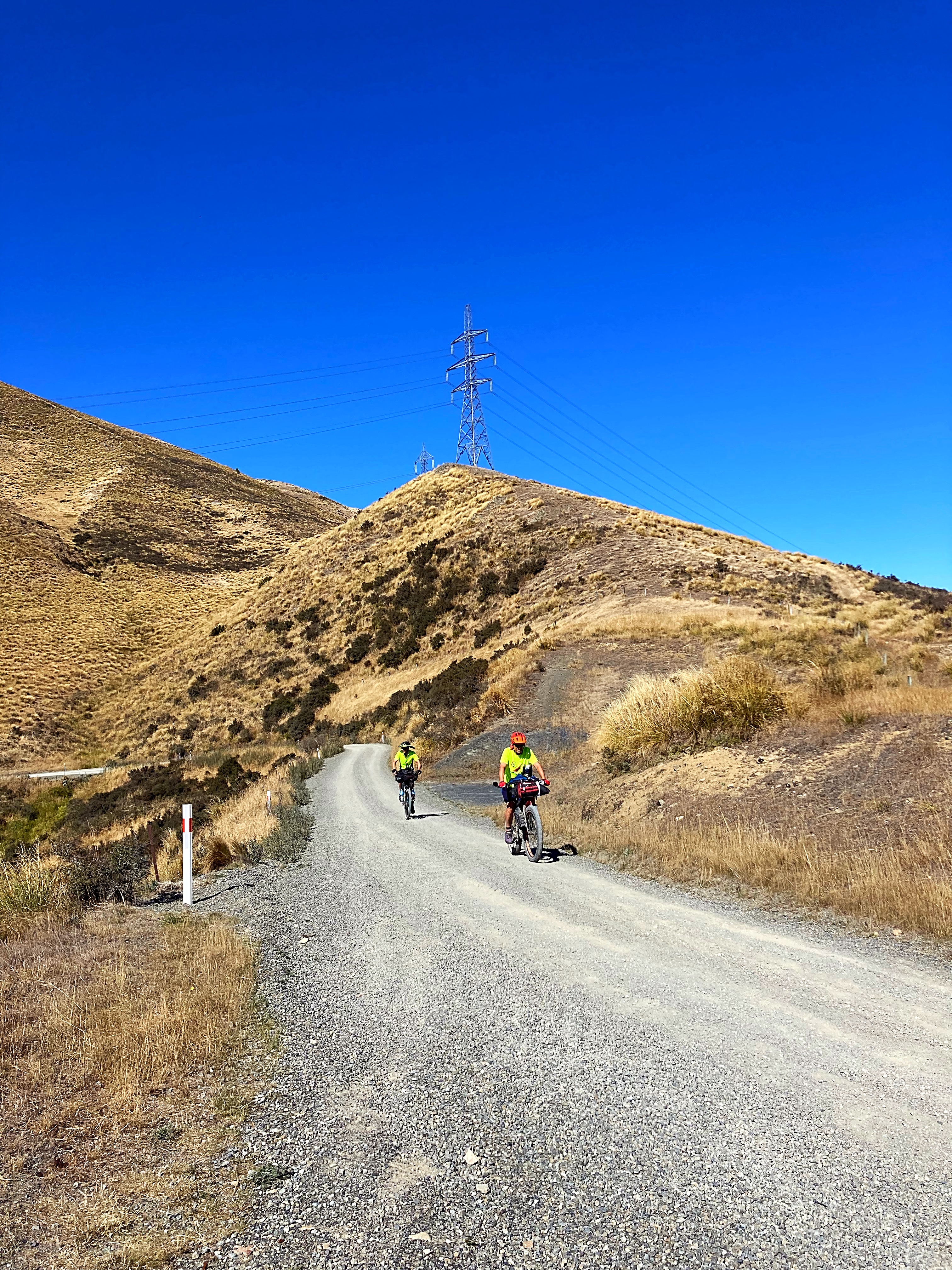
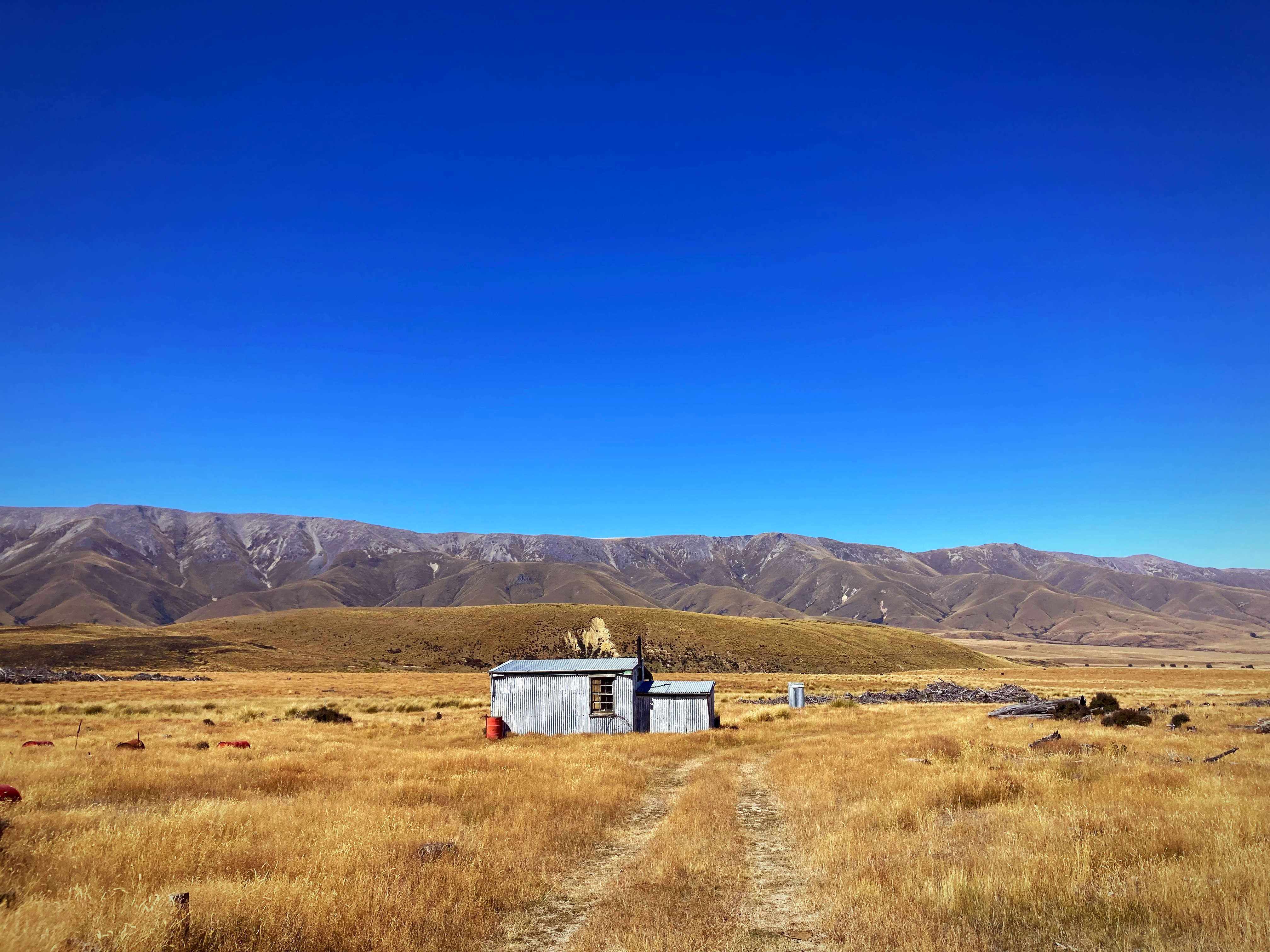
Day 9 – Omarama to Oturehua 81km 1157 metres climbed
We woke to what felt like a winters morning and it’s supposed to be summer wouldn’t want to be here when it was really winter .
We had all the layers on when we left Omarama – the temperature fluctuated between 1 and 5 degrees and everything was numb. We were chasing the sun but even when we found that, it didn’t help much.
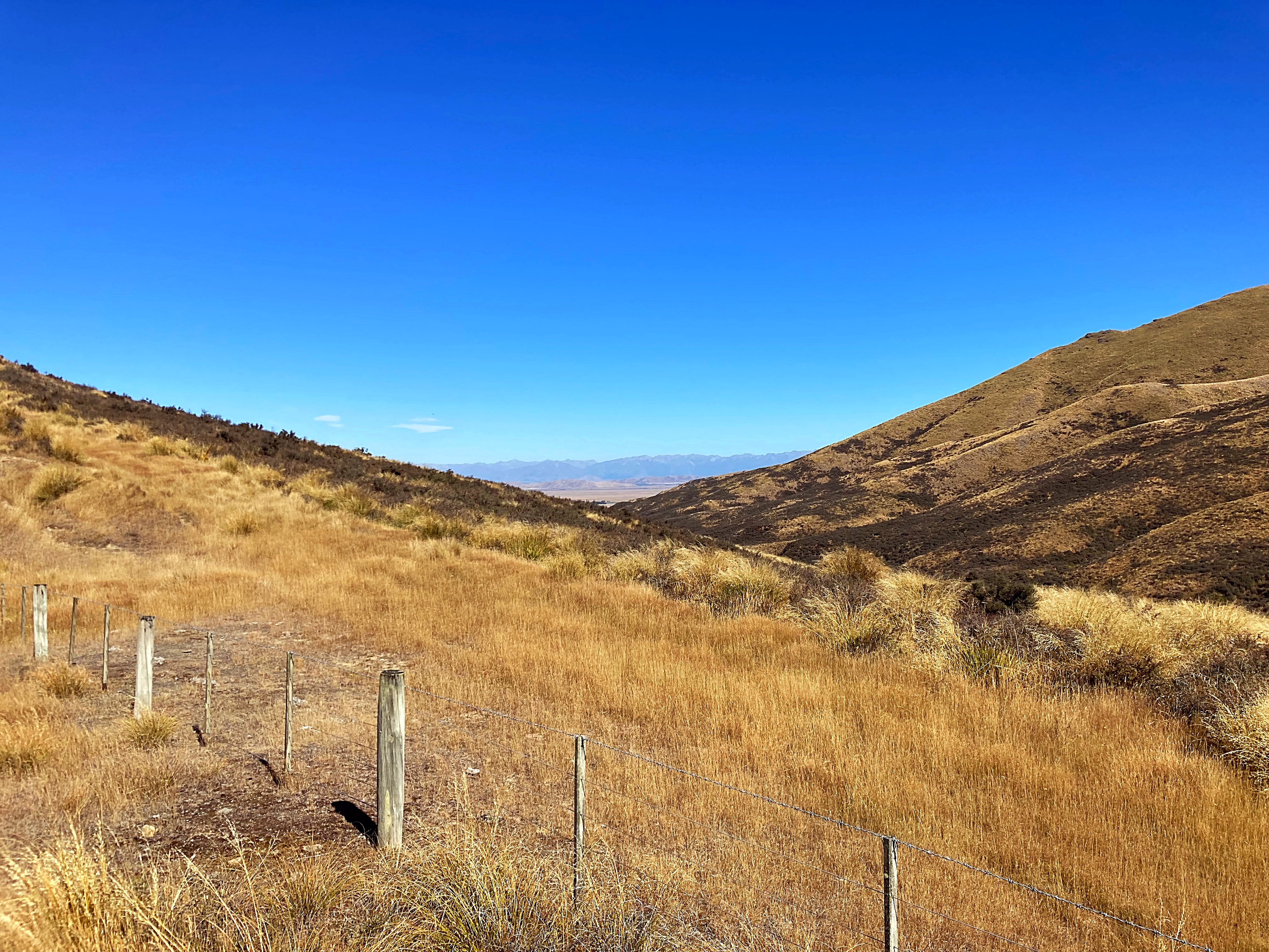
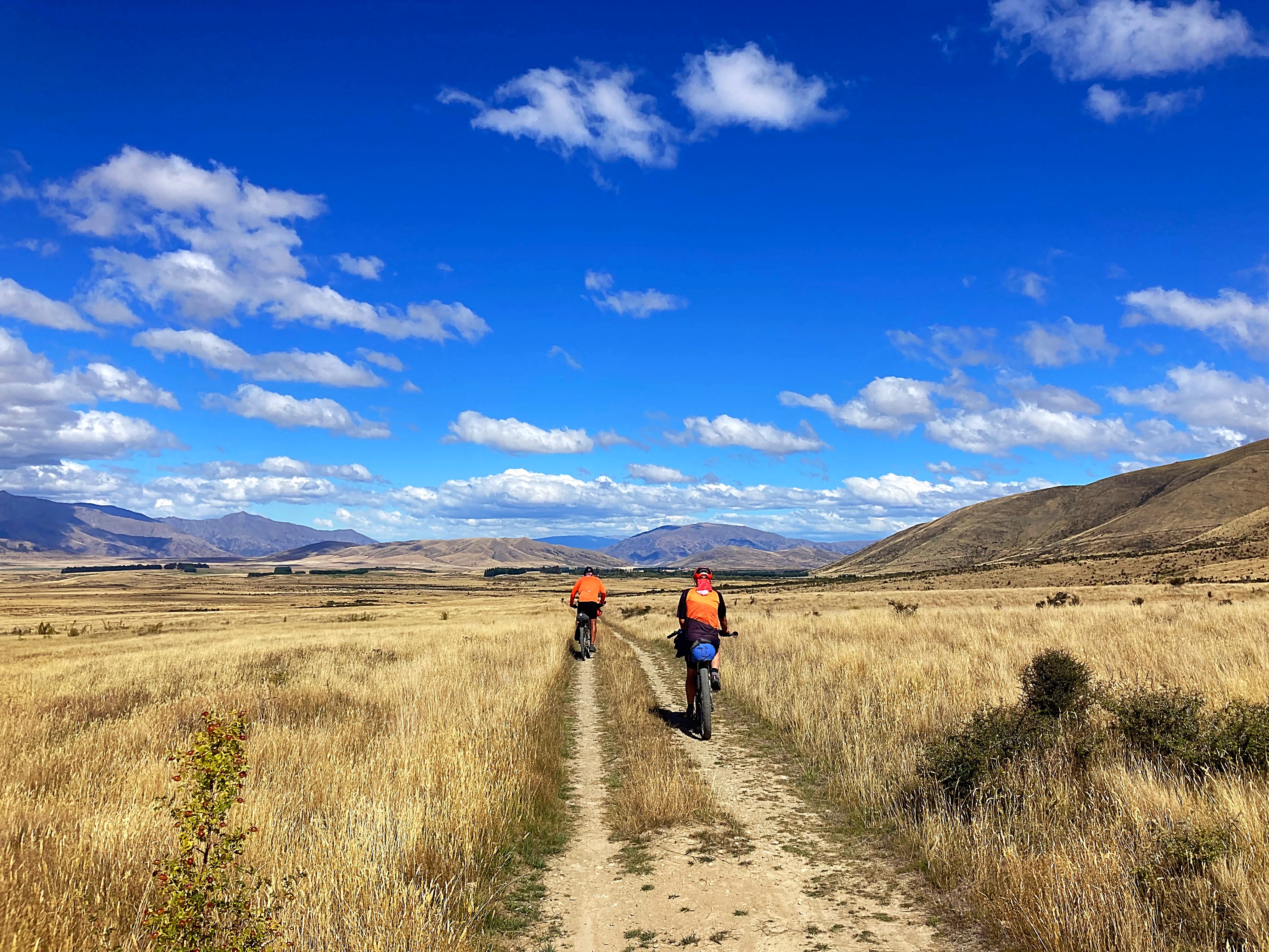
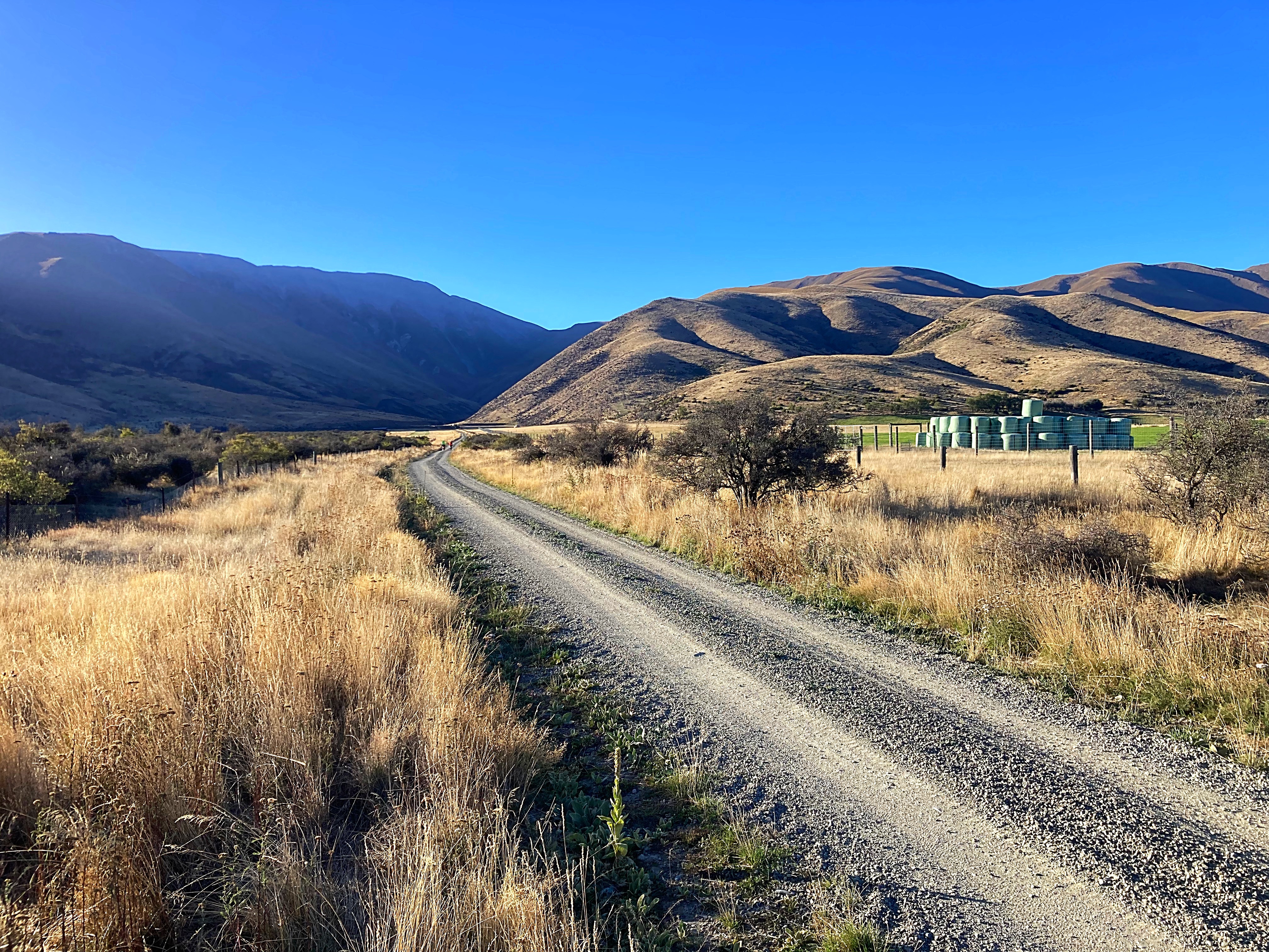
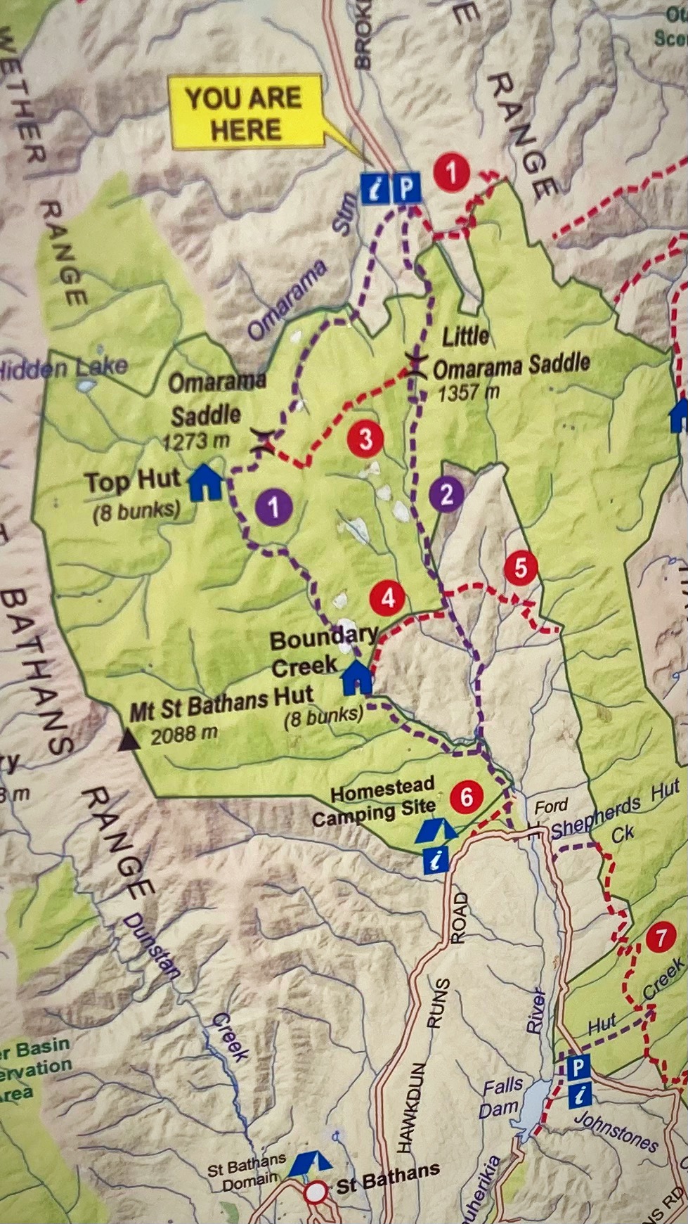
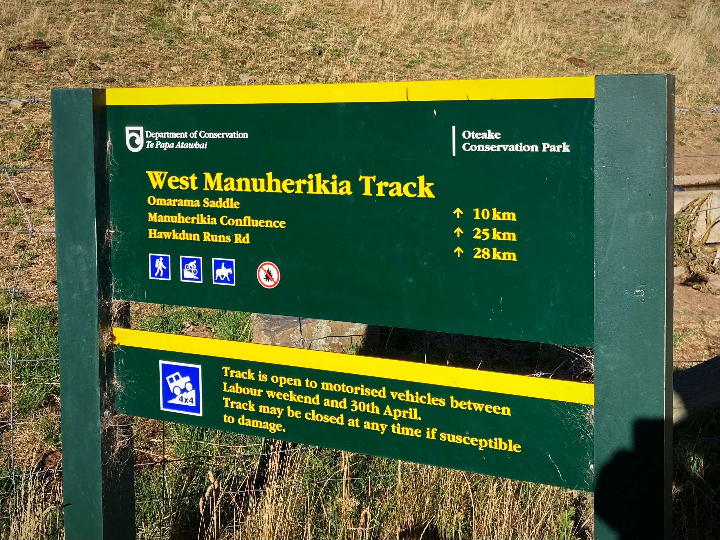
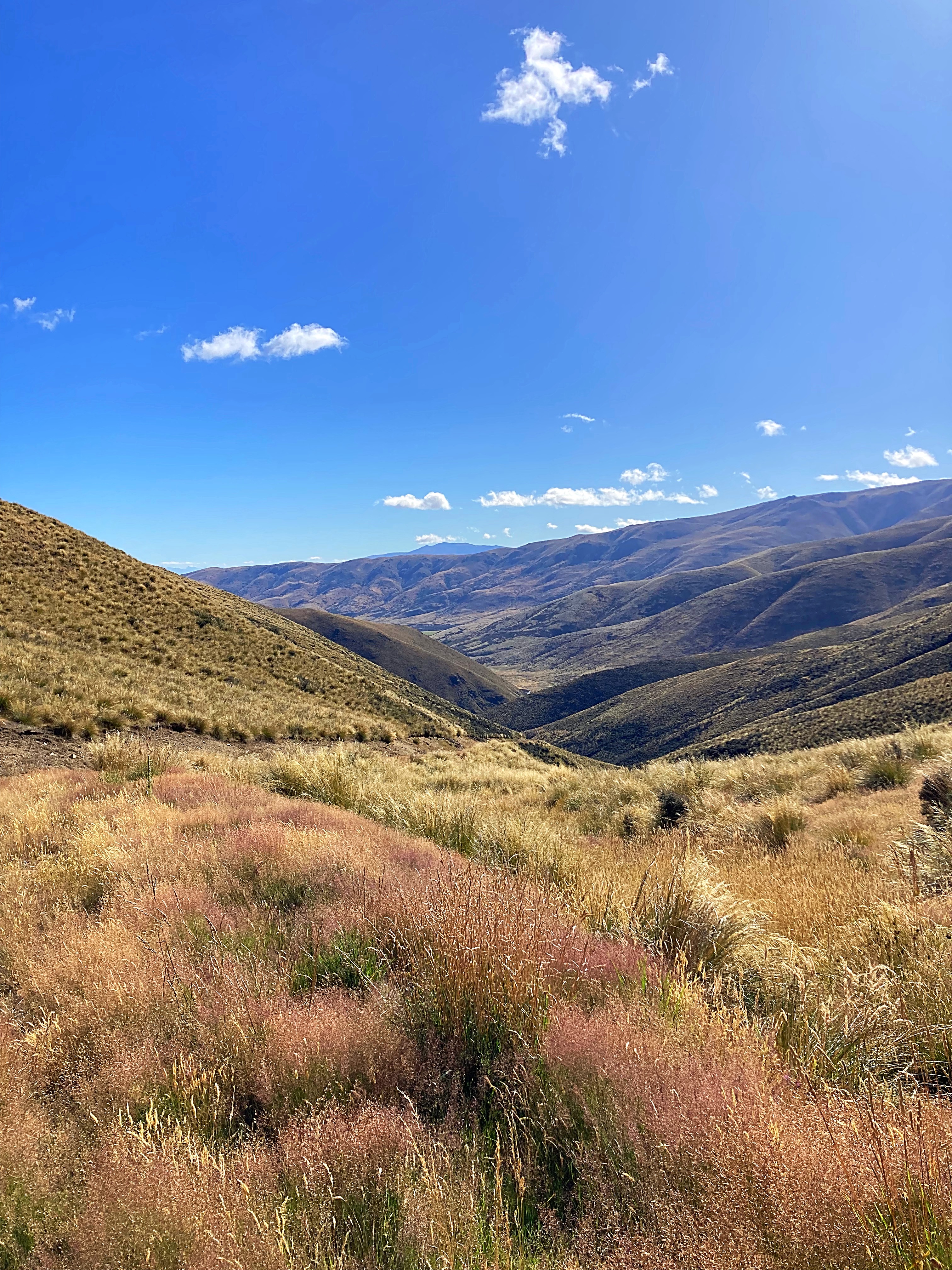
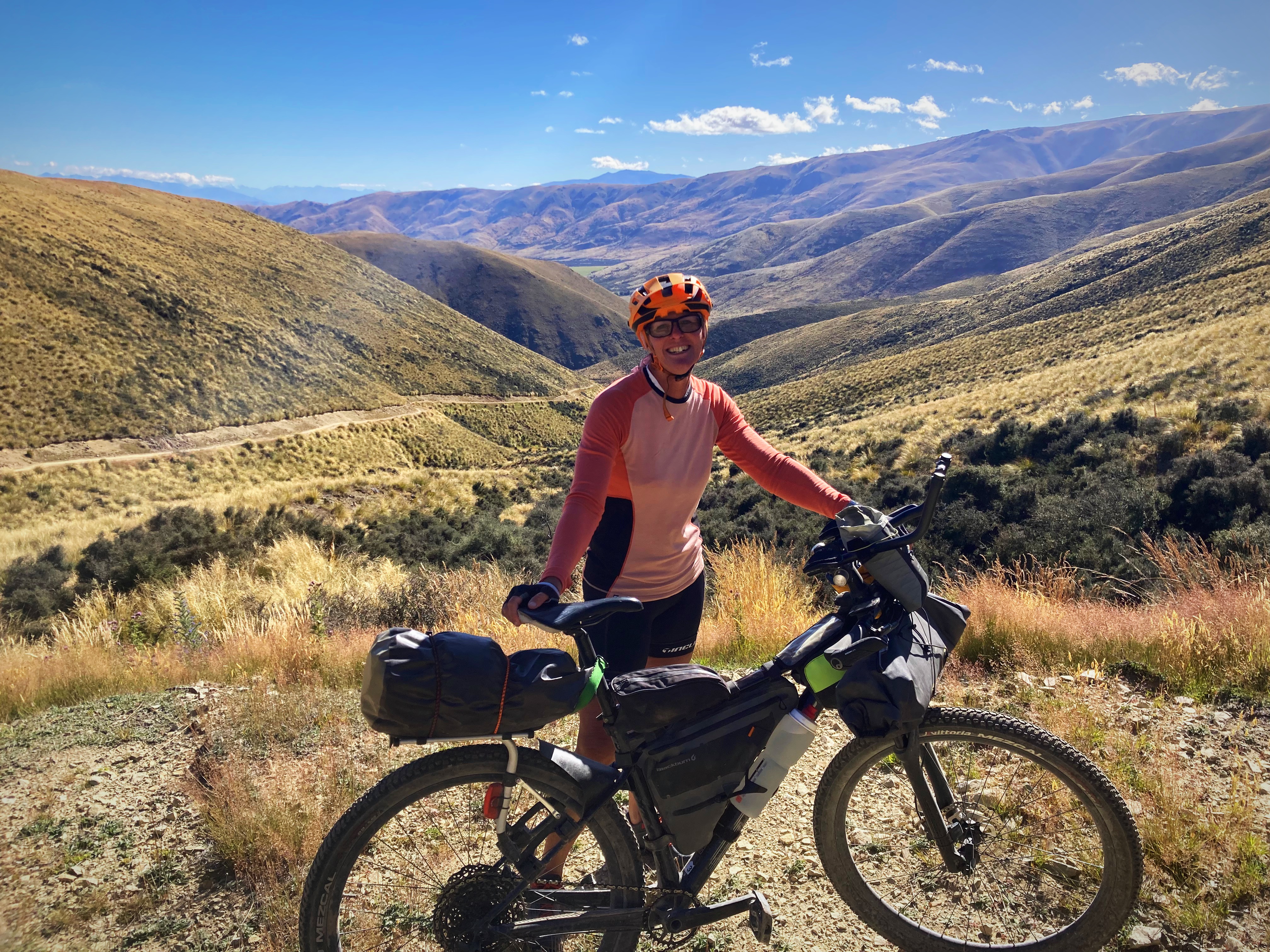
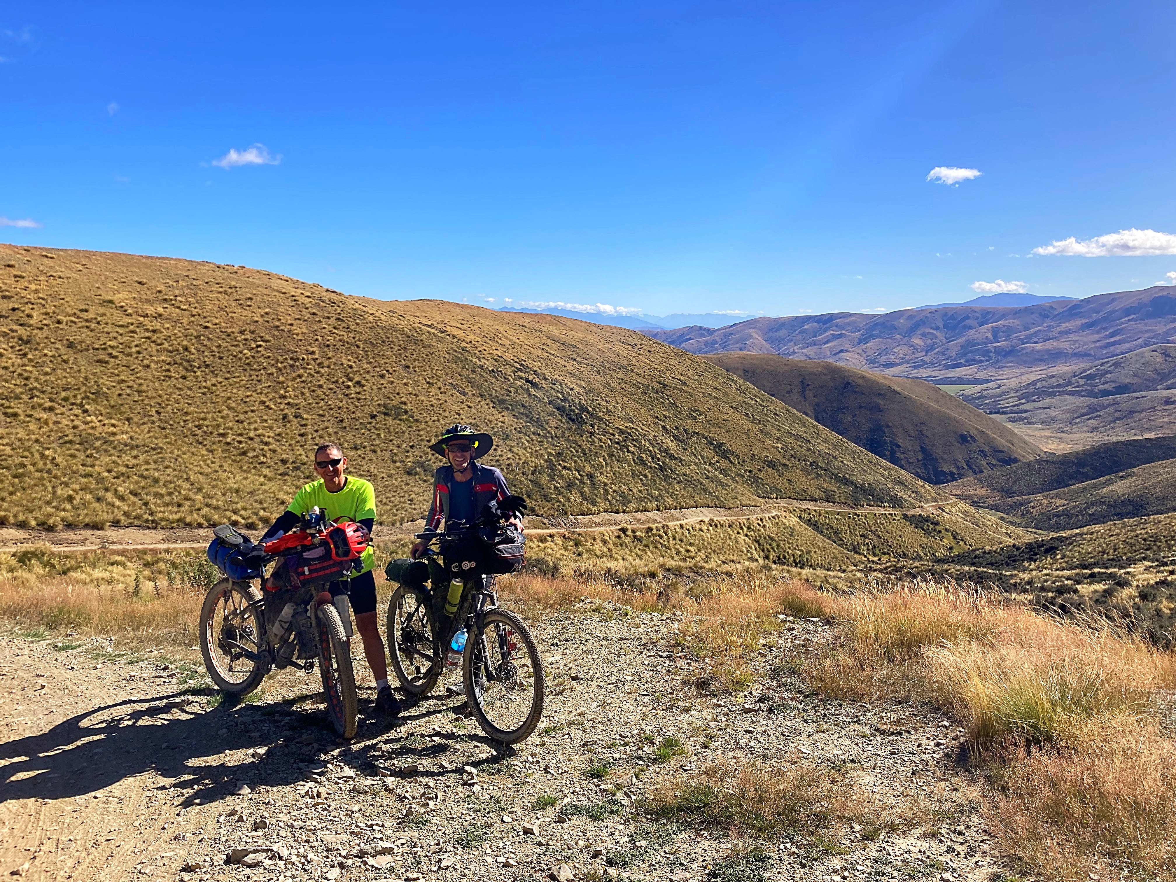
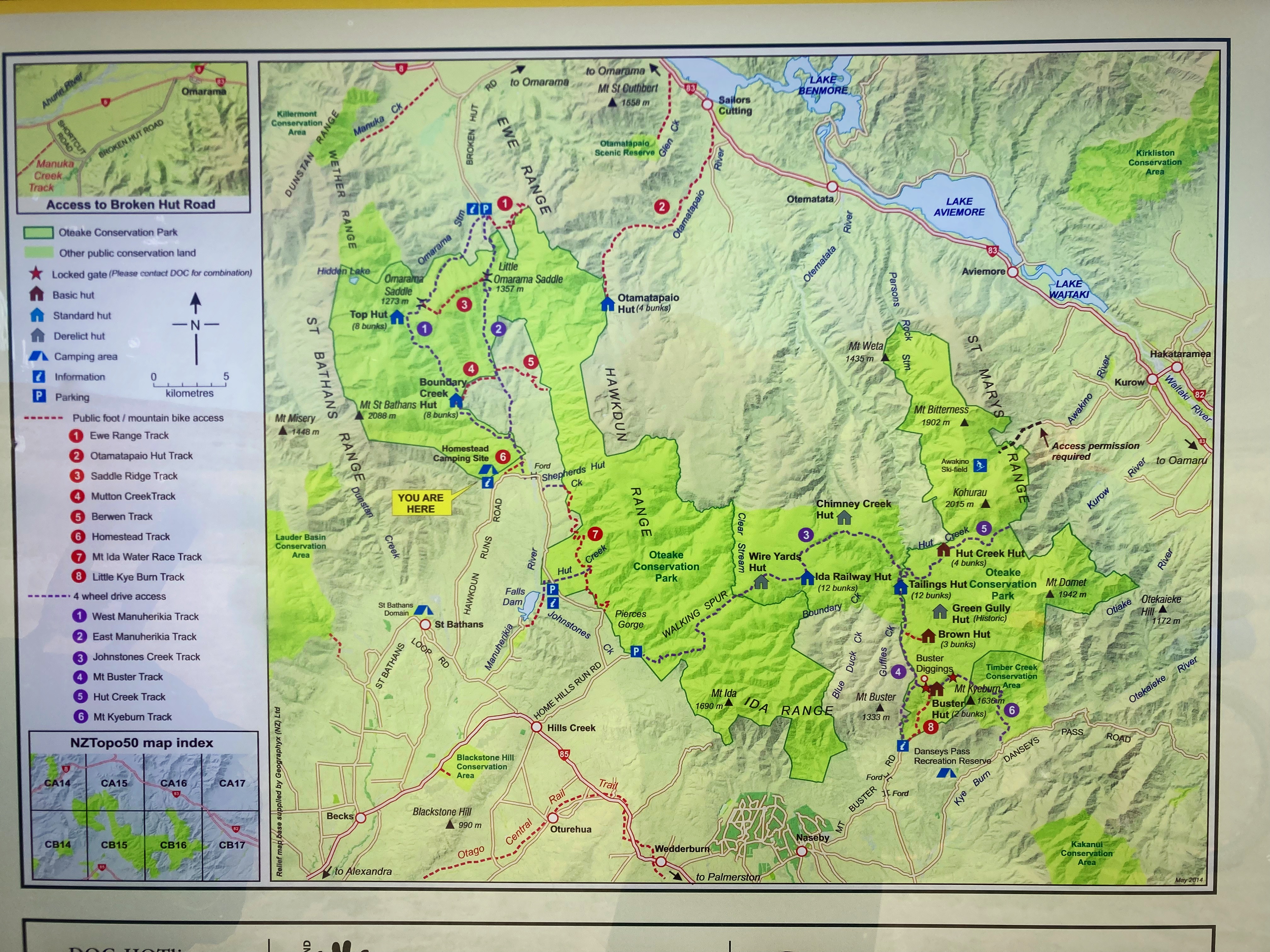
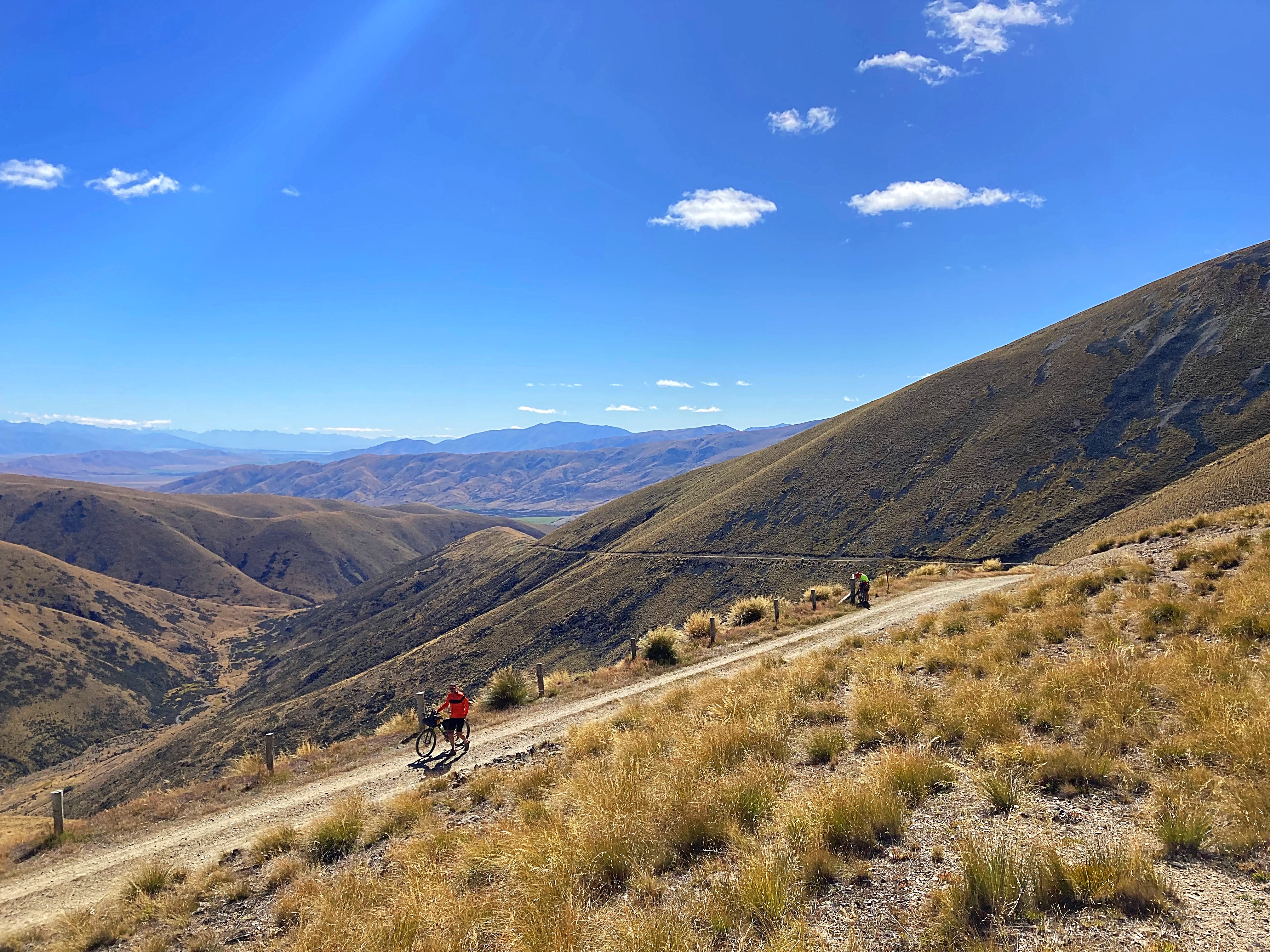
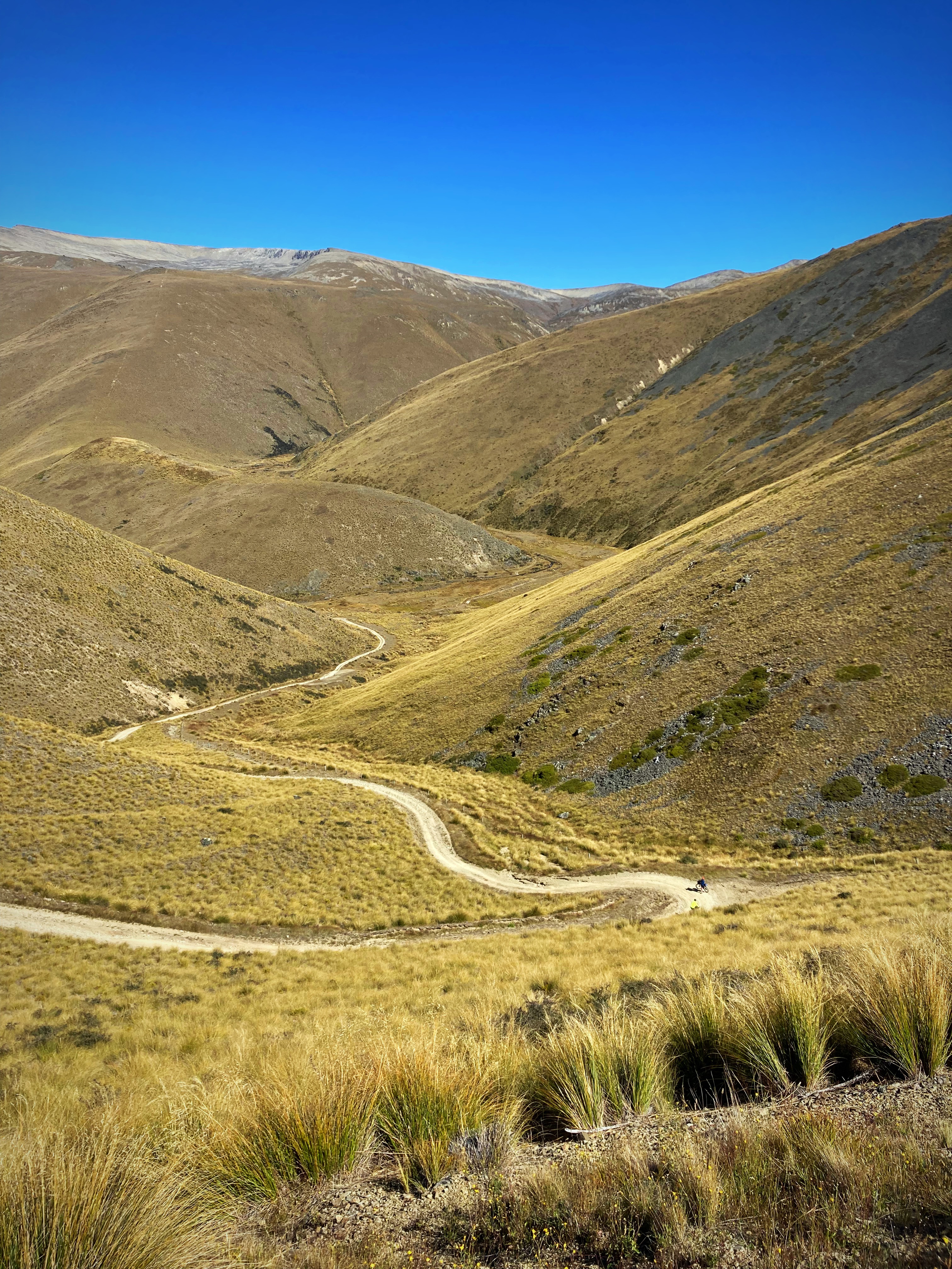
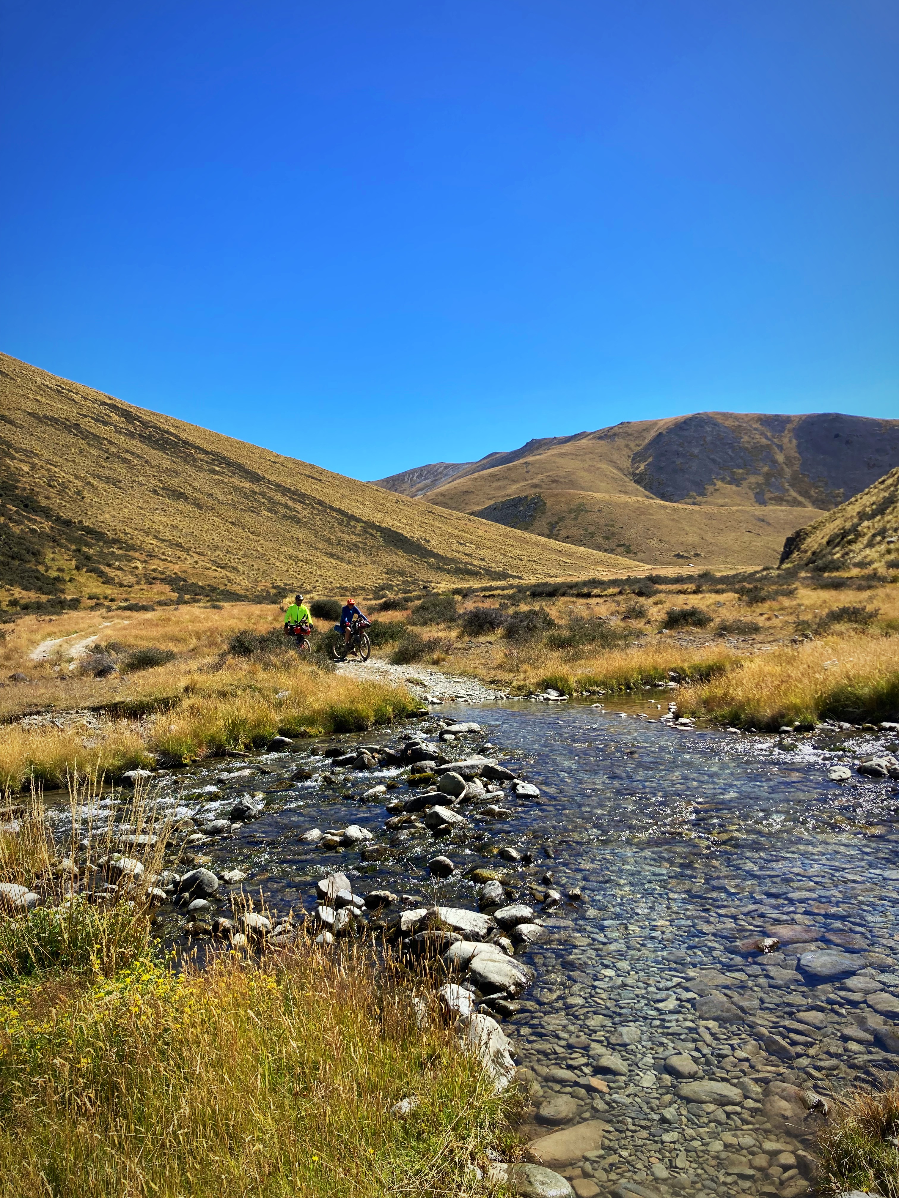
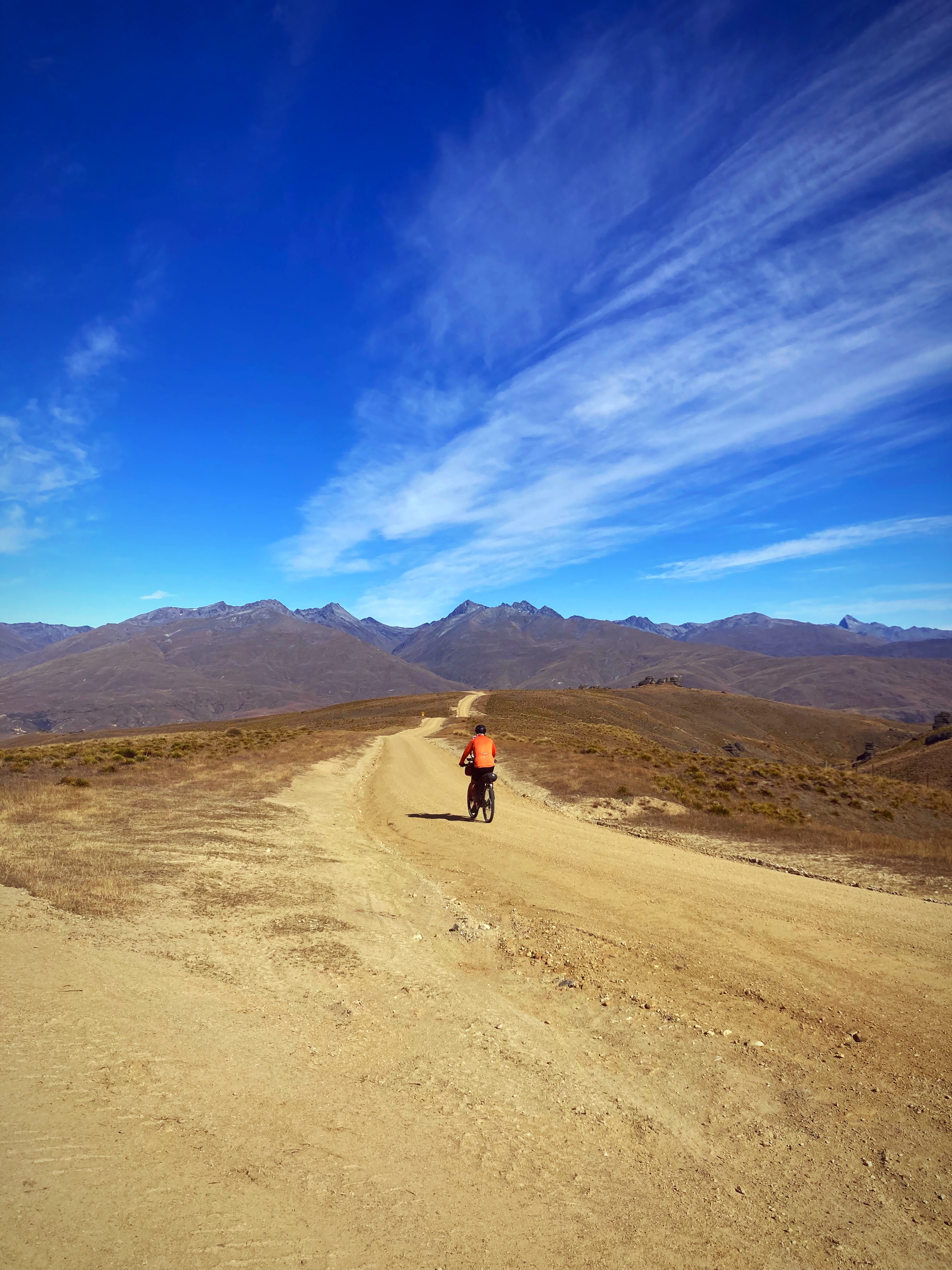
We had a 20 kilometre gradual climb up to the start of the West Manuherikia Track where we would start our climb over the Omarama Saddle.
Five kilometres in and the climb and track surface took a nasty turn. Hike a bike kicked in – it took us about two hours to go 9 kilometres.
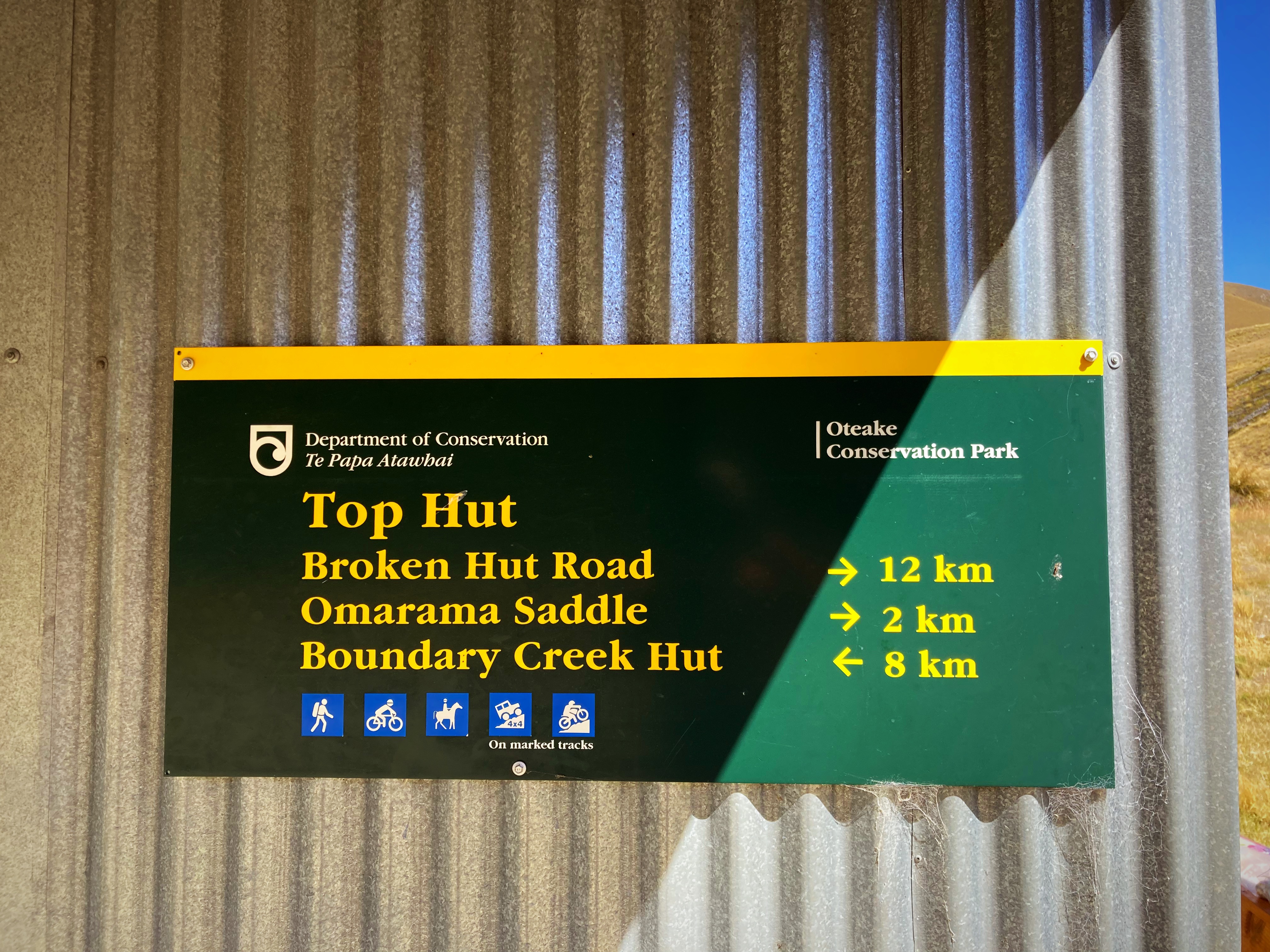
It was a welcome relief to reach the saddle at 1250 metres but when we saw what the downhill track looked like that relief disappeared fast.
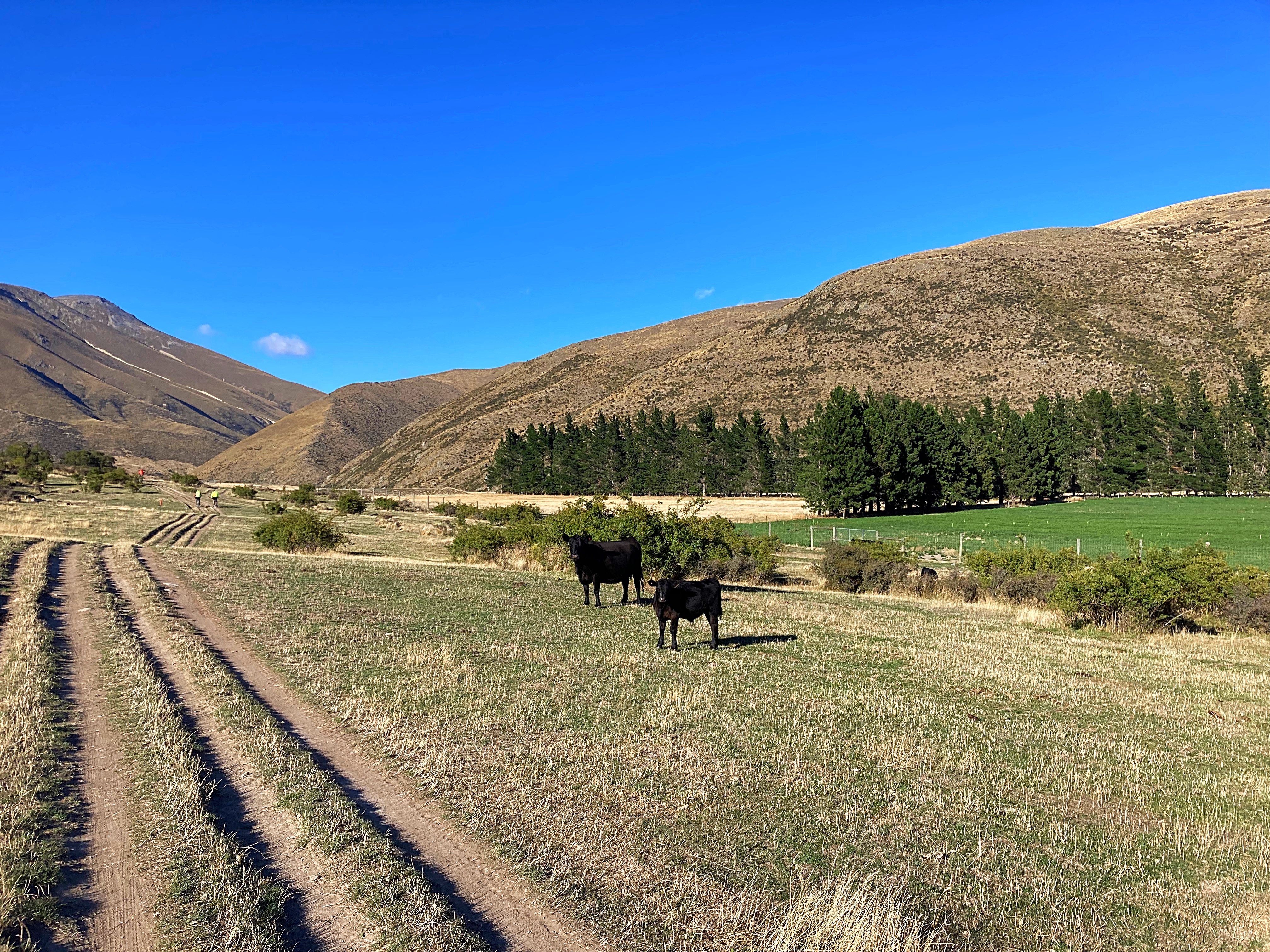
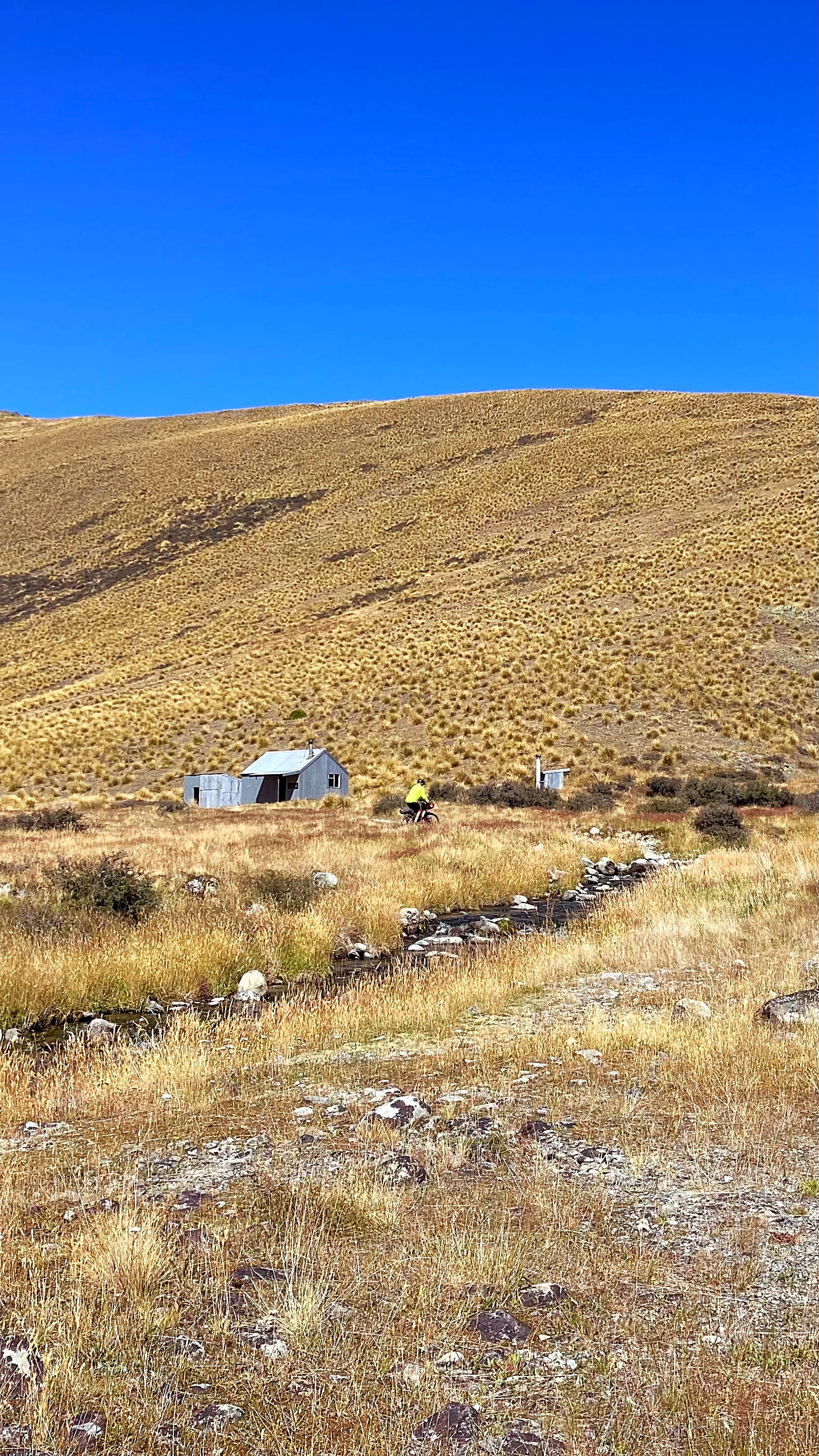
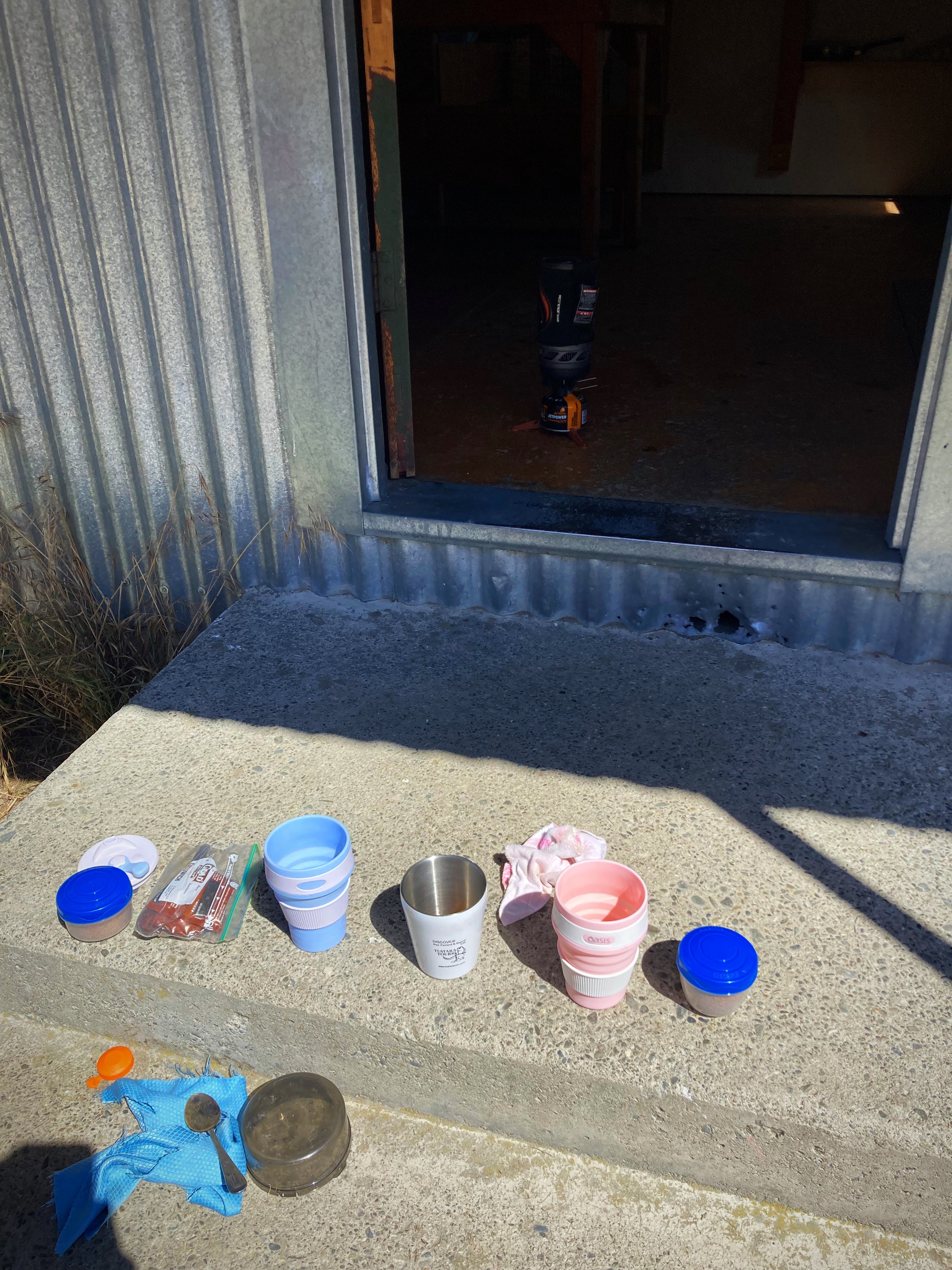
We slowly made our way down to the first hut (Top Hut) where we had lunch – even fired the jet boil up for coffee. We had crossed two fords by this stage – thirty to go
We lost count of how many fords we crossed but the guidebook says 30. Captain & Mrs Cautious walked anything that looked remotely deep but Crammers and the Young One attempted most of them with a very high strike rate. Put it this way, the only thing that got wet was our shoes and socks. The deepest ford was just above mid calf.
Once we left the track, we were on gravel roads all the way to Oturehua getting in at 5.45pm. Another big day out in big and remote country. Although it was challenging, it was a challenge I enjoyed. Doing it with like minded people who love a laugh also helps. Absolutely beautiful scenery and a pretty perfect day to do it – the winds had shifted from a nor wester yesterday to a southerly which was pretty mild.
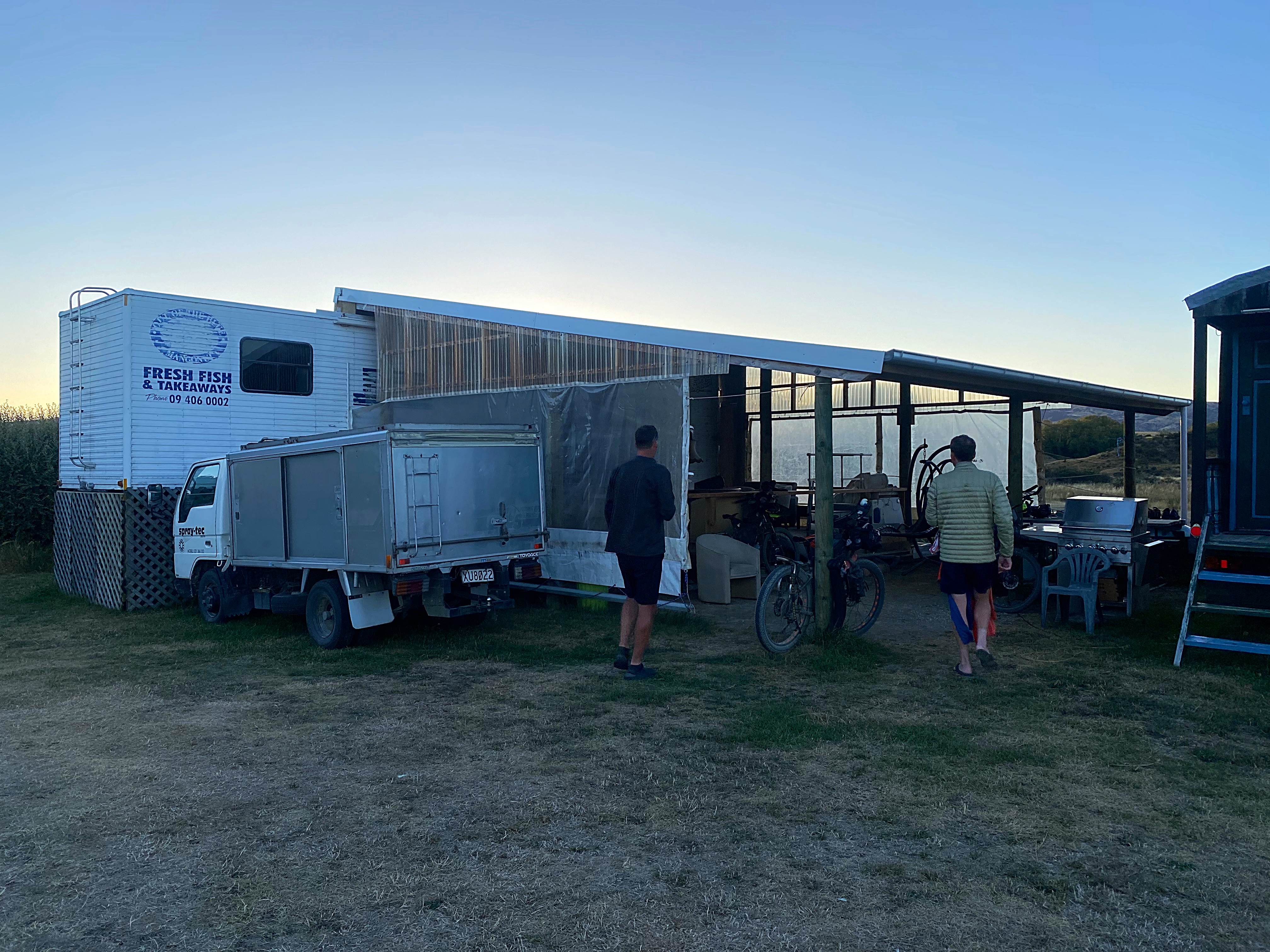
We’re staying at Crows Nest Accommodation in a converted transporter. Very quirky but it will do the trick.
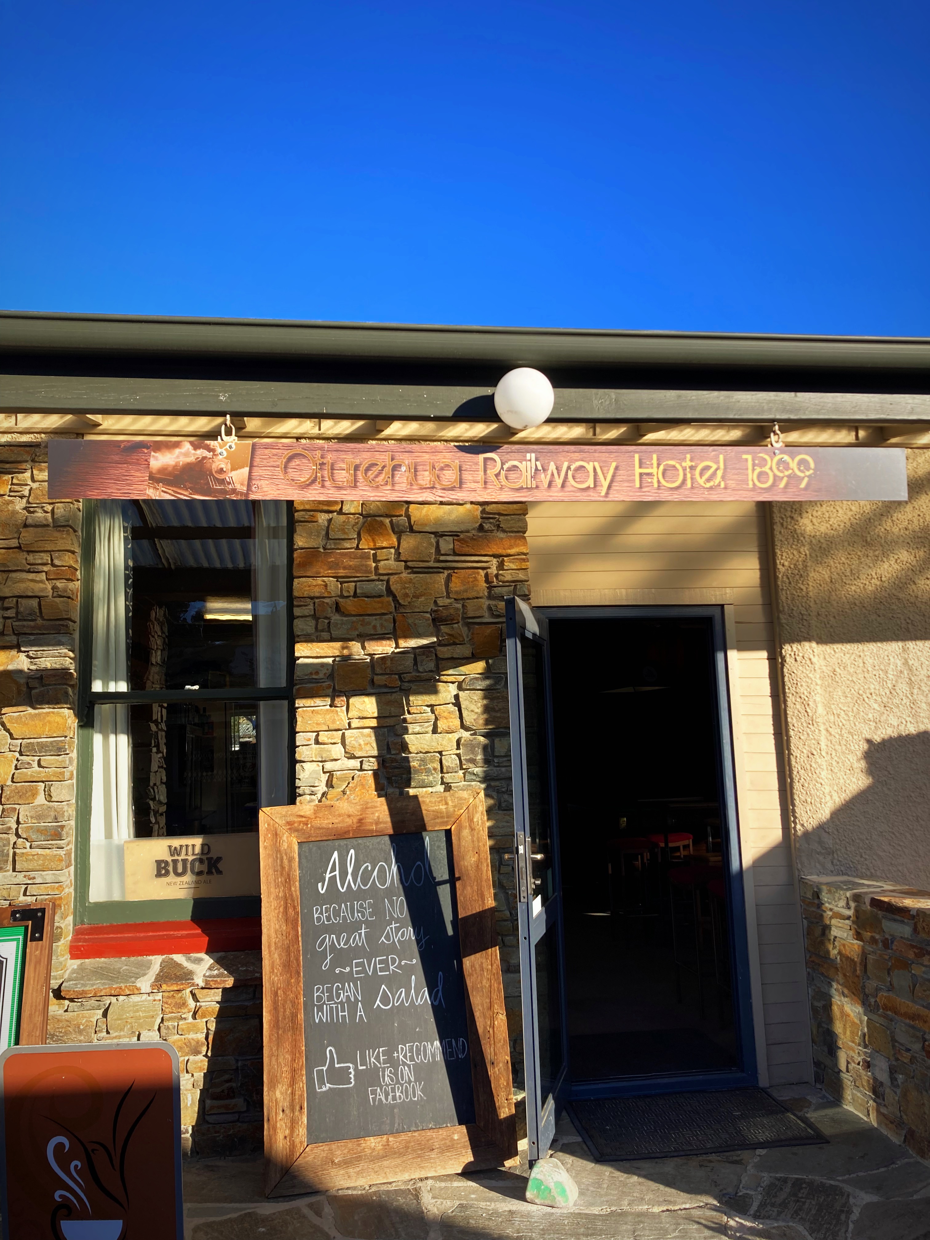
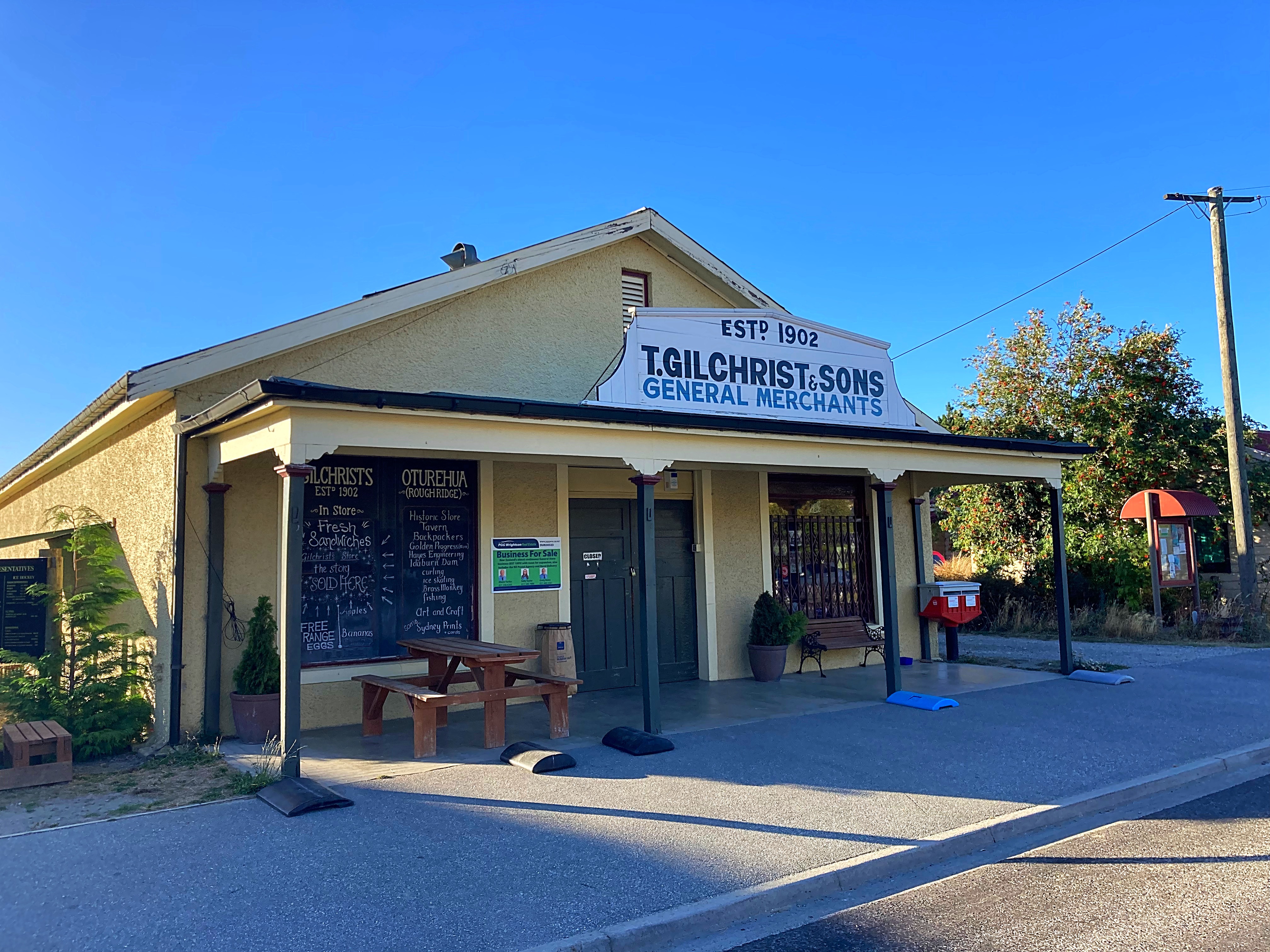
We had dinner at the Oturehua Railway Hotel which has been around since 1899. The food and hospitality were great. Just across the road is Gilchrists Store which is the longest running store in New Zealand.
21 February 2024
Day 10 – Oturehua to Cromwell113km 715 metres climbed
Another freezing start to the day with a 2 degree temperature dropping to minus 1. Everything was numb but once we got into the sunshine things did improve slightly.
The first 60 kilometres of today’s ride was along the Central Otago Rail Trail (CORT) from Oturehua to Alexandra. The CORT bike trail was the inaugural bike trail in NZ and is iconic, showcasing the beautiful central Otago scenery.
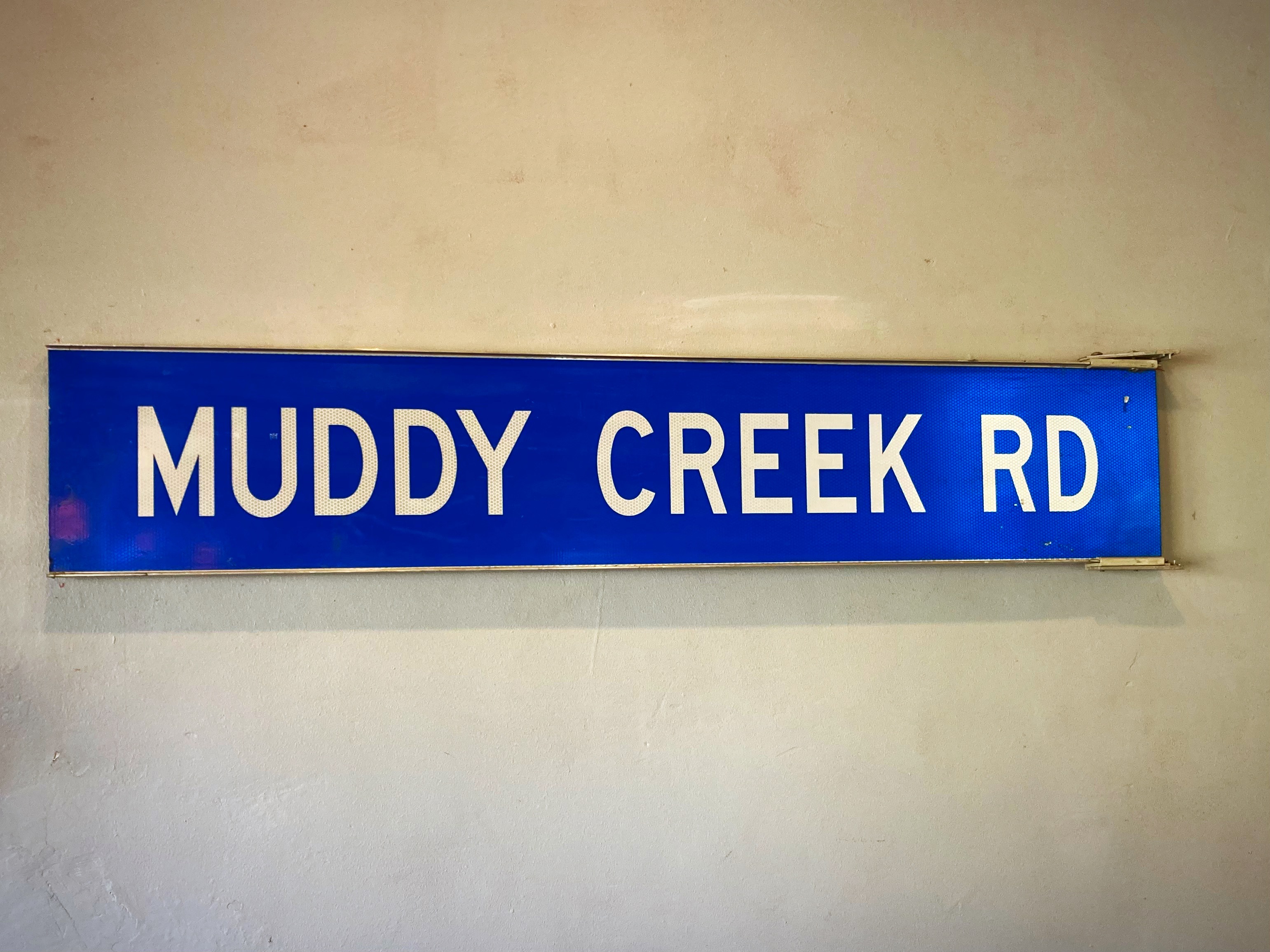
We stopped in Omakau for our second breakfast at the Muddy Creek cafe – amazing what a good coffee can do. Onwards to Alexandra where we enjoyed our second coffee of the day.
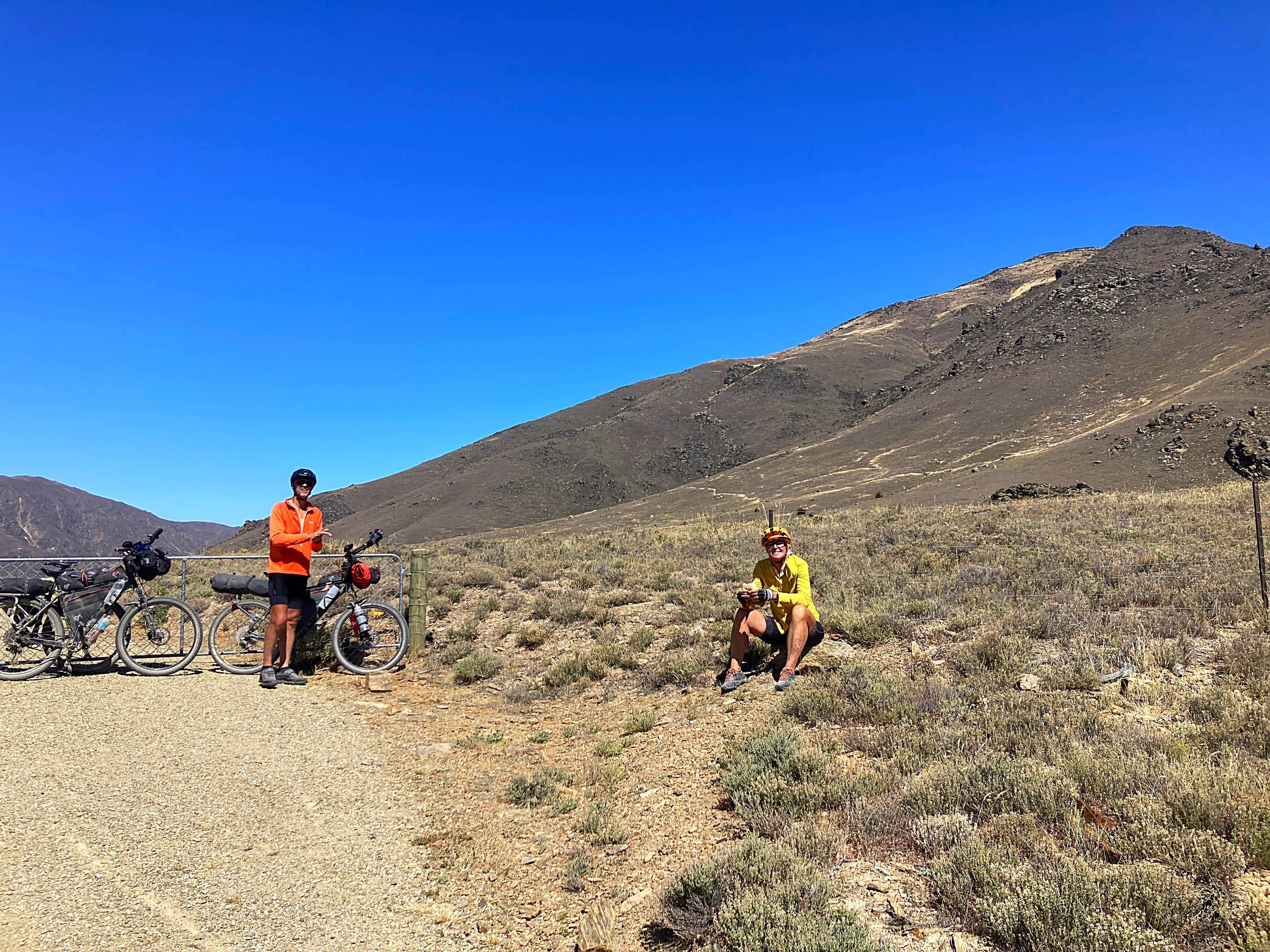
Unfortunately, we left Crammers in Alexandra to be evacuated out by his friend Paul. He’s running on one cylinder which is not ideal when you’re heading into remote locations. Lambers & Crammers / Dilly & Dally are taking a temporary hiatus.
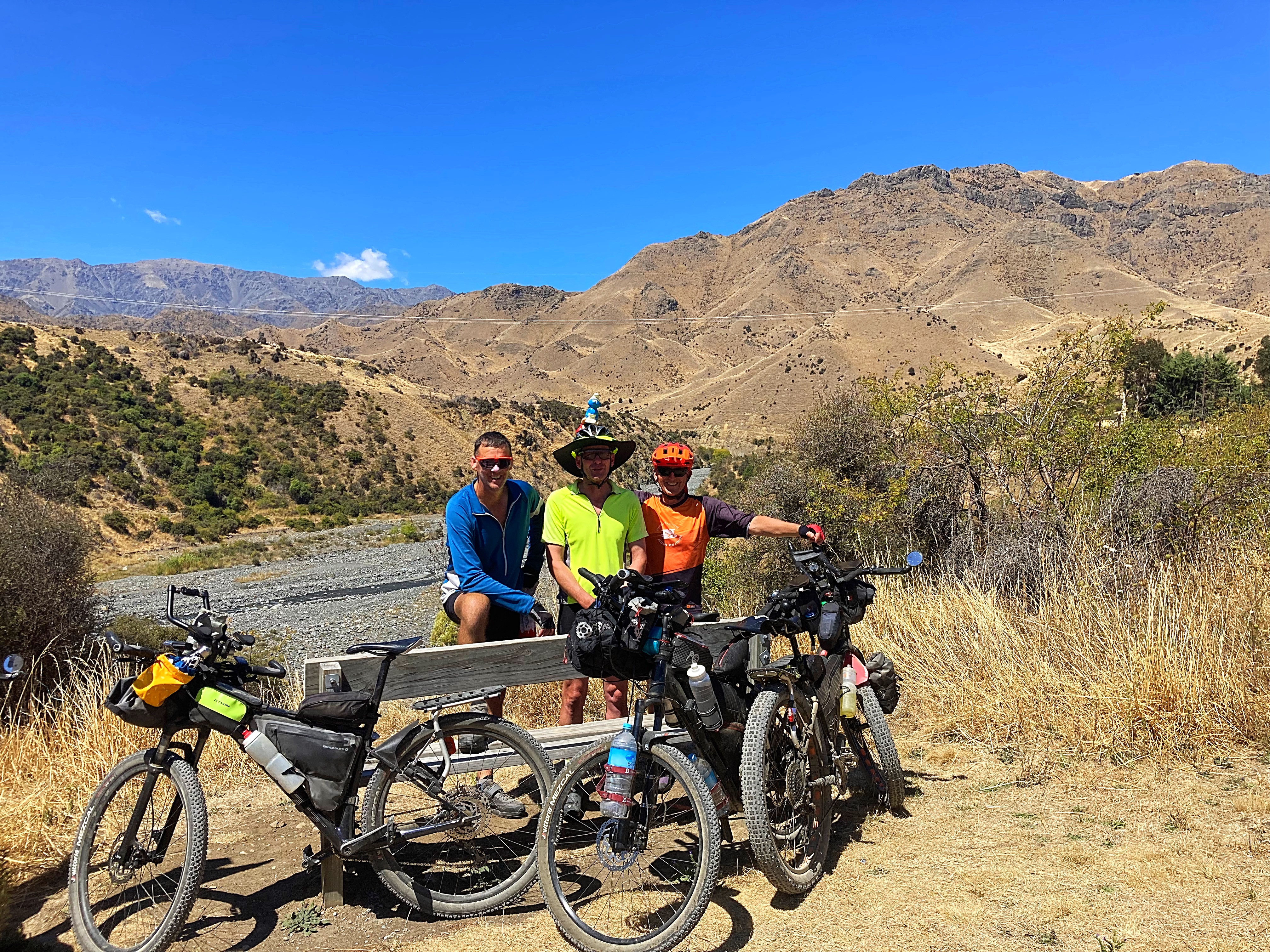
Smurfy is carrying on the journey though on my handlebars now. He survived his couple of photo shoots today and is safely tucked up in my helmet for the night
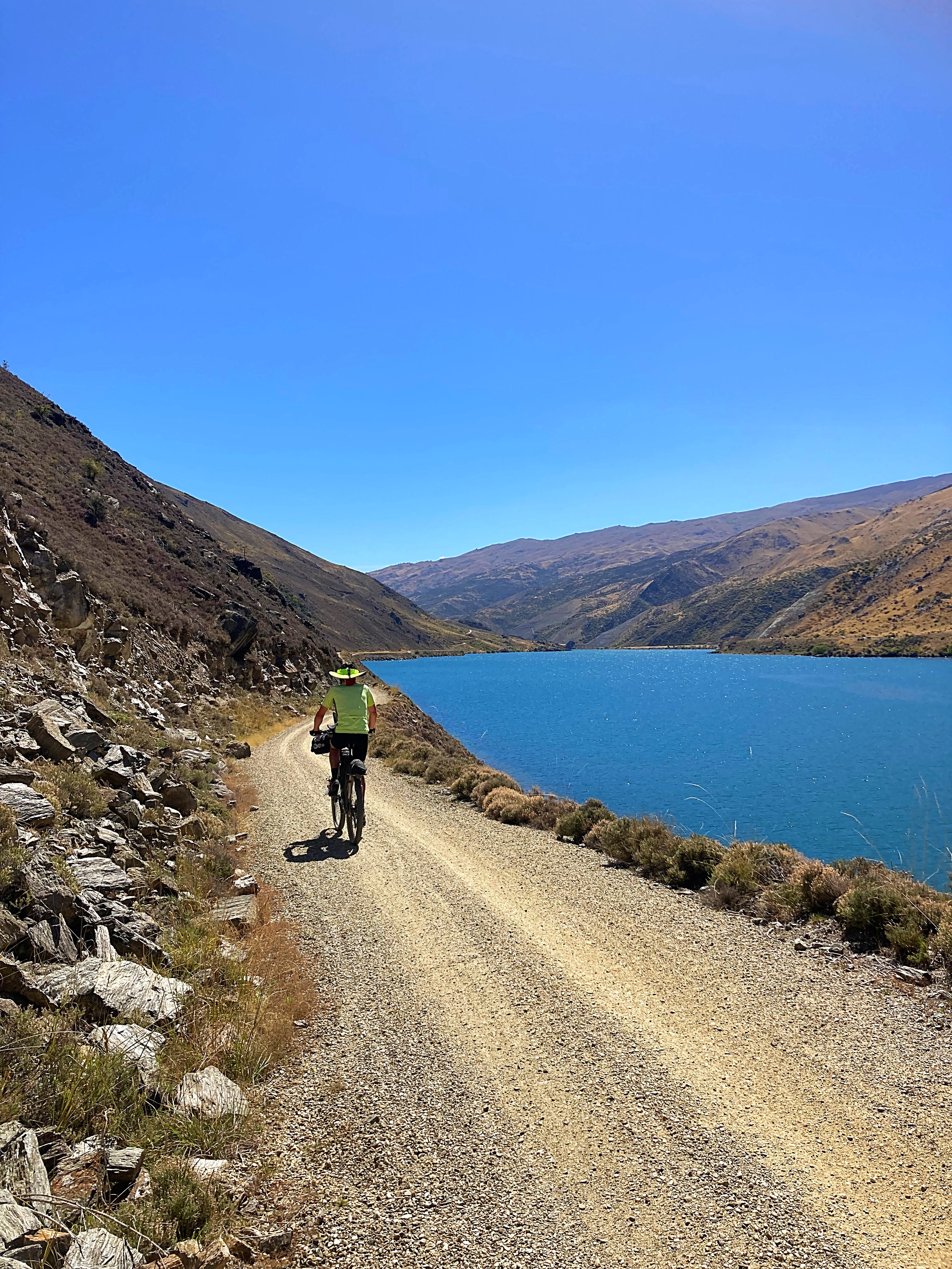
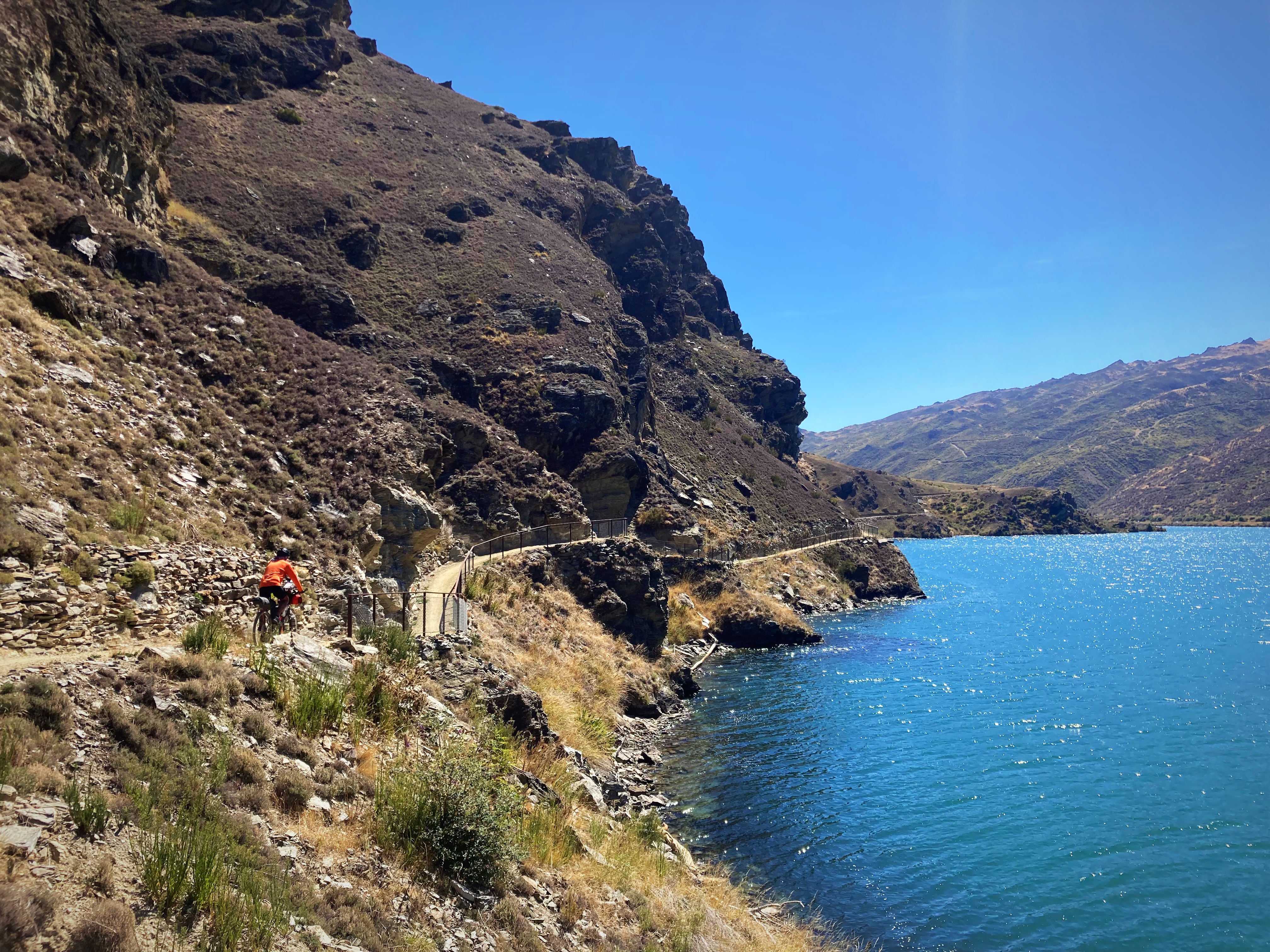
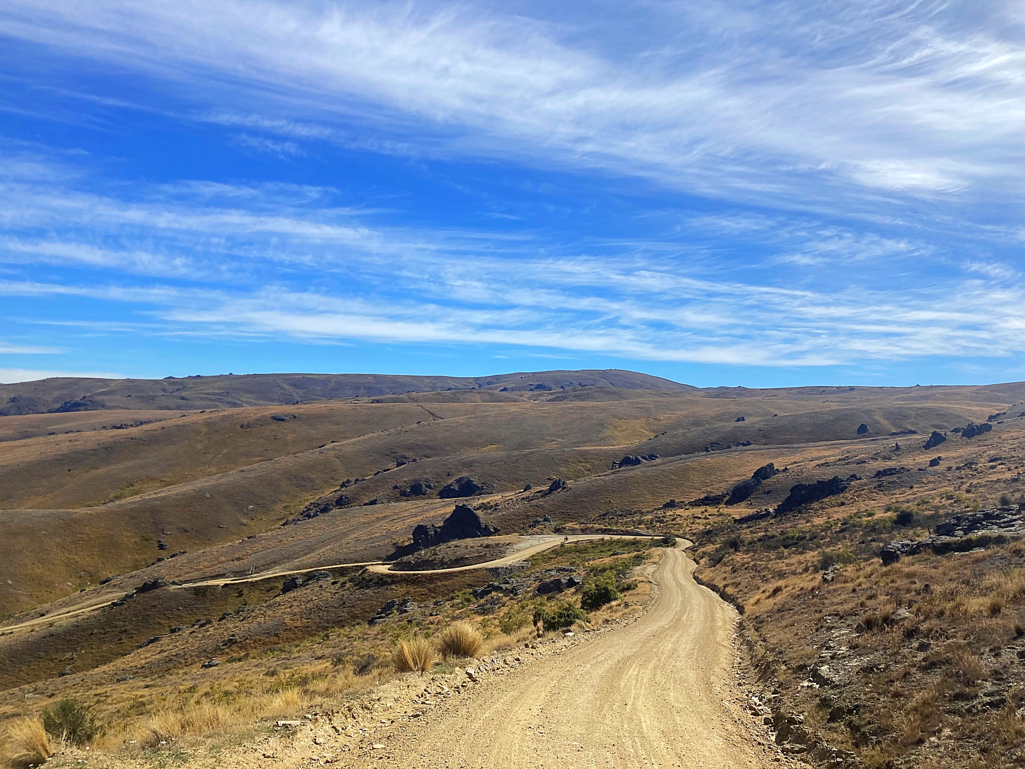
Then there were three . Next up was the River Trail between Alexandra and Clyde – one of my favorite short rides. We seriously had the most perfect day weatherwise .
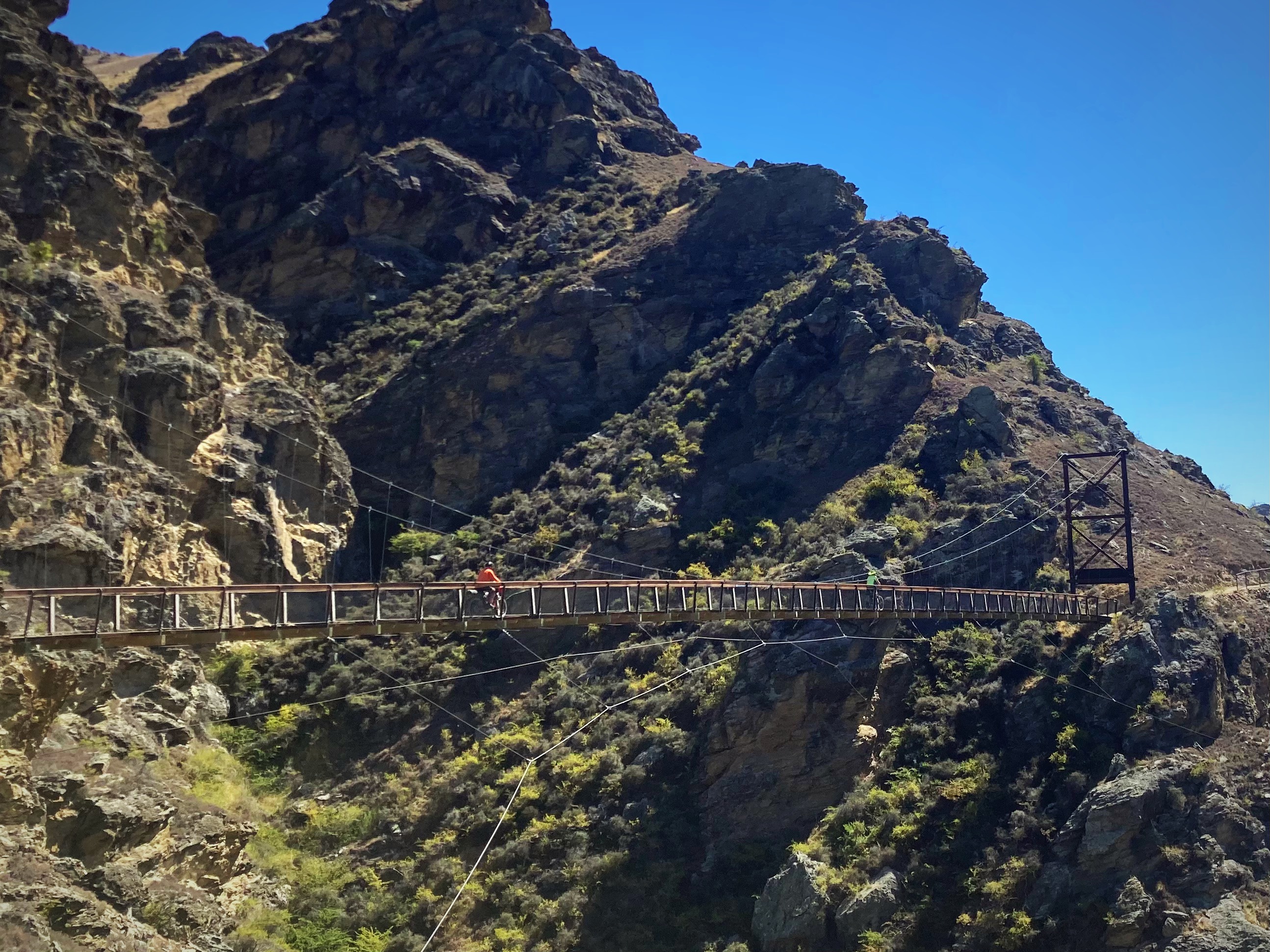
We didn’t venture up into Clyde but carried on along the Dunstan Trail which is NZ’s newest cycle trail. Linking the heritage towns of Cromwell and Clyde, this trail offers close survey of landforms shaped not only by nature but also the gold miners and dam-builders who toiled here during the last two centuries. Following in their footsteps, world-class track builders have constructed clip-on boardwalks, an 86m suspension bridge, and impressive rock walls. It is a spectacular ride.
Although I have ridden today’s trails a few times I am still blown away by the scenery. Admittedly the sunshine and blue skies add to the experience.
22 February 2024
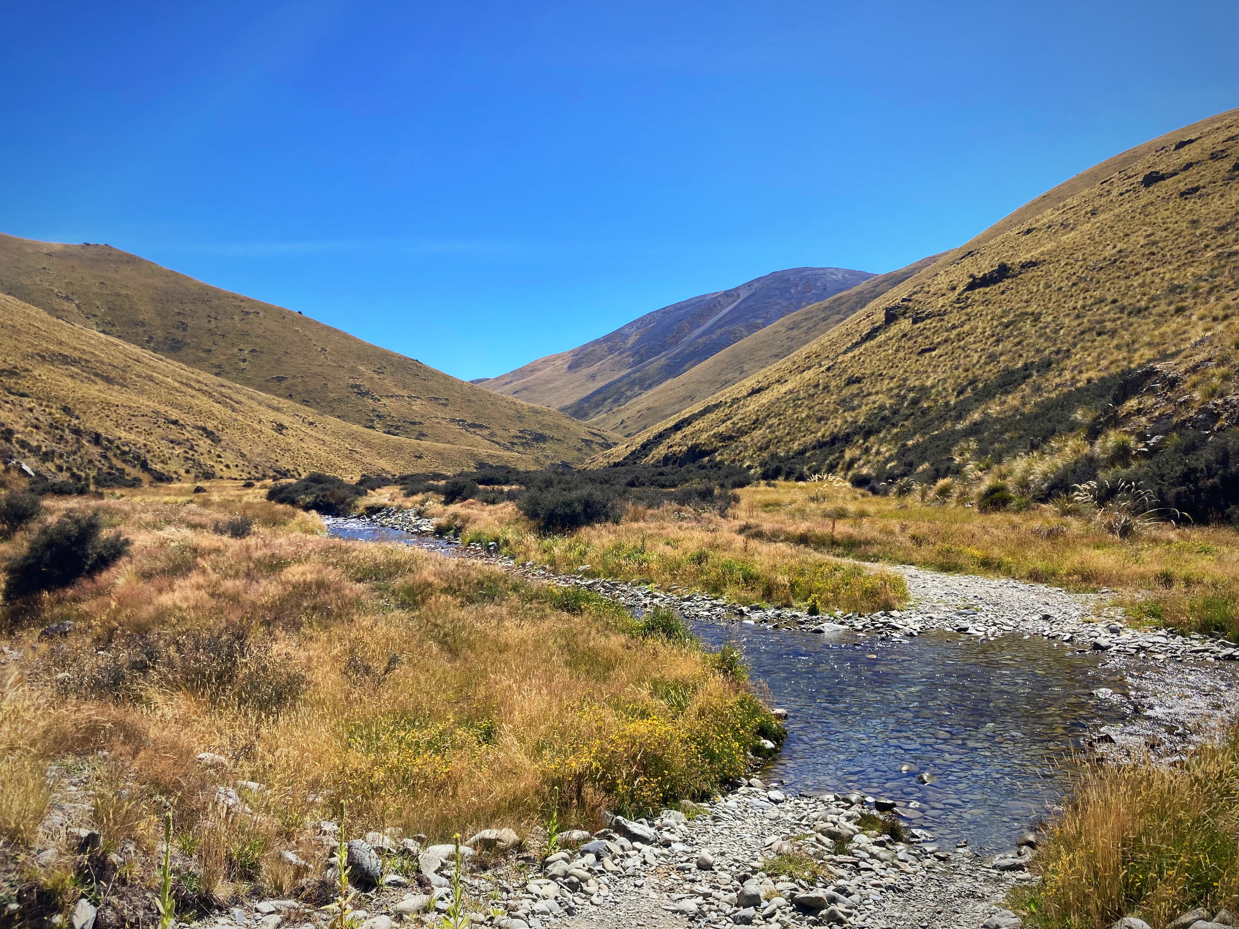
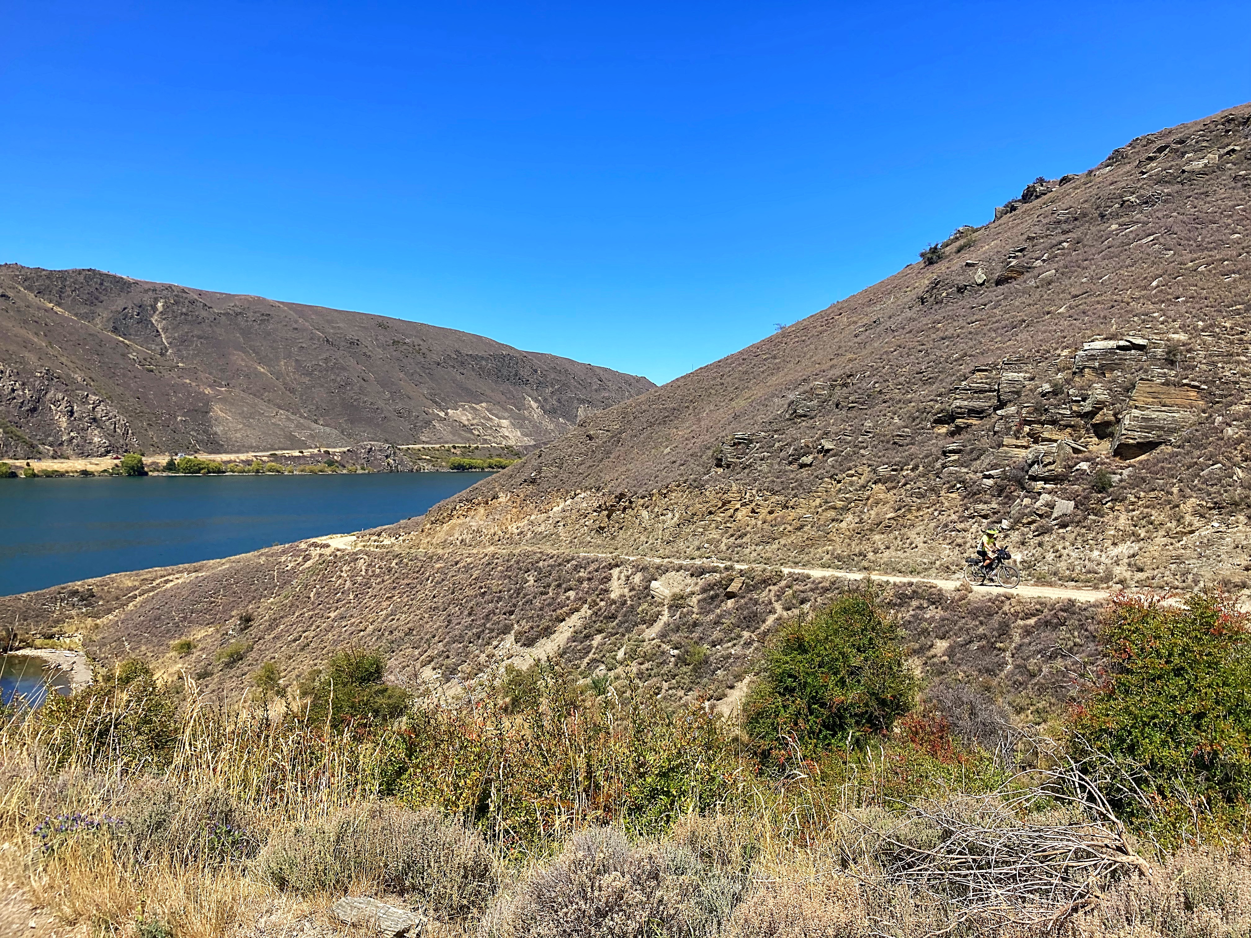
Day 11 – Cromwell to Athol 93km 1844 metres climbed
And then there were two – the physcolists are dropping like flies. Hicksy had to pull the pin today due to an injury. The Young One and Lambers are pedalling on though.
And pedal we did – wowsers, what an epic day in terms of riding, climbing and scenery.
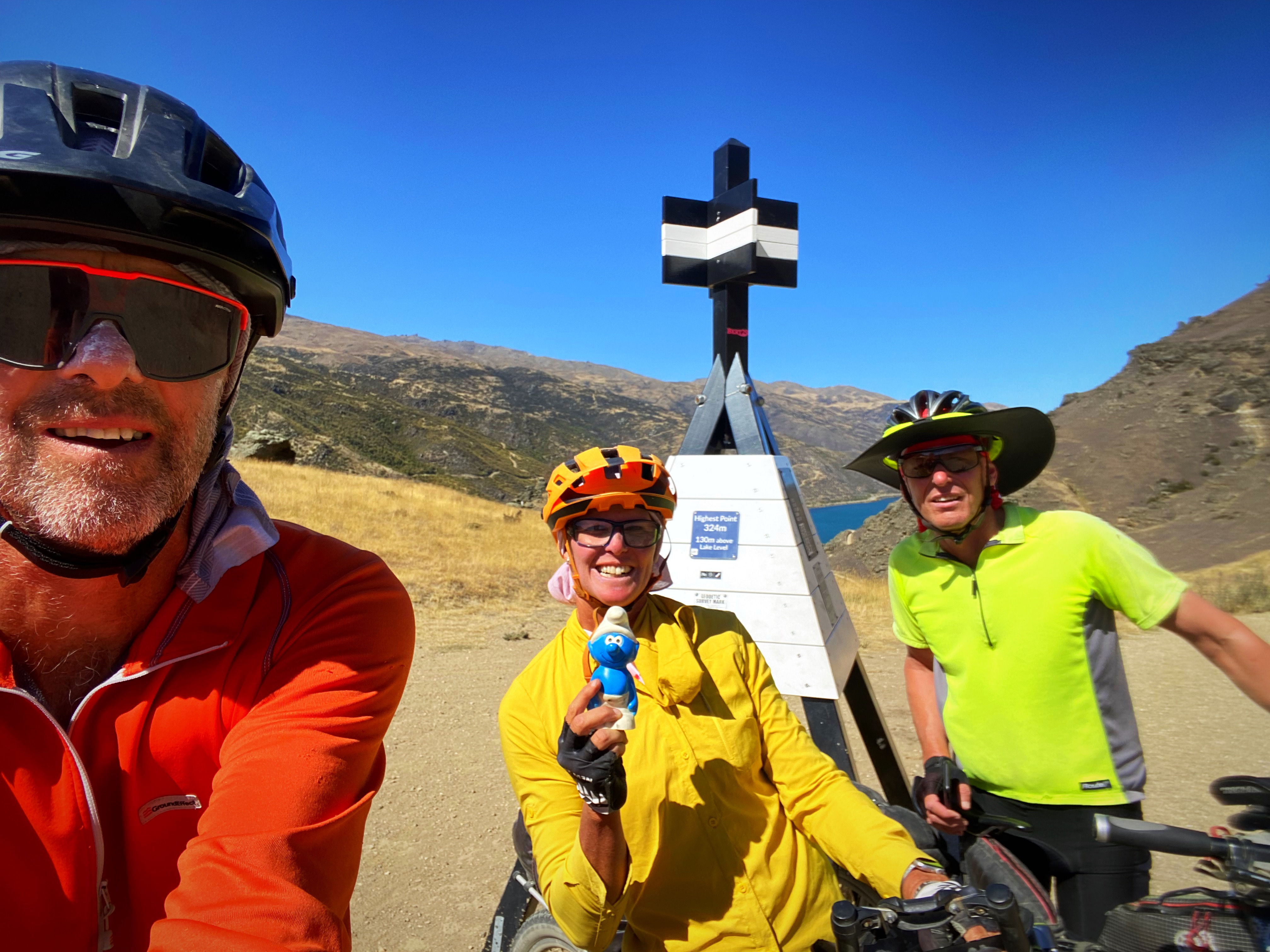
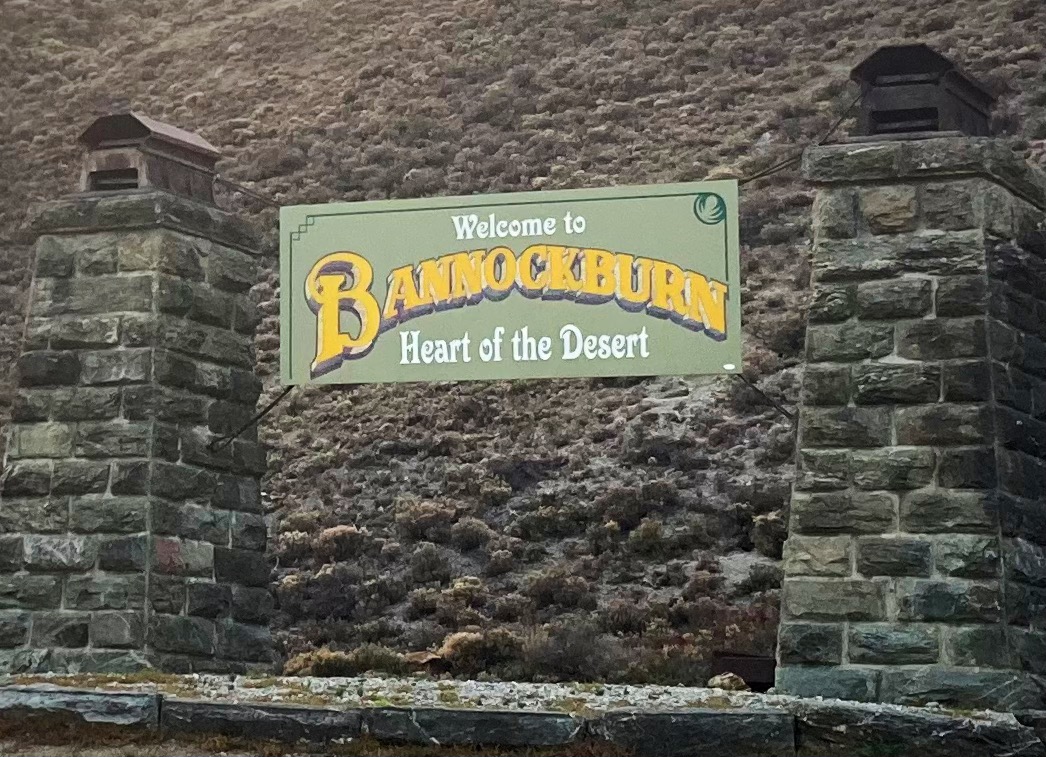
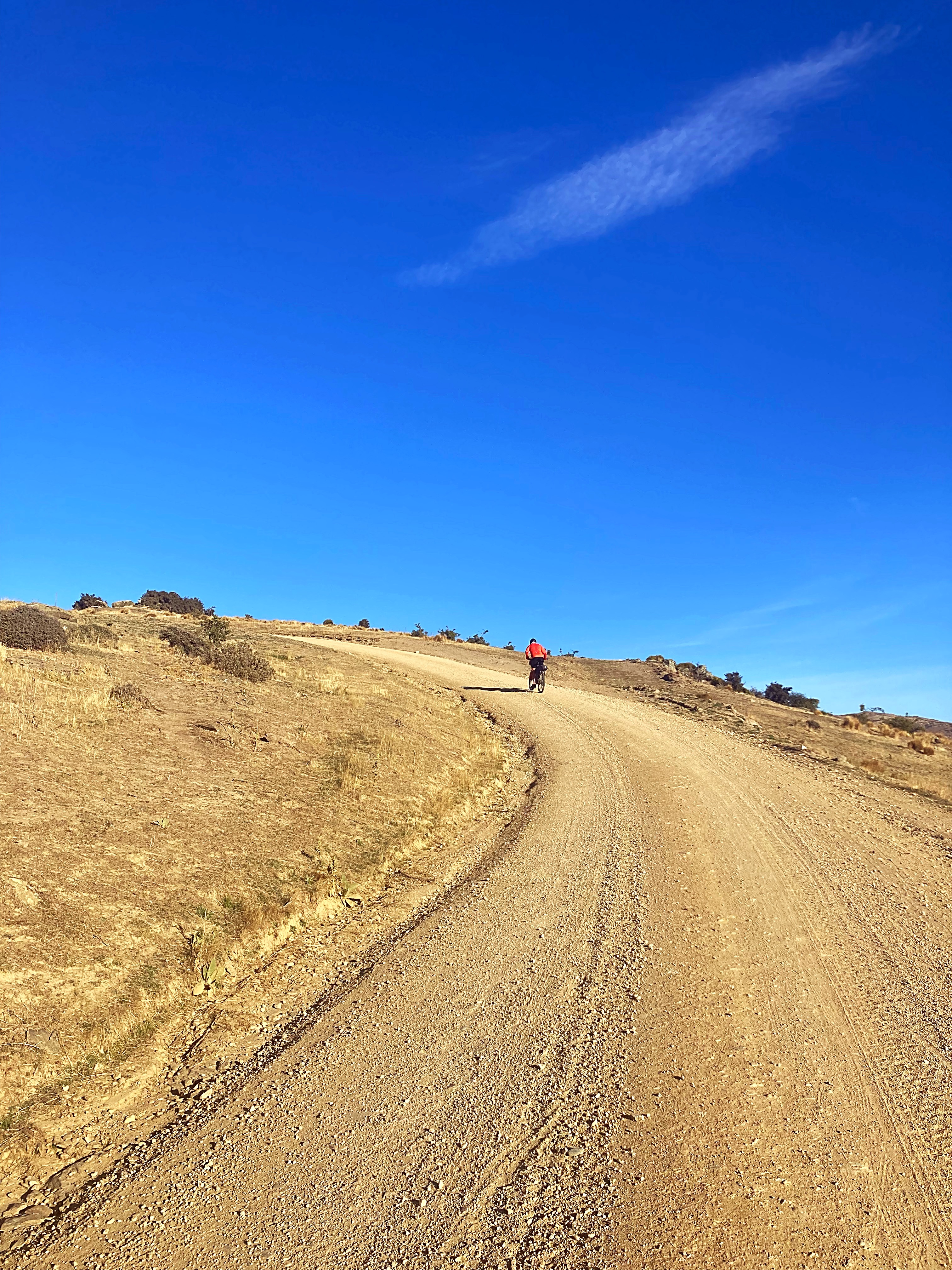
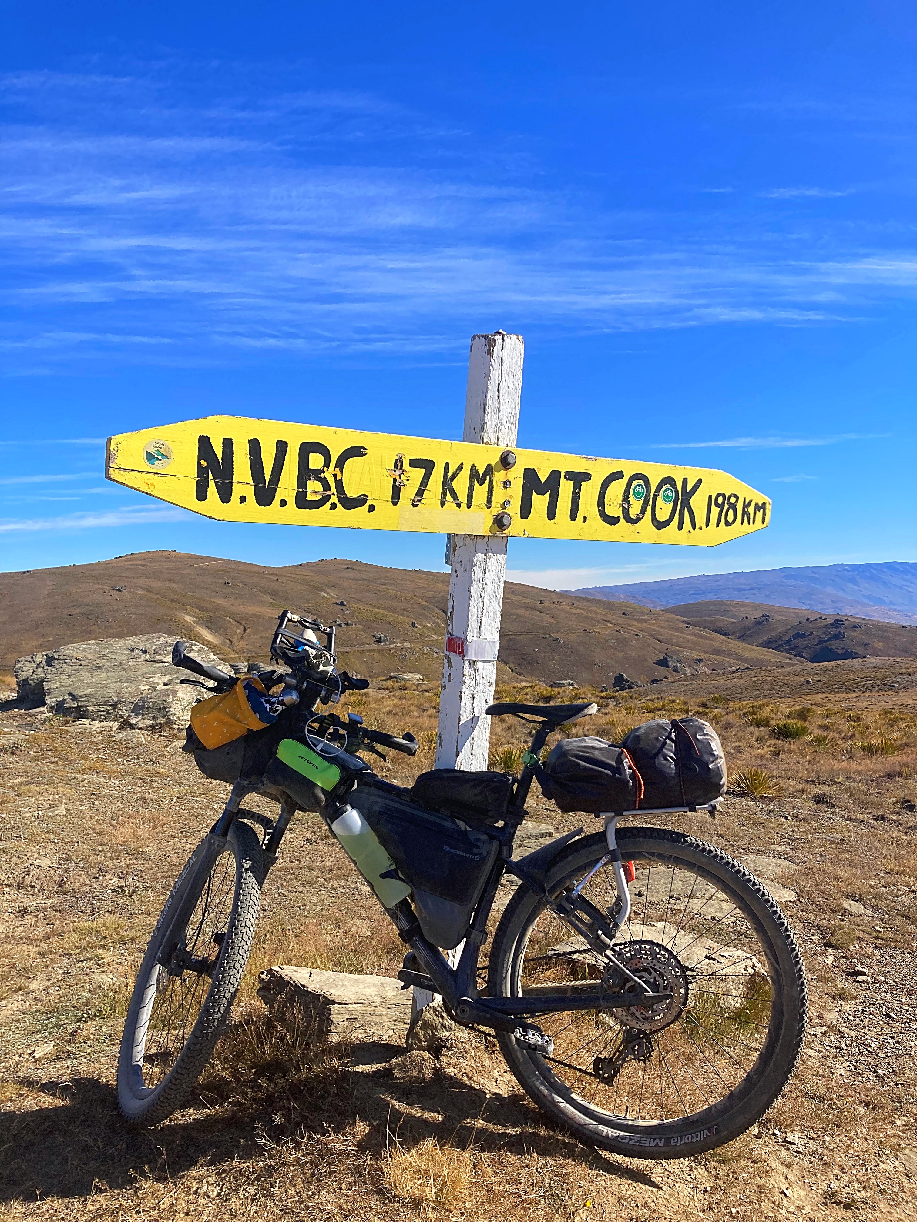
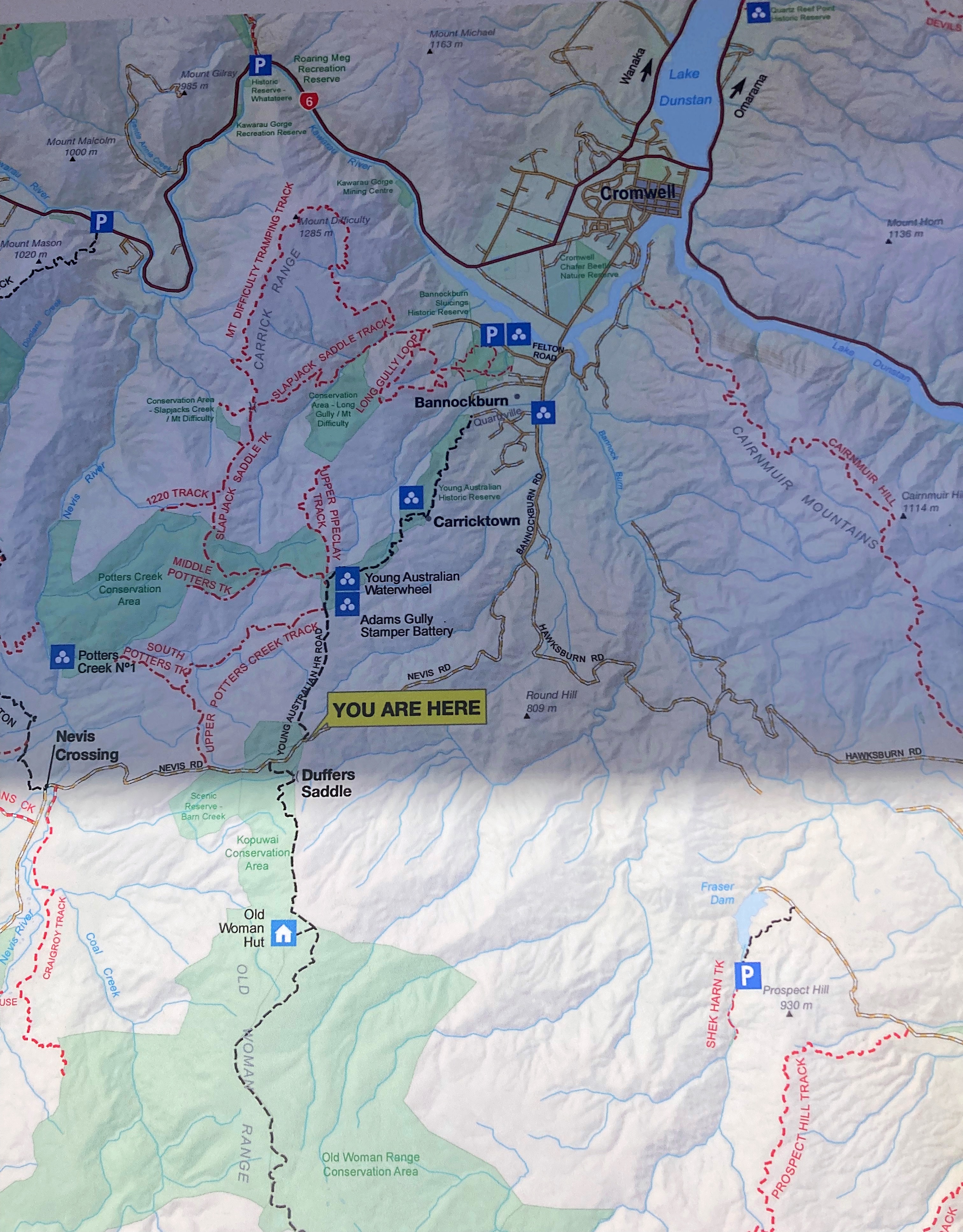
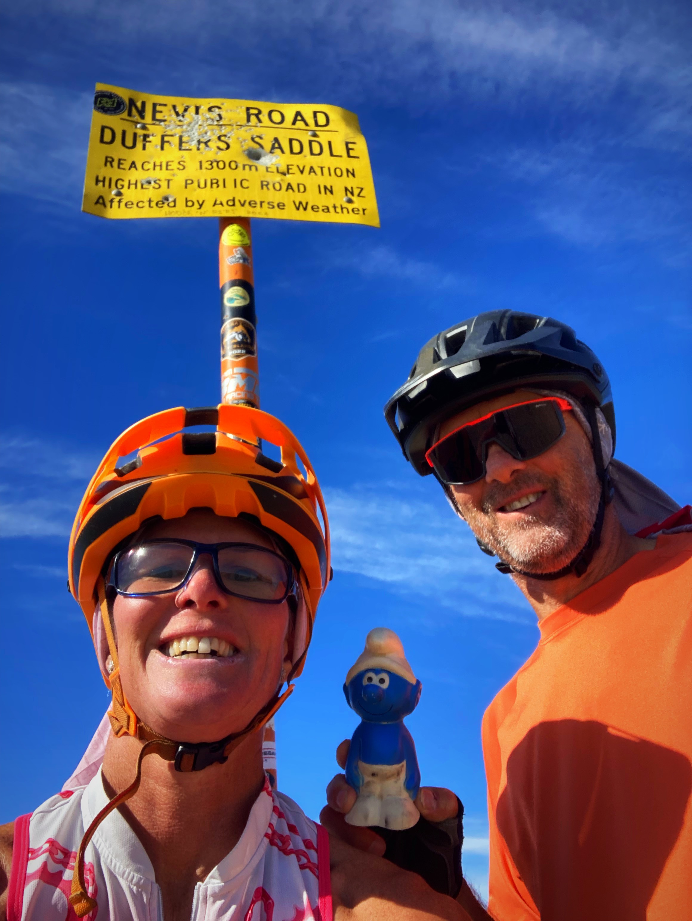
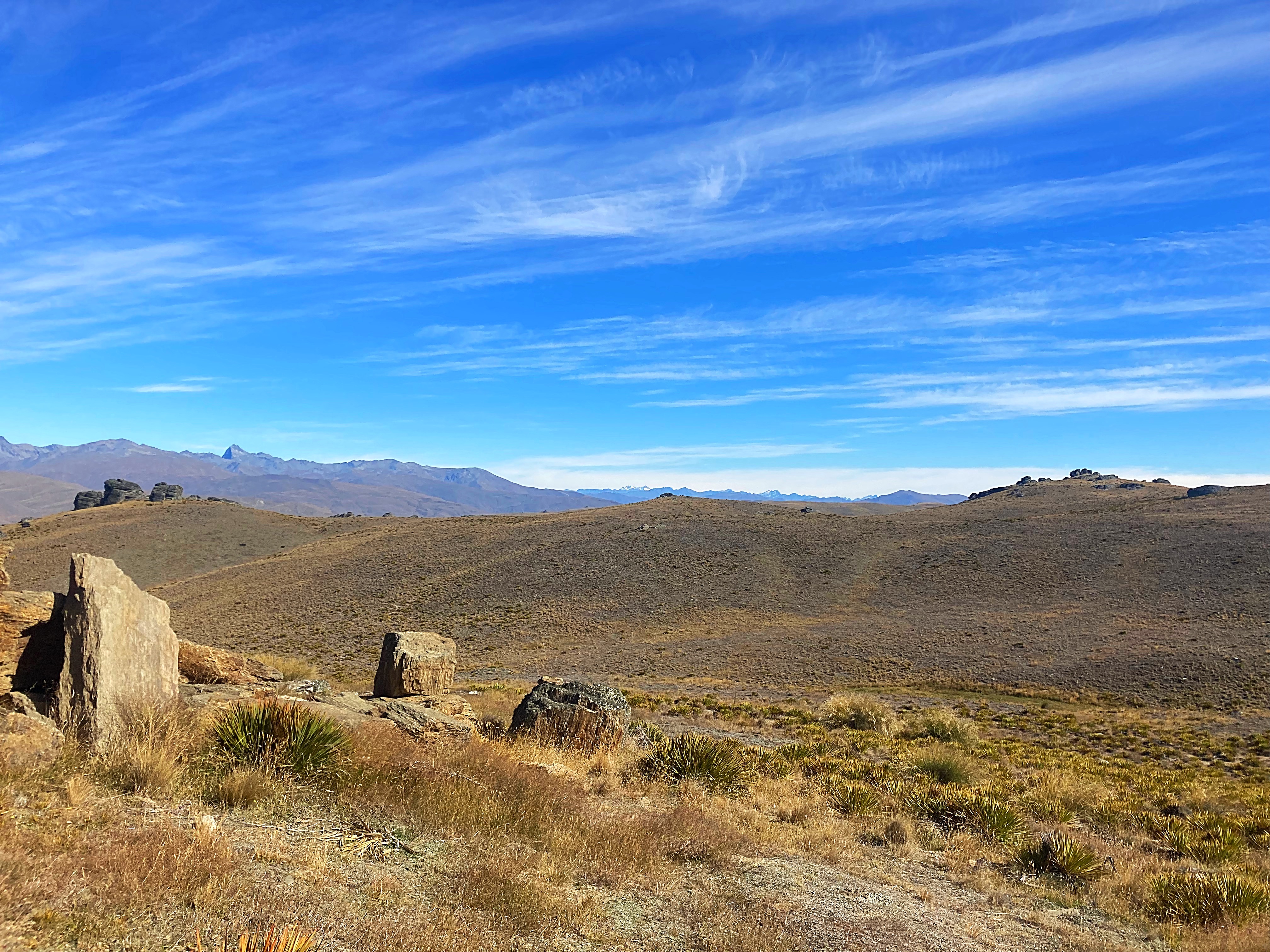
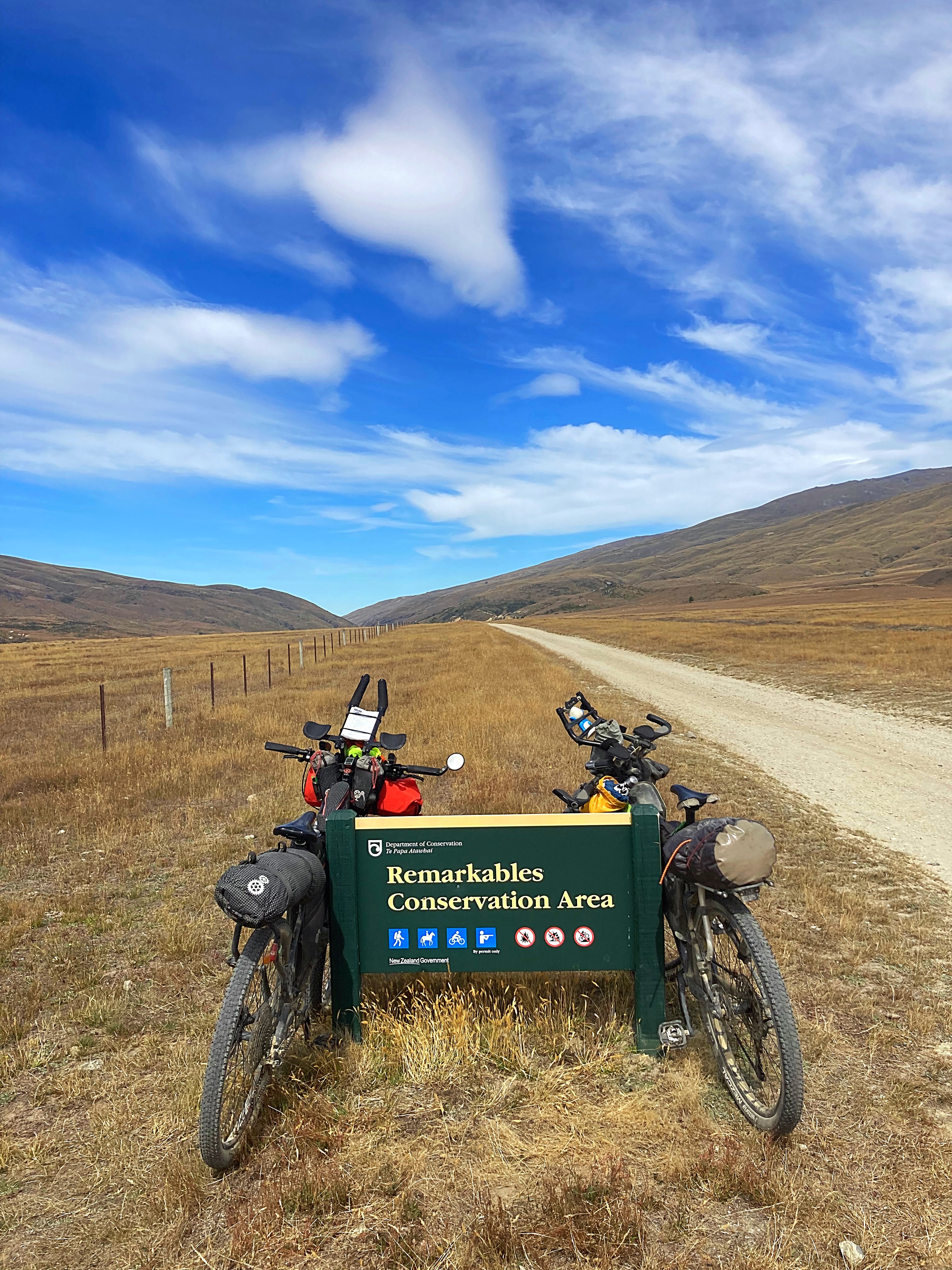
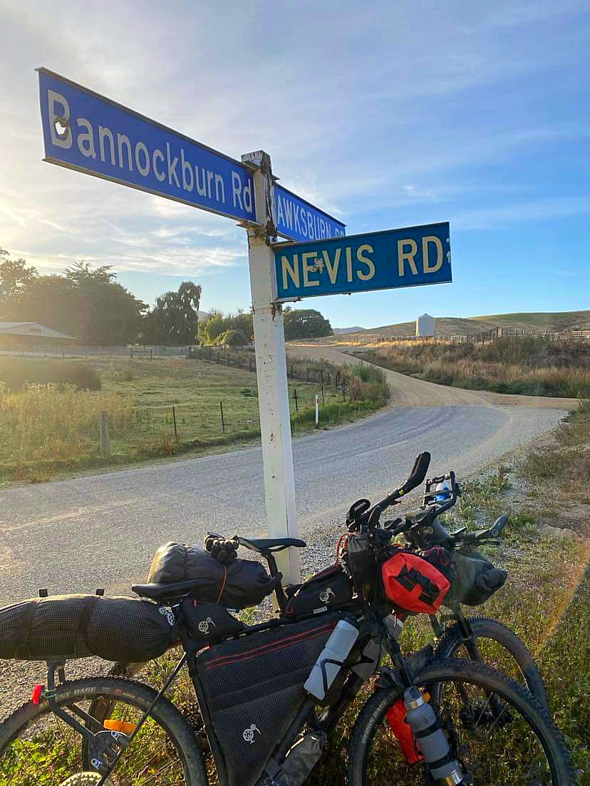
We left Cromwell just before 7am and headed back to Bannockburn to rejoin our route. Five kilometres in, we turned right onto Nevis Road where we would begin by climbing about 1000 metres in 10 kilometres to reach Duffers Saddle. Duffers Saddle is the highest public road in NZ with the high point at 1300 metres above sea level.
The surface was excellent and the climbing manageable – I had a couple of hike a bike moments but Chris rode the whole thing . The views were magnificent. Again we had perfect conditions with clear blue skies. It was quite surreal to be so high up and to get a Birds Eye view of The Remarkables and other mountain ranges. It was also so quiet.
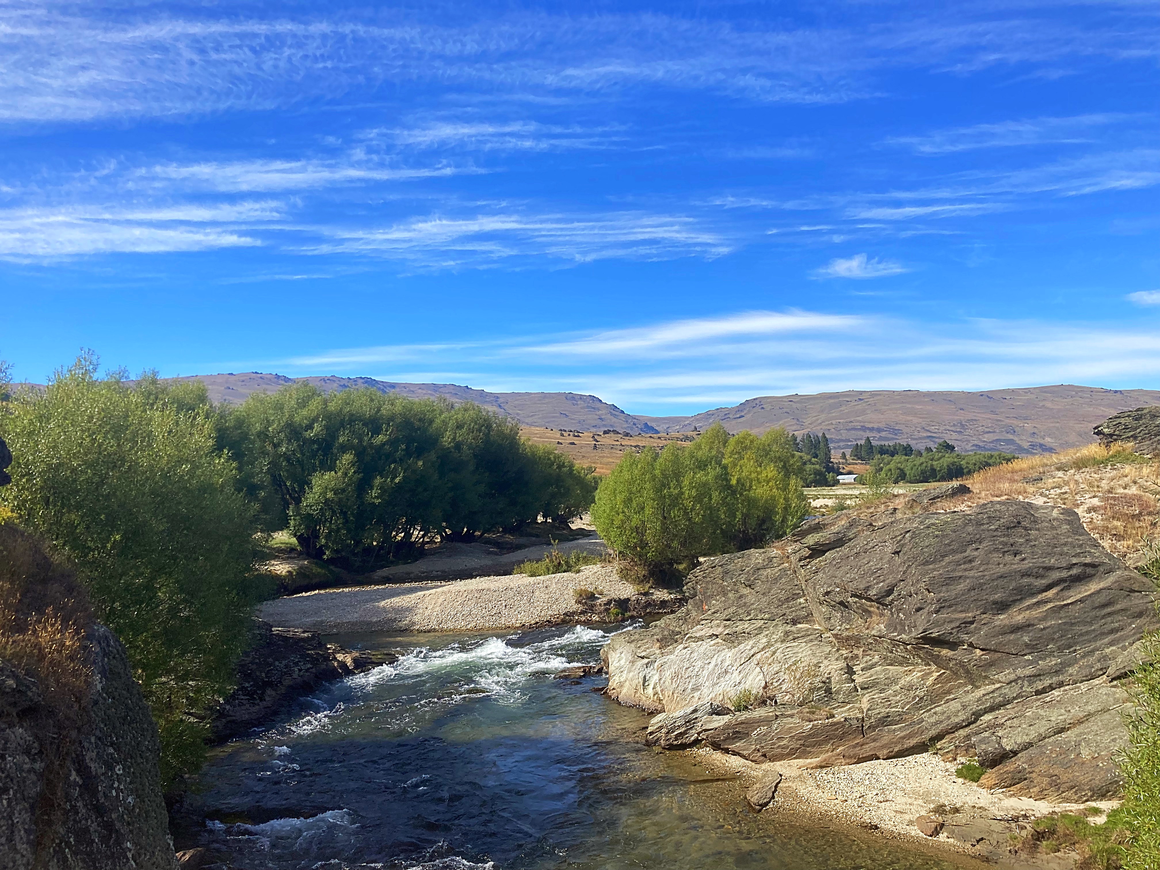
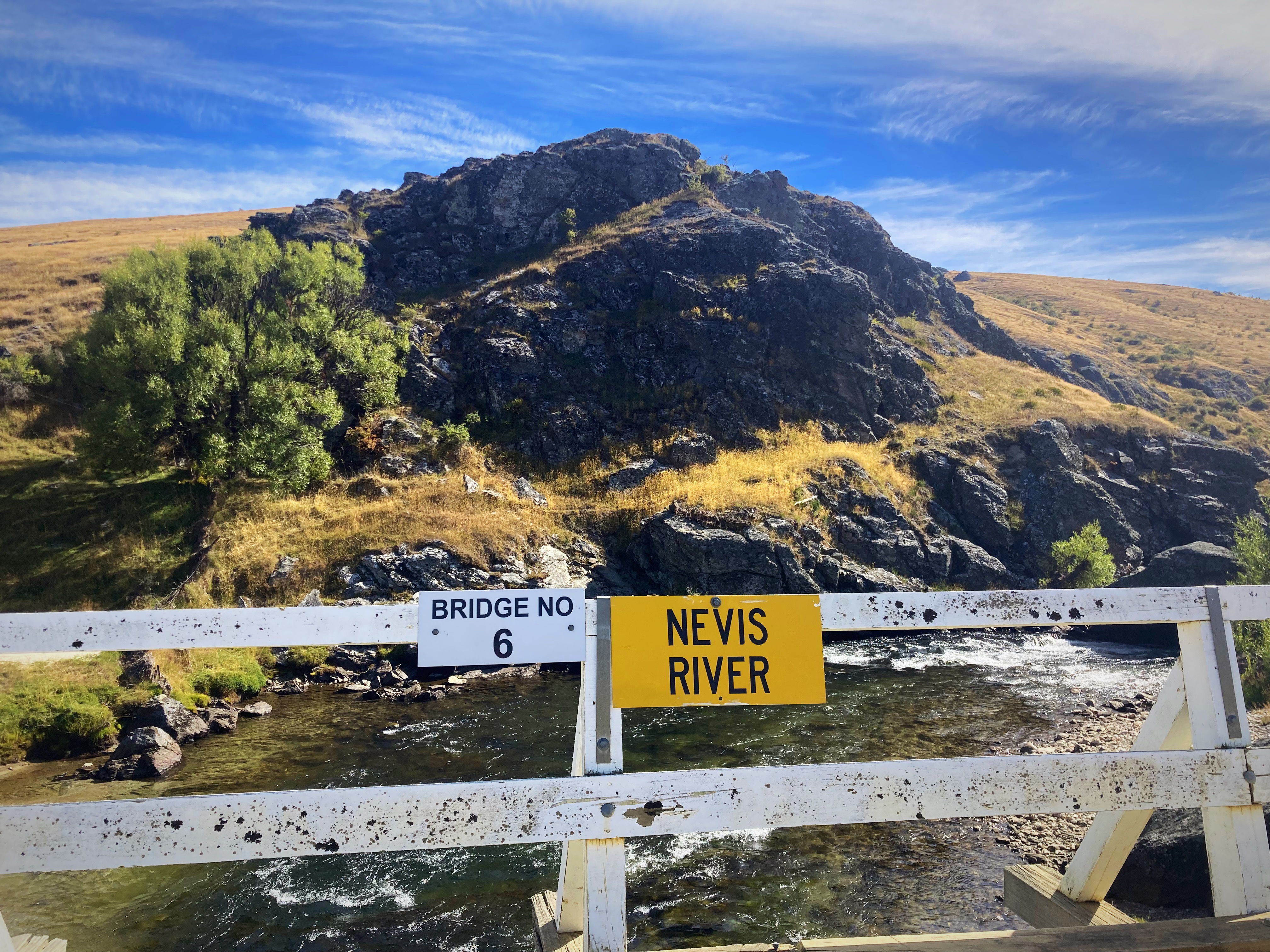
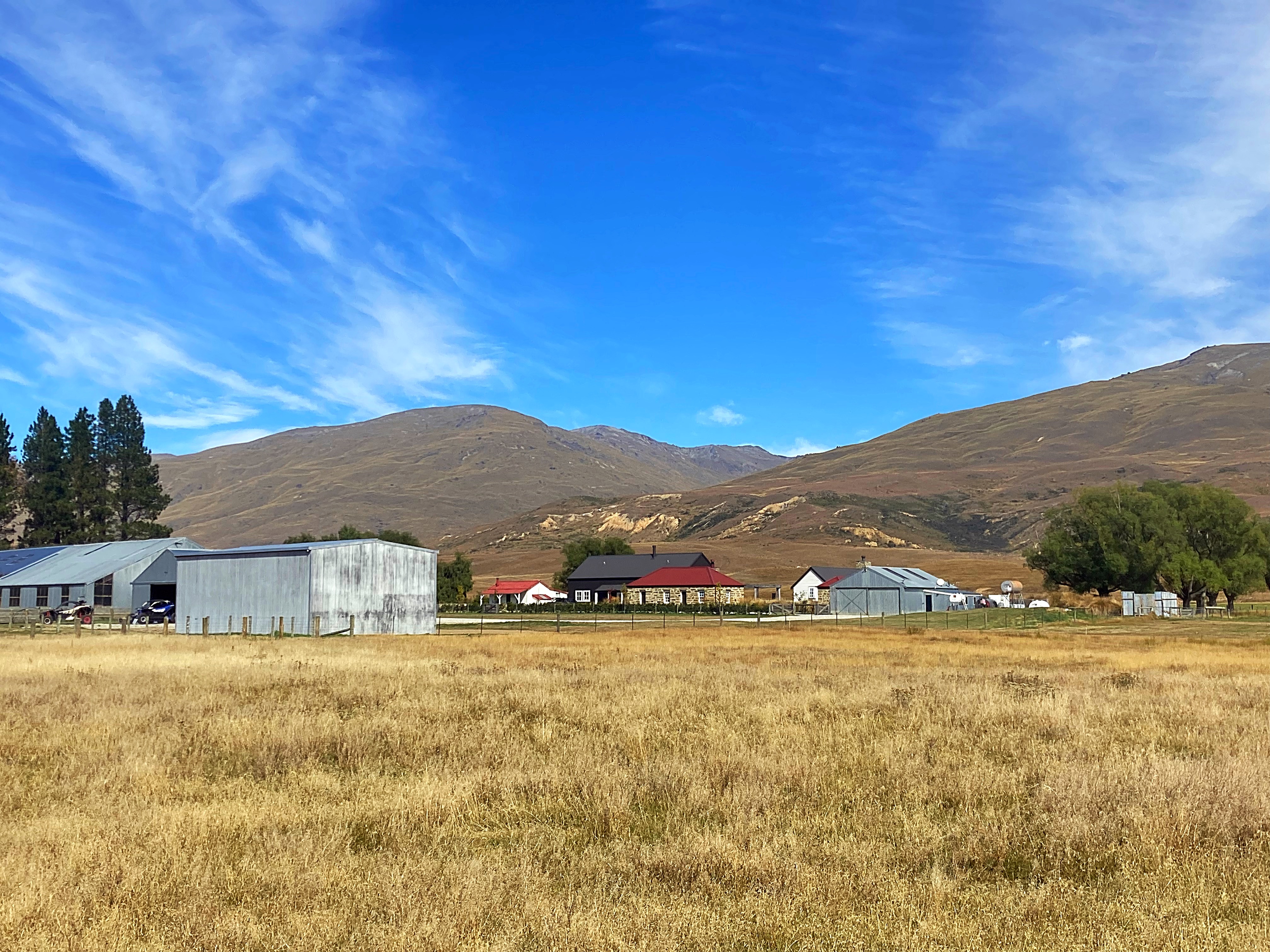
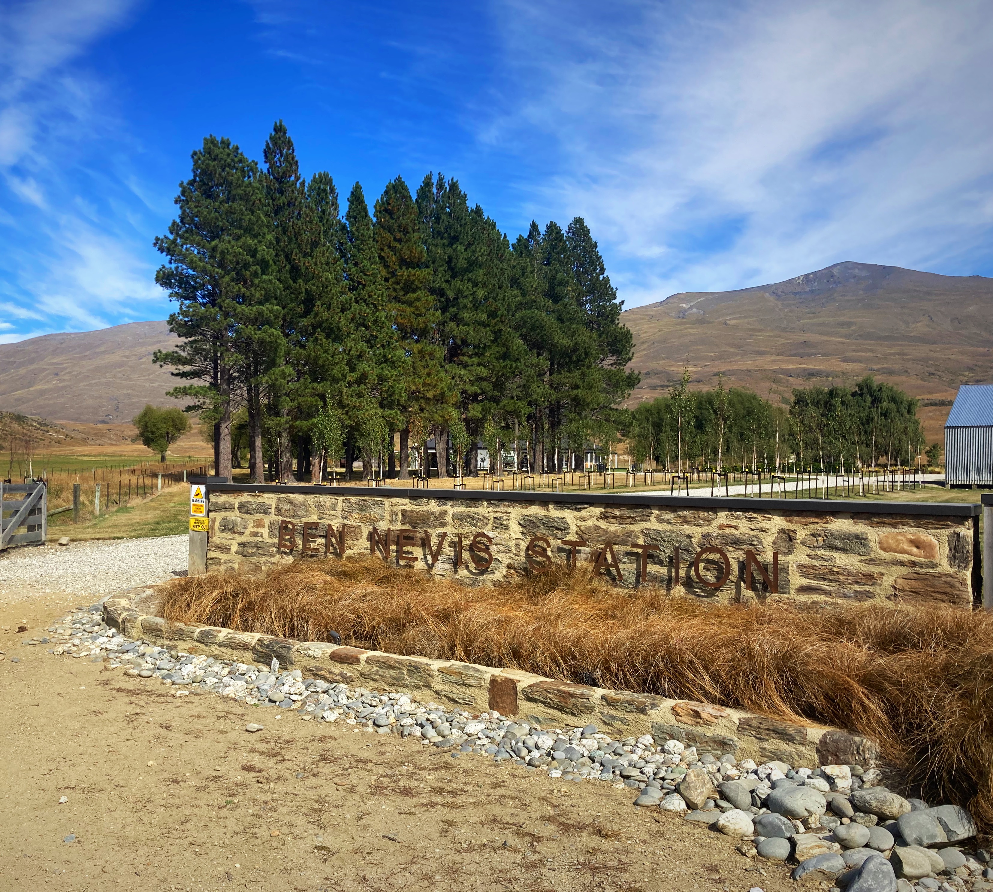
We took our time on the descent so we could soak it all in. We then crossed the Nevis Bridge before passing through the homestead and other buildings at Ben Nevis Station. We were then in the Nevis Valley.
The Nevis Valley was first used as a trail route by Maori people. Early European settlers farmed the valley and in 1862 gold was discovered by miners from the Dunstan goldfield (Central Otago) and the Nokomai Goldfield,(Southland) in October that year. Efforts to keep the find a secret failed – and so began the Nevis Valley gold rush.
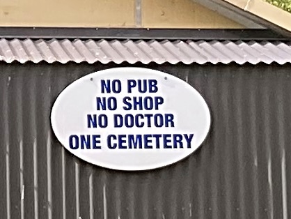
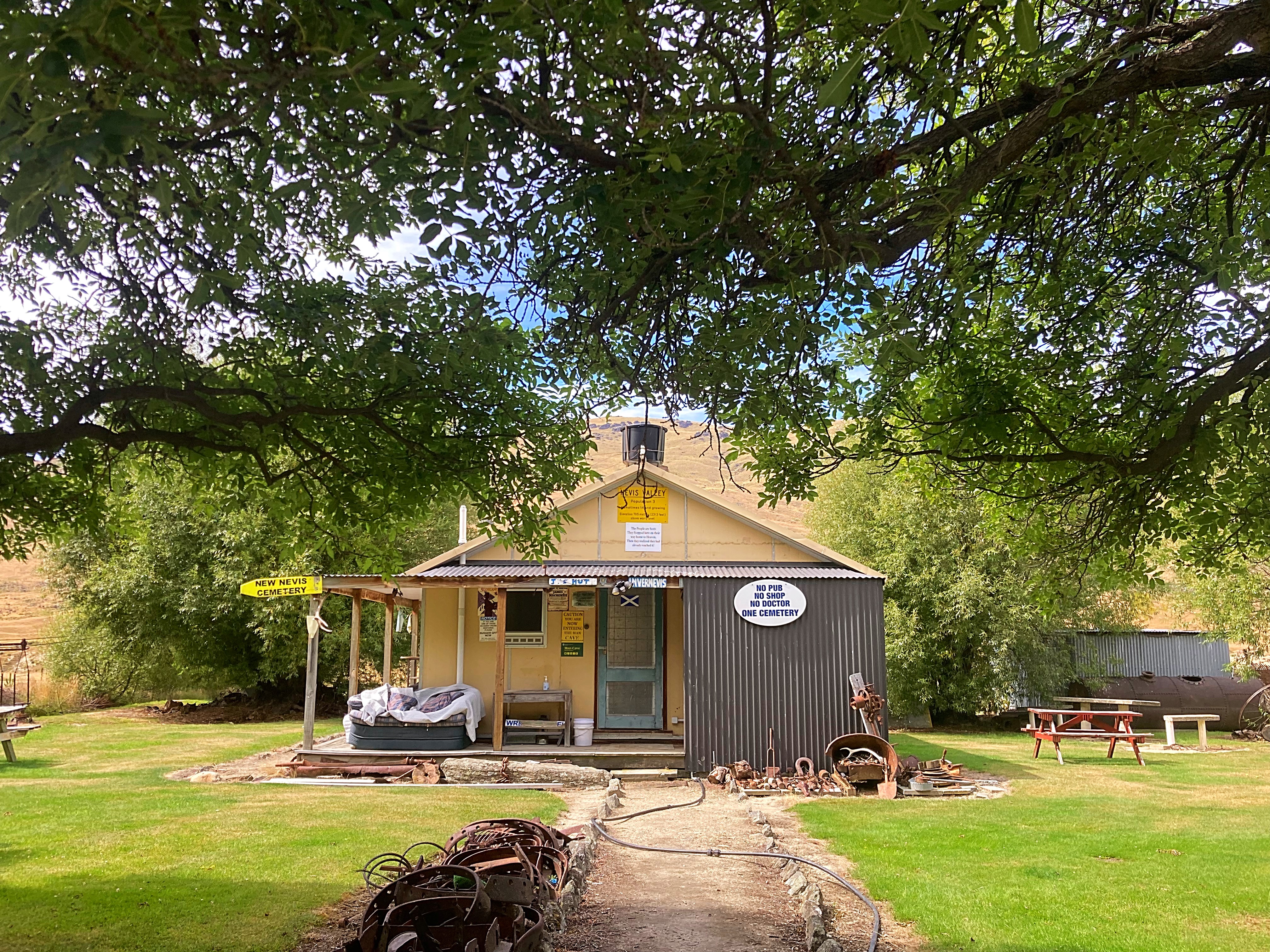
Saved by the remoteness of this valley, the remains of numerous stone buildings from the gold mining days offer a fascinating insight into the perseverance and ingenuity of early pioneers. The relics include everything from the cemetery and settlement buildings through to a woolshed and the first ski hut.
Today only the family at Ben Nevis Station occupies the area, so it still feels very isolated. High mountain ranges rise from either side of the valley – to the west the Remarkables and Hector Mountains, and to the east the Old Woman Range. Fed by numerous creeks from the ranges, the Nevis River meanders along the broad valley floor.
The archaeological significance of the Nevis Valley lies in the culmination of layers of interaction between humans and the natural environment from moa-hunting times to the pastoralism of today, forming a palimpsest. This has left a dynamic array of inter-related archaeological and historic sites which have been untouched by any modern developments. The Nevis Valley is the only extensive, isolated, yet easily accessible, valley system of this type in New Zealand where a range of key events of the region’s history can still be seen scattered on the landscape.
The Nevis Valley site is designated in the district plan as an Outstanding Natural Landscape.
We crossed the river about 25 times. They weren’t as deep as the ones on the Omarama Saddle so I managed to ride quite a few. We came across a few vehicles, some Dusty’s (motorcycles) and some ATV’s having fun on the 4WD tracks. We also saw a few fishermen – apparently it is good fishing in the river.
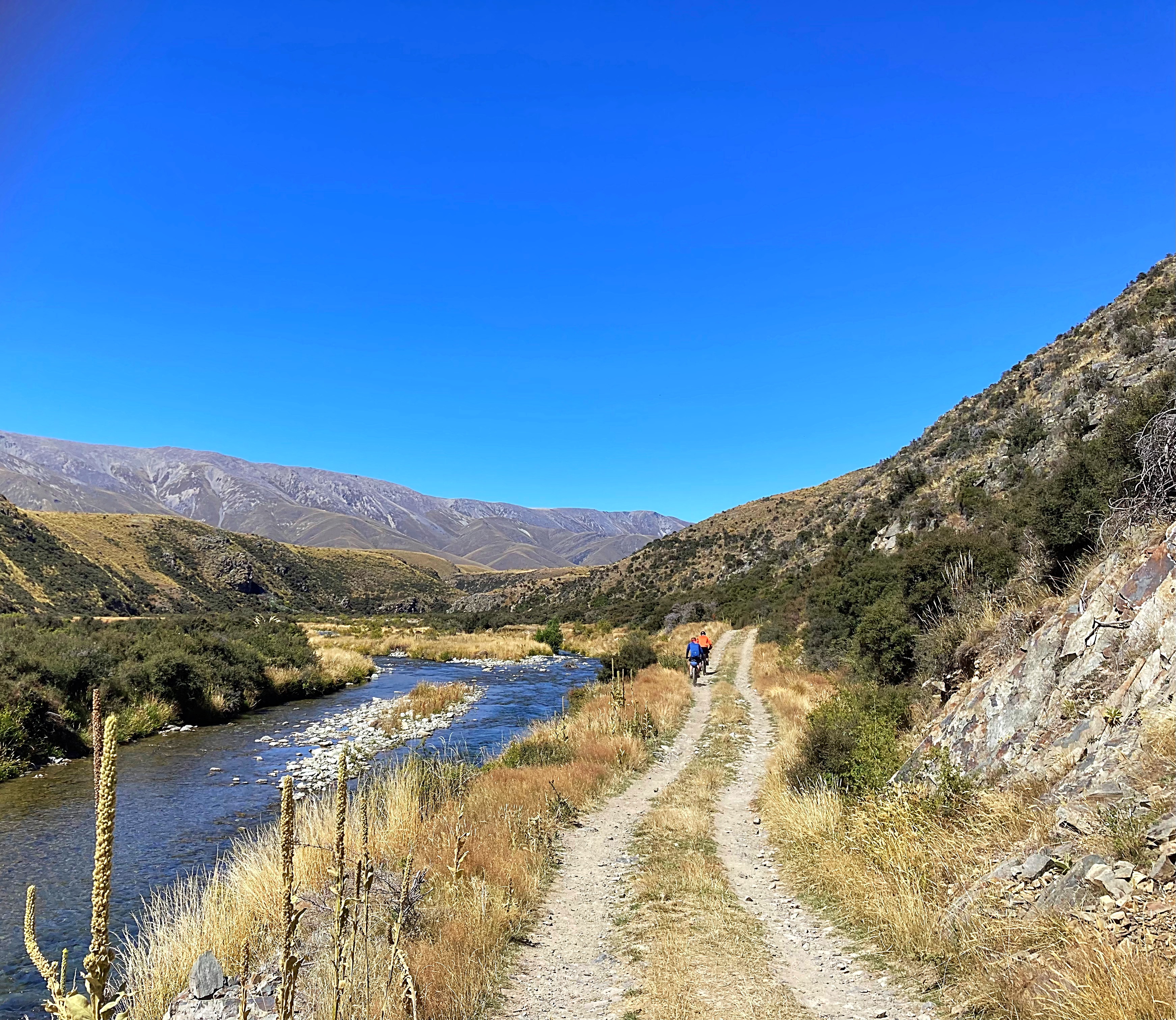
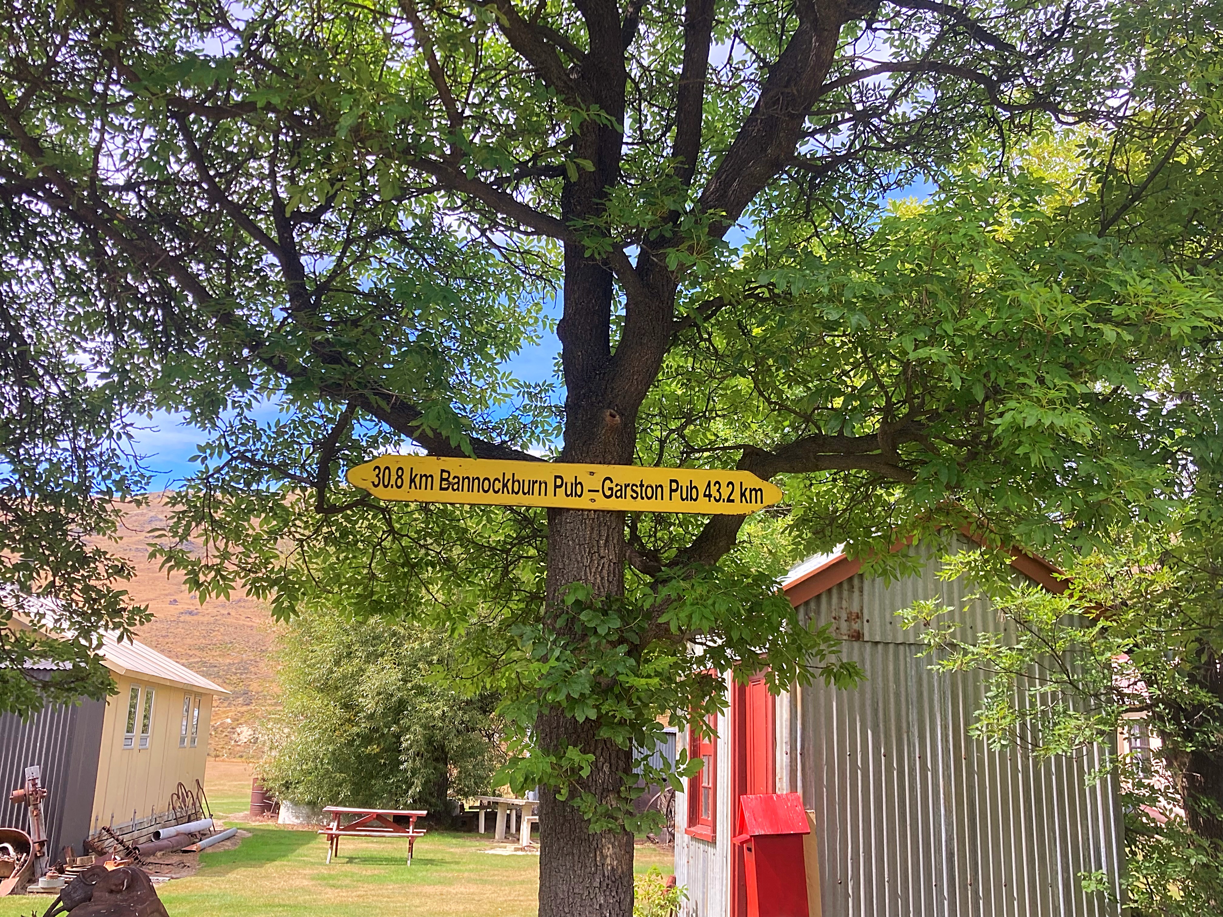
We then began our climb out of the Nevis Valley which has a high point of about 1100 metres, before descending into Garston (a valley of green which was in stark contrast to what we had looked at all day) and then riding 11 kilometres on the Around the Mountains cycle trail to Athol where we are staying tonight.
It would be fair to say that we felt pretty wrecked when we got in tonight.
23 February 2024
Day 12 – Athol to Te Anau 140km 820 metres climbed
We had a foggy start today and rode the first twenty kilometres not really seeing anything. Just before our second breakfast of the day at the Five Rivers Cafe, the fog cleared.
Apart from the delightful head winds which taunted us from the 20 kilometre mark to the 86 kilometre mark, it was perfect riding conditions. The first 86 kilometres were on the Around the Mountain Cycle Trail from Athol to the Mavora Lakes Road.
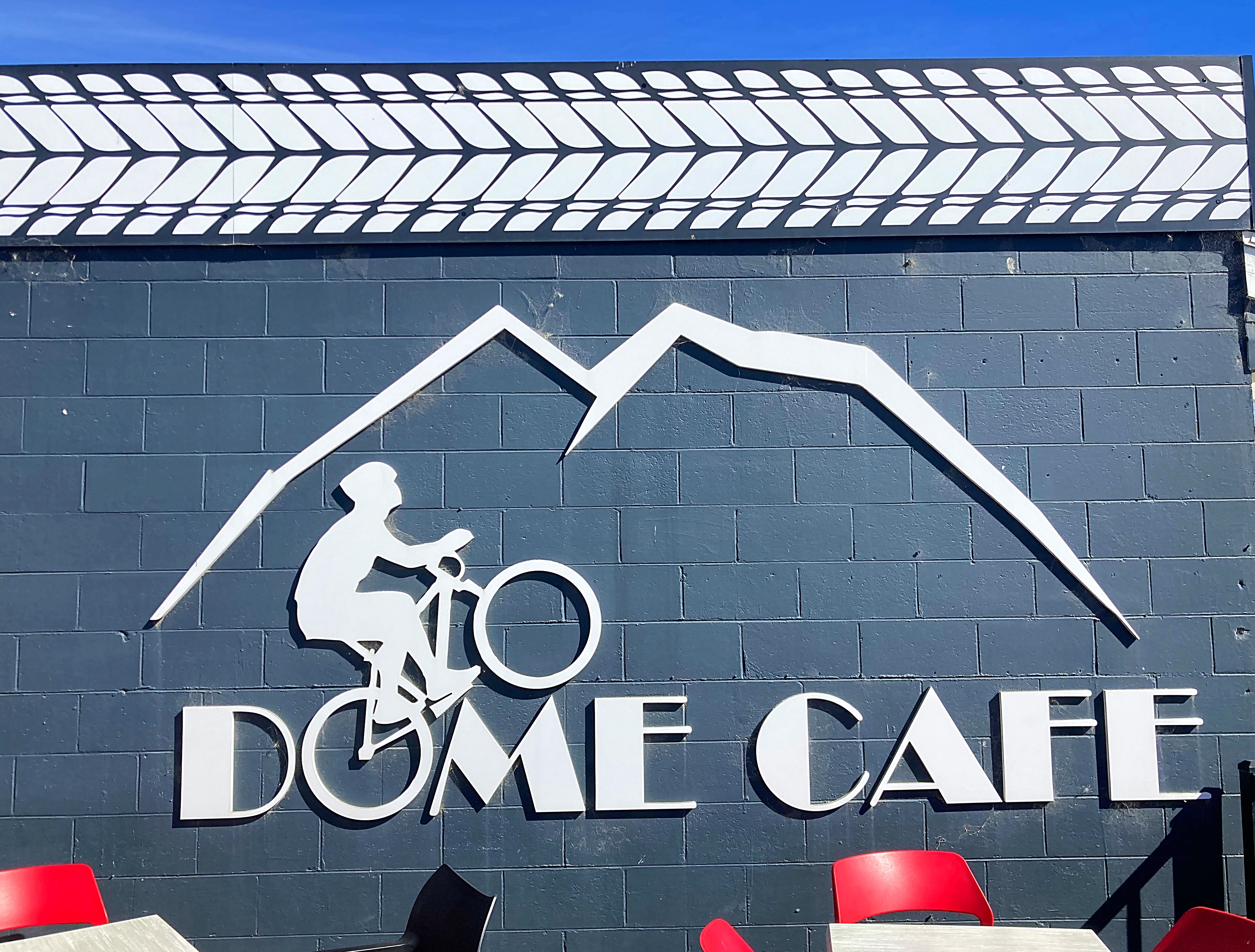
At the 50 kilometre mark, we stopped in Mossburn for our third breakfast at the Dome Cafe. We were clearly making up for the lack of coffee stops yesterday.
Just before Mossburn we rode down ‘border collie alley’ lucky for us the border collie has pulled up injured or we would have been out there all day.
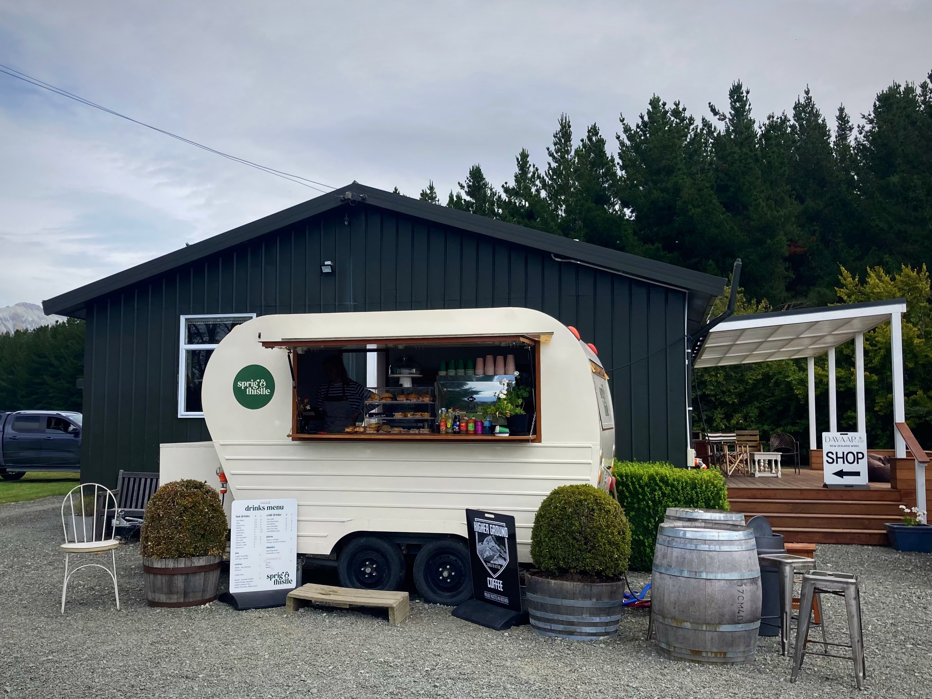
Just after getting back on the tarseal we had our third cafe stop of the day at the Sprig n Thistle – wow, what a great find. We then followed the main road for about 12 kilometres which was a bit hairy with cars and buses flying past at a rate of knots.
It wouldn’t be a Kennett Brothers adventure if we didn’t then leave the fast flowing tarseal to take in the back country gravel roads which added at least 25 kilometres to the ride overall today.
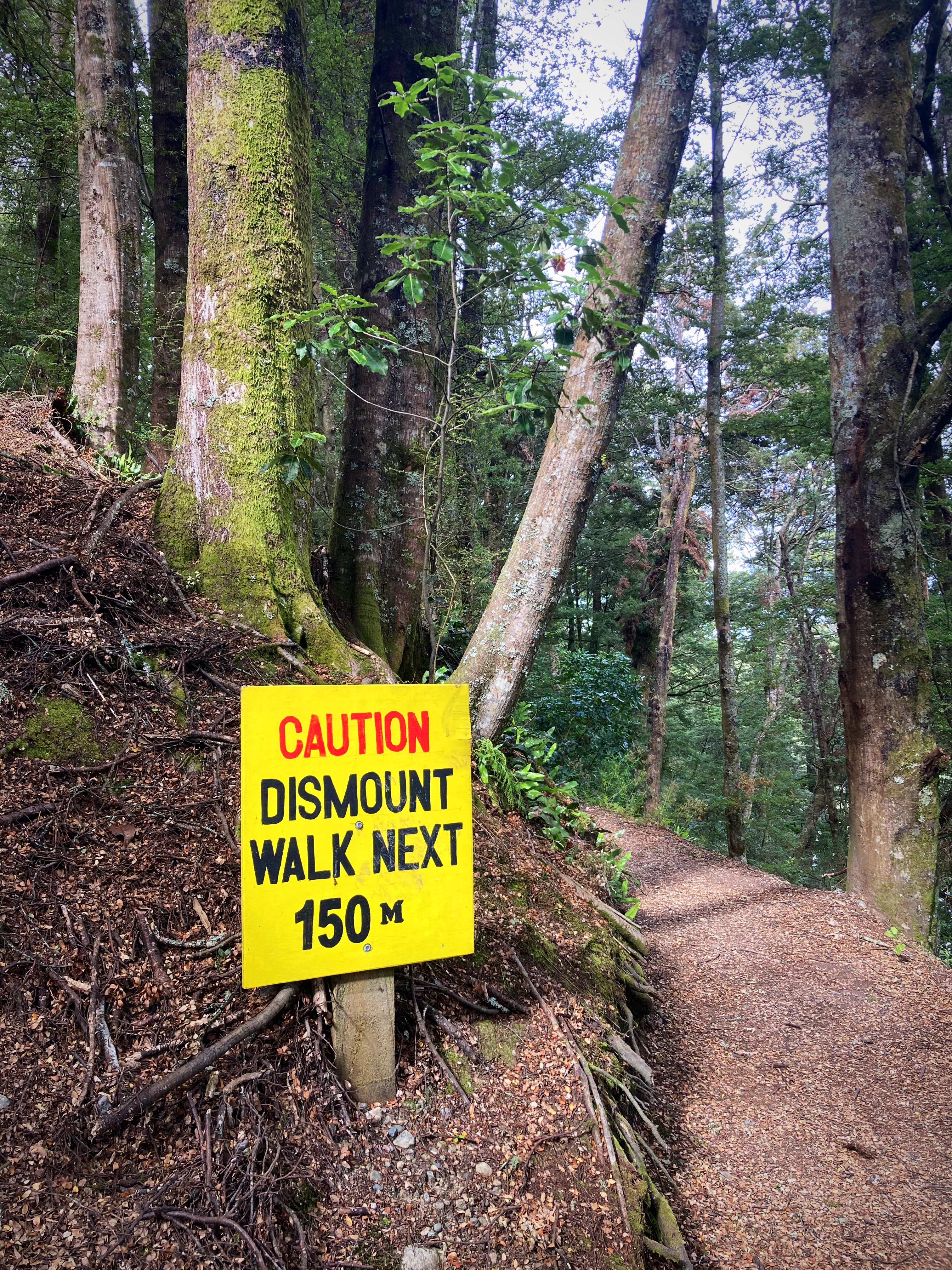
About 15 kilometres from Te Anau we got on the new Lakes2Lake Trail which was lovely and I am sure I would have loved it had I not been 125 kilometres deep . We made Crammers proud though by riding a “dismount and walk section”. We’re not as advanced as him though so there is no video footage while riding with one hand
We finally made it to Te Anau at about 6pm where we are staying at Hicksy’s nephews place. Hicksy was here to greet us, sort our washing, provide chocolate milk and generally fuss over us. The border collie has morphed into a trail angel
We enjoyed a lovely meal at the Te Anau Club – cannot go past blue cod when in the Deep South.
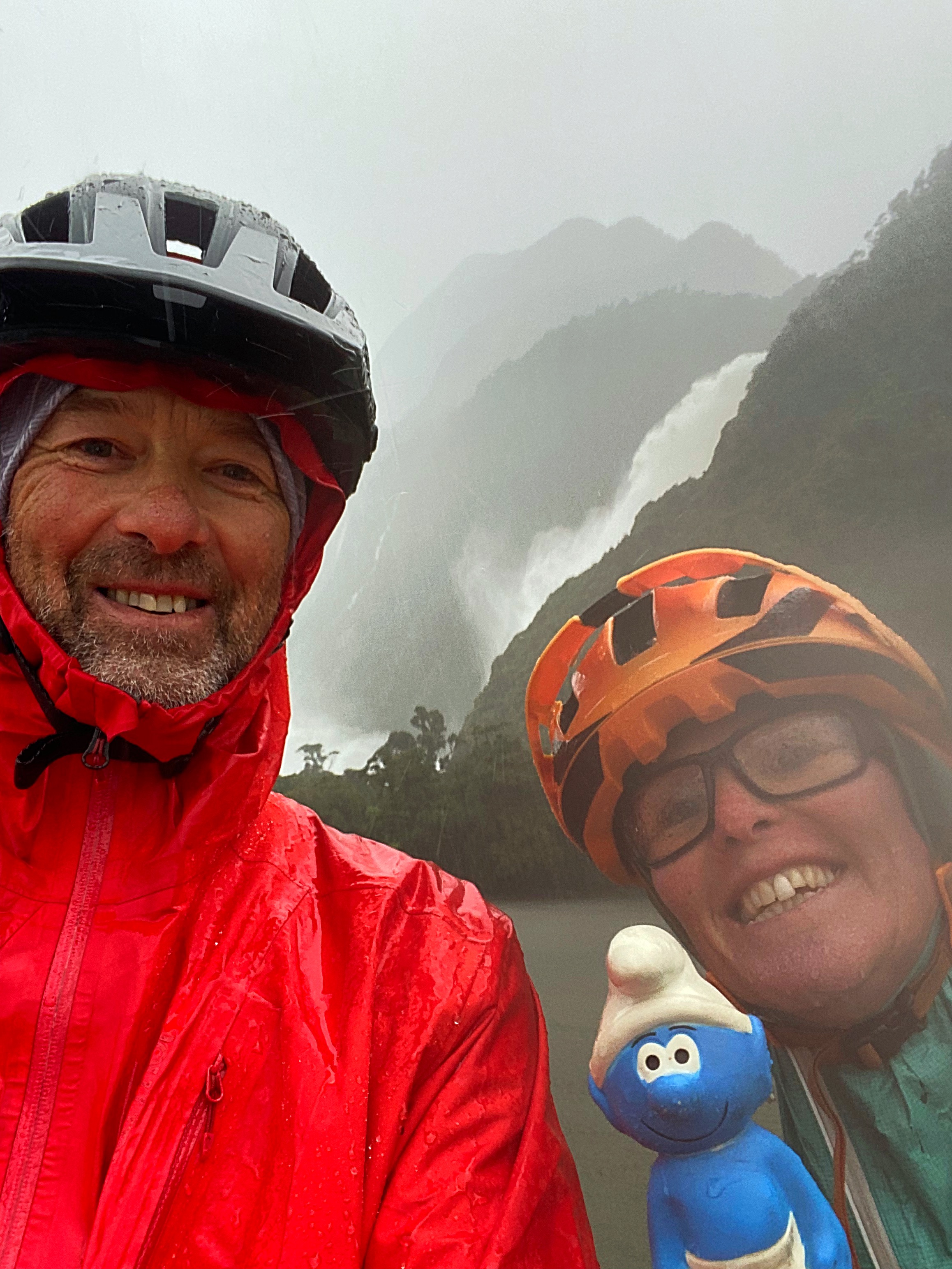
As you can see Smurfy is having the time of his life
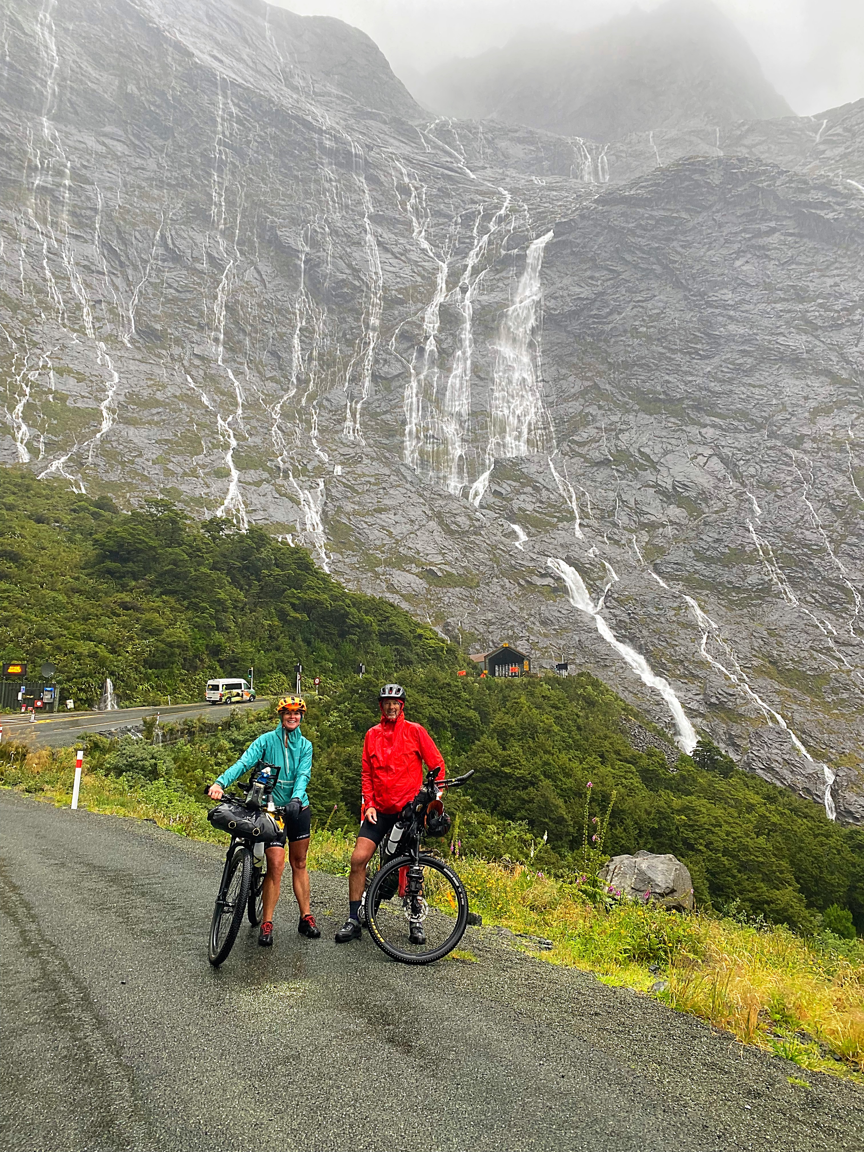
24 February 2024
Day 13 – Te Anau to Milford Sound 120km 1,600 metres climbed per the guidebook (my Strava said 2,700 metres and Chris’s Strava said 2,200 metres )
1,426 total kilometres in 13 days
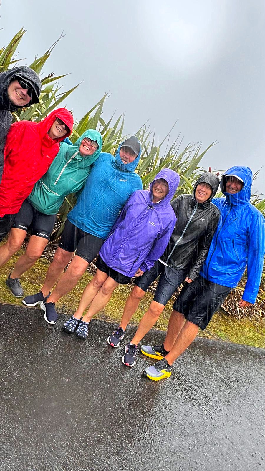
Twelve out of thirteen ain’t bad I suppose. The SUNGRL’s sun powers faltered on the last day, so Chris and I had a very wet ride into Milford Sound.
The forecast didn’t look flash, so we got away at 6am and had a few sprinkles and some gusty headwinds in the first 50 kilometres. By our third snack stop at 85 kilometres the heavens had really opened up, so it was pedals to the metal. One bonus of a wet day in Milford Sound is the amazing waterfalls coming down from the mountains. It is a mystical and magical place.
I had thought that the Homer Tunnel (which is where the big descent starts) was at the 110 kilometre mark. We had to stop at these traffic lights and I was thinking they were doing roadworks halfway up the climb – I didn’t realise we had actually made it to the tunnel at the 100 kilometre mark. It was then an 18 kilometre yahoo descent into the Sounds. Unfortunately due to the rain we had to curtail our yahoo a bit – it was still a fantastic feeling to know we were so close to the end.
We had made good time arriving at 2.15pm after seven hours and forty minutes riding time. We had even beaten our shuttle with Hicksy in it – Hicksy had one job – to cheer us over the finish line
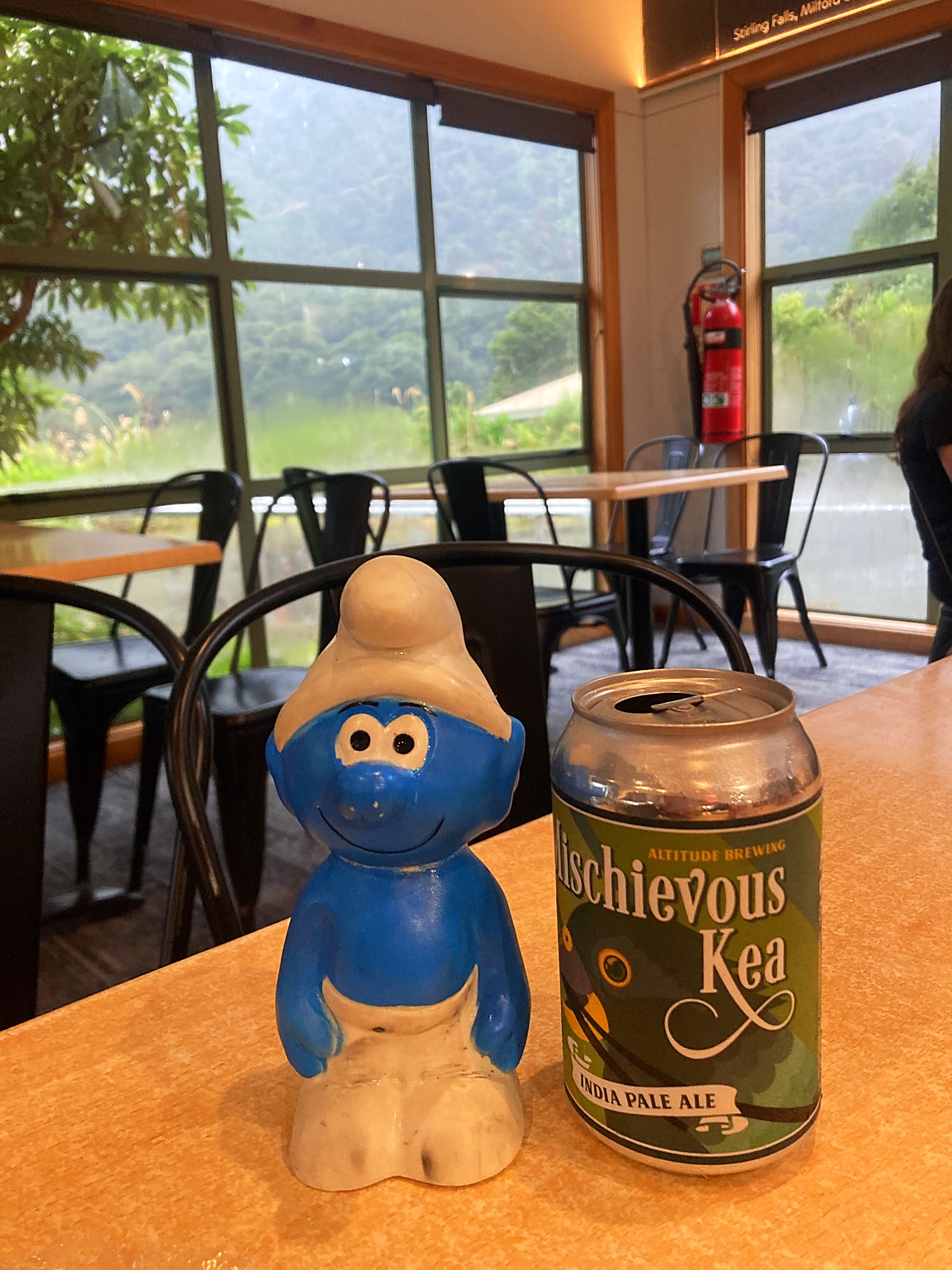
We were soaked to the bone so it was a welcome relief to put dry clothes on and enjoy a hot drink and food.
Fiordland, the region where the Milford Sound is, has an average of about 7 metres of rain fall per year, over an average of about 200 rain-days per year. I guess we picked one of those 200 days
The rainfall and unpredictable weather patterns are due to the famous ‘Roaring Forties’ westerly air streams. These winds pick up moisture as they cross the Tasman Sea, are pushed up by the mountains then release it as heavy rain in the west and snow at higher levels.
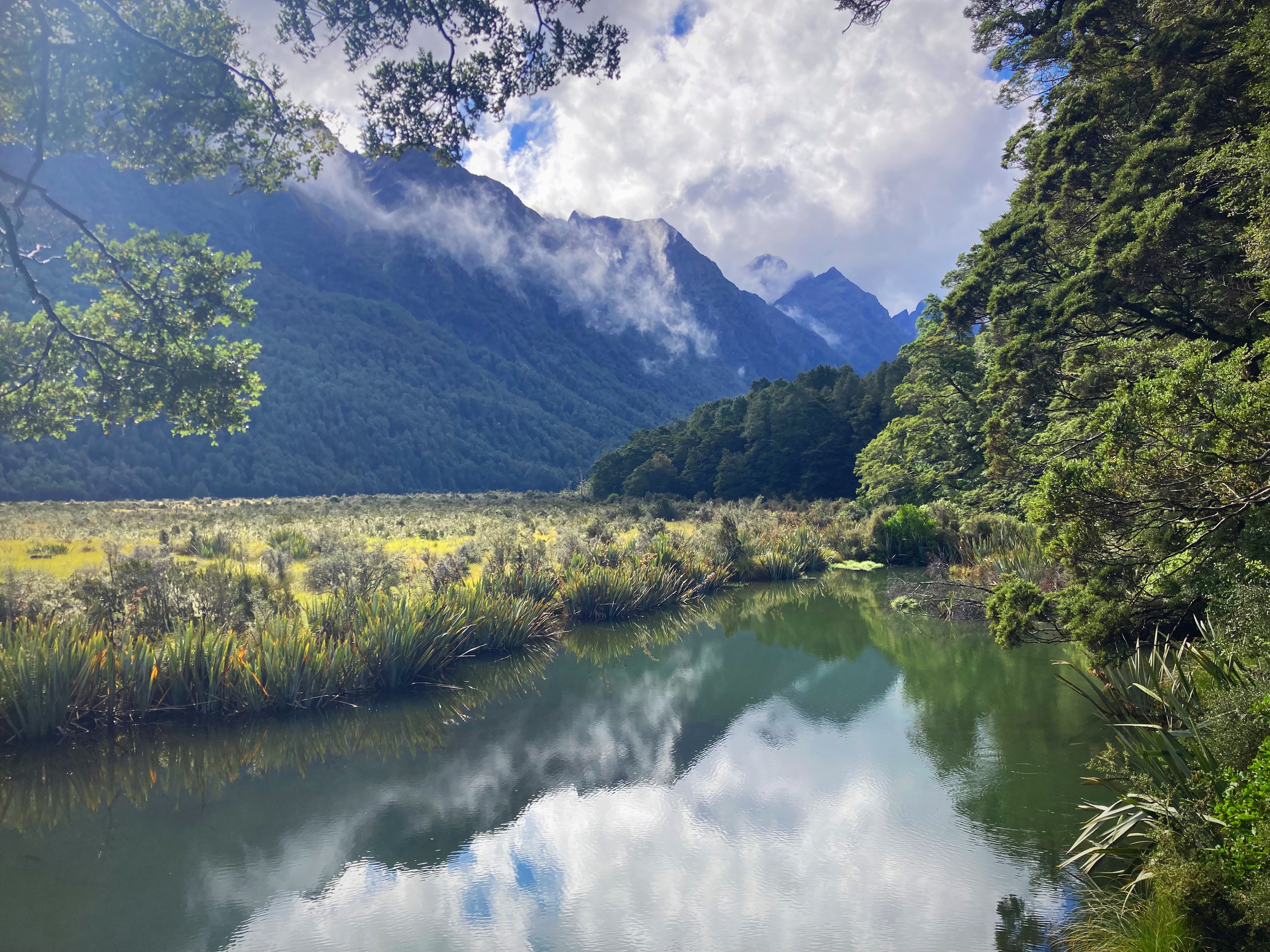
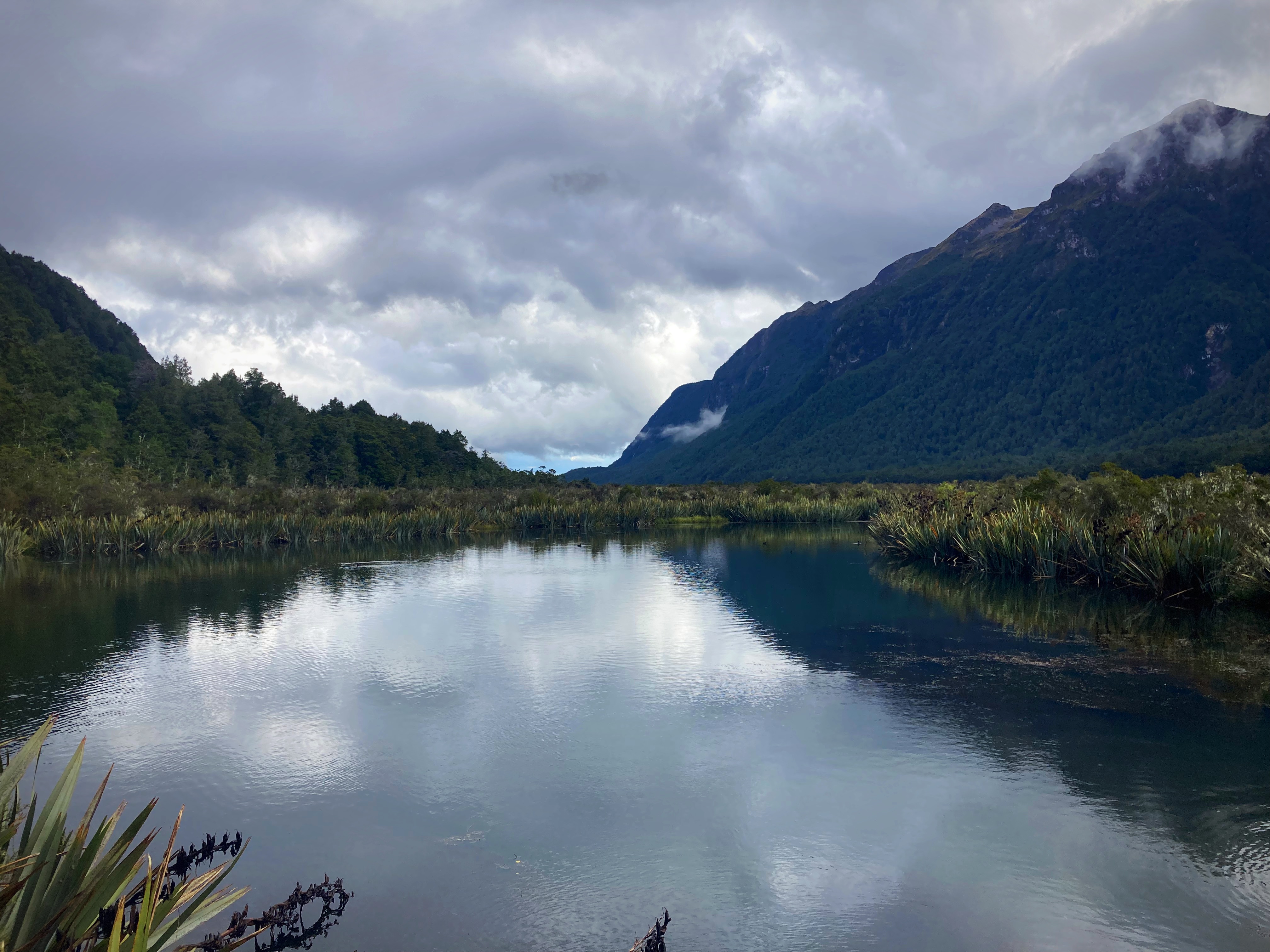
Safely in the shuttle with our bikes we headed back out of the Sounds to Queenstown. The sun then decided to come out so we stopped at the Mirror Lakes to have a look.
Mirror Lakes and the Eglinton Valley make a valuable contribution to Te Wahipounamu-South West New Zealand World Heritage Area. They are part of the largest system of inland waterways in New Zealand, stretching (almost unbroken) from Martins Bay/Kotuku in the north to Te Waewae Bay on the south coast.
Intact river systems, like these found in Fiordland, are becoming increasingly rare on an international scale. Many New Zealand plants and animals that live here will not survive unless the special character of their freshwater environment is safeguarded.
Our shuttle driver, Steve, kept us entertained with information and stories of the area. We had a debrief on speaker phone with Crammers from his hospital bed.
Back to Paul’s (our Queenstown Trail Angel) place to box the bikes up before a couple of drinks to celebrate another amazing journey on our bikes.
Thanks to my physcolists for another memorable adventure. We traversed some challenging terrain but what a treat it was to enjoy such beautiful vistas. There was never a shortage of banter and laughs and a privilege to share the experience with such great humans. Until next time…..
Due to the weather we didn’t take many photos and to be honest I’m not sure they would have done the Milford Sounds justice. To get a better appreciation of the sheer beauty of this special place google Milford Sounds for some amazing videos on YouTube.
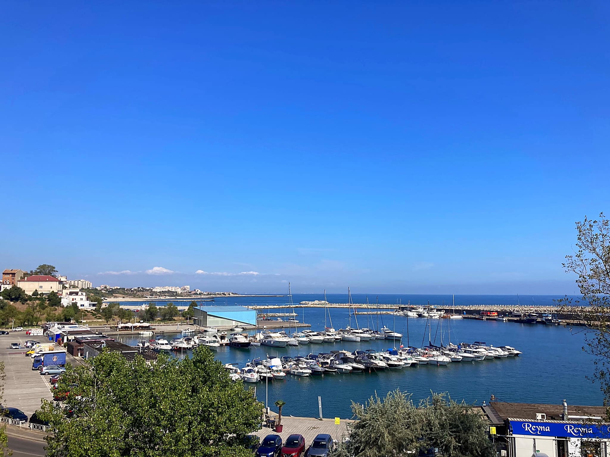
As part of my “let’s explore at least one new place a year” and on a good recommendation, we came to Luang Prabang (LP) in Laos.
We arrived on an ATR-72 which is a twin-engine turbo prop plane that we are very familiar with in NZ.
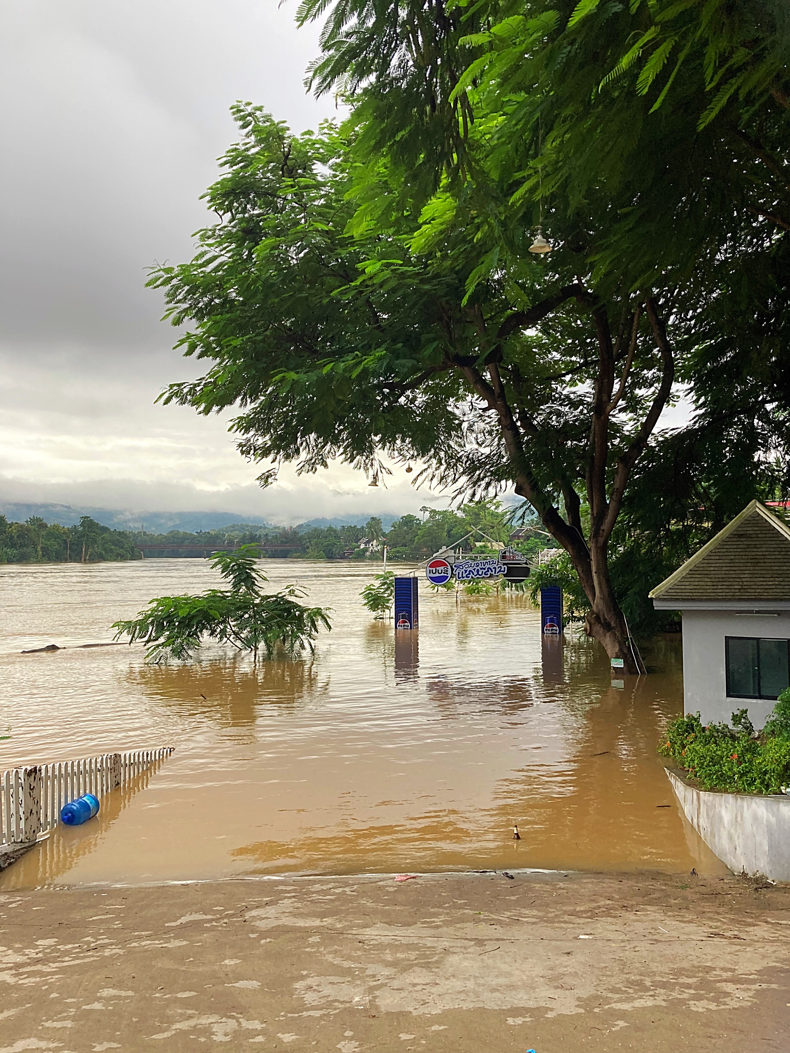
Unfortunately, Typhoon Yagi decided to turn up to the party in China and northern Vietnam the day before we arrived which had a spin off for northern Asia. The first three days we were here it rained a lot of the time but we still managed to explore the town and eat a lot of yummy food and drink a lot of yummy cocktails.
LP reminded me a lot of Hoi An in Vietnam and has a strong French influence. The food has a strong Vietnamese influence which is my favourite Asian cuisine so there was really nothing to complain about. The people are really friendly and speak good English generally.
LP means “Royal Buddha Image” and the town is a UNESCO World Heritage Site. It was listed in 1995 for unique and “remarkably” well preserved architectural, religious and cultural heritage, a blend of the rural and urban developments over several centuries, including the French colonial influences during the 19th and 20th centuries.
The town has many beautiful buildings, but the streets are a little unkempt. We stayed at a hotel on what they call the ‘island” or ‘tongue’. It is surrounded on one side by the Nam Khan River which flows into the Mekong which is on the other side. Due to all the rain the rivers were flowing high and fast. There is actually a flood warning in place here due to all the rain that has fallen further north causing flooding upriver.
Typhoon Yagi is the strongest typhoon to make landfall in 10 years in the Chinese holiday island of Hainan and has claimed some lives and caused over a million people to be evacuated. We got off lightly and will be back in Hua Hin before any flooding issues hit LP.
We enjoyed watching the people go about their daily business and came across a number of schools. The kids were noisy, happy and very engaged in their learning. We were especially intrigued by them all turning up on motorbikes, both petrol and electric. They look way too young to be in control but can often be seen with two or more onboard. With the rain, the pillion passenger was usually holding the umbrella.
There were a number of zebra crossings in place around town, but I am unsure why – the locals certainly have no idea what they mean as they drive through them as you wait patiently on the side of them or sometimes in the middle of them. It is also left-hand drive here which also took a bit to get used to again.
Facts (thanks Wikipedia)
Laos is officially known as the Lao People’s Democratic Republic (LPDR).
It is the only landlocked country in Southeast Asia – it is surrounded by China, Vietnam, Thailand, Cambodia and Myanmar.
The capital city is Vientiane.
The population is approximately 7.8 million.
The country was under a French protectorate from 1893, occupied by the Japanese in World War II, recolonised by France until it won autonomy in 1949. It gained independence in 1953 as the Kingdom of Laos.
Laos’s strategies for development are based on generating electricity from rivers and selling it to its neighbours, namely Thailand, China and Vietnam. It has been referred to as one of South East Asia’s fastest growing economies despite being classified as one of the least developed.
As part of the Vietnam war between 1964 and 1973, the US dropped two million tonnes of bombs on Laos, nearly equal to the 2.1 million tonnes the US dropped on Europe and Asia during World War II, making Laos the most heavily bombed country in history relative to the size of it’s population.
Some 80 million bombs failed to explode and remain scattered throughout the country, rendering vast swathes of land impossible to cultivate.
The Lao PDR is one of the world’s few socialist states openly endorsing communism.
Human rights violations remain a significant concern in Laos.
China is the biggest foreign investor in Laos.
Subsistence agriculture still accounts for half of the GDP and provides 80% of employment. Rice dominates agriculture, with about 80% of arable land area used for growing rice.
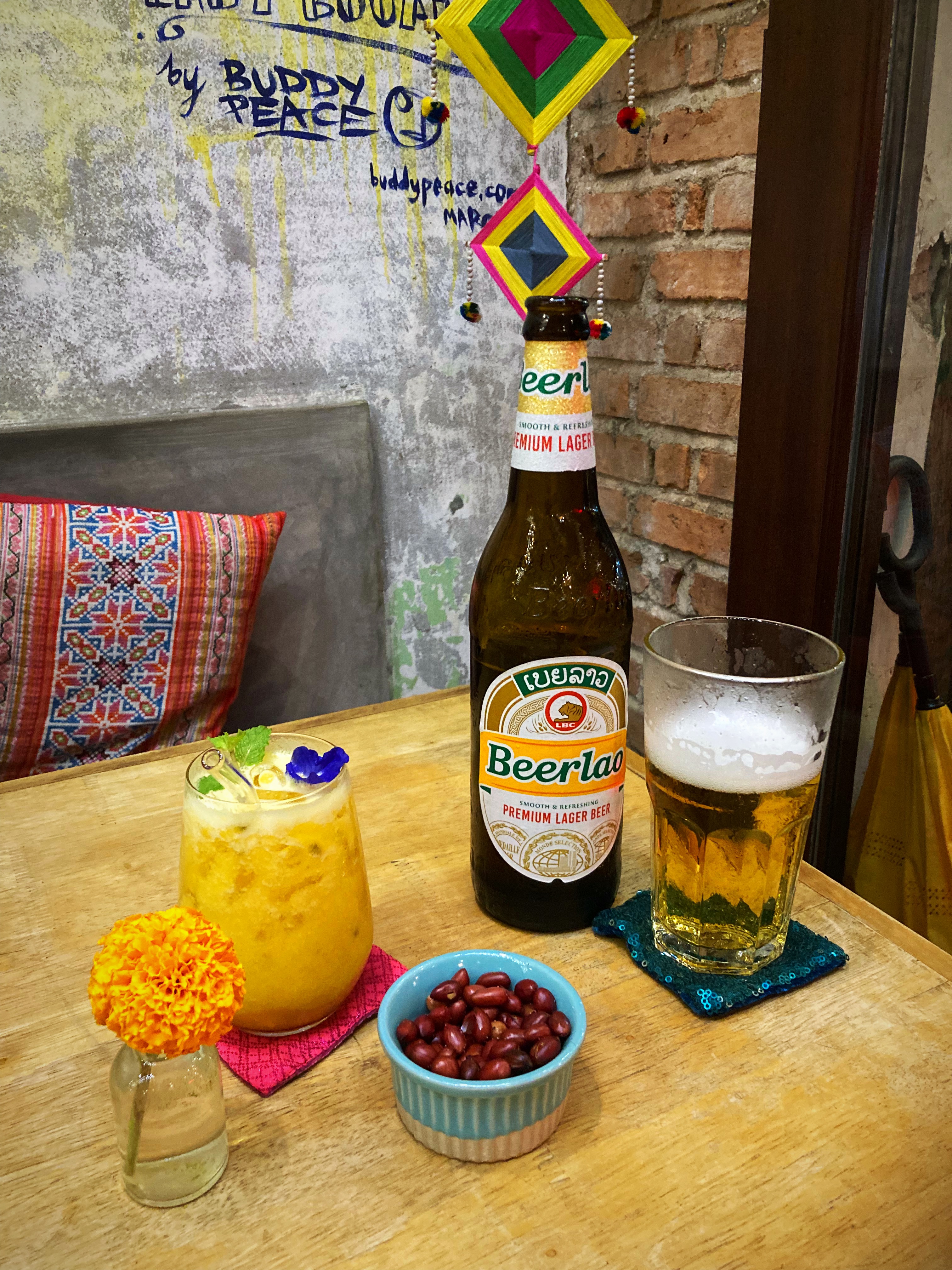
The country’s most widely recognised product may be Beerlao, which in 2017 was exported to more than 20 countries worldwide. The Lao Brewing Company was originally state owned, but Carlsberg Group acquired 70% of the shares with the remaining 30% owned by the government.
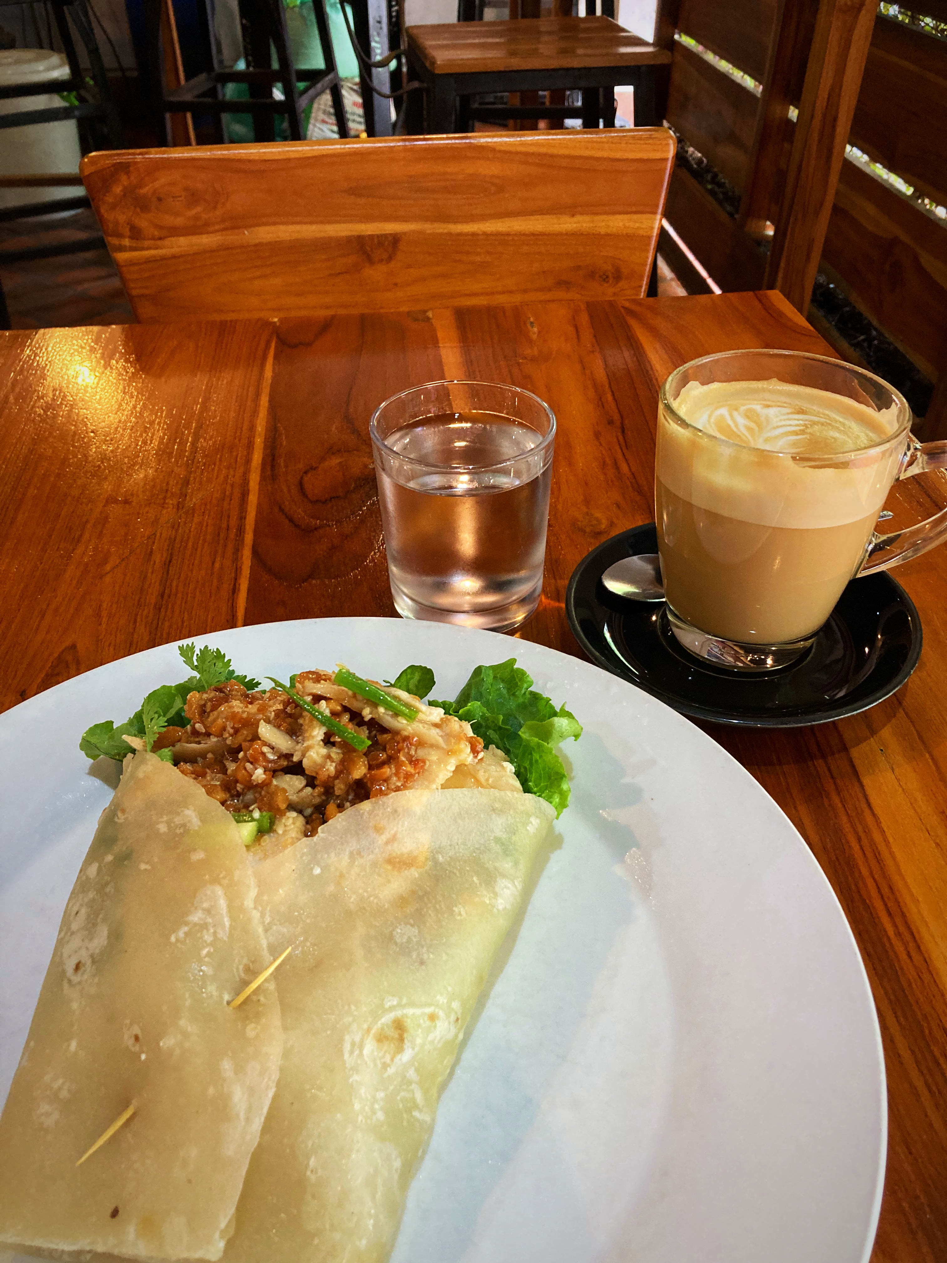
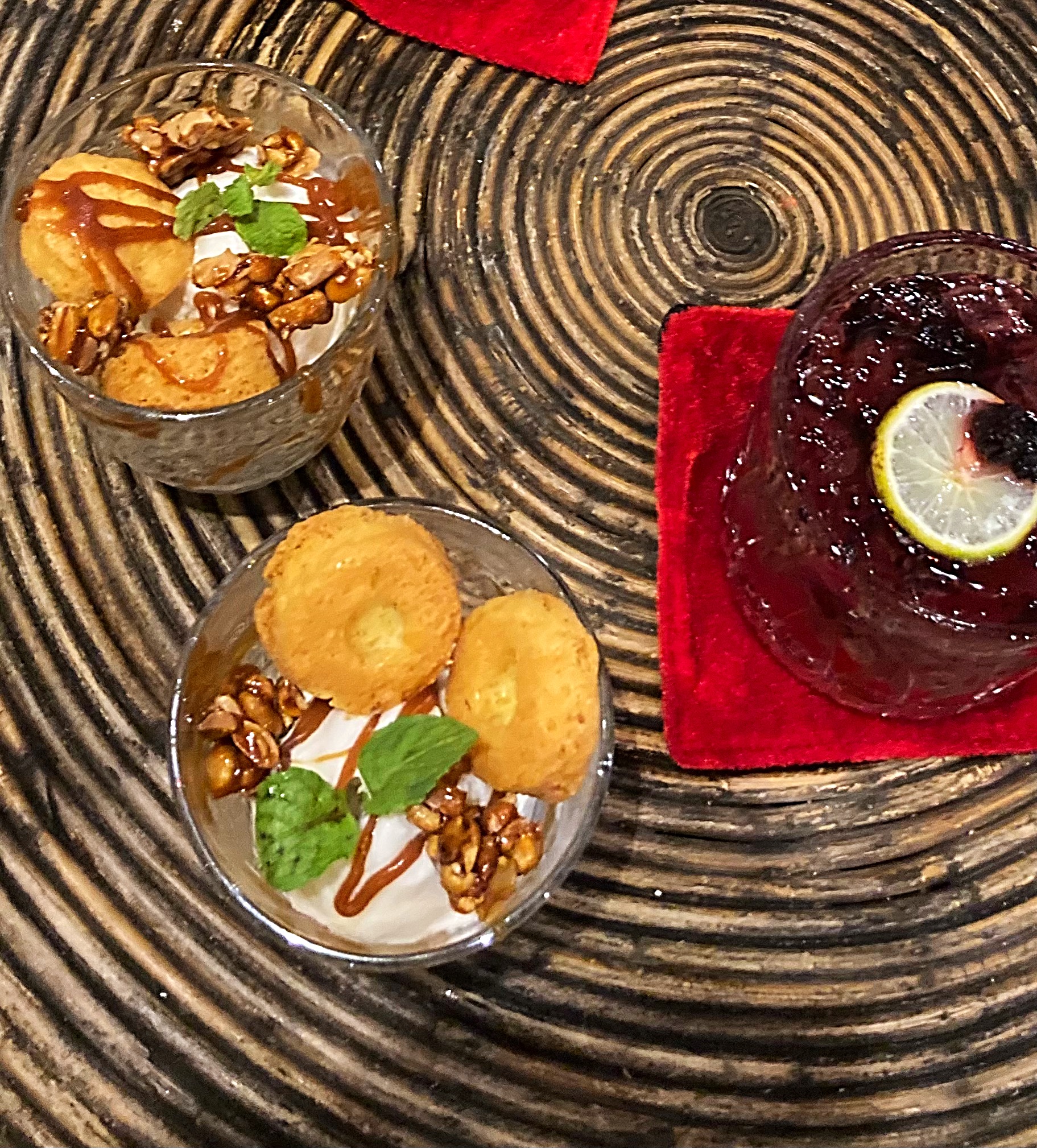
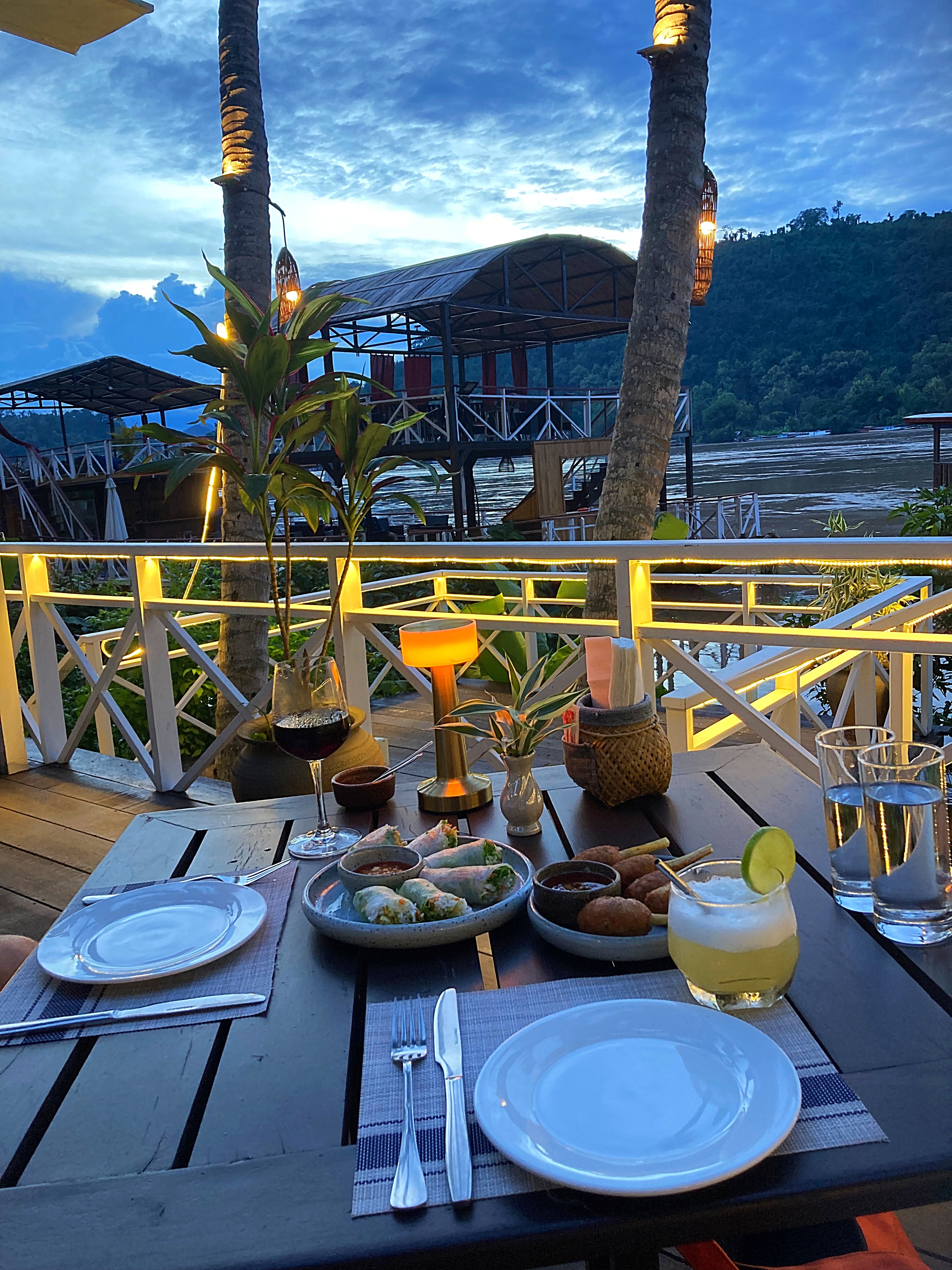
As I mentioned earlier, there are lots of yummy food and drink options. The restaurants and cafes we went to had put a lot of thought into their menu’s, the quality and the presentation of the food. I would liken it to Bali but with a much more authentic vibe and real pride in what they were offering. Here are some of the places we ate at and highly recommend:
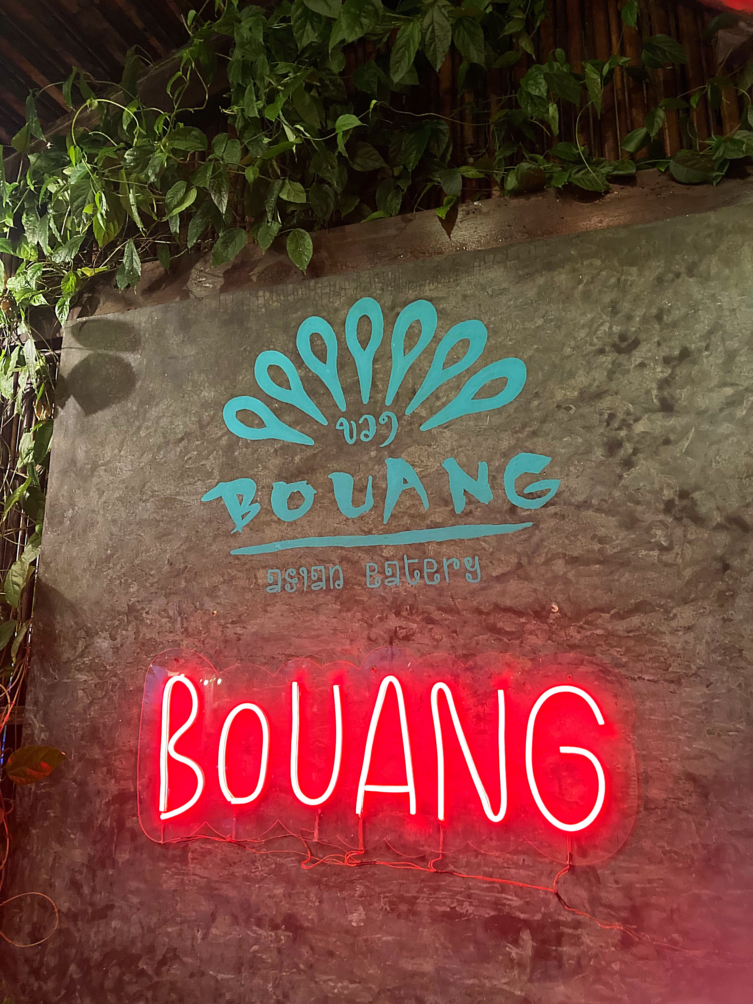
Bouang
A colourful, family run restaurant with yummy local dishes.
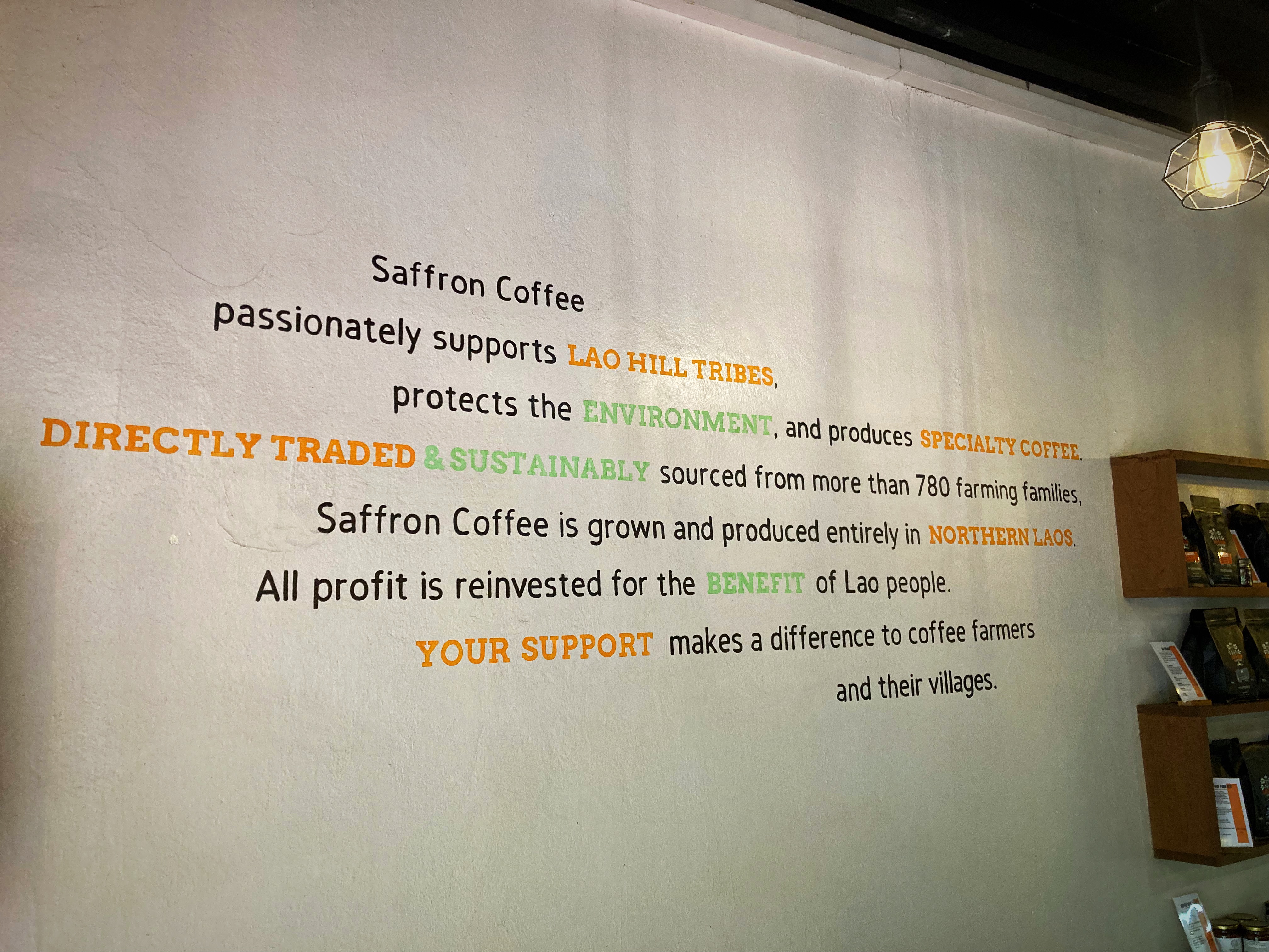
Saffron Coffee
I visited Saffron Coffee every day and enjoyed some great lunches there. I met one of the owners called Todd who was really interesting to talk to. They run as a social enterprise ensuring the people that they work with are equipped with the things they need to prosper.
Check out their website www.saffroncoffee.com for more information on their operation and methods.
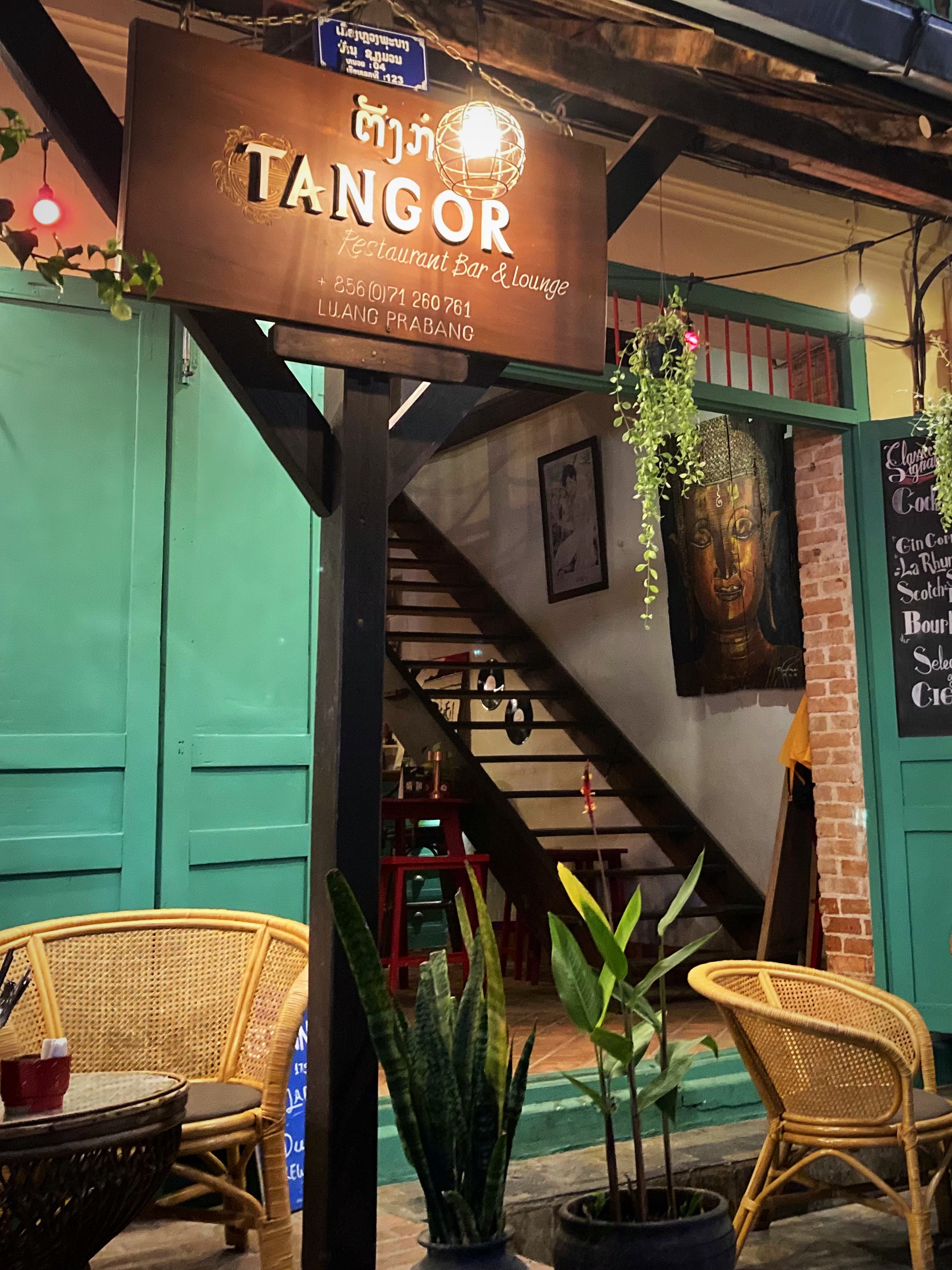
Tangor
Tangor has been open since 2012 serving Asian fusion food with a French twist. Located on the main road it is a great spot to sit on the terrace and people watch.
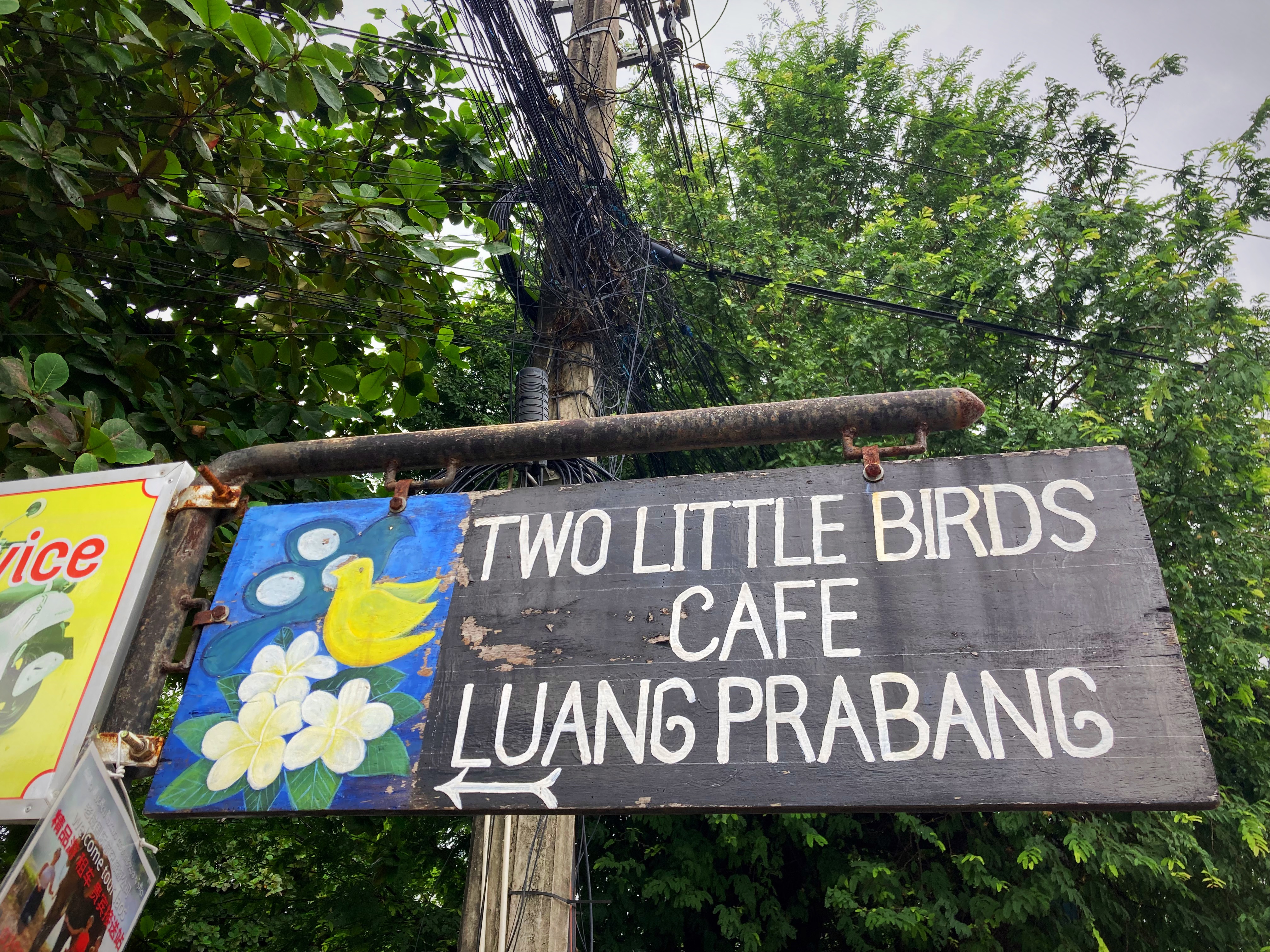
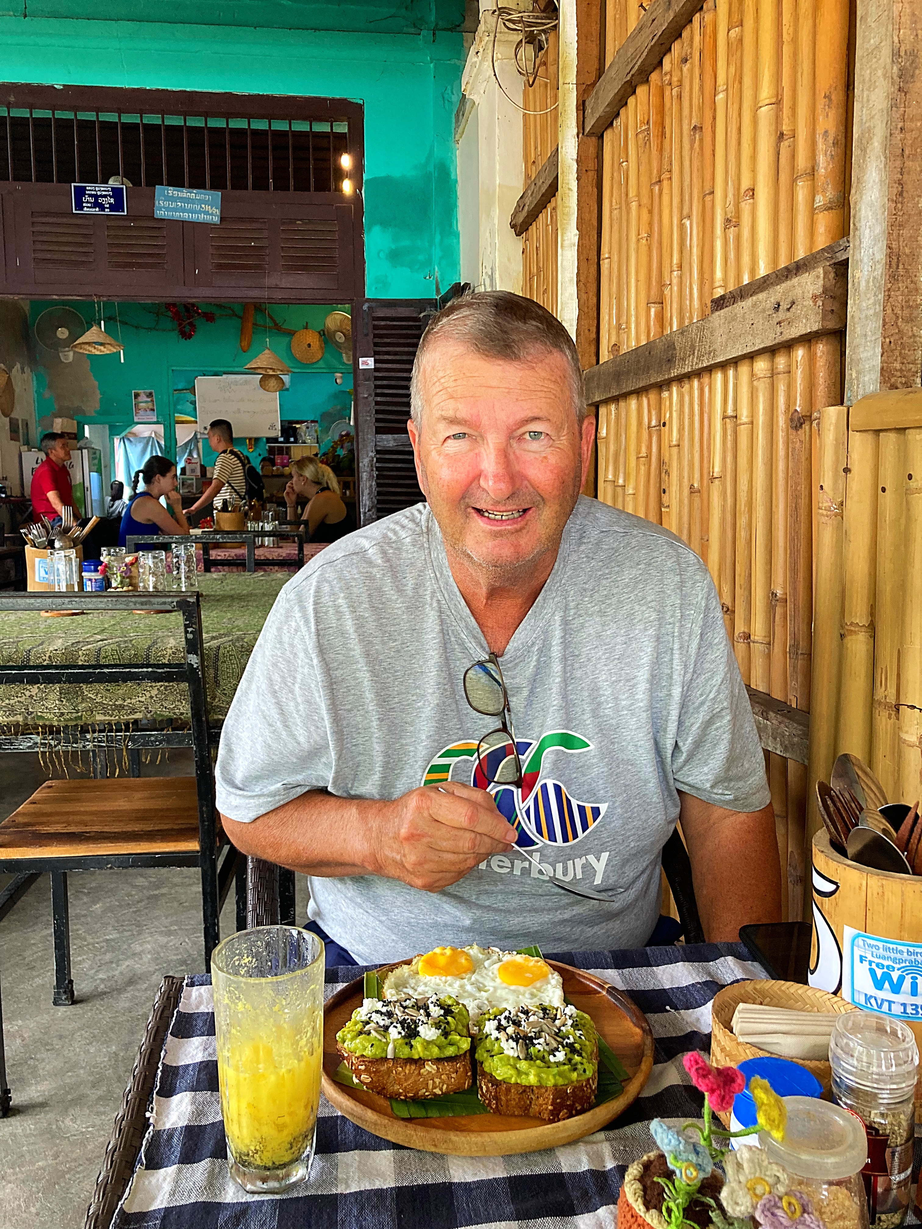
Two Little Birds Cafe
This place was about one kilometer from town with a vegan focus. A little family-owned cafe that makes the most delicious smoothie bowls as well as traditional Laos dishes with a vegan or vegetarian twist. We went there for breakfast most days and enjoyed chatting with the owner. He is a tour guide for Contiki but when he is not guiding, he helps out in the cafe.
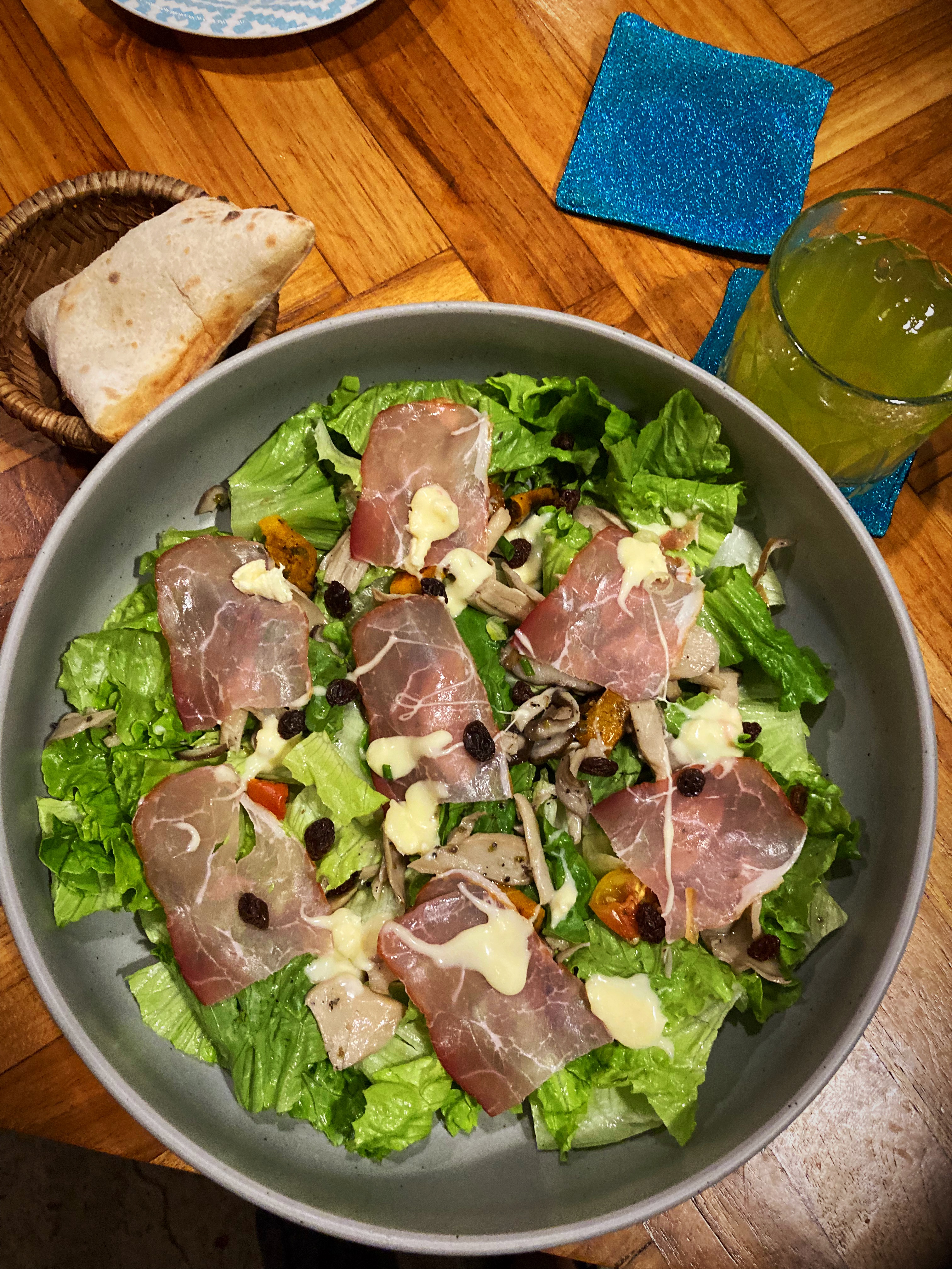
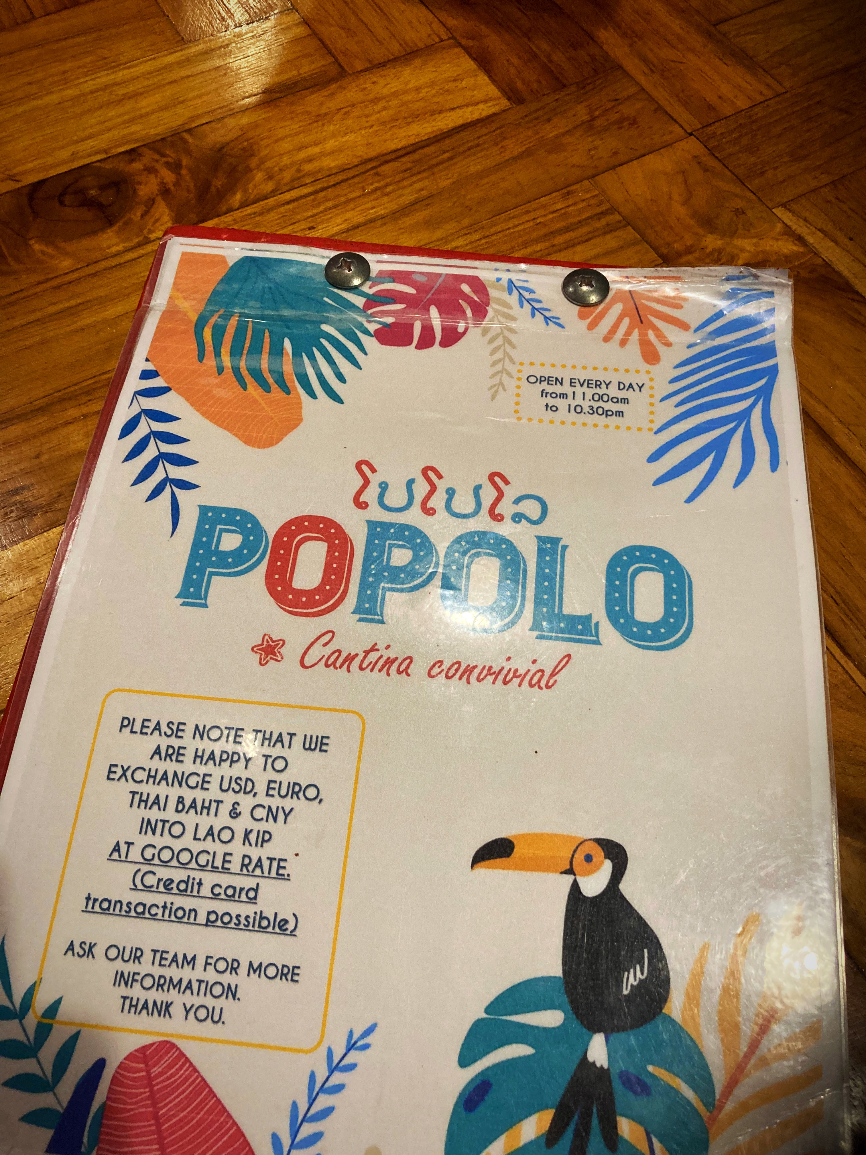
Popolo
Fantastic pizzas and salads. The pizza bases are made from sourdough that has been proving for 72 hours.
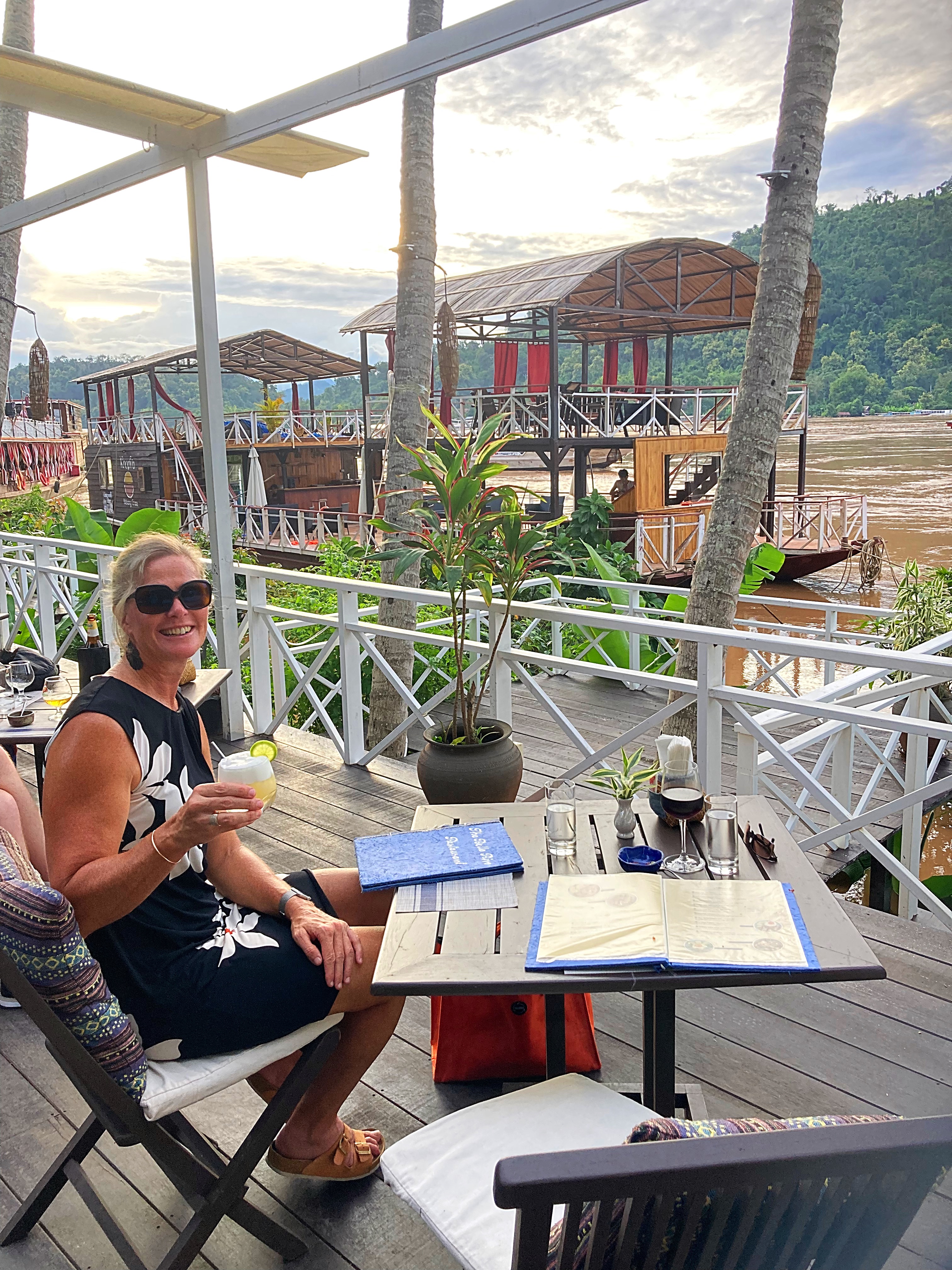
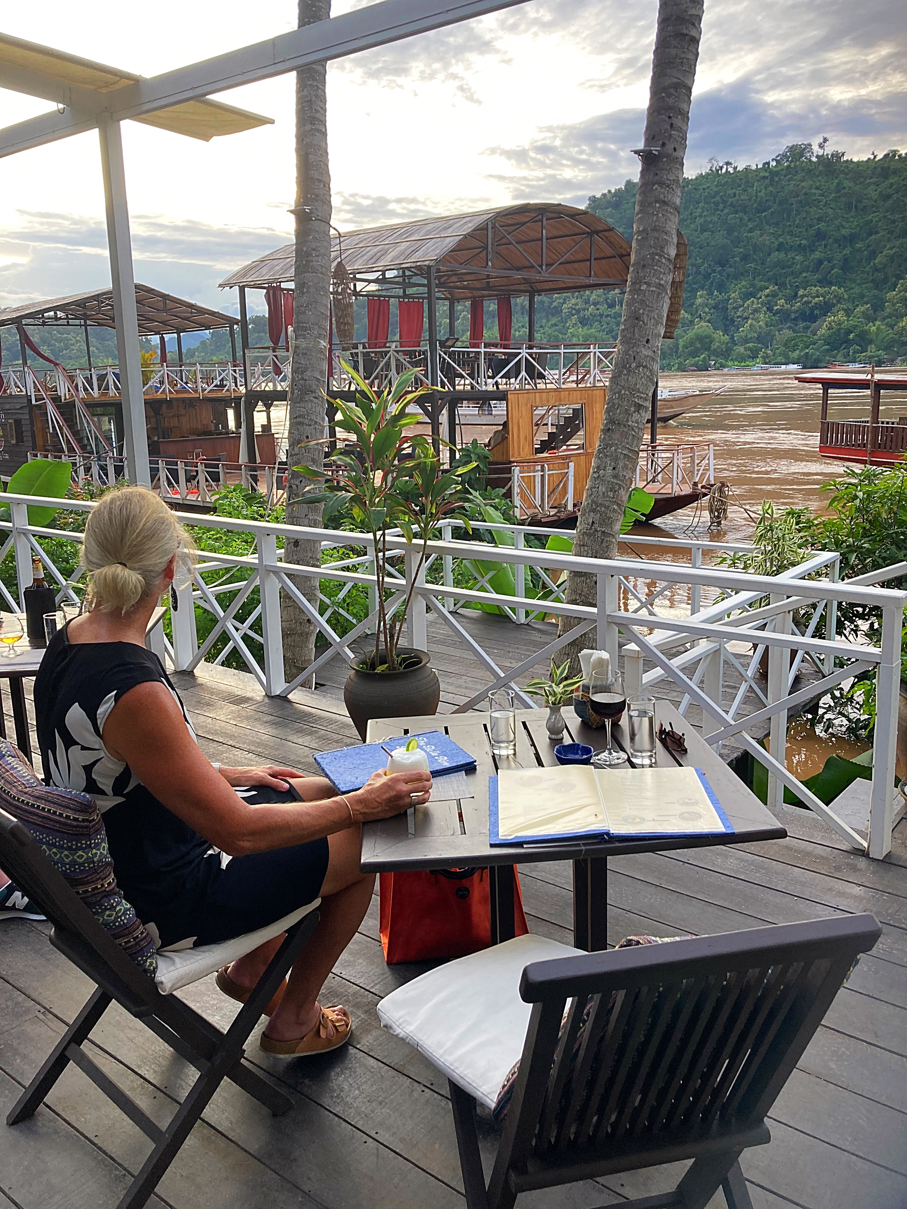
The Belle Rive
This restaurant is associated with the four-star Belle Rive Hotel down on the banks of the Mekong. A little more expensive but well worth it to enjoy the sunset over the Mekong. Unfortunately, the risk of flooding mentioned earlier, meant that the staff were busy shifting everything up to higher ground in case of flooding. Absolutely delicious food, drinks and service.
Sena
We didn’t eat here but enjoyed an after-dinner drink. Their cocktail named “Honeymoon” is an absolute must. It is lucky I only discovered it on our last night!
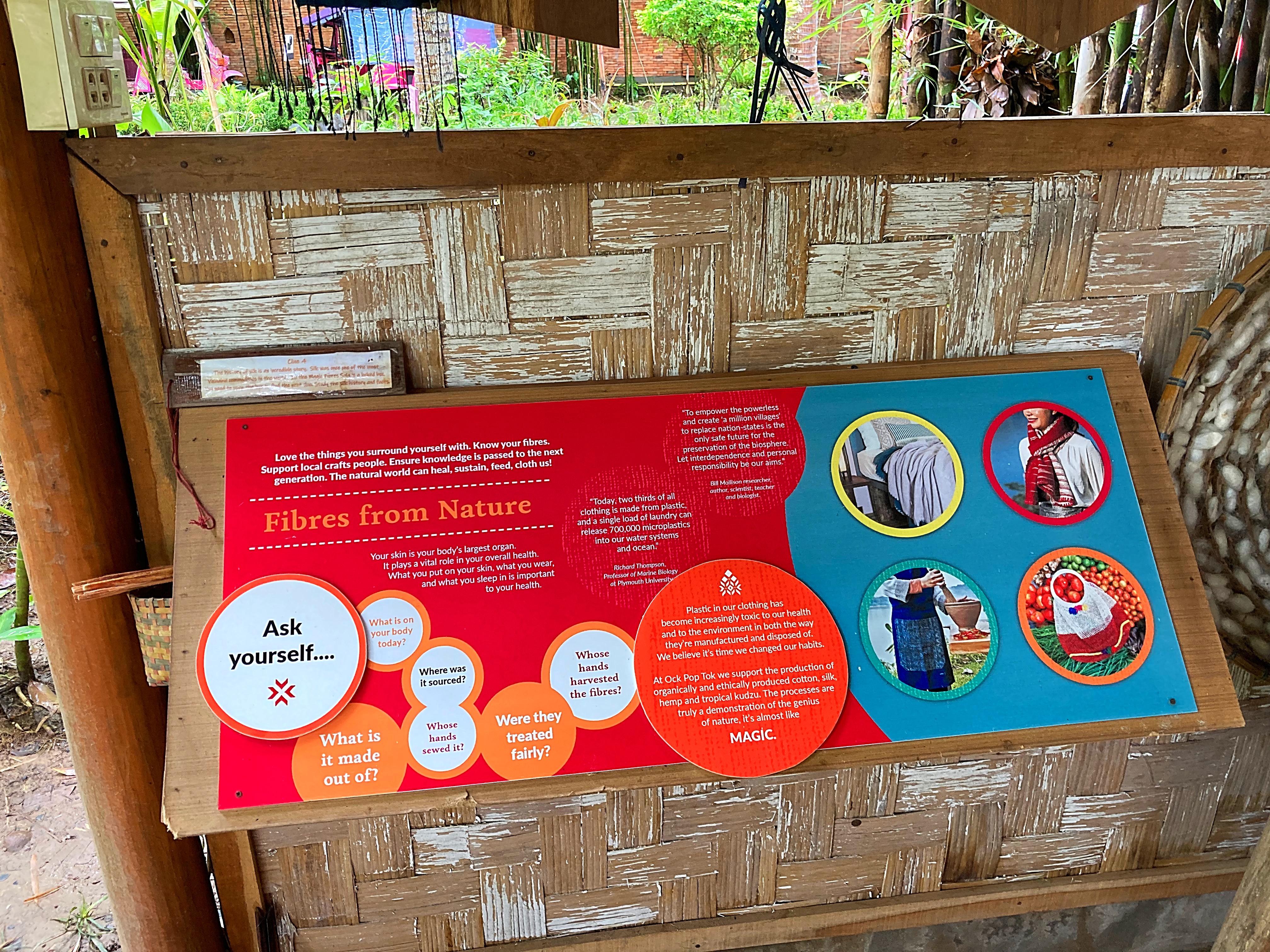
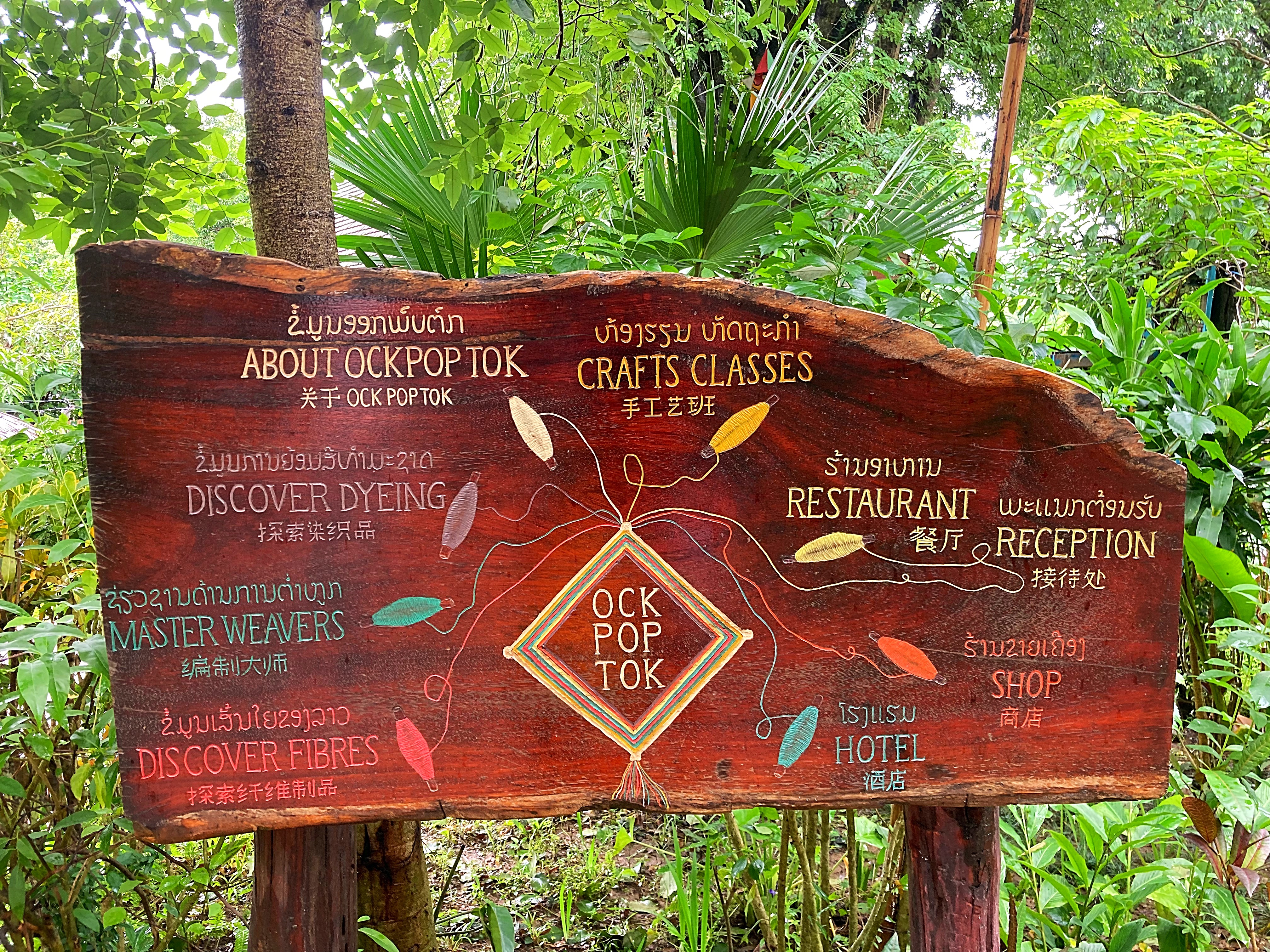
Laos has a number of social enterprises where the focus on the business is to educate, employ and empower the people involved. I walked out to Ock Pop Tok’s living craft centre, meaning “East Meets West” which is the perfect analogy for the meeting of British Jo and Laotian Veo, the two co-founders. Since the beginning, the artisan social enterprise, has been trying to bring two worlds together. Merging traditions from the east with innovation from the west has allowed them, since 2000, to elevate the profile of Lao textiles and contribute to its preservation. Check out their website for more info https://www.ockpoptok.com it is absolutely inspirational and so interesting.
Unfortunately, I arrived at lunchtime so there were no demonstrations or tours happening. You can do a self-guided audio tour or just walk around and read all the information boards. There was one woman working on her loom – wow is all I can say. Such intricacy using the traditional equipment and methods.
On the last morning I decided to walk up Phousi Hill – it was still a little cloudy after some more overnight rain but that just added to the mystical nature of it, with some clouds still lingering in the mountains.
Phou Si, which means “sacred hill” is about 100 meters high. There are about 300 steps to the top but it is worth the effort. From the top you will have great 360 degree views of Luang Prabang, the Mekong and Nam Khan rivers and the forested mountains.
Ancient legend tells of a powerful Naga (part human, part serpent deity in Buddhist and Hindu belief) who used to call the mountain home, and there are beautiful little temples and shrines dotted throughout the hill, their gilded rooftops just visible above the trees.
As my good friend Debs says, you must leave a little salt on the bread. Due to the rainy weather, we didn’t get to explore the Kuang Si waterfall or visit the Buffalo dairy farm. They are on the list for next time as we will definitely be back.
After two amazing weeks in Sicily it was time to start our journey home.
Sicily – Zurich – Singapore
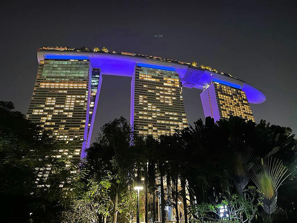
We went from the dry heat of Sicily to the humid heat in Singapore for a couple of nights. Apart from Debs, none of us had been to Singapore before and Debs visit was many moons ago.
We stayed in Chinatown and enjoyed the culinary delights and hustle and bustle that has to offer.
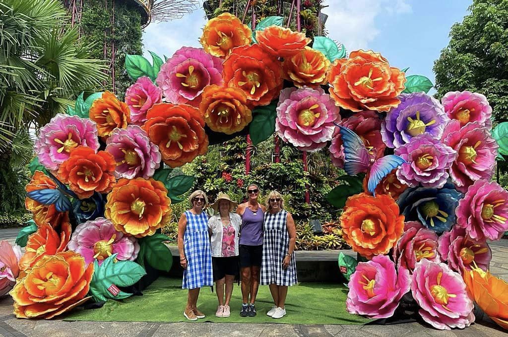
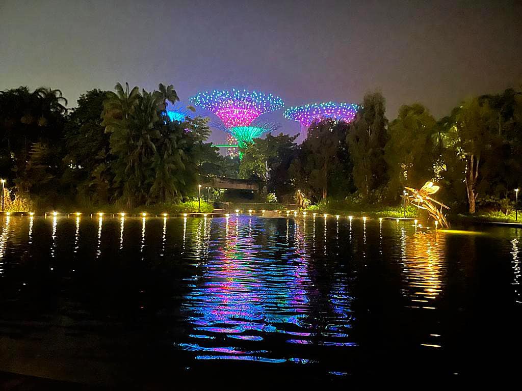
We spent our only full day in Singapore zipping around on the MRT visiting the various sights – Little India, Orchard Rd and the Gardens by the Bay.
Gardens by the Bay is a nature park spanning 101 hectares (250 acres) and was part of the nation’s plans to transform its “Garden City” to a “City in a Garden”, with the aim of raising the quality of life by enhancing greenery and flora in the city. Its Flower Dome is the largest glass greenhouse in the world.
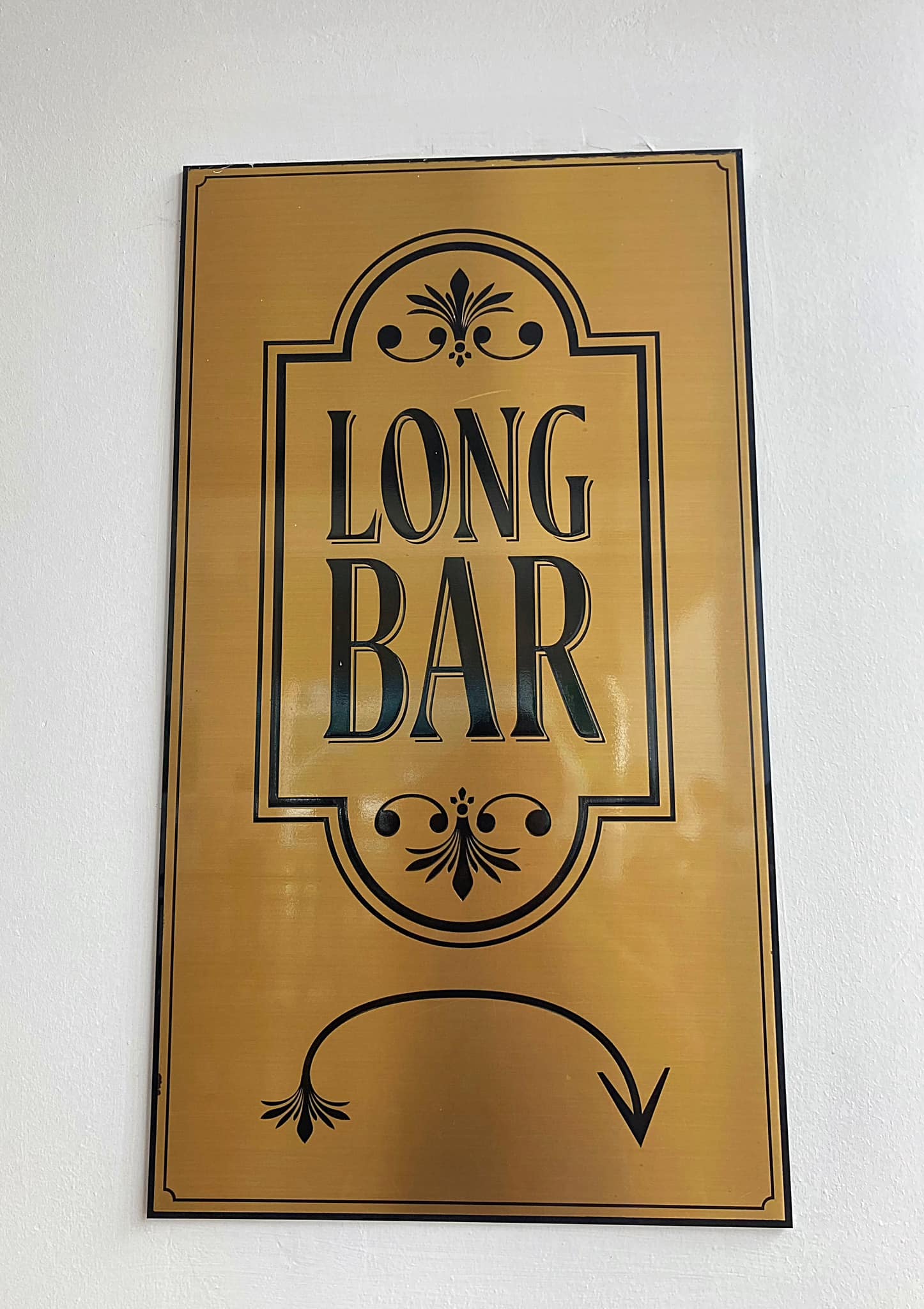
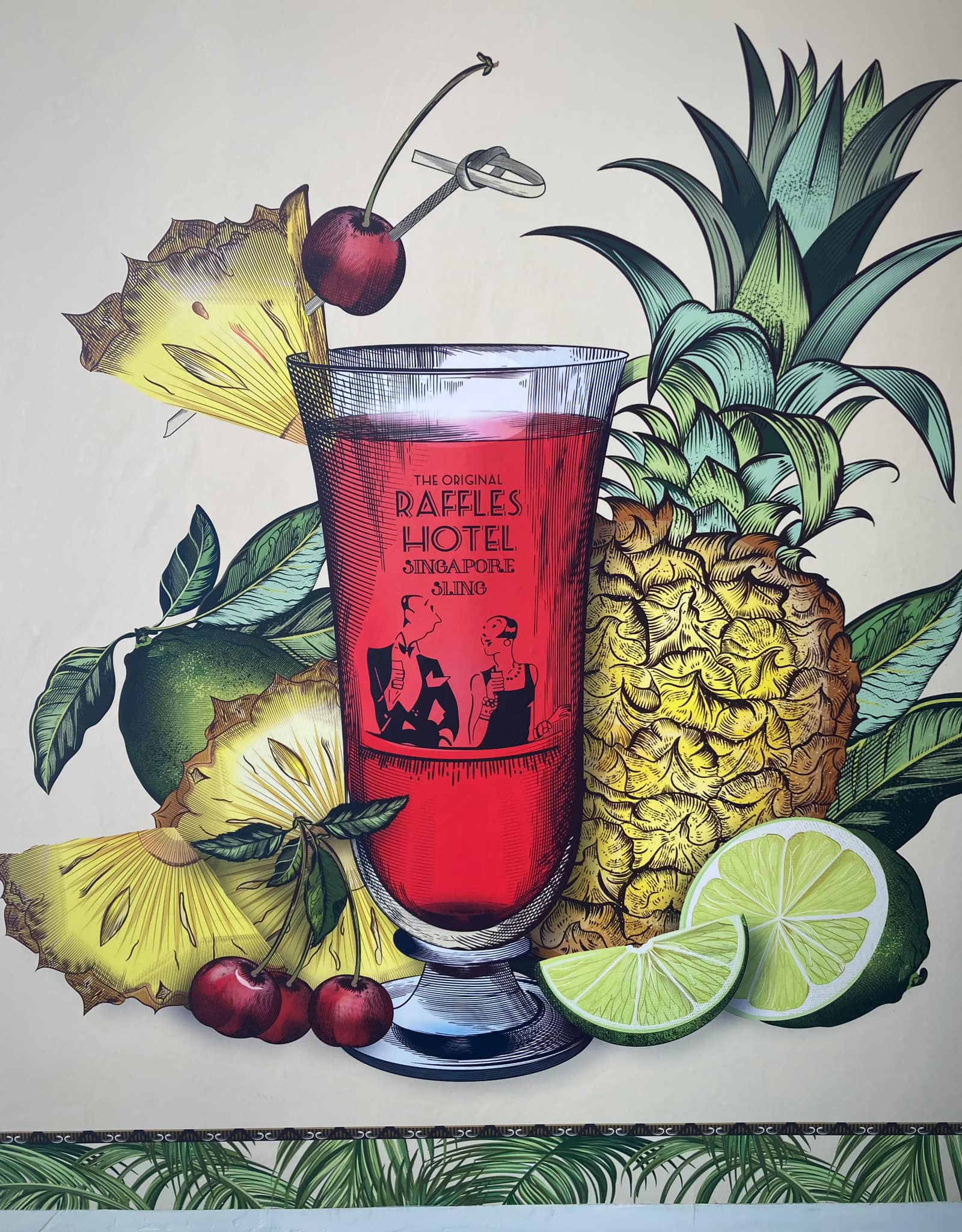
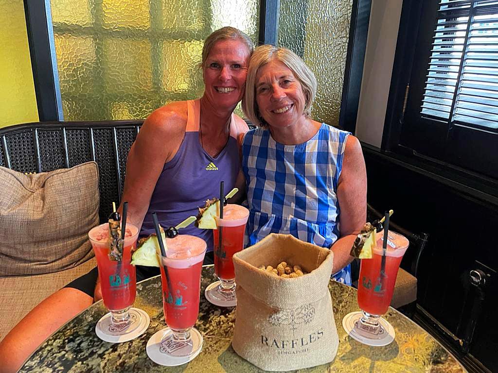
We finished off with a Singapore Sling at Raffles.
Ngiam Tong Boon was a talented Hainanese bartender in the 1900s helmed with years of experience managing bars, hotels and restaurants in Asia. After being hired by Raffles Hotel Singapore, he worked as a bartender in Long Bar, then located in Cad’s Alley. It was during this period that an undisputed legacy was born.
With a rose tint, tall Raffles glass and crisp pineapple and cherry garnish, the Singapore Sling continues to be a favourite among guests even after a century. The Singapore Sling elates guests with a perfect fusion of acidity, sweetness, and bitterness coupled with a dash of alcohol, while remaining aesthetically pleasing.
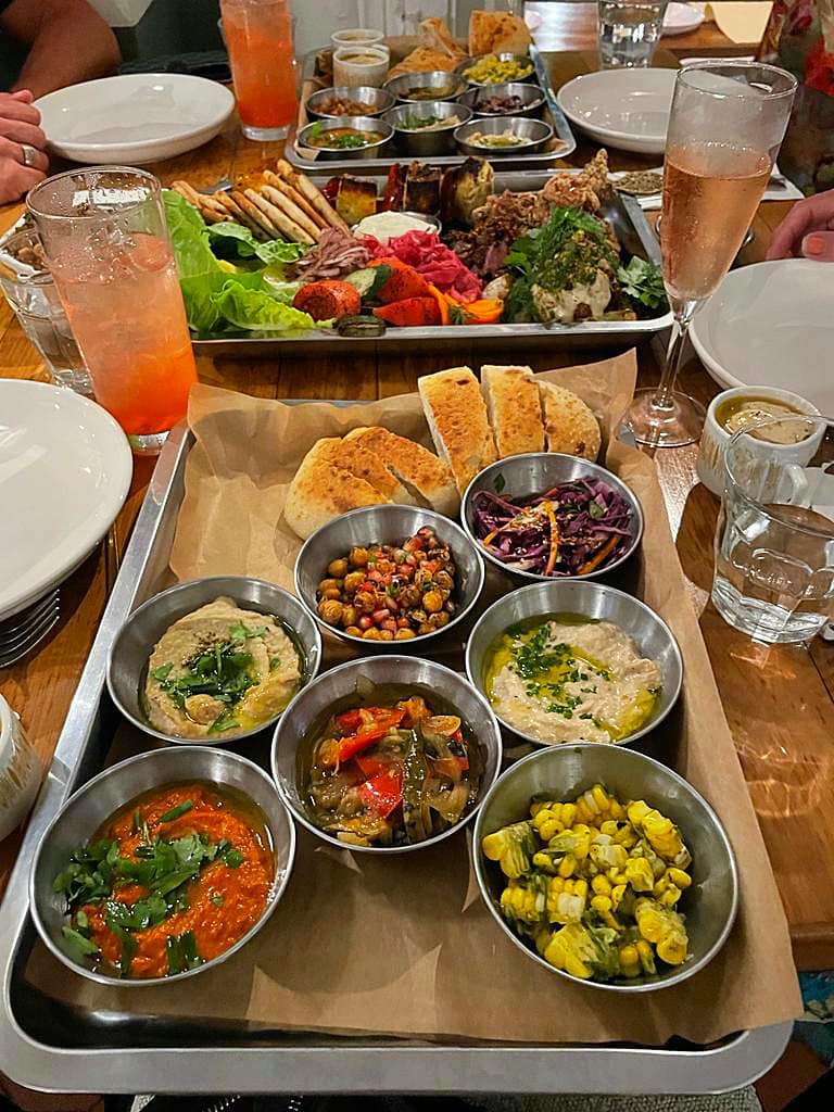
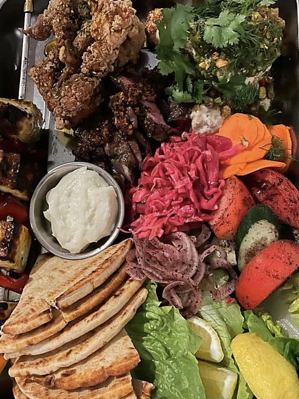
We went to the highly recommended restaurant, Artichoke, for dinner. Artichoke is a Middle Eastern-inspired New School Kebab and Mezze Bar in the heart of Singapore’s Arts and Heritage district, helmed by chef-owner Bjorn Shen. The food and service were top notch.
Singapore is a beautiful city that prides itself on its orderliness, cleanliness, efficiency and friendliness. Quite the contrast to Sicily
Today we went to the Botanic Gardens which are pretty amazing. The idea of a national garden in Singapore started in 1822 when Sir Stamford Raffles, the founder of modern Singapore and a keen naturalist, developed the first “Botanical and Experimental Garden” at Fort Canning. This garden closed in 1829 and it was not until 30 years later that the Singapore Botanic Gardens at its present site was founded by an Agri-Horticultural society. This oasis of beauty and greenery was soon handed over to the Government.
In the early years, the Gardens played an important role in fostering agricultural development in Singapore and the region through collecting, growing, experimenting and distributing potentially useful plants. One of the earliest and most important successes was the introduction, experimentation and promotion of Pará Rubber, Hevea brasiliensis from 1877.
This became a major crop that brought great prosperity to the Southeast Asian region. In the 1920s, the Gardens spearheaded orchid breeding and started its orchid hybridisation programme. In contemporary times, the Gardens also played a key role in Singapore’s Garden City programme through the continued introduction of plants of horticultural and botanical interest.
Today, the more than 80-hectare Gardens is home to over 10,000 kinds of plant life set in verdant landscapes. The Gardens has grown into one of the world’s finest tropical gardens and an important centre for botanical and horticultural research, education and conservation. It is also home to the National Orchid Garden, which features the world’s most extensive and comprehensive exposition of orchid culture.
It was then time to head to the airport – three Bella’s heading back to NZ with one heading to her home away from home in Thailand. A wonderful two weeks exploring, eating, drinking, chatting, laughing and enjoying each other’s company
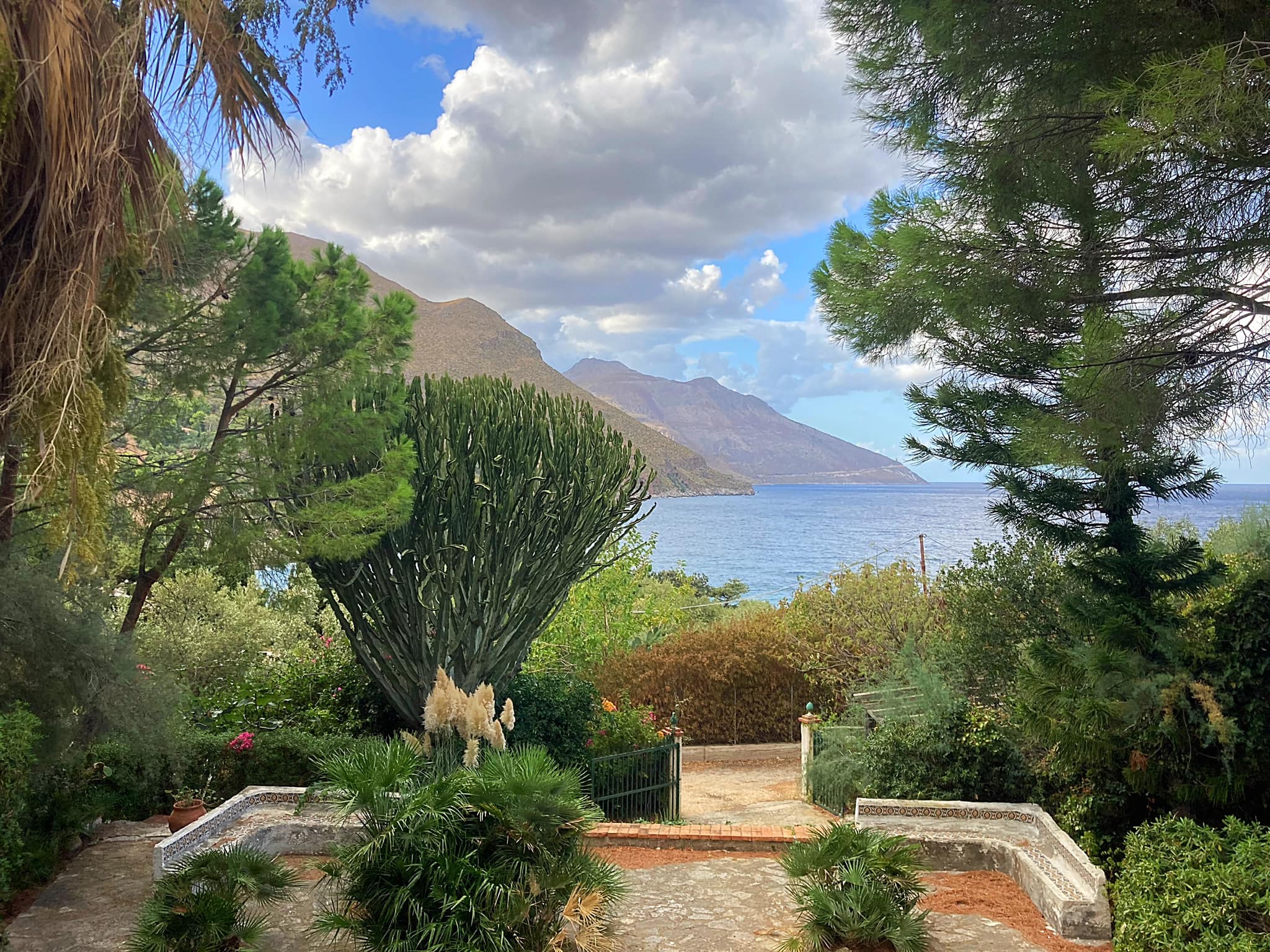
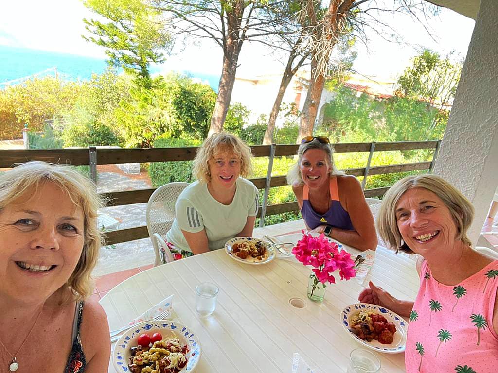
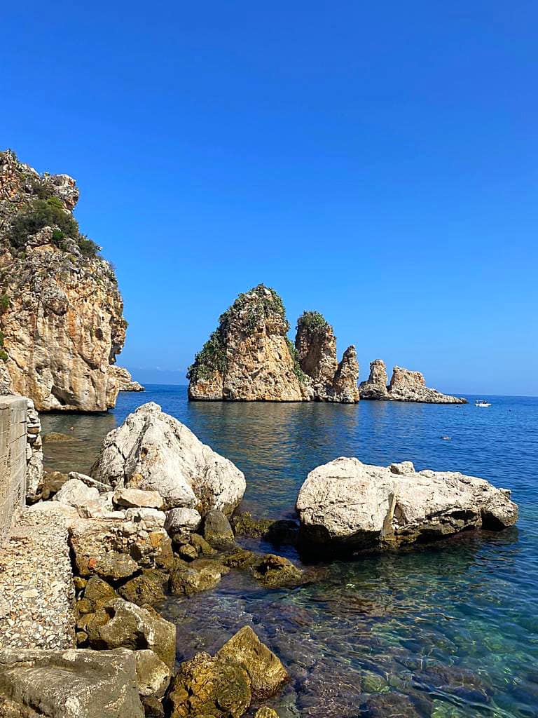
From Bucharest I flew to Sicily to join my dear friends Jo, Kaye and Debs on a Sicilian sojourn. We are staying in a rustic villa near the village of Scopello. It is perfect for our first week in Sicily and has a lovely view out to the ocean and a beautiful beach about 500 metres away.
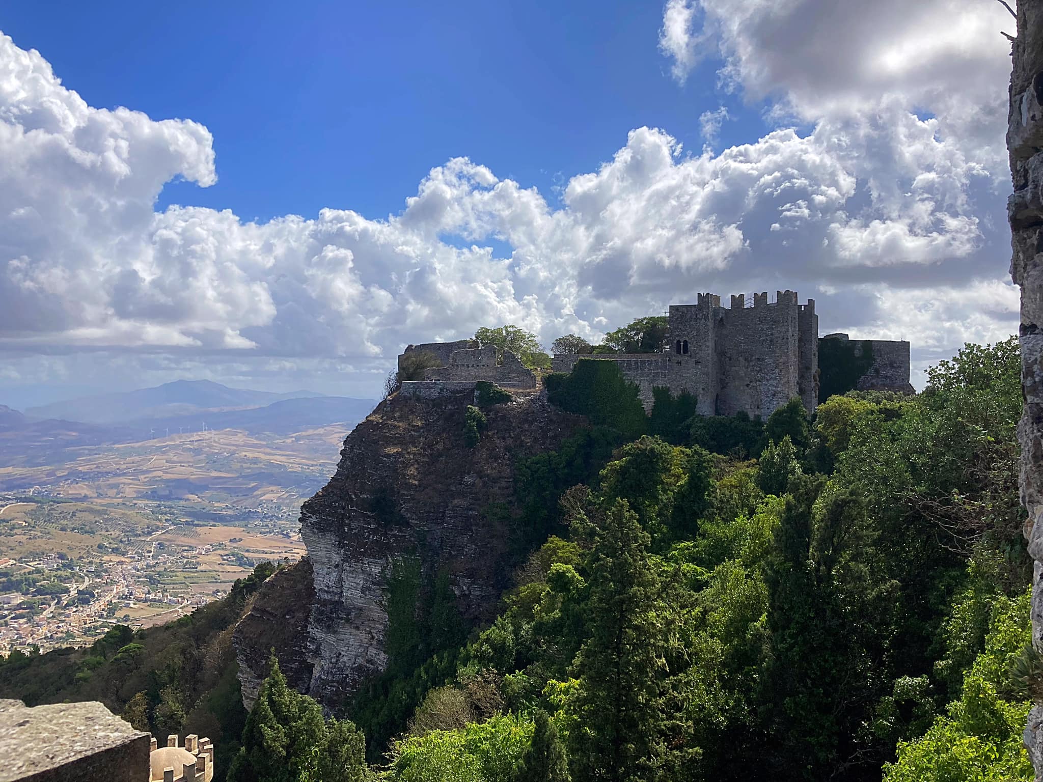
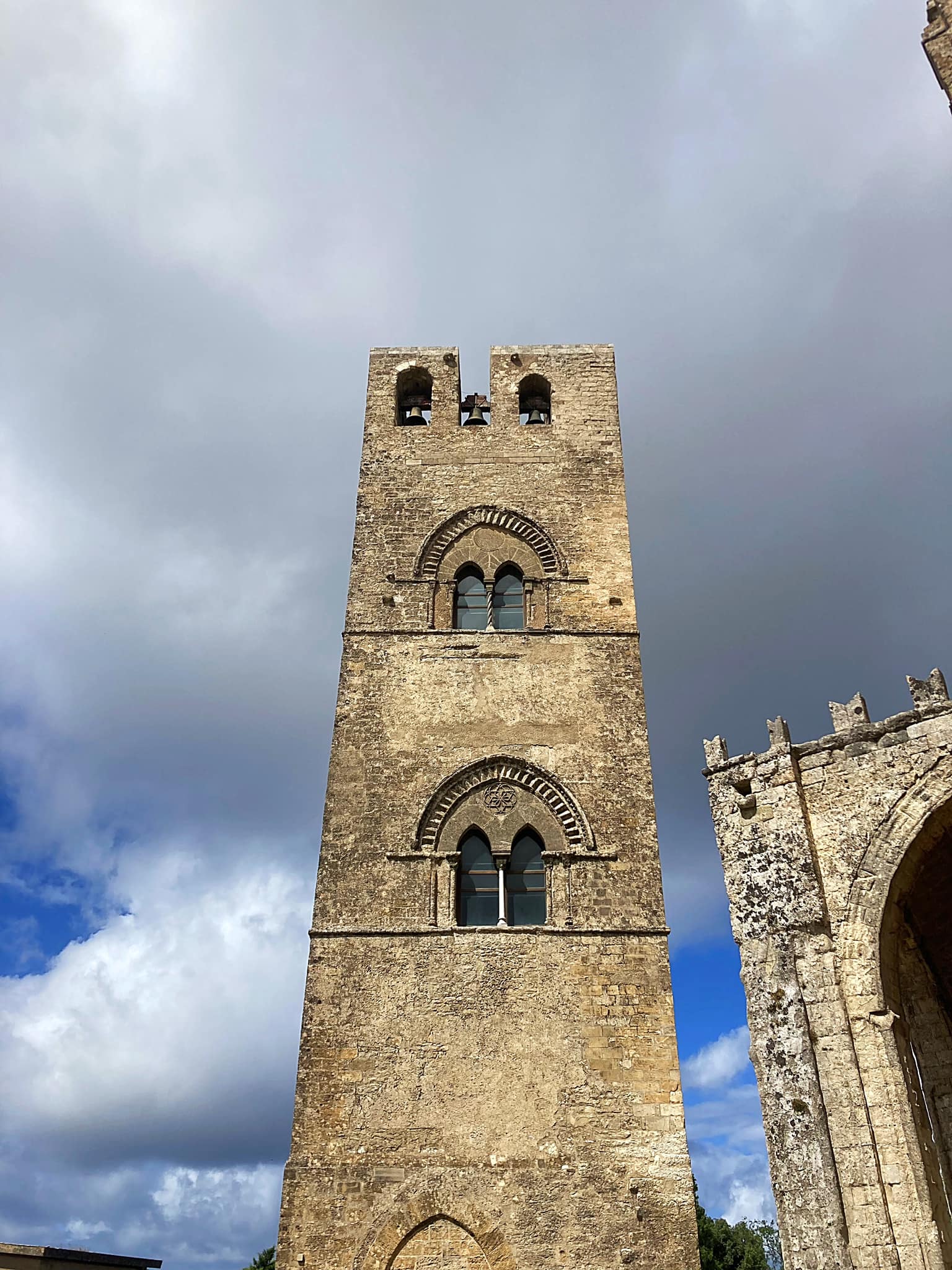
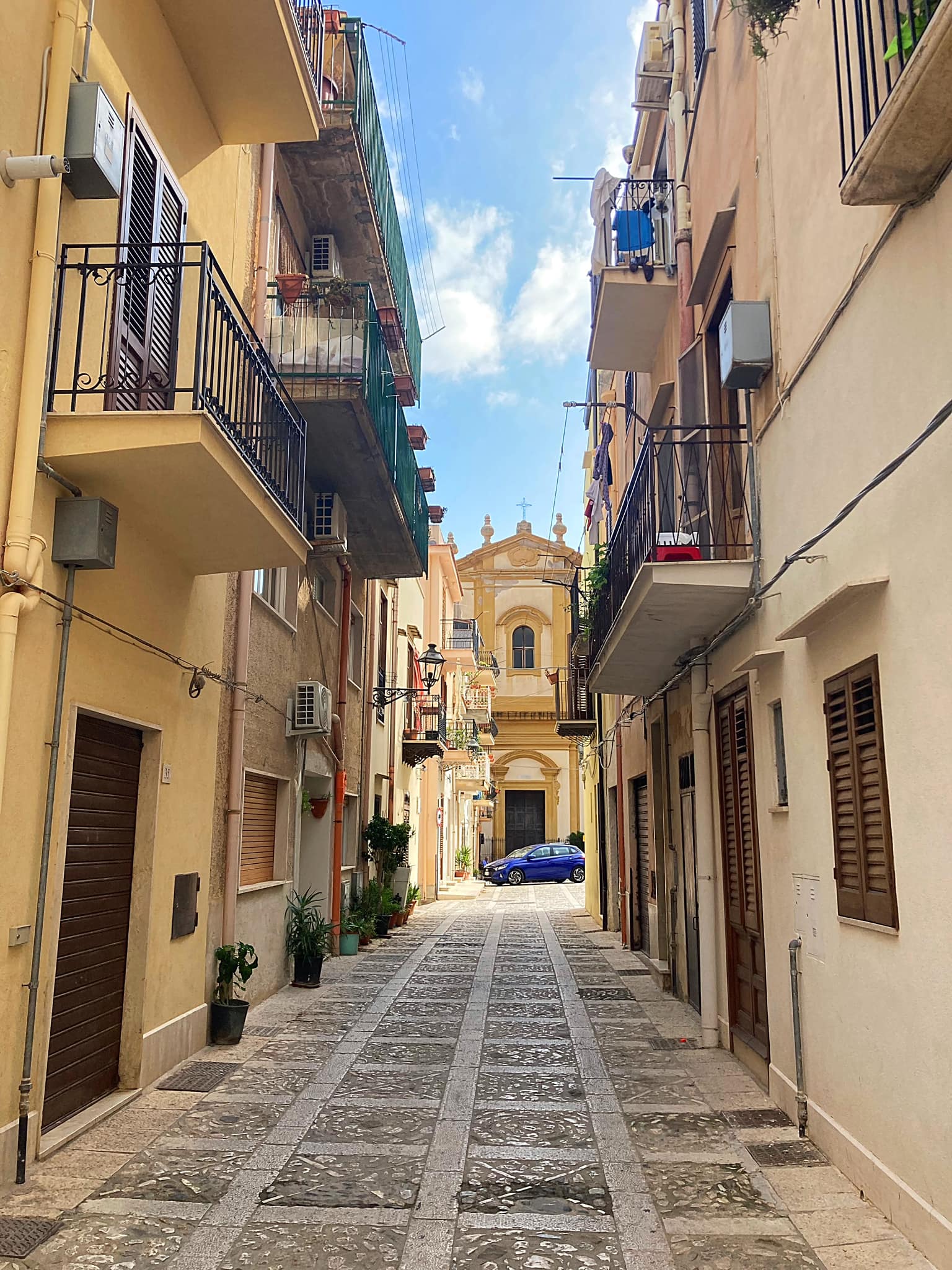
On our first day of exploring we went to the village of Erice. Unfortunately the weather was a bit hit and miss. Erice is a historic town and comune in the province of Trapani, Sicily, in southern Italy. It is a member of the I Borghi più belli d’Italia (“The most beautiful villages of Italy”) association.
In the northeastern portion of the city there are the remains of ancient Elymian and Phoenician walls (Cyclopean masonry) indicating different stages of settlement and occupation in antiquity.
There are two castles that remain in the city: Pepoli Castle, which dates from Saracen times, and the Castello di Venere (“Venus Castle”), dating from the Norman period, built on top of the ancient Temple of Venus, where Venus Ericina was worshipped.
During the Second World War a Luftwaffe Operations Centre (main support weapon of the German Army) was located on the slopes of Monte Erice from early 1943 until they were forced by Allied air raids to relocate.
Erice is about 750 metres above sea level up narrow and winding roads so it was a good introduction to driving and parking in Italy .
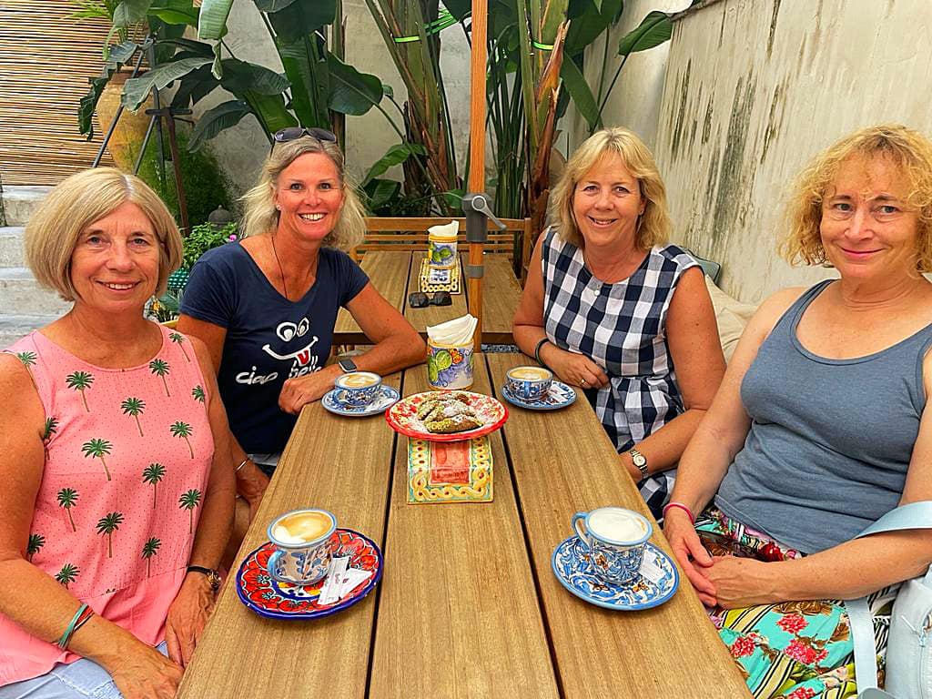
Bella’s on Tour – Sicily – Palermo
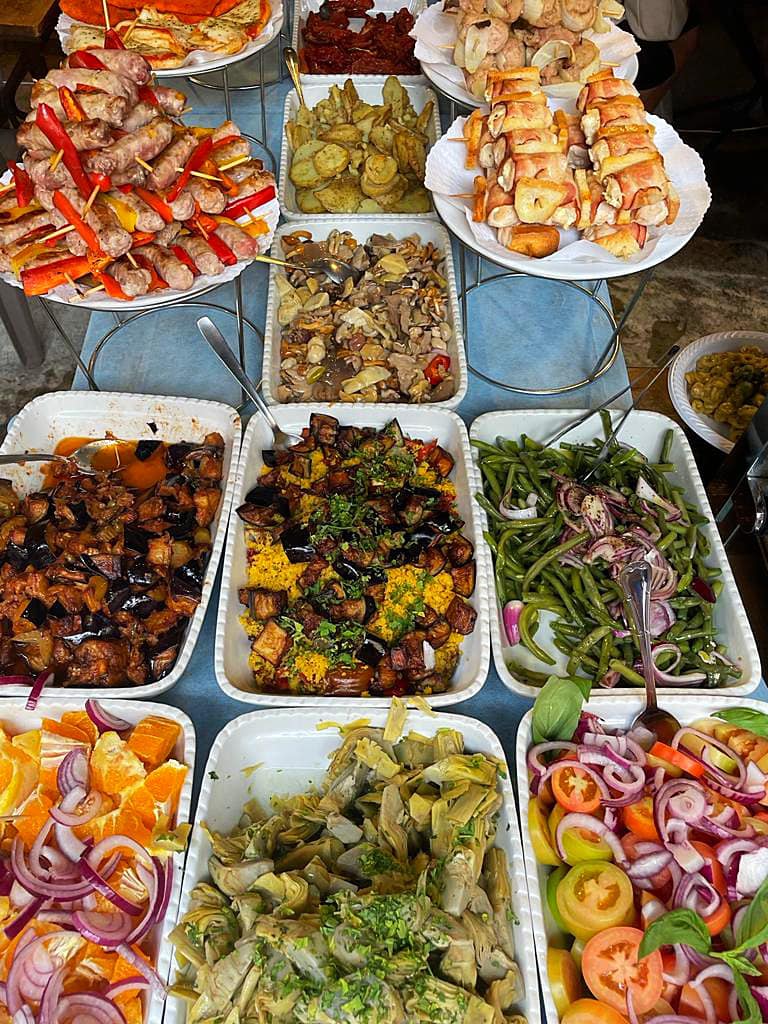
Italy is all about the food so what better way to spend half a day than doing a walking street food tour.
We navigated our way to Palermo and managed to find a carpark building – we weren’t keen on parking like the Italians which appears to be any which way but upside down
We met our guide, Justyna, who was so lovely. Our group consisted of the Bella’s, three American girls and an American couple. The three American girls were a real laugh and we enjoyed their company. They actually thought we were quite cool and told us they wanted to be like us when they grew up – the ultimate compliment
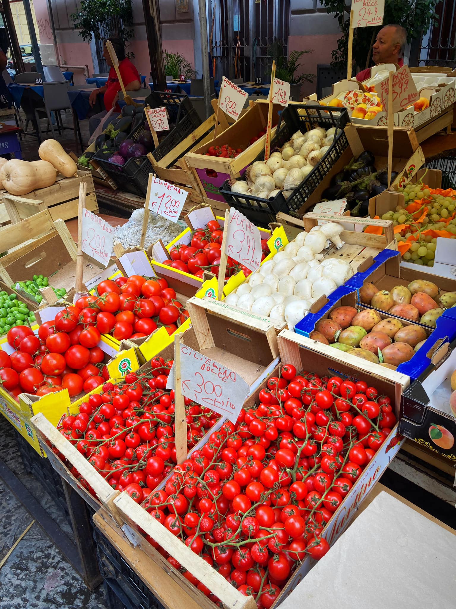
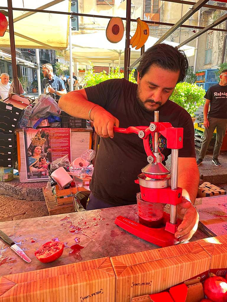
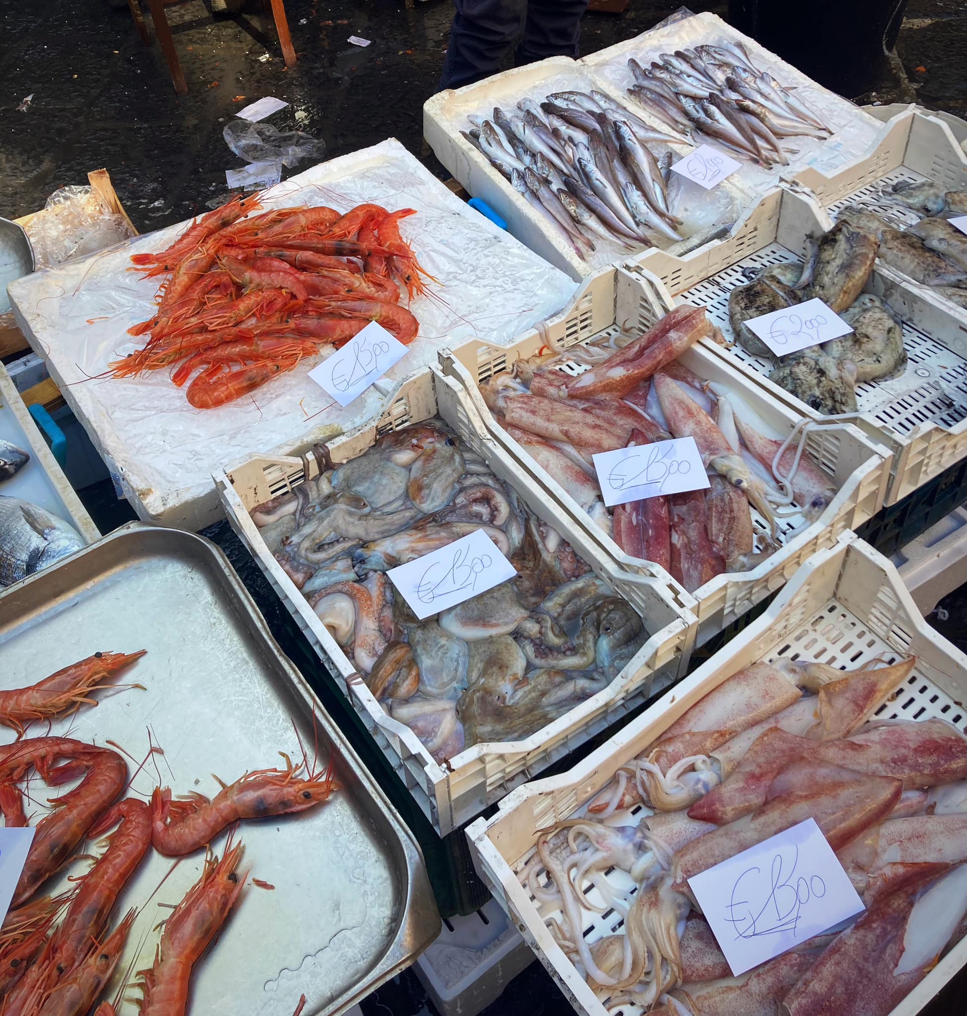
The food market, Mercato Ballaro, operates seven days a week from 7am to 2pm and has everything from fresh fish to pasta to cheese and olives.
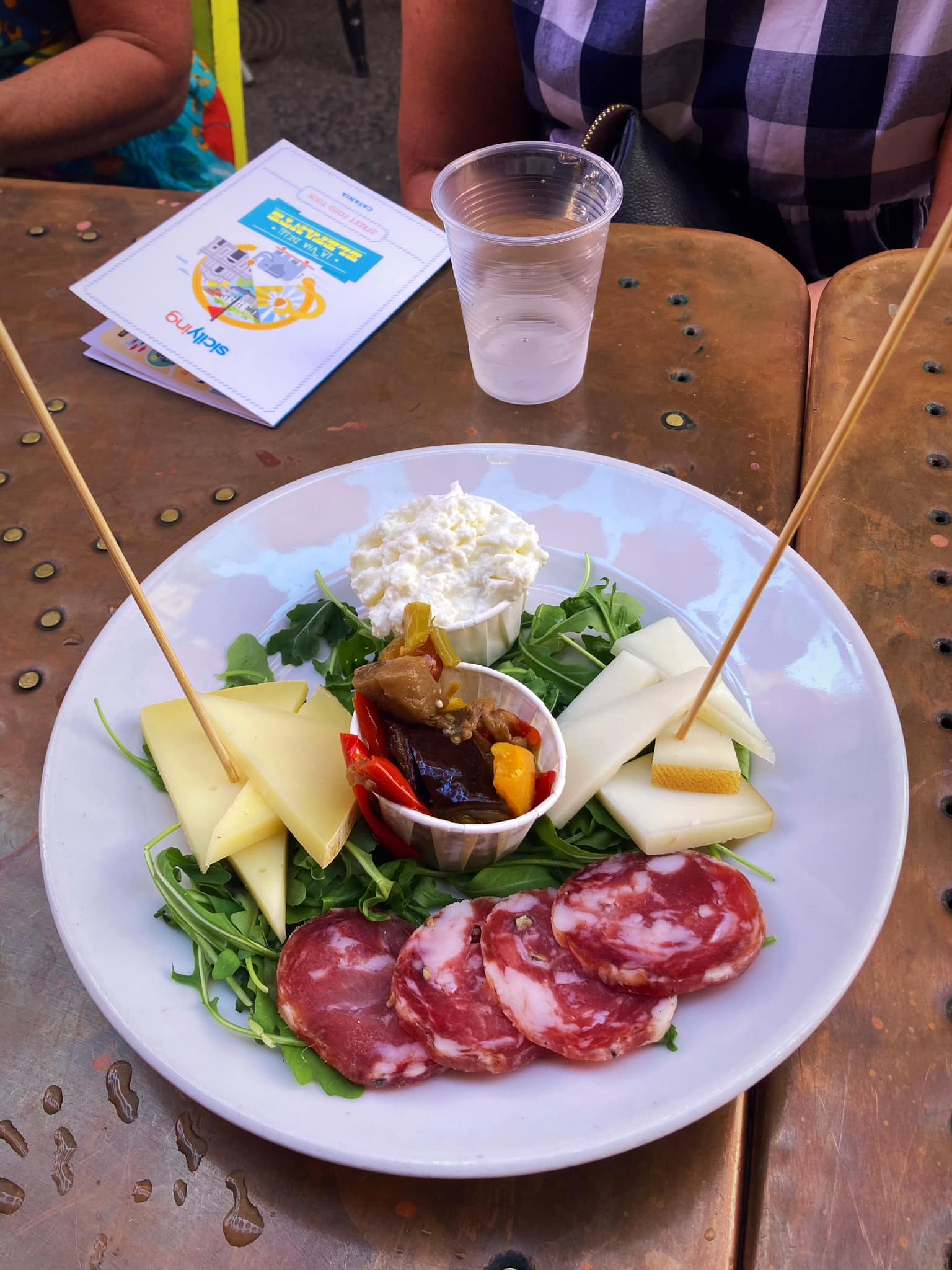
Street food in Palermo goes back many centuries and is influenced by the many cultures that have occupied Sicily. We started off with Panelle (chickpea flour fritters), Arancina or Arancini (fried rice balls), Crocchè (potato fritters) and Caponata (chopped fried aubergine and other vegetables, seasoned with olive oil, tomato sauce, celery, olives, and capers, in an agrodolce sauce).
As you can imagine we were pretty full by then but wait there’s more.
Justyna pointed out the Bello Bello Sfincione food cart which has been going since the 1950’s. Sfincione is a fluffy Sicilian pizza traditionally made with thick dough that is left to rise for several hours or even overnight. The thicker crust, similar to focaccia, is typically topped with tomato sauce, onions, anchovies, oregano and caciocavallo cheese.
We then started making our way through the market stalls. As soon as we pointed at something, Justyna was getting us a sample – we were about to be rolling out of that place.
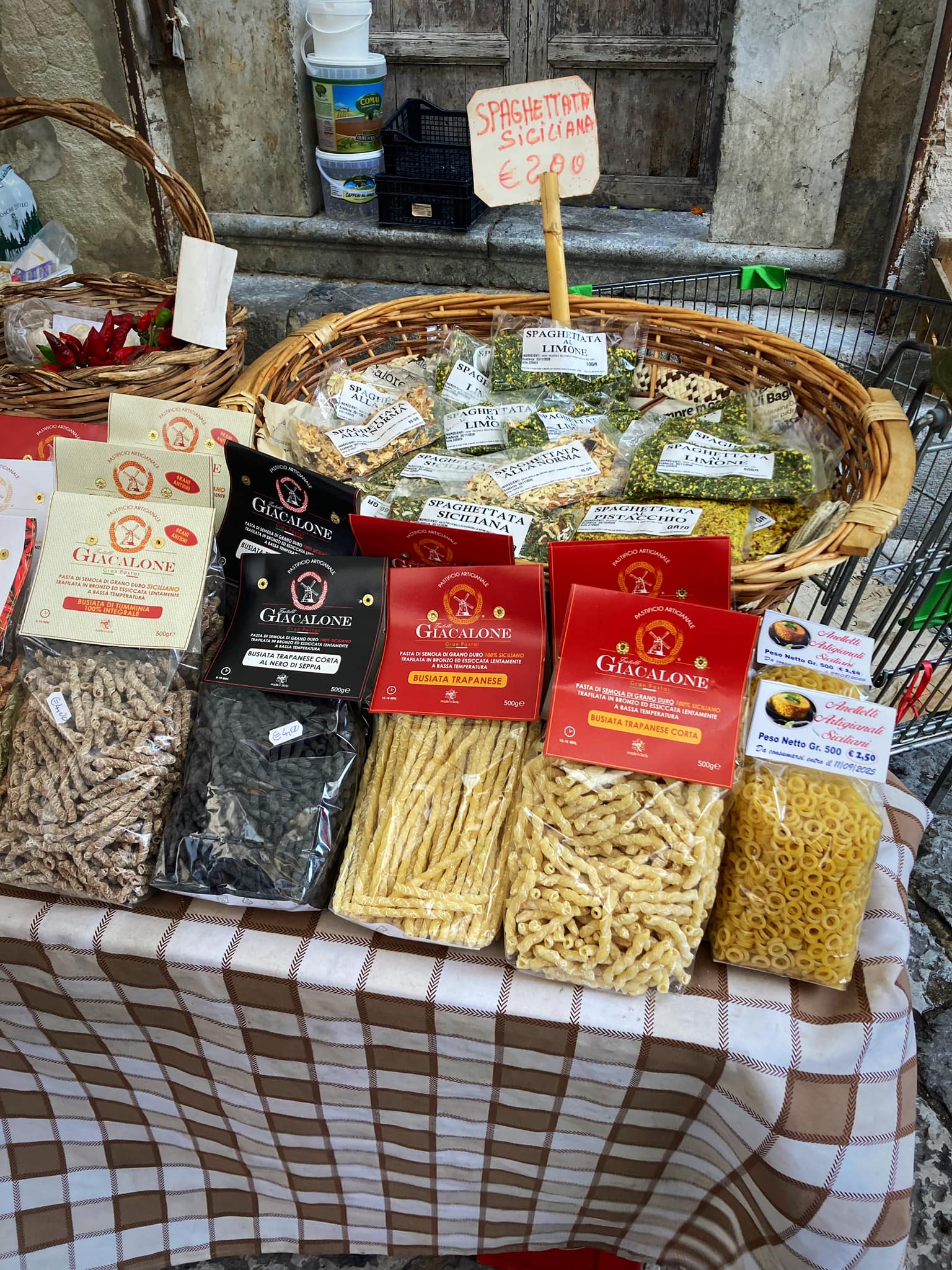
I especially liked the Pecorino cheeses which are hard Italian cheeses made from sheep’s milk. The name “pecorino” derives from pecora, which means sheep in Italian. There were also a lot of pistachio products – a creamy mixture used in sweet treats and a salty one used in pastas and the like.
We finished off with a Limoncello Spritz before heading into the shopping streets. Wow it was a busy place. We then stopped off for some Granita which is a semi-frozen dessert made from sugar, water and various flavorings. Originally from Sicily, it is available throughout Italy in varying forms. It is related to sorbet and Italian ice; however, in most of Sicily, it has a smoother, more crystalline texture.
We then visited Quattro Canti which is a baroque square which is officially known as Piazza Vigliena. It has a four corner building which has been perfectly created and decorated with statues of Spanish Kings and fountains.
Next stop was Piazza Pretoria Pretoria is regarded as probably, the most beautiful square in the whole of Palermo. The grand square features a magnificent fountain, with sixteen statues of nymphs, humans, mermaid, and other creatures. It was constructed during the time of the inquisition.
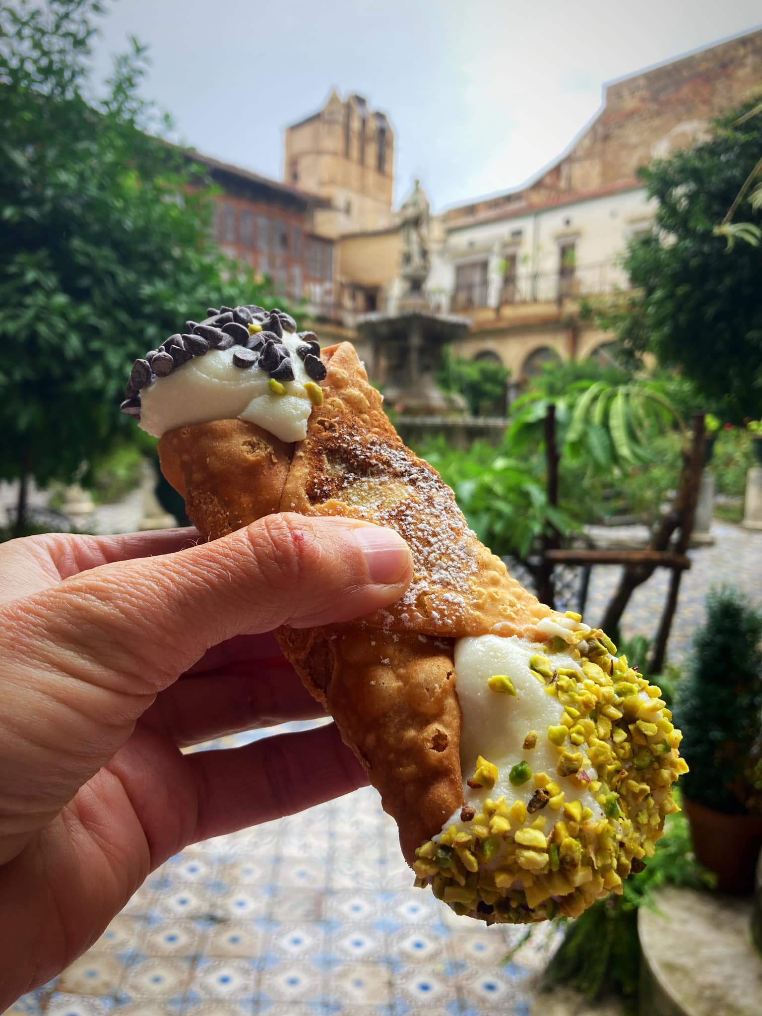
Justyna then went off to get us a cannolo.
The Sicilian cannolo or cannoli for plural is the King among Italian desserts. Famous worldwide, the only original and authentic cannolo comes from the island of Sicily.
This tube shaped fried crispy and flaky shell filled with classic sweet ricotta, garnished with candied orange peel or chopped pistachio. They are believed to have originated from the Palermo and Messina area before spreading to the rest of Italy and around the world.
Holy smoke, we were about to burst.
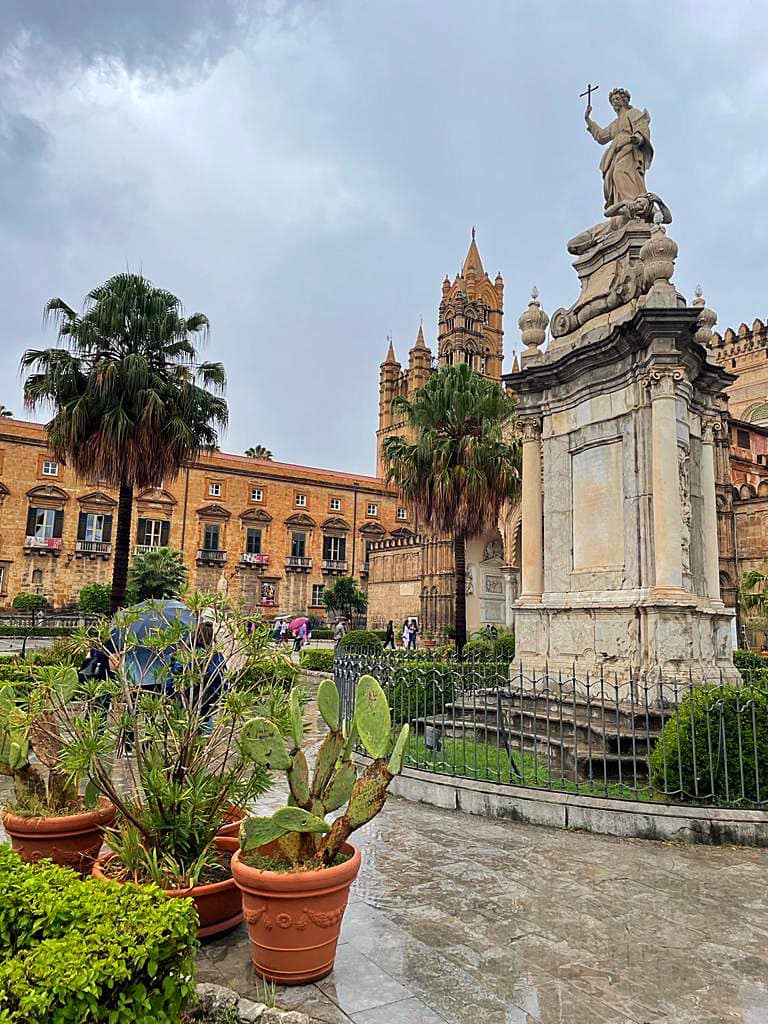
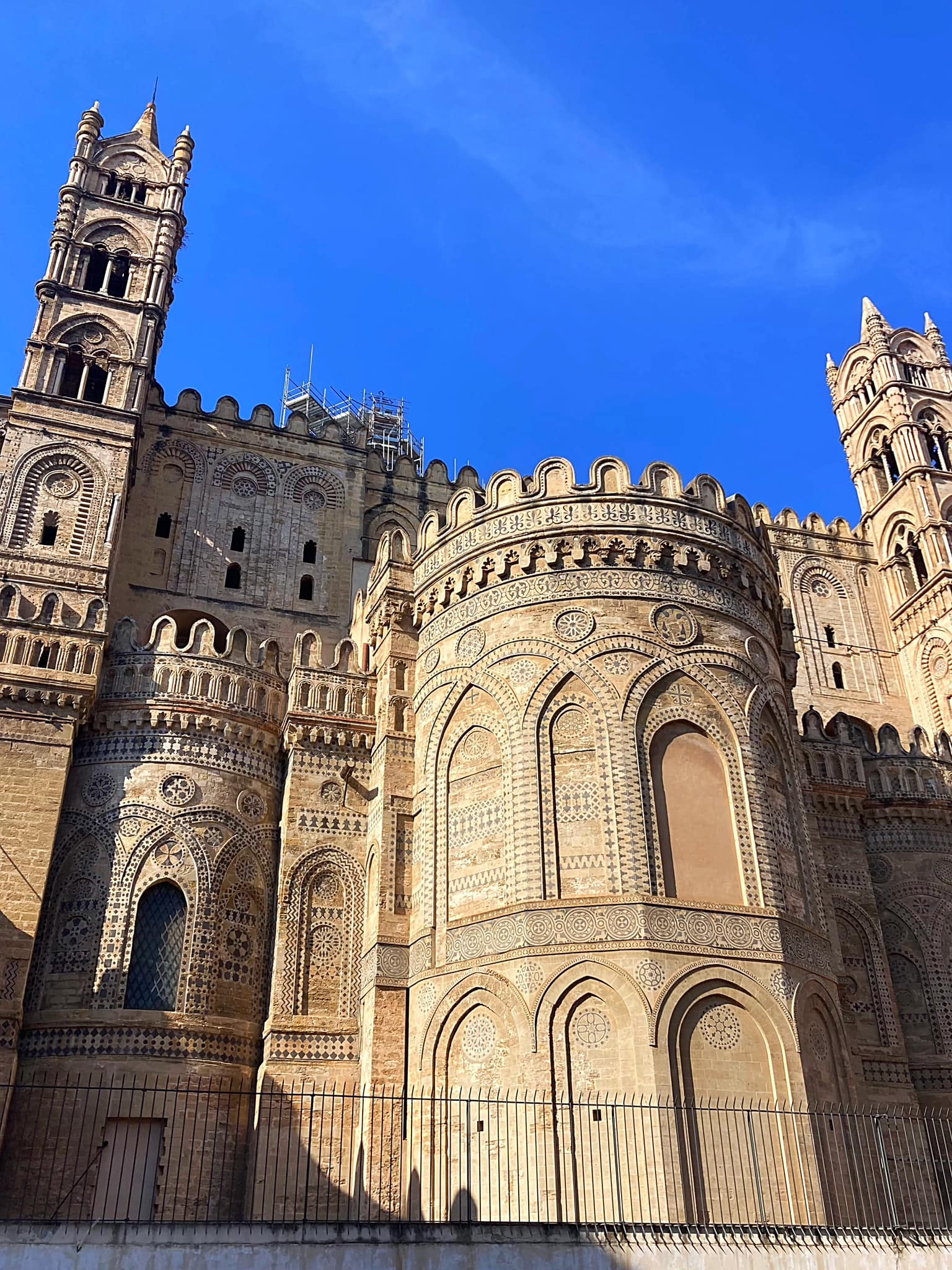
Thankfully our next stop was the Palermo Cathedral which was originally built in 1185. It is dedicated to the Assumption of the Virgin Mary. As an architectural complex, it is characterized by the presence of different styles, due to a long history of additions, alterations and restorations, the last of which occurred in the 18th century.
The statue out of the front of the Cathedral is that of Rosalia (1130–1166), nicknamed la Santuzza (“the Little Saint”), who is the patron saint of Palermo in Italy, Camargo in Chihuahua, and three towns in Venezuela: El Hatillo, Zuata and El Playón. She is especially important internationally as a saint invoked in times of plague. From 2020 onwards she has been invoked by some citizens of Palermo to protect the city from COVID-19.
Palermo is the capital of both the autonomous region of Sicily and the Metropolitan City of Palermo, the city’s surrounding metropolitan province. The city is noted for its history, culture, architecture and gastronomy, playing an important role throughout much of its existence; it is over 2,700 years old. Palermo is in the northwest of the island of Sicily, by the Gulf of Palermo in the Tyrrhenian Sea.
It has a population of about a million people and is one of the largest cities in the Mediterranean, and is now among the top tourist destinations in both Italy and Europe. It is widely known for its colourful fruit, vegetable and fish markets at the heart of Palermo, known as Vucciria, Ballarò and Capo. Roman Catholicism is highly important in Palermitan culture.
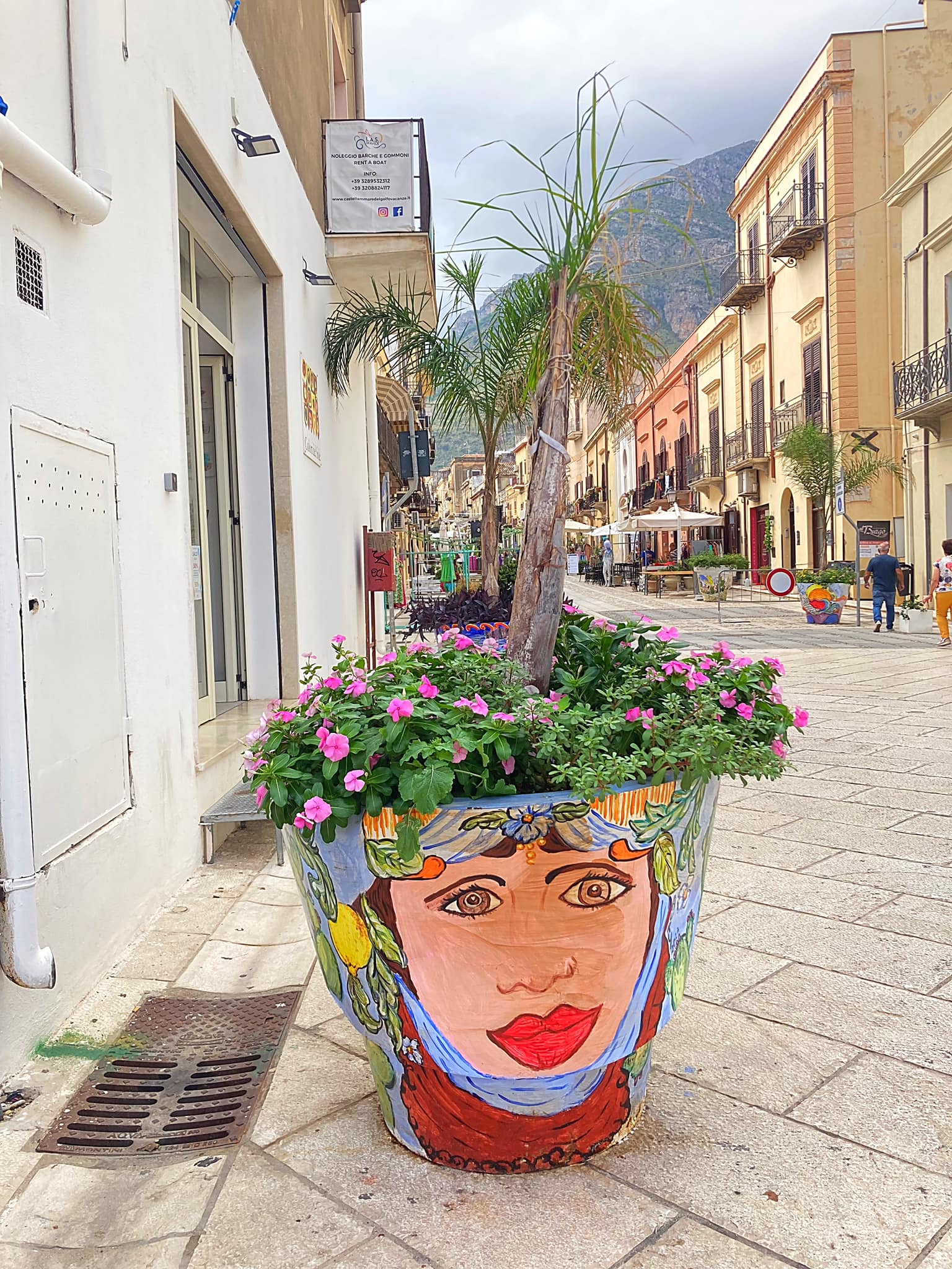
Bella’s on Tour – Sicily – Castellammare del Golfo and Scopello
There are so many villages and settlements on Sicily to explore.
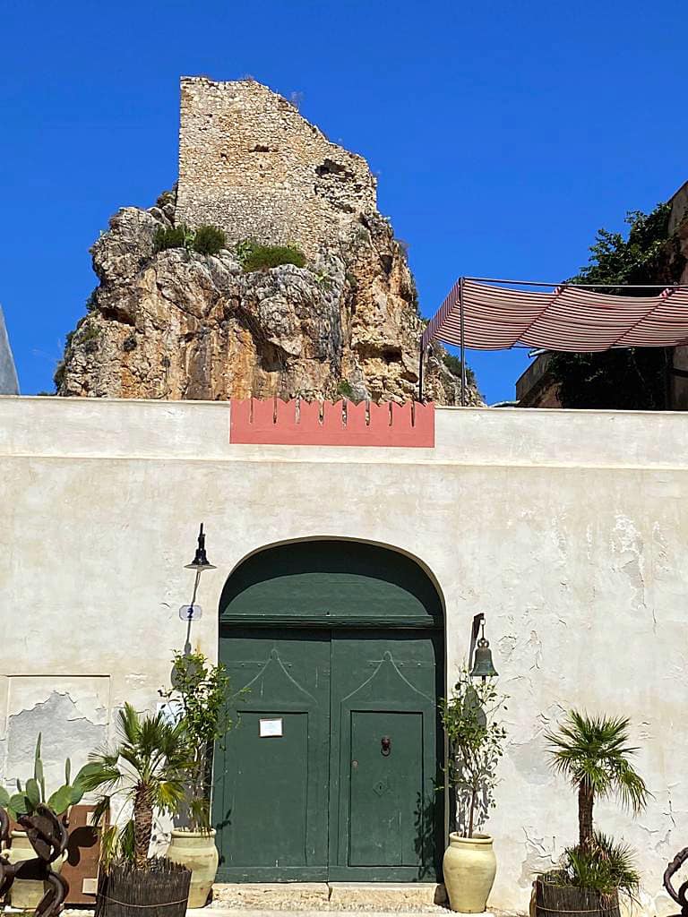
We visited Castellammare del Golfo. The name can be translated as “Sea Fortress on the Gulf”, stemming from the medieval fortress in the harbor.
Fishing has been important in Castellammare del Golfo since ancient times. Today the town’s economy continues to be based on fishing with the addition of tourism.
The small town is also noted for having been the birthplace of many Sicilian-American Mafia figures. This is the origin of the Castellamarese war, fought by the Masseria clan against the Maranzano clan for control of the Underworld in New York City.
During the height of Italian immigration to the United States, many residents from Castellammare del Golfo immigrated to New York City. After World War II, this immigration continued but to different parts of New York City.
Debbie has a small obsession with the groups of old Italian men that seem to gather in the middle of these villages. I believe she’s looking for the Godfather .
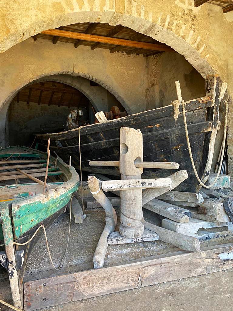
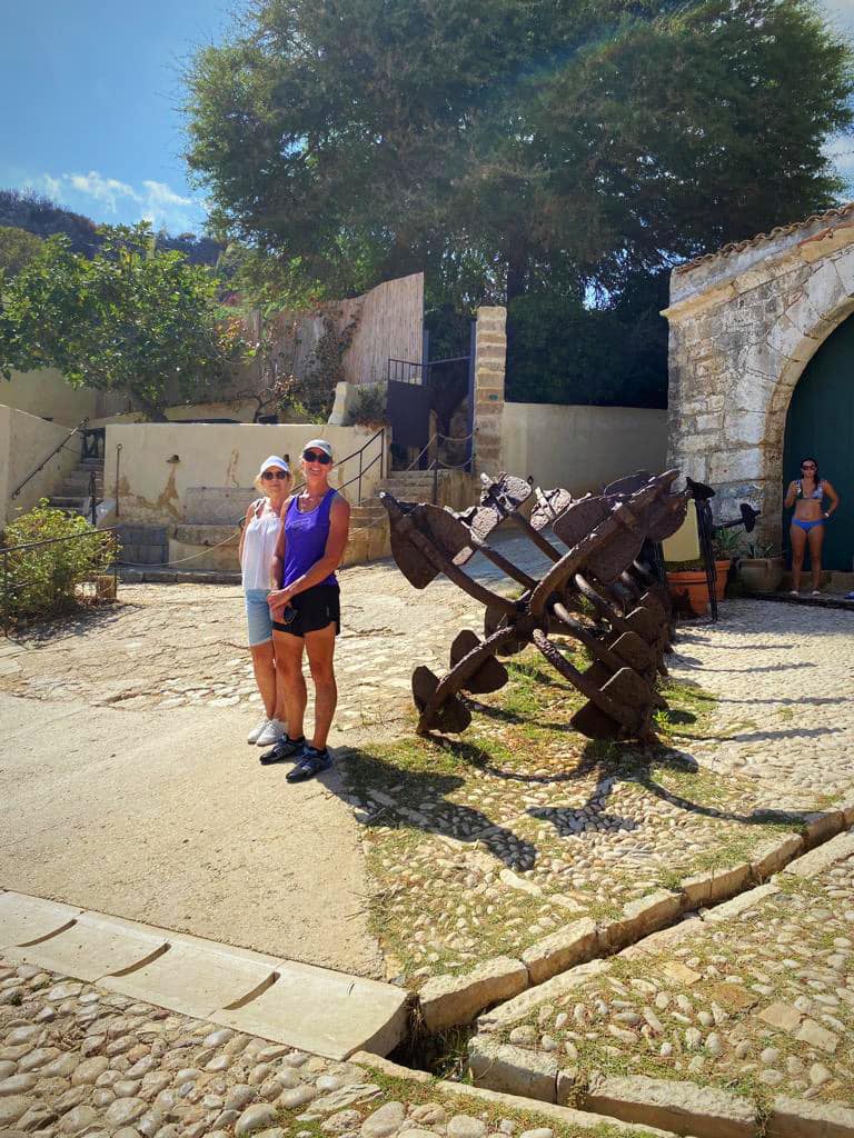
We also visited Tonnara di Scopello which is one of the oldest and most important in Sicily. This complex contains a museum that is a historical testimony of the fishing economy (namely tuna) which for centuries has represented one of the main sources of income for the local people, still preserving intact today, all the equipment and tools used for tuna fishing.
The tonnara (tuna factory) was in operation from the 13th century until its closure in 1984. The complex was greatly developed in the 15th and 16th centuries. The museum was really interesting and included a lot of photos which put in context how hard these fishermen worked. It is now owned by the Florio family and has accomodation and a restaurant onsite. No photos were allowed to be taken inside the premises.
The Florio family is a prominent entrepreneurial Italian family who started many lucrative activities in Sicily involving the export of Sicilian products (such as Marsala wine) in the nineteenth century. The family extended its interests to shipping, shipbuilding, fisheries, mining, metallurgy and ceramics.
In 1906, Vincenzo Florio created the Targa Florio, one of the oldest car races in the world. The first Targa Florio covered 277 miles through multiple hairpin curves on treacherous mountain roads where severe changes in climate frequently occurred and racers even faced bandits and irate shepherds. The race passed through many small villages, and fans lined up along the roads with no protection from the race cars. It was suspended in 1978 because of safety concerns. Today, the race continues with a different circuit as a minor racing event.
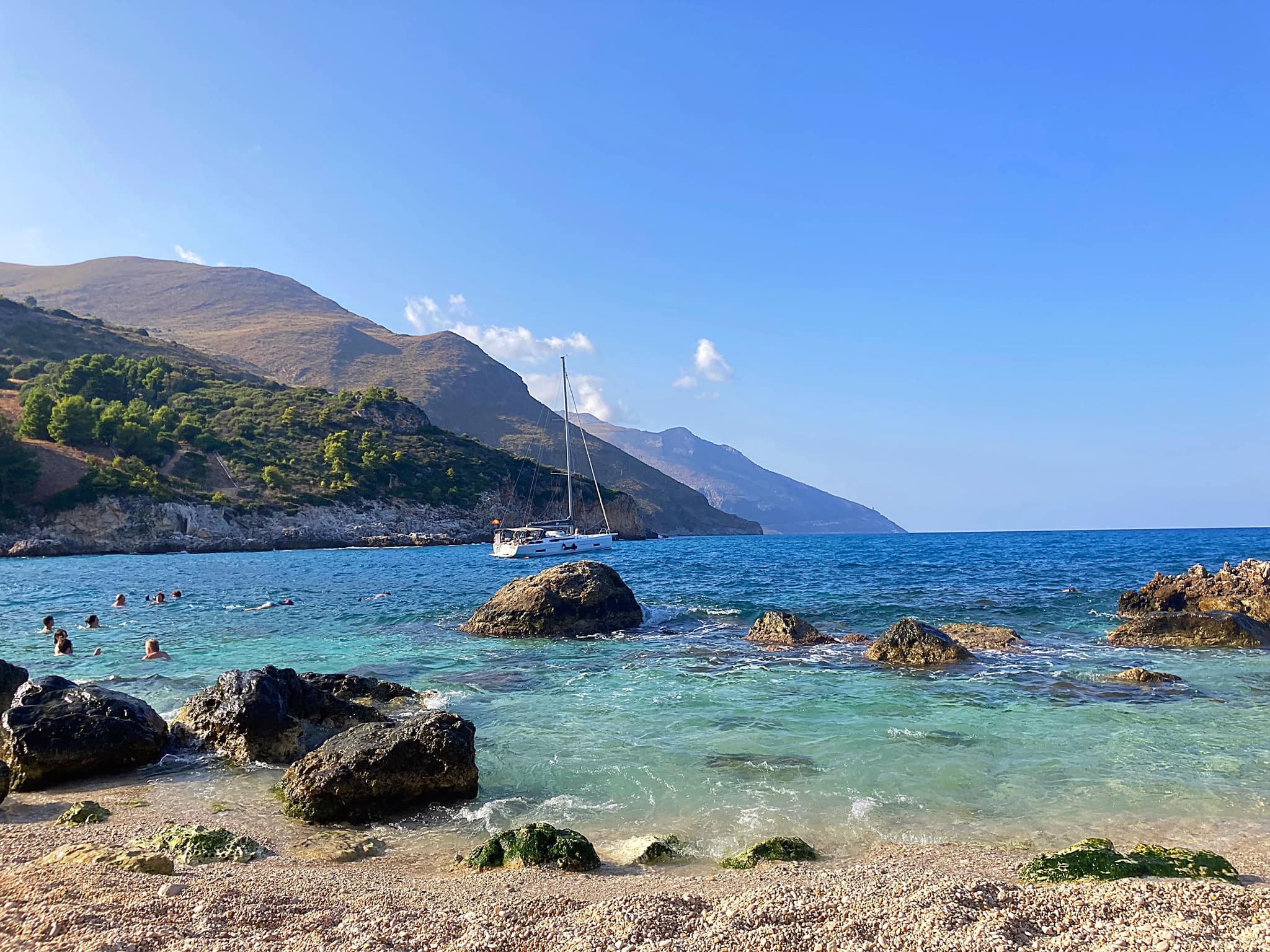
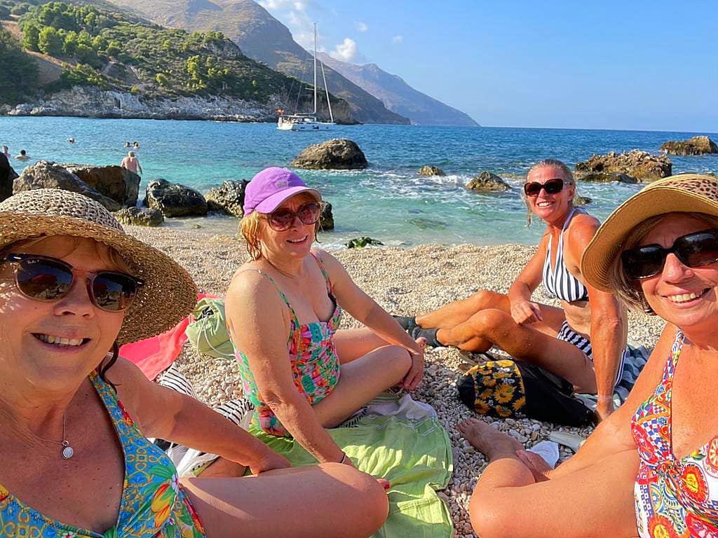
We enjoyed a lovely afternoon on Cala Mazzo di Sciacca, the beach about 500 metres from our villa before heading into Scopello for dinner.
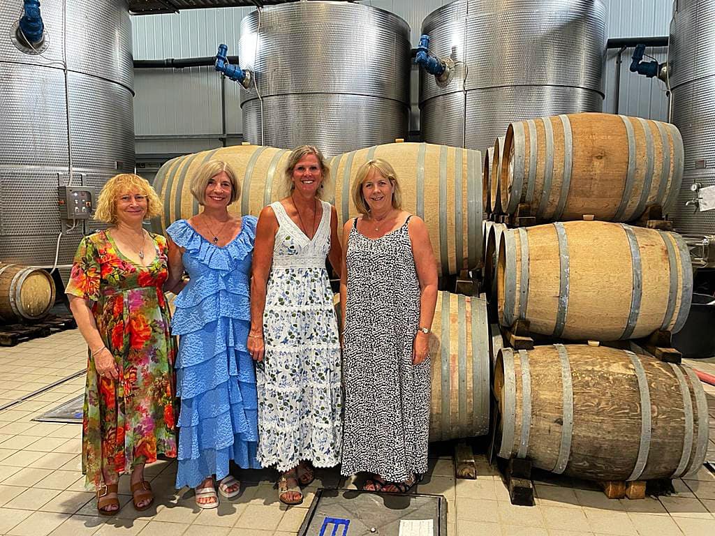
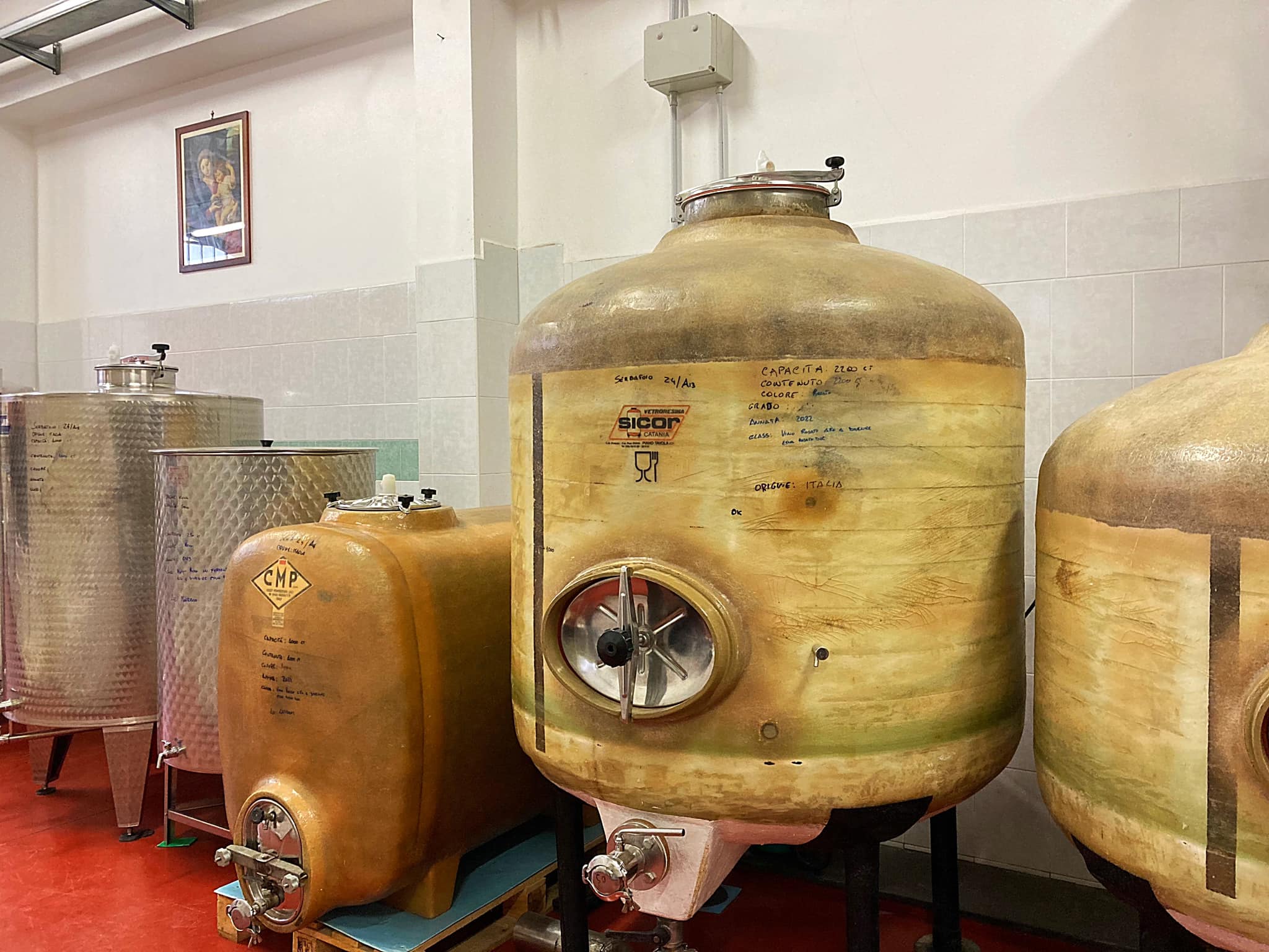
Bella’s on Tour – Sicily – Vini Cassara
We booked a wine tour at Vini Cassara expecting to turn up at a rustic vineyard where we would try a few wines in amongst the vines. We were all decked out in our pretty dresses looking the part.
When google maps told us we had reached our destination we thought there had been a mistake. We were sitting outside a very industrial looking winery. After driving down a few hairy roads around the vineyard we decided to go and ask for directions at the office.
We were greeted by the lovely Lucia who told us we were in the right place. OK, not quite what we expected but we rolled with it.
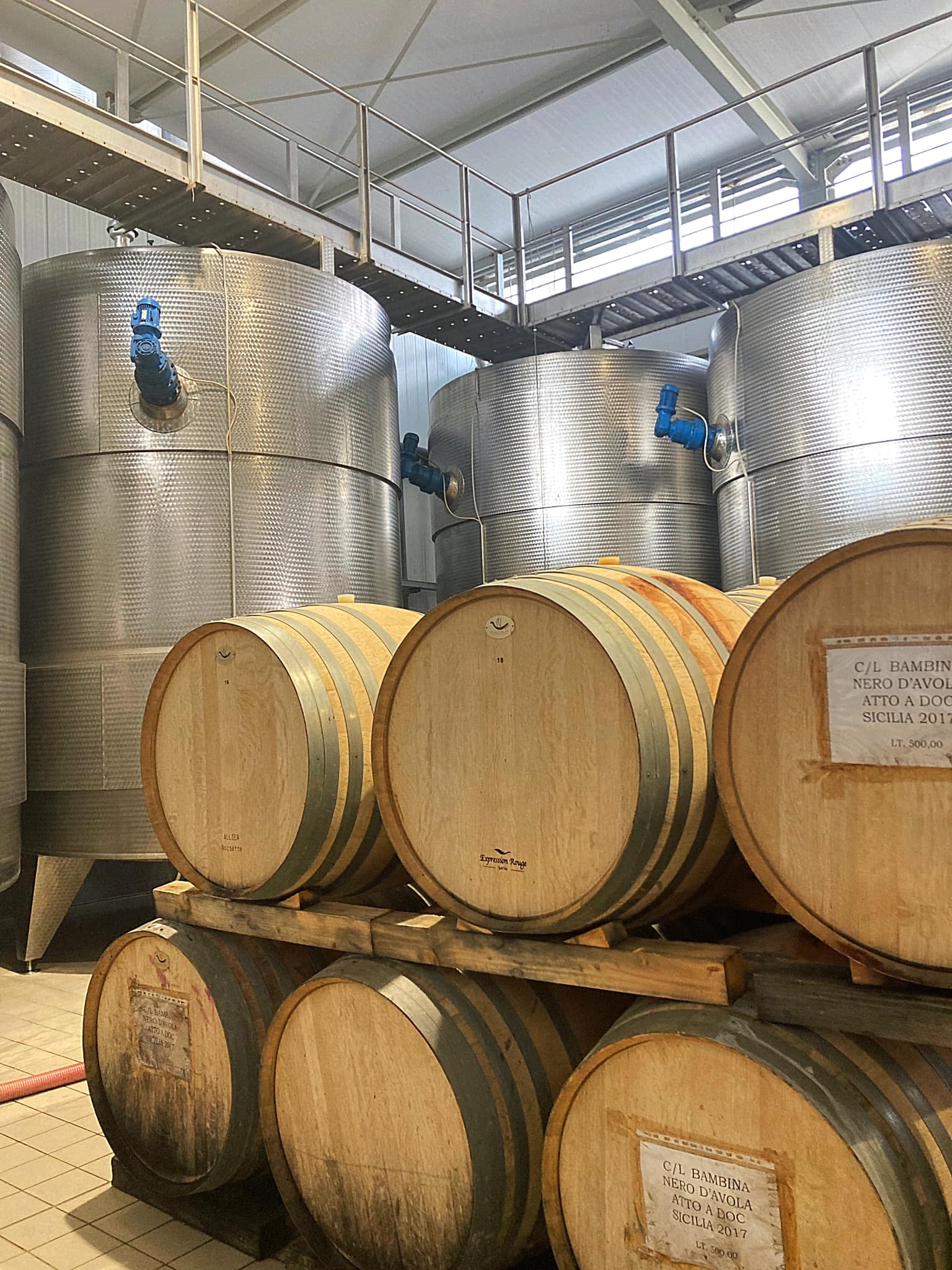
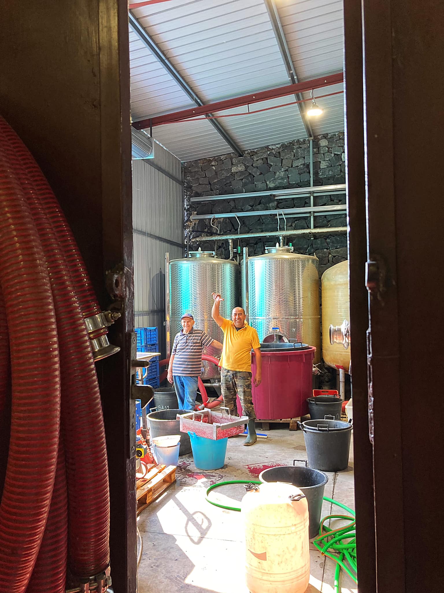
Lucia explained the history of the winery and proceeded to take us for a tour inside the production / bottling facility.
A dream in the Mediterranean that spans four generations. In 1860 Pietro Cassarà launched wine production and handed down the passion to Rocco and then to his nephew Nicolò who in the 1980s with his young son Antonello wrote a new page in the history of Sicilian wine.
In 2007 the most sophisticated technologies arrived in the modern company, allowing Antonello to create his own brand and start a larger production intended for the whole world. Only a few years later Cassarà wines delighted the palates in Japan, China, Australia and Canada.
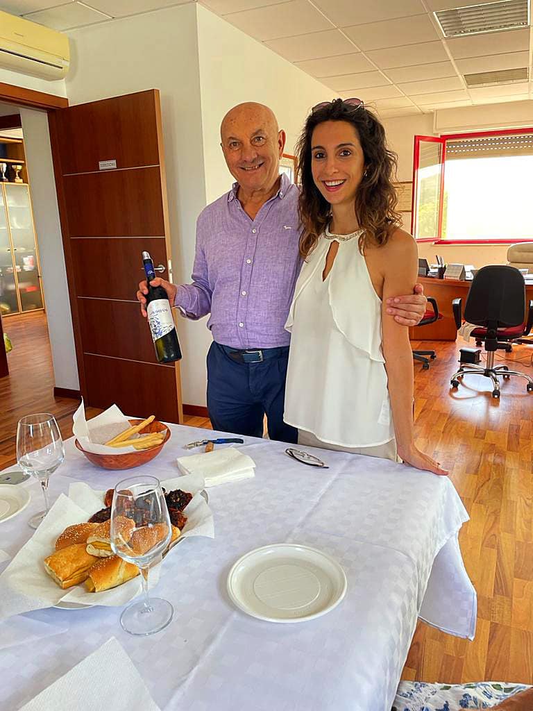
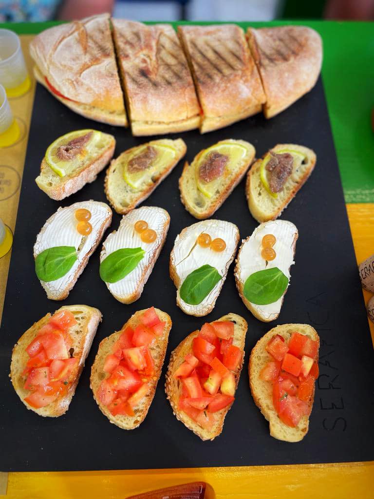
After the tour, we then went back to the “office” where we were greeted by Lucia’s father, Antonello and Lydia, the office manager. They had organised some traditional Sicilian food and we sat down to try the wines. Antonello didn’t speak English but was very engaging and Lucia interpreted for him. Lydia’s parents were originally from Alcamo, where the winery is, but had immigrated to the US where she was born. She came back to Alcamo when she was 21 and has worked at the winery for 15 years. She spoke great English and we really enjoyed chatting to her.
Lucia is an only child and is helping with the marketing for the vineyard. She is a classical pianist with a degree in Pianoforte and Cinema Studies. She has also written a book – Mozart, Disney and Co. So, so interesting to talk to.
We tried their Sauvignon Blanc called Jacaranda. It is a lot more floral than the NZ Sauvignon Blanc which is more grassy. We then tried the Nero D’Avola called Solcanto. Absolutely delicious. The winemaker also joined us but had limited English.
They had also organised a Sicilian Cassata Cake for us – a visual masterpiece. It is made from sweetened ricotta, iced with marzipan and decorated with candied fruit. Very rich and sweet but a perfect finish to our visit.
Again, the best experiences come from the least expected things. We were welcomed so warmly by Antonello, Lucia and Lydia and given a genuine insight into their wines and how they operate as a family business.
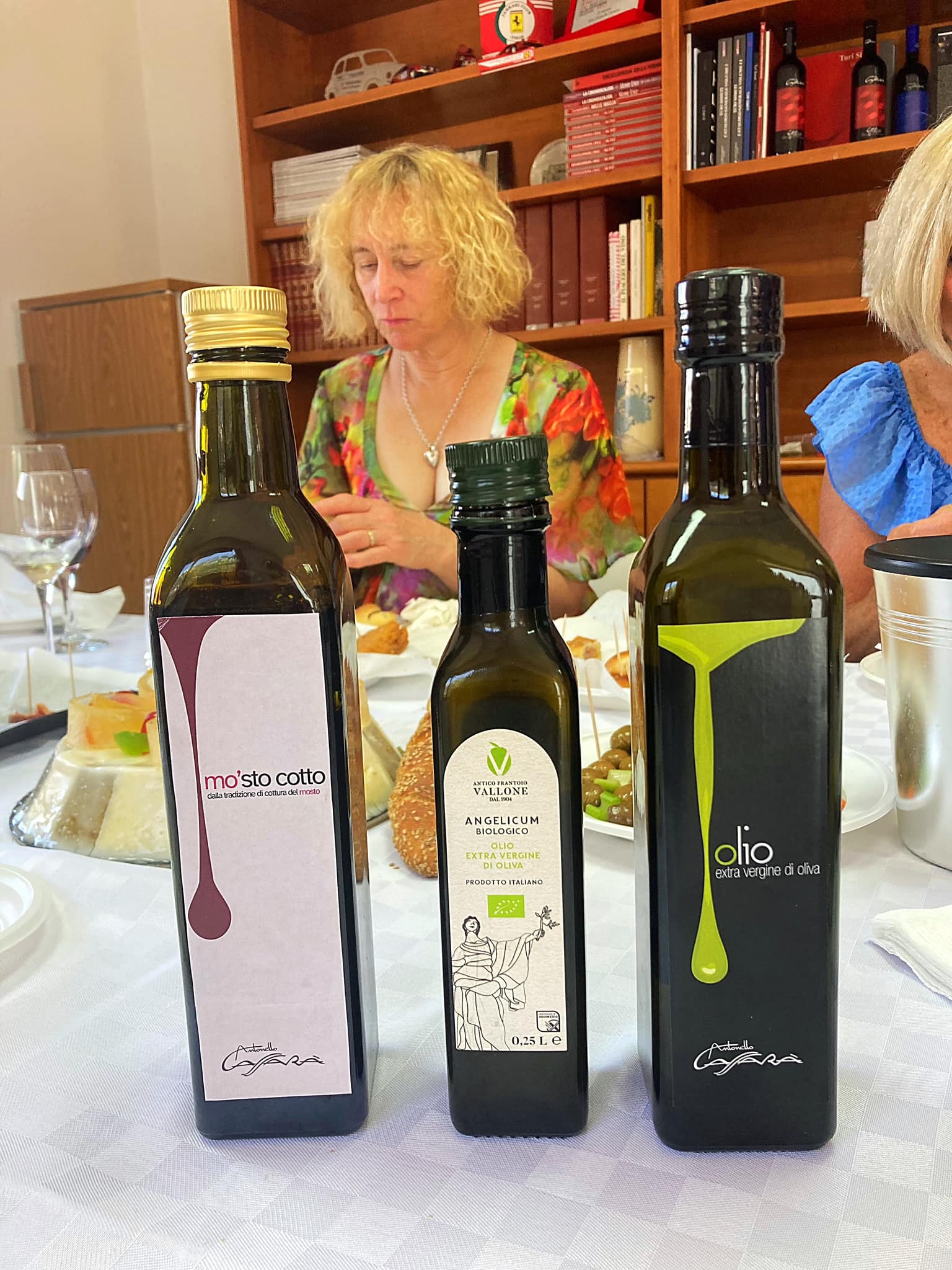
They follow organic practices and most of their wine is exported. They also make some by-products – Mosto cotto, also called vino cotto or saba, is made by cooking the liquid that results from initial whole grape pressings — seeds, skin, stems and all. By reducing it down to a syrup, the complex flavors that give wine its unique, distinctive notes are amplified. The resulting product is a sweet, tangy addition to savory dishes as well as desserts. We tried some with pecorino cheese and it was a hit.
They are also one of the only wineries producing grape sugar which is a syrup obtained from grapes through the clarification, deionization — also known as rectification (RCM) — and final concentration of grape juice. This process removes non-sugar compounds from the liquid, resulting in simpler syrups that contain only water and grape sugars glucose and fructose, in roughly equal parts. More recently, RCM has found favor with food and beverage manufacturers, which use it in fruit juices and preserves, yogurts, baby foods and other products.
Rising interest in grape sugar is part of a broader trend toward greater use of sugars of fruit and plant origin, such as sweeteners obtained from apple, agave and maple plants. These sugars are a better fit with consumer demands for “natural” products than sugars extracted from sugarcane and corn, which dominated the market in the past.
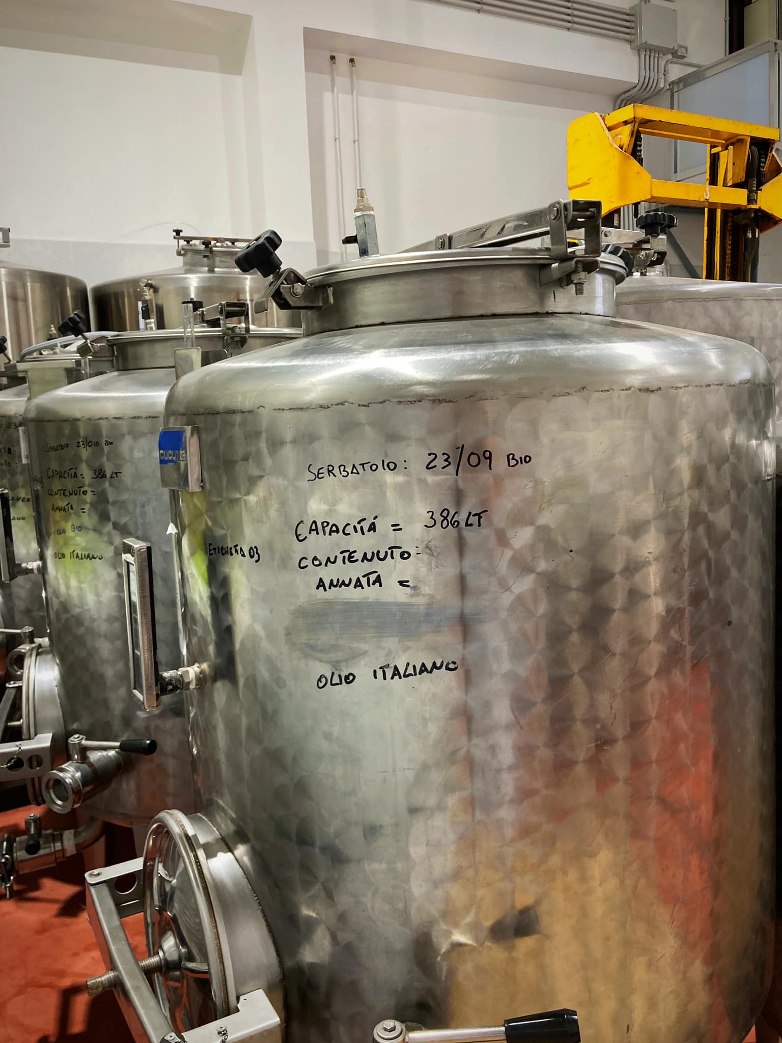
They also produce olive oil from a different location.
Bella’s on Tour – Sicily – Favignana
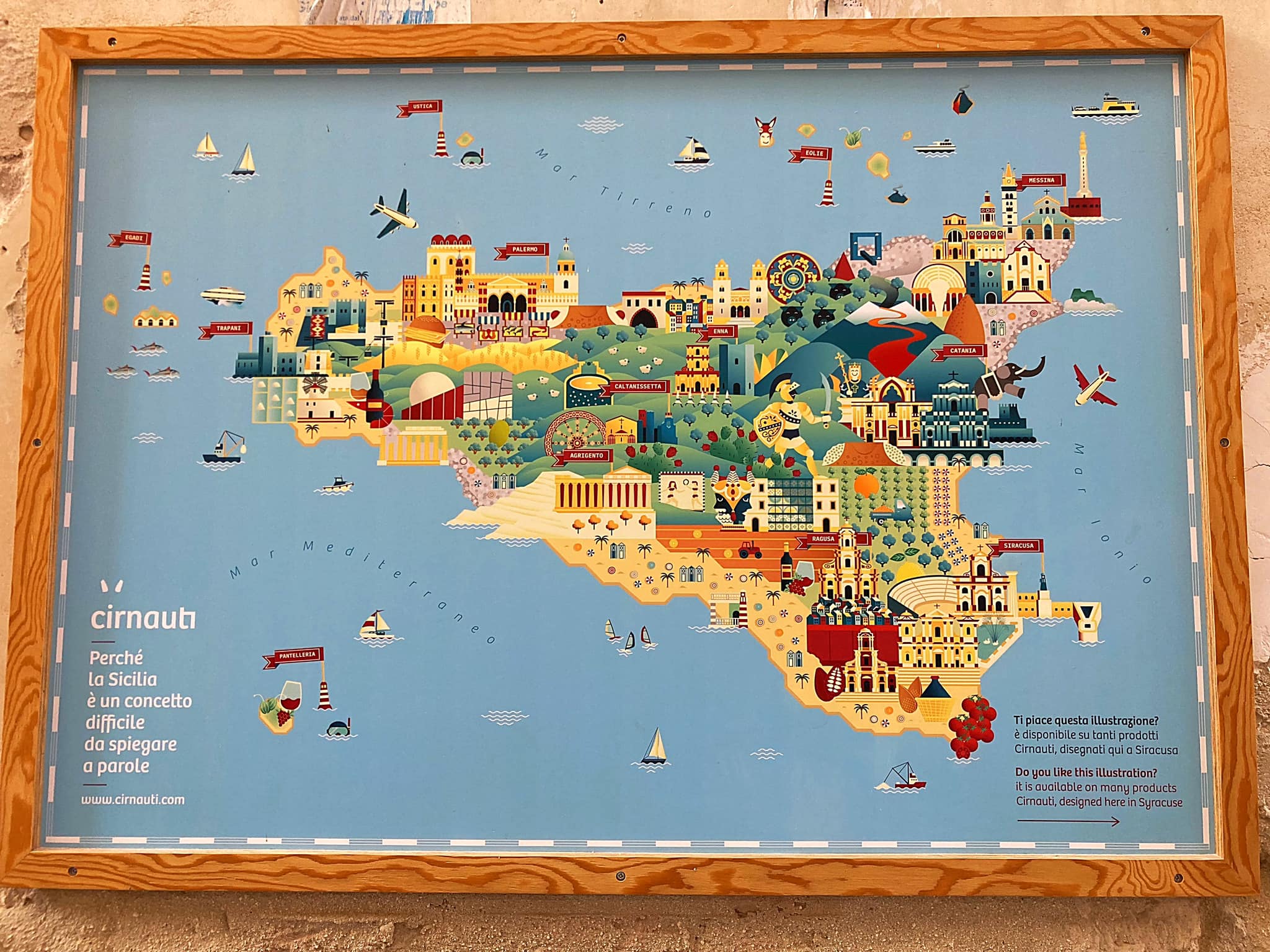
Sicily is the largest and most populous island in the Mediterranean Sea and one of the 20 regions of Italy. Sicily itself is also surrounded by some smaller islands.
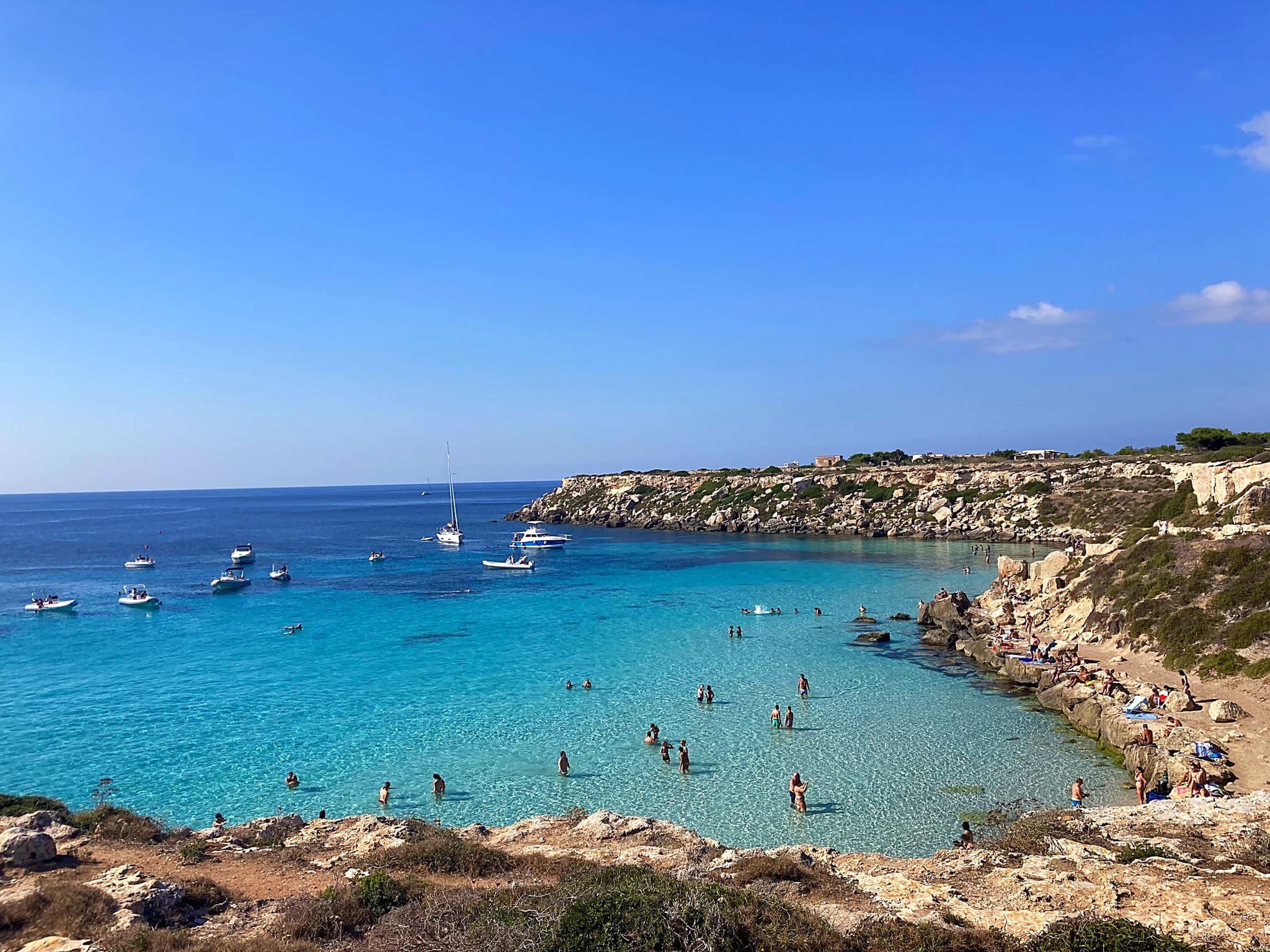
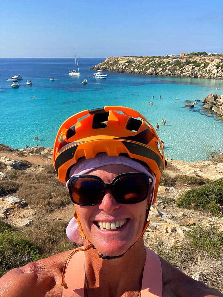
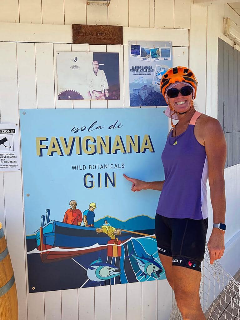
On Saturday we took a ferry from Trapani to Favignana (30 minutes) which is one of three islands in the Egadi Islands, Levanzo and Marettimo being the other two.
As you approach Favignana you see a fort perched high up on the hill. For centuries, Favignana was protected by the Fort of Santa Caterina. Originally built by the Arabs as a watchtower, subsequently enlarged by the Normans, and later used as a prison by the Bourbon Kings.
Ignazio Florio one of Italy’s richest and most powerful industrialists purchased the whole island in 1874, along with all commercial fishing rights. Florio quickly began work on enlarging and beautifying an existing tuna processing plant (tonnara).
The tonnara on Favignana was one of several owned by the Florios in Sicily, but arguably their most important, for it was here that they trialled and perfected new industrial processes, including a groundbreaking technique for preserving tuna in olive oil, and the invention of a key-opened tin can.
Long before the Florios came to exploit the island’s resources, Favignana had been a Roman outpost. During the First Punic War, several naval battles were fought off the coast of Favignana, including one sanguinary clash which turned the water red – hence the name of Cala Rossa, one of the island’s most picturesque bays. The spoils of the Roman victory included Favignana, which provided the Roman Empire with a rich source of tuff stone. Quarries were dug all over the island and these angular depressions are very much part of the topographical make-up of Favignana today.
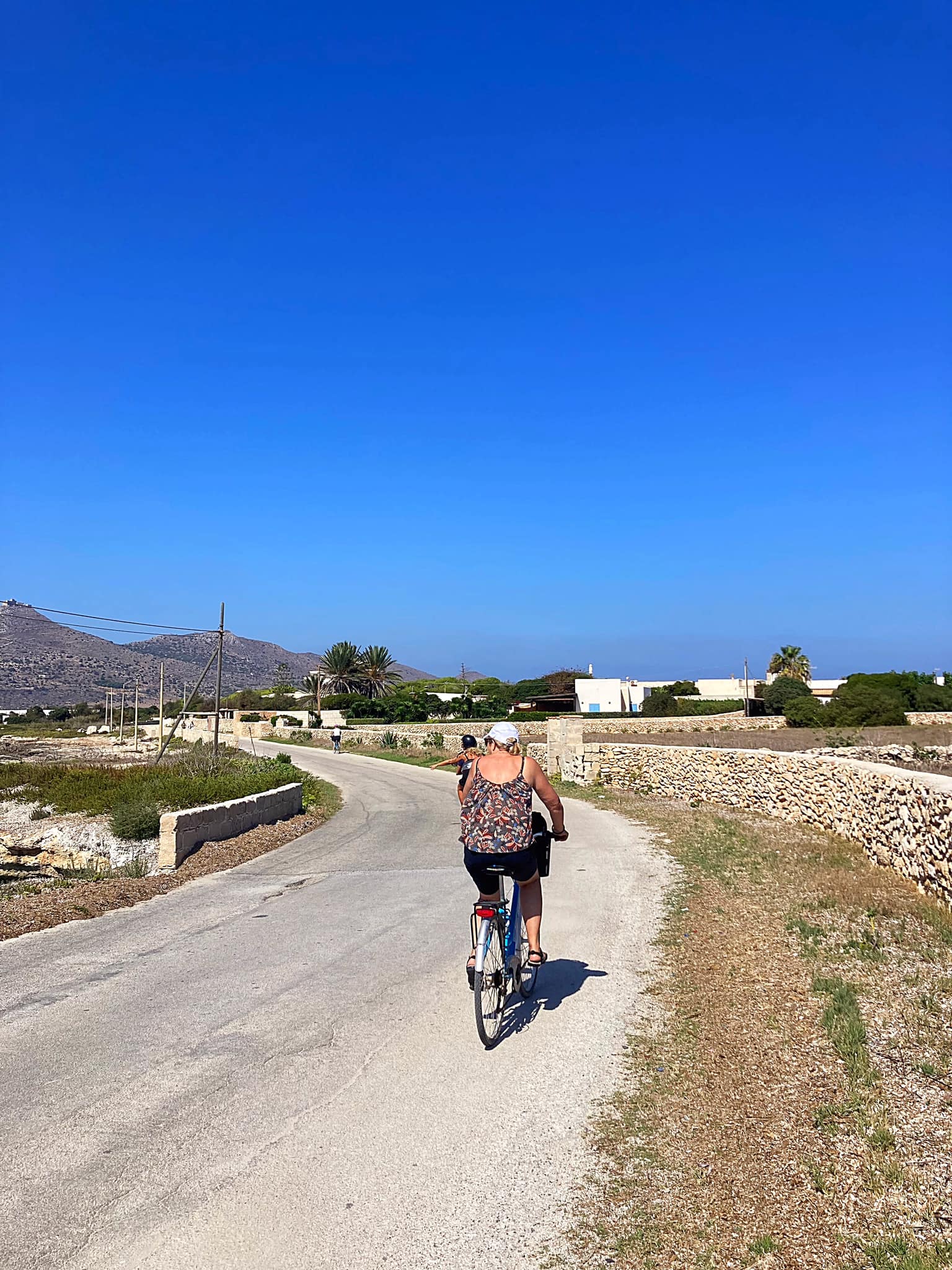
Favignana measures 9km from east to west and the most popular form of transport is by bicycle so we hired some bikes at the port and set off to explore the island.
The bays and beaches have transparent and electric blue waters – so gorgeous. We had a swim halfway round before stopping for lunch. On the way back to the old town we stopped at Cala Rossa for a swim. Unfortunately it was a little difficult to actually get into the water without clambering over some sharp looking rocks. It was worth a visit though – the colour of the water was amazing.
We headed back to the old town for some lemon granita. While we were there we saw a wedding party – the bride and all her family were walking through the old town to the church. Everyone clapped as they walked past.
It was then back on the ferry to the mainland.
Bella’s on Tour – Sicily – Palermo revisited and Syracuse
On Sunday, after a lovely week on the western side of Sicily in Scopello we shifted to the eastern side closer to Catania.
Sicily is a big island and it was going to take us about three and a half hours to cross it. We decided to stop off at the markets in Palermo on the way. It was nice going back a second time as things felt familiar.
We had breakfast near the markets and then wandered down to the harbour. Limoncello tasting, a lovely coffee stop and some retail therapy were par for the course
We then set off on our road trip, missed a turn at a detour and added forty minutes to our journey . Our new home for the week was worth the wait though. We have a pool and great views over Mt Etna.
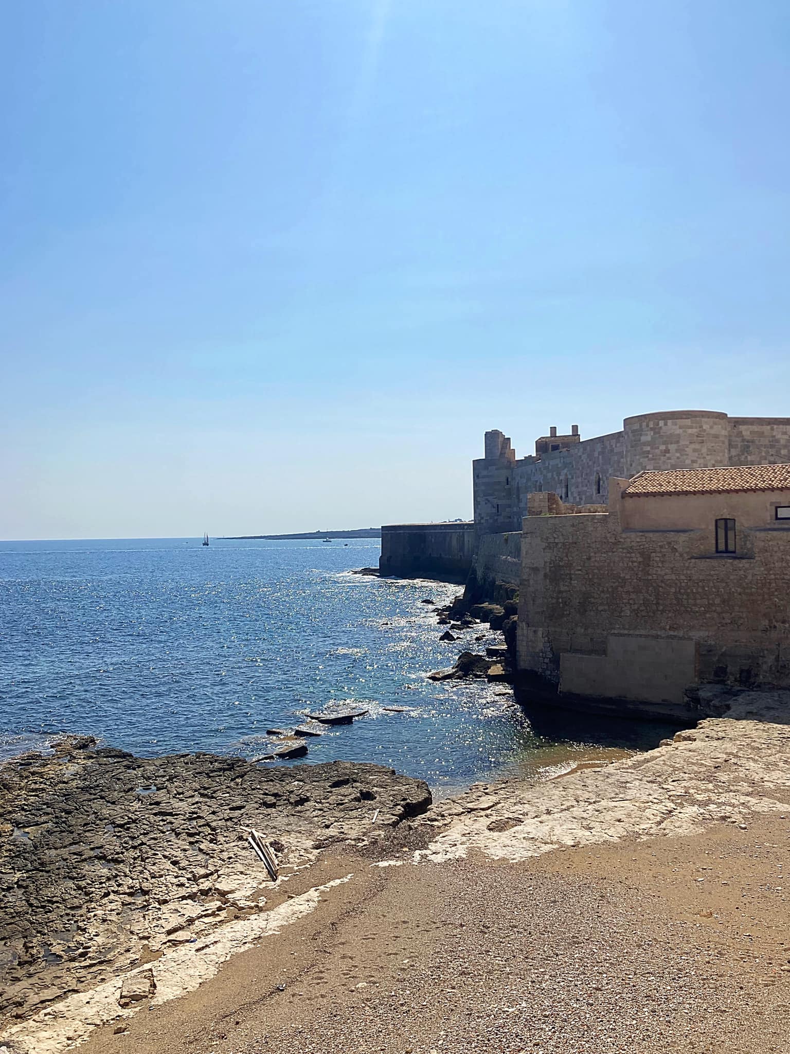
On Monday, we took a drive to Syracuse which is notable for its rich Greek and Roman history, culture, amphitheatres, architecture, and as the birthplace and home of the pre-eminent mathematician and engineer Archimedes. This 2,700-year-old city played a key role in ancient times, when it was one of the major powers of the Mediterranean world.
We checked out the Piazza Duomo, the cathedral, the Arethusa Spring, Castello Maniace and the Fountain of Diana.
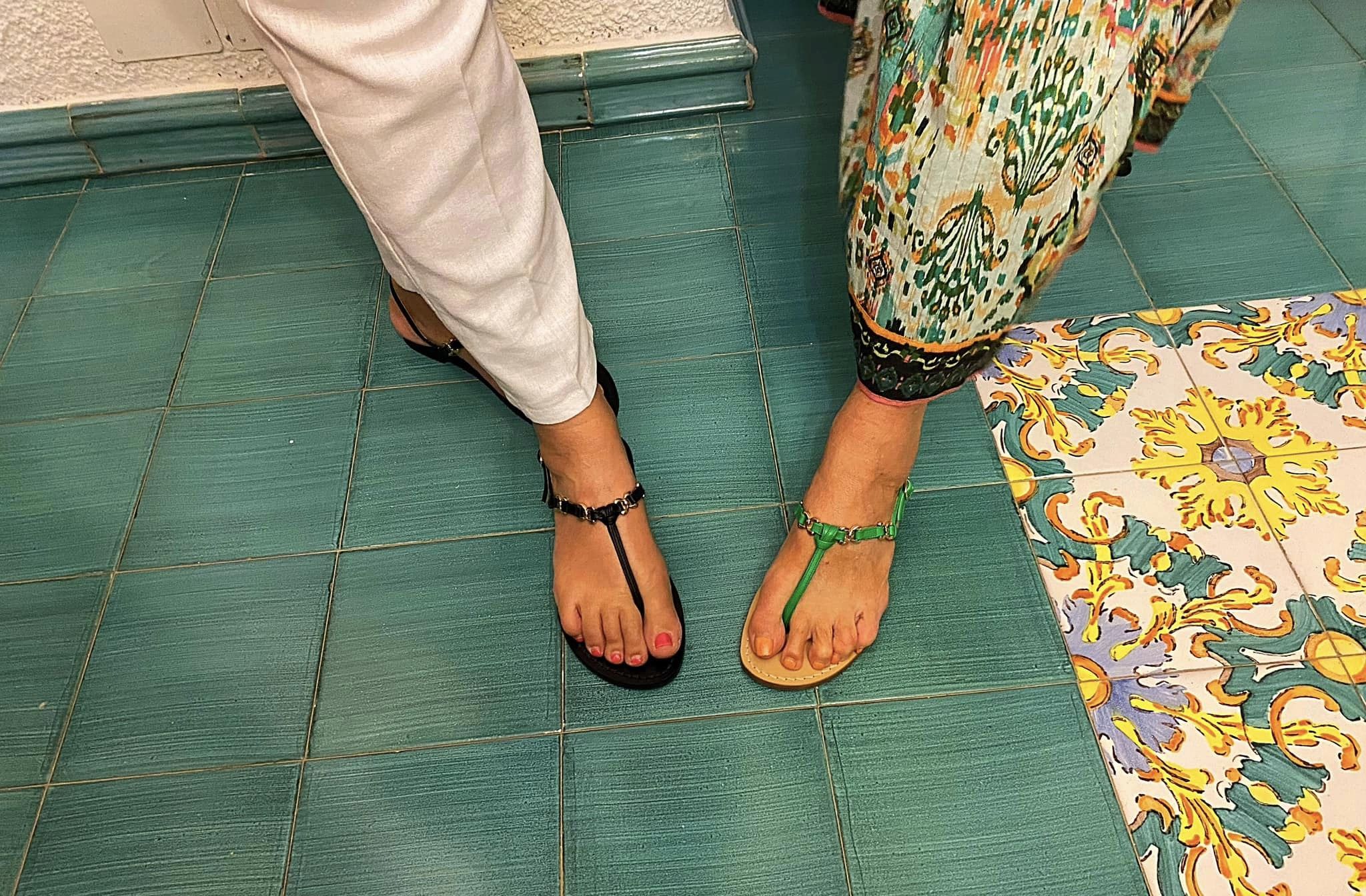
A couple of the Bella’s also got some custom made sandals while they waited which they described as a special experience. It might have helped that the sandal maker was rather cute
It was then home to enjoy the pool and a limoncello spritzer
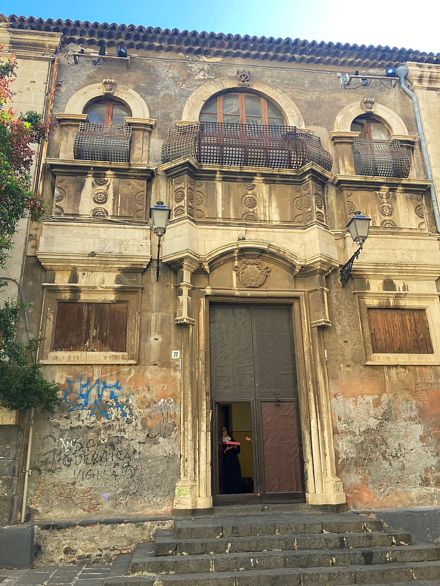
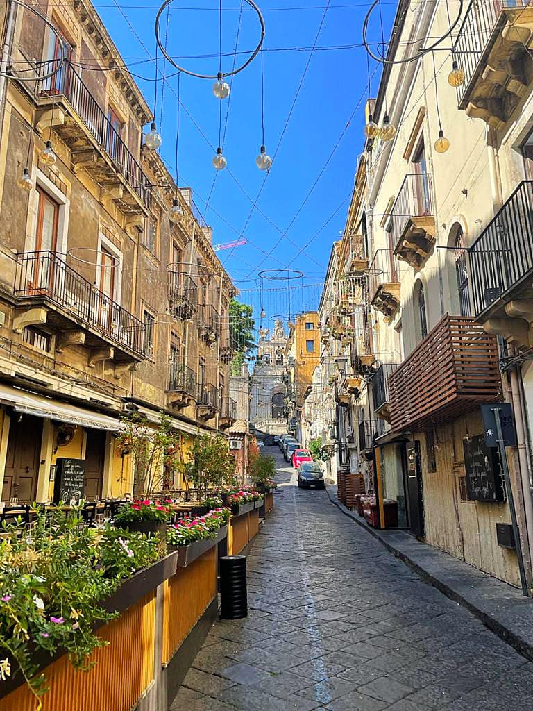
Bella’s on Tour – Sicily – Catania
When we did our food tour in Palermo, our guide Justyna told us about the fierce rivalry they have with Catania which is on the east coast of Sicily. She mentioned a number of times that the various street foods in Palermo were far superior to those in Catania. Given our love for Italian food we had to check it out for ourselves.
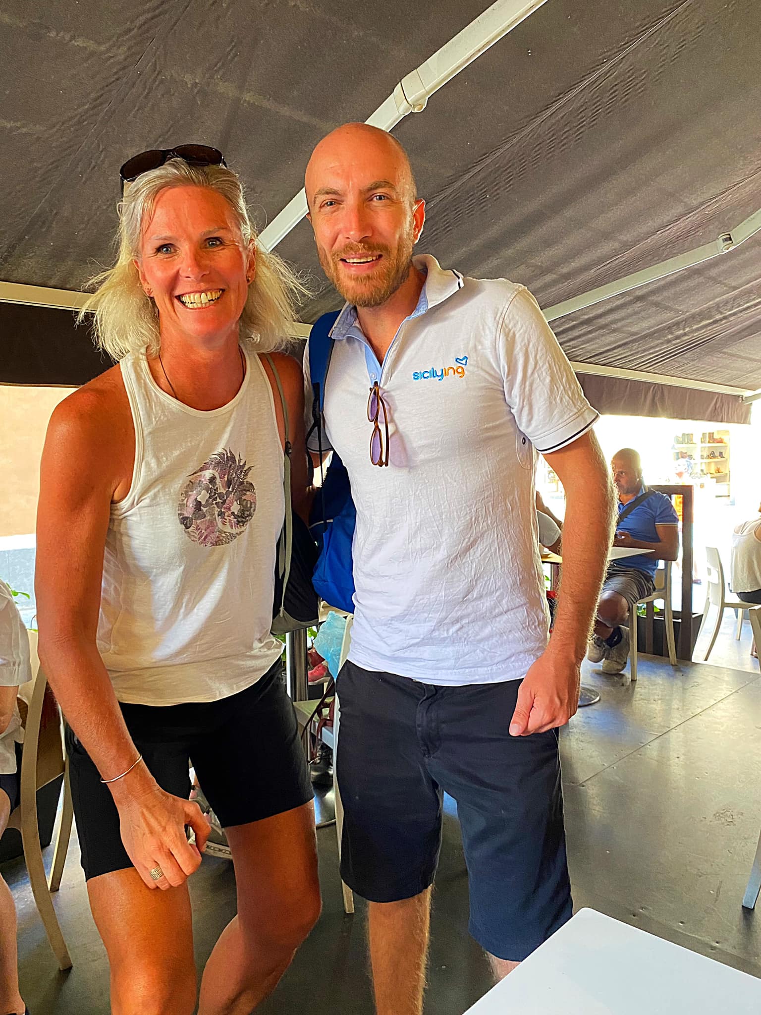
Catania is the second largest municipality in Sicily, after Palermo, both by area and by population. Despite its reputation as the second city of the island, Catania is the largest Sicilian conurbation (a region comprising a number of metropolises, cities, large towns, and other urban areas which through population growth and physical expansion, have merged to form one continuous urban or industrially developed area), among the largest in Italy, as evidenced also by the presence of important road and rail transport infrastructures as well as by the main airport in Sicily, fifth in Italy. It is located on Sicily’s east coast, at the base of the active volcano, Mount Etna, and it faces the Ionian Sea. The population of the city proper is about 312,000 while the population of the Metropolitan City of Catania is about 1.1 million.
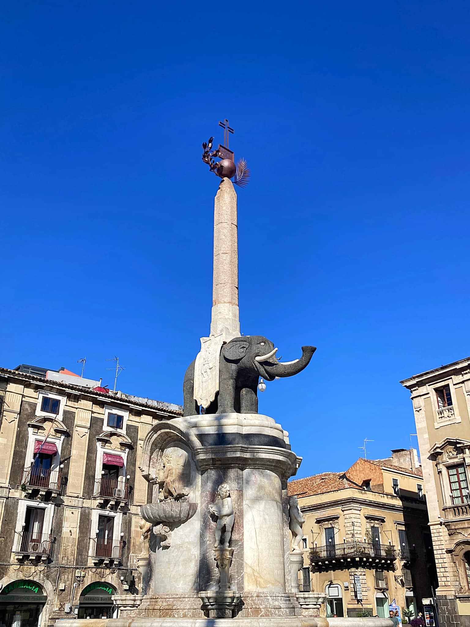
We navigated our way through rush hour traffic before walking to the Piazza Duomo to meet our guide, Francesco. There were also an English couple, an English woman who has lived in Rome for forty years and her Irish friend. The Rugby World Cup was the first topic of conversation once she knew we were from NZ. Francesco was very interested in NZ and the pacific islands due to his interest in sailing.
On our way to the markets, we stopped to admire a river that flows under the Piazza. There was an immaculately dressed man standing there having his picture taken with whoever wanted – Debs was front and centre
We walked through the fish market which is a very lively place. Swordfish is very popular on the menus here.
We then went to a local restaurant in the market for some tastings. We had some cheese and salami. The ricotta was absolutely delicious.
Next up we had a choice of seafood or horse meat. Given the other three are seafood lovers and none of us were keen on eating horse, we went with the seafood option. One of the others in the group tried the horse meat and said it was super salty.
We then left the market and wandered past some churches and a convent. The buildings are dirty looking due to the ash from Mount Etna’s historic eruptions, the most recent being in August this year
Mount Etna is located above the convergent plate margin between the African Plate and the Eurasian Plate. It is one of the tallest active volcanoes in Europe, and the tallest peak in Italy south of the Alps with a current height (July 2021) of 3,357 m (11,014 ft), though this varies with summit eruptions. Over a six-month period in 2021, Etna erupted so much volcanic material that its height increased by approximately 100 ft (30 m), and the southeastern crater is now the tallest part of the volcano.
Mount Etna is one of the world’s most active volcanoes and is in an almost constant state of activity. The fertile volcanic soils produced from this activity support extensive agriculture, with vineyards and orchards spread across the lower slopes of the mountain and the broad Plain of Catania to the south. Due to its history of recent activity and nearby population, Mount Etna has been designated a Decade Volcano by the United Nations. In June 2013, it was added to the list of UNESCO World Heritage Sites.
We have a fabulous view of Mount Etna from where we are staying.
Next up on the tasting menu was Arancino given we were in Catania. The rivalry between Catania and Palermo extends to this yummy morsel. According to Palermitans there’s no doubt! It’s Arancina (Singular) and Arancine (Plural) and it has the shape of a ball. While according to Catanians it’s more correct to say Arancino (S) and Arancini (PL) and it has the shape of a cone!
But it’s not only a matter of vowels or shape but gender! In fact, according to the Italian grammar, the word arancina is feminine while arancino is masculine! Palermitans love to say “a’ arancina fimmina è!” (the arancina is a lady!”
We passed the area where they are uncovering the ruins of the Amphitheatre of Catania which was built in the Roman Imperial period, probably in the 2nd century AD.
Next up we had a Cipollina which refers to a type of small, somewhat flattened onion that has a thin skin and a sweet taste. This is typical of the province of Catania. The Cipollina is a crunchy box of puff pastry filled with stewed onions, tomato sauce, mozzarella and ham. Really, really delicious
We then went to a drinks kiosk to try a Seltz Limone e Sale which is sparkling water, juice of a lemon and a teaspoon of salt. This drink was offered for the first time in 1896 and is a good supplement of mineral salts and very refreshing after a day at the beach. They offered a mandarin version which I took – good choice as it was refreshing – the ones who chose the lemon version said it was too salty!
Next up was the Granita which we have become very well acquainted with on this trip. Granita is a semi-frozen liquid compound prepared with water, sugar and a fruit juice or other ingredient. I have had a pistachio one and a number of lemon ones. This time I went with chocolate and it was delicious – very creamy. Jo had the coffee one and was not impressed.
Two different food tours and two different experiences. We found Catania a lot more relaxed but the blackened buildings did give an impression of being a dirty city. The Sicilian food though was a hit in both places.
Bella’s on Tour – Sicily – Taormina
Today we headed to Taormina which is about an hour north of where we are staying on the east coast of the island.
Taormina is a historic town that sits 250 metres above sea level. A cable car connects the historic center of Taormina with its beach area of Mazzarò.
The history of Taormina dates back to before Ancient Greece established its first colony on Sicily in 734 BCE in Magna Graecia and it has been a tourist destination since the 19th century.
Taormina followed the history of Sicily in being ruled by successive foreign monarchs. After the Italian unification, Taormina began to attract well-off tourists from northern Europe, and it became known as a welcoming haven for gay men and artists.
We caught the cable car up to the town and the view on the way up was pretty special. We enjoyed a lovely coffee near the piazza before going exploring. It is a very upmarket town, well kept with lovely shops and greenery.
We visited the Villa Communale of Taormina which was originally the garden of the house of an English noblewoman who lived in Taormina in the nineteenth century: Lady Florence Trevelyan. The daughter of a cousin of Queen Victoria, Lady Florence arrived in Taormina in 1884, fleeing from a scandal at court. She was accused of having an affair with the Prince of Wales, the future King Edward VII, who was already married to Alexandra of Denmark. In Taormina, Lady Florence met the doctor Salvatore Cacciola, who was to become the mayor of Taormina and whom she married in 1890. Over the years the couple bought several pieces of land where they built their villa and around which the noblewoman began to create an English-style garden.
Until 1990, Florence Trevelyan also owned Isola Bella (also known as the Pearl of the Ionian Sea), a small island below Taormina, before it was bought by the Region of Sicily, being turned into a nature reserve, administered by the Italian branch of the World Wide Fund for Nature. There is a narrow path that often connects the island to the mainland beach.
After our explore we caught the cable car down again and drove along the coast to do a two hour boat tour to see Isola Bella and Grotto Azurra which had stunning light reflections creating a contrasting blue pool against the walls of the ancient cave.
Our captain also pointed out San Domenico Palace, A Four Seasons Hotel, which was the hotel used as the setting for season 2 of the hit HBO show The White Lotus. Located on a hillside overlooking the Ionian Sea, the building was once a once a convent back in the 14th century, and has been welcoming guests as a hotel since 1896.
We stopped to have a swim which was amazing – the water is so clear and warm. On the way back to the port the captain cranked up the music and a bit of dancing took place. The captain even put on a bit of a show and may or may not have had a little dance with one of the Bella’s . We met some lovely people on our tour from Wales, the UK, Scotland, Australia, Italy and Israel.
Parking is a bit of an issue in Italy. Most of the time the parking machines don’t work and the parking buildings on Google maps don’t exist or are closed. The Italians just seem to park wherever but we’re a little nervous to do this. Anyway, today we were attempting to use a parking machine when a guy on a push bike came along and told us to follow him to a parking lot. We went down a dusty alley and he told us it was EU5 to park for the day. Jo was suspicious that it was a scam but we were running late for the boat tour so we went with it. We were all a little nervous that either our car would be gone when we got back or they would demand a ransom.
We enjoyed a lovely lunch after the boat trip before nervously heading back to the car. After overshooting the entrance to the dusty alley and some confusion as to whether we were on the right street, we located the parking lot – another guy with his push bike was sitting there this time. Our car was also still there and no ransom was demanded .
On the way home we stopped at the supermarket for Prosecco and tonic supplies as well our first gelato on tour. It has been the best day, topped off by a convincing All Blacks win which we managed to watch on my laptop.
Bella’s on Tour – Sicily – Caltagirone & Valley of the Temples
A big day on the road for the Bella’s today.
First stop was the village of Caltagirone which is famous for its ceramics. Take one look at the landscape around Caltagirone, and you’ll understand why ceramics became the destiny of this hilltop town. For two millennia, the clay has meant a living for the people of Caltagirone. The word Caltagirone itself derives from the Arabic phrase Qal’at al Ghiran, or Rock of the Vases, which, according to legend, is the name its medieval inhabitants gave it.
Today, Caltagirone is the center of an uncomplicated, exuberant ceramics tradition. The designs are bold and brash, with a palette dominated by blues, greens and yellows and big, bold designs. This pottery exudes a sense of warmth and cheer that feel as if they could only exist on Sicily.
On Sicily, ceramic art is deeply rooted in time. The ancient Phoenicians and Greeks brought their artisanal traditions to the island, creating amphorae, kraters, kylixes, and other typical ancient wares using the ruddy earth and painted with styled black and red figures. The technique of laying bright, saturated colors against a white tin oxide background developed in the Middle Ages, and may have been introduced into Sicily during the Muslim conquest of the ninth through the eleventh centuries. These early artists left their masterpieces to bake in the hot Sicilian sun, and then left them behind, where they continue to inspire Sicily’s artisans today.
Caltagirone boasts a a set of world famous steps called Scalinata di Santa Maria del Monte which were built in 1606 in order to connect the ancient part of Caltagirone to the new city built in the upper part. The work required 10 years of work and was carried out under the direction of Giuseppe Giacalone. The original staircase had rest areas and a total of 150 steps. Since 1954, the steps leading to the church of Santa Maria del Monte have been entirely decorated with polychrome ceramic tiles, following the ancient local artisan tradition. The figurative themes of the ceramics are floral or geometric, and represent the Arab, Norman, Angevin-Aragonese, Spanish, Renaissance, Baroque, eighteenth-century, nineteenth-century and contemporary styles.
We met this group of cyclists on the stairs. They were all riding tandems and there were 17 of these tandems doing a 12 day cycle tour around Italy. It’s a volcanic island with many hills, crazy Italian drivers and it is very hot. And people thought I was mad cycling across Europe
Coffee, treats and a bit of retail therapy were enjoyed before we set off to the Valley of the Temples some two hours away.
The Valle dei Templi or Valley of the Temples, is an archaeological site in Agrigento (ancient Greek Akragas), Sicily. It is one of the most outstanding examples of ancient Greek art and architecture of Magna Graecia, and is one of the main attractions of Sicily. The term “valley” is a misnomer, the site being located on a ridge outside the town of Agrigento.
Since 1997, the entire area has been included in the UNESCO World Heritage List. The archaeological and landscape park of the Valle dei Templi, with its 1300 hectares, is the largest archaeological park in Europe and the Mediterranean basin.
The remains are in such good condition and it was amazing to get so close to them. The Valley includes the remains of seven temples, all in Doric style. Temple of Juno, Concord, Hercules, Olympic-Jupiter, Vulcano, Castor and Pollux.
We saw some GIrgentana goats which are endemic to the area. The Girgentana breed has its ancient origins in the Markhor or Falconeri goat (Capra falconeri), from the English naturalist Falconer, who first noticed it in northern Afghanistan and Balochistan. According to some authors the import of the first specimens of the goat is attributed to the Greeks, but other writers attributed it to the Arabs. It was bred and selected in Sicily, particularly in the south western area. Its name derives
from Girgenti (the name of the city Agrigento). It is a middle-sized goat with a long and thick white coat, sometimes with brownish markings. Its milk, renowned for its good ratio of lipids and proteins, is intended for direct consumption. This goat breed is threatened of extinction due to its small number of specimens and breeders.
We then had a two hour drive back to the west coast. We decided to go to a little seaside village called Brucoli for dinner on the way home. Unfortunately the restaurant we were going to go to was closed (although Google said it was open) so we ended up at a pretty fancy place called Al Castello.
We weren’t really dressed for such a nice restaurant but we were allowed in at 7.30pm and not a minute before, despite the staff sitting around playing cards. Most restaurants in Italy open between 7pm and 8pm. Despite the service being pretty officious the food was amazing – burrata ravioli in a tomato soup (Jo & I) and salmon steak with pistachio crust on cream of sweet potato and caramelised onion (Kaye & Debs).
Bella’s on Tour – Sicily – Serafico Terra Di Oilio e Vino
Our last full day on the beautiful island of Sicily. What an absolute treat it has been.
A relaxed start to the day with a return trip to Brucoli for a walk and coffee. It was nice to see it in the daylight and it was a hive of activity with the local fisherman bringing in their catches for the locals to come and buy on the side of the street. One such fisherman took quite a liking to Kaye and insisted on having a photo with her.
It was then back home for a swim before heading to Serafico for a late afternoon olive oil and wine tasting on the slopes of Mount Etna. The Serafico production plant / mill and tasting room / shop sit at about 800 metres above sea level. The company is family owned and has been operating since 1950.
The tradition of the cultivation of olive trees on Etna has its roots in history and legend: the first traces of olive cultivation in Sicily date back to the first millennium thanks to the Phoenicians and later to the Greeks. In this context the presence of the volcano, with its eruptive manifestations, has fed the myth of this crop: the Cyclops Polyphemus, personification of Etna with its only eye injected with the fire, is in fact blinded by Ulysses and companions with an olive trunk.
Overlooking the Gulf of Catania, admiring the Simeto Valley, in the territories of Nicolosi, Ragalna and Santa Maria Di Licodia up to 1,000 metres above sea level, Serafica’s olive groves of Nocellara etnea (olive variety), cultivar queen of the territory, give their extra virgin olive oil an articulated and rich taste.
We were met by our host Georgia who first took us to see a cave which showed three distinct layers of soil which were a result of the large eruptions over thousands of years. They have olive trees (40 hectares in total) and vines (15 hectares) at various levels above sea level which influences the taste of both the oil and wine.
Georgia took us through the olive oil process and showed us the traditional presses versus the new technology. They use both depending on who they are producing the oil for. There are some small growers they contract manufacture for who prefer the traditional press. Interestingly it takes 8 kilograms of olives to make a litre of olive oil. They also leave the nut in through the pressing process – the Nocellara etnea variant of olives are very delicate and the nut adds to the flavour.
The waste product from the pressing process looks a bit like cork and they sell this to the locals as a source of fuel for their stoves and fires.
The olive harvest period starts about mid October and goes through to December with the higher olive trees being the last to be harvested. They hand harvest the olives and they are pressed straight away to prevent them heating up.
We then went into the wine production area. They have 15 hectares of vines at between 650 and 900 metres above sea level. The grape varieties of Etna are Nerello Mascalese and Nerello Cappuccio (both red) and Carricante and Catarratto (both white). During the tasting we tried the Grotta del Gelo (red), Grotta dei Lamponi (rose made from the Nerello Mascalese) and the Grotta della Neve (white). I really liked them all – the noses on them were quite floral but they weren’t floral to taste. They were all quite dry and the mineral flavours came through. The red was the favorite for everyone.
They do some contract manufacturing for some of the smaller vineyards in the area too. They are just starting their harvest now.
On Sunday they are having a festival for the locals to mark the start of the harvest. They have some vines set aside for them to pick and do the traditional foot stomping. Georgia said they welcome a number of school groups through regularly to learn about what they do. You could see from the tasting area that they had a lot of educational stuff for the kids. As a company they appear very connected and invested in the community.
They even have a natural spring two hundred feet below the ground. They have set up a system to bring it up for the locals to come and buy – EU1 for 40 litres. We tried the water and it was good – it was lightly sparkling. It was a busy place with cars and people coming and going filling their bottles.
Georgia explained that the town water is not drinkable due to the state of disrepair of the infrastructure with lots of heavy metals detected in the water.
Georgia taught us how to taste the olive oil. We tried three – one from 400 metres, one from 600 metres and one from 1000 metres above sea level. They were all so delicate and smooth but the level of spiciness at the back of your throat increased the higher up the origin of the olives.
We then enjoyed some snacks where we could try the different oils. They also had some flavour infused ones – I loved the orange one. There was also a range of locally produced relishes / jams all using locally produced saffron. This local saffron producer does a lot of collaborations with other local producers of various products and sounds very innovative. Love these sorts of stories.
More special and informative memories made on the island of Sicily.
The full Euro Velo 6 cycle trail spans Europe between the Atlantic Ocean and the Black Sea. Due to a lack of cycle infrastructure and the fact that the route goes up near the Ukrainian border we decided to finish in Belgrade, Serbia.
However, the lure of the Black Sea saw us fly from Belgrade to Bucharest in Romania for a few days. We had originally planned a private tour to Constanta and the Black Sea but it fell through at the last minute so we decided to take the train and do a self guided tour. The train station in Bucharest is called Gara de Nord reflecting the French influence in the city.
The train trip (about three hours) was fun and very relaxing. The landscape started off very flat and brown before becoming a little greener closer to the coast. We saw many herdsman with their flocks of sheep, goats and cows. A very different scene to what we are used to in NZ. The landscape and buildings had an impoverished look about them.
We crossed the Danube–Black Sea Canal (Romanian: Canalul Dunăre–Marea Neagră) which is a navigable canal in Romania, which runs from Cernavodă on the Danube river, via two branches, to Constanța and Năvodari on the Black Sea. It is an important part of the waterway link between the North Sea and the Black Sea via the Rhine–Main–Danube Canal.
Although the idea of building a navigable canal between the Danube and the Black Sea is old, the first concrete attempt was made between 1949 and 1953, when the communist authorities of the time used this opportunity to eliminate political opponents, so the canal became notorious as the site of labor camps, when at any given time, between 5,000 and 20,000 detainees, mostly political prisoners, worked on its excavation. The total number of prisoners used as labor force during this period is unknown, with the total number of deaths being estimated at several tens of thousands. The construction works of the Danube–Black Sea Canal were to be resumed 20 years later, in different conditions.
Constanta is the country’s fourth largest city and principal port on the Black Sea coast. It is also the oldest continuously inhabited city in the region, founded around 600 BC, and among the oldest in Europe. It has a population of about 265,000.
We caught an Uber from the train station to the old town where we wandered down to the waterfront. Along the way we saw the museum of archaeology, the Grand Mosque of Constanta and the Casino which was under renovation. We climbed to the top of the minaret of the mosque for a great view over the Port of Constanta and the Black Sea.
The construction of the port began on October 16, 1896, when King Carol I set the first stepping stone for the construction and modernization of the port. After the opening of the canal the port grew exponentially. After the Romanian Revolution of 1989, the port faded in importance for the Romanian economy, traffic was dwindling and in 2000 the port registered its lowest traffic since World War II of 30 million tonnes of cargo. It is now back up to about 56 million tonnes of cargo annually.
We enjoyed a Lebanese lunch before heading to the beach. The water was clear and a lovely temperature. It was so good to be swimming again. We then spent a relaxing couple of hours on the beach before heading back to Bucharest on the train.
Day 53 – Romania – Peles Castle, Brasov & Bran Castle – 0km
On our second day in Bucharest we took a tour up to the north through the Carpathian Mountains to visit Peles and Bran Castles and the town of Brasov.
Our guide, Emmanuel, was extremely knowledgeable and passionate with a great sense of humour. He warned us that the traffic on our journey could be particularly bad due to various roadworks. We could relate to his humour / sarcasm when he described how productive these road workers actually were
Our first stop was Pele Castle which was the summer residence of the Romanian royal family. Commissioned by Carol I (1839-1914), independent Romania’s first king, Peles Castle was constructed between 1873 and 1883 and built in a neo-Renaissance style with Fachwerk facades. Carol had fallen in love with the superb scenery and so commissioned a royal hunting preserve and summer retreat. Peles Castle was the first ever European palace to be powered by electricity, created in its own power plant, and to have central heating.
King Carol II of Romania was born at the castle in 1893, giving meaning to the phrase “cradle of the dynasty, cradle of the nation” that Carol I bestowed upon Peleș Castle. Carol II lived in Foișor Villa for periods during his reign. Princess Maria died there in 1874.
After the forced abdication of King Michael I of Romania in 1947, Communist Romania seized all royal property, including Peleș Estate. The castle was opened as a tourist attraction for a short time. It also served as a recreation and resting place for Romanian cultural personalities. The castle was declared a museum in 1953. Nicolae Ceaușescu (general secretary of the Romanian Communist Party from 1965 to 1989, and the second and last communist leader of Romania) closed the entire estate between 1975 and 1990, during the last years of the Communist regime. The area was declared a “State Protocol Interest Area”, and the only persons permitted on the property were maintenance and military personnel.
In 2006, the Romanian government announced the restitution of the Royal Domain including all properties and land within the domain to the former monarch, King Michael I. Negotiations soon began between the king and the government of Romania, and were concluded in 2007. The castle is on lease from the royal family to the Romanian state.
There was a lot to see inside the castle with so many different styles and artefacts. There were a number of rooms inspired by different countries. There is a wealth of artwork in over 160 rooms, including thousands of paintings and sculptures. The armoury room was particularly impressive.
After Peles Castle we went to the town of Brasov for lunch, which is a city in Transylvania. Emmanuel recommended a local restaurant (La Ceaun) where we could have two of the local dishes – bean soup served in a bread bowl and cabbage rolls with rice and ham served with sour cream. Emmanuel also recommended having a shot of plum brandy with lunch, which we did – it was pretty strong and seemed to get stronger once we started eating
It was then time to meet Dracula at Bran Castle in Transylvania. The origins of this castle go back to 1212. The fortress is on the Transylvanian side of the historical border with Wallachia. Wallachia has always been part of the Romanian Empire whereas Transylvania was part of Hungary. With the 1920 Treaty of Trianon, Hungary lost Transylvania, and the castle became a royal residence within the Kingdom of Romania.
Although many castles of the time belonged to members of the nobility, it has been established that Bran Castle was built almost exclusively for fortification and protection of German colonists in Transylvania.
Bran Castle is not mentioned in the novel Dracula (author – Bram Stoker), and the novel’s description of the castle does not match Bran Castle. The claimed connection between the castle and the Dracula legend is tourism-driven.
During Stoker’s research on the region of Transylvania, he came across accounts of the atrocities committed by Vlad III, and used the Dracula name after reading on the subject; but his inspiration for Dracula was not solely based on the historical figure. It is largely due to American cinema that Vlad III is considered the inspiration for the Dracula character.
The Wallachian ruler Vlad Țepeș (Vlad the Impaler; 1448–1476) does not seem to have had a significant role in the history of the fortress, although he passed several times through the Bran Gorge.
Though many myths have been connected to him in connection with the Dracula myth, most historians agree that Vlad III Dracula, also known as Vlad the Impaler, never set foot in Castle Bran, which was neither a friendly place for him to visit nor under his rule.
Marie (born Princess Marie Alexandra Victoria of Edinburgh; 29 October 1875 – 18 July 1938) was the last queen of Romania as the wife of King Ferdinand I. The castle was inherited by her daughter Princess Ileana who ran a hospital there in World War II. It was later seized by the communist regime with the expulsion of the royal family in 1948.
After various legal proceedings, on the 18th May 2009, the administration of Bran Castle was transferred from the government to Princess Ileana’s children, Archduke Dominic and his sisters, Archduchess Maria Magdalena and Archduchess Elisabeth. On 1 June 2009, the Habsburgs opened the refurbished castle to the public as the first private museum in the country.
It was then time for our three hour trip back to Bucharest. We enjoyed a yummy Mexican dinner back in the city washed down with a few mango margaritas
Day 54 – Bucharest – 0km
We spent our last day in Romania doing a self guided walking tour of Bucharest. Bucharest has a population of 1.75 million and is extremely vibrant and busy with lots of tourists. We stayed in an AirBNB on the edge of the old city which is party central. A great location but extremely noisy with one of the bars nearby operating until 7am not ideal in the sleeping stakes.
Bucharest, the capital and cultural center of Romania, is one of the largest cities in Southeastern Europe.
First mentioned as the “Citadel of București” in 1459, the town became the permanent location of the Wallachian court during the reign of Vlad III the Impaler, in 1698. The medieval remnants from that period, still found in the Lipscani neighborhood, include Hanul lui Manuc (Manuc’s Inn), tiny Eastern Orthodox Stavropoleos Church, and the ruins of Curtea Veche (the Old Court).
In 1862, after Wallachia and Moldavia united into the Principality of Romania, Bucharest became the new nation’s capital city, and later, in 1881, that of the newly-proclaimed Kingdom of Romania. That period brought about a new phase in the urban development of Bucharest. Romanian Athenaeum, constructed from 1886 to 1888, is a living monument to that (part of the European Heritage since 2007) and a symbol of Romanian culture.
In between two world wars, the city’s elegant architecture and cosmopolitan sophistication of its elite earned Bucharest the titles “Little Paris” and “Paris of the East”, in which Calea Victoriei (Victory Avenue) was seen as its analogue to Champs-Élysées. Bucharest also has an Arcul de Triumf to commemorate Romania’s victory in the First World War and the coronation of King Ferdinand and his wife Marie. It is only 27 metres high compared to the Arc de Triomphe in Paris being 50 metres tall.
The city suffered heavy damage during World War II. After the establishment of Communism in Romania, Bucharest saw much of its historic center razed and built upon with new developments. One of the iconic landmarks of Socialist Realism, emerged in the 1980s under the dictatorship of Nicolae Ceaușescu, is the Palace of the Parliament, a massive government complex of 1,100 rooms.
Following the Romanian Revolution of 1989, and notably since 2000, the city has enjoyed continuous modernization prompted by both economic and cultural boom. In 2017, Bucharest was declared a European city with the highest growth of tourists staying overnight.
It is located in the south-east of Romania, on the banks of the Dâmbovița river, less than 60 km (37.3 mi) north of the Danube River and the border with Bulgaria. It is also one of the most populated cities of the European Union (EU) within city limits and the most populated capital in Southeastern Europe.
Our walking tour included:
1. The Palace of the Parliament
The Palace of the Parliament in Bucharest is a multi-purpose building which houses both chambers of the Romanian Parliament. According to the World Records Academy, the Palace is the world’s largest civilian building, most expensive administrative building, and heaviest construction. The Palace was designed and nearly completed under the Ceauşescu regime as the seat of political and administrative power. Nicolae Ceauşescu named it the House of the Republic, although many Romanians call it the People’s House.
Constructing the Palace and Civic Center required demolishing much of Bucharest’s historic district, including 19 Orthodox Christian churches, six Jewish synagogues, three Protestant churches (plus eight churches had to be relocated), and 30,000 residences. The construction began in 1983; the cornerstone was laid on 25 June 1984.
While the building was intended to house all four major state institutions (in a similar manner to the UK Houses of Parliament), Ceausescu opted to make the palace his personal residence and have the government operate in it.
2. Manuc’s Inn
Manuc’s Inn is the oldest operating hotel building in Bucharest. We had a coffee stop here.
The inn was built in 1808 as a khan, and originally owned by a wealthy and flamboyant Armenian entrepreneur, Emanuel Mârzaian, better known under his Turkish name Manuc Bei. By the middle of the 19th century, it was Bucharest’s most important commercial complex, with 15 wholesalers, 23 retail stores, 107 rooms for offices or living, two receiving rooms, and a pub.
3. Stavropoleos Convent
Stavropoleos Convent, also known – during the last century when the convent was dissolved – as Stavropoleos Church built in 1704, is an Eastern Orthodox nunnery in central Bucharest, Romania. Its church is built in Brâncovenesc style. The patrons of the church are St. Archangels Michael and Gabriel. The name Stavropoleos is a Romanian rendition of a Greek word, Stauropolis, meaning “The city of the Cross”. Among other things the convent is particularly famous for is Byzantine music; it has a choir and the largest collection of Byzantine music books in Romania.
4. Revolution Square and Memorial of Rebirth
Piaţa Revoluţiei (Revolution Square) was once known as Piaţa Palatului (Palace Square), and was renamed after the Romanian Revolution of 1989.
The former Royal Palace (currently, the National Museum of Art of Romania), the Athenaeum, the Athénée Palace Hotel, the University of Bucharest Library, and the Memorial of Rebirth are all found here. The square also houses the former Central Committee of the Romanian Communist Party headquarters from where dictator Nicolae Ceauşescu and his wife fled by helicopter on December 22, 1989. Three days later the Ceaușescus were executed at 4:00 p.m. local time at a military base outside Bucharest on 25 December 1989. The execution was carried out by a firing squad consisting of paratroop regiment soldiers. The main charge against them was genocide with over 60,000 deaths.
In 1990, the building became the seat of the Senate and since 2006 has accommodated the Ministry of the Interior and Administrative Reform.
From 1930 to 1948, an equestrian statue of King Carol I dominated the square before being destroyed by the Communists. In 2007, the Bucharest City Hall set out to recreate the statue based on the original blueprints kept by the sculptor’s (Meštrović) family.
The Memorial of Rebirth, inaugurated in August 2005, commemorates the struggle, which claimed nearly 1,500 lives and brought Communist era in Romania to its end. The memorial features a 25-meter marble pillar, upon which a metal “crown” is placed. The pillar stands amid a 600 m² plaza covered in marble and granite. Despite a commonly-acknowledged need for such monument, its design has been largely criticized as devoid of symbolism, too abstract, and not adequately reflecting the suffering and magnitude of the 1989 revolution.
5. Romanian Athenaeum
The Romanian Athenaeum is a concert hall in the center of Bucharest and an architectural landmark of the Romanian capital city. Opened in 1888, this ornate, domed, circular building is the city’s main concert hall and the home of the George Enescu Philharmonic and the George Enescu annual international music festival.
6. Fountains
The 44 fountains in downtown Bucharest are located at a 1.4-km distance between Alba Iulia Square and Constitution Square. The artesian fountains of Unirii Square, built during the communist period, were restored to life following an investment of 9 million Euros. Bucharest can now boast the first smart fountains in Europe designed 100% on a computer, with a fantastic show of color, music, and 3D projections on the water. In fact, Bucharest holds the Guinness Record for the longest choreographed fountain system in the world.
Unirii Square wasn’t always what it is now. Before the 1980s, there were a lot of houses and covered food markets where the fountains now lie. The entire capital used to gather here on market days to stock up. The square used to be pretty small, until they decided to enlarge it. With this vast modification of the square, also came the building of 44 fountains, along the Unirii Boulevard. The locals used to walk by the fountains on sunny days, and this hasn’t changed throughout time.
We were fortunate enough to see the show after dinner on our last night in Bucharest – it was uplifting and amazing – a great lasting impression of our few days in the city.
We had dinner at Fabrica – the red brick building was once a part of an industrial architectural complex dating back to 1898. For more than a century, it hosted a sock factory, Apollo. Yet, though it survived the transition to capitalism, the complex went bust in 2003. While some parts of the structure were demolished, with blocks of flats rising in their place, a part of Fabrica was saved and transformed into a bar, terrace, club, and arts centre — the first of its kind in Bucharest. The landmark has been added to city’s listed buildings giving it some protection.
A bittersweet moment at the airport on Sunday morning, after eight amazing weeks together. We said goodbye and went our separate ways with our hearts and memories full after a very special adventure together.
Due to being so hot when we arrived yesterday and only having the energy to go to Aqua Land we didn’t explore Ràckeve. This morning we went in search of coffee and found a bustling little town full of people going about their business. Found a lovely little cafe which even did a Matcha Latte.
We crossed the Árpád hid bridge to the east side of the Ráckevei-Duna. Immediately our visual senses were inspired again as we looked across the water at the reflections of the church and little holiday houses on the water. It was a gorgeous time of the morning and we really enjoyed that first twenty kilometres along the river.
At one of the photo stops, Graham spotted a largish sea snake and along the track I saw a small snake wriggling along. Any thoughts of swimming in the Danube are fast disappearing. We then came across a lady heading to the river for a swim – she spoke a little English and told us that we could swim in the river – it’s not too cold she said. It’s not the cold we’re worrying about
We then hit an unsurfaced track along the flood dyke. There was no shade so it was hot work in about 27 degree heat. There was a bit of a head wind which was both a hindrance and a help. We came across a herdsman moving his sheep, goats and a donkey along the riverside.
The road conditions in Hungary are pretty poor with lots of potholes which makes for interesting riding when we’re on the road sections.
We had a coffee stop in Dunavecse before being back on a cycle path next to the road. We are now traversing the great Hungarian plain which is flat as far as the eye can see.
Our lunch stop was in Solt before a thirteen kilometre cycle to Harta which is home for the night. There is nothing of great interest here but our quasi AirBNB is very nice. We biked down to a restaurant on the Danube for dinner. The setting was great but unfortunately the food was definitely not as good as we have been having.
It is getting darker earlier now so we ended up cycling home in the dark using our phones as lights.
Day 44 – Harta to Baja – 74km
Another blue sky day with temperatures in the late twenties. After leaving Harta we followed the Danube before going inland through some villages.
Andy spotted the statue of Ferenc Rákòczi II and his horse in Ordas, which is carved out of a tree. He was the leader of the 1703 to 1711 uprising against the Hapsburgs.
We were looking forward to visiting the town of Kalocsa but the directions got lost in translation and we ended up missing it. It is one of the oldest towns in Hungary. The countryside surrounding Kalocsa is Hungary’s main area for the cultivation of paprika peppers. We saw houses with strings of drying peppers and September is the month they have a paprika festival which brings thousands of visitors.
We were now on the flood dykes with very little shade and no coffee stop options in sight. We finally found a shady spot and checked Google for options. Wallah there was a cafe 150 meters away down by the river. We refuelled on coffee and burgers – I had a Camembert one
Back onto the flood dykes in full sun and a head wind. It was thirsty work. We came across a group of wooden statues which reminded us of the Maori pouwhenua. Unfortunately we couldn’t find any information about them so are unsure of their meaning and significance.
We arrived into Baja about 2pm and the guy who greeted us at the hotel was so lovely. He wanted to chat and was very interested in our NZ passports. We are staying in the centre of town which is quite bustling with a population of 38,000.
I needed a new cord for my laptop and I found a computer store. I asked the young guy if I could pay for the cable and then bring it back if it didn’t work. He said there was no need to pay, just take it and see how you go. I went back to pay for it and he said if I had any trouble just bring my laptop in and he would take a look. Great service and very trusting.
We enjoyed dinner at a Mexican restaurant down by the river which was nice. Tonight is our last night in Hungary. It has been interesting, the people have been friendly with a good level of English and we’ve enjoyed the food. The cycling has been the least favourite part with poor quality tracks and long, exposed stretches on flood dykes with very little time beside the Danube.
Hungary is a land locked country in Central Europe. It has a population of 9.7 million, mostly ethnic Hungarians and a significant Romani minority.
Hungary came under Habsburg rule at the turn of the 18th century, later joining with the Austrian Empire to form Austria-Hungary, a major power into the early 20th century.
Austria-Hungary collapsed after World War I, and the subsequent Treaty of Trianon established Hungary’s current borders, resulting in the loss of 71% of its territory, 58% of its population, and 32% of ethnic Hungarians. Following the tumultuous interwar period, Hungary joined the Axis powers in World War II, suffering significant damage and casualties. Postwar Hungary became a satellite state of the Soviet Union, leading to the establishment of the Hungarian People’s Republic. Following the failed 1956 revolution, Hungary became a comparatively freer, though still repressed, member of the Eastern Bloc. The removal of Hungary’s border fence with Austria accelerated the collapse of the Eastern Bloc and subsequently the Soviet Union. On 23 October 1989, Hungary again became a democratic parliamentary republic. Hungary joined the European Union in 2004 and has been part of the Schengen Area since 2007.
Hungary is an OECD high-income mixed economy with a very high human development index and skilled labour force. Major industries include food processing, pharmaceuticals, motor vehicles, information technology, chemicals, metallurgy, machinery, electrical goods, and tourism. Hungary is the largest electronics producer in Central and Eastern Europe. Electronics manufacturing and research are among the main drivers of innovation and economic growth in the country. In the past 20 years Hungary has also grown into a major centre for mobile technology, information security, and related hardware research.
Day 45 – Baja (Hungary) to Osijek (Croatia) – 123km
It was our biggest day on the pedals today so we got away at 7am. Baja was already buzzing with people going about their daily business.
After the first few kilometres we were then on the flood dyke heading for Újmohács to cross the Danube at the 34 kilometre mark. We all missed the turning resulting in a few extra kilometres on todays total. Back we went to find the turn and made it just in time to jump on the ferry to Mohács, which is the last town in Hungary on our trip.
Three kilometres after Mohács we hit the 3000 kilometre mark so had great fun trying to make a 3000 sign – I hope you’re all impressed with our efforts.
Another fourteen kilometres on and we crossed the border into Croatia or Republika Hrvatska which is our seventh country on the Euro Velo 6.
Just before the border we came across an old Iron Curtain watchtower.
We found a coffee shop in the village of Topolje. The proprietor didn’t speak English but there was a young guy (customer) in the shop who did, so he helped us out. His name was Mikey and Andy struck up a conversation with him. His mother had been displaced to Germany during the Yugoslav Civil War and that is where he had been born. After the war ended they were asked to leave Germany and return to Croatia. Mikey ended up going back to Germany to study but has just shifted back to Topolje where he said work is scarce. Mikey then went on his way.
We enjoyed our coffee on the terrace out the front and then I went in to pay the bill. The proprietor said ‘no Mikey paid”. What a lovely start to our stay in Croatia. I left a little brass kiwi with the proprietor to give to Mikey next time he’s in to thank him for his kindness to the five kiwis whose day he made.
This part of Croatia is an important wine growing region that suffered badly during the Yugoslav Civil War. This was very evident in the villages we went through with a lot of damaged, derelict and abandoned houses and buildings. Whole villages have been left in rack and ruin thirty years on.
The Yugoslav Wars were a series of separate but related ethnic conflicts, wars of independence, and insurgencies that took place in the SFR Yugoslavia from 1991 to 2001. The conflicts both led up to and resulted from the breakup of Yugoslavia, which began in mid-1991, into six independent countries matching the six entities known as republics which previously comprised Yugoslavia: Slovenia, Croatia, Bosnia and Herzegovina, Montenegro, Serbia, and North Macedonia (then named Macedonia). Yugoslavia’s constituent republics declared independence due to unresolved tensions between ethnic minorities in the new countries, which fuelled the wars. While most of the conflicts ended through peace accords that involved full international recognition of new states, they resulted in a massive number of deaths as well as severe economic damage to the region.
The afternoon’s cycling was mainly on rural roads. One road was under construction but a helpful local told us that we could get through on our bikes. The road workers were very friendly, saying hello, and threatening to hose us down. I’m sure in NZ we would have had to detour and there would have been 25,000 road cones in our way
The Euro Velo 6 overlapped in part with what they call the The Amazon of Europe which spans across almost 1 million hectares of highly valuable natural and cultural landscapes, where the 3 rivers Mura, Drava and Danube connect Austria, Slovenia, Croatia, Hungary and Serbia into the world’s first 5-country UNESCO biosphere reserve.
We arrived into Osijek at about 3.30pm. Fortunately it hadn’t been as hot as previous days but still hot enough to warrant a trip to the supermarket to get beers and snacks for the team before going about our usual tasks of showering and laundry.
Osijek has a population of 108,000 and sits beside the River Drava 25km above its confluence with the Danube.
During the 20th century Osijek became an important industrial city, the oil refinery being a particular target for heavy allied bombing during the Second World War.
Osijek held out against an attack by Serbian forces of the Yugoslav National Army during the civil war (1991 to 1995) when it is estimated that 6000 shells landed in the city. Many residents fled with those remaining sleeping in bomb shelters. Most of the damaged buildings have now been restored. About 800 people were killed by Serbian shelling and air strikes; while atrocities against Serbs by Croatian forces have led to five Croats, including the Croatian commander General Glavaš, being imprisoned for war crimes.
Day 46 – Osijek (Croatia) to Backa Palanka (Serbia) – 93km
Another early start to beat the heat which again wasn’t too bad, with a bit of cloud cover for good measure.
Our first 44 kilometres was almost entirely on the road and was through an area that was a heavily fought over front line during the Yugoslav Civil War. The guide book said we may see signs warning of possible land mines and unexploded ordinance which fortunately we didn’t. We certainly saw houses and buildings that had been damaged by shelling though.
We stopped in Dalj for coffee – the coffee shop served coffee, beer and wine only and was full of men (young and old) chewing the fat, enjoying a coffee or a beer or a wine all at 8.30am
The first part of the route today had many memorials to the people who lost their lives in the war. There was also a memorial to the 714 Croat survivors of Serbian concentration camps.
We entered Vukovar at the 44 kilometre mark which has a current population of 27,000 (pre the war this was 46,000). After the Turkish occupation (1526 to 1687) the land was repopulated by a mixture of nationalities including Germans, Slovaks, Ukrainians and Russians, in addition to returning Croats and Hungarians, thus establishing a situation that would contribute to the disaster which occurred some 300 years later.
When the war broke out in 1991, Vukovar was on the front line. Battle for control of the city lasted 87 days and it is estimated that Yugoslav and Serb forces fired up to 12,000 shells and rockets into the city per day, making it the fiercest European battle since the Second World War. The city was completely destroyed and most of the population fled, many never to return. Post war recovery has been slow and Vukovar remains an ethnically divided city where approximately equal numbers of Croats and Serbs remain wary of each other’s actions and intentions.
We visited the memorial (brac and pazin stone cross) erected in honour of all fallen defenders for Croatian freedom in October 1998 at the estuary of river Vuka. It was a gift from the Croatian Navy, military district Pula. The words “Navik on Zivi ki zgine posteno” (“Die Honourably, Live Forever”) are inscribed at the bottom of the Cross in the eldest Croatian script, the Glagolitic.
We also visited the shell marked and battered water tower that has been preserved as a symbol of the conflict.
One of the information boards had the following written on it which I thought was very poignant.
“Vukovar is a metaphor for life.
Life is never a straight line. Sorrow and joy, tears and laughter, rises and falls weave together all the time. “
After leaving town we stopped at the Vukovar war cemetery before descending and ascending on a plateau beside the Danube Valley. Our route has been so flat that this was a bit of a shock to the system but we all coped admirably.
Before crossing the border into Serbia we stopped at a Croatian winery called Ilocki Podrumi which is a large winery still preserving the Croatian winemaking tradition. I tried a Traminac which I would liken to a Pinot Gris.
JP and wine create a very entertaining combination and we were wondering if our visit to a winery just before crossing our first border check point was a good idea. Apparently she was going to be very “elequent” if questioned
First stop was the Croatian border control where we got our passports stamped. We were then in no man’s land for about 500 metres before queuing with the cars at the Serbian border control. We all gave our passports to Hilary (Mother Duck) so she could field any questions. All our passports scanned successfully (a little trouble with JP’s) and we were into Serbia – no questions asked.
Serbia is the eighth and final county we will enter on our bikes. My only knowledge / perception of Serbia is what I have seen on the news which has invariably been about war and conflict, so it was a little surreal to be entering this country.
We are staying just out of Backa Palanka (population 28,000), which is an amalgam of three towns – Stara Palanka (Old Palanka, mostly Serbs who survived Turkish occupation), Nova Palanka (New Palanka, new Serb settlers after the occupation) and Nemačka Palanka (German Palanka, new German settlers after the occupation). By the time they merged in the 20th century there was an overall German majority. In 1945 the German population was expelled and the city repopulated with ethnic Serbs from Bosnia. During the civil war, 5000 Serb refugees arrived from Croatia and Bosnia and many have stayed.
We are staying on the outskirts of town in what is an oasis compared to what we biked through (many damaged and derelict houses). The hotel, bar and restaurant are lovely. We had a fantastic waiter who made some great recommendations re local fare. I had Turkey with pastry and Gorgonzola cheese. Delicious
Today we had many interactions with the locals. We came across people biking, walking, in their front yards, shopkeepers, road workers and the majority engaged with us through a friendly wave, greeting or smile. Extremely welcoming and heartwarming.
Day 47 – Backa Palanka to Stari Slankamen – 73km
We had the biggest breakfast on tour this morning at the Grand Hotel which set us up for the day. It also turned out that the storm we had encountered in Brandon, France about a month ago also caused damage in Serbia. The Grand Hotel had a number of trees fall down with some of them still perched on the roof.
We spent the first twenty kilometres on the road with cars zipping past us at a rate of knots. The guide book had said that the off road flood dykes were rough which didn’t appeal. We then spotted people cycling on them from where we were on the road and they looked OK. We asked a farmer working his field how we could get up there and he let us cut across beside his rows of carrots.
It turned out to be a sealed bike path for the rest of the 24 kilometre ride into Novi Sad.
Novi Sad (translates to New Plantation) is the second biggest city in Serbia with a population of 208,000. Rapid post-war industrialisation more than doubled the population to 180,000 in 1991 and an influx of 50,000 Serb refugees from Bosnia and Croatia during the civil war expanded it further. NATO reprisal bombing raids during the Kosovo campaign (1999) destroyed all three bridges and severely damaged the city. The core city is surrounded by communist era housing developments.
We also passed a Soviet era helicopter that has ended up as part of a nightclub in Novi Sad.
The second half of today was also going to be on busy roads so we opted to catch the train to Beska where we then had an eighteen kilometre cycle on quieter roads to our accommodation for the night in the vineyards.
The eighteen kilometre cycle turned into a twenty four kilometre adventure as we tried to find our Airbnb. For some unknown reason the owner couldn’t drop us a pin on Google maps or give us an address. He had just sent a list of instructions directing us from a local restaurant in the village.
A few phone calls and pictures of hand drawn maps later (as well as a descent and then ascent through an apple orchard) we were met by a woman standing at the gate. She didn’t speak a word of English but showed us inside. The place ended up being about 4 kilometres from the village (not the 500 metres we were lead to believe) up and down some hills. Hilary then called the owner back to say that based on the original information, we had booked the restaurant back in the village for dinner but we were buggered if we were going to be biking back down there. He thought we had arrived by car so confusion reigned. In the end he organised for the neighbours to drive us to the restaurant and pick us up again.
JP, Graham and I opted for the Lada which was hilarious. Very soft back seats with absolutely no suspension. The old guys two dogs chased and out ran the car almost halfway to the village – he was laughing as he pointed at the speedo to show the dogs were doing 40 kilometres an hour. He spoke no English but grinned away as we were in fits of laughter.
We had a lovely dinner at Rustic, again sampling some local dishes paired with local wine. Our waiter was lovely (and rather handsome) making great recommendations and enjoying a laugh with us. He was actually from Croatia.
This area of Serbia is like a fruit bowl with many different crops being grown – apples, nectarines, peaches, watermelon, grapes, cabbages, potatoes, carrots. It is apple harvest time so we saw lots of crates of apples being transported around.
The Airbnb was also supposed to have a small pool per the pictures but no pool was to be found. I had been dreaming about that pool all day as the temperatures hit 30 degrees. To be fair, we were just happy to have found the place.
The views from the property are lovely as we look down on all the orchards and vineyards and we had a beautiful sunset as we sat out on the deck. We will always find the positives at the end of the day and we always end the day with lots of laughter.
Day 48 – Stari Slankamen to Belgrade – 32km
Today was our last day on the pedals – we have cycled over 3200 kilometres in the past 48 days from France to Serbia, experiencing eight different countries.
An absolute dream come true that exceeded all my expectations. The cycling was not hard (mostly) but to do it day in, day out, over an extended period takes an immense effort. Packing up each day and moving on, being in the moment and taking everything in, required resilience. We were on a journey together but also on our own individual journeys overcoming our own obstacles. I’m very proud of Hilary, Graham, JP, Andy and myself – this was an epic adventure, and we shouldn’t underestimate what we have just achieved. Thank you for helping to make my dream come true.
An especially big thank you to Hilary who did the lions share of the bookings and logistics – everything worked out so well and if it wasn’t quite on point we made the most of it anyway – another measure of the teams resilience and character.
The cycling infrastructure is now non existent so we made the decision to only cycle 20 kilometres today to Indija and then to catch the train into Belgrade central.
There wasn’t a big area on the train for bikes but we all managed to squeeze on. I ended up blocking the toilet door and when it opened these two woman appeared who had clearly been smoking in there (the trains are non smoking). They saw the door was blocked so stayed shut in there until the next stop. Once they left I just backed on in and stayed there for the rest of the journey which was about half an hour. The conductor came through and thought it was funny, even taking a picture of me standing in the toilet with my bike.
Meanwhile JP was making friends. Omar was quite a colourful character who spun a lot of yarns that were hard to believe. The guy sitting next to him, who we thought was his friend was grinning away. It turns out they had just met on the train – he was Russian but working remotely in Belgrade as an IT engineer. He had left Russia as a result of the war. JP aptly named him the Russian spy.
Omar then became interested in our bikes so JP was trying to broker a deal for Andy’s bike. Omar told Andy to message him at 9pm sharp that night re a deal – all very entertaining.
Once off the train, Andy navigated us across town to Decathlon (retail therapy was in order knowing we don’t have to carry it on our bikes now) – this involved nearly going onto a motorway off-ramp the wrong way, getting directions from the local police and cycling via the hospital which was pointing us towards the emergency department. Fortunately all ended well and we didn’t need to return to the emergency department.
We were wandering around the store and who should come up to JP but the Russian spy coincidence or not?
We cycled about 4 kilometres back to meet our Airbnb host Nina, who was delightful with lots of information to make our stay in Belgrade a good one.
The original plan had been to donate my bike to charity when I finished. A friend of Hilary’s who lives in Belgrade told her I could sell it, as the demand for second hand bikes is huge as they are hard to come by. She offered to advertise it on the expat electronic notice boards for me.
At 2pm she messaged to say she had someone interested and would put me in touch. We got into the Airbnb at 3pm, Andy helped me remove all the bits I wasn’t selling and by 4.30pm I was meeting Gywn and my bike was sold. It all happened so fast, I didn’t have time to be emotional. After 20,000 kilometres (give or take) I’m very happy she’s gone to a good home.
Gywn is an American just starting a two year stint with the US embassy here after spending the past ten years in Germany. She will use my bike for some commuting and an upcoming trip to Slovenia.
Graham’ brother Mike and his wife Sue turned up at the apartment – they are traveling in Europe and are going to ride Hilary and Graham’s bikes back to Vienna before taking them home to NZ.
We had a lovely dinner together in Skadarlija which is the main Bohemian quarter, similar to Montmarte in Paris. The streets cobblestones go back to the Roman era and it is full of traditional restaurants. The restaurants were all busy and each one had traditional bands playing.
We had dinner at Tri šešira, founded in 1864, which is the oldest, still operational kafana in Skadarlija and second overall in Belgrade. The food was really good.
We have three nights together in Belgrade before JP goes home and the rest of us go to Bucharest. I look forward to the reflections and celebrations over the coming days.
Well rested after our day off we were all happy to be back on our bikes – the cloudless blue sky certainly added a spring to our pedals.
Andy and Hilary expertly guided us out of Vienna in peak hour traffic – no mean feat in a city with a population of about 2 million. They do have a great network of cycle paths and lanes though. It was about 5km back to the route which resumed in the Prater Gardens.
Again the trail was amazing, following long straight flood dykes through the riparian wooded wetlands of the Donau-Auen National Park. Prior to getting to the National Park we spent some time on Donauinsel which is a 21km long, man made island between the Danube and Neue Donau rivers, which was created between 1972 and 1988 as part of the flood protection scheme.
The 93km square Donau-Auen national park was established in 1996 to protect the largest area of undeveloped wetland floodplain in Central Europe, after environmentalists had succeeded in blocking construction of a hydroelectric dam at Hainburg, that would have flooded the whole area. It is home to more than 30 species of mammals and 100 types of birds.
Just before Hainburg we struck a traffic jam on the suspension bridge – there was a large group of mainly Australian cyclists on a day trip in front of us. One of the woman in the group didn’t want to cycle so had got off her bike and was pushing it. Instead of squeezing over to let everyone pass she proceeded to walk, holding everyone up. Eventually one of her group got through to her and we got past. You can imagine the Aussie twang while they sorted themselves out
Hainburg occupies one of the most strategically important locations on the Danube, literally the point where east meets west as, for many centuries, it was the most easterly point of the Holy Roman Empire.
We crossed the Austrian-Slovak border or the old ‘Iron Curtain’ 62km from Vienna. There was an old border checkpoint and a blue gate on the track which is now permanently open. No signs or fanfare so if you weren’t aware of the blue gate you wouldn’t know you had crossed the border. We are now in country number five on our journey.
We passed an old Soviet isolated infantry casemate (bunker) B’S4 “Lany” which was built in 1937 as a part of the Czechoslovak border fortifications system, the most perfect European fortification system in the 30s of the 20th century.
Just before crossing the bridge into Bratislava we could see the Novy Most suspension bridge in Petrzalka where there is a viewing platform.
Bratislava was a revelation – soon after crossing the bridge we were in the old town with a gorgeous tree lined promenade with restaurants. I didn’t know what to expect but wow it is a vibrant and happening place. We found a restaurant serving traditional Slovakian food and settled in. I had sheep’s cheese gnocchi with bacon which I really enjoyed.
Bratislava has a population of 460,000 and was previously known as Pressburg (Germany) and before that as Pozsony (Hungarian). It has found a new purpose since the end of communism and the splitting of Slovakia from Czechoslovakia.
In 1919 the Austro-Hungarian Empire was broken up by the Trianon Treaty and the new country of Czechoslovakia was established. Pressburg, together with much of Hungary, north of the Danube became Czechoslovak; its name changed to Bratislava, the language of government changed to Czech and many of the Hungarian residents left. After the Second World War, the German speaking population were expelled, and Czechoslovakia came under Soviet control with a communist government. The old city became neglected and run down.
The end of communism in 1989 and Slovak independence in 1992 resulted in Bratislava becoming capital of the new country of Slovakia. Economic recovery was slow at first, but entry into the EU in 2004 and its close proximity to Western European markets attracted substantial investment in new industry. The city centre has been extensively renovated. In 2009, economic success led to Slovakia becoming the first ex Soviet block country to be admitted into the Euro currency zone.
We thoroughly enjoyed exploring the old town. It was full of people and there are many bars and restaurants. The people are friendly and most in the hospitality sector speak good English.
Day 37 – Bratislava to Gyor – 80km
Another perfect day for cycling – not a cloud in the sky but a gentle breeze to keep us cool.
We left the beautiful old town of Bratislava and headed back across the bridge. Although the trails are still paved or asphalt, the quality has declined. The first 20 odd kilometres to the Hungarian border was uneventful. The guide book had said there was no demarcation of the border so Hilary kept an eye out on Google maps. In fact the border was well marked. There was an old bollard gate that we shut to give the effect, took the photos and realised later on that we didn’t even get it in the picture . Hungary is our sixth country on the Euro Velo 6.
Not long after crossing the border I was admiring the new Hungarian Euro Velo signs and went in a pothole. The impact threw one of my panniers off and broke the strap that holds it to the bike rack. JP and Graham to the rescue with a bungy cord.
The first village we passed through in Hungary was called Rajka. There was a new subdivision being built and the houses looked similar in style to what we have in NZ. The biggest difference was that they were all concrete. At times I felt like we could have been cycling through a suburb in small town NZ.
Our first stop was in Mosonmagyarovar which has a population of 32,500. It was weird to look at the road signs and signs in the shop fronts with not an ounce of recognition. In France, Germany and Austria we could decipher some words as they were more familiar and made sense. These signs really were in a foreign language.
Mosonmagyarovar was an important medieval trading route between Hungary and Austria. The reopening of trading links since the fall of communism has led to a boom in dentistry. With 350 practitioners, the town has the highest number of dentists per head in the world. Clients are not only from nearby Austria, where dental treatment is considerably more expensive than in Hungary, but also from worldwide, flying in via Vienna and Bratislava.
We found a traditional Hungarian restaurant for lunch and after a few lost in translation moments managed a lovely rapport with the staff who were very sweet. Hungarian goulash, dumplings and scrambled eggs and vegetable dumplings were enjoyed all round. Food and drink is a lot cheaper than in the previous countries. My latte was $3.25 versus about $7 previously.
On the bikes again for what was a relatively boring cycle compared to our previous days – we really have been so spoilt with the scenery. We passed a lot of crops and harvested paddocks but even they looked a bit drab. Don’t get me wrong, there’s nowhere else I’d rather be than enjoying a blue sky day on my bike.
We arrived into Gyor (pronounced Gear) at about 2.30pm which is a beautiful town so our visual buds were back in their happy place.
Gyor has a population of 132,000 and sits on the confluence of the Mosoni Duna and Raba rivers and is the regional capital of north-west Hungary.
During the immediate post Second World War period with communists in power, many of the historic buildings were neglected. This changed in the 1970’s, so much so that in 1989 Gyor won a European award for its protection of historic monuments.
Post communist developments have seen Audi build a large car factory just east of the city, which produces two million car engines annually and assembles some Audi sports cars. Ninety percent of all Audi engines are made here, as well as some for Volkswagon and Lamborghini.
Day 38 – Gyor (Hungary) to Komarno (Slovakia) – 58km
After a lovely stay and breakfast at the Teatrum Hotel we navigated our way out of town and passed the vast Audi production site.
Today’s ride was much more interesting with gently rolling countryside. We had a mixture of field tracks, country roads and cycle tracks, with some stretches of main road without cycle lanes.
The guide book had us going through a village called Babolna but the Euro Velo signs bypassed it and there were no signs directing us there, which was a shame. A horse breeding and stud farm was established here in 1789, providing horses to the Hungarian army. In 1836 an Arabian stallion named Shagya was imported from Syria and this horse became the progenitor of a breed of thoroughbreds now recognised all over Europe.
In addition to the stud, a military riding academy was established and Bablona became a centre of equine activity. It is now the Hungarian National Stud with over 250 horses stabled there, including 19 breeding stallions.
It would have been great to see but we were 10km down the road before we realised we had missed it.
Andy clicked over 2000 kilometres today so we marked it out with some wild hemp plants found growing beside the track. Graham surprised Andy with a beer which was dutifully consumed We had to do a quick photoshoot as a car appeared on what we thought was the cycle track .
Not long after that we went through a village where we found a little kebab shop with a friendly man behind the counter. We all enjoyed a tasty chicken pita bread for lunch.
Just before entering Komarom we visited the Monostor fortress. Monostor, one of three military forts ringing Komarom, is the largest modern-era fortification in Central Europe, covering an area of over 70 hectares and possessing barracks for 8000 soldiers. Built between 1850 and 1871, during the period of the Austro-Hungarian Empire, its main purpose was to control shipping on the Danube.
Despite its impressive system of walls, ditches and casements, the fortress never saw military action and was mainly used as a training garrison. During the Soviet period it was used as a secret arsenal to store large quantities of Russian weapons and ammunition.
We then got our first glimpse of the Danube again after two days, as we crossed the bridge back to Slovakia where we are staying in Komarno which is the sister city to Komarom in Hungary.
Both cities were part of the Hungarian community prior to the breakup of the Austro-Hungarian Empire in 1919. From 1919 until 2007, customs and immigration checks slowed connections across the river, but since both Slovakia and Hungary signed the Schengen accord in 2007 all restrictions have been lifted. Even today, 60 percent of the population of Kormano are ethnically Hungarian.
Kormano’s main industry is shipbuilding, and it produces many of the vessels that ply the Danube.
We are staying in a gorgeous apartment on Europa square and enjoyed a lovely afternoon wandering around the village. Tonight, I had a traditional Hungarian dish called Paprikish Chicken with dumplings and cottage cheese. It was delicious. We were worried that the food in the Eastern European countries wouldn’t be up to much, but boy have we been wrong. It is definitely heavier, but the combinations and flavors are great.
Day 39 – Komarno (Slovakia) to Esztergom (Hungary) 57km
Another gorgeous day as we headed down the Danube.
The first village we came across had a loud speaker playing Berlin’s, Take my Breath Away, in Slovakian. JP did a little dance performance for the team. The song then stopped and a woman proceeded to speak. As we carried on through the village, new speakers kicked in. We were imagining these speakers spouting communist propaganda back in the day.
Not long after this we found the best coffee spot on our trip to date. A gorgeous little coffee and wine shop attached to a small hotel with a tasting room with full glass windows looking over the Danube. The girl in the shop told us that the speakers we had heard were broadcasting the news.
The next part of the ride was alongside the Danube where we weaved in and out of tree lined tracks. Although the water was glistening in the sunlight, we still thought it too murky to swim in. We had a paddle instead – our first in the Danube.
We climbed a lookout tower for an on high view up and down the Danube.
The last twenty odd kilometres weren’t as nice but we made it to Sturovo in time for lunch – we were still on the Slovakian side of the river.
After lunch we crossed the Maria Valeria bridge to Esztergom in Hungary, where we met our landlord for the night. We are staying in two gorgeous little apartments with a lovely courtyard and an underground wine cellar. There was great excitement as the cellar was stocked with local wines we could purchase so we made a plan to have dinner in the cellar.
JP and I biked off to the Tesco Hypermarket to get supplies. We enjoyed pre dinner drinks and nibbles in our courtyard before shifting to the cellar for dinner. The wines were delicious (bubbles, a white and two reds) and were from a vineyard 20 kilometres away. We left JP in the cellar with her glass of red and Spotify. She put on her own concert for one.
Meanwhile the rest of us attempted to watch the All Blacks v France game on YouTube but got blocked so ended up resorting to listening to it on Newstalk ZB. We all sat in Hilary and Graham’s bedroom – I imagine this is what it was like back in the day. Mum, Dad and the kids gathered around the wireless. One child had half an ear open, snoring intermittently, one was oblivious and singing to herself while the other was tuned in listening intently .
We didn’t get a lot of time to explore Esztergom as we wanted to enjoy our home for the night.
We couldn’t miss the basilica though which stands atop Castle Hill. It was built between 1822 and 1869 and is Hungary’s biggest church. Esztergom’s role as the seat of the Catholic primate and centre of the church in Hungary earned it the contrasting sobriquets “Hungary’s Rome”, from believers, and “city of reaction”, from communist authorities.
The city was badly damaged during the Second World War and the impressive Maria Valeria bridge, which connects Slovakia and Hungary, was destroyed. It remained in ruins until it was rebuilt and reopened in 2001.
Day 40 – Esztergom to Budapest – 71km
We got away at 8am this morning as we had a ferry to catch across the river 12km down the track at 8.50am. The point of the ferry was to avoid 12km on the main road. We got there about 8.30am and enjoyed some quiet time as we waited, and waited and waited…
No ferry so it was back up to the main road to Visegrád which turned out to be a very popular place with the local lycra brigade (mainly middle-aged men riding road bikes). We found a lovely cafe with a garden out the back. Hilary got chatting to a couple of the lycra brigade who were super friendly and gave us some good tips for our cycle to Budapest.
We stopped in Szentendre which is well known for its collection of craft workshops, studios and art galleries. The town was a centre of Serbian immigration into Hungary between the 17th and 19th centuries. They left Serbia to escape Turkish occupation. These Serbs bought Christian orthodox churches and colourful baroque merchant houses to Szentendre. After the Trianon Treaty most of Hungary’s Serbs immigrated to Yugoslavia and today there are less than 100 ethnic Serbs living in the town.
We enjoyed a Langos for lunch which is a traditional Hungarian dish made from deep-frying a yeasty dough. I had sour cream, sauerkraut and bacon bits on mine. The bread was delicious – the topping was a bit smokey for me. Traditionally they have a creamy garlic sauce topped with cheddar cheese.
We were then back on a cycle path headed for Budapest. Budapest has a population of about 1.8 million so it was pretty busy as we navigated our way to our central city AirBNB. First impressions is that it is a mix of modern and historical buildings with a busy tourism sector. We loved the vibe and will enjoy exploring more tomorrow on our day off.
After getting cleaned up, JP and I explored a little market she had been recommended. We also visited the synagogue which is the largest in Europe. The Jewish population had reached 250,000 pre the Second World War. The synagogue was severely damaged by Nazi supporters and many of its congregation died in concentration camps.
The synagogue was restored in the 1990s with a USD5 million donation from the Estée Lauder foundation and an Imre Varga sculpture of a weeping willow tree with the names of 400,000 Hungarian victims of the holocaust inscribed on its leaves.
We continued to explore and came across a lot of what we think are stag parties – groups of men roaming around drinking. We came across a group of men dressed in suits with pink flamingos on them so JP asked if she could take a photo.
We had a traditional dish of Letcho for dinner – Hungarian style ratatouille. JP had hers natural but I got mine with egg and sausage. It was delicious.
We are looking forward to exploring more of this interesting city tomorrow.
Day 41 – Budapest – 0km
Where do I even begin! We have had a fabulous day exploring, in what is, my new favorite city.
We treated ourselves to a yummy breakfast at a restaurant called TwentySix Degrees which was set in a tropical jungle setting.
Next up we did a Segway tour of the city. Our guide Argen, originally from Kyrgyzstan, was lovely. He explained the history of Budapest well and showed us the main sites. He has been here for two years studying media and communication and does the Segway tours on the side. He speaks four languages (Kyrgyzstan, Russian, German and English) but doesn’t speak Hungarian. He said this is one of the hardest languages to learn in the world.
Budapest was an imperial city with splendour to match that of Vienna. The catastrophe of the Second World War, followed by over 40 years of communism, left the city in a run down state, with many of its elegant buildings dirty and crumbling. Much work has been done since 1989 to bring the city’s architecture back to life, and the freshly cleaned honey-coloured Süttö limestone of Budapest’s principal buildings reflects a new optimism in the city.
The current city is a result of an amalgamation in 1872 of Óbuda and Buda – on a hillside west of the Danube – with Pest, on the flat floodplain to the east. Buda had developed as the Royal city, first of Hungarian kings and later of Hapsburg emperors.
We were staying on the Pest side and started our Segway tour there crossing over to the Buda side to admire St Matthias Church and Fishermen’s bastion on castle hill. There is a great view over Pest from up here. We also saw where the President of Hungary resides on the hill which is currently the first female President. The Prime Minister, Viktor Orban has been re-elected for his fourth term of four years. Argen said the results were dubious – the older generation adore him but the younger not so much. The younger generation want change but there is a lot of apathy when it comes to actually voting.
We also saw the 0 km statue which is the starting point for all distances from Budapest.
Buda is linked to Pest, the commercial and industrial heart of the city, by seven road bridges, all rebuilt after destruction in 1944 – 1945.
The oldest of these bridges, Széchenyi lanchid chain bridge (1849), originally built by British engineers, is a scaled up version of Marlow Bridge, which crosses the Thames in England. We were supposed to cross back over this bridge but it was closed for the Budapest marathon. We saw some of the front runners who were doing extremely well given it was about 30 degrees.
Instead we headed towards Margaret Bridge admiring the Hungarian parliament buildings (largest building in Hungary) across the river in Pest. These parliament buildings are the third largest in the world following Westminster in London and the Romanian parliamentary building in Bucharest.
We crossed back to Pest and went to visit the Shoes on the Danube which is a memorial erected on 16 April 2005. Conceived by film director Can Togay, he created it on the east bank of the Danube River with sculptor Gyula Pauer to honour the Jews who were massacred by fascist Hungarian militia belonging to the Arrow Cross Party in Budapest during the Second World War. They were ordered to take off their shoes (shoes were valuable and could be stolen and resold by the militia after the massacre), and were shot at the edge of the water so that their bodies fell into the river and were carried away. The memorial represents their shoes left behind on the bank. It bought tears to my eyes thinking about the atrocities of war.
Our last stop was to view St Stephen’s Basilica which is named in honour of Stephen, the first King of Hungary (c. 975–1038).
A thoroughly enjoyable morning and such a great way to cover a lot of ground without breaking a sweat.
The afternoon was spent wandering around the city which is full of life. We enjoyed a lovely dinner at a restaurant that had been recommended to us by some locals JP got chatting too. We had a lot of laughs coming up with some appropriate hand signals to indicate if we needed help or were OK if we found ourselves a little way from each other and something happened. You’d think after 40 odd days we would have had this sussed .
Day 42 – Budapest to Ràckeve – 49km
It was very sad to say goodbye to the beautiful city of Budapest this morning.
We had read on the forum that it could take a bit of time to get out of the city but through some good navigation by Andy we made it to the outskirts in about 45 minutes.
It was another hot day in Hungary and not the most exciting of cycle trails or scenery. We are now following the lower Danube and unlike the well developed tourist infrastructure of Germany and Austria, after Budapest we have entered a region where tourism is still in its infancy.
South of Budapest, the Danube divides into two arms, with the 48km long Csepel-sziget island between them which is set between the western arm of the Danube and the smaller eastern Ráckevei-Duna arm. It varies in width between 3km and 8km.
Legend says it was originally settled by Arpad’s tribe of Magyars, the island being named after Arpad’s horse Cespel. Frequent floods caused issues for centuries but major hydrological works in the 20th century finally controlled the Danube. The Ráckevei-Duna arm is now a navigable side steam much valued for water sports and fishing.
We cycled along the island to reach Rackeve. There was a lot of building and renovation going on and we got the impression that a lot of these houses were holiday homes.
We had a little pit stop once we got on the island to enjoy the shade and refuel.
Just before Rackeve, Andy’s tyre started to go down and JP had a small issue with her bike. Mike’s Bikes and Bytes (he fixes both bikes and computers) to the rescue where both bikes have had an overnight stay.
Andy, Graham and I biked out to Aqua-Land and spent a few hours luxuriating in the various pools they had on offer. Some pools had these massage jets in them which worked wonders on our shoulders and backs.
We had dinner at one of the four restaurants in town, Cadran Pizzeria Pub, which was really nice. The house we are staying in has an underground cellar (no wine) where we played Cabo for the first time since Dole in France.
2,000 kilometres take two – due to an unexplained app malfunction we mistakenly thought we hit 2,000 kilometres yesterday. After whipping up a quick spreadsheet last night (3 out of 5 of us are accountants after all) we discovered we were 66 kilometres short.
It was another rainy day and not a lot to take note of along the route, so we put our pedals to the metal and whipped out 50km by 11.15am.
We are now heading southeast along the Gauboden plain with the foothills of the Bayrischer Wald forest rising to the north. The Danube is really wide now and there is a lot more boat traffic.
Not far out of Regensburg we saw King Ludwig’s Walhalla which is a pantheon commemorating 195 ‘Germanic’ heroes.
It is a reproduction of the Athenian Parthenon and was commissioned by King Ludwig I as a pantheon for Germanic heroes. Leo von Klenze designed it, and it opened in 1842. Made of marble with 348 marble steps leading to the entrance, it contains 130 marble busts and 65 plaques commentating the great and good of Germanic speaking peoples – Beethoven, Bismarck, Goethe etc
The name Wahalla originated from the place where Wotan, leader of the gods in Nordic legend, welcomed new entrants into heaven.
We had an early lunch in Straubing in a lovely warm bakery / cafe. We lingered for quite a while before heading back out into the rain.
Sixteen kilometres after lunch we hit the 2,000 kilometre mark for real and marked it in our unique way.
We arrived into Deggendorf about 2.45pm where we are staying in a lovely hotel. It has a ‘spa’ which includes a sauna and roof top pool. The pool is supposedly 34 degrees but didn’t really feel it so I didn’t last long in there.
We had a wander around Deggendorf before dinner – it is quite a busy place with a population of 32,000. The town gained a place in infamy due to an anti -semitic program in 1337, when the entire Jewish community was destroyed by fire.
We are now two days out from Austria, so I warmed up with a Wiener schnitzel for dinner tonight
Day 30 – Deggendorf to Passau – 59km
The best breakfast on tour mantle previously awarded to Hotel Im Reid in Donauworth, has been passed to Gasthof Hotel Hoettl in Deggendorf. Meats, cheeses,make your own muesli, sausages, bacon, slice your own prosciutto, juice your own fruit & veges, alternative milks, vegan deserts, cakes, fruit, a huge selection of teas…..
We had a more leisurely start to the day and the rain had stopped with a shimmer of blue skies above. It still wasn’t particularly warm but no complaints after the last three days. We were dry!
The Danube was certainly showing the effects of the last two days of heavier rain as it was running very high. In some places you could see where it had come up and over the path. We had met a Dutch guy called Christian, along the route yesterday, who caught us up again this morning. Some parts of the track were flooded so he navigated us around them. He then proceeded to get a flat tyre which we helped him fix. It went flat again just as we reached Vilshofen for our coffee stop so he went in search of a bike shop. He was a lovely guy and very interesting to talk to.
We got to Passau at 2.30pm, couldn’t check in until 4pm so we went exploring.
Passau is dramatically positioned on a peninsula between the Danube and Inn rivers. As the river Ilz joins from the north at the same point, Passau is known as Dreiflussstadt (three river city) and the point at the tip of the peninsula where the rivers join as Dreiflusseeck (three river corner).
We went down to the peninsula to see this convergence but it was flooded. We came across sandbags and people cleaning up. Christian mentioned that it had been raining heavily for a few days in the Alps and that we would see the effects of that in Passau.
During our exploration we also came across a lone front bike wheel padlocked to a post. The lesson we took from this was, never just lock your front wheel to something as they can take the rest of your bike. JP and I have a system which has worked well so far but a good lesson all the same.
Most of the city’s architecture is in baroque style – the result of rebuilding following a devastating fire in 1662 that destroyed most of the old town.
The organ in the cathedral has five different manuals and nearly 18,000 pipes all played from one console, is the biggest in Europe.
We are staying north of the Danube at the Veste Oberhaus, formerly the bishops’ fortress and nowadays a youth hostel. It stands on a bluff overlooking the mouth of the Ilz. It was a bit of a climb up here I must say, but so worth it for the view.
The river Inn, at 517km long, is the greatest upper Danube tributary both in length and volume of water. Rising in the High Swiss Alps southwest of St. Moritz, it flows down through the Engadine valley into Austria. Turning north and away from the mountains into Germany, it reaches the Danube at Passau – where its contribution of water doubles the Danube’s flow. As much of this water originates in the High Alps, some from glacial meltwaters, it has a characteristic milky colour caused by dissolved limestone. We could see this from our vantage point at the youth hostel.
We had a lovely dinner overlooking the convergence of the rivers and even enjoyed a couple of beers – who even am I
Day 31 – Passau to Linz – 100km
We woke to a foggy morning from our accommodation on high, but it soon cleared to an overcast but dry day.
Four kilometres into our ride we crossed into Austria – our fourth country on the Euro Velo 6. The scenery seemed to change immediately as we crossed the border – we left what felt like an industrial landscape in Germany and crossed into a very green, rural and forested Austria.
We followed the very swollen and very brown Danube through a wooded gorge. At the twenty five kilometre mark in Engelhartszell, we were supposed to catch a ferry to the north side of the river but the ferry was not running due to the state of the river. The trail continues on the south side anyway so it wasn’t a major.
There was a very modern looking art gallery that JP was keen on visiting. We left her there and went in search of coffee. It was all looking a bit grim until we came across the cafe at the Trappist abbey.
Meanwhile JP was being shunned at the fancy art gallery for parking her bike out front. The chain grease on her fingers probably didn’t help either.
The abbey, founded in 1293 as a Cistercian abbey by the bishop of Passau, served as a summer residence for the Prince Bishop rulers of the city and as a refuge for travellers on this thinly populated part of the Danube, until its closure in 1786.
It reopened in 1925 as a monastic house for Trappist monks who had left German Alsace following its return to French control in 1919, becoming the only Trappist abbey in Austria.
Despite strict vows of silence and prayer and an ageing and declining brotherhood the monks found time to operate a small distillery and brewery, producing herbal liqueurs and strong beers. There were 73 Trappist monks there in 1939, 9 in 2009 and none now – the religious side of things was ordered to close in May 2023. The brewery and distillery continue to operate in modern facilities.
Not being able to catch the ferry meant we were able to check out the beers and spirits on offer. Andy, being the good bugger he is, took one for the team and had a beer at 11am (before having to ride another 60 odd kilometres). I purchased some little bottles which may come in handy when the going gets tough on the bike .
The riding after our coffee stop was fantastic – concrete paths with a slight downhill gradient right alongside the Danube with a forest backdrop on our right. Gorgeous.
We stopped just out of Aschach at a little Thai eatery for fried rice and chicken before heading to Ufer to catch a cable ferry across to Ottensheim on the north side of the river. The chain ferry is driven across the river by the strength of the current.
When the Ottensheim hydro-electric dam was built in the 1970’s, an old arm of the river became a backwater. This has been converted into an international standard 2km rowing lake, which held the World Rowing Championships in 2008.
We arrived into Linz about 4pm. Linz has a population of 191,000 and is Austria’s third largest city. It is a busy city with a mix of modern and old buildings, lots of tourists and some nice parks in the centre. We are going to explore the city a little more in the morning.
We are staying in our last youth hostel of the trip tonight. Unfortunately, they have not lived up to our expectations in terms of meeting and mingling with other cyclists. We thought they would be more like the backpacker hostels in NZ where it is a lot more communal with shared cooking facilities and spaces to hang out. You live and learn.
Day 32 – Linz to Grein – 73km
A little unexpected precipitation greeted us as we saddled up this morning to do a ride around Linz.
First stop was the Mariendom (new cathedral). Franz-Josef Rudigier was an ardent “brick and mortar” priest of the 19th century. He would proselytize by building. He laid plans for the largest church in Austria, then and now. Largest, but not the highest. By law it was not allowed to be taller then Saint Stephen’s Church in Vienna. The New Cathedral is a mere two meters shorter.
The cornerstone was laid in May, 1862 but was not officially finished and consecrated until 1904. The full name of the church was “Cathedral of the Immaculate Conception.”
The plans were drawn by Master Builder Vincenz Statz of Cologne in the French High Gothic style. The Cathedral can seat up to 20,000 souls. It is 130 meters in length and it covers 5,170 square meters of area. The stained glass windows were impressive.
We got side tracked by a market selling local produce. We came across a Mohnkuchen or poppy seed cake which is a local specialty – a perfect accompaniment with our coffee. We also acquired some bread and goats cheese.
We then visited the Holy Trinity Column. The city of Linz had been lucky in dealing with the fates. It had neatly dodged the last great plague, the Turkish Wars of 1683 and the War of the Spanish Succession of 1704. Foreign invasions had fizzled out and in 1712, a major fire had done the same. The Emperor, the estates and the people were grateful.
The Holy Trinity Column was created by Salzburg stonemason Sebastian Stumpfegger as designed by Antonio Beduzzi. It is almost 66 feet (20 meters) high. It is in the Baroque style, made of white Untersberg marble.
Adolf Hitler regarded Linz as his home and had plans to make it both cultural capital of the Third Reich and an industrial powerhouse. Industrial development was encouraged along the Danube, dominated by Austria’s largest steelworks and chemical works. This was evident as we left Linz.
We visited the Mauthausen concentration camp, where many original buildings remain as a gruesome but sobering memorial to victims of Nazi atrocities. This camp operated from 1938 to 1945. Initially most of the inmates were political prisoners from Austria and Germany who were used as slave labour in granite quarries producing building materials for use in Linz and Numberg. Later, large numbers of prisoners arrived from other countries invaded by Nazis. Approximately 100,000 prisoners died here.
It was a very sobering experience, and we didn’t feel good about photographing the camp itself. We visited the many memorials from the countries affected like Hungary, Poland, Slovenia, Italy, the US, the UK of which some were quite confronting. We did take photos of these. Despite the gruesome history, they have done a good job of preserving what must never ever be repeated again.
The sun came out again to lift our spirits. The guide book said we should take a ferry to the south side of the river which we duly did. We got talking to the ferry captain enroute and once he realised where we were headed, told us the guide book was wrong and that the best route was to stay on the north side for another 15km and then cross to the south. We had a lovely little jaunt across and back again chatting to the captain and another Austrian couple we picked up across the river.
Again I was in biking heaven as we whipped along right next to the Danube. We crossed over where the captain had recommended and enjoyed the final 20 odd kilometres between gentle rolling hills and the fertile agricultural land of the Mostviertel (cider quarter) before coming alongside the Danube again. We knew what we would be sampling tonight.
Tonight we are staying in Grein which has a population of 3,100. It developed during medieval times, its importance coming from being positioned at the entrance to the Strudengau gorge. Here barges were unloaded to transport cargoes past the rapids and this attracted merchants, traders and river pilots.
We saw lots of river boat cruises today and enjoyed having a drink down by the river as they enjoyed their sunset journey upriver.
Day 33 – Grein to Rossatz – 83km
A beautiful bluebird day greeted us as we went down to the river to catch the ferry to Wiesen on the south side of the Danube. Again the paths alongside the river through the Strudengau gorge were amazing with a slight downhill gradient.
Our first stop of the day was in Ybbs where we visited the Fahrradmuseum or cycle museum. It had a large collection of bikes from the original dandy horse through to the racing bikes of today. It was interesting to see how the bike revolutionised people’s freedom.
In June 1894 Anna Kopchovsky aka Annie Londonderry decided to leave Boston behind and bicycle around the world with just one change of clothes and a pearl-handled pistol. Thanks to the newly invented and easily accessible “safety bikes” women began to literally elevate to higher gears. From 1880 onwards women started to celebrate their freedom cycling around dismissing etiquette and strict clothing rules.
To conclude, bikes were not just responsible for jolly weekends, firm legs and a well-balanced digestion – they also rolled around equality of the sexes and first steps of women’s emancipation. On a revolutionary note: women started to wear pants!
Next stop was Melk which is a very popular spot with the river boat tourists. There is a very large Benedictine abbey that sits on a rocky bluff 50m above the town – you can see this a few kilometres out as you bike down the Danube.
We stopped in Melk for lunch. While JP ordered I said I would try and find an ATM. I got as far as the apricot liqueur tasting shop next door – oops . We were about to enter the Wachau, which is extensively planted with orchards (predominantly apricot) and vineyards. The apricot baileys was devine but transportation by bike is getting tricky given I already have a good mini bar on board. I settled for a little sampler pack to add to said mini bar
The ride from Melk to Durnstein was amazing – orchard and vineyard after vineyard – a visual sensory overload.
We stopped in Willendorf to see a replica of the Willendorf Venus, an 11cm limestone effigy of a plump female figure, which was discovered in 1908 during excavations for a new railway line. It is believed to be a Palaeolithic (Stone Age) female fertility symbol, the most realistic object from this period discovered in Europe. The original is in a museum in Vienna but an oversized version stands on the site where it was discovered.
Next stop was to admire the Tausendeimerberg vineyard in Spitz which is said to produce 1000 buckets of wine in a good year – 50,000 bottles. The positioning of the vines on the hill means they are all picked by hand.
Weissenkirchen is the principal wine village of the Wachau. It is said to be the original home of the Riesling grape.
We came across a little cave filled with all sorts of wine and spirits which again were so tempting. You had to ring the bell for service but we resisted knowing that we would be easy targets for a good salesperson.
At Durnstein we had to cross the river by ferry to our home for the night in Rossatz – due to the levels of the Danube the ferry was restricted on how many bikes and people it could take. Hilary and Graham went on one, Andy on another and then JP and I on a separate trip. I decided to sample some of my purchases while waiting – Saturday night, a beautiful evening on the Danube, why not
We finally got to our accommodation about 6pm – a long, busy, beautiful day.
Next problem was dinner – Hilary and Andy went on a scoping mission and discovered a festival in the town square. A number of food and drink options – the drink options being the wine from the famous Wachau. It was a fundraising event for a number of community organisations. They had an Austrian brass band playing too. We couldn’t have picked it better. The locals welcomed us with open arms and were very friendly.
We ate a variety of local dishes which were all delicious. We also tried some Sturm which is a young wine that is basically fermented freshly pressed grape juice. And that’s exactly what it tastes and feels like you’re drinking – carbonated grape juice. So even though the alcohol content tends to be rather low, (beginning at 1%), you tend to drink more than you would a wine. It was delicious and I could easily have kept drinking it. Instead I moved onto the sparkling wine made with the Grüner Veltliner grape which accounts for 32% of Austria’s wine production. Along the Danube to the west of Vienna, in Wachau, Kremstal and Kamptal, it grows with Riesling in terraces on slopes so steep they can barely retain any soil. The result is a very pure, mineral wine capable of long aging.
We were then joined by three brothers from the neighboring village – 2 were winemakers on a 9-hectare family vineyard and one was a chef. They spoke great English and were so interesting to talk to. They all played an instrument in a brass band too so were singing along to the traditional songs. An excellent night and the reason this post is a day late
Day 34 – Rossatz to Vienna – 90km
We decided to get away early today so we could get to Vienna at a reasonable hour – I was a little slow after such a big day yesterday and the festivities last night.
We planned to have breakfast enroute which proved a little tricky with very few villages to start with and it being a Sunday. We finally found a very welcome sight at the 36km mark near Zwentendorf – needless to say we were all pretty hungry.
The trail ran alongside the river and across the very flat Tullnerfeld plain. This area is the energy powerhouse of Austria, with hydroelectric, nuclear and thermal power stations along the route.
Zwentendorf, where we had breakfast, was planned to be Austria’s first nuclear power station. Work ceased in 1979 after a referendum voted against nuclear power so it remains abandoned.
Refuelled, we passed by the village of Tulln which was the site of a Roman cavalry camp.
We had a lunch stop in Klosterneuburg which was also once a Roman settlement.
We arrived into Vienna at 2.15pm – we had blitzed the 90km – it was an overcast day with only a few things to see.
We had a lovely salad for dinner prepared by JP before JP, Andy and I worked out the underground train system to go into town to the film festival. It was the last night of the festival. It wasn’t quite what we expected but we listened to some good live music beforehand.
Vienna is a visual feast with so many amazing buildings. We look forward to exploring on our day off the bikes
Day 35 – Vienna – 0km
Today was a rest day – our second in 35 days. I’m lucky enough to have been to Vienna a couple of times so I took the opportunity to do a bit of life admin (IYKYK).
Tonight, JP and I went to St Charles Church (Karlskirche) to listen to Vivaldi’s Four Seasons concert. It was absolutely mesmerizing and I never appreciated how physical it is for the musicians. I was also surprised how young they were – so very talented. The Harmonia Ensemble Vienna performs Vivaldi’s Four Seasons with 5 Musicians, a solo Violinist and a String Quartet.
Karlskirche is one of the most important sacred buildings in Central Europe and a symbol of Vienna. It is the last great work of the eminent Baroque architect Johann Bernhard Fischer von Erlach. Completed in 1739, it was built by virtue of a vow made by Emperor Charles VI during a plague. The church is dedicated to the Habsburg emperor’s namesake, St. Karl Borromäus. His life and works are depicted on the two giant columns (47 meters tall) next to the entrance portal. The lavish dome frescoes by Johannes Michael Rottmayr cover 1,250 m² of magnificent color.
The Four Seasons (Italian: Le quattro stagioni) is a group of four violin concertos by Italian composer Antonio Vivaldi, each of which gives musical expression to a season of the year. These were composed around 1718−1720, when Vivaldi was the court chapel master in Mantua.
The Four Seasons is the best known of Vivaldi’s works.
They were a revolution in musical conception: in them Vivaldi represented flowing creeks, singing birds (of different species, each specifically characterized), a shepherd and his barking dog, buzzing flies, storms, drunken dancers, hunting parties from both the hunters’ and the prey’s point of view, frozen landscapes, and warm winter fires.
Antonio Lucio Vivaldi (4 March 1678 – 28 July 1741) was an Italian composer, virtuoso violinist and impresario of Baroque music. Along with Johann Sebastian Bach and George Frideric Handel, Vivaldi ranks amongst the greatest Baroque composers and his influence during his lifetime was widespread across Europe, giving origin to many imitators and admirers. He pioneered many developments in orchestration, violin technique and programmatic music.
After meeting the Emperor Charles VI, Vivaldi moved to Vienna, hoping for royal support. However, the Emperor died soon after Vivaldi’s arrival, and Vivaldi himself died in poverty less than a year later.
A fitting end to our visit to the city of music and culture.
We are currently experiencing a heatwave where we are so we were on our bikes at 7am to get some kilometres under our belts before it got too hot.
After a few kilometres along the still and misty Rhine we headed through an industrial landscape of factories separated by various crops. It all looked very tidy and orderly.
We also passed the Leibstadt Nuclear Power Plant which is located near Leibstadt, canton of Aargau, Switzerland, on the Rhine River and close to the border to Germany. Commissioned in 1984, it is the youngest and most powerful of the country’s four operating reactors.
We then found ourselves back in Switzerland cycling through farms and villages. Again we criss crossed the German / Swiss border a number of times that we lost count and quite often didn’t know what country we were in.
Our first real stop of the day was at the Rhine Falls which are in Switzerland. The Rhine Falls is the most powerful waterfall in Europe. The falls are located on the High Rhine on the border between the cantons of Schaffhausen (SH) and Zürich (ZH). It was pretty busy with tourists but made a nice lunch spot.
We then spent most of the afternoon along the Rhine. It was so hot that we couldn’t wait to find a good swimming spot. In fact we had two swims before getting to Radolfzell where we are staying tonight.
Radolfzell am Bodensee is a town in Germany at the western end of Lake Constance.
It was a big day on the pedals, but the many drinking fountains and two swims kept us going. I drank about 5 litres of water / electrolytes today and still felt dehydrated.
Day 23 – Radolfzell to Fridingen – 68km
Today we were exclusively in Germany although the confusion levels are still high when it comes to greetings, thank you and coffee orders – bonjour, guten tag, Grüezi, merci, danke, cafe-o-lait and milchkaffee are all still coming out randomly in the wrong places .
Although we were still on the Euro Velo 6 route today, we have now connected into the Danube Cycleway. We said goodbye to the Rhine yesterday, went north today and connected with the Danube or Donau in Tuttlingen where we stopped for lunch.
The Danube is the second-longest river in Europe, after the Volga in Russia. It flows through much of Central and Southeastern Europe, from the Black Forest into the Black Sea. A large and historically important river, it was once a frontier of the Roman Empire and today connects ten European countries, running through their territories or being a border. Originating in Germany, the Danube flows southeast for 2,850 km (1,770 mi), passing through or bordering Austria, Slovakia, Hungary, Croatia, Serbia, Romania, Bulgaria, Moldova, and Ukraine. Among the many cities on the river are four national capitals: Vienna, Bratislava, Budapest, and Belgrade. We will visit all of these capitals on our journey.
Our first sighting of the Danube in Tuttlingen was very underwhelming but we are hoping for bigger and better the further down river we get.
Today was our biggest climbing day on the trip – 850m over 68km. It was also one of our hottest days – not a good combination with no river in sight for a cooling dip.
I actually enjoyed the change of scenery and the different forest areas we went through – the smell of pine trees reminded me of NZ.
We are staying in Fridingen tonight which is a very quaint little place with a population of 3.100.
Day 24 – Fridingen to Riedlingen – 75km
For me, this morning was heaven on earth bike riding . The backdrop is one of stunning karst scenery, following the Danube as it cuts the narrow Donautal gorge through the forested limestone hills of the Swabische Alp
There were a number of small villages along the floor of the gorge and castles perched on the cliffs above. The whole area is part of the Obere Donau Nature Park, which is home to a number of rare mammals including lynx and chamois inhabiting the hills and beaver in the river.
We did not see any of these rare mammals but we did see a squirrel, deer, horses and Jerusalem donkeys.
The bible says that Mary rode a donkey into Bethlehem before giving birth to the baby Jesus. Then, on Palm Sunday Jesus rode into Jerusalem for the last time on a donkey. The religious significance of the donkey is expressed in Christianity, Judaism and Islam. The King, riding the lowly donkey, is seen as a symbol of peace and salvation.
The legend of the Jerusalem donkey goes something like this – after he brought Jesus into Jerusalem the donkey was troubled because he knew what Jesus was about to go through with his trial, suffering and death on the cross. The donkey seeing the sad treatment of Jesus wished he had been able to carry the cross; after all, it was his job to carry man’s burdens. The donkey could not bear to watch and turned away but in his concern stayed nearby as Jesus endured his torture. God saw this and caused the shadow of the cross to fall across the little donkey’s back and he has carried the sign of the cross ever since as a symbol of God’s love.
Speaking of Jerusalem, my learned friend JP explained that the fields of small yellow daisy like flowers are Jerusalem artichokes.
Such a contrast in scenery from where we had come from and we were all loving it.
We stopped in Beuron which is the site of a major Benedictine abbey. Originally founded as an Augustinian abbey in 1077, it was destroyed during the Thirty Years’ War, then rebuilt, before being suppressed in 1802 during the Napoleonic Wars. The Benedictines took over in 1863 and today 60 monks live and work here. With over 400,000 books, the abbey holds the largest monastic library in Germany.
Andy stopped to talk to a guy from a forestry company who explained that they were there planning for future felling and planting. He said they are encouraging the building of more wooden houses and that they count their carbon credits by the number of wooden houses rather than the number of trees.
Our lunch stop was in Sigmaringen which is dominated by the huge Schloss Sigmaringen, the ancestral home (since 1535) to the Hohenzollern-Sigmaringen – the junior branch of a family whose senior branch provided the kings of Prussia and the kaisers of Imperial Germany.
Our afternoon riding was not a patch on the mornings and the sun had come out with a vengeance. The trails were still fantastic and we made it to Riedlingen, our home for the night, just before 3pm.
Riedlingen has a population of 10,000 and is a medieval town dating back to 1247. It has many buildings from the 16th to 18th centuries. The most notable is Schone Steiger (1556) which now houses the town museum.
Interestingly we also came across a Maori tattoo and piercing studio – I couldn’t find any information about it on the internet so I was left wondering about the connection to NZ.
We enjoyed a nice dinner down on the Danube where we watched these young boys jumping off the bridge. This has given us hope for future swim spots which unfortunately didn’t make an appearance on our ride today – the river was pretty shallow along the trail.
Janine and I went to listen to a local band – the female vocalist was awesome. A thunderstorm had threatened while we were having dinner and made itself known while we walked home. Fortunately it didn’t unleash fully until we got back. It has stopped raining now but there is still lightening in the sky.
We have now done just over 1,600km’s so we are halfway to Belgrade, which is our finish point.
Day 25 – Riedlingen to Ulm – 82km
After last nights thunder and lightning we woke to a warm but overcast day – perfect cycling conditions. We did have a little bit of rain too but it didn’t amount to much.
The boys were very excited as our first planned stop of the day was in Ehingen which is known as the Bierkulturstadt or beer culture city. This is due to the existence of four independent breweries that produce 43 different beers. They even had their drinking shirts on but alas when we got there they were closed. Boys day has been postponed
Andy had clocked up his 1,000 kilometres this morning and was keen to celebrate with a beer. He settled for a sausage instead. We did toast him at dinner tonight though.
We left Ehingen and went up the Schmiech Valley to Blaubueren to visit the Blautopf blue water lagoon, source of the Blau River. The lagoon is 21 metres deep and is fed by water from a karst spring that runs blue due to natural chemical impurities in the water. It is one of Germany’s largest springs.
Tonight we are staying in Ulm – population 170,000. In 1377, construction of a huge cathedral began, financed by local traders and guilds rather than Catholic authorities. Due to economic conditions and wars, construction ceased from the 16th to the 18th century with the cathedral being completed in 1890.
The spire was originally planned to be shorter but it was later increased to 161.5 metres so as to be 4 metres taller than the Koln cathedral and become the tallest spire in the world.
Eighty percent of the medieval buildings in Ulm were destroyed by bombings in December 1944.
Albert Einstein was born in Ulm in 1879.
We explored the city centre where the cathedral is, as well as the fisherman’s quarter which is a maze of cobbled streets and half wooden houses.
We also visited the “Schiefes Haus“, or crooked house, which is the most frequently photographed former town house in Ulm and dates all the way back to the year 1406. It has had some renovations over the years and is now a hotel.
We had a lovely dinner at Gaststätte Wilder Mann where they served some Bavarian dishes which were delicious. Ulm is made up of twin settlements, Ulm in Baden- Württemberg and Neu Elm across the Danube in Bavaria.
We are staying in our first youth hostel tonight – the idea was to connect with some fellow cyclists of which we have seen none!
Day 26 – Ulm to Donauworth – 94km
This morning we crossed from Baden-Württemberg into Barvaria. The morning’s cycling was nice and flat through long stretches of riparian forests. The weather has also cooled so we seem to be whizzing along.
Just prior to lunch we stopped to look at the restored remains of Apollo Grannus (god of healing), the largest Roman temple discovered north of the Alps.
We had a lunch stop in Lauingen on the Marktplatz which is overlooked by a 54m high Schimmelturm tower which was built in 1478.
The cycling after lunch was through a wide agricultural valley. We passed through Blindheim (Blenheim in English) where the nearby battle of Blindheim took place on the 13th August 1704.
This was a decisive battle during the war of the Spanish Succession (1701 to 1714). It was between 48,000 French and Bavarian troops commanded by the Duke of Tallard, who were marching east to attack Vienna, and 51,000 allied troops (English, Dutch, Prussian and Savoyard) commanded by the Duke of Marlborough and Prince Eugene of Savoy. The two armies met on the open plain north-west of Blindheim. The result was a conclusive victory for the Alliance and a rout for France, who lost 30,000 troops (killed, wounded, missing) as well as all their artillery and stores. 6,000 were killed and 6,500 wounded on the Alliance side.
At the end of the fighting there were over 20,000 bodies on the battlefield and, 300 years later, farmers still unearth remains. In England, a grateful Queen Anne rewarded Marlborough with a stately home, Blenheim palace, named after the battle.
We arrived into Donauworth at 3pm just before the heavens opened up. We were greeted by the most delightful receptionist. The hotel is in the centre of town. After getting sorted we had a drink at an Asian fusion restaurant and bar, before moving to the Indian restaurant for dinner.
The hotel we are staying in is owned by an Italian family and there is an Italian restaurant attached. We went and had a post dinner drink there and met a couple of locals who were up for a chat. It was really busy so it was fun watching the passionate Italian owner and staff dealing with each other and the customers.
Donauworth has a population of 18,250 and is situated at the confluence of the Danube and Wornitz rivers and was the point where the imperial road from Nuremberg to Augsburg crossed the Danube.
We are staying in the oldest part on Ried Island. Due to the rain we haven’t had a chance to explore yet.
Day 27 – Donauworth to Ingolstadt – 62km
The drought has been broken We woke to light rain which was forecast to stick around all day. We had a shorter day today so decided to spend a bit of time enjoying a lovely leisurely breakfast (best one on tour so far) and looking around Donauworth before heading off about 10.45am.
Donauwörth is a cool spot with lots of colourful buildings. We walked down to see the convergence of the Wornitz and Danube rivers. The Danube has got quite wide now and was flowing really fast.
Rain jackets on, and off we went. We started off by the main roads before undulating through the foothills of the Frankische Alb. Again the riding through the forests and along the river was great despite the rain.
Our first stop was in the renaissance town of Neuburg. Neuburg is dominated by the Italianite-style Residenzschloss palace. There is also the oldest Protestant church in Bavaria, Schlosskapelle (1543) which is nicknamed ‘the Bavarian Sistine’ – an illusion to its highly decorated ceiling frescoes, which are said to rival those in Rime’s Sistine chapel. Unfortunately we didn’t get to see inside the church.
After lunch it was head down, bum up for the last 20km as it was still raining.
We saw a number of maypoles in the villages we passed through today. On 1 May, a beautifully decorated tree trunk is raised in a prominent place in the community. The raising of the maypole is held in high esteem, especially in Bavaria, Baden-Württemberg and Austria. The maypole itself is a proud, delimbed and debarked tree trunk, usually decorated with a top left green and a wreath, and especially in Bavaria it is often painted in the national colours of blue and white. This magnificent piece is often handcrafted and decorated with all kinds of symbols and signs that are typical of the respective region or municipality.
The tradition of raising the maypole dates back to pagan times, when the tree symbolized the power of spring and the return of life.
We are in another Youth Hostel tonight which has again failed to meet expectations – it is deathly quiet with no other cyclists in sight. The youth hostel itself is an old medieval fortress and very close to the historic centre of town.
JP had an incident in the shower tonight – the lock broke on the inside of her cubicle so she couldn’t get out the door. We got the manager who couldn’t sort it so JP had to do some climbing up the wall and over the top. We sent the manager away to get a ladder, which he did, but she still needed to hop onto Andy’s shoulders before being able to reach the ladder. She was fully clothed during these antics and there is no photographic evidence of her gymnastic abilities.
One of the locals last night told us of a beer festival going on in Ingolstadt this weekend so once again the boys got excited. We were all going to go and check it out but couldn’t get an Uber or taxi – so two boys wait….
Ingolstadt has a population of 127,000 and is one of Germany’s most dynamic and prosperous modern cities. It is a University city and the old school of anatomy within the university was chosen by Mary Shelley as the setting for her best selling novel Frankenstein.
The city’s modern prosperity arises from its two oil refineries as well as it being the headquarters of the car manufacturer Audi.
There are also four breweries, and local beer connoisseurs take pride in the fact that in 1516 a decree was issued in Ingolstadt that governed the purity of beer in Bavaria. This was eventually adopted by the whole of Germany and us still in force today.
Day 28 – Ingolstadt to Regensburg – 90km
Life is not all beer and skittles and our first 50km today was in the rain. It was also along a lot of limestone paths which had become a bit slushy with the rain, making it even harder work. Everyone went into head down, bum up mode and we got it done.
Our first stop was in Weltenburg where we had to catch a ferry 4.5km up the river. While was waited for the ferry we had a traditional Bavarian potato soup (vegan) and it was just perfect – we were cold and hungry. The much anticipated (by Graham in particular) Apfelstrudel was also on offer so some of the team also indulged in this – apparently it did not disappoint
In Weltenburg you will find a Kloster which was founded in AD 620 and is considered the oldest abbey in Bavaria. Its baroque cloisters surround St Georgenkirche church, a masterpiece built by the Assam brothers from 1716 to 1739. The abbeys first foundation was dissolved in 1803 during the Napoleonic War. It became a fully independent Benedictine abbey in 1913.
Within the abbey is a brewery that has operated since 1050, making it the oldest monastic brewery in the world. A range of beers is still produced, the best known being a dark beer called Kloster Barock dunkel.
Between Weltenburg and Kelheim the Danube flows through the Donaudurchbruch, a rugged gorge with neither roads nor tracks following the river. This is why we had to catch the ferry.
In the gorge the river is only 80 metres wide and depending on the water level up to 20 metres deep. This is the narrowest and deepest part of the Bavarian Danube. The flow velocity is at about 25 metres per second. The rocks are limestone going back to the Jurassic period. The course of the Danube was further north but over millions of years has worked its way through this limestone and the gorge came into being without human intervention or blasting – just through the forces of nature.
The ferry ride took about 25 minutes and when we disembarked the rain had cleared and we even had a glimmer of sunshine. This made the remaining 40km into Regensburg much nicer.
Six kilometres after leaving the ferry we hit the 2,000km mark on our journey and marked it in our own style.
Tonight we are in Regensburg which has a population of 127,000. We were pretty worn out after todays efforts. We cleaned the bikes (they were filthy), ourselves (equally filthy) and then did our washing. It was then an easy dinner before roaming around the supermarket – one of my favourite things in a foreign country – the simple things.
After posting the above I have discovered we have not reached our 2,000 kilometre mark – we are 68.2 kilometres short! We will sort that tomorrow.