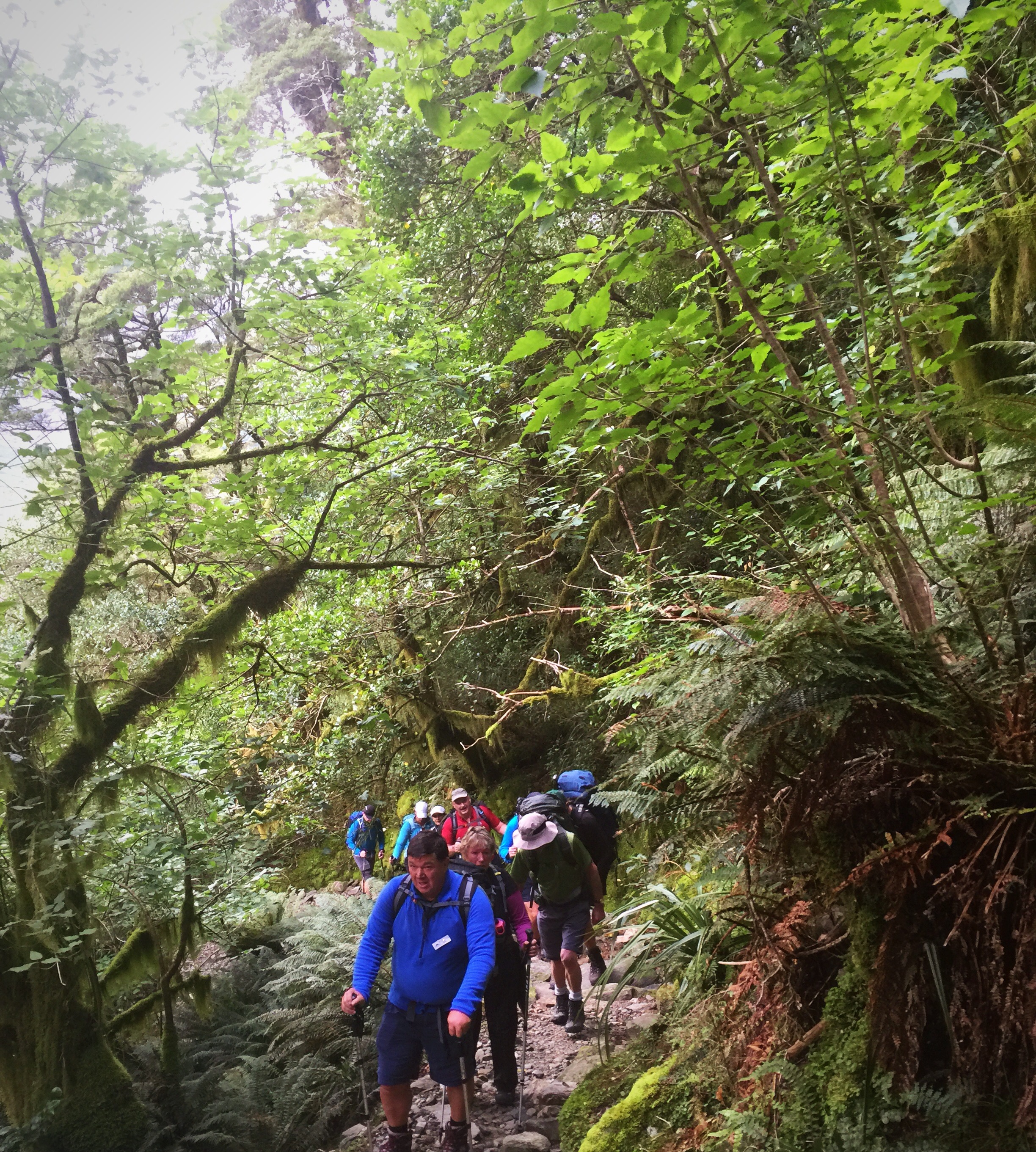
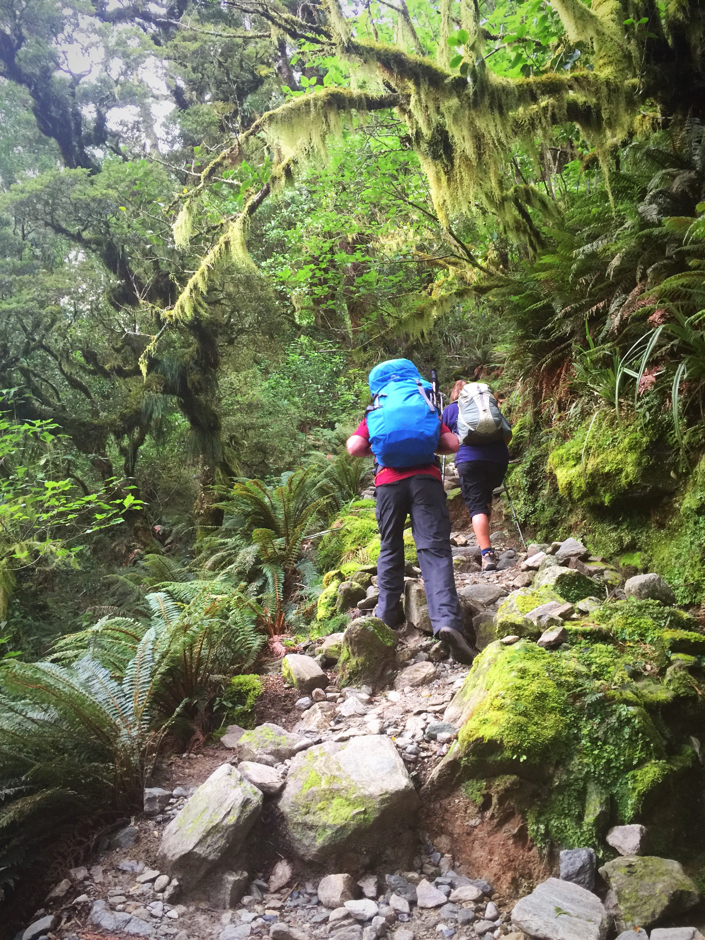
Day three was the day we were most anxious about – at the previous evening’s briefing we were told that we would climb 700 metres over 6 miles and descend 900 metres over 3.5 miles. There are 11 switchbacks going up and one of the switchbacks has 7 mini switchbacks on it!
Start time was 7.30am and Steve and I got on the track early. The tracks were in good condition and we made good progress. Steve stopped to take a few layers off and I kept moving hooking up with Matthew. We started the switchbacks but I didn’t count them so didn’t really know where we were at when one of the guides, Hannah, went by and said you’re on switchback number 9, not far to go now. The sign at Mintaro Hut said it would take us two and a half hours to the Memorial Cairn and we did it in one hour and twenty minutes!

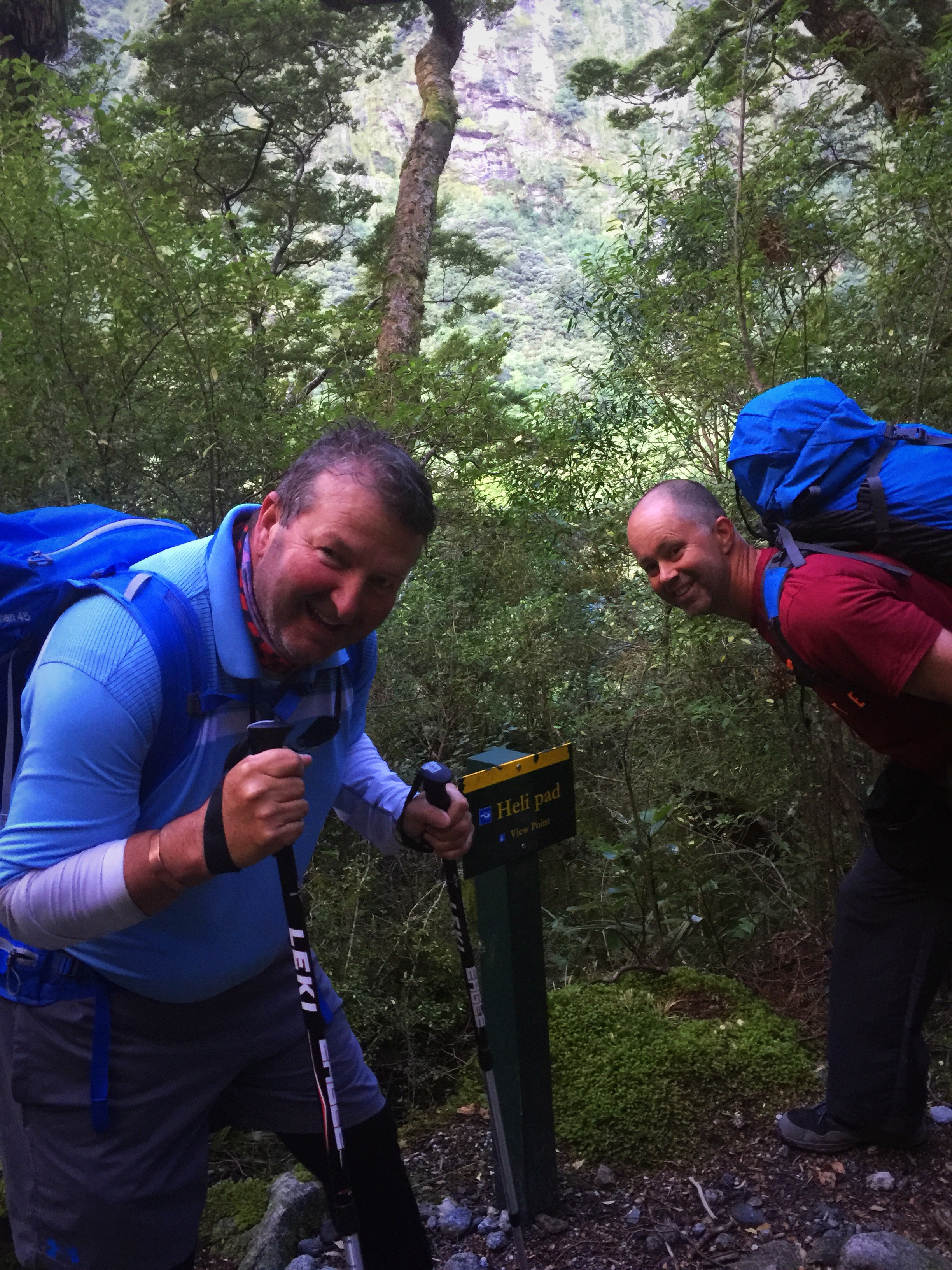 The boys looking hopefully at the Heli pad sign
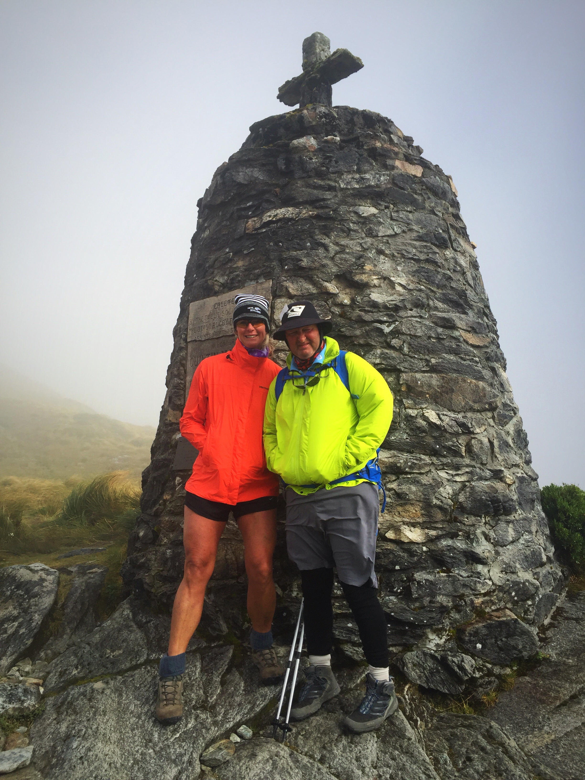
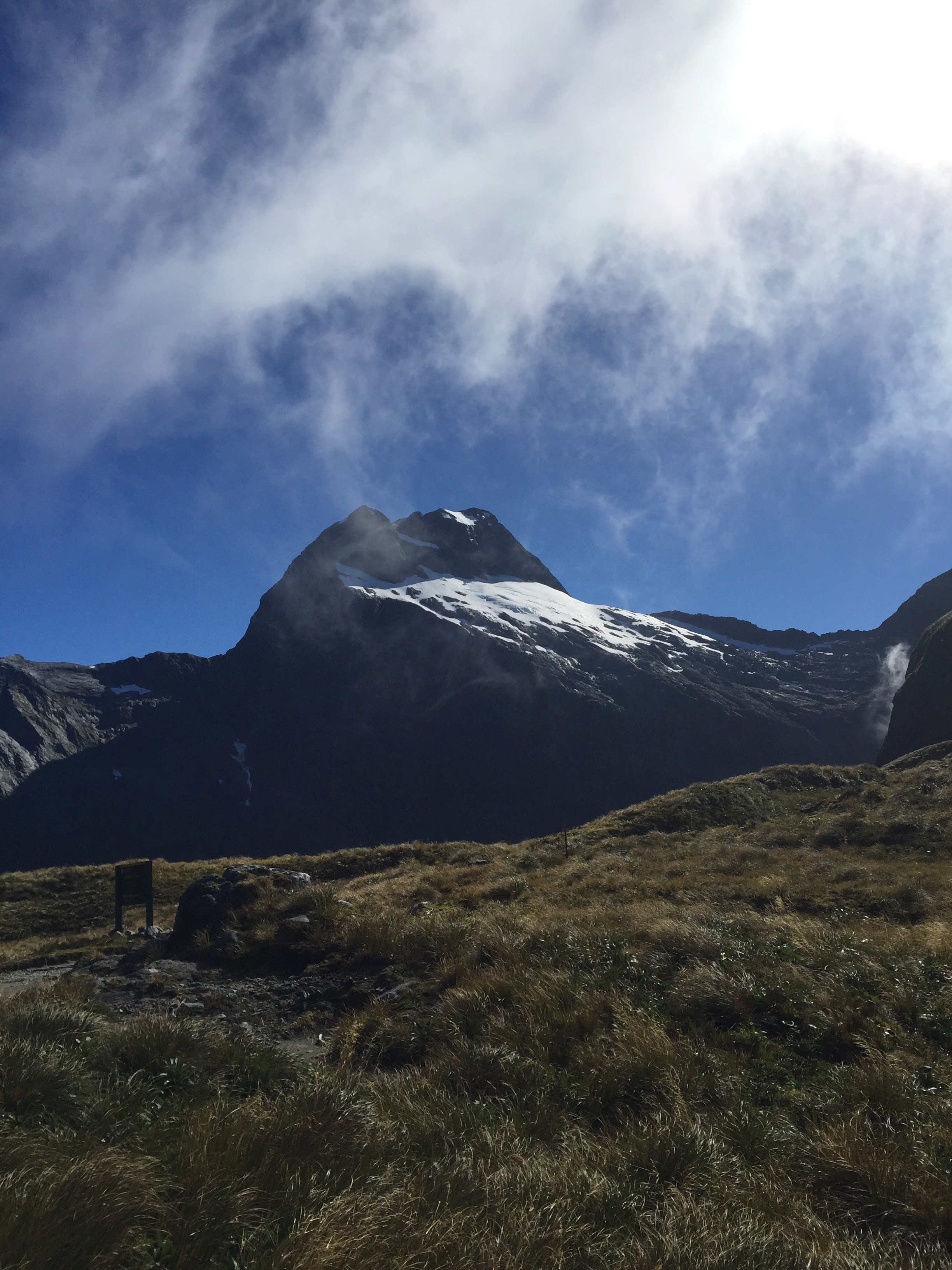
The temperature had dropped and the wind was blowing about 55 kilometres per hour when we reached the Memorial Cairn. It was freezing. Hannah had hot drinks available which I took advantage of. Matthew decided to keep going up to Pass Hut which was our lunch stop. I waited for Steve. I found a little spot behind the Memorial to shelter in. The clouds were passing overhead pretty quickly and every now and then you would get a glimpse of the mountains but they didn’t clear altogether.

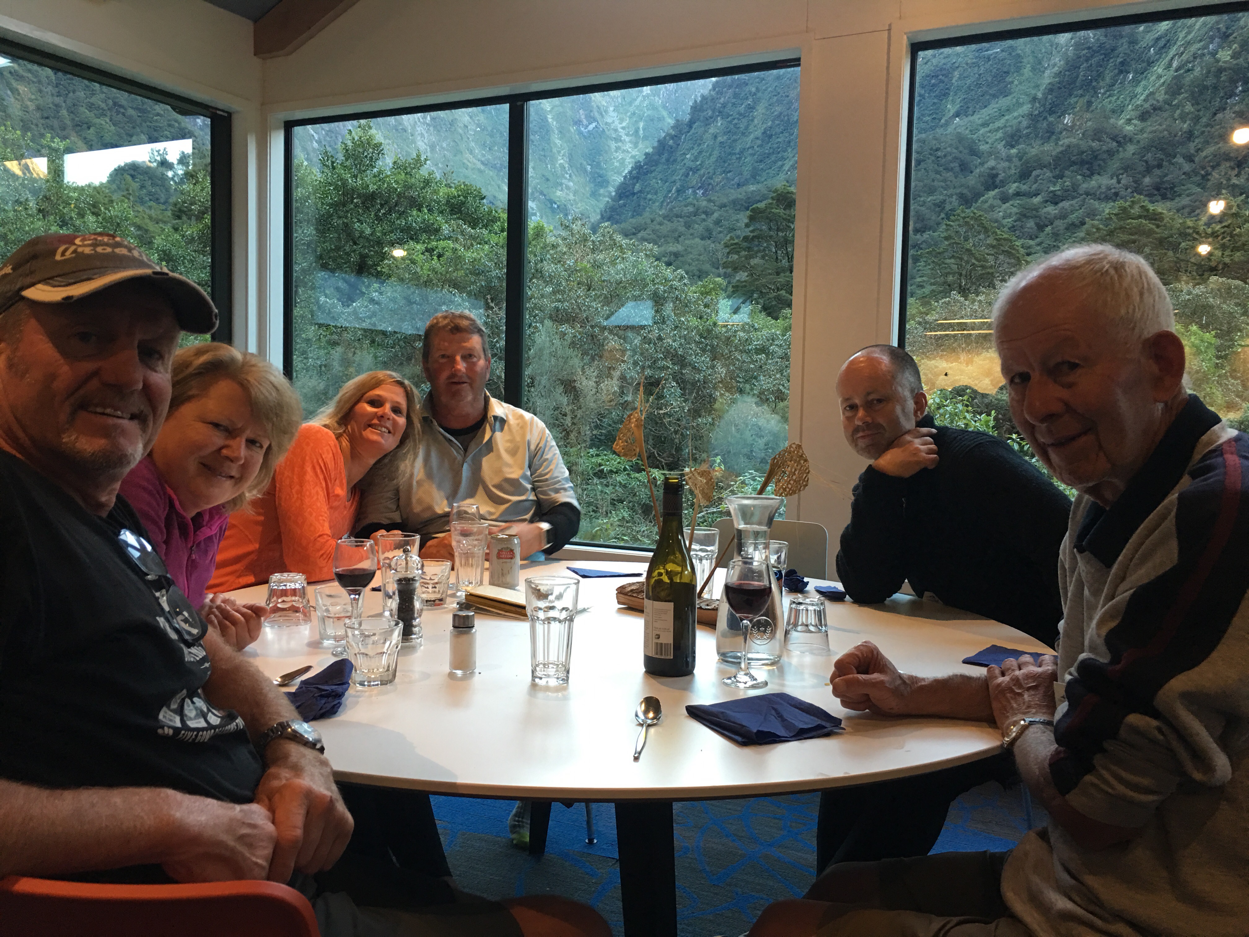
Steve wasn’t too far behind but he was frozen so I managed to get a quick photo of the two of us at the Memorial Cairn. As you can see from his face it really was the last thing he wanted to be doing. He certainly wasn’t interested in a re take!
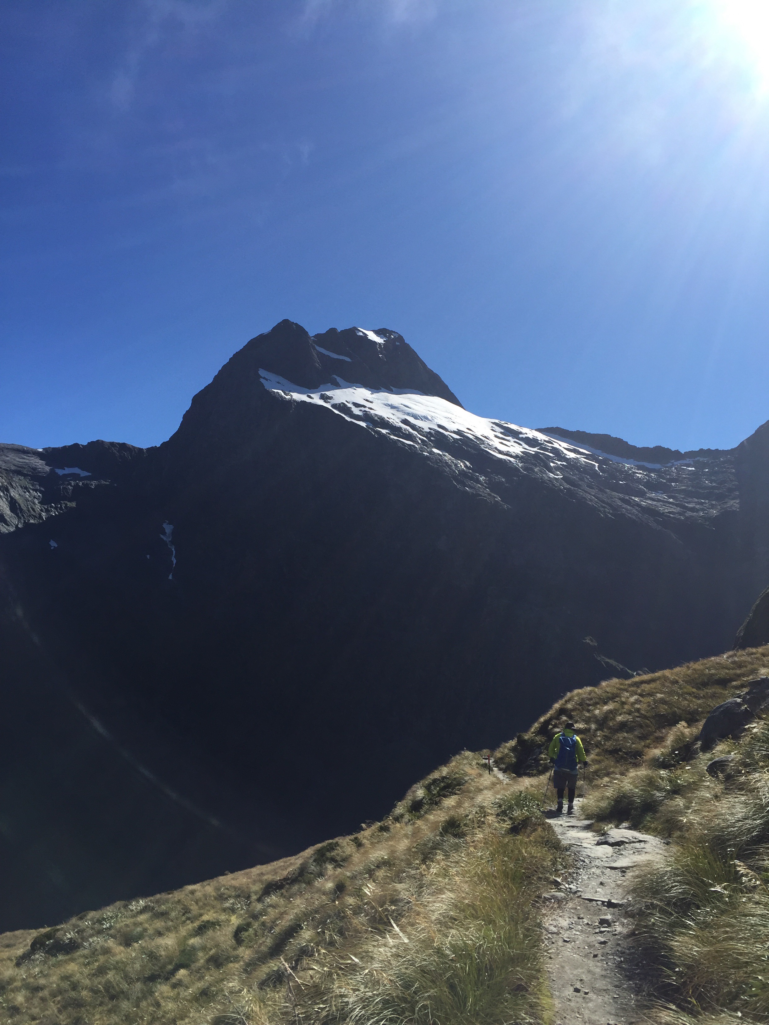
We carried on past the highest point on the pass and then up to Pass Hut – I gave Steve one of my gloves but then decided to stop and get out a pair of socks. We ended up with one glove and one sock on each.
We got into Pass Hut and Kelly told us to take any wet layers off and get dry and warm again. Kelly also told us this was a pretty calm day with 55 kilometre per hour winds. I braved the toilet which was out on the cliff edge but didn’t hang around too long to take any pictures – it really was a room with a view though. Standing in the hut eating my lunch I could feel the cold draft seeping up my legs. I decided to put my leggings on and then we started our descent.
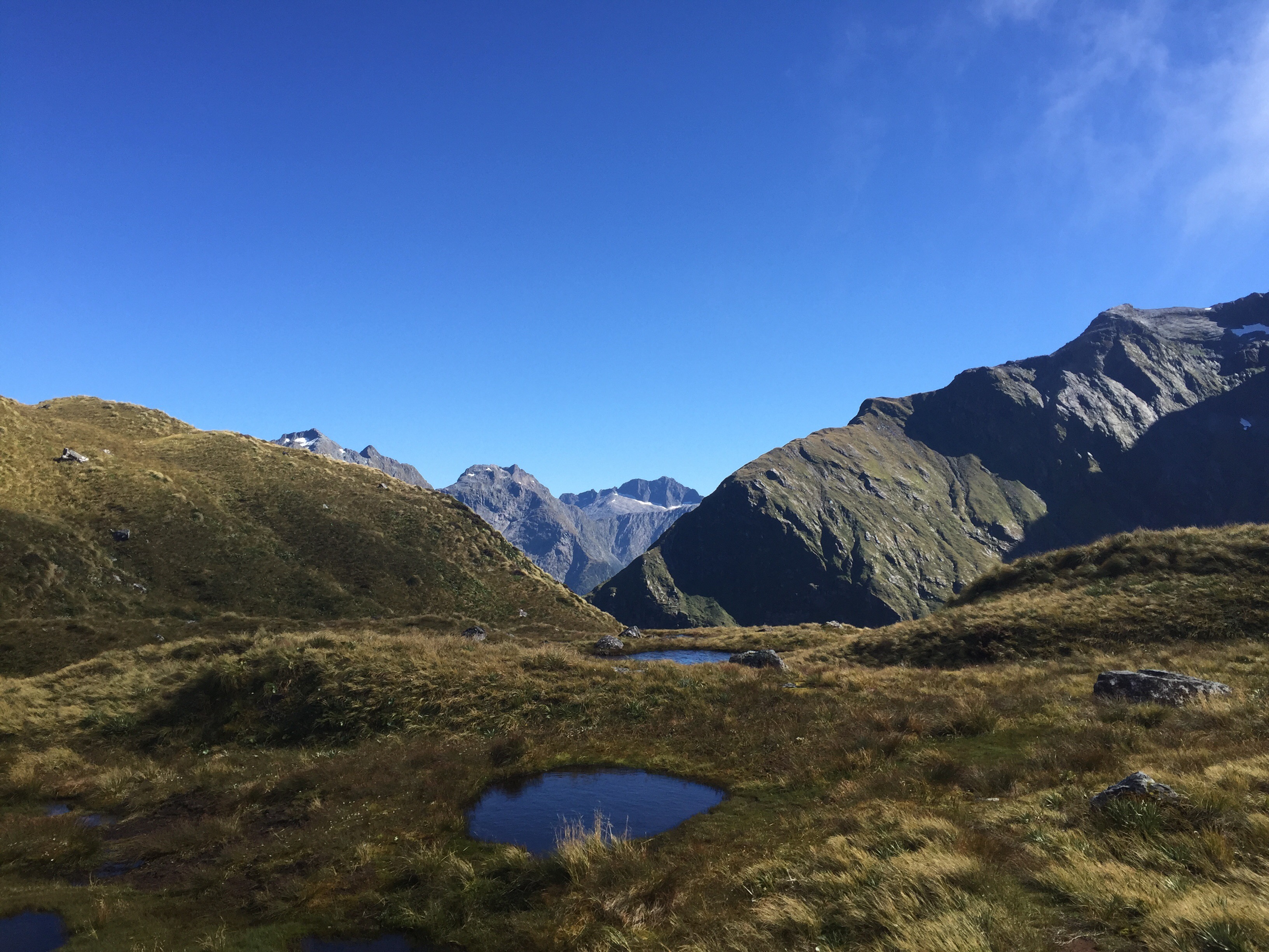
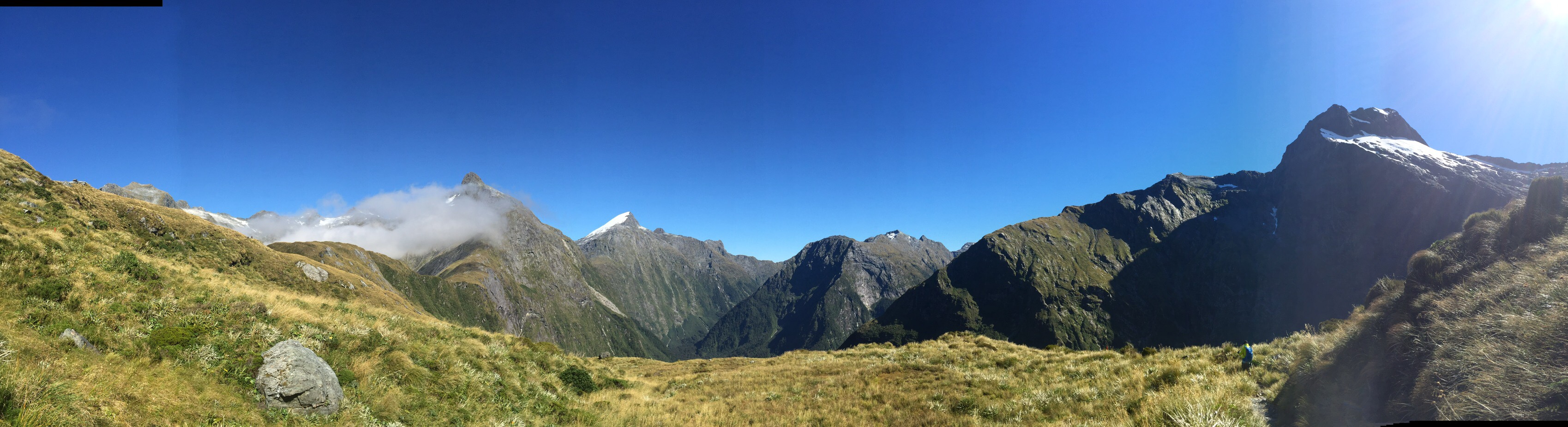
The timing for the descent was three hours but we thought given we had blitzed the climb we would blitz that. Within ten minutes of leaving the Hut all the clouds had cleared and the sun had come out – we felt instantly warm – it was such a nice feeling. The vistas were amazing. There were a few helicopters buzzing around overhead as Wednesday is supply restocking day for all the huts.


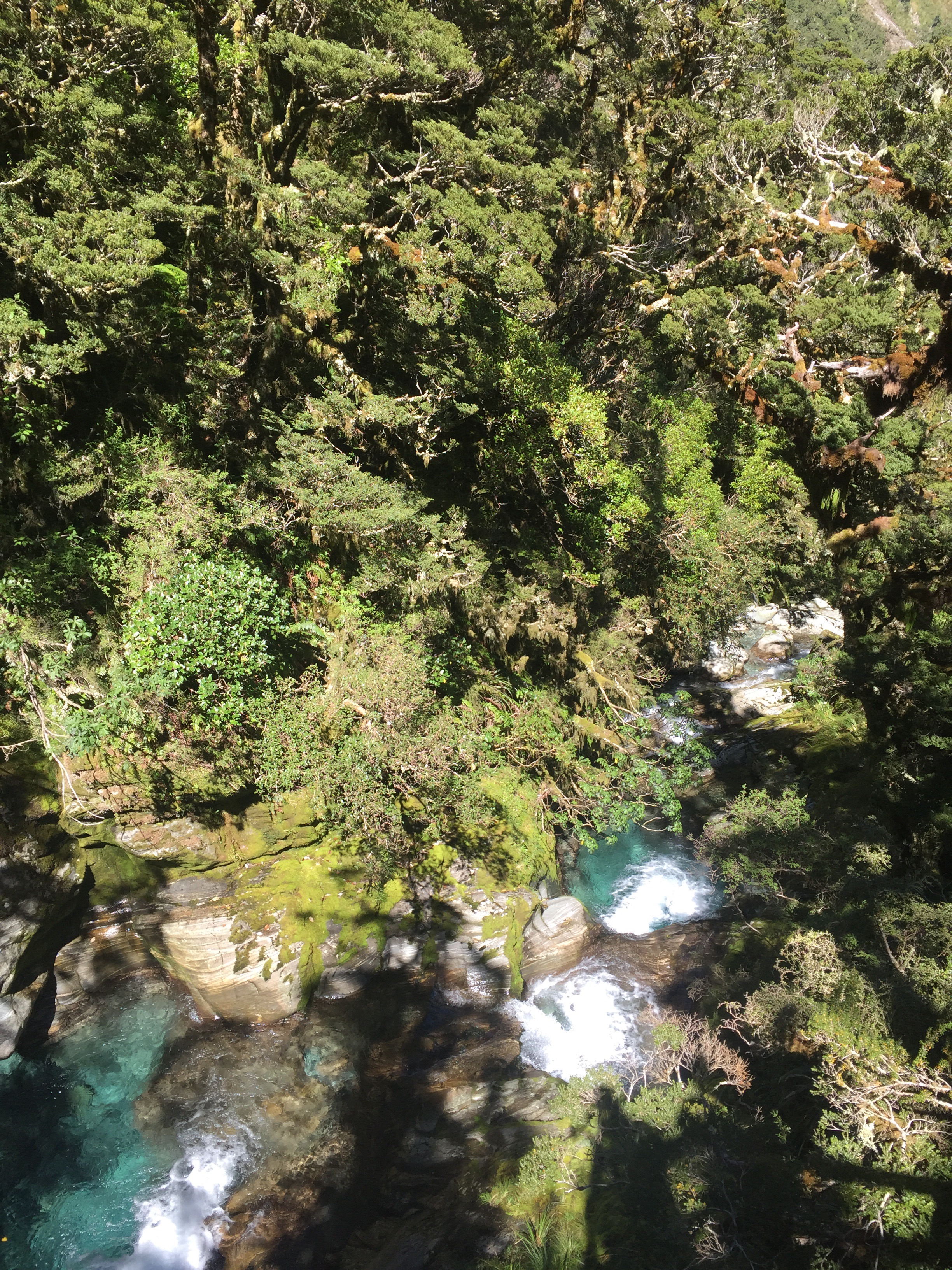
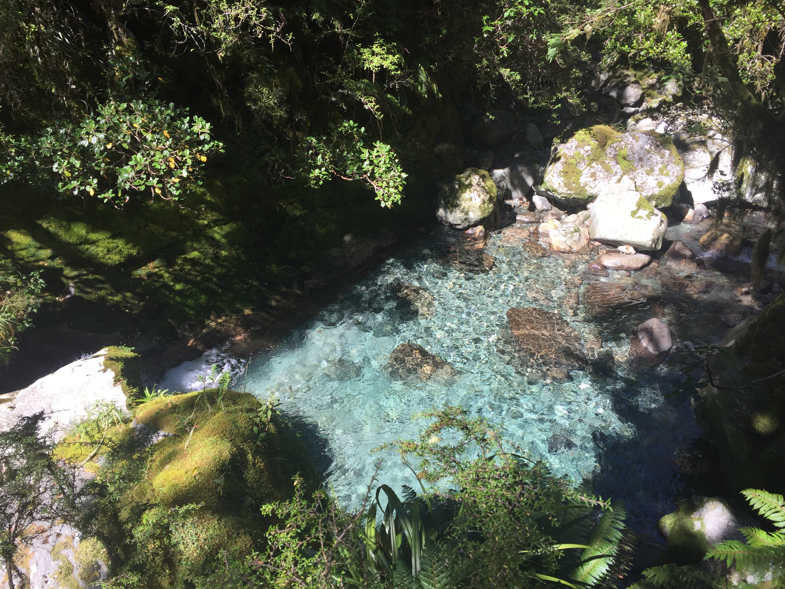
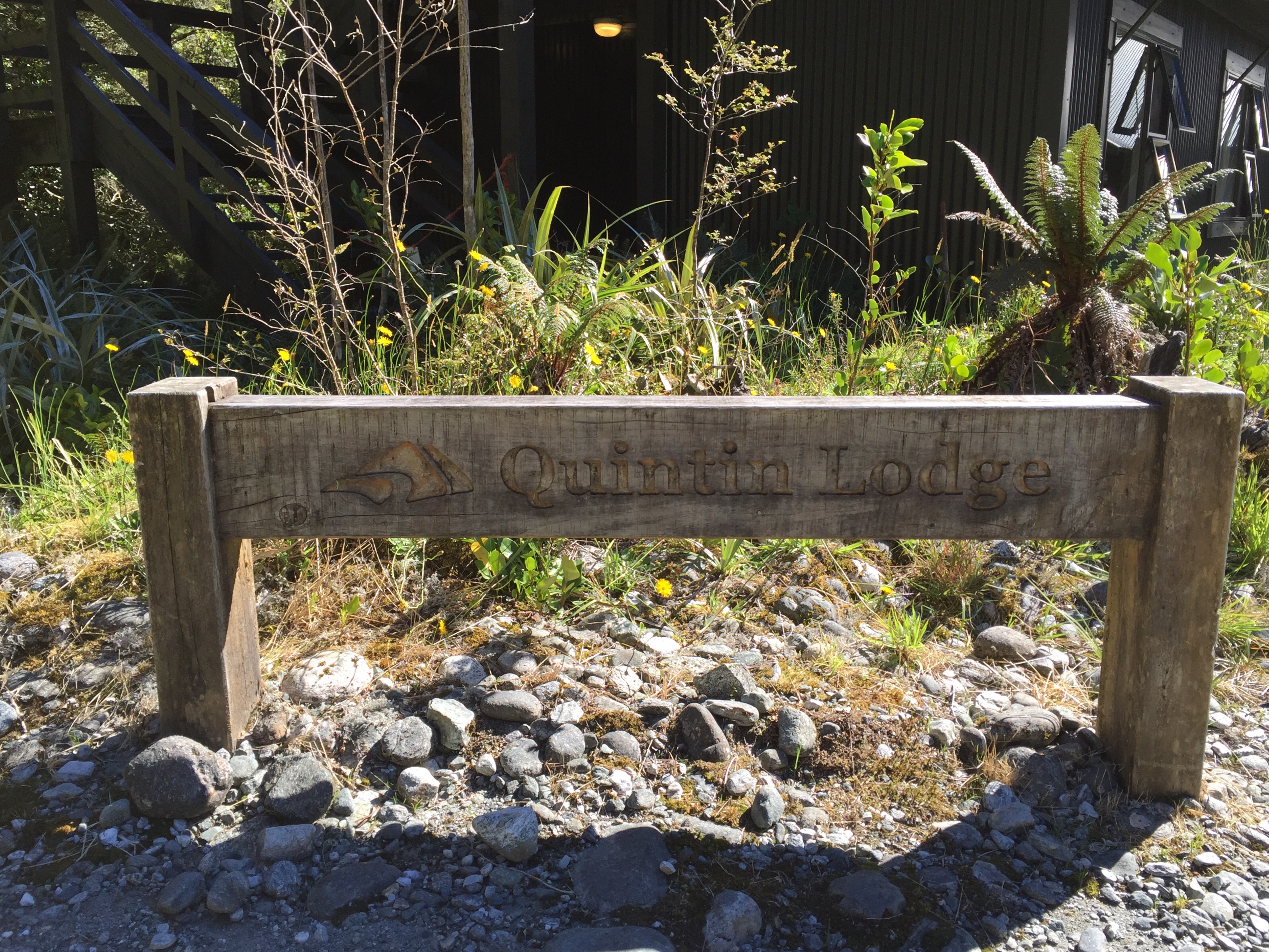
We made good progress zig zagging down the hill and a few of the others caught us at Cascades Shelter. The waterfall and rock pools were stunning and the colour of the water was beautiful. From memory we thought we only had about a mile to go after the shelter. That mile turned out to be one of the longest miles – the track had got quite rocky and we just kept descending. I thought I saw the Hut at one stage but was obviously seeing things. Matthew then thought he saw something but again he was seeing things. We were very quickly getting over this descent. We then passed the twenty mile marker but still continued on for quite a way eventually crossing the Roaring Burn swingbridge to find Quintin Hut. It was a welcome sight.

It had taken us three hours so they were not wrong on the timing of the descent. Looking at the walk notes afterwards it does say that the descent is some of the hardest walking and it was.
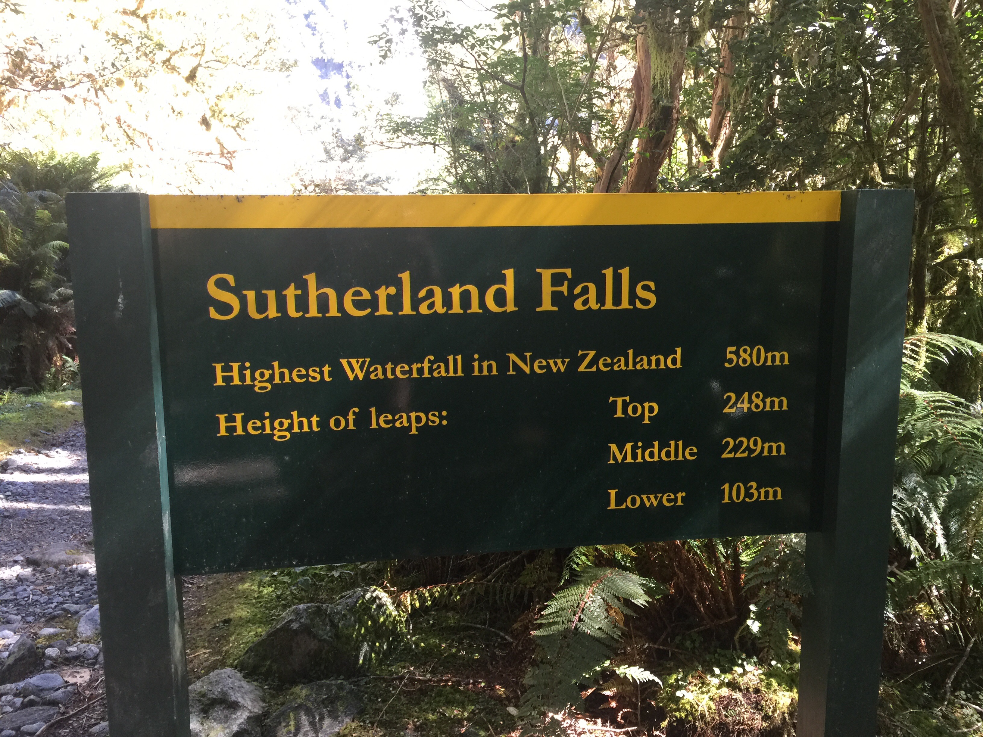
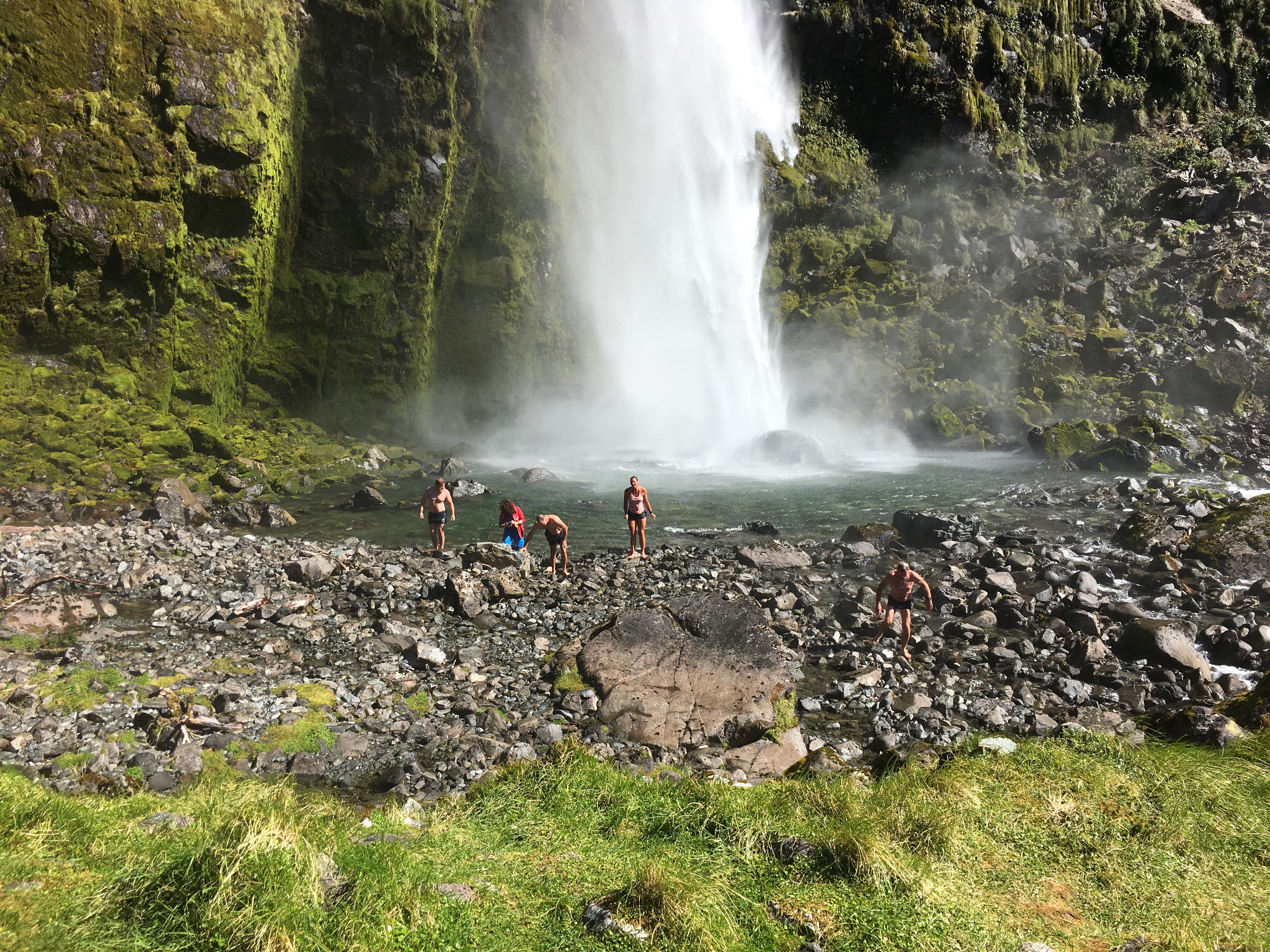
After a little bit of sustenance we (minus Steve) then decided to do the highly recomended walk to Sutherland Falls – New Zealand’s highest waterfall at 580 metres high. The walk was noted as being one and a half hours return but we did it in just over an hours return. It was definitley worth it – the Falls are impressive and the volume of water coming down and the force of it is quite incredible. A few of the freedom walkers were having a swim and Matthew and I had decided we would have one too.
The spray from the waterfall was intense and you got quite wet just getting to it. Walking over the rocks just to get to the waters edge was also a challenge and I eventually fell over hurting both a toe and my little pinky which remained sore for some days afterwards! I didn’t find the water that cold although I wouldn’t have wanted to wallow in it for too long. I lay back and put my head under – you can’t beat fresh alpine water on your skin and hair.

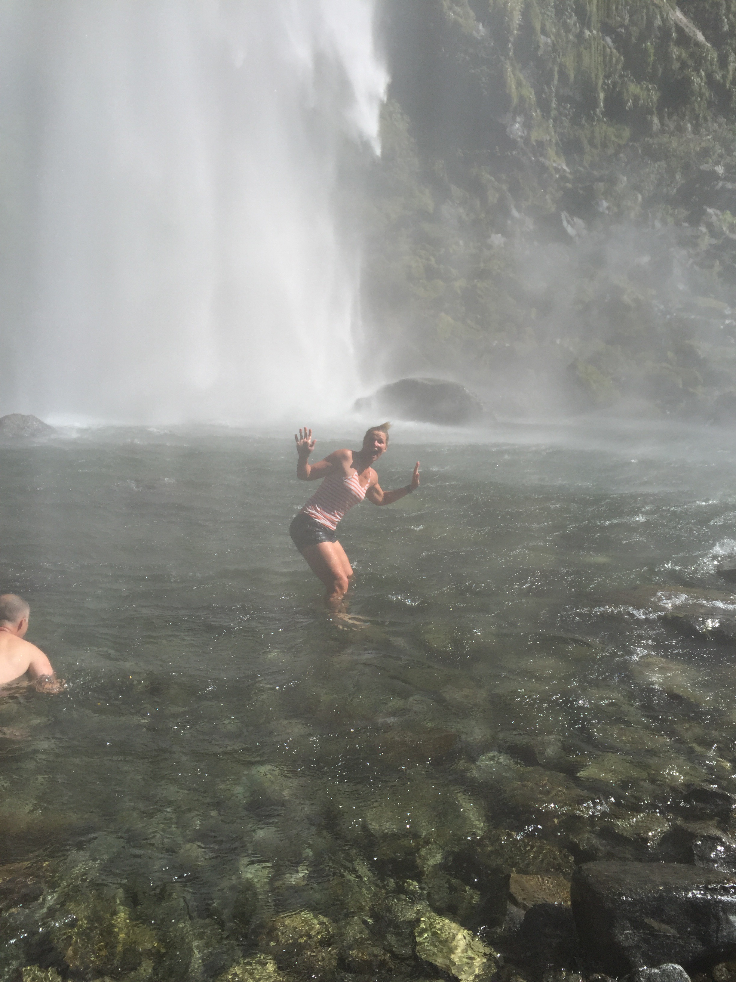

I was amazed how warm I felt when I got out – the further away you got from the spray the warmer you got. I then enjoyed the walk back to the hut in my wet clothes : ). Luckily the sun was shining and it had turned into quite a warm day.

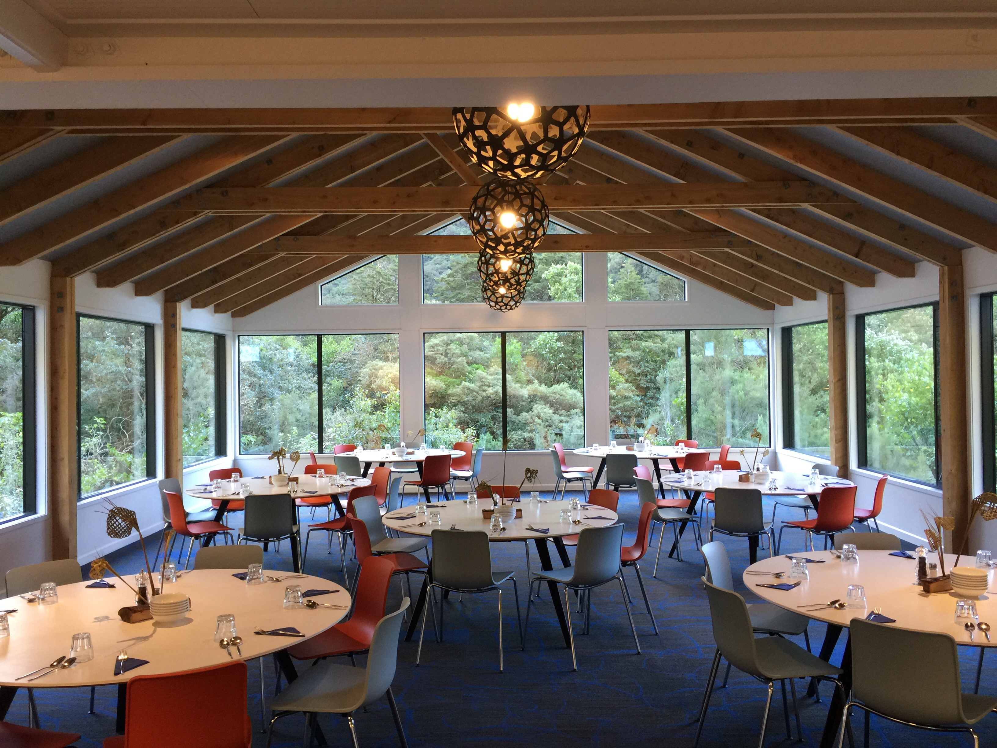
We were served up another delicious meal and retired to bed reasonably early in preparation for the 21 kilometres that lay ahead the next day.

Pass Hut History
The walk from the memorial cairn to the Pass Hut is the most exposed and dangerous stretch of the Milford Track.
On a calm day it’s difficult to beleive that up here winds can reach frightening speeds, often requiring walkers to hang onto the snow grass to stop themselves being blown off the edge! These regular gusts have spelt doom for many of the previous Pass Huts.
Built in 1928 the first Pass Hut was prefabricated in Invercargill and packed up to the pass by horses. Along the way they packers had much difficulty with the heavy curved roofing iron and ended up axing it in half before reaching the site! Although small, it became a haven and a welcome addition to the tracks comforts.
It was blown down three times during its 40 year service on the pass. When it was flattened for the second time in 1947, many years passed before its reconstruction. Thankfully Bill Anderson, hut keeper at Quintin during the 1950s and 60s gave up on waiting for a replacement and laboriously carted box wood lining, and bits of iron up to the pass week after week from Quintin. He recycled the old foundations, the original door and roof, and parts of the walls found near the site.
At the beginning of the 1958 / 59 season a new “A” frame hut replaced the 1928 version. This time all the building material was air-dropped in making much lighter work of it. While this hut made the first one seem like a match box, the numbers of walkers requiring shelter at the Pass continued to increase and a larger addition was soon added.
In late 1967 the first National Parks Board hut was built on the pass to provide shelter for the new ‘freedom’ or ‘independent’ walkers. This was to relieve the obvious pressure on the guided walks THC hut which was by now catering for up to 60 walkers. IT had not long been in place when a huge gale lifted it from its foundations and disposed of it in 1968. At the same time, the original 1928 hut rebuilt by Bill Anderson was finally blown off the pass and the second THC hut was also crumpled!
The force of the winds brought the THC and Parks Board together to build a new hut – another “A” frame hut that was in use through the 1970s. In the early 1980s it was replaced again before being replaced once more in 2010 by the one that exists today (the sixth version). So far it has managed to stand strong against the fierce winds crossing the pass at phenomenal rates – but for how long?
Today, constructions workers encounter the same testing conditions but also face a different set of challenges with modern building requirements!
Using existing concrete foundations laid in 1982, the current hut’s construction began in February 2010. With winter conditions approaching, workers had a small window of opportunity to complete construction. The installation of temporary waorkers quarters airlifted in by helicopter (and secured with sacks filled with rocks!) enabled construction all day through most types of weather. Even minor setbacks from one specific storm could not hold construction despite pushing the workers quarters a few feet off their foundations! The hut was completed in May 2010.
Cutting a track up the Clinton
On September 7th 1888, Quinton MacKinnon and mate Ernest Mitchell, left for the head of Lake Te Anau and set up base camp on the bank of the Clinton River. As they blazed their track up the Clinton Valley they shifted their camp forward each day.
“It was fearful work,” wrote Mitchell afterwards, “through ‘lawyers’ (a prickly plant) and over rocks, the ground getting worse as we got higher”. It rained continually for several days and everything in the tent got soaking wet. Then the sun came out and their blankets became “a moving mass of blowflies”. Mitchell’s dog raided two blue duck nests sucking all 14 eggs dry and doing the explorers out of a feed of pancakes. But they were both arriving guns and they shot five kakapo for tucker instread. They also tried kiwi, but found the “flesh far too rank for eating”.
As they approached the pass at the head of the valley they came to a pretty little lake which they named “Lake Beautiful” (later named Lake Mintaro). “It was the loveliest lake I have ever seen” wrote Mitchell, “with bush on one side and tussocky slopes on the other. Surrounded by a great amphitheatre of mountains it lay at the foot of the saddle, with lots of paradise ducks on it.”
On October 16th 1888 they hauled themselves up through the scrub and snow grass onto the top of the pass. Unfortunately it was raining and the visibility was poor, but they groped their way along the pass toward Mt Balloon and descended about halfway down the far side where they camped for the night, fireless and supper less. The next morning they scrambled down to the bushline and followed the left bank of the Roaring Burn down to a shingle beach where they killed and grilled a blue duck. Continuing along the bank of the Roaring Burn they then intercepted Sutherland’s track close to his slab Beech but and left a message set on a stick. The next day they continued out to Milford Sound.
MacKinnon wrote in Sutherland’s visitors book: “October 21st 1888. Found good available track from Te Anau to connect with Sutherland’s Track at Beech Hut. Found government maps very much out and the Hermit’s (Donald Sutherland) explorations very much in.”
Memorial Cairn
Today, a rough hewn cairn stands strong in the memory of their achievement. The memorial is one of the most historical features remaining on the Milford Track. After Mackinnon’s drowning in Lake Te Anau in 1892, the idea of building a memorial in his honour was raised by the Gaelic Society. They raised funds over the next twenty years and with government assistance and also funds from the Otago Rugby Football Union, they were ready to have a memorial built. The Gaelic Society called upon well known Dunedin stone mason, James Robertson, to undertake the task. James, a Scotsman aged 67, was in two minds about accepting the challenging but prestigious task on top of the exposed MacKinnon Pass. However he finally gave in and proceeded to Pompolona Hut in December 1914, accompanied by a labourer. Here they based themselves, walking up the pass every day. They collected blocks of stone from near the site, then dressed and fitted them using a limestone mortar. The circular corn was created with a space left for the final Celtic cross and sandstone inscription plaque, which were added later. The stone work was completed on April 25th 1915. The rigours of the climate at an altitude of 1100 metres took its toll on James’ health and in July of that year he passed away.
Donald Sutherland
In 1888, Donald Sutherland cut a track to the Sutherland Falls and built a simple slab hut. He had been commissioned to do so by Cheif Surveyor of Otago C. W. Adams, who was bringing a team of surveyors to map the Arthur Valley, measure the height of Sutherland Falls and hopefully find a route through to Lake Te Anau. Sutherland’s slab hut was built to accomodate the surveyors, who moved it closer to the river. It became known as Beech Hut.
In 1897, two corrugated iron huts were built on the present site and collectively they became known as Quintin Huts, named after Quintin MacKinnon, the first guide and discoverer of the MacKinnon Pass.
The lodge has been developed on the same site ever since and remains the only main lodge on the Milford Track not to have been destroyed by fire or avalanche.
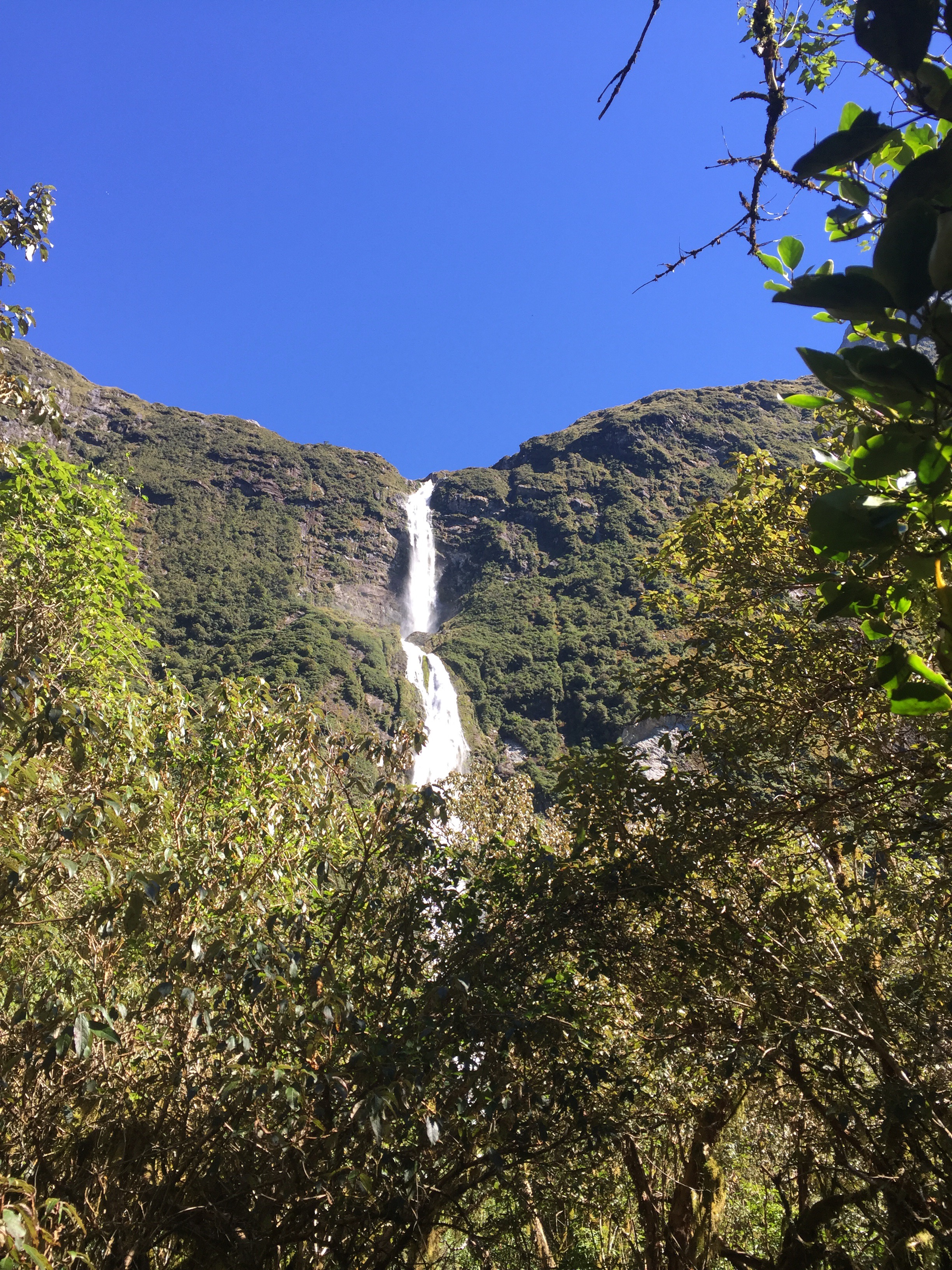
Sutherland Falls
On 10th November 1880, Donald Sutherland and John Mackay obtained their first view of a high waterfall cascading down a sheer face of rock in three great leaps. Naming it the Sutherland Falls, Sutherland estimated that it was between 3,000 to 4,000 feet high. A generous figure which he later increased to 5,700 feet, but which surveyor C.W. Adams eventually cut back to 1,904 feet (580 metres).On this same trip they had discovered the Mackay Falls, naming it after John Mackay.
William (Bill) Anderson
Bill and his wife May were employed by the Tourist Hotel Corporation (THC) as hut managers at Quintin Hut in 1950. This was the start for Bill of a 30 year relationship with the Milford Track. In 1973, Bill built a replica of Sutherland’s original Beech Hut on the same site as the original. He used hand-pit-sawn timber and traditional methods in its construction. His most famous exploits were in the exploration and creation of the Anderson Track, a loop track on the true left bank of the Staircase creek, from which a person could obtain a full length 35mm photograph of the Sutherland Falls.
Airstrip
Machinery for construction of an airstrip at Quintin Lodge was airlifted to the site by helicopter in May 1968. Be February 1969, the airstrip had been completed. This brought an end to the delivery of supplies by tractor, boat and packhorse.
These were now brought in. by light aircraft. By the late 1990s, helicopter resupply had completely taken over from that of fixed-wing aircraft and the airstrip was left to be reclaimed by the native forest.
Ecology
Kiwi
There are resident Kiwi still found along the Milford Track and they can be heard calling at night.
There is debate about whether Kiwi evolved from a flightless ancestor, or lost its ability to fly. But it does have a very small vestigial wing, with a tiny cat-like claw on the end. This stumpy wing gave rise to the species’ name – Apteryx – meaning ‘wingless’.
Kiwi have evolved quite differently to other birds.
- They burrow like some mammals, and their body temperature is lower than most birds, between 37 and 38 degrees Celsius, just like a mammal.
- The kiwi’s powerful legs are heavy and marrow filled, like a mammal. They make up a third of the bird’s weight. The skeletons of most birds are light and filled with air sacs to enable flight.
- While most birds depend on sight, the kiwi relies on a highly developed sense of smell and touch. The kiwi’s sense of hearing is also well developed. It’s ear openings are large and visible, and it will cock its head to direct its ear toward soft or distant noises.
- A female has two ovaries – like a mammal, unlike most birds, which have one. The chick emerges from it’s enormous egg, fully feathered and able to feed itself – which is very unusual for a bird.
- Kiwi plumage is hair-like, and it has cat like whiskers on its face and around the base of its beak. These whiskers are likely to have evolved to help the bird feel its way through the dark.
Kakapo
While no longer found on mainland New Zealand, Fiordland was the last stronghold for the Kakapo. The species has declined drastically since the introduction of mammalian predators. The surviving individuals were all taken to predator free offshore islands in an attempt to bring them back from the brink of extinction. Early Maori and European explorers in the Milford area relied on this unique bird as a source of food.
Like the Kiwi, the Kakapo has evolved in a very unique way.
- The Kakapo is the heaviest parrot in the world.
- It is possibly the longest-lived bird species in the world; the low adult mortality rate suggests a mean life expectancy of 90 years.
- It is flightless.
- It is the only parrot that has a ‘lek’ breeding system. Kākāpō don’t breed every year – that depends on whether there’s enough rimu fruit around for them to eat. But when they do breed, they do it different to most! In the breeding season, the male kākāpō can inflate like a balloon and emit a low ‘sonic’ boom which, in mountainous terrain, can be heard up to five kilometres away. Breeding activity usually starts in about December, when male kākāpō take to prominent ridges, rocks or hilltops with low-growing vegetation and begin a courtship competition for female attention. This is known as ‘lek’ breeding, and is not known from any other parrot species in the world – or from any other New Zealand bird. From its prominent bowl site, each bird inflates a thoracic air sac and emits a deep resonant non-directional ‘boom’ from its swollen body, announcing to any females in the area that he is ready to mate. After 20-30 booms they then make a high-pitched metallic call, or ‘ching’. This pinpoints the male’s position, to direct the females to him. The booming and chinging serenade can last for eight hours without break, every night for 2-3 months in the breeding seasons when nesting occurs. The males compete against each other, and can release thousands of ‘booms’ a night.
The kakapo is the heavyweight of the parrot world, with smaller females weighing 1.4kg and the males 2.2kg. Fat reserves of a kilogram or more can be added prior to a breeding season.
It is thought that, many hundreds of thousands of years ago, the kakapo was probably a typical, lightweight parrot that flew through the air to travel and gather its food. But the process of evolution without the presence and effect of mammals in New Zealand saw the bird give away its flying skills, put on weight, and become a good hiker and climber instead, with powerful claws.
Kakapo also have very strong legs, allowing them to walk several kilometres at a time. Their wings are still large, but now have little more use than to slow it down when it leaps from the top of low trees and help kakapo maintain their balance while running or climbing.
Another peculiar habit of the kakapo is to freeze when disturbed, keeping absolutely still and hoping to blend into the background. Most animals have evolved more useful forms of defence, such as taking flight; but the kakapo obviously did not need this behaviour in the days when New Zealand’s predators were birds.
New Zealand has more species of flightless birds – both living and extinct – than any other country. They include kiwi, kakapo, takahe, weka, Moa, three flightless wrens and two adzebills.
One reason New Zealand has so many flightless birds is that, before humans arrived about 1000 years ago, there were no land mammals that preyed on birds. Predators were other birds, such as laughing owl, eagle, goshawk and falcon. With no predators sniffing them out, flightless birds could safely forage from the forest floor, living and nesting on the ground.
Flying takes a lot of energy. With the ground being so safe, birds could save energy by walking.
Since people arrived in New Zealand, the forest floor has become a place of threat and peril for all New Zealand’s flightless birds.
