Siem Reap – Cambodia

We spent 10 days in Siem Reap in Cambodia in early August. People that had been there before thought that was quite a long time and the locals who asked us how long we were there for were also surprised. It turned out to be a good decision as we really felt like we had plenty of time to explore and get to know the place.

Cambodia 🇰🇭

Cambodia is a country located in the southern portion of the Indochina peninsula in Southeast Asia. It is 181,035 square kilometres (69,898 square miles) in area, bordered by Thailand to the northwest, Laos to the northeast, Vietnam to the east and the Gulf of Thailand to the southwest.

The sovereign state of Cambodia has a population of over 15 million. The official religion is Theravada Buddhism, practised by approximately 95 percent of the population. Cambodia’s minority groups include Vietnamese, Chinese, Chams and 30 hill tribes. The capital and largest city is Phnom Penh, the political, economic and cultural centre of Cambodia. The kingdom is an elective constitutional monarchy with a monarch, currently Norodom Sihamoni, chosen by the Royal Throne Council as head of state. The head of government is the Prime Minister, currently Hun Sen, the longest serving non-royal leader in Southeast Asia, ruling Cambodia since 1985.

See below for more detail on the History of Cambodia

Siem Reap

Siem Reap is the capital city of Siem Reap Province in northwestern Cambodia. It is a popular resort town and a gateway to the Angkor region.

Siem Reap was little more than a village when French explorers such as Henri Mouhot “re-discovered” Angkor in the 19th century. However, European visitors had visited the temple ruins much earlier, including António da Madalena in 1586″. In 1901, the École française d’Extrême-Orient (EFEO) (‘French School of the Far East’) began a long association with Angkor by funding an expedition into Siam to the Bayon. The EFEO took responsibility for clearing and restoring the whole site. In the same year, the first Western tourists arrived in Angkor, a total of about 200 in just three months. Angkor had been “rescued” from the jungle and was assuming its place in the modern world.

With the acquisition of Angkor by the French in 1907 following a Franco-Siamese treaty, Siem Reap began to grow. The Grand Hotel d’Angkor opened in 1929 and the temples of Angkor became one of Asia’s leading draws until the late-1960s, when civil war kept tourists away. In 1975, the population of Siem Reap, like all other Cambodian cities and towns, was driven into the countryside by the communist Khmer Rouge.

Siem Reap’s recent history is coloured by the horror of the brutal Khmer Rouge regime. Since Pol Pot‘s death in 1998, however, relative stability and a rejuvenated tourist industry have revived the city and province.

Siem Reap now serves as a small gateway town to the world heritage site of Angkor Wat. In recent years, the city has regularly ranked in the top ten for “Best Destination” lists produced by entities such as TripAdvisor, Wanderlust Magazine, and Travel+Leisure.

The Khmer Rouge

The Khmer Rouge was Cambodia’s ruling party from 1975 to 1979 and was responsible for one of the worst mass killings during the 20th Century.

Under the leadership of Pol Pot, the dreaded Khmer Rouge brought Cambodia back to the old ages by forcing millions of people to leave the city and work on farms in the countryside. The communists believed that cities were tools towards capitalism. So in order to create the ideal communist society, people had to live and work in the rural areas as peasants. Peasants were viewed by the Khmer Rouge as ideal communists for the Cambodian state as they were simple, uneducated and hardworking.

The evacuation of the city was the first of many radical steps taken by the Khmer Rouge. The organization then dictated the life of every Cambodian citizen with rules on religion, money and private ownership. Communications with the outside world were eliminated and family relationships were dismantled. All rights and responsibilities were eradicated as Pol Pot declared the nation to start at “Year Zero”, signifying the end of Cambodia’s 2000-year history. The Khmer Rouge arrested any person suspected of having relations with the former government or foreign affairs. Many of these arrested people were ethnic Vietnamese, ethnic Chams, Cambodian Christians and Buddhist monks.

The assassinations occurred in great numbers as it happened everywhere in the country. Most of those who were executed were buried in mass graves. To save on ammunition, executions were commonly done using hammers, spades, axe handles or sharpened bamboo sticks. Many victims were even forced to dig their own graves. The Khmer Rouge killed almost 25% of the country’s population. Almost 2 million people of Cambodia were massacred or died from diseases, starvation, exhaustion and forced labor.

The Khmer Rouge command was finally overthrown in 1979 by the invasion of the Vietnamese troops after many violent border confrontations. In the years that followed, Cambodia went through a process of healing and reopening to the international community. Survivors told their stories as the 1980s Hollywood movie “The Killing Fields” brought the Khmer Rouge victims to worldwide attention.

Exploring Siem Reap

Steve arrived the night before I did as I was coming from Switzerland. He had been picked up by transport arranged by the hotel which was a tuk-tuk Cambodian style – a scooter pulling a chariot. He described it as being picked up in a trailer 😂. He organised some transport for me the next day and I was not quite sure what to expect but actually I loved my chariot and enjoyed cruising around in them for the rest of our stay.

We went into town for some dinner that night to an area called Pub Street – Steve’s idea of heaven. It is an area where two roads meet at an intersection and at 5pm they are closed off to the traffic so it becomes a pedestrian only area. There are lots of bars and restaurants and the atmosphere is very buzzy. The beer in most bars is USD0.50 cents and cocktails are about USD2.50. We had a great dinner and were very impressed with the range of eating options and the reasonable prices. They did fresh spring rolls like they do in Vietnam so I was in heaven.

The next morning we spent relaxing by the pool which was nice. I did some research on cafes and good coffee and The Little Red Fox Espresso came up. We got dropped off in Pub Street and I navigated my way to Hup Guan Street and discovered an area called Kandal Village. The ‘Village’ has a few small businesses, including a few cafes, an Italian trattoria, a silk textile shop, spa, and a handful of boutiques and concept stores. It was so peaceful and I loved the intimacy of all the shops.

Kandal Village grew one small business at a time and slowly earned a reputation of being a peaceful place to escape the hustle and bustle of the city and tuk-yuk drivers. The business owners got together and voted on a name – they chose Kandal Village because almost all the tuk-tuk drivers were familiar with the name – which means ‘middle’ and it is located behind the old Phsar Kandal which is the Centre Market.

Rather than a website, blog or app, which would be the first step for most place-branders, the group chose an endearingly old-fashioned tool of persuasion to promote the emerging new district – a petite paper brochure featuring all the businesses, which they distributed around Siem Reap. Of course social media has now put it on the digital map.

What I was soon to discover in Siem Reap was that there are a number of socially responsible businesses putting a huge emphasis on the training and well being of their staff who are predominantly young. Over fifty percent of the population in Cambodia is under 22 years old due to the atrocities the people endured in the 1970’s so they are a vital part of the future of the country.

Being a lover of good food and coffee I wanted to visit and support all these places and I wasn’t dissapointed in any of them and was super impressed with the staff who are friendly, speak good english and appear to really want to better themselves. Interestingly enough most of these places were started and are owned by expats who then employ and entrust the Cambodian people to run them – they are the ones promoting the advancement of the young people who are willingly responding.

We engaged in conversations with some of the people we met about the political state of their country and without being too forthcoming there was a definite unfavourable flavour emerging. It is widely known that Cambodia is one of the most corrupt countries in the world and although they have a ‘democratically’ elected Government there are many questions as to the validity of the election process. I don’t have an in-depth knowledge of this but my impressions are that the people are trying very hard to make the most of what they have without too much input or assistance from the Government and that there are a lot of foreign organisations trying their best to help the people to be able to help themselves.

See below for some of these amazing cafes, restaurants and socially conscious organisations making a difference to the lives of the local people in Siem Reap that we visited.

City Tour & Floating Village

On the first night in Pub Street we met a tuk-tuk driver called TukTuk Charlie and he was quite a character. He said he could take us on a city tour one day if we liked and gave us his business card – very professional 😉

We got in contact with him and on Thursday he came to pick us up from the hotel. We passed the small killing field close to the centre of town near the Wat Thmey Temple.

The Wat Thmey Temple is a live monastery where a large Stupa memorial can be found. The stupa has glass sides filled with the skulls and bones of those who died during the Khmer Rouge. These have been diligently gathered by local residents in memory of their families and friends. The Wat Thmei Temple is the spot of one of the terrible killing sites where hundreds of Cambodian civilians were tortured, killed and buried. The mass of bones and skulls at the stupa shows the cruel behavior of the Khmer Rouge at the time.

We also went past the children’s hospital Kantha Bopha, which had been founded by a Swiss paediatrician called Beat Richner. After working in Zurich’s children’s hospital he took up a role with the Swiss Red Cross and travelled to Cambodia just prior to the Khmer Rouge reign in 1975. He returned to Cambodia in 1992 and dedicated the rest of his life to building and running the 5 children’s hospitals that are now in Cambodia where children are treated free of charge.

See below for some more information about a man who can only be described as a hero and humanitarian of the highest order.

We then passed the King Master Statue which is a popular shrine for Cambodians to come and pray and you’ll often see many people praying and cleaning the area. On the other side of the street is a pagoda called Preah Ang Chek.

Opposite this area is the royal residence which is the king’s official residence when he is in town. You might hear some people refer to it as the Royal Palace, but it is a residence and not a palace.

We then headed about 30 minutes out of town to see the floating village. We weren’t quite sure what to expect and when we got there we saw a number of buses and quite a few people. We bought our tickets and headed out to the wharf which was quite chaotic with all these boats. It turned out a friend of Charlie’s worked on one of the boats so we went on that boat and it ended up with just us on the boat with Charlie, the boat owner and his friend. First stop was the bottle store 🤔 which was a shack on the side of the river where the beer was stored in ice.

The boys, including Steve all cracked open a beer as we cruised up the channel filled with very brown and murky water into the Lake. I had everything crossed that the boat was lake worthy 🤞.

We then entered the lake proper which is called Tonlé Sap, Khmer for ‘vast body of fresh water’ and more commonly translated as ‘great lake’. It is a combined lake and river system of major importance to Cambodia. It is in the heart of Cambodia and is home to many floating villages. The area around the Tonle Sap including the province of Siem Reap is part of the greater Tonle Sap Biosphere Reserve.

We saw little boats buzzing everywhere – this is how the lake people who live in the floating villages get around. There are schools, shops, cafes (tourist orientated) and even farms located on the lake – just like a village on land only it is on water.

I was talking to my friend Daniel who runs Childs Dream in Thailand after our trip and he was telling me that they have built a high school on the lake along with two boarding houses – one for girls and one for boys. Prior to this there was no high school on the lake meaning unless the lake children went and lived in town they didn’t continue with their higher education. The school has 200 students, some of who travel by boat daily to get there. Those that live too far away can stay in the boarding houses. Childs Dream raised the money to build these facilities but the financial management and daily operations are handled by the Cambodian Government.

For more information about what Childs Dream does in Cambodia check this link out https://childsdream.org/cambodia/

Five provinces circle the area of Tonle Sap Lake. More than three million people inhabit the lake and surrounding banks and 90% of them earn a living by catching fish or are involved in some sort of agriculture.

The Lake is the largest body of fresh (although I would seriously question the term ‘fresh’ 😂) water in South East Asia. It’s dimensions change depending on the monsoon and dry season. During the monsoon season between June and October, the lake is filled by water flowing from the Mekong and is 14 meters in depth with a surface of 10,000 square kilometres . In the dry season from November to May it’s size is 3,000 square kilometers with two meters in depth and the water flows out from the Lake to the Mekong. In the monsoon season the flooded forest surrounding the edge of the lake provides the best shelter for all kinds of spawning fish. The lake has over 300 species of fresh water fish as well as snakes, crocodiles, tortoises, turtles and otters. It also has more than 100 varieties of water birds including storks and pelicans.

The lake is an important commercial resource, providing more than half of the fish consumed in Cambodia. In harmony with the specialized ecosystems, the human occupations at the edges of the lake is similarly distinctive – floating villages, towering stilted houses, huge fish traps, and an economy and way of life deeply intertwined with the lake, the fish, the wildlife and the cycles of rising and falling waters

Charlie and the boat boys were talking about crocodile farms on the lake and I couldn’t quite work out how this worked. Anyway we pulled up next to a floating house / pontoon and went aboard. Charlie took us over to this pen that had about 6 massive crocodiles 🐊 in it – they didn’t look real but when Charlie splashed a bit of water into the pen they were very much alive. The pen next door had about 50 smaller crocodiles 🐊 in it. They breed them for the meat and skin. To be honest I was pretty freaked out! The pens are blocked off under the water but still 😳.

They also had a number of birds in pens – chickens, geese etc… that are also farmed for eating. I was quite happy to get back on the boat and head back to what was still dry land.

Daniel also told me that a few years back they had really bad flooding in Siem Reap and the outer areas – the lake flooded and the crocodiles escaped and were found all over the place, including in town 😳. On the way out to the lake we saw all these houses built on 14 metre high stilts – this is for when the rainy season comes and the lake floods – these houses can only then be reached by boat too.

Charlie took us back to town in the TukTuk with a new appreciation for our lives in NZ on dry land free of crocodiles 😉.

Phare Circus

On the Friday night I went to the Phare Circus. More than just a circus, Phare shows are unlike any in the world: dance, theater, original live music and breathtaking circus arts are used to tell uniquely Cambodian stories from recent history, folklore and modern society.

Phare artists are graduates of Phare Ponleu Selpak, an NGO school and professional arts training center in Battambang, Cambodia.

The Phare Ponleu Selpak Arts (PPSA) was founded in 1994 by nine young Cambodian men returning home from a refugee camp after the fall of the Khmer Rouge. At the camp they took drawing classes and found art to be a powerful tool for healing. When they returned home they began offering free drawing classes to street children. Soon they opened a school, eventually offering formal K-12 education and professional arts training in the areas of visual arts (illustration, painting, graphic design, and animation), theater, music, dance, and circus. Today more than 1,200 pupils attend the public school daily and 500 attend the vocational arts training programs. All programs are offered for free.

In 2013, with the aim of financial self-sufficiency, PPSA created Phare Performing Social Enterprise (PPSE) with three missions:

• Create meaningful employment opportunities for Cambodian artists

• Create financially sustainable social businesses that provide a reliable income streams for Phare Ponleu Selpak

• Revitalise the arts sector in Cambodia and promote Cambodian art locally and internationally

PPSE is the parent company of: Phare, The Cambodian Circus.

• Opened in February 2013

• Based in Siem Reap

• Nightly professional shows under a 330-person big top, 365 days a year

• Almost 75% of profit goes directly to PPSA

• Seen by over one hundred thousand people

• In the media: CNN, Al Jazeera, The Guardian, BBC News, AFP, and many more

• Organizers of the Tini Tinou International Circus Festival, the only circus festival in Cambodia

• Oversee Phare Boutique, which sells original paintings, drawings and music CDs from PPSA and local products made by Cambodian NGOs.

The performance I went to was entitled “White Gold” and it was about rice.

‘In the Khmer language, “nourishment” cannot be expressed without the word “rice”. Cambodians are born, live, work and die in the rice fields. Rice is eaten morning, noon and night. Rice represents the richness of Cambodia but also how Cambodia is exploited by the outside world.

“White Gold” begins with a celebration of people’s respect for rice. After damaging his father’s mandala by accident, our leading character finds himself thrown from his village, into a world where rice becomes commerce and hard labor.

As the community’s values shift towards monetary interest, they find themselves plunged into competition, jealousy, greed, self-interest.

“White Gold” follows an individual and his community as they balance the demands of the modern world, community and Buddhist teachings of moderation.’

This was all portrayed through traditional music, dance, acrobatics and painting. It was so cleverly done and I was enraptured for the whole performance – I had a few heart in the mouth moments with some of the acrobatics – amazing!

Check out https://pharecircus.org

Countryside by Scooter

On the Saturday I had booked to do a bicycle tour into the rural villages with Butterfly Tours. Butterfly Tours was set up by a university student wanting to earn a bit of money to fund his education. He now employs other students who take guided tours when they are not studying.

I got picked up from the hotel in a TukTuk and taken to the Butterfly Tours office . When I got there I was the only one booked for the bicycle tour but three people had booked for the scooter tour so they asked me if I wanted to join that. Steve and I had talked a few times about why riding a scooter in these countries without a motorbike licence is not a good idea as you would not be covered by your insurance if something happened. I threw caution to the wind and did it anyway 😮.

We started off on the road with other cars but it wasn’t long and we were riding on dirt lanes in the countryside – what could possibly go wrong!

First stop was the local market – it was very local and I was not enticed to buy anything. There is minimal refrigeration of meat products and the flies are fairly rampant. Our guide Vong pointed out dog meat which is quite commonly consumed by the locals – in fact he said there is very little that the locals do not eat 🤔.

We then went to the rice fields were Vong talked about the cultivation and harvest of rice. These two little girls came to listen in and they were the cutest little buttons – curious but cautious of these strange looking humans all al the same time.

Cambodia lies in the Mekong Peninsula of Southeast Asia, with a total land mass of 178,520 km2, of which about 22% is arable. Much of the country is taken up by a central plain, in the middle of which is the huge freshwater lake Tonle Sap which we visited on Thursday. This plain is the country’s grain basket; it is bounded by mountain ranges in the southwest and northeast.

The climate is tropical monsoonal; there is a short rainy season, prolonged dry season, and irregular rainfall both from year to year and within years. Most rain falls from May to mid-November. Often, a 10- to 15-day dry spell (called the short dry season) occurs in July or August.

The population in 2011 was 14.3 million. An estimated 66% of the population is dependent on farming. Agriculture made up 36.7% of GDP in 2011. The main agricultural products are rice, rubber, maize (corn), vegetables, cashew, cassava, and silk. Rice is the country’s staple food, providing 65–75% of the population’s energy needs.

Cambodia’s economy has been driven more by other sectors in recent years, particularly garment manufacture, as well as construction and tourism. Oil and mineral deposits hold promise of future major contributions to the country’s GDP.

As a result of food shortages in the late 1970s, many Cambodian farmers were forced to eat their rice seed and traditional varieties were lost. In the 1980s, more than 750 traditional Cambodian rice varieties were reintroduced to the country from its seed bank in the Philippines – a vivid demonstration of the foresight that created the seed bank in the 1960s. With assistance from the Australian Agency for International Development (AusAID), they were also able to introduce improved rice varieties, better crop management, and extensive training programs, as a result of which Cambodia became self-sufficient in rice in the 1990s for the first time in 30 years.

Rice in Cambodia is grown in four different ecosystems: rainfed lowland, rainfed upland, deepwater, and irrigated. The rice area has been expanding since the 1990s, from about 1.9 million ha in 1995 to 2.8 million ha in 2010. The proportion of rice area under irrigation increased from 15% in 2006 to 25% in 2010.

The rainfed lowlands of Cambodia are bunded fields that are almost completely dependent on local rainfall and runoff for water supply. Rainfed lowland rice is cultivated in all provinces. The largest concentration is around Tonle Sap, the Tonle-Basaac River, and the Mekong River.

The rainfed uplands are unbunded fields that depend entirely on rainfall. They are generally found scattered on rolling lands, some of which are mountainous forested areas. They form only a small proportion of the total rice land in Cambodia.

Deepwater rice is grown in low-lying areas and depressions where maximum water depth can reach more than 3 m. The floodwaters originate from Tonle Sap and the Mekong and Tonle-Basaac rivers and their tributaries.

Next stop was a distillery of sorts where they made rice wine. Srah, or rice wine, is one of Cambodia’s oldest and most traditional alcoholic drinks. It’s been used through the ages in ceremonies and celebrations, as well as medicinally. An apple a day for us in the West is a pre-breakfast shot of rice wine for a Cambodian farmer. And while younger people in the cities may have moved on to beer and whiskey, in the countryside rice wine is still the dominant post-work tipple. They have also been known to give the woman a shot of rice wine after they give birth to warm them up.

Rice wine is produced by mixing boiled rice with a type of yeast called called mae. The mixture is put into clay jars to ferment, then a few days later it’s boiled over a hot fire that is kindled with leftover rice husks. The resulting steam is condensed and cooled, producing an 80 percent spirit that is blended to produce 35 percent rice wine.

Although producing srah is a Cambodian tradition, in recent times home brewers and mass manufacturers have been trying to create higher alcohol per volume (APV) rice wine as quickly as possible by using chemical additives—namely methanol. Methanol poisoning from rice wine has become a problem in the countryside, with hundreds having been hospitalised and dozens dying after imbibing impure or phoney srah over the past four years.

Once the rice has been used to make the wine it is often fed to pigs – rice wine production and pig farming go hand in hand. Most rice wine is produced for personal / family consumption so it is the pig farming that brings in the income – they sell the live pigs for between USD3 and USD4 per kilogram.

We of course had to sample the rice wine which I liken to petrol ⛽️ 😂. They say it is similar to Japanese Sake. Either way it is not for me 😉, I’ll be sticking to the real stuff 🥂🍷 .

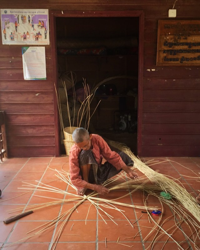
We then went to see some traditional basket weaving. We also learnt about how important the palm tree 🌴 is. They use the trunks for beams in houses, the leaves for the roof, the root for medicine and the flower for palm juice.
img_7129

We also stopped off at a place making clay pottery – they use these moulds that they then put in a big kiln.  Interestingly minions figures as well as Angry Birds are popular.

On our way back to the Butterfly Tours office we stopped at a Buddhist Pagoda and while we were there we witnessed a sun halo☀️😇. Halos are rings of light that can encircle the sun or the moon, and they usually occur when a thin layer of cirrus clouds are present in the sky. According to the Weather Channel, Sun Halos are caused by mixed components of chemistry, physics and geometry.

Recall that the atmosphere is a mix of gases, including oxygen, nitrogen and water vapor. At high enough altitudes in the sky, the water vapor condenses and then freezes into ice crystals. As sunlight passes through the ice crystals, the geometry of the crystals cause the light to refract, similar to what happens when light passes through a prism. How cool 😎.

We all made it safely back to the office with no mishaps or incidences 😅.

Cocktail Making Class – Asana

Steve, who doesn’t like cocktails, suggested we go to a cocktail making class so he could learn how to make them for me – how sweet.  We saw a flyer advertising a class where they use traditional khmer herbs, spices and infused rice spirits to create cocktails.

The class was held at Asana, Old Wooden House which is the only house still existing in the old market district.  The house has been transformed into a bar but it still has a very homely feel – you can go upstairs or sit under the house next to the garden.

We were the only ones booked for the class that evening and our teacher was awesome.  She taught us to make a Ginger Mojito which was really nice – Steve even drank his one – his first cocktail ever.  He thinks that spirits taste like medicine but the way this cocktail was made, the fresh ingredients were the heroes of the drink.

The second one we made was called Tamarind Sauce which we used white rum, rice paddy herbs, tamarind juice and kaffir lime leaves – it had a real sweet, sour taste going on and was really nice.  Again you could taste the natural ingredients rather than the alcohol so Steve also drank this cocktail.

We could choose what to make for the third cocktail and Steve made one using lemongrass and I made a Sombai Sling which had a lot of different spirits in it including a locally made liqueur called Sombai Galangal (strong ginger) and Tamarind.  It was nice but the alcohol taste overpowered the natural flavours.

It was great fun and afterwards we relaxed in the hammocks and chairs they had under the house and enjoyed a few nibbles along with the last cocktail we had made.

Angkor Wat

We saved Siem Reap’s biggest tourist attraction until last – Angkor Wat – the place most people would associate with Cambodia. We had a private tour arranged through the hotel. It was pretty hot so I had dressed appropriately forgetting that you have to cover your legs and shoulders in the temples. I had to buy some floaty pants and wear one of Steve’s t-shirts which I actually grabbed out of the washing pile. I looked and smelt like a right dag so there are no photos of me 😂. So was I really there 🤔 ?

Anyway despite not looking or smelling the best it was an interesting tour – the construction and detailed artwork or devatas are amazing and especially when you consider the era that it was built in.

Angkor Wat is a temple complex and is the largest religious monument in the world, on a site measuring 162.6 hectares.

Originally constructed as a Hindu temple dedicated to the god Vishnu for the Khmer Empire, it was gradually transformed into a Buddhist temple towards the end of the 12th century. It was built by the Khmer King Suryavarman II in the early 12th century in Yaśodharapura (present-day Angkor), the capital of the Khmer Empire, as his state temple and eventual mausoleum. Breaking from the Shaiva tradition of previous kings, Angkor Wat was instead dedicated to Vishnu. As the best-preserved temple at the site, it is the only one to have remained a significant religious centre since its foundation. The temple is at the top of the high classical style of Khmer architecture. It has become a symbol of Cambodia, appearing on its national flag, and it is the country’s prime attraction for visitors.

Angkor Wat combines two basic plans of Khmer temple architecture: the temple-mountain and the later galleried temple. It is designed to represent Mount Meru, home of the devas in Hindu mythology: within a moat more than 5 kilometres long and an outer wall 3.6 kilometres long are three rectangular galleries, each raised above the next. At the centre of the temple stands a quincunx of towers. Unlike most Angkorian temples, Angkor Wat is oriented to the west; scholars are divided as to the significance of this. The temple is admired for the grandeur and harmony of the architecture, its extensive bas-reliefs, and for the numerous devatas adorning its walls.

We also visited Angkor Thom which is a lot smaller. I really liked the Bayon Temple which is the temple at the centre of the city, it was a lot more intimate than Angkor Wat.

Angkor Thom (literally: “Great City”), was the last and most enduring capital city of the Khmer empire. It was established in the late twelfth century by King Jayavarman VII. It covers an area of 9 km², within which are located several monuments from earlier eras as well as those established by Jayavarman and his successors. At the centre of the city is Jayavarman’s state temple, the Bayon, with the other major sites clustered around the Victory Square immediately to the north.

The last temple we visited was the Tomb Raider temple, officially known as Ta Prohm.

Dubbed the Tomb Raider temple because it provided the mystical backdrop for the 2001 Hollywood hit starring Angelina Jolie. Constructed in 1186 as one of the first buildings in Jayavarman VII’s grand vision of creating a network of public buildings and structures, Ta Prohm was originally named Rajavihara – monastery of the king – and served as Mahayana Buddhist monastery and university.

Jayavarman VII – who completed Angkor Wat, which was started by Suryavarman II – dedicated the sacred site to his family, with evidence of this found in inscriptions on the temples’ stele. For example, Ta Prohm’s main image represents Prajnaparamita – the personification of wisdom in Mahayana Buddhism – was modelled on the King’s mother.

The stele records also reveal Ta Prohm was home to more than 12,500 people, including 18 high priests and 615 dancers. More than 800,000 people living in surrounding villages provided services and supplies to the temple, which was home to a bounty of treasures that took in gold, pearls and silks.

It also notes there were 102 hospitals in the Kingdom at that time.

After the fall of the Khmer Empire in the 15th century, Ta Prohm was abandoned and left to let nature take her course for centuries. When restoration of the temples started in the early 21st century, then under the direction of the French, experts decided to leave the enchanting, root-entangled temple as it was – swallowed by the jungle.

Extensive conservation and restoration works have taken place in recent years. All around the temple there were areas where the stones from various parts of the temple were laid out and numbered being prepared to be put back together like a jigsaw puzzle. What a painstaking process and one that will take many years. The trees that had grown inside the ruins and become part of the structure were quite incredible.

During our stay in Siem Reap we stayed in a couple of places – the first place was a small hotel called Anachak Angkor Residences which was about ten minutes from town. We treated ourselves for the last four nights at the Anantara which was very nice. It was also about ten minutes from town and they offered a free return TukTuk service.

On our last night at the Anantara we had drinks with an Australian guy and his daughter. They recommended we try this restaurant called Wild which only served Spring Rolls and had a cool outdoor seating arrangement including a treehouse to sit in. You can’t book so we decided to take a TukTuk there and try our luck.

When we arrived there was a group of four and a couple queued. The owner told the group of four it may be a while before they could get in so they left. The next group, a couple, seemed to know the owner and said they would comeback another night which put us to the front of the queue. We were happy to wait. In the meantime a couple of guys queued behind us and were chatting away to us – they asked us if we had come because the place was number one on TripAdvisor. We hadn’t known that so that was pretty cool. We got a spot on the grassy area within ten minutes.

The place is owned and run by a young French couple who left their Parisian life to find more passion and purpose in their lives. All the food and unique cocktails are crafted in house using local products with as much of it being organic as possible. They pay their local Cambodian staff above the standard and they get bonuses based on the profits made. They have a little shop at the back of the restaurant selling items made locally by local families and businesses. All the profits go to a local NGO called Soulcial Trust which supports social inclusion of people with disabilities, through sport.

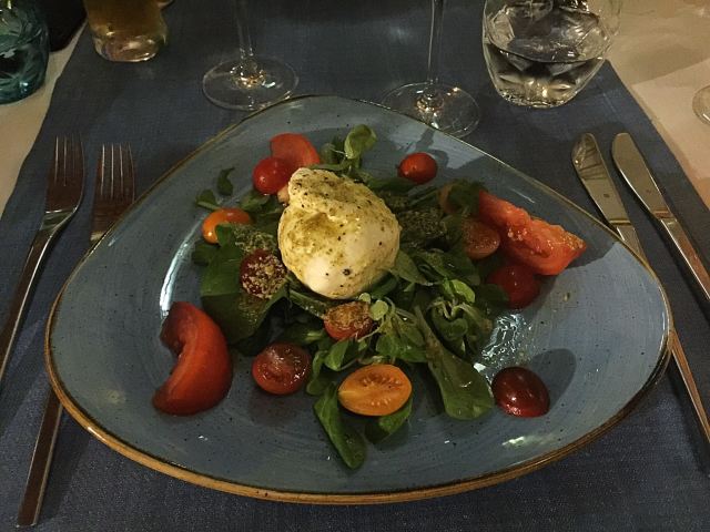
We had a couple of different types of spring rolls each and they were delicious. I tried the fresh ones which were a take on a burrata salad with a basil oil for dipping – OMG they were so good. I couldn’t resist trying the dessert option too of a deep fried, chocolate filled spring roll – pretty damn good!

We interacted with the French couple who were lovely and very accomodating to everyone in what was quite a busy environment. They said it took them a while to find the perfect spot for the restaurant as they wanted an outside area where people could dine in a picnic type environment. They do also have table seating on an outdoor terrace. It was very unique, simple and delicious 😋. A great way to spend our last night in Siem Reap.

History of Cambodia

In 802 AD, Jayavarman II declared himself king, uniting the warring Khmer princes of Chenla under the name “Kambuja”. This marked the beginning of the Khmer Empire, which flourished for over 600 years, allowing successive kings to control and exert influence over much of Southeast Asia and accumulate immense power and wealth. The Indianised kingdom facilitated the spread of first Hinduism and then Buddhism to much of Southeast Asia and undertook many religious infrastructural projects throughout the region, including the construction of more than 1,000 temples and monuments in Angkor alone. Angkor Wat is the most famous of these structures and is designated as a World Heritage Site.

After the fall of Angkor to Ayutthaya in the 15th century, a reduced and weakened Cambodia was then ruled as a vassal state by its neighbours. In 1863, Cambodia became a protectorate of France, which doubled the size of the country by reclaiming the north and west from Thailand.

Cambodia gained independence in 1953. The Vietnam War extended into the country with the US bombing of Cambodia from 1969 until 1973. Following the Cambodian coup of 1970 which installed the right-wing pro-US Khmer Republic, the deposed king gave his support to his former enemies, the Khmer Rouge. The Khmer Rouge emerged as a major power, taking Phnom Penh in 1975 and later carrying out the Cambodian genocide from 1975 until 1979, when they were ousted by Vietnam and the Vietnamese-backed People’s Republic of Kampuchea, supported by the Soviet Union, in the Cambodian–Vietnamese War.

Following the 1991 Paris Peace Accords, Cambodia was governed briefly by a United Nations mission (1992–93). The UN withdrew after holding elections in which around 90 percent of the registered voters cast ballots. The 1997 factional fighting resulted in the ousting of the government by Prime Minister Hun Sen and the Cambodian People’s Party, who remain in power as of 2019.

Cambodia is a member of the United Nations since 1955, ASEAN, the East Asia Summit, the WTO, the Non-Aligned Movement and La Francophonie. According to several foreign organisations, the country has widespread poverty, pervasive corruption, lack of political freedoms, low human development and a high rate of hunger. Cambodia has been described by Human Rights Watch‘s Southeast Asian Director, David Roberts, as a “relatively authoritarian coalition via a superficial democracy”. Constitutionally a multi-party liberal democracy, the country is effectively governed under one-party rule as of 2018.

While per capita income remains low compared to most neighboring countries, Cambodia has one of the fastest growing economies in Asia, with growth averaging 7.6 percent over the last decade. Agriculture remains the dominant economic sector, with strong growth in textiles, construction, garments and tourism leading to increased foreign investment and international trade. The US World Justice Project‘s 2015 Rule of Law Index ranked Cambodia 76 out of 102 countries, similar to other countries in the region.

Cafes, restaurants and socially conscious organisations

The Little Red Fox Espresso

The Little Red Fox Espresso deserves it’s reputation as making the best coffee in Siem Reap – I would go as far as saying it makes the best coffee ever! It was so good as was the food and service. It is owned by a couple of Australian guys who have a social conscience in both how they treat people and the environment being one of the first cafes in Siem Reap to take noticeable action towards lowering its daily carbon footprint and sharing the knowledge on how to go green and clean with their team and the community.

This is their vision:

Our vision here at The Little Red Fox Espresso is one that always looks into the future for our team. Training and support in our workplace is of integral importance. We endeavour to guide our team members in many aspects of life. Hospitality skills, English skills, general world knowledge, health and hygiene, savings plans, personal development, environmental improvement This is of the utmost importance for creating a future for someone that is stable, able and full of self confidence.

http://www.thelittleredfoxespresso.com

HAVEN

HAVEN is a non-religious social enterprise and a training restaurant for vulnerable young adults from orphanages* and safe shelters, as well as underprivileged young adults from very rural poor areas. By teaching these young people quality work skills as well as important life skills, we support thesm in their transition from institution to real world as well as giving them a chance to step out of the poverty cycle.

We first opened in 2011 in the Old Market area in Siem Reap‘s town center. During the four years at our first location we could accept a total of 25 disadvantaged young adults to do the vocational training.

With the increasing demand for training places, but with lease prices skyrocketing in the center, we moved our HAVEN Training Restaurant to a bigger, more special and more beautiful new space in the Wat Damnak area in December 2015. Here we can take in and train more students, create more secure jobs for employees and welcome more guests.

HAVEN is run by 2 dedicated Swiss people, 1 Cambodian Head Chef and around 20 wonderful employees (the HAVEN Family). These are all beautiful people either acting as teachers & mentors, helping us train the trainees or making sure everything runs smoothly in the restaurant.

Each year we take in around 15 trainees, who we train and teach on a daily basis.

In addition to the work training and the life skills workshops we also take financial responsibility of all our trainees and provide them with protected and guided shared housing, meals, medical care and a monthly training allowance. Furthermore we offer them English and computer lessons.

http://www.havencambodia.com/en/welcome/

Marum

Marum is another vocational training restaurant giving marginalised and at risk youth a chance to learn basic life and work skills. It is run by an organisation called Friends International.

Siem Reap, the home of Angkor Wat, is the center of the tourism industry in Cambodia. With the number of tourists rising at an average of 15% a year, this status has led to Siem Reap being a driver of the Cambodian economy. However, increases in wealth have not been equitable throughout the province, and many marginalized children are forced into risky situations in order earn income for their families, including working on the streets in tourist areas. This exposes children to a variety of dangers such as sickness, drug use and exploitation by locals and tourists.

Kaliyan Mith (“Good Friends” in Khmer) fully utilizes the Friends model of social business, social support, and public mobilization to build the futures of children and families. Responding to the problems of predatory tourism, child abuse, lack of access to education, and youth employment, the program assisted 11,412 children, youth and caregivers in 2017.

Also falling under the Friends International model is the Friends ‘n’ Stuff shopping experience.

“Founded in Phnom Penh in 2005, Friends ‘n’ Stuff is an ethical lifestyle brand that is rooted in and inspired by Southeast Asia. Our contemporary, playful designs delight customers so we can help empower families.

We proudly pioneered upcycled fashion in Cambodia and built a reputation as one of the region’s leading socially-conscious brands. Every Friends ‘n’ Stuff purchase creates a positive social impact, as all profit is reinvested into the lifesaving programs of Friends-International. We provide training, a stable income, social support, and employment assistance to parents in need.”

I really enjoyed my lunch here and visited the Friends ‘n’ Stuff shop at the restaurant which had so many cool things recycled from all manner of recycled material. I could have gone crazy 😜 😉.

https://friends-international.org/in-cambodia/#siemreap

Smateria

Smateria design and make bags and accessories from recycled materials. I visited their shop and was so taken with the funky and functional bags – again I could have gone crazy 😜 but managed to engage the self control and ‘tight-arse’ Accountant mindset 😂. I am now, however, the proud owner of a very cool handbag made from recycled fishing net and car tyres 💗.

Smateria’s journey begins when founders Jennifer Morellato and Elisa Lion met in Cambodia, sharing a passion for creativity, sustainability, and business. After prototyping their first bags with upcycled and recycled materials, they took the entrepreneurial plunge to transform their ideas into a thriving social enterprise.

Bags and accessories that fuse together fashion, playfulness and social consciousness.

Our passion lies in taking unusual materials and crafting them into innovative and fashionable bags and accessories, using recycled materials wherever possible. We do this to stretch the boundaries of a material’s usability, quashing the idea that fabrics and materials can only be used for specific purposes.

We couldn’t be happier with where this journey has taken us so far. Since beginning in a small garage space in Cambodia 2006, we now have several shops across Siem Reap and Phnom Penh, online stores and distributors that continue to spread our style worldwide.

At Smateria our passions go beyond creating unusual designs. We have a clear mission to employ Cambodian workers in a fair and sustainable way, where employees are treated well and priority is given to the employment of women and mothers.

Over 80% of our current employees are women, and we challenge the glass ceiling by ensuring all our staff have equal opportunities to grow and develop within their roles. We offer a free childcare centre on site, and all our staff receive benefits such as English lessons, double maternity and family support leave, health insurance, savings accounts, and training to develop their skills and careers.  All our employees are given paid holiday leave which they must take, so we can ensure they can see their families, take rest, and have a healthy work-life balance. It is our mission to create a safe, happy workplace where Cambodian women are given space to thrive.

Our workshops are made safer for our employees by following the leading standards for luminosity, space per employee, and ergonomics. They also receive professional training on fire safety, have regular electrical audits, and professional training to balance health and work.

http://smateria.com

Common Grounds

“Common Grounds is not only about freshly brewed coffee, a selection of pastries and tasty sandwiches as well as delicious soups of the day – it’s also about people. You don’t have to be a socially responsible traveller to enjoy a freshly brewed cappuccino, a grilled cheese sandwich and tomato soup combo or some of the local Khmer dishes, but the team at Common Grounds also aim to promote ’micro-enterprise development’, giving locals a working chance and create income that helps to sustain the Children’s Home in Siem Reap Common Grounds serves as a vocational training center, teaching English and computer skills and provides housing for long and short-term volunteers and staff.. If you bring your own laptop, there is also free wireless Internet and, as a whole, we believe Common Grounds is a good choice whether you’re looking for a healthy breakfast, lunch or dinner.” Lonely Planet Magazine

http://commongroundscafes.org

img_7348

New Leaf Cafe

My keyboard journey of all things good in Siem Reap lead me to the claim that the New Leaf Cafe did the best Espresso Martini in town plus some pretty good food. They donate a share of their profits to various local charities helping local people and are always striving to improve their environmental impact.

Georgina and Ian, first met in January 2013 whilst volunteering at a school in Siem Reap. They shared a common desire – to build a sustainable business that provides charities with much needed funding & support.  They chose to establish a social enterprise cafe/restaurant in the heart of Siem Reap.  The concept appealed to them as a way in which to give back: creating jobs, sourcing locally / sustainably and generating profits that are donated to charities focused on education.

As a social enterprise, New Leaf has implemented numerous environmentally friendly initiatives and adopted fair employment practices; including a living wage, profit share, regular training and providing career development opportunities.

New Leaf opened its doors in July 2013 and within 3 months made its first cash donation. Since then New Leaf has donated over $40,000 and 2,000 books.

New Leaf’s vision is to support education in Siem Reap province, through profits generated by being a high quality dining experience that offers a “taste of Cambodia”.

https://newleafeatery.com/about-us/

The Hive

Known for its superb coffee and a distinctly inner city vibe, the Hive is a bustling social hub for expats and tourists alike. Since its conception in 2013, this Australian owned, locally managed café has cemented itself as a Siem Reap favourite. If you’re a coffee lover, a brunch goer, a juice detoxer, early diner or simply looking for a touch of home, The Hive awaits.

Cafe .9 by Lynley

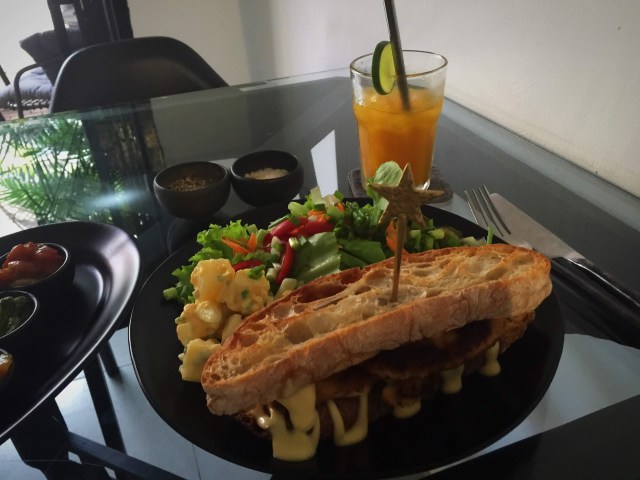
We went to Cafe .9 by Lynley a couple of times for the delicious Schnitzel Sandwhich with green salad and home made potato salad. The cafe is located in Kandal Village and I highly recommend it if you’re looking for some yummy, flavourful home cooking 😋.
img_6969

Maybe Later

Maybe Later serves California style Mexican food.  The primary mission of the Maybe Later family is to help rebuild the creative community that once thrived in Cambodia, before it was intentionally and savagely destroyed in the recent past.  Our present focus is on developing young creative talent interested in the genre of “street art” stemming from the late 1970’s and 1980’s American hip hop, breakdancing, skateboarding, and surfing cultures.  We believe in the unique power of this public domain art form to transform the energy of communities and entire cities, hence the choice to transform our entire building into a skeleton with paint.  We also know that a properly funded and organised street art scene in any city provides children and young adults with a healthy way to grow and express themselves, while reducing the allure of dangerous drugs and other harmful addictions.

Our secondary mission is to demonstrate, by example, that a profitable hospitality business serving a tourism-driven market can be achieved with little or zero destructive environmental impact.  To this end we have partnered with @PICUPS.KH (Plastic Initiative Cambodia) to help eliminate single-use plastic from Cambodia and the World at large.  Everything we use is made from plant based organic compounds that will fully bio-degrade in 30 to 180 days in the right composting environment.

They had a very cool cocktail menu with some amusing descriptions:

Maybe Later – it’s been said the path to Hell is paved with good intentions.  So to Hell with all the things you intended to accomplish today, and quite possibly tomorrow, once you make this choice.  Vodka, white rum, gin, fresh pineapple juice and orange fruit juice, finished with cranberry (be careful with these, very strong drink).

Yoga Pants Dropper – now that you’re properly stretched, calm, and meditated….. you’re craving something healthy but also a little naughty because you realise there’s only 1 day left of this epic vacation you’ve spent cleansing your body and mind.  So order one of these, ask for the wi-fi password, and get your ‘right swipe’ on before it’s too late.  Bacardi silver rum, fresh pineapple, fresh lime, fresh kale, soda.

Kulen Mountain Cooler – the first sip of this refreshment is like taking a cool bath under a gushing waterfall in the jungle on a sweltering hot day.  Finishing the third one is like doing the exact same thing, with a naked stranger.  Bombay sapphire gin, fresh water melon, fresh cucumber, palm sugar, soda.

Beat Richner & the Kantha Bopha Children’s Hospitals

Beat Richner (13 March 1947 – 9 September 2018) was a Swiss pediatrician, cellist and founder of children’s hospitals in Cambodia. He created the Kantha Bopha Foundation in Zurich in 1992 and became its head. Until his death in 2018, Beat and another expatriate oversaw and ran the predominantly Cambodian-manned hospitals. As both a cellist and a medical doctor, Richner was known by patients, audiences, and donors as “Beatocello”.

After receiving his medical degree in 1973, Dr Richner specialized in pediatric care at the Zurich Children’s Hospital. Following this, working for the Swiss Red Cross, he was sent to Cambodia where he worked at the Kantha Bopha Children’s Hospital in Phnom Penh in 1974 and 1975. The hospital is named in memory of HRH Samdach Preah Ang Mechas Norodom Kantha Bopha (1948–1952), who was the daughter of King Norodom Sihanouk and died at a very young age. When the Khmer Rouge overran Cambodia, Richner was forced to return to Switzerland where he continued his work at the Zurich Children’s Hospital.

In the process of pursuing his medical career and an interest in music and entertainment, Dr. Richner developed the character of “Beatocello”, an artistic and comedic clown who played the cello. Along with this persona, Richner also published many children’s books based on “Beatocello”.

In December 1991 Richner returned to Cambodia and saw the devastation that had taken place following the ensuing conflicts with the Khmer Rouge and Vietnam. He was asked to re-open and re-build Kantha Bopha by the Cambodian government. Creating the Kantha Bopha Foundation in March 1992, Richner officially returned to Cambodia to begin reconstruction and Kantha Bopha was reopened in November 1992. Since then, the foundation has funded the expansion of Kantha Bopha Children’s Hospitals to include five hospitals in total.

As “Beatocello”, Richner performed free concerts at the Jayavarman VII hospital in Siem Reap on Thursday and Saturday nights, during the high season. The evenings included songs, played on his cello, and talks on the health crisis in Cambodia. He asked the young tourists for blood, the older tourists for money, and the ones in between for both.

Richner and his work in Cambodia were also the subject of six documentary films by Georges Gachot: Bach at the Pagoda (1997), And the Beat Goes On (1999), Depardieu goes for Beatocello (2002), Money or Blood (2004), “15 Years of Kantha Bopha” (2007), “Beatocello’s Umbrella” (2012) . In 2006, the documentary “Dr Beat and The Passive Genocide of Children” by Australian film maker Janine Hosking was produced.

Prior to his death, of the 2400 Kantha Bopha staff members, Dr. Richner alongside the head pathologist Dr. Denis Laurent, were the only expatriate staff members employed at the hospitals.

Richner waged war on the large aid agencies, claiming that their policies of poor health care for poor people in poor countries are both illogical and immoral.

Richner was named “Swiss of the Year” in 2002.

He died of a serious illness on 9 September 2018 aged 71.

The five children’s hospitals built by Richner and the Kantha Bopha Foundation are located in Cambodia’s major cities. All of the hospitals provide treatment free of charge.

The Kantha Bopha hospitals treat half a million children per year free of charge. Approx 100,000 seriously ill children are admitted. Japanese encephalitis, malaria, dengue fever and typhoid are common, often exacerbated by the presence of TB. TB is the number one killer. Mortality rate is an astonishingly low 1%. Richner says that over 80% of all paediatric health care in Cambodia is provided by his hospitals.

The hospitals are primarily funded by donations from individuals in Switzerland. Operational expense in 2006 were in the order of US$17m. Since the Foundation started in 1991, it has reportedly raised US$370 million.

In addition to medical care, the hospitals also provide an International Postgraduate Course. The Kantha Bopha Academy for Pediatrics was started in 2009. The program includes lectures and courses on general pediatrics, infectology, immunology and diagnostic imaging. The course program also includes an introduction into the organization and management of a children’s hospital and maternity facilities in a poor tropical country.

Posted in Cambodia | Tagged , , | 3 Comments

My Swiss Summer – Switzerland

I enjoyed another trip up to Switzerland to visit my very good friends Karin & Elvis in July. You just can’t beat summer in Switzerland!

The trip from Bangkok started extremely well with an upgrade to Business Class on Swiss Air. The flight was overbooked in economy and being a single traveller I got lucky. I landed in Zurich at 7pm and it was still 32 degrees!

After a bit of a sleep in the next day we went on a bike ride along the river to Dallenwiel where they have a factory that makes goat cheese. I was really channeling my Heidi here 🐐 👧 😂. We also enjoyed some time in Lake Lucerne and by the pool.

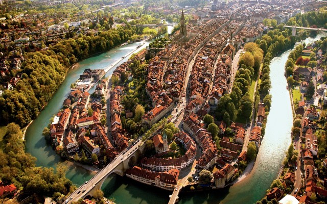
On Thursday we went on a road trip to Bern which is where the Swiss parliament resides. One of the cool things to do in Bern is to float down the Aare – the swift flowing river that winds its way through the city.

The Aare river flows around three sides of the city of Bern. Extending 288 kilometers, the Aare is the longest river flowing entirely within Switzerland. The Aare river has a special meaning in the Swiss capital, Bern. The Bernese have a special love for “their” river. And they treat it with the same tenderness with which the renowned Aare Loop flows around the city. The Aare is their pride and joy, and the center of daily life. In the Middle Ages, in particular, when the city of Bern was spread only on the lower part of the peninsula, the Aare provided great protection from foreign armies on three sides of the city. It wasn’t until the construction of the first high bridges in the 19th century that there were multiple ways to access the city

In the summer it is particularly popular – who needs the sea when you have the Aare. There were so many people enjoying the free lido area on the banks of the river and also floating down it. We walked alongside the river for about a kilometre and then got all set to jump off the bridge in to the quite fast flowing river below. Karin & Elvis did it but I chickened out – I could see the bottom and wasn’t too keen on hitting it. I went to the side of the river and jumped in from there. Karin & Elvis waited for me part way down and we floated the rest of the way together. It is so much fun but there is an art to getting out – you have to get to the side and then grab onto the railings and hold on or you will continue down the river. There are some dam gates further down but that area is a no go for safety reasons.

We repeated the experience another couple of times – it is addictive and I probably could have done it all day long if it hadn’t been for walking bare feet in the searing heat. The river temperature was about 21 degrees so positively tropical – as you can imagine the river can get pretty cold but the great summer weather worked it’s magic for us.

img_4797

Prior to floating down the river we went to the Zentrum Paul Klee museum which is dedicated to the artist Paul Klee and features about 40% of his works.  Paul Klee (18 December 1879 – 29 June 1940) was a Swiss-born artist. His highly individual style was influenced by movements in art that included Expressionism, Cubism, and Surrealism. Klee was a natural draftsman who experimented with and eventually deeply explored color theory, writing about it extensively; his lectures Writings on Form and Design Theory (Schriften zur Form und Gestaltungslehre), published in English as the Paul Klee Notebooks, are held to be as important for modern art as Leonardo da Vinci‘s A Treatise on Painting for the Renaissance. He and his colleague, Russian painter Wassily Kandinsky, both taught at the Bauhaus school of art, design and architecture. His works reflect his dry humor and his sometimes childlike perspective, his personal moods and beliefs, and his musicality.

The exhibition was broken down into the various periods of his life and focused on who he was associating with at the time in terms of his art. It was really clear to see how his art changed over the years and the influence those other artists had on him – they also displayed some pieces from these artists to enable you to see the commonalities. One such artist was Pablo Picasso whom he admired greatly and who he finally got to meet in 1933 / 1934 while exhibiting in London and Paris.

They also had a feature exhibition downstairs entitled Ecstasy or Ekstase in German which was quite bizarre in my opinion.

Ecstasy – a desire for moments of intense pleasure and passion is a universal feature of human existence. This exhibition explored the great diversity of ecstatic phenomena and traces their changing cultural meanings and representations in visual art.

There was lots of footage of events / gatherings / parties where people were dancing, shaking, crying uncontrollably – very psychedelic 🤪🥺

img_4798

On the way back to Buochs we called into another village called Hergiswil where there was a group of people practising the Alphorn. The Alphorn is also known as an Alpine Horn or Alpen Horn. It has its origins in central Europe, primarily in Switzerland, Austria, Germany, and Northern Italy. It is a natural conical (cone-shaped) horn made of wood, and is played with a cup shaped mouthpiece, similar to trumpet, french horn, or trombone.

I can imagine it is quite an art to play one of these instruments.

On Saturday the 27th July I borrowed one of Karin’s friends electric mountain bike so we could cycle up the Buochserhorn – the home mountain of the village of Buochs where Karin & Elvis live. The Buochserhorn standing at 1,807 metres high is in the Swiss Prealps, overlooking Lake Lucerne on the range west of the Schwalmis.

You can cycle up to about 1,500 metres and walk the rest of the way to the top. We mainly cycled on the roads and passed many farmers houses – you have to have a permit to drive your car up there so the traffic is pretty much restricted to those living up there. I just love checking out the farm houses and barn set ups which house the cows in both the summer (for the heat) and the winter (due to the snow and cold weather). It is so different from NZ – most farms have between 15 and 25 cows whereas in NZ an average form would have about 180 cows and in a lot of cases even more.

It was a fantastic day and the views were pretty spectacular. We had taken the binoculars up with us so we could check out what Elvis was doing at home 😂.

We cycled back down a different way and had lunch in Niederrickenbach next to a Benedictine monastery. I really enjoyed my sausage salad – if you have read any of my previous Swiss blogs you will know I am not usually a sausage fan but I love Swiss sausages.

After lunch and a wrong turn initially, which resulted in pushing my bike back up a hill 😂, the road effectively wound it’s way through a forest to the bottom. It was stunning and right up my alley. Karin had been teaching me some german sentences – one a day, so today she decided I should learn to count from one to ten so most of the way down I was repeating the numbers in German to myself. We had to stop regularly as the brakes on the bikes overheat so at each stop I had to count to ten 👩🏼‍🎓 with proper pronunciation – easier said than done for me with my Kiwi accent 🙄.

After a stunning day on the Saturday the rain came on Sunday and stayed around most of the day so a chill day at home was in order.

On Monday afternoon we went and played a round of golf at Andermatt which is a really nice course in a popular ski area. It was really windy and that combined with borrowed clubs that Noah potentially used it was an interesting round. Actually things improved and it was a very enjoyable afternoon.

img_6400

The plan for the next few days was to head over to Glarus where Karin’s parent live and do a bit of hiking.

The most scenic route to Glarus is over the Klausen Pass which is a high mountain pass in the Swiss Alps connecting Altdorf in the canton of Uri with Linthal in the canton of Glarus. Somewhat unusually, the boundary between the two cantons does not lie at the summit of the pass, but some 8 kilometres down the slope towards Linthal, with the summit being in Uri. The summit of the Pass sits at 1,948 metres.

I have been up here before and it is a stunning part of Switzerland. The plan was to drive to Urnerboden which is on the other side of the Klausen Pass, park the car and catch the bus back up to the summit of the Klausen Pass and begin our hike to the Glacier Lake from there.

We were running a bit tight on time and everything in Switzerland runs to a precise timetable as you can imagine so there is really no wriggle room 😂. We calculated we would probably be fine, that was until we came across a farmer moving cows on the road just past the summit on the way down. OMG, talk about browns cows! And they were weeing and pooing all over the place – Elvis had cleaned his car for my arrival so it was looking a bit grim after that encounter.

img_6551

We finally got past the cows and Karin started channeling Lewis Hamilton and it was time to hold on – it is very windy coming down the Klausen Pass with lots of drop offs 🥺. She was worrying about me feeling sick but having to hang on to stop flying out of my seat was enough of a distraction. I was also charged with counting down the clock. We pulled into the carpark and the bus was already there – Karin had to put her boots on but I was ready to go so she told me to run to the bus and tell it to wait. I had only learnt a few sentences in German at this stage and “can you wait for my friend” was not one of them but I was prepared to put on the Kiwi charm and hand signals if necessary. Fortunately there were a few other people getting on the bus and paying their fares so by the time I got to the front of the queue Karin had arrived 😅.

We caught our breath whilst on the bus going back up tp where we had just come from.

First stop was the Griesslisee (glacier lake) from where you can see the Clariden Glacier. This lake formed in the 1980’s and doesn’t have an official name. We had our lunch on the lakes edge and of course had to test out the water – at first it was nice and refreshing but it did not take long for the feet to start going numb ⛄️. There were a few small glaciers floating on the lake and we watched one small one disappear under the water. There were a number of loud crashes where bits of ice or rocks fell into the lake on the far side – you could always hear them but not always see them.

We left the lake and started the hike towards the cable car that would take us down to Urnerboden where we had left the car. We stopped off at a little Alp to have some refreshments – coffee with liquor in it to be precise 😉 and met up with some people that Karin had been talking to on the bus. It turned out that Karin had taught one of the woman’s sons a few years back.

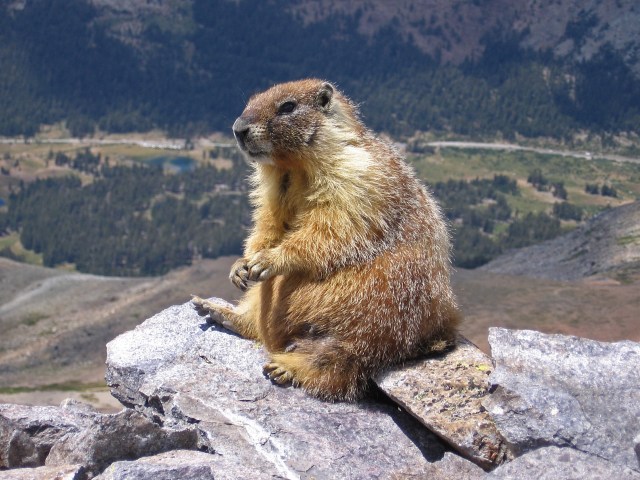
Back on the track which was undulating and crossed a few pastures and waterways – we had seen a lot of different flowers along the way which added to the magic of it all. We were climbing up a rocky path that twisted and turned when something ran across a few metres in front of us. My first reaction was “there’s a cat” but then I realised it was a Marmot.

img_4799

Marmots are large rodents with characteristically short but robust legs, enlarged claws well adapted to digging, stout bodies and large heads and incisors to quickly process a variety of vegetation. Marmots are the largest members of the squirrel family. Some species live in mountainous areas where they typically live in burrows and hibernate there through the winter. Most marmots are highly social and use loud whistles to communicate with one another, especially when alarmed.

I had seen Marmots in captivity before but never in the wild so it was quite exciting. We decided to climb up onto a grassy hill and wait to see if the marmot appeared again. About ten minutes later he came out of hiding and went back towards the path, where he stood on his hind legs and started whistling. Next minute on the either side of the valley we spotted another marmot who whistled back. It was quite fascinating to watch – luckily we had taken the binoculars so we could take a closer look.

We carried on and came across another couple of marmots running through the field – they stood on top of this cliff looking down the valley for quite a while so again we could observe them through the binoculars.

We arrived at the 2,000 meter high Fisetengrat on the Fiseten Pass and took the cable car back to the Urnerboden Valley which is the largest alpine meadow in Switzerland where approximately 1,200 cows roam in spring and autumn. There is even a cheese factory there to process all the milk produced and Karin purchased a few cheeses to take to her parents.

When we got to the cable car the same family that we had talked to on the bus and at the little Alp were sitting inside – they had taken the road so had beaten us there.

The descent down to Urnerboden was about 700 metres – the cable car goes diagonally down the mountain above the forest. I love cable cars!

Enroute to Karin’s parents in Schwanden we stopped off at Karin’s favorite spot – the Berglistüber waterfall. As early as 1897, this waterfall was described as one of the most beautiful waterfalls in Switzerland. You can venture behind the “water curtain” and comfortably reach the outcrop of the thrust fault which we did. The rock face consists of about 150 million year old winter limestone from the so-called Griesstock Nappe. The underlying shale rocks are of about 50 million year old flysch rock, which was deposited over the bedrock and has barely shifted since that time.

When we woke up on Wednesday morning it was raining which had been forecast. We went into Glarus and did a spot of retail therapy which is always good fun. The weather cleared up in the afternoon so Karin’s Mum drove us up to the top of the village and we walked to Karin’s brother’s place in Glarus. It was nice to get more of a feel for the place that Karin had grown up in.

Before dinner we went and played a little nine hole golf course which was fun.

The 1st of August is the national holiday of Switzerland. Although the founding of the Swiss Confederacy was first celebrated on this date in 1891 and annually since 1899, it has only been an official holiday since 1994.

We had planned a hike to Leglerhütte which sits at 2,273 meters above sea level and is a restaurant / hotel up in the Alps in Glarus – the area is known as a wildlife sanctuary where if you are lucky you can see a few alpine animals.

We caught the cable car at Kies-Mettmen up to Mettmenalp which sits at 1.600 meters so our hike for the day was going to take us up some 600 metres. At Mettmenalp, there is a beautiful water reservoir called Stausee Garichti. The water was so clear and calm it is a paradise on its own. There are a couple of routes you can take up to Leglerhütte and we decided to go with the one that started with a short, sharp uphill. We had another route option after we got to the top of this section – the first one would have taken us down 500 meters and back up again or you could just continue upwards – you can guess which one we took 😊.

The views were stunning and I enjoyed the landscape. As we got into the pre Alps the vegetation changed and we came across some snow / ice which was fun to walk across.

We enjoyed some lunch at the Leglerhütte – we had a traditional soup called Bunder Gerstensuppe or Swiss Barley Soup. Karin & Elvis said it was definitely not up to standard and I thought it lacked flavour so that was a shame. We had a delicious summer fruit pastry wth whipped cream to make ourselves feel better 😋.

Because we were up at 2,273 metres, the clouds kept rolling in and out so the views were constantly changing. We re traced our steps back down for a while before branching off to take a different route back to Mettmenalp. We found this big cave which had a fast flowing river flowing through it so decided to take a short cut through it which added to our adventure.

It was a beautiful day and I just loved all the nature that we were seeing. We took a small detour once we got back to the Stausee Garicht and came across a nice stream where we took our boots off and soaked our feet – man it felt good.

There was an information board next to the stream that referred to a Swiss doctor called Max Bircher-Benner whose theory of life was based on harmony between people and nature. He was also the guy who invented Bircher Muesli.

Bircher-Benner was born in 1867 and attended Zurich University to study medicine and then opened a general clinic. During the first year the clinic was open, Bircher-Benner came down with jaundice, and he claimed he became well again by eating raw apples. From this observation, he experimented with the health effects raw foods have on the body, and from this he promoted muesli, a dish based on raw oats, fruits, and nuts. Bircher-Benner expanded on his nutritional research and opened a sanatorium called “Vital Force” in 1897.

He believed raw fruits and vegetables held the most nutritional value, cooked and commercially processed foods held even less, and meat held the least nutritional value. Eventually, Bircher-Benner gave up meat entirely and became a vegetarian. Other scientists of the time did not respond well to what Bircher-Benner referred to as his “new food science,” but the general public caught on to his ideas to the point where he had to expand his sanatorium practice. His nutritional habits and eating patterns steadily grew in popularity until he died on January 24, 1939 in Zürich at the age of 71.

Bircher-Benner’s work was not recognized by other scientists until the discovery of vitamins in fruits and vegetables in the 1930s.

Even though the level of processed food would have been fairly low back in those times, how ahead of the game was Dr Bircher-Benner?

We caught the cable car back down to where we had parked the car and went back to Karin’s parents to enjoy a coffee and some treats under the shade of the trees in the backyard – it had been such a lovely day.

That evening we had a BBQ and waited for it to get dark so we could watch all the fireworks and bonfires which is a tradition on Swiss National Day. On all the mountains that were surrounding us we could see bonfires – we got the binoculars out so we could take a closer look. All the neighbours come out into the street and it was quite a festive atmosphere.

img_6869

The next day we headed back to Buochs – we took the Pragel Pass which is a mountain pass joining the cantons of Glarus & Schwyz. Unfortunately it was raining and cloudy so we didn’t see the best of the Pass. We did stop and pick wild blueberries though – we accessed these off the side of the road – knowing how expensive they can be in NZ, how good is that 😊.

My last two days in Switzerland were lovely and sunny so we enjoyed a couple of nice walks by the lake, a couple of lake swims, paddle boarding and mojitos by the pool. It was such a lovely way to finish off my trip with all my favourite things. Big thanks to Karin & Elvis for the creation of many more wonderful memories. It was then time to say ‘until next time’ 👋 😘.

Posted in Switzerland | Tagged , , , , , , , , , , | 3 Comments

Nikanti Golf Club – Bangkok, Thailand

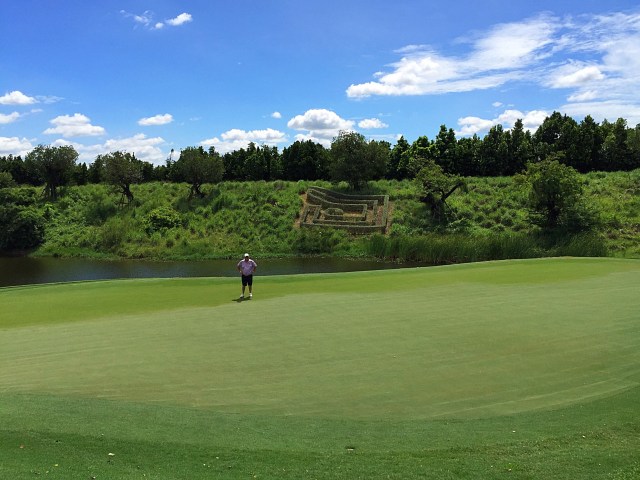
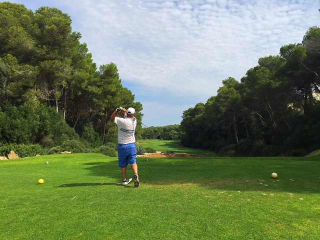
Today we treated ourselves to a round at the Nikanti Golf Club. Steve has played there a couple of times before and had said how much he enjoyed it so we played it on our way to Bangkok.

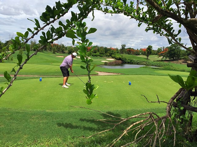
Nikanti sits in the fresh air among former rice paddies about an hour from Bangkok proper and was established in 2014. Nikanti is a reasonably short course but uses water and elevated and undulating greens to give those that play the course a bit of a challenge.

It also has a unique routing. Rather than having a traditional front and back nine, Nikanti is made up of three loops of six, each one starting and ending at the main clubhouse. Finally, each circuit comprises two par-3s, two par-4s, and two par-5s. Having an equal number of par-3, par-4 and par-5 holes is somewhat controversial, but why not? Par-72 is still on offer, and it gives golfers the chance to play a wide variety of holes through the round.

I loved the course and played OK – I only lost 5 balls 😉. Steve played really well and it took him until the last hole to lose his first ball. Our caddies were sweet but boy did they have some lungs on them when they were yelling ‘four’ while standing right behind you 😡. The facilities are impressive and very modern and we made the most of them.

Posted in Bangkok, Thailand | Tagged | 1 Comment

Cycling in the Catlins – Catlins, New Zealand

In late February I headed to Invercargill to go and explore the Catlins with some friends. Natural High organised our itinerary and provided support throughout the trip.

Until a few years ago I didn’t know where the Catlins were – I thought they were a group of islands off the bottom of the South Island near Stewart Island but no, the Catlins form the south eastern coast of the South Island.

The area lies between Balclutha and Invercargill, straddling the boundary between the Otago and Southland regions. It includes the South Island’s southernmost point, Slope Point.

A rugged, sparsely populated area, the Catlins features a scenic coastal landscape and dense temperate rainforest, both of which harbour many endangered species of birds, most notably the rare yellow-eyed penguin. The coast attracts numerous marine mammals, among them New Zealand fur seals and Hooker’s sea lions. In general terms the area enjoys a maritime temperate climate. Its exposed location leads to its frequently wild weather and heavy ocean swells, which are an attraction to big-wave surfers, and have also caused numerous shipwrecks.

People have lived in the area since around 1350 AD. Prior to European settlement, the region was sparsely inhabited by nomadic groups of Māori, most of whom lived close to river mouths. In the early days of European settlement the area was frequented by whalers and sealers, and saw milling became a major local industry from the mid-19th century until the 1930s.

Tourism has become of growing importance in the Catlins economy, which otherwise relies heavily on dairy farming and fishing.

The region’s population has fallen to less than half its peak in the early 20th century. Some 1,200 people now live in the Catlins, many of them in the settlement of Owaka. This is linked to population centres to the north and southwest via the area’s only major road, part of the Southern Scenic Route. Owaka contains the area’s main school,The Catlins Area School, catering for students from year 1 to year 13. There are three other small primary schools throughout the Catlins district. Owaka also has a medical centre, the nearest hospital being in Balclutha. The Catlins is governed at local level as part of the Clutha and Southland Districts and is represented at national level as part of the Clutha-Southland electorate.

Day 1 – Invercargill to Pounawea – 🚐 & 32km 🚴‍♀️.

Our first day in the Catlins has been spectacular. Firstly we were blessed with blue skies and sunshine and secondly we only encountered head winds on the odd occasion 👍🏼. The Catlins comprises an area in the southeastern corner of the South Island of New Zealand. I was expecting it be wild and rugged like the West Coast but we were greeted with white sandy beaches and gently rolling hills – more akin to Northland than the West Coast. We had a lovely lunch at Kaka Point before cycling out to Nugget Point to see one of two lighthouses that serve this region. We could see the seals frolicking & swimming far below us. We walked down to Roaring Bay to see if we could see any yellow eyed penguins coming ashore but weren’t so lucky. We then drove to Tunnel Hill and walked through an old rail tunnel which was completed in 1893 – it is NZ’s southern most railway tunnel. Back on the bikes to Pounawea where we are staying in waterside cabins. We enjoyed a lovely meal at the Lumberjack Cafe in Owaka. Owaka is the biggest settlement in the Catlins with a population of 400 – it even has its own Teapot Garden 😉. The entire Catlins population is only 1,200. Once again the scenery in this beautiful country we are so lucky to call home has blown me away 😊.

Nugget Point is one of the most iconic land forms on the Otago Coast. The lighthouse at its tip stands at 76 metres above the water and is surrounded by rocky islets also referred to as nuggets. The lighthouse was built in 1869 and originally powered by an oil burner. It was converted to electricity in 1949 powered by a diesel generator until 1960 before being connected to mains electricity. It was automated in 1989 and is now computer monitored and operated by Maritime New Zealand.

The Teapot Garden collection was started 13 years ago by a local Owaka man called Graham Renwick. There was no grand plan behind the garden it just popped up and now has about 1,400 teapots in it from all over New Zealand and the world.

Day 2 – Pounawea to Chaslands – 🚐 & 32km 🚴‍♀️.

We awoke to calm seas and sunshine – a good start. We drove around to Jacks Bay to do a walk to see Jacks Blowhole. The sea travels 200 metres through a cave into this massive hole – the sea wasn’t wild today so the culmination of this water travelling 200 metres wasn’t as fiery as it can be but it was still impressive. After walking back to Jacks Bay we watched about 6 sea lions frolicking on the beach before getting on our bikes to cycle to Purakaunui Beach which is popular with the surfers. Unfortunately the weather had deteriorated a bit and we got a little bit of rain going in there. Next stop was Purakaunui Falls which were picturesque. It really is a nature lovers paradise down here – there is literally something to see at every turn and all the tracks and signs are so well maintained. After some lunch it was back on the bikes to Papatowai where we came across the annual Papatowai Challenge – a 15.5km run or walk. The terrain was very hilly but there were some impressive competitors out there. The light drizzle had also made it quite muddy which Graeme discovered as he hooned down the hills on his bike. We then drove up to Matai Falls before coming back to Papatowai to enjoy a coffee at The Lost Gypsy. We then cycled up Florence Hill Lookout. The clouds had cleared and the sun was shining again which made for some stunning vistas. Most of the promotional photos for the Catlins are taken from this lookout and you can see why. We could see back along the coast to where we had come and down along Tautuku Bay – wow 😮. We then had a fast descent down on the bikes before stopping for a paddle at the beach – surprisingly it wasn’t as cold as I thought it would be. We finished the day with a walk to Lake Wilkie which due to its environment is very reflective. Another stop at a historic sawmilling site was also interesting – back in the day there were 182 sawmills in the Catlins. Today there is only one. Tonight we are staying at Whistling Frog 🐸 Resort which is very cool. We enjoyed a yummy dinner at the cafe and it was blue cod all the way – it is hard to get at home, yet it is on pretty much every menu down here 😋. The Catlins is proving to be such a wonderful discovery 🐧🐝🐬🌿🌊☔️☀️👏🏻

Jacks Blowhole is 55 metres deep and 200 metres from the sea. It was formed when the roof of a large subterranean cave was eroded by the sea and fell in. As with the bay and nearby island, Jacks Blowhole is named after the famed Ngai Tahu Cheif, Tuhawaiki, known to early European settlers as Bloody Jack – apparently he was fond of using the expletive ‘bloody’.

The Purakaunui Falls are a cascading three tiered waterfall that stand at 20 metres tall. They are one of very few South Island waterfalls away from the alpine region. The falls are an iconic image for the Catlins and they were featured on a postage stamp in 1976.

Lake Wilkie was formed after the last ice age and has gradually shrunk to it’s current size of 1.7 hectares. Bog lakes like Lake Wilkie are a rare ecosystem in this part of the country. Trapped towards the coast by a small cliff, water accumulated in a depression between ancient sand dunes. Originally, the lake was much larger and is slowly being filled in and reclaimed by the vegetation around it. Today, the lake is very shallow and its water coloured brownish by organic acids released by the peaty soils.. The introduced whistling tree frog is common around the lake’s edges and provides the name of our accommodation for the night – Whistling Frog Resort.

First inhabited by the Maori people in the period 900 – 1700 AD, the Catlins is an area with a rich history. Captain James Cook sighted the area in 1770, but it was not until the period 1810 – 1830 that whalers and sealers arrived in the Catlins. The Catlins takes its name from Edward Catlin, a ship’s captain who made a land claim in the district in 1840. The first settlement of land by Europeans took place in the mid 1850’s. Settlers arrived primarily to mill trees, the first mill being in operation around 1865. Nine timber mills were operating near the Catlins and Owaka Rivers by the 1880’s. In 1877, 107 ships sailed from the Catlins area loaded with timber bound for house building in Dunedin and Christchurch. Farming became more prevalent in the 1870’s and 1880’s and since the end of the sawmilling era, the Catlins district has relied on farming as its mainstay.

Day 3 – Chaslands to Curio Bay – 34km 🚴‍♀️.

We started the day with a bit of sight seeing in the van. First up were the 22m McLean Falls. We then walked the Tautuku boardwalk which winds through wetlands with wonderful views across to Maori Tapu (sacred spiritual) land. We had to wait until 11am to visit Cathedral Caves due to low tide being at 1.10pm – you can only visit the caves two hours either side of low tide. The caves are located in cliffs at the northern end of pristine Waipati Beach – the two sea-formed passages together measure just on 200 metres – and their impressive height is up to 30 metres. It was then back to the Whistling Frog 🐸 to have a picnic lunch and saddle up the bikes. We stopped at NZ’s answer to Niagara Falls 😜 – they were named by a surveyor with an obvious sense of humor who had seen the real McCoy in North America. We then enjoyed a nice coffee at the old Niagara schoolhouse which is now a cafe. It had been rather a chilly day with a high of 11 degrees so the cafe with its hothouse like conditions was quite a treat. I’m not complaining though because we got very little rain. We then stopped in Waikawa to look at the museum which had all manner of interesting things in it. I even discovered a number of Lambs who resided here in the late 18th and early 19th centuries – need to check the family tree. Our final destination was Curio Bay where we are staying beachfront. I’m looking forward to getting out there to explore tomorrow 🏄‍♀️ 🐬 ☀️😎

At 199 metres in total passage length, Cathedral Cave is one of the finest examples of a sea cave in New Zealand and is currently one of the 30 longest known sea caves in the world.

In contrast to limestone caves which form by the chemical action of water slowly dissolving calcite in the rock (a process known as dissolution), sea caves are formed by the mechanical action of the waves eroding or collapsing the rock. Many sea caves form along weaknesses, such as fractures or faults, in hard rocks otherwise resistant to erosion. Because there is a limit to how far the wave energy can travel through a cave before losing its erosive power, there is also a limit to how far a sea cave can tunnel into a cliff. This is why many of the longest sea caves in the world have several entrances or form a tunnel through the headland. In the Catlins the maximum distance into the cliff seems to be 150 metres.

Cathedral Cave is formed in resistant Jurassic sandstone (about 160 million years old) of the Murihiku Terrance, although the cave is much younger (tens to hundreds of thousands of years). The cave originally formed as two separate caves, which later joined at the back to create a cave almost twice as long.

Day 4 – 2 hours 🏄‍♀️ with 🐬, 32km 🚴‍♀️ and a bit of sightseeing in the 🚐.

We witnessed a pretty magical sunrise over Curio Bay this morning. It was only 9 degrees with a forecast high of 12 but we had a blue sky day all the way and what better way to start it than with a surf lesson. We were very fortunate that the guy who sorted our accommodation also runs the Catlins Surf School. He told us that the conditions for this morning were going to be perfect for surfing so we signed up. It was so much fun and I even managed to stand up a few times. What made it even more special was sharing the water with 5 Hector Dolphins who swam around us and surfed the waves next to us. Definitely one of the highlights of my life 😊. It was then onto the bikes through to Slope Point – the southernmost point of the South Island. Our next ride was out to Waipapa Point where there is a lighthouse. This coastline saw many shipwrecks in the early days and included NZ’s worst maritime disaster in 1881 where 131 people lost their lives on the Tararua. We visited the memorial enroute to Waipapa Point. The scenery today was stunning – green rolling hills laden with sheep and stunning coastlines. We could also see across to Stewart Island. We then drove back to Curio Bay where we are staying for a second night. On arriving back at our house, aptly named Dolphin View, we saw a couple of Dolphins playing in the water. The most perfect day 🏄‍♀️🐬🚴‍♀️☀️😎.

Photo cred for the surfing photos – Andrea 👍🏼😊

Curio Bay is one of the major attractions in the Catlins, attracting around 100,000 visitors annually. It is best known as the site of a petrified forest some 180 million years old. It also hosts a yellow-eyed penguin colony, arguably the rarest of penguin species, with approximately 1600 breeding pairs in the extant population. The bay, along with Porpoise Bay, is home to the endemic Hector’s dolphin.

The SS Tararua was a passenger steamer that struck the reef off Waipapa Point on the 29th April 1881, in the worst civilian shipping disaster in New Zealand’s history. Of the 151 passengers and crew on board, only 20 survived the shipwreck.

Sailing from Port Chalmers, Dunedin at 5pm on 28 April 1881, the Tararua was en route to Melbourne via Bluff and Hobart. Steering by land on a dark night, with clear skies overhead but a haze over the land, the captain turned the ship west at 4am believing they had cleared the southernmost point. After breakers were heard at 4.25am, they steered away from the west for 20 minutes before heading west again. At about 5am, the ship struck the Otara Reef, which runs 13 kilometres out from Waipapa Point.

The first lifeboat was holed as it was launched, but the second lifeboat carried a volunteer close enough to swim to shore and raise the alarm. A farmhand rode 56 kilometres to Wyndham to telegraph the news. However, while a message reached Dunedin by 1pm, it was not marked urgent, and it took until 5pm for the Hawea to leave port with supplies. Meanwhile, the wind and waves had risen. Around noon, six passengers who were strong swimmers were taken close to shore; three managed to get through the surf, with the help of the earlier volunteer, but the others drowned. On a return trip, one man attempted to get ashore on the reef, but had to give up; another three drowned trying to swim to the beach. Another boat capsized trying to get a line through the surf. Eight of the nine crew survived, but the boat was damaged, and locals who had gathered on the shore could not repair it. The remaining boat could no longer reach the ship, due to the waves, and stood out to sea in hope of flagging down a passenger ship to help. The Tararua took over 20 hours to sink, with the stern going under around 2pm and the rest disappearing overnight. The last cries of the victims were heard at 2.35am. Only one managed to swim safely from the ship to shore.

About 74 bodies were recovered, of which 55 were buried in a nearby plot that came to be known as Tararua Acre. Three gravestones and a memorial plinth remain there today.

The Waipapa lighthouse was built in response to the Tararua disaster. It was first lit on the 1st January 1884. With its sibling, the retired Kaipara North Head lighthouse, this was one of the last two wooden lighthouses built in New Zealand. The lighthouse was automated and the keepers withdrawn in 1975. It has been solar powered since 1988. A new LED beacon was installed externally on the balcony of the lighthouse in December 2008. Restoration work conducted in 2008 ensured it was weather proof and secure from vandalism.

Day 5 – 23.5km 🚴‍♀️ and sightseeing in the 🚐.

The dolphins put on another fine display for us on our final morning in this beautiful part of the country – such a treat 🐬😊. We then went and checked out the petrified forest – a forest buried millions of years ago by ancient volcanic mud flows and gradually replaced by silica to produce the fossils now exposed by the sea. Fossil forests of this age are very few throughout the world, and this is one of the most extensive and least disturbed of them. The overall area stretches for 20 kilometres from Curio Bay to Slope Point. We then drove back to the Waipapa Point turnoff to resume our cycling. First stop was Fortrose which is situated on Toetoes Bay at the mouth of the Mataura River, and is on the far western edge of the Catlins. It is touted as being the best brown trout fishing spot in NZ. We continued cycling for another hour past all the fishing huts and through dairy farming country. It was then back in the van to check out Bluff which has the longest history of any NZ town and is home to the Bluff oyster. We had great views out to Stewart Island from the lookout. We then headed back to where it all began – Invercargill. We explored Queens Garden which sprawls across 80 hectares of beautifully kept gardens, wildlife habitats, and sports areas. It was a very impressive facility and even boasts an 18 hole golf course. At the back of the museum is a tuatara enclosure. Tuataras are one of the only living relics that survived the Jurassic era. They are endemic to NZ and their name derives from the Māori language, and means “peaks on the back”. It was then time to say goodbye to my cycling buddies and Steve from Natural High. It has been an awesome and very enlightening trip and the discovery of a nature lovers treasure trove. A must visit 👍🏼😊.
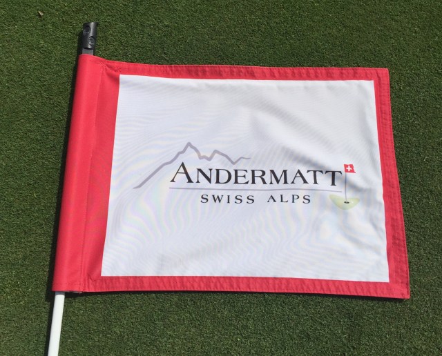
Fortrose was named after Fortrose in Black Isle, the Scottish Highlands. The Toetoes estuary contains approximately 400 hectares of expansive tidal flats, 13km of the lower Mataura River and 4km of the Titiroa Stream. The estuary, dune system and Fortrose Headland are an example of headland beaches created by sustained periods of river and sea interaction. The estuary is used for whitebaiting, trout fishing and floundering.

The Mataura River is promoted as the best brown trout fishery in New Zealand. Three main fin fish found in the estuary are trout, salmon and flounder. Gamebird hunting (ducks and Canadian Geese) takes place within the estuary but it is mainly confined to shooting from shore with a few maimai erected on the tidal flats.

Bluff is the southernmost town in mainland New Zealand and although Slope Point and Stewart Island are further south it is colloquially used to refer to the southern extremity of the country (particularly in the phrase ‘from Cape Reinga to Bluff’.

James Spencer is credited as Bluff’s first European settler. In 1824 he purchased land from Tuhawaiki (Bloody Jack), built a house and established a fishing station which employed 21 people. This was the beginning of Bluff, which today has the longest history of any New Zealand town. The current population of Bluff is about 1,800.

The port at Bluff is comparably smaller to their other ports in NZ but still moves about 2.2 million tonnes of cargo each year. The Taiwan Point aluminium smelter and fossil fuel exploration activity in the Great South Basis may ensure the future relevance of the port.

There is a twice daily ferry service to Stewart Island some 60 kilometres across Foveaux Strait. It is the main gateway for ships heading to Antarctica. The harbour is home to the Foveaux Strait oyster fleet. Bluff oysters are renowned for their succulence and flavour, and are considered a delicacy nationwide, with Bluff holding an annual oyster festival.

Invercargill is the southernmost and westernmost city in New Zealand and one of the most southernmost cities in the world. Many streets in the city, especially in the centre are named after rivers in Great Britain, mainly Scotland. These include Dee and Tay as well as Tweed, Forth, Tyne, Esk, Don, Ness, yarrow, Spey and Eye rivers. The population is about 52,000 people.

After visiting one of New Zealand’s most stunning landscapes this information on a board on Bluff Hill resonated with me and hopefully with everyone as we move forward in an ecological and sustainable manner.

After 80 million years of isolation, New Zealand is slowly becoming like everywhere else. Today’s landscape has been shaped by generations of hard working immigrants. Forests have given way to towns, industries and farmland. Human achievement has a price. Natural habitats that were home to some of the world’s most unusual and vulnerable plant and animal communities have gone forever.

In 700 years, New Zealand has lost 32% of its native land birds, and over 500 of its special plants and animals are threatened with extinction.

Southland (including Fiordland) claims the greatest share of those threatened species simply because, for many, southern forests, wetlands, mountains, sand dunes and offshore islands are their last refuge.

New Zealanders are awakening to the value of their unique natural heritage; the contribution its beauty and difference makes to tourism, scientific understanding ….. and above all to human well being.

“Man did not weave the web of life; he is merely a strand in it. Whatever he does to the web he does to himself.” Chief Seattle

Posted in Catlins, New Zealand | Tagged , | Leave a comment

Sail Croatia – Split to Dubrovnik – Croatia

After spending a few days in the capital of Croatia we then started our journey south to explore the Dalmatian coast from Split to Dubrovnik. We spent three nights in Split before getting on a Sail Croatia cruise that navigated some of the beautiful Croatian islands. We then spent three nights in the old town of Dubrovnik which was very enjoyable.

Croatia as a whole exceeded our expectations – in general the people were friendly, the food was good – we had some exceptional meals and the towns / villages were gorgeous. The ocean was next level – I have never been swimming in such crystal clear waters.

All in all we were in Croatia for 16 nights which really gave us a chance to get to know the country. The history of the country and the region is fascinating and I was especially moved by the recent history that saw Croatia fighting for independence. I finished reading “Goodbye Sarajevo” part way through our Sail Croatia trip. This is an amazing story and I felt very endeared to some of the local people that I talked to about what it was like for them and their families. Spoiler alert – there is a NZ connection in the book which made the story all the more special.

We booked the Sail Croatia trip on friends recommendations rather than doing a lot of research ourselves. The trip was great but just a few things to note if you are considering booking one yourselves. We found the days were very structured and probably for good reason – breakfast time was usually between 8am and 9am, there would be a swim stop sometime between 10am and 12pm, lunch was usually at 12.30pm and we would dock between 2pm and 4pm. If you had organised an excursion on the island you were docking on you would not usually have a great deal of time to explore the old towns which were all amazing.

The docking times were dictated by the Port Authorities in each Port so there was no ability to go ashore any earlier. Quite often we were moored up just outside the port for a couple of hours and although it was nice just lazing around on the boat it would have been nice to have the option to go ashore earlier and explore.

There was nothing wrong with the food on board but the three course lunch which sometimes included a soup starter wasn’t really appropriate for the beautiful Mediterranean conditions we were enjoying – a buffet lunch with nice breads, cold meats, cheeses and fruit would have been so much more enjoyable. I know this is a first world problem but just something to note if you are considering booking a Sail Croatia trip.

The boat was owned by the Captain who provided the crew including the chef and bar staff. Sail Croatia then have a representative / tour guide on board. We felt at times there was a bit of a disconnect between the two parties and our lovely tour guide, Ana, had to work very hard to keep us happy and informed on a timely basis. The captain and the crew didn’t really engage with us – I had read somewhere that the Croatians casual nature can be misconstrued as rude when that is not their intention.

There were 36 guests on the boat – 5 Brits, 29 Aussies and 2 Kiwis (us). There were a few groups of friends travelling together but everyone got on well and we enjoyed everyone’s company. We were travelling with our friends from London, Denise and Gary, which was fantastic – it was great to be able to spend so much time together given we live at opposite ends of the earth.

There appear to be a lot of options re getting around the Croatian Islands and if you wanted a bit more flexibility you might want to consider chartering a smaller boat with a group of friends with a skipper or you could of course sail yourselves 😮.

Split

We spent three nights in Split and had two full days to explore. We stayed about 15 minutes walk above the old town so it was a good workout going backwards and forwards to the old town. We felt toured out so we spent the two days exploring Split at our own pace. The old town started off as the palace built by the Roman Emperor Diocletian and slowly grew into a town over the centuries that followed. It is an incredible place which so many alleyways and steps connecting it all up. We went round in circles a few times trying to find something we had seen previously. Just out from the old town walls is the Port which is a very lively place with bars, restaurants, boats, ferries and lots of people.

We found some lovely little eating places and I was impressed with the variety and healthy eating options. Some places worth a visit included:

4 Coffee Soul Food – a little hole in the wall that did great coffee

D16 Coffee – a quaint little cafe that again did fantastic coffee, cookies and chia seed puddings (might not appeal to all but this is my idea of heaven)

Portofino – we didn’t manage to get in here as it was fully booked but it looked great

Kitchen 5 – they had a small menu but what they did was delicious. Steve had the Veal Confit and went into a trance like state saying he didn’t want the meal to end. I had the purple risotto and I too was in heaven.

Muma & Pjaceta – they had some great healthy options including smoothies and Buddha bowls. They were open for breakfast, lunch and dinner and had a very relaxed vibe.

Daddy Cool – a vegetarian place that used falafels as the main ingredient in their offerings

The parking in the streets above the old town where we stayed was non existent so they park up on the footpaths which means you have to walk on the roads. The streets are narrow too so there is a lot of manoeuvring if you meet a car coming the other way 😳.

The history of Split…..

The history of Split is over-flowingly rich and turbulent to fit in just a couple of sentences. Although the Split area was earlier inhabited by the Greek colonies, Emperor Diocletian should be considered its first citizen and founder, starting his lavish villa of around 300 square meters near the great city of Salona in 293 AD, only to retire from the Roman throne within its walls after building it for ten years.

Turbulent centuries that followed turned the villa into a city, conceived by the fugitive inhabitants of Salona who fled from the Avars and Slavs. Many authorities changed hands in the city which, in the years to come, grew beyond the Palace walls, from the Croatian Kings in the 10th century, through the Hungarian and Venetian administration, to the French rulers and the Austro-Hungarian monarchy. Modern age and the 20th century “moved” Split from the kingdom of Yugoslavia, through tragic, yet heroic times of the Italian and German occupation during the Second World War when Split was one of the centres of anti-fascist resistance, to the Socialist Yugoslavia and the present period of the free and independent Croatia, member of the European Union.

Diocletian Palace and the entire historical core of Split have been on the World Heritage UNESCO list ever since 1979, and not only for the extraordinary preservation of the Palace, but also because the Palace and its city (or the city and its Palace, if you like) continue to live a full life.

Diocletian Palace is one of the best preserved monuments of the Roman architecture in the world. The Emperor’s Palace was built as a combination of a luxury villa – summer house and a Roman military camp (castrum), divided into four parts with two main streets. Southern part of the Palace was, in this scheme, intended for the Emperor’s apartment and appropriate governmental and religious ceremonies, while the north part was for the Imperial guard – the military, servants, storage etc. The Palace is a rectangular building (approximately 215 x 180 meters) with four large towers at the corners, doors on each of the four sides and four small towers on the walls. The lower part of the walls has no openings, while the upper floor is open with a monumental porch on the south and halls with grand arch windows on the other three sides. Over the centuries the Palace inhabitants, and later also the citizens of Split adapted parts of the palace for their own requirements, thus the inside buildings as well as the exterior walls with the towers significantly changed the original appearance, but the outlines of the Imperial Palace are still very visible.

All historical layers from the old Rome, middle ages till today are still visible and alive in this structure. A walk through the ancient city takes you through time, along the great examples of ancient architecture like Peristyle, the middle aged Romanesque Church and Gothic Palace, Renaissance portals of the noblemen’s houses, Baroque facades and modern architecture superbly merged in the rich heritage.

Such stratification is mirrored in everyday life of Split. Local inhabitants sit in the same cafes, restaurants, shop in the same stores as tourists, giving them the impression that, by arriving to Split, they became a part of the city and its rhythm. The vegetable market and the fish market represent the centre of each family’s life in Split, just as the entire social life of this city of 200,000 reflects on the Riva (waterfront), where every guest should endeavour to have his coffee alongside noisy, temperamental folk of Split.

Split is much more than glorious architectural scenery. Split is also a venue for excellent gourmet and vine experiences, numerous cultural happenings like film and theatre festivals, exhibitions, excellent museums and concerts, a city which offers eclectic modes of entertainment starting with numerous clubs and bars, through street festivals to events such as Ultra Europe Festival visited each year by up to 100,000 young people from around one hundred countries of the world. Split with its sport results is something only a handful of cities of similar size around the world can boast about as it is the home of a dozen Olympic medal winners as well as other sports medals.

When you tire of the city bustle, there’s Marjan, hill symbol over the city, with its forest, jogging trails, mountain climbing and biking, recreational terrains, but also the ancient churches where the late citizens of Split sought spiritual peace. Also very unusual to find in a city the size of Split are the numerous beaches with extraordinarily clean sea, from the well known Bačvice to the stone secluded oases’ all around Marjan.

After all that’s said are you at all surprised that citizens of Split have a saying “There is no place like Split”?

Just outside the Palace walls is a statue of Gregory of Nin who was a medieval Croatian bishop who strongly opposed the Pope and official circles of the Church and introduced the national language in the religious services after the Great Assembly in 926, according to traditional Croatian historiography. Until that time, services were held only in Latin (being under the jurisdiction of Roman influence before the Great Schism), not being understandable to a majority of the population. Not only was this important for Croatian language and culture, but it also made Christianity stronger within the Croatian kingdom.

The statue was erected in September 1929 in the Peristyle of Diocletian’s Palace and can be seen in postcards of the pre-World War II period. In 1941, the statue was moved outside the city by Italian occupying forces. In 1954, it was re-erected in a different location, to the north of the Palace and Old Town of Split, just outside the Golden Gate, where it currently sits. A major restoration of the monument took place between 2013 and 2015.

The 8.5-metre (28 ft) tall statue is a heavily trafficked tourist site in the town – rubbing the statue’s toe is said to bring good luck. The toe has been worn smooth and shiny as a result.

img_2743

On Saturday the 1st of September we boarded Aurora, the boat that would be our home for the next seven nights. We had our golf clubs in tow still and I was a bit concerned that we would have to sleep with them if there wasn’t much space in our cabin. I was pleasantly surprised at how spacious the cabin was – the golf clubs fitted nicely under the bed.

Markarska

We set sail for Makarska which is a port on the mainland – we had never heard of this place but it turned out to be quite a vibrant port. We didn’t dock until about 7pm so it was a quick change and out for dinner at Bounty Steakhouse.

The city of Makarska grew around a natural harbor protected by a picturesque peninsula of Sveti Petar (St. Peter) and the cape Osejava. In the past it provided protection and safe harbor during stormy weather to sailors, pirates and merchants, and nowadays it does the same for yachts, sailing boats and tourist ships. This contributed to its development into a trading port, especially during the Ottoman and Venetian occupation. Today, there is a ferry line which runs a few times a day from Makarska to Sumartin on the island Brač. Makarska has a population of 15,000 and is one of the most famous tourist destinations on the Croatian coast, attractive for its nature and good climate, rich in tourist attractions and full of hospitable hosts.

Hvar

On Sunday we headed for the island of Hvar which is the fourth most populated of the Croatian Islands. There are about 1,246 islands but only about 45 are inhabited. We were going to have two nights on Hvar – one in Stari Grad and one in Hvar town itself. Stari Grad was a sleepy little village (it was Sunday so that also added to the sleepy feel) but one of my favorite on the trip. We had a wander around and discovered these lovely little alleys and squares.

We had a wine tasting organised at one of the local, family owned and operated vineyards called Hora. All but one of the people on our boat took up the wine tasting option and it was a great way to break the ice and get to know our fellow passengers and tour guide, Ana, a little better.

The guy doing the tasting was quite informative and we tasted two white wines, a rose and a red. I enjoyed the first of the whites and the red the best. They also provided the most delicious bread and home grown and pressed olive oils. We also sampled some local cheese and salami 👌🏼.

Everyone had a great time and really enjoyed the wines so Steve negotiated an additional two hours there (there is always that one person 😂) which Ana and the rest of the group were happy with. We purchased some bottles of wine, continued enjoying the ambience of the location and had a wander around the property. They also grew lavender and made various lavender products.

After getting back to the port we went and had dinner at the Fig Restaurant – I had looked at the restaurant online and it sounded lovely. They didn’t take reservations so there was a chance we may have to wait for a table. Gary said he would charm his way in 😉 but there was no need – we got a table straight away. The food was amazing. We had Flatbreads to start and they had the most delicious topping combinations – I’m drooling writing about them – take me back right now ☺️. The restaurant is tucked back from the water in one of the squares. Mark & Ange from Melbourne joined us for dinner and it turned out the owner of the restaurant, Rob, was from Melbourne although he had been born in Croatia and had only recently moved back. What a lovely guy – we enjoyed chatting to him very much and he gave us some good onward recommendations.

When we returned to the waterfront it was quite lively with people in the bars. A storm was brewing and we had the most spectacular lightening display. We decided to head back to the boat before the skies opened up – we got about two thirds of the way back before the rain came down. It was quite an amusing sight watching the people in front of us start to run in waves as the rain swept the promenade. We took cover until it eased off and managed not to get too wet getting back to the boat.

img_2974Lightening at 11pm illuminating the harbour

The next morning we headed for Hvar which is on the other side of the island. We had to get a water taxi into the port about 4pm as they don’t allow the boats to dock until 9pm at night. Ana took us for a walk to the citadel which was first built in the 6th century to see the views over the port which were fantastic.

Gary had been stung by a wasp the day before and his arm had become quite red and swollen so he took a trip to the Doctors. A jab in the bum and some antibiotics and he was on the mend. The wasps proved to be quite a problem in a lot of the ports and in talking to one of the locals this was not a normal occurrence – the wasps had just started making a nuisance of themselves this summer – good timing guys 😬.

img_3257

We had booked dinner at Dalmintinos which sounded good on TripAdvisor and came highly recommended by Rob from the Fig Restaurant. I couldn’t book a table but was able to go on the wait list. We bumped into Lee and Colin from NZ again and had a drink with them before dinner. We enjoyed our meal and the service was fantastic. We then had a wander around Hvar which was a very happening place. It has become the new Ibiza for the young Brits and they were everywhere heading to the nightclubs. We had a demure night cap before calling it a night about midnight.

Hvar is approximately 68 km (42.25 mi) long, with a high east-west ridge of Mesozoic limestone and dolomite, the island of Hvar is unusual in the area for having a large fertile coastal plain, and fresh water springs. Its hillsides are covered in pine forests, with vineyards, olive groves, fruit orchards and lavender fields in the agricultural areas. The climate is characterized by mild winters, and warm summers with many hours of sunshine. The island has about 11,000 residents.

Hvar’s location at the center of the Adriatic sailing routes has long made this island an important base for commanding trade up and down the Adriatic, across to Italy and throughout the wider Mediterranean. It has been inhabited since pre-historic times, originally by a Neolithic people whose distinctive pottery gave rise to the term Hvar culture, and later by the Illyrians. The ancient Greeks founded the colony of Pharos in 384 BC on the site of today’s Stari Grad, making it one of the oldest towns in Europe. They were also responsible for setting out the agricultural field divisions of the Stari Grad Plain, now a UNESCO World Heritage Site. In medieval times, Hvar (city) rose to importance within the Venetian Empire as a major naval base. Prosperity brought culture and the arts, with one of the first public theatres in Europe, nobles’ palaces and many fine communal buildings.

The 16th century was an unsettled time, with the Hvar Rebellion, coastal raids by pirates and the Ottoman army from the mainland, resulting in some unusual fortified buildings on the northern shore to protect the local population. After a brief time under Napoleonic rule, the island became part of the Austrian Empire, a more peaceful and prosperous time. On the coast, harbours were expanded, quays built, fishing and boat building businesses grew. At the same time, the island’s wine exports increased, along with lavender and rosemary production for the French perfume industry. However, this prosperity did not continue into the 20th century as wooden sailing boats went out of fashion, and the phylloxera blight hit wine production. Many islanders left to make a new life elsewhere.

One industry, tourism, has however continued to grow and is now a significant contributor to the island’s economy. The formation of The Hygienic Association of Hvar in 1868 for the assistance of visitors to the island has been instrumental in developing an infrastructure of hotels, apartments, restaurants, marinas, museums, galleries and cafes. Today, the island of Hvar is a popular destination, consistently listed in the top 10 islands by Conde Nast Traveler magazine.

Vis

The next day we sailed to the island of Vis. We anchored just out of the port about 11am and enjoyed a swim – the conditions were idyllic. I just can’t get over how turquoise and clear the water is. After lunch we docked and had a couple of hours to explore before our tour of the island.

Vis is the farthest inhabited island off the Croatian mainland with a population of 3,617 in 2011. The island’s two largest settlements are the town of Vis on the island’s eastern side (the settlement for which the island was originally named) and Komiža on its western coast.

Once known for its thriving fishing industry in the late 19th and early 20th century, the main present-day industries on the island are agriculture and tourism. Vis town and Komiža are also seats of separate administrative municipalities which cover the entire island and nearby islets, which are both part of Split-Dalmatia County. In 2017 Mamma Mia! Here We Go Again was filmed on location on Vis.

We had chosen to do the military tour of the island. We were met by our guides Goran and Slavin in a couple of old land rovers which are not known for their spacious interior but it was fun all the same. Goran and Slavin had some military experience and apparently Goran had been a well known journalist in Zagreb. Ana spoke very highly of him and said she was inspired by what he was doing in Vis and his passion for the island. This passion certainly came through during the tour – both Goran and Slavin also had a good sense of humour.

img_3107

Vis was isolated from the outside world from 1940 until 1991 when Croatia became independent. It was used as a military base with 20 kilometres of underground tunnels, mines, caves and storage facilities. Vis was intensively fortified from the early 19th century, first by UK, then by Austro-Hungarian Empire, Greeks, Romans, Venetians and everybody else who controlled the island.

During World War II, Vis was at one point the main hideout of Josip Broz Tito, the leader of the Yugoslav partizans. Realizing the strategic importance of the island and the usefulness of its many caves and coves from his years there fighting the Germans, Tito kept a tight grip on Vis, making it one of the main naval bases of the Yugoslav People’s Army. This effectively turned the entire island into a closed military zone, out of bounds for both Yugoslav civilians from the mainland, and foreigners. Many areas were prohibited even to the island’s residents. Preparing for war with Vis as the front-line, the Yugoslav navy burrowed and excavated for decades, turning the island into a maze of caves, underground tunnels, bunkers and submarine hideouts.

For 50 years, the island followed a policy of isolation and was inaccessible to tourists. When the Yugoslav army left the island in 1992 Vis was left as a ghost town of former army barracks which serve as a haunting reminder in the minds of Vis residents. Stranded in this remote outpost among a population that resented their presence, the Yugoslav Navy left peacefully almost overnight, leaving behind empty barracks, caves and tunnels they had tended for almost half a century.

The labyrinth of tunnels and even a submarine cave were actually built in the 1950’s which was after World War II and were never used in an actual battle. They were only ever used for training exercises. Tito was paranoid and ruled by putting fear into the people that no one was to be trusted and they must always be prepared to protect themselves.

Our first stop was on Vis was Fort George (named after King George III) where Goran explained the history of the region and the island using some great stories and analogies. He spent a bit of time talking about Yugoslavia and the subsequent war of independence. I must say I have been quite captivated by these recent events in history and I managed to find a simplified version which attempts to explain the reasoning behind it. For anyone else that is interested here is the link https://www.ricksteves.com/watch-read-listen/read/understanding-yugoslavia

Fort George was built by the British when the Austrian Imperial authority in the region was ceded to the French as a part of a humiliating peace settlement dictated by Napoleon. Fearing Napoleon would turn the Adriatic into a French lake, with free rein to launch warships from the Venetian Arsenal and expand his empire further into Europe, the Royal Navy was sent to the Adriatic with a regiment of foot and detachment of artillery to prevent Napoleon’s ambitions coming to fruition.

The British had used the island of Vis for its fresh water and safe anchorage for a number of years prior to committing defences to the island. In 1811 the French successfully raided the bay of Vis inflicting damage to the town and destroying numerous merchant vessels. It was hence decided that the bay of Vis needed protection from further such attacks. Initial defences were built on Host Island in the middle of the harbour, consisting of two 18 pound guns in a stone fortification.

In 1812 Fort George was begun after the British Governor, Colonel Robertson, decided that the harbour needed greater protection. The defences were completed by late 1813 and two years later were handed to the Austrians, who had begun reclaiming control of their Adriatic territories following decline and eventual fall of Napoleonic forces in the region.

Goran then told us about the Battle of Lissa (sometimes called Battle of Vis) that took place on 20 July 1866 in the Adriatic Sea near the Dalmatian island of Lissa (“Vis” in Croatian) and was a decisive victory for an outnumbered Austrian Empire force over a numerically superior Italian force. It was the first major sea battle between ironclads and one of the last to involve deliberate ramming.

The Italian navy fired roughly 1450 shots during the engagement, but failed to sink any Austrian ship while losing two ironclads. One of the main reasons for this poor performance was internal rivalry between the Italian fleet commanders: for example, Italian Vice Admiral Albini, with his ships, did not engage the enemy during the battle. The engagement was made up of several small battles: the main battle was between seven Austrian and four Italian ironclads and showed the ability of Austrian commander Tegetthoff to divide his more numerous opponents and then destroy the isolated ironclads.

There are many shipwrecks around the island of Vis making it a great place to dive.

When we entered Fort George Goran pointed out a caper plant growing from the walls. Vis has a large number of herbs growing in the wild which Slavin pointed out on our jaunt around Vis – wild garlic, lavender, thyme.

img_3071

We then went to visit the tunnels and submarine cave. Slavin explained that after the submarine cave was built they discovered the water wasn’t deep enough to submerge the submarines in anyway so they had to submerge in the open – this wasn’t going to be particularly useful if the enemy were spying on them. They had made these big camouflage nets that hung from the entrance though so if an enemy plane happened to fly over they wouldn’t know the cave was there. In theory the creation of these tunnels and the cave were very clever – it was just a shame that they cost a lot of money and were really built out of one man’s paranoia.

Our next stop was the memorial to the British RAF pilots who had used the island of Vis as a refuelling stop in World War II. There is an airstrip on the island located very strategically in a valley. The runway was not very long though and tailed off to the right at the end. There were a lot of casualties here. There are apparently about 30 planes located off the coast of the island which are amazing dive spots.

The most recent discovery occurred in March 2010 when the remains of a heavy B24 bomber also known as the Liberator were discovered in the sea close to the southern part of the island. The plane was found in the open sea, around 500 metres from the islets close to the southern part of Vis, on an underwater cliff, at a depth of just 39 metres.

There is also an intact B17 lying on the sand as if it had just landed, and it seems as if it was still standing on its wheels! Divers have reported that it is resting on the sand, while the port wingtip is several meters above the sandy bottom. The wreck lies in 72m deep and only about 100-150m from the shore of Vis island.

The runway on the island was abandoned a couple of years ago but they are trying to resurrect it. Meanwhile the sheep are having a field day.

Not far from the runway is a cricket wicket which came about due to the discovery of a letter one of the British Captain’s wrote to his mother in 1809.

“We have established a cricket club at this wretched place, and when we do get anchored for a few hours, it passes away an hour very well.”

Captain William Hoste was a former shipboy of Lord Nelson himself, a distinguished naval commander who was on his way to a knighthood and was rather more used to sinking Napoleon’s warships than guarding a small island in the Mediterranean (around 200 ships were captured or resting at the bottom of the sea on his account). His six-year posting on Vis was not entirely to his liking – after all, it was hot, isolated and Englishmen of his time were never terribly comfortable away from home; it was 1809, and air-conditioning, ice-cream, the aqualung and sun-lotion were all discoveries that lay many years into the future. Instead, they turned to that most English of pastimes – cricket!

There’s some doubt as to whether the Captain ever actually played the game – he appears to have been a specialist fielder much like other more recent English recruits to the club – but he gave it his blessing and over the years the island became used to the sound of leather on willow. Captain Hoste would later distinguish himself further during the 1811 “Battle of Issa”, overcoming significantly larger French forces.

When the British departed, the cricket club was disbanded and ought to have become little more than an interesting footnote in the island’s history – but the story wasn’t quite over yet…

The rebirth actually started with Nik Roki. Nik was born on Vis but emigrated to Melbourne in the 50s when he was just fifteen years old. It was a time when Australia was in need of foreign workers and actively encouraged immigration (how times change!) – Nik was one of thousands who made the journey and settled quickly into their new way of life. This, of course, soon included a fascination with the game of cricket, a sport that Nik initially found extremely confusing. After spending several years in Australia, in the process moving across the country to Perth, Nik had seen enough of the game to become a complete convert – and like any good “Australian” passed on his enthusiasm to his son, Oliver. It was with some surprise, then, that twenty years after returning to Vis to set up his wine-making business with his wife Valerie they discovered that the island had a secret cricket history of its own.

“In 2002 I found a letter in Tom Pocock’s book, Remember Nelson, where he talked about the club,” says Oliver Roki “I thought it would be a great idea for tourism if we started up the club again, so we did. After all, I started up a restaurant without knowing how to cook – why not start up a cricket club even if you don’t know how to play?” (both Oliver’s cooking and medium pacers have improved hugely since).

Did they have a pitch? No. Did they have numbers enough for a decent game? Not really – all they really had was some very basic plastic training equipment but this was enough to improvise their way around the game, playing wherever and whenever the occasion allowed. With a keen eye for publicity, Oliver had already managed to get the revived club into the local press – they even managed to get a professional cricket coach to come over and give them a few pointers. The Sir William Hoste Cricket Club was on its way. The island’s helipad became the club’s unofficial pitch (“great if there are any injuries during the game!”), and after the St Radegund pub in Cambridge had donated some proper kit for them to use, they were ready (almost) for their first match.

These days the Vis cricket club has around thirty adult members and almost as many in the junior ranks, the only cricket club in Croatia to have a dedicated youth set-up. They are also the only club side with a policy of selecting home-grown players, mostly out of necessity; the majority of Croatian-Australian “retournees” settle in either Zagreb or Split for professional reasons and join the clubs there. This leaves Vis to pick their side from islanders and the occasional lost Englishman. Given their disappointing showing in annual Hrvatski Kriket Kup competition (only once have they not finished bottom) they could probably do with a few more Australians…

We drove up towards the highest point on the island but stopped just below it to watch the sun set over Komiza. The highest point actually has the only remaining active military base on it. When the island was an isolated military base there were about 5000 soliders on it – today there are 5.

We were up at about 1800 feet and it was actually pretty chilly so it was a quick sunset photo before we headed down to the settlement of Komiza which is the fishing village on the western side of the island. Unfortunately we didn’t have a lot of time there as we had a dinner reservation at 8.30pm.

A quick trip back to the town of Vis, a quick change and our ride arrived to take us to Rokis which is the restaurant owned by Oliver mentioned above.

Roki’s is a family-run restaurant which was established in 1991, continuing a 200-year-old family tradition in wine production. They first began producing and selling their own wines, before setting up a tavern to accompany the wines.

Rokis specialise in ‘peka’ which is one of the most popular meals in Croatia’s Dalmatia region. ‘Peka’ is a blend of vegetables and meat drizzled with olive oil, sprinkled with herbs, and then baked to perfection under a bell-like dome, or “ispod čripnje.”

A “peka” is a large metal baking dish with a bell-shaped dome lid, used to cook food in an open fireplace, with hot coals and embers placed on top of the dome for even, slow cooking. Think of it as a primitive slow-cooker! Meat, poultry, fish and vegetables can all be cooked in this way, and the finished dish is also referred to by the same name: peka!

It is the sort of restaurant you can’t just decide to go to on the night – you have to book and order your ‘peka’ in advance due to the slow cooking process. We had booked the table on the Sunday and then on the Tuesday I had to call before 12pm to let them know what meat we wanted. They do lamb, veal, octopus and fish. We went with a mixed meat ‘peka’ – lamb and veal. The meat was so tender and the accompanying potatoes were heavenly. We also had a few bottles of their red wine which was also very nice. The setting was lovely and the service really good. Our meal at Rokis was definitely a highlight of the trip.

Korcula

On Wednesday we headed for Korcula. Steve and I had been there in 2014 when we were on a cruise – I remembered it had a lovely old town and beautiful waterfront. The boat was not going to be docking until about 3.30pm so we organised a water taxi to come and collect us off the boat a bit earlier. We had decided not to do any excursions on Korcula – we just wanted to explore the old town at leisure.

Korcula had 15,522 inhabitants in 2011 which makes it the second most populous Adriatic island after Krk and the most populous Croatian island not connected to the mainland by a bridge. The population are almost entirely ethnic Croats (95.74%).

During the First World War, the island (among other territorial gains) was promised to the Kingdom of Italy in the 1915 Treaty of London in return for Italy joining the war on the side of Great Britain and France. However, after the war, Korčula became a part (with the rest of Dalmatia) of the State of Slovenes, Croats and Serbs in 1918. It was ruled by Italy from 1918 to 1921, after which it was incorporated into the Kingdom of Serbs, Croats and Slovenes, known from 1929 on as the Kingdom of Yugoslavia. In 1939, it became a part of the autonomous Croatian Banate.

After the Axis occupation of Yugoslavia in April 1941, Italy annexed the island. After the Armistice between Italy and the Allied powers in September 1943, it was briefly held by the Yugoslav Partisans who enjoyed considerable support in the region. Korčula was then occupied by German forces which controlled the island until their withdrawal in September 1944. With the liberation of Yugoslavia in 1945, the Federal People’s Republic of Yugoslavia was formed, and Korčula became a part of the People’s Republic of Croatia, one of the six Yugoslav Republics. The state changed the name to Socialist Federal Republic of Yugoslavia in 1953, and so did the Republic into Socialist Republic of Croatia. After 1991, the island became a part of the independent Republic of Croatia.

The old city is surrounded by walls, and the streets are arranged in a herringbone pattern allowing free circulation of air but protecting against strong winds. Korčula is tightly built on a promontory that guards the narrow sound between the island and the mainland. Building outside the walls was forbidden until the 18th century, and the wooden drawbridge was only replaced in 1863. All of Korčula’s narrow streets are stepped with the notable exception of the street running alongside the southeastern wall. The street is called the Street of Thoughts as one did not have to worry about the steps. They say that Korcula is a mini Dubrovnik due to its positioning and layout.

We enjoyed a lovely meal at Fillipi which is on the promenade of the city wall overlooking the ocean. Denise had booked us a table whilst wandering around and was told they didn’t have any waterfront ones left. When we arrived at 7.30pm we were seated waterfront – it was gorgeous and probably the best setting in which we had dinner on the trip. The service was impeccable – our waiter Boris was so professional, helpful and pleasant. He recommended a lovely local white wine called Bire GRK – they only make small quantities of this and it is only sold on the island. After dinner we went to one of the little wine shops and bought a bottle to enjoy at sometime later on our trip.

Mljet

I was very excited about our destination on Thursday – Mljet. The Mljet National Park is the oldest marine protected area in the Mediterranean and it has delighted its numerous visitors for 56 years with the colours and the scent of untouched nature.

The Park was founded on 11 November 1960, and the renowned researcher and academician Branimir Gušić was a great contributor to its protection status.

The Mljet National Park stretches over almost 5400 hectares, including a marine area of 500 meters from the coast, islands and cliffs, and therefore spans over almost a third of the island. Two deep bays filled with seawater, known as Malo Jezero and Veliko Jezero (Small Lake and Great Lake) are the most famous locations of this area and an important geological and oceanographical phenomenon.

The entire surface area of the park is extremely rich with life, and numerous endemic and endangered species are a testament of the importance of protecting it.

We hired some bikes to bike around the lakes and out to where the sea feeds into the lakes – the lakes are salt water lakes. It was absolutely stunning and although the bike left a bit to be desired it was still great to be back on a bike at one with nature. Again the colours of the water are incredible and you can swim anywhere you like on the island apart from where the boats come and go from.

Ana had told us about a swimming spot under the bridge where the current takes you as you float on your back. Of course I was up for that and it didn’t disappoint.

img_3220

Back on the bikes a bit further around the Great Lake we went where we caught a little boat across to the Isle of Saint Mary.

There is a Benedictine monastery with the Church of Saint Mary on the Isle of Saint Mary situated in the southern part of the Great Lake. The area of the isle is 1.2 acres (0.5 hectares). The monastery was being built from 1177 to 1198.

Initially, the Benedictines built the monastery and later on the church. During centuries, the church changed its appearance under the influence of different styles, the Renaissance and Baroque, but the central part remained Romanesque. The Church of Saint Mary as part of the monastery compound is a single nave Romanesque (Apulian) construction, built after the original Benedictine’s building in Monte Gargano. The church was partitioned and extended in the 16th century when the coat of arms of Gundulić family was installed on the porch. On several occasions, alterations were made in the Romanesque monastery. At present time, the building is a two-floor Renaissance building enclosed with courtyards on two sides and having arcaded main tract facing the courtyards. A defensive tower was built in the south-eastern corner therefore all the buildings, including the church, became defensive structures. The monastery was also reconstructed during the Renaissance, thus creating a uniform complex with the church.

The history of the monastery extends as far as 1198 when the Pope Innocent III issued a document consecrating the Church of Saint Mary on the isle of the same name in the Great Lake on the island of Mljet. The Benedictines organised the monastery in accordance with the Rule of Saint Benedict. For a long time, the Benedictines were taking good care of the island and lived in harmony with nature praising God. Many significant names, like Mavro Vetranović and Ignjat Đurđević, could be found among the Benedictines of the monastery. In 1345, the Benedictines renounced their rule over a part of the island therefore Mljet obtained a Statute and municipality in Babino Polje.

Formally, it was annexed by the Republic of Ragusa (the original name for Dubrovnik) in 1410. The monastery continued with its activities until 1809, when it was closed during the rule of Napoleon. From that time on, the island had a number of different owners; the monastery property was governed by the state, and the monastery became more and more neglected. In 1960, the monastery was converted into a hotel and was opened until 1991. In 1998, the dilapidated monastery was given back to the Diocese of Dubrovnik. Renovation and redecoration works are currently ongoing.

We went into have a look at the cloister and it had a very peaceful and tranquil feel about it and you could just imagine the monks going about their business in there. The church was also really nice.

We headed back to the port and had a drink at one of the bars with a few of our fellow passengers. We had a captains dinner that night on the boat and none of us were really looking forward to it given the lunches we were being served. Ana had told us that the starter was Octopus salad and the main Sea Bass – not being a lover of fish this was not going to end well. I had asked for an alternative and Ana hoped they could accomodate me.

We all got tidied up and were pleasantly surprised – we were served platers of nice cheese and cold meats, seafood risotto and octopus salad. At least there was something I could eat. I was served pork for my main so was pretty happy about that. The fish lovers at the table said the Sea Bass was actually really nice. Desert was a lovely panacotta so all in all it exceeded our expectations.

After dinner a couple of the crew cranked up the music and started dancing. A few people got up but the music was a bit naff to start with. It had its moments but it is always hard to satisfy a range of music tastes. Someone from the Port Authority came onboard about 11pm and shut the music down – we had to move inside! Some people drifted off to bed but going inside seemed to spur some people on and they partied on until 2am – guess who was also there until the end 💁‍♂️🙄.

Everyone was a bit slow on Friday morning as we headed for the final port of Dubrovnik. We anchored up near one of the Eliphati islands called Kolocep and had a swim stop. I decided to go and sit on the rocks on the shoreline and stood on a sea urchin 😬. I pulled out the three spikes but unfortunately a couple broke off so I had to round up some sharp utensils to perform surgery. A few of the Aussies on board who have experienced sea urchins first hand told me to keep an eye that they didn’t become infected – so far so good!

We docked about 4.30pm in the new port area of Dubrovnik which is about 15 minutes by bus into the old town. We managed to purchase some tickets for the local bus and went to check the place out. There was one cruise ship in and the place was so busy. We were going to be here for three nights after getting off the boat so we just had some dinner and headed back to the boat for the night. We said goodbye to Ana that night – she had to catch the overnight bus back to Split to start another cruise the next morning.

The bus ride back to Split would be straight forward if not for a six mile stretch where you actually cross into Bosnia-Herzegovina.

During the Communist period, Marshal Tito decided to award the republic of Bosnia-Herzegovina a symbolic outlet to the sea at Neum, even though the road goes through Croatia. Nobody foresaw then that lines drawn on a map for administrative convenience would congeal into an international border. As things ended up, the Balkans became more balkanized, just as western Europe became more united. The border crossings at Neum mean that it is impossible to drive to Dubrovnik to Split without passing through Bosnia-Herzegovina. Anxious to create a single stretch of contiguous territory, Croatia has begun work on a $300 million bridge to the Peljesac peninsular that would link the two cities , bypassing Neum.   There is little economic justification for the expensive bridge, and many environmental arguments against, but this is a part of the world where common sense does not always apply.

Ana had been a great guide – nothing was ever a problem and she did her best to accomodate everyone’s requests. She had a great knowledge of the history of her country but also shared some of her frustrations with the Croatian Government. The economy has struggled to recover from the war of independence and there is a level of corruption in the higher echelons. The wheels turn slowly which is frustrating for people wanting to improve their situation. The unemployment rate in Croatia averaged 17.57% from 1996 until 2018, reaching an all time high of 23.60% in January of 2002 and a record low of 8.60% in July of 2018.  The tourist season runs from about April to November so people working in this industry normally have to find alternative employment in the off season.

A lot of people have left Croatia over the years due to the discord with the Government. Ana said she too would have left if it hadn’t been for her boyfriend who is a teacher and believes they should stay and be part of the change. The boat crew and Sail Croatia staff work back to back cruises during the high season having about two hours off every fortnight. This takes its toll and I think compromises safety and the level of experience both the staff and guests have.

It was very interesting talking to Ana and getting her perspective on things. Her father is Croatian and her mother is Bosnian. A lot of inter racial marriages fell apart in the war of independence but she is thankful that wasn’t the case for her parents. Her mother was an economist but couldn’t get work for about 10 years after the war – her pension has been pro rated due to this. Ana’s sister is an architect but hasn’t been able to get work for a year. Ana said it is very common to only have one person working in a family. People often take jobs they don’t want to do and I think this was reflected sometimes in the casual attitude they had to service or lack of.

I hope for the people of Croatia that things improve soon as it is an amazing country with so much to offer.

Dubrovnik

We got off the boat at 8.45am on the Saturday and got a taxi into the Old Town where we had booked an AirBNB for three nights. It was fun navigating the golf body bags through the throngs of people! Luckily we were in the lower part of the old town where there were no steps apart from the three flights up to the apartment.

There were 5 cruise ships in town that day so you can imagine what it was like. We had a bit of lunch and went to ride the cable car to get a birds eye view over the area. When we got there they had closed the cable car as there was the threat of a thunderstorm. We decided to take a walk to Sv. Jakov (St. James) beach which is about half an hour away instead as it looked like the thunderstorm wasn’t going to come to much. It was beautiful and we enjoyed a nice drink there before getting a water taxi back to the old town. It was nice to be able to see the coastline from both perspectives – land and sea.

There was one cruise ship in on the Sunday but the place was still pretty busy. We had booked a free walking tour for 10am but it got re scheduled to 12pm. Our guide Marco was great and gave us a good insight into Dubrovnik and pointed out the places of interest.

Dubrovnik is one of the most prominent tourist destinations in the Mediterranean Sea, a seaport and the centre of Dubrovnik-Neretva County. Its total population in the 2011 census was 42,615. In 1979, the city of Dubrovnik joined the UNESCO list of World Heritage sites.

The prosperity of the city was historically based on maritime trade; as the capital of the maritime Republic of Ragusa (the original name for Dubrovnik), it achieved a high level of development, particularly during the 15th and 16th centuries, as it became notable for its wealth and skilled diplomacy.

After gaining independence from Venice in 1358, Dubrovnik flourished into a modern independent city-state with wide-spread connections all around Europe. During the wealthiest period of the Republic, between the 14th and 18th centuries, it recognized the authority of seven different monarchs or states within it. In order to avoid conflict between their vassals and to keep the peace among other competition at sea, these state delegates were skilled in negotiation and diplomacy. During the 18th century, the Republic had between sixty and ninety consulates all over the world (the Habsburg Monarchy, in comparison, had only 30).

The Republic had good diplomatic relationships with many states, but in order to trade with the Ottoman Empire (in what is today Turkey) it was required to pay a large amount of money annually in the form of a ‘tribute’. What is more, it was also required to send ‘guest’ hostages (noble citizens of the Republic who were treated with respect, but who acted as a ‘guarantee’ that the tribute would arrive again the following year) to Istanbul throughout the year. There wasn’t much choice in the matter though, as this ensured keeping their independence which they valued above all, with the Republic’s motto being “Non bene pro toto libertas venditur auro,” meaning “liberty is not well sold for all the gold.”

There was great benefit in being able to freely trade in the East. The Ottoman Empire used the Republic like a main distributer of merchandise in the inner Balkans. The main goods distributed were ore, especially silver and Dubrovnik was the main port for goods that were traveling from Italian states to Black Sea. Under the protection of the Ottoman Empire, Dubrovnik had a settlement in every major city in the Balkans, from Istanbul to Belgrade, Bucharest, Sofia and Sarajevo, where it had established its own hospitals, trade courts, cemeteries and churches within the cities.

The Republic had strong relations with Rome and the Spanish kings too. Not only was it a Roman Catholic country, but it was also a main trade mediator between the West and East. With all of these benefits in both politics and goods, Dubrovnik developed a great fleet which was even covered against accidents by naval insurance from the city itself. The city port of Gruž (Grauosa) could receive around 100 big ships, the largest of which was the famous Dubrovnik Karaka, large enough to carry a crew of 140 people.

There were many famous sailors who were not sailing under the Republican flag alone, but who were captains of foreign ships. Records from the 18th century claim that Dubrovnik had around 250 ship captains. Its ships were also active in the Atlantic, and especially across the shores in England (London and Southampton), where they traded Greek wine and English wool.

Behind all the power of diplomacy and wealth was the Republic’s main trading good – salt. Salt was the main item of export during the Republican times and the income generated from it was huge. After liberation from Venice, Dubrovnik bought territory in the peninsula of Pelješac where the famous salt works were active during the Roman times. The salt works were immediately revitalised and the new city of Ston was founded, complete with all of the necessary administrative support.

Ston’s salt works are the oldest active salt works in Europe. Salt is still being produced here according to the “old way” – depending a lot on the sun, wind and sea. Over 45 000 square meters of salt works are divided into 53 pools that are each named for what are considered the most important Saints in Dubrovnik (among whom St. Blaise, the guardian of the city, St. Francis, St. Nicholas and St. Joseph). The only pool that does not carry a saint’s name is Mundo – the pool from which the Republic used to give salt to its poorest citizens.

Salt was a very expensive commodity, and at the time often used for the conservation of food. The price was thus very high and only the wealthiest patrons could afford it in large amounts. Most of the salt was shipped to the Habsburg court in Vienna. The purest, and therefore highest quality salt was taken from a special pool paved with granite slabs.

With the huge benefits accorded through the salt trading (a third of the total GDP at the time), the living-standard in the Republic during the 17th century was the highest in Europe. According to old records, the salt works produced more than 6000 tonnes of salt every year between 1611 and 1637. In comparison, today Ston’s salt works produce only about 2000 tonnes per year.

In order to protect their main commodity, the Republic built a vast system of fortifications up to seven thousand kilometres in length between the 14th and the 18th centuries. The walls were reinforced with ten round and thirty-one smaller square forts, that together make up the longest walls in the world after the Great Wall of China. The reasons for building such a system were the high level of insecurity caused by wars between the Ottoman Empire and Western Europe.

In order to provide high security to both the citizens and city’s main commodity, it was necessary to have a stable government. Not only did the Republic boast well-organised diplomacy abroad, but it also had its own city management to maintain law and order that was provided by the Big and the Small Council and the Senate. They sought to place the Republic’s interests first, and disobeying this order with greed or self-interest was immediately sanctioned. From within the Councils and the Senate members a Duke was chosen. The Duke was a symbolic figure only and his mandate lasted for only one month. In this way, they supressed individuality and the possibility of autocracy.

With security and safety guaranteed, many citizens were rich. It was a modern and well-organised society with highly developed legislation which, as a result, in 1416 abolished slavery and condemned slave trafficking on their ships.

In 1991, after the break-up of Yugoslavia, Dubrovnik was besieged by Serbian and Montenegrin soldiers of the Yugoslav People’s Army (JNA) for seven months and suffered significant damage from shelling. After repair and restoration works in the 1990s and early 2000s, Dubrovnik re-emerged as one of the top tourist destinations in the Mediterranean. By 2018 however, the city had to take steps to reduce the excessive number of tourists, especially in the Old Town. One method to moderate the overcrowding was to stagger the arrival/departure times of cruise ships to spread the number of visitors more evenly during the week.

Despite demilitarisation of the old town in early 1970s in an attempt to prevent it from ever becoming a casualty of war, following Croatia’s independence in 1991 Yugoslavia’s Yugoslav People’s Army (JNA), by then composed primarily of Serbs, attacked the city. The new Croatian government set up military outpost in the city itself. Montenegro, led by president Momir Bulatović, and prime minister Milo Đukanović, coming to power in the Anti-bureaucratic revolution and allied to Slobodan Milošević in Serbia, declared that Dubrovnik would not remain in Croatia because they claimed it historically had never been part of Croatia. This was in spite of the large Croat majority in the city and that very few Montenegrins resided there, though Serbs accounted for 6.8 percent of the population.

On October 1, 1991 Dubrovnik was attacked by JNA with a siege of Dubrovnik that lasted for seven months. The heaviest artillery attack was on December 6 with 19 people killed and 60 wounded. The number of casualties in the conflict, according to Croatian Red Cross, was 114 killed civilians, among them poet Milan Milišić. Foreign newspapers were criticised for placing heavier attention on the damage suffered by the old town than on human casualties.

Nonetheless, the artillery attacks on Dubrovnik damaged 56% of its buildings to some degree, as the historic walled city, a UNESCO world heritage site, sustained 650 hits by artillery rounds. The Croatian Army lifted the siege in May 1992, and liberated Dubrovnik’s surroundings by the end of October, but the danger of sudden attacks by the JNA lasted for another three years.

Following the end of the war, damage caused by the shelling of the Old Town was repaired. Adhering to UNESCO guidelines, repairs were performed in the original style. Most of the reconstruction work was done between 1995 and 1999. The inflicted damage can be seen on a chart near the city gate, showing all artillery hits during the siege, and is clearly visible from high points around the city in the form of the more brightly coloured new roofs. ICTY indictments were issued for JNA generals and officers involved in the bombing.

General Pavle Strugar, who coordinated the attack on the city, was sentenced to a seven-and-a-half-year prison term by the International Criminal Tribunal for the former Yugoslavia for his role in the attack.

img_3324img_3306

Marco pointed out the Church of St Blaise.  According to tradition, Saint Blaise’s miraculous intervention thwarted a planned invasion of the city in 971, and in gratitude, the people of Dubrovnik enthusiastically embraced the saint’s cult, proclaiming him their patron and protector. Over the centuries, the relationship between city and saint flourished, and the identities of both became virtually inextricable. The annual Festivity of Saint Blaise, which has been celebrated in some form since at least 1190, only reinforced this association.  Statues of Saint Blaise can be found everywhere in the city.

img_3326

Marco then talked about the walls built around the city and the varying thicknesses which were strategically thought out. The construction of the walls was quite a feat given everything had to be done by hand or will limited tools.

The Walls of Dubrovnik (Croatian: Dubrovačke gradske zidine) are a series of defensive stone walls surrounding the city of Dubrovnik in southern Croatia. With numerous additions and modifications throughout their history, they have been considered to be amongst the great fortification systems of the Middle Ages, as they were never breached by a hostile army during this time period.

The oldest systems of fortifications around the town were likely wooden palisades. Today’s intact city walls, constructed mainly during the 12th–17th centuries, mostly a double line, have long been a source of pride for Dubrovnik. The walls run an uninterrupted course of approximately 1,940 metres (6,360 ft) in length, encircling most of the old city, and reach a maximum height of about 25 metres (82 ft). The bulk of the existing walls and fortifications were constructed during the 14th and 15th centuries, but were continually extended and strengthened up until the 17th century.

This complex structure, amongst the largest and most complete in Europe, protected the freedom and safety of a “civilised” and “sophisticated” republic that flourished in peace and prosperity for some five centuries. The walls were reinforced by three circular and 14 quadrangular towers, five bastions (bulwarks), two angular fortifications and the large St. John’s Fortress. Land walls were additionally reinforced by one larger bastion and nine smaller semicircular ones, like the casemate Fort Bokar, the oldest preserved fort of that kind in Europe. The moat that ran around the outside section of the city walls, which were armed by more than 120 cannons, provided superb city defense capabilities.

Marco explained the Croatian flag to us – it consists of three equal size, horizontal stripes in colours red, white and blue. In the middle is the coat of arms of Croatia.  The flag combines the colours of the flags of the Kingdom of Croatia (red and white), the Kingdom of Slavonia (blue and white) and partially of the Kingdom of Dalmatia (blue and yellow). Those three kingdoms are the historic constituent states of the Croatian Kingdom.  The shield is in the red and white checks of Croatia. Above is a crown made of shields of its various regions. From left to right they are the ancient arms of Croatia, Dubrovnik, Dalmatia, Istria and Slavonia.  The current flag and the coat of arms were officially adopted on 21 December 1990, about ten months before the proclamation of independence from Yugoslavia and a day before the Constitution of Croatia on 22 December 1990.

Marco pointed out a doorway that had been bricked up – above the door was this inscription: COCHALVIT . COR . MEV . ITRA . ME . ET . DITATOE . MEA . EXARDESCET . IGNI which translates to ‘My heart became hot within me. As I mused, the fire burned’. Psalm 39 from the Book of David guards the doors to the house where the first Orphanage was founded in 1432. Ospitalle della misericordia, as it was called in Dubrovnik at the time, provided shelter for many unwanted children.

Many girls and women approached the doors at dusk or dawn trying to hide themselves from view, bringing the small bundle and leaving it on the wheel in the window that the nuns would turn and take the child in to their care. At the Orphanage children remained until the age of six and after that they were either taken into foster families or into labour arrangements. Boys were often sent to merchant ships, and girls were taken into houses as maids. Rarely, the mother herself would take the child back and, in order to facilitate later identification, they used to leave half a coin with the child, keeping the other half for themselves.

img_3325

Dubrovnik was also the main filming location in Croatia for King’s Landing, a fictional city in Game of Thrones, the famous television series based on the series of fantasy novels “A Song of Ice and Fire” and distributed by HBO. For those who have seen the series and are passionate about it, a visit to Dubrovnik will become a beautiful déjà vu because of the way in which it was so well integrated into the setting of the series.

With a base such as that of the Old Town of Dubrovnik, no special measures were necessary for scenery or special effects in order to play the fortified port city of King’s Landing, a stronghold of the Lannister family. Filming grandly exploits the large outer walls, fortifications built over time by human hands, as well as the narrow streets of the old town where several scenes happen during the course of the episodes.

We went and walked the city walls at 6pm that evening which was very enjoyable – the temperature was perfect and the sun was just starting to set. It is also not that crowded at that time of the night.

That evening we enjoyed a lovely meal at Azur which is a restaurant that serves an Asian & Croatian fusion type of food – we were lucky to get in. We had booked the night before and the only time we could get in was 9pm. It was very nice though and we all enjoyed our meals. We then met up with Ange & Mark from our sailing trip to have a drink and watch the US Open men’s final.

On Monday Gary & Denise went over to Lokrum Island for the day. I wasn’t sure if Steve would enjoy it after reading the reviews – it sounded like there weren’t a lot of places to lie in the shade and the swimming spots were rocky with the threat of sea urchins! I decided to do the next best thing and dragged him along the coast line to Sv. Jakov (St. James) beach where you could hire a lounger chair and umbrella. Steve and beaches don’t usually go together but he stuck it out and was very excited when we organised a water taxi back to the old town in the afternoon – one less walk 😜. I had 5 swims – I wanted to get my final fix of this magical water.

Gary & Denise had a good day and they said the reviews didn’t do the island justice really.

img_3331

A couple of other good eating spots to note if you are visting Dubrovnik – Cogito Coffee, Nishta Vegan Restaurant and Pink Shrimp. I did’t personally visit Pink Shrimp due to my seafood affliction but Denise and Gary really rated it. Our walking tour guide Marco had recommended it to us. I can recommend Cogito and Nishta first hand though 😋.

That evening we went to Gradska kavana Arsenal restaurant for our final meal together before flying back to London the next morning. We had tried to book a table at Gradska kavana Arsenal the night before and they said they were fully booked but we could try our luck as sometimes people don’t turn up. With a bit of Gary charm 😉 we got a lovely table out on the terrace. The food and service were amazing and also good value – we could see why it was such a popular spot. It was such a nice way to end our 10 days together in Croatia.

img_3390

The next day we all flew back to Stansted airport in London. Denise and Gary went through the E-Passport entry point while we queued up with all the non EU citizens – the queue was extremely long and the customs officers were being extremely thorough – not sure if it had anything to do with the date – 9/11 😳. We kept in touch with Denise via text as we were separated by the customs booths 😬. They retrieved our bags for us but in the end they had to go as their taxi was waiting. It was a bit of a sad end to our holiday together as we waved goodbye over the border control wall 😥.

We eventually got through about twenty minutes later. We were headed to Heathrow Terminal 4 on the National Express bus to catch a flight to Bangkok via Doha. Our time in the Northern Hemisphere had come to an end. We had a blast and thoroughly enjoyed catching up with friends in this part of the world and discovering some new places. Until next time 👋 😘.

Posted in Croatia | 3 Comments

Plitvice Lakes National Park – Croatia

Our next destination in Croatia was Split. Enroute to Split is the Plitvice Lakes National Park which we really wanted to see. We decided the easiest way to do this was to hire a car for the day. We set off from Zagreb about 8.30am and arrived at the Lakes about 10.30am. Parking is of a premium and not in a conventional carpark but alongside these windy little roads. We managed to find a spot for our little car and went to get tickets to the park.

Thanks to some inside information (🙏 Di) I found a short ticket line inside the currency exchange place. The ticket includes the use of the boats and buses. When we got to the lake the queue for the boat was quite long so we opted to walk along the lake edge first. The park is well set up with a number of different walking tracks, boat and bus pick up options.

It was so nice to be out in nature again and the upper lake we were walking alongside was beautiful and so clear. You could see the fish going about their business.

We had a picnic lunch and then caught the boat back across the lake. Just as I was walking down the jetty to hop on the boat I pulled my phone out of my backpack – that wasn’t the only thing that came out of my bag. The parking ticket had got caught in the top of my phone cover so when I pulled the phone out the ticket came out and proceeded to sail off into the lake. it was my turn to have a muppet moment 🙈.

I went over to one of the park staff and told him what had happened – the lake was nice and calm so the ticket was bobbing merrily in one spot. He grabbed the boat hook and managed to fish the ticket out for me 👏 – crisis averted and we still managed to get on the boat before it left. It turned out the guy that had saved my bacon was actually the skipper of the boat.

The boat took us to P2 which also was the point where you caught another boat back to P1 and the carpark. P2 is a high congestion point so when we got off the queues were quite long and it was unclear where the queue for P1 was. We walked up the stairs thinking we could cross over to the P1 line but we just kept on walking and the next minute we were doing a loop through all these little lakes and waterfalls.

We then decided we would just walk back to P1. We were a bit confused when we saw a sign saying P2 – a quick check of the map confirmed that we were doing a loop and you actually couldn’t walk back to P1. The bonus was we got to see more of the lakes and get our daily steps up 😇.

Once we arrived back at P1 on the boat we went to find our car and carry on to Split which was just under three hours. We navigated our way to Villa Vice, our accomodation for the next three nights and dropped our bags off. Wow what a myriad of little streets, most of them one way. Parking is of a premium so the footpath doubles as a carpark so you generally have to walk on the road.

We then successfully re fuelled the car and dropped it back to the car rental depot before walking back to the hotel ✅.

Plitvice Lakes National Park is one of the oldest and the largest national parks in Croatia. In 1979, Plitvice Lakes National Park was added to the UNESCO World Heritage register.

The national park was founded in 1949 and is situated in the mountainous karst area of central Croatia, at the border to Bosnia and Herzegovina. The important north-south road connection, which passes through the national park area, connects the Croatian inland with the Adriatic coastal region.

The protected area extends over 296.85 square kilometres (73,350 acres). About 90% of this area is part of Lika-Senj County, while the remaining 10% is part of Karlovac County.

Each year, more than 1 million visitors are recorded.

The national park is world-famous for its lakes arranged in cascades. Sixteen lakes can be seen from the surface. These lakes are a result of the confluence of several small rivers and subterranean karst rivers. The lakes are all interconnected and follow the water flow.

They are separated by natural dams of travertine, which is deposited by the action of moss, algae, and bacteria. The particularly sensitive travertine barriers are the result of an interplay between water, air and plants. The encrusted plants and bacteria accumulate on top of each other, forming travertine barriers which grow at the rate of about 1 cm (0.4 in) per year.

The 16 lakes are separated into an upper and lower cluster formed by runoff from the mountains, descending from an altitude of 636 to 503 m (2,087 to 1,650 ft) over a distance of some eight km, aligned in a south-north direction. The lakes collectively cover an area of about two square kilometres (0.77 square miles), with the water exiting from the lowest lake forming the Korana River.

The lakes are renowned for their distinctive colors, ranging from azure to green, grey or blue. The colors change constantly depending on the quantity of minerals or organisms in the water and the angle of sunlight.

Posted in Croatia | 2 Comments

Zagreb – Croatia

Our next stop was Zagreb in Croatia 🇭🇷 .

Zagreb is the capital of Croatia. Croatia is a country situated in the western Balkans. It is to the east side of the Adriatic Sea, to the east of Italy. It is also bordered by Slovenia to the northwest, Hungary to the north, Bosnia and Herzegovina to the southeast, Serbia in the east, and Montenegro to the south. Croatia is geographically diverse; flat agricultural plains along the Hungarian border (Central European area), low mountains and highlands near the Adriatic coastline and islands. There are 1,246 islands and it’s highest point is Dinara, at 1,830 metres. Northern Croatia has a temperate continental climate whereas the central and upland regions have a mountainous climate.

We arrived into Zagreb at lunchtime on Sunday and it was raining – two cool days in a row was a bit of a shock to the system after months of sunshine and hot temperatures! It was very straight forward clearing customs and collecting our bags – in fact our bags beat us out – a first 👍🏻. When you travel with golf bags you become accustomed to waiting for your bags. We had booked a private transfer to the hotel which was convenient.

Our studio apartment was really centrally located. The staff were great and after checking us in proceeded to give us some information on places to see and eat. It was Sunday so not a lot was open. We found a food hall though and had the most delicious Asian dishes – they were hot and filling – great comfort food on a dreary Sunday.

Monday was business as usual though – cloudless blue skies – a little chilly to start with but it soon heated up. I did an early morning walk around the city which was nice. I had my map in hand but it is a very logically laid out city.

We went and had some breakfast before perusing the shops and then checking out rental cars and Segway Tours. Next stop after Zagreb is Split so we decided the best option for getting there was to hire a car for the day – we could then see the Plitvice Lakes National Park enroute.

I then made a call to the Segway City Tour Zagreb to book a tour – they could fit us in at 12.30pm which was perfect. While I was on the phone this couple started walking towards me – I was focused on the call but thought why are these people coming at me. It turns out the couple who were coming towards me were friends from NZ whom we used to play golf with in Auckland – Colin & Lee. What a coincidence to bump into them all the way over here. They are in Croatia to do a bus tour which started the next day.

After catching up on all the news and making plans for dinner the next night we went in search of lunch before our tour. There are so many nice bakeries with great selections – I love the quality of the bread they bake – my true weakness in life!

We met our Segway guide Anamarije at Hotel Esplanade. Even though we had used a Segway before she still put us through our paces and tested our competencies. Once we had passed her tests we were on our way.

Our first stop was opposite the Railway Station in one of the parks that forms the Lenuci Horseshoe. The Lenuci Horseshoe is the 19th century patchwork of squares and parks which are home to numerous scientific and cultural institutions and they represent the high point of Zagreb’s urban planning by Milan Lenuci. The Horseshoe connects seven parks including the Botanical Gardens. This area is part of what they call the Lower Town which was established in the 19th century to attract more people to live and work in Zagreb.

The park opposite the Railway Station is called Trg Kralja Tomislava after the first President of the Croatian Kingdom back in 925. The statute of him on top of a horse sits at the entrance to this park.

Getting back to the Railway Station – Anamarije advised us not to use the railway services in Croatia as she doesn’t believe they are up to standard. It was a nice looking building though.

Anamarije then told us she would give us the shortest history lesson about Croatia and how it came to be – she did well because according to my research Croatia has had a complex history being part of many different dynasties over the years.

See below the simplest history I could find 😊. I am currently reading Goodbye Sarajevo which is set in the early 1990’s in Bosnia and Croatia – it is hard to believe that these events happened in my lifetime and continue to happen in some parts of the world today 😔.

We rode alongside three of the parks and stopped at the entrance to Zrinjevac Park to see the Meteorological Post. This was erected in 1884 to collect weather data. It still collects weather data to this day but it is not used in official records although it is still accurate. The vintage weather instruments are wound up every Monday. You can see it plotting the humidity, temperature and pressure – this tape is also replaced weekly.

We then arrived at the town square. The square has existed since the 17th century. Its first name was Harmica.

In 1848, the square was renamed to its present name – Ban Jelačić Square. A large statue of ban Josip Jelačić on a horse, created by Austrian sculptor Anton Dominik Fernkorn was installed on 19 October 1866 by Austrian authorities, despite protests from Zagreb councilmen. It also caused unease amongst Hungarians, who see Jelacic as a traitor. Count Josip Jelačić von Bužim (16 October 1801 – 20 May 1859) was the Ban (Noble) of Croatia between 23 March 1848 and 19 May 1859. He was a member of the House of Jelačić and a noted army general, remembered for his military campaigns during the Revolutions of 1848 and for his abolition of serfdom in Croatia.

A horsecar line passing through the square’s southern side was introduced in 1891. In 1910–11 horses were replaced by electric trams.

In 1946, the square was renamed Trg Republike (Republic Square). Jelačić’s statue was removed in 1947 as the new Communist government of Yugoslavia denounced him as a “servant of foreign interests”. Antun Bauer, a curator of the Gliptoteka gallery, kept it in the gallery cellar.

After World War II, car traffic through the square intensified. In 1975, the square became a car-free zone.

On 11 October 1990, during the breakup of Yugoslavia and after the 1990 elections in Croatia, and Jelačić’s historic role has again been considered positive and the statue was returned to the square but on the north portion facing the south. The name of the square has again been changed to his second name, after Josip Jelačić.

Jelačić Square is the most common meeting place for people in Zagreb. There is an insignificant clock at one end of the square which the locals use as a meeting point – ‘meet you at the clock’.

We then rode through Ribnjak Park which isn’t part of the Horseshoe but sits below the walls to the Cathedral which is in the Upper Town. What an awesome park – it was set up for a kids festival with all sorts of cool activities. It was fun doing a bit of off roading on the Segway.

We then headed further away from the city to see Mirogoj, Zagreb’s largest cemetery. We had been told by a couple of sources that it was worth visiting and they weren’t wrong – it is like an open air sculpture park. The 500 metre long Neo-Renaissance arcades, designed by Herman Bolle, are one of the finest examples of historicist architecture in Croatia. It is a burial ground for people of various faiths and a testament to the religious tolerance where segregation of graves is strictly forbidden. The first funeral held here was in 1876. It is the final resting place of many famous Croatians.

We then went to visit the Upper Town which is actually the coming together of two rival neighbouring villages Gradec and Kaptol.

In 1242 King Bella IV of Hungary and Croatia proclaimed Gradec a free royal city allowing its citizens a higher degree of autonomy, including the right to choose a mayor. In return, they delivered on the promise to fortify Gradec with walls and towers, creating an urban landscape still recognisable today. The 13th century design also included several gates, although the Stone Gate is the only one to survive into the present day. From the very beginning the main square featured St Mark’s Church, even though the original was smaller than the one built in it’s place later on.

At the peak of Ottoman expansion in the late 15th and early 16th centuries Zagreb was an important line of defence. Fortified walls and towers were also built around Kaptol which is where the cathedral sits.

The city grew into an important mercantile and craft centre, attracting settlers from all over the Hapsburg Empire. The population mushroomed and new schools and hospitals were opened, establishing Zagreb as the economic and cultural hub of Croatia. The unification of Gradec and Kaptol in 1850 served to confirm its growing status. Infrastructure developed fast; the first railway to Zagreb was opened in 1862 (you would have thought they could get it right by now 😉), the city gasworks were established one year later, and by 1878 Zagreb had its own water supply.

In 1880 Zagreb was struck by a catastrophic earthquake which destroyed much of its historic core, including Zagreb Cathedral. As devastating as it was, the event pushed the city toward an unprecedented modernisation. The development of the Lower Town mentioned above began. From 1917 to 1925 several universities and colleges were established. And in 1926 Zagreb became home to the first radio station in this part of Europe.

Zagreb became the capital of Croatia when it declared independence in 1991. It is home to about 1 million people now which is just under 25% of the total population in Croatia.

The Zagreb Cathedral is the tallest building in Croatia. The earthquake in 1880 saw the main nave collapse and the tower was damaged beyond repair. As part of its restoration two spires of 108 metres were added. The stone used at the time was of poor quality so extensive restoration works began 30 years ago and they’re still not finished. It is a bit of a joke with the locals and Anamarije wonders whether she will see the scaffolding around the right tower removed in her lifetime – she has only ever known it with the scaffolding

We also visited St Mark’s Square which is in Gradec. On one side of the Square is the Parliament buildings and on the other is the Governmental buildings. The Church of St Marks is also in the square – it has a mosaic tiled roof which is quite unique. The tiles are laid so that they represent the coat of arms of Zagreb (white castle on red background) and Triune Kingdom of Croatia, Slavonia and Dalmatia.

The Parliament buildings were bombed by Serbia in 1991 but fortunately no one was in them so there were no casualties. The President is now located in another part of the city.

The President of Croatia, officially styled the President of the Republic, is the head of state, commander in-chief of the military and chief representative of the Republic of Croatia both within the country and abroad. The President is the holder of the highest office within the Croatia’s order of precedence, however, the president is not the head of the executive branch (“non executive president”) as Croatia has a parliamentary system in which the holder of the post of Prime Minister is the most powerful person within the country’s constitutional framework and within everyday’s politics.

Kolinda Grabar-Kitarović is a Croatian politician and diplomat serving as the 4th and current President of Croatia since 2015. She is the first woman to be elected to the office since the first multi-party elections in 1990. At 46 years of age, she also became the youngest person to assume the presidency.

The Croatian Parliament or the Sabor is the unicameral representative body of the citizens of the Republic of Croatia; it is Croatia’s legislature. Under the terms of the Croatian Constitution, the Sabor represents the people and is vested with legislative power. The Sabor is composed of 151 members elected to a four-year term on the basis of direct, universal and equal suffrage by secret ballot. Seats are allocated according to the Croatian Parliament electoral districts.

The Government of Croatia is the main executive branch of government in Croatia. It is led by the President of the Government or prime minister. The prime minister is nominated by the President of the Republic from among those candidates who enjoy majority support in the Croatian Parliament; the candidate is then chosen by the Parliament. There are 20 other government members, serving as deputy prime ministers, government ministers or both; they are chosen by the prime minister and confirmed by the Parliament (Sabor). The Government of the Republic of Croatia exercises its executive powers in conformity with the Croatian Constitution and legislation enacted by the Croatian Parliament. The current government is led by Prime Minister Andrej Plenković.

We then went back down to the Lower Town where we completed the horseshoe via the last three parks and then past the Botanical Garden which closed at 2pm that day.

Once again we had thoroughly enjoyed our Segway tour – we covered about 11km in three hours and learnt so much about Zagreb. It really is a lovely city and although it is busy it is hard to believe it is home to one million people.

After the tour we went up to what they call ‘culture street’ to have a drink – there are lots of bars and restaurants up this alley behind the town square. The area has a great atmosphere but again the smoking in public is a real downer. In Croatia, you can smoke in almost every bar and night club 😬.

The next day I visited the Botanical Gardens and Steve wandered around the shops. The Botanical Gardens were well laid out with lots of species and information on the different plants. They weren’t super attractive but I liked the giant Lilly pads.

We then met up for lunch at La Struk – this restaurant serves a local specialty called Strukli. Zagorski Strukli is a unique traditional Croatian dish served in most households across Hrvatsko Zagorje and Zagreb. It is made from special dough and fresh cottage cheese. There are two types – kuhani Strukli meaning boiled and peceni Strukli meaning baked. We shared a baked one and it was yummy. They make them fresh so your wait time is about 20 minutes but we both agreed it was worth the wait.

We’re not big Museum people but the Museum of Broken Relationships had come highly recommended and it was something different. Its exhibits include personal objects left over from former lovers, accompanied by brief descriptions.

The “museum” began as a traveling collection of donated items. Since then, it has found a permanent location in Zagreb. It received the Kenneth Hudson Award for Europe’s most innovative museum in 2011.

The museum was founded by two Zagreb-based artists, Olinka Vištica, a film producer, and Dražen Grubišić, a sculptor. After their four-year love relationship came to an end in 2003, the two joked about setting up a museum to house the left-over personal items. Three years later, Grubišić contacted Vištica with this idea, this time in earnest. They started asking their friends to donate objects left behind from their break-ups, and the collection was born.

In the years that followed, the collection went on a world tour, visiting Argentina, Bosnia and Herzegovina, Germany, Macedonia, the Philippines, Serbia, Singapore, Slovenia, South Africa, Turkey, the United Kingdom, and the United States. Between 2006 and 2010, the collection was seen by more than 200,000 visitors. Along the way, it gathered new items donated by members of the public; more than 30 objects were donated by Berliners alone during the exhibition in that city in 2007.

In the meantime, after unsuccessful attempts to interest the Croatian Ministry of Culture in finding a temporary location for the museum, Vištica and Grubišić decided to make a private investment and rent a 300-square-meter space in Zagreb’s Upper Town, making it the city’s first privately owned museum. The museum, finally opened in October 2010, proved popular with foreign tourists in particular, not only due to its original subject matter.

The museum encourages discussion and reflection not only on the fragility of human relationships but also on the political, social, and cultural circumstances surrounding the stories being told. The museum respects the audience’s capacity for understanding wider historical, social issues inherent to different cultures and identities and provides a catharsis for donors on a more personal level.

It was quite interesting reading all the stories and seeing the items that symbolised the relationships. Some were a little disturbing like the axe but others were quite amusing like the soft toy centipede – this couple had a long distance relationship and they would rip off a leg of the centipede’s each time they were together. The plan was once all the legs were gone they would be permanently together. Only three legs got ripped off and “the centipede was not left an invalid” 😂.

To get to the museum we rode the Funicular – at 66-metres, the track makes it one of the shortest public-transport funiculars in the world.

Next to the Museum is the Lotrščak Tower. Each day at noon they fire a cannon from the tower. Legend has it a cannon shot from the Lotrščak tower soared over the river Sava and landed in the Turks’ encampment, right on a platter of chicken that was being carried to the Pasha for his lunch. The Pasha decided against attacking a city of fearsome sharpshooters so Zagreb escaped invasion. Since this ace shot was fired at noon, a cannon has been fired at that time from the same tower ever since. Sited in the Upper Town, the tower originally was part of the city’s defences, and later served as a prison.

That evening we had dinner with Lee & Colin at Vinodol – this was recommended by our hotel and it was a good recommendation 👍🏻.

Zagreb had been a great city to visit and a good introduction to Croatia.

History of Croatia

Ancient Croatia

Before 5,000 BC the people of what is now Croatia learned to farm although they only had stone tools. Later they learned to use bronze then iron.

After 390 BC Greeks settled in colonies along the coast. Then after 229 BC the Romans gradually took control of Croatia. By 12 AD the Romans ruled it all. The Romans divided up the area into provinces. The coast was made the province of Dalmatia. Part of Croatia became the province of Noricum (which included part of Austria). The rest of Croatia became the province of Pannonia (which included part of Hungary).

In time the Croatian adopted the Roman way of life. The Romans founded new towns and they built roads. However Roman control of Croatia collapsed in the 5th century.

Croatia in the Middle Ages

Early in the 7th century a Slavic people called the Croats migrated to the area. At first they settled in Dalmatia. However in the 8th century they expanded northwards and inland. Two separate Croatian states emerged, one by the coast, the other inland. In the 9th century the inland Croatians became subject to the Franks, a powerful people who ruled most of Europe.

Meanwhile in the 9th century Croatia was converted to Christianity. However the Croats became part of the western Catholic Church based in Rome rather than the Eastern Orthodox Church based in Constantinople.

Meanwhile in the 8th and early 9th centuries trade and commerce grew in Croatia. Roman towns were revived and new towns were created.

Then in the eleventh century King Petar Kresimir (1058-1074) managed to unite the two Croatian states.

However in 1102 the Hungarian king Koloman conquered Croatia.

During the Middle Ages trade and town life flourished in Croatia and many towns grew large and important. However Venice coveted parts of Croatia. In 1202 Crusaders agreed to take the town of Zadar to repay a debt they owed to the Venetians. They captured it in 1204. In 1205 the Venetians captured Dubrovnik and Istria.

In 1358 the Hungarian-Croatian king defeated the Venetians and took back Croatian territory in Dalmatia. However in 1382 Dubrovnik bought its independence. It remained an independent republic until 1808.

Meanwhile the Venetians still had designs on the Croatian coast. In 1409 after a war the king of Hungary-Croatia sold Dalmatia (except Dubrovnik) to Venice. So the Venetians were left in control of Istria and most of Dalmatia.

In 1493 the Ottomans defeated the Croatians at the battle of Krovsko Poje. In 1526 the Hungarians were crushed by the Turks at the battle of Mohacs. The king of Hungary-Croatia was killed and his kingdom passed to an Austrian, Archduke Ferdinand of Habsburg. However the Turks continued to advance and by the late 16th century they controlled most of Croatia.

Yet in the late 17th century the Turks were pushed back. They were driven back from Vienna in 1683 and in 1716 they were defeated at the battle of Petervaradino, which led to the liberation of Croatia.

The 18th century was a relatively peaceful one for Croatia. However Croatian society changed little.

19th Century Croatia

In 1797 Venice was forced to hand over its territory in Croatia to Austria. However in 1809 Napoleon formed the territory in the area into a new state called the Illyrian Provinces but the new state was short lived. After Napoleon was defeated in 1815 the old order returned. Austria took all the territory that once belonged to Venice. The Austrians also took Dubrovnik.

Yet the ideas of the French Revolution did not die out in Croatia. In the early and mid-19th century Croatian nationalism grew and Croatian culture and literature flourished.

Then in 1847 the Croatian parliament, the Sabor made Croatian the official language. It also abolished feudalism.

In 1848 a wave of Revolutions swept across Europe and rebels took power in Hungary. However Hungarians and Croats fell out and they went to war. Yet the Austrian monarchy soon regained power and both Hungary and Croatia became firmly a part of the Austrian Empire again. Still in 1867 the Austrian Empire split into two halves, Austria and Hungary. The Austrian monarch remained the king of both halves but otherwise they were largely independent. Croatia was split. Dalmatia was ruled by Austria while most of Croatia was ruled by Hungary.

In the late 19th century Croatian nationalists were divided into two schools of thought. One wanted a new state uniting all Southern Slavs. The other wanted an independent Croatia.

20th Century Croatia

In 1914 the First World War began. Even before it ended in November 1918 the Austro-Hungarian Empire was breaking up. Croatia declared its independence in October 1918.

Nevertheless on 1 December 1918 the Croats agreed to join with Slovenes and Serbs to form a new state called the kingdom of Serbs, Croats and Slovenes. The Croats soon became disenchanted as they wanted the new state to be federal whereas it became a unitary state. Demands for autonomy were led by Stjepan Radic, who was shot in 1928.

In 1929 King Alexander suspended parliament and introduced a royal dictatorship. The state was renamed Yugoslavia.

In the 1930s there were 2 extremist parties in Croatia. The Communists and the Fascist Ustase, which was founded by Ante Pavelic in 1929.

In 1939 the Yugoslav government gave in to demands for Croatian autonomy and created an autonomous region called the Banovina.

The same year the Second World War began. At first Yugoslavia was neutral but in March 1941 a coup was held by pro-British officers. As a result the Germans attacked Yugoslavia on 6 April 1941 and they quickly conquered the country.

The Germans set up a puppet state in Croatia with the fascist Ustase in charge. However Croatia was liberated by partisans in 1945 and afterwards a Communist regime was imposed.

However during the 1960s nationalism re-emerged in Croatia. Some people demanded more autonomy but in 1971 Tito, the Communist leader put a lid on all demands for reform. However Tito died in 1980.

Communism collapsed in most of Eastern Europe in 1989. The same year non-Communist organisations were formed in Croatia. In May 1990 elections were held. The Croatians sought to leave Yugoslavia but there was a substantial minority of Serbs living in Croatia. In May 1991 the Croatians voted for independence. However on the pretext of protecting Serbs living within Croatian borders the Yugoslav army invaded and a long war began.

Meanwhile the EU nations recognized Croatian independence on 15 January 1992. The war ended in 1995 with the Erdut Agreement. Eastern Slavonia was administered by the UN until 1998 when it was handed over to Croatia.

21st Century Croatia

Croatia joined NATO in 2009. Then in 2013 Croatia joined the EU. Meanwhile tourism is flourishing in Croatia. The population of Croatia is 4.3 million.

The Croatian War of Independence (1991 to 1995)

The Croatian War of Independence was fought from 1991 to 1995 between Croat forces loyal to the government of Croatia—which had declared independence from the Socialist Federal Republic of Yugoslavia (SFRY)—and the Serb-controlled Yugoslav People’s Army (JNA) and local Serb forces, with the JNA ending its combat operations in Croatia by 1992. In Croatia, the war is primarily referred to as the “Homeland War”.

A Brief Timeline of events 1989 – 1995 (1998)

1989 – June – 2,000,000 Serbs listen to Milosevic’s speech in Kosovo, where Milosevic threatened the other Yugoslav republics that “armed conflict” is not ruled out by Serbs to achieve their goals of the centralisation of Yugoslavia.

1990 – May – Serb-led Yugoslav People’s Army seize the arms caches of the Territorial Defenses of Croatia and Bosnia Herzegovina, redistributes arms to Serb “defense committees” and other paramilitary and terrorist groups – violence against Croats and other non-Serbs in mixed areas of Croatia increases, thousands flee to other regions of Croatia for safety.

1990 – June – Serbs in the Dalmatia and Lika declare the: Autonomous Municipalities of Northern Dalmatia and Lika” in Croatia.

1991 – March – Serbia declares the mobilisation of Serbian special forces, Slobodan Milosevic declares on television that “Yugoslavia does not exist anymore.”

1991 – March – Croatian police are ambushed in Plitvice Lakes Croatia, one police officer is killed – attacks against Croats in mixed Serb-Croat areas drastically increases – Serb police and Yugoslav People’s Army troops do nothing to prevent or prosecute it.

1991 – April – Serb terrorists disarm Croatian police in the town of Pakrac – the Yugoslav People’s Army, after distributing arms to Serbian terrorists there, moves in to Pakrac to “separate the warring factions,” essentially consolidating Serb territorial gains – Yugoslav People’s Army begins openly siding with the Serb terrorists in Croatia and ethnically cleansing non-Serbs and Croatia-loyal, democratic Serbs from areas that Serb ultra-nationalists claim to be part of “Greater Serbia.”

1991 – May – Ultra-nationalist Serbs hold a sham election in Croatia and declare union with Serbia.

1991 – May – In response to Serb attacks and the terrorist activities of ultra-nationalist Serbs, 86% of eligible Croatian citizens take part in a referendum on independence, with 94% favouring it.

1991 – June – Croatia declares independence from communist Yugoslavia immediately after Slovenia did the same.

1991 – August – The siege of the Croatian city of Vukovar begins as Serbian armed forces, along with the Serb-dominated Yugoslav People’s Army, begin an open scorched earth and ethnic cleansing policy in areas under their control, and begin savage attacks against free Croatian towns, villages and hamlets, in an attempt to cut Croatia off at four strategic points, and force Croatia to cede over 70% of its territory to Serbia.

1991 – November – The siege of Vukovar, which destroyed most of the city, ends – Serb forces massacre 261 hospital workers, and wounded soldiers taken from the hospital – Serb forces are filmed singing “Hey Slobo send us salad, there will be meat, we will slaughter the Croats” – no Western news agencies translated the song even after there was a complaint to BBC regarding this.

1992 – January – European Community peace negotiators are killed in Croatia after being attacked by a Serbian jet after a cease fire is declared between Croatia and Serbia and Croatian Serbs loyal to Milosevic’s regime in Croatia – Serbs violate the agreement and every subsequent agreement until Operation Storm by continuing ground, artillery and air attacks against Croatia – a total of 10,000 Croatian civilians were killed, 30,000 disabled (4,000 of them children) and almost 300,000 were ethnically cleansed with another 100,000 displaced by fleeing to areas out of Serb artillery and mortars. An additional 400 sick and elderly Croats were killed by Serb police, paramilitary and civilians in areas occupied by Serbian terrorists during the UN presence – not a single investigation was launched by Serb authorities. Croats are barred from returning, and Serbs repeatedly refuse peace negotiations that stipulate non-Serbs returning.

1995 –  May – Operation Flash/The Croatian army captured the self-declared Serb enclave of Western Slavonia in its first major bid to retake territories occupied in 1991. In reply the Croatian rebel Serbs launched a rocket attack on Zagreb, the Croatian capital. Milan Martic, Croatian Serb leader of rebel Serb forces, ordered the shelling of Zagreb, killing six people and wounding many.

1995 – June – Srebrenica in Eastern Bosnia falls to Bosnian Serb and regular Serbian army forces – about 8,000 Bosniak (Muslim) men and boys are slaughtered.

1995 – August – Operation Storm/After over four years of endless Serb attacks, with Bihac on the verge of becoming the next Srebrenica, Croatia began this liberation campaign of the Serb self-proclaimed “Krajina” region of Croatia (the US takes action and provides intelligence to Croatian Army as Serb aggression is obvious beyond a shadow of a doubt). This liberating offensive captured in days a region that Serb rebels had held for 4 years. Most of this Serb-occupied area was taken in a 3-day offensive.

1998 –  January – Eastern Slavonia part of Croatia was peacefully reintegrated into Croatia.

From the time of this reintegration Croatia has been faced with a different kind of war – the transition into democracy from the communist Yugoslavia totalitarian regime. Battles are and have been many in this sphere, often strewn with misinformation and anti-Croatian propaganda within Croatia and internationally. The future – self-determination, democracy and freedom – that Croatians defended at overwhelming costs to human life and living during the 1990’s war has not yet arrived. With truth and justice gaining their rightful place it will arrive eventually but not without determined pursuits of both, by all who truly want it.

Some other images from Zagreb….

Posted in Croatia | Leave a comment

Prague – Czech Republic

Prague was one of those places I had heard a lot of people talk about but never really knew much about. Prior to arriving I did some reading and was intrigued by the history – it was one of those lightbulb moments when you start piecing bits of history together that have wafted vaguely on your horizon over the years. The history goes back thousands of years but the history that I am referring to happened in the late 1980’s and early 1990’s when I was of an age to be aware of world events. I have included some information on the Czech Republic below which outlines some more information on the history of the country.

Prague is the capital and largest city in the Czech Republic, the 14th largest city in the European Union and the historical capital of Bohemia. Situated in the north-west of the country on the Vltava river, the city is home to about 1.3 million people, while its larger urban zone is estimated to have a population of 2.6 million. The city has a temperate climate, with warm summers and chilly winters.

Prague is home to a number of famous cultural attractions, many of which survived the violence and destruction of 20th-century Europe. Main attractions include the Prague Castle, the Charles Bridge, Old Town Square with the Prague astronomical clock, the Jewish Quarter, Petřín hill and Vyšehrad. Since 1992, the extensive historic centre of Prague has been included in the UNESCO list of World Heritage Sites.

The city has more than ten major museums, along with numerous theatres, galleries, cinemas and other historical exhibits. An extensive modern public transportation system connects the city. Also, it is home to a wide range of public and private schools, including Charles University in Prague, the oldest university in Central Europe.

Since the fall of the Iron Curtain, Prague has become one of the world’s most popular tourist destinations. Prague suffered considerably less damage during World War II than some other major cities in the region, allowing most of its historic architecture to stay true to form. It contains one of the world’s most pristine and varied collections of architecture, from Romanesque, to Gothic, Renaissance, Baroque, Rococo, Neo-Renaissance, Neo-Gothic, Art Nouveau, Cubist, Neo-Classical and ultra-modern.

As of 2017, the city receives more than 8.4 million international visitors annually. Prague is the fifth most visited European city after London, Paris, Istanbul and Rome.

The Czech name for Prague is Praha which is derived from an old Slavic word, práh, which means “ford” or “rapid”, referring to the city’s origin at a crossing point of the Vltava river. The same etymology is associated with the Praga district of Warsaw.

The English spelling of the city’s name is borrowed from the French. Prague is also called the “City of a Hundred Spires”, based on a count by 19th century mathematician Bernard Bolzano, today’s count is estimated by the Prague Information Service at 500. Nicknames for Prague have also included: the Golden City, the Mother of Cities and the Heart of Europe.

The Vltava river is 430.3 kilometres (267.4 mi) long and drains an area 28,090 square kilometres (10,850 sq mi) in size, over half of Bohemia and about a third of the Czech Republic’s entire territory. As it runs through Prague, the river is crossed by 18 bridges (including the Charles Bridge) and covers 31 kilometres (19 mi) within the city.

After a full days travel we finally got to Prague about 10.30pm – we hadn’t had dinner and although we weren’t super hungry we thought we better have something so we didn’t wake up at 3am ravenous! Most of the restaurants were closing so ham and cheese from the local minimarket did nicely.

We had booked a Segway tour for Thursday morning. We had read that the locals did not like Segways and they were banned from the inner city. Our driver the night before had also expressed his dislike for Segways in no uncertain terms. Apparently they used to just be hired out without guides and with the number of stag parties that frequent the city you can imagine the carnage they caused. We knew our tour was a more panoramic one from the outskirts of the city and we were happy with that.

Our guide Martin was a university student on his holidays – he was very well travelled and was off to do a six month stint at the university in Granada, Spain next.

First stop was the Great Strahov Stadium which was built for displays of synchronised gymnastics on a massive scale with a field three times as long as and three times as wide as the standard Association football pitch. When it was an active sports venue, it had a capacity of around 220,000 spectators, making it the largest stadium and the fourth largest sports venue ever built. Today, it is no longer in use for competitive sports events; it is a training centre for Sparta Prague, and is used to host pop concerts.

The stands are all in varying states of disrepair. It was let go because it was not practical given it’s size. The building of this stadium was an example of how the Russians flexed their muscles to show their dominance back in the communist days. Another example we saw was the TV tower which blights the skyline – it is big and ugly!

We rode through some residential neighbourhoods – there are some grand old houses. The architecture is detailed and the houses solid.

Martin pointed various things out that we could see over the city and gave us some good information as well as tips as to what to and what not to visit. He also wrote down the names of some restaurants for us to try.

We visited the park where the Petřín Lookout Tower (Czech: Petřínská rozhledna) is located. I opted to climb the 299 steps to the top to get a view over the city. Steve & Martin went off to sample the local beer. It appears that it is very common to drink on the job – the guy in the ticket office took a swig of his beer just before he served me. See below some information about the Czech’s and their love affair with beer.

The Petřín Lookout Tower is a 63.5-metre-tall steel-framework tower which strongly resembles the Eiffel Tower. In 1889, members of the Club of Czech Tourists visited the world exposition in Paris and were inspired by the Eiffel Tower. They collected a sufficient amount of money and in March 1891 the building of the tower started for the General Land Centennial Exhibition. It was finished in only four months.

Petřínská rozhledna is often described as a small version of the Eiffel Tower. In contrast to the Eiffel Tower, Petřínská rozhledna has an octagonal, not square, cross-section. Further, it does not stand, as does the Eiffel Tower, on four columns of lattice steel. The whole area under its legs is covered with the entrance hall. It is also five times smaller.

That evening we tried out one of Martin’s recommendations for dinner – Kozlovna – it was a gastro type pub and served lots of the local dishes like pork knuckle, goulash and dumpling soups. Meat features prominently in the Czech’s diets.

We ventured to the Old Town Square which is full of beautiful architecture – coupled with the history, Prague would have to be one of the most enchanting and fascinating places we have visited.

Old Town Square is a historic square in the Old Town quarter of Prague. The square features various architectural styles including the Gothic Church of Our Lady before Týn, which has been the main church of this part of the city since the 14th century; the church’s towers are 80 metres high. Prague Orloj is a medieval astronomical clock located on the Old Town Hall. The clock was first installed in 1410, making it the third-oldest astronomical clock in the world and the oldest one still in operation.

There were street performers and restaurants all around the square along with a lot of tourists.

On Friday morning we walked to Prague Castle which was across the river from where we were staying. I wanted to time our visit with the changing of the guard which we managed to do 😊. Changing the Guard takes place in the first courtyard of Prague Castle at 12pm daily. This is the formal handover carried out with a fanfare and banner exchange. The sentries at the gates of the medieval castle are changed every hour from 7am. I bet they are pleased about that – it must be incredibly boring standing perfectly still while everyone looks at you and takes pictures. Like the Swiss Guards at the Vatican these guards have to be between 178 and 188 centimetres tall too.

Records indicate that Prague Castle is the largest castle area in the world. Its three courtyards and a number of magnificent buildings cover over 7 hectares (18 acres).

The Prague Castle (Pražský hrad) was founded around 880 by prince Bořivoj of the Premyslid dynasty. The first stone building in the castle area was the Church of the Virgin Mary of which only remnants can be seen today. In the 10th century, St. George’s Basilica was founded and the first Czech convent was established there – St. George’s Convent, which now houses a gallery. St. Vitus Rotunda, also from the 10th century, was replaced by St. Vitus Basilica in the 11th century, and it is where St. Vitus Cathedral stands today.

Starting in the 10th century, the Prague Castle served as the seat of Czech princes and later kings, and the seat of the Prague bishop.

The Prague Castle experienced one of its greatest periods during the reign of Charles IV (1346-1378) when it became the seat of the Holy Roman Emperor. The Royal Palace was rebuilt, the fortifications were strengthened, and the construction of St. Vitus Cathedral was initiated, following the style of Gothic French cathedrals of the time.

The expansion of the Castle continued during the reign of Charles’ son Wenceslas IV, but the Hussite wars (1419 – 1437) and the subsequent decades during which the Castle was abandoned lead to its deterioration.

King Wladislaw Jagellon moved into the Castle after 1483 and the complex grew once again. New fortifications and guard towers (the Powder Tower, New White Tower, and Daliborka) were built. The Royal Palace was further remodeled and expanded by the grandiose Wladislaw Hall, one of the first demonstrations of the Renaissance style in the Czech lands.

By the time the Habsburg dynasty took over the Czech throne in 1526, the Renaissance style was in full swing in Europe. The seat of power moved to Vienna and the Prague Castle served mainly for recreational purposes. The Royal Garden was built and entertainment sites such as the Belvedere and Ballgame Hall were added in the 16th century. The Cathedral and Royal Palace were modified. New residential buildings were built to the west of the Old Royal Palace.

The reconstruction of the Castle culminated during the reign of Holy Roman Emperor Rudolf II who became Czech king in 1575 and moved his court back to Prague. He wished to turn the Castle into an elegant center of power that would attract foreign artists, scientists and diplomats. The north wing of the Palace and the Spanish Hall were added to house the emperor’s vast collections of art and science.

The Prague Defenestration of 1618 initiated a long period of wars during which the Prague Castle was damaged and looted, rarely serving as the seat of power.

The last large reconstruction of the Castle took place in the second half of the 18th century when it took on a style of a chateau. However, the seat of power was again in Vienna and the Castle continued to deteriorate.

In 1848, emperor Ferdinand V moved to the Prague Castle. The Chapel of the Holy Cross on the Second Courtyard was rebuilt and the Spanish Hall and Rudolf’s Gallery were remodeled.

With the fall of the Austro-Hungarian empire in 1918, the Prague Castle welcomed the first president of independent Czechoslovakia, Tomáš Garrigue Masaryk. Some needed remodeling was commissioned to the Slovenian architect Josip Plečnik. The construction of St. Vitus Cathedral was finished in 1929.

After 1989, many areas of the Castle were made accessible to the public for the first time in history, including the Royal Garden, Ballgame Hall, the south gardens, or the Imperial Stables. Today, the Prague Castle is the seat of the Czech president and the most important National Cultural Monument of the Czech Republic. A number of priceless art relics, historical documents, as well as the Czech Crown Jewels are stored there.

We wandered back along the river and enjoyed some soup with dumplings at Marina Ristorante which is moored on the Vltava river. This was another of Martin’s recommendations and although a bit pricier than other places we had seen, was very pleasant and a nice setting. There are a lot of boats on the river offering scenic cruises, jazz and meals.

After lunch I spent some more time exploring the old town square – I wanted to find the seven foot tall Sigmund Freud who was hanging from a building somewhere.

This unique sculpture, situated in Prague’s Old Town, is not easily noticeable, as it requires passers-by to look up to the tops of the houses around them. It depicts the psychoanalyst Sigmund Freud hanging by a hand, pondering whether to hold on or to let go. It is an unexpected and eye-catching sight, though quite disturbing at the same time. ‘Man Hanging Out’ has often been mistaken for a real suicide attempt and has prompted calls to the Czech fire station and police. Sigmund Freud was born in Freiberg, which is now part of the Czech Republic. During his life Freud suffered from a number of phobias, including the fear of his own death. Artist David Cerny chose to depict the psychoanalyst in his constant struggle with this trepidation.

img_4575

We also did some people watching and were highly entertained by the groups of guys who had rolled into town for weekend long stag parties. We saw a couple of groups of hens but the stags are more prevalent. The cheap beer is the big pull and it is a party city at night. Apparently lots of hotels have banned groups of guys booking rooms due to the carnage they cause 🍻 🍻 🍻 😡.

That night we went to a traditional Czech restaurant and shared the pork knee – it was really tender and very tasty. A traditional Czech accompaniment is sauerkraut which is incredibly good for you. Steve took a liking to it too so that will be going on the menu when we get home 👍🏻.

On Saturday morning there is a Farmers Market near Vysehrad alongside the river so we walked down to check that out. It was great with many local delicacies on offer from cheese, meat, cakes, bread, honey, fruit, veges, coffee and of course beer. There were a number of people, including women, walking around with their glasses of beer as they perused the market and this was before 11am. I said to Steve, wow you must be in heaven here and he said “I have my standards – not before 12pm”. Well, who knew 😂 .

We then wandered up to Vysehrad. Vyšehrad (Czech for “upper castle”) is a historic fort.

The history of Vyšehrad is closely connected with the evolution of Prague districts and the history of the Czech nation. The massive rock looming high over the Vltava river was a tempting location for settlements since the most ancient times and became a subject of many legends. However, the first reliable documents of the existence of a hill fort at Vyšehrad only date back to the mid-10th century as the site where denarii (coins) of Boleslaus II were minted. Since then, Vyšehrad has changed its function and appearance several times. It was a royal castle, even the seat of a monarch for a short period of time. It became a city and later, a Baroque fortress the appearance of which it has retained to these days. At the end of the 1800s, Vyšehrad became a national symbol and the cemetery of the most famous Czechs. Today, Vyšehrad is a popular destination for walks with breath-taking views of the city and a number of major monuments.

We were there to witness a bride being escorted into the Basilica of St Paul and St Peter.

I then dragged Steve back up the river to have a look at The Lennon Wall or John Lennon Wall. Once a normal wall, since the 1980s it has been filled with John Lennon-inspired graffiti and pieces of lyrics from Beatles’ songs.

In 1988, the wall was a source of irritation for the communist regime of Gustáv Husák. Young Czechs wrote grievances on the wall and in a report of the time this led to a clash between hundreds of students and security police on the nearby Charles Bridge. The movement these students followed was described as “Lennonism” and Czech authorities described these people variously as alcoholics, mentally deranged, sociopathic, and agents of Western capitalism.

The wall continuously undergoes change and the original portrait of Lennon is long lost under layers of new paint. Even when the wall was repainted by some authorities, by the next day it was again full of poems and flowers. Today, the wall represents a symbol of global ideals such as love and peace.

We crossed the river on the Charles Bridge which was heaving with people and artists.

Prague flourished during the 14th-century reign (1346–1378) of Charles IV, Holy Roman Emperor and the king of Bohemia of the new Luxembourg dynasty. As King of Bohemia and Holy Roman Emperor, he transformed Prague into an imperial capital and it was at that time by the area the third-largest city in Europe (after Rome and Constantinople).

The Charles Bridge, replacing the Judith Bridge destroyed in the flood just prior to his reign, was erected to connect the east bank districts to the Malá Strana and castle area. On 9 July 1357 at 5:31 am, Charles IV personally laid the first foundation stone for the Charles Bridge. The exact time of laying the first foundation stone is known because the palindromic number 135797531 was carved into the Old Town bridge tower having been chosen by the royal astrologists and numerologists as the best time for starting the bridge construction. In 1347, he founded Charles University, which remains the oldest university in Central Europe.

It was back to the Old Town Square for some lunch and people watching – it had actually been a chilly day (one of the first we have had for some months 😲) but the sun was starting to appear again. We had lunch at Mincovna – goulash and cauliflower fritters 😋. Mincovna means coin mint and the restaurant is the site of coin minting back in the 18th century.

We had thoroughly enjoyed our time in Prague and I had learnt a lot. My curiosity had also been piqued on a few other bits and pieces…….

Skoda

Škoda Auto more commonly known as Škoda, is a Czech automobile manufacturer founded in 1895 as Laurin & Klement. Its headquarters are in Mladá Boleslav, Czech Republic.

In 1925 Laurin & Klement was acquired by the industrial conglomerate Škoda Works, which itself became state owned in 1948. After 1991 it was gradually privatized and in 2000 Škoda became a wholly owned subsidiary of the Volkswagen Group.

Škoda automobiles are sold in over 100 countries and in 2017, total global sales reached 1.21 million units, an increase of 6.6% from the previous year, and the operating profit was €1.6 billion, an increase of 34.6% over the previous year. As of 2017, Škoda’s profit margin was the second highest of all VW Group brands after Porsche.

The perception of Škoda in Western Europe has completely changed since the takeover by VW, in stark comparison with the reputation of the cars throughout the 1980s described by some as “the laughing stock” of the automotive world.

Škoda cars are now made in factories in the Czech Republic, China, Russia, India and Slovakia. A smaller number of Škoda models are additionally manufactured in Öskemen, Kazakhstan and Solomonovo, Ukraine through local partners.

Škoda also produce trams and won the contract to supply the Prague Transport Company with 250 new trams between 2011 and 2018.

Beer

Beer or pivo in Czech has a long history in what is now the Czech Republic, with brewing taking place in Břevnov Monastery in 993. The city of Brno had the right to brew beer from the 12th century while Plzeň and České Budějovice (Pilsen and Budweis in German), had breweries in the 13th century.

The most common Czech beers are pale lagers of pilsner type, with characteristic transparent golden colour, high foaminess and lighter flavour. The Czech Republic has the highest beer consumption per capita in the world at 142.6 litres per person per annum (2014 data). NZ’s consumption for the same year was a measly 62 litres per person apart from Steve Thomas who I believe far exceeds this number 😂.

The history of beer in the modern Czech Republic, historically Bohemia, Moravia, and Silesia, goes back further than the creation of Pilsner Urquell in 1842. Beer was made in the Czech lands even before the Slavic migration in the 6th century, although the ingredients used often differed from what we are used to today.

Hops have been grown in the region for a long time, and were used in beer making and exported from here since the twelfth century. Most towns had at least one brewery, the most famous brewing cities in Bohemia were Budweis, Plzeň, and Prague. Other towns with notable breweries are Rakovník, Žatec, and Třeboň.

Much of the early brewing history of Bohemia is centred on various monasteries, although today there are very few Czech monasteries brewing and selling beer to the public.

Pilsner Urquell was the first “pilsner” type beer in the world. In 1842, a brewery in Plzeň employed Josef Groll, a German brewer who was experienced in the Bavarian lager method of making beer. Beer in Pilsen at the time was not of very good quality and they needed to compete. Groll developed a golden Pilsner beer, the first light coloured beer ever brewed. It became an immediate success, and was exported all over the Austrian Empire. A special train of beer travelled from Plzeň to Vienna every morning. Exports of Czech beer reached Paris and the United States by 1874.

Castles

The Czech Republic is the castle capital of the world. Given its location in the center of Europe, there were armies from all sides who always wanted to come through what is today the Czech Republic. As such, they built a lot of castles. Over 2,000 of them are in the country today which is the highest density of castles in the world. As mentioned above, Prague castle is the largest castle in the world.

Inventions

The Czech Republic invented contact lenses (1959), sugar cubes and the word robot 😯.

Religion

The Czech Republic is the least religious country in the world – only 19% of Czechs believe in God.

Education

90% of all Czechs have completed secondary school – the highest percentage in the European Union.

Famous Tennis Players

Martina Navratilova & Ivan Lendl come from the Czech Republic 🎾

The Czech Republic

The Czech Republic known alternatively by its short-form name, Czechia is a landlocked country in Central Europe bordered by Germany to the west, Austria to the south, Slovakia to the east and Poland to the northeast. The Czech Republic covers an area of 78,866 square kilometres (30,450 sq mi) with a mostly temperate continental climate and oceanic climate. It is a unitary parliamentary republic, with 10.6 million inhabitants; its capital and largest city is Prague, with 1.3 million residents. Other major cities are Brno, Ostrava and Pilsen. The Czech Republic is a member of the European Union (EU), NATO, the OECD, the United Nations, the OSCE, and the Council of Europe.

It is a developed country with an advanced, high income export-oriented social market economy based in services, manufacturing and innovation. The Czech Republic is a welfare state with a “continental” European social model, a universal health care system and tuition-free university education. It ranks as the 6th safest or most peaceful country and is one of the most non-religious countries in the world, while achieving strong performance in democratic governance.

The Czech Republic includes the historical territories of Bohemia, Moravia, and Czech Silesia. The Czech state was formed in the late 9th century as the Duchy of Bohemia under the Great Moravian Empire. After the fall of the Empire in 907, the centre of power transferred from Moravia to Bohemia under the Přemyslid dynasty. In 1002, the duchy was formally recognized as part of the Holy Roman Empire, becoming the Kingdom of Bohemia in 1198 and reaching its greatest territorial extent in the 14th century. Besides Bohemia itself, the king of Bohemia ruled the lands of the Bohemian Crown, he had a vote in the election of the Holy Roman Emperor, and Prague was the imperial seat in periods between the 14th and 17th century. In the Hussite Wars of the 15th century driven by the Protestant Bohemian Reformation, the kingdom faced economic embargoes and defeated five consecutive crusades proclaimed by the leaders of the Catholic Church.

Following the Battle of Mohács in 1526, the whole Crown of Bohemia was gradually integrated into the Habsburg Monarchy alongside the Archduchy of Austria and the Kingdom of Hungary. The Protestant Bohemian Revolt (1618–20) against the Catholic Habsburgs led to the Thirty Years’ War. After the Battle of the White Mountain, the Habsburgs consolidated their rule, eradicated Protestantism and reimposed Catholicism, and also adopted a policy of gradual Germanization. This contributed to the anti-Habsburg sentiment. A long history of resentment of the Catholic Church followed and still continues. With the dissolution of the Holy Roman Empire in 1806, the Bohemian Kingdom became part of the Austrian Empire and the Czech language experienced a revival as a consequence of widespread romantic nationalism. In the 19th century, the Czech lands became the industrial powerhouse of the monarchy and were subsequently the core of the Republic of Czechoslovakia, which was formed in 1918 following the collapse of the Austro-Hungarian Empire after World War I.

Czechoslovakia remained the only democracy in this part of Europe in the interwar period. However, the Czech part of Czechoslovakia was occupied by Germany in World War II, while the Slovak region became the Slovak Republic; Czechoslovakia was liberated in 1945 by the armies of the Soviet Union and the United States. The Czech country lost the majority of its German-speaking inhabitants after they were expelled following the war. The Communist Party of Czechoslovakia won the 1946 elections and after the 1948 coup d’état, Czechoslovakia became a one-party communist state under Soviet influence. In 1968, increasing dissatisfaction with the regime culminated in a reform movement known as the Prague Spring, which ended in a Soviet-led invasion. Czechoslovakia remained occupied until the 1989 Velvet Revolution, when the communist regime collapsed and market economy was reintroduced. On 1 January 1993, Czechoslovakia peacefully dissolved, with its constituent states becoming the independent states of the Czech Republic and Slovakia. The Czech Republic joined NATO in 1999 and the EU in 2004.

Czechoslovakia, or Czecho-Slovakia – Czech and Slovak, was a sovereign state in Central Europe that existed from October 1918, when it declared its independence from the Austro-Hungarian Empire, until its peaceful dissolution into the Czech Republic and Slovakia on 1 January 1993.

The Prague Spring was a period of political liberalization in Czechoslovakia during the era of its domination by the Soviet Union after World War II. It began on 5 January 1968, when reformist Alexander Dubček was elected First Secretary of the Communist Party of Czechoslovakia (KSČ), and continued until 21 August 1968 when the Soviet Union and other members of the Warsaw Pact invaded the country to halt the reforms.

The Prague Spring reforms were a strong attempt by Dubček to grant additional rights to the citizens of Czechoslovakia in an act of partial decentralization of the economy and democratization. The freedoms granted included a loosening of restrictions on the media, speech and travel. After national discussion of dividing the country into a federation of three republics, Bohemia, Moravia-Silesia and Slovakia, Dubček oversaw the decision to split into two, the Czech Republic and Slovak Republic. This was the only formal change that survived the end of Prague Spring.

The Velvet Revolution or Gentle Revolution was a non-violent transition of power in what was then Czechoslovakia, occurring from 16 November to 29 December 1989. Popular demonstrations against the one-party government of the Communist Party of Czechoslovakia combined students and older dissidents. The result was the end of 41 years of one-party rule in Czechoslovakia, and the subsequent dismantling of the planned economy and conversion to a parliamentary republic.

Posted in Czech Republic, Prague | 1 Comment

Magical Menorca – Menorca, Spain

After dropping our little car at Pisa Airport we caught the PisaMover back to Pisa Central station. From here we caught three trains to Malpensa Airport in Milan. We were headed for Menorca which is one of the Balearic Islands off Spain in the Mediterranean Sea. We were going to stay with our Scottish friends David & Audrey who have a place in Son Parc on the northern part of the island.

After travelling most of the day and getting to the airport with plenty of time to spare our flight was then delayed. There had been a flash storm which had caused some surface flooding on the runway so our inbound plane couldn’t land – it was diverted to Turin about 150km away. The EasyJet staff were doing their best but really they had no idea what the state of play was – the storm had passed, so theoretically they could land and then get us on our way.

This eventually happened and instead of departing at 4.15pm we eventually left at 7.30pm. Meanwhile I had misplaced my hat somewhere in the airport. This hat was purchased in Portugal in 2014 for 5 Euro and was well used during that nine months we were over this side of the world. We had left the hat in Switzerland at Karin & Elvis’s when we came home in January 2015 and didn’t expect them to keep it for 3.5 years but they did so I was reunited with my hat when we visited in July.

I was a bit sad but it wasn’t life changing. I had a thought that I might see someone else wearing my hat in the airport and when we went to our new departure gate there it was on the head of a little girl. She looked so happy that I didn’t want to spoil her joy so I was happy to let her keep it. Next minute her Dad was wearing the hat too so the joy was spreading 😂. Cest la vie 😊 🎩.

We arrived in Menorca at about 9pm and David was there to greet us 👍🏻. It was about half an hour to Son Parc where Audrey had prepared some solid as well as liquid 🍷 refreshments for us. We had left the hotel in Tuscany at 5.30am that morning but rather than crashing we got a second wind and next minute it was 2am! We had last seen David & Audrey in late 2014 so it was a good old catch up. It seems that all houses in Spain have a name and David & Audrey’s place is called Las Amapolas or The Poppies 🌺. We were looking forward to our few days at Las Amapolas 😊.

As you can imagine it was a bit of a slow start the next day before we took a drive to Mahon which is the capital of Menorca. Because we had arrived in the dark we didn’t see much on our drive to Son Parc so we could now get a feel for the landscape. It reminded us of our time in the Algarve in Portugal and then in the south of Spain in 2014.

Mahon is also where the Port is and that area reminded me of the Caribbean. It was a Sunday but there a few things open and a cruise ship in. We wandered around and then decided on a lovely little place called Bar a vins for lunch – we took the set menu option for 10 Euro each – bread, main, desert and a drink 😊. We went back to the car and headed for the supermarket – enroute some muppet realised he had left his phone behind at the restaurant 😬. David turned the car around and then was kind enough to walk back up all the steps with said muppet to the restaurant where said phone was retrieved. I really shouldn’t be so mean 😜.

That night Steve and David fired up the coal BBQ and cooked some steaks – not as successful as Steve had hoped but it was nice to have a home cooked meal. A case of déjà vu followed and the 🍷 flowed. It wasn’t quite as late as the previous night but it wasn’t far off.

On Monday we went for a walk along the cliff top overlooking some of the bays on the northern side of the island. It was quite windy which is unusual for this time of the year. The colour of the water was amazing. We had a nice lunch at a cafe at the beach before walking back via the touristic side of Son Parc.

That evening we caught the bus into Fornells which is a quaint little town with a marina – very picturesque. We had a drink at Es Tap and the boys enjoyed a little tapa each that had a quails egg on top.

Dinner was booked for 8.30pm at Sa Proa which was amazing 😉. For my entree I had their take on the Menorcan Bomb – little roast potatoes with black and red sausage covered with scrambled eggs and some basil pesto – 😋. The traditional ‘bomb’ is similar but has a fried egg on top with a runny yolk so when you cut into it the yolk gets mixed in with the potatoes and sausage. I couldn’t resist the desert either – a chocolate coulant (soft centred moist chocolate cake) and tangerine sorbet. Heaven 😇.

On Tuesday we dusted off the golf clubs (it had been about 15 days since they were last used) and went to have a game at Golf Son Parc Menorca which is about 5 minutes from Las Amapolas.

The course was opened in 1977 with 9 holes and today it has 18 holes a high quality competition course redesigned by the late well known course architect Dave Thomas (creator of many prestigious courses such as San Roque and Brabazon, where the Ryder Cup was held at The Belfry). The Par of the course is 69 and is comprised of 6 Par 3’s, 9 Par 4’s and 3 Par 5’s.

The golfing rivalry started in Scotland in 2014 carried over to Menorca – David had won the Scotland game and Steve wanted to even the score. It was a close game with the lead bouncing back and forth. David had a two shot lead at one stage but Steve bounced back to win one up until they revisited the shot holes – Steve was to give David one shot so it turned out that they had halved the match. Steve had originally said that there shouldn’t be any shots as David had home course advantage. Technically they halved but David said that Steve could take a moral victory out of it 🙄.

That evening we visited another great restaurant called Cann Marga – they specialise in steak, cooking them the Argentinian way over hot coals. Given Steve’s fascination with this cooking methodology he made himself known to the chef who was a jolly Spanish man. David & Steve shared a Menorcan ‘bomb’ to start. Again the food was exceptional and we finished off with a chocolate texture desert which was amazing but a quarter of it would have been ample. There is no doubt that our visit to Menorca was a culinary delight. It is great to be able to benefit from inside information from the ‘locals’.

Wednesday morning came around and it was time to leave David & Audrey in peace and to give their livers a break 😂. I revisited the cliff top walk we had done on Monday – it was much calmer and the sun was just rising over another beautiful day. Menorca is a beautiful island and we can see why David & Audrey have chosen it as their second home. We feel very privileged to have spent a few days in their company and to share some of their favourite spots around the island 🙏.

Menorca

Menorca or Minorca is one of the Balearic Islands located in the Mediterranean Sea belonging to Spain. Its name derives from its size, contrasting it with nearby Majorca – Insula Minor, later Minorica “smaller island”.

Menorca has a population of approximately 91,170 (at 1 January 2017). Its highest point, called El Toro or Monte Toro, is 358 metres (1,175 feet) above sea level.

The island is known for its collection of megalithic stone monuments which indicate very early prehistoric human activity. Some of the earliest culture on Menorca was influenced by other Mediterranean cultures, including the Greek Minoans of ancient Crete.

Invaded by Britain’s Royal Navy in 1708 during the War of the Spanish Succession, Minorca temporarily became a British possession. Great Britain took possession in 1713, under the terms of Article XI of the Treaty of Utrecht. Under the governorship of General Richard Kane, this period saw the island’s capital moved to Port Mahon and a naval base established in that town’s harbour.

In 1756, during the Seven Years’ War, France captured the island after the Siege of Fort St Philip and a failed British relief attempt. Thanks to the Treaty of Paris of 1763, the British returned to the island again following Britain’s victory in the Seven Years’ War. In 1781, during the American War of Independence, the British were defeated for a second time, in this instance by a combination of French and Spanish forces, and on 5 January 1782 the Spanish regained control of the island, after a long siege of St. Philip’s Castle in Port Mahon. On the feast of the Epiphany, as an expression of joy, King Charles III of Spain ordered the viceroys, captains general, governors, and military commanders to bring together the garrisons and to extend his greetings to army commanders on the so-called Pascua Militar. The British ceded the island back to Spain the next year in the Treaty of Versailles. Menorca was invaded by the British once again in 1798, during the French Revolutionary Wars, but it was finally and permanently repossessed by Spain by the terms of the Treaty of Amiens in 1802. The British influence can still be seen in local architecture, with elements such as sash windows.

As with the rest of the Balearic Islands, Menorca was not occupied by the French during the Peninsular War, as it was successfully protected by the Royal Navy, this time allied to Spain.

In October 1993, Minorca was designated by UNESCO as a biosphere reserve.

Wine production has been known on the island since ancient times, but it went into a heavy decline over the last century. Now, several new, small wineries have started up, producing wines locally.

Lingering British influence is seen in the Menorcans’ taste for gin, which during local festes honoring towns’ patron saints is mixed with lemonade (or bitter lemon) to make a golden liquid known as Pomada. Gin from Menorca is not derived from grain alcohol but from wine alcohol (eau de vie de vin), making it more akin to brandy. It has the distinction to have geographical identity protection. Probably the best known gin is Gin Xoriguer which is named after the typical Menorcan windmill which was used to make the first gin. One of the reasons it is also known as Gin de Minorca or Gin de Mahón.

Also famous is Mahón cheese, a cheese typical of the island.

One origin story of mayonnaise is that it was brought back to France from Mahon, Menorca, after Louis-François-Armand du Plessis de Richelieu’s victory over the British at the city’s port in 1756. The story goes that Richelieu stopped to eat in a tavern in Mahon. He was served this sauce which he liked so much he took the recipe back to France, where it became known as mayonnaise or is that mahonnaise 😜.

Cami de Cavalls

The Cami de Cavalls is a walking route which goes around the island’s coast. It stretches for more than 160 kilometres and was originally used to connect Menorca’s watch towers and fortresses. The island is about 48 kilometres long and 16 kilometres wide. There are seven lighthouses on the island.

Wooden Gates

I kept spotting these funky wooden gates on our travels – they are traditionally made from olive wood.

Avarcas

Menorca is well known for producing high quality leather shoes and they still manufacture an individually styled sandal called the Avarcas or Menorcan sandal.

Avarca is a traditional sandal originally developed in Menorca. They were originally made from a leather upper and with the sole made from a recycled car tyre. Nowadays however the soles are made in the style of a car tire but from a purpose made mould. These are hard wearing and much lighter in weight than the original car tire sole. Only original avarca manufacturers are granted with the label ” Avarca de Menorca “. This label is granted by local Government and guarantees that avarcas accomplishes minimum quality standards and avarcas are really manufactured in Menorca island.

Posted in Menorca, Spain | Leave a comment

Under the Tuscan Sun – Tuscany, Italy

We re traced our steps back across the 2000 year old cobble stones dragging our golf bags and suitcase behind us. Today’s train trip would take us to Pisa in the heart of Tuscany.

There was not a lot of room for our golf bags so we commandeered a single seat at the back of the carriage and hoped like hell no one had booked that seat. We had window seats facing each other – Steve had a good view of the bags so could keep an eye on them. Unfortunately half way through the trip someone got on that had booked that seat. The conductor told us we could lie the golf bags by the doors to exit the train – no problem when we were moving but every time we stopped at a station Steve had to get up and make sure people could get out! Not the most relaxing journey we have had.

We had booked the second class tickets back in NZ and after our experience in first class on our trip from Switzerland to Rome and then our experience to Pisa we would recommend booking first class going forward – a lot more space for you and your bags!

We arrived into Pisa at about 3pm and caught the PisaMover to the airport which took about 6 minutes. We then followed the signs to the car rental depot to pick up our little car 🚗 and little it was. I did wonder how we were going to fit all our luggage in but once we put the seats down it was surprisingly easy.

We had booked a hotel off the Luxury Escapes website called Renaissance Tuscany IL Ciocco Resort which was in the Garfagnana and Serchio Valley region. It was about an hour and a quarter to the hotel during which time we got our first introduction to Italian drivers! Generally they drive very fast (the speed limit signs are a mere decoration), love to cut corners, tailgate, overtake at any opportunity and beep at you if you’re not going fast enough for their liking and can’t get past. Even with all this crazy driving, cyclists still choose to share the road with these maniacs – they must be crazy Italians too. We encountered a lot of cyclists and if they are coming towards you at the same time as a car is coming towards you the driver of the car will overtake the cyclist without any regard for you coming the other way so it is up to you to take evasive action. It was a harrowing first trip in our little car.

Our hotel was a couple of kilometres up a windy and steep road so our next challenge was to get our little car full of luggage up there. Our poor little car was working hard but coped admirably.

The resort was lovely and set high up above the valley so we decided to take the weekend to chill and relax – it was hot and the pool was a welcome way to keep cool. On Sunday night we took a drive to Barga which was about 6km away. They had a festival over the weekend and had some food trucks in the piazza so we enjoyed a few different dishes from those.

Barga is a medieval town with a population of 10,000. Pania della Croce, a mountain of the Apuan Alps, dominates the surrounding chestnut trees, grape vines and olive groves. Chestnuts are a local speciality although they aren’t in season at the moment.

img_20691

This Red telephone box was a gift to Barga from retired fish and chip shop owner Mauro Cecchini – who’s family were originally from Barga but who has been living and working in Edinburgh Scotland for many years.

Mauro bought the K6 cast iron telephone box in an auction back in 1986 and installed it in his garden where he had a working telephone connected to his house so that he could make and receive calls in the comfort of his own home. When he moved to a smaller house without a garden a few years ago he was forced to leave the box behind.

A chance meeting with the Mayor of Barga, Umberto Sereni and connections with an export/import company in Scotland who moved the 750kgs box for free was enough for the idea of donating the box to the city to pass from just an idea to being a concrete reality.

The iconic cast iron red painted box with its distinctive small window design, crown and telephone panel, was the idea of noted architect Sir Giles Gilbert Scott. He was commissioned to design the box in order to commemorate George V’s Silver Jubilee Year, which heralded a policy to install the so called ‘jubilee kiosks’ into every town or village with a post office. The design, which built upon various prototypes from the 1920s became known as the ‘K6’ and soon became a welcome sight at the roadside across the United Kingdom.

However, it is not used as a telephone box but a book exchange – the smallest library in Tuscany.

On Monday we decided to go and do a wine tasting at a family owned winery near Lucca in the hills of Mataraia. The winery was called Fattoria Colleverde. The drive down to the winery was interesting and we hoped we wouldn’t meet anybody coming the other way. There were olive trees everywhere and it was a beautiful setting.

We got set up for our wine tasting outside – we had opted for the five wines tasting – the pours were very generous so we took our time and enjoyed each one. Our hostess told us a lot about the winery and methodologies.

The land on which the vines are planted was originally in olives and although they still have 2000 olive trees they planted some vines about 35 years ago. The land was part of the wife’s heritage and when her and her husband moved onto the land they decided to plants grapes 🍇 – neither of them had any wine making experience but they have made a success of it over the years. The vineyard is certified organic and they use organic and biodynamic principals in growing and making the wine.

They have 4,500 vines per hectare and produce about 40,000 bottles annually. A lot of it is sold locally with some exports via people visiting the winery. The wine is made in oak or stainless steel vats but they don’t add any additional yeast – it is all fermented naturally. All the grapes are hand harvested.

A lot of the buildings were from the 16th century and they have been restored to their original state.

The main white grape varietal in the region is the Trebbiano. Their red blends were made with a high percentage of Sangiovese. They also make a 100% Chardonnay and their flagship wine called Sinopia is 100% Cabernet Franc.

They don’t have any irrigation so rely on nature. They have a twenty year cycle where they dig up the vines to uncover the soil that retains water – this is compressed and the vines replanted. The vines then take about five years to get back to full production.

It was a wine sort of day so after a lovely few hours at Colleverde we headed back to the hotel to join the complimentary wine tasting we had been invited to. We tasted a local red and a local white wine which were very nice. A lot of the wineries just produce for local consumption.

Although we didn’t taste any prosecco the sommelier gave us some background information. I find I am enjoying the sweeter wines more these days so am tending to go for a prosecco rather than a champagne so I was quite interested in what he had to say.

Prosecco is an Italian white wine. Prosecco controlled designation of origin can be spumante (“sparkling wine”), frizzante (“semi-sparkling wine”), or tranquillo (“still wine”). It is made from Glera grapes, formerly known also as Prosecco, but other grape varieties may be included. The following varieties are traditionally used with Glera up to a maximum of 15% of the total: Verdiso, Bianchetta Trevigiana, Perera, Glera lunga, Chardonnay, Pinot Bianco, Pinot Grigio and Pinot Noir.

The name is derived from that of the Italian village of Prosecco near Trieste, where the grape and wine originated.

Prosecco DOC is produced in nine provinces spanning the Veneto and Friuli Venezia Giulia regions. Prosecco Superiore DOCG comes in two varieties: Prosecco Conegliano Valdobbiadene Superiore DOCG, which can only be made in the Treviso province of Veneto on the hills between the towns of Conegliano and Valdobbiadene (north of Treviso), and the smaller Asolo Prosecco Superiore DOCG, produced near the town of Asolo. DOC and DOCG refer to the designated origin of control with the G standing for Government meaning that a wine with this label not only comes from the area but meets the quality standards as set by the Government.

Prosecco is the main ingredient of the Bellini cocktail and can be a less expensive substitute for Champagne. It is also a key ingredient of spritz, a cocktail popular in northern Italy.

I woke up very early on Tuesday morning to the sound of thunder and I could see lightening flashes through the curtains – it wasn’t a nightmare just a blip in our time under the Tuscan sun. It was definitely cooler with a bit of rain forecast throughout the day so we changed our plans to visit San Gimignano until the Wednesday and had a relaxing day at the hotel.

It actually came out quite nice in the afternoon so we enjoyed some sunshine before our complimentary cooking class at 4pm.

There were 9 of us and we all participated in making the dough for gnocchi, ravioli and tagliatelle. The chef did speak a little english but when he realised we had an Italian speaking guy in the class he deferred to him to translate. Luckily Matteo was a nice guy and enjoyed translating for us.

The chef and his assistant then took our finished products away to cook and add the sauces so I’m not really sure if that qualifies for a cooking class but a raw pasta making class. It was fun never the less.

We all enjoyed the local wines while we waited for our food to be cooked. Matteo and his wife Rosbella were from Torino in the north and although Rosbella didn’t speak english she could understand it. A bridge had collapsed a couple of hundred kilometres north of where we were so that was the big news of the day – Matteo uses this particular bridge regularly so was very interested in how the tragedy was unfolding.

We talked to Matteo about the Italian economy and it was very interesting. He said that if you work for the Government or a Government agency you can retire after 20 years of service and continue to be paid your full salary which is adjusted upwards annually for inflation. What a deal but what an unsustainable situation that the country finds themselves in. I had heard on the news that morning that Italy was looking to lower their retirement age which was going against what other countries around the world are doing. They too have an ageing population and issues with growth due to the reduced labour force.

After World War II, Italy was transformed from an agricultural based economy which had been severely affected by the consequences of the World Wars, into one of the world’s most advanced nations and a leading country in world trade and exports. It has an industrious and competitive agricultural sector (Italy is the largest wine producer in the world), is known for its creative and high quality automobile, naval, industrial, appliance and fashion design – it is the largest hub for luxury goods in the world and the country’s private wealth is one of the largest in the world.

Despite these important achievements, the country’s economy today suffers from structural and non structural problems. The late 2000’s recession hit Italy hard and the Government spent massive amounts of money to revive it which produced a severe rise in public debt. In 2017 debt was 133% of GDP. In comparison NZ’s debt was only 22.2% in 2017. There is a considerable divide in living standards between the north and the south with the south being the poorer cousin.

After our discussion on the Italian economy we enjoyed the pasta that we had helped prepare – it was delicious 😋. We enjoyed the company of our fellow pasta makers – Brian and Kerry from Australia, John from the UK and Matteo and Rosbella from Italy.

Wednesday the 15th of August was Ferragosto which is a public holiday in Italy, Ticino (the Italian speaking part of Switzerland) and San Marino. It coincides with the major Catholic feast of the Assumption of Mary. By metonymy, it is also the summer vacation period around mid-August, which may be a long weekend (ponte di ferragosto) or most of August.

The Roman Catholics celebrate the Assumption of the virgin Mary into Heaven – the day when Catholics believe Mary ascended to heaven “body and soul” after the end of her life on earth. However, it was a holiday in Italy long before it took on a religious significance.

Ferragosto, the Italian name for the holiday, comes from the Latin Feriae Augusti (the festivals of the Emperor Augustus) which were introduced back in 18 BC, probably to celebrate a battle victory, and were celebrated alongside other ancient Roman summer festivals. These festivities were linked to the longer Augustali period – intended to be a period of rest after months of hard labour.

In Roman times, the celebrations included horse races, and the Siena Palio dell’Assunta, which takes place on August 16th, keeps these traditions alive.

Today, the holiday combines both its ancient Roman and Catholic roots; it also marks the semi-official start of Italy’s summer holiday season.

We took a trip to check out San Gimignano which is a small walled medieval hill town in the province of Siena, Tuscany, north-central Italy. Known as the Town of Fine Towers, San Gimignano is famous for its medieval architecture, unique in the preservation of about a dozen of its tower houses, which, with its hilltop setting and encircling walls, form “an unforgettable skyline”. Within the walls, the well-preserved buildings include notable examples of both Romanesque and Gothic architecture, with outstanding examples of secular buildings as well as churches. The Palazzo Comunale, the Collegiate Church and Church of Sant’ Agostino contain frescos, including cycles dating from the 14th and 15th centuries. The “Historic Centre of San Gimignano” is a UNESCO World Heritage Site. The town is also known for saffron, the Golden Ham, and its white wine, Vernaccia di San Gimignano, produced from the ancient variety of Vernaccia grape which is grown on the sandstone hillsides of the area.

At the height of its glory, San Gimignano’s patrician families had built around 72 tower-houses as symbols of their wealth and power. Although only 14 have survived, San Gimignano still retains its feudal atmosphere and appearance.

We enjoyed wandering around the many shops and art galleries. We enjoyed lunch at a restaurant outside the walls that had a great view over the valley. The landscape in this area was more like what we had been expecting in Tuscany – gently rolling fields full of sunflowers and grapes. The area where we are staying is much more mountainous but equally as picturesque.

img_21191img_21201img_2121img_21221img_21231img_21241img_21251

When we were planning our trip to Italy we had checked out staying at a golf resort called Castelfalfi but decided against it. Enroute back to the hotel we came across Castelfalfi so had to stop in to check it out – it looked Ike a great course with lovely scenery albeit a bit hilly.
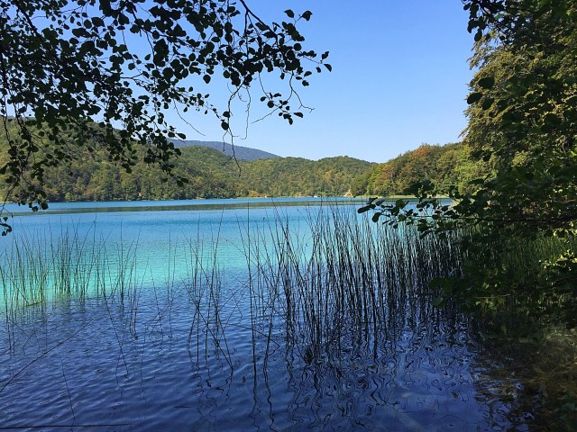
The plan for Thursday was to visit the Cinque Terra which was a couple of hours from where we were staying. I had seen the pictures and it looked beautiful.

The Cinque Terre (five towns) is a string of five fishing villages perched high on the Italian Riviera (region Liguria) which until recently were linked only by mule tracks and accessible only by rail or water. An ancient system of footpaths is still the best way to visit the five villages: Monterosso, Vernazza, Corniglia, Manarola and Riomaggiore.

The Cinque Terre is noted for its beauty. Over centuries, people have carefully built terraces to cultivate grapes and olives on the rugged, steep landscape right up to the cliffs that overlook the Mediterranean Sea.

The breathtaking views of harbours far below the wild but hospitable coastline along with the medieval fortresses and plentiful vines and vibrant colours make this a memorable holiday spot.

The Cinque Terre, recognized in 1997 by the Unesco Mankind’s World Heritage, are today a National Park and Protected Marine Area with the aim of protecting this great cultural heritage and natural environment.

I did some research and decided it was best to park at La Spezia Migliarina and catch the train to the main La Spezia station which is the gateway from the south to the Cinque Terra. When we got to the main station at La Spezia we were greeted by hundreds of people everywhere and a big queue to get tickets for the Cinque Terra. You can buy a day ticket or a multi day ticket that lets you access the trains, toilets, hiking trails and wifi hotspots. I joined the queue and about an hour later I had two Cinque Terra day passes. Next mission was to get on a train – it was crazy busy but with a bit of jostling and sprinting down the platform we got on.

Due to how busy it was we decided just to go to a couple of the villages to get a taste of the place. We went to the furtherest village first – Monterosso.

Monterosso is the largest of the five coastal villages. The village is located on hills cultivated with vines and olives. The vegetation surrounds the built-up area like an embrace; its amazing beaches, its beautiful reefs and the sea’s crystal clear waters make this small village one of the most hospitable of the Ligurian Riviera.

The village is divided in two parts marked by the medieval tower of Aurora. The new part of town, Fegina, is full of life, it is the reflection of an area that tourism has made rich, as the great quantity and excellent quality of hotels and restaurants give evidence.

Fegina is dominated by the famous concrete statue of the Giant, built beside the terrace of a local villa. This statue was created at the beginning of the XX century by Levacher and Minerbi, an architect and a sculptor, and represents Neptune, the god of the sea. Now it has become the symbol of Monterosso.

The old town of Monterosso is dominated by the ruins of the castle and characterized by typical narrow medieval streets carruggi with multi-coloured terraced houses. The beach is the only extensive sand beach in the Cinque Terre and runs along most of the coast line and is well used by tourists and locals.

The beach was jam packed and the water looked so inviting. We strolled along the coastal path enjoying a gelato stop. We have become gelato snobs though after our Roman Food Tour in Rome looking for signs that the gelato is real and not fake – it is not as easy as you may think 🤔, especially in the tourist hot spots.

We then carried on to the Aurora Tower which is in the style of the 1500’s although it has been added to and renovated over the centuries. There is a really nice restaurant up there and we decided to treat ourselves to a Hugo. Everyone has their take on cocktails and today’s Hugo was quite sweet with minimal bubbles – I really enjoyed it and it was such a gorgeous spot.

img_21291img_21301img_21311img_21321img_21341

img_2477

We decided to make our way back to the train station to check out the next village – we had chosen Vernazza but spoke to a couple at the station who were staying at Manarola who said they found it was the quietest of the five villages. I am not sure what planet they were on because when we arrived it was also jam packed. There is no beach here so people just lie on the rocks and jump into the water from there. We walked up to the high point and again the views were gorgeous.

We sat in the shade and ended up chatting to a lovely young French couple – the guy spoke english and told us that his english teacher was from Auckland, NZ. They were fun to talk to and I so love the way they translate English phrases. We discussed the fact that no one checks the tickets on the trains so you could easily ride them for free which they had done on a couple of occasions – they were staying at Monterosso for a few days so had been visiting the different villages. He was laughing and said ‘but I don’t want to be burnt by the fire’ – his take on ‘if you play with fire you could get burnt’.

Manarola, built on a high rock 70 metres above sea level, is one of the most charming and romantic of the Cinque Terre villages.The tiny harbor features a boat ramp, picturesque multicoloured houses facing the sea and a tiny piazza with seafood restaurants.

Along the main road the boats are pulled onto dry land every time the sea is rough. The Main Street down to the sea was lined with small boats. Although there is no real beach here, it has some of the best deep-water swimming around.

The village is all ups and downs, with steep narrow alleys carrugi, leading to the sea. Today the church serves as a religious and community meeting place, but in more ancient times, the bell tower was used as a post to watch for potential pirate raids.

Another peculiarity of Manarola is a pyramid in white cement whose peak can be seen rising between the taller houses and is used as a navigational reference point for all those at sea.

img_2136img_2137img_2139img_2140

We decided we had done our dash with the crowds so headed back to the train station to catch the train to La Spezia and another train back to our car at La Spezia Migliarina. We then had a couple of hours to endure with the crazy Italians on the road before reaching our sanctuary at Renaissance.

It was a worthwhile trip but I would recommend going when it is quieter so you could enjoy the villages without the crowds and the searing heat.

On our travels south we had spotted a cool stone bridge that I wanted to check out – the bridge at Borgo a Mozzano, called “The Devil’s Bridge” or the “Maddalena Bridge” is certainly the most beautiful bridge in the province of Lucca, and one of the most suggestive in Italy. Many legends were born from its myterious construction and its singular design, with one large arch flanked by three smaller ones, inspired the works of many artists. The bridge’s slimming profile, which continues to strike its admirers, must have been even more impressive in the past before a dam was built, in the years after the Second World War, which raised the level of the water in the surrounding area.

According to legend, the bridge was built by Saint Julian who, unable to complete the hard project, asked the Devil for help, offering him in return the soul of the first living being who would have crossed the finished bridge. Once the bridge was finished, Saint Julian threw a piece of bread onto the bridge, luring a dog to cross it, cheating the Devil.

There is little historical information about the building of the bridge. Nicolau Tegrimi, in the biography of Castruccio Castracani, attributes the bridge to Matilde di Canossa (1046-1125) and mentions a restoration made by Castruccio Castracani (1281-1328.) According to the hypothesis of Massimo Betti, during the Castruccio government the minor arches were constructed in stone, replacing previous structure in wood. This would explain the difference between the major arch and the minor ones.

In the 16th century the Hermitage of Maddalena was built on the left bank, providing a name for the bridge. In the following centuries the right bank was built up with factories. In 1889 the structure of the bridge, on the Borgo a Mozzano side, was modified to allow the passage of the train line which runs from Lucca to Aulla. A part of the bridge was demolished and a ramp was built over the train tracks.

We arrived at the bridge about 8.15am and the sun hadn’t risen above the hills so it was rather chilly with quite a wind which we hadn’t really encountered anywhere else. Our visit was short lived.

img_2155img_2157img_2159img_2160

Next stop was Pisa which is the capital city of the Province of Pisa. Although Pisa is known worldwide for its leaning tower (the bell tower of the city’s cathedral), the city of over 91,104 residents (around 200,000 with the metropolitan area) contains more than 20 other historic churches, several medieval palaces and various bridges across the Arno River which empties out into the Mediterranean. Much of the city’s architecture was financed from its history as one of the Italian maritime republics.

The city is also home of the University of Pisa, which has a history going back to the 12th century and also has the Scuola Normale Superiore di Pisa, founded by Napoleon in 1810, and its offshoot, the Sant’Anna School of Advanced Studies as the best sanctioned Superior Graduate Schools in Italy.

The Campo dei Miracoli in Pisa, the Square of Miracles in English, was proclaimed a World Heritage Site by UNESCO in 1987. The square is not located right smack in the center of the city as you might imagine but along the north western edge along the city’s fortified wall, almost out of the center. This is where space was available back in 1094 when construction was first started on the cathedral.

Since the times of the Etruscans, the three structures found in the piazza have been considered central to religious life, symbolizing the main stages of a human life: the Baptistery represents birth, the Cathedral of Santa Maria Assunta life and the Camposanto, of course, alludes to death. The famous Leaning Tower of Pisa is actually considered a part of the cathedral since it is really its bell tower.

The square is surrounded by a beautiful green lawn which you are not allowed to walk on. As in most cities, the square was called Piazza del Duomo until Italian writer and poet Gabriele d’Annunzio described the square as the “prato dei Miracoli,” or “meadow of miracles” in his novel Forse che sì forse che no (1910). The square is now simply known as the Campo dei Miracoli, which is literally the “Field of Miracles”.
Construction of the Duomo began in the 11th century and, after many changes, was actually only completed in the 19th century when the architect Alessandro Gherardesca gave the square its final present appearance.

The Square first started taking shape in 1064 with the creation of the centerpiece of the entire complex: the Cathedral dedicated to Santa Maria Assunta. The cathedral symbolizes the maximum expression of Pisan Romanesque architecture influenced at the same time by various stylistic elements. At the time, Pisa was a Maritime Republic (from the 11th through 15th centuries), and sailors travelled around the Arab world and remained smitten by all the beautiful things they saw.

Years later the enlargement of the fortified wall began (the church at the beginning wasn’t inside the walls) and the building of the baptistery began only in 1152. The baptistery was located directly in front of the Cathedral with a diameter equal to the facade of the cathedral. About 20 years later, work started on the bell tower which is now known simply as the famous Leaning Tower of Pisa. In 1277, work stated on the graveyard, known as the Camposanto.

Before the Florentine siege in the 15th century, you could enter the square through the Porta del Leone, but this was closed by the Florentines when they built the current door called Porta Santa Maria. During the era of the Medici and Lorraine dominance in the region, the four monuments were surrounded by the construction of many other buildings: these were knocked down only at the end of the 19th century when the architect Alessandro La Gherardesca reorganized the square to give it its current structure.

The most recent changes were made during the Fascist era: the monument She-Wolf of Rome was added on the lawn north of the bell tower and 17 cypresses were planted east of the square, in memory of the soldiers that died in the war.

We had parked in the free parking about a kilometre from the tower and walked there passing all the souvenir shops. The tour buses had also started to fill the parking lot. We were pleased we had got there early because the place was really filling up as we left. I had spotted these hand painted t-shirts as we walked in so went back to have a look on the way out. I spoke to the woman and her husband who’s stall it was and it turns out they have a son living in Auckland – he has been there for 15 years and is a real estate agent. They have visited and loved it. The woman and her daughter paint the t-shirts and their main design is the sunflower 🌻 – it was only right I purchased a couple 😉.

img_2481img_2175img_2178img_2179img_2180

The closest large town to the hotel is Lucca and although we had driven past it a number of times we hadn’t stopped in so today was the day. I had googled where to park and ended up within the city walls – we were driving slowly through the car park with ancient walls either side and getting beeped at – bloody Italians! We ended up leaving the city walls and finding some free parking about a kilometre away. Some people we met in Rome had recommended we bike the city walls so we hired a couple of bikes and off went – it was only 4km to circumvent the old town so nothing too onerous.

Lucca has become a popular retirement spot for the British, French, and Germans in recent years. Although the city as a whole contains about 84,000 inhabitants, the old walled city, by far the most interesting part of town, has a population of only 7,500.
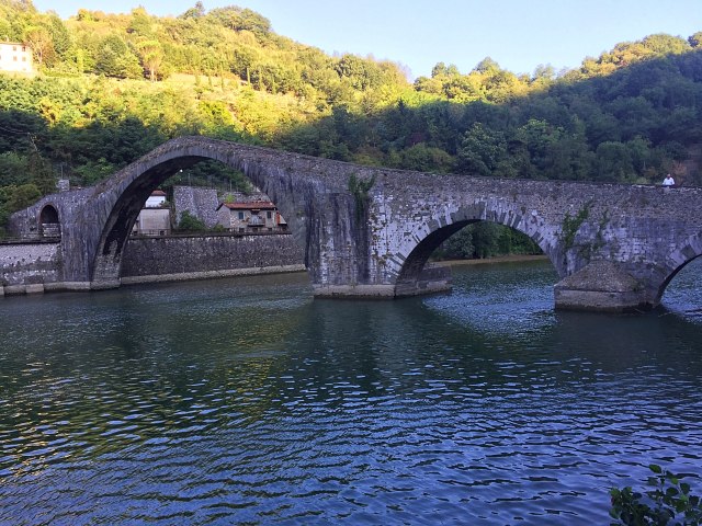
The walls encircling the old town remain intact, even as the city expanded and modernized, unusual for cities in the region. Initially built as a defensive rampart, once the walls lost their military importance they became a pedestrian promenade, the Passeggiata delle Mure Urbane, a street atop the walls linking the bastions. Each of the four principal sides of the structure is lined with a different tree species than the others.
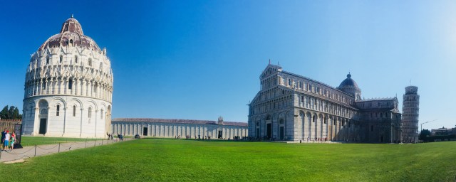
The old walled city is commonly referred to as the city of one hundred churches for the large number of religious buildings which represent marvelous examples of architectural Italian styles.
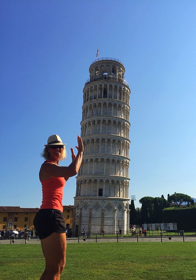
img_2188img_2189img_2190img_2191

It was very hot so after our little jaunt around Lucca we headed back to the hotel for some R & R by the pool – our last afternoon under the Tuscan sun. In the evening we took our little car another 1.2 kilometres up the hill to Locanda Alla Posta for a lovely dinner. We were leaving the restaurant after dinner when Steve said hello to a little fella who was about 3 – he then proceeded to tell Steve in Italian that he had done a farto 😂. The little guys grandma came over to drag him away laughing as she tried to explain what he was saying. It is the same the world over – kids and farting 😮.

Some final thoughts on our trip to Italy…..

In hindsight we didn’t do enough research on Tuscany before coming here. The hotel we stayed at was lovely but it was probably a little bit removed from the action. When I thought of Tuscany I thought of fields of sunflowers, vineyards, local markets and an abundance of fresh produce. I think this would have been more prevalent a bit further south and we wouldn’t have had to travel so far each time we wanted to do something.

I am going to make a generalisation here – the Italian people as a whole are not particularly friendly. Of course we encountered some nice Italians but it wasn’t the norm to be greeted in a positive and friendly manner.

So many people smoke here and it still seems acceptable to smoke in public places although it was banned in 2005.

August is a busy time in Italy so it is probably not the best month to visit if you are not a fan of lots of people and queues.

I mentioned what we perceived to be crazy driving by the Italians above so I was curious to see what their road toll was as a percentage of drivers and cars on the road. It turns out it is about 2% lower than NZ’s per 100,000 population and about 5% lower per 100,000 cars so maybe what we perceive as crazy driving is actually highly skilled driving 🤭.

Posted in Italy, Tuscany | Leave a comment