Grand Cypress Golf Resort – North, South and East Courses, Orlando – Florida, USA

On Monday morning we picked up a rental car in Miami and headed north to Orlando. It was a beautiful day and the drive north was very pleasant. We thought we may stop off along the way and have a game of golf but there were so many courses to choose from we decided to get to our destination which were the Villas at Grand Cypress. Grand Cypress Resort has 45 Jack Nicklaus designed golf holes – Steve thought this sounded like heaven when he booked it : )

There are three nines – the North, South and East nines and an 18 hole course called The New Course which is a tribute to The Old Course at St Andrews. Our villa overlooked the North nine and the weather on the afternoon we arrived was picture perfect.

/home/wpcom/public_html/wp-content/blogs.dir/eb7/67251693/files/2014/12/img_2485.jpg

When we got up on Tuesday morning it looked a little misty outside and then the fog descended – a different picture to the previous afternoon.

/home/wpcom/public_html/wp-content/blogs.dir/eb7/67251693/files/2014/12/img_2486.jpg

/home/wpcom/public_html/wp-content/blogs.dir/eb7/67251693/files/2014/12/img_2487.jpg

We headed over to the Clubhouse anyway and set off on the South nine – we were playing the South and the East nines today. It actually only took a couple of holes for the fog to clear and another stunning day greeted us. They say the South is the hardest nine and the East has a bit more water. I thought the courses were stunning with the trees and lakes. The colours of the trees were really pretty and because the day was so still the reflections on the lakes were fantastic.

The South nine was built in 1984 and the East nine was built in 1986.

/home/wpcom/public_html/wp-content/blogs.dir/eb7/67251693/files/2014/12/img_2489.jpg

/home/wpcom/public_html/wp-content/blogs.dir/eb7/67251693/files/2014/12/img_2490.jpg

/home/wpcom/public_html/wp-content/blogs.dir/eb7/67251693/files/2014/12/img_2496.jpg

/home/wpcom/public_html/wp-content/blogs.dir/eb7/67251693/files/2014/12/img_2497.jpg

/home/wpcom/public_html/wp-content/blogs.dir/eb7/67251693/files/2014/12/img_2506.jpg

/home/wpcom/public_html/wp-content/blogs.dir/eb7/67251693/files/2014/12/img_2507.jpg

/home/wpcom/public_html/wp-content/blogs.dir/eb7/67251693/files/2014/12/img_2508.jpg

/home/wpcom/public_html/wp-content/blogs.dir/eb7/67251693/files/2014/12/img_2509.jpg

/home/wpcom/public_html/wp-content/blogs.dir/eb7/67251693/files/2014/12/img_2512.jpg

/home/wpcom/public_html/wp-content/blogs.dir/eb7/67251693/files/2014/12/img_2514.jpg

/home/wpcom/public_html/wp-content/blogs.dir/eb7/67251693/files/2014/12/img_2517.jpg

/home/wpcom/public_html/wp-content/blogs.dir/eb7/67251693/files/2014/12/img_2524.jpg

/home/wpcom/public_html/wp-content/blogs.dir/eb7/67251693/files/2014/12/img_2530.jpg

On Wednesday we played the North and South nines. The North and South nines made the original championship course which has hosted 6 LPGA events since 2001.

/home/wpcom/public_html/wp-content/blogs.dir/eb7/67251693/files/2014/12/img_2536.jpg

/home/wpcom/public_html/wp-content/blogs.dir/eb7/67251693/files/2014/12/img_2537.jpg

/home/wpcom/public_html/wp-content/blogs.dir/eb7/67251693/files/2014/12/img_2542.jpg

/home/wpcom/public_html/wp-content/blogs.dir/eb7/67251693/files/2014/12/img_2546.jpg

/home/wpcom/public_html/wp-content/blogs.dir/eb7/67251693/files/2014/12/img_2558.jpg

/home/wpcom/public_html/wp-content/blogs.dir/eb7/67251693/files/2014/12/img_2565.jpg

/home/wpcom/public_html/wp-content/blogs.dir/eb7/67251693/files/2014/12/img_2571.jpg

Posted in Florida, USA | Leave a comment

Miami Heat v Chicago Bulls, Miami – Florida, USA

When we knew we were going to be spending some time in Miami Steve checked out if there were any basketball games on. Not only were the Miami Heat playing on the Sunday night but they were playing the Chicago Bulls – how cool would that be to see the legendary Chicago Bulls play? We went online and secured some tickets – we wanted to be mid court so we could see all the action.

The game started at 6pm so we got there about 5.30pm – they have lots of pre game entertainment. They welcomed the Chicago Bulls players and then the lights went out. The music was turned up and they rolled out a large Miami Heat flag in the centre of the court – as each Miami Heat player was introduced flames shot out of the gas burners. It was very dramatic.

/home/wpcom/public_html/wp-content/blogs.dir/eb7/67251693/files/2014/12/img_2455.jpg

/home/wpcom/public_html/wp-content/blogs.dir/eb7/67251693/files/2014/12/img_2460.jpg

/home/wpcom/public_html/wp-content/blogs.dir/eb7/67251693/files/2014/12/img_2464.jpg

/home/wpcom/public_html/wp-content/blogs.dir/eb7/67251693/files/2014/12/img_2466.jpg
The game started and I was mesmerised – the one and only basketball game I went to was about 25 years ago between Waikato and North Harbour and I remember it took forever with all the time outs. Each quarter is 12 minutes and time ticked down fast. Each team had a time out per quarter and during this time they had competitions and entertainment going on. I also learnt that each team has 24 seconds to take a shot – I never knew that so that was also exciting watching the 24 seconds tick away and seeing what the teams did to take it to the wire. There were a few 24 second time violations.

The home crowd is pretty lethal with all the chanting and they make lots of noise and boo the opposition when they are taking their shots after a personal foul has happened.

The Miami Heat started well but the Chicago Bulls showed their class and powered past the Heat on the scoreboard. Before we knew it 2 hours and 20 minutes had passed and the game was over. The Bulls won 95 to 73. We both really enjoyed our NBA experience and just cannot believe how many cool sporting events we have managed to attend this year – feeling very blessed : )

/home/wpcom/public_html/wp-content/blogs.dir/eb7/67251693/files/2014/12/img_2469.jpg

/home/wpcom/public_html/wp-content/blogs.dir/eb7/67251693/files/2014/12/img_2471.jpg

/home/wpcom/public_html/wp-content/blogs.dir/eb7/67251693/files/2014/12/img_2472.jpg

/home/wpcom/public_html/wp-content/blogs.dir/eb7/67251693/files/2014/12/img_2475.jpg

/home/wpcom/public_html/wp-content/blogs.dir/eb7/67251693/files/2014/12/img_2480.jpg

/home/wpcom/public_html/wp-content/blogs.dir/eb7/67251693/files/2014/12/img_2482.jpg

/home/wpcom/public_html/wp-content/blogs.dir/eb7/67251693/files/2014/12/img_2484.jpg

The National Basketball Association (NBA) is the pre-eminent men’s professional basketball league in North America, and is widely considered to be the premier men’s professional basketball league in the world. It has 30 franchised member clubs (29 in the United States and 1 in Canada). The NBA is one of the four major North American professional sports leagues – the others being American Football (Gridiron), Ice Hockey and Baseball. NBA players are the world’s best paid sportsmen, by average annual salary per player.

The league was founded in New York City on June 6, 1946, as the Basketball Association of America (BAA). The league adopted the name National Basketball Association on August 3, 1949, after merging with its rival National Basketball League (NBL).

The NBA is divided into two conferences – the Eastern Conference and the Western Conference. Each Conference has 15 teams who are split into three divisions of 5 teams each.

During the regular season, each team plays 82 games, 41 each home and away. A team faces opponents in its own division four times a year (16 games). Each team plays six of the teams from the other two divisions in its conference four times (24 games), and the remaining four teams three times (12 games). Finally, each team plays all the teams in the other conference twice apiece (30 games). The top eight from each Conference then have playoffs to determine who will go through to the NBA final. All playoff series are the best of seven games.

Miami Heat
The Miami Heat are an American professional basketball team based in Miami, Florida. The team is a member of the Southeast Division in the Eastern Conference of the National Basketball Association (NBA). They play their home games at the American Airlines Arena in Downtown Miami. The team owner is Micky Arison, who also owns cruise-ship giant Carnival Corporation. The team president and de facto general manager is Pat Riley, and the head coach is Erik Spoelstra. The mascot of the team is Burnie, an anthropomorphic fireball.

Formed in 1988 as one of the NBA’s four expansion franchises, the Heat have won three league championships (in 2006, 2012 and 2013), five conference titles and 11 division titles. From February 3 to March 27, 2013, the Heat won 27 games in a row, the second-longest streak in NBA history (after the Los Angeles Lakers’ 33 wins). In 2013, Forbes valued the Heat at $625 million, sixth-most-valuable among NBA franchises.

Chicago Bulls
The Chicago Bulls are an American professional basketball team. They are based in Chicago, Illinois, playing in the Central Division of the Eastern Conference in the National Basketball Association (NBA). The team was founded on January 26, 1966. The Bulls play their home games at the United Center, also known as the “Madhouse on Madison.” The Bulls saw their greatest success during the 1990s. They are known for having one of the NBA’s greatest dynasties, winning six NBA championships between 1991 and 1998 with two three-peats. All six championship teams were led by Hall of Famers Michael Jordan, Scottie Pippen and coach Phil Jackson. The Bulls are the only NBA franchise to win multiple championships and never lose an NBA Finals in their history.

The Bulls won an NBA record-72 games during the 1995–96 NBA season and are the only team in NBA history to win 70 games or more in a single season. Many experts and analysts consider the 1996 Bulls to be one of the greatest teams in NBA history. As of 2013, the Bulls were estimated to be the third most valuable NBA franchise according to Forbes, with an estimated value of $1 billion, earning an estimated $52.2 million in operating income in 2013. Michael Jordan and Derrick Rose have both won the NBA Most Valuable Player Award while playing for the Bulls, for a total of six MVP awards. Derrick Rose played on Sunday night in the game against the Miami Heat.

The Chicago Bulls are owned by Jerry M. Reinsdorf (born February 25, 1936) who is a CPA and lawyer – he also owns the MLB’s Chicago White Sox. He started his professional life as a tax attorney with the Internal Revenue Service. He has been the head of the White Sox and Bulls for over 25 years.

He made his initial fortune in real estate, taking advantage of the Frank Lyon Co. v. United States decision by the United States Supreme Court which allowed economic owners of realty to sell property and lease it back, while transferring the tax deduction for depreciation to the title owner.

Posted in Florida, USA | Leave a comment

Miami Sightseeing – Florida, USA

We spent a day in Miami after the first two weeks on our Oceania Cruise before heading to the Caribbean. We then came back to Miami after cruising the Caribbean. After watching C.S.I. Miami we were quite excited to check the place out.

The population of the Miami city area is about 420,000 with 5.5 million in the metro area. During the early 20th century, northerners were attracted to the city, and Miami prospered during the 1920s with an increase in population and infrastructure. The collapse of the Florida land boom of the 1920s, the 1926 Miami Hurricane, and the Great Depression in the 1930s slowed development. When World War II began, Miami, well-situated on the southern coast of Florida, became a base for US defense against German submarines. The war brought an increase in Miami’s population; by 1940, 172,172 people lived in the city.

After Fidel Castro rose to power in Cuba in 1959, many wealthy Cubans sought refuge in Miami, further increasing the population. The city developed businesses and cultural amenities as part of the New South. In the 1980s and 1990s, South Florida weathered social problems related to drug wars, immigration from Haiti and Latin America, and the widespread destruction of Hurricane Andrew. Racial and cultural tensions were sometimes sparked, but the city developed in the latter half of the 20th century as a major international, financial, and cultural center. It is the second-largest U.S. city (after El Paso, Texas) with a Spanish-speaking majority, and the largest city with a Cuban-American plurality.

Miami and its metropolitan area grew from just over one thousand residents to nearly five and a half million residents in just 110 years (1896–2006). The city’s nickname, The Magic City, comes from this rapid growth. Winter visitors remarked that the city grew so much from one year to the next that it was like magic.

/home/wpcom/public_html/wp-content/blogs.dir/eb7/67251693/files/2014/12/img_2374.jpg

We spent a bit of time exploring the Bayside area which is quite close to the Port of Miami which is the busiest cruise port in the world. There were at least 6 cruise ships in port on every day we spent in Miami. The Bayside Marketplace was a hive of activity with lots of little shops, bars and restaurants. We also went downtown but to be honest there wasn’t a lot there.

/home/wpcom/public_html/wp-content/blogs.dir/eb7/67251693/files/2014/12/img_2383.jpg

After all the cruising we had done you would have thought we would have been sick of the water but we decided to take a boat ride around all the little islands that surround Miami. They call it the Millionaires Row trip as the boat goes past all these flash houses, some of which belong to or have belonged to celebrities.

We first went past the Venetian Islands which are a chain of artificial islands in Biscayne Bay in the cities of Miami and Miami Beach. There are seven islands in total and they are all connected by bridge from the Miami mainland to Miami Beach. Flagler Monument Island remains an uninhabited picnic island, originally built in 1920 as a memorial to railroad pioneer Henry Flagler.

/home/wpcom/public_html/wp-content/blogs.dir/eb7/67251693/files/2014/12/img_2386.jpg

/home/wpcom/public_html/wp-content/blogs.dir/eb7/67251693/files/2014/12/img_2387.jpg

There are other islands beyond the Venetian Islands. One of these islands is Star Island which is a highly exclusive island just south of the Venetian Islands. It is connected to the mainland by the MacArthur Causeway.

Celebrities who own or have owned homes on the island include Sean Combs, Gloria Estefan, Don Johnson, Rosie O’Donnell, and Shaquille O’Neal. The largest house on Star Island is owned by Dr Phillip Frost, the founder of the major pharmaceutical company producing generic drugs for the ever so drug thirsty America. The house is approximately 28,000 square foot and has eight bedrooms and ten bathrooms and is worth approximately USD50 million. Dr Frost lives there with his wife who is a school principal and they have no children.

/home/wpcom/public_html/wp-content/blogs.dir/eb7/67251693/files/2014/12/img_2391.jpg

/home/wpcom/public_html/wp-content/blogs.dir/eb7/67251693/files/2014/12/img_2398.jpg

/home/wpcom/public_html/wp-content/blogs.dir/eb7/67251693/files/2014/12/img_2399.jpg

/home/wpcom/public_html/wp-content/blogs.dir/eb7/67251693/files/2014/12/img_2401.jpg

/home/wpcom/public_html/wp-content/blogs.dir/eb7/67251693/files/2014/12/img_2406.jpg

/home/wpcom/public_html/wp-content/blogs.dir/eb7/67251693/files/2014/12/img_2409.jpg

On the Sunday we decided to check out South Beach which is a very happening place in Miami. Restaurants lined Ocean Drive which is just across from the beach although you can’t see the beach from the road. We saw all these buff guys working out in the park – shirts off, muscles glistening in the morning sun…. We also saw lots of high end cars cruising up and down – it seemed every second car was a Ferrari or a Porsche. We went across to the beach which was well groomed and set up. There weren’t too many people swimming though. South Beach reminded us of Surfers Paradise on steroids.

/home/wpcom/public_html/wp-content/blogs.dir/eb7/67251693/files/2014/12/img_2448.jpg

/home/wpcom/public_html/wp-content/blogs.dir/eb7/67251693/files/2014/12/img_2450.jpg

/home/wpcom/public_html/wp-content/blogs.dir/eb7/67251693/files/2014/12/img_2452.jpg

/home/wpcom/public_html/wp-content/blogs.dir/eb7/67251693/files/2014/12/img_2453.jpg

/home/wpcom/public_html/wp-content/blogs.dir/eb7/67251693/files/2014/12/img_2454.jpg

South Beach, also nicknamed SoBe, is a neighborhood in the city of Miami Beach, located due east of Miami city proper between Biscayne Bay and the Atlantic Ocean. This area was the first section of Miami Beach to be developed, starting in the 1910s, thanks to the development efforts of Carl G. Fisher, the Lummus Brothers, and John S. Collins, the latter whose construction of the Collins Bridge provided the first vital land link between mainland Miami and the beaches.

The area has gone through numerous artificial and natural changes over the years, including a booming regional economy, increased tourism, and the 1926 hurricane, which destroyed much of the area. SoBe has a population of approximately 40,000.

In the 1930s, an architectural revolution came to South Beach, bringing Art Deco, Streamline Moderne, and Nautical Moderne architecture to the Beach. South Beach claims to be the world’s largest collection of Streamline Moderne Art Deco architecture. Napier, New Zealand, another notable Art Deco city, makes an interesting comparison with Miami Beach as it was rebuilt in the Ziggurat Art Deco style after being destroyed by an earthquake in 1931.

By 1940, the beach had a population of 28,000. After the December 7, 1941 attack on Pearl Harbor, the Army Air Corps took command over Miami Beach. That year, tourism brought almost two million people to South Beach.

Beginning in the mid 1960s and continuing through the 1980s, South Beach was used as a retirement community with most of its ocean-front hotels and apartment buildings filled with elderly people living on small, fixed incomes. This period also saw the introduction of the “cocaine cowboys,” drug dealers who used the area as a base for their illicit drug activities. Scarface, released in 1983, typifies this activity. In addition, television show Miami Vice used South Beach as a backdrop for much of its filming because of the area’s raw and unique visual beauty. A somewhat recurring theme of early Miami Vice episodes was thugs and drug addicts barricading themselves in utterly run-down, almost ruin-like empty buildings. Only minor alterations had to be made for these scenes because many buildings in South Beach really were in such poor condition at the time.

While many of the unique Art Deco buildings, such as the New Yorker Hotel, were lost to developers in the years before 1980, the area was saved as a cohesive unit by Barbara Capitman and a group of activists who spearheaded the movement to place almost one square mile of South Beach on the National Register of Historic Places. The Miami Beach Architectural District was designated in 1979.

Before the days of Miami Vice, South Beach was considered a very poor area with a very high rate of crime. Today, it is considered one of the wealthiest and most prosperous commercial areas on the beach. Despite this, poverty and crime still exist in some isolated places surrounding the area.

Another unique aesthetic attribute of South Beach is the presence of several colorful and unique stands used by Miami Beach’s lifeguards on South Beach. After Hurricane Andrew, Architect William Lane donated his design services to the city and added new stops on design tours in the form of lifeguard towers. His towers instantly became symbols of the revived City of Miami Beach.

/home/wpcom/public_html/wp-content/blogs.dir/eb7/67251693/files/2014/12/img_2449.jpg

/home/wpcom/public_html/wp-content/blogs.dir/eb7/67251693/files/2014/12/img_2451.jpg

Ricky Martin used to own this house….

/home/wpcom/public_html/wp-content/blogs.dir/eb7/67251693/files/2014/12/img_2390.jpg

This boat is owned by the Dallas Mavericks basketball team’s owner Mark Cuban and cost USD120 million.

/home/wpcom/public_html/wp-content/blogs.dir/eb7/67251693/files/2014/12/img_2418.jpg

SeaFair is the world’s first mobile megayacht venue and one of the ten largest privately owned yacht in the United States. Groundbreaking in scale, ingenuity and style, the yacht – which remains dockside during each event – pairs international fine art, jewelry and collectables with harbor view dining and special events in cities along the eastern seaboard.

The $40M purpose built yacht was designed by internationally acclaimed yacht designer Luiz De Basto. At 228 feet and 2800 international tons, it is the largest ship built for commercial operation in the Intracoastal Waterway and requires a draft of only 6.5 feet allowing it to dock at small yacht facilities in central city locations rather than use commercial ports.
Deck One features a formal entry, ten individual exhibit spaces and a coffee bar. Deck Two features twelve exhibit spaces and the Luxe Lounge, an open-air champagne and caviar lounge on the aft deck. Deck Three features six exhibit spaces and Sapore’, the formal glass-walled restaurant. The Sky Deck (Deck Four) contains Bistro360, an informal open-air restaurant and Bar360, a cocktail reception area.

/home/wpcom/public_html/wp-content/blogs.dir/eb7/67251693/files/2014/12/img_2423.jpg

Hard Rock Miami is the only Hard Rock cafe that doesn’t have a giant guitar on the roof – it was taken out by Hurricane Wilma.

/home/wpcom/public_html/wp-content/blogs.dir/eb7/67251693/files/2014/12/img_2428.jpg

Posted in Florida, USA | Leave a comment

Food Glorious Food – Oceania Cruises

Oceania Cruises is renowned for it’s great food and it certainly lived up to expectation. There were four specialty restaurants on board and we were lucky enough to go to each one a few times over the month.

Polo Grill specialised in steak and seafood which they cooked to perfection.

/home/wpcom/public_html/wp-content/blogs.dir/eb7/67251693/files/2014/12/img_5011-0.jpg

/home/wpcom/public_html/wp-content/blogs.dir/eb7/67251693/files/2014/12/img_4925.jpg

/home/wpcom/public_html/wp-content/blogs.dir/eb7/67251693/files/2014/12/img_4924.jpg

/home/wpcom/public_html/wp-content/blogs.dir/eb7/67251693/files/2014/12/img_4926.jpg

/home/wpcom/public_html/wp-content/blogs.dir/eb7/67251693/files/2014/12/img_5014.jpg

/home/wpcom/public_html/wp-content/blogs.dir/eb7/67251693/files/2014/12/img_5015.jpg

Toscana was an Italian restaurant which had the best bread selection & display. They also had an olive oil and balsamic vinegar menu so you could get just the right combination to go with the bread selection.

/home/wpcom/public_html/wp-content/blogs.dir/eb7/67251693/files/2014/12/img_5017.jpg

/home/wpcom/public_html/wp-content/blogs.dir/eb7/67251693/files/2014/12/img_4946.jpg

/home/wpcom/public_html/wp-content/blogs.dir/eb7/67251693/files/2014/12/img_4949.jpg

/home/wpcom/public_html/wp-content/blogs.dir/eb7/67251693/files/2014/12/img_4950.jpg

/home/wpcom/public_html/wp-content/blogs.dir/eb7/67251693/files/2014/12/img_5020.jpg

/home/wpcom/public_html/wp-content/blogs.dir/eb7/67251693/files/2014/12/img_5021.jpg

Red Ginger was the Asian speciality restaurant which had some great dishes on the menu. Steve took a liking to the garlic chilli prawns having a double serving one night we went there. The tempura vegetables were also delicious. They served all these delicious teas with your dinner – I particularly liked the pear and white ginger tea. They also served our favourite desert – coconut sorbet – to die for )

/home/wpcom/public_html/wp-content/blogs.dir/eb7/67251693/files/2014/12/img_4933.jpg

/home/wpcom/public_html/wp-content/blogs.dir/eb7/67251693/files/2014/12/img_4934.jpg

/home/wpcom/public_html/wp-content/blogs.dir/eb7/67251693/files/2014/12/img_4935.jpg

/home/wpcom/public_html/wp-content/blogs.dir/eb7/67251693/files/2014/12/img_4936.jpg

/home/wpcom/public_html/wp-content/blogs.dir/eb7/67251693/files/2014/12/img_4938.jpg

/home/wpcom/public_html/wp-content/blogs.dir/eb7/67251693/files/2014/12/img_4961.jpg

Jacques was the French speciality restaurant which is named after Oceania’s Executive Chef. They did this fabulous pumpkin soup which they served out of the pumpkin. We had Thanksgiving Turkey at Jacques which was accompanied by all the tasty trimmings.

/home/wpcom/public_html/wp-content/blogs.dir/eb7/67251693/files/2014/12/img_4956.jpg

/home/wpcom/public_html/wp-content/blogs.dir/eb7/67251693/files/2014/12/img_4953.jpg

/home/wpcom/public_html/wp-content/blogs.dir/eb7/67251693/files/2014/12/img_49541.jpg

/home/wpcom/public_html/wp-content/blogs.dir/eb7/67251693/files/2014/12/img_4955.jpg

/home/wpcom/public_html/wp-content/blogs.dir/eb7/67251693/files/2014/12/img_5010.jpg

The Grand Dining Room changed its menu every night and we also had some lovely meals there too.

/home/wpcom/public_html/wp-content/blogs.dir/eb7/67251693/files/2014/12/img_4957.jpg

/home/wpcom/public_html/wp-content/blogs.dir/eb7/67251693/files/2014/12/img_4960.jpg

/home/wpcom/public_html/wp-content/blogs.dir/eb7/67251693/files/2014/12/img_4990.jpg

/home/wpcom/public_html/wp-content/blogs.dir/eb7/67251693/files/2014/12/img_4991.jpg

/home/wpcom/public_html/wp-content/blogs.dir/eb7/67251693/files/2014/12/img_1928.jpg

/home/wpcom/public_html/wp-content/blogs.dir/eb7/67251693/files/2014/12/img_2224.jpg

In between all that eating & drinking we also enjoyed some great sunsets.

Isla de Margarita, Venezuela

/home/wpcom/public_html/wp-content/blogs.dir/eb7/67251693/files/2014/12/img_5006.jpg

/home/wpcom/public_html/wp-content/blogs.dir/eb7/67251693/files/2014/12/img_5007.jpg

/home/wpcom/public_html/wp-content/blogs.dir/eb7/67251693/files/2014/12/img_5008.jpg

Grenada

/home/wpcom/public_html/wp-content/blogs.dir/eb7/67251693/files/2014/12/img_2213.jpg

/home/wpcom/public_html/wp-content/blogs.dir/eb7/67251693/files/2014/12/img_2214.jpg

Martinique

/home/wpcom/public_html/wp-content/blogs.dir/eb7/67251693/files/2014/12/img_2244.jpg

Saint Kitts & Nevis

/home/wpcom/public_html/wp-content/blogs.dir/eb7/67251693/files/2014/12/img_2340.jpg

/home/wpcom/public_html/wp-content/blogs.dir/eb7/67251693/files/2014/12/img_2341.jpg

/home/wpcom/public_html/wp-content/blogs.dir/eb7/67251693/files/2014/12/img_2342.jpg

/home/wpcom/public_html/wp-content/blogs.dir/eb7/67251693/files/2014/12/img_2345.jpg

/home/wpcom/public_html/wp-content/blogs.dir/eb7/67251693/files/2014/12/img_2347.jpg

/home/wpcom/public_html/wp-content/blogs.dir/eb7/67251693/files/2014/12/img_2349.jpg

/home/wpcom/public_html/wp-content/blogs.dir/eb7/67251693/files/2014/12/img_2350.jpg

Posted in Oceania Cruises | Leave a comment

St. Barts – Oceania Cruises

Today I had organised a snorkelling trip for us – I was really looking forward to getting out into the warm Caribbean waters and seeing what was below the surface. Our ship docked in the middle of the harbour so we were tendered ashore where we met our snorkelling guide Ludo. There were just the two of us going snorkelling and another Steve from the USA who was going diving with Ludo.

Ludo told us that the winds were coming from the south which was quite unusual for the island and they were making the waters very choppy. Great! We went to the first spot and Ludo decided it was too choppy and actually dangerous for snorkelling so we went to find another spot. This spot looked a bit better but was not the dead calm waters that I was anticipating. We both kitted up and jumped in. The water was warm and there were lots of colourful fish just below the surface so that was cool. Unfortunately Steve drank a bit too much sea water and ended up feeling rather ill. He hopped back into the boat and ended up feeding the fish!

Ludo and the other Steve came back from there dive. It had got quite choppy so we up anchored and went to find a more sheltered spot closer to the harbour. Steve was still not feeling too flash so he stayed in the boat while I went exploring. There were a lot more bigger fish in this spot with all sorts of colour – it was very cool. Ludo and the other Steve went off to dive around a wreck that wasn’t too far away.

We watched a few small planes come in to land. Apparently the airport on the island is one of the more dangerous airports in the world. The planes have to come in over this mountain and then suddenly drop down to the runway. We could see them clearing the mountain and then dropping suddenly. Ludo told us that they just clear the road near the top of the mountain and a couple of years ago this guy was standing on the top of his roof taking photos of the plane coming in when he was hit by the wheel of the plane and killed.

We got back to the ferry dock and Ludo dropped us off – not the most successful snorkelling venture we have ever had but at least I got to swim in the Caribbean and see some tropical fish. We had a wander around the town which is full of high end designer boutiques and restaurants – it is very expensive. There were also a few super yachts docked in the marina which were very nice. One of the boats was called Casino Royale and Steve spoke to the crew who told him the inside of the boat is all James Bond themed – how cool. Unfortunately Steve didn’t manage to wangle us an invite on board. The crew also told us that there is another boat out there called Sky Fall.

After having a look around we decided to go back to the ship via the tender boat. The tender boat pulled up alongside the ship and it was bouncing all over the place. The crew had to work pretty hard to keep it steady.

The island of St. Barts, known for its chic French ambience and cuisine and white-sand beaches, long has reigned as a favorite getaway spot among celebrity jetsetters.

That’s quite a lofty status for a stony, volcanic, eight-square-mile island that claims no fresh water and little workable land. Named for Christopher Columbus’ brother, Bartolomeo, St. Barthelemy is located near the northern end of the Lesser Antilles group in the West Indies, 15 miles east of St. Martin.

Many St. Bartians are descendants of 17th-century settlers from Brittany and Normandy. In the 18th century, France leased the island to Sweden in exchange for trading rights to the Baltic. It is the only Caribbean island which was a Swedish colony for any significant length of time; Guadeloupe was under Swedish rule only briefly at the end of the Napoleonic Wars. Symbolism from the Swedish national arms, the Three Crowns, still appears in the island’s coat of arms. Almost a century later, locals voted to restore rule to the French. Today, St. Barts, with its population of about 9,000, is a dependency of the French overseas department of Guadeloupe.

The island’s beautiful beaches lend themselves to water sports, from windsurfing, scuba-diving and snorkeling to jet-skiing, sailing and deep-sea fishing. Whales pass by during migration periods, and dolphins are frequently spotted.

The island also claims fame as a place where conspicuous consumption is on display in the form of mega-yachts, elegant designer boutiques, fancy resorts and fine dining. Considered among the best places to nosh in the Caribbean, lunch or dinner at one of the island’s top restaurants can be a major splurge.

International investment and the wealth generated by wealthy tourists explain the high standard of living on the island. St. Barts is considered a playground of the rich and famous, especially as a winter haven, and is known for its beaches, gourmet dining and high-end designers. Most of the food is imported by airplane or boat from the US or France. Tourism attracts about 200,000 visitors every year. As a result, there is a boom in house building activity catering to the tourists and also to the permanent residents of the island, with prices as high as €61,200,000 for a beachfront villa.

St. Barts has about 25 hotels, most of them with 15 rooms or fewer. The largest has 58 rooms. Hotels are classified in the traditional French manner; 3 Star, 4 Star and 4 Star Luxe. Most places of accommodation are in the form of private villas, of which there are some 400 available to rent on the island. The island’s tourism industry, though expensive, attracts 70,000 visitors every year to its luxury hotels and villas and another 130,000 people arrive by luxury boats. It also attracts a labour force from Brazil and Portugal to meet the industry needs.

The height of tourism is New Year’s Eve, with celebrities and the wealthy converging on the island in yachts up to 550 ft in length for the occasion.

IMG_2351.JPG

IMG_2352.JPG

IMG_2353.JPG

IMG_2354.JPG

IMG_2359.JPG

IMG_2362.JPG

IMG_2363.JPG

IMG_2364.JPG

IMG_2365.JPG

IMG_2367.JPG

Posted in Oceania Cruises | Leave a comment

Royal St. Kitts Golf Course, St Kitts – Oceania Cruises

We docked in the commercial port on St. Kitts as two other cruise ships had taken the spots on the pier closest to town. We were shuttled down to the centre of town which is a hive of activity aimed mainly at the tourists. We did a spot of shopping and had a look around – the locals were very friendly.

We had booked a round of golf at Royal St. Kitts for 1pm so headed back to the ship to get ready. Again we shared a taxi to the golf club with Bill & Chris from Vancouver. Our taxi driver was Gloria and she was so lovely. Some of the crew were walking to town so she picked them up along the way and dropped them by the main road so they wouldn’t get lost. She chatted away and pointed out the sights. She told us about her 5 kids and how they eat her out of house and home every day. She arranged to pick us up again at 4.45pm to ensure we didn’t miss our embarkation deadline of 5.30pm.

The course is located in Frigate Bay, an affluent resort area which is sprinkled with estate homes and high end hotels all facing gorgeous stretches of sand. The course is owned and operated by the Marriott so is a typical resort course – quite pretty with wide open fairways so not super challenging. The first 11 holes are closest to the Caribbean side of the island and are surrounded by homes and hotels. The back nine go out towards and along the Atlantic Ocean so are a lot more picturesque. The course has recently been redesigned and renovated by renowned Canadian golf course architect Thomas McBroom.

I had a great round and shot 85. We really enjoyed the course and the staff were super friendly. After racing around in 3 hours 15 minutes we had some time to spare at the end so enjoyed a snack and drink in the bar. Steve also shopped up a storm in the pro shop which was one of the best stocked pro shops we have come across.

As promised Gloria was back to pick us up at 4.45pm and we were back in plenty of time.

In 1493, Christopher Columbus was so smitten with this volcanic island that he named it after himself. Since its discovery, St. Christopher — later shortened by British sailors to St. Kitts — has been fought over by the Spanish, British and French who, tragically, made it a center of the West Indian slave trade. Pirates, including the notorious William Kidd, enjoyed lucrative careers in Basseterre Harbor. The west side of the island borders the Caribbean Sea, and the eastern coast faces the Atlantic Ocean. Saint Kitts and the neighbouring island of Nevis constitute one country: the Federation of Saint Kitts and Nevis.

Saint Kitts has a population of around 35,000, the majority of whom are mainly of African descent. The primary language is English, with a literacy rate of approximately 98%. Residents call themselves Kittitians.

St. Kitts and sister isle Nevis were part of the British Empire until 1967, earning semi-independent status when they were named associated states of Great Britain. In 1983, the 65-square-mile St. Kitts and Nevis became an independent, two-island nation with a parliamentary government headed by a Prime Minister. While British holdovers such as cricket and driving on the left side of the road remain, the Kittitians are extremely proud of their history and how far they’ve come on their own.

Brimstone Hill Fortress National Park, a UNESCO World Heritage Site, is the largest fortress ever built in the Eastern Caribbean. The island of Saint Kitts is home to the Warner Park Cricket Stadium, which was used to host 2007 Cricket World Cup matches. This made St. Kitts and Nevis the smallest nation to ever host a World Cup event. Saint Kitts is also home to several institutions of higher education, including Ross University School of Veterinary Medicine, Windsor University School of Medicine, and the University of Medicine and Health Sciences.

The island’s lush geography lends itself to eco-tourism, starting with the dense tropical rainforests that surround dormant volcano, Mount Liamuiga (known locally as Mt. Misery). Colorful birds and butterflies, as well as the green Vervet monkey, reside here.

For hundreds of years, St. Kitts operated as a sugar monoculture, but due to decreasing profitability, the government closed the industry in 2005. Tourism is a major and growing source of income to the island, although the number and density of resorts is less than on many other Caribbean islands. Transportation, non-sugar agriculture, manufacturing and construction are the other growing sectors of the economy.

St. Kitts is dependent on tourism to drive its economy. St. Kitts & Nevis also acquires foreign direct investment from their unique citizenship by investment program, outlined in their Citizenship Act of 1984. Interested parties can acquire citizenship if they pass the government’s strict background checks and make an investment into an approved real estate development. Purchasers who pass government due diligence and make a minimum investment of US$400,000, into qualifying government approved real estate, are entitled to apply for citizenship of the Federation of St. Kitts and Nevis.

St. Kitts & Nevis uses the Eastern Caribbean dollar, which maintains a fixed exchange rate of 2.7-to-one with the United States dollar. The US dollar is almost as widely accepted as the Eastern Caribbean dollar.

Slavery
The island originally produced tobacco, but changed to sugar cane in 1640 due to stiff competition from the colony of Virginia. The labour-intensive farming of sugar cane was the reason for the large-scale importation of African slaves. The importation began almost immediately upon the arrival of Europeans to the region.

The purchasing of enslaved Africans was outlawed in the British Empire by an Act of Parliament in 1807. Slavery was abolished by an Act of Parliament that became law on 1 August 1834. This emancipation was followed by four years of apprenticeship, put in place to protect the plantation owners from losing their labour force. August the 1st is now celebrated as a public holiday and is called Emancipation Day. In 1883 St. Kitts, Nevis and Anguilla were all linked under one presidency, located on St. Kitts, to the dismay of the Nevisians and Anguillans. Anguilla eventually separated out of this arrangement in 1971, after an armed raid on St. Kitts.

Sugar production continued to dominate the local economy until 2005, when, after 365 years as a monoculture, the government closed the sugar industry. This was due to the industry’s huge losses and European Union plans to cut sugar prices by large amounts in the near future.

IMG_2296.JPG

IMG_2297.JPG

IMG_2298.JPG

IMG_2300.JPG

IMG_2309.JPG

IMG_2310.JPG

IMG_2311.JPG

IMG_2314.JPG

IMG_2322.JPG

IMG_2323.JPG

IMG_2327.JPG

IMG_2328.JPG

IMG_2338.JPG

Posted in Oceania Cruises | Leave a comment

Guadeloupe – Oceania Cruises

On Monday we arrived on the butterfly shaped island of Guadeloupe. Guadeloupe is another island in the French West Indies which comprises Martinique, Saint Marten’s and Saint Bart’s. Guadeloupe’s two main islands are Basse-Terre to the west and Grande-Terre to the east, which are separated by a narrow strait that is crossed with bridges, hence forming the butterfly shape. Guadeloupe is an integral part of France, as are the other overseas departments. Guadeloupe also includes the smaller islands of Marie-Galante and La Désirade, and the Îles des Saintes.

IMG_2370.JPG

As part of France, Guadeloupe is part of the European Union and the Eurozone; hence, as for all Eurozone countries, its currency is the euro. However, as an overseas department, Guadeloupe is not part of the Schengen Area. The prefecture (i.e. French regional capital) of Guadeloupe is Basse-Terre. Its official language is French, although many of its inhabitants also speak Antillean Creole (Créole Guadeloupéen).

We took a half day trip to discover some of the island. Our first stop was in the Parc National de la Guadeloupe where we walked to the Crayfish falls which are named after the crayfish that inhabit the pond at the base of the waters of the Corossol River. Again we were greeted with very lush vegetation. It rains in the mountains most days so water is not a problem on the island.

IMG_2246.JPG

IMG_2247.JPG

IMG_2251.JPG

We then went to Les Jardins de Valombruese some botanical gardens with many local plants and flowers. We also saw some hummingbirds playing in the trees and extracting the nectar from the flowers. Our guide, Romeo was very knowledgable on the flora and fauna so we really enjoyed exploring the gardens. We also went into a little room where they had a display of dolls dressed in traditional clothing. The different outfits represented the area and class from which you came. 71% of the island’s population are of Creole descent which means they are descendants of the various ethnic groups that have come to the Caribbean islands over the years. In a way it is a cover all term which allows these people to have an identity. 80% of the population are Roman Catholics.

IMG_2253.JPG

IMG_2254.JPG

IMG_2255.JPG

IMG_2259.JPG

IMG_2260.JPG

IMG_2261.JPG

IMG_2262.JPG

IMG_2266.JPG

IMG_2273.JPG

We then went to Distillerie Longueteau which is a family owned rum distillery. Here they use modern equipment to harvest the sugar cane and produce the rum which was in stark contrast to the distillery we had been to on Grenada. This distillery had been in operation since 1895. The sugar cane harvest season is from February to May. I tried some coconut rum punch which I enjoyed so purchased a little bottle along with some locally produced chocolate. There were so many other goodies that I would have liked to purchase but again would have trouble bringing back to NZ like vanilla pods, vanilla sugar and honey.

IMG_2278.JPG

IMG_2280.JPG

IMG_2282.JPG

IMG_2284.JPG

IMG_2286.JPG

IMG_2291.JPG

IMG_2292.JPG

IMG_2290.JPG

IMG_2293.JPG

Sugar
Introduced to the West Indies in the middle of the 17th century, sugar cane growing is inextricably linked to the islands’ history and has profoundly shaped its landscape. After a peak in the middle of the 20th century, the sugar industry went into a long period of decline. Save for one, all the factories on the main island of Guadeloupe closed one after the other.

Despite its decline, sugar cane remains the island’s main agricultural crop both in terms of value and farmed area, providing a living for almost 30,000 people, including 4,000 growers. Today, the sugar cane plot is stable at around 12,000 hectares, with the 700,000 tonnes of cane cut producing some 70,000 tonnes of sugar. Another 60,000 tonnes are delivered to the eleven distilleries on the island producing industrial rum and rhum agricole.

More than 90% of the sugar produced is marked for export. Most of it is sent by bulk cargo ship to refineries in Europe. The remainder, special sugars, is packed in big bags and shipped to the EU in 20’ containers. Sugar cane processing is an almost virtuous activity that produces much more than just sugar and rum. Bagasse and molasses, by-products from the sugar refining process, are used in power production and as animal feed respectively.

Sugarcane belongs to the grass family (Poaceae), an economically important seed plant family that includes maize, wheat, rice, and sorghum and many forage crops. Sugarcane is the world’s largest crop by production quantity.

Over the last 30 years bananas have reached 50% of the island’s exports with over 80% of all bananas being exported to Europe.

IMG_2287.JPG

IMG_2288.JPG

History of Guadeloupe
The island was called “Karukera” (or “The Island of Beautiful Waters”) by the Arawak people, who settled on there in 300 AD/CE. During the 8th century, the Caribs came and killed the existing population of Amerindians on the island.

During his second trip to America, in November 1493, Christopher Columbus became the first European to land on Guadeloupe, while seeking fresh water. He called it Santa María de Guadalupe de Extremadura, after the image of the Virgin Mary venerated at the Spanish monastery of Villuercas, in Guadalupe, Extremadura. The expedition set ashore just south of Capesterre, but left no settlers behind.

Columbus is credited with discovering the pineapple on the island of Guadeloupe in 1493, although the fruit had long been grown in South America. He called it piña de Indias, meaning “pine of the Indies.”

During the 17th century, the Caribs fought against the Spanish settlers and repelled them.

After successful settlement on the island of St. Christophe (St. Kitts), the French Company of the American Islands delegated Charles Lienard (Liénard de L’Olive) and Jean Duplessis Ossonville, Lord of Ossonville to colonize one or any of the region’s islands, Guadeloupe, Martinique, or Dominica.

Due to Martinique’s inhospitable nature, the duo resolved to settle in Guadeloupe in 1635, took possession of the island, and wiped out many of the Carib Amerindians. It was annexed to the kingdom of France in 1674.

Over the next century, the British seized the island several times. The economy benefited from the lucrative sugar trade, which commenced during the closing decades of the 17th century. Guadeloupe produced more sugar than all the British islands combined, worth about £6 million a year. The British captured the island in 1759. The British government decided that Canada was strategically more important and kept Canada while returning Guadeloupe to France in the Treaty of Paris (1763) that ended the Seven Years War.

In 1790, following the outbreak of the French Revolution, the monarchists of Guadeloupe refused to obey the new laws of equal rights for the free people of color and attempted to declare independence. The ensuing conflict with the republicans, who were faithful to revolutionary France, caused a fire to break out in Pointe-à-Pitre that devastated a third of the town. The monarchists ultimately overcame the republicans and declared independence in 1791. The monarchists then refused to receive the new governor that Paris had appointed in 1792. In 1793, a slave rebellion broke out, which made the upper classes turn to the British and ask them to occupy the island.

In an effort to take advantage of the chaos ensuing from the French Revolution, Britain seized Guadeloupe in 1794, holding control from 21 April until December 1794, when Victor Hugues obliged the British general to surrender. Hugues succeeded in freeing the slaves, who then turned on the slave owners who controlled the sugar plantations.

In 1802, Napoleon Bonaparte issued the Law of 20 May 1802. It restored slavery to all of the colonies captured by the British during the French Revolutionary Wars, but did not apply to certain French overseas possessions such as Guadeloupe, Guyane, and Saint-Domingue. Napoleon sent an expeditionary force to recapture the island from the rebellious slaves. Louis Delgrès and a group of revolutionary soldiers killed themselves on the slopes of the Matouba volcano when it became obvious that the invading troops would take control of the island. The occupation force killed approximately 10,000 Guadeloupeans.

On 4 February 1810 the British once again seized the island and continued to occupy it until 1816. By the Anglo-Swedish alliance of 3 March 1813, it was ceded to Sweden for a brief period of 15 months. However, the British administration continued in place and British governors continued to govern the island.

In the Treaty of Paris of 1814, Sweden ceded Guadeloupe once more to France. An ensuing settlement between Sweden and the British gave rise to the Guadeloupe Fund. The Treaty of Vienna in 1815 definitively acknowledged French control of Guadeloupe.

Slavery was abolished on the island on 28 May 1848 at the initiative of Victor Schoelcher.

Guadeloupe lost 12,000 of its 150,000 residents in the cholera epidemic of 1865–66.

In 1925, after the trial of Henry Sidambarom (Justice of the Peace and defender of the cause of Indian workers), Raymond Poincaré decided to grant French nationality and the right to vote to Indian citizens.

In 1946, the colony of Guadeloupe became an overseas department of France. Then in 1974, it became an administrative center. Its deputies sit in the French National Assembly in Paris.

Today, the population of Guadeloupe is mainly of African or mixed descent and largely Roman Catholic, speaking French and a Creole patois (Antillean Creole). There are also Europeans, Indians, Lebanese, Syrians, Chinese, and Carib Amerindians(remnants of the original pre-European population). The archipelago of Îles des Saintes is mostly populated by the descendants of colonists from Brittany and Normandy.

On 15 July 2007, the island communes of Saint-Martin and Saint-Barthélemy were officially detached from Guadeloupe and became two separate French overseas collectivities with their own local administration.

On 20 January 2009, an umbrella group of approximately fifty labour union and other associations (known in the local Antillean Creole as the Liyannaj Kont Pwofitasyon (LKP), led by Élie Domota) called for a €200 ($260 USD) monthly pay increase for the island’s low income workers. The protesters have proposed that authorities “lower business taxes as a top up to company finances” to pay for the €200 pay raises. Employers and business leaders in Guadeloupe have said that they cannot afford the salary increase. The strike lasted 44 days, ending with an accord reached on 5 March 2009. Tourism suffered greatly during this time and affected the 2010 tourist season as well.

The French Caribbean general strikes exposed deep ethnic, racial, and class tensions and disparities within Guadeloupe. Guadeloupe has an unemployment rate of approximately 30%. The urban and industrial areas resemble that of any French city with car and machinery dealerships, supermarkets and chain stores. It appeared a more sophisticated island than some of the other islands that we had visited.

Posted in Oceania Cruises | Leave a comment

Martinique – Oceania Cruises

We docked in Martinique on Sunday the 7th December so most things are closed. We decided to have a chill day wandering along the waterfront and listening to the local musicians who were playing at a nearby park. It was a stunning day and the waterfront is very picturesque. We went back to the boat for lunch and watched a jet ski race in the harbour. I went ashore again late afternoon to use the free wifi and ambled back to the ship about 6.10pm. The ship was leaving at 7pm so we all had to be back on board at 6.30pm. When I got to the gangway there were about 8 crew members milling about and smiling at me – I asked them if I was late and they said no, no. I came back to to our room and Steve said somebody had called to see where I was. I was obviously the last one back on the ship and they wanted to bring the gangway in early.

We were docked overlooking Fort de France which has been back in operation as a naval base since 2001.

Martinique is the definition of a refined French-Caribbean island – fashionable and elegant, with an abundance of flora. Filled with ruins and monuments, Martinique has been French, with few interruptions, since 1635, and offers gorgeous beaches, great food and a live volcano. Banana farming, sugar cane raising, the rum business and tourism are all important to the island.

Napoleon’s Empress Josephine, born on the island in 1763, is Martinique’s most famous native. She is both revered for her fame and reviled for her part in propagating the slave trade.

Martinique is one of four islands in the Caribbean that’s part of France (also known as the French West Indies). Others include St. Martin, Guadeloupe and St. Barts. Few speak English there, and you’ll find that signs and menus generally aren’t meant to accommodate anyone who isn’t French.

Martinique’s New World history began in 1502, when Christopher Columbus landed on the island. The French claimed the island in 1635; for 180 years, ownership bounced between France and Britain, before the former took hold for good in 1815. Martinique became a region of France in 1974.

IMG_2215.JPG

IMG_2216.JPG

IMG_2222.JPG

IMG_2230.JPG

IMG_2239.JPG

IMG_2240.JPG

IMG_2241.JPG

Posted in Oceania Cruises | Leave a comment

Grenada – Oceania Cruises

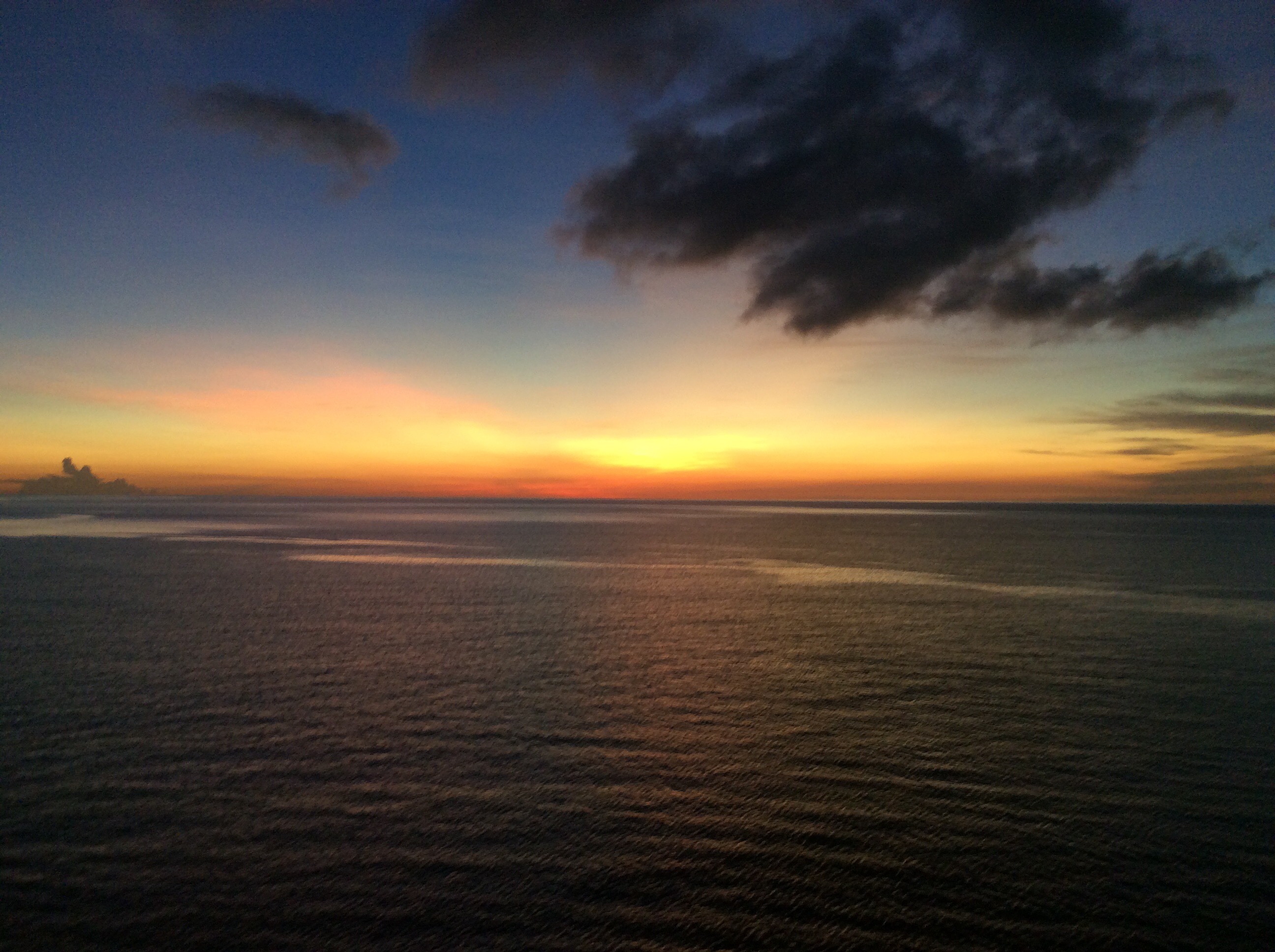
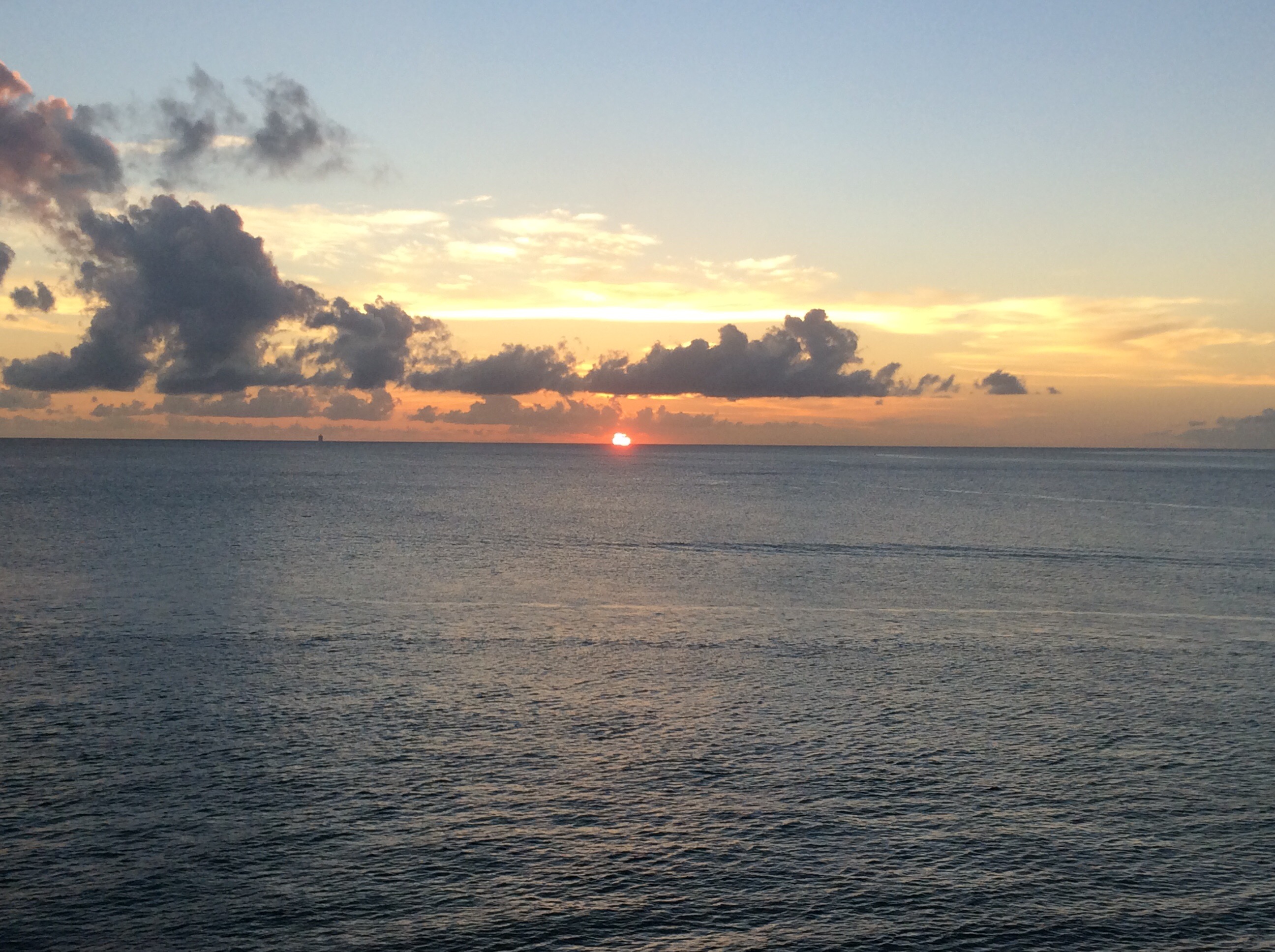
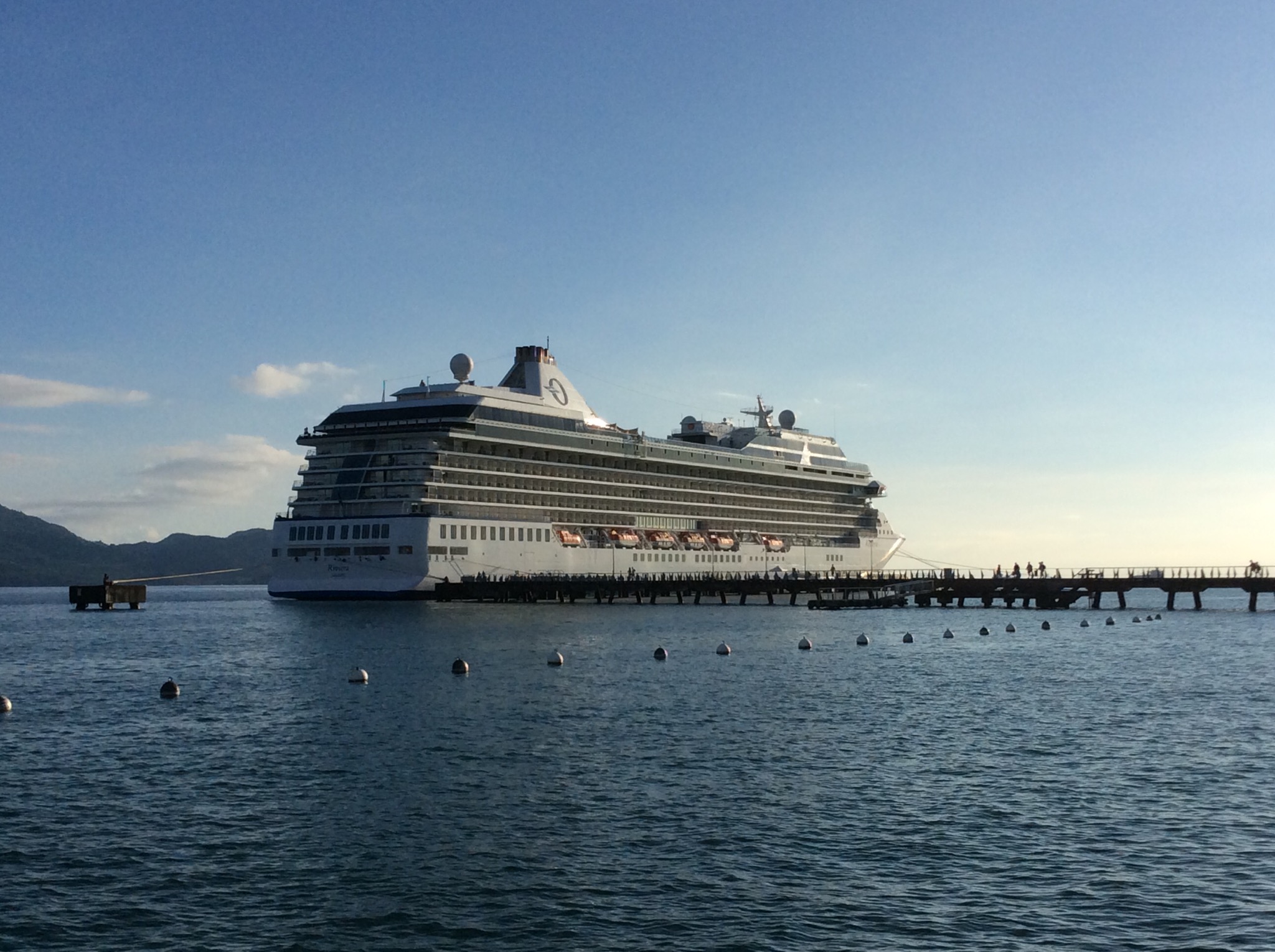
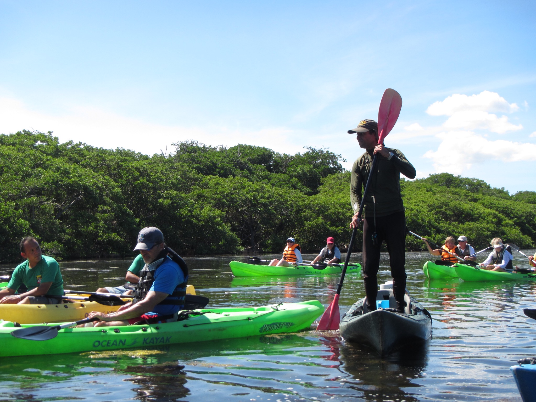
Today we took a tour around Grenada – what a fabulously lush and beautiful island. Sunny blue skies and a temperature of 29 degrees made for a great day. Our guide Louis picked us up from the terminal and we were off. Grenada is extremely hilly so we were pleased we were not doing a bike tour here : )

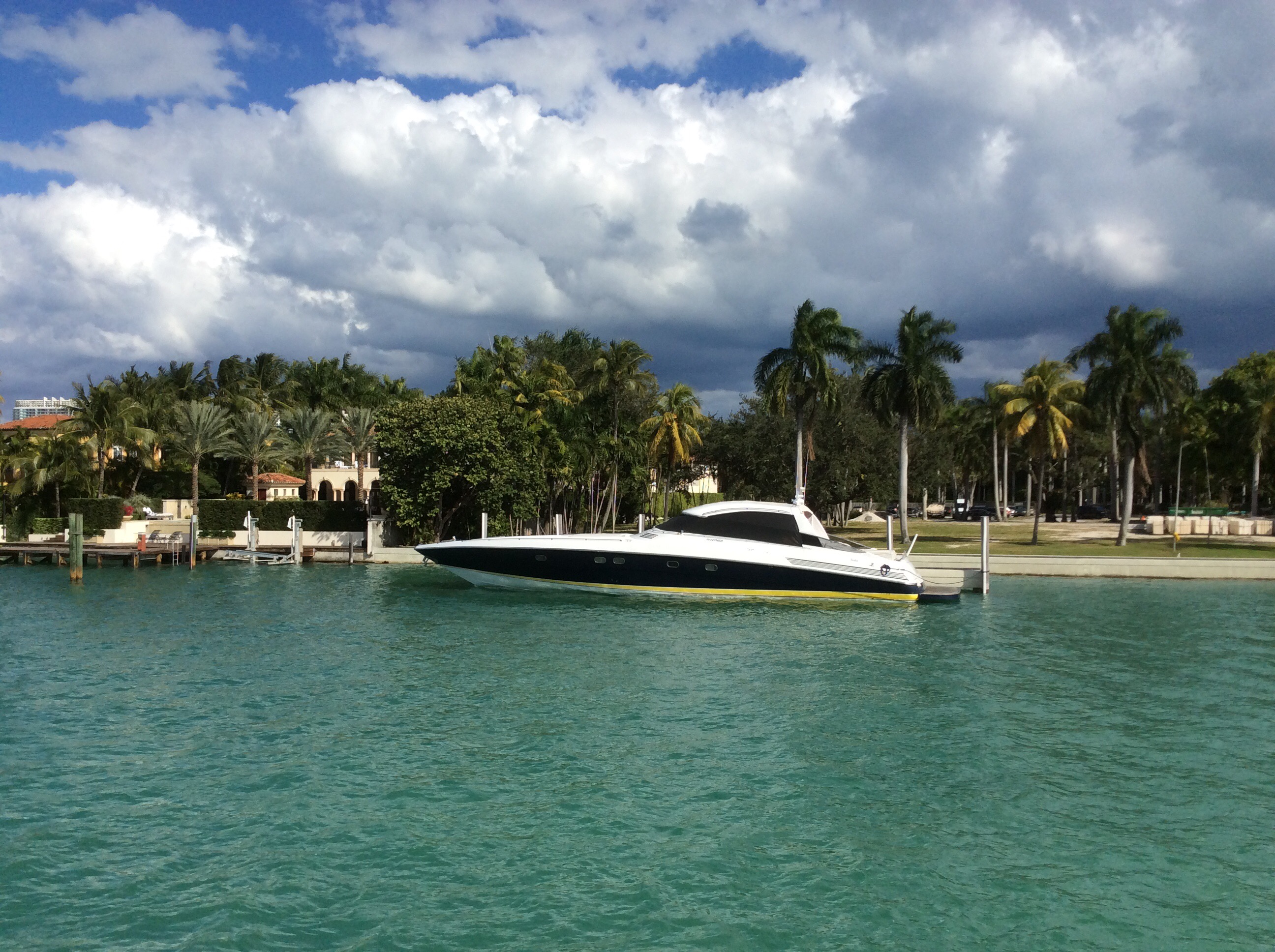
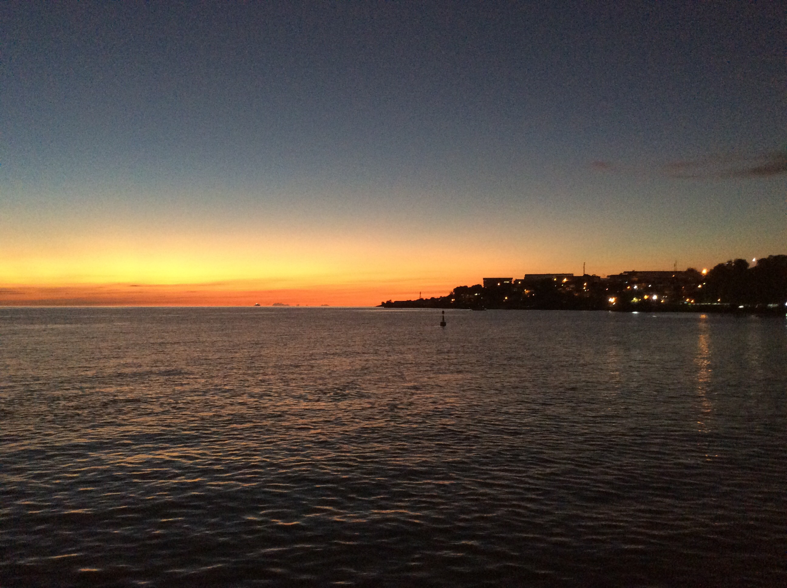
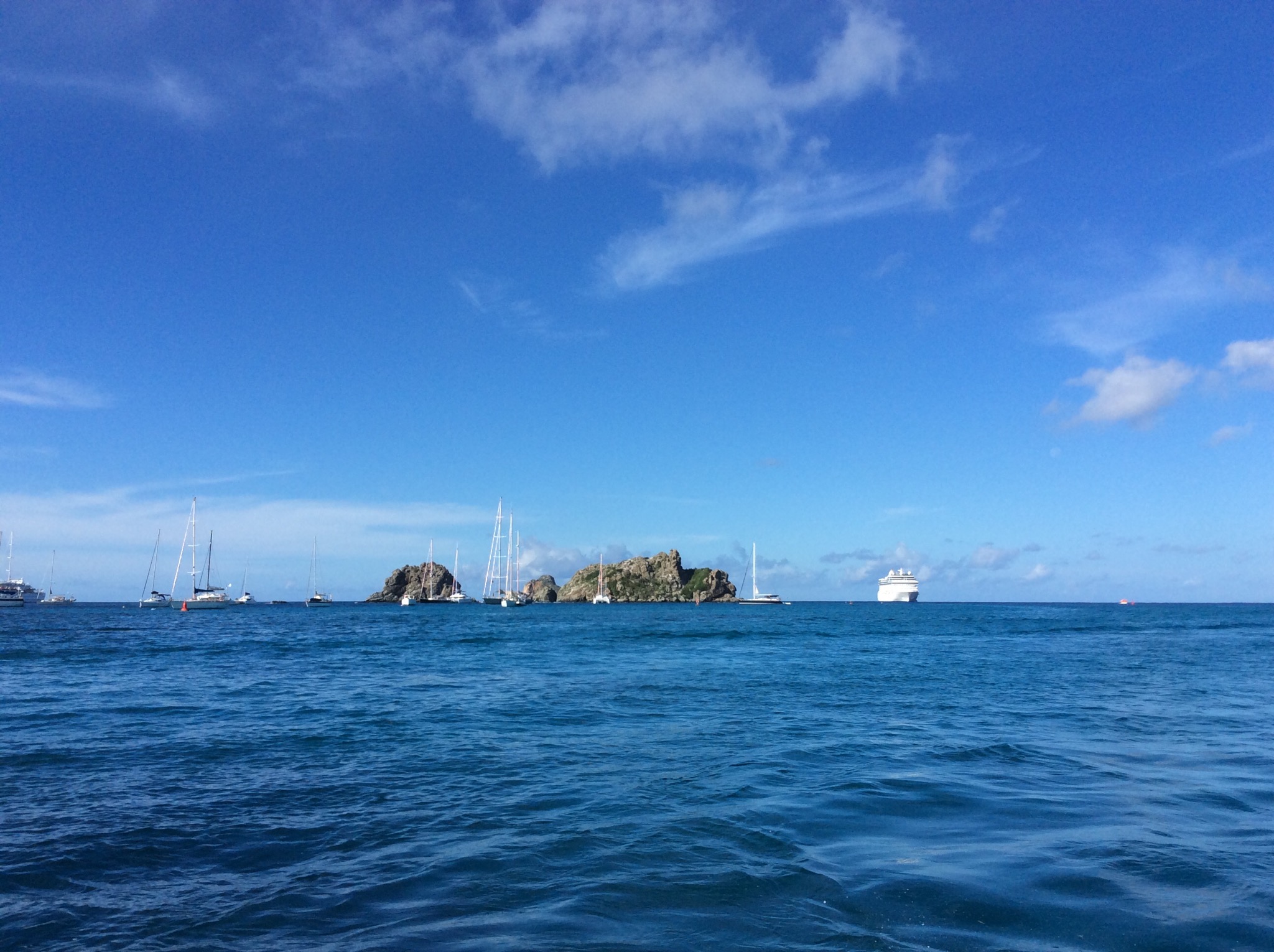
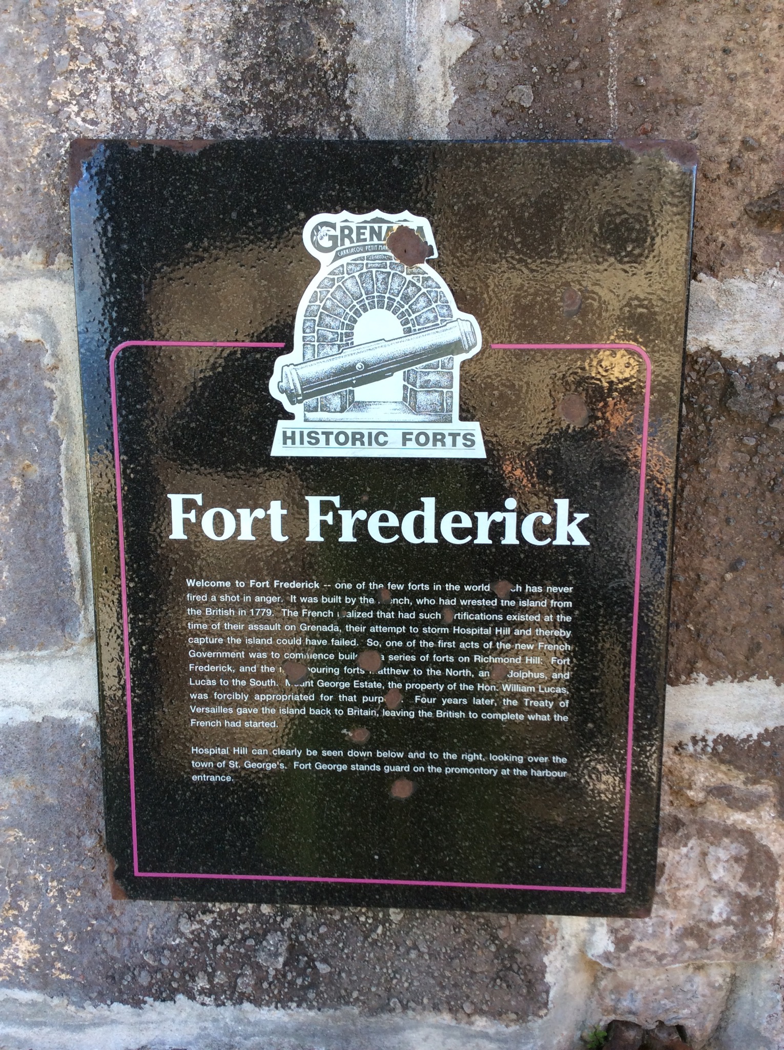
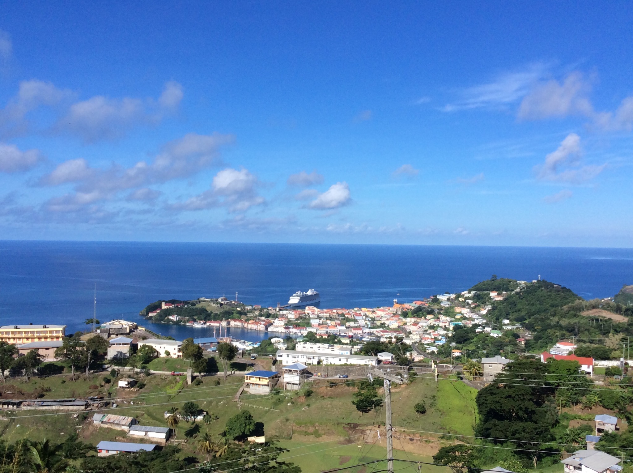
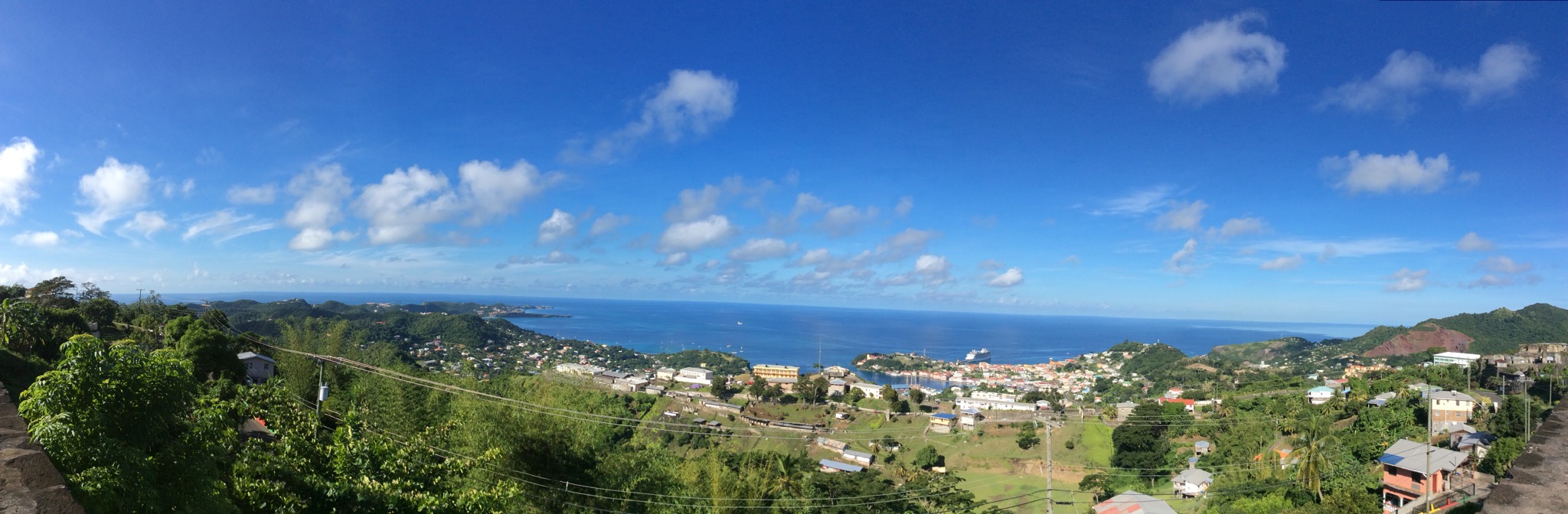
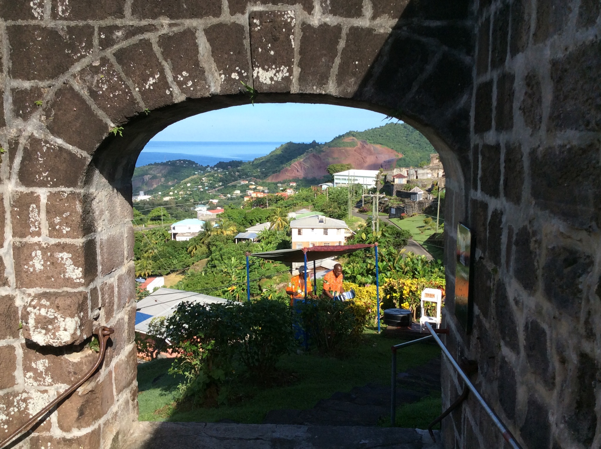
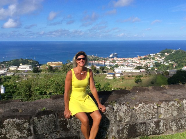
Our first stop was Fort Frederick which sits above St George’s Town and the port where our ship was docked. We had a fantastic view over the harbour which is a perfect horseshoe shape. Fort Fredrick construction was started in 1779 by the French and completed by the British several years later. A chain of forts (Fort Matthew, Fort Lucas and Fort Adolphus) adjoin Fort Frederick and are said to be connected by a network of subterranean tunnels. Large underground cisterns that held water for Her Majesty’s troops are still in use today.

IMG_2155.JPG

IMG_2156.JPG

IMG_2157.JPG

IMG_2161.JPG

IMG_2162.JPG

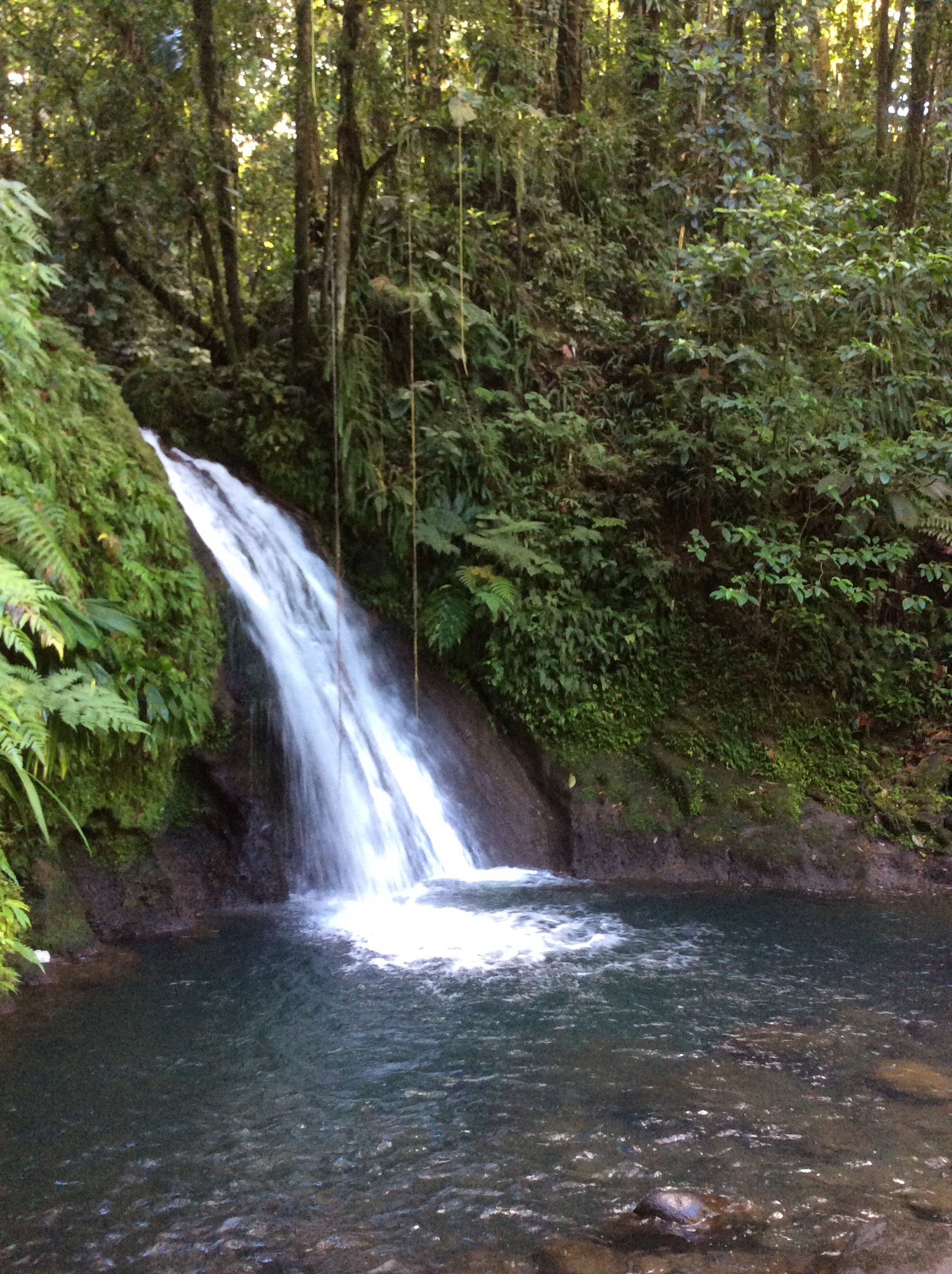
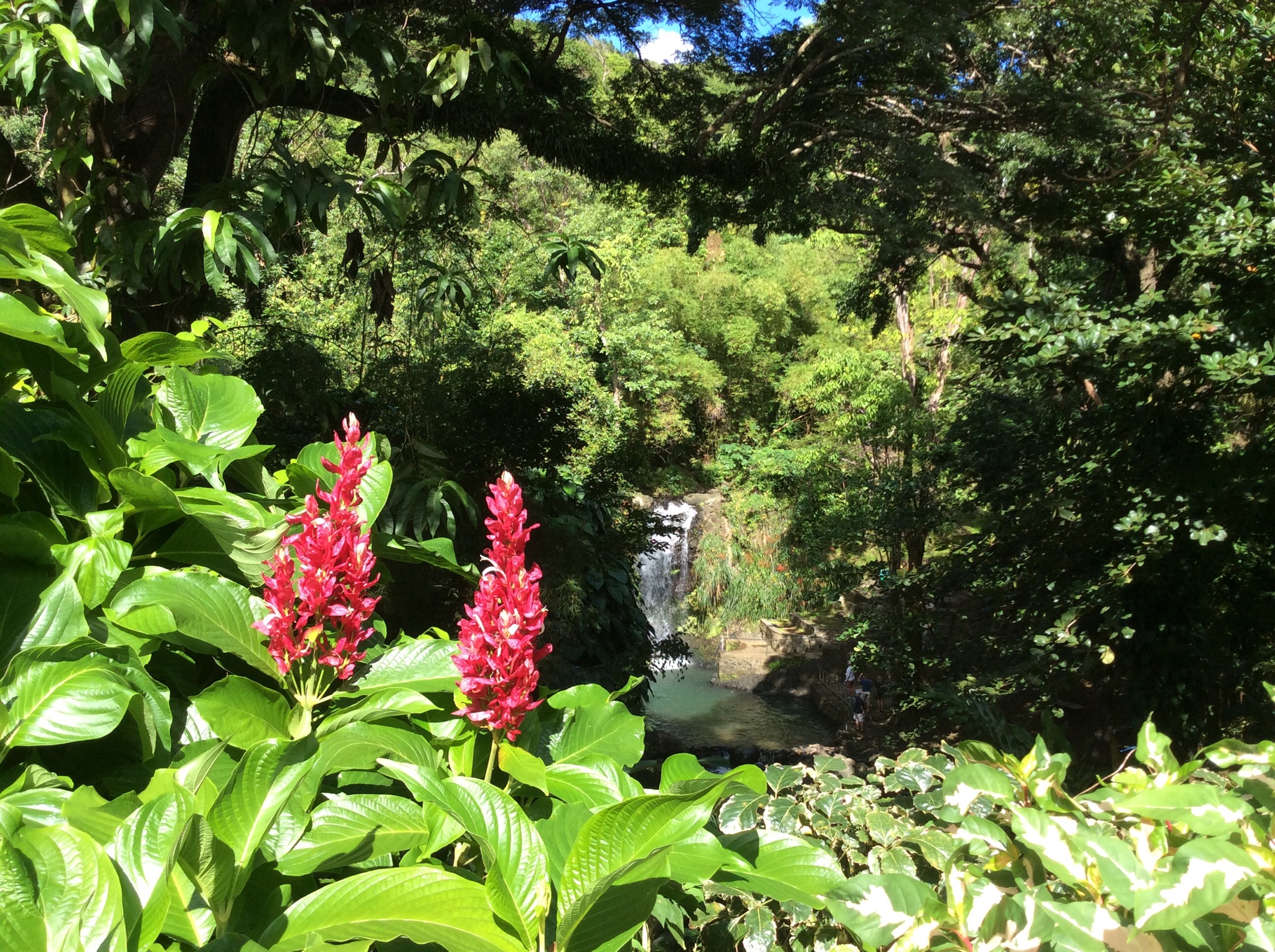
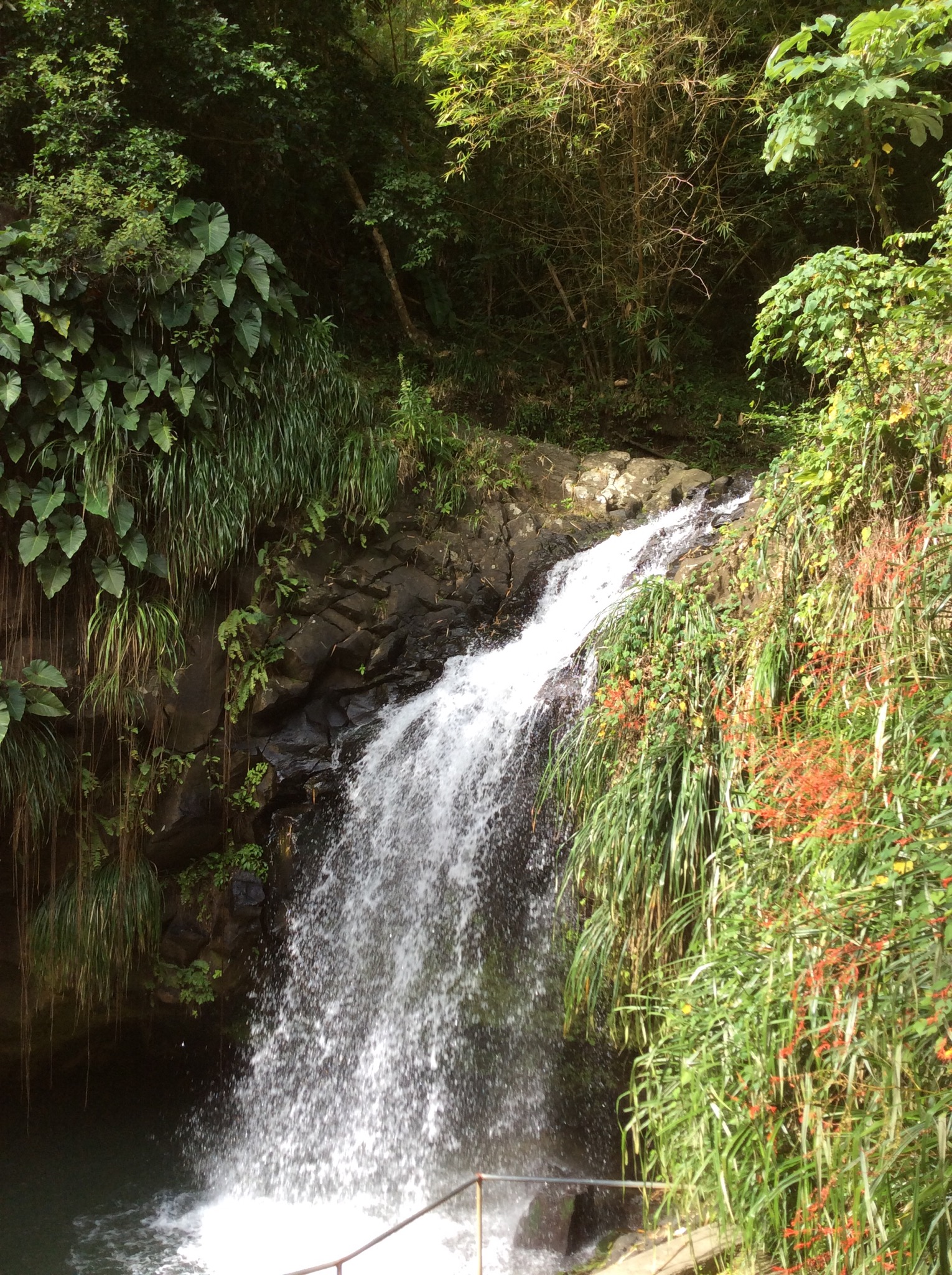
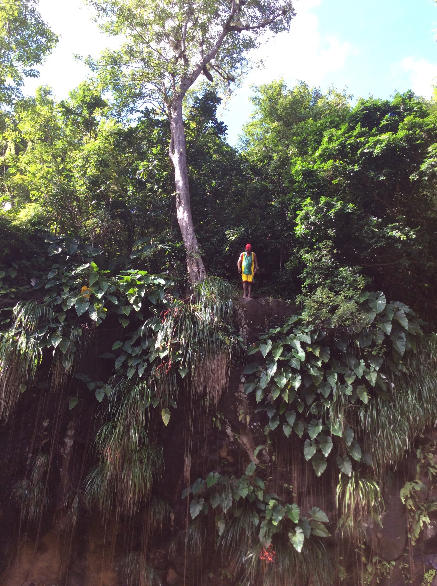
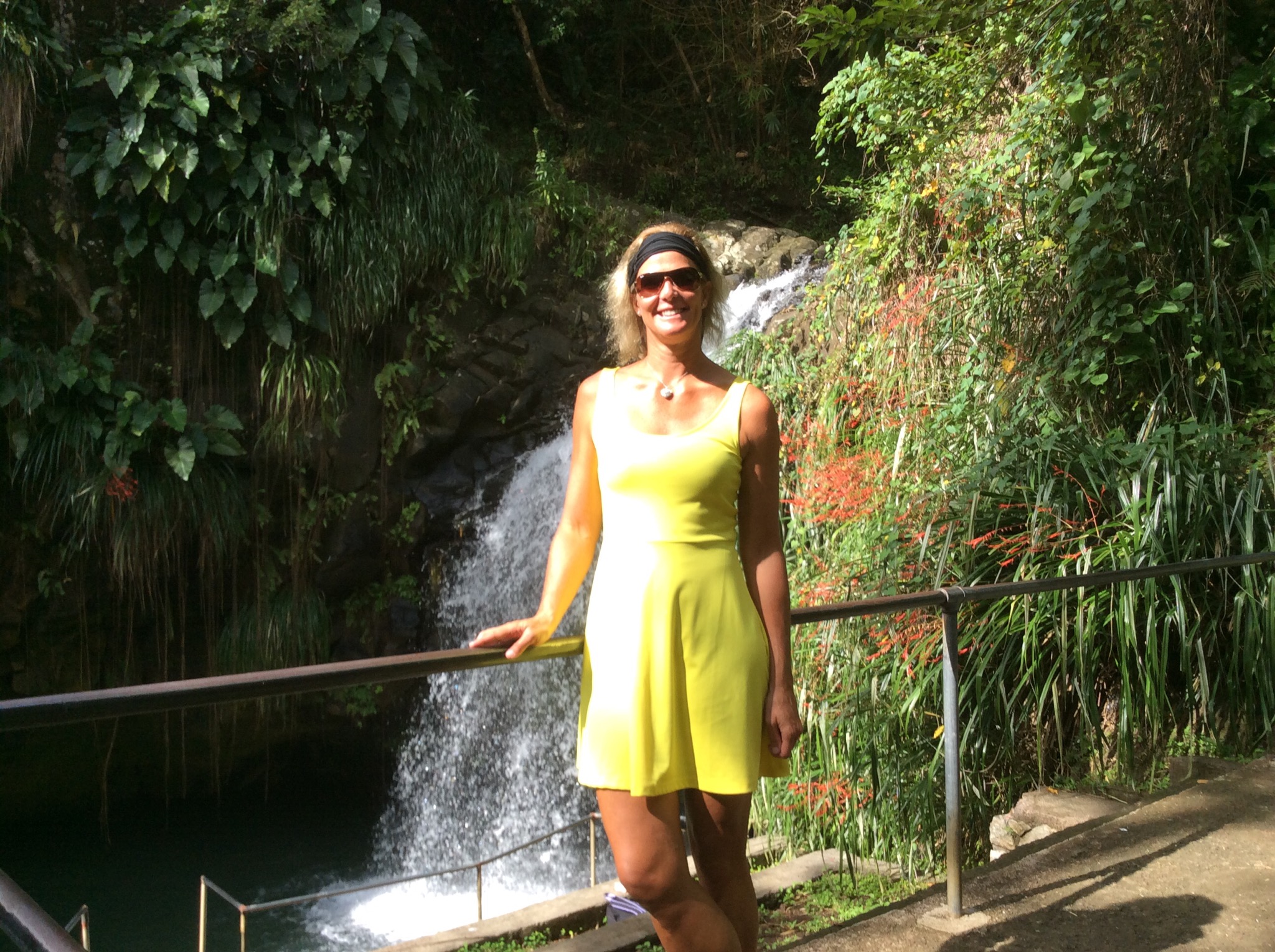
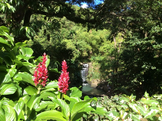
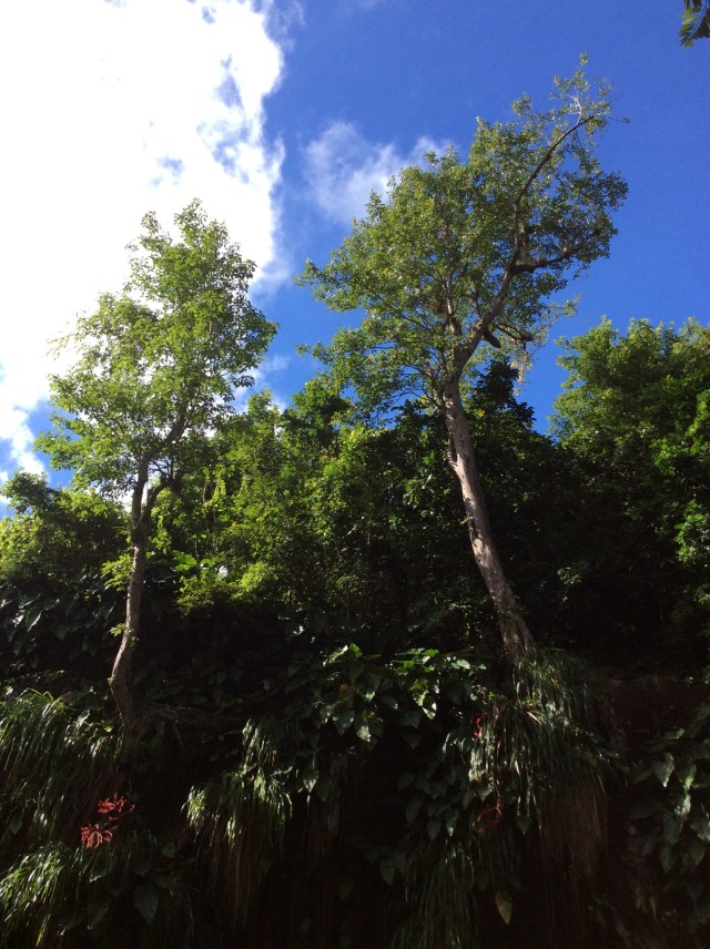
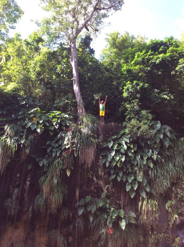
We then drove to Annandale Falls which is a waterfall surrounded by lush vegetation. At the entrance to the path of the falls there were a few stalls selling local items including spice necklaces. They smelt wonderful and apparently last for three years – unfortunately I think NZ Customs may have a problem on my return into the country if I purchased one of these necklaces. There was a guy playing a guitar and making songs up about you as you walked along, for a tip of course : ) When we got down to the falls there were these young guys who climb up and jump off the cliff into the water – again for a tip. We had learnt that unemployment is about 32% on the island so we thought good on these people for using their imagination – it was great watching them jump off for you.

IMG_2164.JPG

IMG_2165.JPG

IMG_2166.JPG

IMG_2167.JPG

IMG_2168.JPG

IMG_2170.JPG

IMG_2173.JPG

IMG_2176.JPG

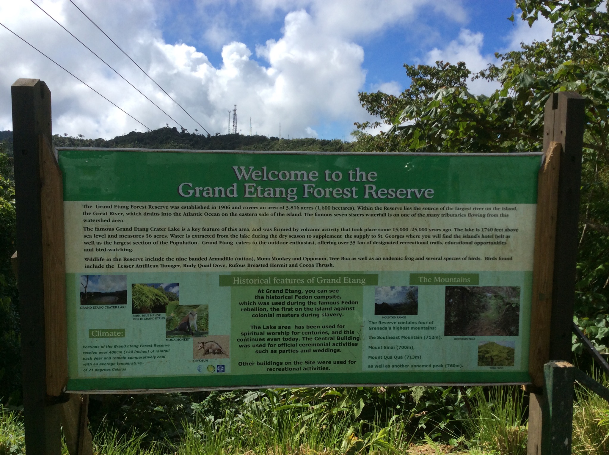
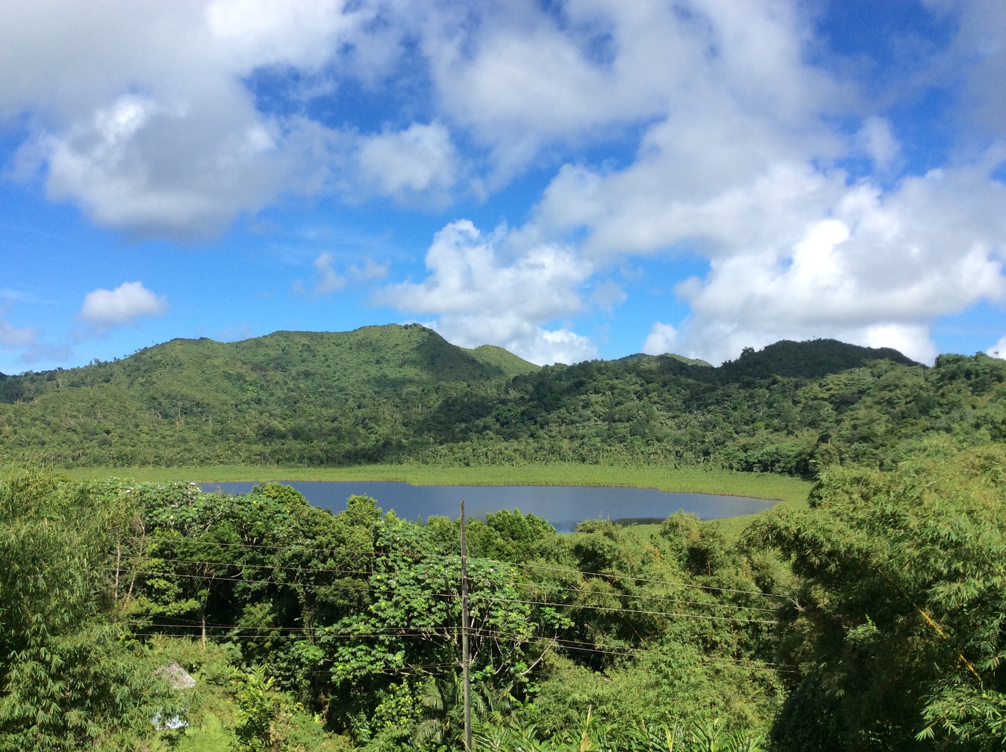
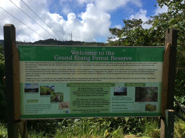
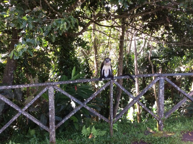
The Grand Etang National Park contains a lake that exists in an extinct volcano at 1,900 feet above sea level. We also saw a Mona Monkey.

IMG_2188.JPG

IMG_2179.JPG

IMG_2181.JPG

IMG_2182.JPG

IMG_2190.JPG

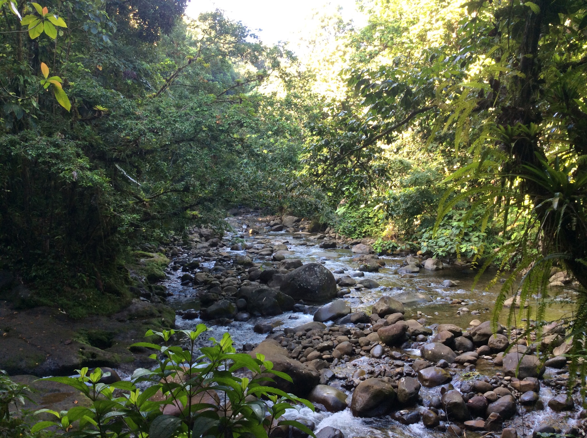
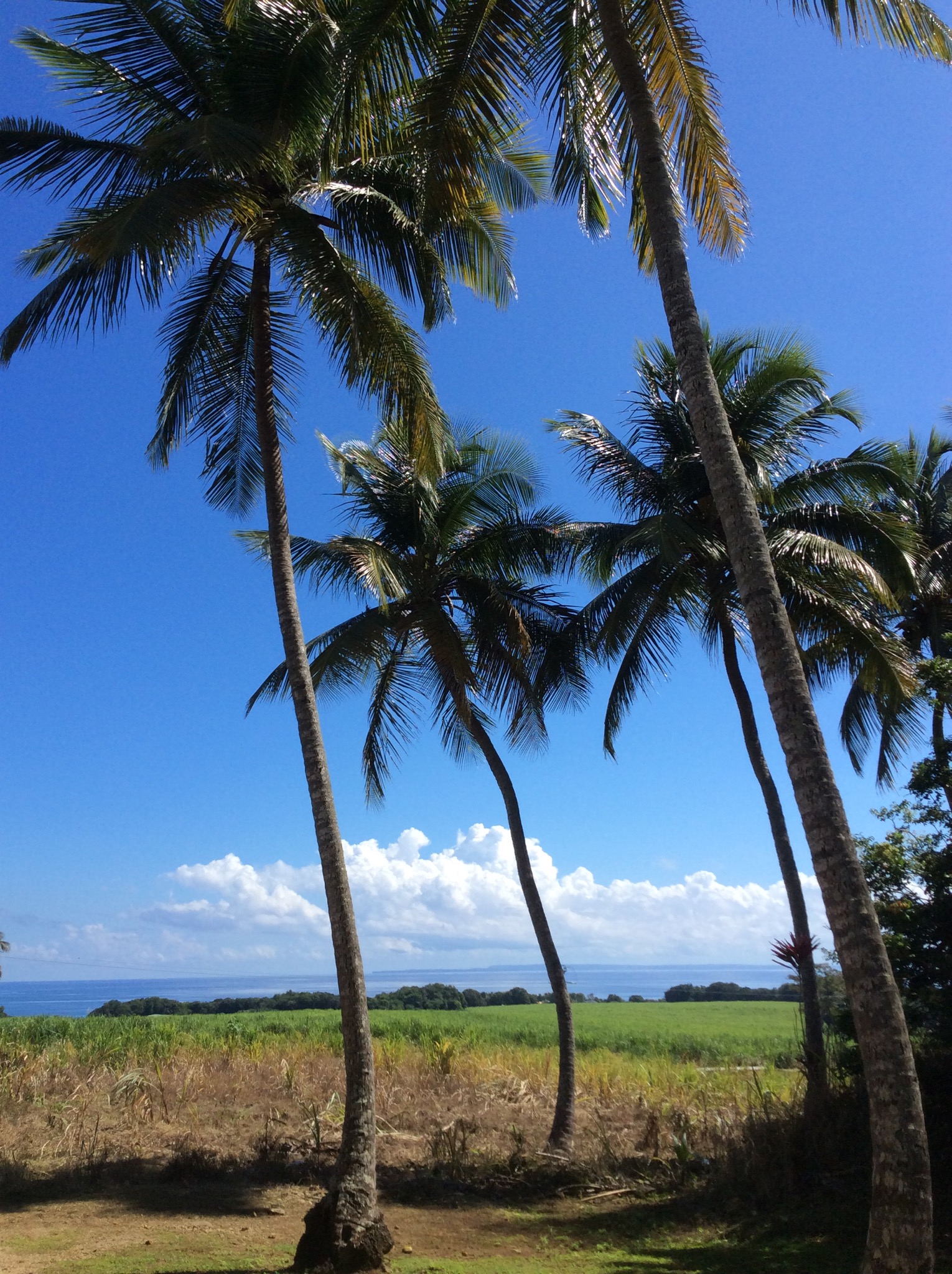
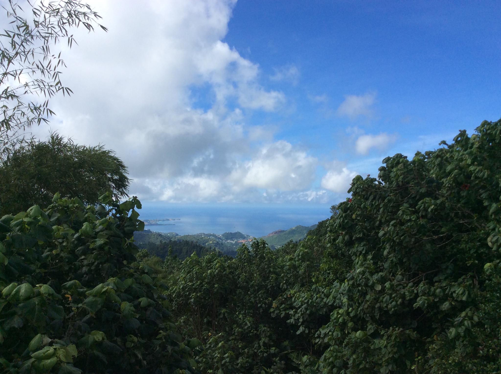
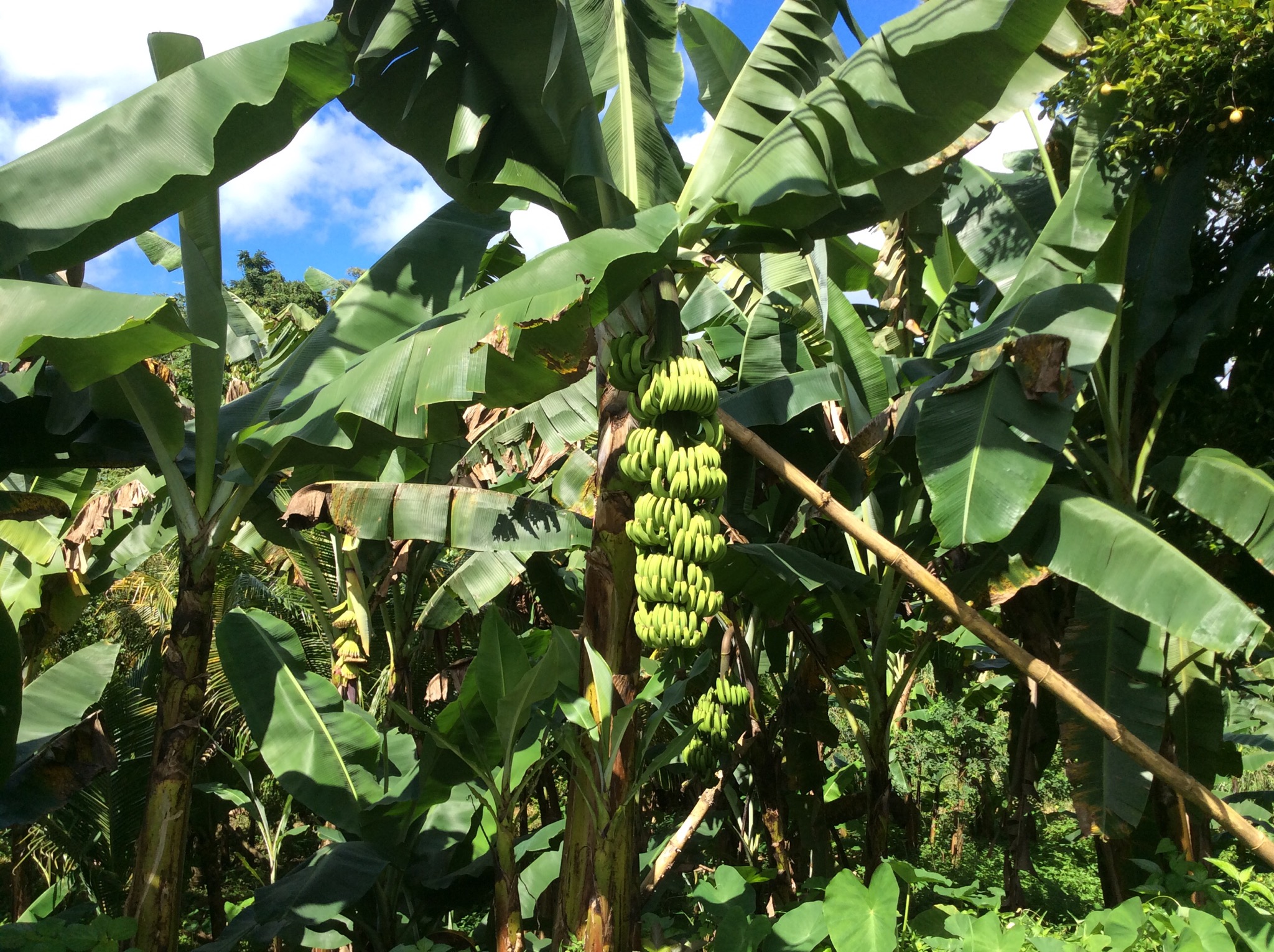
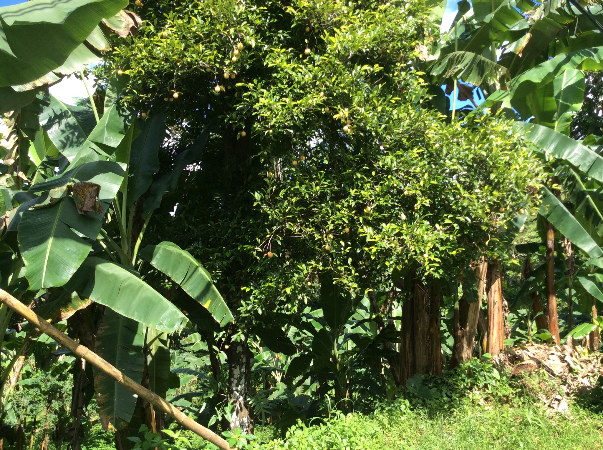
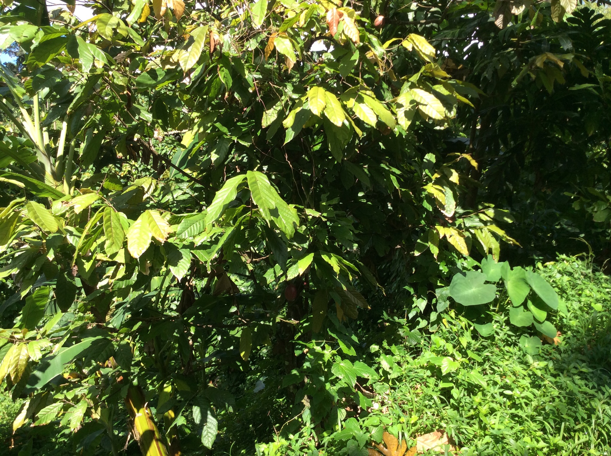
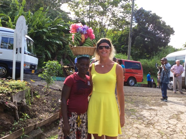
As we drove around the island Louis pointed out various plants, fruit and spice trees. I was quite enamoured with the lush vegetation. The island is split into 6 parishes – St George, St John, St Mark, St David, St Andrew and St Patrick and each one has some little villages of which one is the capital of the parish. There were a number of fishing villages dotted along the coast line. The housing varied from quite nice to subsistence. There were a lot of old cars which had been left to rust out littering the landscape which I thought detracted from one of the most stunning islands I’ve seen – it was a shame. The hilly terrain all over the island gave us some great views of the coast line.

IMG_2191.JPG

IMG_2192.JPG

IMG_2193.JPG

IMG_2195.JPG

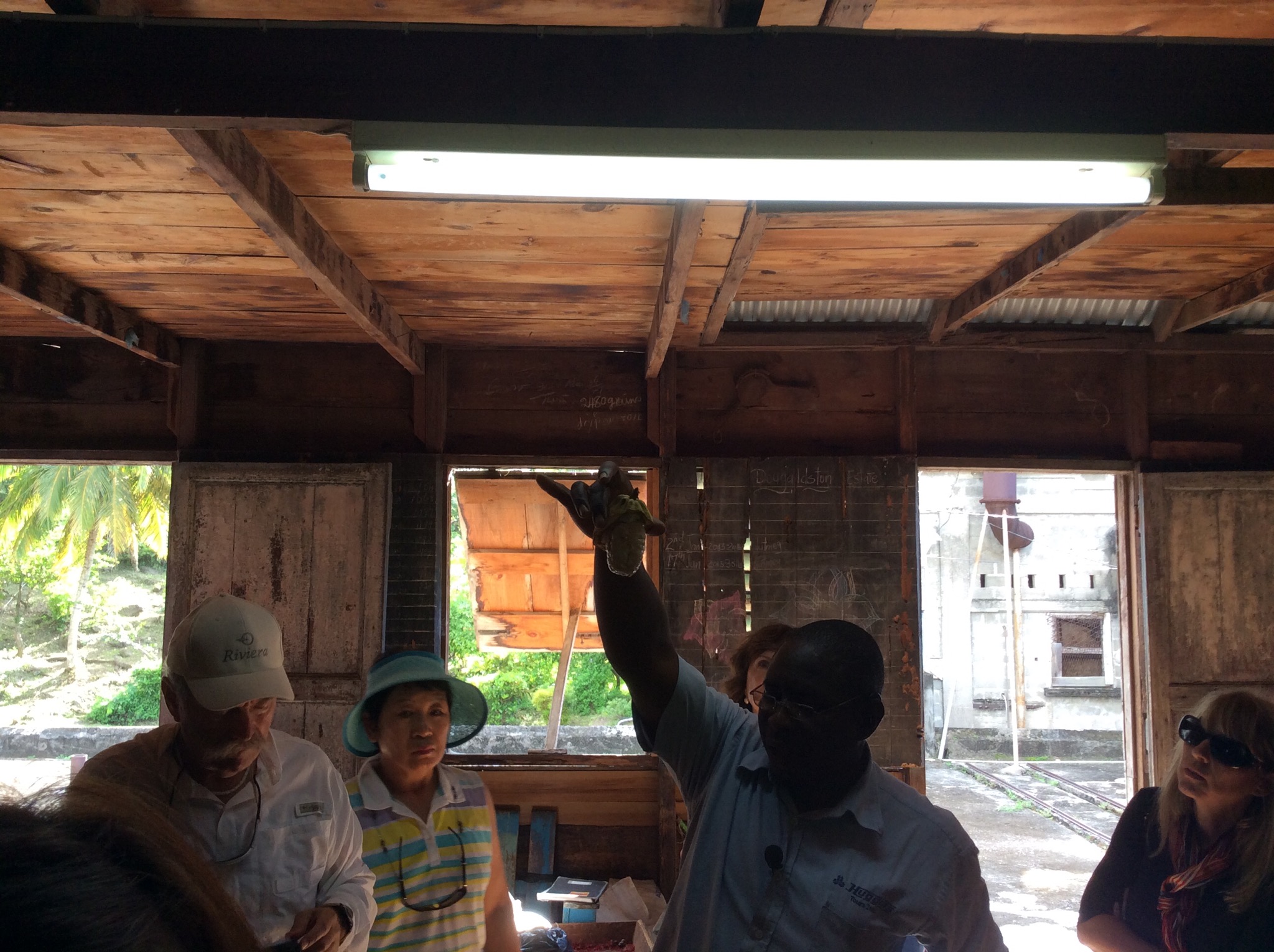
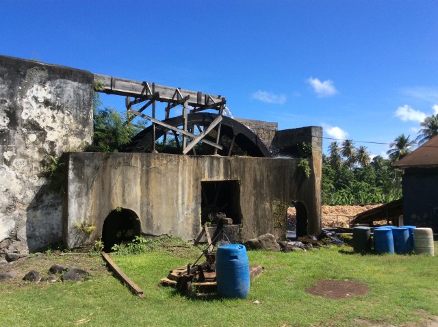
We stopped at the River Antoine Estate which is a rum distillery that still uses a 19th century water wheel to produce 152 proof liquor, considered too strong for visitors to bring home on a plane. The estate has been going since 1785 with very little change in the process over the years. We had a tour around the place and our guide was so lovely – she kept calling us all “my dear”. It was a Saturday so they weren’t crushing the sugar cane so we wandered freely through the place. NZ Health & Safety would have had a field day at this place.

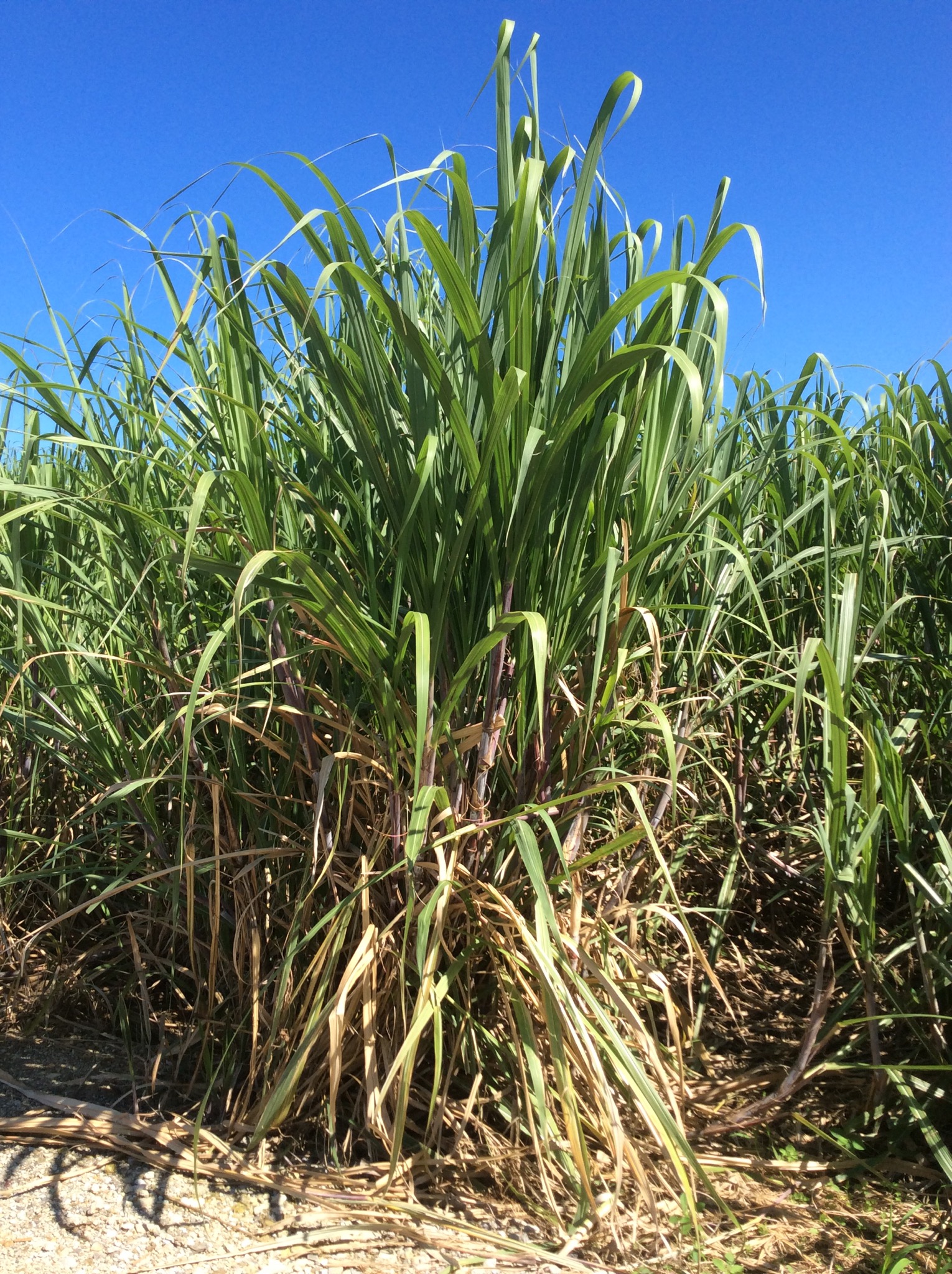
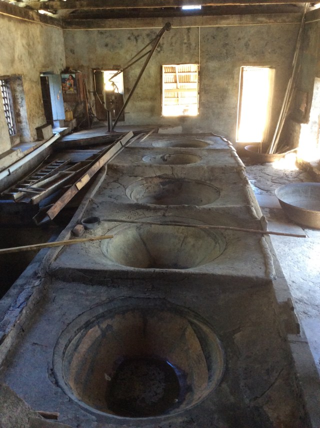
The sugar cane is harvested and then the juice crushed from it – the water wheel produces the power for the crushing machine. It goes through the crushing process twice. The sugar cane fibre is then burnt in the boiling house underneath the boiling pots. The cane juice enters these pots through a wooden guttering. It is then filtered and collected before being processed into syrup via the boiling process. An important ingredient in the sugar industry is white lime which is added to the cane juice as a purifier and as a means of obtaining a satisfactory level of acidity. The boiling pots are made from copper or iron taycher and go from large to small or hot to hottest. They hand ladle the juice from pot to pot. It is then transferred to a holding tank for 48 hours where it cools in preparation for the fermentation process.

The cool syrup is then pumped into a goose neck shaped boiler where the main fuel used for boiling the rum is wood. It is heated up to a temperature of 250 degrees. At this point the alcohol leaves the boiler in the form of vapour or steam into the vaporiser. From here it goes into the condenser and turns into rum. This is then stored and eventually bottled. Most of the rum produced at the River Antoine Estate is sold on the island to locals and tourists alike. The produce 69% alcohol (138% proof) and 75% alcohol rum. The 75% version or 152% proof is considered too dangerous to take on a plane.

I did not try the 69% or 75% rum choosing instead to try the rum punches which were very nice but pretty potent. Some of our fellow travellers tried the straight rum and said it definitely had the ability to curl your hair. The Estate employs 98 people including those that harvest the sugar cane. It has employed many generations over the years – our guide said her Grandmother and Mother both worked on the Estate.

IMG_2196.JPG

IMG_2197.JPG

IMG_2200.JPG

IMG_2205.JPG

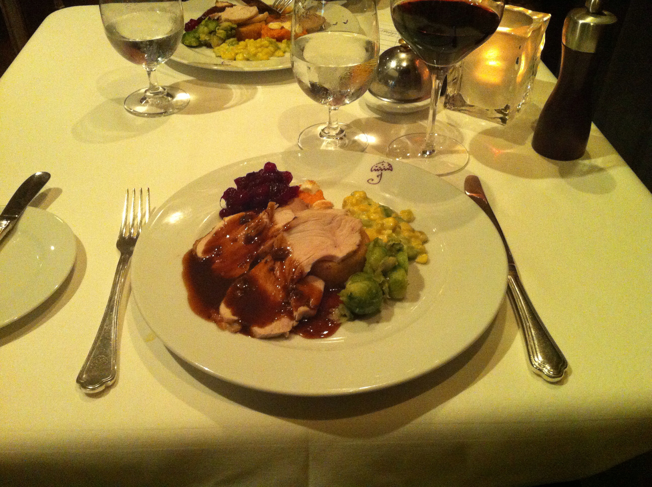
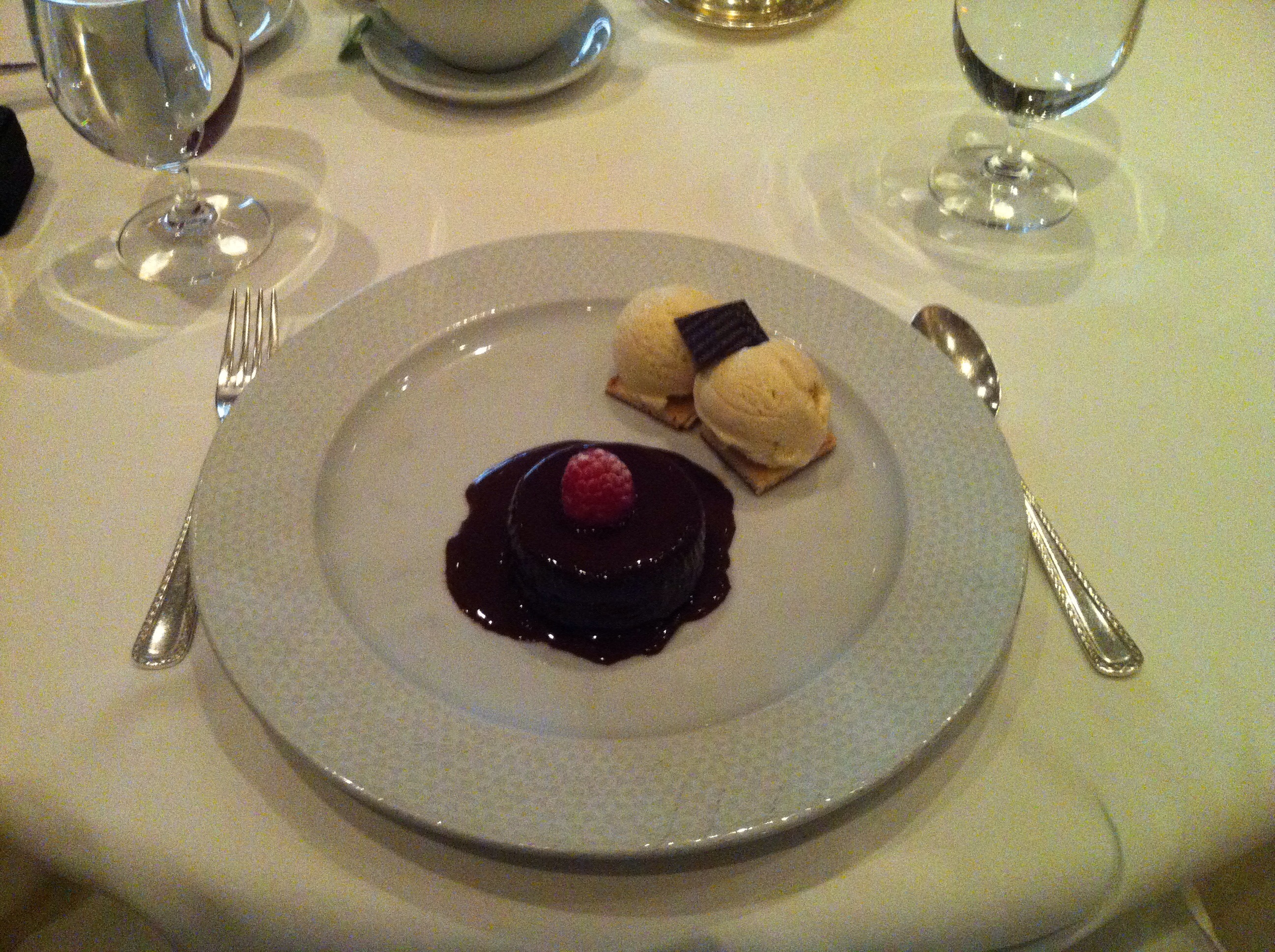
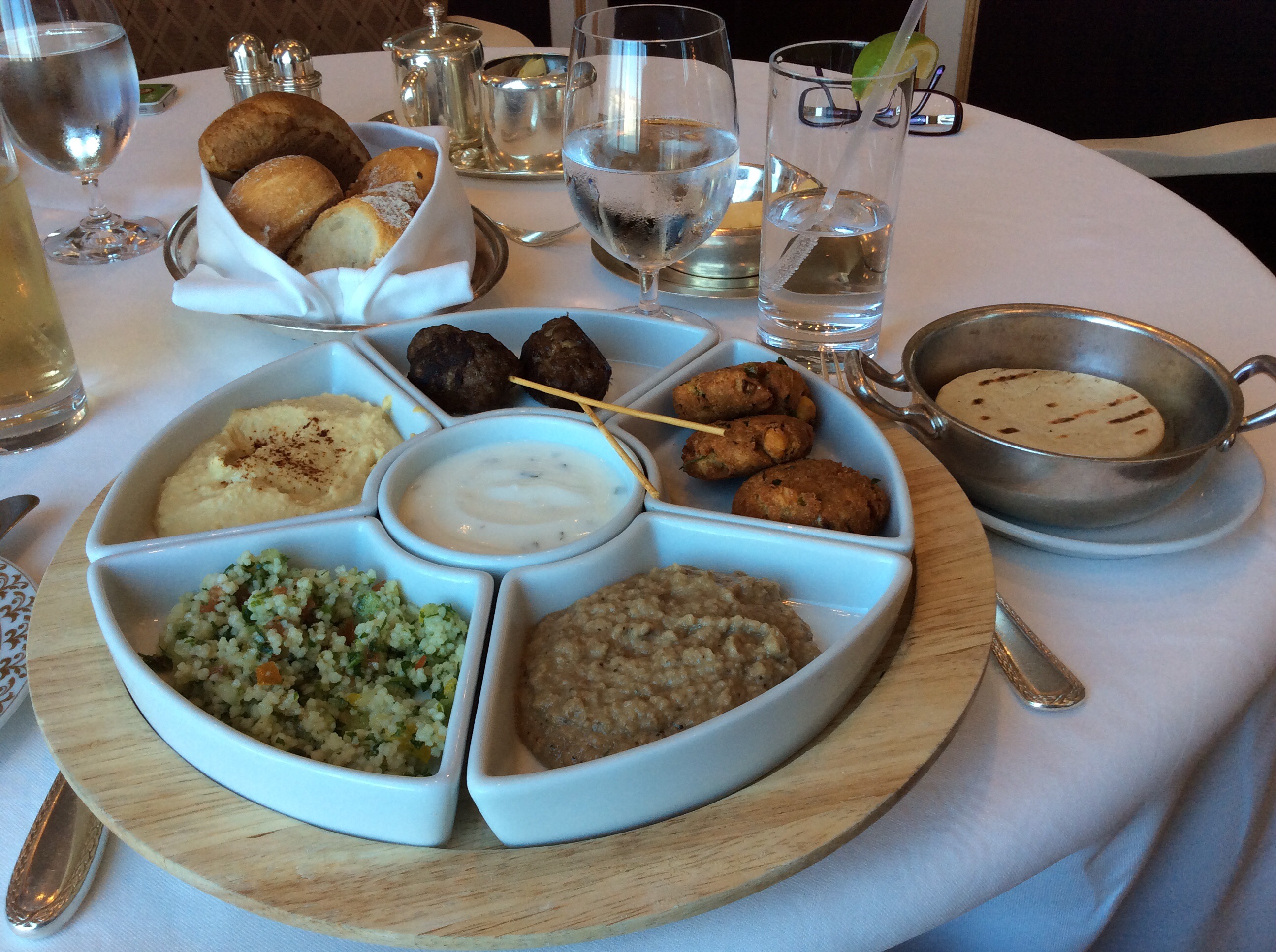
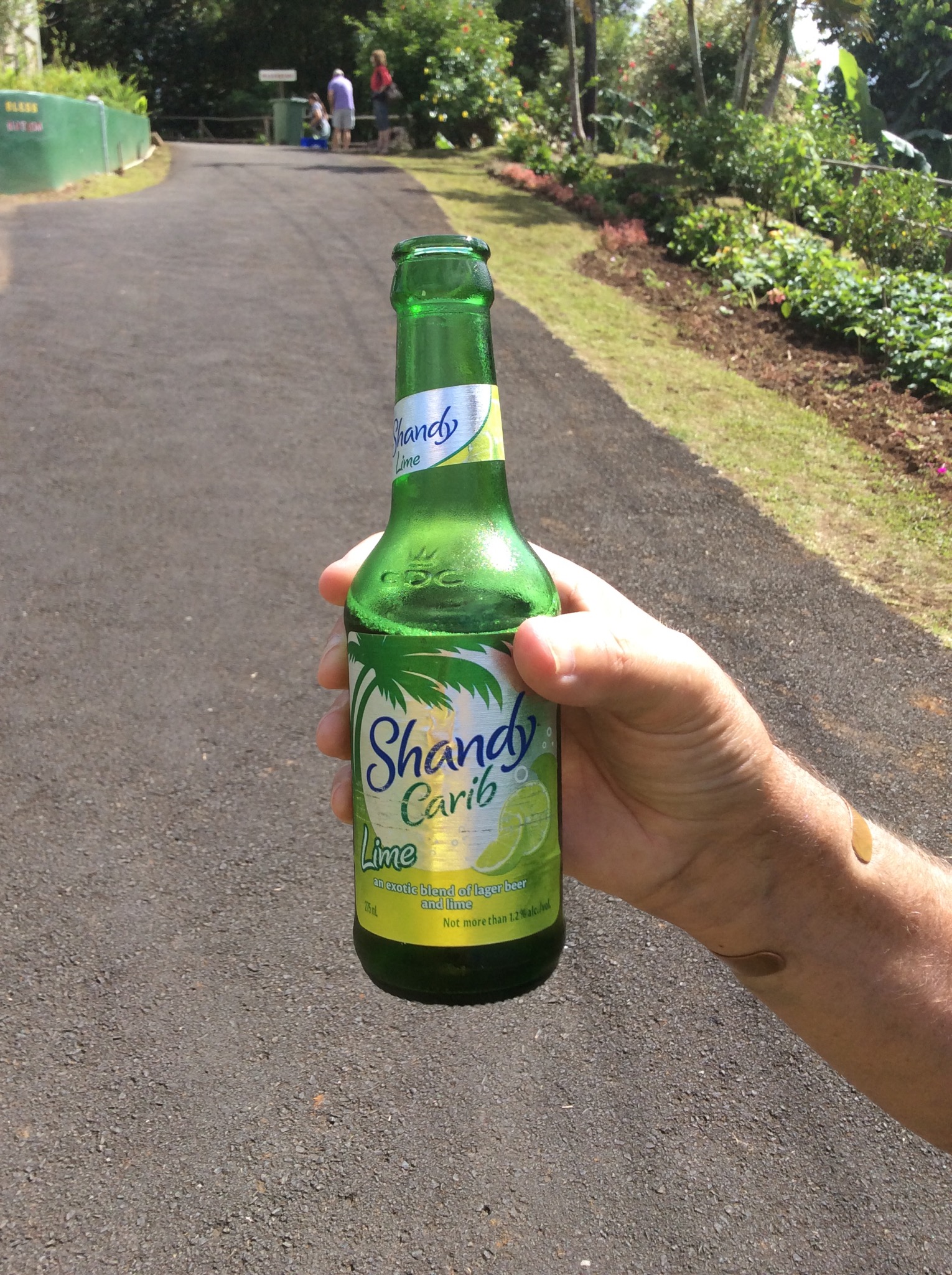
We then had lunch at a restaurant not far from the Estate. The food was lovely and you could taste all the local flavours. We had a local drink made from yellow apples and lime juice – so yummy.

IMG_2206.JPG

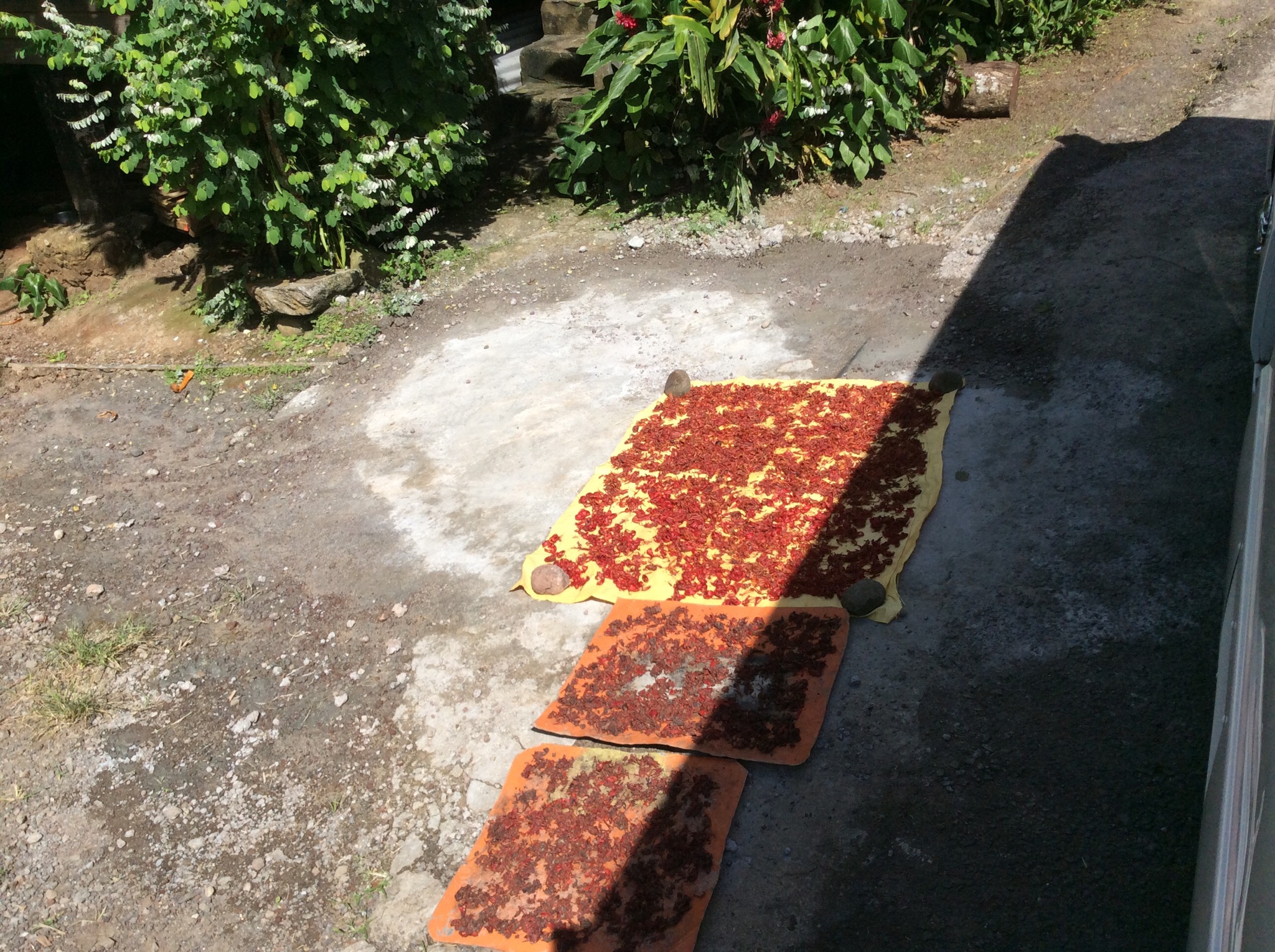
Next stop was the Dougaldston Spice Estate – a historical monument to Grenada’s past, where most of the island’s precious spices (nutmeg, allspice, clove, cinnamon, ginger, cocoa, bay leaves, mace) are grown and processed. Over the years the original owners and people that used to work the estate have died off and the younger generation have not taken up the reigns – the Estate is now a fraction of the size it was. The nutmeg is sold to the nutmeg factory in town and the cacao is sold to the chocolate factory – they then further process it and export it. The cacao that is grown and processed on the island is used in chocolate blends offshore rather than to produce edible chocolate. The island used to be a big exporter of bananas too but due to competition from larger countries this industry has also diminished with most produce being consumed locally by the population of 110,000.

IMG_2207.JPG

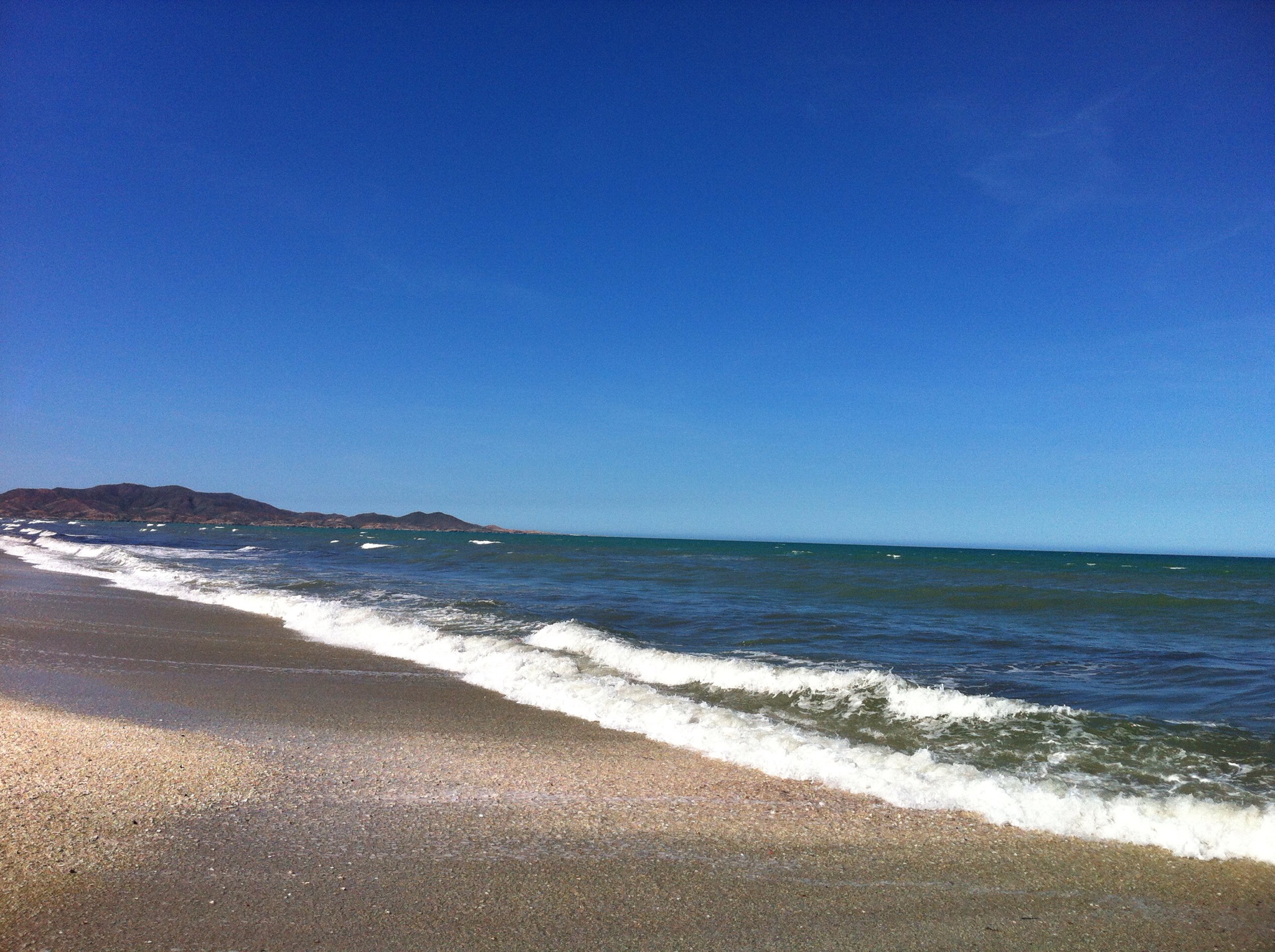
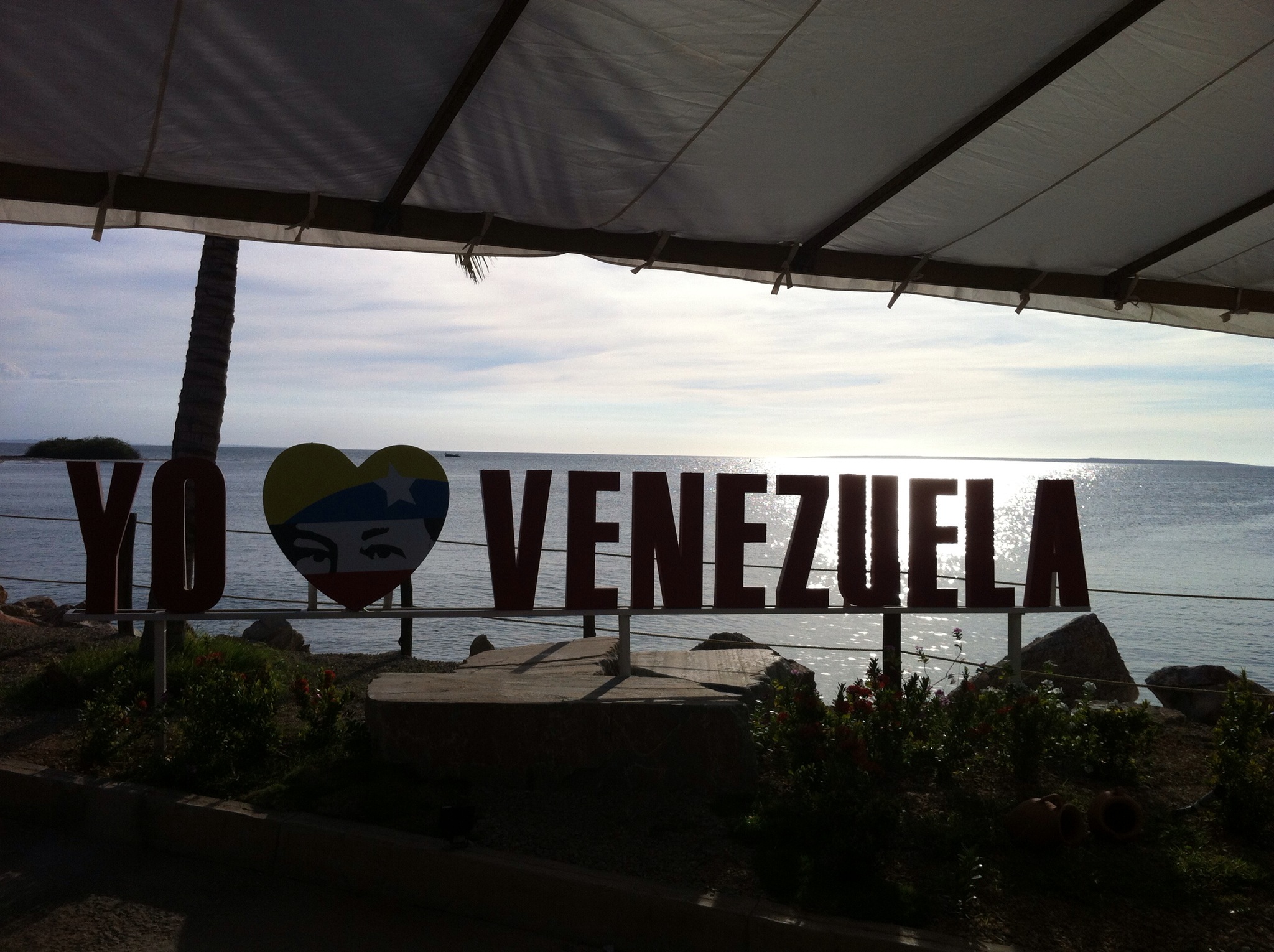
Grenada gets a lot of rain so water is not a problem – they collect it and treat it in the various treatment plants around the island. The electricity company on the island is Canadian owned and they use diesel generators to produce the power for the island which makes it quite expensive. It costs an average household USD120 per month for electricity. The fuel and oil on the island is purchased from Venezuela.

To the uninitiated, the Southern Caribbean island of Grenada is better known for its political history – U.S. troops intervened in a coup during President Reagan’s administration, at the time a controversial volley in the Cold War in 1983 – I don’t remember this but did some more research as it occurred in my lifetime (see below for more information).

It is also known for Hurricane Ivan, which damaged 90 percent of Grenada’s buildings, destroyed 85 percent of its nutmeg trees and left more than half the population homeless in September 2004. While you’ll still see some lingering effects as you tour around the island — churches without roofs, homes still being rebuilt. The famous nutmeg industry is still recovering from the 2004 hurricane – the trees take between seven and 15 years to mature enough to bear fruit. A year later with the help of international donors (Canada, the United States, China, Venezuela, and the European Union) Grenada had experienced a significant turn around in rebuilding efforts. By 2007, Grenada had participated as planned in the hosting of the 2007 Cricket World Cup.

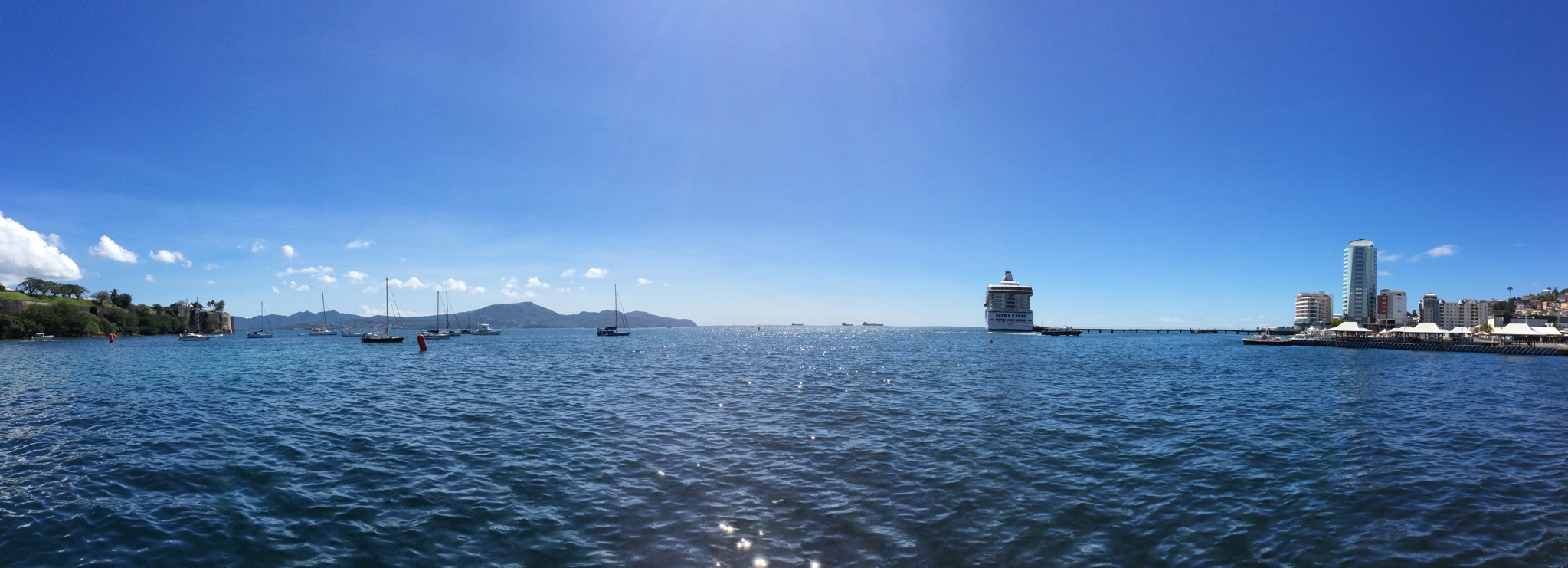
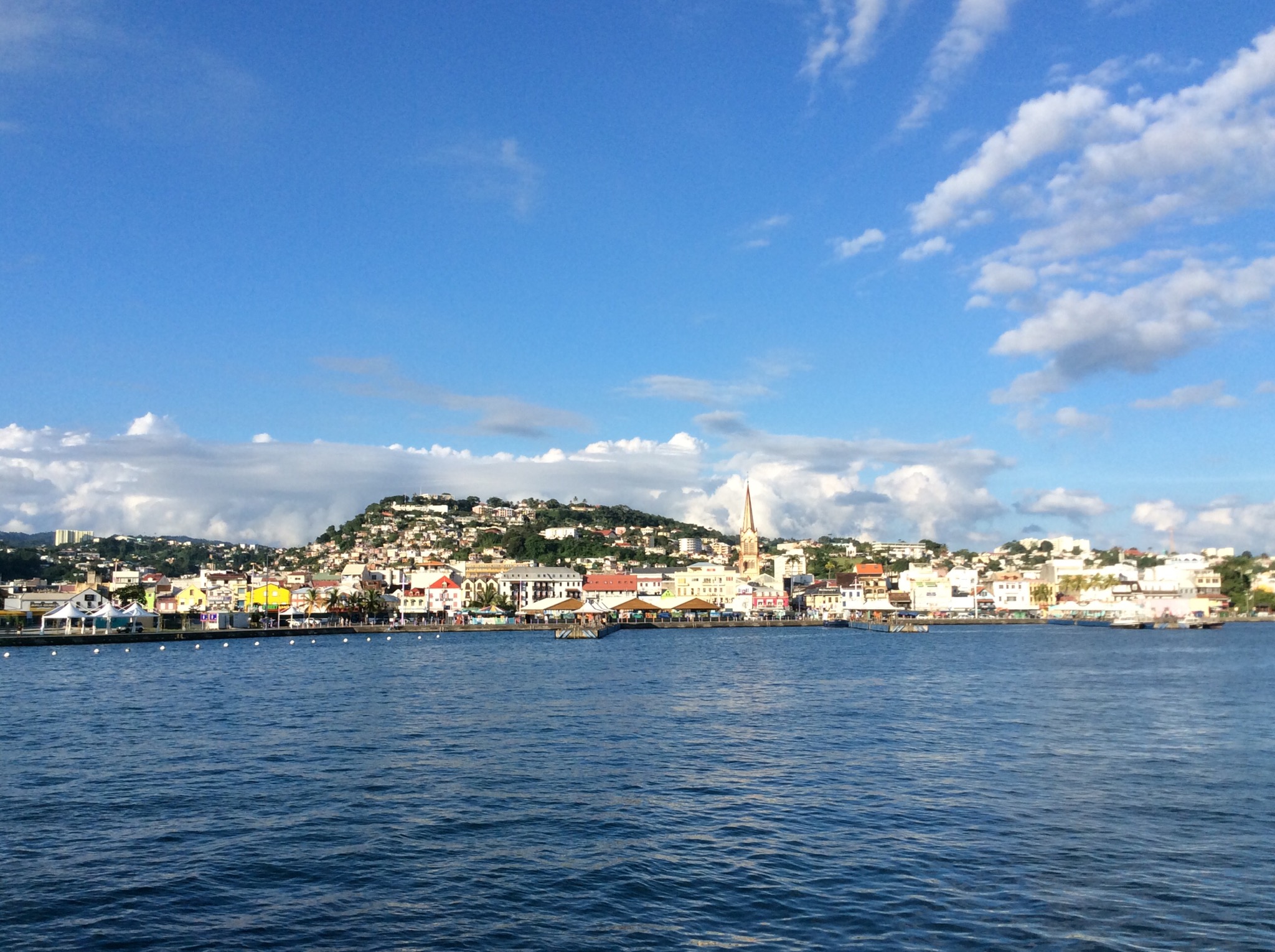
St. George’s is the capital of Grenada. The city is surrounded by a hillside of an old volcano crater and is on a horseshoe-shaped harbor. The city is home of St. George’s University School of Medicine. The main exports are cocoa bean cacao, nutmeg, and mace spice. It has a moderate tropical climate that ensures the success of this spice production. It is known as the Isle of Spice.

In 1666, a wooden fortification was constructed by French colonists on a promontory overlooking Grenada’s natural harbour and named Fort Royale. In 1705, work started on a new star fort on the same site, with four stone-built bastions, to the design of Jean de Giou de Caylus, the Chief Engineer of the “Islands of America” the French West Indies. It was completed in 1710. Meanwhile, the original colonial settlement at the eastern edge of the harbour called Saint Louis after King Louis IX of France, later known as Port Louis, was found to be subject to flooding and malaria, so a new town was constructed called Ville de Fort Royale (“Fort Royal Town”). When the island was ceded to Great Britain by the Treaty of Paris in 1763, the new administration renamed it Saint George’s Town, after the patron saint of England and Fort Royale was renamed Fort George, after King George III. On the 1 November 1775 there was a fire in the town of St. George’s known as the great fire of St George’s. After the great fire of 1771, most of the boarding houses on Granby Street were moved to Gouyave.

Following the withdrawal of Bridgetown, Barbados, in the mid-1880s, St. George’s went on to become the replacement capital of the former colony of the British Windward Islands.

Though St. George’s was discovered by Christopher Columbus on this third voyage in 1498, the island was relatively neglected until 1650, when it was purchased by the governor of Martinique. The French began their colonisation with a series of skirmishes that virtually exterminated the island’s native Carib population. The survivors were pushed north to Le Morne des Sauterurs, where rather than surrender they jumped off the cliff to the jagged rocks below. Today the site of the Carib defeat is known as “Carib’s Leap.”

The average temperature is about 30 °C (86 °F). There are two seasons: the ‘dry’ season is from January to May and the ‘rainy’ season lasts for the rest of the year. There are short spells of rain in the dry period but they last no more than 5 minutes or so. Gray clouds over the mountains are the first sign of rain.

Spices
Nutmeg & Mace
Nutmeg and mace come from the fruit of the aromatic Myrristica fragrans tree. The alien tree was adopted as from March 3, 1967 to the Spice Island. The tree is an evergreen with dark green leaves and small yellow flowers, and grows up to 12 meters tall. It starts bearing fruit after seven or eight years and continues to do so for up to 40 years. The fruit looks like an apricot and when ripe, slit to reveal a walnut sized seed. Covering the shell of the seed are lacy, red-orange strips, which are mace, and inside the shell is the seed itself – nutmeg. It is valued as a cure all for digestive, liver and skin problems and it is believed that it has aphrodisiac qualities as well. It is used extensively for cooking to enhance the flavor of cakes, soups, desserts, drinks and sauces.

IMG_2192-0.JPG

IMG_2195-0.JPG

Cinnamon
This comes from the inner bark of the cinnamon tree (Cinnamonum verum). Whole or ground, it is a popular household spice internationally. It is used to flavor beverages and cakes.

Clove
This dried flavored flower bud, whole or ground (Syzygium aromaticum) is used at home to season hams, sausages, meats, mincemeat pies, fish, turtle preserves and pickles.
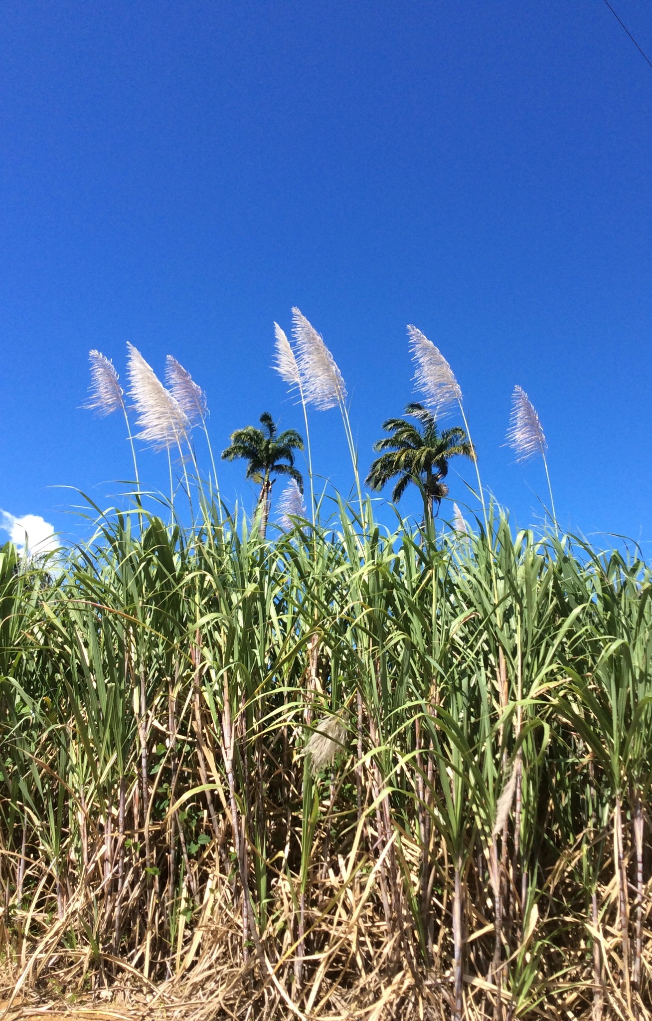
Sugar cane
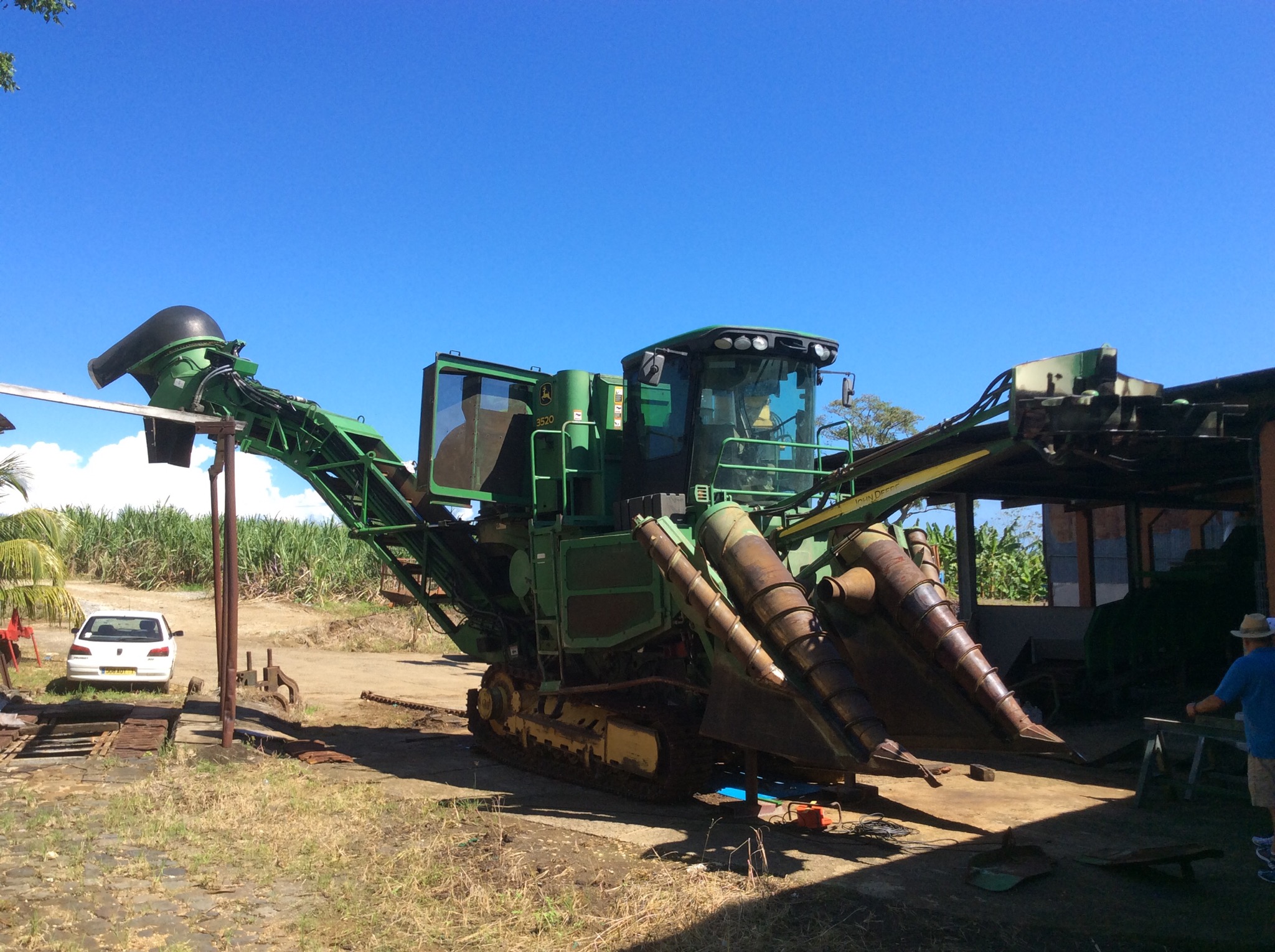
From June to December, cuttings from the tops of cane are laid in holes about five inches deep by five feet square then covered with soil. As the cane grows taller, fertilizer is used. Between planting and harvesting, bananas, corn, peas, potatoes, and other crops are cultivated. January to May, the ripe cane are cut and delivered to the mill to be ground. Boiling and clarifying the cane juice is the next operation. The juice is strained after grinding and then taken to the clarifying copper to be boiled. (Wood coal is the main source fuel). Lime is added to speed up the operation. The liquid sugar is put into coolers for about 14 hours. The molasses is then drained off and taken to the still house to be made into rum.

Operation Urgent Fury (1983)
Sir Eric Gairy had led Grenada to independence from the United Kingdom in 1974. His term in office coincided with civil strife in Grenada. The political environment was highly charged and although Gairy—head of the Grenada United Labour Party—claimed victory in the general election of 1976, the opposition did not accept the result as legitimate. The civil strife took the form of street violence between Gairy’s private army, the Mongoose Gang, and gangs organized by the New Jewel Movement. In the late 1970s the NJM began planning to overthrow the government. Party members began to receive military training outside of Grenada. On 13 March 1979, while Gairy was out of the country, the NJM—led by Maurice Bishop—launched an armed revolution and overthrew the government, establishing the People’s Revolutionary Government. The leftist New Jewel Movement was seen favorably by much of the Grenadan population.

On 16 October 1983, a party faction led by Deputy Prime Minister Bernard Coard seized power. Bishop was placed under house arrest. Mass protests against the action led to Bishop’s escaping detention and reasserting his authority as the head of the government. Bishop was eventually captured and murdered along with several government officials loyal to him. The army under Hudson Austin then stepped in and formed a military council to rule the country. The governor-general, Paul Scoon, was placed under house arrest. The army announced a four-day total curfew where anyone seen on the streets would be subject to summary execution.

The Organization of Eastern Caribbean States (OECS), as well as the nations of Barbados and Jamaica, appealed to the United States for assistance. According to a reporter for The New York Times, this formal appeal was at the request of the U.S. government, which had already decided to take military action. U.S. officials cited the murder of Bishop and general political instability in a country near U.S. borders, as well as the presence of U.S. medical students at St. George’s University, as reasons for military action. The reporter also claimed that the latter reason was cited in order to gain public support. It was later revealed that Grenada’s Governor General, Paul Scoon, had requested the invasion through secret diplomatic channels. Scoon was well within his rights to take this action under the reserve powers vested in the Crown.

On 25 October, Grenada was invaded by the combined forces of the United States and the Regional Security System (RSS) based in Barbados, in an operation codenamed Operation Urgent Fury. The U.S. stated this was done at the request of the prime ministers of Barbados and Dominica, Tom Adams and Dame Eugenia Charles, respectively. Nonetheless, the invasion was highly criticized by the governments in Canada, Trinidad and Tobago, and the United Kingdom. The United Nations General Assembly condemned it as “a flagrant violation of international law” by a vote of 108 in favour to 9, with 27 abstentions. The United Nations Security Council considered a similar resolution, which failed to pass when vetoed by the United States.

The Bishop government began constructing the Point Salines International Airport with the help of Britain, Cuba, Libya, Algeria, and other nations. The airport had been first proposed by the British government in 1954, when Grenada was still a British colony. It had been designed by Canadians, underwritten by the British government, and partly built by a London firm. The U.S. government accused Grenada of constructing facilities to aid a Soviet-Cuban military buildup in the Caribbean based upon the 9,000-foot length, which could accommodate the largest Soviet aircraft like the An-12, An-22, and the An-124, which would enhance the Soviet and Cuban transportation of weapons to Central American insurgents and expand Soviet regional influence. Bishop’s government claimed that the airport was built to accommodate commercial aircraft carrying tourists, pointing out that such jets could not land at Pearl’s Airstrip on the island’s north end (5,200 feet) and could not be expanded because its runway abutted a mountain and the ocean at the other end.

Nearly 8,000 soldiers, sailors, airmen, and marines had participated in Operation Urgent Fury along with 353 Caribbean allies of the Caribbean Peace Forces. U.S. forces sustained 19 killed and 116 wounded; Cuban forces sustained 25 killed, 59 wounded, and 638 combatants captured. Grenadian forces casualties were 45 killed and 358 wounded; at least 24 civilians were killed, 18 of whom were killed in the accidental bombing of a Grenadian mental hospital.

The date of the invasion (25 October) is now a national holiday in Grenada, called Thanksgiving Day, and the Point Salines International Airport was renamed in honor of Prime Minister Maurice Bishop in 2009 to Maurice Bishop International Airport,

Posted in Oceania Cruises | Leave a comment

Isla de Margarita, Venezuela – Oceania

Today we docked in El Guamache on the island of Margarita just off the coast of Venezuela. I had decided to do a kayaking trip whereas all Steve’s table tennis had left him with a sore elbow so he decided to rest up for his upcoming golf games.

There were 24 of us on the kayak tour and we jumped into 4 open top jeeps to go across the island to the National Park. I was joined in my jeep by two guys from Miami, a couple from New York and a woman from Orlando. Lou, the woman from Orlando had visited New Zealand ten years ago and loved it. She thought it was so quaint – like a country stuck in the 1950’s but with internet! I told her we are not that backwards and I have been to some places in the US which truly are stuck in the 1950’s!

We got onto the highway which our driver, Antonio told us was a very important road – it is the only highway on the island that joins the east of the island with the west. We then went off road which was fun and drove alongside the longest beach on the island which is 26km long. Our kayaking guides Alfredo and Jeannine (husband and wife) met us at the kayak camp and we set off into the lagoon. Alfredo said if we had any questions to ask him, if we had any problems ask the wife!

They have a lot of bird and fish life in the lagoon. It is a salt water lagoon that is more salty than the ocean. It was a clear blue sky day with a temperature of 32 degrees – the kayaking created just enough breeze to keep me comfortable. We had to negotiate through some small mangrove openings into different lagoons. It was very picturesque and so quiet.

We saw a lot of bird life – herons and pelicans were flying around. We then went onto a different part of the lagoon and saw the flamingoes. Alfredo then took us into a shallow lagoon where we saw lots of medusa which by scientific definition is a free-swimming sexual form of a coelenterate such as a jellyfish, typically having an umbrella-shaped body with stinging tentacles around the edge. I could see lots of these medusa’s on the bottom of the lagoon. Alfredo picked some of them up to show us the different colours.

IMG_2429.JPG

IMG_2430.JPG

IMG_2431.JPG

IMG_2432.JPG

IMG_2433.JPG

IMG_2434.JPG

IMG_2435.JPG

IMG_2436.JPG

IMG_2437.JPG

IMG_2438.JPG

IMG_2440.JPG

IMG_2444.JPG

IMG_2445.JPG

After we finished kayaking we had some refreshments which included local rum and coke. We then went for a walk on the longest beach on the island – it is 26km long but we just explored a small portion of it. It was then time to go back to the ship but prior to embarking I purchased a locally sourced and made mother of pearl necklace and earrings.

IMG_4994.JPG

IMG_4996.JPG

IMG_4999.JPG

IMG_5003.JPG

Margarita Island (Isla de Margarita) is the largest island in the Venezuelan state of Nueva Esparta, situated off the northeastern coast of the country, in the Caribbean Sea. The capital city of Nueva Esparta, La Asunción, is located on the island. Primary industries are tourism, fishing and construction.

Christopher Columbus became the first European to arrive on Margarita Island in 1498. The local natives were the Guaiqueries people. The coast of the island was abundant in pearls, which represented almost a third of all New World tribute to the Spanish Crown. Margarita Island was fortified against the increasing threat of pirate attacks, and some fortifications remain today. In 1561, the island was seized by Lope de Aguirre, a notoriously violent and rebellious conquistador. Around 1675 the island was captured again, this time by Red Legs Greaves, a pirate known for his humanity and morality. He captured a fleet of Spanish ships off port, before turning the guns on the forts which he stormed and claimed a large booty of pearls and gold. Construction of the fort Santa Rosa was ordered by the governor, Juan Muñoz de Gadea, after the French buccaneer Marquis de Maintenon attacked the island in early 1676.

The island gained independence from the Spanish in 1814 after the collapse of the First Republic of Venezuela. It became the first permanently free territory in Venezuela. In the same year, Luisa Cáceres de Arismendi was detained for over three years in a dungeon of the Fortress of Santa Rosa on the island in an attempt to put pressure on her husband Juan Bautista Arismendi, who was fighting for independence. Simón Bolívar was confirmed as Commander in Chief of the Venezuelan Republic on the island in 1816. From there he started a nine-year campaign to free Venezuela, Colombia, Ecuador, Peru and Bolivia from the Spanish Crown.

Most of the island’s 420,000 residents live in the more developed eastern part of the island, which includes the large cities of Porlamar and Pampatar along with the state capital of La Asunción. The island can be reached by direct flights from Caracas, scheduled or chartered flights from a number of North American and European cities or ferries from Puerto La Cruz, Cumaná, and La Guaira. The climate is sunny and dry with average temperatures ranging from 24 to 37 °C.

Venezuela is a country on the northern coast of South America with an estimated population of about 29 million people. Venezuela is considered a state with extremely high biodiversity, with habitats ranging from the Andes Mountains in the west to the Amazon Basin rainforest in the south, via extensive llanos plains and Caribbean coast in the center and the Orinoco River Delta in the east.

Venezuela was colonized by Spain in 1522 amid resistance from indigenous peoples. In 1811, it became one of the first Spanish-American colonies to declare independence, which was not securely established until 1821, when Venezuela was a department of the federal republic of Gran Colombia. It gained full independence as a separate country in 1830. During the 19th century, Venezuela suffered political turmoil and autocracy, remaining dominated by regional caudillos (military strongmen) until the mid-20th century. Since 1958, the country has had a series of democratic governments. Economic shocks in the 1980s and 1990s led to several political crises, including the deadly Caracazo riots of 1989, two attempted coups in 1992, and the impeachment of President Carlos Andrés Pérez for embezzlement of public funds in 1993. A collapse in confidence in the existing parties saw the 1998 election of former coup-involved career officer Hugo Chávez and the launch of the Bolivarian Revolution, beginning with a 1999 Constituent Assembly to write a new Constitution of Venezuela.

Venezuela is among the most urbanized countries in Latin America; the vast majority of Venezuelans live in the cities of the north, especially in the capital, Caracas, which is also the largest city in Venezuela. Since the discovery of oil in the early 20th century, Venezuela has the world’s largest oil reserves and been one of the world’s leading exporters of oil. Previously an underdeveloped exporter of agricultural commodities such as coffee and cocoa, oil quickly came to dominate exports and government revenues. The 1980s oil glut led to an external debt crisis and a long-running economic crisis, in which inflation peaked at 100% in 1996 and poverty rates rose to 66% in 1995 as (by 1998) per capita GDP fell to the same level as 1963, down a third from its 1978 peak.

The recovery of oil prices after 2001 boosted the Venezuelan economy and facilitated social spending which significantly reduced economic inequality and poverty, although the fallout of the 2008 global financial crisis caused a renewed economic downturn. In February 2013, Venezuela devalued its currency due to the rising shortages in the country. Shortages of items included toilet paper, milk, flour, and other necessities. As of June 2014, Venezuela’s inflation has increased to 62%. This was one of the main causes of the 2014 Venezuelan protests.

United States–Venezuela relations are the bilateral relations between the United States of America and the Bolivarian Republic of Venezuela. Relations have traditionally been characterized by an important trade and investment relationship and cooperation in combating the production and transit of illegal drugs. Relations were strong under conservative neoliberal governments in Venezuela like that of Rafael Caldera. However, tensions increased after the socialist President Hugo Chávez assumed elected office in 1999. Tensions between the countries increased after Venezuela accused the administration of George W. Bush of supporting the Venezuelan failed coup attempt in 2002 against Chavez. Venezuela broke off diplomatic relations with the U.S. in September 2008 in solidarity with Bolivia after a U.S. ambassador was accused of cooperating with violent anti-government groups in that country, though relations were reestablished under President Barack Obama in June 2009. Despite Venezuela’s stated desire for improved relations with the U.S. and its appeals for mutual respect, tensions between both nations are still high as of 2012 due to continuity in U.S. foreign policy under Bush and Obama. In February 2014, Venezuelan Government ordered three American diplomats to leave the country on charges of promoting violence.

With rising oil prices and Venezuela’s oil exports accounting for the bulk of trade, bilateral trade between the US and Venezuela is surging, with US companies and the Venezuelan government benefiting. Nonetheless, since May 2006, the Department of State that, pursuant to Section 40A of the Arms Export Control Act, has prohibited the sale of defense articles and services to Venezuela because of lack of cooperation on anti-terrorism efforts.

Chávez dared the U.S. on 14 March 2008 to put Venezuela on a list of countries accused of supporting terrorism, calling it one more attempt by Washington, D.C. to undermine him for political reasons.

In May 2011, Venezuela was one of the few countries to condemn the killing of Osama Bin Laden.

Venezuela and the United States have not had ambassadors in each other’s capitals since 2010.

Posted in Oceania Cruises | Leave a comment