Denver – Colorado, USA

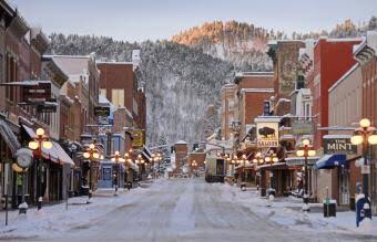
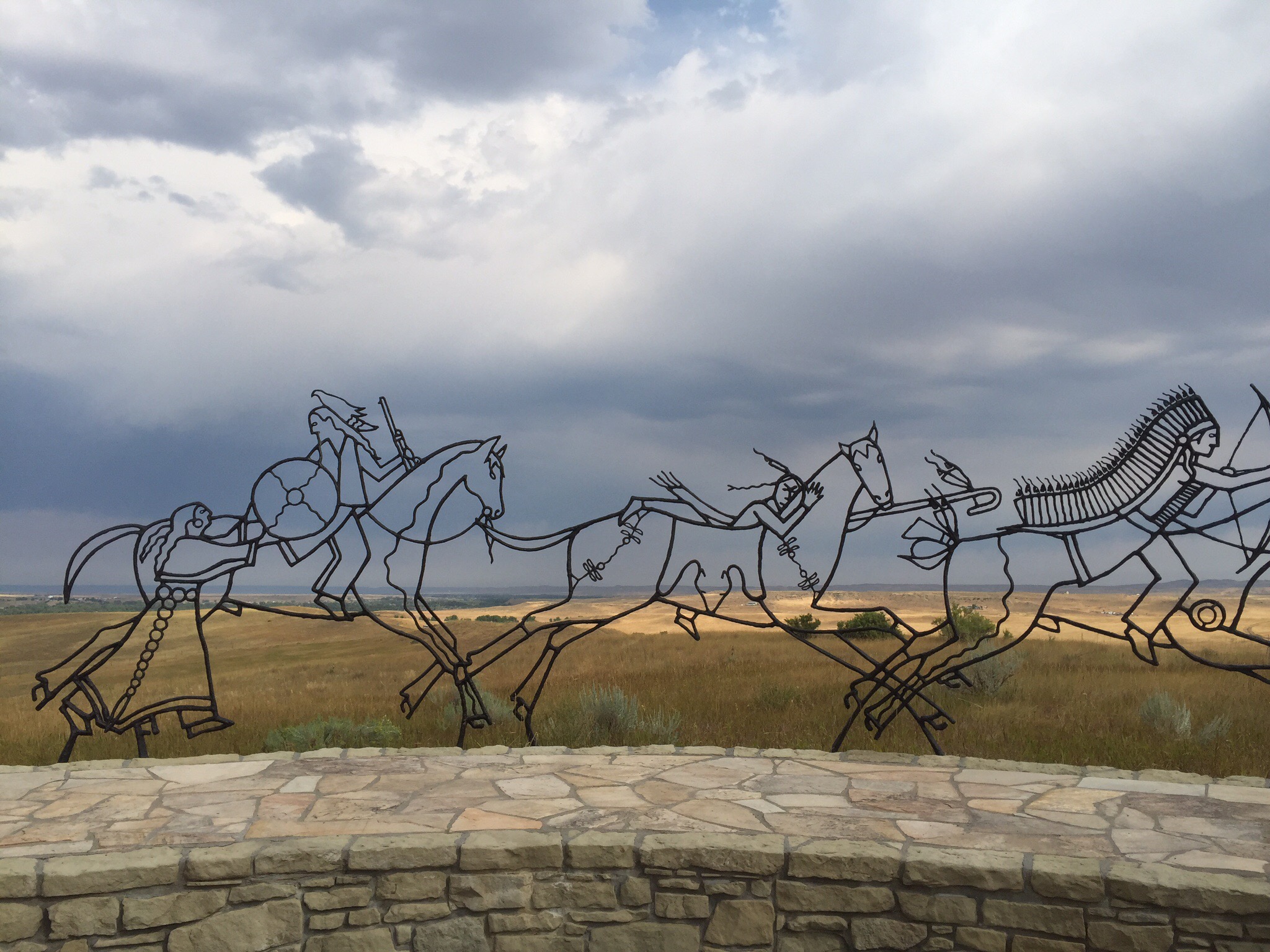
After our little venture down south last night to meet up with Nancy & Bill we realised Denver is a lot bigger than we thought.  The population of the metropolitan area is about 3.4 million.  The city area alone has a population of about 700,000.  We had planned to go into the city to do a walking tour but decided we really didn’t want to drive right into the city.  I researched the public transport options and found one that worked via google maps.  We were going to walk to the Park n Ride which was about 2km from where we were staying and then catch the train into the city.

After going the wrong way to start with we soon got back on track using the little blue dot on google maps : ). We could see the train tracks to the right of us which was a good sign.  We then reached our destination but there was no train station?  We had found the Park n Ride carpark and were right where the map said the train station was – this was a bit weird.  We saw a girl sitting at the bus station so went over to ask her where the train station was.  She looked strangely at us and said there was no train station in this vicinity.  I said but google maps had come up with this itinerary for me and we were here to catch the 8.32am train.  She said there was an 8.32am bus.  I suddenly clicked, just because Google maps uses a train symbol as the public transport option doesn’t mean it is a train!

Now that we had established it was a bus we were supposed to be catching the next mission was to buy a ticket – my understanding was that you needed to have a ticket before you got on the bus or train.  This girl confirmed my understanding and said we would need to go back to some supermarket to buy the tickets – time was of the essence!  She then pulled out these two tickets and said we could use them but we would need to pay USD2 each to the bus driver as well. As you can imagine we were very grateful.  We got chatting and it turns out she was studying at the culinary school.  I also learnt that she hailed from Washington State but had shifted to Denver because her sister said she was bludging off her father, her sister was married to a transgender male wanting to be a female (not a particularly pretty one at that), she had a super cute nephew, her sister is growing dreadlocks, she has lost a lot of weight due to having to walk everywhere because she can’t afford to get her licence or a car and she works two jobs – one at McDonalds earning USD8.55 per hour and one at a care home earning USD10.40 per hour.  This was all in the space of 10 minutes.  She had saved us from a sticky situation so I was happy to listen to her : )

The bus arrived and our tickets plus USD2 worked.  Our journey into Denver city had begun.  At the next stop a girl got on the bus and paid for her entire ticket with cash – hhhmmm.  When we got to the city about 45 minutes later and as we were getting off the bus we asked if we could just pay cash for a ticket on the bus and he said yes.  Our informant was obviously misinformed!

Next mission was to find the starting point for our walking tour which wasn’t too far from where the bus dropped us.  We got the iPad out and used good old Google maps again.  We were just working out which direction we should go in when another helpful citizen came along and told us to use the Maps APP rather than google maps as you can go 3D.  Anyway he set it up for us and pointed us in the right direction.  We got to the Veterans Memorial ready to start our free walking tour – the free walking tours offered in some of the cities we have visited have been fantastic.  

Our tour guide turned up – her name was Janine and she was a Denver local.  She was lovely and so informative and bubbly. This was only the second walking tour that she had guided but had been taking tours at the State Capitol for a while.

Speaking of which, our first stop was the State Capitol building.  Denver is nicknamed the Mile-High City because its official elevation is exactly one mile (5,280 ft or 1,610 m) above sea level, making it one of the highest major cities in the United States.  The 105th meridian west of Greenwich, the longitudinal reference for the Mountain Time Zone, passes directly through Denver Union Station.

Serving as the beginning of the Capitol Hill district, the historic building sits slightly higher than the rest of downtown Denver. The main entrance hall is open 180 feet (55 m) to the top of the dome, about the height of an 18-story building. Additionally, the official elevation of Denver is measured outside the west entrance to the building, where the fifteenth step is engraved with the words “One Mile Above Sea Level.” From this step, at 5,280 feet (1,609 m), the sun can be seen setting behind the Rocky Mountains. A second mile high marker was set in the 18th step in 1969 when Colorado State University students resurveyed the elevation. In 2003, a more accurate measurement was made with modern means, and the 13th step was identified as being one mile (1.6 km) high, where a 3rd marker was installed.

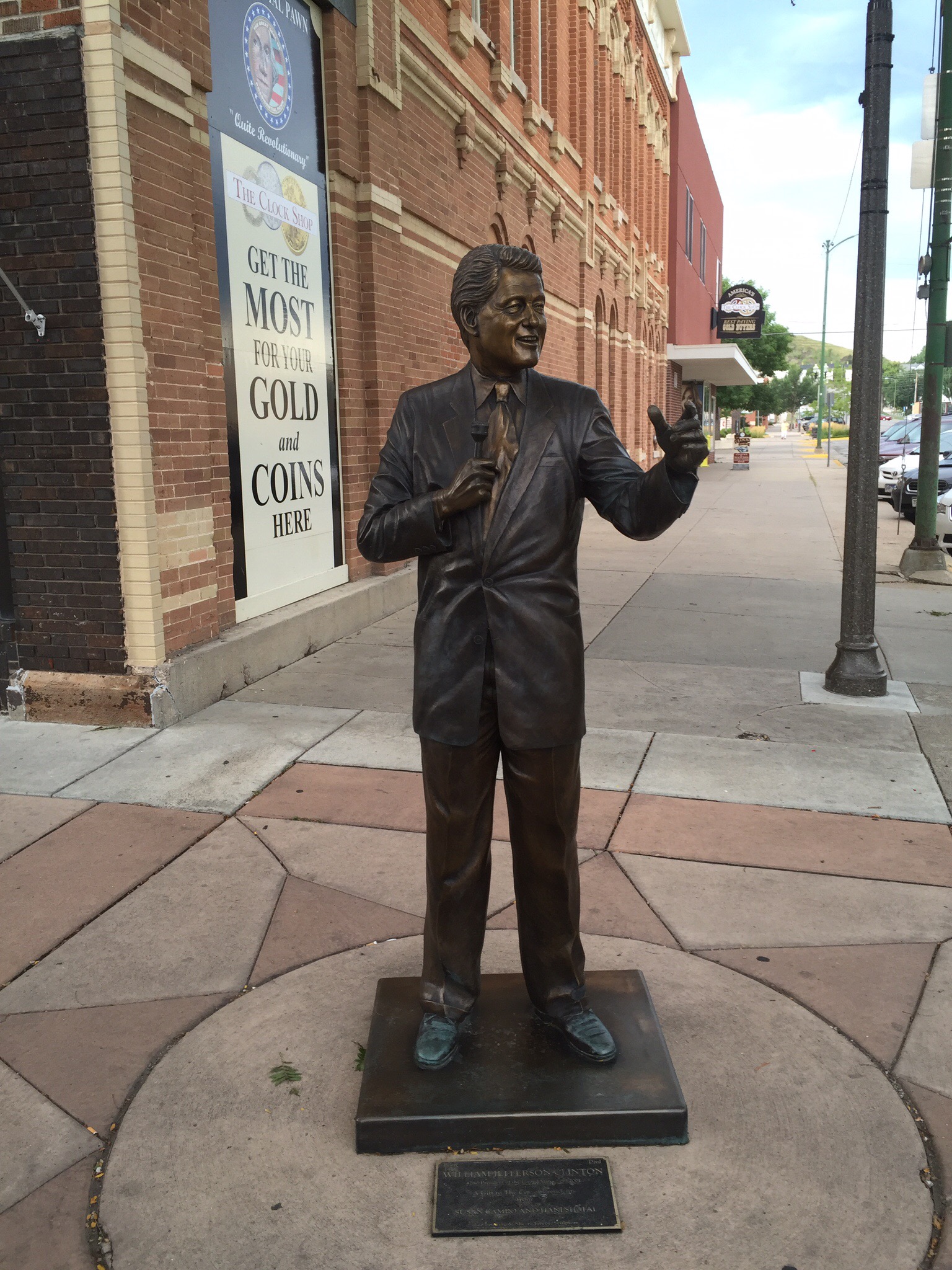
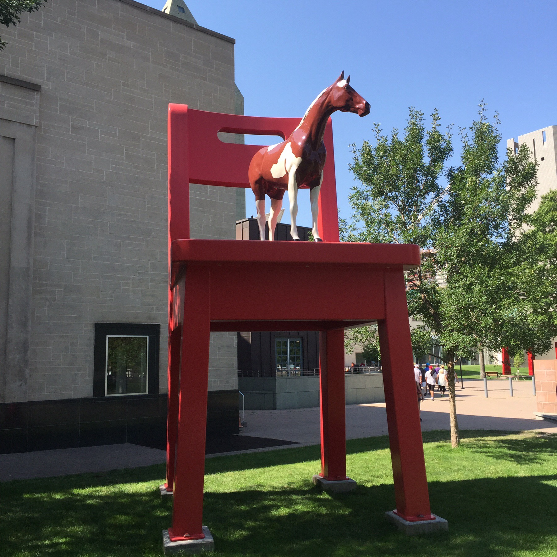
In a lot of the cities we have visited in both Canada and the US they have a lot of public artworks.  Little Horse, Big Chair: Sculptor Donald Lipski claimed he “wanted to give kids something that would really be a cause for wonder.” He succeeded, while also giving the rest of us something to wonder about.  “The Yearling,” located near Denver’s Central Public Library. A six-foot tall pony stands atop a 21-foot bright red chair, watching over the road. 

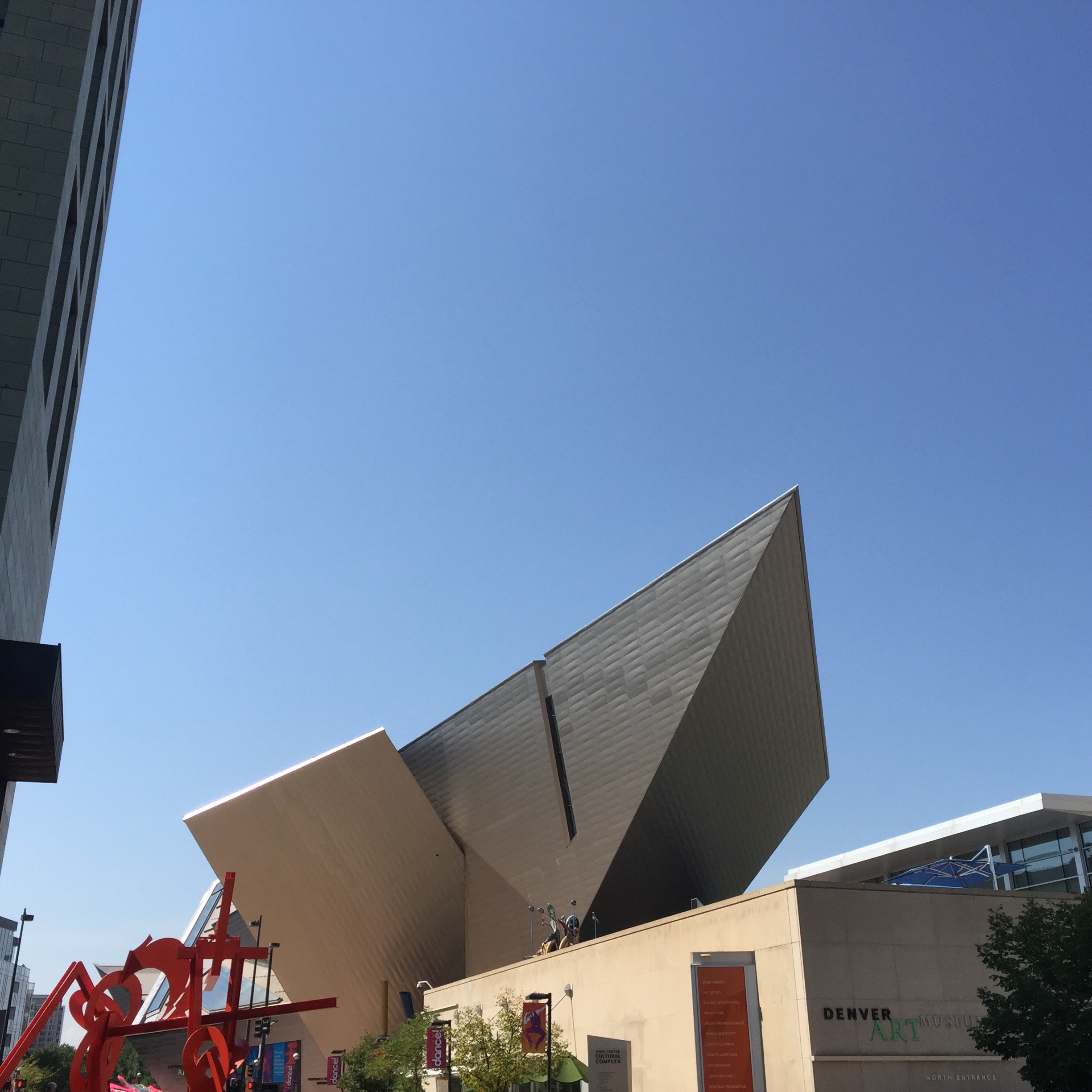
Next stop was the Denver Art Museum or DAM as the locals call it.  The museum is one of the largest art museums between the West Coast and Chicago.  It is known for its collection of American Indian art, and its other collections of more than 70,000 diverse works from across the centuries and world.

There are two parts to the DAM – the Hamilton Building emulates the sharp angles of the nearby Rocky Mountains, as well as the geometric crystals found at the mountains’ base near Denver. Architect Daniel Libeskind said, “I was inspired by the light and geology of the Rockies, but most of all by the wide-open faces of the people of Denver.”

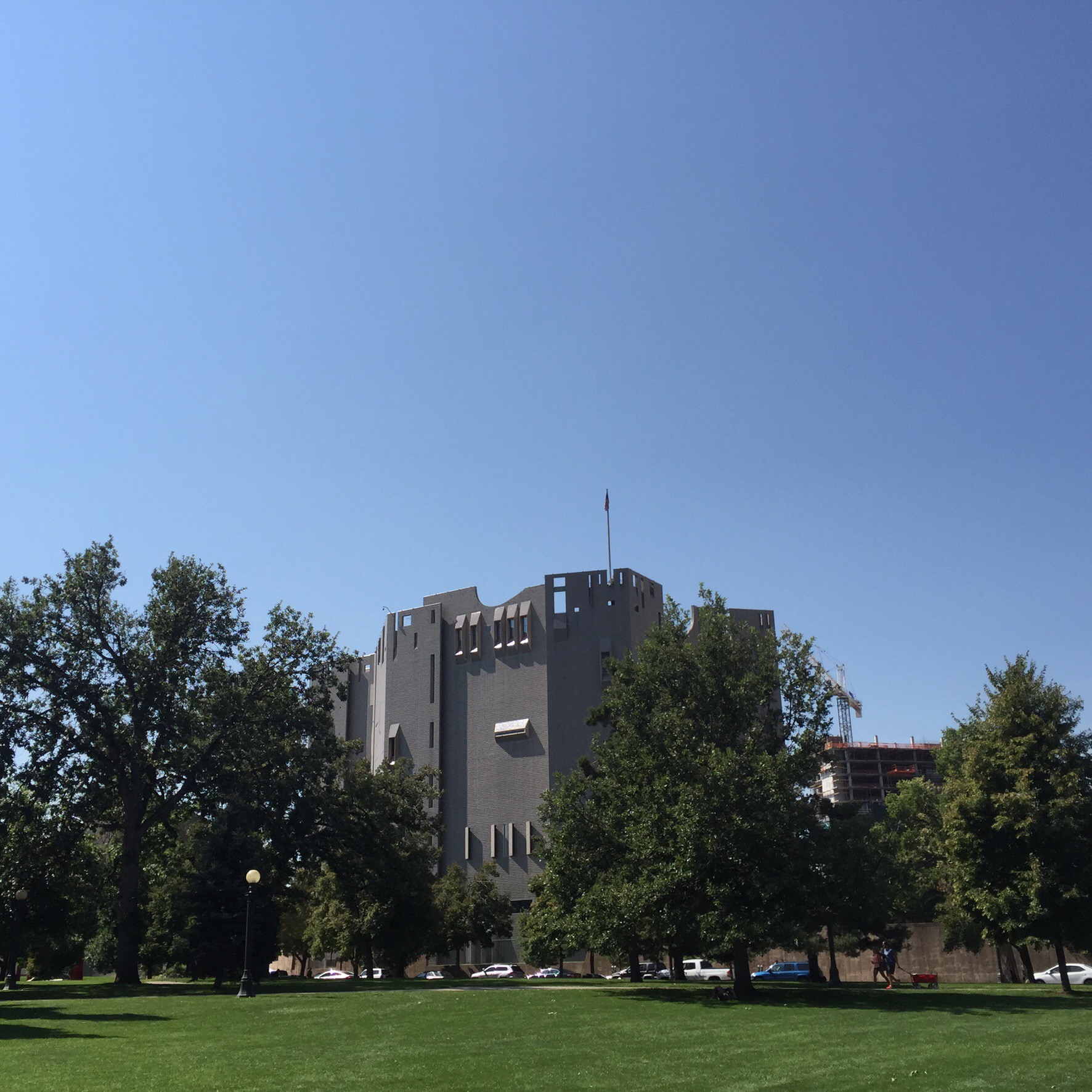
The Duncan Pavillion is joined to the Hamilton Building by a bridge.  The Duncan Building looks like a castle from the outside with minimal windows giving much bigger spaces for the art.  The two-towered “castle-like” façade has 24 sides, and more than one million reflective glass tiles, designed to take advantage of the many beautiful, clear sunny days Denver has. 

Next stop was Food Truck Alley in the Civic Center Park – this is a new initiative on Tuesday’s to Thursday’s as there are very few food options for all the office workers at this end of town.  You also get a good view of the downtown area.  Steve was licking his lips and picking where he wanted to come back to for lunch.

Food Truck Alley

Denver County Court

Meanwhile while Janine was busy talking about the Denver County Court, Steve had made friends with some of the guys on the tour and two of them had decided to take advantage of the activities on offer in the park.

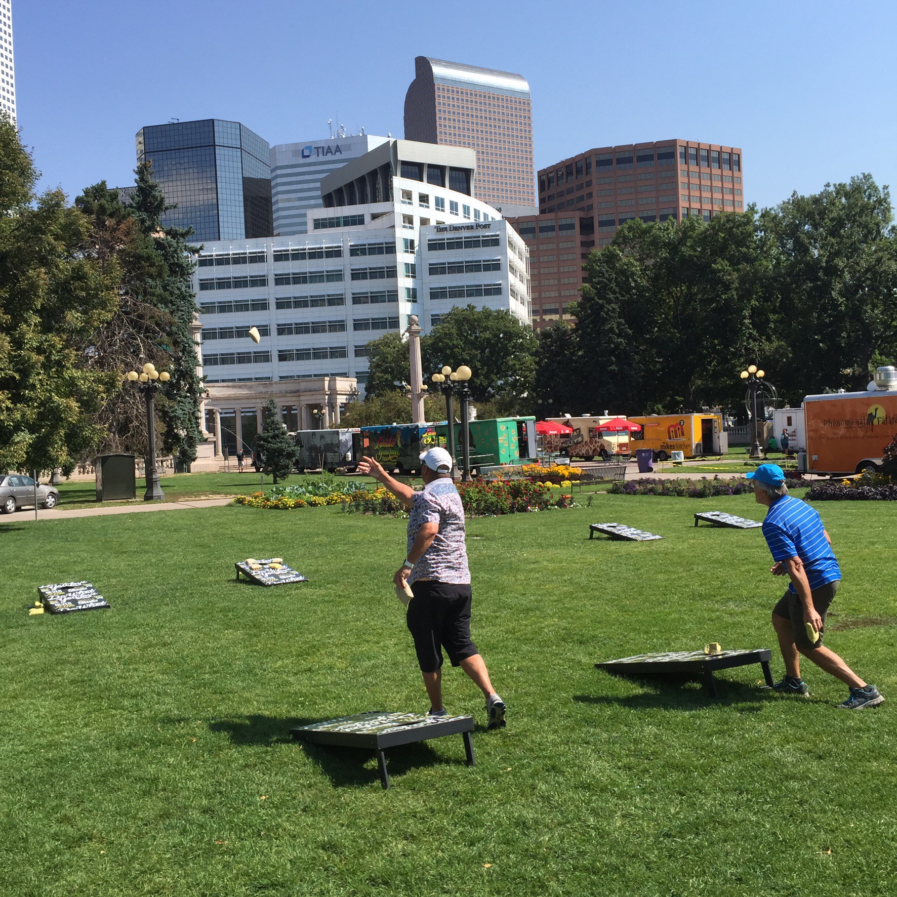
The Civic Center Park was a lovely park and they had blankets spread around on the grass where you could take some time out.

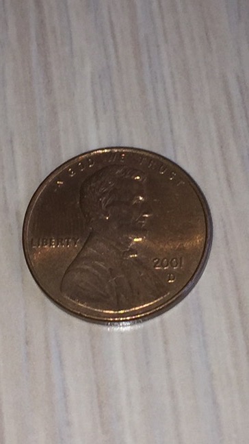
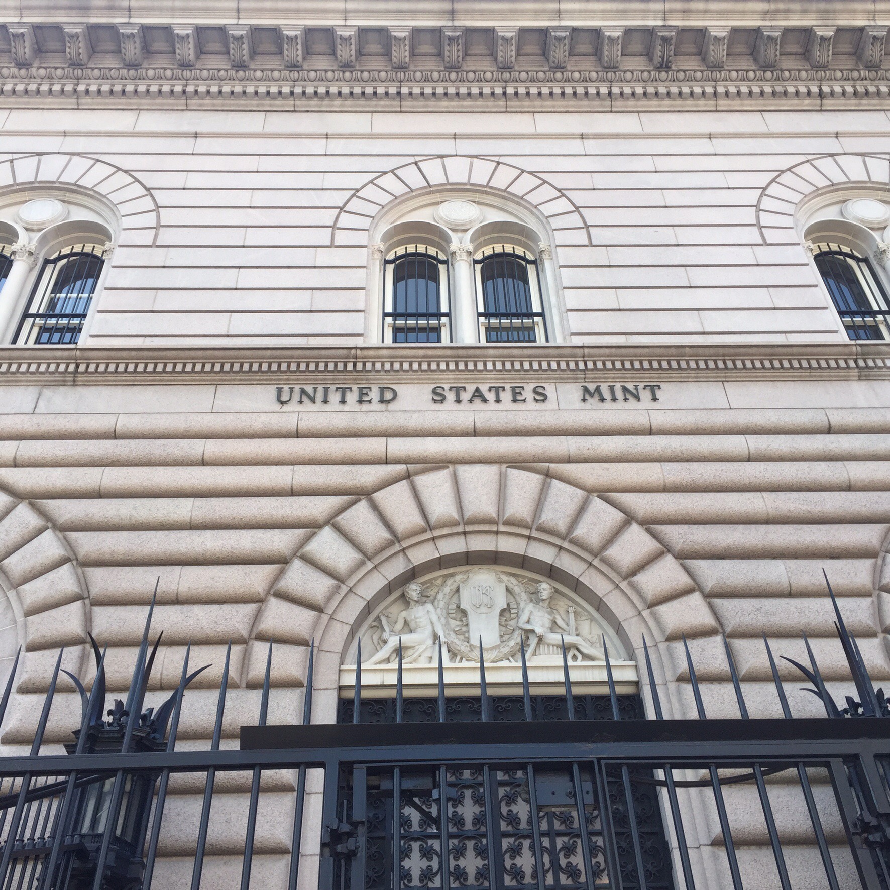
Next stop was the US Mint – apparently you can take a tour in the US Mint but you have to book weeks in advance.  The US Mint has six locations throughout the country but only two of them mint coins that are used day to day – these are in Denver and Philadelphia.  To work out where your coins were minted you will see either a D for Denver or a P for Philadelphia under the date on the back of the coin.


When the United States government began minting coins in 1792, the original United States Mint facility in Philadelphia was hard-pressed to produce enough currency for our small country.

As the country grew and the demand for coins increased, it became necessary to expand Mint facilities. This expansion was further fueled by the discovery of gold, first in the Southeast and later in the West, and the need for hard currency which caused people to mint their own gold coins. In the mid-nineteenth century, additional mints were opened in Charlotte, North Carolina; Dahlonega, Georgia; New Orleans, Louisiana; and San Francisco, California. In 1870, the Carson City, Nevada Mint opened, and in 1904 the Denver, Colorado Assay Office became a mint facility. Today, in order to keep our economy flowing smoothly, the United States Mint maintains facilities in Philadelphia, Denver, San Francisco, and West Point, and a bullion depository in Fort Knox, Kentucky.

The number of coins minted today is astounding. Denver and Philadelphia can each produce tens of millions of coins every day. Manufacturing the coins to meet the needs of the United States requires a tremendous amount of natural resources. That is why the United States Mint had embarked on projects to reduce our energy, water and material use during coin production. 

The functions of each US Mint are as follows:

Headquarters, Washington, D.C.:  Policy formulation and central agency administration; program management; research and development; marketing operations; customer services and order processing; business unit management, all http://www.usmint.gov website services.

Philadelphia, Pennsylvania:  Sculpting-engraving of U.S. coins and medals; production of medal and coin dies; production of coins of all denominations for general circulation; production of regular uncirculated coin sets; production of commemorative coins as authorized by Congress; production of medals; and conducting of public tours.

Denver, Colorado:  Production of coins of all denominations for general circulation; production of coin dies; production of regular uncirculated coin sets; production of commemorative coins as authorized by Congress; and the conducting of public tours; and storage of gold and silver bullion.

San Francisco, California:  Production of regular proof coin sets in clad and silver; production of commemorative coins as authorized by Congress.
West Point, New York:  Production of all uncirculated and proof one-ounce silver bullion coins; all sizes of the uncirculated and proof gold bullion coins; one-ounce platinum bullion coins; the 24-karat one-ounce American Buffalo Gold Bullion Coin; and commemorative coins as authorized by Congress; and storage of silver, gold and platinum bullion.

Fort Knox, Kentucky:  Storage of U.S. gold bullion.


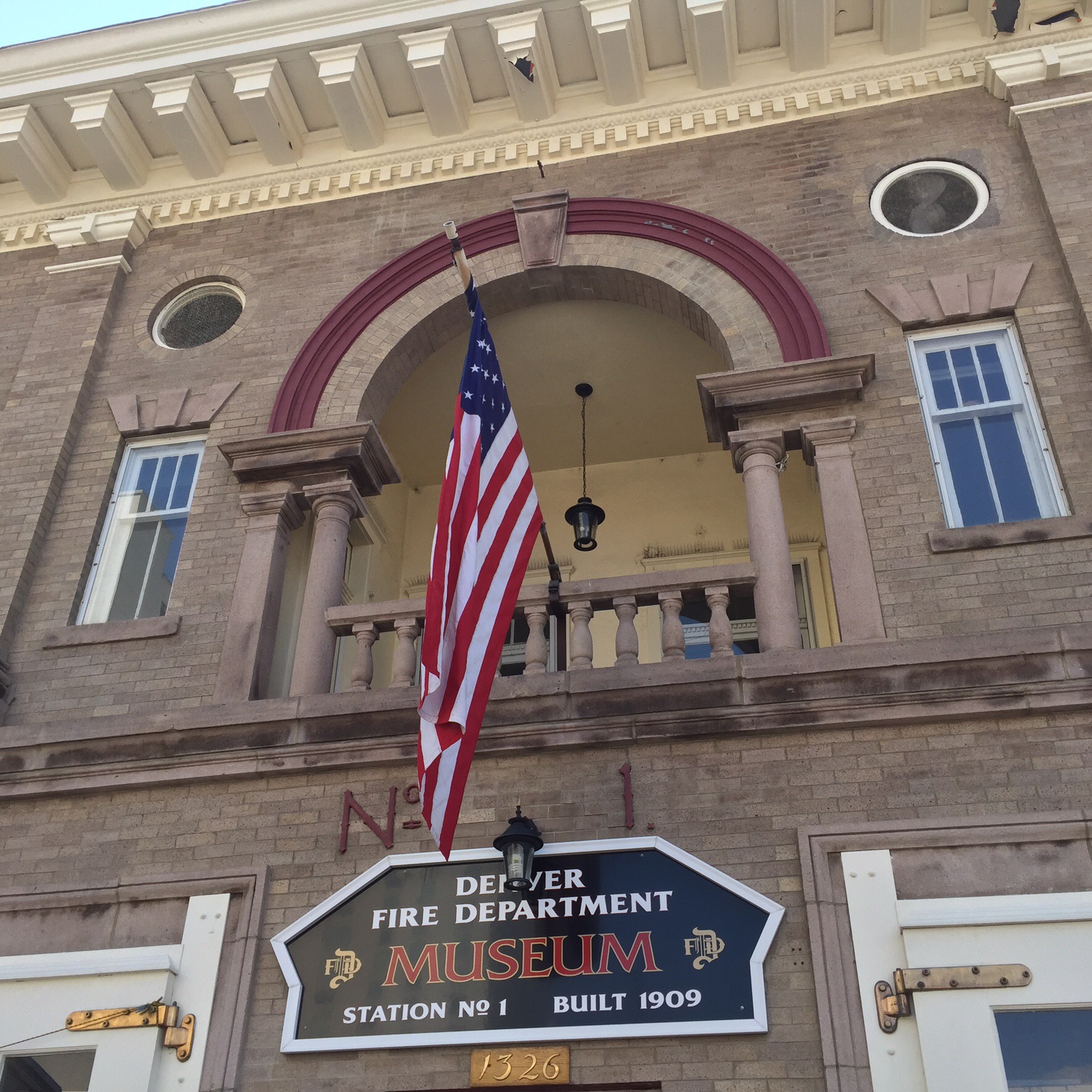
The Denver Firefighters Museum is located in a historic firehouse, Historic Station No. 1, built in 1909 by the Denver architect Glenn W. Huntington.[2] Historic Station One is actually the second station one. The original Station One was located at the corner of 15th Street and Broadway. It was torn down in 1909 to make way for The Pioneer Monument.

Our next stop was the Colorado Convention Center (CCC) which is a multi-purpose convention center.  The center opened in June 1990; the first event being the NBA Draft for the Denver Nuggets.  The Colorado Convention Center underwent a $340 million major expansion that was completed in December 2004. The expansion doubled the size of the facility which now consists of 584,000 square feet (54,300 m2) of exhibit space, 100,000 square feet (9,300 m2) of meeting rooms, and 85,000 square feet (7,900 m2) of ballroom space. The expansion of the facility also included the spectacular 5,000 seat Wells Fargo Theatre. The CCC is now 2.2 million gross square feet.

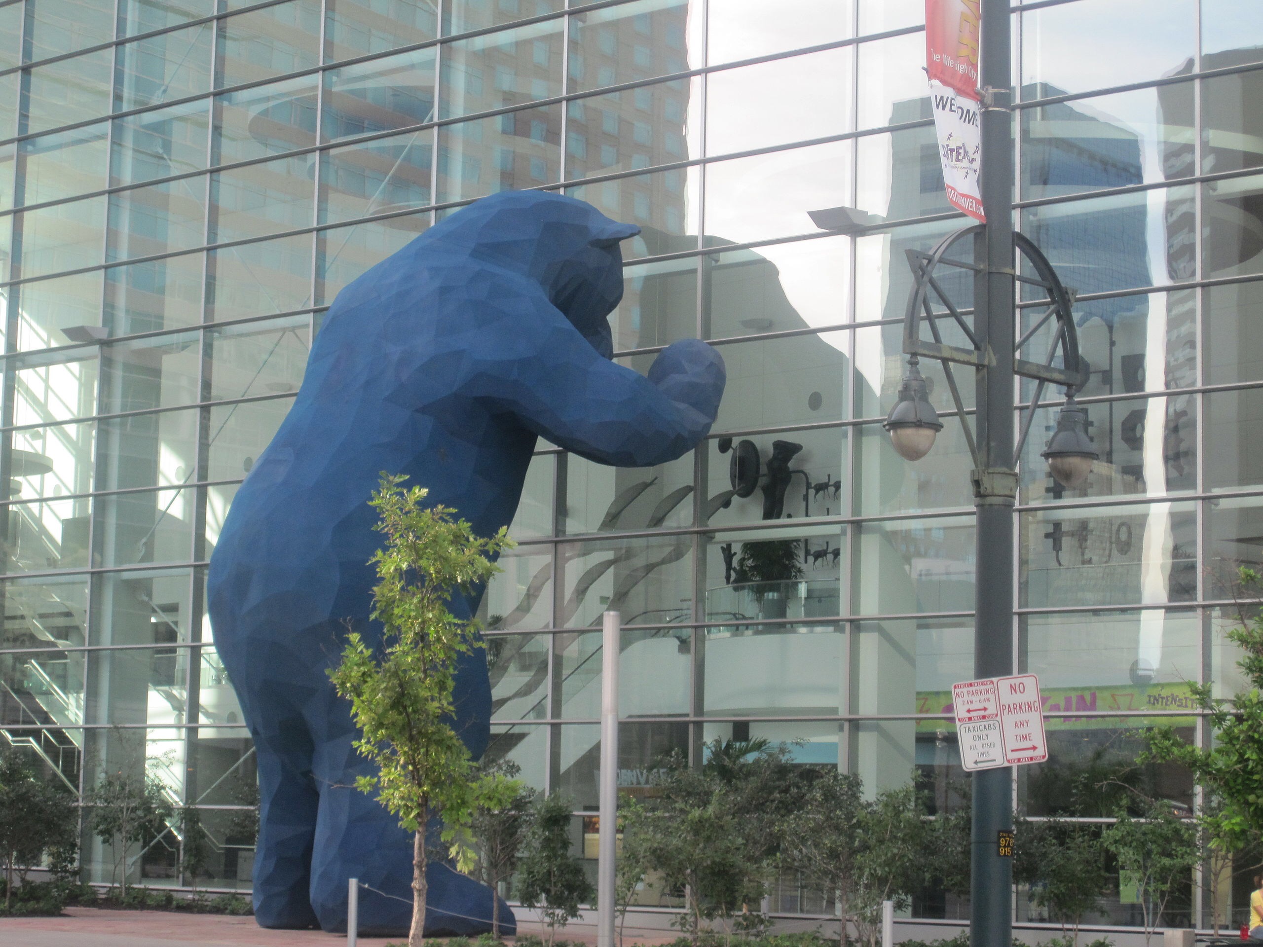
A public art collection is featured throughout the interior and exterior of the convention center. The most visible work is I See What You Mean by Lawrence Argent, located just to the left of the main entrance on 14th Street. Erected in June 2005, the 40-foot (12.19 meters)-tall polymer-concrete-clad sculpture is in the form of a lapis-lazuli-colored bear pushing its nose and paws against the glass facade, attempting to peer inside. 

We then walked down to Larimer Square.  In November 1858, General William Larimer, a land speculator from eastern Kansas, placed logs to stake a square-mile claim on the site of the St. Charles claim, across the creek from the existing mining settlement of Auraria. The majority of the settlers in St. Charles had returned to Kansas for the winter and left only a small number of people behind to guard their claim. Larimer and his followers gave the representatives whiskey, promises, and threats and the St. Charles claim was surrendered.

The name of the site was changed to “Denver City” after Kansas Territorial Governor James W. Denver, in an attempt to ensure that the city would become the county seat of then Arapaho County, Kansas. Ironically, when Larimer named the city after Denver to curry favor with him, Denver had already resigned as governor and no longer had say in naming the capitol.

As the Mile High City’s oldest and most historic block, the buildings along Larimer Square are now home to an inspired mix of independent shops, chef-driven restaurants and lively bars & clubs.

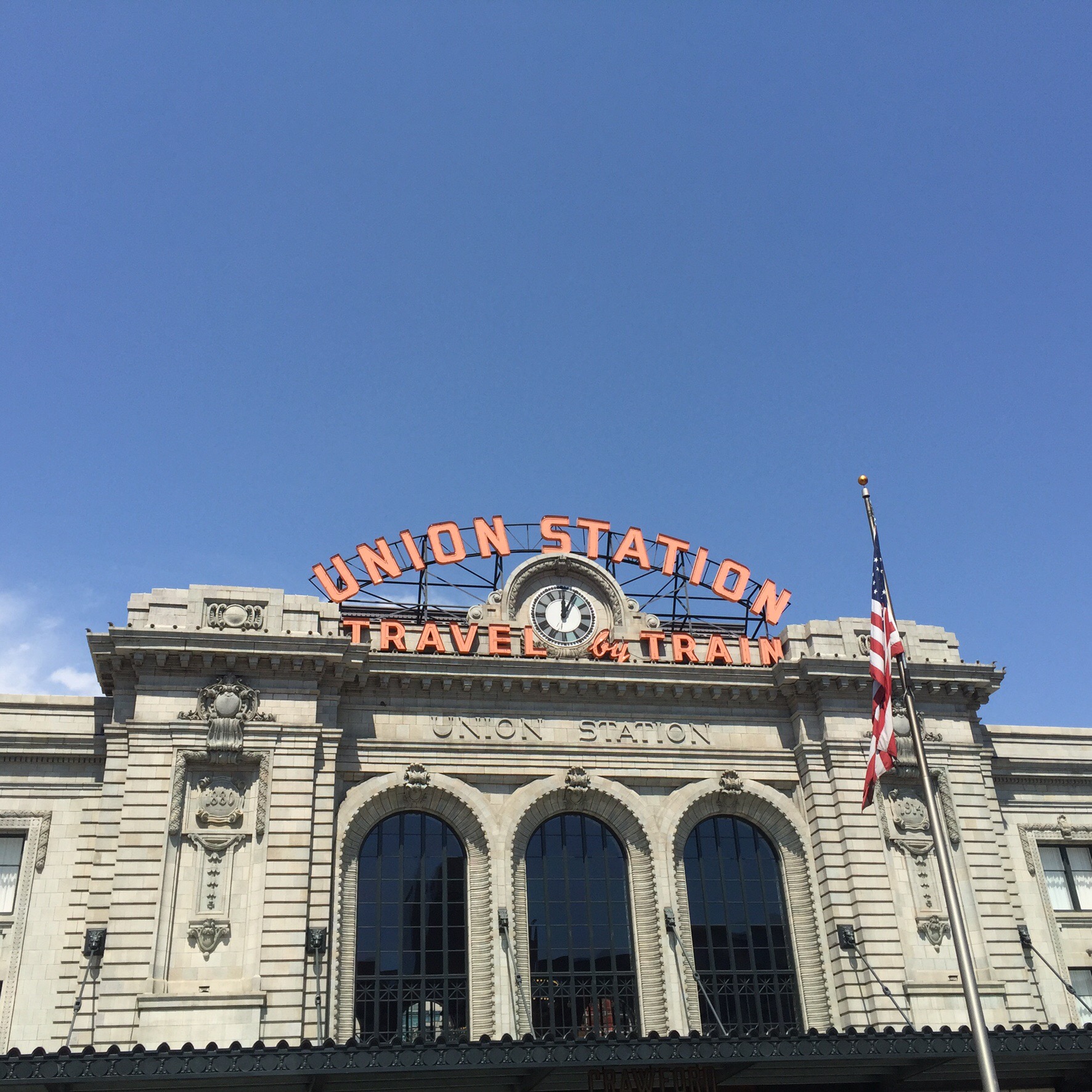
It seems every major city has a Union Station.  Denver Union Station is the main railway station and central transportation hub.  It is located at 17th and Wynkoop Streets in the present-day LoDo (lowered downtown) district and includes the historic terminal building, a train shed canopy, a 22-gate underground bus facility, and light rail station.  A station opened on the site June 1, 1881, burning in 1894. The current structure was erected in two stages, with an enlarged central portion completed in 1914.

In 2012, the station underwent a major renovation transforming it into the centerpiece of a new transit-oriented mixed use development built on the site’s former rail-yards.  The station house re-opened in the summer of 2014 as a combination of the 112-room Crawford Hotel, several restaurants and retailers, and a train hall.

Our last stop on the tour was Coors Field which is home to the Colorado Rockies the city’s Major League Baseball franchise. It is named Coors Field due to Coors beer having the naming rights.  The stadium seats just over 50,000 people.

The temperature had risen to about 33 degrees so after the tour we took solace in an air conditioned bar to plan our next move.  The Canadians on our tour had recomended having lunch at The Cheesecake Factory which apparently had a very extensive food menu besides a very extensive cheesecake menu.  They were right – they had a great menu with lots of healthy options too.

After lunch we revisited Larimer Square – there were lots of cool little shops.  As the day wore on the skies got quite dark which has become the norm on our road trip – it gets so hot during the day that the sky explodes briefly late afternoon.  We were hoping it would hold off until after we found out where we were to catch the bus back to the suburbs.  We were pretty lucky and only got a few spits before getting on the bus – no dramas getting back to the hotel : )

We were very impressed with Denver and pleased we had ventured in to explore what it had to offer.

Ten Things to know about Denver City

1. DENVER HAS 300 DAYS OF ANNUAL SUNSHINE.

Located east of a major mountain range, Denver has a mild, dry and sunny climate with more annual hours of sun than San Diego or Miami Beach. In winter, Denver is dryer than Phoenix with an average daily high of 7 degrees Celcius in February. Golf courses remain open all year and have been played as many as 30 days in January. Denver receives only 14 inches of precipitation a year – about the same as Los Angeles.

2. DENVER’S ARTS AND CULTURAL SCENE IS THRIVING.

In its Old West days, Denver had a performance of Macbeth before it had a school or a hospital. That performance took place in a saloon. Today, Metro Denver collects more for the arts on a per capita basis than any other city. The seven county Denver metro area has a self-imposed tenth of a cent sales tax for the arts that raises more than $40 million a year, which is distributed to 300 arts organizations and facilities.

3. DENVER IS NEAR THE MOUNTAINS, NOT IN THEM.

Denver is located on high rolling plains, 12 miles east of the “foothills,” a series of gentle mountains that climb to 11,000 feet. Just beyond is the “Front Range of the Rocky Mountains,” a series of formidable snowcapped peaks that rise to 14,000 feet. Denver might not be in the mountains, but the mountains still dominate the city. The picturesque mountain panorama from Denver is 140 miles long. There are 200 visible named peaks including 32 that soar to 13,000 feet and above. State law prohibits building any structure that would block the view from the Colorado State Capitol. Penetrating the mountains west of Denver required building the highest auto tunnel in the world (Eisenhower Tunnel) and the sixth longest railroad tunnel in the country (Moffat Tunnel).

4. DENVER IS A CITY OF MANY COLORS AND CULTURES.

Denver grew by 30 percent in the 1990s – an average of 1,000 new residents a week, every week for 10 years. In this period, the Hispanic population in Colorado increased by 73 percent. Today, over 30 percent of the City of Denver is of Hispanic and Latino descent and 11 percent are African American. Denver’s diversity is celebrated at numerous festivals and events including the nation’s largest Cinco de Mayo celebration and the largest Martin Luther King Jr. march and rally, referred to the locals as a “marade.” Denver’s population in 2014 was 648,937, making it the 23rd largest city in the U.S. The seven county metro area has nearly 3.0 million people.

5. DENVER’S HISTORY IS SHORT, BUT COLORFUL.

In 1858, there was not a single person living in the Denver metro area except for some migrating camps of Arapaho and Cheyenne Native Americans. Just 30 years later, Colorado was a state with a population of almost 200,000. It was a Gold Rush that caused this boom and in a 30 to 40 year period Denver saw some of the wildest events in the “Wild West.” This fascinating period is brought to life at museums, old gold mining towns and in hundreds of elegant Victorian buildings. LoDo (lower downtown), a 26 square block historic district, has the largest concentration of Victorian and turn-of-the-century buildings in the country. Today, LoDo is home to 90 brewpubs, rooftop cafes, restaurants, sports bars and nightclubs. The History Colorado Center is a $120 million interactive museum where it is possible to descend into a coal mine, jump off a ski jump and visit other exciting moments from Denver and Colorado history.

6. DENVER LOVES ITS SPORTS.

Denver is one of only two cities (Philadelphia is the other) to have seven professional sports teams: NFL Denver Broncos; NBA Denver Nuggets; NHL Colorado Avalanche; MLB Colorado Rockies; MLS Colorado Rapids; MLL Colorado Outlaws; and NLL Colorado Mammoth. The Colorado Rockies have 11 Major League Baseball attendance records, while the Denver Broncos have sold out every game for more than 20 years. Denver also hosts one of the world’s largest rodeos – the National Western Stock Show & Rodeo. Denver was the only city to build three new sports stadiums in the 1990s: 50,000-seat Coors Field; 75,000-seat Sports Authority Field at Mile High and 20,000-seat Pepsi Center

7. DENVER BREWS MORE BEER THAN ANY OTHER CITY.

The first building in Denver was a saloon, so it’s natural that Denver would become a great beer town. Coors Brewery is the world’s largest. Denver’s Great American Beer Festival is the largest in the nation, offering more than 6,700 different beers for tasting. The Wynkoop Brewing Company is one of the largest brewpubs in the country. On an average day in the Denver Metro area, more than 200 different beers are brewed and can be enjoyed in 100 breweries, brew pubs and tap rooms.

8. DENVER – THE MILE HIGH CITY, REALLY IS EXACTLY ONE MILE HIGH.

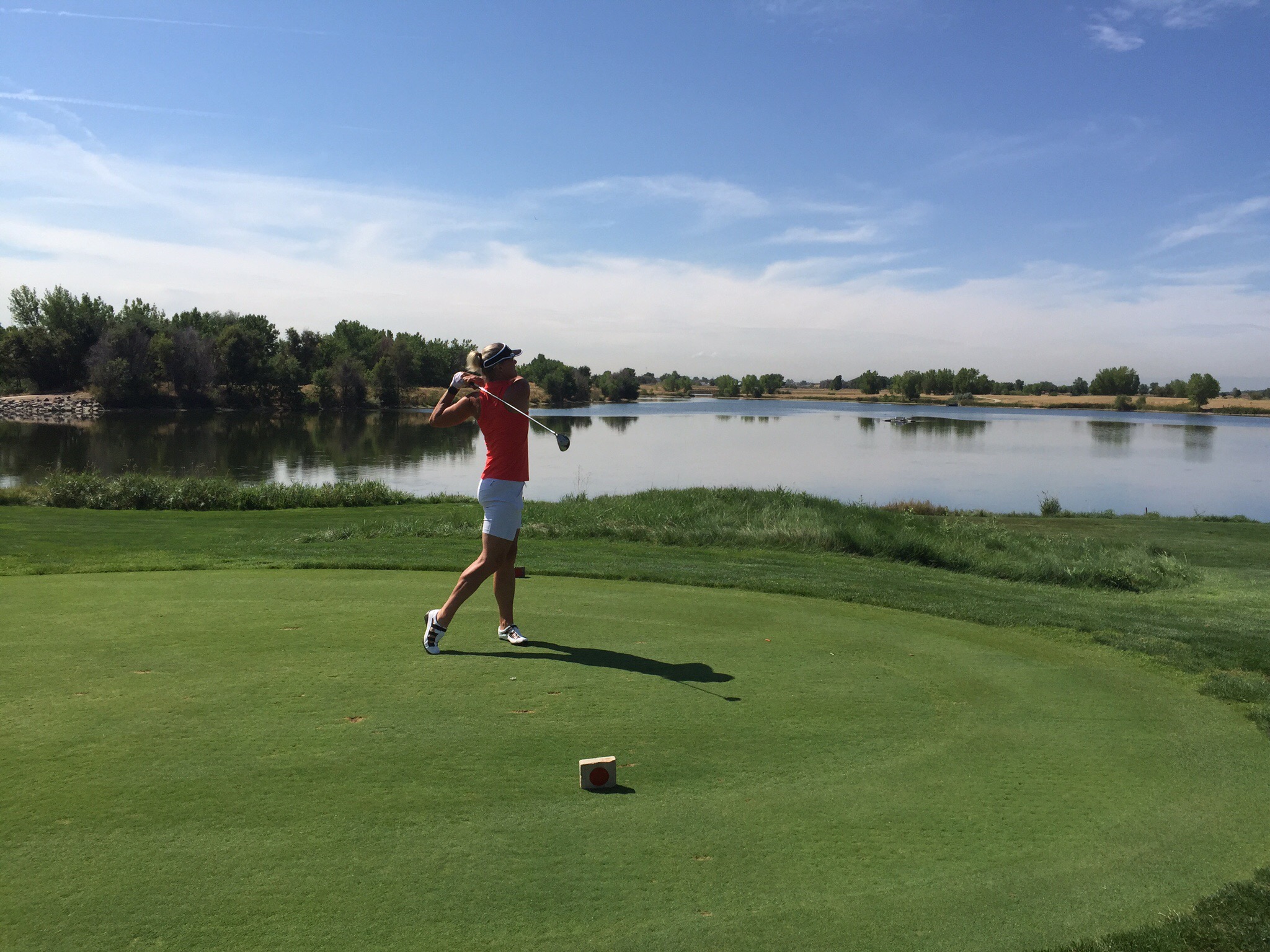
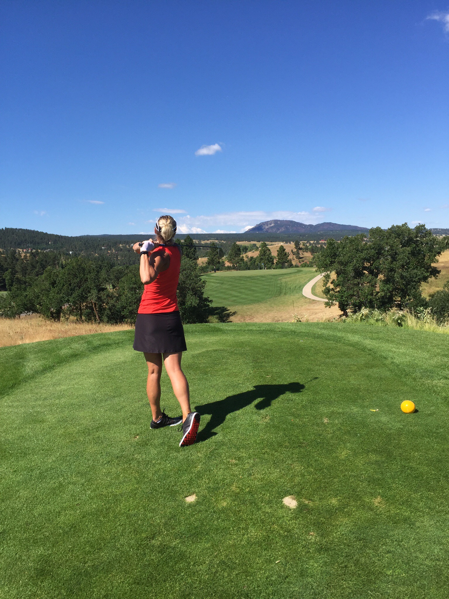
By an amazing stroke of good luck, the 13th step on the west side of the State Capitol Building is exactly 5,280 feet above sea level – one mile high. In Denver’s rarified air, golf balls go 10 percent farther. So do cocktails. Alcoholic drinks pack more of a punch than at sea level. The sun feels warmer, because you are closer to it and there is 25 percent less protection from the sun.

The Mile High City is also extremely dry, so it is a good idea to drink more water than usual. With less water vapor in the air at this altitude, the sky really is bluer in Colorado.

9. DENVER HAS THE 10TH LARGEST DOWNTOWN IN THE UNITED STATES.

Unlike some Western cities, Denver has a definitive, exciting and walkable downtown – the 10th largest in the nation. Within just a one mile radius, there are three sports stadiums, the country’s second largest performing arts complex, an assortment of art and history museums, a mint producing 10 billion coins a year, a river offering whitewater rafting, the country’s only downtown amusement park, a world-class aquarium, more than 8,500 hotel rooms and more than 300 restaurants, brewpubs, rooftop cafes and music venues. The 16th Street Mall is a mile-long pedestrian promenade that cuts through the center of downtown lined with 200 trees and 42 outdoor cafes. Free electric shuttle buses travel up and down the Mall, stopping on every corner. After 6 p.m., the Mall comes alive with horse-drawn carriages and pedicabs. 

10. DENVER HAS ONE OF THE LARGEST CITY PARK SYSTEMS IN THE COUNTRY.

Denver has more than 200 parks within the city and 14,000 acres of parks in the nearby mountains, including the spectacular Red Rocks Park & Amphitheatre, a 9,000 seat amphitheatre that has hosted everyone from the Beatles to top symphony orchestras. Rolling Stone has called Red Rocks the best outdoor concert venue in the world.

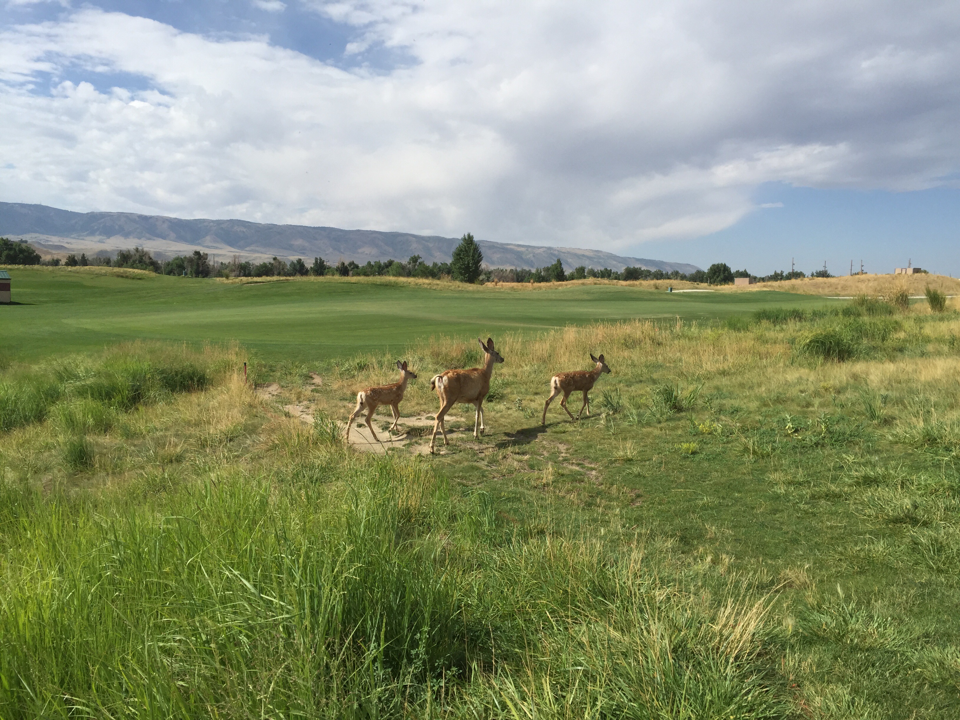
The city has its own buffalo herd located in the mountains with a panoramic view. Other mountain parks include Echo Lake, at the base of the Mount Evans highway – the highest paved road in North America climbing to a 14,260-foot summit, and Buffalo Bill’s Grave on top of Lookout Mountain, the final resting spot of the famous frontier scout and showman.

Denver plants more than 200,000 flowers in 26 formal flower gardens every spring. Metro Denver is home to more than 85 miles of off-street bike paths, one of the largest urban bike trail systems in the nation. Denver B-cycle has more than 800 bright red Trek bikes available for rental at 84 stations across the city. Simply swipe a credit card and pedal off.
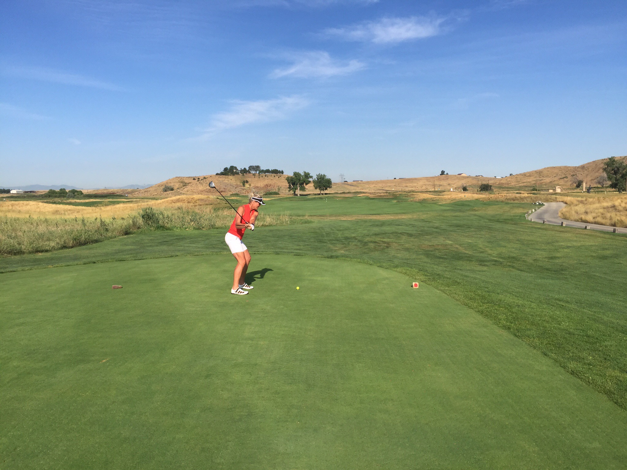
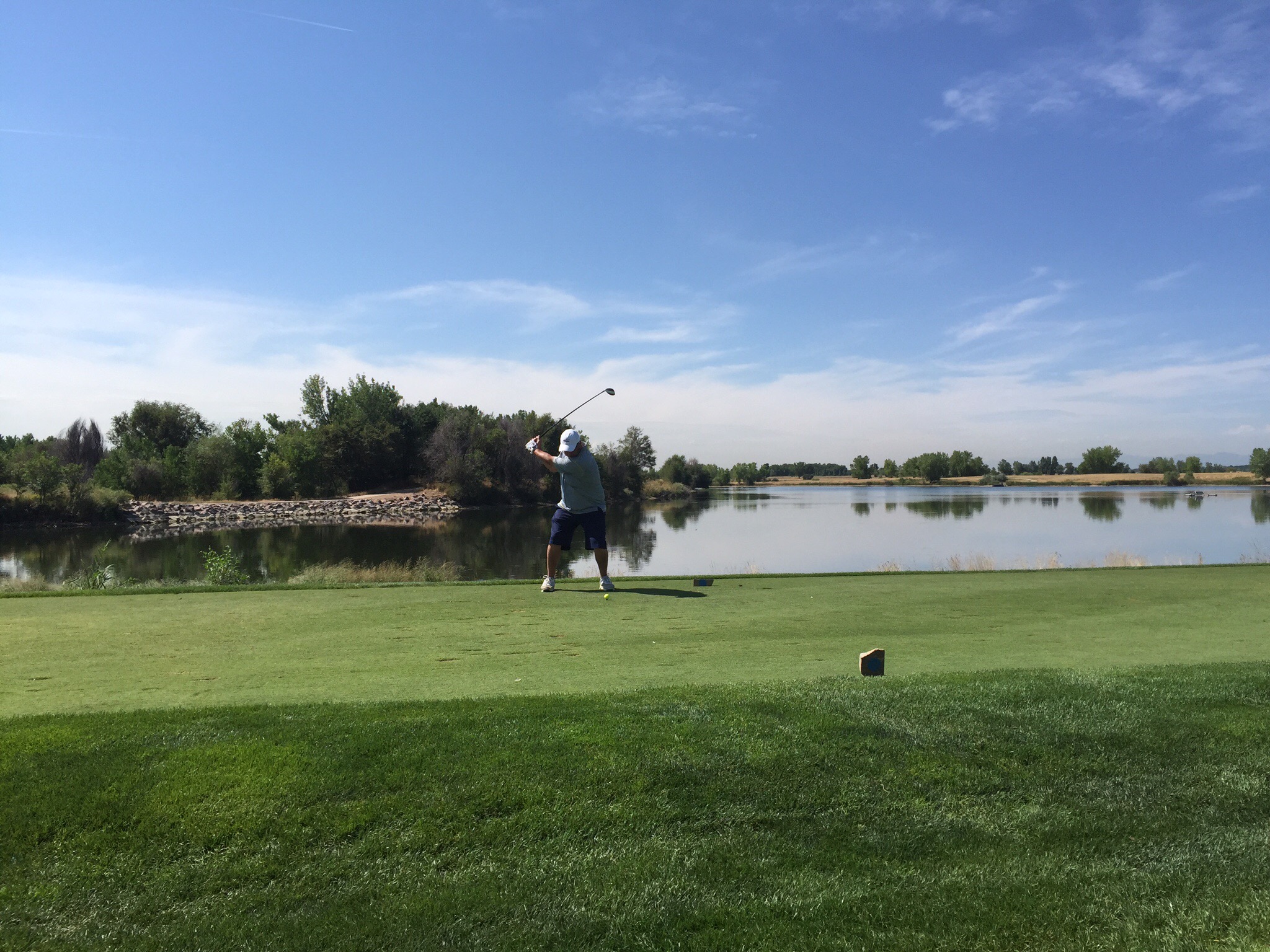
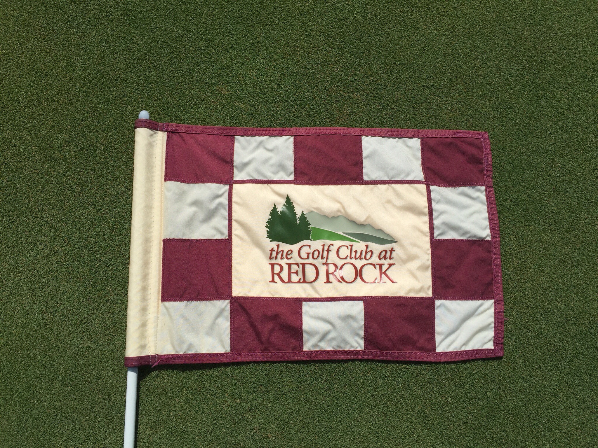
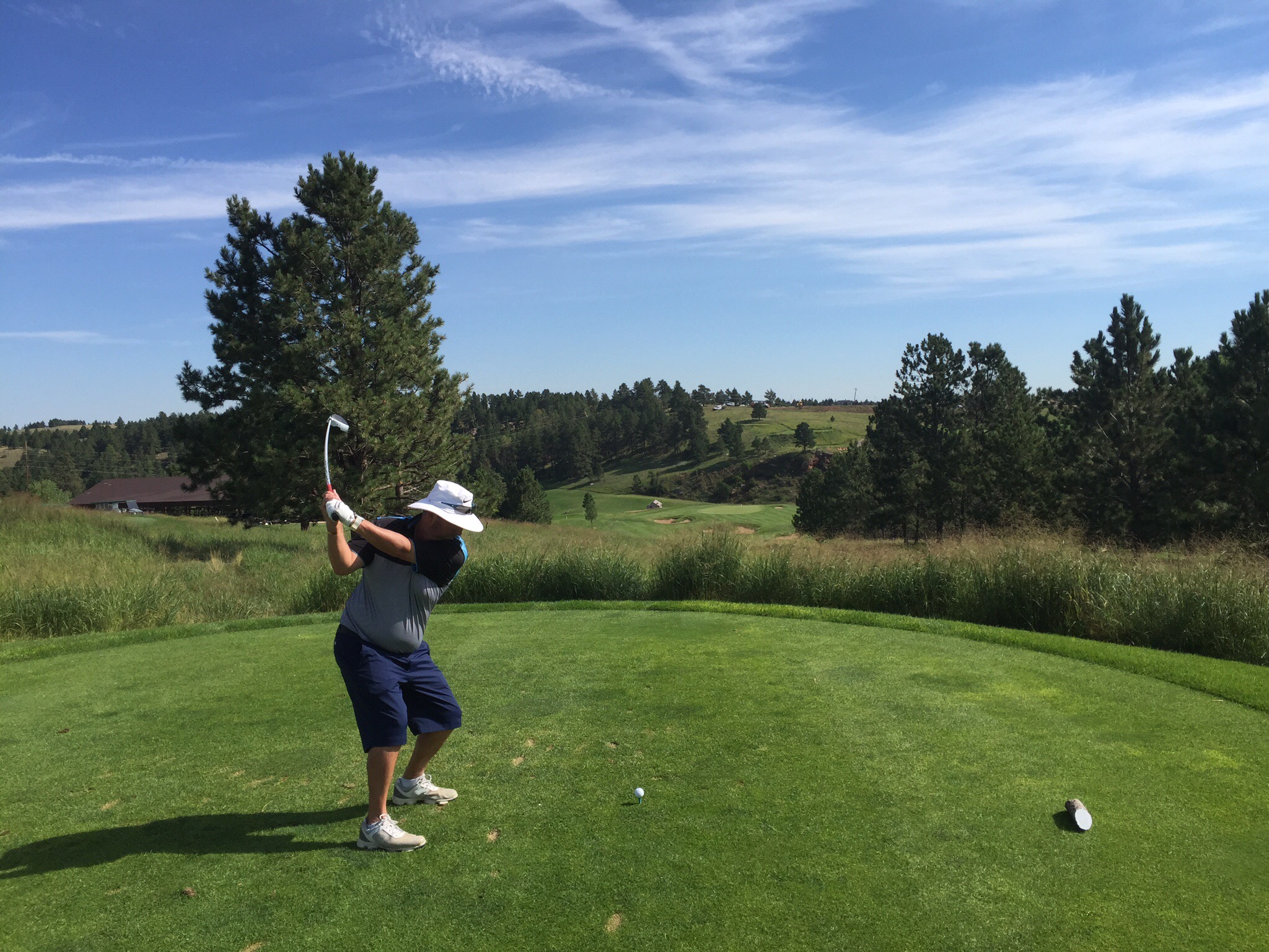
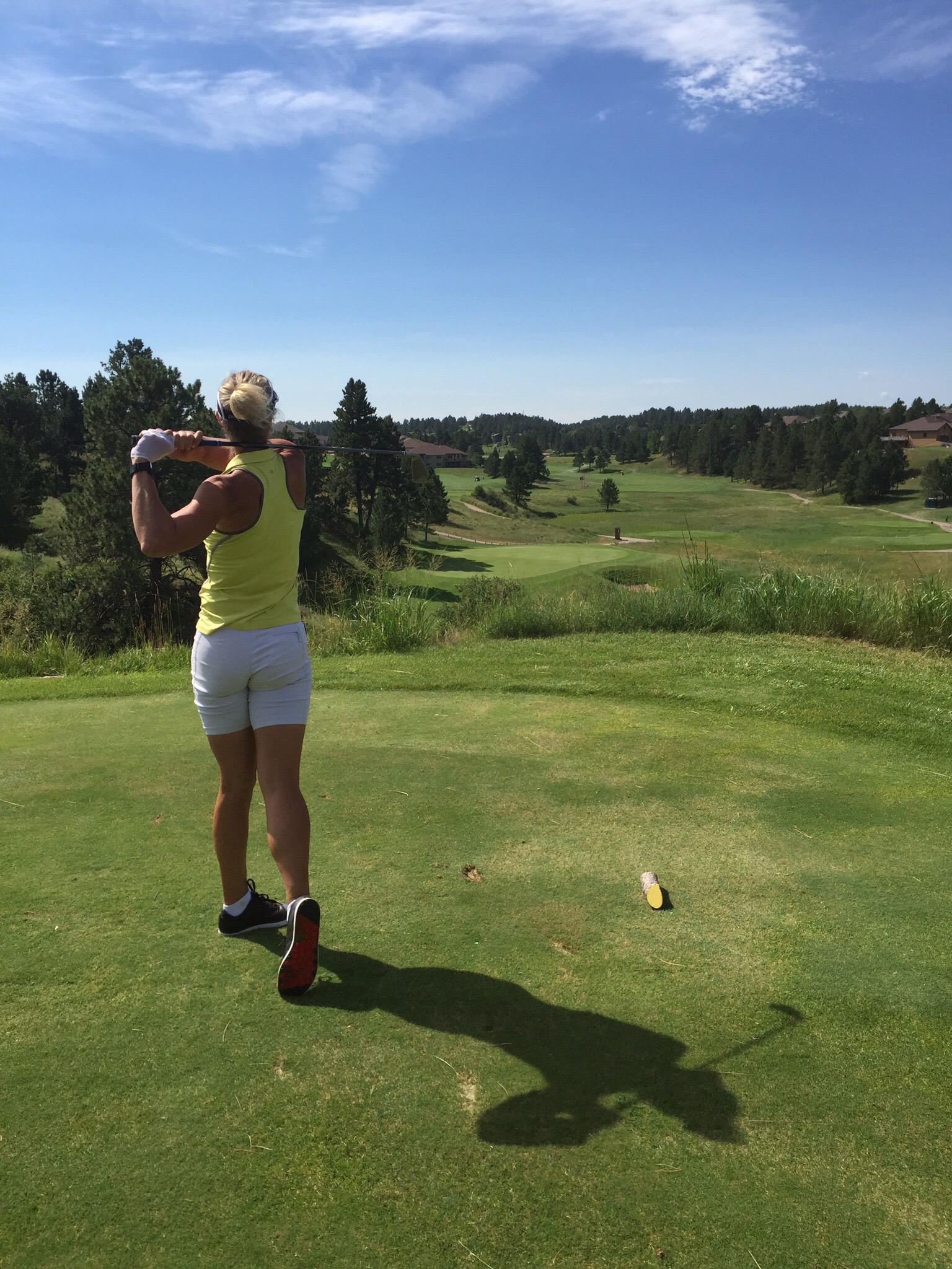
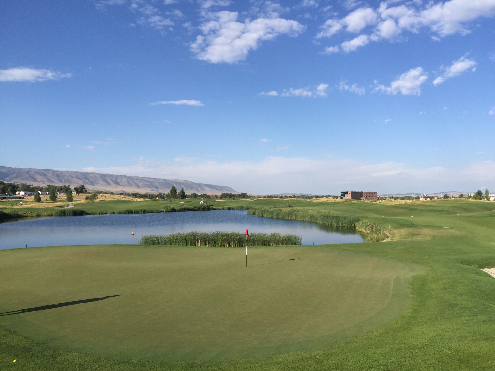
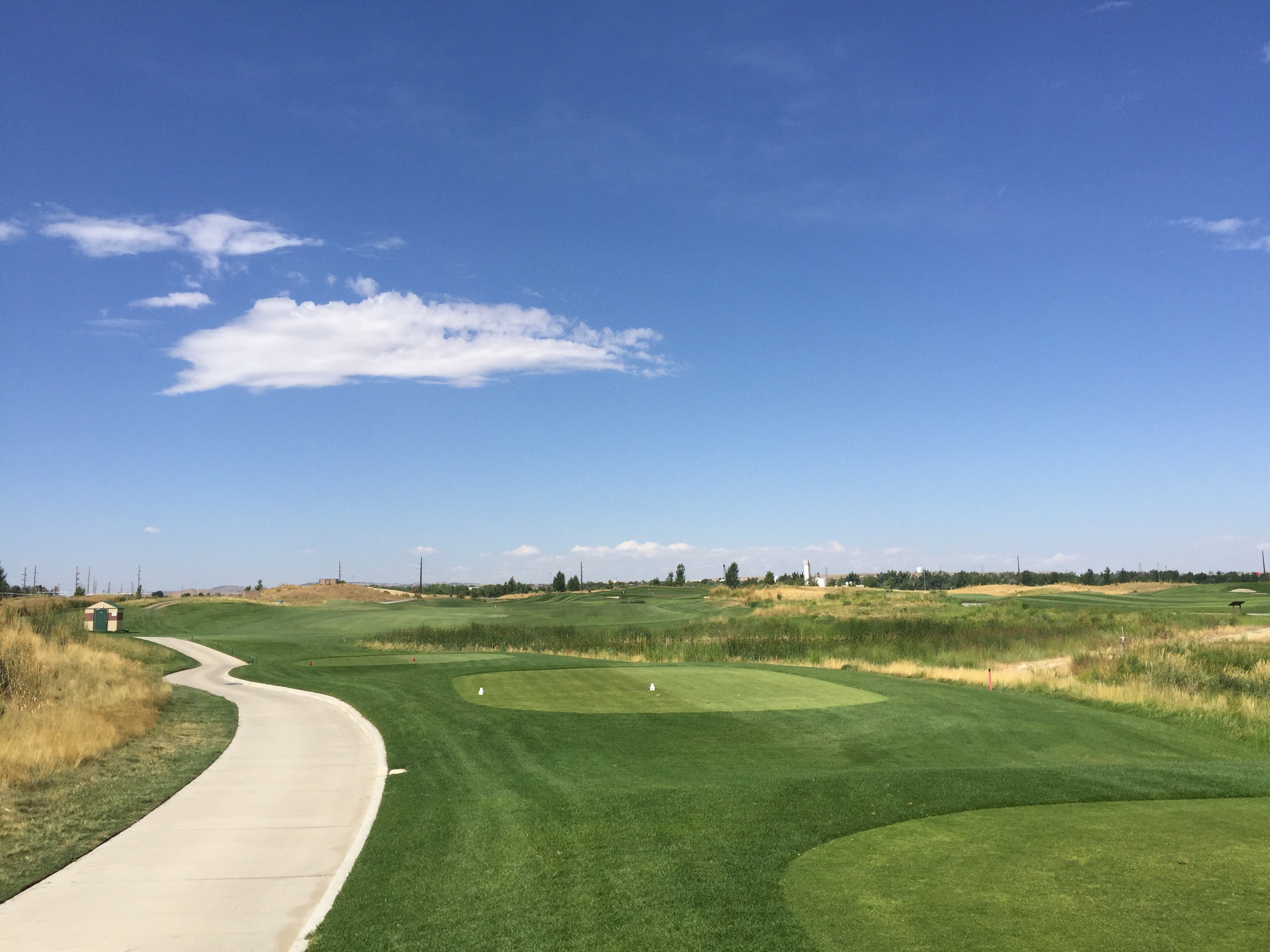
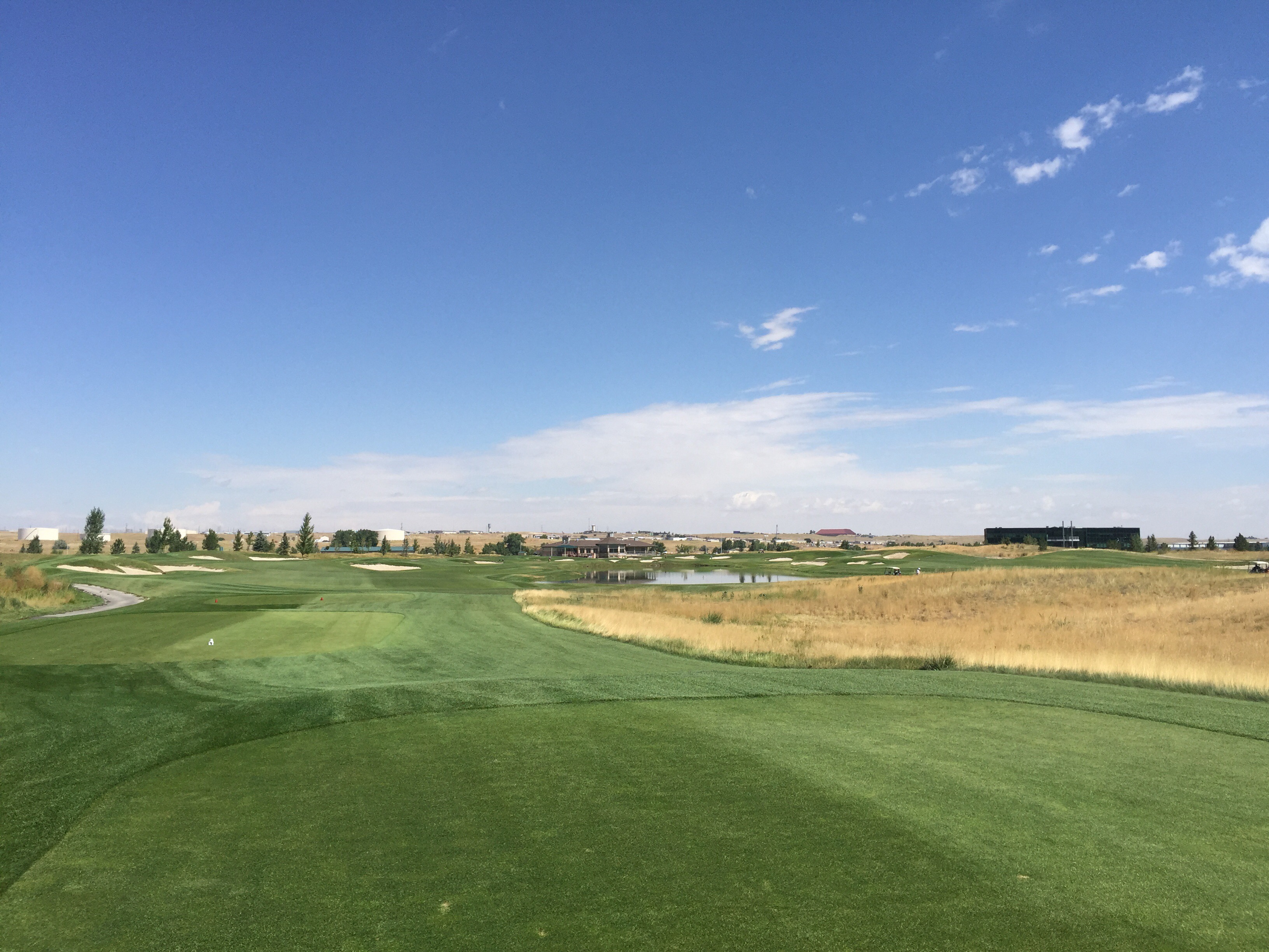
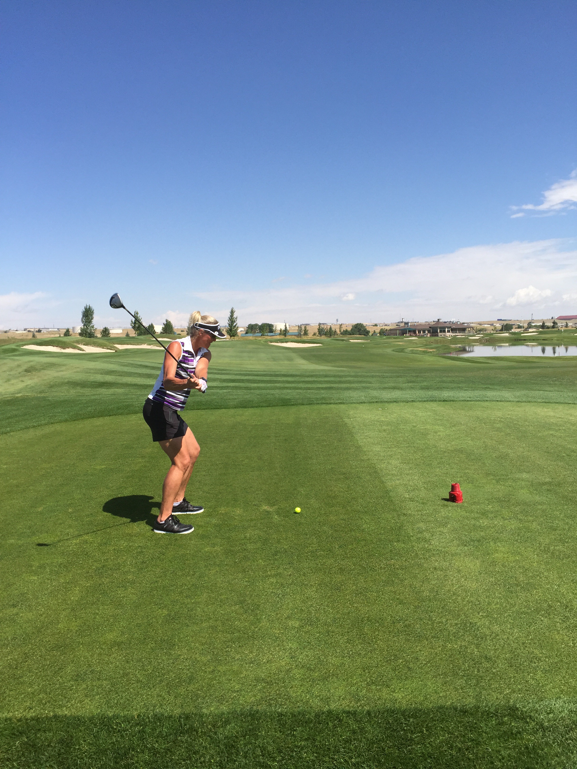
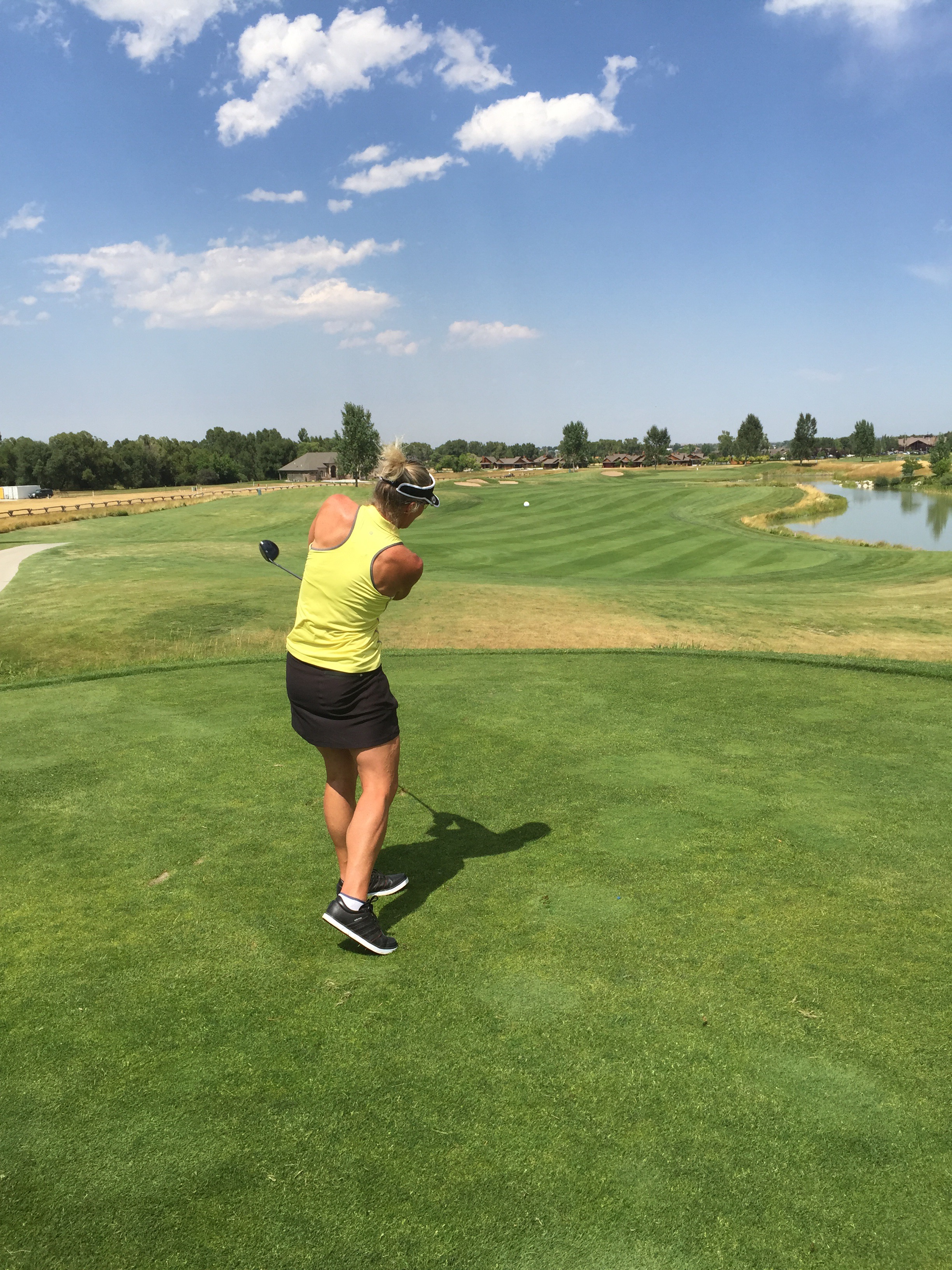
There are 90 golf courses in the metro area that stay open all year long due to Denver’s mild winters. With all of these recreational opportunities, a federal study recently found that Denver has the thinnest residents of any major U.S. city.

Posted in Colorado, USA, United States of America | Leave a comment

Riverdale Dunes Golf Course – Colorado, USA

We had three nights and two full days in Denver so the original plan was to play golf both days.  I then did a bit of googling on Denver and decided I wanted to do some sight seeing too so Steve thought we should play 36 holes in one day so we can sight see the next day.  I’ve never played 36 holes in a day before but was up for the challenge.

Steve had done some research re golf courses in the Denver area and the Riverdale Dunes course came highly recommended.  It was designed by Pete Dye who is one of our favourite designers.  There are actually two courses at Riverdale – the Dunes and the Knolls.  The Dunes is a Scottish style links course, meandering along the South Platte River. There are plenty of pot bunkers, mounds and water, and (naturally) the trademark railroad ties, are featured on this consistently top-rated public golf course in Colorado!

We teed off at 8am and it was already a fairly warm day.  We made good progress and finished the first 18 holes at 11.30am.  The course is really nice and visually appealing on the eye.  I had my best round of the tour, actually my best round for quite some time – I shot an 81 : )

After the first 18 holes we went in to check out what the afternoon field was looking like.  There were a few people teeing off between 12pm and 1pm so Steve decided we would get a sandwich to go and get back out there.  Not quite the way I was envisaging playing my first 36 holes – I was looking forward to a leisurely lunch in the air conditioned clubhouse.  As with Steve though, I also don’t like being stuck behind other players so would rather sacrifice the luxurious lunch and get back out there.

We teed off again at 11.45am and had free reign of the course until the 15th.  We were both playing really well and I managed to birdie the two holes again that I had birdied that morning.  I ended up shooting 80, 1 shot better than the morning round.  This 36 hole lark obviously agrees with me : ). Just quietly I also beleive I beat Steve off the stick although he was a bit cagey about his score : 0

We were all done and dusted by 3pm.

That night we had arranged to meet Nancy & Bill who live in HIghlands Ranch which is south of Denver.  We met Nancy & Bill in Kauai, Hawai in 2012 when we were horse riding and zip lining.  We have kept in touch via Facebook.  Nancy suggested a couple of places so we met at the Flights Wine Cafe in Morrison, south of Denver.  They have a great wine selection and serve tapas out of there 1870’s cottage.  We sat outside in the garden and enjoyed a lovely evening catching up.  I sampled a Sonoma Zinfandel called Sexual Chocolate – couldn’t really go wrong with a name like that : )


Posted in Colorado, USA, United States of America | Leave a comment

Mount Rushmore – South Dakota, USA

On Tuesday morning we left Deadwood, our destination for today being Denver in Colorado some 6 hours away.  We decided to drive through the Black Hills and visit Mount Rushmore along the way.

Mount Rushmore National Memorial is a sculpture carved into the granite face of Mount Rushmore, a granite batholith formation in the Black Hills in Keystone, South Dakota.  Sculpted by Danish-American Gutzon Borglum and his son, Lincoln Borglum, Mount Rushmore features 60-foot (18 m) sculptures of the heads of four United States presidents: George Washington (1732–1799), Thomas Jefferson (1743–1826), Theodore Roosevelt (1858–1919), and Abraham Lincoln (1809–1865).  The entire memorial covers 1,278.45 acres (2.00 sq mi; 5.17 km2) and is 5,725 feet (1,745 m) above sea level.

Originally known to the Lakota Sioux as “The Six Grandfathers”, the mountain was renamed after Charles E. Rushmore, a prominent New York lawyer, during an expedition in 1885.  At first, the project of carving Rushmore was undertaken to increase tourism in the Black Hills region of South Dakota. After long negotiations involving a Congressional delegation and President Calvin Coolidge, the project received Congressional approval. The carving started in 1927.

Over 450,00 tons of rock were removed from Mount Rushmore to bring out the presidential faces.  Although about 90% of the rock was removed with dynamite, the remaining rock was removed by drilling with jackhammers and wedging the rock off the mountain.  The final finishing work on the faces was completed using small jackhammers and facing bits.  Air compressors located at the base of the mountain provided the power to operate these jackhammers.

Upon Gutzon Borglum’s death in March 1941, his son Lincoln Borglum took over construction. Although the initial concept called for each president to be depicted from head to waist, lack of funding forced construction to end in late October 1941.  No fatalities occurred during the construction.  

Mount Rushmore has become an iconic symbol of the United States, and has appeared in works of fiction, and has been discussed or depicted in other popular works. It attracts over two million people annually.

The Four Presidents

George Washington – 1st President – 1789 to 1797

George Washington was born on the 22nd February 1732 in Virginia and died on the 14th December 1799 aged 67.  He was a solider and served as an officer in the French & Indian War.  He was also the Commander in Cheif in the Continental Army during the American Revolution.  He was the first President of the USA and under his term the first tax laws were adopted and the Bill of Right became law.

“Time and habit are at least necessary to fix the true character of governments, as of other human institutions…. Liberty itself will find in such a government, with powers properly distributed and adjusted, it’s surest guardian.”  – Farewell address, September 17, 1796

Gutzon Borgum, the Sculptor said…

“This is the work that I love most, this intimate contact with the four men.  As I become engrossed in the features and personality of each man, I feel myself growing in stature, just as they did when their characters grew and developed.”

“Washington, as the guiding genius from the time of our national conception, through its struggle for life and the completion of its Constitution, becomes the central part of this great group.”

Thomas Jefferson – 3rd President – 1801 – 1809

Thomas Jefferson was born on the 13th April 1743 in Virgina and died on the 4th of July 1826 which coincidentally was the 50th anniversary of the Declaration of Independence.  He was 83 when he died.  He was a lawyer and scientific farmer.  He was the Minister to France and George Washington’s Secretary of State.  Highlights during his term as President included purchasing the Louisiana Territory from France for USD15 million, making the importation of African slaves to the USA illegal and commissioning the Lewis and Clark expedition.

The expedition comprised a selected group of U.S. Army volunteers under the command of Captain Meriwether Lewis and his close friend, Second Lieutenant William Clark. Their perilous journey lasted from May 1804 to September 1806. The primary objective was to explore and to map the newly acquired territory of what is now known as the western part of the USA, to find a practical route across this half of the continent, and to establish an American presence in this territory before Britain and other European powers tried to claim it.

“Never did a prisoner, released from his chains, feel such relief as I shall on shaking off the shackles of power.  Nature intended me for the tranquil pursuits of science, by rendering them my supreme delight.  But the enormities of the times in which I have lived, have forced me to take a part in resisting them, and to commit myself on the boisterous ocean of political passions.” – letter to P. S. DuPont de Nemours, March 2, 1809, two days before leaving office

Gutzon Borgum, the Sculptor said…

“In the portraits and data we have of him… We see the young man, the torch bearer, the artist, the architect, the musician and builder, the creator in all his varied moods. I am sorry I have only one portrait to make of him.”

Abraham Lincoln – 16th President – 1861 to 1865

Abraham Lincoln was born on the 12th February 1809 in a log cabin in Kentucky and died on the 15th April 1865 aged 56 in Washington, DC after having been shot at Ford’s Theatre the night before. He was a lawyer and was elected to the Illinois State Legislature in 1834 and a Member of the US House of Representatives between 1847 and 1849.  The Civil War began and ended during his time in office.

“We are not enemies, but friends.  We must not be enemies.  Though passion may have strained, it must not break our bonds of affection.  The mystic chords of memory, stretching from every battlefield, and patriot grave, to every living heart and hearthstone, all over this broad land, will yet swell the chorus of the Union, when again touched, as surely they will be, by the better angels of our nature.” – First Inagural Address – March 4, 1861

Gutzon Borgum, the Sculptor said…

‘He was more deeply rooted in the home principles that are keeping us together than any man who was ever asked to make his heart-beat national.”

“He is at once the heart and soul of Mount Rushmore.”

Theodore Roosevelt – 26th President – 1901 to 1909

Theodore Roosevelt was born on the 27th October 1858 in New York and died on the 6th January 1919 in New York aged 60.  He was an author, a lawyer and a public official.  His career highlights included being the Governor of New York and being the Commander of the Rough Riders in the Spanish-American War.  He was William McKinley’s Vice President and became the youngest President at 42 when William McKinley was assassinated.  Highlights when he was in office include being the first President to travel outside the US, he worked to bring big business under regulation and the construction of the Panama Canal began.

“Perhaps the two most striking things in the presidency are the immense power of the President, in the first place; and in the second place, the fact that as soon as he has ceased being President he goes right back into the body of the people and becomes just like any other American citizen.” – written in early 1900’s and published in The Youth’s Companion, November 6, 1902

Gutzon Borgum, the Sculptor said…

“Roosevelt seems fairly to have leaped with life.  He kidnapped energy and carried it into the Nation’s home… He remains undrawn, none will engrave him.  His spirit is still at large, uncaptured by artist or sculptor.”


The last model made by the sculptor in 1938. The scale was One Inch = One Foot

Lincoln Mask – plaster masks of each of the presidents represented on Mount Rushmore were made by the sculptor.  These masks were hung from cables on the mountain and were used by workers for visual comparisons and measurement.

Posted in South Dakota, USA, United States of America | Leave a comment

Crazy Horse – South Dakota, USA

Next stop on our trip south through the Black Hills was Crazy Horse.  I must admit we didn’t really know much about the story behind the Crazy Horse sculpture before we arrived.  Just as we walked into the Visitors Centre they announced that the orientation film was about to start so we went and took a seat in the theatre.

We were both quite blown away by the story behind the Sculptor, Korczak Ziolkowski and his family.  They have made it their lifelong mission to protect and preserve the culture, tradition and living heritage of North American Indians.

Born in Boston, of Polish descent, Sculptor Korczak Ziolkowski (1908 – 1982) grew up in foster homes. After gaining recognition at the 1939 World’s Fair, Korczak received a letter from Lakota Cheif Henry Standing Bear, to come to the Black Hills of South Dakota and carve a mountain. The letter stated, “[m]y fellow chiefs and I would like the white man to know the red man has great heroes also.”

After some study and many letters back and forth, Korczak accepted the invitation and work began in 1948 with only $174.
Crazy Horse was the chosen subject for the project. Korczak wrote “Crazy Horse has never been known to have signed a treaty or touched the pen. Crazy Horse, as far as the scale model is concerned, is to be carved not so much as a lineal likeness, but more as a memorial to the spirit of Crazy Horse – to his people. With his left hand, it stretched in answer to the derisive question asked by a white man. “Where are your lands now?” He replied “My lands are where my dead lie buried.”

Korczak’s wife Ruth (Ross) Ziolkowski (1926 – 2014) followed Korczak to the Black Hills from West Hartford, Connecticut to volunteer her assistance with the project. They were married Thanksgiving Day, 1950 and had ten children and the Memorial became a family undertaking as well as a humanitarian and educational public charity.

The boys grew up helping their father on the mountain, the girls assisting their mother in the ever expanding visitor complex. Everyone helped with the dairy farm, the lumber mill and the multitude of other year-around activities at Crazy Horse, where, since 1947, the construction has never stopped.

As they reached adulthood, the Ziolkowski sons and daughters demonstrated that Korczak and Ruth imparted to their family not only knowledge and skill, but also a deep love of the Crazy Horse dream. All were free to leave, but seven remained involved in the project. 

Realising this project would span generations, Korczak and Ruth created plans to ensure the future of Crazy Horse Memorial Foundation.

When Korczak passed away, Ruth took over leadership. Among many feats, she shifted focus to finish Crazy Horse’s Face, enabling visitors to see the profile from the Visitor Centre. Ruth passed away in May 2014.
Today, many Ziolkowski family members, dedicated staff and Board of Directors carry on the dream of the Memorial’s Founders – Cheif Henry Dtanding Bear, Korczak and Ruth Ziolkowski at Crazy Horse Memorial.

The mission of the Crazy Horse Memorial Foundation is to protect and preserve the culture, tradition and living heritage of North American Indians. The Foundation demonstrates its commitment to this endeavour by continuing the progress of the world’s largest sculptural understating by carving a memorial of Lakota Leader Crazy Horse; by providing educational and cultural programming; by acting as a repository for American Indian artefacts, arts and crafts through the Indian Museum of North America and the Native American Educational and Cultural Centre and by establishing and operating the University of North America and when practical, a medical training centre for American Indians.

In the words of Korczak Ziolkowski “Never forget your Dreams.”

Crazy Horse

Crazy Horse was born as a member of the Teton Sioux tribe on Rapid Creek about 40 miles northeast of Thunderhead Mt. in the year 1843(?). He was killed at Fort Robinson by an American Indian soldier around midnight on September 5, 1877 while under a flag of truce – age 34.

Not much is known of the very early years of Crazy Horse. He would have grown up with the traditional ways of the Lakota. As a very young child he would have learned things like recognizing animals & what types of plants were edible. He would have lain in the tall grass of the prairie listening to and attuning his senses to nature, hoop toss, whipping toss game and whirling bone games with his friends. He would have been taught the ways of his people from multiple sources: his father, aunts, uncles, grandmothers, grandfathers and any other member of the tribe. Learning happened every day and was always something that prepared the young man for his future life as a warrior for the tribe. A boy of 4 or 5 would have already mastered the use of tomahawks, bows and horseback riding.

As with tradition Crazy Horse was not originally named Crazy Horse. He happened to start out in this world as “Curly”, aptly named this because he had wavy hair. He would be called Curly until he earned his father’s name, Tasunka Witco (Crazy Horse), by proving himself in battle. Contemporaries of Crazy Horse described him as fairer skinned than the “typical” Native American of the time, with lighter wavy hair than most. They also described his character as introspective, Crazy Horse always thought before speaking.

Crazy Horse lost his mother at age 4. Raised by his father and step mothers he was again faced with great tragedy at the young age of 12 where he witnessed an attack by Lieutenant J.L. Grattan on a Brule-Oglala encampment. The altercation seems to have started as a misunderstanding while Conquering Bear negotiated with Grattan over a stolen cow from a passing homesteader. No one knows who fired the first shots but this attack on the Lakota people provided the fuel needed to create a flame of war that lasted for over 23 years.

Once Crazy Horse was old enough he would have set out on one of the most important rites of passage to a Lakota warrior…the Vision Quest (Hanblecheya – which is defined as “crying for a visions “or “to pray for a spiritual experience”). This rite of passage would have given Crazy Horse guidance on his path in life. He would have gone alone into the hills for four days without food or water and cried for a dream to the great spirits.

“Crazy Horse dreamed and went into the world where there is nothing but the spirits of things. That is the real world that is behind this one, and everything we see here is something like a shadow from that world…. It was this vision that gave him his great power, for when he went into a fight, he had only to think of that world to be in it again, so that he could go through anything and not be hurt.” – Black Elk

By the time Crazy Horse was in his mid-teens he was already a full-fledged warrior. His bravery and prowess in battle were well-known by the Lakota people. He rode into battle with a single eagle feather in his hair, a rock behind his ear, his body painted with white hail balls and a lightning symbol on his face. The symbols and rituals that went into preparing for war was meant to allow the warrior to draw power and protect themselves from harm during battle.

In 1876 Crazy Horse led a band of Lakota warriors against Custer’s Seventh U.S. Cavalry battalion. They called this the Battle of the Little Big Horn or Custer’s Last Stand. Custer, 9 officers and 280 enlisted men all lay dead after the fighting was over. According to tribes who participated in the battle 32 Indians were killed. Although Crazy Horse is often given credit for killing General George A. Custer, there is no proof that he was the one who took Custer’s last breath. It is known that without Crazy Horse and his followers the battle’s outcome would have been much different as he was integral in stopping reinforcements from arriving.

It was after the Battle of the Little Big Horn that the United States Government would send scouts to round up any Northern Plains tribes who resisted. This forced many Indian Nations to move across the country always followed by soldiers until starvation or exposure would force them to surrender. This is how Chief Joseph of the Nez Perces & Sitting Bull of the Hunkpapa Lakota were forced into submission.

In 1877, under a flag of truce, Crazy Horse went to Fort Robinson. Negotiations with the U.S. Military leaders stationed at the fort broke down. Eye witnesses blame the breakdown in negotiations on the translator who incorrectly translated what Crazy Horse said. Crazy Horse was quickly escorted toward the jail. Once he realized that the commanding officers were planning on imprisoning him, he struggled and drew his knife. Little Big Man, friend and fellow warrior of Crazy Horse, tried to restrain him. As Crazy Horse continued to free himself, an Indian infantry guard made a successful lunge with a bayonet and mortally wounded the great warrior. Crazy Horse died shortly after the mortal wound was inflicted. There are different accounts putting the date of his death at either September 5, 1877 or September 6, 1877.

It is a well-known fact that Crazy Horse refused to have his picture or likeness taken. Crazy Horse lived under the assumption that by taking a picture you were taking a part of his soul and would shorten his life. The popular response to photograph requests would be, “Would you imprison my shadow too?”. The likeness that Korczak created for Crazy Horse Memorial was developed by descriptions from survivors of the Battle of the Little Big Horn and other contemporaries of Crazy Horse the man. Korczak, decided to create a monument that captured what Crazy Horse stood for instead of a true likeness based on the descriptions provided to honor the great warrior chief’s wishes. With his left hand thrown out pointing in answer to the derisive question asked by a Cavalry man, “Where are your lands now?” he replied, “My lands are where my dead lie buried.”

Why was Crazy Horse was chosen by the Native Americans?

Crazy Horse was born on Rapid Creek in 1843. He was killed when he was only 34 years of age, around midnight the morning of September 6, 1877. He was stabbed in the back by an American Indian soldier at Fort Robinson, Nebraska, while he was under a flag of truce. During his life he was a great leader to his people. He did not have an equal as a warrior or chief. He gave submissive allegiance to no man, White or Indian, and claimed his inalienable rights as an Indian to wander at will over the hunting grounds of his people. He never registered at any agency; never touched the pen; never signed a treaty. He wanted only peace and a way of living for his people without having to live in the whiteman’s reservations.

Crazy Horse defended his people and their way of life in the only manner he knew, but only after he saw the treaty of 1868 broken. This treaty, signed by the President of the United States said “As long as the rivers run and the grasses grow and trees bear leaves, Paha Sapa, the Black Hills, will forever and ever be the sacred land of the Indians.” He took to the warpath only after he saw his friend Conquering Bear killed; only after he saw the failure of the government agents to bring required treaty guarantees such as meat, clothing, tents and necessities for existence. In battle the Sioux leader would rally his warriors with the cry, “It is a good day to fight-it is a good day to die.”

In 1877 Crazy Horse’s wife, staying at Fort Robinson, was dying of tuberculosis. His only child, a daughter, had recently died of this same disease. Under a guarantee of safe conduct both into and out of the Fort, Crazy Horse agreed to confer with the Commanding Officers. History has proven since that the intention never was to let Crazy Horse go free, but rather to ship him to the Dry Tortugas in Florida. The chief had no notion of what was in store for him until he entered the building and saw the bars on the windows. Right then he was face to face with the fate the whiteman had intended for him. He drew a knife (the fact that he had not been disarmed is good proof that he never surrendered) and attempted to get his Indian friends outside of the stockade. Little Big Man, friend and warrior companion of Crazy Horse, hoping to avoid trouble, seized Crazy Horse’s arms. In struggling to free himself, Crazy Horse slashed Little Big Man’s wrist. At this point an infantry man of the guard made a successful lunge with a bayonet and Crazy Horse fell, mortally wounded.

In the minds of the Indians today, the life and death of Crazy Horse parallels the tragic history of the redman since the whiteman invaded their homes and lands. One of the many great and patriotic Indian heroes, Crazy Horse’s tenacity of purpose, his modest life, his unfailing courage, his tragic death sets him apart and above all others.” – Korczak Ziolkowski, Sc. May, 1949


The model on which the Crazy Horse sculpture is based on – this is what it will look like when it is finished 

Posted in South Dakota, USA, United States of America | Leave a comment

The Golf Club at Red Rock – South Dakota

The guys from the wine bar recommended we play golf at Red Rock in Rapid City which is about 45 minutes from Deadwood where we were now staying. Apart from Spearfish Canyon Country Club there are only a few 9 hole courses in the Spearfish / Deadwood area so we thought why not.

Steve called and booked us in and the guy on the other end of the phone also a Steve said it would be USD75 each including a cart. When we arrived on the Monday morning for our tee time, Steve from the golf club remembered Steve’s phone call and said they actually had a special on – USD69 for both of us including a cart – bargain!

The course is set in a fairly new subdivision with some nice houses. It was very up and down with some great elevated tees. Steve from the golf shop had warned us that there can be rattle snakes in the long rough – great! I must say I felt a bit nervous – not a normal feeling for me. Steve said to me “if our balls go into the long rough we’ll just drop another one – it’s not worth dying over a $3 golf ball.” I was more than happy with that plan but it seems Steve really is a tight arse accountant – on the second hole he is in the long rough looking for his ball! Trust me, he was on his own!

I’m happy to report we didn’t come across anything untoward apart from a deer and her fawn who were sheltering in the shade just off the path after the 18th. They were quite happy to pose for photographs.

We were convinced , however, that all the elephants had escaped from the zoo and had been buried in the greens. They were very tricky with many ups and downs. It would be fair to say we both had the worst putting stats of the trip. I had a four foot birdie putt on the par five 9th and ended up taking an 8. I was not a happy camper.

We ended up bumping into the guys from the wine bar in the clubhouse so joined them for lunch. They had already played 18 holes somewhere else and we’re going out to play 18 at Red Rock.

After golf we went into Rapid City to check it out. Because they are quite close to Mt Rushmore where the four great ex US Presidents are carved in stone they have a Presidential theme in the downtown area with a bronze statue of a past President on each corner. They also had a Presidential Pawn shop – yes that is Pawn and not Porn – ironically Bill Clinton’s statue was outside this store!

We went in to have a look around and were amazed at the amount of guns they had for sale – this is just so foreign to us. It is really interesting chatting to the locals about the gun laws though. The majority are in favour of everyone carrying a gun and say there would be an uprising if the Government tried to take them away. The guy in the Pawn shop let Steve hold a few guns. His theory on the gun laws is that there is more crime and gun related deaths in the states that have strict gun laws. The gun laws in South Dakota are fairly relaxed and most people carry a gun. Apparently there is minimal crime as the good guys with guns outnumber the bad guys with guns. Interesting.

Rapid City is named after Rapid Creek, on which the city is established, it is set against the eastern slope of the Black Hills mountain range. The population was 67,956 as of the 2010 Census.  Known as the “Gateway to the Black Hills” and the “City of Presidents”, it is split by a low mountain ridge that divides the western and eastern parts of the city. Ellsworth Air Force Base is located on the outskirts of the city. Camp Rapid, a part of the United States Army National Guard, is located in the western part of the city.  In the neighboring Black Hills are the popular tourist attractions of Mount Rushmore, the Crazy Horse Memorial, Custer State Park, and Wind Cave National Park.

There are 42 life sized bronze statues of all the US Presidents with the exception of the current one but he will be coming to a corner in Rapid City very soon : ). The City of Presidents project began in 2000 to honor the legacy of the American presidency. Each of the sculptures is privately funded, and the pattern of placement was chosen to maintain a coherent structure and eliminate any sense of favoritism or political gain.

Gerald Ford – 38th President

James Monroe – 5th President

George Washington – 1st President
Jimmy Carter – 39th President
Bill Clinton – 42nd President

After that bit of enlightenment we headed back to Deadwood where we are staying. Deadwood is a real Wild West town with lots of gambling and bars. The night before on our walk we had seen this shop with some great Harley Davidson paintings so wanted to go and check it out.

We got talking to the artist, Scott Jacobs who it turns out is the official artist for Harley Davidson and has been for the past 23 years. He has also started doing some wine scene paintings which were also great. His art was amazing and I am not so into motorbikes. He is based in San Diego but has just opened up this shop given the interest in the area due to the annual Sturgis Motorcycle rally.

Some of his art is also on t-shirts etc… His art is sold on 105 cruise ships that sail all over the world so he has been to NZ a couple of times on one of these cruise ships. He was off to Iceland on Friday on a cruise ship to promote his art. Some of the paintings looked like photos – they were that vibrant. He also collects and restores old Harley Davidson’s and had a few displayed in the shop. One of them was a 1926 Harley that he had raced across the USA twice. Such an interesting guy.

Check out http://www.scottjacobsstudio.com

That evening we went to Legends Steakhouse for dinner – this had again come highly recommended by our wine bar friends. You can’t book but we had got ourselves on a priority seating list the evening before. We turned up and they said there was a 45 to 60 minute wait – I said we were on the priority seating list. She found our name and the next minute a waitress was taking us to a table – the system works! It was really nice to have a steak that resembled what we are used to eating at home, washed down with a red Zinfandel – perfect.


Deadwood is named after the dead trees found in its gulch.  A gulch is a deep V-shaped valley caused by erosion.  The population was 1,270 according to the 2010 census. 

The settlement of Deadwood began illegally in the 1870s on land which had been granted to American Indians in the 1868 Treaty of Laramie. The treaty had guaranteed ownership of the Black Hills to the Lakota people and land disputes were endemic, having reached the United States Supreme Court on several occasions. However, in 1874, Colonel George Armstrong Custer led an expedition into the Black Hills and announced the discovery of gold on French Creek near present-day Custer, South Dakota. This announcement triggered the Black Hills Gold Rush and gave rise to the new and lawless town of Deadwood, which quickly reached a population of around 5,000.

Noted people who were born, lived, or have resided in Deadwood include Calamity Jane, Wyatt Earp and Wild Bill Hickok.  The towns Tagline is ‘Where Western Legends were Born’. Three times a day in the summer they close the Main Street and do a mock shootout – unfortunately we didn’t get to witness this but did see some of the characters who are part of the reenactment – OMG you would seriously think they have just stepped out of the 18th century regardless of whether they were dressed up or not : 0

I also didn’t manage to capture any images of the Main Street so have borrowed some of these off the internet… 

What Deadwood would look like in the winter

Posted in South Dakota, USA, United States of America | Leave a comment

Spearfish Canyon Country Club – South Dakota, USA

We arrived into Spearfish late in the afternoon.  We had booked a Stay and Play package at the Spearfish Canyon Country Club which I had dialled into the GPS.  When we arrived at the Country Club there was no accomodation in sight so I checked the website – we were staying at the Spearfish Canyon Lodge which was some 25 minutes away.  The drive down to the Lodge was pretty nice though through the canyon valley.  When we arrived at the Lodge we were greeted by lots of motorcyclists, beer tents and motorcycle paraphernalia – we were both thinking what have we got here.

We checked in no problem and got sorted.  There is only one place to eat out there so we were worried that we would have to drive back into town for dinner as it would be so busy but by the time we went for dinner at 7.30pm the place was deserted.  We learnt that they all eat early and then head into Sturgis for the evening’s entertainment.


On Saturday morning we headed back into Spearfish to play golf at the Spearfish Canyon Country Club. The Spearfish Country Club was established in 1921 and the front nine was opened shortly thereafter, making it one of the oldest golf courses in the great state of South Dakota. In 1988, the Spearfish Canyon Country Club became the only 18-hole golf course in the Northern Black Hills.  

It wasn’t a long course but you had to play strategically and the greens on the front nine were really small – the smallest greens I’ve ever played on.  Steve said he grew up playing on a course with small greens but that was quite some time ago!  They intimidated us to start with but we got used to them.  The back nine is much more open and the greens are bigger.  We really enjoyed the course so signed up to play again on Sunday.


After golf we checked out the town of Spearfish which is not large. We had a nice lunch and then Steve went off to False Bottom bar while I found a nice cafe that did good coffee. When I joined Steve in the bar he had of course made friends with the bar staff. They were making authentic tacos using non processed, fresh ingredients. Jarred the taco maker was really into organic eating and has his own vege garden and chickens etc… 

We then decided to go to the movies – Steve had been hanging out to see the Jason Bourne movie.  The movie theatres in Spearfish were nice and small.

Steve had spotted a wine bar that he wanted to check out so after the movies we went to the Level Wine Bar – we were the only customers there.  It turns out the owners had been playing golf a few holes behind us so recognised us.  They are both retired policemen from California.  They have retired to Spearfish so they can play golf and hunt — they are both bow hunters.  The wine bar is a bit of a hobby which one of their daughters run.  A couple of glasses of wine later, invitations to NZ extended we thought we better get something to eat before heading back to the Lodge.

On Sunday morning we walked up to Roughlock Falls which is up behind the Lodge.  The water was so clear we could see lots of trout.


We enjoyed another game at the Canyon Club which was much better the second time around as we knew what not to do. In saying that it is still no guarantee the ball is going to end up where you want it to!

Spearfish 

Spearfish is located in Lawrence County in South Dakota and has a population of about 11,000.  Before the Black Hills Gold Rush of 1876, the area was used by Native Americans (primarily bands of Sioux but others also ranged through the area) who would spear fish in the creek (hence the name of the creek and subsequently the town). Once the gold rush started, the city was founded in 1876 at the mouth of Spearfish Canyon, and was originally called Queen City.  Spearfish grew as a supplier of foodstuffs to the mining camps in the hills. Even today, a significant amount of truck farming and market gardening still occurs in the vicinity.

Posted in South Dakota, USA | Leave a comment

Devil’s Tower – Wyoming, USA

We left Casper and headed north east – today’s adventure was to check out the Devil’s Tower Monument before heading into Spearfish in South Dakota.  The annual Sturgis motorcycle rally has been on in this area for the past week so there were a lot of motorcycles around.  I was quite fascinated by all the bikes, outfits and people – this is a way of life for them and some of the bikes are pretty amazing.  Most of them don’t wear helmets – apparently it is ony required by law if you are under eighteen.

The Sturgis Motorcycle Rally is an American motorcycle rally held annually in Sturgis, South Dakota, usually during the first full week of August. It was begun in 1938 by a group of Indian Motorcycle riders and was originally held for stunts and races, but it has evolved into being a meeting for motorcycle enthusiasts from around the world. It brings significant income to the citizens of Sturgis, a town of only 6,627 people. It is one of the largest motorcycle rallies in the world.  They reckon some 400,000 attend annually.  The population of the whole state of South Dakota is only a 1,000,000 so for that week the population explodes.

Many attendees of the Sturgis Rally have families, bring their children and drive trailers and campers to the rally, and ride their motorcycles just the last few miles. The director of the rally estimated in 2005 that less than half the attendees actually rode there.  Shipping companies transport thousands of motorcycles to Sturgis for attendees who arrive via airline.  Last year there were 12 fatalities and this year there have been 2 to date.

Apparently there are some sights to behold in Sturgis with females wearing leather chaps with only a g-string or lacy underwear.  I was quite keen to go and just feel the vibe in Sturgis but Steve wasn’t keen – not even the minimalistic attire could entice him.  To be fair we have seen more motorcycles in the last two days than we have in our lives.

We lined up with the motorcycles to drive up to the Devil’s Tower – it costs USD10 for a vehicle or USD5 for a motorcycle.  This is my favourite picture from today.

About 50 million years ago molten magma was forced into sedimentary rocks above it and cooled underground. As it cooled it contracted and fractured into columns. An earlier flow formed Little Missouri Buttes. Over millions of years, erosion of the sedimentary rock exposed Devil’s Tower and accentuated Little Missouri Buttes. The tower rises 867 feet from its base and stands 1,267 feet above the river and 5,112 feet above sea level. The area of its teardrop shaped top is 1.5 acres. The diameter of its base is 1,000 feet.

There are a few walking trails at the base of the tower so we decided to do the one that circumnavigated the base – it was about 2km long.  You can also climb the tower with a permit so we witnessed a few people climbing up there – they were attached by ropes and once they reached the top they abseiled down.

The legend of the native Kiowa people says….

“Eight children were at play, seven sisters and their brother.  Suddenly the boy was struck dumb; he trembled and began to run upon his hands and feet.  His fingers became claws, and his body was covered with fur.  Directly there was a bear where the boy had been.  The sisters were terrified; they ran, and the bear ran after them.  They came to the stump of a great tree, and the tree spoke to them.  It bade them to climb upon it, and as they did so it began to rise into the air.  The bear came to kill them, but they were just beyond its reach.  It reared against the tree and scored the bark all around with its claws.  The seven sisters were borne into the sky, and they became the stars of the Pleiades.”

Bear Lodge is one of the many American Indian names for the Tower.  Colonel Richard Dodge named it Devils Tower in 1875.  He led the military expedition sent to confirm reports of gold in the Black Hills and to survey the area.  Scientists them thought Devils Tower was the core of an active volcano.  Recent data suggest it is an igneous intrusion.

On July 4, 1893, with fanfare and over 1,000 spectators, William Rogers and Willard Ripley made the ‘first’ ascent, using a wooden ladder for the first 350 feet.  The fact that there was already a flagpole for raising Old Glory atop the Tower suggests the first ascent might have been one day earlier.  The Tower became a Fourth of July meeting place for ranching families who might see each other but once a year.  At the annual picnic, Mrs Rogers used her husband’s ladder to become the first woman to reach the summit.

Records of Tower climbs have been kept since 1937.  Some 5,000 climbers come every year from all over the world to climb o the massive columns.  Over 220 climbing routes have been used.

In 1906 President Theodore Roosevelt proclaimed Devils Tower the first national monument under the new Antiquities Act.  His action made Wyoming the home of both the first national park – Yellowstone in 1872 – and the first national monument.  

A 1922 Harley Davidson


Posted in United States of America, Wyoming, USA | Leave a comment

Three Crowns Golf Course – Wyoming, USA

Today we played golf at the Three Crowns Golf Course which is in Casper, Wyoming.  It came highly recomended and it didn’t dissapoint.  We were supposed to play yesterday afternoon also but someone put their back out getting out of the car!  He was much better this morning but still wasn’t sure he would be able to play until he swung a club.  I wanted to play regardless so we went to the golf course for our 8am tee time anyway.  After warming up he decided he would be fine and he was.

This is another golf course built on reclaimed land that had been used in the energy industry in days gone by.  In the case of Three Crowns this land used to be an oil refinery.  Our road trip starting in Calgary, Canada and then going through Montana and Wyoming has been really interesting in terms of the various energy industries that have and are still the basis of these provinces and states.  See the article below re the history of the land used for the Three Crowns Golf Course.

We played the first nine on our own and then a guy who had been playing behind us joined us on the 10th.  His name was Nick and he was from Gillette, Wyoming which is about 175km north of Casper.  His wife, Noreen, is a State Legislator and was in town for a mining and oil summit so he thought he would have a game of golf.  Turns out he was quite a handy golfer on a 4 handicap.  Steve immediately decided they should play for the Presidents Cup – the US versus the rest of the world.  Steve had to work pretty hard to regain the honour and he reckons he won the back nine by 1 hole.  Nick said he wasn’t keeping score : )

Noreen’s summit was being held nearby so she joined us for lunch in the Clubhouse.  We also met a few other people that were attending the summit including some lobbyists.  We had some interesting discussions about politics and nuclear power.  Wyoming is a fairly strong Republican state so although not really wanting to vote for Donald Trump they feel they don’t have much choice as they certainly don’t want Hilary Clinton to be President.

What they have done in terms of cleaning up this old oil refinery site is impressive and the state of Wyoming prides itself on making a huge effort to right the wrongs of earlier years.  Nick is a retired engineer who worked in the coal industry.  There are three coal operations in Gillette where he lives and they are all facing bankruptcy due to the price of coal falling.  These towns that we have been travelling through are real ‘boom or bust’ towns due to the industries they rely on from an economic perspective.  

Email addresses were exchanged and an invitation to NZ was extended to Nick and Noreen before we went on our way.

I decided to do some exploring in downtown Casper this afternoon.  On my way back to the hotel the skies got quite black and I could hear thunder in the distance.  I upped my pace and only had about a kilometre to go when the heavens opened up.  I managed to find a tree to shelter behind  and being the eternal optimist thought that the skies were clearing.  The next minute it was hailing!  OK, maybe it wasn’t going to clear anytime soon.  I decided to Skype Steve to come and pick me up – I told him I was under a tree outside Rainbow Real Estate – ironic really : ). The next minute the wind and rain changed directions so I had to move around to the other side of the tree – it was such a quick turnaround and then more hail started falling.

Steve then located me and I came back to the hotel to dry off.   The rain stopped eventually so we took a trip to the supermarket – part of the hotel carpark was flooded and when we parked outside the supermarket we discovered the hail was still lying on the ground.  We went from about 33 degrees on the golf course to 14 degrees within a few hours.  I’m sure it will be back to normal again tomorrow : )


The flooded carpark

Hail still on the ground about an hour later

Three Crowns’ Remediation Done Just Right

By Steve Habel, Cybergolf

Wyoming is America’s least populated state, and the city of Casper, with 54,000 residents, is one of its benchmark towns. Casper was built on the back of the energy business – especially oil and natural gas, and the city’s past, present and future are directly linked to this vital industry.

Given that fact, it’s appropriate that Casper’s newest and best golf course was built on the site of one of the region’s largest and longest-operating oil refineries. Smack dab in the middle of town, and directly adjacent to the North Platte River, lies Three Crowns Golf Club, an award-winning track and remediation project on the former Amoco Oil Refinery. 

Where once there were tanks and towers and heat exchangers and thousands of miles of pipe, there is now a gleaming and green, par-72, 7,065-yard Robert Trent Jones, Jr.-designed course. The layout has 110 acres of manicured turf and 45 acres of native grasses. Eight lakes – four of which help remediate water pollution – come into play on 14 holes, and 84 bunkers filled with white sand punctuate the golfscape while adding challenges galore. 

Three Crowns is named for BP Amoco’s old symbol – crowns of gold, white and red, which represent the three different grades of gasoline sold by the company. The golf course occupies land that still contains millions of gallons of refinery product scheduled for recovery over the next two decades.

The successful exploration and discovery of abundant oil reserves in Wyoming has been the driving force in the economy in the state for decades and led to the construction of the Midwest Oil Refinery in Casper in 1912. The facility is a significant part of the city’s history, but the condition of the property around the refinery and the runoff from it into the river was a health risk and a huge cause of concern for local residents. 

The 340-acre site pumped and refined 48,000 barrels of oil a day for eight decades before Amoco announced the refinery would be closed. On December 13, 1991 – as stories grew of basements on the site filled waist-deep with oil leeching from the ground – the last barrel of gasoline was refined and the site was shut down. It took eight years before the Wyoming Department of Environmental Quality signed a consent decree with the corporation to establish a framework for cleanup of the property. The site, now known as Platte River Commons, includes the golf course, a burgeoning business park, jogging trail and riverside parks. 

The department then went to work with the entire Casper community and identified an environmentally safe reuse of the land. It was quite an undertaking as over the years close to 300 million gallons of oil had spilled onto the site.

One of Jones, Jr.’s biggest challenges in designing Three Crowns was adjusting to the requirement that cuts could not be made deeper than six feet. In preparing the site, 3,000 miles of pipe and 400,000 cubic yards of concrete were removed, and contaminated soil was capped with 6 feet of clean dirt. Landowner BP Products North America, which had merged with Amoco, then installed a remediation system; an intricate arrangement of pumps, oil separators, monitoring and recovery wells and other technology is integrated across the course to treat and test all water, ensuring that it meets environmental standards before it is returned to the North Platte River. 

Using high-tech maps that identified places where the soil was uncontaminated at lower depths, Jones’ construction team dug lakes (which they lined with geotechnical fiber to keep out contamination) and used the excavated dirt to build mounds and other features around the course. 

The mounds separate the golf holes from each other, lend an isolated feel to the course and are covered in native grasses that turn wheat-colored in summer to beautifully set off the verdant fairways.

There are more than 100 recovery wells working at Three Crowns GC, many on the footprint of the golf course. They produce not only oil (about 30 barrels a day are still taken out of the ground), but water as well. Jones incorporated the water-remediation process into the design. 

And what a job the RTJ team did. Opened in 2005 with much fanfare, Three Crowns Golf Club is a jewel to play and a tough course for anyone. Rated at 73.3 and sloped at 133 from its back set of four tees, the track crosses the old rolling refinery site with a combination of long par-3s (all at least 200 yards), monster par-5s (three are 575 yards or longer) and a collection of mostly short par-4s (the longest of which is just 425 yards). 

A before and after photo of the land. 


Posted in United States of America, Wyoming, USA | Leave a comment

Powder Horn Golf Club – Wyoming, USA

Our destination today was the Powder Horn Golf Club which is located just outside Sheridan in Wyoming.  We had booked a round of golf in the afternoon and were staying in one of the houses in the Powder Horn community.

The centerpiece of The Powder Horn community is the nationally recognized 27-hole championship golf course. The original eighteen holes opened in 1997, followed by the addition of a new nine holes that opened in 2002.   There are three distinct nines – the Eagle nine, the Stag nine and the Mountain nine.  We played the Stag and Eagle nines.  

With a nod to the game’s mecca, St. Andrews, the Mountain Nine features a small replica of the famous Swilcan Burn Bridge, as well as large greens, 30 sizeable sand bunkers and the open rolling terrain of a Scottish links course. Woods and wetlands surround the Old Red Barn to create target golf with Old West flair on the Stag Nine. The Eagle Nine rounds out the course, offering surprising length and creative shots within a mix of meadow and creek-side terrain. 

The Powder Horn Golf Club is managed by Troon Privé, the world’s leader in private club management.

PS – A powder horn was a container for gunpowder, and was generally created from a cow, ox or buffalo horn. 

Our house for the night

This was a first – fried Brussel Sprouts accompanied by aioli, blue cheese and a balsamic reduction – quite tasty : )

Sheridan

Sheridan has a population of about 18,000.  The city was named after General Philip Sheridan, Union cavalry leader in the American Civil War.[7] Travel book information describe Sheridan as the scene of many fierce battles between US Cavalry and the Sioux, Cheyenne and Crow Indian tribes.

Like many towns in the western United States, Sheridan’s early industries included cattle ranching, logging, coal mining, railroading, agriculture, and small factories including a flour mill, brewery, and sugarbeet refinery. Residents today find employment in many fields including nearby coal mines; education; coal bed methane extraction; health care; retailing; banking; law firms; city, county, and state government; National Forest; home construction; and a large number of small businesses; farming; and ranching.

Posted in United States of America, Wyoming, USA | Leave a comment

Battle of the Little Bighorn – Montana, USA

On our way from Billings to Sheridan we stopped off at the Little Bighorn Battlefield Monument.  The monument sits in the middle of a huge expanse of prairie land just up from the Little Bighorn River and you can imagine the battle in the day.  As well as the monument there is a Visitor Centre as well as a cemetery.  It was really interesting and the reasons for the battle are similar the world over with the indigenous people being forced to change their traditional habits by the white people.

In the words of Ta Sunke Witko – Crazy Horse “We did not ask you white men to come here.  The Great Spirit gave us this country as a home.  You had yours.  We did not interfere with you.  We do not want your civilisation!”

Th monument memorialises one of the last armed efforts of the Northern Plains Indians to preserve their ancestral way of life.  Here in the valley of the Little Bighorn River on two hot June days in 1876, more than 260 soldiers and attached personnel of the US Army met defeat and death at the hands of several thousand Lakota and Cheyenne warriors.  Among the deat were Lt. Col. George Armstrong Custer and every member of his immediate command.  Although the Indians won the battle, they subsequently lost the war against the military’s efforts to end their independent, nomadic way of life.

The Battle of the Little Bighorn was but the latest encounter in a centuries-long conflict that began with the arrival of the first Europeans in North America.  The contact between Indian and Euro-American cultures had continued relentlessly, sometimes around the campfire, sometimes at treaty grounds, but more often on the battlefield.  It reached its peak in the decade following the Civil War, when settlers resumed their vigorous westward movement.  These western emigrants, possessing little or no understanding of the Indian way of life, showed slight regard for the sanctity of hunting grounds, or the terms of former treaties.  The Indians’ resistance to those encroachments on their domain only served to intensify hostilities.

In 1868, believing it “cheaper to feed than to fight the Indians,” representatives of the US government signed a treaty at Fort Laramie, Wyoming with the Lakota, Cheyenne and other tribes of the Great Plains, by which a large area in eastern Wyoming was designated a permanent Indian reservation.  The government promised to protect the Indians “against the commission of all depredations by people of the United States.”

Peace, however, was not to last.  In 1874 gold was discovered in the Black Hills, the heart of the new Indian reservation.  News of the strike spread quickly, and soon thousands of eager gold seekers swarmed into the region in violation of the Fort Laramie treaty.  The army tried to keep them out, but to no avail.  Efforts to buy the Black Hills from the Indians, and thus avoid another confrontation, also proved unsuccessful.  In growing defiance, the Lakota and Cheyenne left the reservation and resumed raids on settlements and travellers along the fringes of Indian domain.  In December 1875, the commissioner of Indian Affairs ordered the tribes to return before January 31, 1876, or be treated as hostile so”by the military force.”  When the Indians did not comply, the army was called in to enforce the order.

The army’s campaign against the Lakota and Cheyenne called for three separate expeditions – one under General George Crook from Fort Fetterman in Wyoming, another under Colonel John Gibbon from Fort Ellis in Montana and the third under General Alfred H. Terry from Fort Abraham Lincoln in Dakota.  These columns were to converge on the Indians concentrated in southeastern Montana under the leadership of Sitting Bull, Crazy Horse, and other war Chiefs.

Custer and his 7th Cavalry were under the command of General Terry and they were ordered to approach the Little Bighorn from the south.  The 7th Cavalry, numbering about 600 men, located the Indian camp at dawn on June 25.  Custer, probably underestimating the size and fighting power of the Lakota and Cheyenne forces, divided his regiment into three battalions.

Custer’s precise movements after he separated from the other two battalions have never been determined, but vivid accounts of the battle by Indians who participated in it tell how his command was surrounded and destroyed in fierce fighting.  In the battle the 7th Cavalry lost about 210 men.  The other two battalions lost 53 men with the Indians losing about 100.  The Indians removed most of their dead from the battlefield.  The tribes and families scattered, some going north, some going south.  Most of them returned to the reservation and surrendered in the next few years.

Tatanka-iyotanka – Sitting Bull 1831 – 1890

Sitting Bull was born between the years of 1831 and 1837, near the confluence of the Grand and Missouri Rivers in present day South Dakota.  During his youth he became an accomplished hunter and warrior.  He rose to prominence within his tribe as both a political and spiritual leader and became a champion of traditional Lakota culture.  He is often characterised as a spiritual leader whose wisdom and eloquence was able to transform people to act together in resisting the encroaching westward expansion.  During the winter and spring of 1876, open warfare broke out between the combined Lakota and Cheyenne and the Federal military forces.  Sitting Bull was a leading voice in combating the US Army’s invasion of what he saw as Lakota way of life.  The premiere battle of this struggle on the northern plains was the Battle of the Little Bighorn.  After Custer’s defeat, Sitting Bull, along with his people, fled north to Canada.  In 1881, he returned to the US to surrender. Sitting Bull was killed by Indian police on the Standing Rock reservation in South Dakota on December 15, 1890.


George Custer 1839 – 1876

George Armstrong Custer was born in New Rumley, Ohio on December 5, 1839.  After his early education he became a teacher but soon accepted an appointment as a cadet at the United States Military Academy.  He graduated from the Academy in JUne of 1861.  He chose the Cavalry as the Branch he wished to serve with.  Initially Custer was assigned staff duty with the Army of Potomac.  During the Civil War he steadily advanced in responsibility and rank.  In the majority of the battles he engaged in with Confederate forces he was victorious.  He escaped harm in battle having 11 horses hot from under him and incurring only one wound fro a Confederate artillery shell during the Battle of Culpepper Courthouse.  As a result he became known for his legendary “Custer Luck.”  During 1866 when the US &th Cavalry Regiment was created at Fort Kansas, Custer was promoted to Lt. Colonel of the regiment.  Custer and the 7th Cavalry were assigned to accompany General Terry and the Dakota column in the summer campaign of 1876.  In compliance with General Terry’s strategy and orders, he and 262 men met their death at the Battle of the Little Bighorn, June 25, 1876.


The remains of about 220 soldiers, scouts, and civilians are buried around the base of this memorial.  The white marble headstones scattered over the battlefield denote where the slain troopers were found and originally buried.  In 1881 they were reinterred in a single grave on this site.  The officers remains were removed in 1877 to various cemeteries throughout the country.  General Custer was buried at West Point Cemetery in New York.

The marble headstone with the black emblem on it is where General Custer was slain.

Custer National Cemetery, like Arlington National Cemetery, provides a final resting place for many generations of those who faithfully served in the United States Armed Forces.  Here, Americans of many races and beliefs rest side by side.


Posted in Montana, USA, United States of America | Leave a comment