
We were very lucky to have our Swiss friends, Karin & Elvis, come and visit us in NZ this summer. They were in NZ for a month and we got to spend about three weeks of this time with them. They last came to NZ together in February 2006 for a couple of weeks and spent all their time in the North Island. Karin returned in November 2011 for a month and apart from a trip to Nelson also spent most of her time in the North Island.
Apart from coming to see us in the Hawke’s Bay their focus was on the South Island this time round.
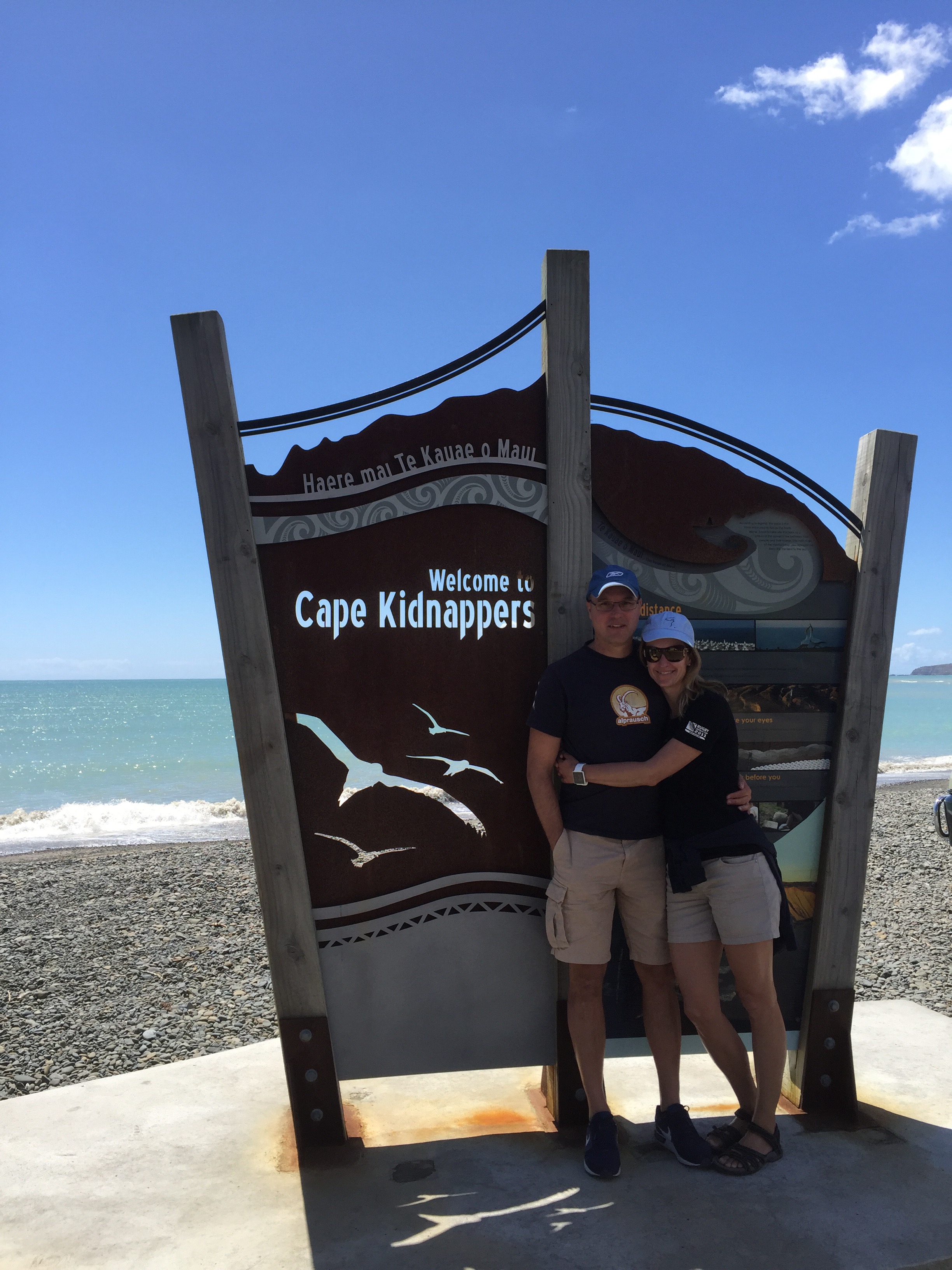
After landing in Auckland they ventured down to Nelson where they spent the night with my Mum before carrying on to the Abel Tasman area. After a few days there they made there way up to us in the Hawke’s Bay. They had been to Napier before but there is more to the Hawke’s Bay than Napier : )
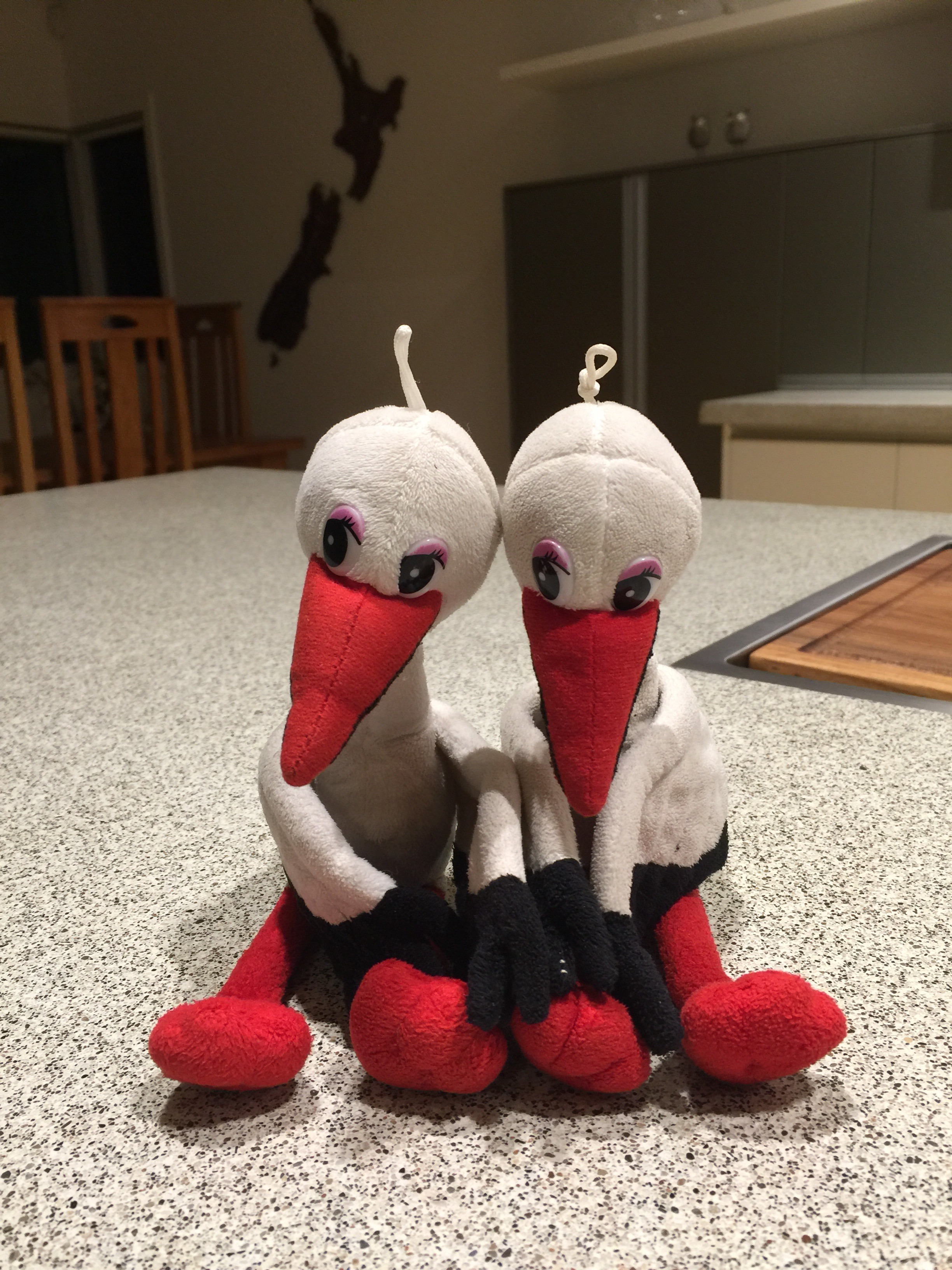
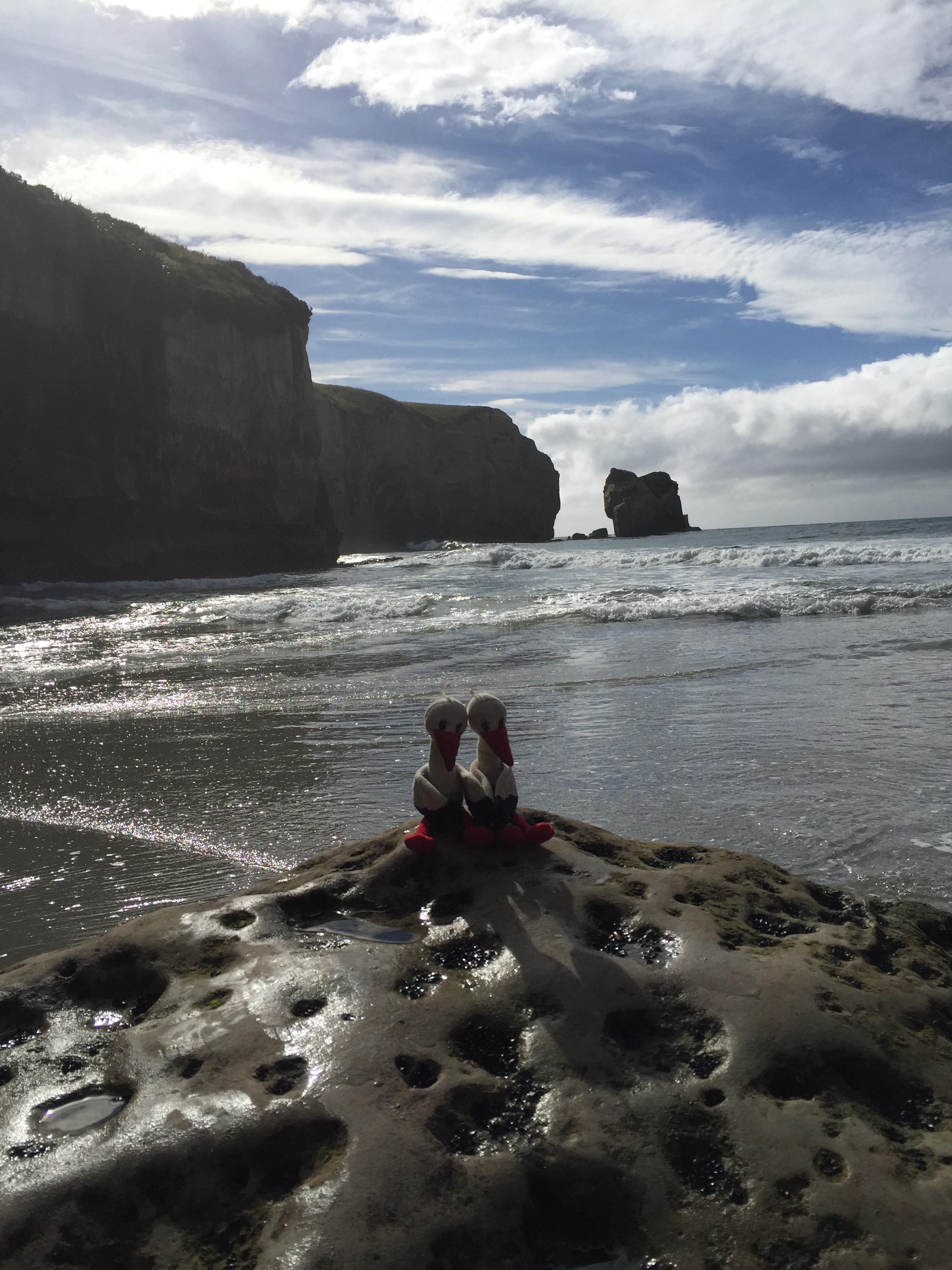
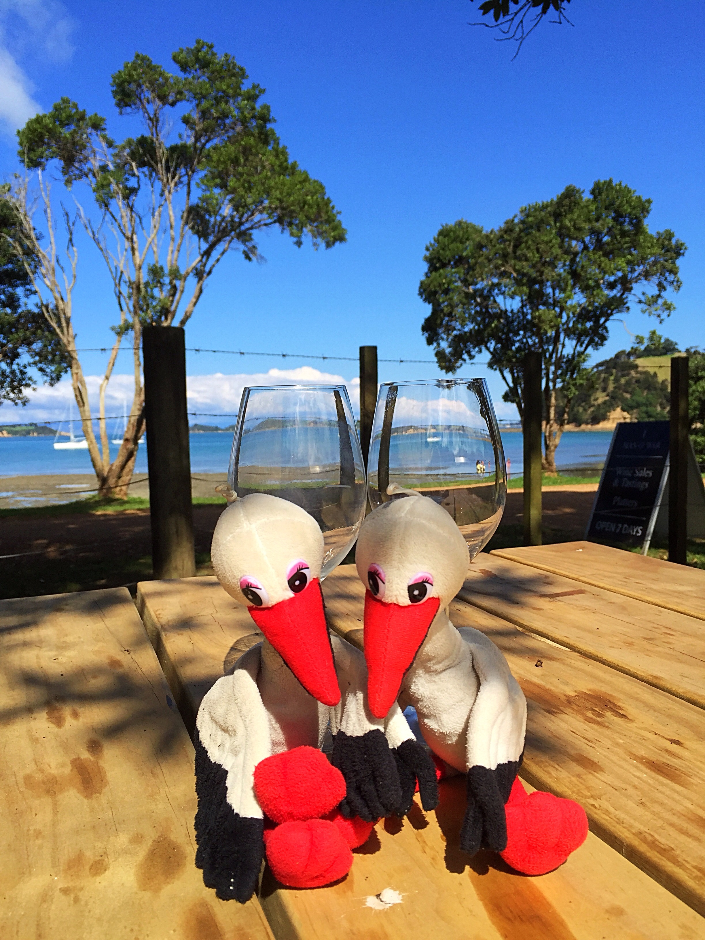
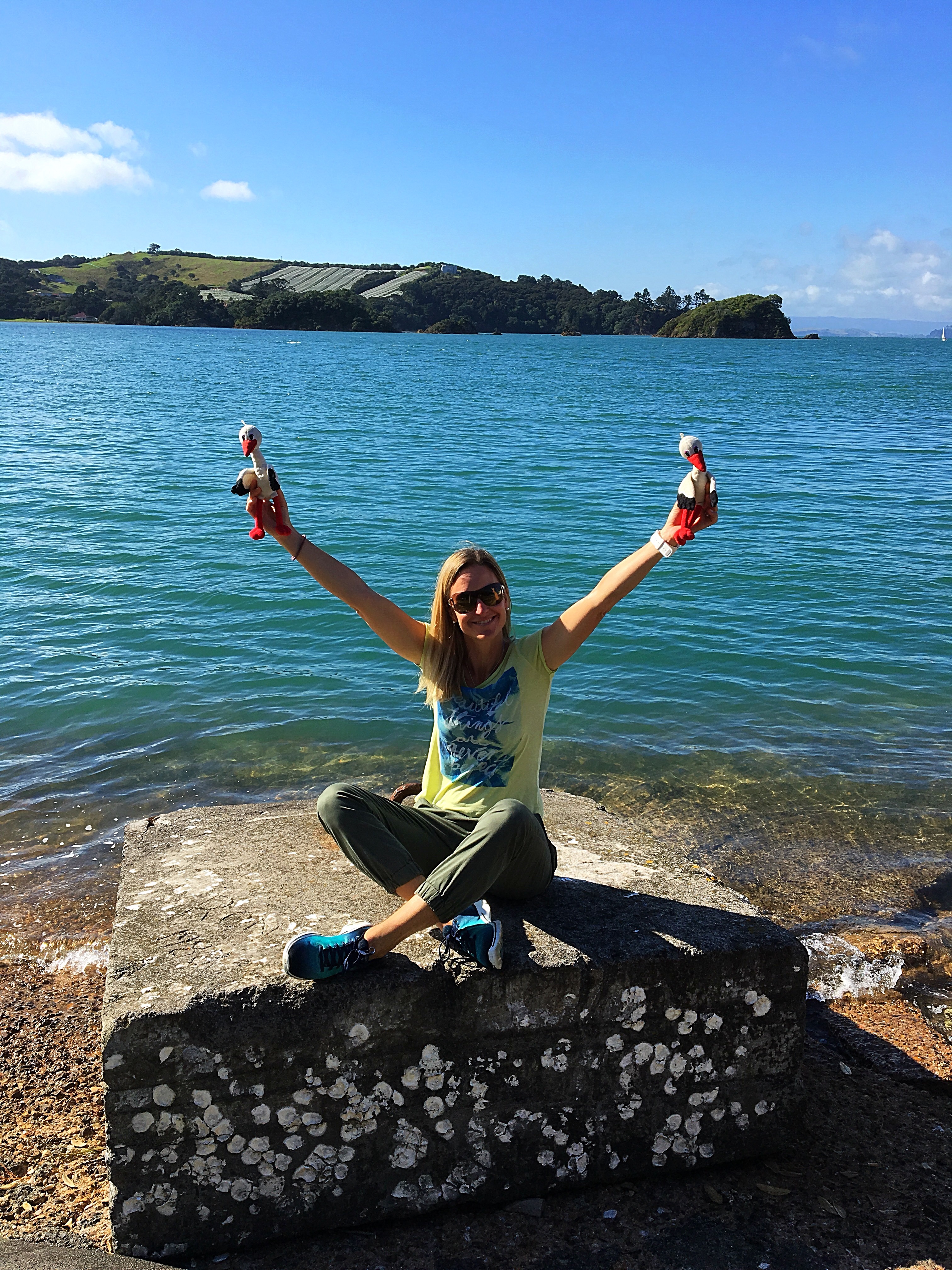
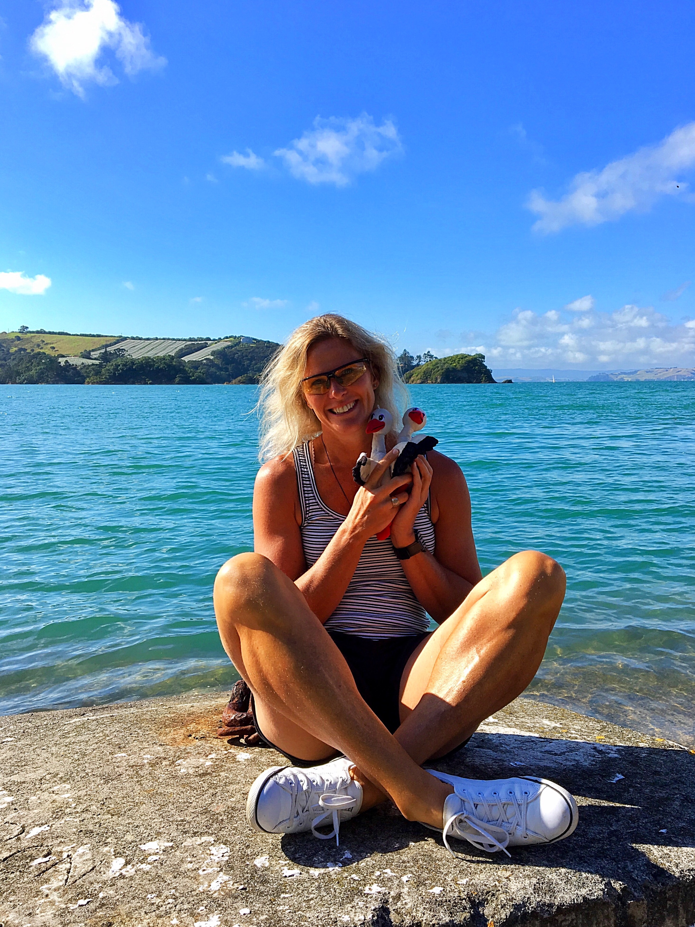
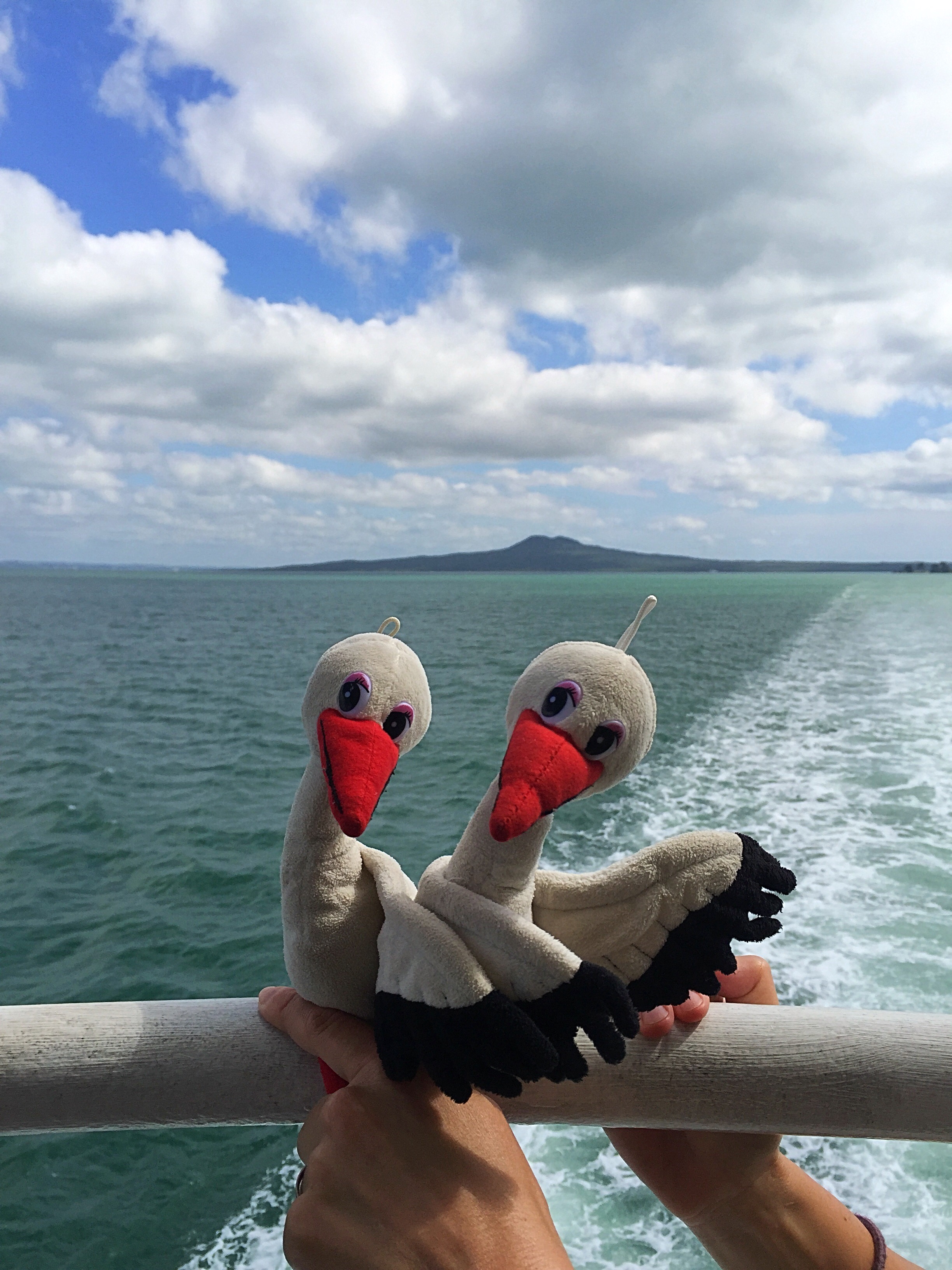
It was good to see them both and show them where we now lived. Pinot and Riesling our little storks were also reunited – we had purchased them in a village in France called Obernai back in September 2011. They have travelled all over the world with us. The boys are not that impressed wth them though and are always threatening to make them fly far away! Karin did confess that Riesling was nearly lost forever after she left her in Japan. After a great deal of emails and a bit of money Riesling was safely returned to Switzerland : )
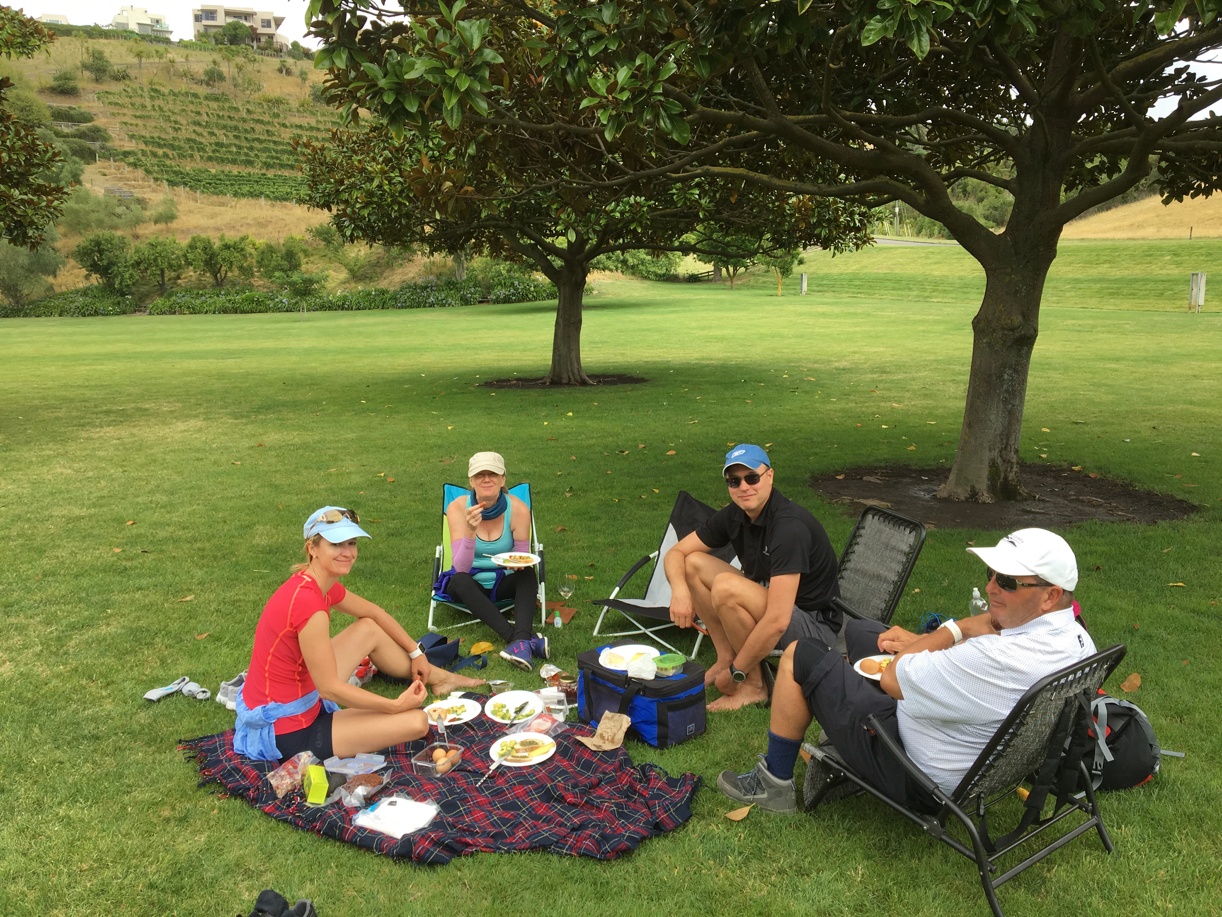
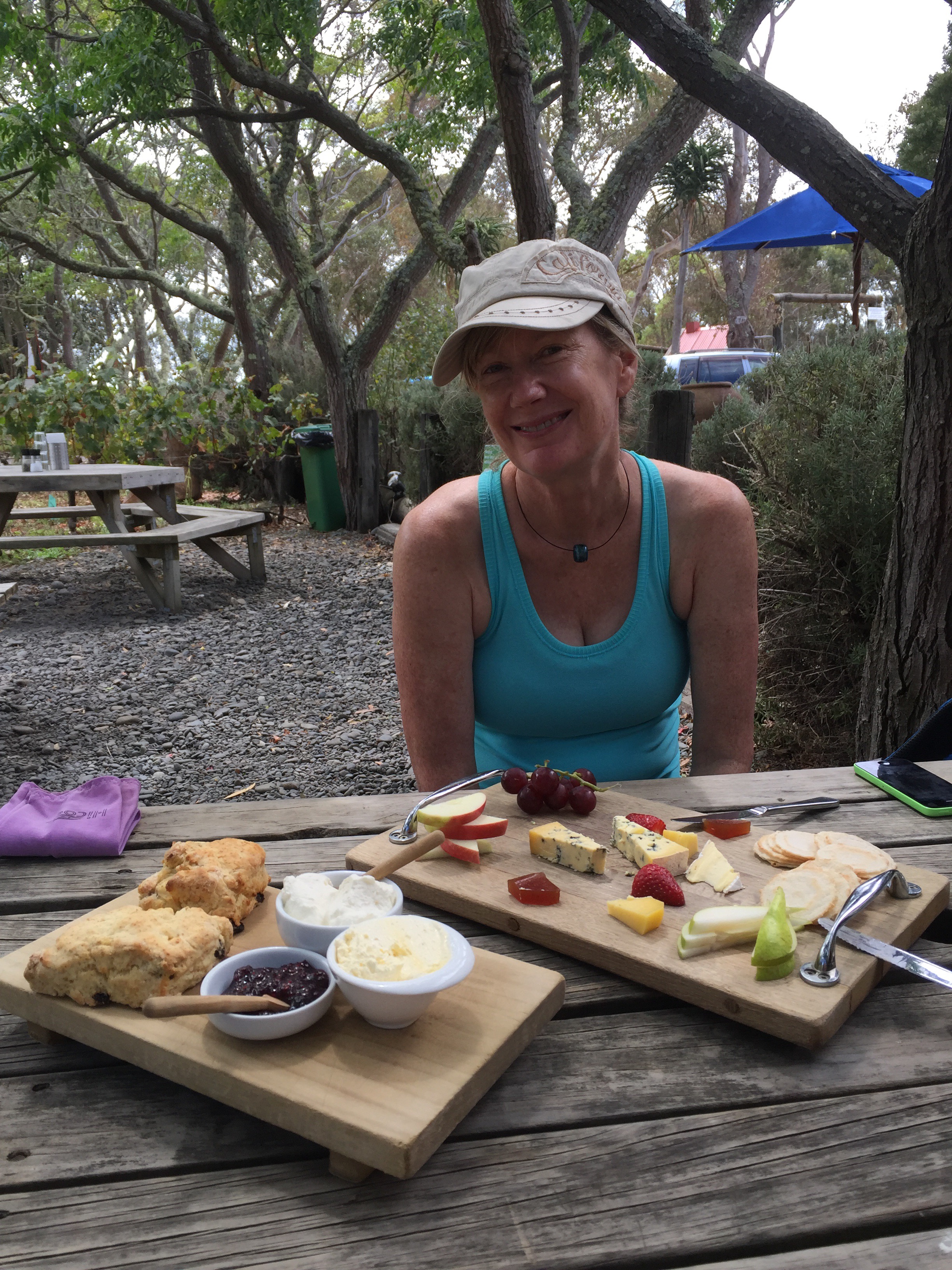
We went for a drive out to the Clifton Peninusla and enjoyed some scones with jam and cream at Clearview Estate.
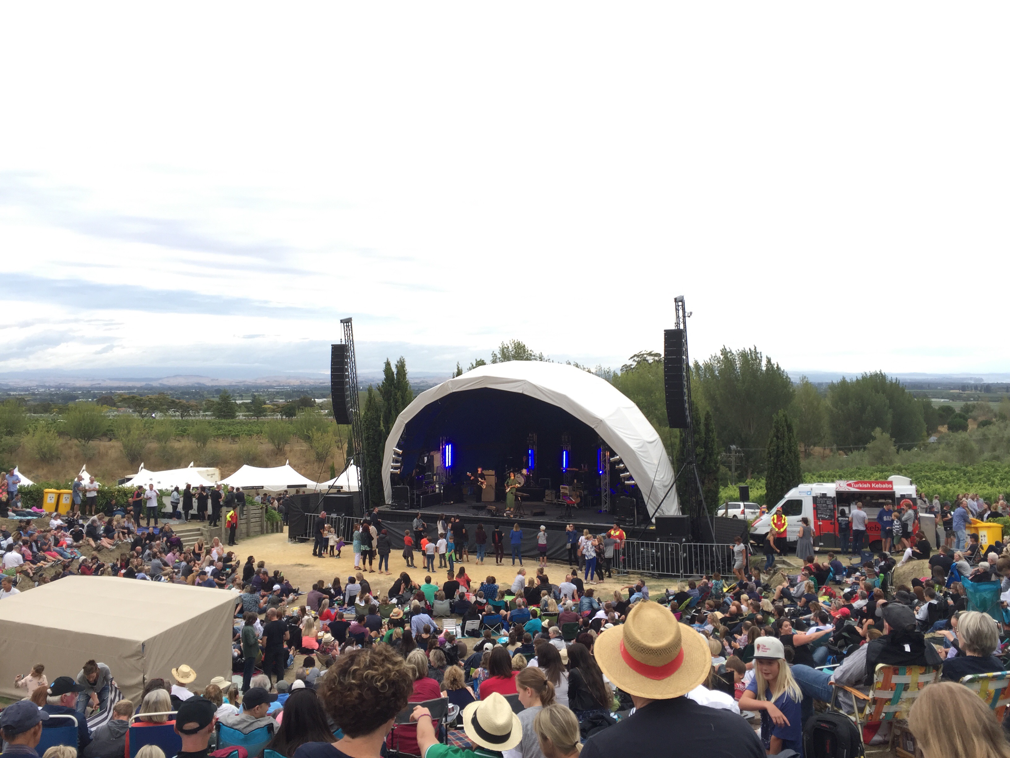
We went to a concert at Black Barn Winery on the Friday night to listen to three NZ artists – Benny Tipene, Bic Runga and Brooke Fraser. It was a clear night but a little chilly. Benny Tipene, whom I had never heard of before was the stand out of the night. Bic Runga was very disappointing with her lack of stage presence and Brooke Fraser was great.
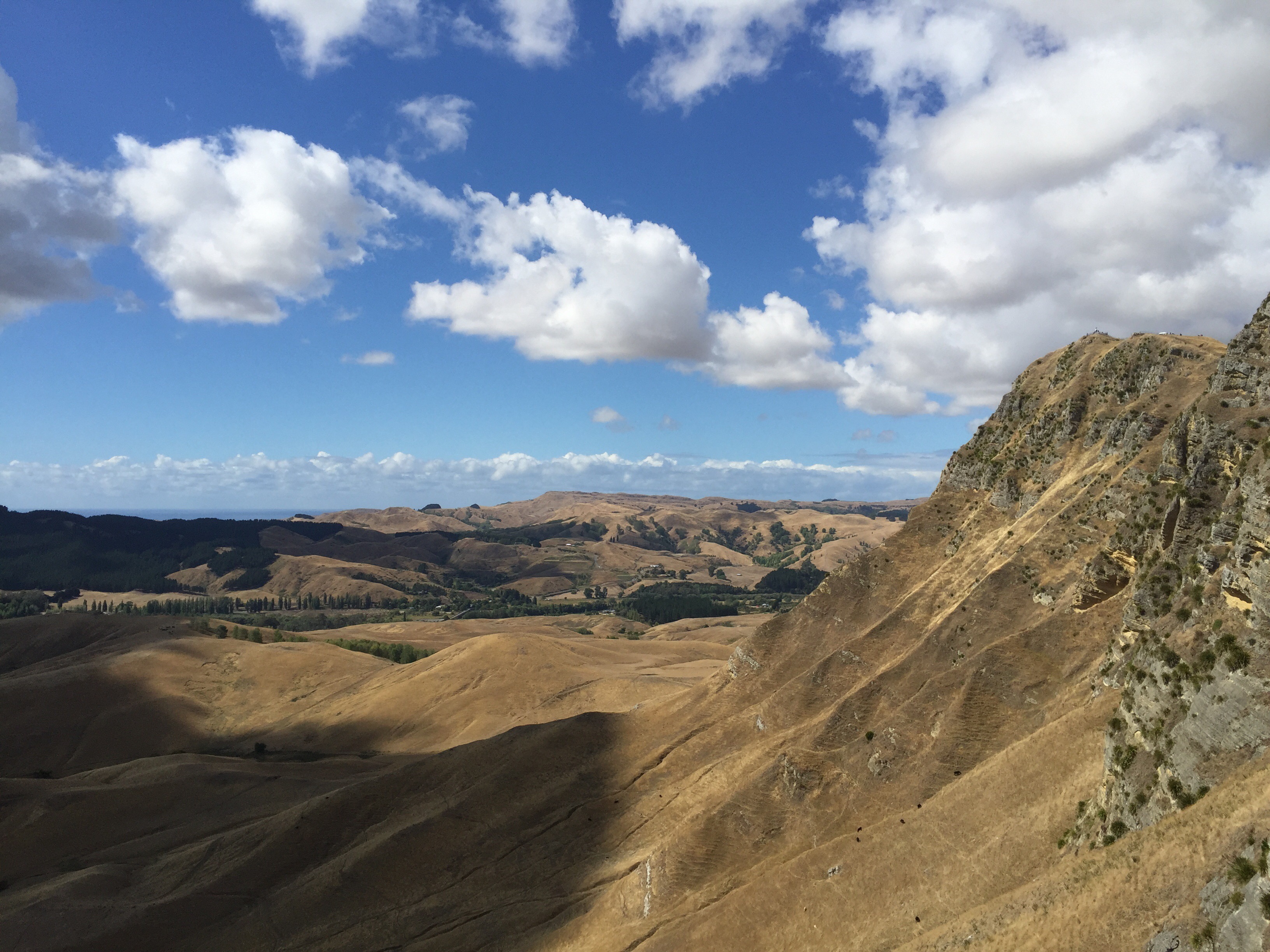
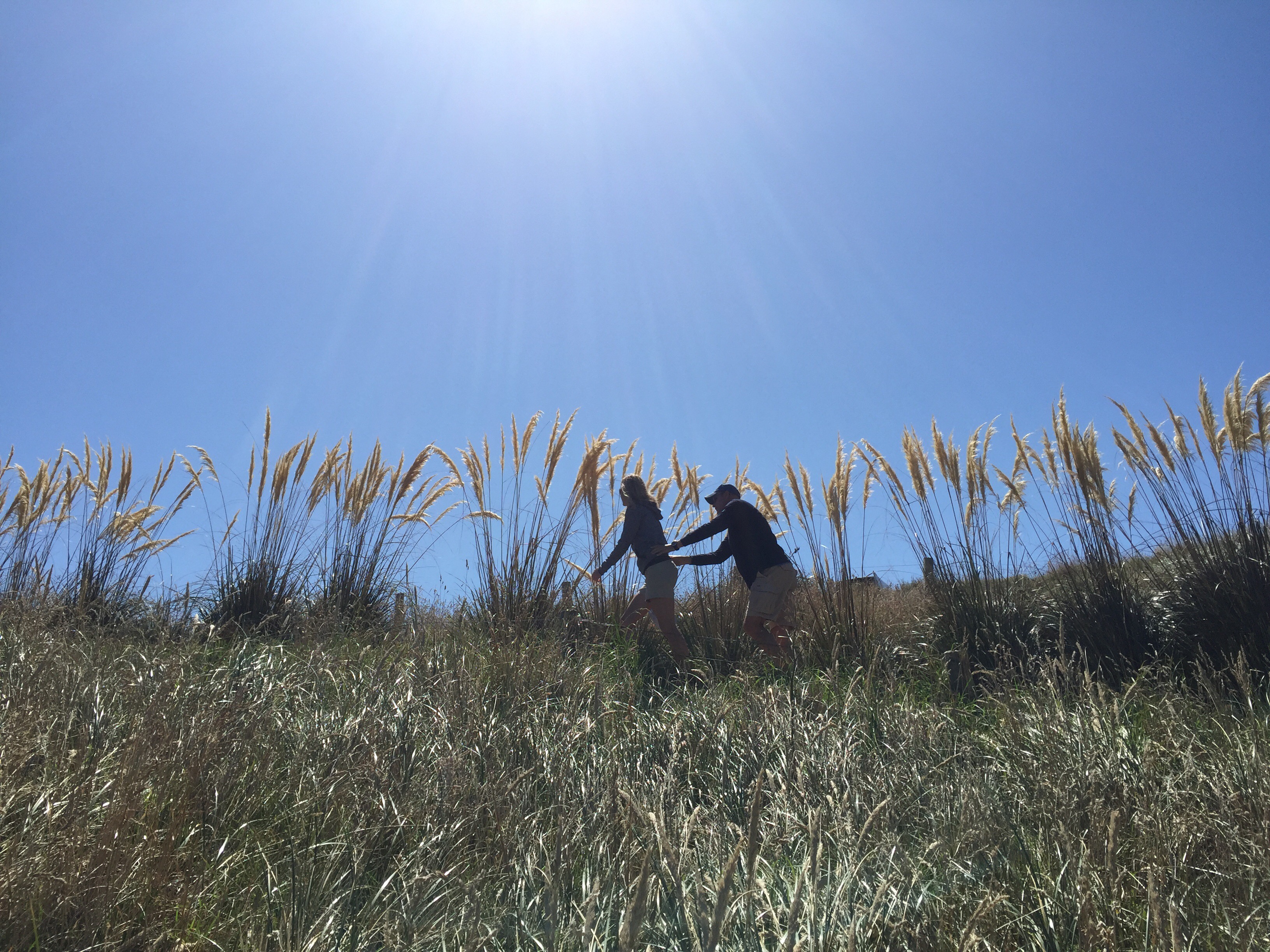
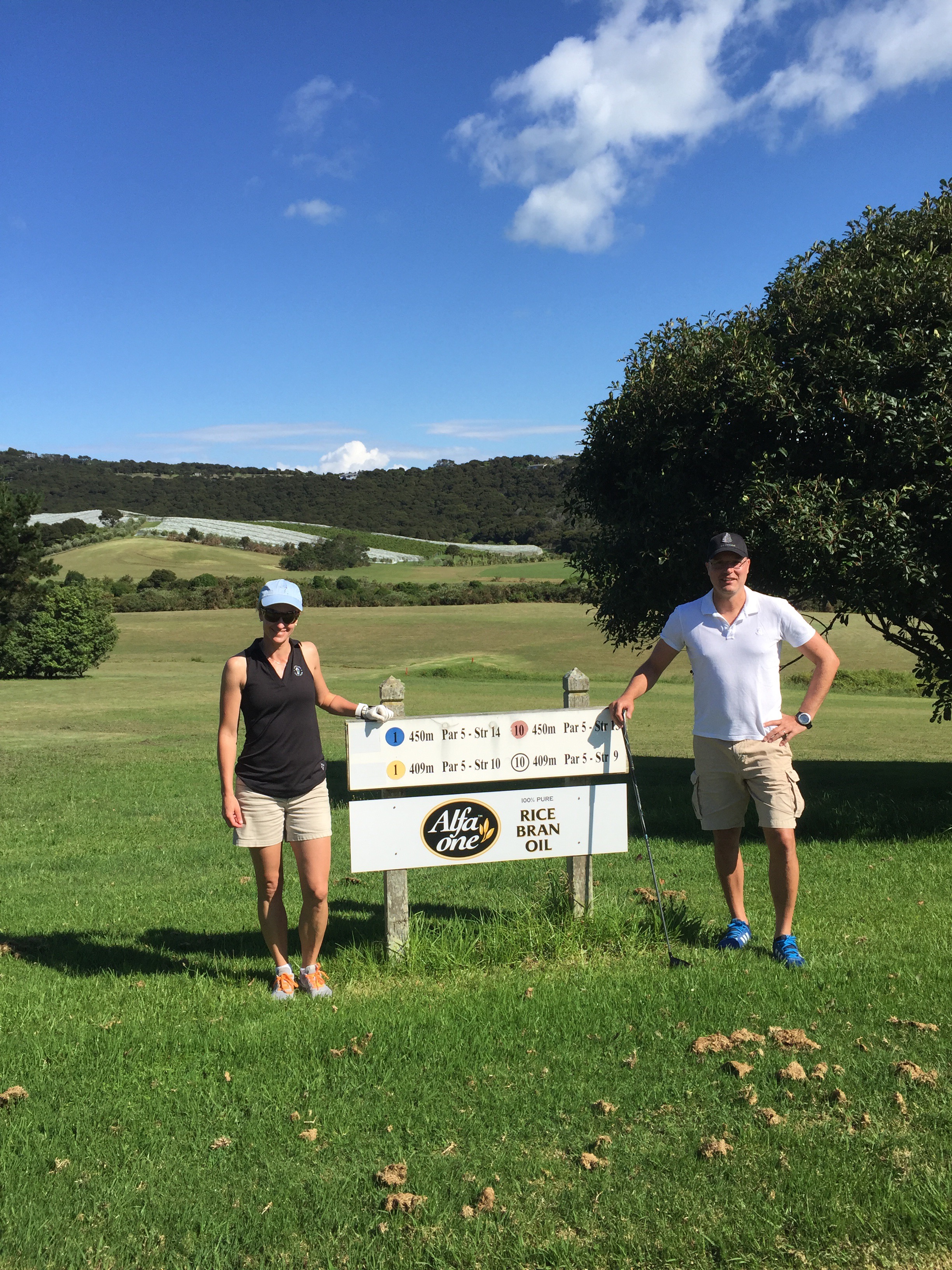
We did some walking up Te Mata Peak and Steve spent a lot of time at the golf course coaching both Karin & Elvis – they truly have the golf bug now.
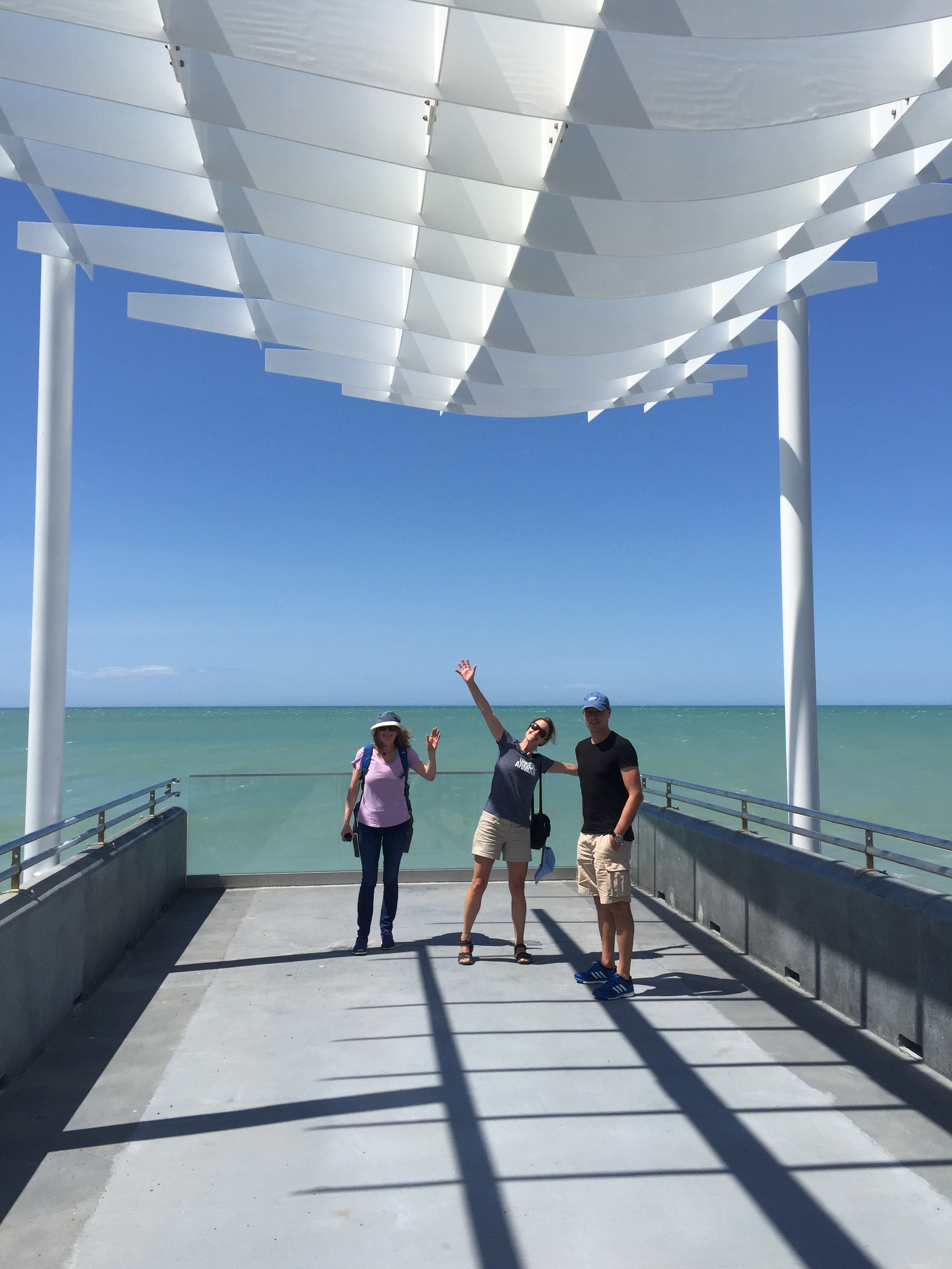
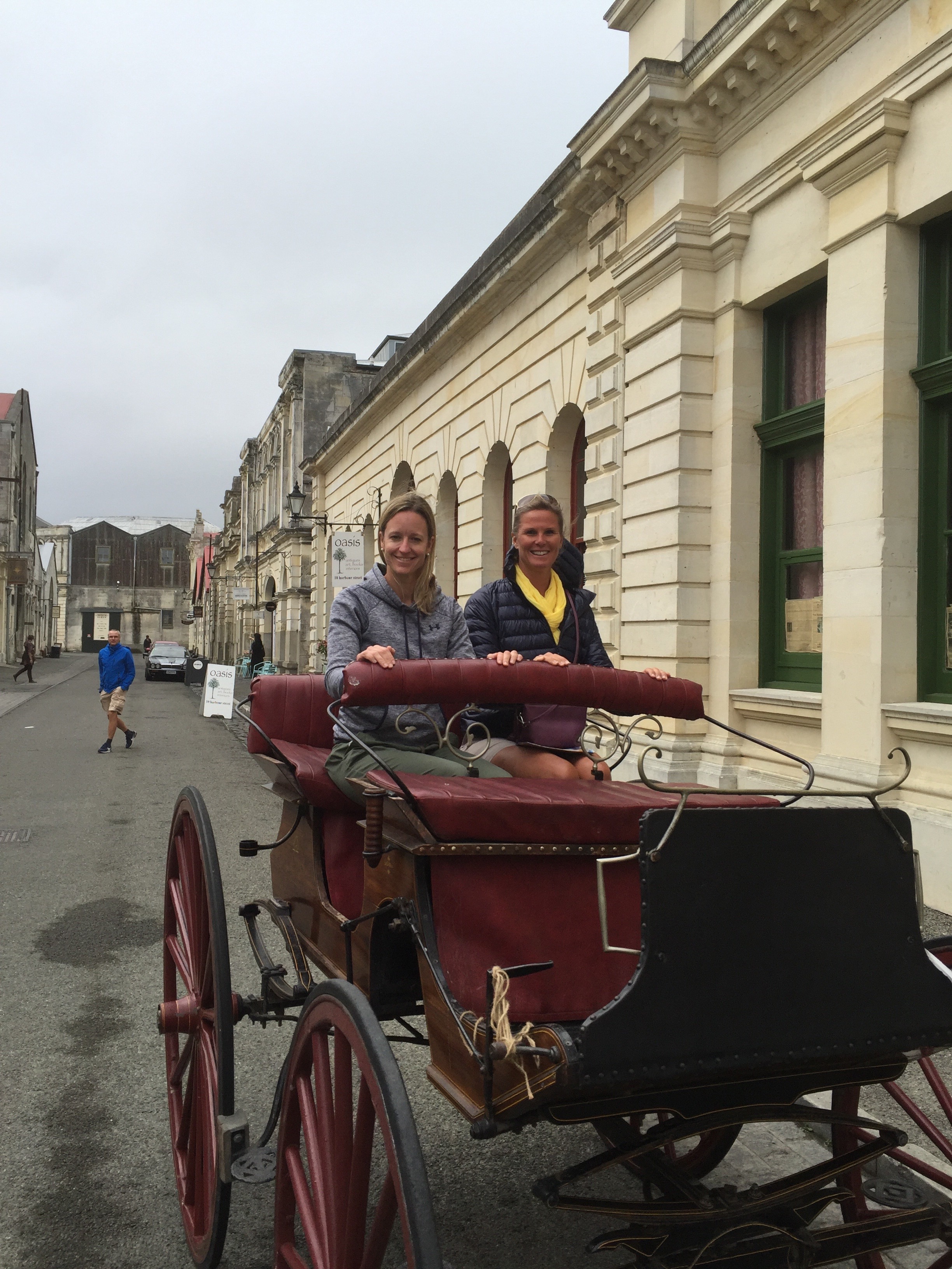
On the Monday, our friend Andrea from Australia arrived for a couple of days. We had just done the Mountain to Sea Cycle with Andrea and she hadn’t been to the Hawke’s Bay before. I took Karin, Elvis and Andrea over to Napier to do the Art Deco Tour which they found interesting. Napier has one of the largest collections of Art Deco buildings in the world alongside South Beach in Miami, Florida.
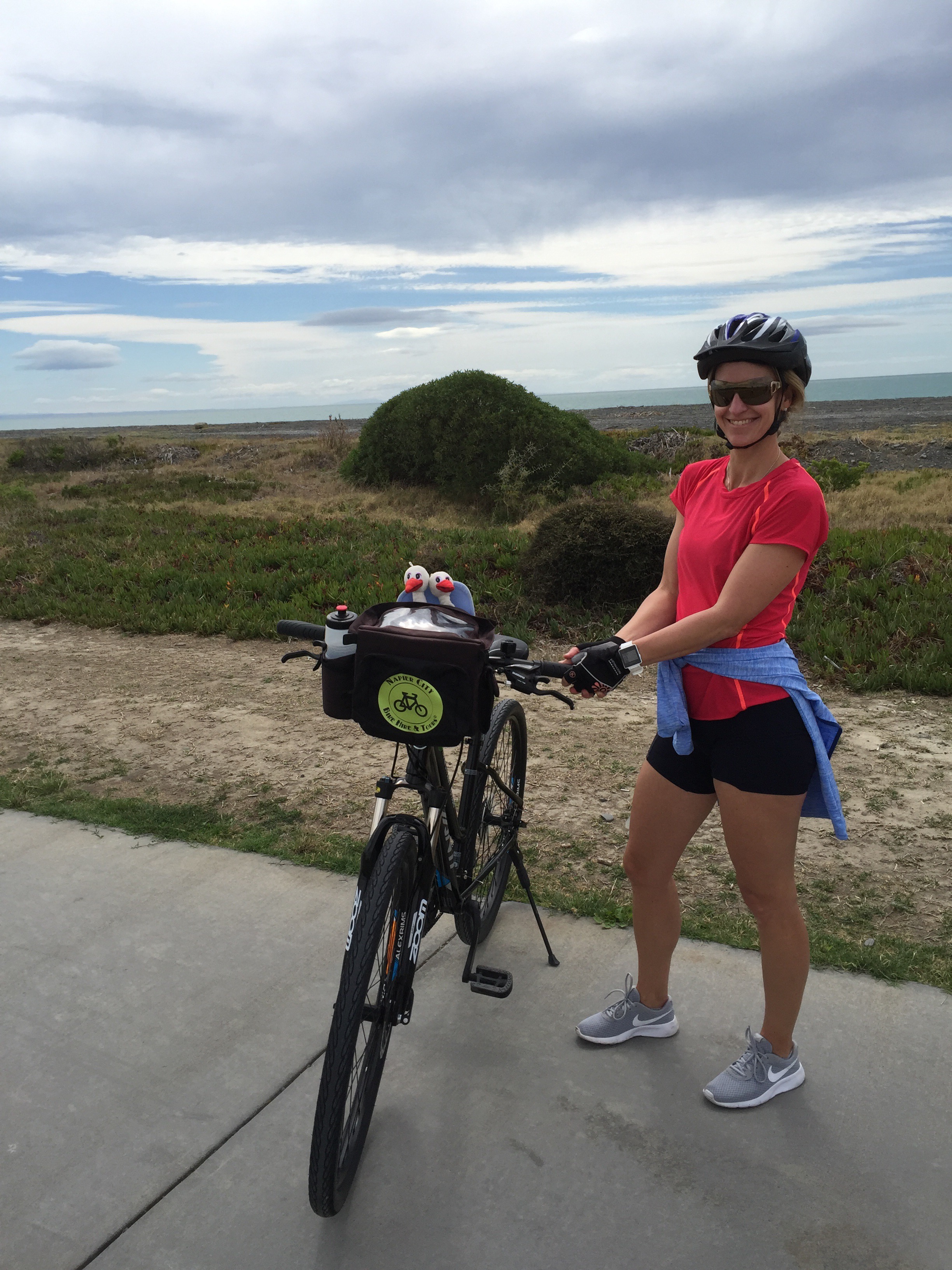
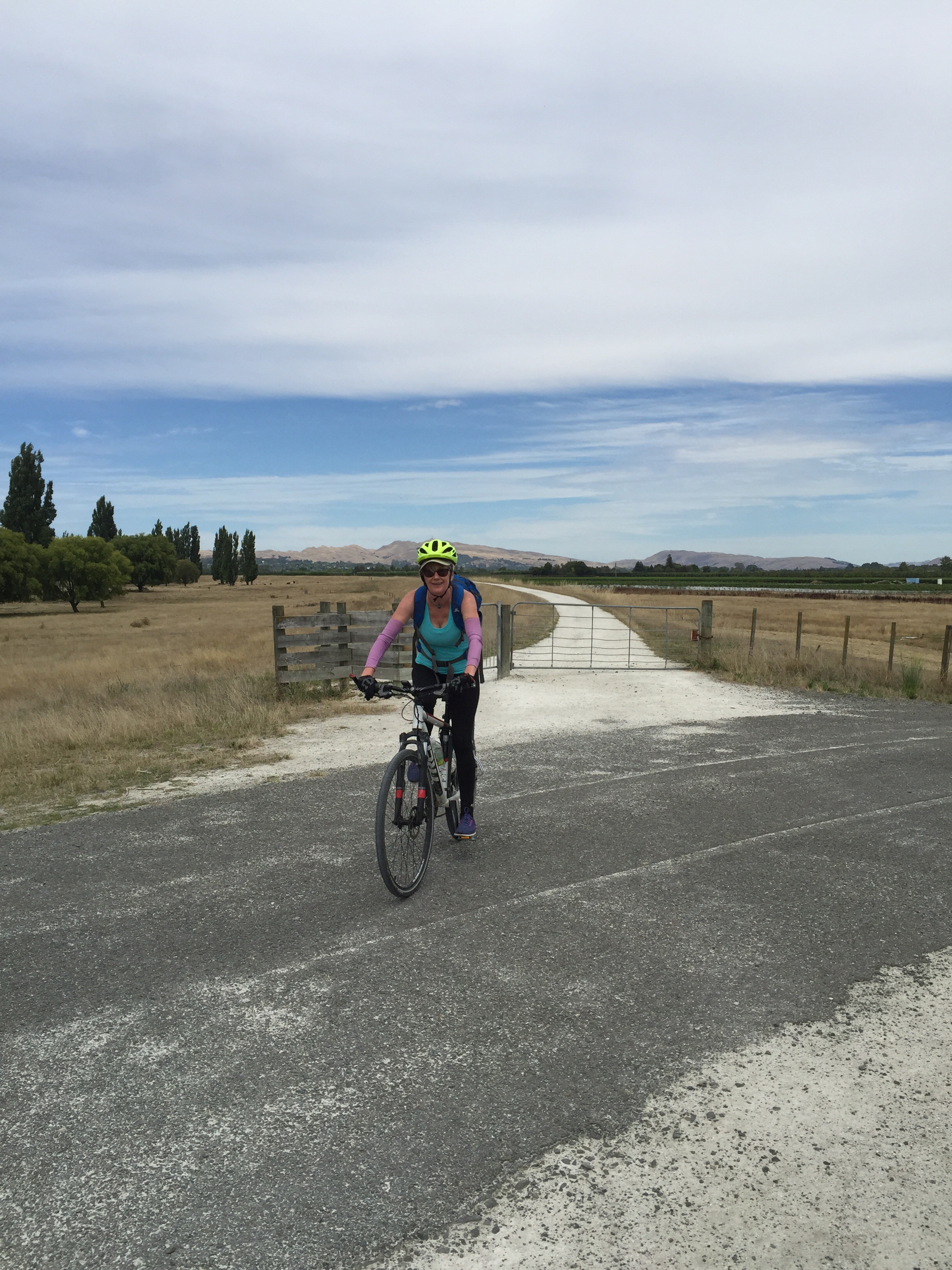
On the Tuesday we hired some bikes and did the Water Loop over in Napier – this is a 40km loop that takes in the sea front, orchards, wineries, Taradale, Ahuriri – the historic fishing port and the Port. We enjoyed a bottle of wine at Church Rd Winery with our picnic lunch.
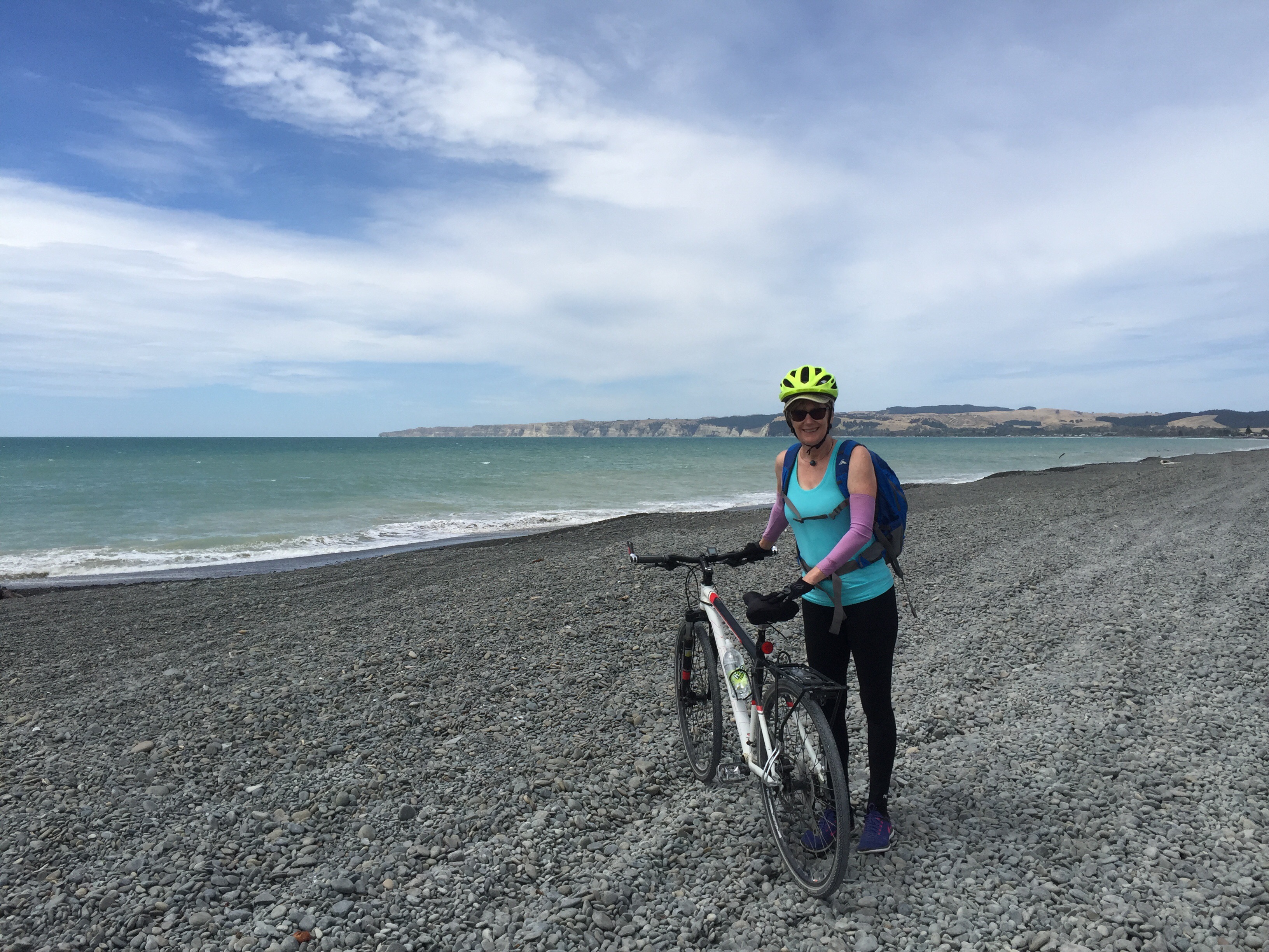
On the Wednesday Karin and Elvis went off to the golf course and Andrea and I biked out to Haumoana and Te Awanga where we enjoyed a bite at Clearview Winery.
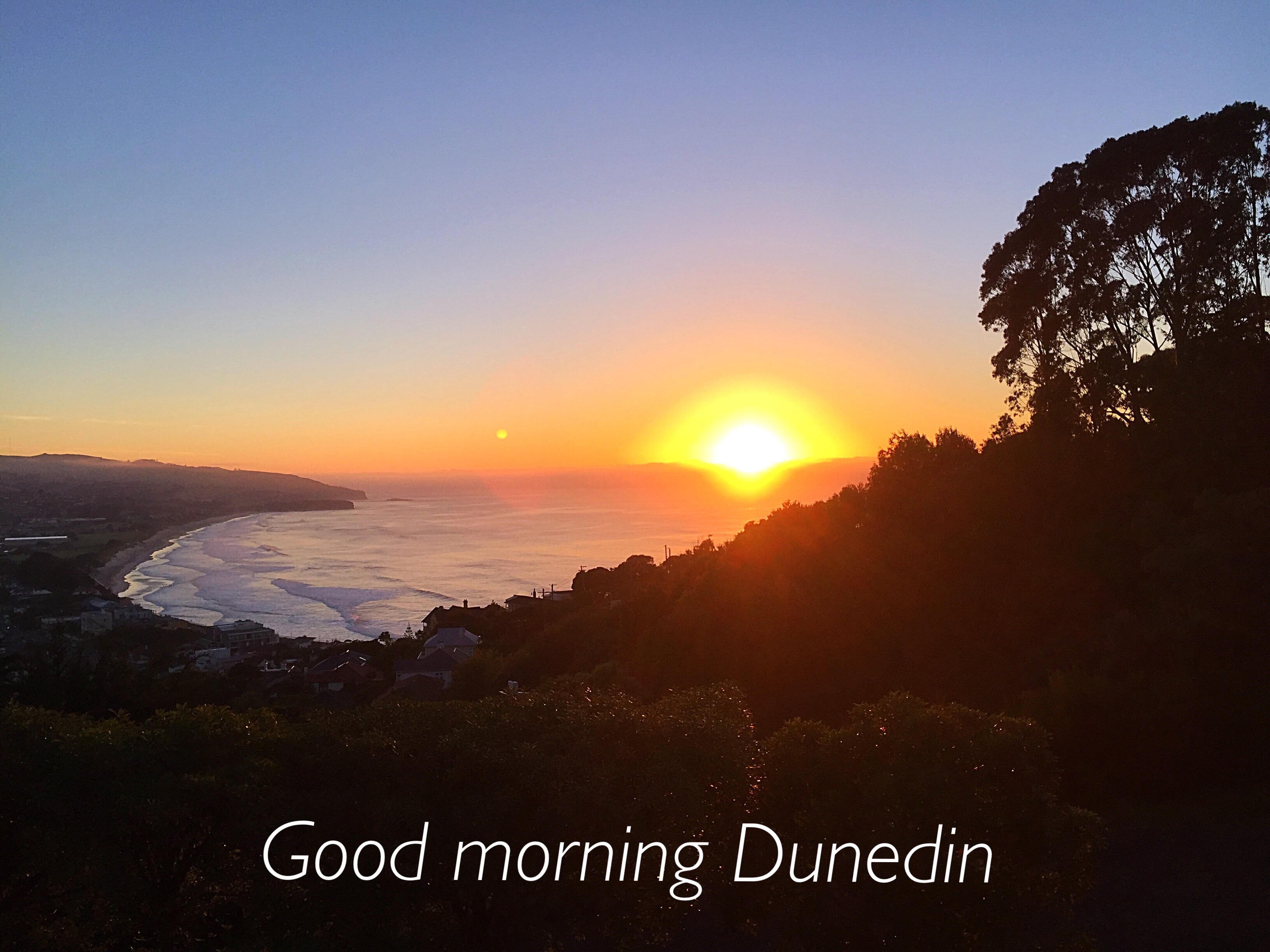
On the Thursday it was time to say goodbye to Andrea who was heading back to Australia via Auckland. Karin, Elvis, Steve and I were heading to the deep south – Dunedin. As we were going to the airport it started drizzling so we knew it was time to leave town. Although Dunedin was chilly the sun was shining when we arrived.
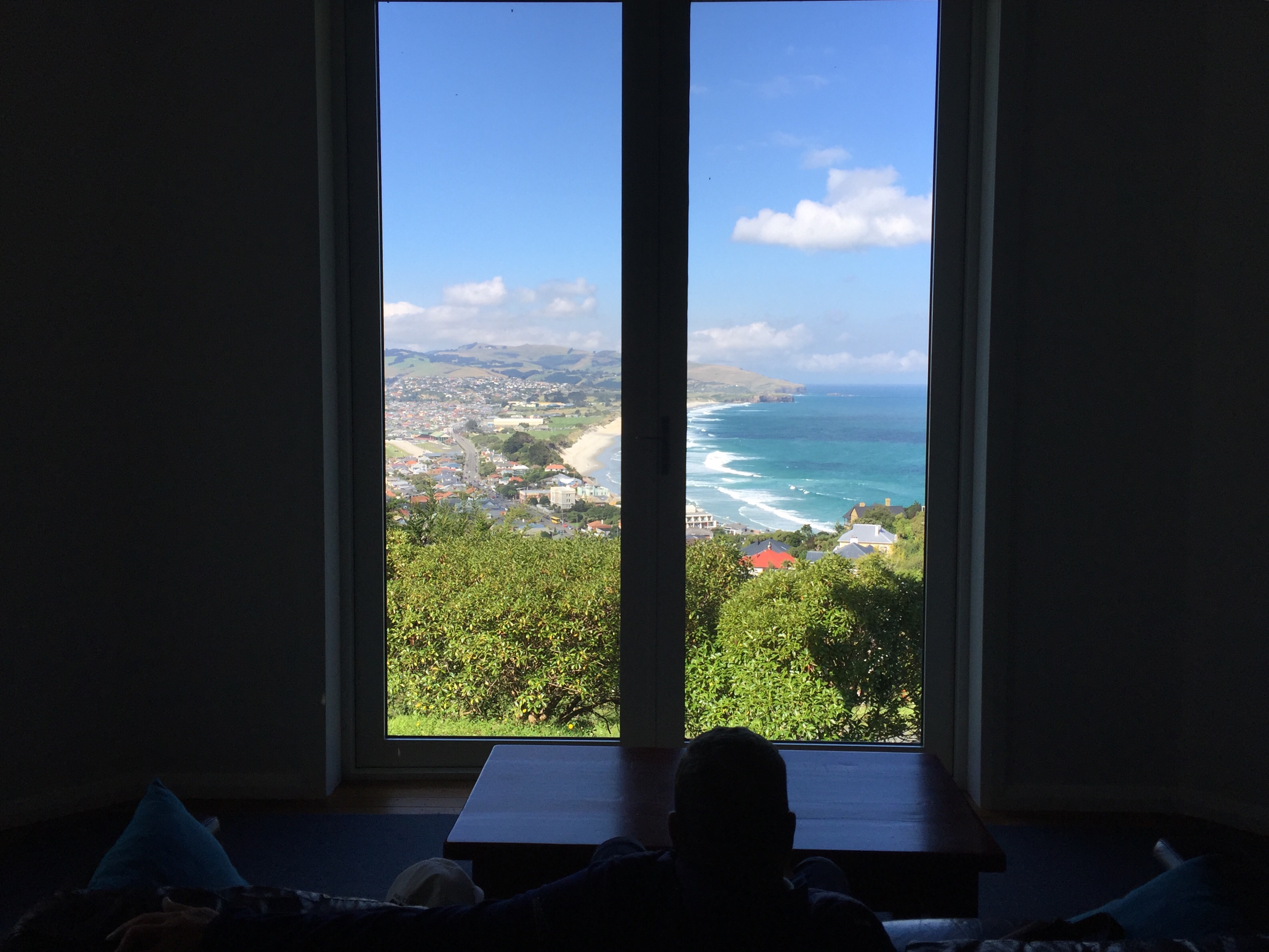
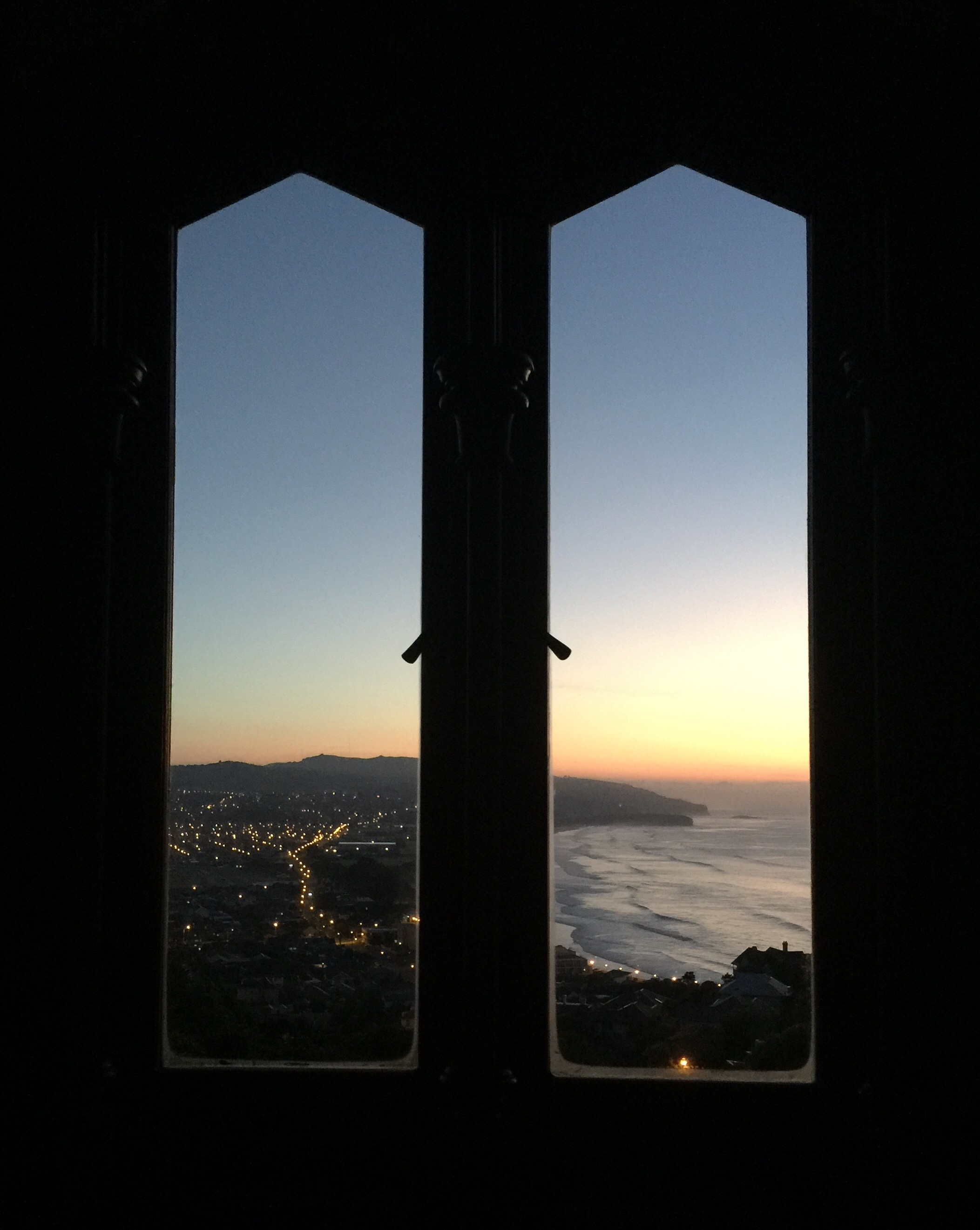
We stayed in this Air BNB which had fabulous views over Saint Clair Beach. The guy that owned the Air BNB lived upstairs and he had the most amazing collection of old artifacts including about 25 life size models of various tribal people from all over the world. He has been sculpting the heads out of clay for the last 25 years – you had to see them to believe them. He gave us a tour of his private museum – it was incredible.
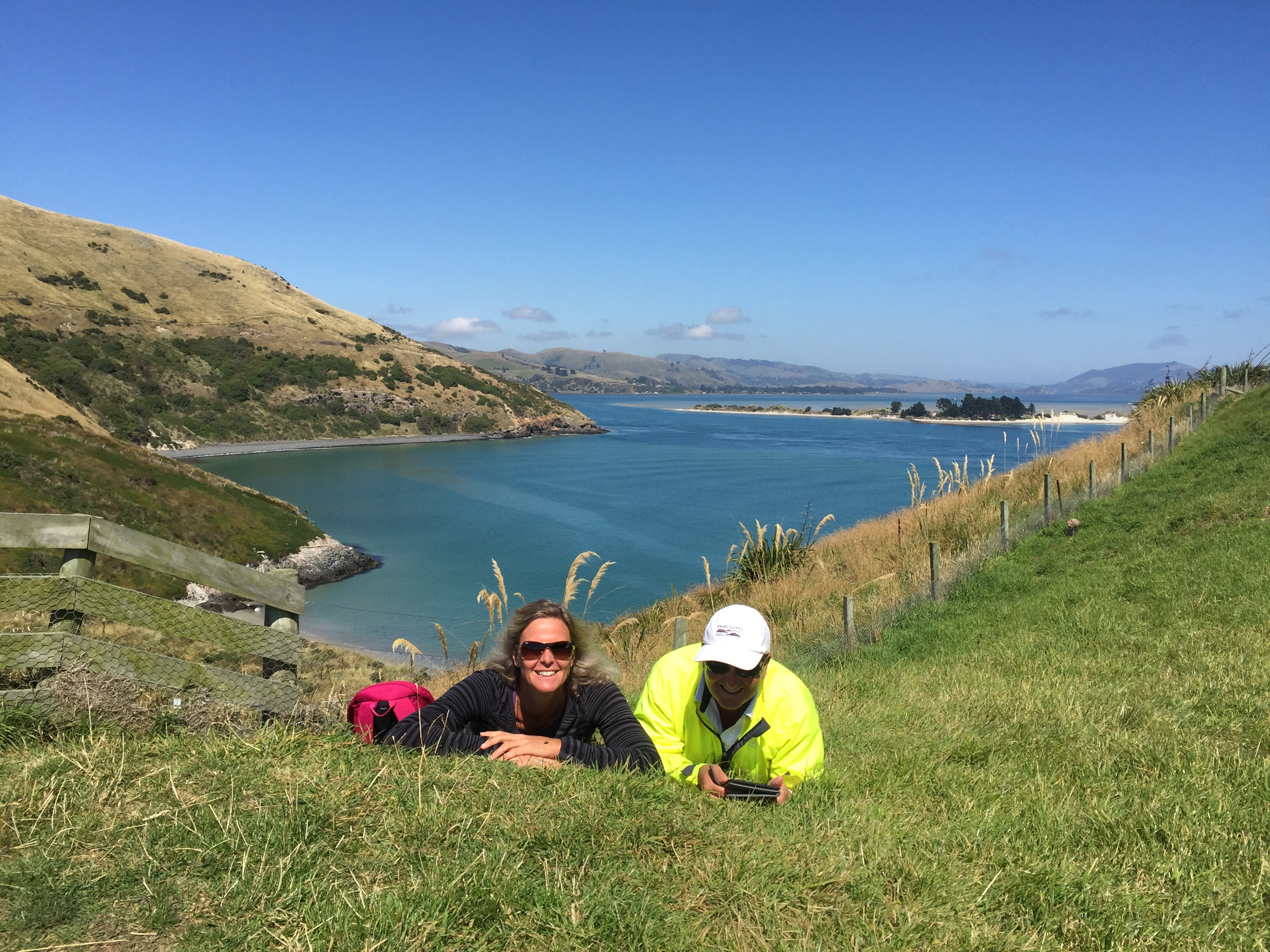
The next day we headed south to find the place where Karin’s uncle had spent a bit of time over the years. The place was somewhere near the Taieri river mouth. We came across a woman walking her dog who happened to be talking to the local plumber so Karin jumped out to ask if they knew about this guy that her uncle used to come and visit. It seems this old guy was a bit of a local identity so the plumber knew who he was and where his house was. He has since died and someone owns his property now but the old cottage he used to live in is still there. The woman who owns the property came home while we were there and said we were welcome to go and have a look around as long as we didn’t let the chickens escape.
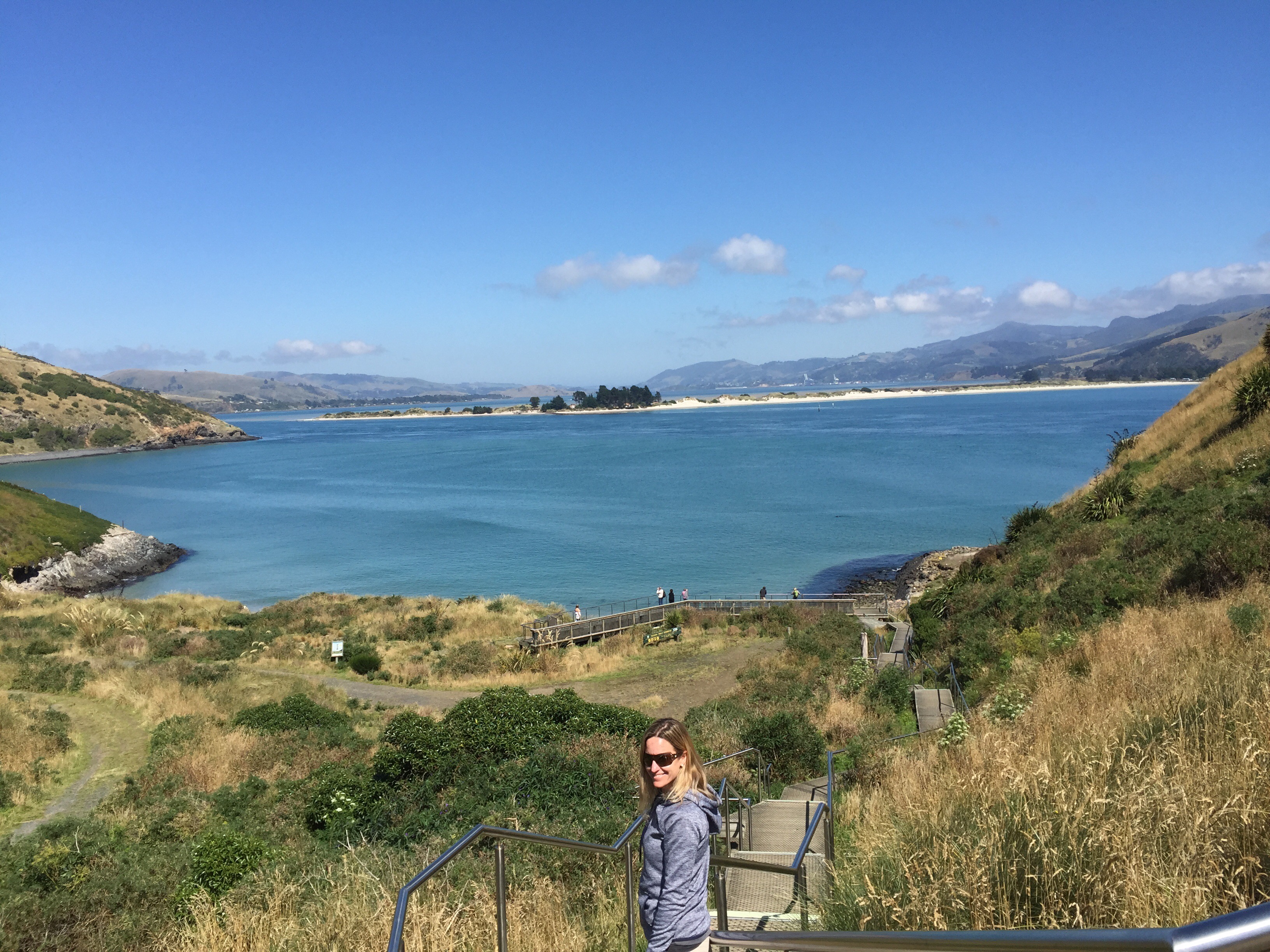
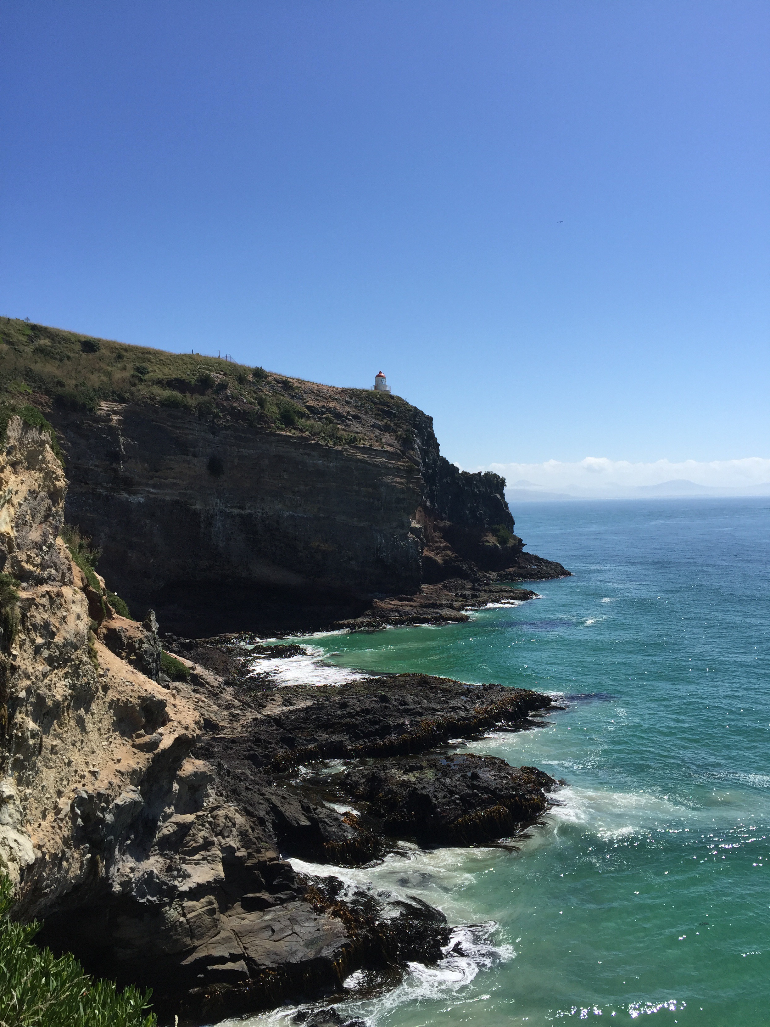
Next stop was the Otago Peninsula and the Royal Albatross Centre. Karin & Elvis did a tour while Steve and I basked in the sunshine. We took the scenic route back to Dunedin and then visited the Dunedin railway Station which is a very impressive building.
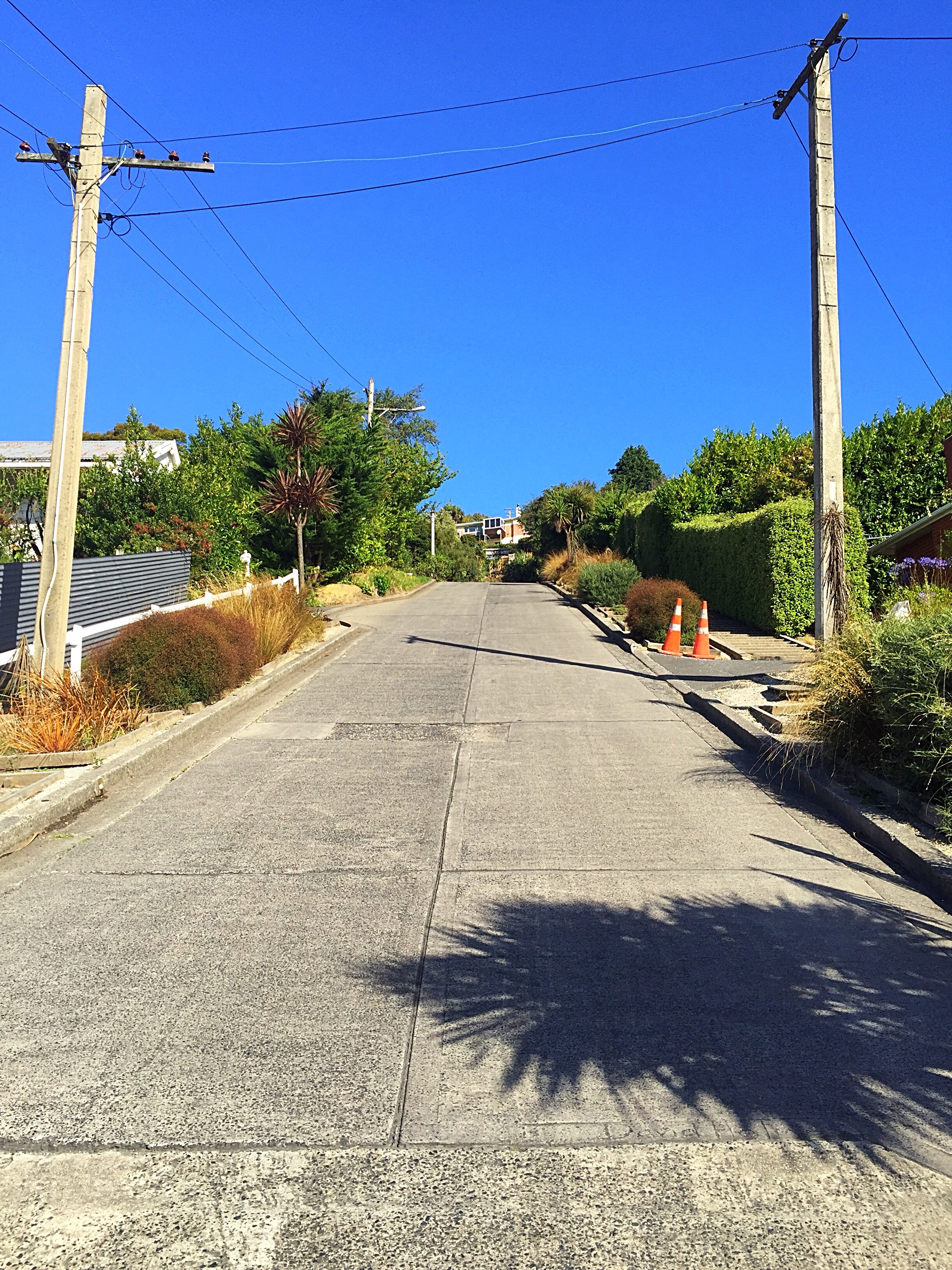
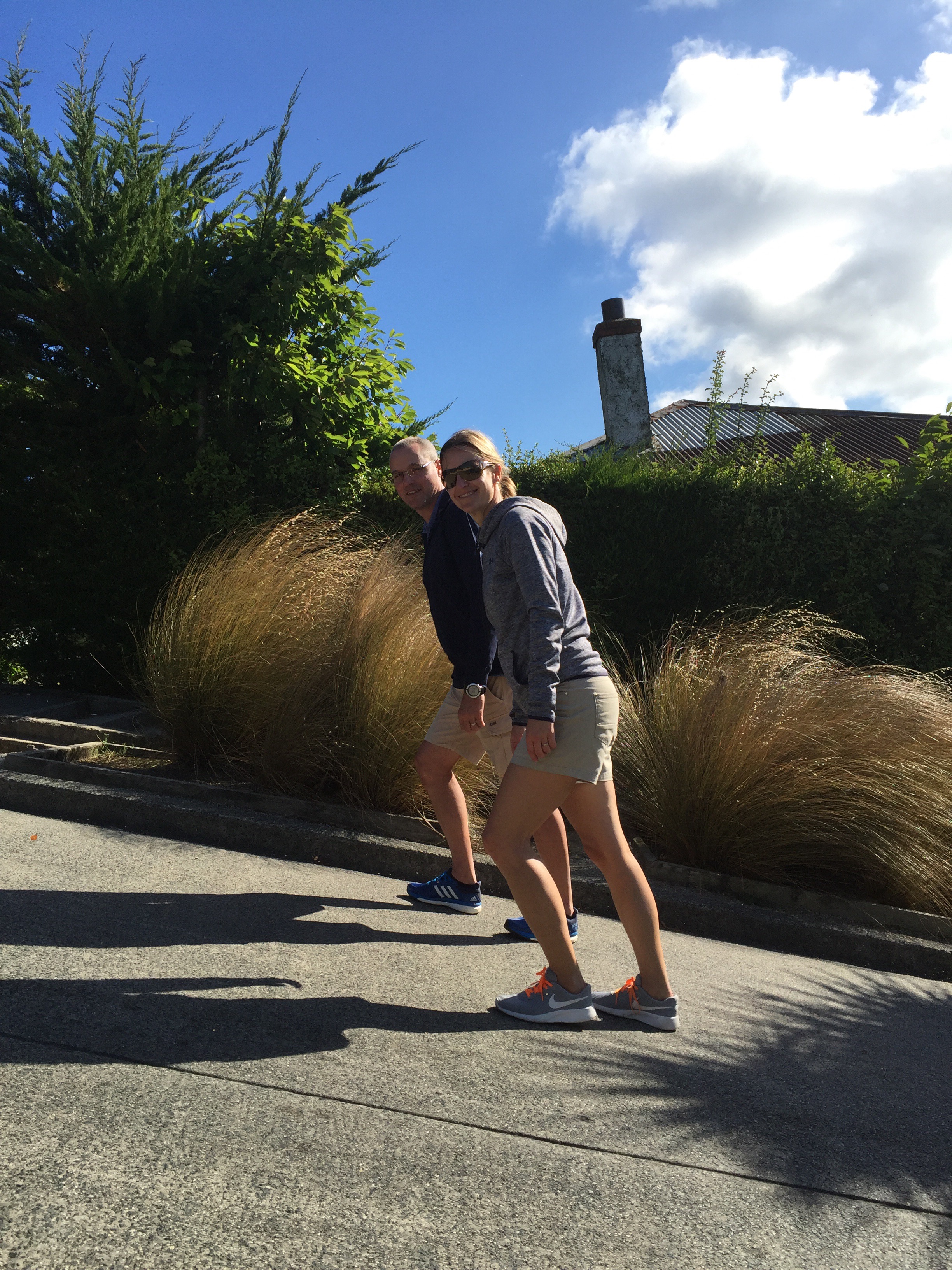
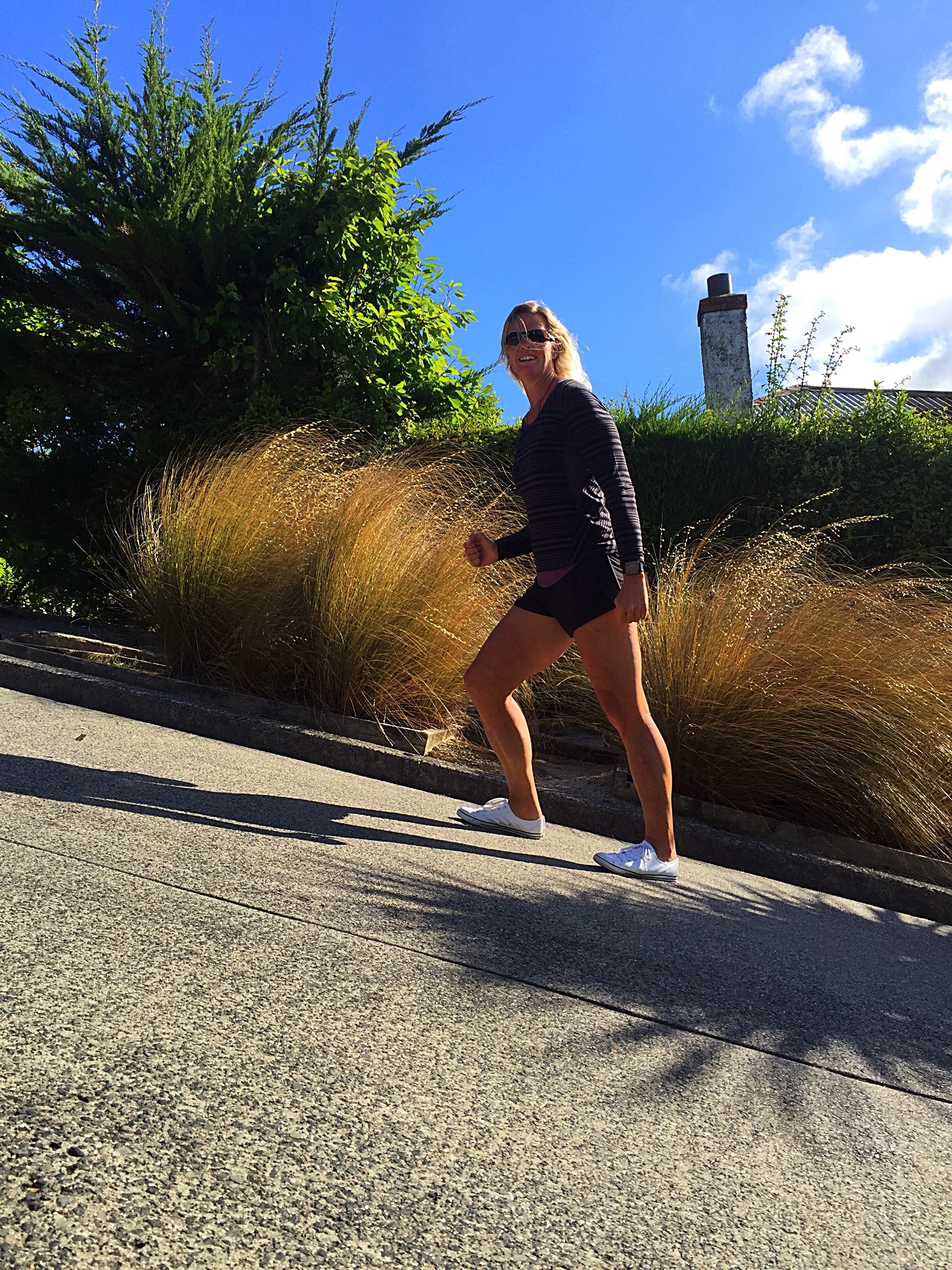
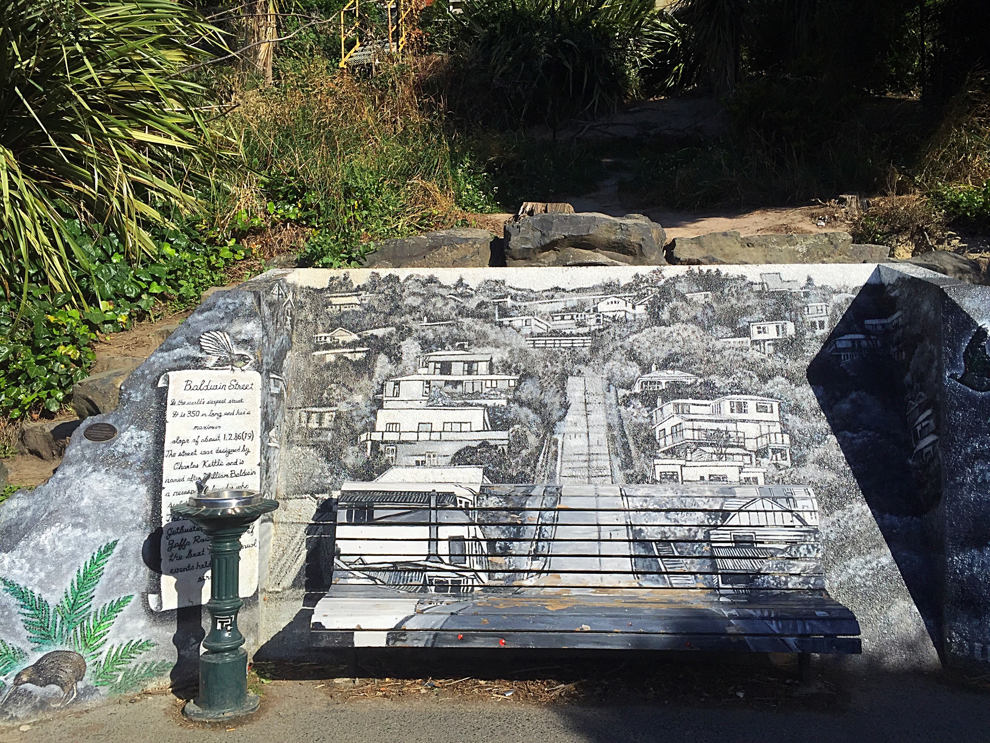
We then took a drive to see the world’s steepest residential street – Baldwin Street. Despite having been to Dunedin before we had never visited this icon before.
A short straight street a little under 350 metres (1,150 ft) long, Baldwin Street runs east from the valley of the Lindsay Creek up the side of Signal Hill towards Opoho, rising from 30 m (98 ft) above sea level at its junction with North Road to 100 m (330 ft) above sea level at the top, an average slope of slightly more than 1:5. Its lower reaches are only moderately steep, and the surface is asphalt, but the upper reaches of this cul-de-sac are far steeper, and surfaced in concrete (200 m or 660 ft long), for ease of maintenance (bitumen—in either chip seal or asphalt—would flow down the slope on a warm day) and for safety in Dunedin’s frosty winters.
The street’s steepness was unintentional. As with many other parts of early Dunedin, and indeed New Zealand, streets were laid out in a grid pattern with no consideration for the terrain, usually by planners in London. In the case of Baldwin Street (and much of the Dunedin street plan), the layout was surveyed by Charles Kettle in the mid-19th century. The street is named after William Baldwin, an Otago Provincial Councillor and newspaper founder, who subdivided the area.
The street is the venue for an annual event in Dunedin, the Baldwin Street Gutbuster. Every summer since 1988 this exercise in fitness and balance involves athletes running from the base of the street to the top and back down again. The event attracts several hundred competitors annually and the race record is 1:56.
Since 2002, a further charity event has been held annually in July, which involves the rolling of over 30,000 Jaffas (spherical confectionery-coated chocolate confectionery). Each Jaffa is sponsored by one person, with prizes to the winner and funds raised going to charity. This event follows a tradition started in 1998, when 2,000 tennis balls were released in a sponsored event raising money for Habitat for Humanity.
In March 2001, a 19-year-old University of Otago student was killed when she and another student attempted to travel down the street inside a wheelie bin. The bin collided with a parked trailer, killing her instantly, and causing serious head injuries for the other student.
We then ventured back to the Air BNB to enjoy a home cooked meal and some more great views of Saint Clair.
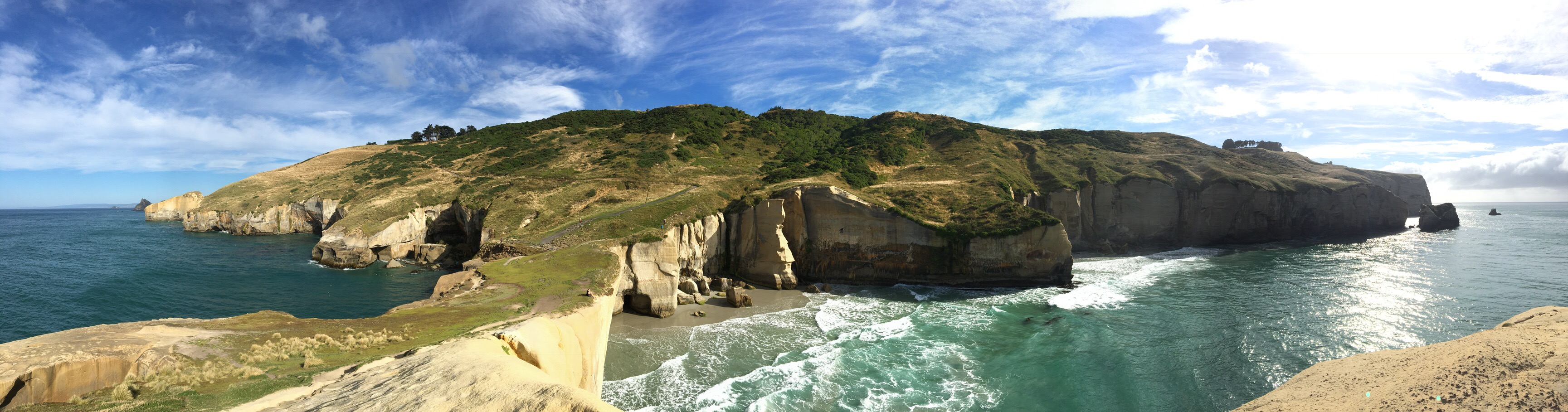
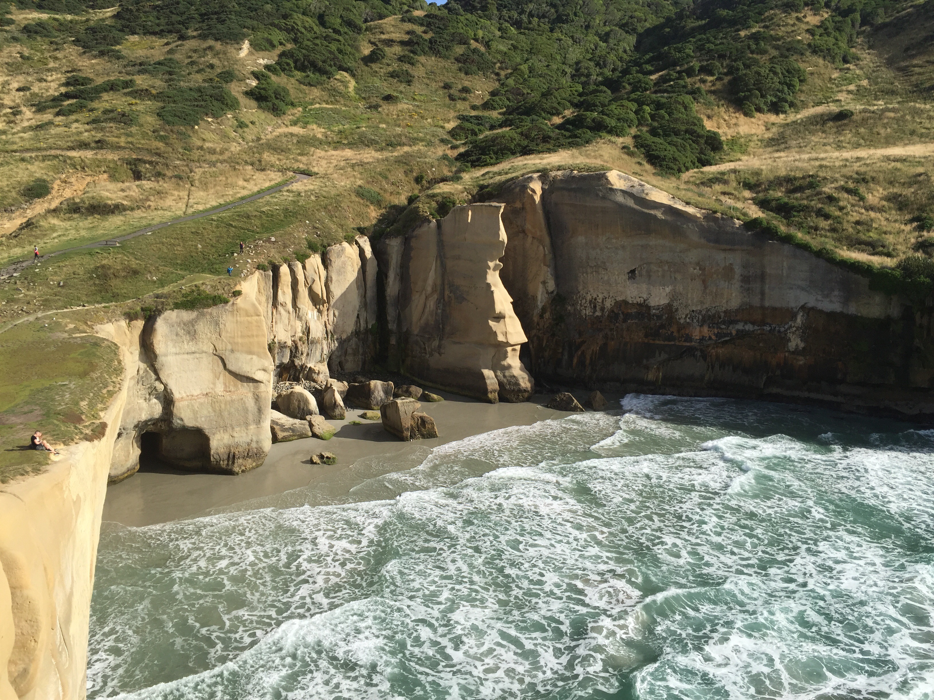
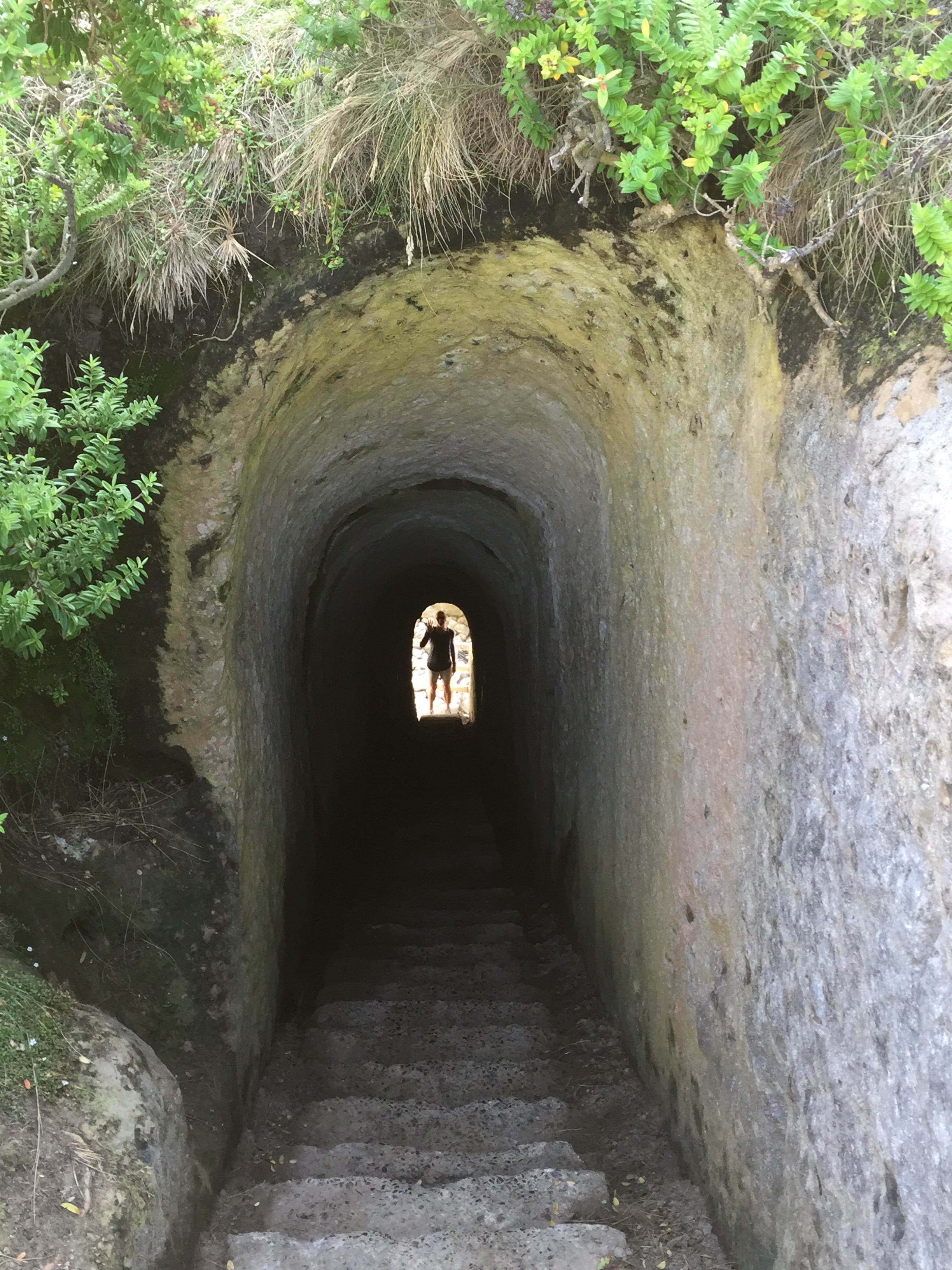
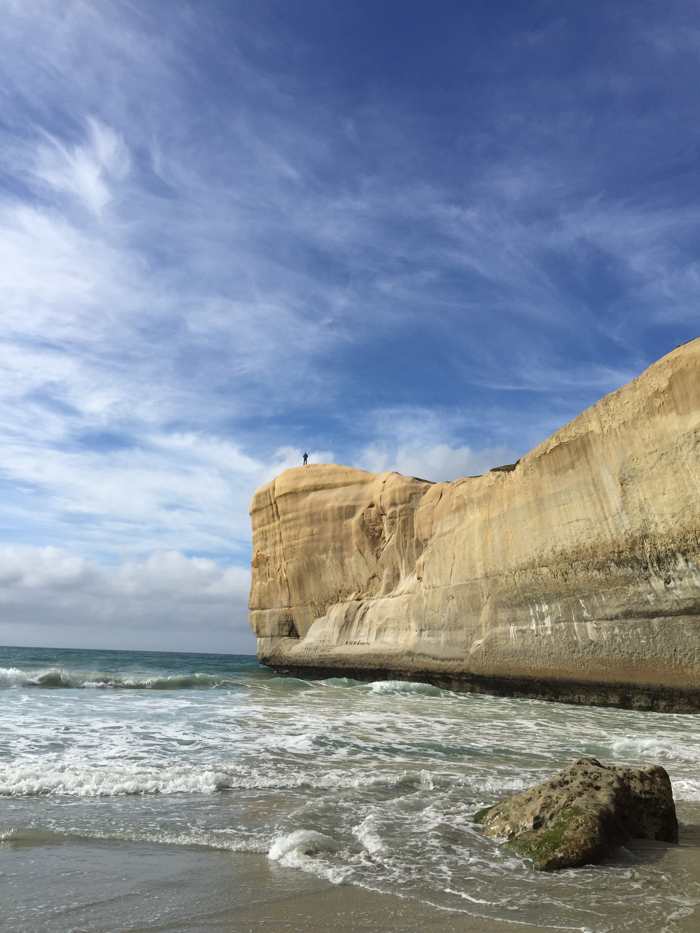
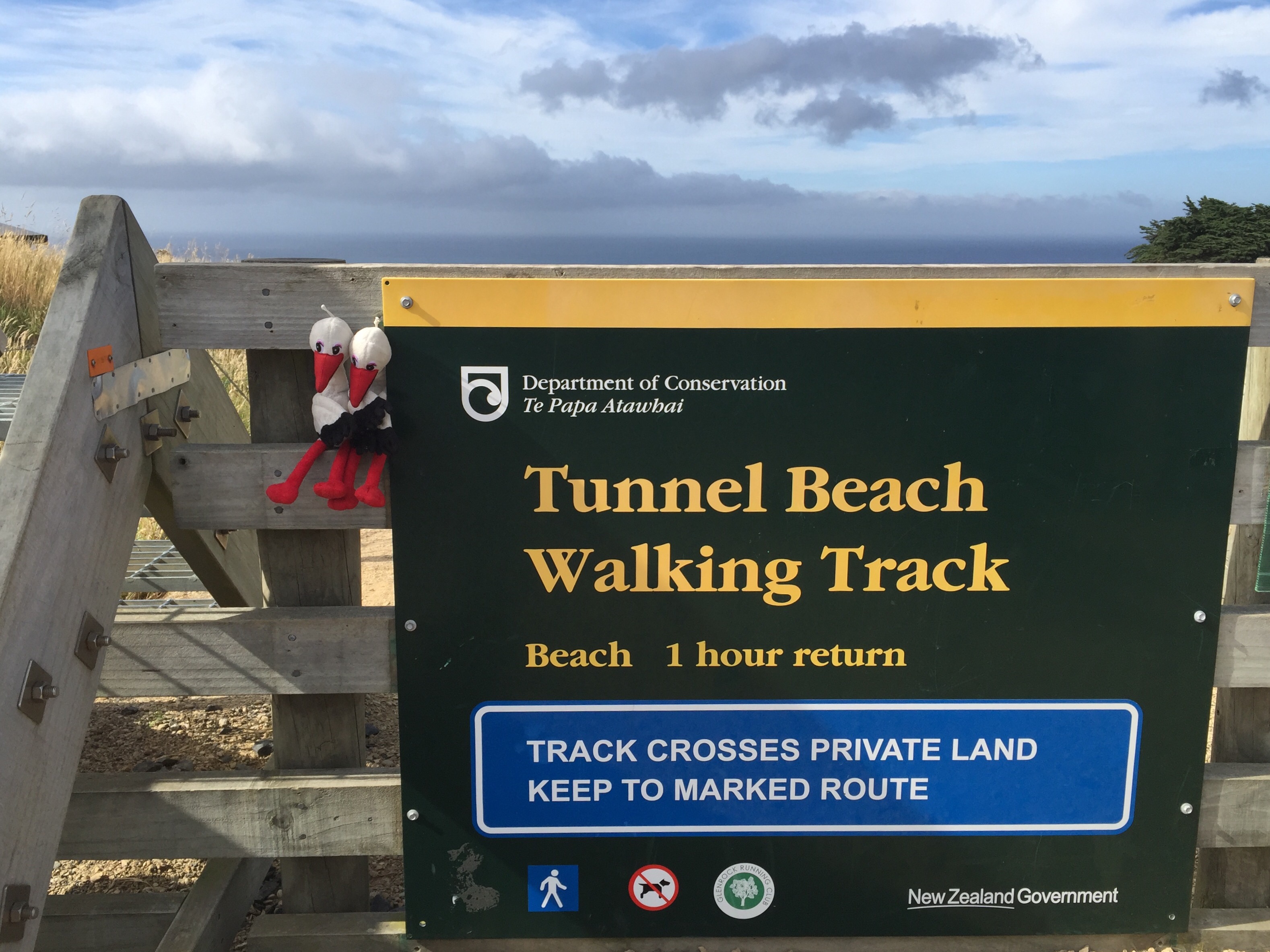
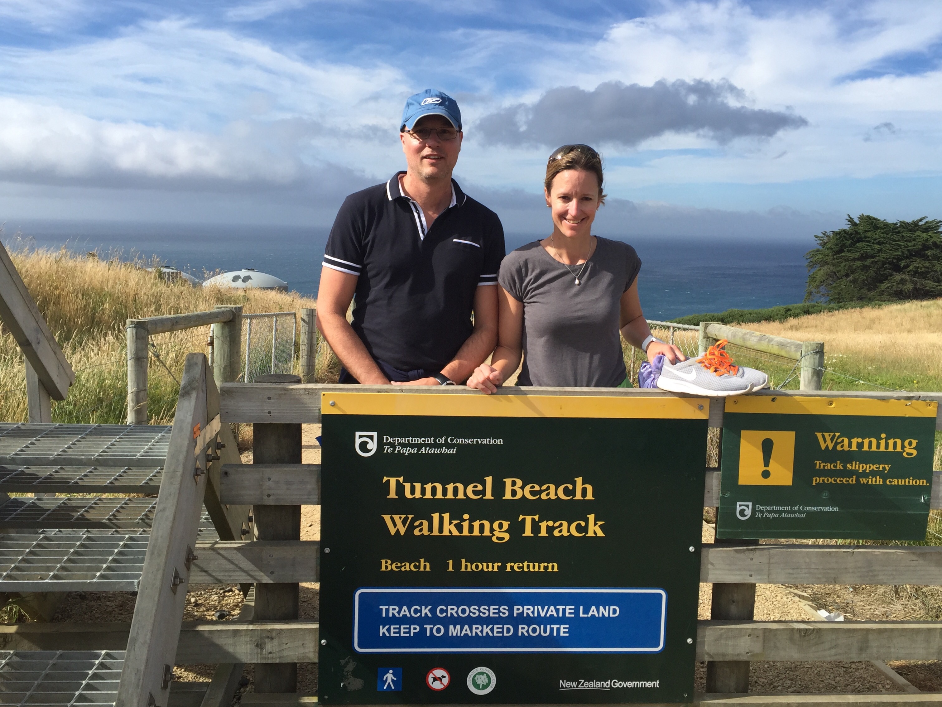
On the Saturday morning we went for a walk to Tunnel Beach. Tunnel Beach has sea-carved sandstone cliffs, rock arches and caves. Beyond the beauty of the rugged sandstone cliffs, its claim to fame is the tunnel down to the beach that a local politician, John Cargill, son of Captain William Cargill, had commissioned for his family in the 1870s.
Access to the beach is via a track across private farmland, and is open year round excluding lambing season from August to October. The track was opened in 1983, and is a popular walking track. It descends from 150 metres (490 ft) above sea level at its start, a short distance off Blackhead Road, winding for some 1200 metres to the top of the tunnel close to a natural sea arch. The tunnel descends 72 steps to the beach, and is dimly naturally lit.
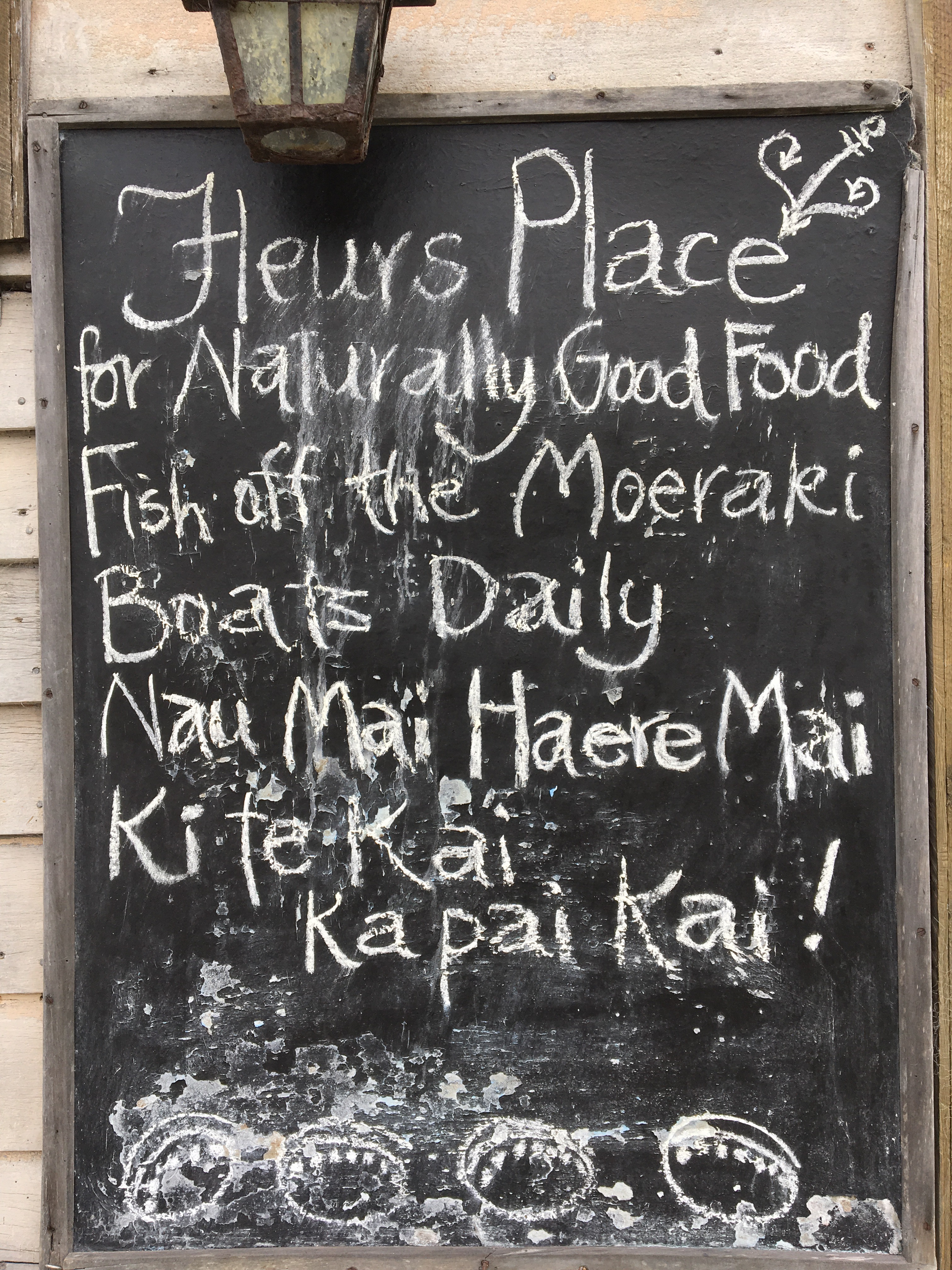
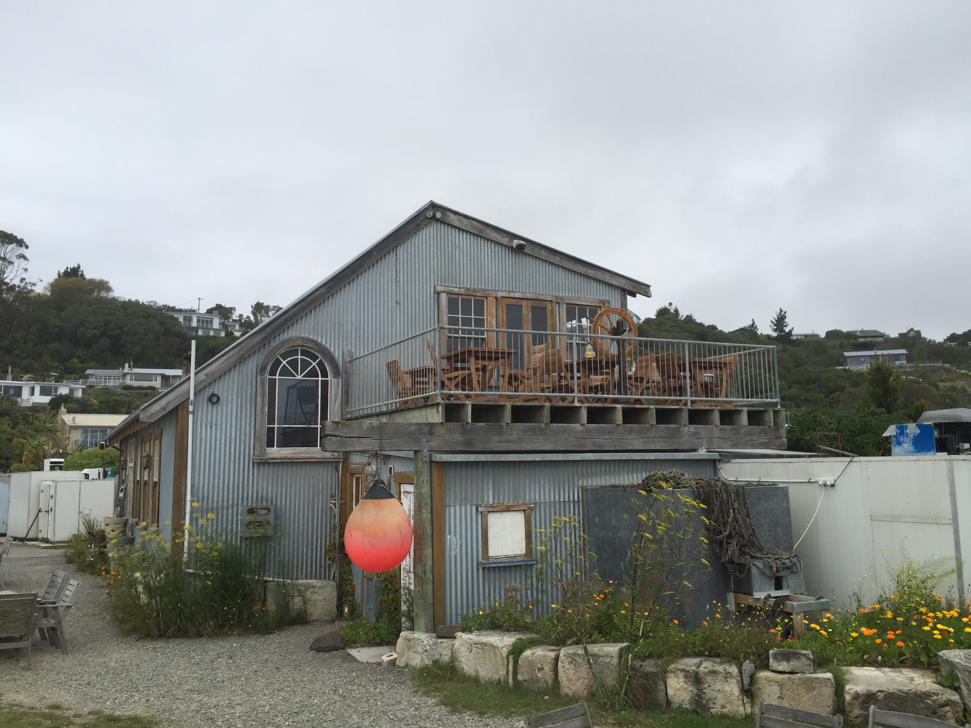
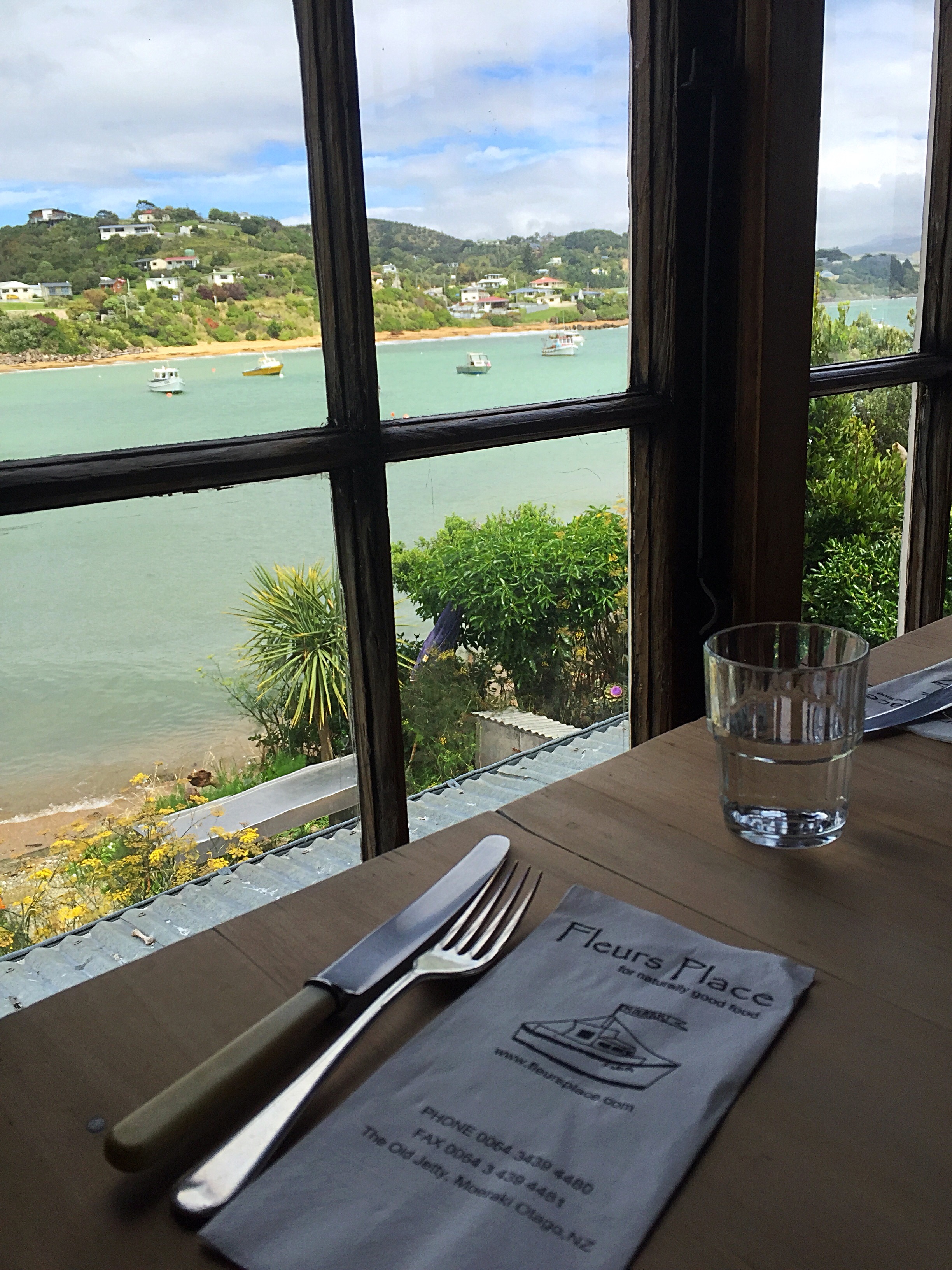
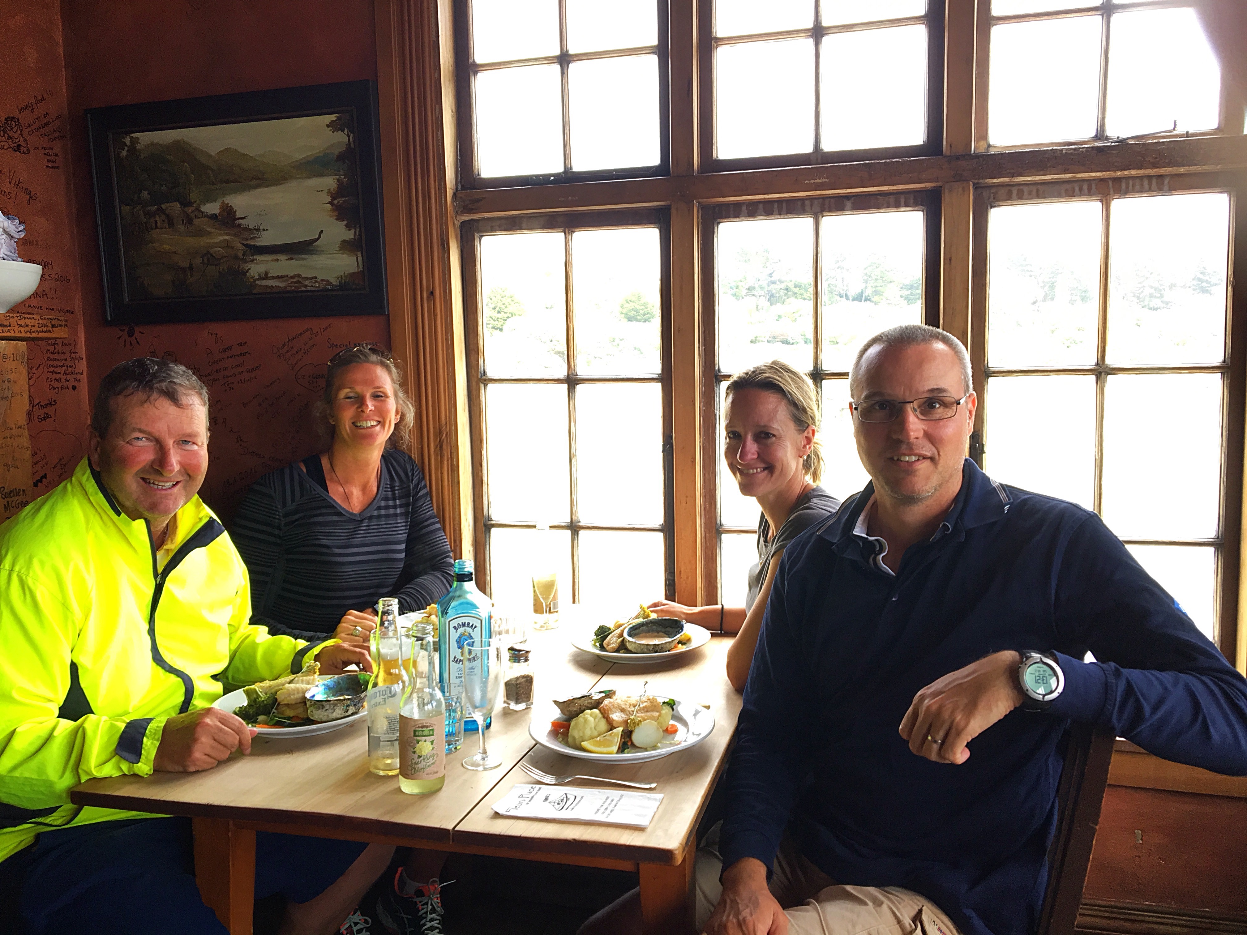
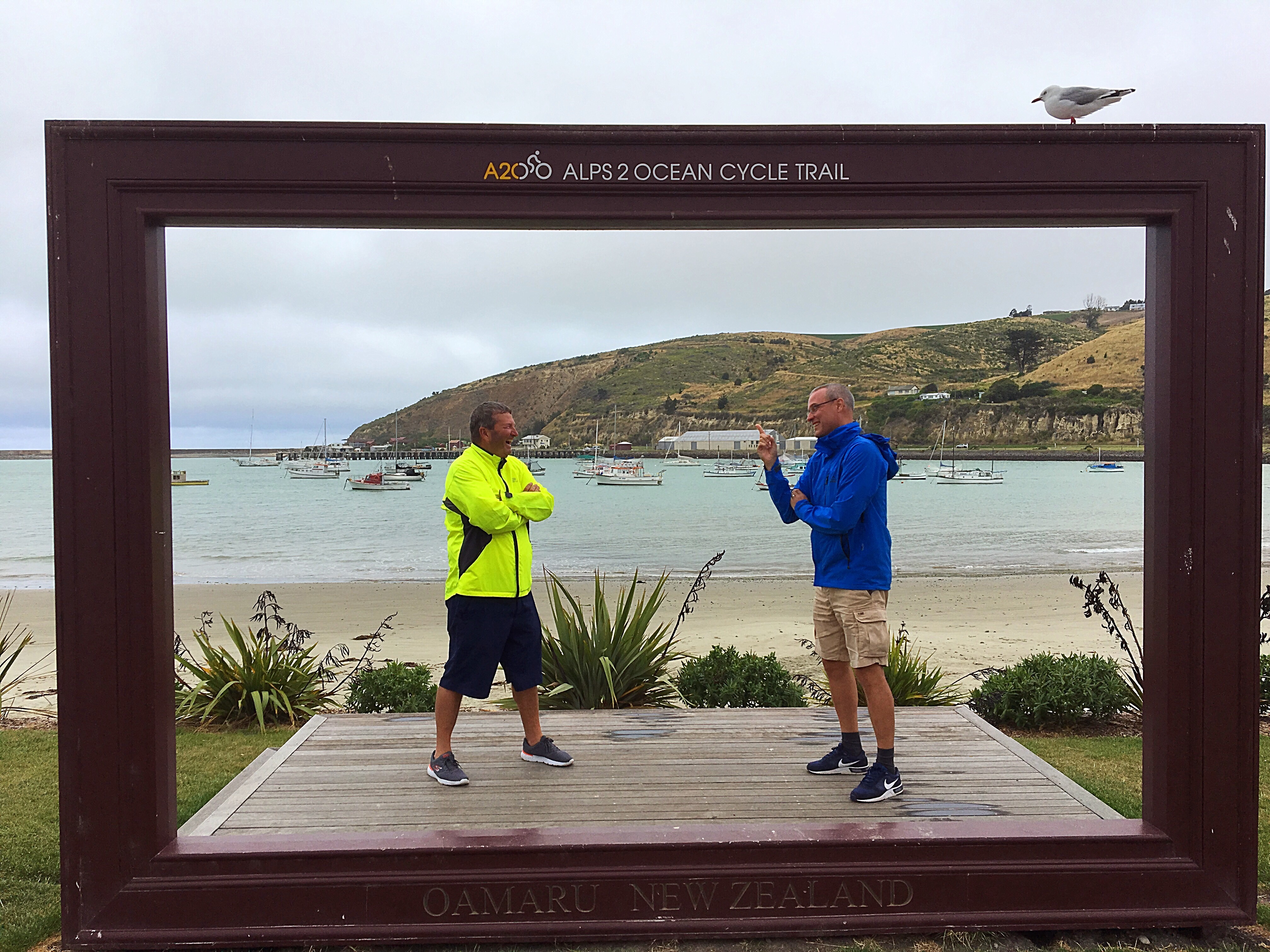
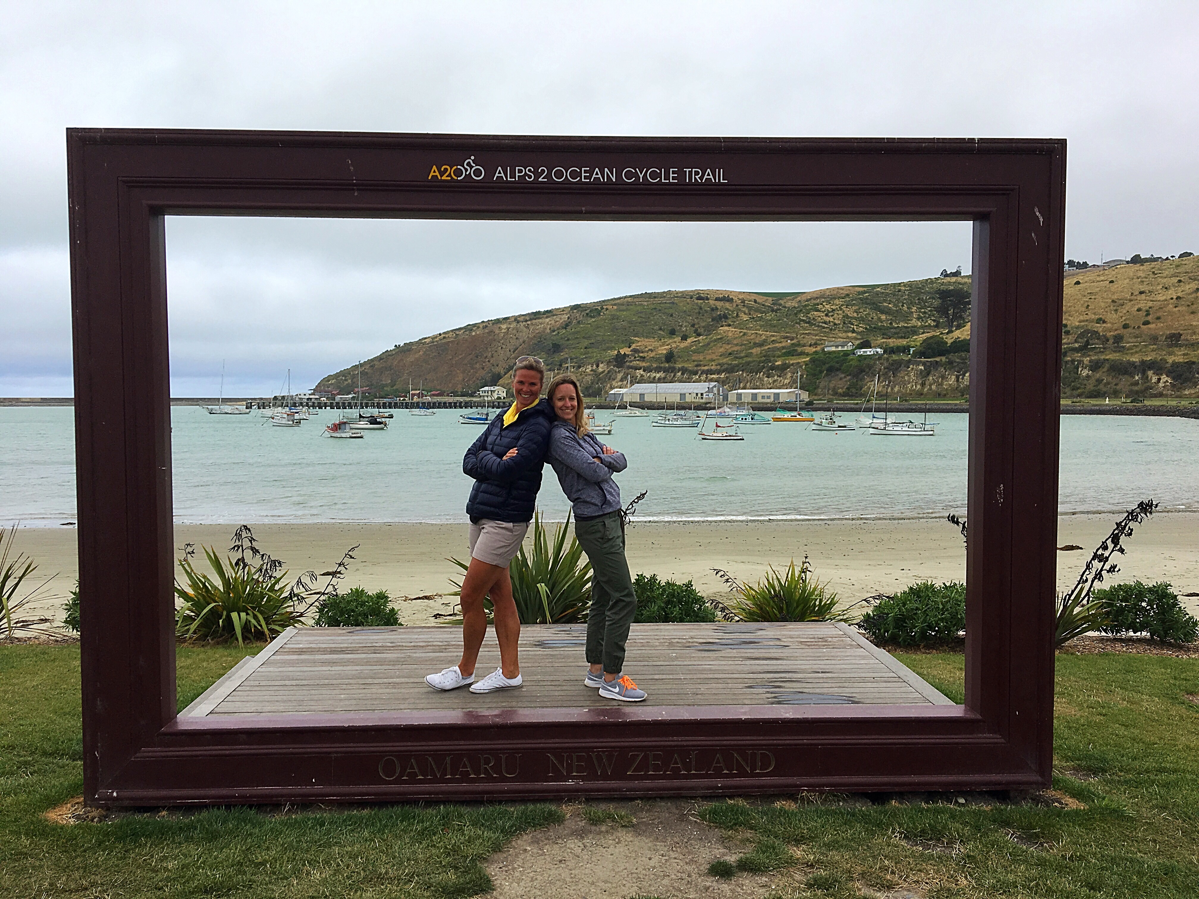
Next stop was Fleurs Place at Moeraki. Moeraki is located about 70km north of Dunedin and 30km south of Oamaru. Moeraki means ‘a place to rest by day.’ Fleurs Place is a restaurant, cafe and bar right on the waterfront at the old jetty. Their specialty is fresh fish straight from Moeraki Bay fishing boats.
The restaurant established on an early whaling station site in 2002 and is built from gathered collectables and demolition materials from all over New Zealand. The owner Fleur Sullivan has made her reputation in Central Otago where she established Olivers restaurant and has received numerous awards for her restaurants and in recognition for her contribution to tourism.
When British television chef and restaurateur Rick Stein was told he could choose to go anywhere in the world to write a travel article for English newspaper the Daily Mail, he chose Fleurs Place in Moeraki.
The restaurant, run by the inimitable Fleur Sullivan, was ‘Just one of those places that keeps cropping up in conversations’ whenever there was a gathering of ‘foodies’, he said. Set in the sleepy little fishing village of Moeraki on the Otago coast, Fleurs Place has an unbeatable setting.
There’s water on three sides, fishing boats bobbing in the harbour, the famous Moeraki boulders across the bay and, to the north, the open sea. Fleur uses only the freshest of local ingredients – indeed, fishing boats land their catches right into her restaurant.
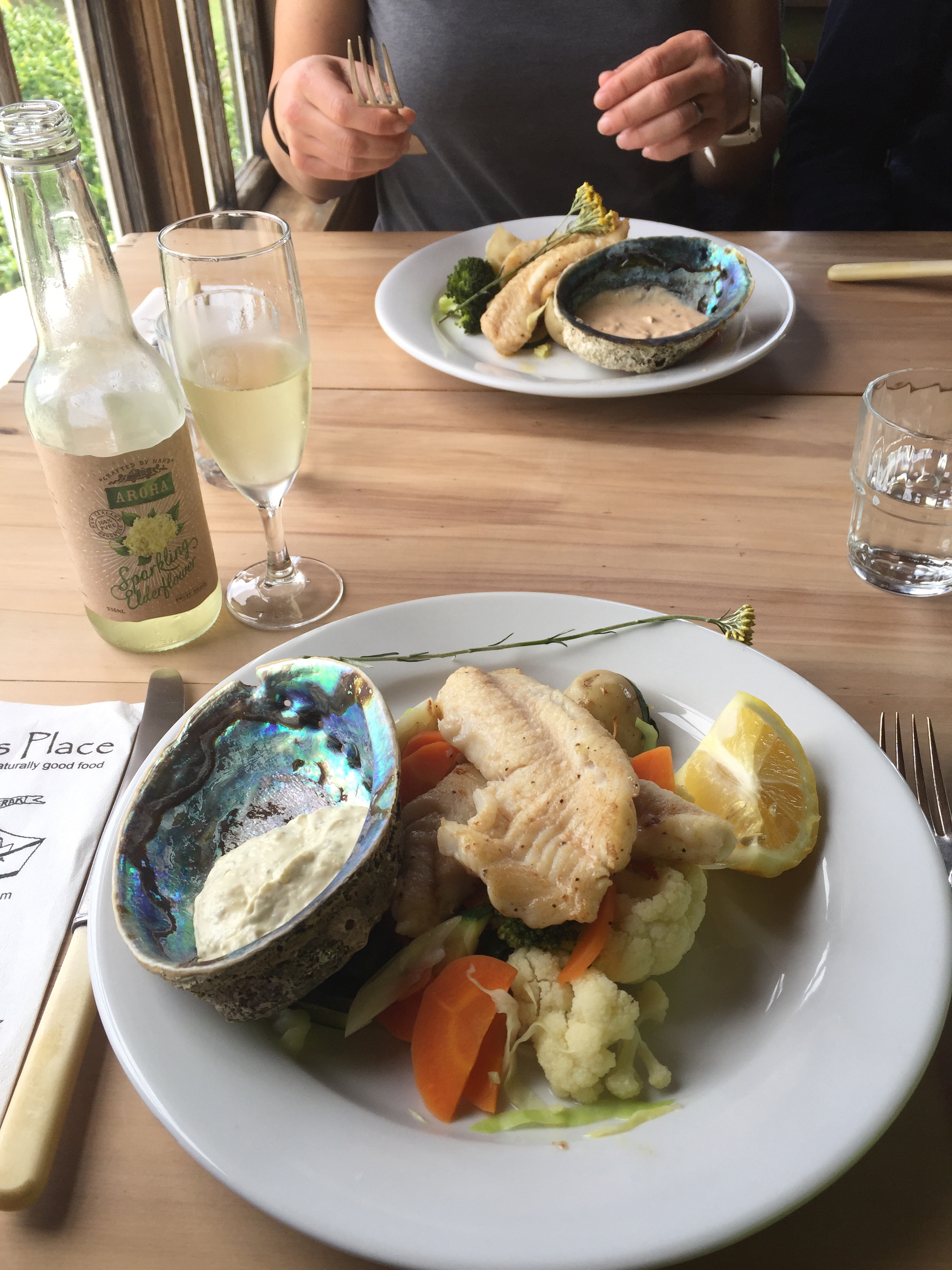
We too had heard of Fleurs on many occasions but had never managed to visit. We all had the blue cod for lunch and it was delicious.
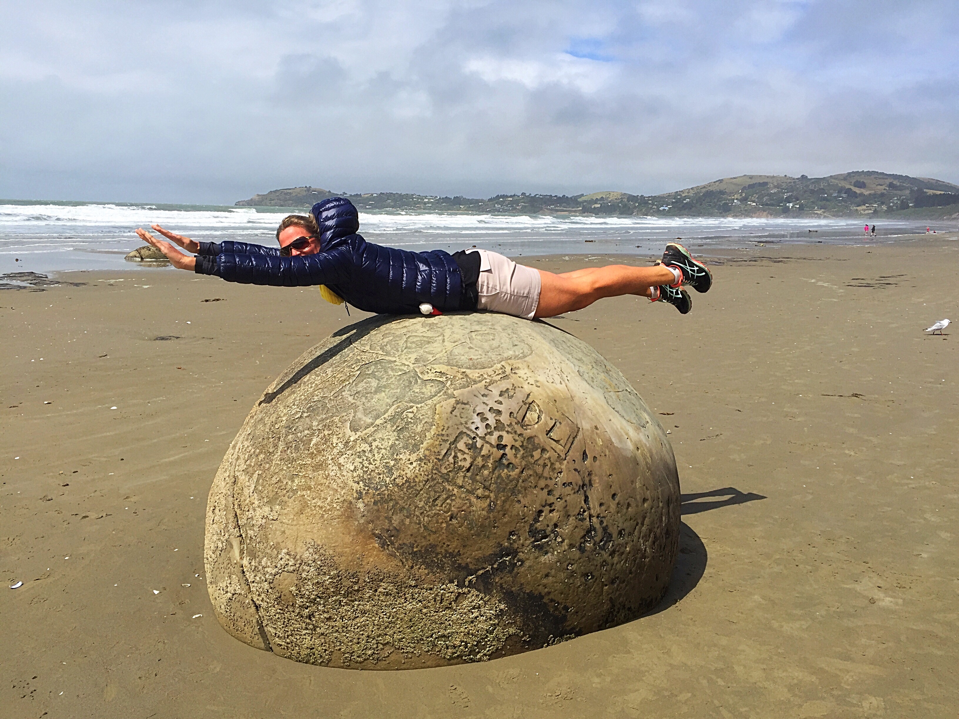
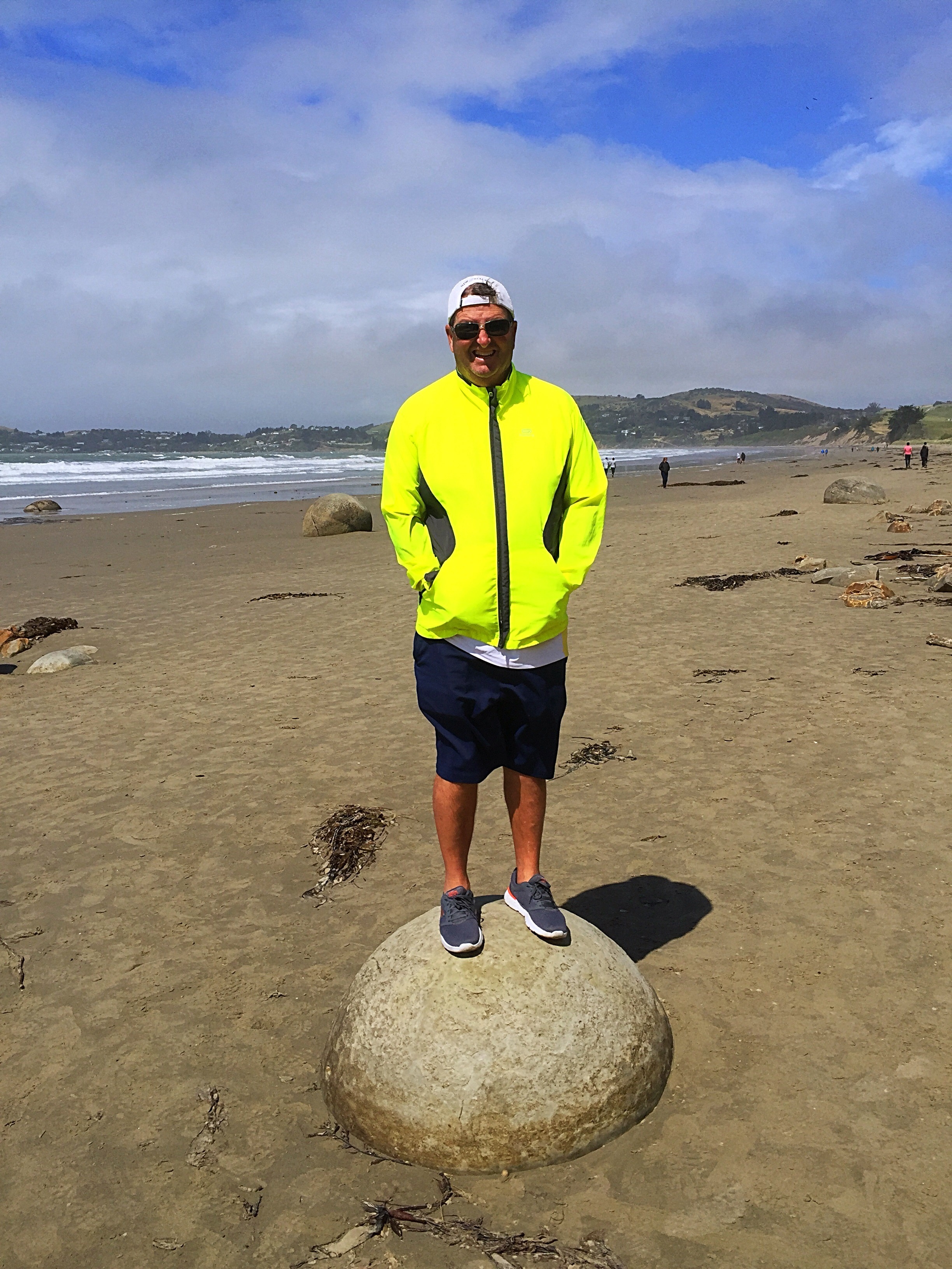
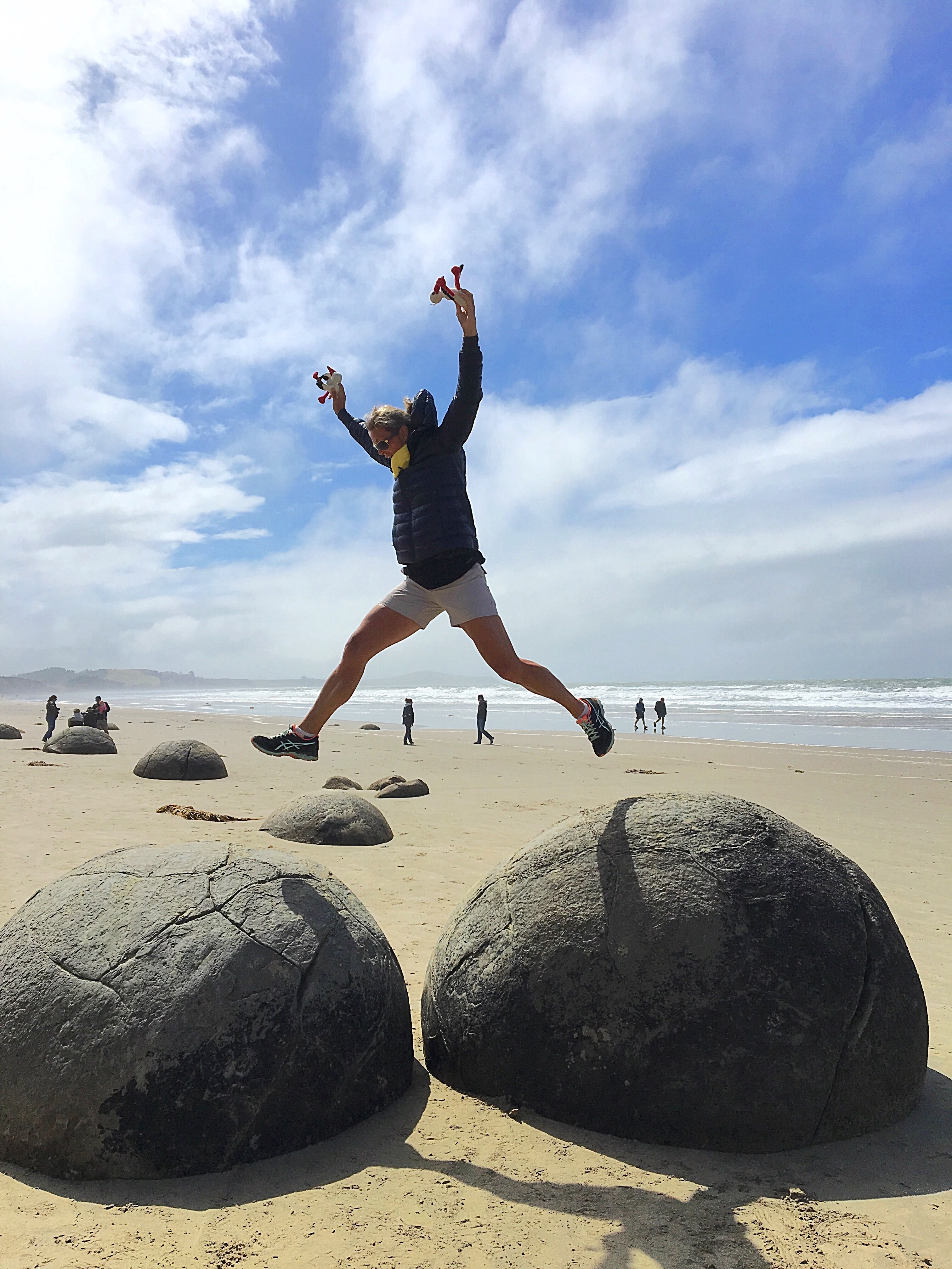
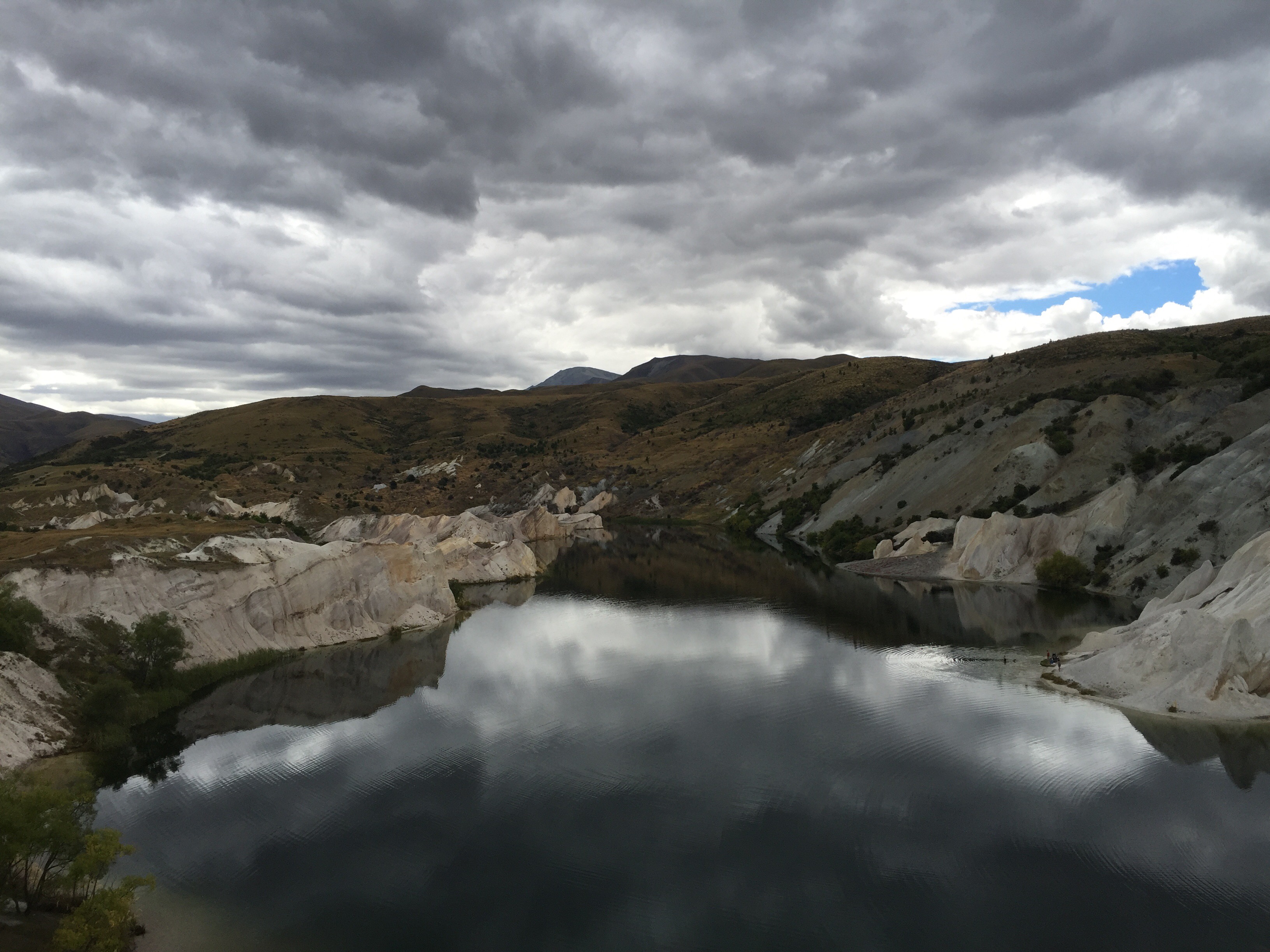
Another place we had not visited before was the Moeraki Boulders which are about 10 minutes up the road from Fleurs Place.
The Moeraki Boulders are a group of very large spherical “stones” on Koekohe Beach near Moeraki on New Zealand’s Otago coast. These boulders are actually concretions that have been exposed through shoreline erosion from coastal cliffs that back the beach.
The boulders are one of the most fascinating and popular attractions on the South Island. They originally formed in ancient sea floor sediments around 60 million years ago. Some of the boulders weigh several tonnes and are up to 3 metres in diametre!
Maori legend tells that the boulders are remains of calabashes, kumaras and eel baskets that washed ashore after the legendary canoe, the Araiteuru was wrecked at nearby Shag Point (Matakaea).
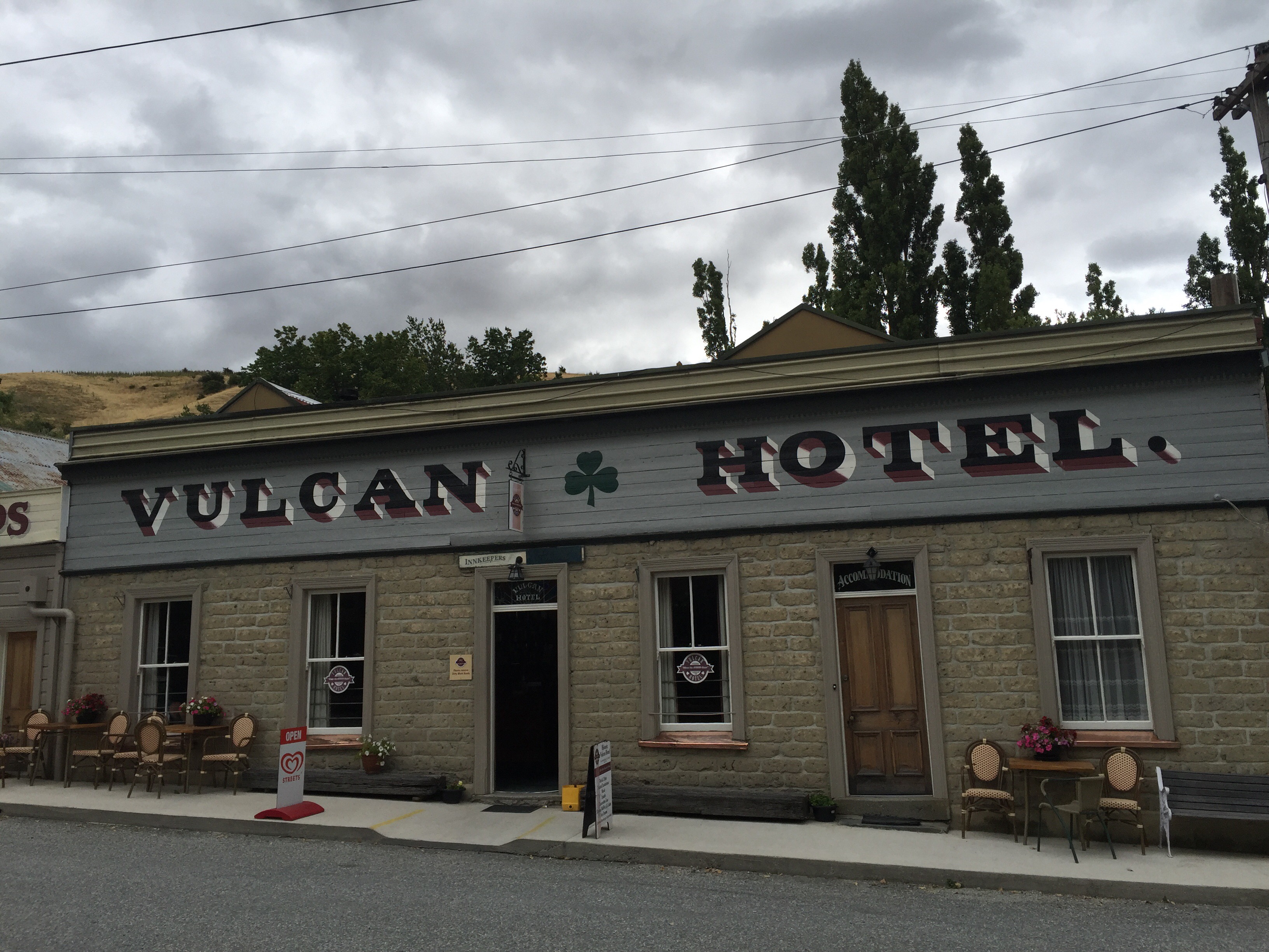
We got to Oamaru late afternoon and had a quick look around the Victorian quarter. Originally the commercial and business district of Oamaru, the buildings in the Precinct were predominantly grain and seed warehouses throughout the late 19th century. The charitable trust, Whitestone Civic Trust, was later established with the aim of preserving the Oamaru Victorian Precinct and it now owns 16 of the Victorian buildings. These beautiful limestone buildings house a mixture of galleries, shops, traditional crafts, food & drink outlets.
Oamaru used to be rich and ambitious. In its 1880s heyday, Oamaru was about the same size as Los Angeles was at the time. Refrigerated meat-shipping had its origins nearby and the town became wealthy enough to erect the imposing buildings that grace the main street today – these buildings are all beautifully crafted out of limestone or what we now call Oamaru stone. However, the town overreached itself and spent the end of the 19th century teetering on the verge of bankruptcy.
Economic decline in the 20th century meant that there wasn’t the impetus to swing the wrecking ball with the same reckless abandon that wiped out much of the built heritage of NZ’s main centres so these beautifully crafted buildings remain intact today. It’s only in recent decades that canny creative types have cottoned on to the uniqueness of Oamaru’s surviving Victorian streetscapes and have started to unlock this otherwise unremarkable town’s potential for extreme kookiness.
We decided to do the evening viewing of the Blue Penguin, another of Oamaru’s icons. The Oamaru Blue Penguin Colony is located only a few minutes from the town centre. A small number of blue penguins began nesting in a rock quarry area at the edge of Oamaru Harbour in the 1970s, twenty years later the colony was formed to protect the birds.
Blue Penguins or Korora (maori name) are the worlds’ smallest penguins. They are approximately 30cm tall, weigh around 1kg and live to about 8 – 10 years old. Blue penguins breed around the coast of New Zealand and Southern Australia.
They leave early in the morning before sunrise, and return after dark. During the day they will either stay hidden inside their nests or go out to sea. The penguins will normally make their nests by digging a burrow or hiding amongst rocks. At the colony they provide nesting boxes as they are less prone to collapsing or flooding than natural nests.
We saw 78 blue penguins come back in that night – they are very cute. One got a bit disorientated and ended up under the grandstand we were sitting on. When we left to go back to our accommodation that night we also saw another couple on the rocks near the carpark. It is not uncommon for them to be seen in town.
Fast facts about Blue Penguins
- Blue penguins are the smallest penguins in the world at just 35-43cm tall
- They weigh between 1 and 1.5kg
- The average life span is 6.5 years, but there are some records of penguins living up to 20 years
- Penguins travel 15–75 km at sea each day
- Long-term partnerships are the norm, but ‘divorce’ is not uncommon
- Underwater, penguins can reach speeds of up to 6km/hr but average 2–4km/hr
- Chicks will often return to within a few metres of where they were raised and once settled in an area never move away
- Blue penguins only come ashore under the cover of darkness
- They commonly nest in burrows, rock crevices, caves, nesting boxes, or under buildings
- From June to November penguins come ashore to lay eggs (generally two) and raise young in burrows
- By March they have moulted and returned to the sea.
- The chicks are guarded for the first 2-3 weeks, after which both parents go to sea to keep up the supply of fish
- Adults feed their chicks but never their mate. They take over incubation duties so their mate can go to sea to feed
- Chicks usually fledge 8 weeks after hatching and are independent from then on.
- Blue penguins feed on surface schooling fish, squid and crustaceans.
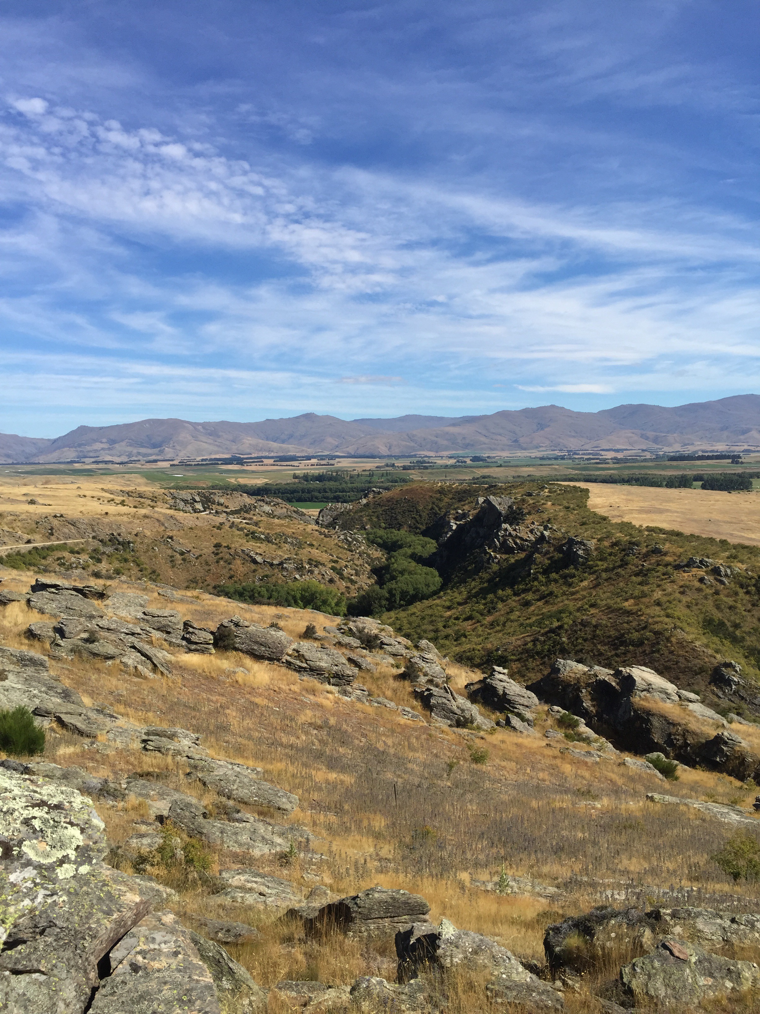
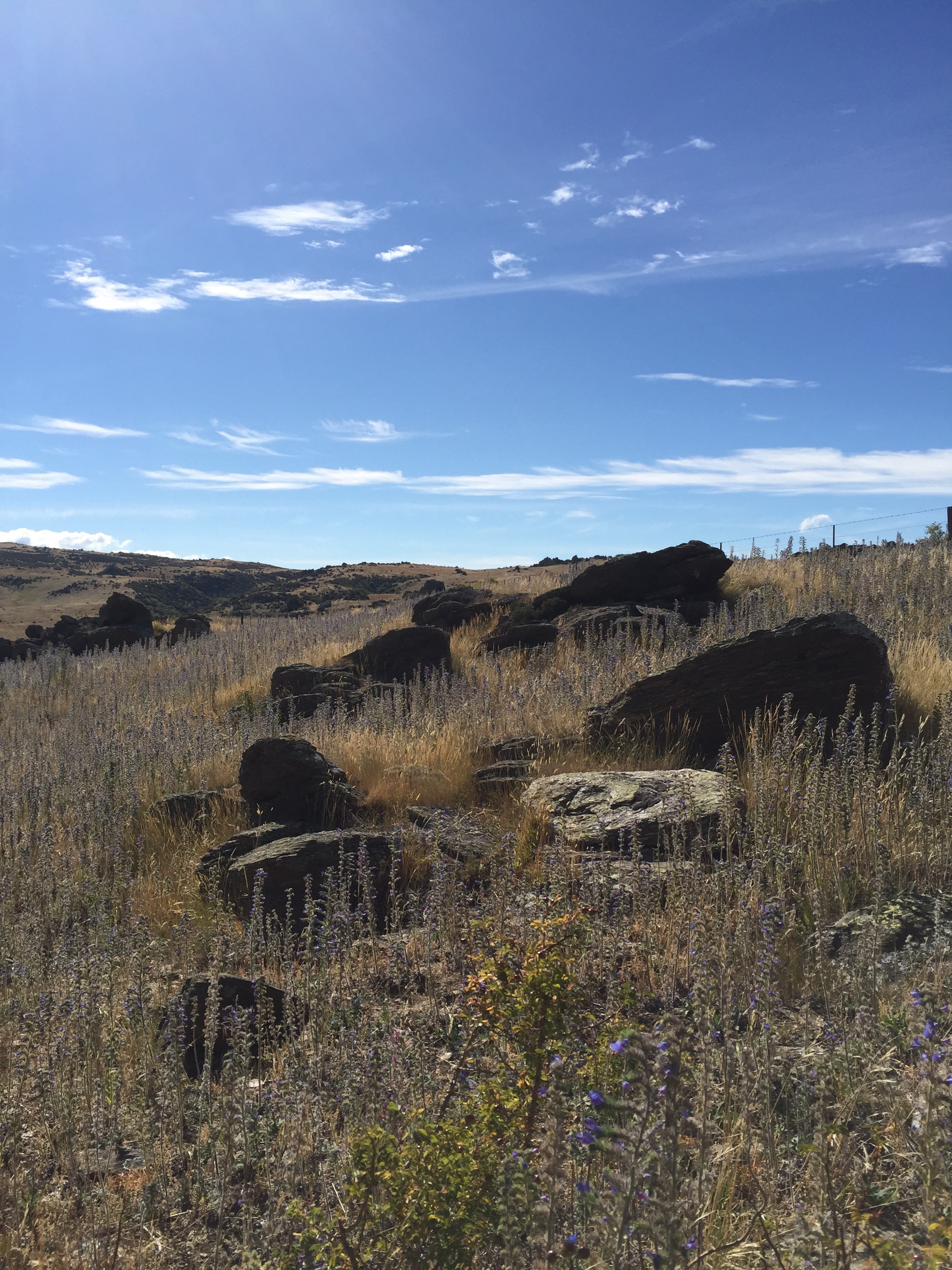
The next day we headed towards Alexandra and decided to take the historic Danseys Pass. Danseys Pass is located in the Kakanui Mountains, between Central Otago and North Otago, in the South Island of New Zealand. It is 920 metres above sea level at it’s highest point.
It lies between the Maniototo plain (part of the Taieri River water catchment) and the northern foothills of the Kakanui Mountains (part of the Waitaki River catchment). Much of the road going over Danseys Pass is unsealed. The road was built for the owners of large sheep runs, the brothers Allan McLean and John McLean.
Though not a major arterial road, the pass is a fairly well-used link between the towns of Naseby and Ranfurly in the south and Duntroon in the Mackenzie Basin of inland Canterbury. Also, if State Highway 1 between Hampden and Moeraki is closed, it is closest detour, despite adding over 100 km to the journey.
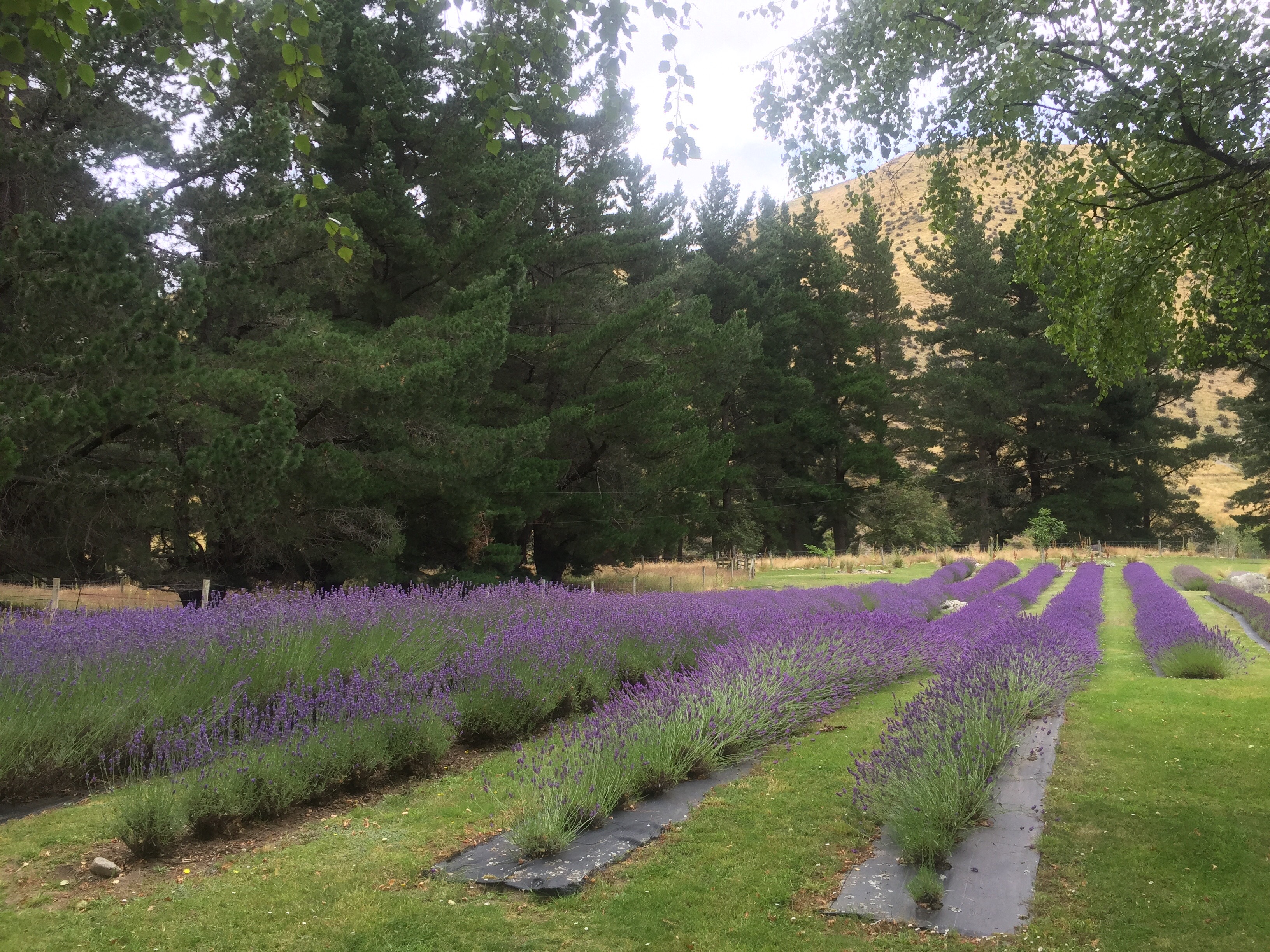
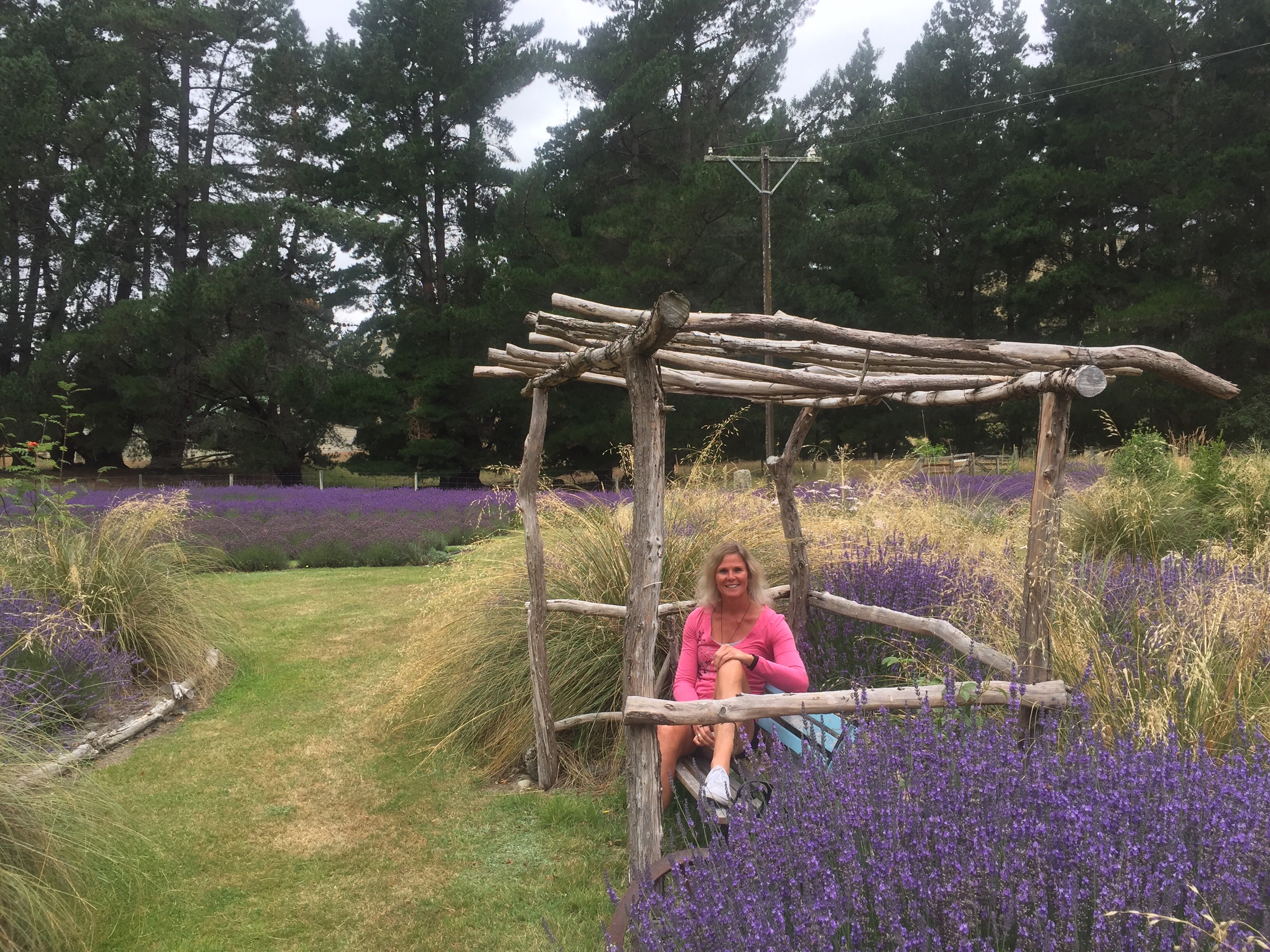
Along the way we discovered Danseys Pass Lavender. Thanks to the pure mountain air, hot dry summers and long cold winters their lavender produces a fine pure oil of the highest quality. What a hidden treasure – we explored the shop and gardens and enjoyed a lavender flavoured icecream which was delicious. They outsource the making of the icecream to a guy in Oamaru who really knows what he is doing – the lavender flavour was present but subtle.
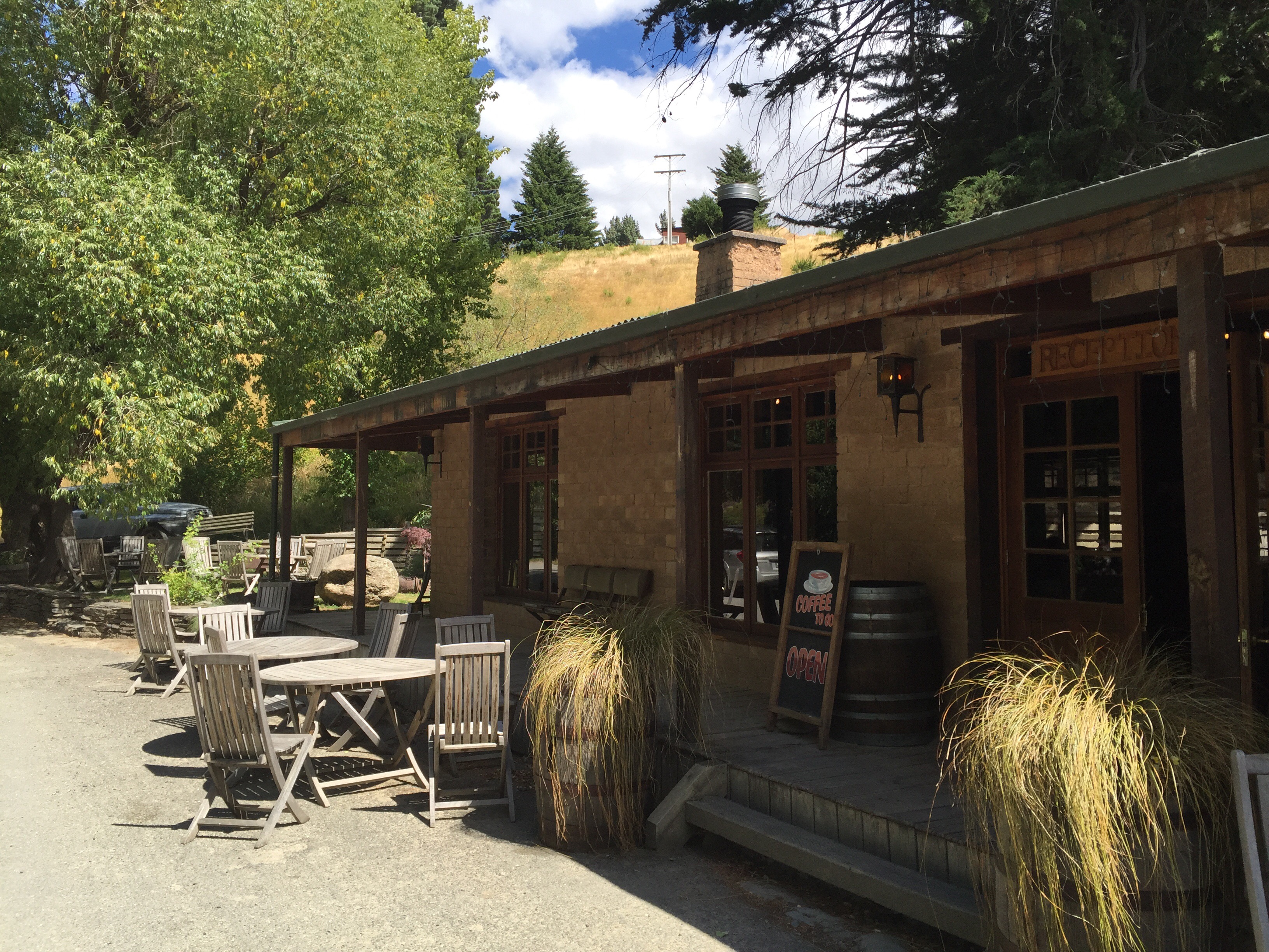
Next stop was the Danseys Pass Coach Inn where we decided to have lunch. We also had a few games of ‘get the ring on the stick’ – amazing what brings out the competitive spirit.
Named after William Heywood Dansey, a North Otago run holder who used the route to move stock, Danseys Pass links Central Otago to the Waitaki District. Danseys Pass is an alpine unsealed, narrow road winding through and over the Kakanui mountain range. At its highest point the saddle is 920m above sea level and can be closed by snow in the winter months.
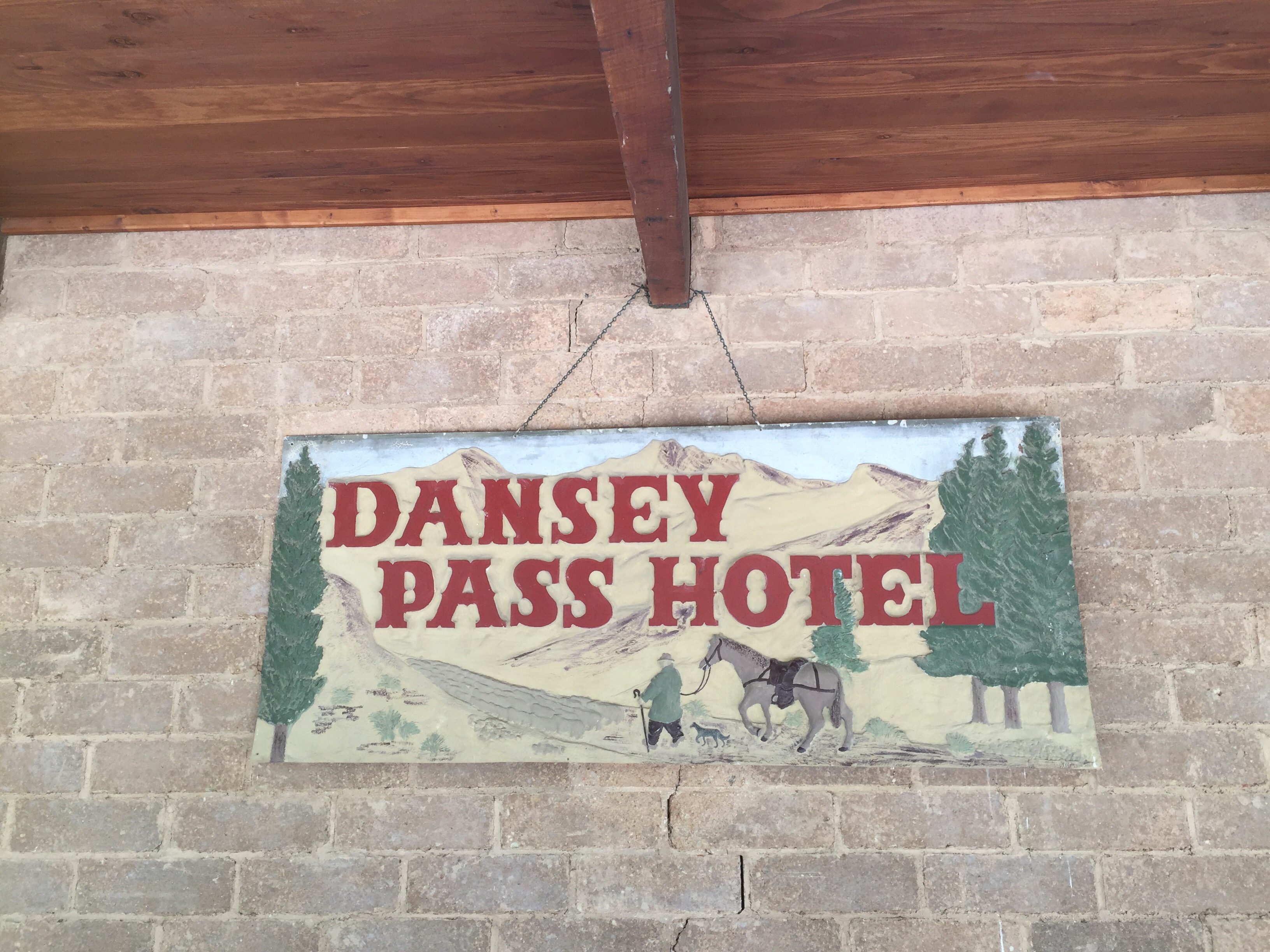
The Pass Hotel (now the Danseys Pass Coach Inn) was built in 1862, with the original stonework constructed by a mason known as “Happy Bill”. Bill’s remuneration was in beer, and he received one pint for every schist boulder shaped and laid. Legend has it that after a particularly busy day the blithe craftsman fell into an open grave at the cemetery, and slept the night away.
Danseys Pass Coach Inn is located deep within the Kyeburn Diggings about 20km from Naseby and has a colourful history traced back to 1860s, when it serviced a multicultural gold prospecting community of 2000. Teamsters with their wagon train plying trade between Waitaki Basin and Central Otago gold fields used the Coach Inn as a stopover when travelling on to the more remote prospecting areas of central Otago.
During 1861 the prospector Leggatt found gold at the Upper Kyeburn, and in July 1863 a rush at Mount Buster took place about eight miles from Rayburn Diggings. There was once a thriving community at Kyeburn Diggings, the Mount Ida Chronicle of 1870 lists business places at Kyeburn Diggings as three hotels, three stores, one butchery and one bakery. The district was also accused of having six unlicensed grog shanties. Coal mining was also important at Kyeburn, and good quality ignite was worked until 1900.
One report in 1880 estimated the number of Chinese working the diggings as six hundred. There was even a Chinese store about two hundred yards above German Creek, which was not pulled down until 1920. The deep cutting on the terrace behind the hotel was worked by the Chinese, as was the adjacent cutting on the road as Chinaman’s cutting.
In September 1869 the first service was held in the new Union Church, the preacher being The Reverend James Burchette. This tiny church served the community for twelve years, and was then moved next to the school and used as a library. A new church of sun-dried brick was constructed and stood until 1923.
Today only the Danseys Pass Coach Inn, first built in 1862 and standing at 2,000ft about sea level remains to remind travellers of a colourful history, and a gold prospecting community of more than two thousand souls. Now only clumps of trees and an occasional decaying wall, mark the places where many large families were raised. The early miners planted trees in what was originally a treeless country, and one fine specimen of Redwood is still to found about four hundred years old up German Creek.
We also called in at the former gold mining town of Saint Bathans.
We got to Alexandra about 5pm and it was very warm which is not unusual. Alexandra normally boasts some of the hottest temperatures in NZ in summer but also some of the coldest in winter. We chilled out for a bit and then decided to find somewhere for dinner – not an easy feat on a Sunday night in Alexandra. One of the only places open was Tabla Indian which is in a little house down the bottom of the town. They had good reviews on TripAdvisor so we thought we would give them a go. We were the only ones there and we sat out the back in a little courtyard. The food was excellent as was the service – no complaints!
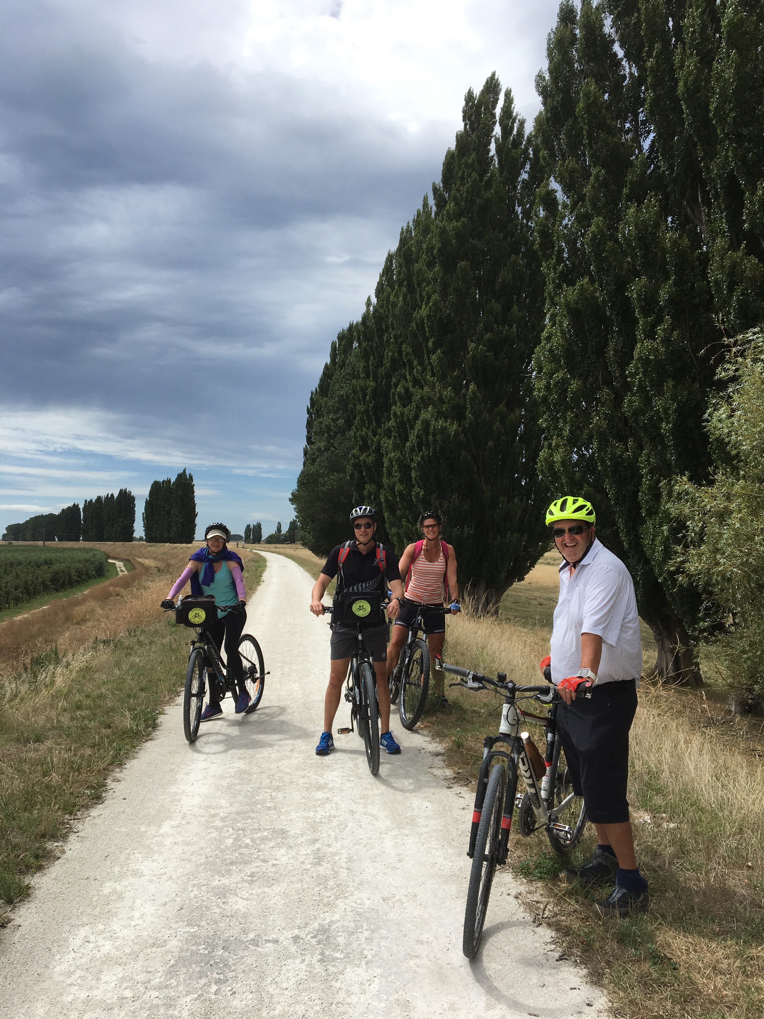
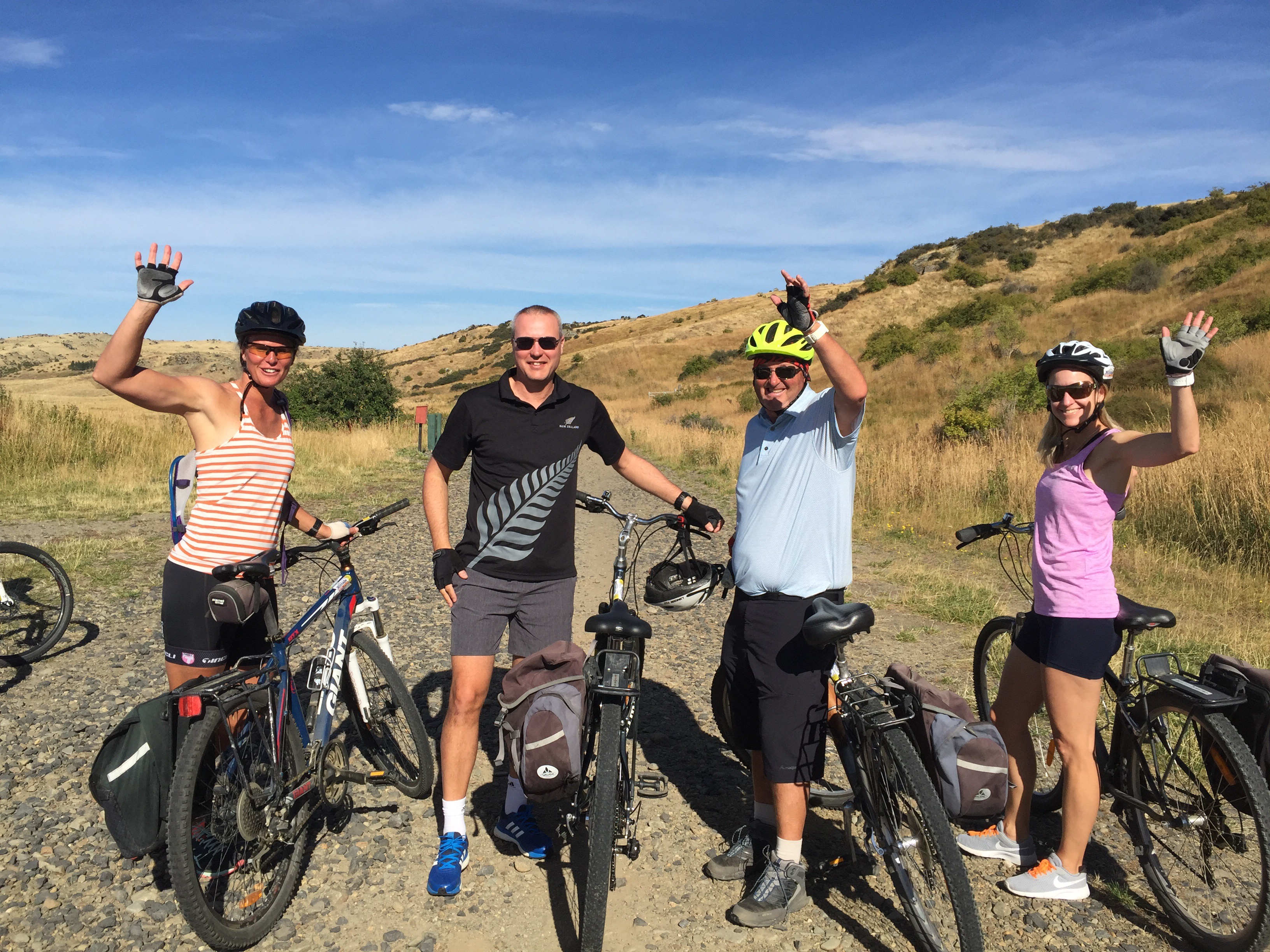
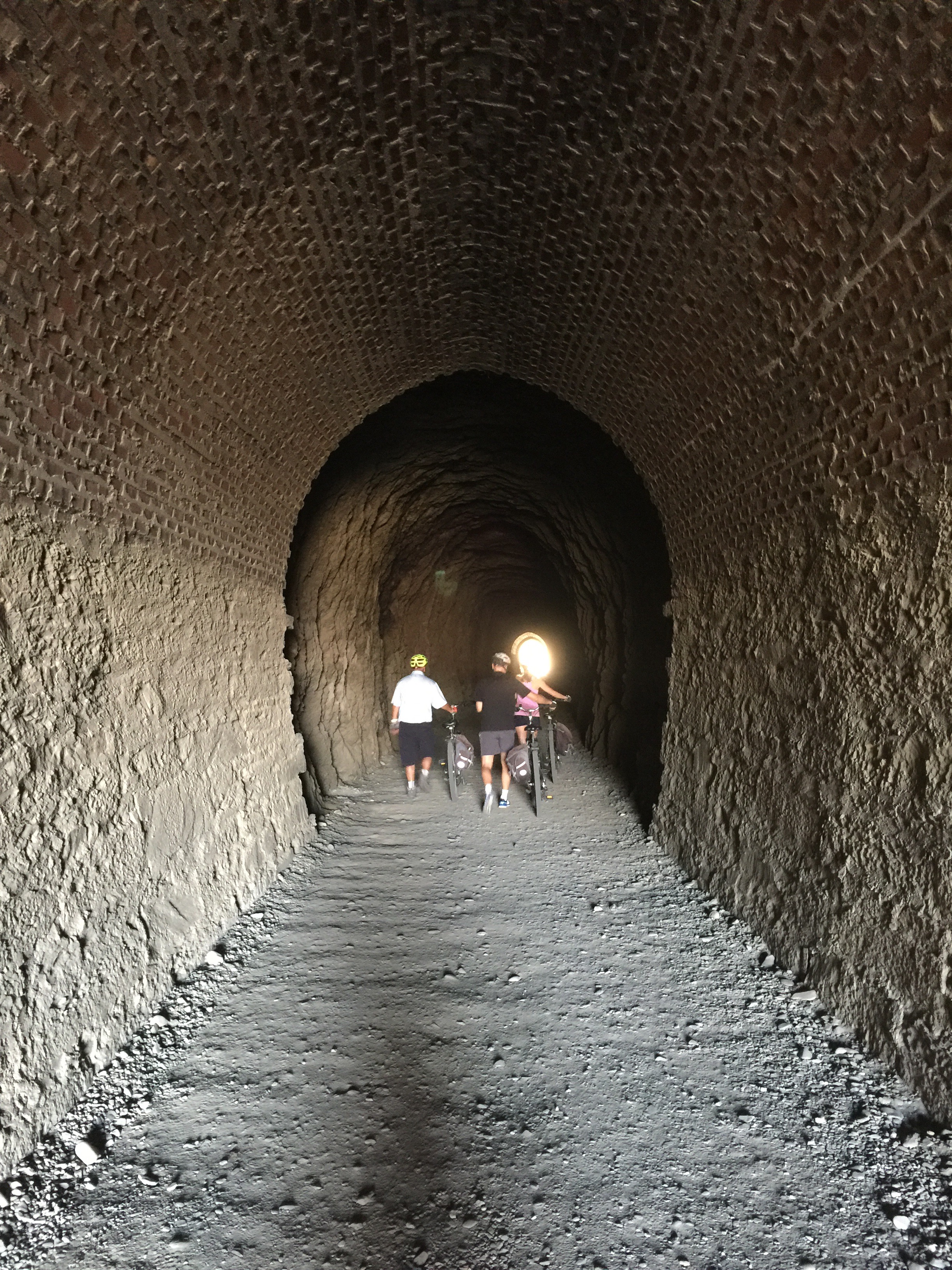
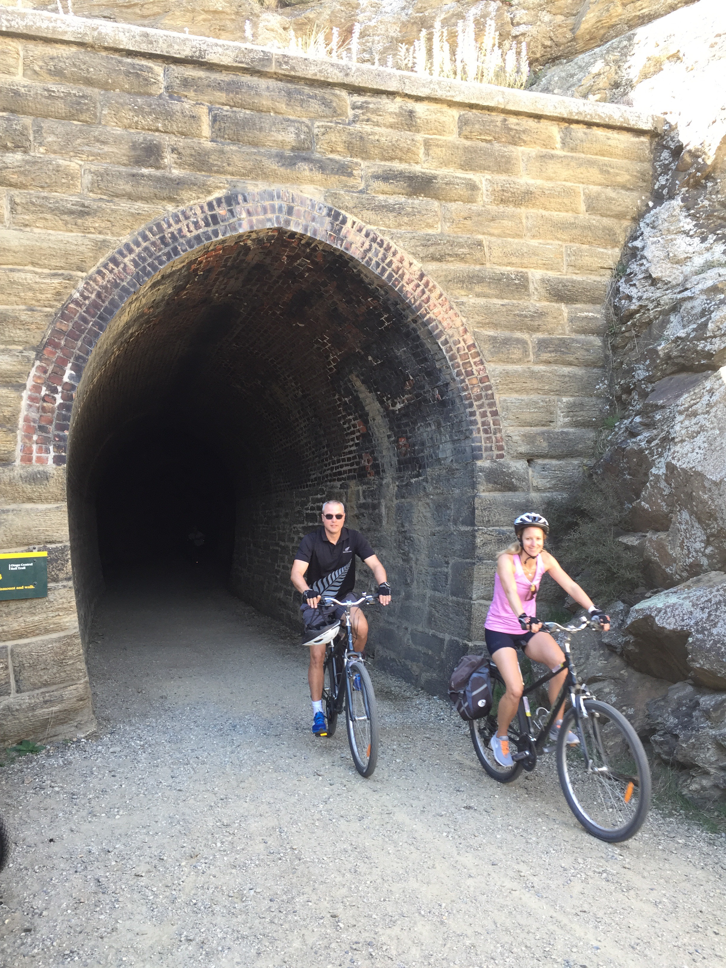
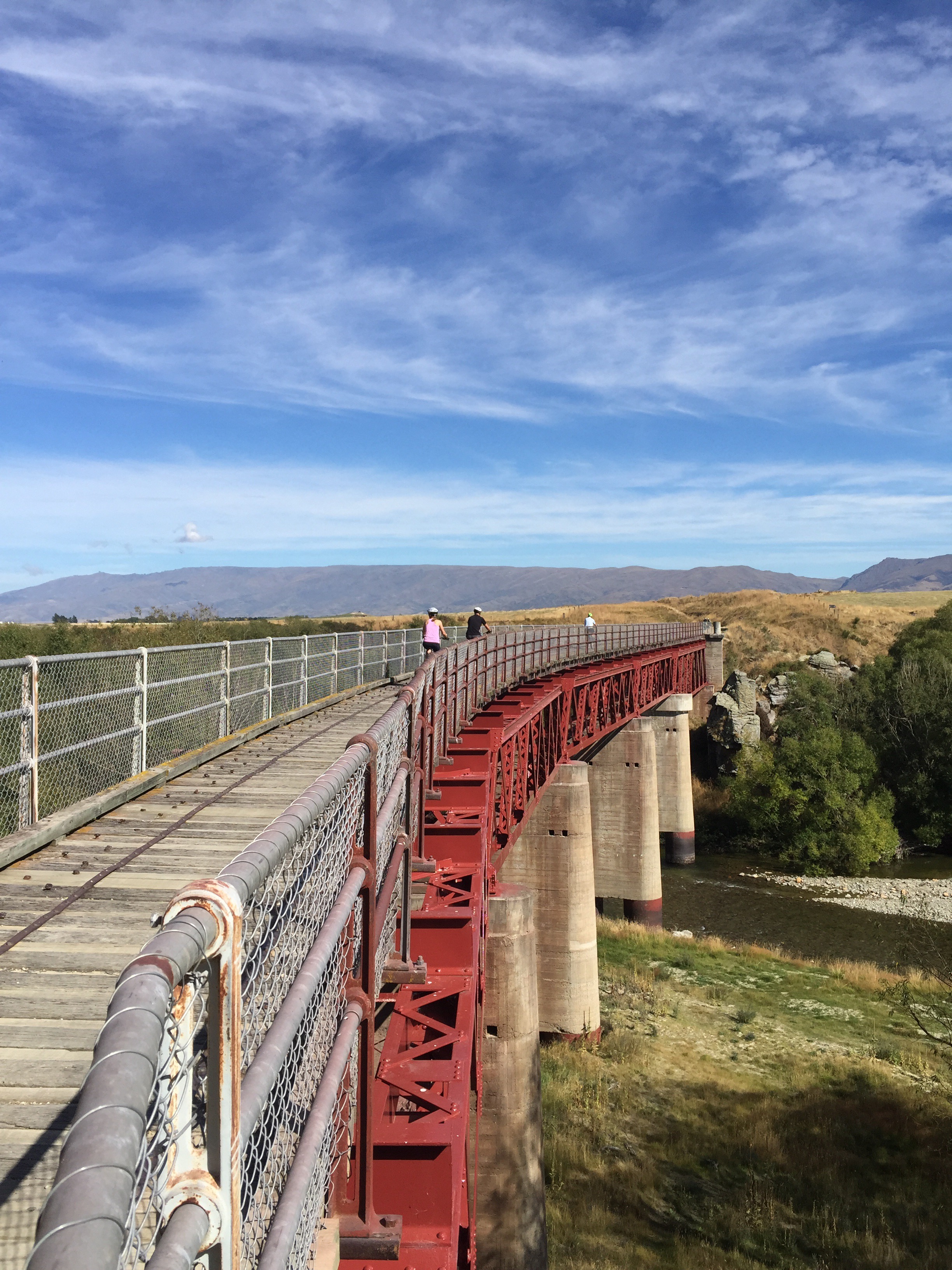
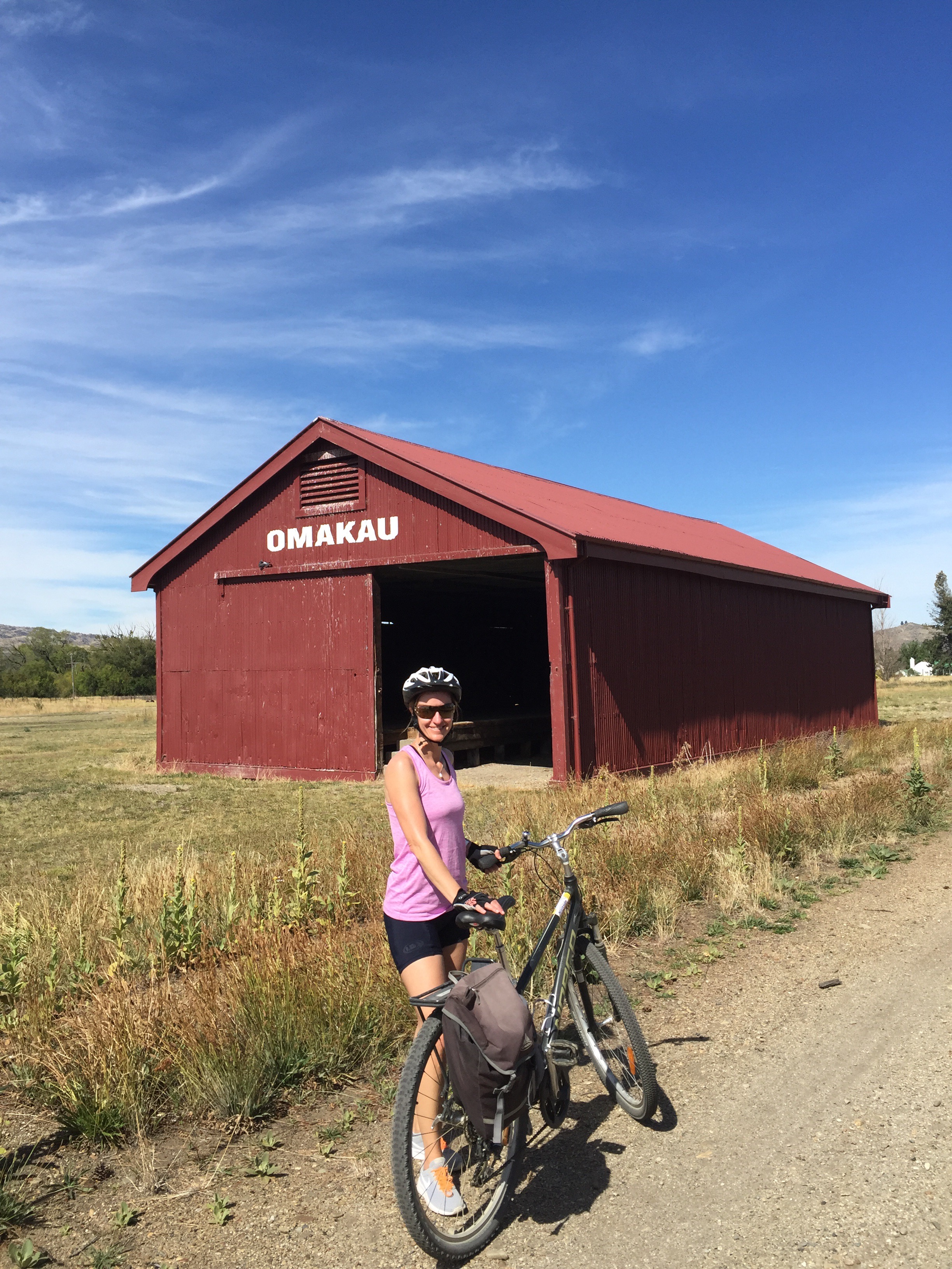
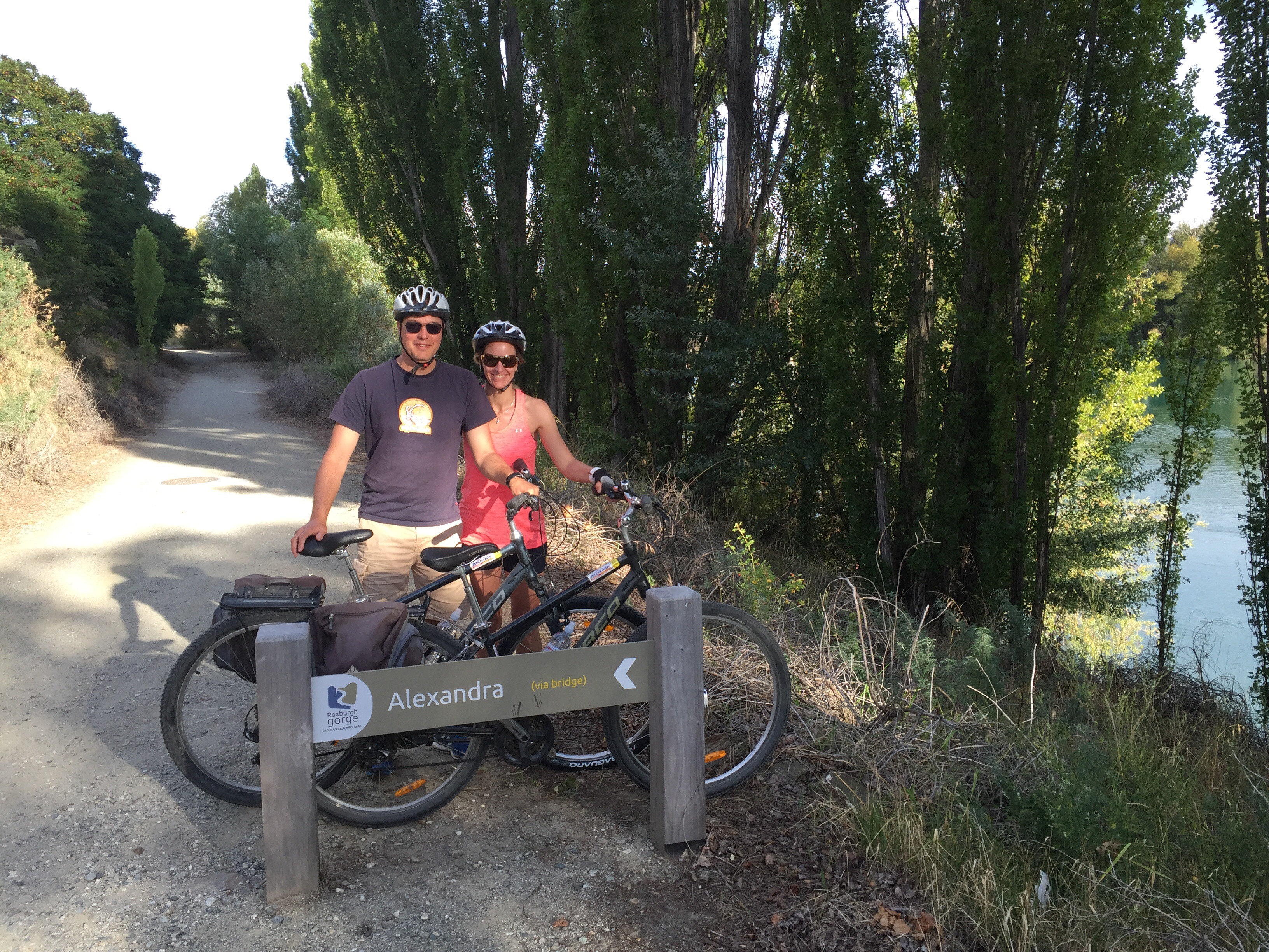
The plan on the Monday was to cycle the last 50km of the Central Otago Rail Trail. We organised bike hire and transport through Phil at Altitude Adventures in Alexandra. Phil dropped us off just past Lauder, took the team photos and left us too it. We have done the Rail Trail three times and as always it never disappoints. The scenery is spectacular and the trail is fun, especially the last 50km which is down hill.
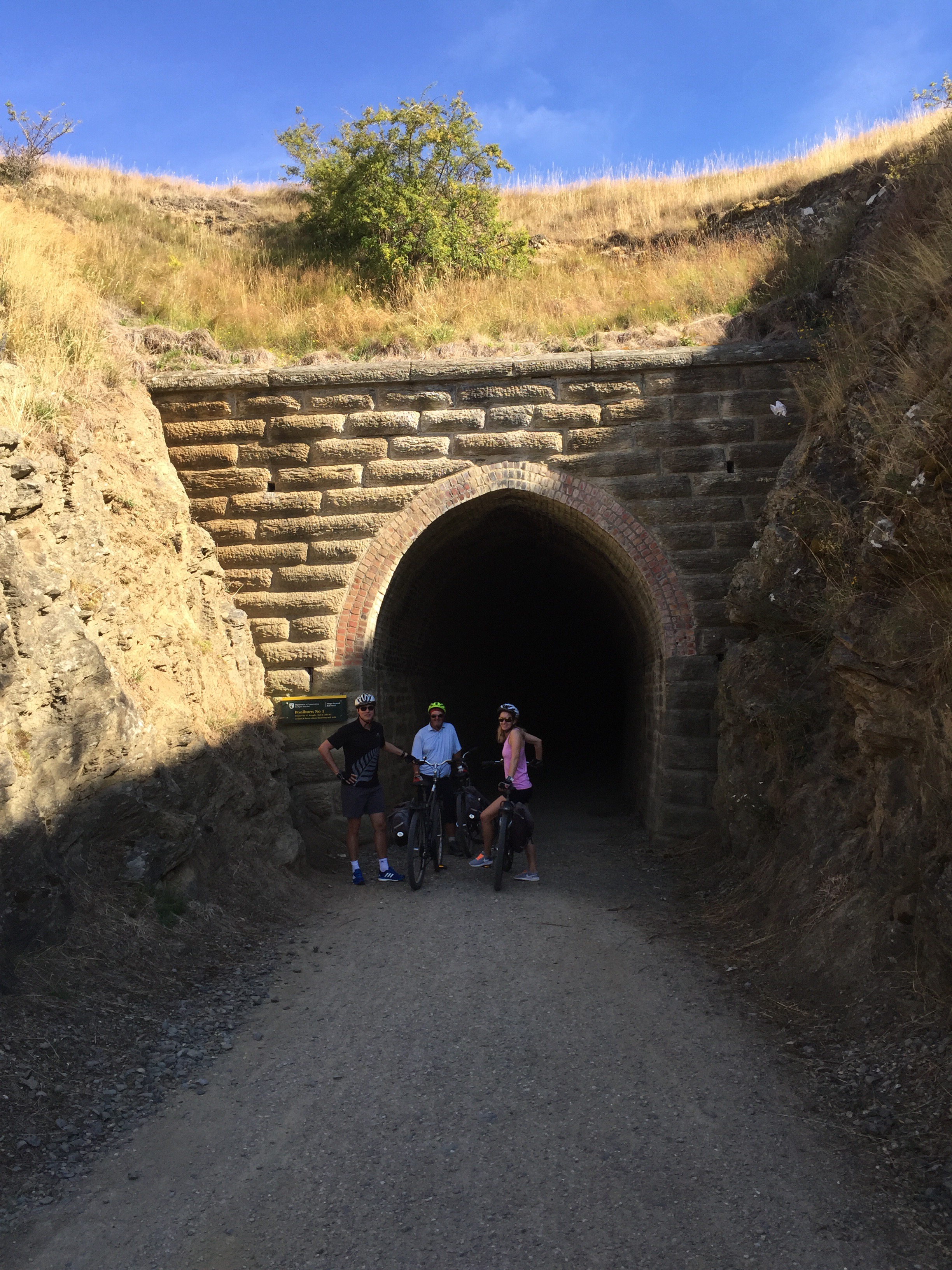

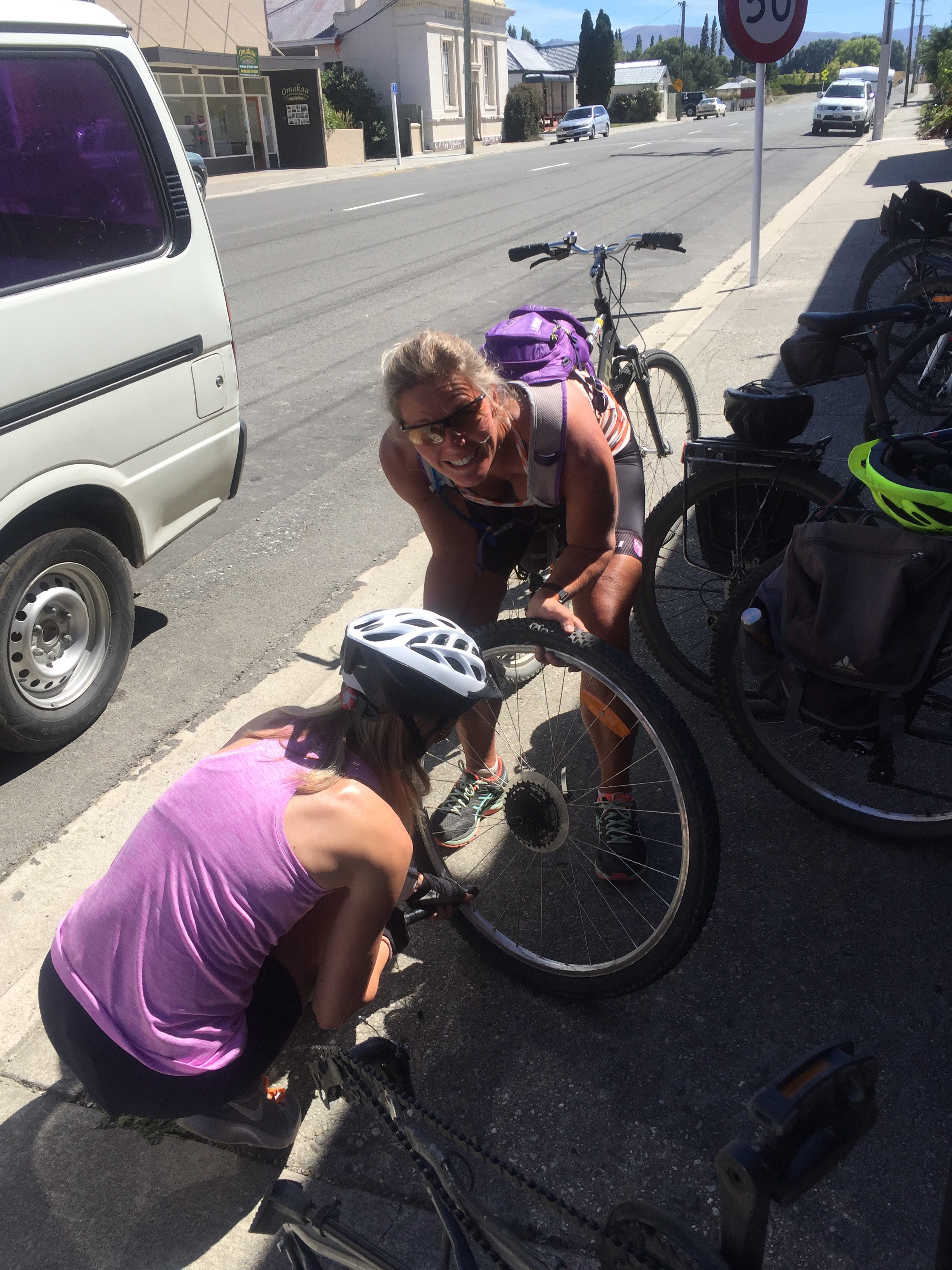
We stopped in Omakau for a coffee. When we went to get back on our bikes we discovered Elvis’s back tyre was as flat as a pancake. It was all a bit weird as we couldn’t find what had caused it. Anyway we replaced the tube and were back on our way. We took a side trip to Ophir which has the oldest continually running postal service in the country, open on weekdays from 9am till noon. We got there just before 1pm but the lady who runs the post office was still there. She told us if we were quick she would give us a tour so in we went and she locked the door behind us. Someone came and banged on the door but she ignored them – lucky us. They still hand frank the mail and have quite a lot of the original equipment. It is very cute.
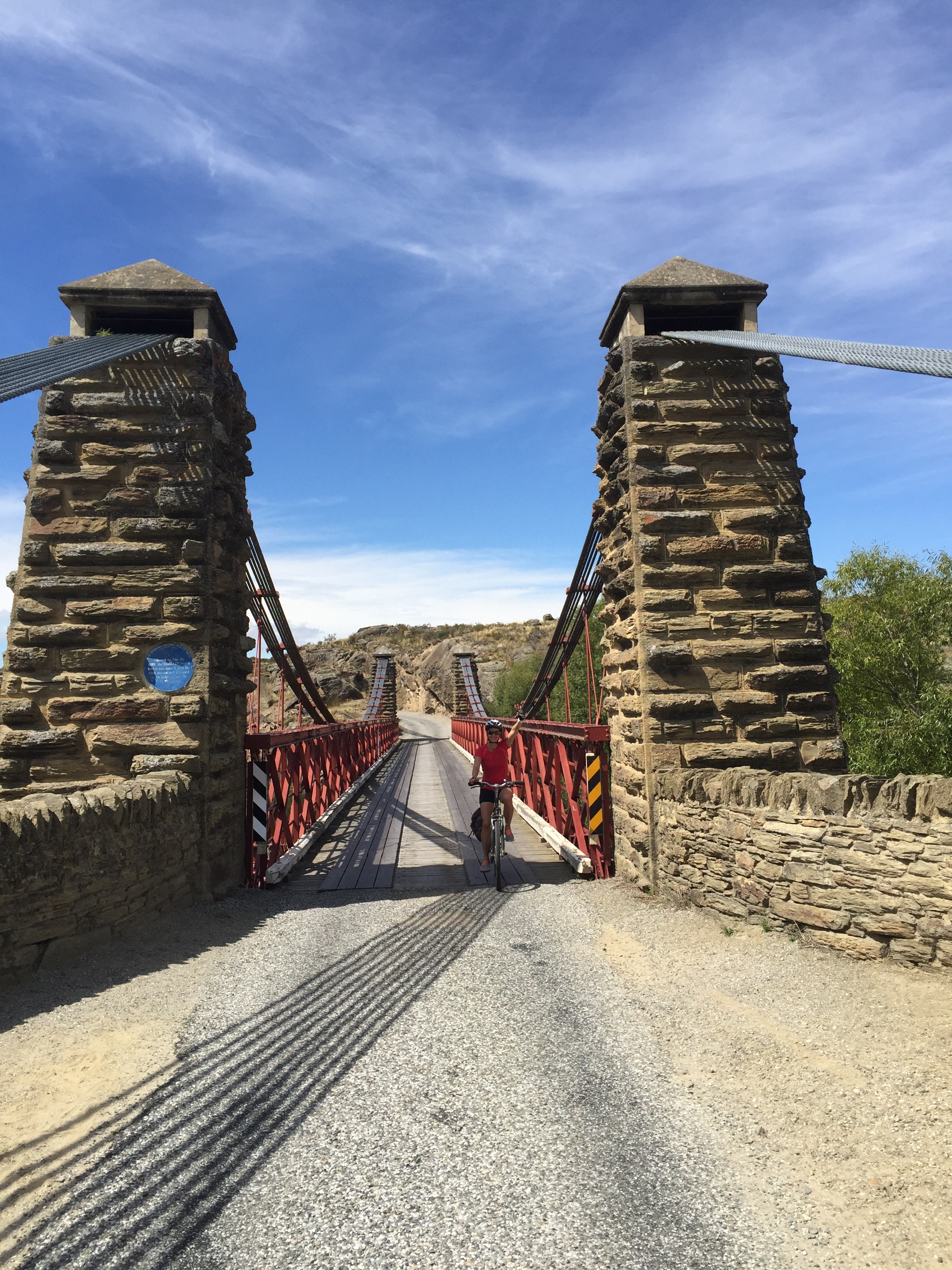
We then crossed the Manuherikia River across the 1880 Daniel O’Connell suspension bridge with its stone piers. Anchored in solid schist, the bridge is named after the 19th-century Irish nationalist – a reminder of the many Irish gold miners who came to the area.
We then had to ride on a the road for a little bit before we could re join the track and find Steve who had decided not to do the side trip to Ophir.
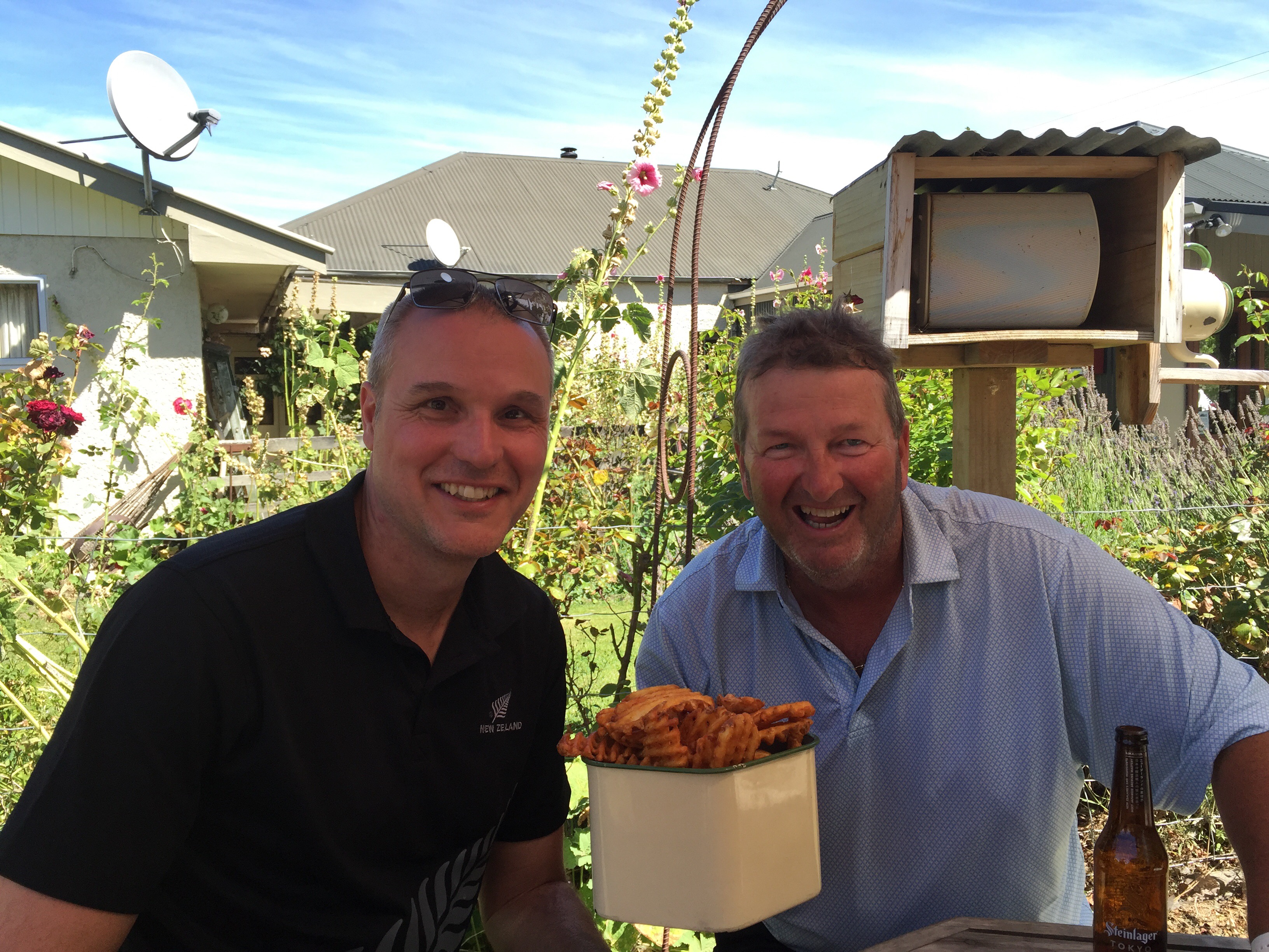
We stopped off at Chatto Creek for a drink and some waffle fries that the boys could not resist. It was a busy spot with lots of cyclists re hydrating on this warm day.
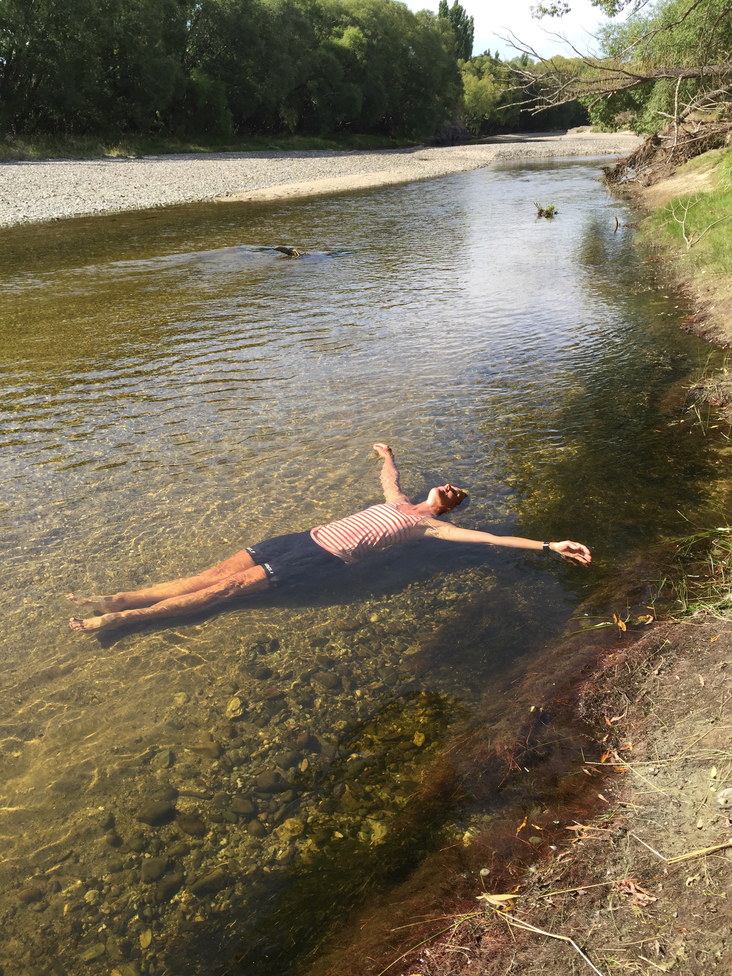
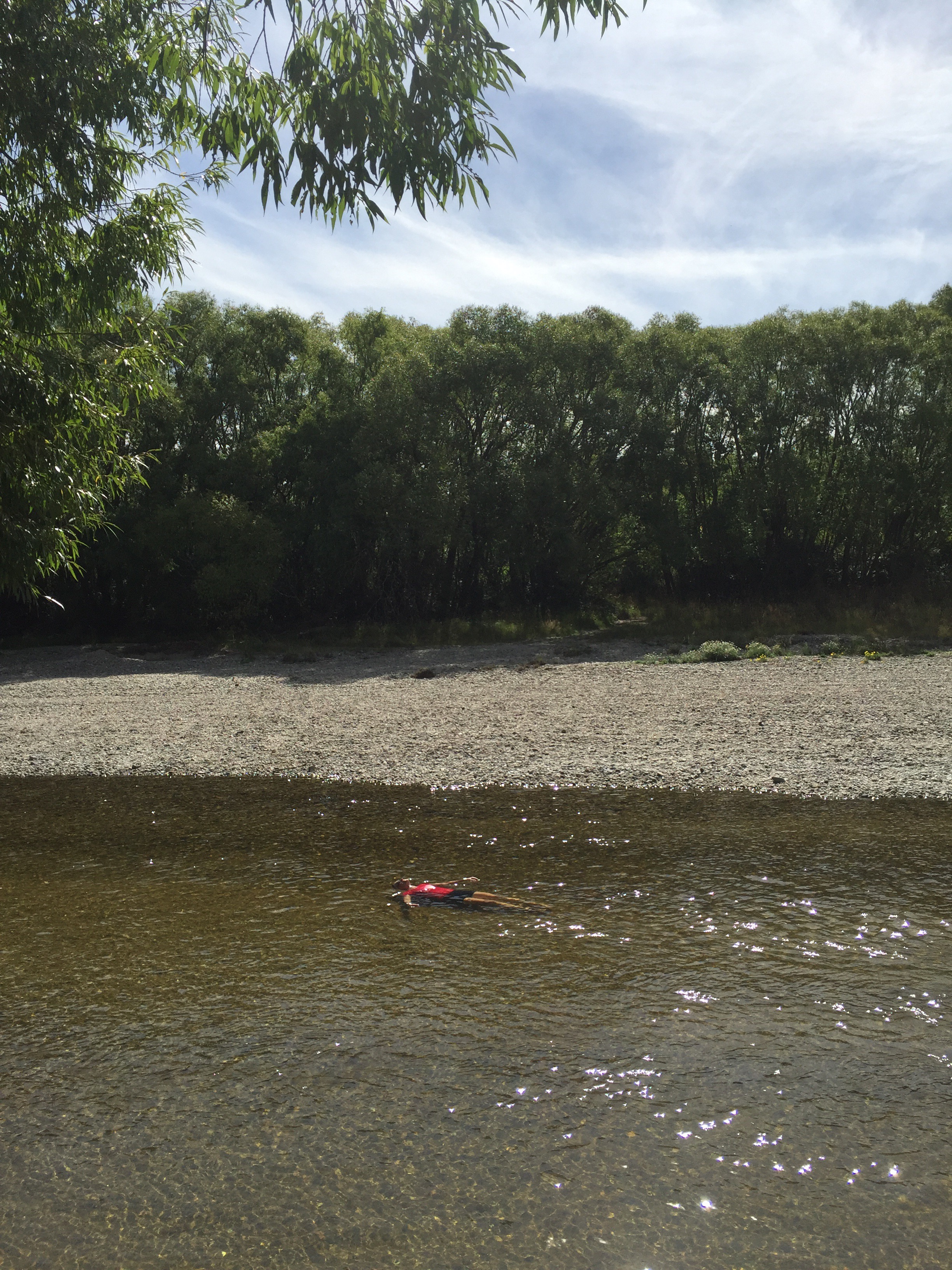
We had been looking for the perfect lunch spot down by the river but it never appeared so we ended up carrying on through to Alexandra and finding a spot by the river there. Karin & I went swimming and did a bit of floating down the river.
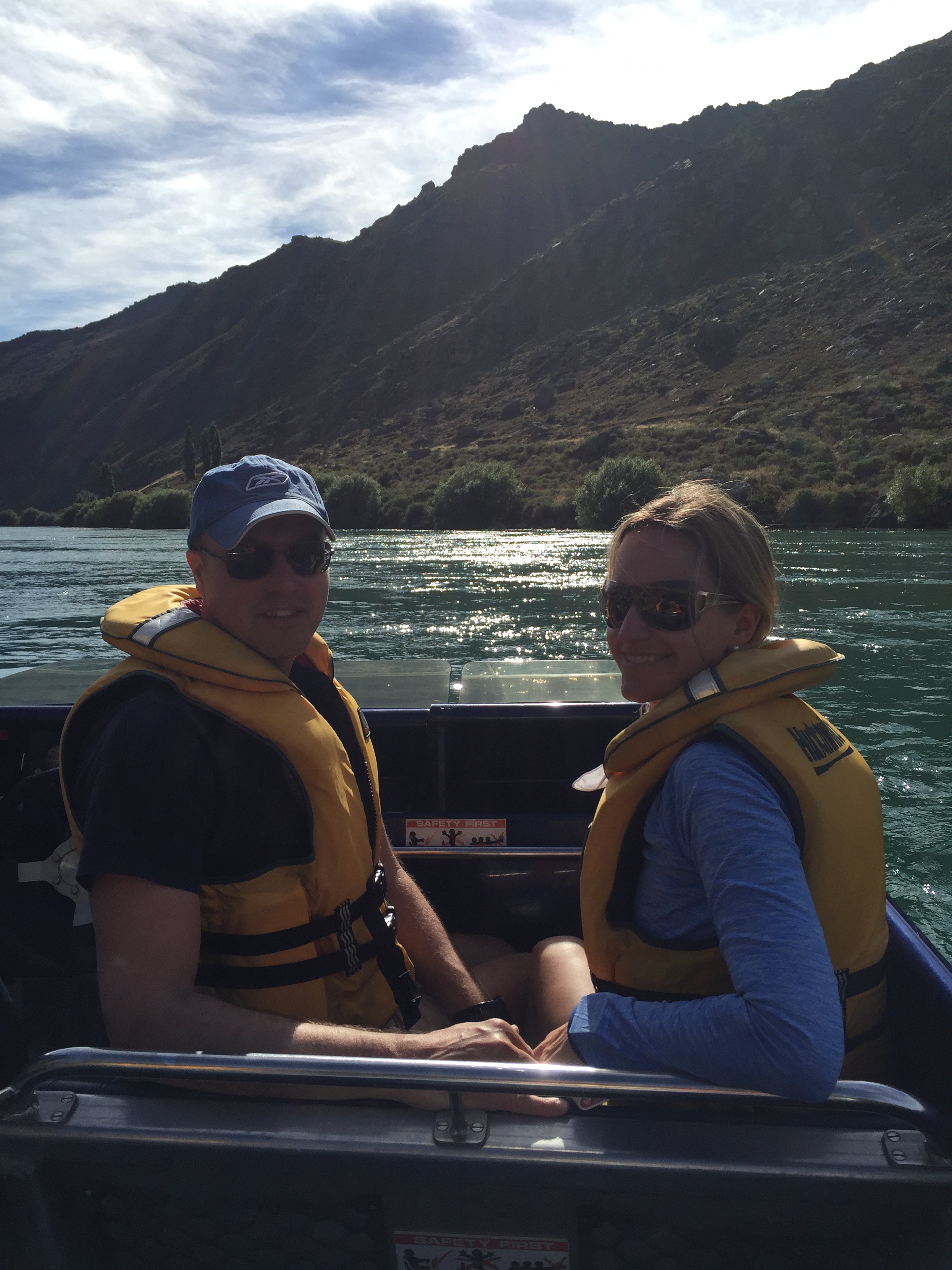
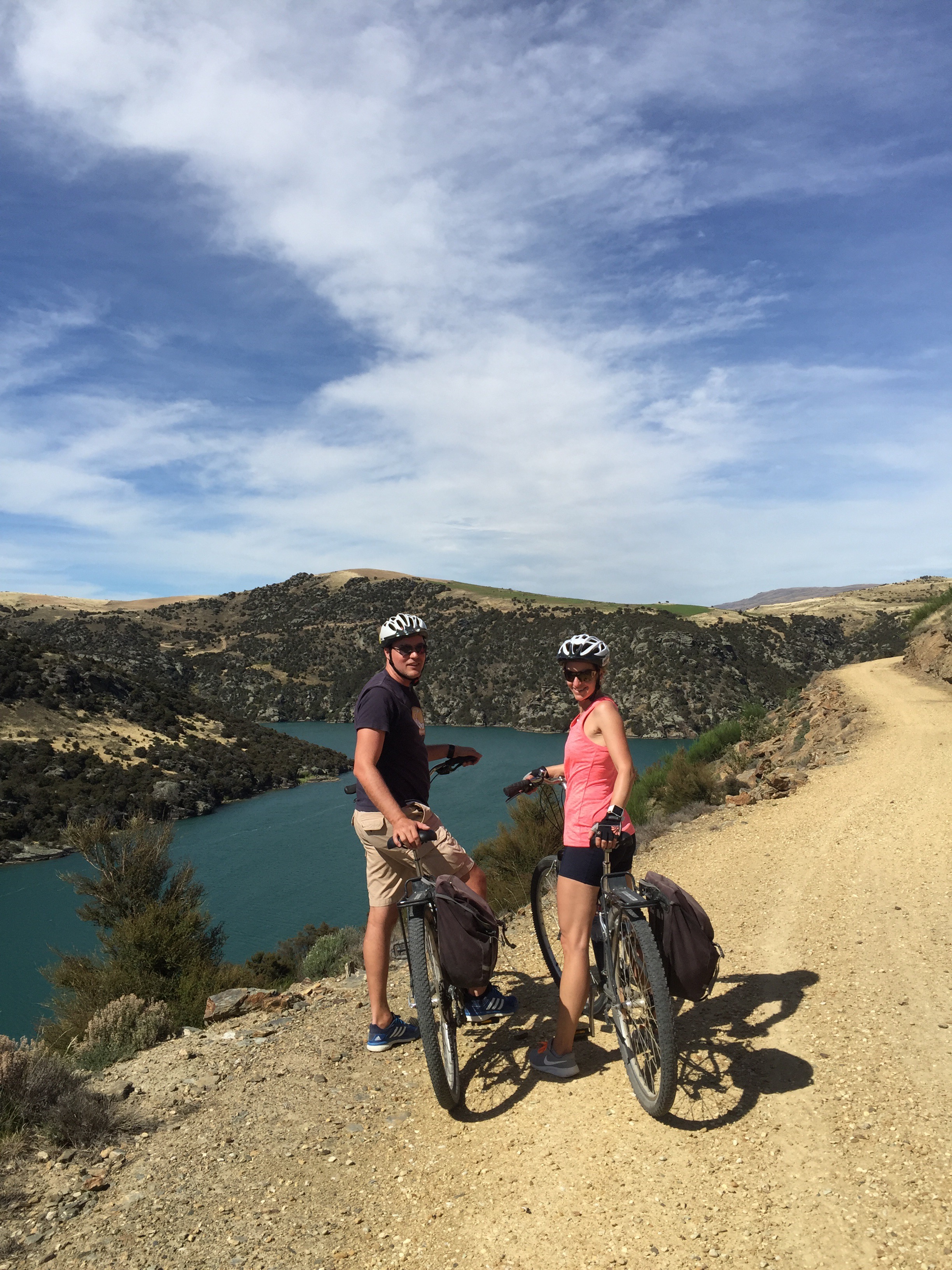
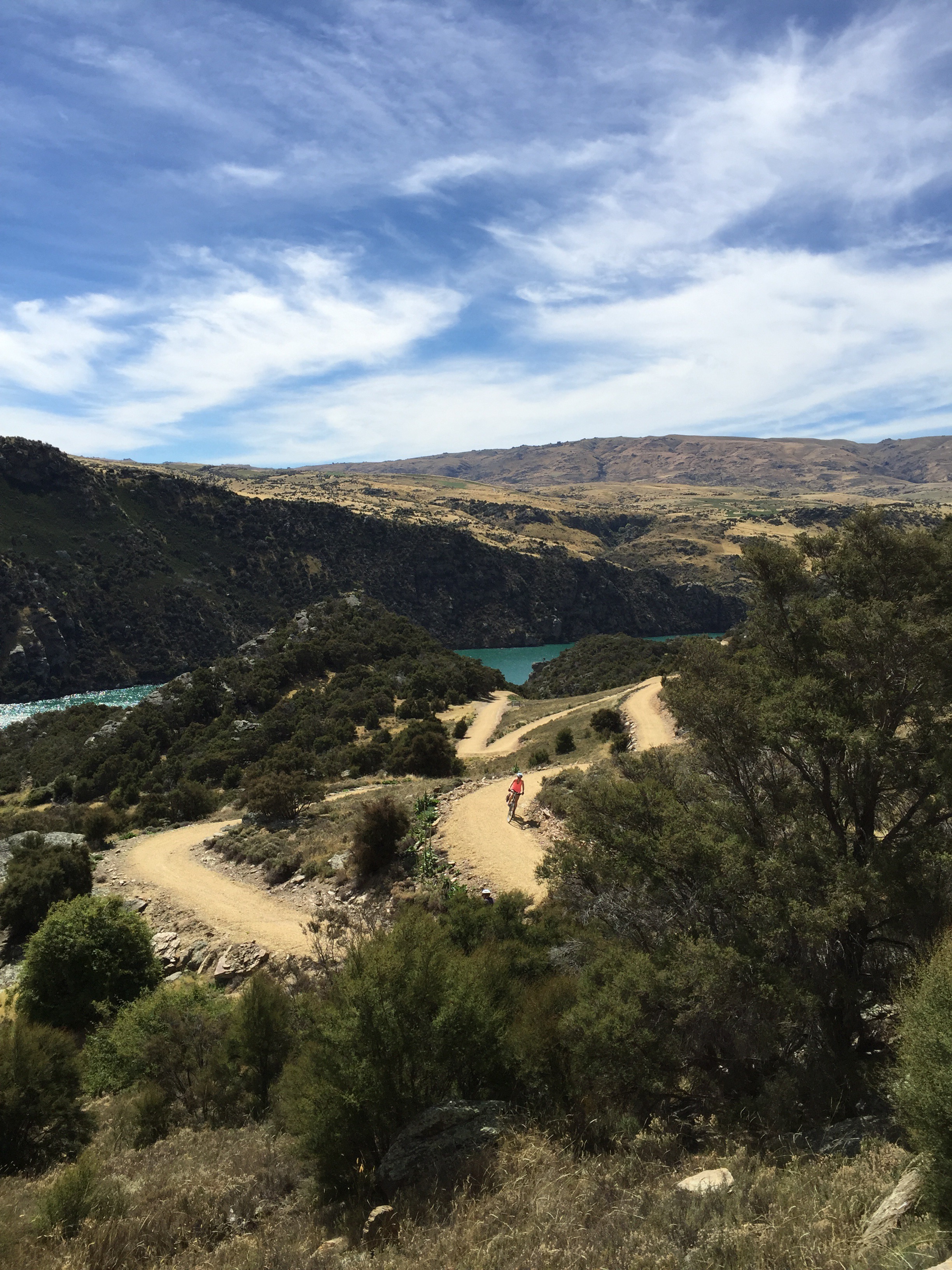
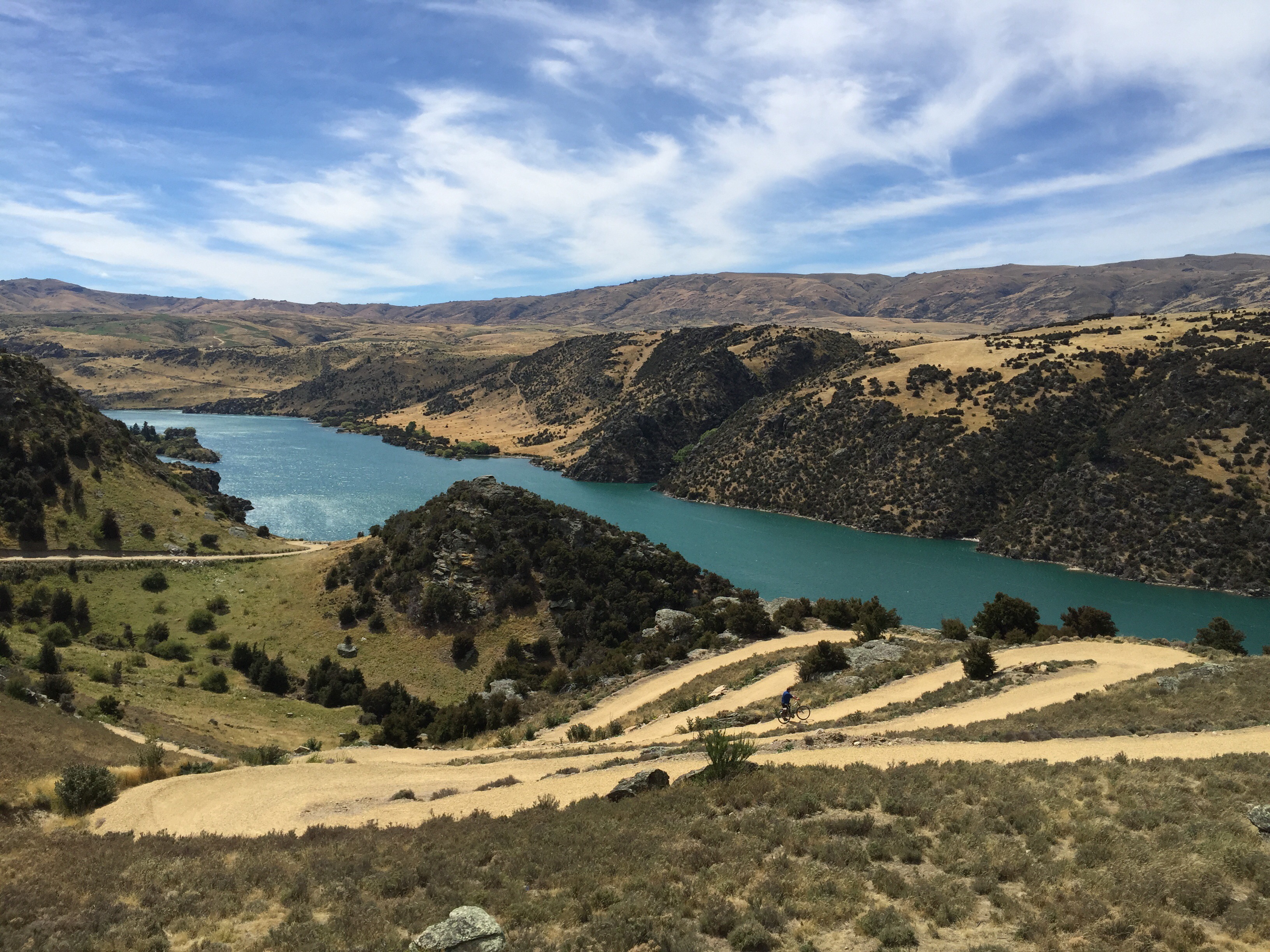
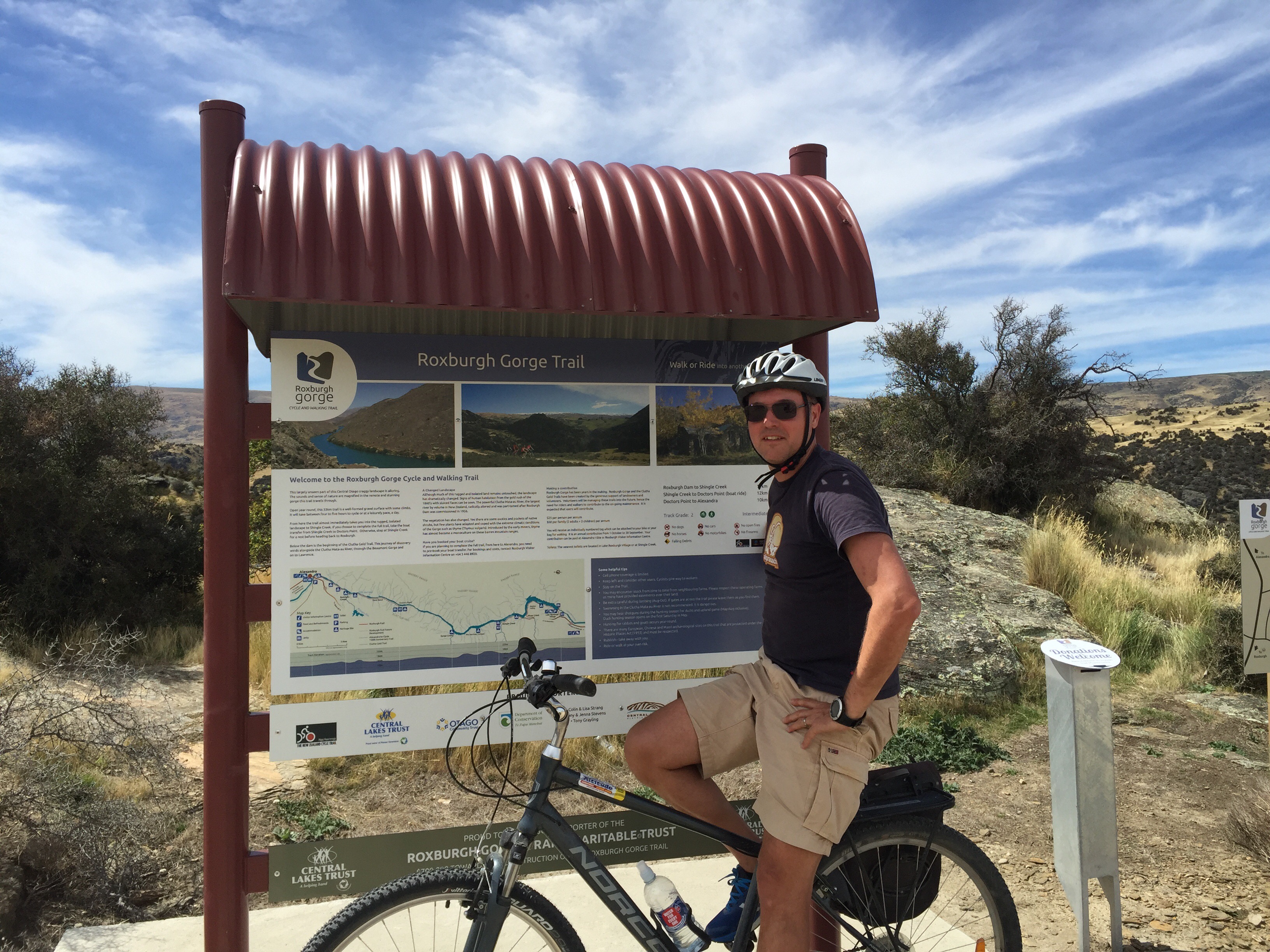
The next day we had more cycling planned – this time the Roxburgh Gorge Trail which is a 33km trail alongside the Clutha River. You cycle the first 11km before hoping on a jet boat for the next 12km before rejoining the trail for a further 22km of riding. The jet boat ride is necessary as the middle section of the trail is not accessible by bike. As part of the jet boat ride you get a commentary regarding the history from the jet boat driver who in our case was Dave. He was a born and bred local so had an in depth knowledge of the area. Karin & Elvis had never been in a jet boat before so Dave took special care of them and gave us a 360 degree thrill spin at the end.
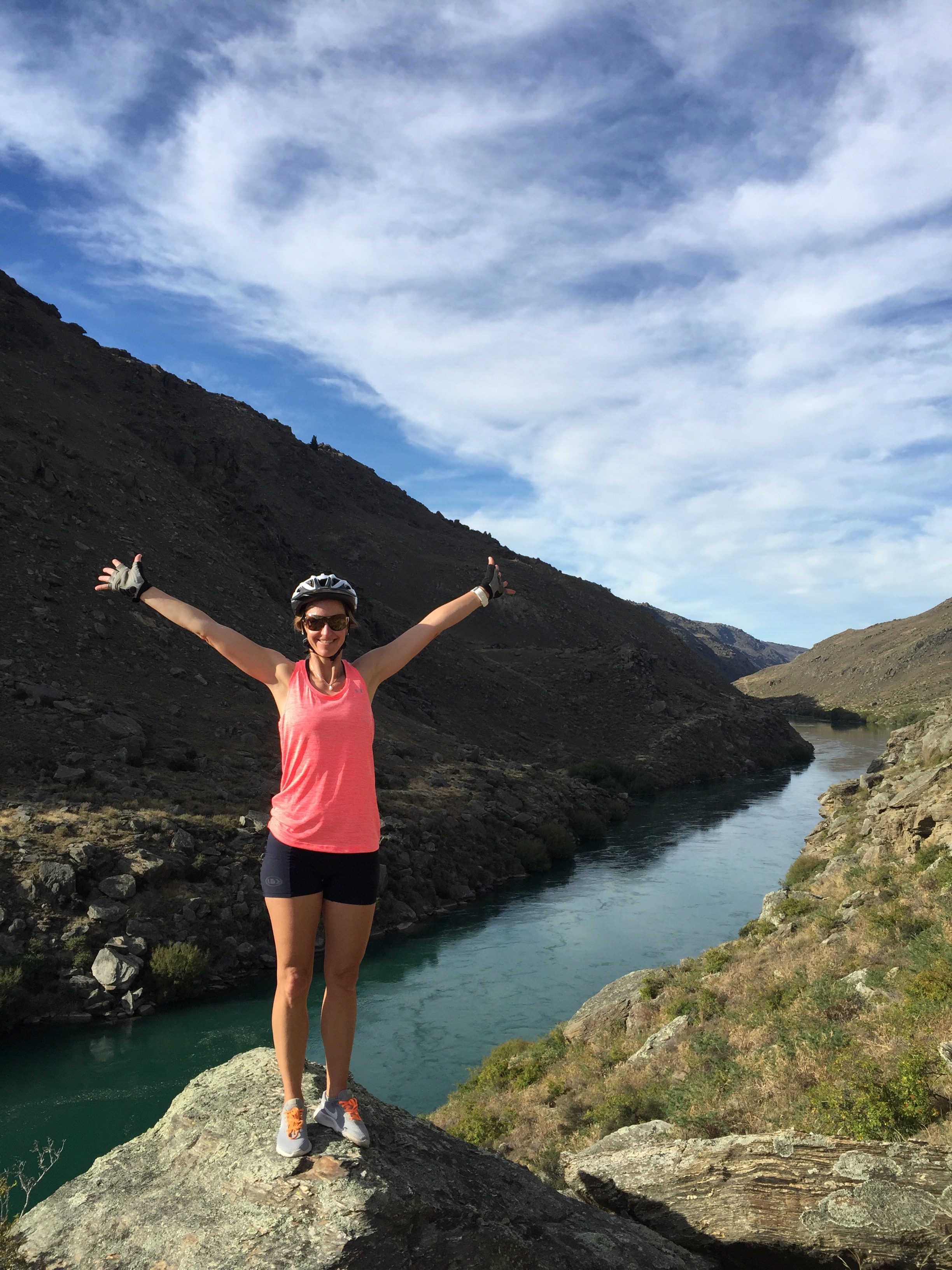
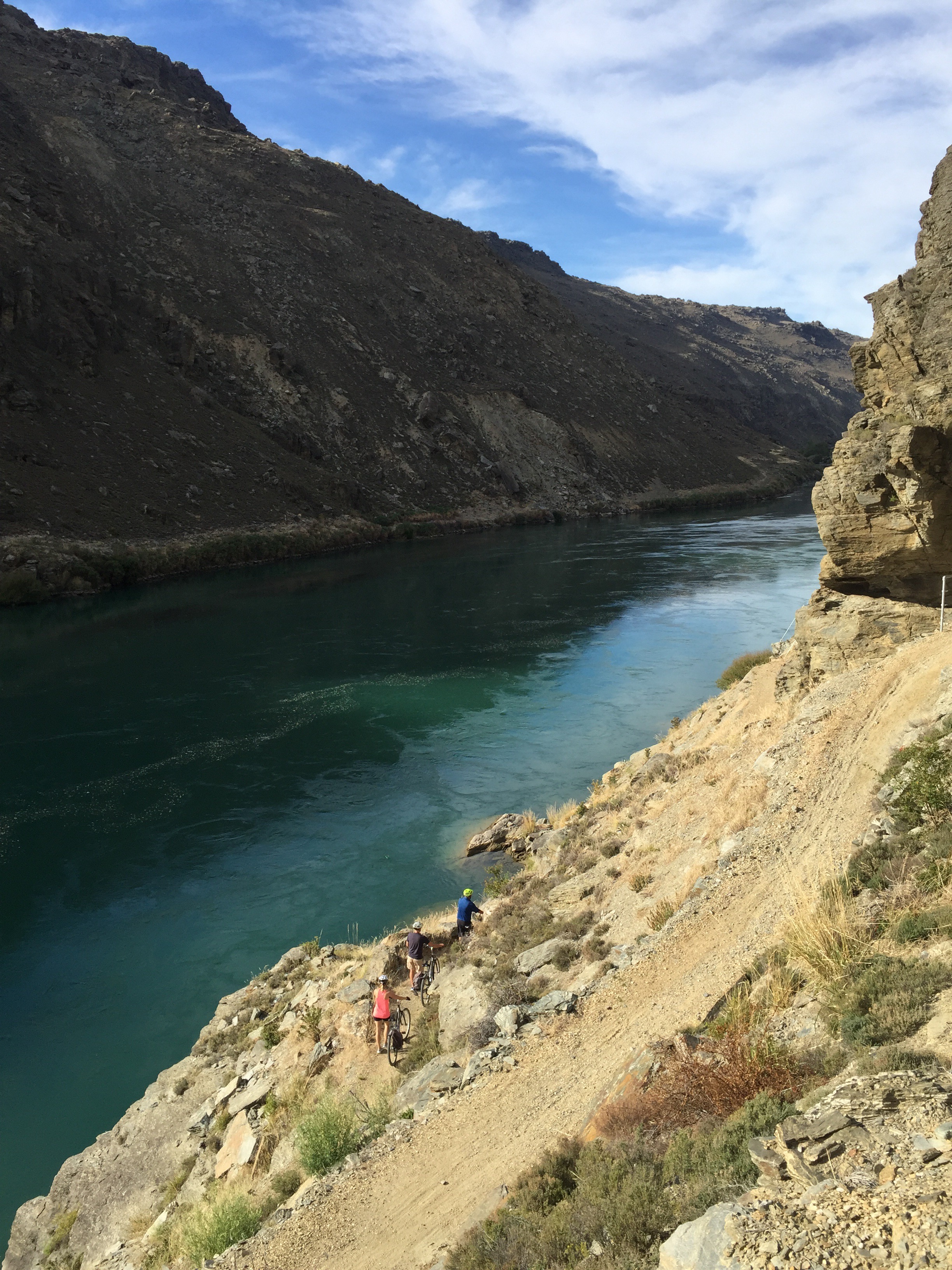
After getting off the jetboat at Shingle Creek we cycled another 11km to the Roxburgh Dam. Karin & I decided to check the water out but decided against a dip – it was rather chilly and the wind got up so it would have been a bit cold to cycle in wet clothes. We got to Roxburgh village about 2pm, just in time to enjoy a refreshing beverage at The Store before Phil turned up to drive us back to Alexandra. The cycling and views had been well worth it.
Wonders of the Roxburgh Gorge – source – http://www.mightyclutha.blogspot.co.nz
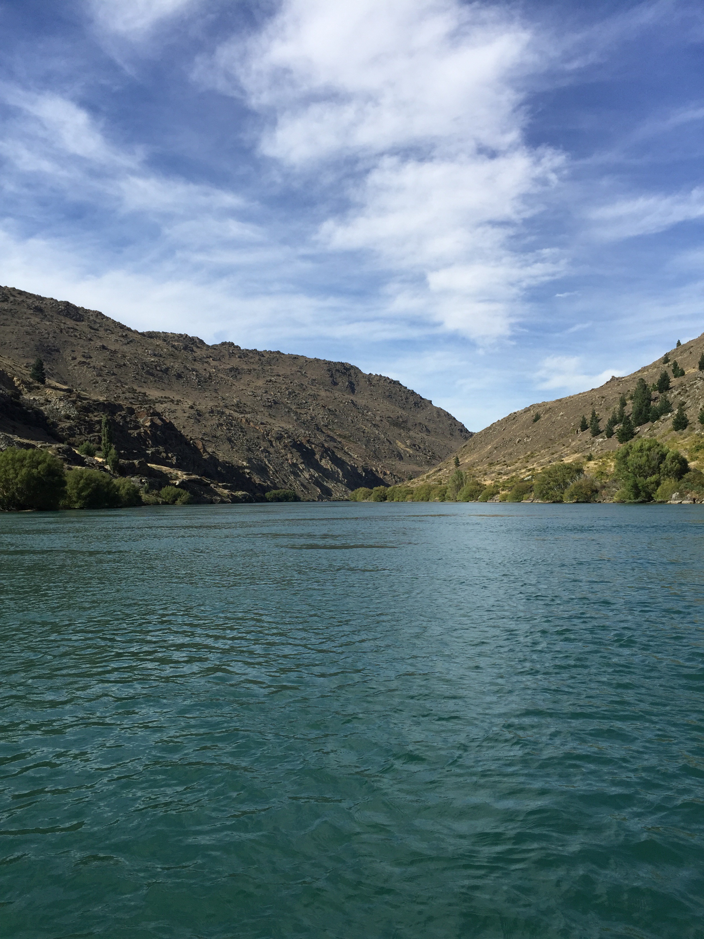
THE ‘Mighty Clutha’ forms the heart of one of the world’s most unique waterways. It traverses the dramatic semi-desert landscape of Central Otago, in the South Island of New Zealand, but the most spectacular river gorges, and much more, have been destroyed … by dams. This is the unofficial story of the Clutha Mata-Au River and its stolen treasures. It is a story steeped in bitterness, shame, destruction, and sadness.
Before the Roxburgh dam was commissioned in 1956, the 30 km Roxburgh Gorge was up to 400 metres deep, and so narrow that in places its towering walls rose vertically above the boiling waters of the Clutha Mata-Au. The river was so constricted that it flowed as swiftly as 40 kilometres an hour through narrow chutes hundreds of metres long. In other sections the current slowed – but not much, flowing over landslide obstructions that had at one time dammed the gorge, before being overtopped by massive rapids. Today’s sedate current bears no resemblance to the powerful torrent that once echoed through the gorge, drowning out the voices of men.
The first feature of the gorge, 675 metres below the Manuherikia confluence, was a constriction formed by schist bluffs on both sides that reduced the width to just 39 metres. This is now known as the “Italian Bend,” but the early gold-miners called this the “Gates of the Gorge.” Foot-tracks were etched precariously along the steep and boulder-tumbled walls of the gorge on both sides, as the miners hunted up gold and dug cave-like shelters under large slabs of fallen schist.
Just over five kilometres down the gorge from the “Gates,” and nearly two kilometres beyond Butcher’s Point, the true left wall of the gorge had long ago collapsed, blocking the river. The resulting over-topping waters had cut through the obstruction with unimaginable force, forming a torrential rapid that had over time, at its foot, scoured out a large, amphitheatre-like basin within high walls of unstable rock. This rapid, descending through a narrow chasm, was known as the “Golden Falls.” It filled the “Narrows” with a crashing din so loud that shouting men could not hear each other. In the centre of this basin below the rapid, the deeply driving waters had pushed up a shingle island. Hence, the name “Island Basin.” The Golden Falls and Island Basin were astonishing features in a remarkably dramatic location.
Beyond Island Basin at Doctor’s Point, two powerful rapids known as Doctor’s Falls No 1 & 2 dropped through a boulder strewn constriction below a maze of gold workings, stone cottages and cave shelters etched into the true-left side of the gorge.
Nearly two kilometres below Doctor’s Point, the river again met a sudden obstruction. A huge schist slab had slid down from the true left into the river, against which river-borne shingle and boulders had jammed up, creating a rapid so tumultuous that the gold-miners called it the Molyneux Falls. Here was a ferocious whitewater descent, tumbling violently some four-metres down a twenty-metre section of boulders, at breathtaking speed. At normal or low flow, these falls were deadly. In high flow they were somewhat washed out, but still incredibly swift.
The gold-miners, dreaming of lowering the river above the falls to expose gold, tried several times to blast the huge thirty by twelve metre schist slab that lay at the head of the Molyneux Falls. But time and again the slab didn’t move. Drilling and blasting merely succeeded in cracking the slab, so that it settled into place even more.
Further down the gorge, other rapids also raced through narrow chutes, until finally, at the southern end of the gorge, after boiling through massive eddies near McKenzie’s Beach, the current eased slightly as it passed another bluff at Coal Creek – a site selected for the construction of the Roxburgh dam in 1947.
It is worth remembering that the wonderful features of the old Roxburgh Gorge were never physically destroyed prior to the filling of the Roxburgh reservoir. They were flooded, and now lie mothballed in silt. Given the limited lifespan of the ageing Roxburgh dam, and the silting, flooding and instability issues of the gorge, there is an ever-growing case for dam decommissioning and gorge restoration.
Inevitably, some time in the future, the largest high volume rapids in New Zealand – the once thunderous Golden and Molyneux Falls, will be re-born. Gradually, decades of trapped sediment will be stripped away, and the long-hidden wonders of the Roxburgh Gorge will be revealed.
Phil dropped us back to our Jucy car in Alexandra and we set off for Wanaka – the final destination on our South Island sojourn with Karin & Elvis. We stopped in Cromwell to get some fresh fruit and not long after leaving there the Jucy car broke down! Luckily Steve had got it mostly off the road although a policeman stopped to see if we were OK and advised that we didn’t actually just in the car incase someone hit us. Karin thoughfully tied Steve’s fluro jacket to a road marker which alerted the cars travelling at 100kms per hour that we were up ahead. Steve had called Jucy and the AA and they were going to be there within the hour so we sat on the side of the road and read our books.
More than an hour passed and there was no sign of the AA. Steve was just calling them when a young guy stopped up ahead and reversed back. He asked if we were OK and did we want a lift to Wanaka. Karin, Elvis and I decided to hitch a ride to Wanaka. Steve stayed with the car. He was a nice young guy who had only just shifted to Wanaka and was working as an apprentice builder. He dropped us at the accomodation. Meanwhile Steve had been towed back to Cromwell to get a new battery which they didn’t end up having in stock. They did some work around so he could at least drive to Wanaka. They would then bring a new vehicle over the next day.
They told him to turn the radio off as well as the air conditioning etc… – the less things draining the battery the better. He made it to just around the corner from the accomodation when the car died again – apparently it was Karin & I’s fault as we had left the air conditioning going full blast in the back seat and he hadn’t heard that it was on! Who was to know : 0
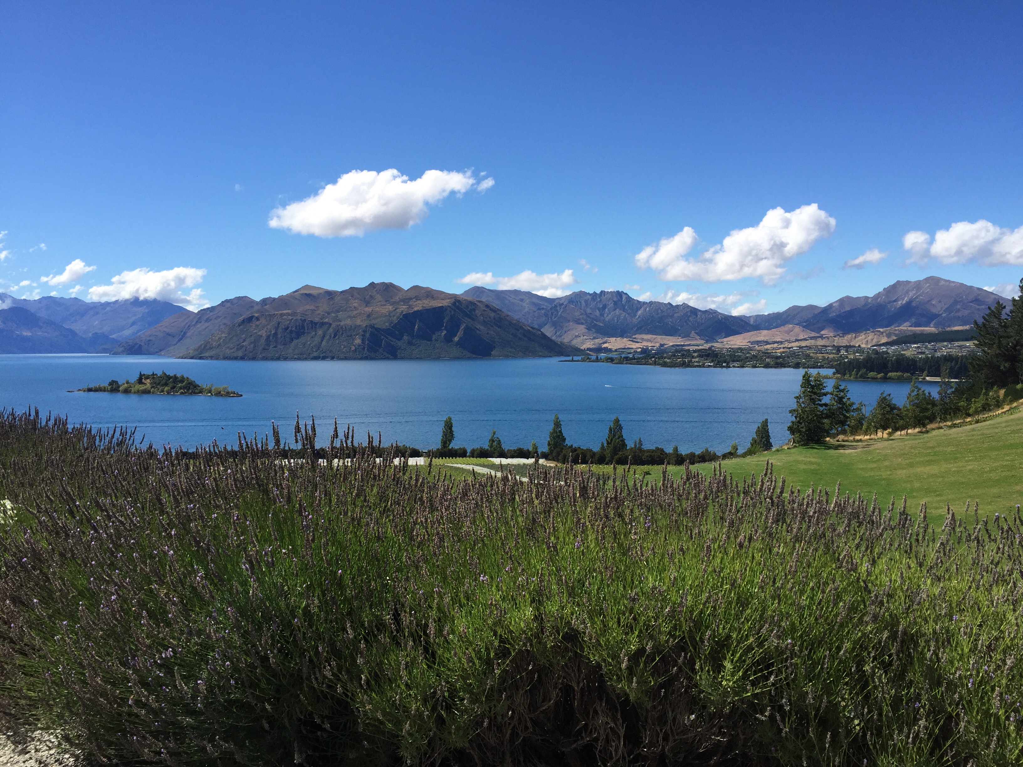
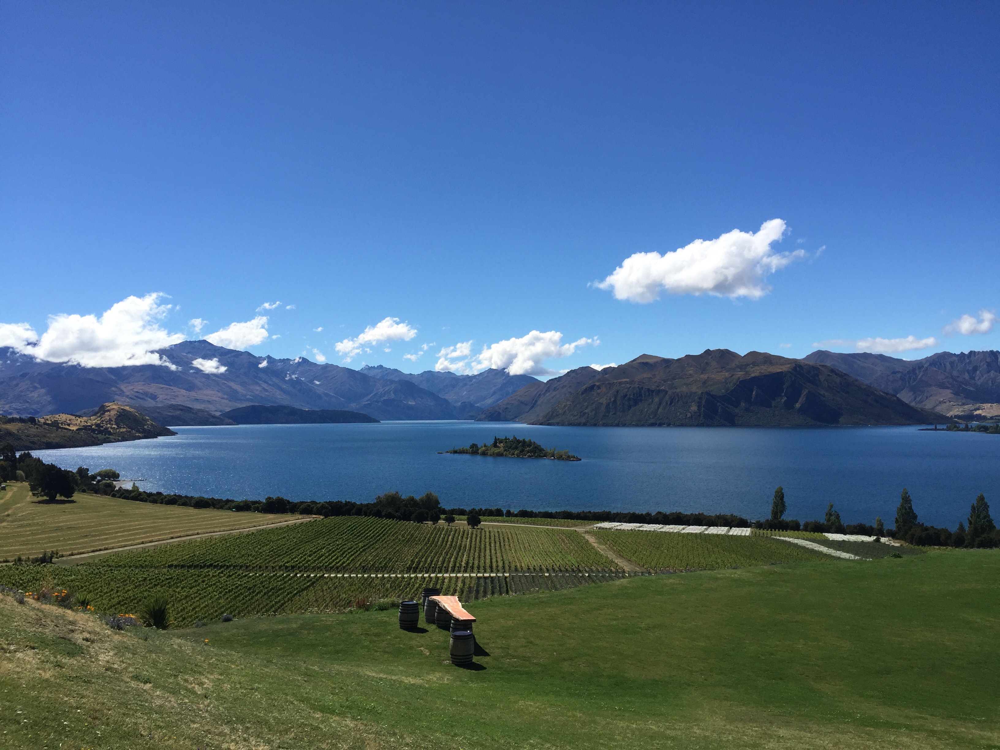
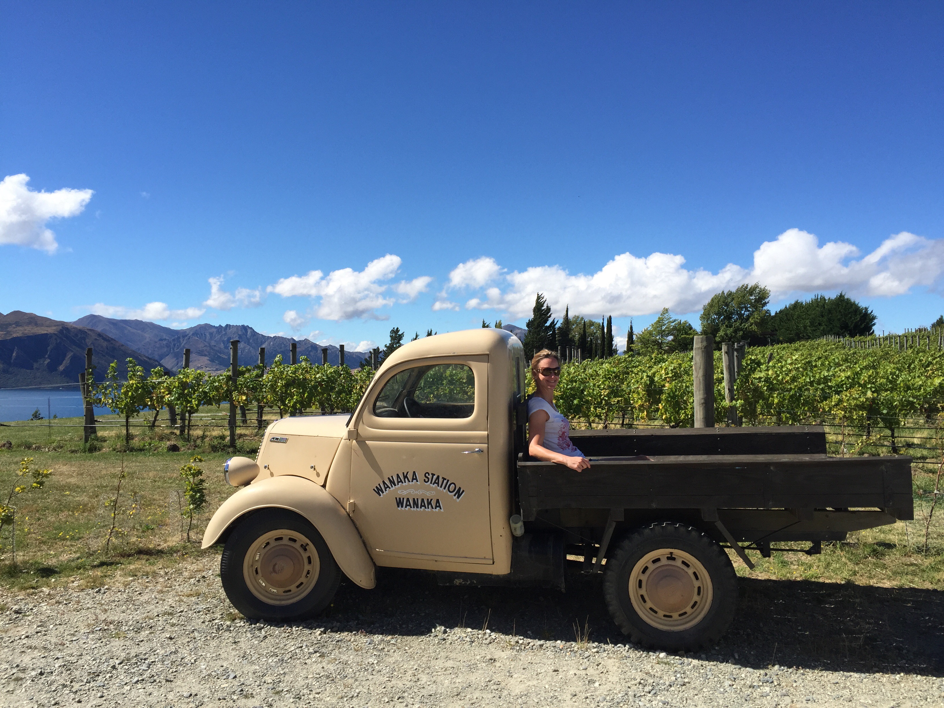
It actually rained until about 11am the next morning so we had a lazy morning – much needed after all our activities and excitement. The sun came out in the afternoon so we went to Rippon winery and did a tasting. We had been here before but had never done a proper tasting – it was really interesting and good to learn about the land and the people that make Rippon what it is today.
Land
Light – Central Otago: the only continental climate in New Zealand viticulture with high ultra violet light, long sunshine hours and highly refractive soils.
Air – Wanaka: A more temperate climate relative to the rest of Central Otago due to its close proximity to the dividing mountains of the Southern Alps.
Water – Lake Wanaka: the temperance of this large thermal mass, coupled with the protective nature of Ruby Island further softens Rippon’s microclimate.
Earth – Schist: the metamorphic mother rock, rich in foliated mica and quartzite is deposited as glacial moraines, coarse-altered gravels, ancient lake-bed clays and wind-blown loess.
People
In 1975, Rolfe Mills,the third generation of his family on the farm, started to plant a series of experimental rows of Vitis vinifera.
In 1982 Rolfe and his wife Lois planted the first block of vines with the express interest of growing high quality wine and released their first commercial vintage in 1989. The land continues to be farmed by the Mills family, together with a dedicated long term staff.
As winegrowers, the team’s principal commitment is to the soil. Nurturing a healthy, responsive medium underfoot binds the vines and the people to their land.
Biodynamic farming and no irrigation help the vine drive energy into its seed and issue raw material that is capable of fostering wines that are true to their place.
For over 30 years, through careful observation and selection the varieties and the individual vines that were proven to be most suited to the site were planted, parcel by parcel, on the farm’s most favourable slopes. The greater majority of Rippon’s vines today remain on their own roots.
They produce a wine called Osteiner, a variety born of Riesling and Sylvaner. This grape is only grown at Rippon and in another small holding in Germany so is very unique. I really liked the wine so got a bottle to put in the cellar. When we got home we discovered we also had a bottle of the 2008 Osteiner so we must have liked it on a previous visit too : )
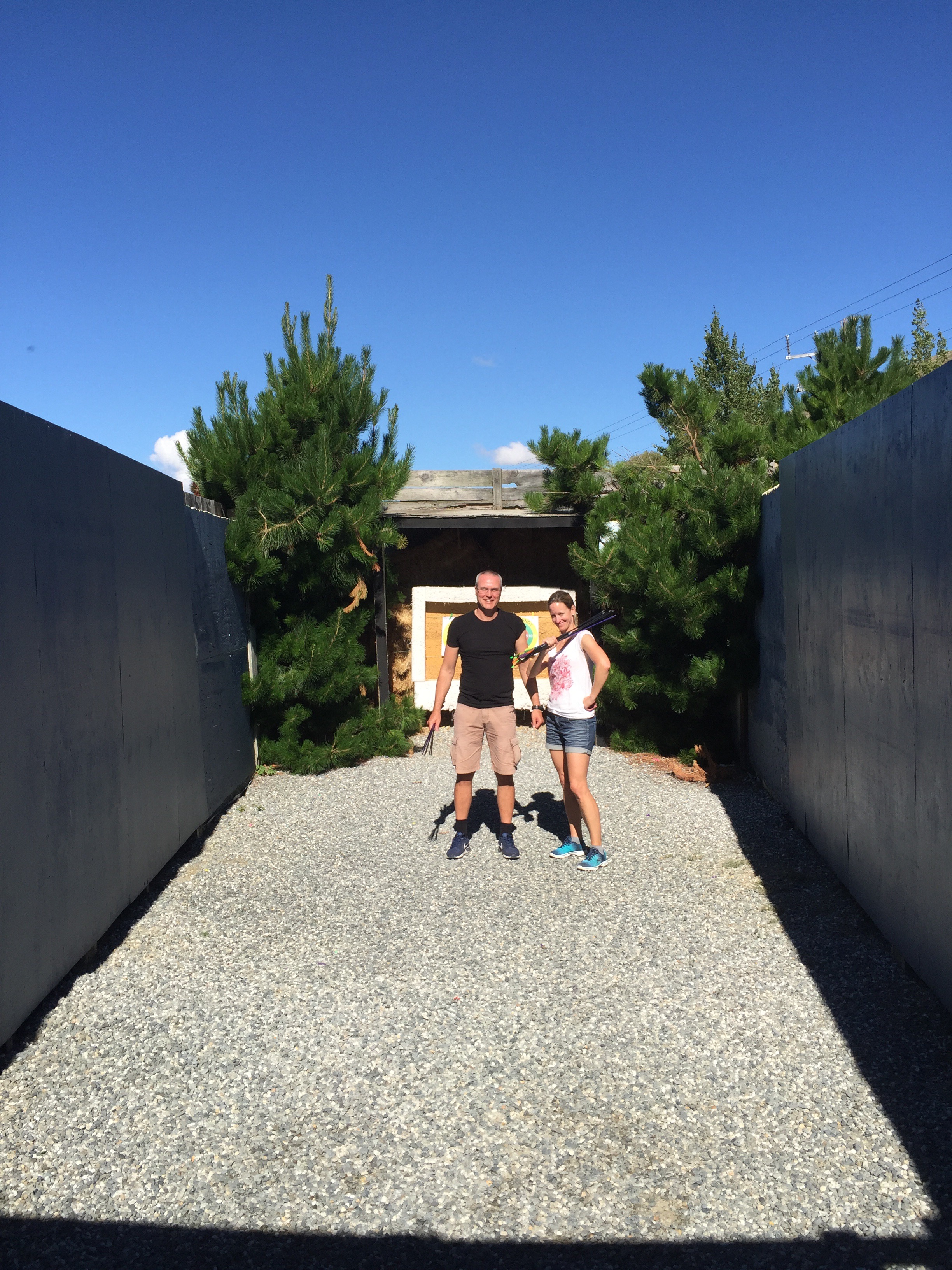
Next stop was the driving range for the now Golf obsessed Swissies : ). They also had an archery set up there so they also gave that a go. Turns out Karin is a bit of a dead eyed dick with the old bow and arrow!
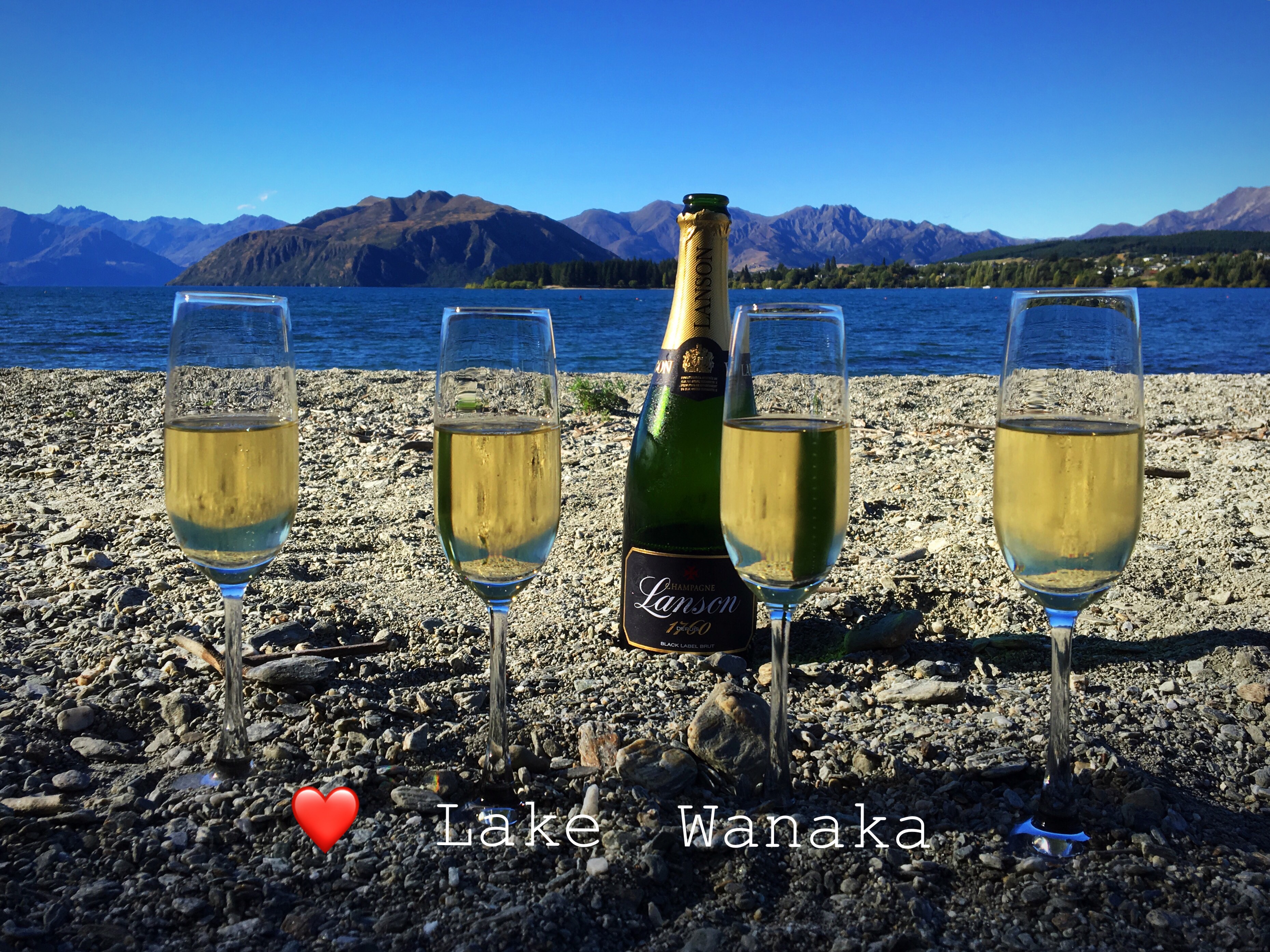
That evening we enjoyed a bottle of champagne down on the shoes of the beautiful Lake Wanaka.
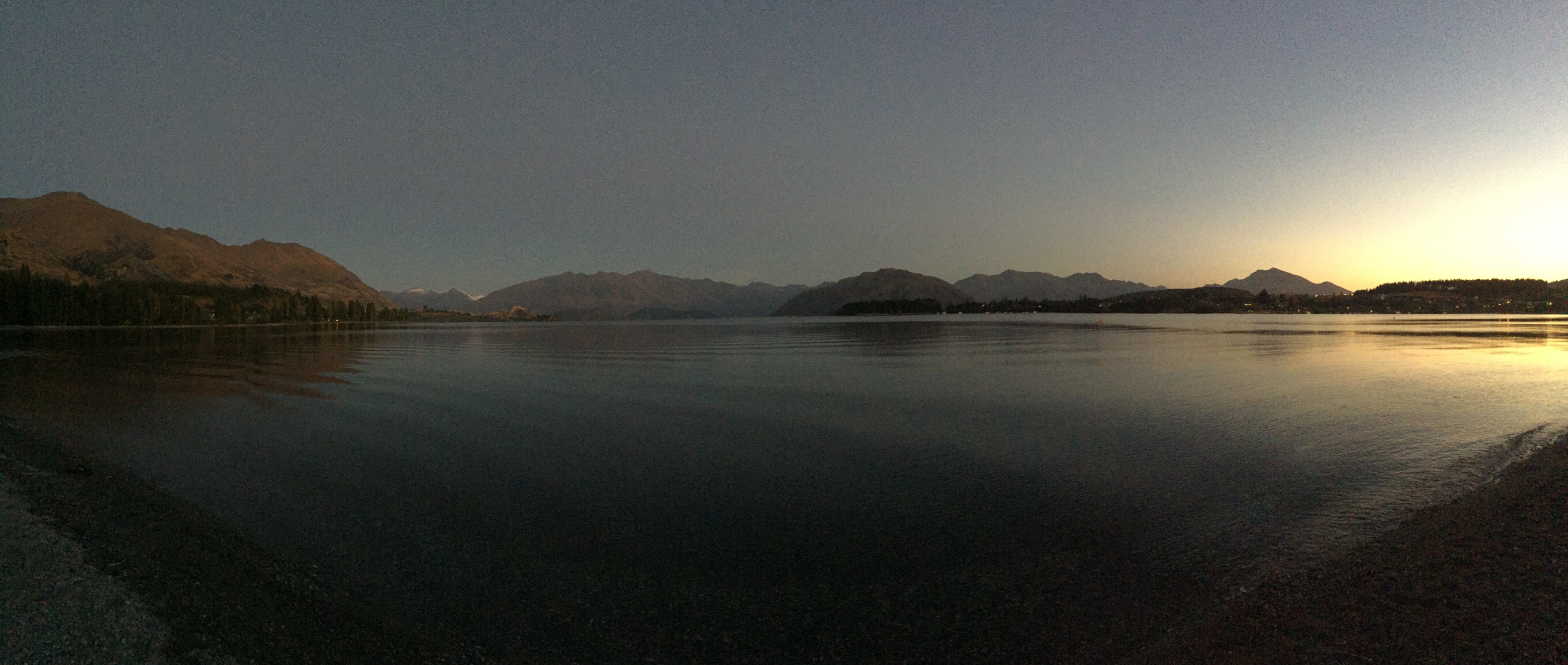
The next morning at sunrise the lake was just as beautiful.
On the Thursday it was time for Steve and I to head back to the Hawke’s Bay for the weekend. We drove over the Crown Range Road where a bronze plaque at the vista point claims that this historic summit, at 1076 m (3530 ft) is the highest sealed road in New Zealand, which is not correct. The Crown Saddle is however the highest sealed pass (2m higher than the Desert Road summit on State Highway 1 in the North Island). Karin & Elvis continued onto visit Milford Sound and Invercargill before returning to Dunedin to fly to Auckland.
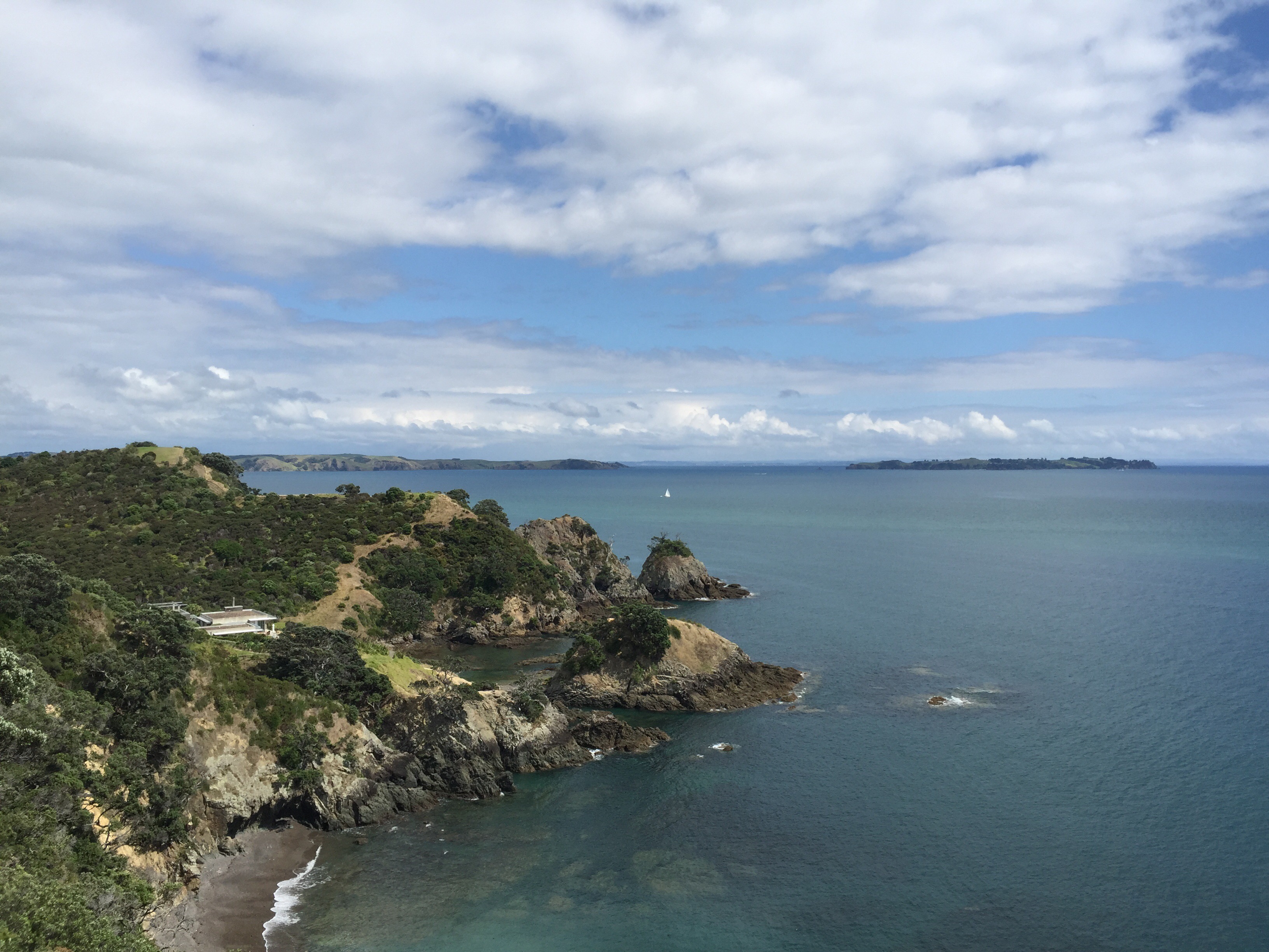
Steve and I then drove to Auckland on the Monday to meet Karin & Elvis off the plane – we were Waiheke Island bound. The sun was shining and we enjoyed the ferry ride over to the island.
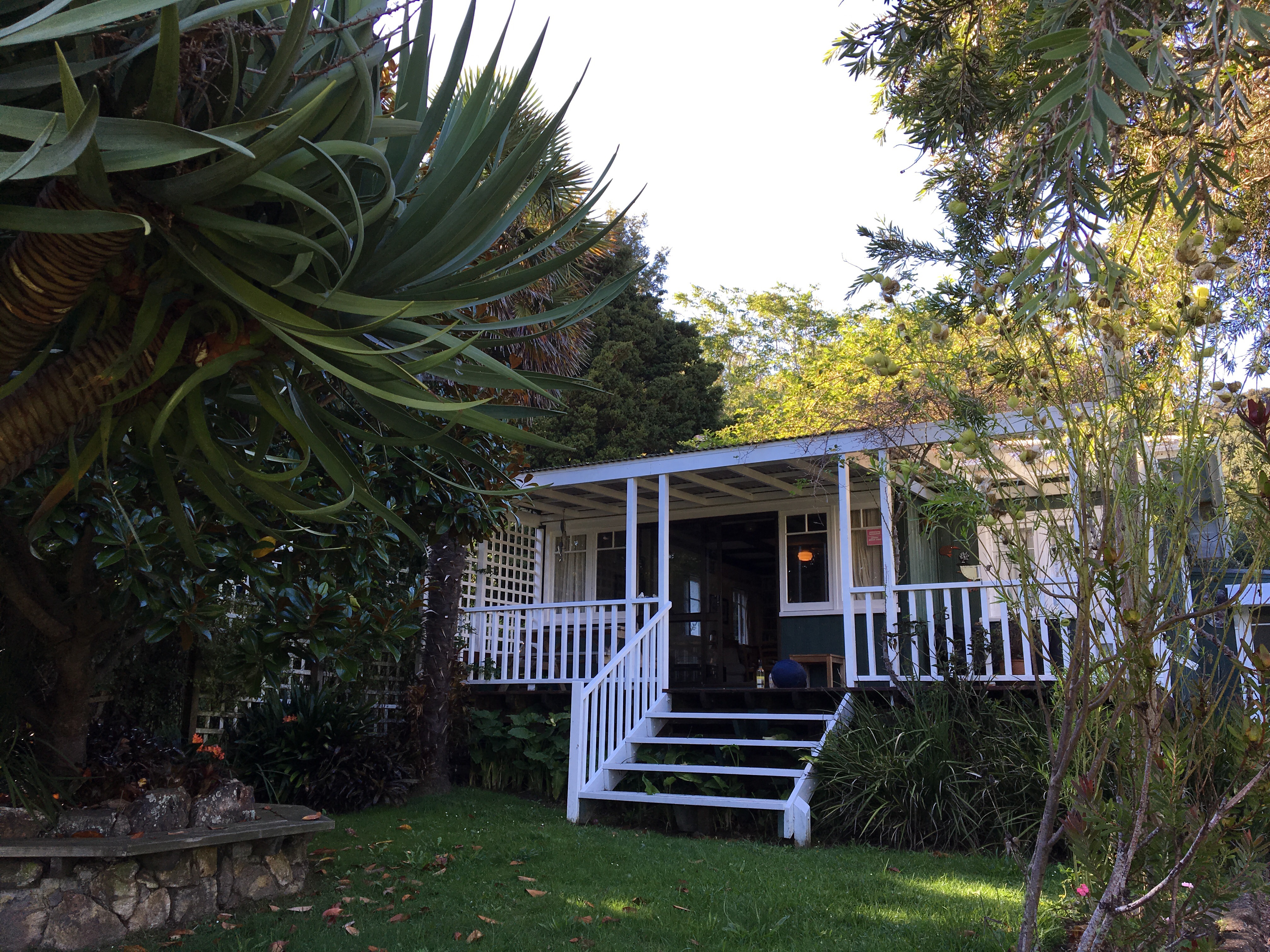
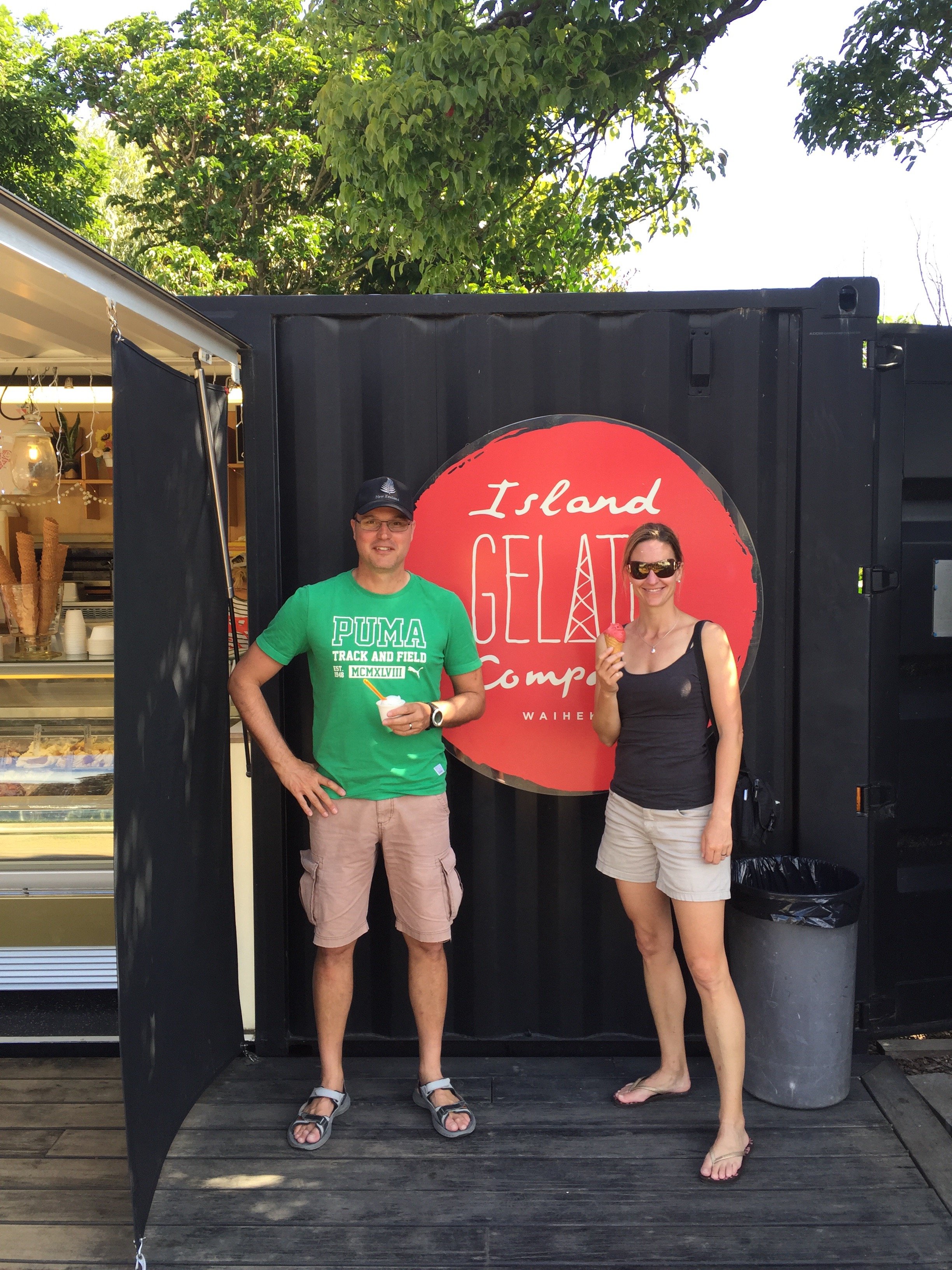
We had three nights on the island staying at the cute Glasen Cottage which is owned by our friends parents. We explored Oneroa and discovered the Gelato shop – it was so good. We all said that had to go our list of daily to-do’s 🙂
The next day we did the coastal walk from Matiatia to Oneroa – it was a little overcast and humid. We had a swim at Onetangi Beach after lunch before heading for the Waiheke Island golf club where Karin & Elvis played their first nine holes on a proper golf course. Steve was the swing coach and I was the ettiquite advisor. They did well and wanted to come back for more the next day.
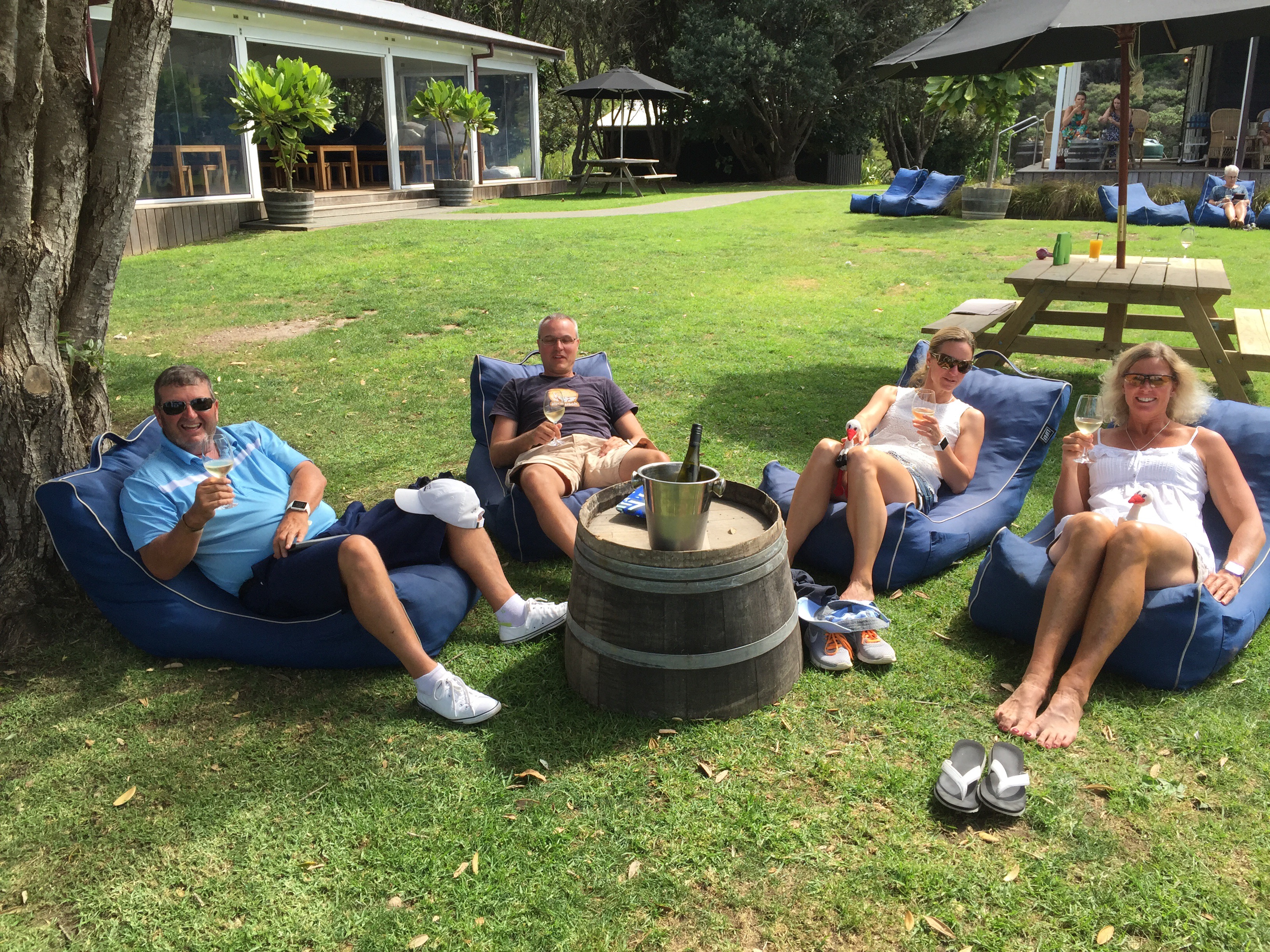
We got up early on the Wednesday and played another nine holes. We then went to Casita Miro for a tapas style lunch before venturing around to Man O War Bay to lounge in the sun at the vineyard there. Waiheke really does feel like a tropical island.
We finished the day with another visit to the Gelato shop : )
Unfortunately all good things must come to an end. On Thursday we headed back to Auckland where we had to say goodbye to our friends. We had a blast showcasing New Zealand to them and miss them. Switzerland and New Zealand, although similar landscape wise, couldn’t be further apart!
Pinot also had to say goodbye to Riesling – we’re all hoping to be reunited again in 2018.
The title of this blog “Making New Zealand Great Again” came about because Elvis and Karin introduced us to the You Tube clips where various countries prepared introduction videos about their countries for the incoming US President – Donald Trump. For President Trump, one country and one country only is first – America. These funny videos are begging for their countries to be second. When Karin & Elvis farewelled us at the airport they said “thanks for making New Zealand great again”. Just as I am sure the Americans are thanking President Trump for making America great again : )

Very exciting blog……best so far. Not too much golf….
And I even got a brief mention….