
Tour Aotearoa is one of the world’s great bike packing trips: stretching 3000 kilometres from Cape Reinga to Bluff in New Zealand it follows a combination of cycle trails, tracks, paths and lanes connected by the most enjoyable country roads available.
The Tour Aotearoa route was designed by Jonathan Kennet, a New Zealand cycling guidebook writer. In February 2016 he organised a Brevet event designed to highlight the best New Zealand Cycle Trail Great Rides, Heartland Rides and quiet back country roads. Approximately 250 took part in this Brevet. The event was such a success he organised another one for February 2018 where there were spaces for 600 people to participate starting on 6 different dates.
The idea of participating in such an event was sparked about four years ago when my friend Philip said he would like to ride from the top of NZ to the bottom before he was 50. I thought that sounded like a fun thing to do but that was as far as it went at that stage. Fast forward a couple of years and a friend of mine from Auckland sent me an email detailing the 2018 Tour Aotearoa and wondered if I would be keen. I had a look and thought it would be awesome so got my name onto the list – I was about number 587 out of 600. I then contacted Philip and he basically said “where do I sign?” He went onto the waiting list but it wasn’t long before he had a confirmed spot.
We then requested to start on the 12th February 2018 – this was confirmed in December 2016 so we had a good 14 months of planning ahead of us.
Philip lives in Taranaki so we each did our own gathering of information and research into bikes and bike packing gear. There was quite a lot of information from the 2016 Brevet with people posting handy hints online. I relied a lot on the guys at the bike shop to advise me on bikes and gear – I just wanted something that was reliable and would work from a practical point of view.
Philip did a lot more research into bikes and drove his wife mad as he went backwards and forwards trying to make a decision.
Next up was the training – the message I got loud and clear via the online posts was not to over train – that was fine by me! Because we do an annual bike trip with a group of friends I was out on my bike once a week which I kept up over the winter before increasing to twice weekly rides in September. The training plan on the website recommended:
Month One – two one hour rides and a three hour ride per week
Month Two – two two hour rides and a five hour ride per week
Month Three – a two hour, a three hour and two five hour rides per week
It was all about time in the saddle rather than distance. Having a good base of a couple of rides a week I then pretty much stuck to the above regime for November through to January. I tapered off in the first two weeks of February which was really nice as the training had started to take over my life.
D day loomed and the final gear preparation occurred. I didn’t have any gear when I signed up so slowly acquired the bike packing bags – one of the training recommendations is to ride with a fully laden bike towards the end so you get used to it. I bought a one man tent for the times we would need to camp and spent a night in it on my back lawn. I spent quite a bit of time looking at cycling clothes working out what would be most practical – I am not a fan of the traditional cycling tops so ended up with some lightweight merino singlet tops with a built in bra – one less item of clothing to pack : ). I also bought a UV 50 long sleeve top to keep the sun off. I also trialed some merino cycling shorts from Ground Effects which ended up being really good. I took two singlet tops, two cycle shorts, one sun top and a rain jacket. I used arm warmers and knee warmers if I got cold and found that was all I needed from a cycling perspective. I took another merino singlet and some shorts for sleeping in as well as a pair of tights and a technical long sleeve top for at night if it got cold. I also took my lightweight puffer jacket for extra warmth at night and my togs for either swimming in or if I had to shower outside.
Now all we had to do was get to Cape Reinga! We managed to get a seat on the bus organised via the Tour – this left from Auckland so I just had to get myself and my bike to Auckland. Steve ended up driving my bike up while I flew up. He just about beat me to Auckland though as my first flight got cancelled along with the next one I had been transferred to due to the plane not being able to land in Napier. Third time lucky and I got on the 1pm fight. Philip flew up from New Plymouth with his bike and Steve picked him up. His bike box weighed well over the 23kg limit but he pulled a swifty on the check in staff by discreetly holding one end of the box off the scales 😂.
We spent that night with friends in Auckland which was nice before Steve dropped us at Park N Fly in South Auckland to catch the bus. The bus turned out to be the old mountain bike bus they use for shuttles in the Redwoods in Rotorua. It definitely did not make for a comfortable ride! It was, however, the only bus that could pull a trailer with 30 odd bikes on. It started raining just as we loaded our bikes on and pretty much didn’t stop until Kaitaia.
There was an additional minibus with about 9 people on it leaving from Albany – the driver went and put petrol in when it should have been diesel so we had to divert and pick up the extra bikes while they arranged another minibus for the people. This probably added two hours to our trip which was already going to be about six hours!
Finally on the road, the bus creaked and groaned its way over the hills. We did wonder if we would make it at all sometimes!
We grabbed some dinner in Kaitaia before the final stretch to Waitiki Landing which is about 20km south of Cape Reinga. We had booked a twin cabin at the camp ground for the night but when we got there we had been given a double – not a good start! They couldn’t find the roll away bed so Philip ended up in the bunk room with some guy that snored!
I did a Facebook post for every day of our journey which I have replicated below along with the photos. In summary the Tour was the most challenging thing I have ever done – it was definitely harder than I thought to was going to be but at no point did I feel like quitting. In the beginning we underestimated how the different surfaces and gradients would impact on how long it would take us to get from A to B. We also set some unrealistic targets which sometimes we achieved but maybe to our detriment the next day. We didn’t book any accommodation in advance and winged it from day to day up until the final week when we had a clear plan as to what we going to do each day. We got lucky with the accommodation and only ended up tenting twice. We wouldn’t have minded tenting a bit more but the weather wasn’t that conducive and when you could get a bunk for $25 a night versus a tent site for $15 it was a no brainer. The North Island was much easier to get accommodation in than the South Island beyond Nelson.
I had a leg issue due to my seat being slightly crooked after our big day into Whakahoro. The difficult Kaiwhakauka Trail made it worse so we had to reduce our daily goals for a couple of days to sort that out which worked well as it never flared up again. We managed our butts well and had no issues there apart from the end of day uncomfortableness from sitting on a bike seat for too long. Some people did not fare so well and there were a few withdrawals due to serious infections along with other injuries. Our mantra was to preserve our bikes and to preserve our bodies – 3000km is a long way and we wanted to make it to the end! There were no risks taken even though I had three involuntary dismounts! Our bikes did very well too – I had four broken spokes and Philip had to get his bottom bracket replaced. I took my bike to get serviced when I got home and have got a new chain and cassette, new brake pads and wheel bearings. The bike shop also told me that whoever had fixed my spokes hadn’t put the cassette back on properly so I think Lady Luck was on my shoulder from Palmerston North to Bluff as I didn’t have any issues apart from some clunky gear changing at times 😅.
Food wise we found that wraps, salami and cheese slices travel very well so that was a good lunch option if there were no cafes. After a few days we got sick of wraps so replaced them with fresh buns – Philip had a little backpack that they traveled well in. Our friend in Matamata gave us some of the local baker’s (Baker Brian) hot cross buns which were a hit so they became a go to. Apart from the ones another friend in Queenstown bought us, none measured up to Baker Brian’s : )
We enjoyed a lot of good cafe food and coffee along the way as well as some nice casual meals at night. The meals at Formerly the Blackball Hilton and Dawsons Hotel in Reefton were standouts along with the home cooked meals we were spoilt with. We ate our fair share of OSM’s (one square meals) as well as various other muesli bars. Chocolate milk was also a bit of a hit for later in the day to get us through.
We met some great people along the way – everyone was on their own journey but we shared the end goal of getting to Bluff. One of the things that got me through on the hard days was knowing I had a hot shower, nice food and some good chat to look forward to in the evening. We got nick named the “dilly dalliers” as we usually arrived last in the evening but we never turned down an opportunity to talk to someone along the way, whether they be a fellow rider, a local farmer or someone interested in what we were doing. This really enriched our experience and enjoyment along the way.
It was nice to ride into Bluff with some of those people we had met and share the jubilation with them. It was also great having people along the way give us words of encouragement or a thumbs up. The support via text, email and social media was also awesome and buoyed us along.
Some statistics:
Pies – 6
Easter Buns – way too many to count
Nights in a tent – 2
Nights with friends and family – 5 including the Massey Halls of Residence
Longest Day – 180km (South Auckland to Matamata)
Shortest Day – 40km (Whakahoro to Pipiriki)
Am I pleased to be home – yes
Would I do it again – I’m unsure
PS – Philip turns 50 in October so he achieved his goal 😃
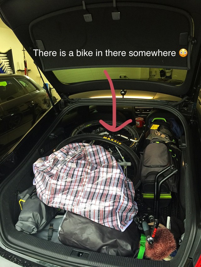
Day -2 The bike is enroute to Auckland for phase one of the journey north 🚲🚗
Day -1 Phase 2 and 3 of our trip to the Cape. A little bit of precipitation in Auckland but forecast for tomorrow is looking good and apparently we’ll have a tail wind – wahoo. We’ve been warned to watch out for rogue waves going down 90 mile beach tomorrow though – apparently they’ve been known to take out buses 🚎 so what chance do we have 🚴♀️ 🌊


Day 1 – Cape Reinga to Broadwood 139.4km. It was airy and mystical up at the Cape – quite apt for such a special and spiritual place. The conditions were then pretty close to perfect for our jaunt down 90 mile beach – slightly cloudy with a side / tail wind. We got to Ahipara about 5pm had a break and decided to push on to Broadwood – we did wonder what we’d done 10km in after the sun decided to really beat down but we got our second wind. Stayed at Broadwood Guest House with a few others and enjoyed a good carbo load of spag bol.


Day 2 – Broadwood to Trounson Kauri Park – 103.5km. A very wet start to the day that eventually let up for the 400m climb up to Tane Mahuta. Awesome downhill afterwards though. A cup of soup for dinner at Donnelly’s Crossing before bunking down at the DOC Camp. Nice hot showers so no complaints.


Day 3 – DOC’s Trounson Kauri Park to Maungaturoto by bike 103.4km and then on to Helensville by bus. The original plan was to ride to Pouto Point and catch a boat across the Kaipara but the boat’s engine has bitten the dust. All sorts of weather today. Met some trail angels just out of Dargaville offering fresh water and freshly picked grapes. Tonight’s accommodation is at The Kaipara Yacht Club with about 20 others – $5 including hot showers and a cuppa. Our new motto is “what goes down always goes up”


Day 4 – Helensville to just north of Clevedon – 90km. The sun was shining for our arrival into Auckland. After our jaunt up Mt Eden we were greeted in Cornwall Park by our own personal trail angels – Kaye, Margaret, Debs & Paul. Cold water and sliced fruit plus coffees 👍🏼. Another trail angel greeted us under the Mangere Bridge – thanks for the chat and encouragement Rosco. Arrived at Rachel & Jim’s and our clothes made their own way to the washing machine 😂. They’re smelling so much better now as are we. Spoilt with a lovely dinner and comfy beds. A great day in the City of Sails – such a pretty city. Life is good 😊.


Day 5 – just north of Clevedon to Matamata – 180kms. An early start and a big day! We decided the conditions and terrain warranted giving 180kms a nudge and thankfully it all panned out. The Seabird Coast taking in Kawakawa Bay, Kaiaua and Miranda was stunning – lovely to look across and see the Coromandel Peninsula in all its glory. We then moved onto the Hauraki Rail Trail which takes you through one of NZ’s most valuable dairy farming areas and the towns of Paeroa and Te Aroha. Had to have an obligatory photo stop at the L&P bottle. Spotted a supportive sign between Paeroa and Te Aroha – it’s the little things that buoy you on. With 37km to go we decided we’d indulge in our first pie as well as some liquid sustenance. Not part of the normal eating plan but after 11 hours in the heat it helped get us through. Met some personal trail angels just out of Matamata – thanks Steve and Sue for your encouragement and chat – so good to see your smiling faces. About a kilometre from our bed for the night we were escorted by a horn tooting maniac down the street – thanks for letting all of Matamata know we had arrived Sheree, Heidi and Tayla (although I think Tayla may have had second thoughts about being seen in the car with her embarrassing mother 😂). Phil and I loved it though and appreciated the swimming pool, hot shower, washing machine and amazing dinner. Another amazing day on the road 🚴♀️☀️😎.


Day 6 – Matamata to Mangakino – 95km. The day started well with the first 40kms going reasonably fast. We had some more personal trail angels pop up on Horahora Rd – thanks Dad & Dot for the plums and homegrown passionfruit as well as the lamb mascots and flag waving. The day then took a harder turn in the form of the Waikato River Trails – section 1, 2 and 3. As the name suggests they roll down beside the Waikato River and roll they do – upwards and downwards and pretty steeply in places. Challenging riding towards the end with a fair amount of bike pushing – this is when you really find out how heavy your bikes are 😬. After thinking several times they had shifted the town of Mangakino we finally arrived at about 8pm. Staying in the Maraetai Lodge with a number of other cyclists. Made a quick call to Gary at the Bus Stop Cafe to see if he would stay open for us which he did. Good vege burger and smoothie for dinner and a good chat with Gary and his wife. Looking forward to seeing the lake in the morning before we leave. A hot, sticky and challenging day that included an unscheduled lie down 😂.


Day 7 – Mangakino to the Timber Trail Lodge – 90km. We visited the Bus Stop Cafe for breakfast and checked out Lake Maraetai before heading off on the trails. We did about 5km of section 4 of the Waikato River Trails before branching off onto some back country farm and forestry roads. I took protein snacks to a new level when a bee flew in my mouth and stung my 😛 ouch! Got the drug cabinet out and all was well again after a few hours – didn’t stop me talking though 😂. We climbed just over 800 metres over 40km before getting to the geographic centre of the North Island. Check out the monument picture as to how they determined where this was. We crossed a narrow wire bridge over Mangakino Stream which was interesting with a loaded bike. My bike then had a lie down just before a river crossing 😂. No trail angels today but we did come across what we named a “hells angel” who rode his motorbike down to the swing bridge to laugh at the cyclists crossing it! After descending from the centre of the North Island we entered the Timber Trail. The first 13km of the Timber Trail climbs from 600 metres to just under 1000 metres so that kept the legs awake. We came across a couple of trees down which again gave us a little challenge. We then rolled up and down to the Timber Trail Lodge which is at the 40km mark and arrived just in time for dinner at 7pm which was delish.


Day 8 – Timber Trail Lodge to Whakahoro – 137km. After a lovely evening at the Timber Trail Lodge followed by breakfast we hit the trail at 8am. We did the second half of the Timber Trail which I had remembered from my previous experiences as being predominantly down hill. We carried on through to Taumarunui where we consumed two pies each – it felt like a two pie kind of day. Next destination was Whakahoro some 67km away – we had never heard of the place. It was about a 300 metre climb over 30km and then a 37km descent. Unfortunately it started raining and the downhill gravel roads didn’t roll quite as fast as we would have liked. We didn’t end up getting into Whakahoro until about 9.30pm – tested out the night riding skills. We were staying at the Blue Duck Lodge which is a shared accommodation arrangement. The instructions for us were left at the cafe with a map. Interesting times looking for our accommodation in the dark – a bit of slip, sliding around and we found it. Some people were in our allocated beds but we found another empty room so alls well that ends well. Found our dinner in the communal kitchen, had a yarn with the local bee keeping crew and then it was a shower and bed – we were knackered!


Day 9 – Whakahoro to Pipiriki – 40km cycling plus 32.5km jet boat ride. We had big plans for today but they went out the window after we first got onto the Kaiwhakauka Trail – a wet and muddy single track combined with my dodgy leg which had developed the previous night. There was a 500 metre climb over 17km and we walked about 12km of it – we were slip sliding all over the show! Saw one guy come off and slide down the bank – fortunately he was OK. After a wet night the weather was remarkably nice unlike the track! If I never see that track again it will be too soon 😬. We got to the Mangapurua Track and had a break at the trig – I elevated my leg for a bit but it was still a little painful on the downhill and even more so as we got closer to the Bridge to Nowhere. I then limped down to the landing to get on the boat. A big thumbs up to my riding buddy Phil who pushed me along, manoeuvred my bike over the swing bridges and got my bike loaded onto the boat – he is a legend 😊. We then blasted along the Wanganui River to Pipiriki. Our original plan was to go on to Wanganui (another 77km) but opted for an early finish in Pipiriki. Wanganui River Adventures are amazing – they put on a burger, chips and drink combo for $20 and provided free tea and coffee. We asked about accomodation options as we didn’t fancy putting the tents up and were offered free camp stretchers in the communal room next door – there ended up being about 10 of us in there. Free showers were also on offer but the power went off. They got a generator going but the shower queue became very long so we opted for a baby wipe shower – another first for the trip. Their hospitality and friendliness was second to none. Let’s hope the anti inflams, tiger balm and rest payoff for tomorrow’s riding.


Day 10 – Pipiriki to Wanganui – 73km. Hallelujah – tar seal! Had a lovely ride down the Wanganui River past the settlements of Jerusalem, Ranana and Matahiwi. There is a lot of history in this area – for more info check out the blog https://sungrl18.com/?s=Jerusalem+&submit=Search I did last year. There is also a lot of roadworks going on along that road and we stopped a few times before dodging diggers, dump trucks and the like. Enjoyed a good chat with one of the Wanganui Loader boys though who was manning the Stop / Go sign. A good climb over the Gentle Annie tested the leg but I got there with a bit of a push from Phil. A nice downhill to Upokongaro where we enjoyed a late lunch at the cafe. Checked into Anndion Lodge right on the trail where Donna, Aleisha and James joined us for the night and bought homemade lasagne and veges 😋. Resting and icing – will be good to go again tomorrow 🚲 ☀️ 😎


Day 11 – Wanganui to Ohingaiti (we think) – 83km. After a late start from Wanganui due to socialising, a torrential downpour and shopping our first stop was the Durie Hill Elevator. You go into a tunnel and the elevator takes you up to the suburb of Durie Hill. Apparently it was built to encourage people to live in the suburb. After leaving Wanganui we ventured through sheep and forestry land which was very scenic. We got to Hunterville late afternoon, had a bite to eat and stocked the pantry for dinner, breakfast and morning tea. The sun was shining so we headed towards Rangiwahia and about 23km in decided to camp out for the night. Found a lovely spot in a hay paddock, put up the tents and had our dinner of buns, salami and cheese. We splashed out with a yoghurt each for dessert along with some sultana biscuits. It was an enjoyable evening ride high above the Rangitikei River. We can hear the stags roaring and the sheep bleating – ain’t nature grand.


Day 12 – Ohingaiti (we think) to Palmerston North – 110km. After a pretty good sleep in what sounded like the wild at times 🦌🐄🐑🐈 we woke to our chilliest morning on tour. It was a lovely clear day though and it didn’t take long to warm up as we had more climbing to do. Got caught in a sheep traffic jam early on and then had a yarn with a local farmer before more climbing. A trio of Taranaki Trail Angels turned up just prior to Rangiwahia bearing friendly smiles and yummy food gifts. John, Chris and Bede had also bought their bikes and took turns riding with us. The overall ride profile trended downhill but there was actually a lot of climbing pre Ashurst. The countryside is beautiful and we had great views of Mt Ruapehu. We had lunch at the Apiti Tavern and then carried on to Ashurst with a coffee stop along the way – the boys had even bought a flask of coffee with them. The boys then headed back to Taranaki while we made our way to Palmerston North along the Manawatu Cycle Way. Tonight’s accomodation surprise is on the floor of Aleisha’s (Phil’s daughter) room in the halls of residence at Massey University. Given it is O week it could be a noisy night. The leg has definitely improved – shame about the rest of the body 😂


Day 13 – Palmerston North to Masterton – 112km. Amazingly we had a good sleep on the floor of Aleisha’s room – just shows how tired we were. We had to venture back into the city for bike repairs – I had 4 broken spokes and Phil had a dodgy bottom bracket. After a bit of mucking about we were on the road at 10.30am. We thought our first challenge for the day was the Pahiatua Track which is a 250 metre climb over 5kms but no, our first challenge was the climb up Polson Hills Drive – even my heart was hurting after that! Just prior to that we had to wait for the entire Harley Davidson population to fly by before we could cross the road. The Pahiatua Track was actually quite pleasant. After a quick lunch we headed for Eketahuna which was a gradual incline over 35km. Took the photo control point snap of the big kiwi before heading onto Masterton. A few ups to start with before a nice long descent over 20kms. The countryside on today’s trip was a bit more mixed than yesterday but still beautiful. We had a few friendly waves from the local farmers and a big thumbs up and well done from one of them. We’ve splashed out on a bunk room tonight at Mawley Holiday Park – very excited to be sleeping in a proper bed tonight. We’ve officially clocked up 1,420 kilometres so not far off the halfway point 👍🏼😊


Day 14 – Masterton to Upper Hutt – 110km. After a leisurely breakfast (it was Sunday after all) at the Village Grind we hit the road to Martinborough. The profile looked pretty good and it was all on tar seal so how hard could that first 50km of the day be? The windy Wairarapa put paid to that – it was a sign of things to come for the rest of our day. We came across another sheep jam and some friendly roadies (road bikers) – this is quite something given they normally won’t even acknowledge us. One applauded us as we went by while another stopped to chat and take a photo for us. We had a picnic lunch in the square in Martinborough before venturing back into the wind! We had 30kms to do before we hit the Rimutaka Incline and it was windy, windy, windy. Had a few near misses where we nearly got blown off. My odometer clicked over 1,500kms so we celebrated with a hot cross bun. The incline itself which is a 350m climb over 7km was challenging and again I managed an involuntary lie down after being blown sideways and losing my footing 😂. We crossed the ravine at what they call Siberia and even in the middle of summer it is pretty chilly. Got to the summit and had some afternoon tea in the shelter before descending the 10kms to the start of the track. You know it’s windy when you’re going downhill at 20km an hour and then a big gust comes along and you’re suddenly doing 5kms an hour – actually feels like you’re going backwards. We took a couple of wrong turns after getting off the trail but managed to find our way to the Kiwi Holiday Park in Upper Hutt – another bunk bed which I believe was a wise choice over pitching the tents in this wind. Fingers crossed the wind drops before we get on the⛴ tomorrow.


Day 15 – Upper Hutt to Smiths Farm Holiday Park (20km past Picton) – 60km cycling and 92km ferry crossing. The forecast was not looking flash for our 40km jaunt into Wellington and sure enough it delivered. Head winds and driving rain made for what felt like the longest 40km to date. One bright spot along the way was a 2016 TA rider coming out to meet us near Avalon – thanks for the words of encouragement Jeff Lloyd. He told us he was going to bring a flask of hot chocolate out but he couldn’t find the flask – what do you think we thought of for the next 25km! Visibility was next to nothing so it was very disconcerting not being able to see the city in the distance. We were absolutely drenched by the time we arrived at the Bluebridge Ferry Terminal – our fingers had given up working so changing gear was a no go and getting the helmets and gloves off at the end was a challenge. Luckily we had dry clothes to change into for the Crossing so after warming the hands up with hot water we peeled our wet kit off. I was a bit nervous about how rough the Crossing was going to be given the weather so got some sea legs. It turned out to be quite pleasant and by the time we had left the end of the North Island the skies cleared a bit and it stopped raining. We shared a table with Laura from Bath who has just started her year long OE in NZ and Ron and Rosie from Yorkshire who are doing a bit of a whistle stop tour of NZ. Really enjoyed their company before parting ways in Picton. The ferry was half an hour late docking because they had a learner driver who wanted to take a different route 😬. It was 6pm by this time so we grabbed a bite to eat before getting back into our cycling gear for the 20km ride to Smiths Farm Holiday Park. We have a nice little unit tonight equipped with a jug and tea bags – it really is the simple things when you’re on the road. The owner offered us a farm walking tour and the opportunity to feed the animals – we politely declined – we need to save our legs and we do enough talking to animals along the road everyday 🦌🐄🐑🐈. Very excited to have finished the North Island in one piece – may the South Island deliver sunny skies and tail winds.


Day 16 – Smiths Farm Holiday Park (20km past Picton) to Monaco In Nelson – 83km. We managed an early start and headed to the green lipped mussel capital of NZ, Havelock. We had a pit stop there before sharing the road with a number of trucks to Pelorus – luckily it was a quick, slightly downhill ride of 19km. We enjoyed our second breakfast at the Pelorus Bridge Cafe – we knew what lay ahead so fuelling appropriately was critical. A few Kodak moments on the Pelorus Bridge – an ancient one lane structure over the Pelorus River. Next mission – the Mangatapu Saddle – see the profile photo – a 650 metre climb over 7km. We had been told it is the hardest climb on the trip and that the last few kilometres are unrideable due to the loose rocks and ruts. They were not wrong and I certainly did my fair share of walking. Philip “the legend” Cram on the other hand managed to ride all the way to the top! The descent is just as narly in places and I again did some walking. Towards the bottom the track starts rolling next to the Maitai River which is very pleasant. We reached Nelson and popped into the bike shop for further maintenance before following the cycle track out to my Mum’s at Monaco. Enroute I did manage to get my side bar caught on the bridge and had another involuntary lie down and cause a traffic jam 🙈. Enjoyed a nice dinner and am looking forward to a comfy 🛏 tonight.


Day 17 – Monaco, Nelson to Lake Rotoroa – 130km. Leaving the home comforts of Mum’s was made doubly hard by the fact it was raining ☔️ but we forced ourselves out onto the road at 7am. We passed through Brightwater before stopping for coffee at Wakefield where we met up with Gill who we hadn’t seen since Auckland. It was then up and over the Dovedale Saddle which was wet and mushy – the climb wasn’t too bad though before a pretty good descent. We then spent 10kms on a forestry road where we met a couple of logging trucks – afterwards we were told it was closed due to logging – oh well! We were then met by our personal trail angel bearing hot soup and homemade buns and muffins – thanks JP, it was spot on given the wet conditions. A quick 7kms into Tapawera where we got supplies for dinner and breakfast. There is minimal accomodation or supplies at Lake Rotoroa and we had lucked out on the backpackers so we were conjuring up all sorts of plans – haybarns, abandoned buildings, basically anything but putting up a tent in the rain. When we were in Tapawera there were three other TA riders who had named themselves “the buggered bunnies”. Apparently they had started off as “the bouncing bunnies” on Ninety Mile Beach. We had a chuckle to ourselves and went on with our business. Ten kilometres towards Lake Rotoroa we saw one of the bunnies coming back towards us – she told us she was too buggered to carry on so was heading back to Tapawera. Five minutes later the other two bunnies were also heading back towards Tapawera. They stopped and told us that they had just cancelled their accommodation at the Lake and if we wanted it we should ring straight away. My fingers hit redial (I had called earlier) faster than you could say Jack Robinson. Success – we had secured a warm bed and hot shower for the night. That certainly buoyed our efforts in the rain. We came across these funny looking vines before working out they were hops. Hops is a big industry in this area and we went past a couple of processing plants too. They are exported all over the world so it was cool to see another thriving industry in our backyard. We spent a bit of time playing cat and mouse with the trucks on State Highway 6 before turning off for the Lake. We got to the Gowan Bank Backpackers about 7pm and were offered pies and a washing service – result. We were pretty hungry so also consumed the peanut butter sandwhiches we had made at Mums. We’re sharing the bunk room with Gill who we had reunited with this morning and Ed from Dunedin. Always good to swap war stories.


Day 18 – Lake Rotoroa to Reefton – 155km. After a very comfortable evening at the Backpackers we headed to the lake to take our photo control point picture. Today was all about conquering saddles while on our saddles. The skies were light and the sun came out which was a nice change from yesterday. First up was the Braeburn Track – a 200 metre climb over 3.4km before descending 30km into Murchison. We enjoyed a lovely breakfast at Rivers Cafe including free coffee for TA riders 😊. Next up was the Maruia Saddle – a 280 metre climb over 7km. This was a very pleasant ride through the beech forest. We descended down to Highway 65 where we played Russian roulette with the trucks – the road is extra busy due to the issues through Kaikoura. We celebrated passing the 2000 kilometre mark at Springs Junction with a milkshake and a few marshmallow 🐣 eggs 😋 👏🏻. The third and final saddle for the day was the Rahu Saddle – a 250m climb over 8km. The descent from the Rahu Saddle was pretty awesome – it really was the hill that just kept on giving – 34km all the way into Reefton. We arrived at The Old Breadshop Backpackers about 7pm. Met a European couple staying here who are walking the Te Araroa Trail – the walk from Cape Reinga to Bluff. 😲 what a challenge – they are taking six months to do it. Had a very tasty meal at the local pub in town called Dawson’s – great West Coast hospitality too. Really enjoying the South Island so far and the body and bike appear to be holding up. A real boost to pass the 2000km mark too 😊.


Day 19 – Reefton to Blackball – 86km. Today we rode the Big River Track to Waiuta – this is the last technical off road trail for the TA. They say to allow 5 to 7 hours as you climb up into old gold mining country and descend on a grade four track through the forest and many streams. The first 25km climbed up about 500 metres to Big River Hut. We had three river crossings just before the hut and we got wet feet! There were a few spots I found unrideable but it was generally OK. We came across some treats that had been left especially for TA riders at the Merrijigs Hotel – thanks to the anonymous trail angel 😇. They call this ride “The Greatest ride in History” due to gold mining heritage in the area. We enjoyed our lunch up at the hut before embarking on our next challenge – the Waiuta Track section. When we registered to ride the TA we had to make a $100 donation to a charity of our choice. They did, however, suggest the Waiuta Track upgrade program and I believe they received about $60k from the TA riders. I found this track very challenging and ended up walking a lot of it – it was wet and slippery with many little stream crossings. It was hard work pushing my loaded bike and I got close to throwing my toys out of the cot! The surrounds were beautiful but I was pleased to see the end of it. We then descended to Ikamatua and made a decision to carry on another 30kms to Blackball. Enroute to Blackball we stopped off at the Pike River Memorial – this is a lovely tribute to the 29 miners who lost their lives on the 19th November 2010. It was very sobering looking at each personal tribute – they were much loved family men. We got to Blackball about 7.30pm where we are staying at Formerly the Blackball Hilton. Blackball, at first, was a base for transitory gold seekers. But from 1893 a more settled community developed with the coal mine’s opening. We enjoyed a fabulous meal here tonight with Glen, a fellow TA rider from Wellington.


Day 20 – Blackball to Hokitika- 129km. Today was all about the Wild West. After a second breakfast in Greymouth we started the West Coast Wilderness Trail which is a 132km mostly off road trail from Greymouth to Ross. Our photo control point was the Greymouth Bar which we missed so we improvised from the beach 😉. We also met a group from Wanaka doing the trail and they gave us $30 each for our charities – how cool was that. We enjoyed a snack in Kumara where we met up again with Tim who we hadn’t seen since Wanganui – his group has drifted apart with a couple of the guys pulling out 😳. We then rode up into the forest to Cowboys Paradise – this is supposedly a replica Wild West town but it is extremely underwhelming. The trail back down to Hokitika is fast flowing through bush and next to a waterway system that feeds into a hydro dam. I did the West Coast Wilderness Track in 2014 and only about 30% of it was off road – it is about 90% off road now and would be the best trail by far that we have ridden on the TA. The surface is great, the scenery lovely and it is well sign posted – no need for the guide books today. Today we swapped Russian roulette with the trucks to Russian roulette with the 🐝 – they fly into you at high speed in this part of the country. Luckily they haven’t been able to make landfall in my mouth yet 😂. We got to Hokitika to find it pretty much booked out! After a few phone calls we did manage to find a cabin at the Hokitika Holiday Park – the only downside was that it was 4km outside Hokitika in the wrong direction. It had a laundry though which was very high on the priority list after a bit of precipitation over the last couple of days. It was warm and sunny when we arrived in Hokitika though so no complaints ☀️😎.


Day 21 – Hokitika to Franz Josef – 144km. We cycled the 4km back to town where we visited the iconic Hokitika driftwood sign. We then completed the West Coast Wilderness Trail by cycling the 32km to Ross. Had our second breakfast there at the one and only cafe. The forecast looked fairly dire but at this stage we’d only got a little bit wet. We carried on towards Harihari and stopped at Lake Ianthe (pronounced “an-thee” or “ee-an-thee”). This is a popular spot for water sports. We had a nice lunch in Harihari with a couple of other riders before our last 62km to Franz Josef. The guide book said that the scenery would just keep getting better and I’m sure it did but unfortunately our visibility was limited due to the cloudy and misty conditions. We got extremely wet in the last 30km and were happy when we rolled into town. The town is named after the Franz Josef Glacier – itself named by Julius von Haast in honour of the Emperor of Austria Franz Josef I of Austria. Following the passage of the Ngai Tahu Claims Settlement Act 1998, the name of the town was officially altered to Franz Josef / Waiau. The glacier’s terminal face is 5 kilometres (3 mi) from the town and its accessibility makes it a major tourist attraction and the reason many people visit Franz Josef. The town is within the Westland Tai Poutini National Park. We are staying at Chateau Franz Backpackers – $34 for a bed, hot soup at 6pm and breakfast 👍🏼😊. A bit light on the photos and news today so will confess to eating our remaining two hot cross buns as a midnight snack the other night – Crammers has now taken to keeping them under lock and key from me 😂. 2390km down – 610km to go 👍🏼.


Day 22 – Franz Josef to Haast – 146km. We decided to take advantage of the free breakfast at the Backpackers so didn’t get away until 8am. To be honest it was raining cats and dogs so motivation was also lacking. We had three big climbs ahead of us between Franz and Fox Glacier – 321m, 408m and 411m over 23km. It took us just under two hours. We took advantage of the free coffee for TA riders at Hobnail Cafe and had a second breakfast. Tried drying my top under the hand dryer before re layering. Back into the wet we went. We were supposed to do a 12km side trip to Fox Glacier to take a control point photo – what a shame the road was closed 😜. It stopped raining about two hours later and we saw these signs to Bruce Bay – we were a little confused about this Bay as we thought we were inland – that’s the trouble when you just follow the prompts in the guidebook and look at elevation profiles. Bruce Bay was like an oasis – the sun had come out and there was a real fruit Icecream 🍦caravan – heaven. Who would have thought we would be standing on a beach eating Icecream after the start to the day we had. We actually followed the coast around for most of the afternoon. Next stop was the Salmon Farm Cafe – neither of us like salmon so luckily they had some other options for lunch. Our next photo control point was at Knights Point Lookout. Te Wahipounamu (place of greenstone) or South West NZ is one of the great wilderness areas of the Southern Hemisphere with it’s snow capped mountains, ice rivers, unbroken forests and tussock grasslands. A world heritage area was granted in 1990 in recognition of the natural values. World heritage is a global concept that identifies natural and cultural sites of world significance – places so special that protectionism is of concern to all people. The other significant natural occurrence in the South West of NZ are the sandflies – holy guacamole they are vicious and immune to bug spray it would seem. Apart from the sandflies it was certainly nice to be able to see and appreciate the landscapes today. Knights Point was also where Sir Keith Holyoake (past Prime Minister of NZ) officially opened the Haast Pass in 1965 – the road connecting Westland with Otago. We crossed the long, single lane Haast bridge about 7.15pm and took in the magnitude of the river. We checked in to the Haast Lodge and went to the Hard Antler Bar & Restaurant for some dinner. There were 7 other TA riders there so we joined them to catch up on the days happenings. We decided it was a two Icecream 🍦 sort of day so after our Blue Cod mains we had an Icecream sundae 😋. Long may this fine weather continue ☀️😎.


Day 23 – Haast to Lake Hawea – 128km. Another wet morning – yee ha 😳. We set off early because we had a big hill to conquer – the Haast Pass. The Haast Pass is a mountain pass in the Southern Alps of the South Island of New Zealand and takes its name from Julius von Haast, a 19th-century explorer who also served as Provincial Geologist for the Provincial government of Canterbury. After leaving Haast at 7am we rode 50km from sea level to 100 metres above sea level. We then started the climb proper – 464 metres over 9km. The first part was incredibly steep and I must admit I freaked out thinking there was no way I could maintain that gradient for 9km. Fortunately it levelled out and was actually OK. The elevation map looked like it was pretty steep right at the end so I was mentally prepared for it but it never eventuated. I was ecstatic to see Ed & Gill at the high point sign and don’t think I’ve smiled so much for a photo yet. There is a note in our guide book that says we should spare a thought for explorer, AP Harper who in 1900 was the first person to hike and bike over the Haast Pass – 65 years before the road was completed. It rained the whole time but I was so worried about this climb I didn’t notice it until our descent when we got pretty cold – being wet and travelling at high speed on a bike will do that to you. The rain did mean that there was practically a waterfall on every corner. Prior to the climb we took a side trip to see Roaring Billy Falls. Next stop was Makaroro which was 78km from Haast. Because we arrived after the supermarket had shut the night before we had to make do with limited supplies from the Backpackers – a small box of cereal and fruit and a tin of spaghetti. We had a couple of snack bars on the way over the pass but by Makaroro we were famished. Hot food and coffee never looked and tasted so good. The next 49km undulated from 300m to 450m along the northern tip of Lake Wanaka through what they call The Neck to Lake Hawea. We had a lovely southerly head wind 😬 most of the afternoon but rolled along quite nicely and arrived at Lake Hawea at 5.50pm. Despite the overcast conditions the scenery was still spectacular. We needed to do some washing but discovered there was only one washing machine and dryer at Lake Hawea hotel – a long queue of Backpackers meant that was going to be too much of a mission. We decided instead to hand wash the shorts and have been making good use of the hair dryer to dry them 😂. Donna and James have joined us for the night – they are on a road trip to Bluff to take Philip home when it’s all over. We enjoyed a nice meal together in the hotel tonight.


Day 24 – Lake Hawea to Queenstown – 120km. My SUNGRL powers have been restored – after having rain most days on our South Island leg we got a stunner today. It was a little chilly leaving Lake Hawea – the long fingered gloves had to be dusted off for the first time in 24 days. First up was the Hawea River Track before getting onto the Outlet Track through to Wanaka. We enjoyed a second breakfast at Relishes Cafe – very 😋. Next up was the 25km ascent to Cardrona which wasn’t too bad. Took the obligatory photo of the old Cardrona Pub which was established in 1863 and is one of New Zealand’s oldest hotels. It is one of only two remaining buildings from the Cardrona Valley gold rush era. We then began tackling the last 14km to the top and the highest point on our entire trip – 1076 metres above sea level. I’ve driven this road many times and seen cyclists battling away and thought “are they nuts?” Well today it was me who was nuts! The last 3kms are the steepest but we managed to hang on to the handlebars and make it to the summit. I felt pretty proud of myself. The Crown Range Road is the highest sealed pass in NZ beating the Desert Road in the North Island by 2 metres. The weather was perfect and Queenstown never fails to disappoint with its stunning vistas from every angle. Our Queenstown Trail Angel turned up at the summit with hot cross buns and jet planes – what a legend – thanks Paul. Donna had driven Paul to the top and he then turned into our very own personal tour guide. After a very fast descent down the other side of the Crown Range we popped into Arrowtown for lunch. Paul then guided us along the Queenstown Trail into Queenstown itself. The shores of Lake Wakatipu were alive with tourists enjoying the beauty of the place. We met Donna, James and Paul’s wife Rachel for a drink before being spoilt with hot showers, a washing machine and dryer, lamb shanks and pavlova 👍🏼😊. We actually felt like we were on holiday after conquering the Crown Range – it was just so nice to be enjoying the scenery and nice weather. A boat trip and 240km’s to go – we got this 👍🏼.


Day 25 – Queenstown to Mossburn – 103km. A little bit grey and murky this morning as we boarded the TSS Earnslaw for our crossing on Lake Wakatipu to Walter Peak Station. The TSS Earnslaw is a 1912 Edwardian vintage twin screw steamer. It is one of the oldest tourist attractions in Central Otago, and the only remaining commercial passenger-carrying coal-fired steamship in the southern hemisphere. Walter Peak Station, founded in 1860, is a 25,758 hectare working high country sheep station on the southern shore of Lake Wakatipu. It runs approximately 18,000 Merino and Perendale sheep and about 800 beef cows. After a spot of bike maintenance we set out at 11am – the first boat is at 10am so it was a nice leisurely start to the morning. It warmed up fairly quickly as we started our ascent towards Von Hill. We stopped for some lunch next to the river which was very picturesque. Next up was the ascent proper which again was nicer than the profile suggested. Unfortunately the head wind kicked in which added to the challenge. It felt surreal to be so high up (700 metres above sea level) surrounded by these big mountain ranges. It had turned into a blue sky day and the scenery was stunning. After about 50km of it though on a gravel road we were a little over it 😬. We stopped for a couple of picnic lunches along the way before dropping down onto the Around the Mountains Cycle Trail for 23km into Mossburn. We questioned the appeal factor of this trail – the trail meanders via farmland and is not particularly scenic. We finally arrived into Mossburn at 7.30pm – it was another one of those “have they moved the town” ends to the day. We are staying at the Mossburn Railway Hotel which is great – the owner got us sorted and took our dinner orders which got prepared while we showered. Blue Cod is a must when you’re in the Deep South – melt in your mouth 😋. There are 15 of us here tonight and we enjoyed a bit of banter over dinner. Everyone is excited to be finishing tomorrow but a little sad that the adventure is coming to an end. We have met some great people and enjoyed the camaraderie out on the trails. Bluff here we come 🚴♀️☀️😎.


Day 26 – Mossburn to Bluff – 137km. Everyone was up early – the end was in sight. Most of the 15 riders who had stayed at the Railway Hotel were on the road at 7am – there was a trail of red flashing lights snaking their way down the first 13km on the Around the Mountains Trail. Enroute to Winton we stopped for a snack outside Dipton West School (apparently Bill English’s farm was 3km down the road) and had a chat to the caretaker. The kids were doing a triathlon today so were busy warming their bikes up around the field. Some stopped by to wish us luck – they’ve had a steady stream of TA riders going past their gates for the past few weeks so knew the deal. By the time we got to Winton we had done 69km so a larger snack and coffee were in order. We followed the Winton Trail out of town and missed reading the instruction to turn right so ended up going round in a circle – we don’t like doing extra kms but it gave us a laugh anyway. Today’s photo control was a Southland local – I said I would take a photo of a sheep – Philip said I had to be cuddling it though so we spent a bit of time looking for a friendly sheep to no avail. I had to settle for an uncuddly shot. Next stop was Wallacetown where a milkshake was in order – taking advantage of all food stops on the last day. We then headed towards Invercargill where we skirted around the outside on the Estuary Trail. The tide was out and the landscape is fairly harsh and unattractive so it was head down towards Bluff. The wind had got up so we were also battling that. Ed who comes from Dunedin was taking the local lead – he told us the trail had been extended so we carried on – the trail soon ran out and we found ourselves marooned on the wrong side of the railway lines opposite the highway. No problems – we’ll just lug our fully loaded bikes down one side, across the railway lines and up the other side – thank goodness there were 5 of us to pull the bikes up. Everyday has had an adventure of some sort so that was today’s 😳. Onto State Highway One we went – a very busy road with trucks and cars. Most of the group that had left the Hotel this morning rode in convoy into Bluff which was pretty cool. It was quite an emotional moment seeing the iconic signpost at Stirling Point and to see the family and friends that had come to meet us. Donna and James had bought some beer and bubbles so we shared them around and savoured the moment with everyone. We spent about an hour and a half chatting and saying goodbye to these people we had enjoyed the journey with at various times along the way. I’m still wondering how I got from Cape Reinga to Bluff – it is quite surreal. I know I definitely wouldn’t have got there without my riding buddy Philip – he was happy to cruise along at my pace, kept my bike maintained, maintained the pantry in his frame bag (next to his butt butter and toothpaste 😂), shared the food prep and washing duties and was just an all round pleasure to bike 3000km with. Well actually we only physically biked 2952km according to my odometer. The official length of the course including boat trips was 3026km so we’ll go with that. Tonight we have enjoyed a great evening with friends in Invercargill and tomorrow I will box up my bike and fly home. Thanks to all our dot watchers and social media followers out there – your words of encouragement meant more than you’ll ever know 🙏🏻🚴♀️☀️😎.


