
The Milford Track is a widely known tramping (hiking) route in New Zealand – located amidst mountains and temperate rain forest in Fiordland National Park in the southwest of the South Island.
The 53.5 km hike starts at Glade Wharf at the head of Lake Te Anau and finishes in Milford Sound at Sandfly Point, traversing rainforests, wetlands, and an alpine pass.
The New Zealand Department of Conservation classifies this track as a Great Walk and maintains three huts along the track: Clinton Hut, Mintaro Hut and Dumpling Hut. There are also three private lodges and four day shelters available.
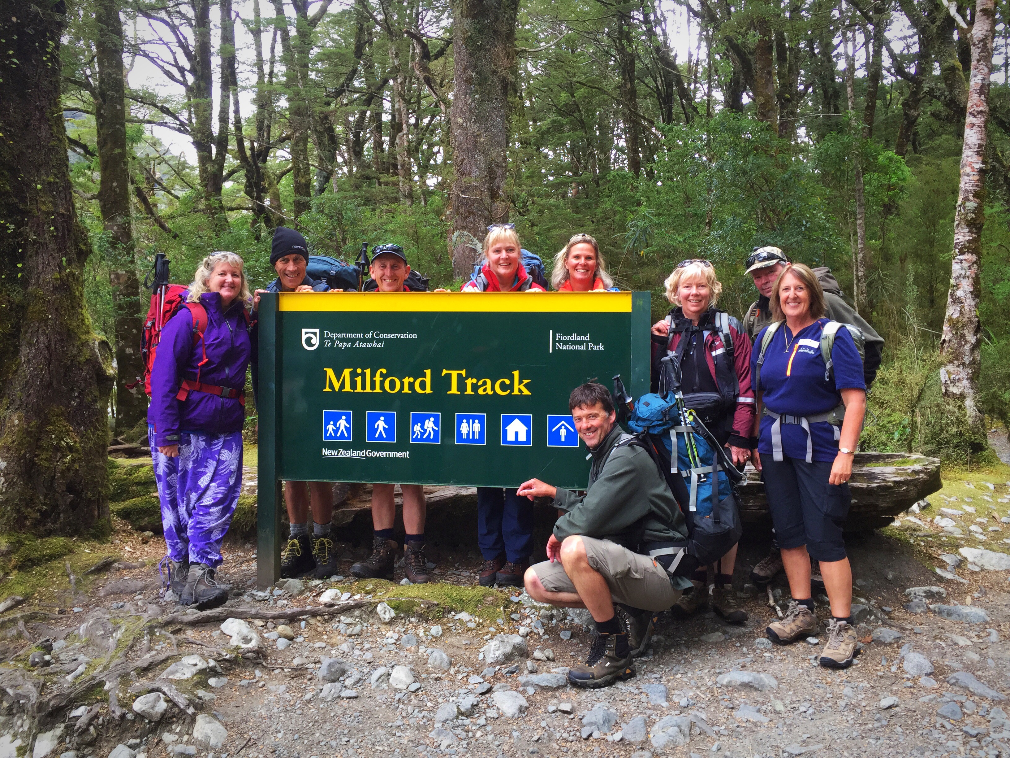
There were 16 of us doing the walk and we had booked through Ultimate Hikes in Queenstown which meant we would be staying in the private lodges. The group consisted of Steve & I, Sheree & Matthew, Matthew’s Dad Gary (Gazza) and his mate Barry (Bazza), Karen & Danny, Donna & Philip, Jen & Phil, Linda and John and Chris and Mary. The last eight are all from Taranaki (the Naki) with all but Jen & Phil being dairy farmers. We all arrived into Queenstown on the Sunday afternoon and some of us converged on a pub to watch the Warriors first game of the season. There was a briefing at Ultimate Hikes at 4.45pm which the girls, Gazza and Bazza and all the team from the Naki duly went to. Steve, Matthew and Danny stayed to watch the Warriors.
The briefing was good and I really got a good feel for what it was going to be like out on the track. We had to complete a consent form each and note down our preferred name that would go on our name tags. Karen, Sheree and I thought we would get revenge on the slackers by putting Steve’s preferred name as Precious, Matthew’s as Normy (his middle name is Norman) and Danny’s as The Lone Ranger (he tends to go off alone).
A quiet night followed for me but Steve, Sheree and Matthew went off drinking with some friends of Sheree & Matthews. I did try and warn Sheree that she’s never too flash the next day after a few drinks!
We had to be back at the Ultimate Hikes headquarters at 8.30am the next morning to meet our guides, and do any last minute admin. We went to collect our name tags and discovered that they had reverted to our normal names (I was supposed to SUNGRL) – I was not happy. They thought that we were only joking – we had been deadly serious. Funnily enough they picked up on Steve’s nickname of Precious and did use it frequently over the next few days – I wonder why : ). We were to have four guides on the trip – Hannah, Charlotte, Mark and Kelly. Kelly was to meet us later in the day – he was just finishing his second back to back Milford Track with another group. All four guides have walked the track a number of times so they were well versed in the routine.
We set off in the bus at 9am – our driver Jimmy gave us a great running commentary about the area as we drove along.
Jimmy told us about Lake Wakatipu which is the longest lake in New Zealand at 80km long. It covers an area of 291 square kilometres and is also very deep, its floor being below sea level, with a maximum depth of 380 metres. It is at an altitude of 310 metres, towards the southern end of the Southern Alps.
He also explained that Lake Wakatipu has a regular seiche – a word I had never heard of before. A seiche is a standing wave in an enclosed or partially enclosed body of water. Seiches and seiche-related phenomena have been observed on lakes, reservoirs, swimming pools, bays, harbours and seas. The key requirement for formation of a seiche is that the body of water be at least partially bounded, allowing the formation of the standing wave.
The term was promoted by the Swiss hydrologist François-Alphonse Forel in 1890, who was the first to make scientific observations of the effect in Lake Geneva, Switzerland. The word originates in a Swiss French dialect word that means “to sway back and forth”, which had apparently long been used in the region to describe oscillations in alpine lakes. Lake Wakatipu’s seiche is well known – it varies its surface height at Queenstown by 20 centimetres in a 27-minute cycle.
Jimmy also shared the Maori legend of lake Wakatipu – here is the full version from http://www.southernadventures.co.nz
Long ago, before the promise of gold brought Pakeha to Otago, the Maori roamed the land, hunting for moa and greenstone and eels. Manata and Matakauri, two star-crossed lovers, lived in a village in the area. The couple were not allowed to marry as Manata was the daughter of the chief, and Matakauri was a commoner.
One night, a giant taniwha named Matau stole into the village, and kidnapped Manata. He carried her away to his lair in the hills, and tied her to him with a magical cord.
Manata’s father was distraught. He asked the young men of the village to go and save Manata, offering her in marriage to whoever brought her home safely. The young men were afraid, but Matakauri, who loved Manata with all his heart, followed the nor-west wind to the still-young mountains where the giant lived. He found Matau asleep, with Manata lashed next to him. When Matakauri was unable to cut the enchanted cords, Manata begged him to go, fearing that the giant would wake up and kill him. Matakauri refused to leave her; but as Manata began to cry, the love in her tears dissolved her bonds and they escaped.
Matakauri brought Manata back to the village, and the couple were allowed to be married. Later, fearing that Matau would return to cause more trouble, Matakauri went back to the mountains where the monster lived. He found the giant sleeping, lulled by the warm wind, and he set a great fire around him. The hot wind caused the flames to roar violently; the taniwha’s body burned so long and so hot that a trough hundreds of metres deep and 75 kilometres long was created.
After Matakauri left, the rains came and filled the newly formed valley with water, which is now known as Wakatipu, the trough of the giant. Although the giant has been dead for many long years, his heartbeat can still be seen in the steady rise and fall of the beautiful lake that is his resting place.
According to the legend, Lake Wakatipu rests in the trough formed by Matau’s burning body, Glenorchy at his head, Kingston at his feet and Queenstown resting on his knee. His ever-beating heart – the only part of him remaining – is under Pigeon Island and causes the seiche which makes the level of the lake rise and fall regularly and rhythmically.
After leaving the shores of Lake Wakatipu we stopped in Mossburn for a toilet stop before carrying on to Te Anau where we had lunch and I took a walk down to the lake. It was overcast and a little chilly.
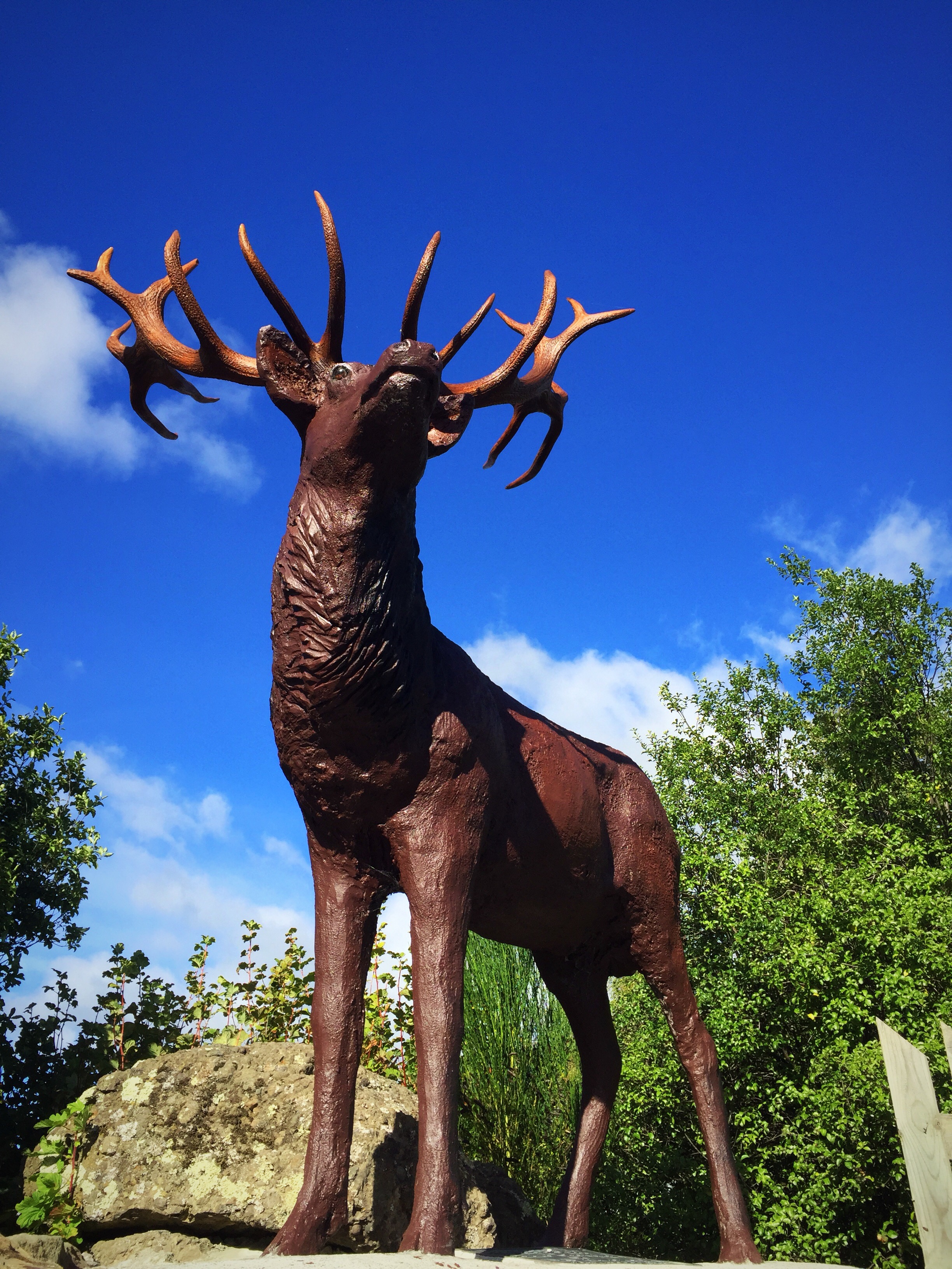 The moose of Mossburn
 The goose (times two) of Mossburn

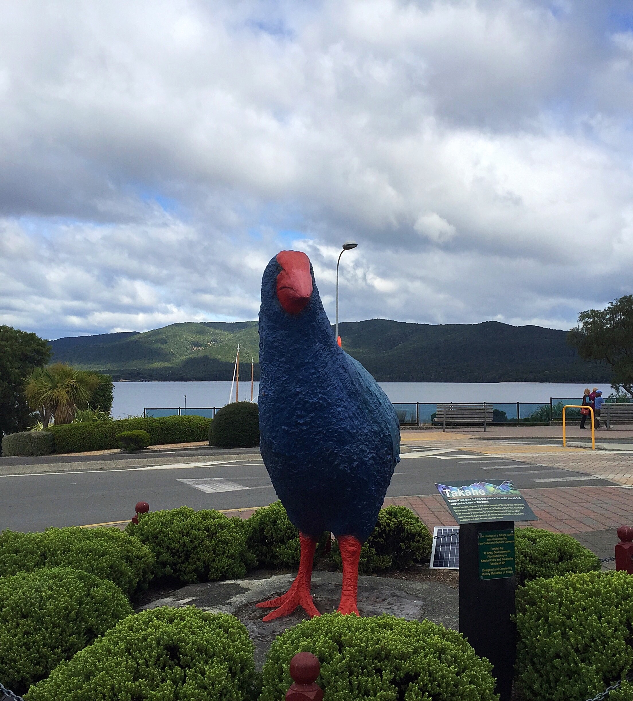 The Takahe. Extinct? Not quite, but the only place in the world you will find wild takahe is in Fiordland. Across the lake, high up in the alpine tussock of the Murchison Mountains, takahe were rediscovered in 1948 by Dr Geoffrey Orbell from Invercargill. Their survival is supported by a local Department of Conservation captive breeding programmme as well as work controlling introduced predators and deer in their mountain home.
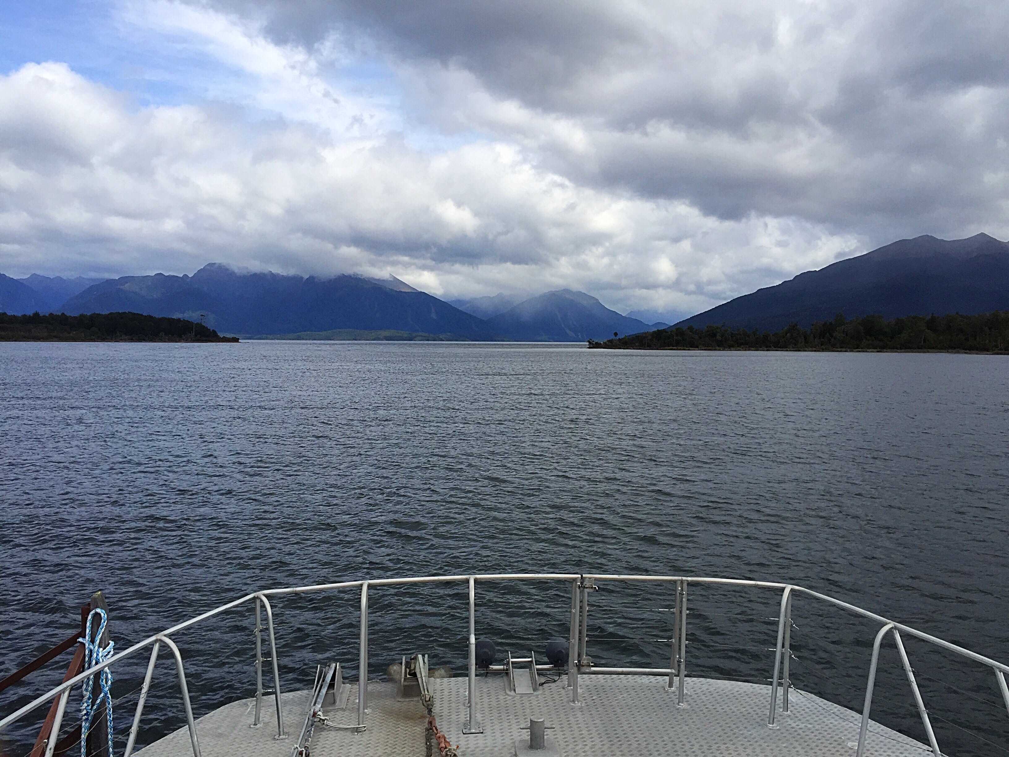
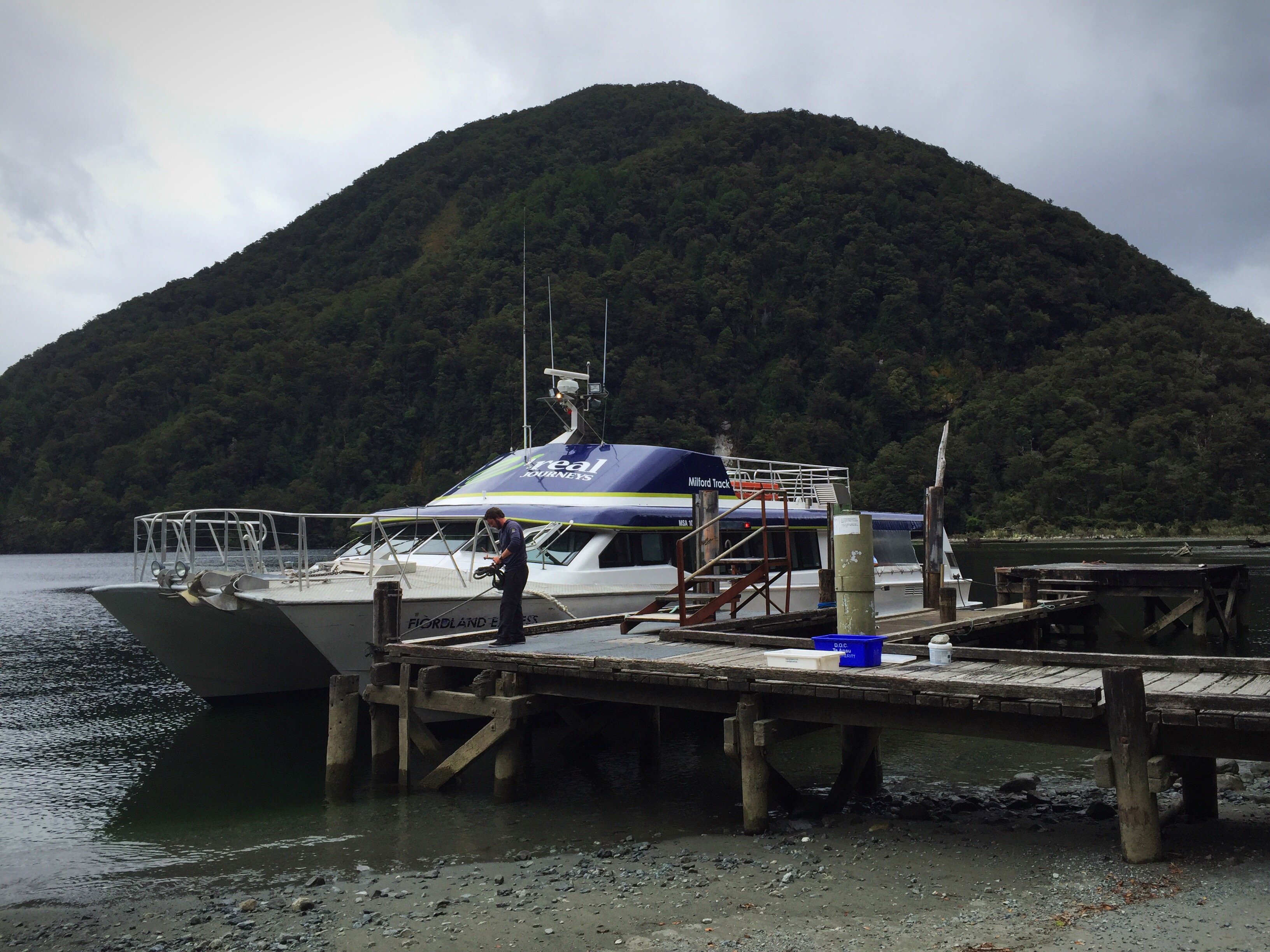
Our next stop was Te Anau Downs where we met our our fourth guide for the trip, Kelly, and got on the boat to cross Lake Te Anau to the start of the Milford Track.
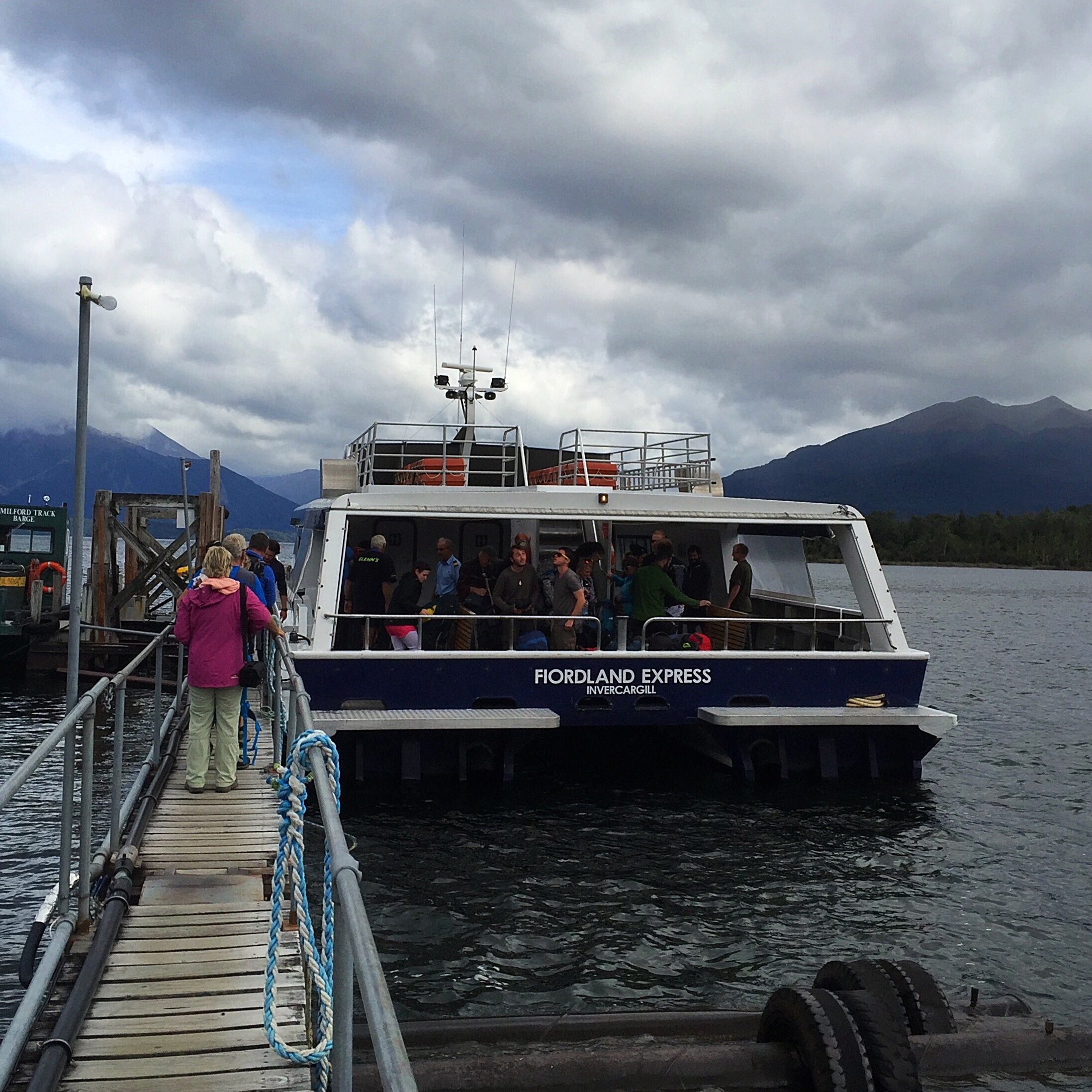
The boat ride was good but unfortunately the low cloud didn’t portray the lake and it’s surrounds in the best light. As we came ashore at the other end of the lake the sandflies gave us a warm welcome – it was time to cover up and get the insect repellant out! We had a 1.6km walk to Glade House, our Lodge for night one.


 Me and the crew from the Naki
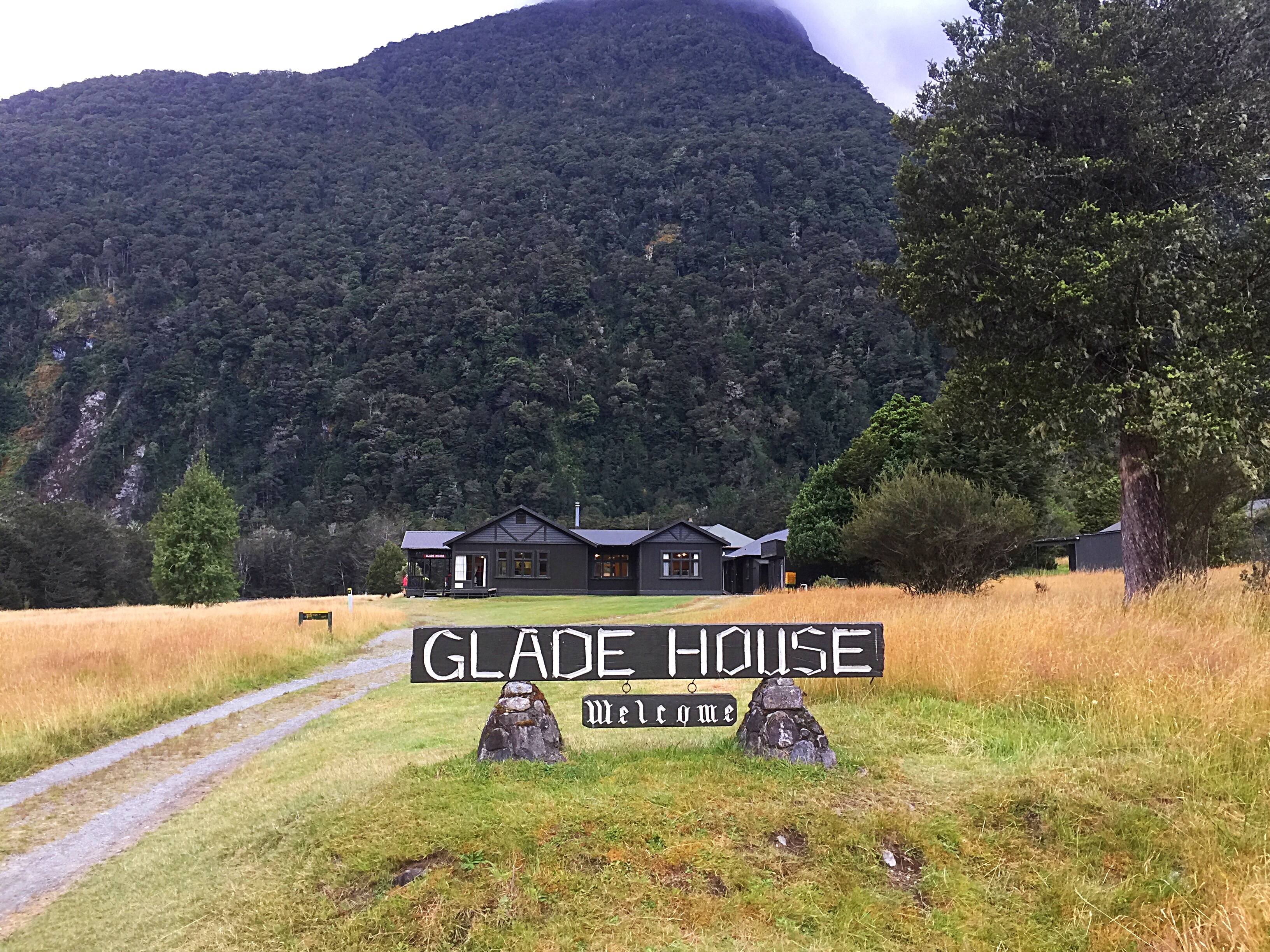
The reason for the name Glade House is because it is set in a glade which we came across pretty quickly. The Clinton River runs just out in front – what a picturesque spot. We had time to settle into our rooms and then we all met for a group photo before setting off in groups on a Nature Walk.

Hannah was our group’s guide on the nature walk and she pointed out all sorts of native trees and birds. The South Island Robin and Tomtit can be seen quite regularly in the area as are Fantails or Piwakawka. You can also see the Rifleman but they are a little less common.


 The South Island Robin
After the nature walk it was time to get ready for dinner – our first three course meal of the trip and it didn’t dissapoint. Despite all the walking we will be doing I don’t think we will be losing any weight on this trip!
After dinner we had a slide show about the historic figures involved in bringing the Milford Track to life and a bit about the terrain, nature and birds we would see along the way.
We then had to get up by country of origin and introduce ourselves to the rest of the group – there were 50 people in total in our group. There were a group of girls from Sydney as well as a few other Aussies. A couple from the US and one lady from the Netherlands. Kelly said that this was the largest contingent of Kiwis that he had ever had in a group. The Kiwis were the last group to introduce themselves with Steve being the last person – his introduction went like this “Hi I’m Steve and I have FOMO (fear of missing out) so if I didn’t come along I would be left at home alone. I’m not really here for the walk but the socialising at night.”
One of the American’s, Stephen, had actually endeavoured to do the walk the year before but they had so much rain that the track got flooded and they ended up being helicoptered out after two days walking. Stephen alluded to this in his introduction speech and said that was why he was doing the walk again so he could complete it and was hoping not to see a helicopter on this trip. Steve Thomas finished his introduction speech with ” I really hope I see a helicopter and I get to go on it!
It was a reasonably early night in anticipation of the 16km that lay ahead the next day.
History of the Milford Track
The native Māori people used the Milford Track for gathering and transporting valuable greenstone. There are many Māori legends about the track and the native species found in it.
Coming in from the Milford end, Donald Sutherland and John Mackay were the first European explorers to see what are now known as Mackay Falls and Sutherland Falls, in 1880. At the Lake Te Anau end, Quintin McKinnon was employed to try to find an overland tourist route into Milford Sound, and in 1888 discovered what is now named Mackinnon Pass; with his route becoming known as the Milford Track. He was the first guide to take walkers from Lake Te Anau to Milford Sound. McKinnon began by guiding tours himself and expanded with a marketing campaign from there. Many parts of the Milford Track are named for McKinnon, including Mackinnon Pass, the highest point of the track (although the spelling is slightly different). He also impressed with his “ability at cooking pompolonas, a type of scone from which one of the guided trip huts takes its name.”
In 1901, the government via the Department of Tourist and Health Resorts, and later the Tourist Hotel Corporation assumed administrative control of the track and guided tours until it was sold to a private enterprise in 1990. The track was very famous with women from early on. Some parties consisted of three-quarters females even in the first half of the 20th century.
For a great length of its history, only commercial guided tours had the right to be on the track, but in 1965 a “freedom walk” by 46 members of the Otago Tramping Club led to the opening up to the current system of dual system in 1966 with additional huts and facilities for independent walkers created allowing individual, non-guided tours on the route. Today, a quota system allows approximately half the capacity of the track to be used by guided tours, while the other half is undertaken by people walking on their own or in informal groups. The two types of walker use separate systems of huts.
Due to its popularity and the limited facilities available for overnighting (camping is not permitted), the track remains heavily regulated.
Access
Unlike most of the other Great Walks the Milford Track has no direct carpark access, and hence trampers require boat transport to the start of the track from Te Anau Downs to Glade House (the southern start of the track). There is also foot access to the start via the Dore Pass Route (10.5 km one way) although this is an advanced track and not recommended for most walkers. At the northern end of the track at Sandfly Point another boat is required to take trampers back to Milford Sound. The north to south option still involves both boats but can only be done during the winter season.
Summer peak season
During the summer peak season of late October to late April, access to the trail is highly regulated. Walkers must complete the track in four days, travelling only in the northward direction. Camping is prohibited on the trail. Walkers can tramp the track independently, or as part of a more expensive guided walk with a guide company. A maximum of 90 walkers can start the trail per day (40 Independent, and 50 Guided). Usually these 90 places are booked out for many months in advance, despite the high cost of the guided walks.
Due to the one-way ticket system and limited hut capacities, trampers need to keep moving even during bad weather. During periods of especially heavy flooding, the DOC regularly calls in helicopters which fly trampers over flooded sections of the track at no further charge.
Independent tramping
If hiking independently, each night must be spent in a hut owned and maintained by the Department of Conservation. The huts for independent walkers have basic facilities, which include bunk areas, restrooms, and cooking facilities; walkers have to carry their own equipment and food.
Guided tramp
On a guided walk, walkers stay in lodges owned and operated by Ultimate Hikes (see below for more information about Ultimate Hikes). These lodges have facilities such as hot showers, catered meals, beds, lounge areas, electric lights, and drying rooms. Guided trampers need only carry clothing, toiletries, their sheets, and lunch while on the trail. Guides walk with trampers, providing as little or as much assistance as required.
Off Season
During the off season from May to mid-October, the track is essentially unregulated, and can be tramped in either direction, over any number of days. It is however much more difficult and dangerous tramping in this season, as facilities at huts are removed, some bridges (up to 10) are removed to prevent avalanche damage. Advice to those contemplating using the track during the winter includes:
“…there are 57 avalanche paths in the area, some of which may cross the track and bring avalanche debris to the valley floor…. you must be competent at crossing large, swift, icy rivers…Mackinnon Pass is not marked and is often covered in deep snow…”
History of Glade House
In 1895, John and Louisa Garvey landed at the head of Lake Te Anau and walked up the east bank of the Clinton River where they came to a beautiful clearing in the bush. It was such an idyllic spot, with grass growing right down to the river’s edge, the crystal clear Clinton gliding gently by, and a magnificent backdrop of rugged bush clad mountains.
“I would like to build a house in this glade” said Louisa to her husband. And so they did.
Funding from friends allowed the Garvey’s to erect the first accommodation at the head of Lake Te Anau.
After the first Glade House opened in 1895 – 1896, the existing Clinton Hut fell into disuse and the start of the Milford Track was re-routed along the Glade House side of the river. From Glade House walkers were ferried across the Clinton River to link up with Mackinnon’s original track in the vicinity of Mackinnon’s hut where they would meet Donald Ross, ‘the popular government guide’. He and his brother Jack succeeded MacKinnon as guides on the Milford Track.
Built with the framework outside to keep the rats out, Glade House had a long verandah which Louisa adorned with climbing roses. She planted Mt Cook Lilies and an orchard. In the evenings, she engaged guests with good humour, musical interludes and fine home cooking. She also found time to raise eleven children. Six of the eldest Garvey sons served as guides and trackmen on the Milford Track and their second youngest boy, Charley, walked the entire track at the tender age of eight! The family soon established a reputation of homely hospitality with evening entertainment.
With Government interest increasing, the Tourist Department purchased Glade House in 1903 as part of its general take over of the Milford Track. The Garvey’s were retained as managers and stayed on right up to 1908. During this time, extensions to Glade House were undertaken and Robert Murrell of Manapouri was appointed as chief guide. Walkers were issued with track tickets costing the princely sum of three shillings and six pence (about 35 cents).
The Glade House fire started just after midday on New Years Day 1929. It began in the boiler room, but quickly raced through the whole wooden building with flames leaping out of the windows and through the roof. A large party from the Otago Tramping Club that had just arrived back from Milford scrambled to organise a ‘bucket brigade’. But the task was a hopeless one and the trampers turned their attention to saving as much as they could from inside.
The whole building was engulfed in flames and Glade House was razed to the ground. Occurring at the height of the tourist season the timing couldn’t have been worse. Walkers stayed in temporary marquees and tents until a new Glade House was built in 1930.
I beleive Glade House burnt down again later in the 20th century and had to be rebuilt but I cannot recall when.
Pigeon Post
Glade House was linked to Milford by telephone, but communications with the foot of the lake was maintained by carrier pigeon, which kept the Garvey’s informed as to how many tourists to expect. The telephone line was fine when it was working but it was highly susceptible to damage by windfalls and avalanches and was in a constant state of disrepair. Pigeon lofts were built at the huts along the track and the surest means of communication proved to be Pigeon Post!
Landscapes
Origins in Gondwana
- 600 million years ago, some of New Zealand’s oldest rocks are formed. These rocks form much of current Fiordland.
- 250 million years ago, with Gondwana intact, river sediment and volcanic ash settle on sea floor, creating some of the rocks of New Zealand.
- 100 million years ago, ancestral New Zealand was a large mountainous area along the eastern margin of Gondwana.
- By 85 million years ago, the New Zealand landmass had split from Gondwana due to a spreading ridge.
- 55 million years ago, this seafloor spreading ceased.
- By 35 million years ago, much of the New Zealand landmass has sunk beneath the ocean. This deposits a sedimentary ‘blanket’ over much of the drowned area.
- By 5 million years ago, a new period of uplift due to the collision of the Pacific and Australian techtonic plates raises much of the New Zealand landmass above water.
- Over the last 5 million years there has been about 20km of uplift around the Alpine Fault, but erosion has kept the mountains to their current height.
Te Waka o Aoraki
Maori, the indigenous people of New Zealand (Aotearoa), first arrived in waka unua (double hulled voyaging canoes) from Hawaiki more than 600 years ago.
Ecology
A land without mammals
When the first human settlers arrived in New Zealand from Polynesia in the 13th century, they found a terrestrial flora and fauna unique in the world. Some species had developed from ancestors that evolved in the original Gondwana, and others had arrived over millions of years. The Polynesians found a land that was 85% covered with forest and large shrubs, with 80% of the plants endemic to New Zealand.
The terrestrial fauna was even more remarkably endemic, with very limited variety. The only land dwelling representatives of reptiles, mammals and amphibians were four small frogs, several lizards, the tuatara and three bats.
The first humans found an abundance of birds, many of large size, but restricted in the variety of species. The bird fauna had evolved for millions of years in a non-mammalian predator free environment, which was reflected by a large number of species that were flightless or were poor fliers. Ratites proliferated in particular, with the largest Moa developing unopposed into the tallest bird the world has ever known.
Introduced species
Certain introduced animals have done immense damage to the native New Zealand bush. Some, like rats, were stowaways on canoes or ships. But some were introduced on purpose – possums and stoats are among those which were brought over to solve one problem, but created another.
Possums
Possums were introduced from Australia in the mid 1800s to be used for fur. Millions of them now live in forest throughout New Zealand. They kills trees by stripping them of leaves, fruit and seeds.
Rats and mice
Pacific rats (also known as kiore) came with the first Polynesian settlers, about 1250 – 1300 AD. Ship rats and Norway rats arrived with the first Europeans and quickly spread. Rats have killed all sorts of birds and bats.
Stoats and cats
Stoats were brought from Britain in the 1870s to control rabbits. They spread to the bush, where they took eggs from nests and killed young native birds. Cats were carried on ships to control the rats on board. They first came to New Zealand on Captain James Cook’s ship, and later with whalers and sealers. Wild cats prey on birds, lizards and insects, and are hard to control.
Ultimate Hikes
The Routeburn and Greenstone Tracks had their beginnings in the 1860s when a route through the Southern Alps to the West Coast was proposed for shipping gold to Australia, though this never eventuated. The Routeburn track was finally completed in the 1920s. A private guided walking operation was founded in 1967 and the concession to operate private walks was awarded to Ultimate Hikes in 1989.
Quintin McKinnon discovered the pass which allowed land access to Milford Sound in 1888, and he was the first guide to take walkers from Lake Te Anau to Milford Sound, on what is now famously known as the Milford Track. In 1901, the government established the Department of Tourist and Health Resorts and assumed administrative control of the track. The guided walk operation was retained in government control until it was sold to a private enterprise in 1990. Ultimate Hikes acquired the concession to operate on the Milford Track in 1992. The company remains the only one permitted to operate multiday guided walks on the Milford, the Routeburn and the Greenstone Tracks (which, combined with the Routeburn Track makes up the Grand Traverse). Ultimate Hikes has put extensive time, effort and investment into upgrading the facilities on the tracks, and they constantly strive to provide a safe and professional guided walk experience with an international reputation, attracting walkers from New Zealand and all over the world.
Operating in National Parks, where in excess of 9 metres of rain can fall per year, is a challenge; unpredictable weather conditions and relative inaccessibility of the lodges are major considerations in the daily operation of the guided walks. Accommodation for walkers is provided in purpose-built lodges, privately owned and operated by Ultimate Hikes.
Over 120 people are employed each walking season to ensure that the service provided exceeds our walker’s expectations.
Safety is paramount and we have strong communication systems connecting the guides, lodges and Queenstown base at all times.
Considerable effort goes into maintaining the tracks and Ultimate Hikes works closely with the Department of Conservation, on track maintenance and pest control.
Ultimate Hikes also operates guided day walks on the Milford, and Routeburn Tracks. These day walks are specifically designed for those who can’t fit the full walks into their holiday.
Sister companies of Ultimate Hikes include other iconic New Zealand visitor attractions; the historic Hermitage Hotel, Glacier Explorers, Tasman Valley 4WD and Argo Tours, and the Sir Edmund Hillary Alpine Centre (all located at Aoraki Mt Cook Alpine Village), NZSki Ltd operators of New Zealand’s premier ski areas: Coronet Peak, The Remarkables and Mt Hutt, and AJ Hackett Bungy New Zealand.
