
We woke up about 7.30am and my roomie Robyn reported it was raining – I told her that we weren’t leaving until 9.30am and it will be fine by then! By the time we went for breakfast things were already looking brighter with a bit of blue sky poking through and by the time we biked out of there the rain had stopped and the sun was coming out. SUNGRL – the forever optimist : )
The new track goes ‘over’ the hill rather than round it so I was looking forward to seeing how this panned out. The trip notes said that the first 6.3km is easy cycling before a 4km climb from 600 metres to 900 metres. After completing this 10km we all decided that the trip notes need to be revised as everyone thought that the first 6km was harder than the 4km climb – the first 6km was uphill, windy and over various terrain. The 4km climb was straight and steady – we even had a tail wind which was a nice change : ) We did learn some new terminology on this 4km though – ‘false summits’, of which there were a few – the trail appeared to reach the high point but kept winding upwards.
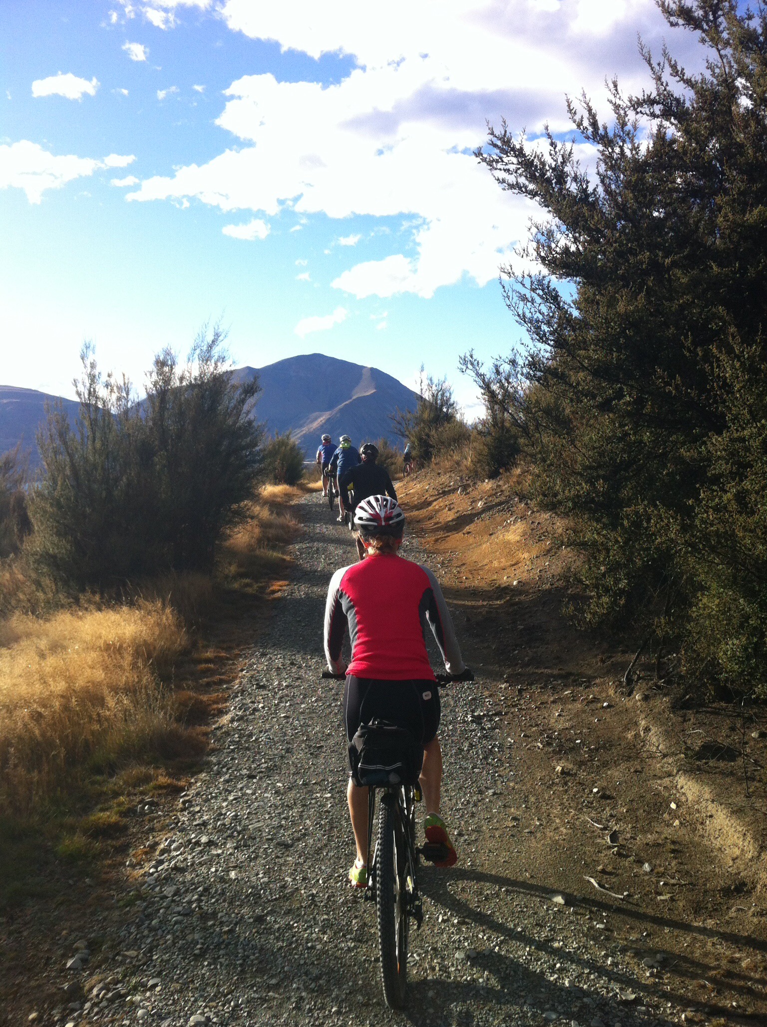
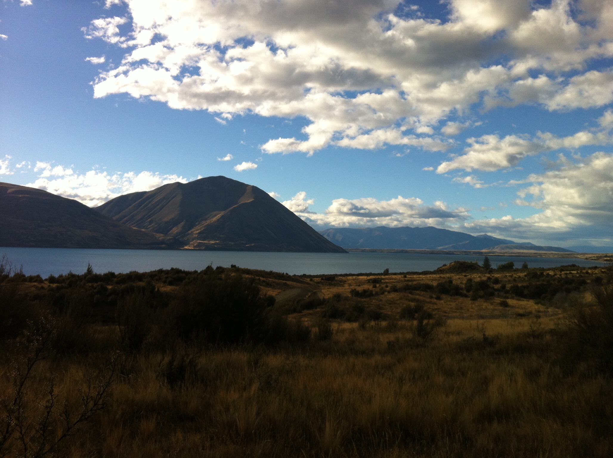
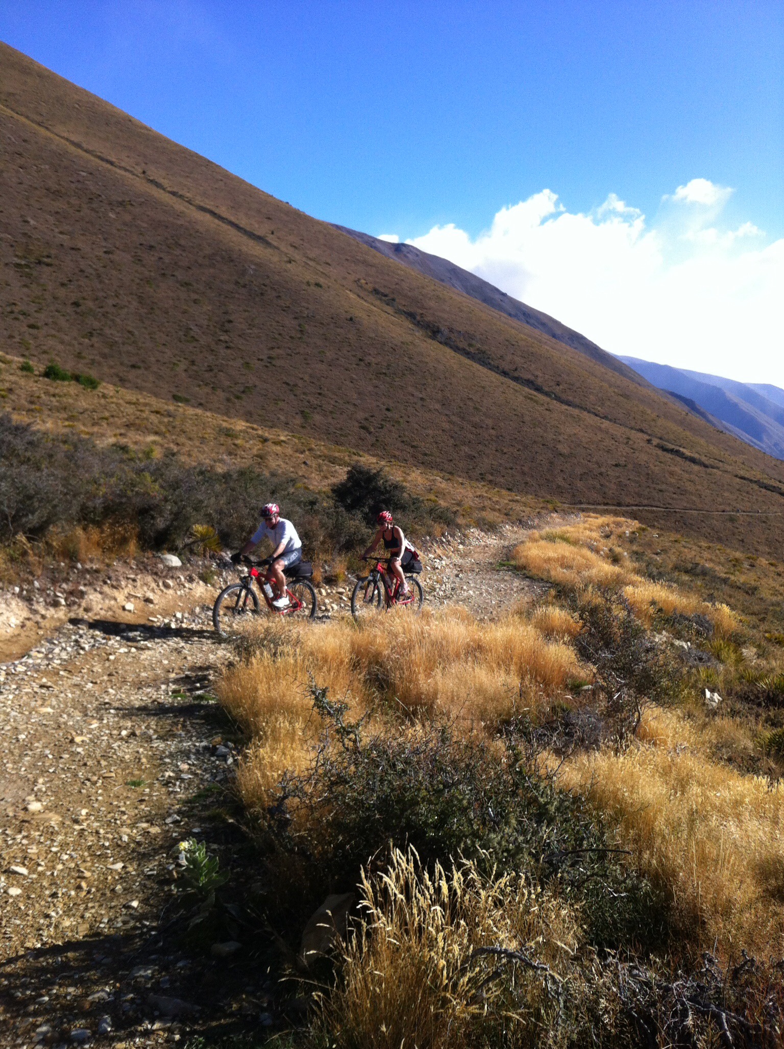
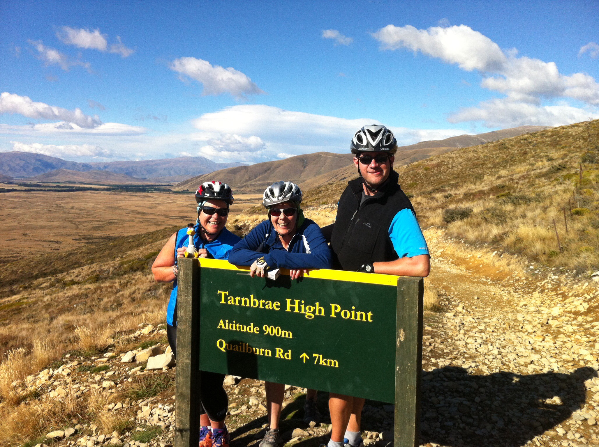 The views back over Lake Ohau on the climb up were fantastic. After reaching the true summit at 900 metres above sea level we had a few twists and turns before some fantastic downhill riding through the paddocks. Just before the Quailburn Road intersection we were met by Rae & Trish who had decided to ride in the van for the first part of the day – there was a large puddle of water which they were encouraging us to ride through – the shoes got a little wet but it was great fun.
 We then rode 2km up the road to a historic woolshed where we had lunch. The woolshed was part of the Quailburn run on the Benmore Station – see below for more information on the Benmore Station.
 After lunch we had about 22km to go before reaching today’s destination which was Omarama. This riding was mainly downhill and to start with on gravel roads. It was great fun until I had to get out of the way of an oncoming car and nearly came off my bike in the thick gravel.
 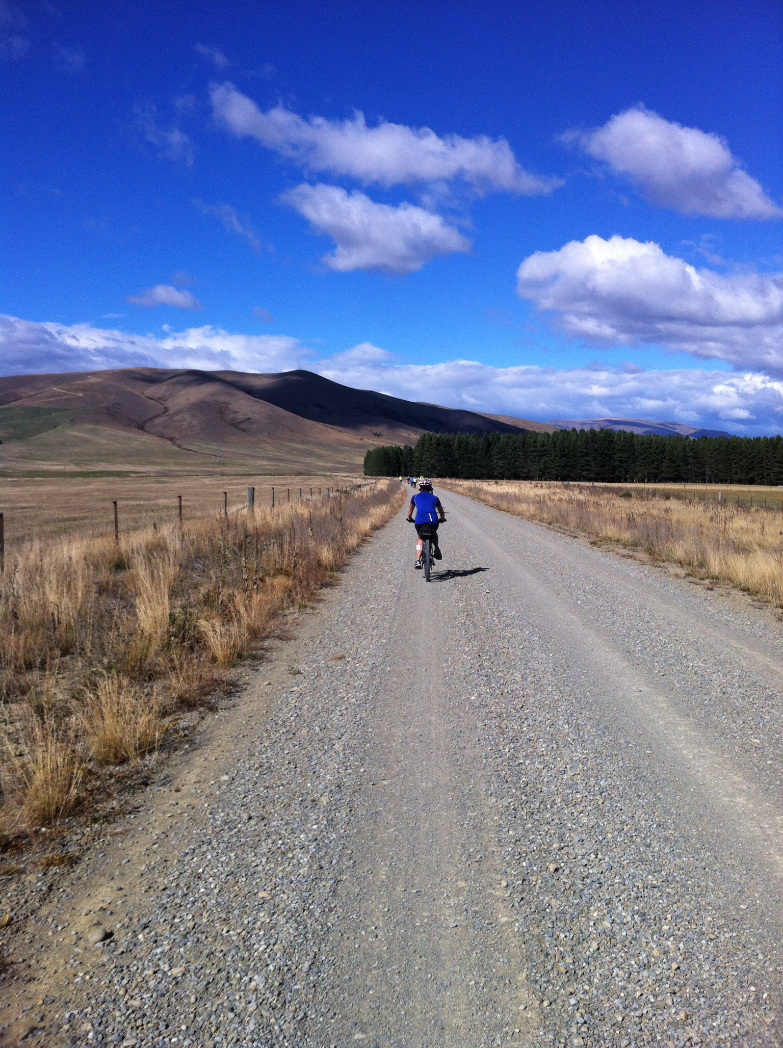 Omarama which has a population of about 250 people is primarily a rural service centre, providing local farmers and other residents with necessities and facilities such as grocery shopping, fuel and mechanical services, as well as a post shop. In more recent years these and similar services have expanded moderately, due to the increase in new residents and visitors, including anglers, artists, astronomers, sailplane enthusiasts, skiers and general tourists. A significant proportion of permanent village residents are employees of (or contractors to) Meridian Energy Limited, a state-owned enterprise which is responsible for much of New Zealand’s hydroelectricity generation.
Due to the strong gliding conditions and spectacular scenery in the Omarama area, as well as the entire Mackenzie Basin, it is known as a world-class gliding location, gaining fame among sailplane pilots around the world after hosting the 1995 World Gliding Championships.
Omarama is Māori for “Place of Light”, a reference to its extraordinarily pure and clear sky. Omarama is home of the annual mid winter star party. Local street lighting and other light sources are dimmed or switched off for the duration of the event. Benmore Peak Observatory is located approximately 13 km north of Omarama, atop the nearby Benmore Range
We got to Omarama about 3pm and everyone was looking forward to a soak in the hotpools – Leona gave them a call and they were fully booked until 10pm! It was Easter Saturday which explains why they were so busy – note for next time we’re passing through Omarama – book in advance!
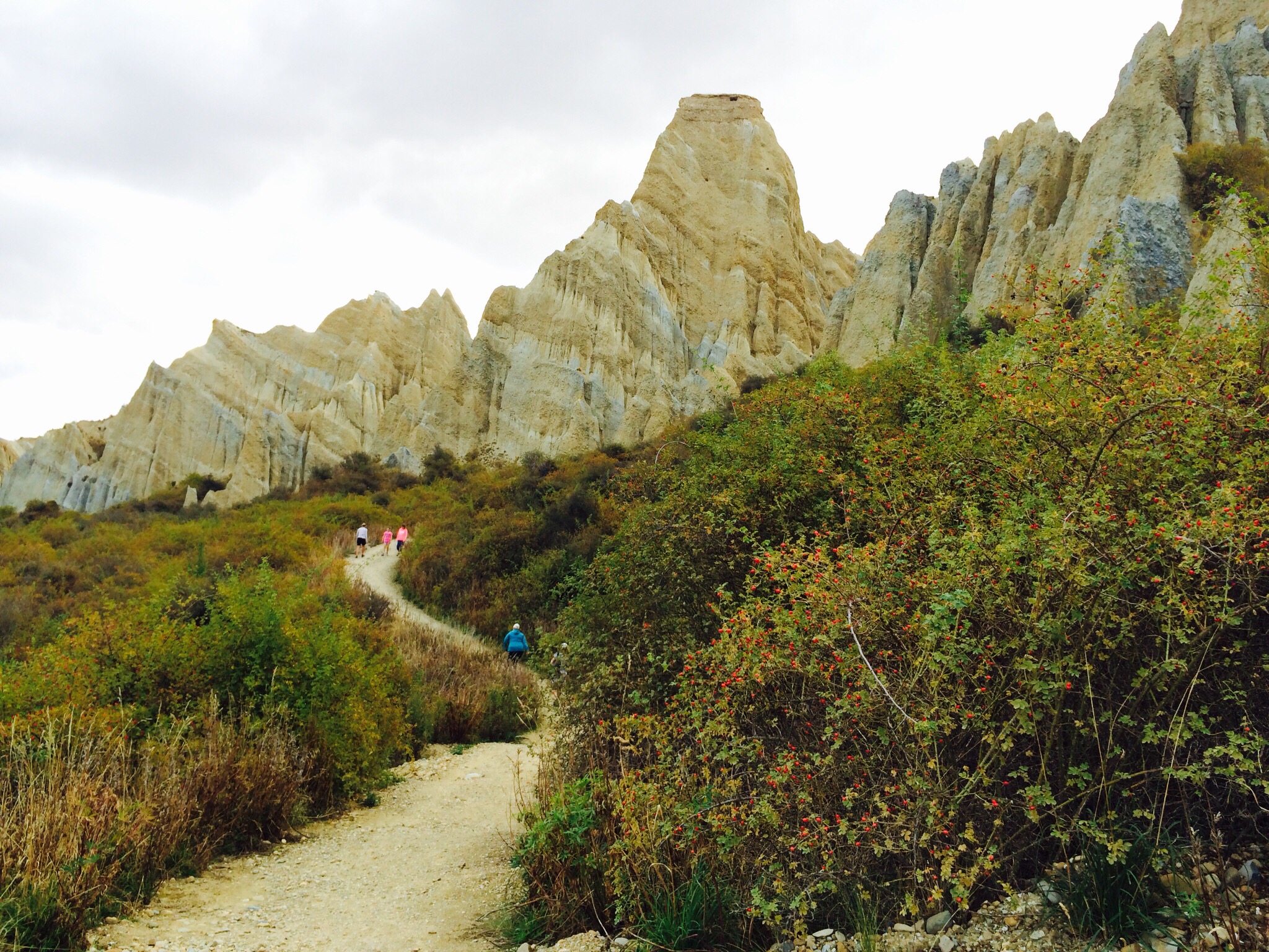
Instead of soaking in the hot pools we took a drive out to see the Clay Cliffs. These reminded me of the fairy chimneys in Cappadocia in Turkey. The Clay Cliffs are huge sharp pinnacles and ridges with deep, narrow ravines separating them. The Clay Cliffs are made of layers of gravel and silt, deposited by rivers flowing from glaciers existing 1-2 million years ago. Compared to the nearby mountains, which are 250 million years old, the Clay Cliffs are relatively new. Today the gravel and silt layers can be seen as sloping bands as the strata have been tilted since their deposition 1-2 million years ago. 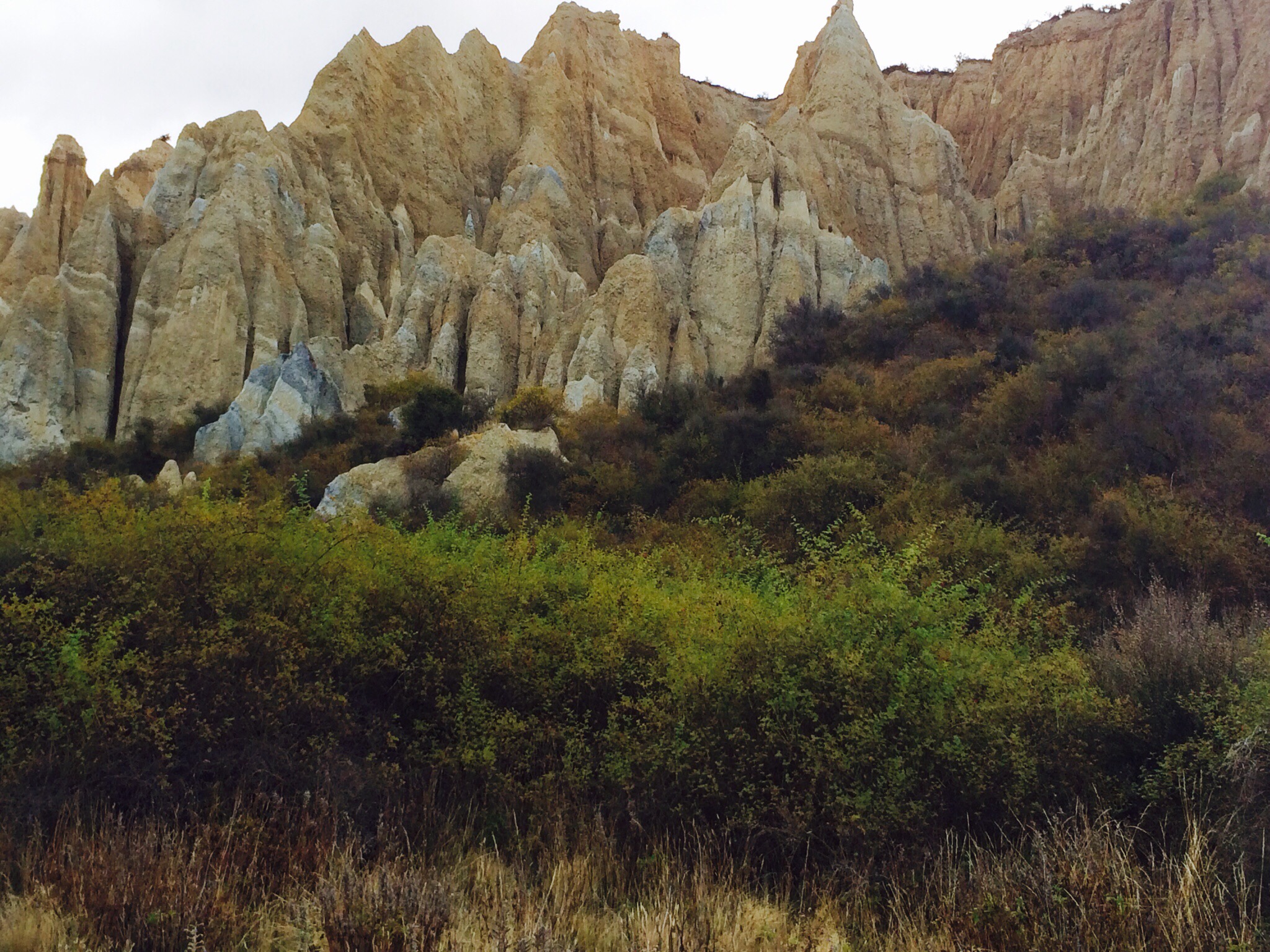
 After our Clay Cliffs excursion it was time for a bit of R & R before dinner at the restaurant at the Heritage Gateway Hotel where again we had lots of laughs.
Benmore Station
Two Scotsmen set off in search of new country to settle. Having come though Mackenzie Pass and crossed the Tekapo, Pukaki and Ohau rivers, they climbed to the top of the last terrace and saw straight ahead of them north-facing tussock-covered ridges sloping gently to rich grassy plains. “I’ll take this country” said McMurdo pointing to the range. “That’s just the country I’ve decided to take” retorted Fraser.
They debated for some time, neither giving way. They decided to race to Christchurch to register the claim but this was over 200 miles away over very rough country. In the end they decided to race to a matagouri bush about a mile away. The winner was to take the land to the left, the loser the land to the right. McMurdo won the race and named the land Benmore after his birthplace in Scotland. The year was 1857 and the Mackenzie country was set to change.
By the late 1800’s over 80,000 sheep were being shorn each year at Benmore Station. During shearing time the number of men working on the station swelled, with often 25 blade shearers on board. Wool from Benmore sheep was sent to Oamaru and transported by ship to Dunedin. Wool bales were loaded onto wagons pulled by bullock teams. The bullocks could pull more slowly and surely than horses, grip the terrain better with their cloven hooves, and didn’t require supplement feeding. It was a long, slow journey to Oamaru over rough roads, with the bullock teams travelling at a top speed of three kilometres an hour.
The woolshed was constructed in the early 1920’s from beech poles taken from Quailburn Bush. Pockets of forest in gorges and gullies around Quailburn and Lake Ohau were the only local source of timber. Beech was used for rails for yards, firewood and in the building of early huts.
Today we can only marvel at the conditions endured by farmers and their station hands. Mustering was particularly trying as a vast amount of land had to be covered and the weather conditions were often ghastly. The shepherds used horses on the flat but the high country, rising up to 1,900 metres was covered on foot. A fall from steep icy slopes was a constant risk.
By purchasing neighbouring runs, Benmore became one of the largest properties in Otago with over 200,000 acres. A huge public auction in 1916 marked the end of an era for Benmore. It was broken up into pastoral runs which were then offered for licence. As a result, twelve large stations and nine smaller ones were created. The Quailburn Run where the woolshed is was named after the native quail that were found there.

Thanks greeat blog post